Ospreys’ nesting effort draws competition atop maritime ship

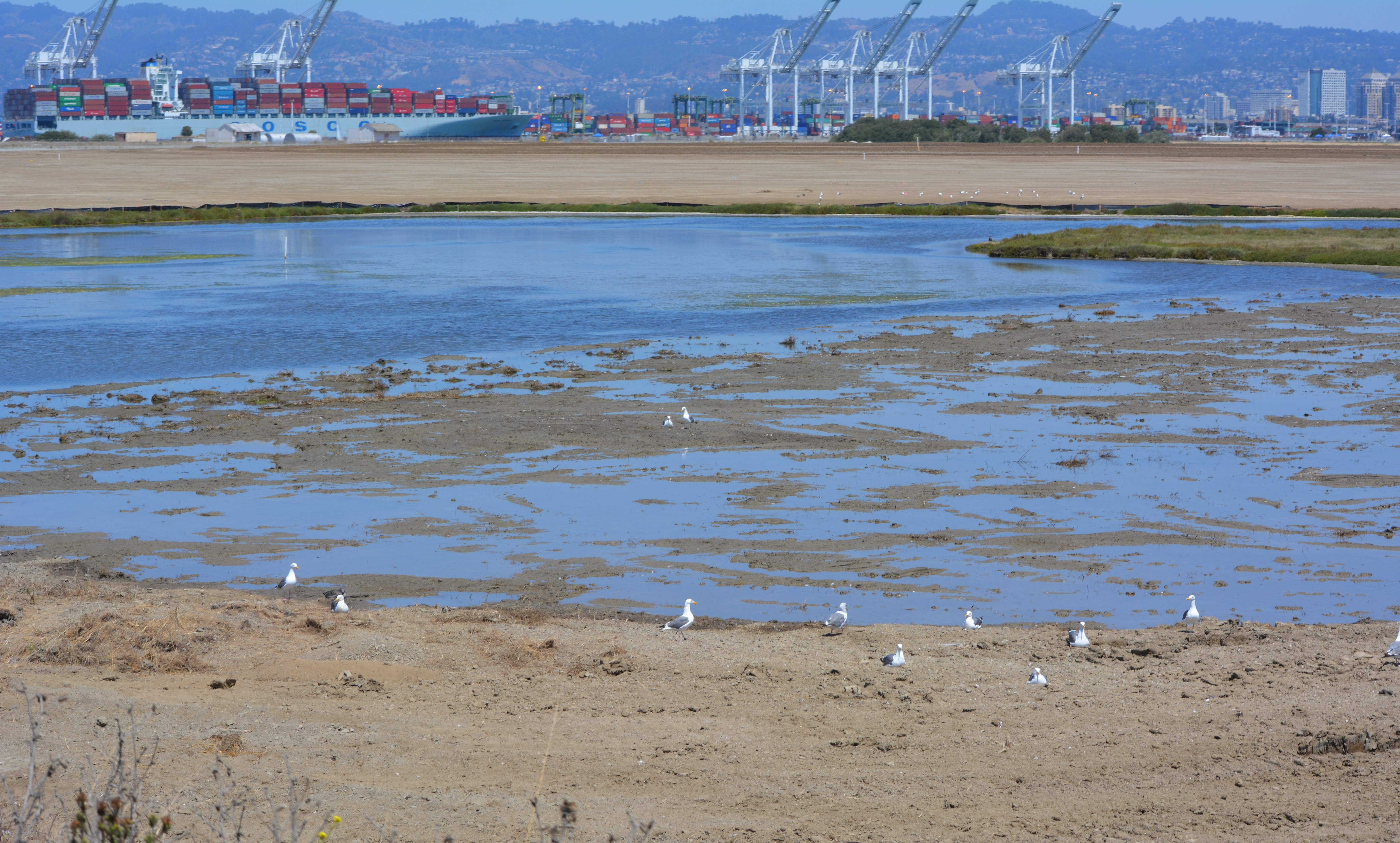
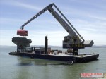
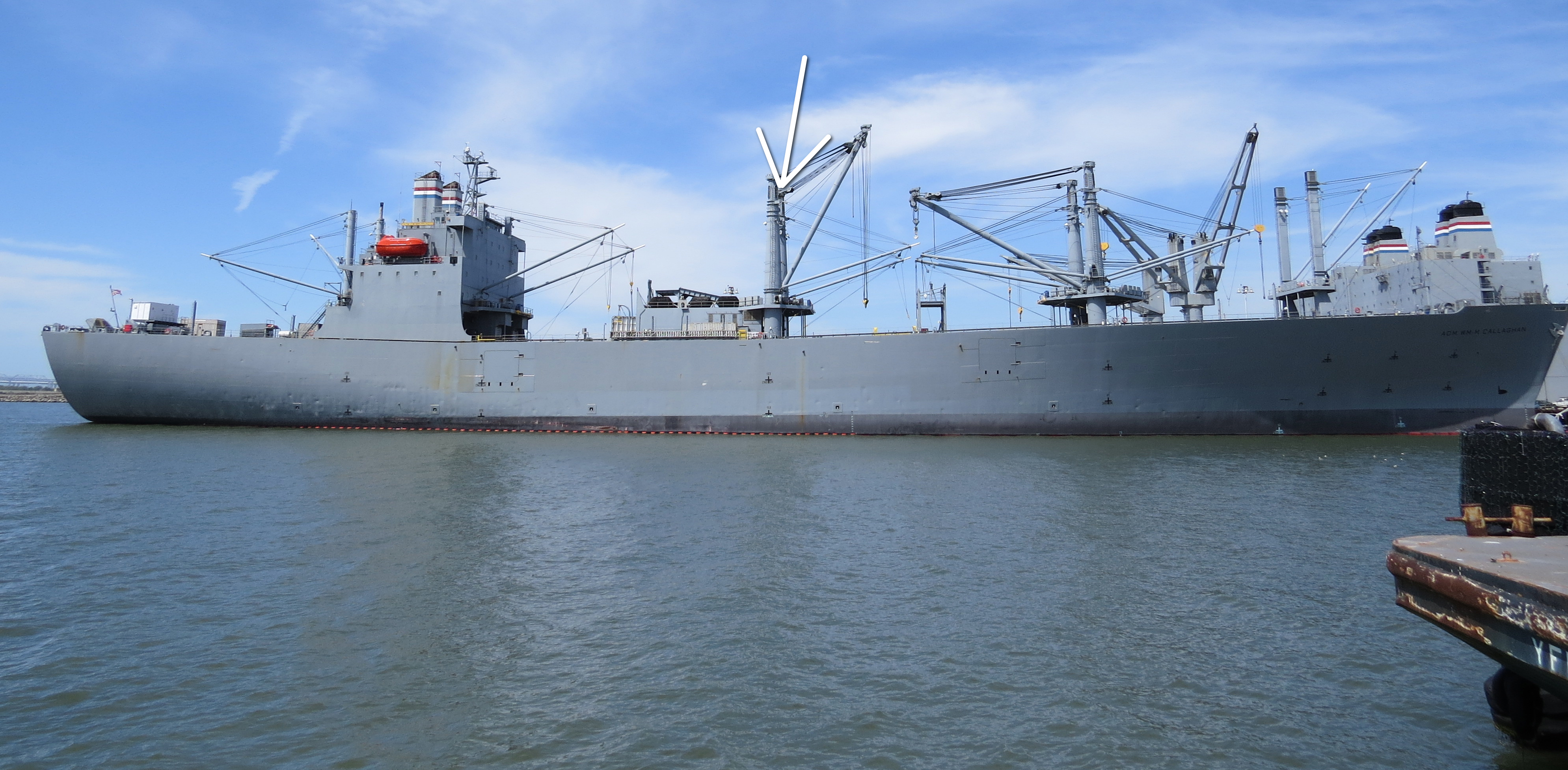
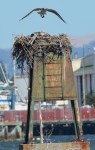
The ospreys returned to Alameda Point again in 2013 to nest, but not at their previous nesting site on the old light stand at the entrance to the Seaplane Lagoon.  This year they settled atop one of the towering kingposts holding a cable and boom hoist on the maritime ship Admiral William Callaghan.  Unfortunately, a third osprey interfered with the nesting pair.

Osprey landing on the kingpost nest on the maritime ship Admiral Callaghan docked at Alameda Point - May 2013.
Osprey landing on the kingpost nest on the maritime ship Admiral Callaghan docked at Alameda Point – May 2013.

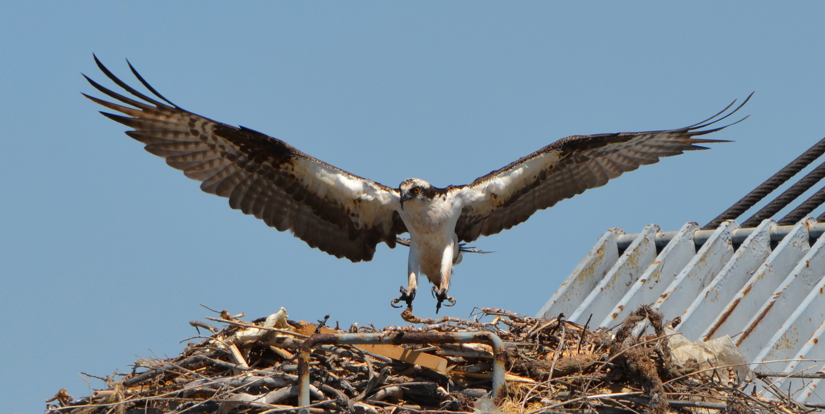
As the month of March came in, Alameda wildlife biologist and birdwatcher Leora Feeney began checking to see if the ospreys had returned to their Seaplane Lagoon nest.  While scoping out the surrounding area with her binoculars, Feeney spotted a returning osprey on one of the maritime ready reserve ships docked at Alameda Point.  As the weeks went by, she noted that nest building and fishing were the order of business for the osprey pair on their new shipboard nest.

Osprey bringing in nest material for the Callaghan kingpost nest - 2013.
Osprey bringing in nest material for the Callaghan kingpost nest, with mate in nest – 2013.

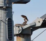
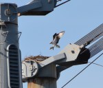
On April 4, Feeney recorded in her osprey log that the female had settled deep into the nest as if incubating at least one egg.  But a third osprey spotted two weeks earlier now became trouble, with the nesting male osprey seen escorting the interloper away.

“Incubation seemed the order of business during April, but on May 5th no birds were seen at the nest,” said Feeney.  “This was not a good sign.”  During following observations by Feeney, it became clear that another female osprey was visiting the pair often.  “The pair tried to discourage her by flying around her and escorting her away,” said Feeney.  But in doing so, the effort would leave the nest briefly unattended and vulnerable to the ever-present gulls looking to steal fish scraps or even an egg or a chick. 

The maritime ready reserve ship Admiral William Callaghan stationed at Alameda Point.  Arrow indicates nest location.  Viewed from Pier 3 next to USS Hornet.
The maritime ready reserve ship Admiral William Callaghan stationed at Alameda Point. Arrow indicates nest location. Viewed from Pier 3 next to USS Hornet.

“The female interloper, however, was persistent.  She appeared dirty, maybe oiled,” said Feeney.  “And it became questionable if the nest had eggs or chicks.  We were no longer seeing brooding,” said Feeney.

On May 20, the captain of the Callaghan generously agreed to allow a few interested parties to climb up to the bridge and higher to look down into the nest to gather more information.  No eggs or chicks were seen.  “But it didn’t help much to understand this year’s osprey story,” said Feeney.  “A strong theory is that the interloper disturbed the nesting pair more often than my brief visits detected,” she said.  “The other ‘woman’ may have allowed enough distraction for the active nest to be pirated by gulls.” 

It was hoped that a second nesting attempt might occur, but it didn’t.  “There is always concern about adequate food availability and sufficient experience when birds nest,” said Feeney.  “And now we see competition is part of the game.” 

No one can say for sure what caused the failure.  “It is interesting, however,” said Feeney, “that two ospreys were still seen standing at both the 2012 nesting site that fledged one healthy big osprey and the 2013 ship nesting site as recently as August 23.”  “This site tenacity gives us hope that they will return in 2014.”

Video of osprey attempting to mate again after earlier nesting effort was disrupted by a second female.


This story also appeared in the Alameda Sun.

Fuel contamination in groundwater flagged for more cleanup work

Under the petroleum cleanup program the Navy has been removing tanks and fuel lines and cleaning up spills and fuel leaks dating back to the early 1990s before the base closed.  Most of the tanks and fuel lines were removed within three years after the base closed in 1997. 

Cleaning up leaked and spilled fuel has been slower, often involving running a vapor extraction pump 24/7 for years.  In a few cases, a groundwater contamination site will require a callback after the initial work is completed.  The Navy’s routine monitoring of groundwater, even after cleanup work has been completed, is aimed at determining whether there is a rebound in contamination readings and follow-up treatment is necessary.  Three such sites needing more work, on land recently acquired by the city, are currently undergoing follow-up treatment at the Navy’s expense.

Two of the sites once served as automobile service stations.  The other site is where fuel was removed from planes before they were serviced. 

Former location of auto service station and car wash where fuel leaked into the ground.  Part of the site is receiving follow-up cleanup work.  Near Main St. and Pacific.  Soccer field in background.
Former location of gasoline service station and car wash operated between 1971 and 1980 where fuel leaked into the ground. Part of the site is receiving follow-up cleanup work. Near intersection of Main St. and Pacific. Soccer field in background.

The treatment method is simple.  Air is pumped into the ground where the contamination is the highest.  This causes the petroleum products to vaporize, and then a suction system draws out the vapors into a barrel of charcoal.  The air injected into the ground also helps natural petroleum-digesting bacteria to grow.

Petroleum cleanup site receiving follow-up cleanup next to Main St. across from Bayport.  Site was former location of Navy auto service station.
Petroleum cleanup site receiving follow-up cleanup next to Main St. across from Bayport. Site was former location of Navy auto service station.

Solar-powered cleanup for the first time at Alameda Point  

Air injection/extraction pumps at the two former service station sites are running on electricity from the grid.  At the former plane de-fueling site next to Building 410, however, the Navy is using a solar-powered pump for the first time anywhere at Alameda Point.  Derek Robinson, the Navy’s Environmental Coordinator, explained the solar choice saying, “Electricity is not optimum because the overhead electrical tie-in is located too far away for the system to be tied in to the grid cost effectively.  The solar units provide the power necessary to operate the air sparging and soil vapor extraction system at a competitive price.”  The only other option was a combustion engine pump running on gas or diesel.  

“The battery storage system is traditional lead/acid batteries,” said Robinson.  “The solar array charges storage batteries allowing the system to store energy and operate in cloud cover and beyond strictly daylight hours; however, the system is designed to power off the blowers once the voltages drop below a preset level,” he said.  

Sustainable Technologies, located just a block away at Alameda Point, constructed the entire rig.  It consists of solar panels, a box full of lead-acid batteries, a circuit panel, and a pump.  Ironically, Sustainable Technologies is located on a Superfund site that will take another six years to clean up.  

Solar-powered cleanup at Building 410.

The area next to Building 410 where the fuel spills occurred has had a number of cleanup actions going back to 2002.  “Corrective actions under the petroleum program were conducted in 2002 and 2011 and a remedial action under the CERCLA [Superfund] program was conducted between 2005 and 2006,” said Robinson.

Work will continue until the end of the year.  The Navy will always be responsible for returning to do more cleanup work if groundwater testing shows some of the contamination was missed.

Locations of three petroleum cleanup sites currently undergoing more cleanup work.


Waterfront plan for Seaplane Lagoon sees value in nature

Returning part of the Seaplane Lagoon shoreline to nature is one of the biggest changes that have emerged in the planning process at Alameda Point.  The design proposal for the western side of the Seaplane Lagoon echoes the major theme of the Greenspace Project of Golden Gate University’s Center on Urban Environmental Law – the interconnected ecosystem. 

Seaplane Lagoon green areas (proposed)
From Town Center and Waterfront Precise Plan presentation to Planning Board.
(click on map image to enlarge)

The draft Town Center and Waterfront Precise Plan for the Seaplane Lagoon and eastern entrance area, presented to the Planning Board on August 21, offers a number of new concepts, including moving the proposed marina from the west side of the lagoon to the east side.   The waterfront plan is being refined concurrently with zoning changes, an environmental impact report, and a master infrastructure plan, which are all aimed at providing the level of detail necessary for the city to start marketing property to investors in 2014.

In reporting to the Planning Board on design plans of the city’s consultant, Skidmore, Owings and Merrill (SOM), city staff stated:  “Due to the vast scale of the study area and the Seaplane Lagoon as its centerpiece, the Town Center will be able to support a wide variety of unique waterfront experiences—some of which build and expand upon existing assets and activities, some of which introduce entirely new opportunities.  SOM proposes the following four waterfront zones and experiences:

1. Natural environment—along the western edge of the Seaplane Lagoon with trails, docks, camping, outdoor sculpture and wetlands.

2. Promenade and recreational opportunities—along the northern edge, with early phased soccer fields, food concessions, bike and pedestrian paths, open lawn, and kayak access.

3. Urban edge—along the eastern side and portions of northern edge with marinas, docks, eating patios, overlooks, and ferry service.

4. Industrial—further south on the eastern side with maritime uses located near the MARAD ships and the USS Hornet.”

Seaplane Lagoon western edge
From Town Center and Waterfront Precise Plan presentation to Planning Board.

Climate adaptation grant funding needed – As currently envisioned, however, the de-paving, removal of buildings, and alteration of the western Seaplane Lagoon shoreline area is put off into the distant Phase 3 future — a decade or more from now — when presumably a surplus of infrastructure funds will allow for implementation.  One option available for timelier implementation would be to begin now seeking grant funding from agencies that focus on shoreline climate change adaptation.  There will be no commercial development on the western side of the lagoon, and therefore the project would become a public asset.

Lying directly to the west on the Nature Reserve is the Runway Wetland, whose habitat value would be greatly enhanced by a connection to the Seaplane Lagoon.  Additionally, the draft Master Infrastructure Plan predicts a $10 million savings if the area were allowed to become tidal wetland as sea level rises.

Eastern jetty of Seaplane Lagoon with Great Blue Herons with nest and landing gull.  Heron is directly above proposed tidal marsh featured on map above.  West shore of Seaplane Lagoon in background.
Great Blue Herons with nest (left) and gulls on eastern jetty of Seaplane Lagoon. Heron is directly above proposed tidal marsh featured on map above. West shore of Seaplane Lagoon in background.
Great Blue Heron standing in shallow Seaplane Lagoon area where tidal marsh is proposed.
Sea Lion catching fish in Seaplane Lagoon.  Floating haul out platforms would increase their presence.
Sea Lion catching fish in Seaplane Lagoon. Floating haul out platforms would increase their presence.
Black-crowned Night Heron poking around for food on eastern jetty of Seaplane Lagoon.  One of the regular but seldom seen wildlife visitors.
Black-crowned Night Heron poking around for food on eastern jetty of Seaplane Lagoon. One of the regular but seldom seen wildlife visitors.
Alameda Point Channel in foreground that connects San Francisco Bay to the Seaplane Lagoon.

Unless otherwise noted, all photos are copyright Richard Bangert.  Permission requests appreciated before reproducing.  See “About” page for contact info.

Massive landscaping project changing scenic area on Nature Reserve

On August 3, 2013, the Navy’s annual environmental cleanup tour visited the worksite known as Site 2 on the southwest corner of Alameda Point.  Work has been underway at the site since early this year, constructing a 79-acre soil cover atop the old waste disposal area.  Due to budget cutbacks this year, only the Restoration Advisory Board was taken on the tour.

Transition from soil cover to wetland.  Port of Oakland in background.
Transition from soil cover to wetland. Port of Oakland in background.

The site was closed for waste disposal in the mid-1980s and given a soil cover that did not meet landfill closure standards.  For more than a decade after it was added to the Superfund cleanup program, the regulatory agencies and the Navy went back and forth about how best to close the site in an environmentally safe manner.

The slope of the soil cover is so important to the engineering design that the blades on the graders are not even controlled by the driver.  Blades on the graders, and even the bulldozer, are controlled by an onboard computer that uses a GPS satellite to maintain a uniform elevation.  The engineering concept for this soil cover is to minimize the slope so as to minimize movement in an earthquake, while at the same time providing for drainage.

Looking east at partially completed soil cover from the western shoreline of Alameda Point.

Soon the contractor will be laying down a 200-mil-thick HDPE geonetting material to act as a barrier to burrowing animals.  Next, they will add two more feet of soil before installing monitoring equipment, drainage features, access road, and seeding the soil with a variety of California native grasses.  Seeding is planned for this fall before the rainy season.

The 30-acre wetland area is not contaminated, but it will receive some upgrades with additional wetland.  There is both a freshwater wetland area fed by rainwater, and a saltwater wetland area connected to San Francisco Bay via an underground culvert.  The culvert will be replaced due to its age.

Partial view of wetland on southwest corner of Alameda Point.       Maritime ships and USS Hornet in background.
Partial view of wetland and soil cover on southwest corner of Alameda Point. Looking east with maritime ships in background.

More than 600,000 cubic yards of soil is required to complete the project.  Of that amount, 110,000 cubic yards have been recycled from the Seaplane Lagoon dredging after it tested clean.  The rest is being barged in from Decker Island in the Sacramento River near the town of Rio Vista.

Soil from Decker Island being off loaded from barge at southwest corner of Alameda Point.

This 110-acre project site, featuring the most scenic viewpoint in all of Alameda, will be transferred to the U.S Department of Veterans Affairs (VA) along with another 400 acres of the Nature Reserve, and 112 acres for the VA’s clinic and columbarium.  A nearby public access area on the western shoreline will be developed when the VA completes their road along the northern perimeter of the columbarium to the western shore.  The Bay Trail will eventually run along the shoreline.

Partial view of wetland area on Site 2 - Alameda Point Nature Reserve.
Partial view of wetland area on Site 2 – Alameda Point Nature Reserve. Bay Trail will be on the other side of the embankment that runs along the far side of wetland area.
Showing wetland on the left that was added and will be allowed to naturally revegetate.  Wetland on the left connected to San Francisco Bay.  Freshwater wetland is to the right.  Looking east toward hangars.
Wetland on the left connected to San Francisco Bay. The muddy part in the photo was recently added and will be allowed to naturally revegetate. Freshwater wetland to the right. Looking east toward hangars.
North Pond wetland connected to San Francisco Bay.  Port of Oakland in background.
North Pond wetland connected to San Francisco Bay. Port of Oakland in background.
Wetland area on Site 2 looking north from southern perimeter of the site.
Off loading soil from barge for Site 2 soil cover at Alameda Point.  Southern shoreline.
Off loading soil from barge for Site 2 soil cover at Alameda Point. Southern shoreline.
Construction equipment at Site 2.  Looking east with maritime ships in background.
Construction equipment at Site 2. Looking east with maritime ships in background.
VA project at Alameda Point with adjacent Nature Reserve that includes Site 2 remediation area.
VA project at Alameda Point with adjacent Nature Reserve that includes Site 2 remediation area. 

Google map showing Site 2 is here.

For more background, see previous story “Landscaping the Navy’s underground waste disposal site.”

Least Terns thriving this year at Alameda Point

Three busloads of visitors to the nesting area were treated to a great show on the annual “Return of the Terns” day, June 15.  The nesting area is on the Nature Reserve, located on the airfield of the former naval air station.  Adult terns could be seen busily bringing small fish to their young, and doting on the young chicks as they scampered around the sandy colony.  The cool temperatures of the day made it less stressful for the young birds. 

The adults will continue bringing fish to their young and watching over them until they’re ready to fly south in early August.  It looks like it will turn out to be a very good year for Alameda’s least tern colony, the largest in Northern California.  Another tern colony is on the Hayward shoreline.  The California Least Tern is an endangered species.  The colony at Alameda Point is managed by the U.S. Fish & Wildlife Service.

CA Least Tern @ Alameda Point - June 15, 2013
CA Least Tern @ Alameda Point – June 15, 2013
CA Least Tern with fish at Alameda Point
Least Tern colony at Alameda Point.  Control Tower in background.
Least Terns flying above the colony site at Alameda Point. Control Tower in background.

CA Least Tern with chick.  Alameda Point 2013.

CA Least Tern adult with chicks at Alameda Point.

CA Least Tern w/chick at Alameda Point 2013

CA Least Tern at Alameda Point with chick. 2013

CA Least Tern @ Alameda Point 2013

CA Least Tern bringing in fish at Alameda Point

CA Least Tern next to shelter for chicks.

Landscaping the Navy’s underground waste disposal site

Thirty-five years after the Navy stopped disposing of toxic waste in unlined pits next to San Francisco Bay on Alameda Point’s southwest shoreline, the final actions to comply with state and federal laws are finally being implemented this year. 

Site 2 where industrial waste is buried.  Area up to the wetland will be covered with two feet of additional soil.
Site 2 where industrial waste is buried. Area up to the wetland will be covered with two feet of additional soil.

Decades of wrangling between the Navy and regulatory agencies over how to handle the West Beach Landfill, dubbed Site 2, were finally ironed out this spring.  The U.S. Environmental Protection Agency (EPA), the Regional Water Quality Control Board (Water Board), and the California Department of Toxic Substances Control (DTSC) have agreed to a plan that calls for leaving the estimated 1.6 million tons of industrial waste in place and adding more soil to the existing soil cover.  

Placement of soil cover at Site 2 - May 2013.  US Navy Photo.
Placement of soil cover at Site 2 – May 2013. US Navy Photo.

The Navy began dumping waste in the area in 1952, four years before they surrounded the area with a seawall.  The dump was closed in 1978, but early efforts to comply with state environmental laws for landfill closure were not to the satisfaction of the Water Board.

In its May 2012 draft engineering work plan for the landfill, the Navy cited a decade of groundwater monitoring along the shoreline that proved the toxic chemicals of concern are not migrating toward the Bay.  Instead, the chemical concentrations are either stable or declining.  The contents have been sitting in water-saturated subsurface soil since the disposal program began 60 years ago. 

Radiological hotspots of debris and soil, including a small storage building, were removed after an earlier scan of Site 2.  Before the current two feet of clean soil is put in place, the soil will again be scanned down to a depth of one foot, and elevated concentrations will be removed.  Radium-226 paint waste was disposed of in the landfill.

One of the major concerns about leaving this landfill in place is the consequence of a major earthquake.  The Navy responded to a comment from a DTSC engineer by acknowledging that in the event of a maximum credible earthquake, the riprap boulders forming the “seawall is conservatively assumed to be non-existent, instantaneously whisked away and replaced with a 25-foot vertical face of liquefiable sand subject to plastic flow without being constrained by a rigid shell (sea wall).”  The Navy’s earthquake model predicts that the earthen embankment above the seawall at the perimeter of the landfill, composed of clay and not sand, will glide into the Bay and “will not be overtopped by the waters of San Francisco Bay and freeboard of about 5 feet above mean sea level will remain, and so the refuse will remain isolated.”

Navy graphic showing predicted movement of embankment berm into San Francisco Bay during an earthquake.
Navy graphic showing predicted movement of embankment berm into San Francisco Bay during an earthquake. Click on image to enlarge.
Navy graphic depicting position of embankment berm at Bay shoreline a following catastrophic earthquake.
Navy graphic depicting position of embankment berm at Bay shoreline following a catastrophic earthquake. Click on image to enlarge.
Southwestern shoreline of Alameda Point at Site 2 landfill.  Rock/cement riprap seawall, with green embankment berm above.  Looking north toward Port of Oakland.
Southwestern shoreline of Alameda Point at Site 2 landfill. Rock/cement riprap seawall, with green embankment berm above. Looking north toward Port of Oakland.

The Navy removed a perimeter security fence from their plans following objections from regulators and the public.  “Navy’s design and [Superfund] requirements for this project do not preclude future use of the site for limited public access or passive recreational purposes,” said the Navy.  Simple “Habitat Restoration Project” and “Stay on trail” signs were deemed adequate.

In an unusual move, the Navy offered the Restoration Advisory Board the opportunity to select the new vegetation that will anchor the 60 acres of clean soil.  In the fall of 2013, the Navy will seed the new soil with 13 native grasses, most of them flowering.  The Navy has permanently removed the 12-foot high embankment on the eastern, inland side of the landfill site, which will make the grassland visible from the mixed-use area.

The 30-acre wetland area on Site 2 was not contaminated, but will receive improvements to the quality of several acres.  The culvert connecting the wetland to San Francisco Bay will be regularly inspected and permanently protected.

Final Remedial Action Work Plan for Site 2 – Alameda Point – April 2013

Volunteers maintain tern nesting area at Alameda Point Nature Reserve

The endangered least terns have returned.  Committed volunteers prepare and maintain this unique site during the non-nesting season.  The public can see the fruits of their work on June 15.

2013 maintenance work began on January 13th by clearing weeds from the outer perimeter of the nesting area.  The terns need a clear view of their surroundings to feel comfortable that predators are not lurking nearby.  Trimming vegetation near the nesting area is a high priority on work party checklists.

January work party
January work party

Volunteers were at the site again in February, March, and early April prior to the terns’ mid-April arrival.  Tasks included replacing deteriorated plastic mesh along the base of the fence around the nesting site.  The plastic mesh keeps chicks from wandering out through openings in the chain link fence.  The chain link fence is there to keep out predators, and to keep out rabbits that might easily trample eggs.

Replacing black mesh "chick fence."
Replacing black mesh “chick fence.”

Another of set of tasks involves randomly placing wooden A-frames and half-round clay tiles that serve as shelters for the chicks from predators like hawks.  One of the senior volunteers has been working to help the terns since the base closed.  This year he brought 48 wooden chick shelters that he made at his home.  Another task is the distribution of oyster shells that make it harder for flying predators to distinguish where the chicks are located.

Going for another load of oyster shells to distribute on the nesting area.

The number of volunteers ranged from 12 to as many as 30 each month.  Among the volunteers this season were members of the Tau Beta Pi engineering fraternity at UC Berkeley, which has been sending volunteers for many years, and members of the Encinal High School Key Club.

Setting out the chick shelters.

Volunteers will return in September after the terns are gone.  They will gather up the A-frames, clay tiles, oyster shells, and the numbered plaster markers that the US Fish & Wildlife Service uses to keep track of nesting success.  Picking up the “tern furniture” allows for weed control and periodic grading of the sand and gravel.

During May, June, and July, another set of volunteers participate in the “Tern Watch Program.”  Volunteers are trained in recording observations as they watch from their vehicle near the nesting site.  A cinder block grid system helps in recording feeding activity, among other things.  If predators are threatening the colony, the volunteers alert the Fish & Wildlife Service in the office nearby.

Volunteer opportunities:

Return of the Terns tours

On June 15th, the general public gets an opportunity to observe the nesting activity of the terns during a bus tour to the site.  The tours leave from Crab Cove Visitor Center in Alameda.  Registration and a fee are required.  More info is on the Return of the Terns flyer.

Previous stories about the least terns:

Least terns depart – volunteers move in at Alameda Point refuge

Protecting the California Least Terns at the Alameda Point Wildlife Refuge

January – April 2013 Photo Gallery

Click on photos to enlarge and view slideshow