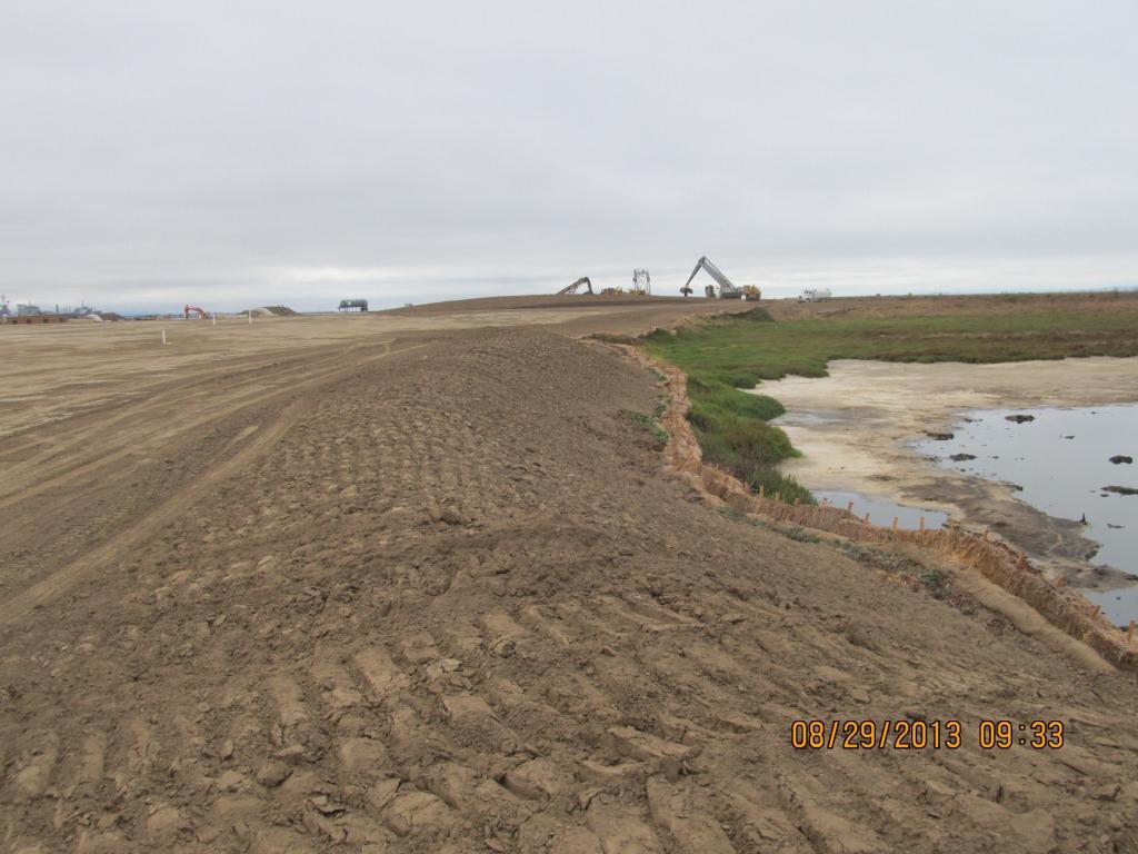
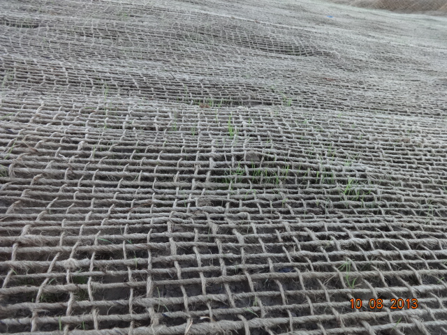
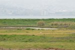
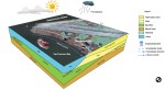
The Navy’s cleanup program has not only removed toxic substances from below ground, it has dramatically improved some of the above ground environment by creating new native grassland and wetlands. January rains filled the Navy’s new seasonal wetland on the northwest shoreline corner of Alameda Point and fostered growth of newly planted native grass seed on the surrounding soil.
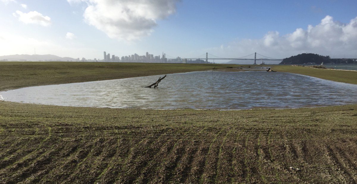
New Site 1 wetland on January 13, 2016, with San Francisco in background. Rows in soil with emerging growth were created during sowing of seeds. Navy photo.
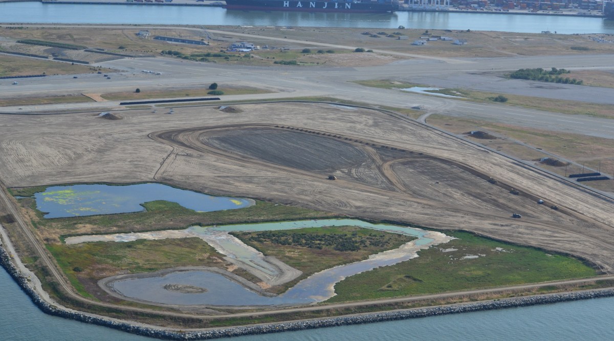
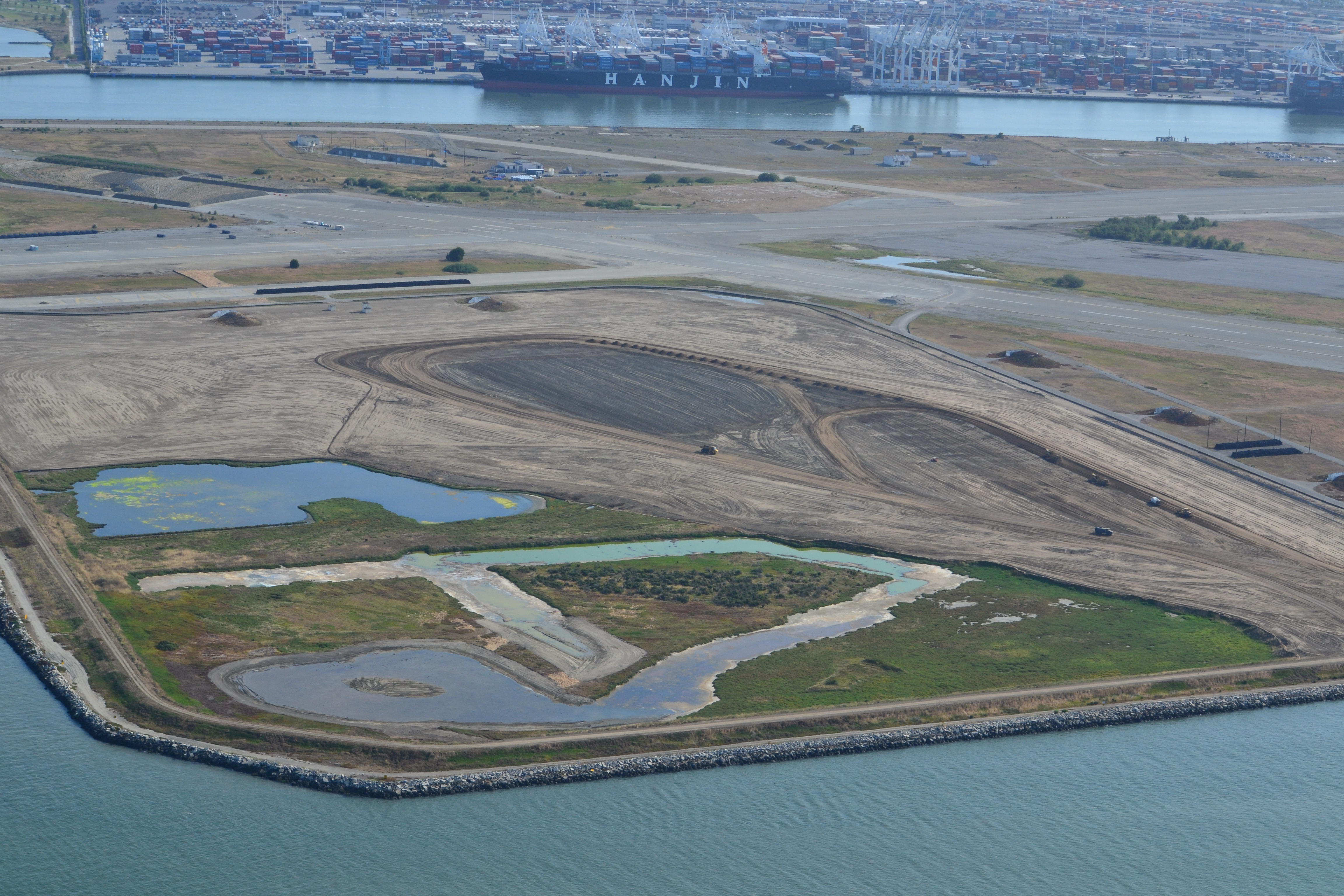
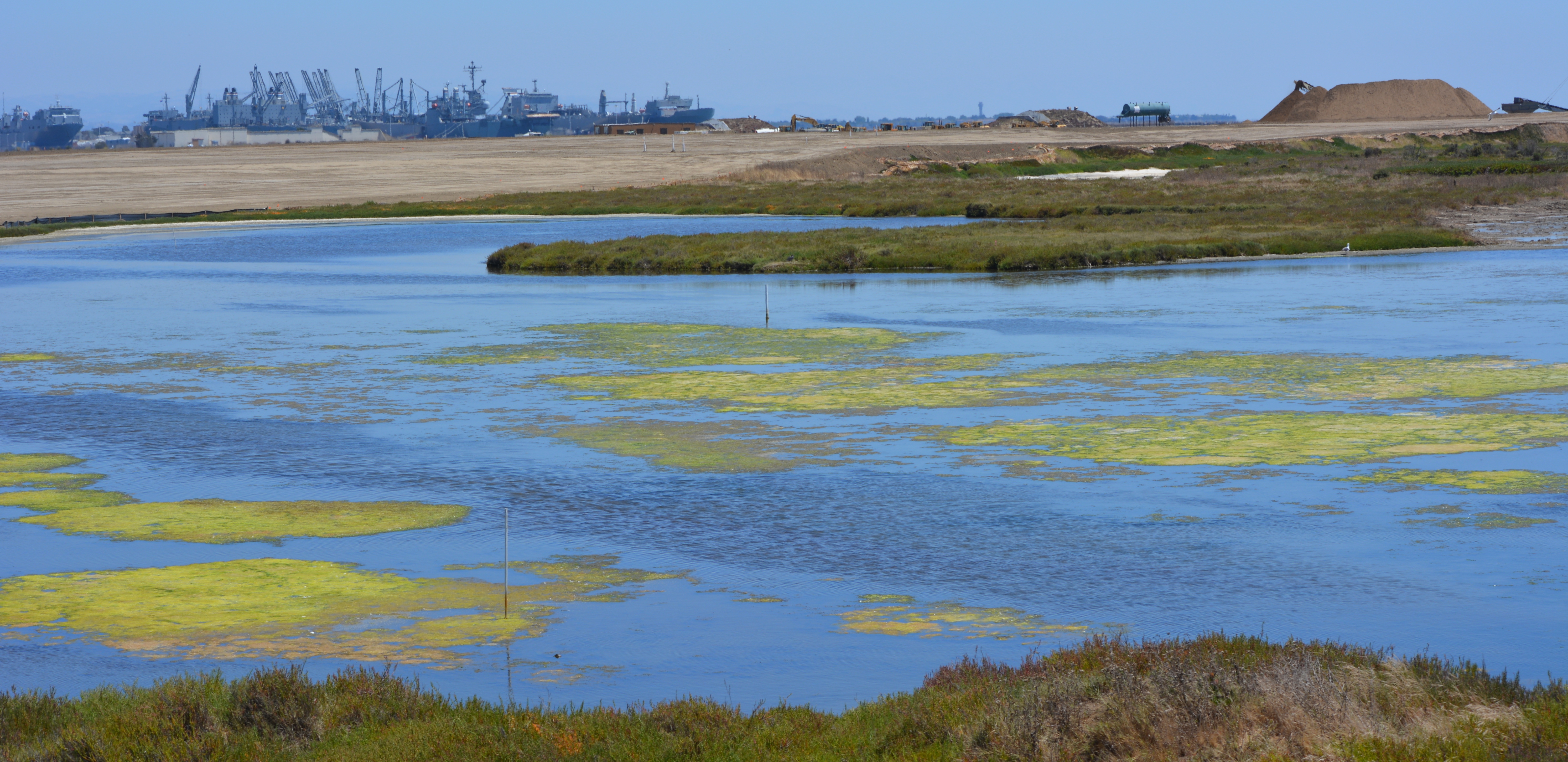
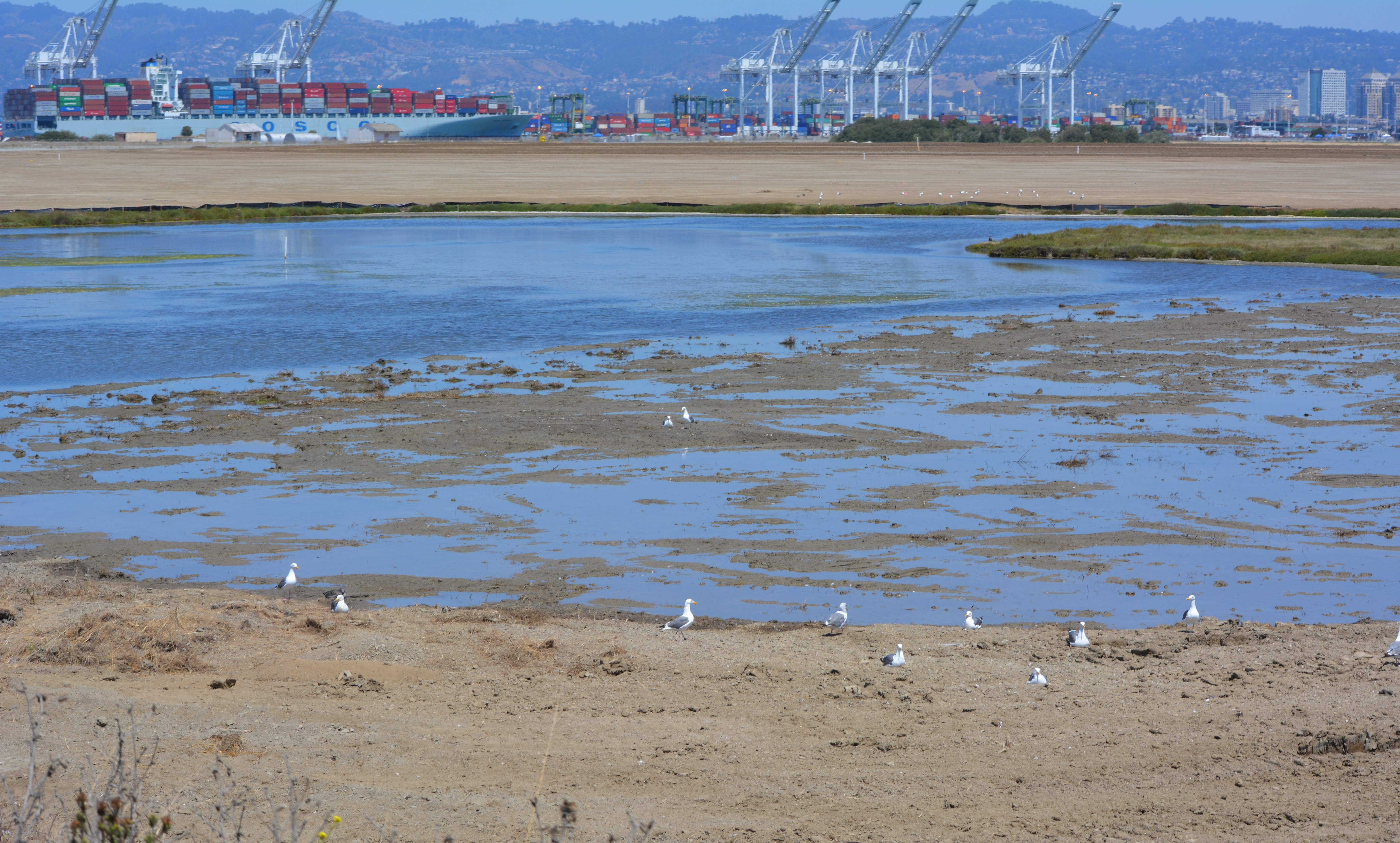
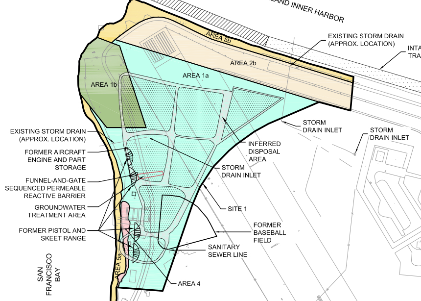
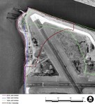
The 2.25-acre wetland lies within an approximately 37-acre shoreline cleanup area known as Site 1 at the confluence of the Oakland Estuary and San Francisco Bay. It is where the Navy buried its waste between 1943 and 1956. Most of the waste pits were covered by pavement in the mid-1950s when a new runway was added.Continue reading “Navy adds a wetland and grassland”
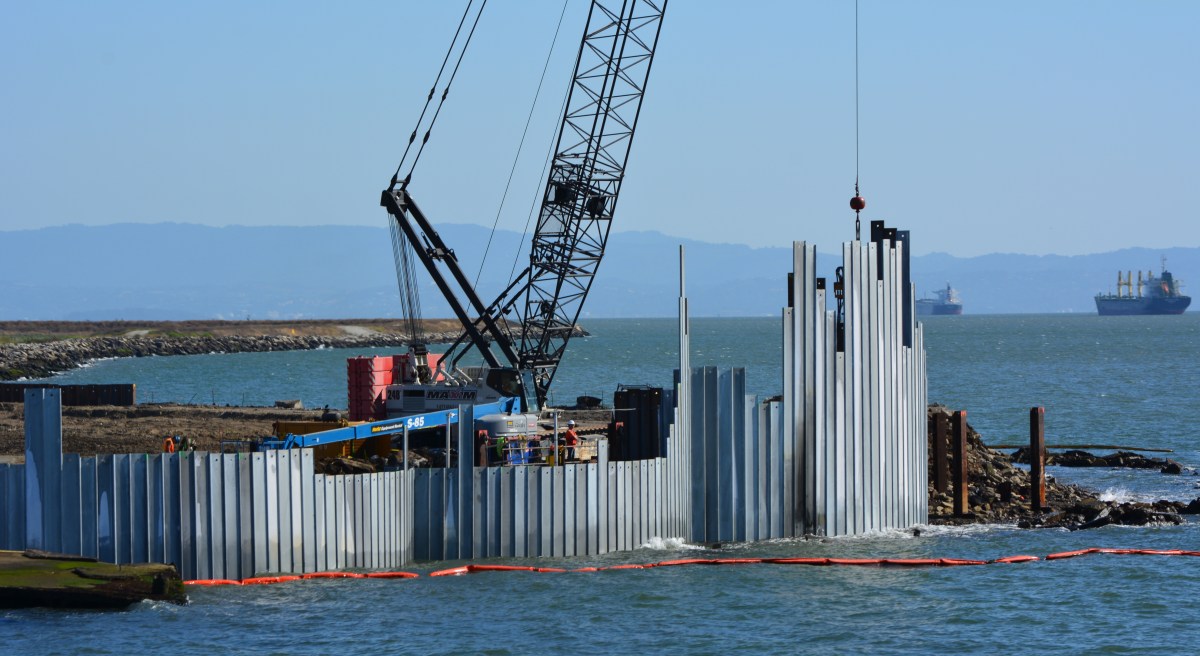
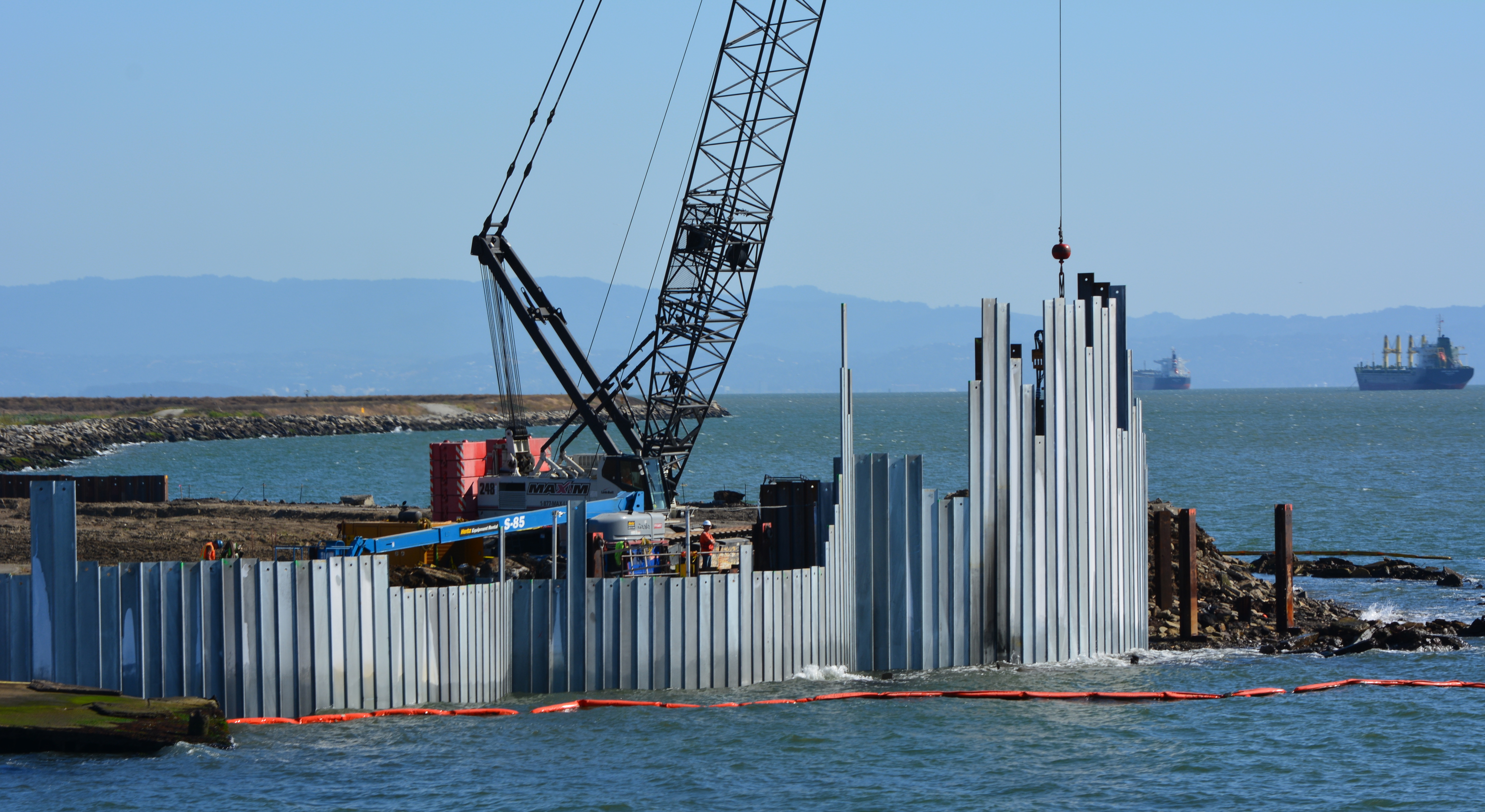
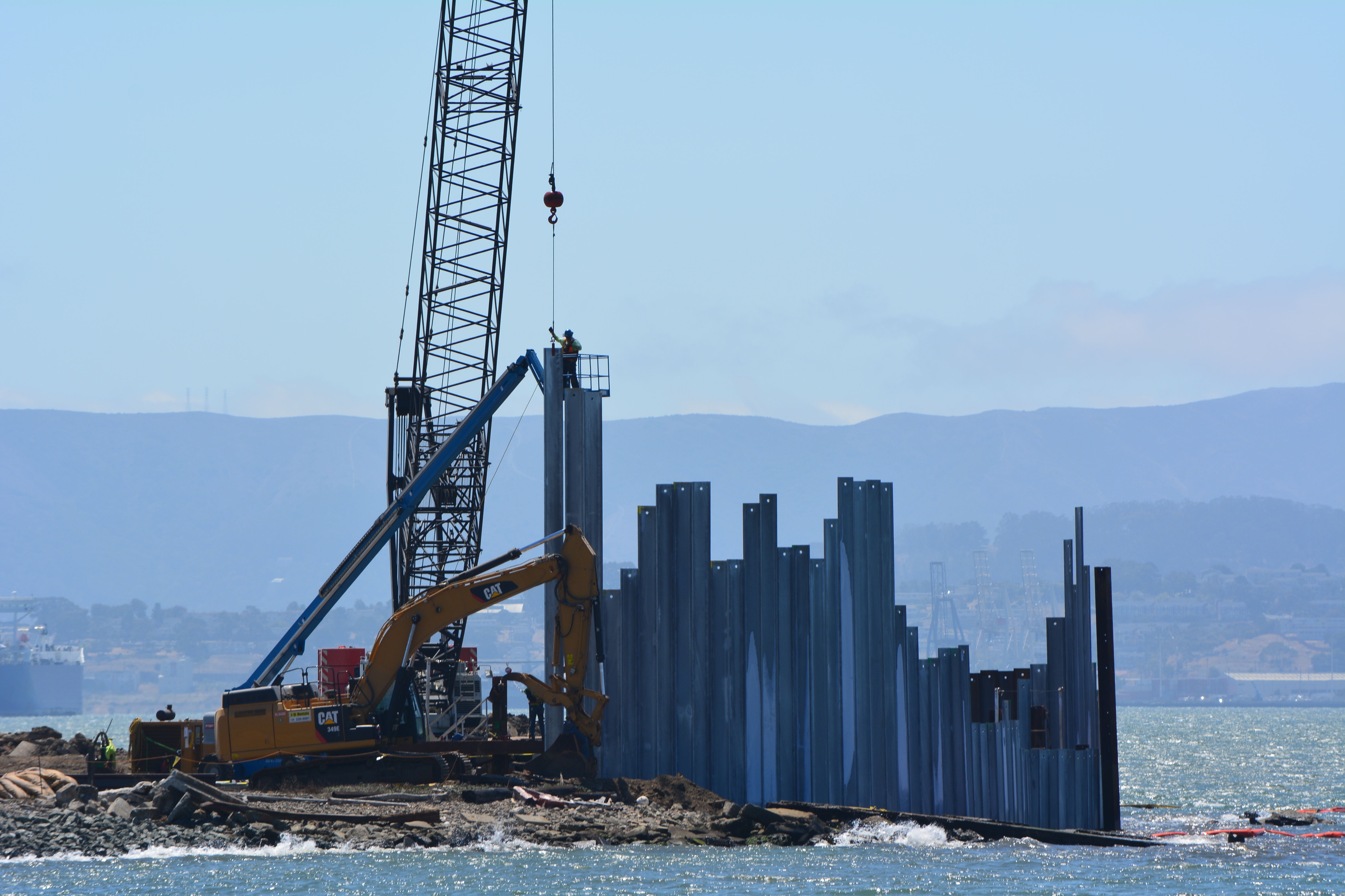
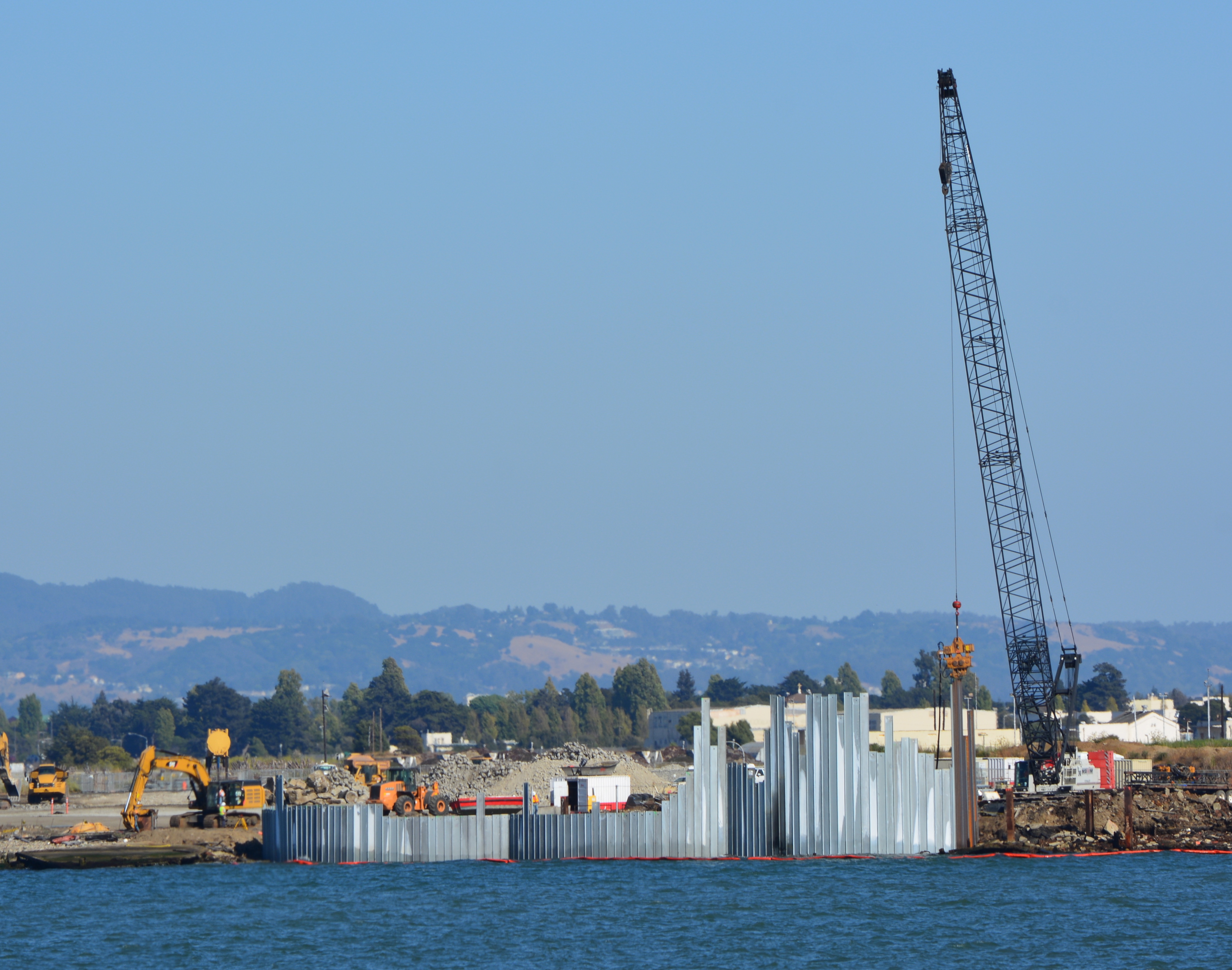
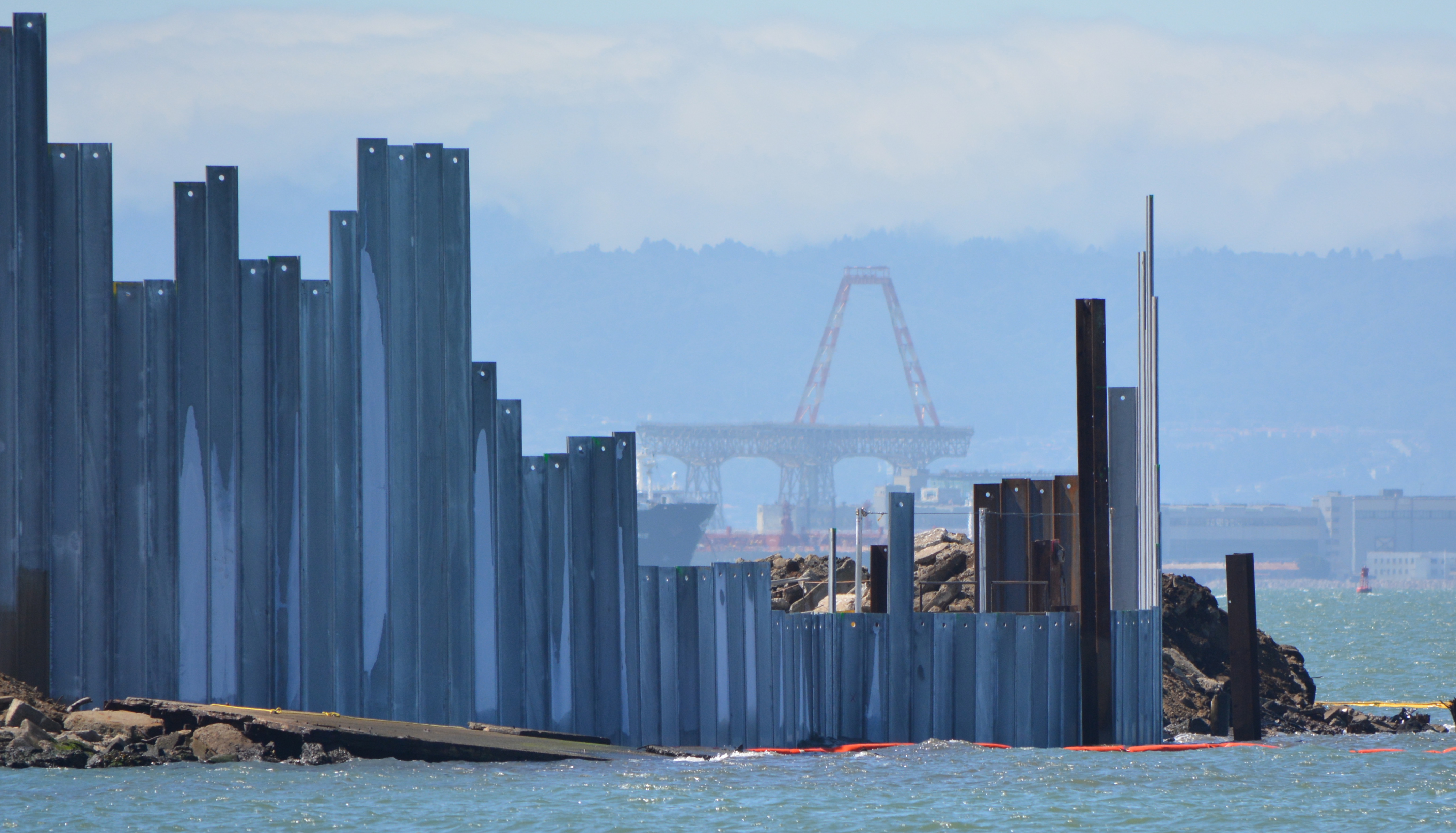
The Navy began embedding a steel barrier along several hundred feet of the western shoreline of Alameda Point during the week of August 18. The purpose of the barrier is to contain contaminated ash and burn waste material that was bulldozed into the Bay some 60 years ago and is now overlain with silt. The area is where the Navy burned various waste materials.
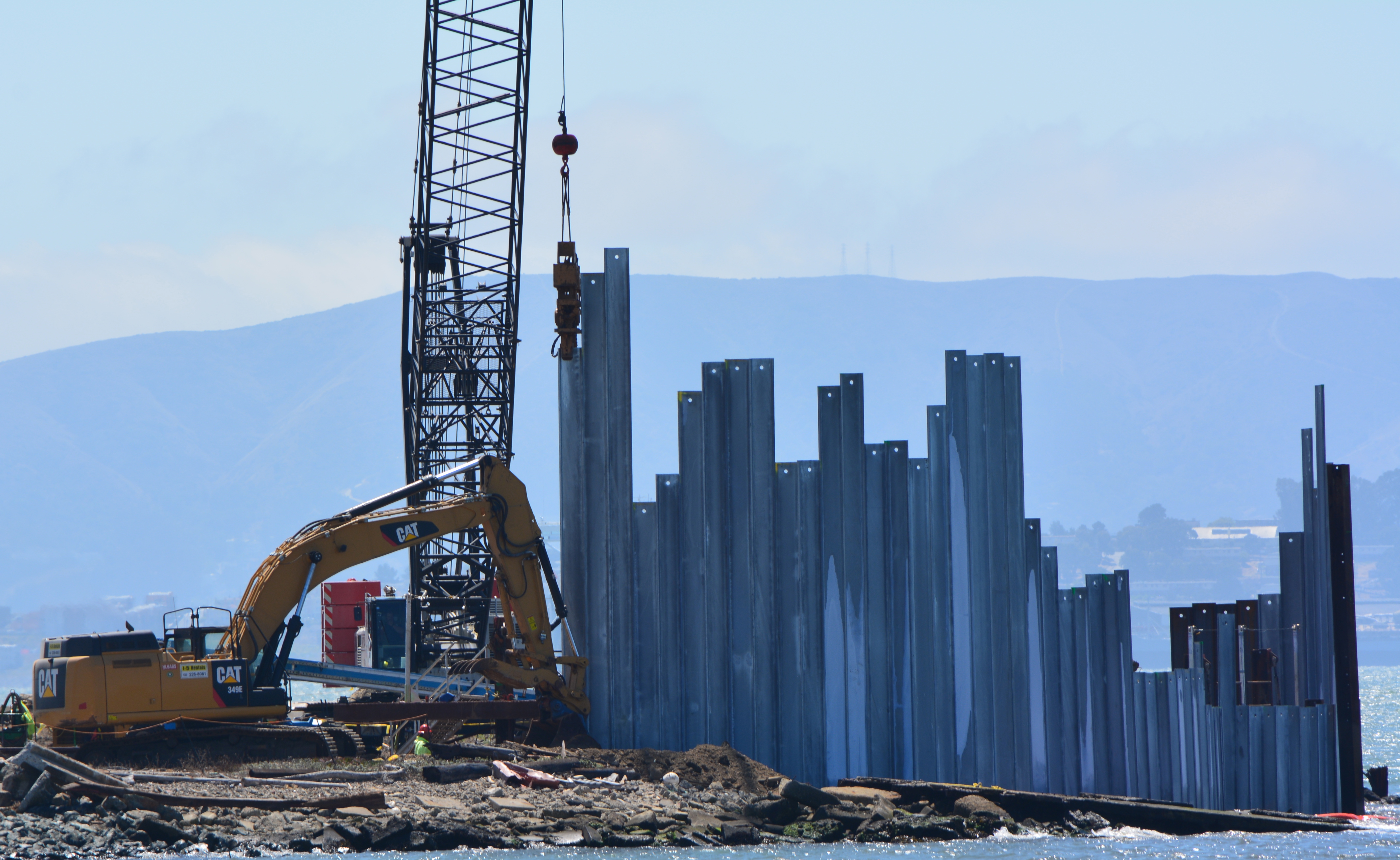
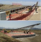
Three of the waste isolation cells under construction at northwestern tip of Alameda Point. A total of 15 cells, each one separated by a wall behind the face of the barrier, will be constructed here.
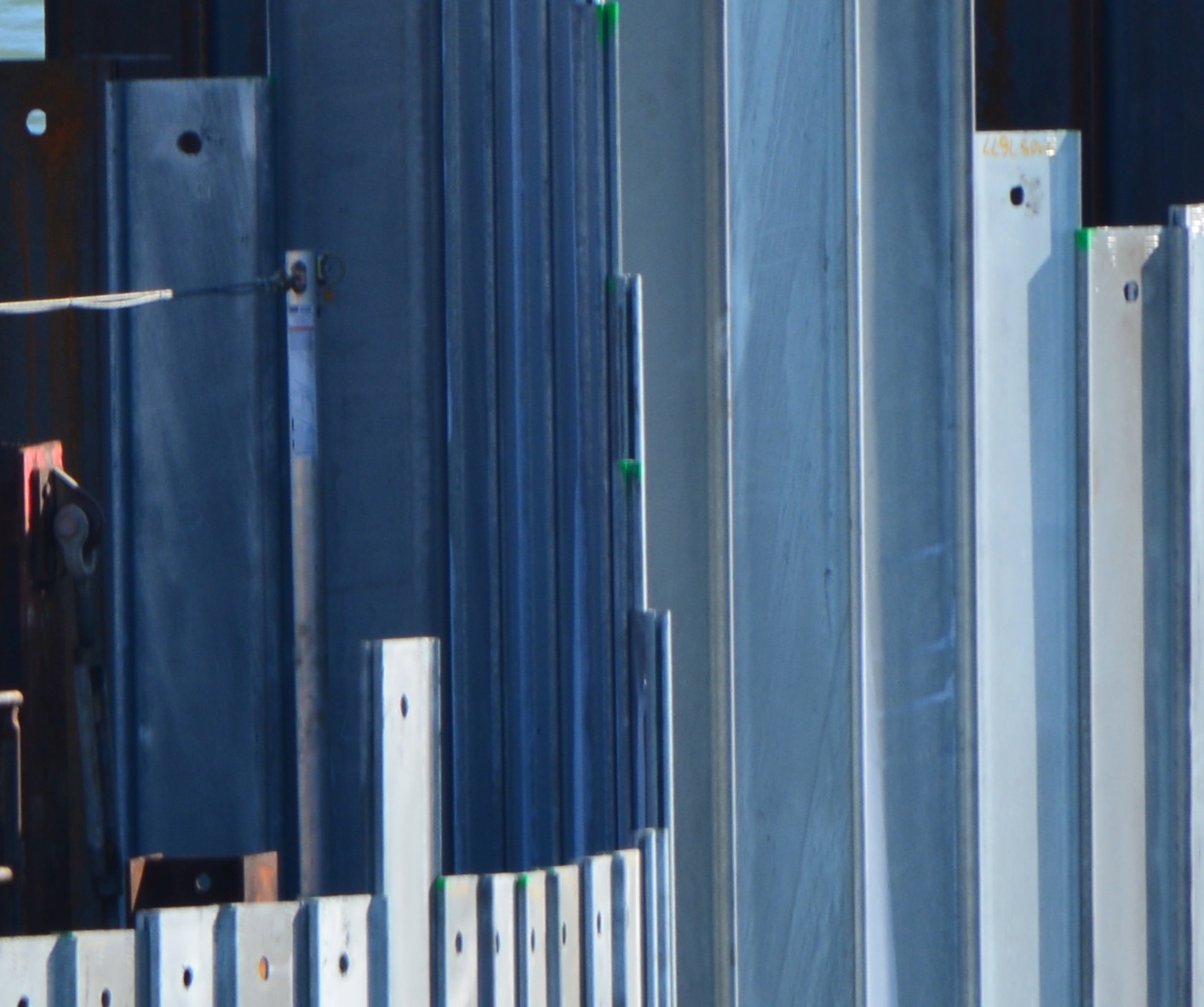
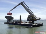
The containment system is called a waste isolation barrier. It consists of 35-foot-long interlocking steel pilings that are hammered into the ground with a hydraulic vibrator suspended from a crane cable. Perpendicular steel walls behind the barrier add stability. The final elevation of the top of the waste isolation barrier will be approximately 10 feet above mean sea level.
A worker guides one of the galvanized steel pilings into place as crane operator maneuvers.
Tests around the area were conducted in 2010, 2011, and 2012 to determine if any of the chemicals in the burn residue were entering San Francisco Bay. None were found to be entering the Bay. Nevertheless, the Burn Area’s proximity to the Bay requires that the contaminated waste either be removed or permanently isolated. Removing all of the waste from under the shoreline would have cost $40 million. The containment system costs $13 million.
Piling being slowly driven into the ground by a hydraulically operated vibratory hammer.
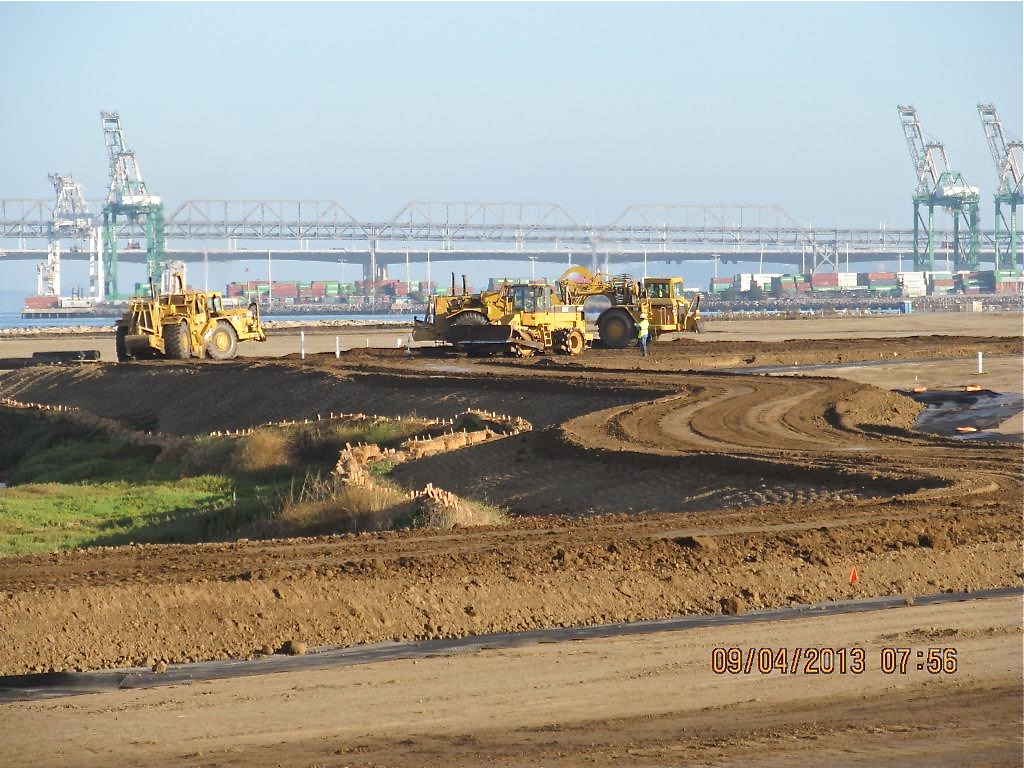
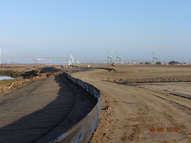
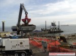
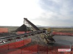
The construction of the shoreline waste barrier is part of a larger Navy cleanup project on the adjacent 37 acres, called Site 1, which was once used as an underground waste disposal area. Much of the area is now covered by runway pavement that will remain in place. The entire 37 acres right up to the steel barrier will be covered with three feet of clean soil and seeded with native vegetation. A small wetland area will also be created along the shoreline.
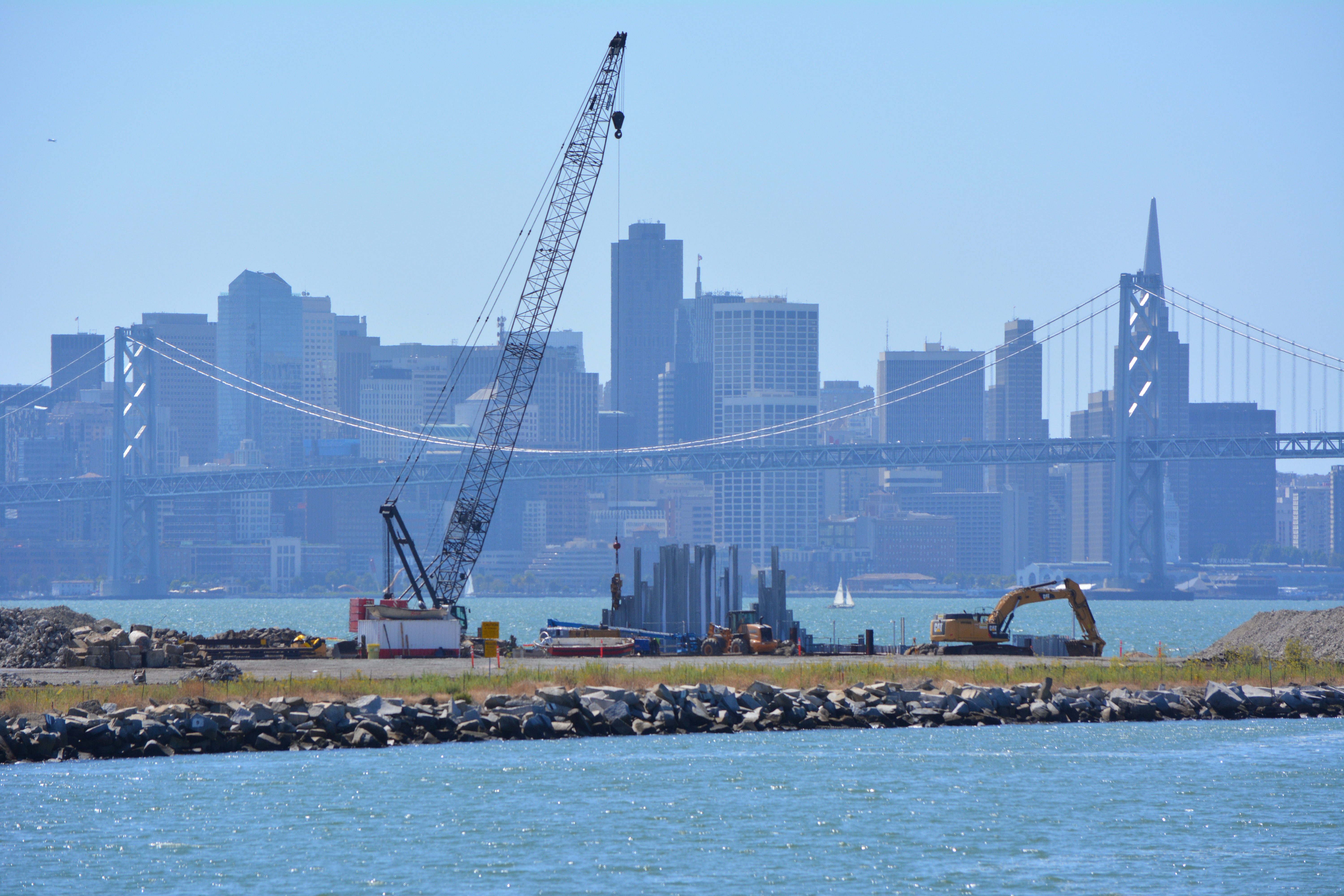
Site 1 cleanup project with crane. Oakland Estuary in the foreground and San Francisco in the background.
When completed early next year, the area will be suitable for passive recreational use, including the Bay Trail.
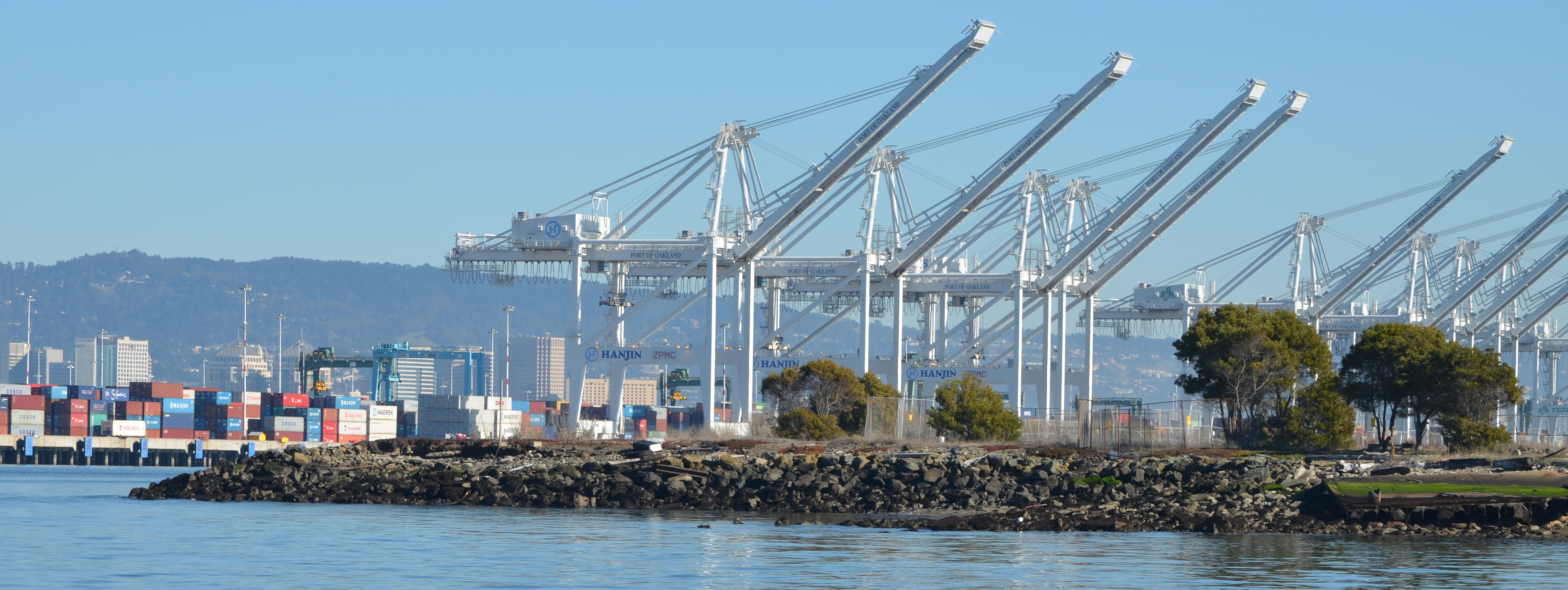
The work can be observed from the Oakland side of the estuary at Middle Harbor Shoreline Park right next to the cranes.
Background information can be found in this post from April 2013.
More photos and a diagram below
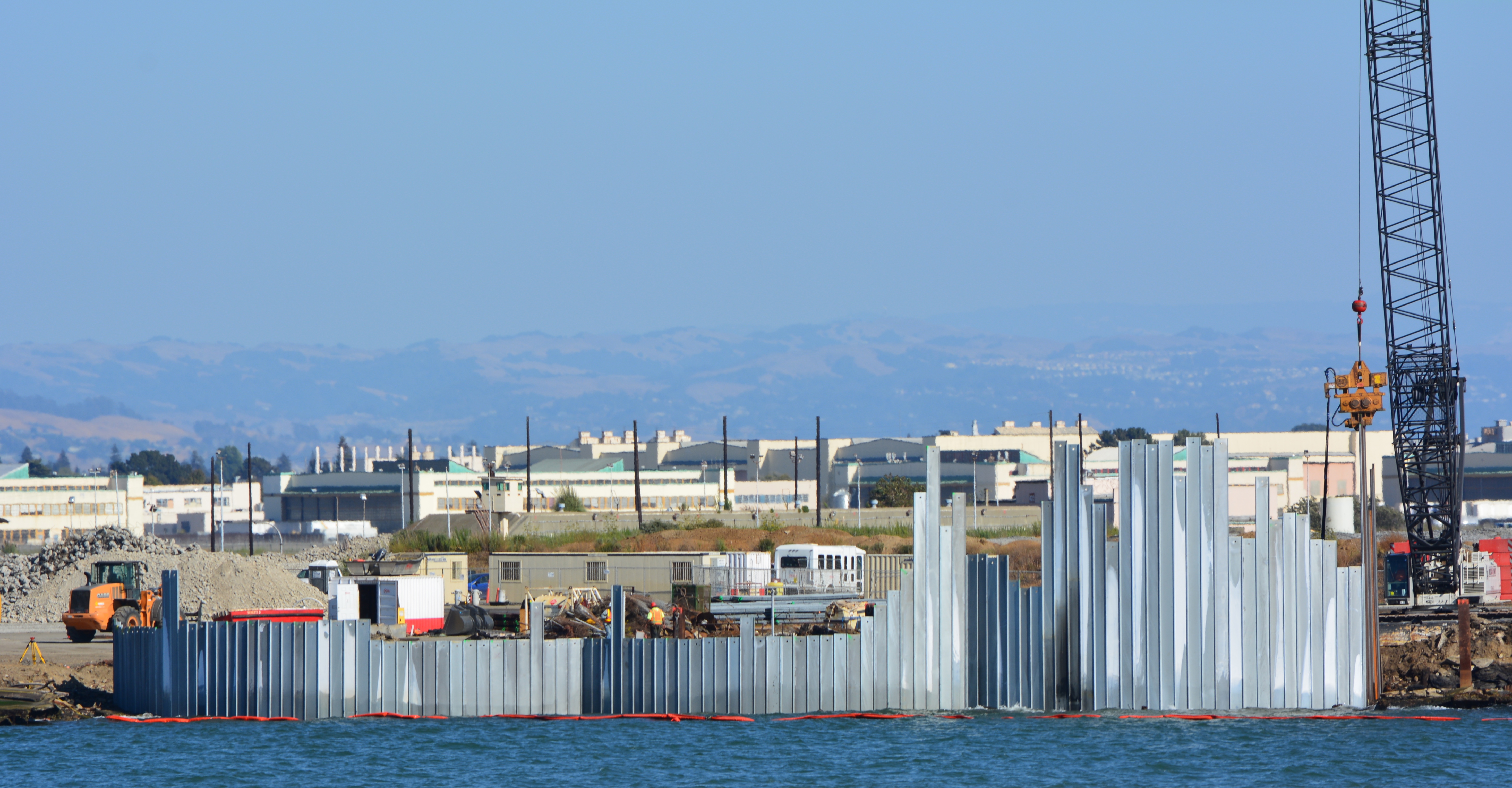
Waste isolation barrier will have 12 more cells to the right when completed.Diagram of shoreline waste isolation barrier at northwestern tip of Alameda Point. Navy diagram.
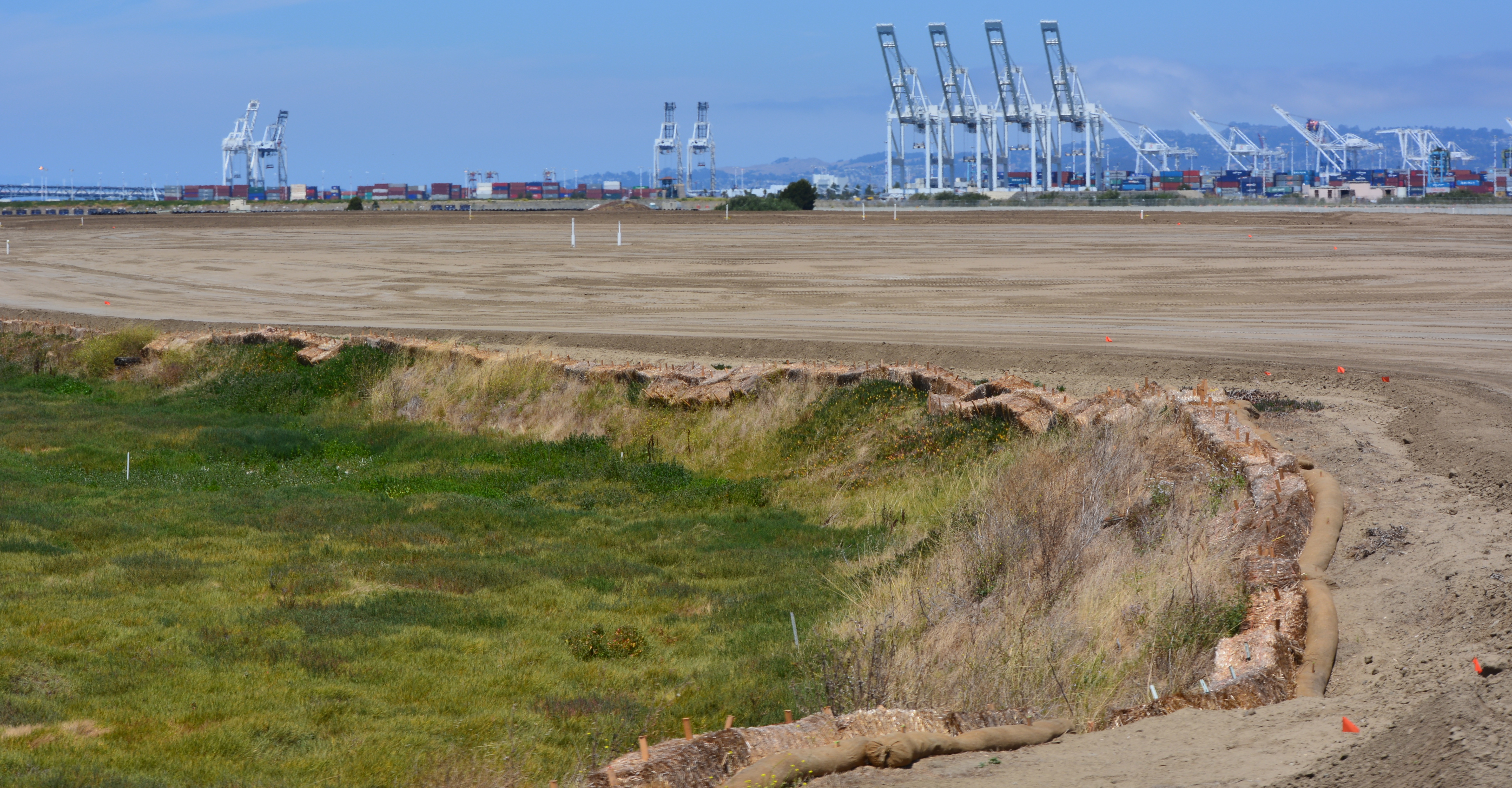
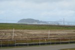
Landscaping of the 100-acre landfill area on the southwest corner of Alameda Point is nearing completion. The seeding of the landfill site with flowering native grasses is almost ready to begin. Contouring of the site is complete. Stabilization of the shoulder around the wetland area is complete. Placement of the final soil cover is underway.
Site 2 wetland area and adjacent contouring underway in early July 2013. Wetland area has since been expanded by several acres. Port of Oakland is in the background. Bay Trail will eventually follow the foreground shoreline along the Bay. Funding and construction of the Bay Trail is not part of this project, and is yet to be funded.
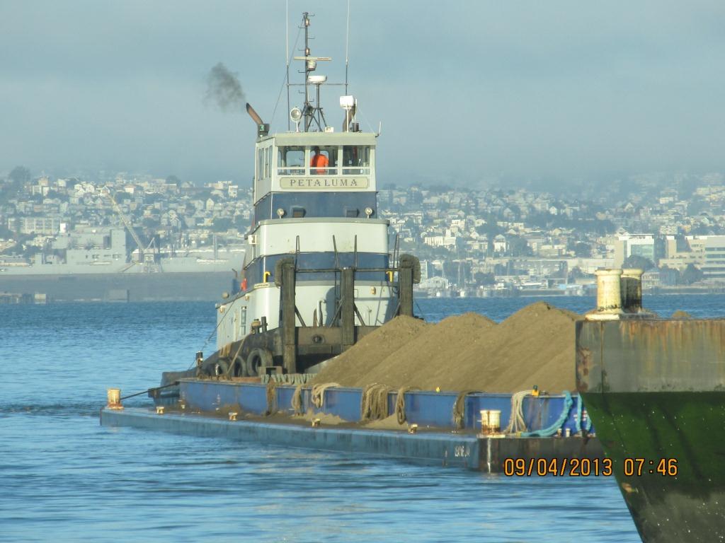
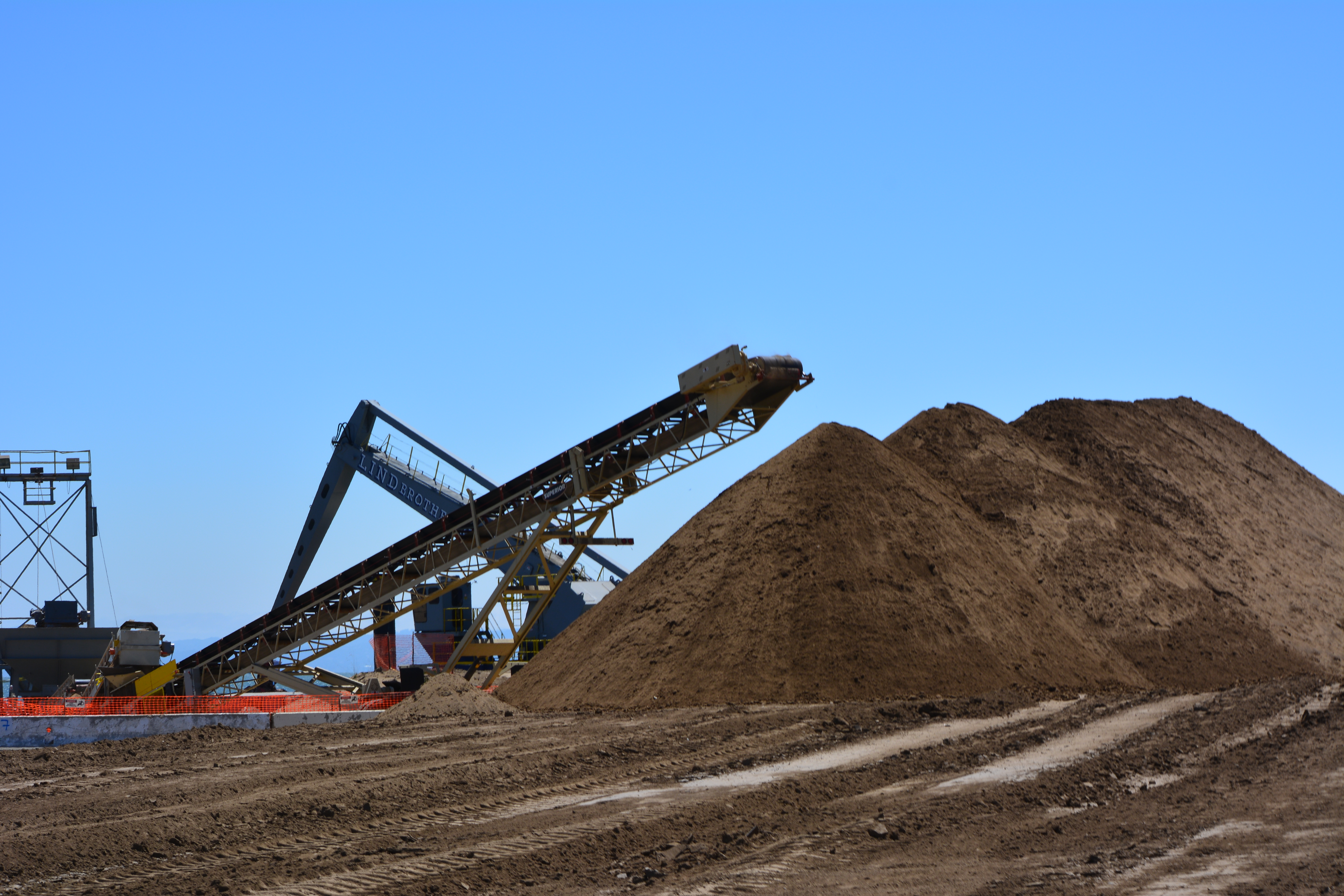
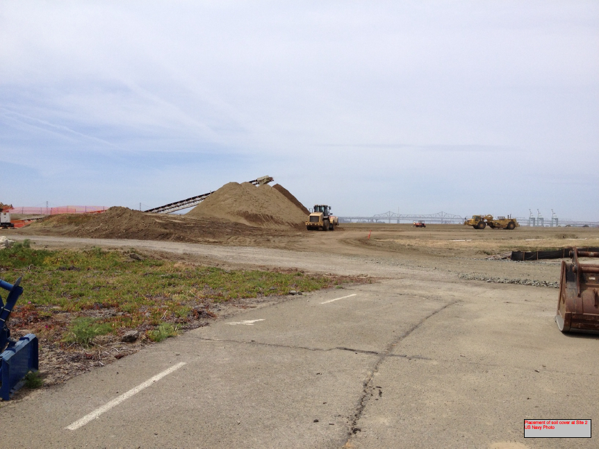
The contouring of this industrial landfill site was completed on August 16, 2013. Approximately one-third of the contouring, or base layer, soil is clean soil recycled from Seaplane Lagoon dredging. The recycled soil stock was quickly exhausted, along with soil recycled after removing some of the berms and high areas. More than half of the base layer – 193,000 cubic yards – is soil barged in from Decker Island in the Sacramento River.
Soil being delivered from Decker Island.
This contouring phase, which began in January of 2013, created the base layer with a specially-engineered slope. It was then scanned for radiation using scanners towed by a small vehicle, even though the site had been surveyed for radiation prior to placing the base layer.
Scanning the base layer for radiation.
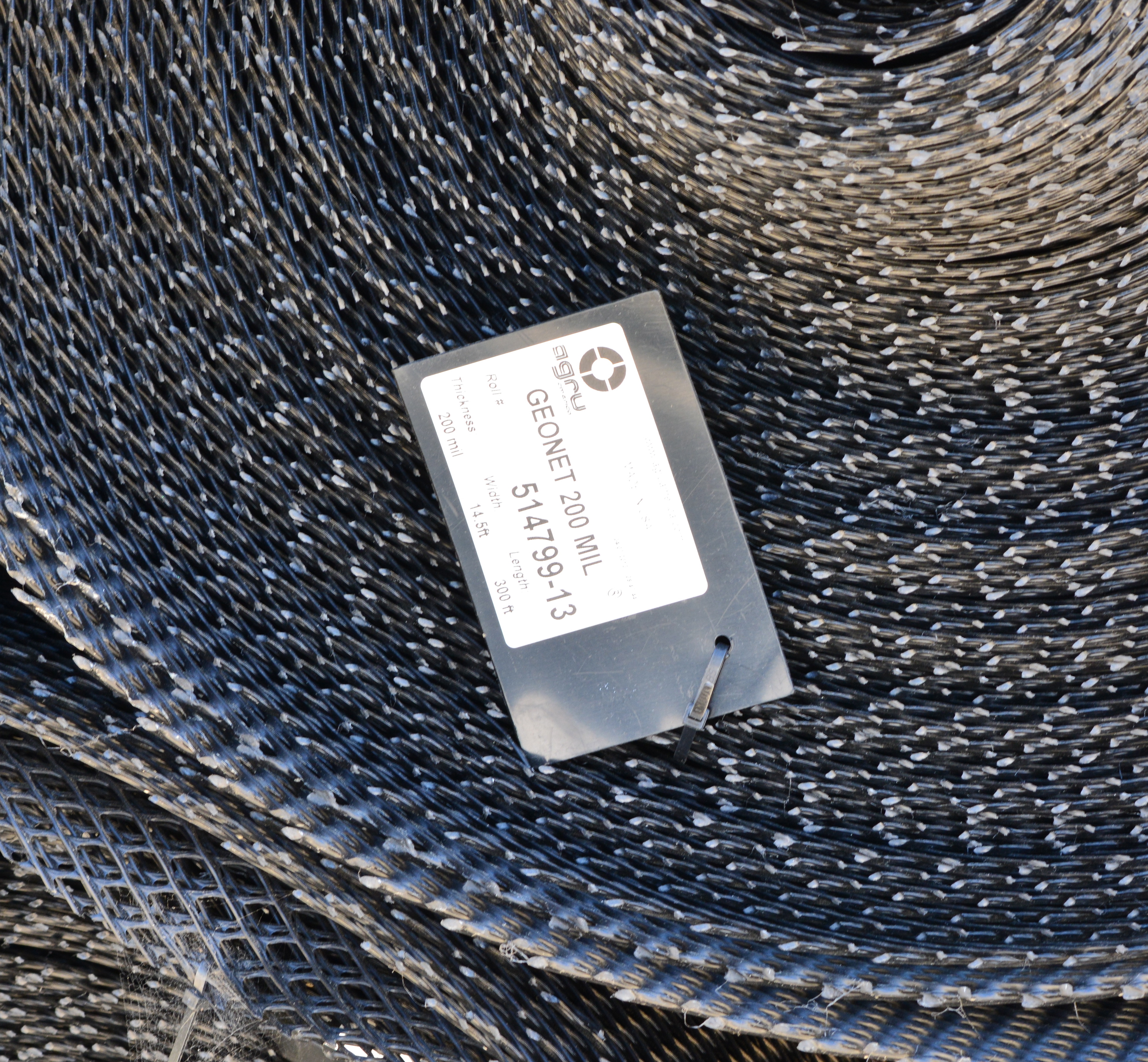
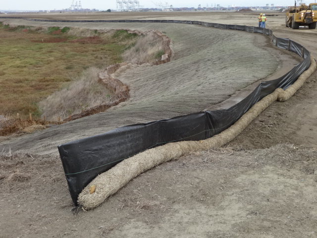
Placement of the plastic biobarrier (see photo below) and the final soil cover using soil barged in from Decker Island began on August 19, 2013. The biobarrier is a plastic mesh that is designed to discourage burrowing animals from coming into contact with the waste area. The biobarrier installation is over 90% complete as of week #38 (October 24, 2013). The final two-foot soil cover is over 60% complete. The final soil cover includes six inches of soil amended to promote growth of vegetation.
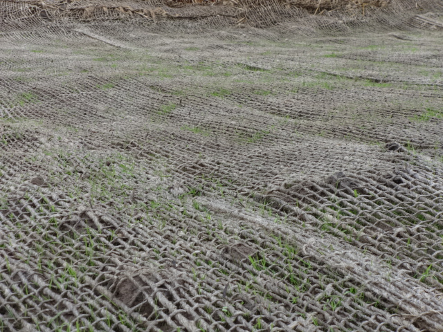
The soil stabilization and drainage work on the shoulder around the wetland area is also completed. It includes native rye grass seeding, a jute mesh cover, and a silt fence. Some of the rye grass has already started to sprout.
Stormwater controls near wetland area being created.
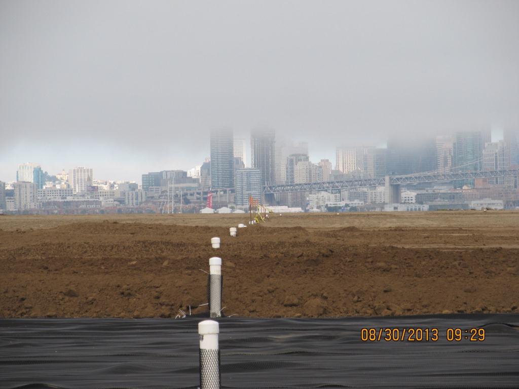
New monitoring wells will be installed starting in late November.
Hydroseeding of the site with an assortment of California native grasses will begin in late November or early December.
In 2014 the old culvert connecting the north side of the wetland with San Francisco Bay will be replaced with a new culvert.
Fifty tons of old fence and metal have been recycled. The temporary work fence will be removed at the end of the job. The methane gas vents will be short and virtually unnoticeable (see photo below). Due to the age of the landfill and the fact that very little organic waste was deposited there, the methane gas produced is minor and will not require the 10-foot tall vent stacks proposed in an earlier workplan.
Methane gas vent pipes.
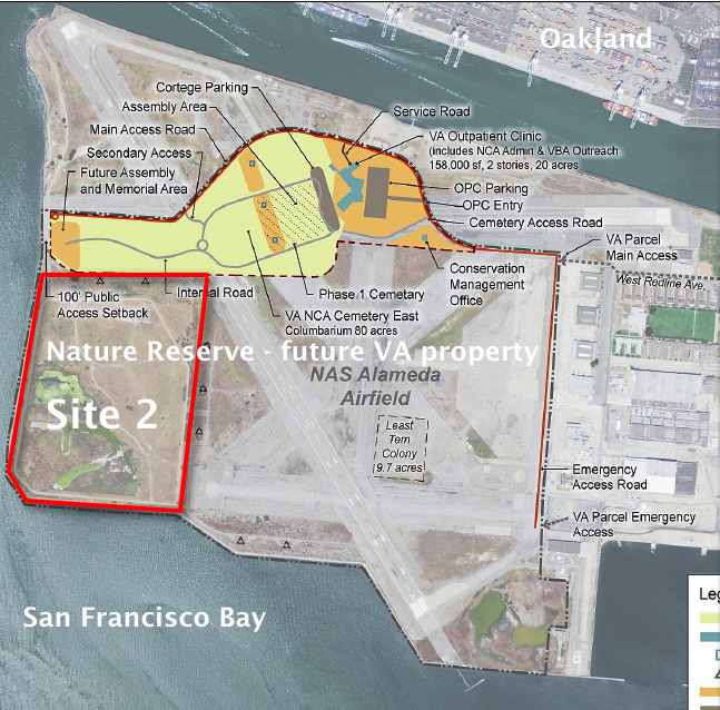
This site, along with adjacent land, will be transferred to the U.S. Department of Veterans Affairs in late 2013 or early 2014.
VA map, with Site 2 and Nature Reserve notations added by Alameda Point Environmental Report.Biobarrier to discourage burrowing animals. Photo credit: Alameda Point Environmental Report.
Silt fence installed above jute mesh around wetland area.Silt fence under construction.Jute mesh around wetland shoulder, with grass starting to sprout.Week 36 – Vegetation growing through jute mesh around shoulder of wetland area.
Source: The information in this update was gathered from the weekly progress reports for Installation Restoration Site 2 Remedial Action at Alameda Point. The progress reports are posted on the Envirostor website maintained by the California Department of Toxic Substances Control (DTSC). The source for all photos in this update, unless otherwise credited, is DTSC.
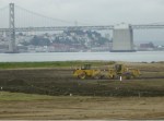
On August 3, 2013, the Navy’s annual environmental cleanup tour visited the worksite known as Site 2 on the southwest corner of Alameda Point. Work has been underway at the site since early this year, constructing a 79-acre soil cover atop the old waste disposal area. Due to budget cutbacks this year, only the Restoration Advisory Board was taken on the tour.
Transition from soil cover to wetland. Port of Oakland in background.
The site was closed for waste disposal in the mid-1980s and given a soil cover that did not meet landfill closure standards. For more than a decade after it was added to the Superfund cleanup program, the regulatory agencies and the Navy went back and forth about how best to close the site in an environmentally safe manner.
The slope of the soil cover is so important to the engineering design that the blades on the graders are not even controlled by the driver. Blades on the graders, and even the bulldozer, are controlled by an onboard computer that uses a GPS satellite to maintain a uniform elevation. The engineering concept for this soil cover is to minimize the slope so as to minimize movement in an earthquake, while at the same time providing for drainage.
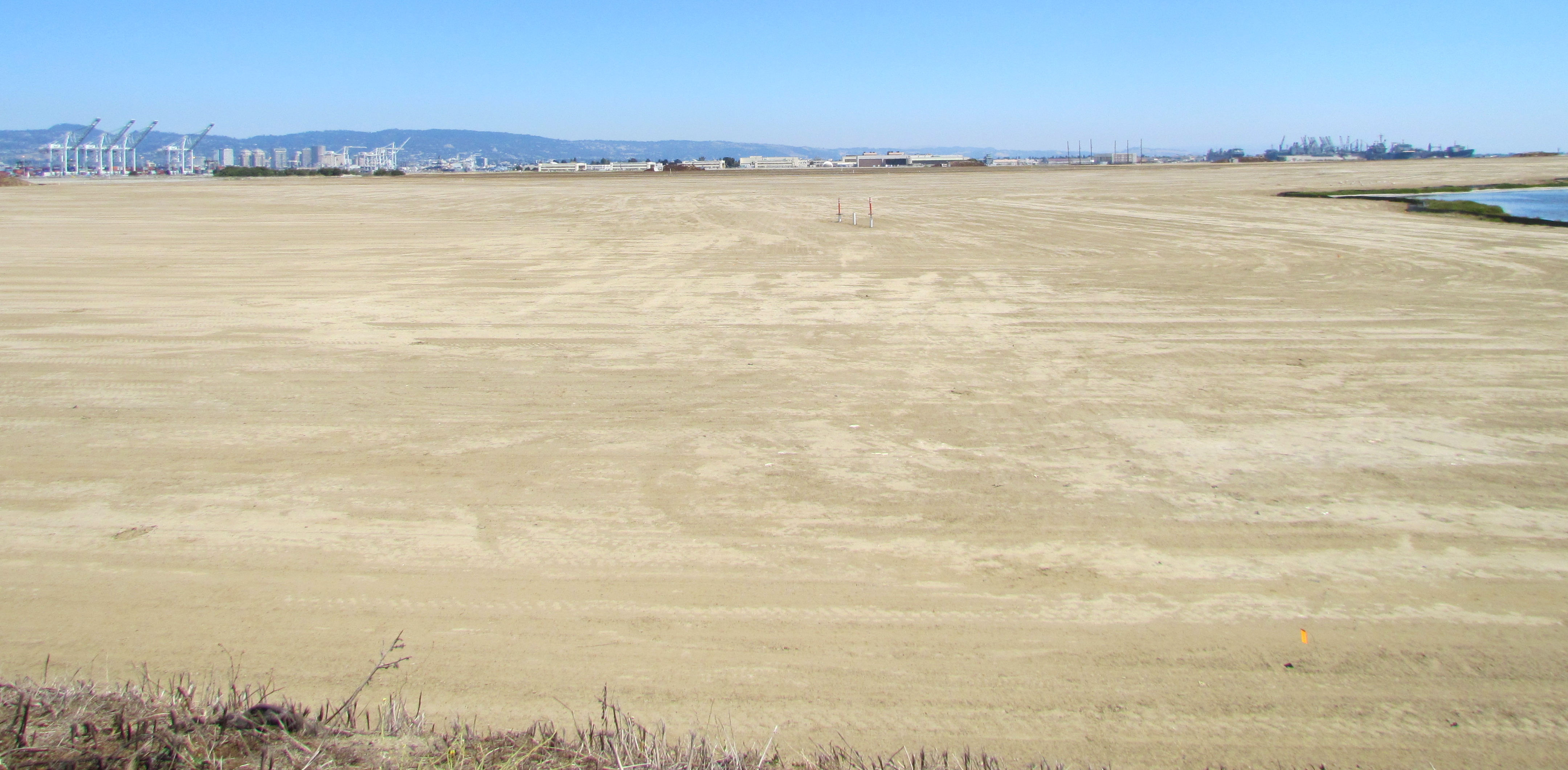
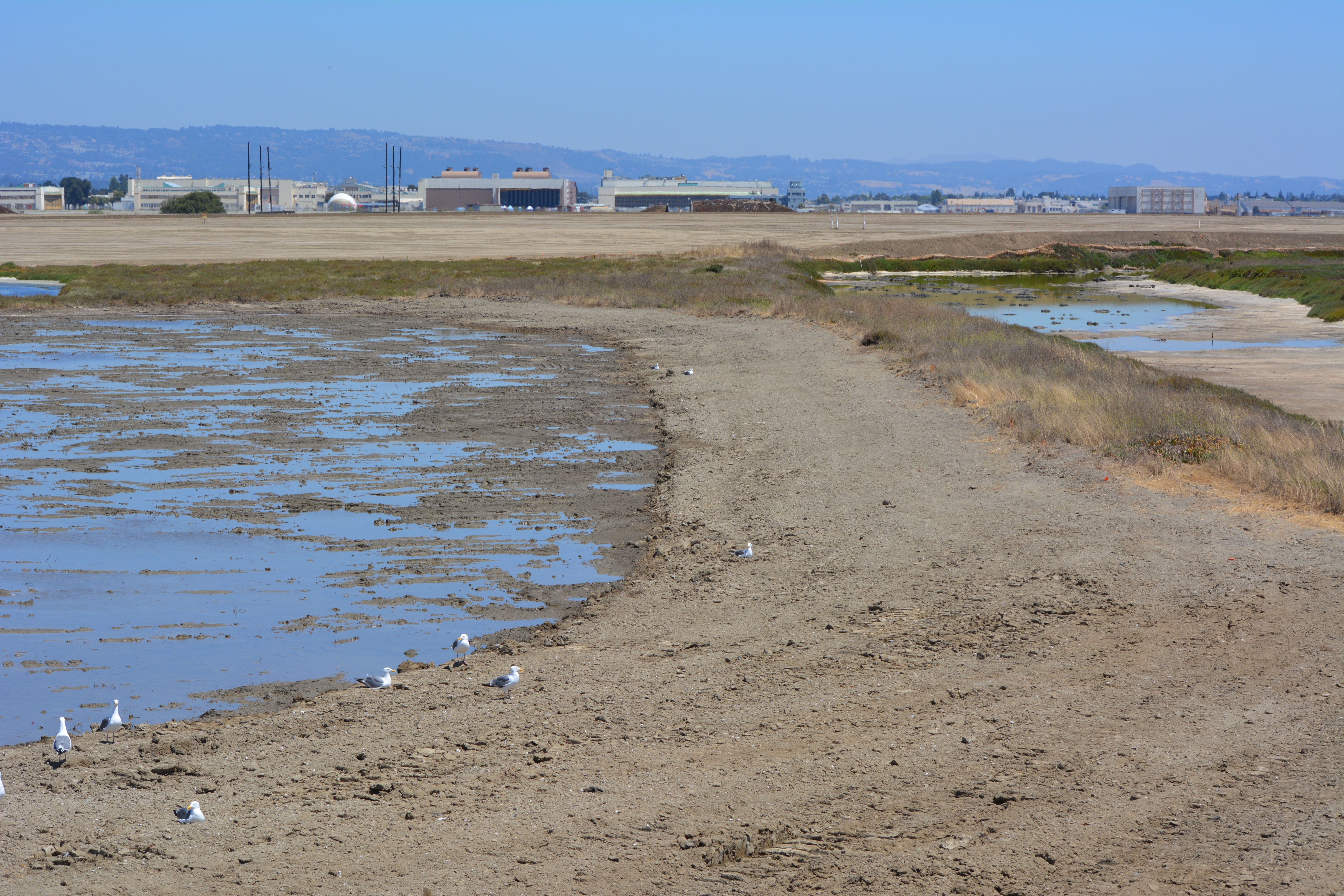
Looking east at partially completed soil cover from the western shoreline of Alameda Point.
Soon the contractor will be laying down a 200-mil-thick HDPE geonetting material to act as a barrier to burrowing animals. Next, they will add two more feet of soil before installing monitoring equipment, drainage features, access road, and seeding the soil with a variety of California native grasses. Seeding is planned for this fall before the rainy season.
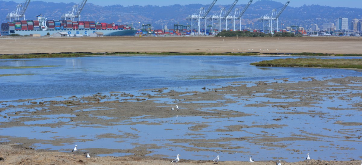
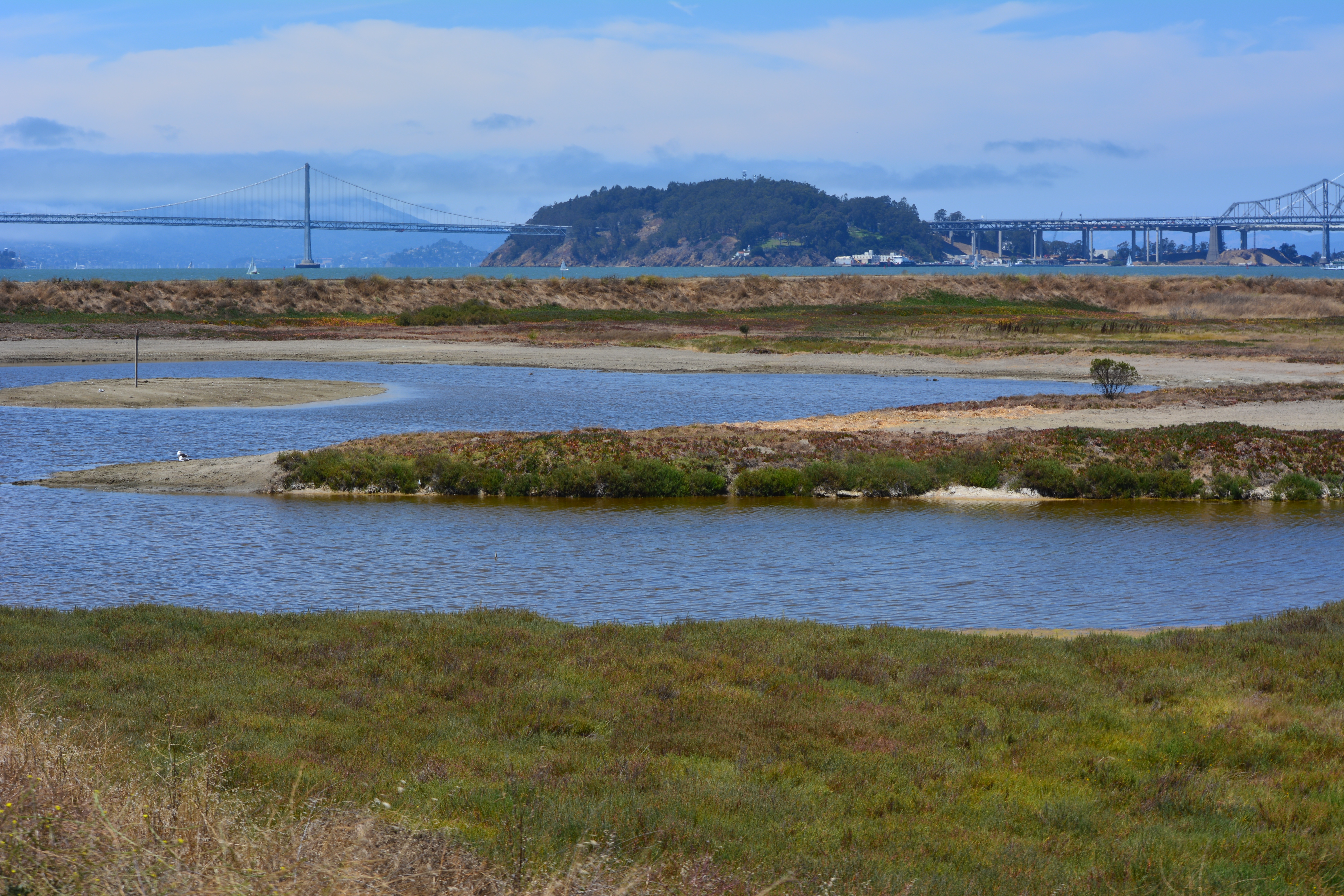
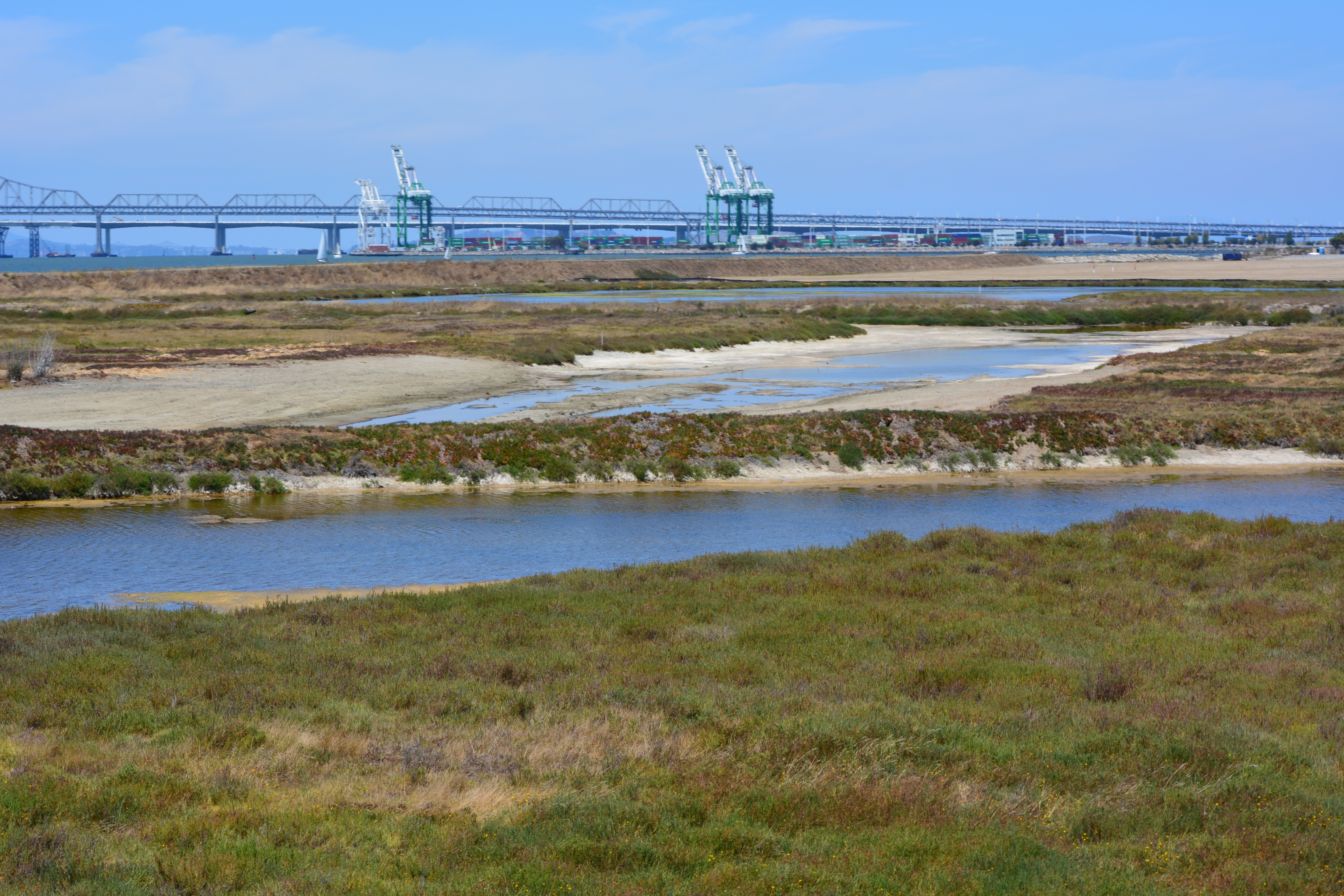
The 30-acre wetland area is not contaminated, but it will receive some upgrades with additional wetland. There is both a freshwater wetland area fed by rainwater, and a saltwater wetland area connected to San Francisco Bay via an underground culvert. The culvert will be replaced due to its age.
Partial view of wetland and soil cover on southwest corner of Alameda Point. Looking east with maritime ships in background.
More than 600,000 cubic yards of soil is required to complete the project. Of that amount, 110,000 cubic yards have been recycled from the Seaplane Lagoon dredging after it tested clean. The rest is being barged in from Decker Island in the Sacramento River near the town of Rio Vista.
Soil from Decker Island being off loaded from barge at southwest corner of Alameda Point.
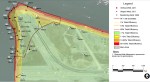
This 110-acre project site, featuring the most scenic viewpoint in all of Alameda, will be transferred to the U.S Department of Veterans Affairs (VA) along with another 400 acres of the Nature Reserve, and 112 acres for the VA’s clinic and columbarium. A nearby public access area on the western shoreline will be developed when the VA completes their road along the northern perimeter of the columbarium to the western shore. The Bay Trail will eventually run along the shoreline.
Partial view of wetland area on Site 2 – Alameda Point Nature Reserve. Bay Trail will be on the other side of the embankment that runs along the far side of wetland area.Wetland on the left connected to San Francisco Bay. The muddy part in the photo was recently added and will be allowed to naturally revegetate. Freshwater wetland to the right. Looking east toward hangars.North Pond wetland connected to San Francisco Bay. Port of Oakland in background.Wetland area on Site 2 looking north from southern perimeter of the site.Off loading soil from barge for Site 2 soil cover at Alameda Point. Southern shoreline.Construction equipment at Site 2. Looking east with maritime ships in background.VA project at Alameda Point with adjacent Nature Reserve that includes Site 2 remediation area.
Thirty-five years after the Navy stopped disposing of toxic waste in unlined pits next to San Francisco Bay on Alameda Point’s southwest shoreline, the final actions to comply with state and federal laws are finally being implemented this year.
Site 2 where industrial waste is buried. Area up to the wetland will be covered with two feet of additional soil.
Decades of wrangling between the Navy and regulatory agencies over how to handle the West Beach Landfill, dubbed Site 2, were finally ironed out this spring. The U.S. Environmental Protection Agency (EPA), the Regional Water Quality Control Board (Water Board), and the California Department of Toxic Substances Control (DTSC) have agreed to a plan that calls for leaving the estimated 1.6 million tons of industrial waste in place and adding more soil to the existing soil cover.
Placement of soil cover at Site 2 – May 2013. US Navy Photo.
The Navy began dumping waste in the area in 1952, four years before they surrounded the area with a seawall. The dump was closed in 1978, but early efforts to comply with state environmental laws for landfill closure were not to the satisfaction of the Water Board.
In its May 2012 draft engineering work plan for the landfill, the Navy cited a decade of groundwater monitoring along the shoreline that proved the toxic chemicals of concern are not migrating toward the Bay. Instead, the chemical concentrations are either stable or declining. The contents have been sitting in water-saturated subsurface soil since the disposal program began 60 years ago.
Radiological hotspots of debris and soil, including a small storage building, were removed after an earlier scan of Site 2. Before the current two feet of clean soil is put in place, the soil will again be scanned down to a depth of one foot, and elevated concentrations will be removed. Radium-226 paint waste was disposed of in the landfill.
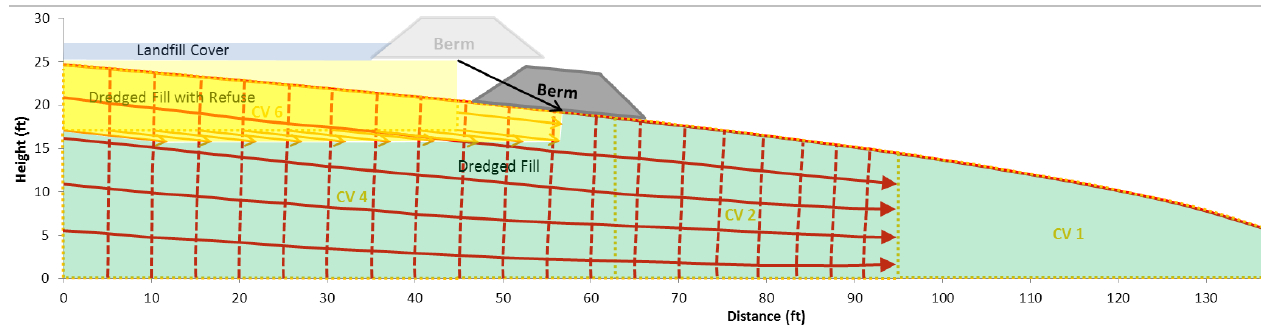
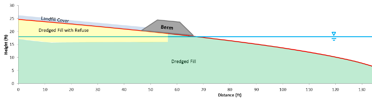
One of the major concerns about leaving this landfill in place is the consequence of a major earthquake. The Navy responded to a comment from a DTSC engineer by acknowledging that in the event of a maximum credible earthquake, the riprap boulders forming the “seawall is conservatively assumed to be non-existent, instantaneously whisked away and replaced with a 25-foot vertical face of liquefiable sand subject to plastic flow without being constrained by a rigid shell (sea wall).” The Navy’s earthquake model predicts that the earthen embankment above the seawall at the perimeter of the landfill, composed of clay and not sand, will glide into the Bay and “will not be overtopped by the waters of San Francisco Bay and freeboard of about 5 feet above mean sea level will remain, and so the refuse will remain isolated.”
Navy graphic showing predicted movement of embankment berm into San Francisco Bay during an earthquake. Click on image to enlarge.Navy graphic depicting position of embankment berm at Bay shoreline following a catastrophic earthquake. Click on image to enlarge.Southwestern shoreline of Alameda Point at Site 2 landfill. Rock/cement riprap seawall, with green embankment berm above. Looking north toward Port of Oakland.
The Navy removed a perimeter security fence from their plans following objections from regulators and the public. “Navy’s design and [Superfund] requirements for this project do not preclude future use of the site for limited public access or passive recreational purposes,” said the Navy. Simple “Habitat Restoration Project” and “Stay on trail” signs were deemed adequate.
In an unusual move, the Navy offered the Restoration Advisory Board the opportunity to select the new vegetation that will anchor the 60 acres of clean soil. In the fall of 2013, the Navy will seed the new soil with 13 native grasses, most of them flowering. The Navy has permanently removed the 12-foot high embankment on the eastern, inland side of the landfill site, which will make the grassland visible from the mixed-use area.
The 30-acre wetland area on Site 2 was not contaminated, but will receive improvements to the quality of several acres. The culvert connecting the wetland to San Francisco Bay will be regularly inspected and permanently protected.
Bare soil is where the eastern embankment used to be.
Site 2 landfill with eastern embankment removed.
West Beach Wetland on southwestern Alameda Point. San Francisco in background.
West Beach Wetland with San Francisco Bay in the background. Part of wetland is connected to the Bay via metal culvert.
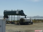
Off-loading of the soil hopper. US Navy Photo.
Off-loading of soil from barge to the soil hopper. US Navy Photo.
Soil conveyor at Site 2. US Navy Photo.
Imported soil stockpile. US Navy Photo
Water truck being filled. US Navy Photo.
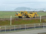
Site 2 grading equipment. US Navy Photo.
Eastern (inland) embankment at Site 2 being removed. US Navy Photo.
Loading trucks with Site 17 (Seaplane Lagoon) dredge spoils that were cleared as non-hazardous and stockpiled on the runway north of Site 2. US Navy Photo.
Site 2 wetland mitigation plan. US Navy map.
Site 2 trail signage. US Navy images.
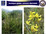
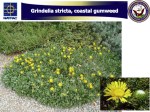
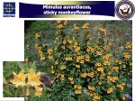
One of the native grasses to be hydroseeded on Site 2 in the fall of 2013.
One of the native grasses to be hydroseeded on Site 2 in the fall of 2013.
One of the native grasses to be hydroseeded on Site 2 in the fall of 2013.
One of the native grasses to be hydroseeded on Site 2 in the fall of 2013.
One of the native grasses to be hydroseeded on Site 2 in the fall of 2013.
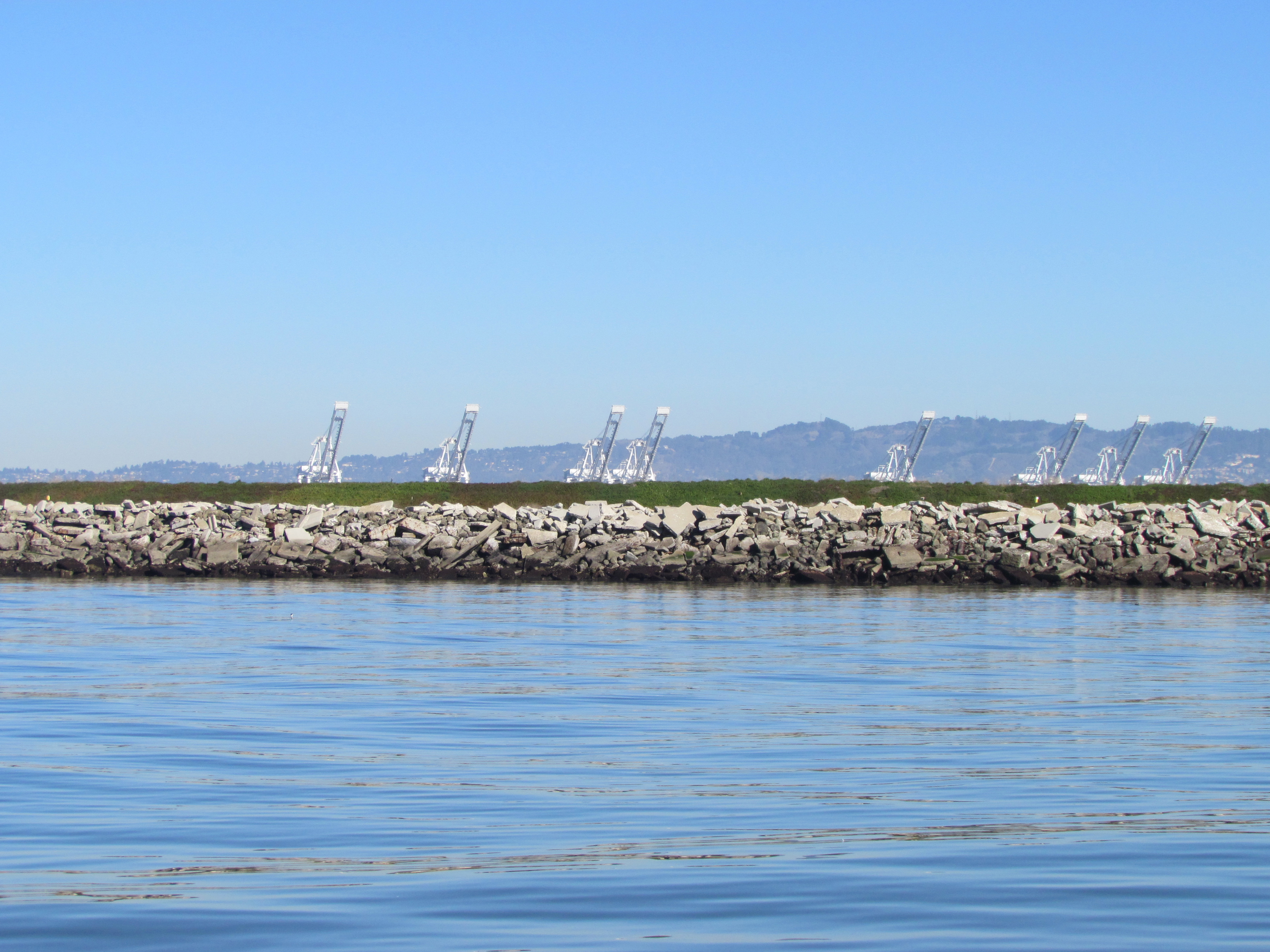
Northwest tip of Alameda Point. Waste burning area is immediately to the right of trees. Port of Oakland is in background.
It was the 1950s, before the environmental movement of the 1970s and the laws that followed in its wake. Hauling waste materials out to the western shoreline of Alameda Point to be burned and bulldozed into the Bay was not considered irresponsible. The “Burn Area,” as it is called, lies next to the shore near the entrance to the Oakland Estuary.
Burn Area on Site 1. San Francisco Bay to the left. Oakland Estuary to the north.
By 2009, the Navy was ready with a plan to finally remove several acres of contaminated Burn Area soil and haul it away. In 2010, testing by the cleanup contractor preparing to do the work, however, revealed additional burn residue that extends over a longer area and under the shoreline slope. The new information triggered a complete re-evaluation of the plan.
Excavation and removal at the greater depth and under the shore would drive the cost up from the original $5 million to $40 million. Fortunately for the Navy, a new and lower cost option became available just as the Navy and regulatory agencies were gathering more soil and groundwater data and discussing options.
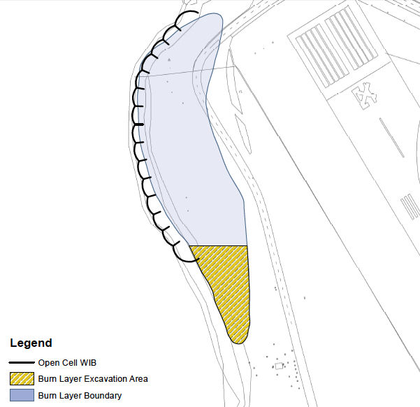
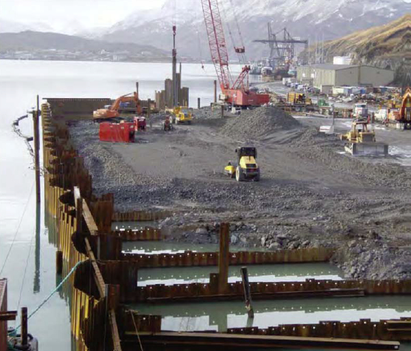
In 2011, the US Army Corps of Engineers approved a shoreline steel containment system called an “open cell vertical confined disposal facility.” Primarily used for harbor and waterway reinforcement and as a containment area for dredge sediment, the system is also suitable for permanently isolating and containing the toxic burn material along several hundred feet of Bay shoreline. This option will cost $13 million.
Open cell sheet pile containment system under construction at Dutch Harbor, Alaska. The same system is proposed for the Alameda Point Burn Area. Photo source: US Army Corps of Engineers 2011 report.
The Navy calls the open cell system a “waste isolation bulkhead.” It consists of a wall of interlocked steel plates embedded in the earth along the shoreline. Perpendicular steel walls extend toward the shoreline to form cells, or compartments, and provide anchorage. The absence of welding to hold the system together allows it to flex without failing and eliminates the problem of welds corroding.
Tests around the Burn Area were conducted in 2010, 2011, and 2012 to determine if any of the chemicals in the burn residue were entering San Francisco Bay. None were found to be entering the Bay. Nevertheless, the Burn Area’s proximity to the Bay requires that it either be removed or permanently isolated.
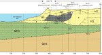
The Burn Area is located on the 37-acre Site 1 cleanup area. The site includes about a half dozen unlined underground pits that were used for waste disposal and are now partially covered by runway pavement.
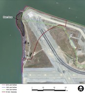
Site 1 landfill map. Area 1b is the Burn Area as it was originally configured. Click to enlarge.
Cleanup of asolvent plumeon Site 1 that posed a potential threat to the Bay took place last year. Previous cleanup on the site included removal of debris and soil contaminated by radium-226 used in painting luminescent aircraft dials.
When the Navy is finished with the Burn Area bulkhead barrier, the Burn Area will again be tested for radiological contamination. All 37 acres of Site 1 will then be covered by at least two feet of clean soil and seeded with native grasses.
Site 1 will be available for passive recreational use as part of the proposed 147-acre regional park along the northern shoreline. Site 1 will be part of the final conveyance of land to the city slated for 2019. The VA’s property is adjacent and to the south and east.
The Navy’s project manager along with the cleanup contractor for Site 1 will be present at a special public meeting to answer questions and take comments on the new proposed plan for the Burn Area. The meeting is on April 9 at the Alameda Main Library, 1550 Oak Street, from 6:30 pm to 8:00 pm.
The Navy’s recently-completed soil and groundwater study for the Burn Area is called aFocused Feasibility Study(FFS) and is located on the state Envirostor website.
The FFS is very large and is divided into parts. Recommended parts to look at first:
Part 1, Part 3 (cool maps), Part 4 (mostly raw data, but has trench photos), and Part 8 (descriptive letters from PND Engineers that own the patent on the open cell system, and all the comments by the regulatory agencies and the responses to comments.) Part 5 has a lot of technical data and description of the groundwater model in relation to the Bay.
Reference material on the open cell barrier proposed for the Burn Area:
Overview of the Open Cell Confinement Disposal Facility system byPND Engineers.
2012reportto the Alaska Legislature on the Open Cell system.
Image highlights from the Focused Feasibility Study for the Site 1 Burn Area
Click on images to enlarge.
1939 Land Surface – Site 1
1946 Land Surface – Site 1
2010 Land Surface – Site 1
Updated Burn Area shape – Site 1
Gold area is part of the newly discovered burn material. This relatively thin area will be dug up and placed in the main burn area behind the bulkhead barrier.
Well locations for groundwater testing.
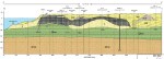
Geologic conceptual model – Site 1
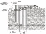
Geologic model cross section – hand drawn
Geologic cross section. Charcoal area is the burn material.
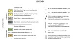
Burn Area geology legend
Charcoal-colored area is the burn residue and debris.
Sheet pile bulkhead drawing for containing the Burn Area at Site 1.
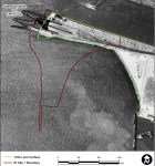
Site 1 at the northwestern tip of Alameda Point was used as the principal disposal area for all waste generated at Naval Air Station-Alameda from 1943 to 1956. This disposal area, which was once part of the Bay, was created by sinking pontoons and barges in the Bay and backfilling with dredge soil.
Disposal of cleaning solvents and petroleum products at one unlined pit within the landfill resulted in a groundwater plume that poses a threat of leaching into San Francisco Bay today.
In the 1990s the Navy installed an underground barrier system, called a funnel and gate permeable reactive barrier, to stem the flow of contaminants into the Bay. It was not a permanent solution. In July of this year the permanent solution began with the injection of neutralizing chemicals into the plume.
Protecting marine life
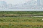
San Francisco Bay at Alameda Point western shoreline where threat of solvent leaching exists.
Most cleanup activities around the base are aimed at eliminating direct health risks to humans, such as from soil or from vapors that could enter a building. In a few cases, the cleanup is focused first on direct impacts to marine life such as fish, which could in turn cause health problems for people who eat them.
The cleanup effort at the Site 1 plume is one of those cases. This effort will keep toxins — solvents, petroleum products, and metals — from ever leaching into the Bay, being ingested by fish, and then consumed by humans. The effort will also reduce unacceptable levels of vapors that are escaping directly above the plume. The future use of the site will be restricted to open space recreational.
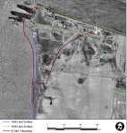
The process
July 2012 – Manifold system of hose lines that send oxidant chemicals to individual wells that go into the underground plume contamination area. Navy photo.
The chemical injection process, called In Situ Chemical Oxidation (ISCO), is accomplished by injecting oxidants (catalyzed hydrogen-peroxide and sodium persulfate) into the plume through injection wells. “These oxidants produce short-lived reactions that directly destroy the targeted contaminants,” according to the Navy. Groundwater tests will determine if further treatments are necessary.
Tanks of chemicals for neutralizing solvent plume. Shown as work area being set up in June 2012.
Treatments will continue until either the groundwater is clean enough, or the solvent and petroleum concentration has been reduced by 75%. Once they get to 75% reduction, further injections are more or less a waste of money. From then on, the contaminant concentration is low enough that the remainder will either degrade or disperse and dilute naturally without posing a risk to fish or humans. This process is called natural attenuation and is often relied upon to finish the job when the bulk of contaminants are neutralized and treatment methods no longer yield effective results.
The groundwater plume is also contaminated with metals consisting of arsenic, copper, mercury, nickel, silver, and zinc. The metals problem will, in theory, be taken care of when the solvents and petroleum products are eliminated. This will cause the chemistry of the groundwater to change, which in turn will cause the metals to no longer remain dissolved in the water. The metals will return to their solid state and remain where they are. That’s the theory.
But to make sure it’s working, there will be a long-term groundwater monitoring program to make sure the metals aren’t moving. If problems arise in the future, the Navy will have to come back and design a new remedy. The Navy is responsible for the landfill’s contents staying in place in perpetuity.
Map of Site 1 disposal area with arrow from left indicating plume treatment area. Map also shows outlines of individual unlined pits that were used for disposal of waste. Half of the area is now covered by runway.
The Navy opted not to remove the landfill contents because of the $93 million price tag and because the risk of contaminant releases was deemed low. A new set of environmental concerns associated with digging up and hauling away a landfill was also cited during the decision process.
The groundwater plume being treated is approximately 30 feet wide by 160 feet long, and it occurs mainly between depths of 5 and 10 feet below the ground surface.
Site 1 groundwater treatment work underway in July. San Francisco in background. Navy photo.
Delay on soil cover
All of 30-acre Site 1 will eventually be covered with soil and seeded with native grasses. Work on the soil cover was delayed when the contractor discovered that the part of the landfill once used for burning waste was larger than expected. The documentation has to go back through the review process, with a work plan for the soil cover hopefully prepared and ready to implement by 2014.