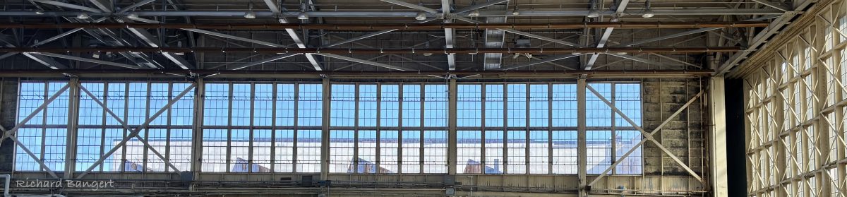
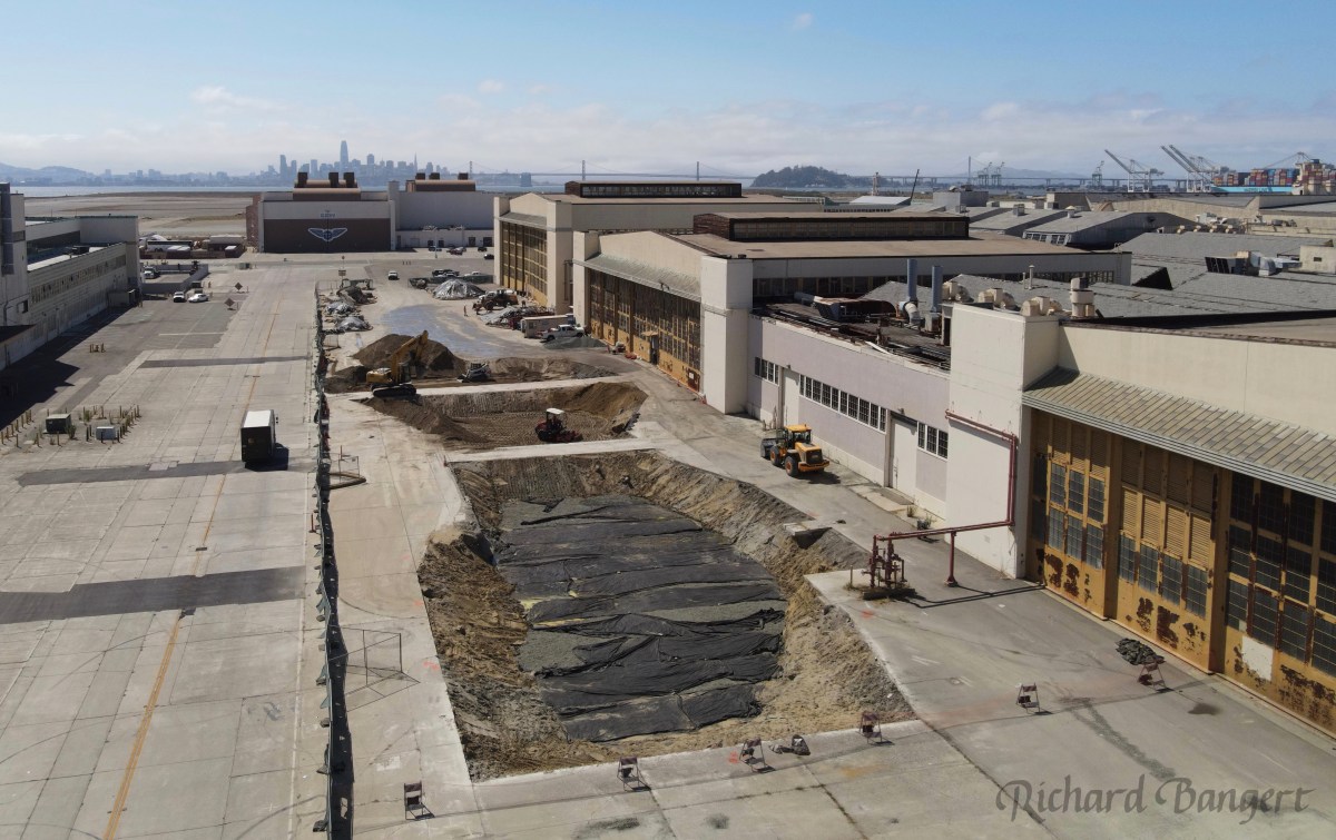
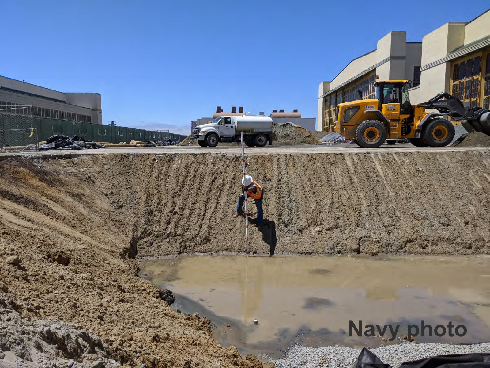
Cleaning up petroleum contamination in soil and groundwater is pretty straightforward. It is usually accomplished by one or more tried-and-proven methods that rely on inserting PVC pipe into the contamination zone for treatment. But multiple efforts outside the sprawling Building 5 hangar complex on West Tower Avenue at Alameda Point failed to reduce contamination to regulatory goals. In August 2020, after almost two decades of investigation and treatment efforts, the Navy resorted to a rarely used option of digging up all of the soil down to the water table and hauling most of it away.
Building 5 was the location of the Navy’s plane refurbishing and overhaul facility where thousands of civilians worked. It was known as the Naval Air Rework Facility. Before an airplane was moved into the hangar, it underwent de-fueling, flushing out fuel lines and cleaning various components with products akin to paint thinner. This preparatory work was the source of the contamination in the soil and groundwater near the big hangar doors. Continue reading “Navy digs up petroleum contamination in rare cleanup action”
The Navy has spent more than 15 years cleaning up contaminated groundwater underneath two former gas station sites at Alameda Point. They are still at it, but it’s not because the Navy is slow or lacking in commitment and expertise. It’s the nature of groundwater cleanup, which involves intermittent treatment efforts.
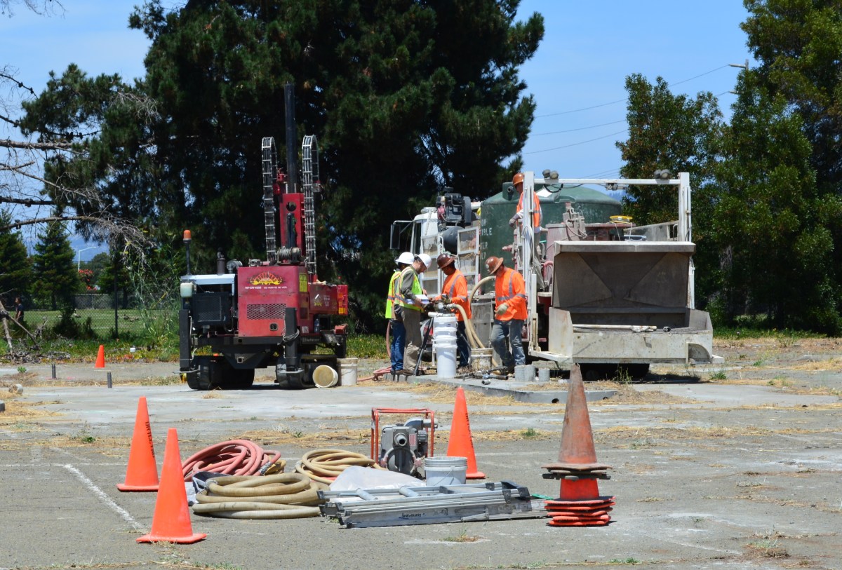
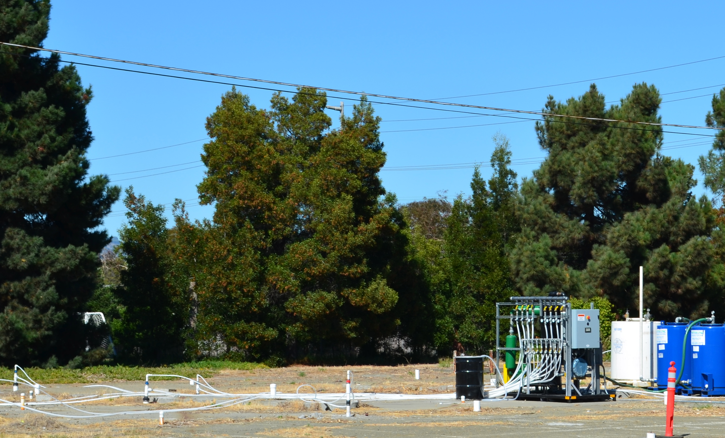
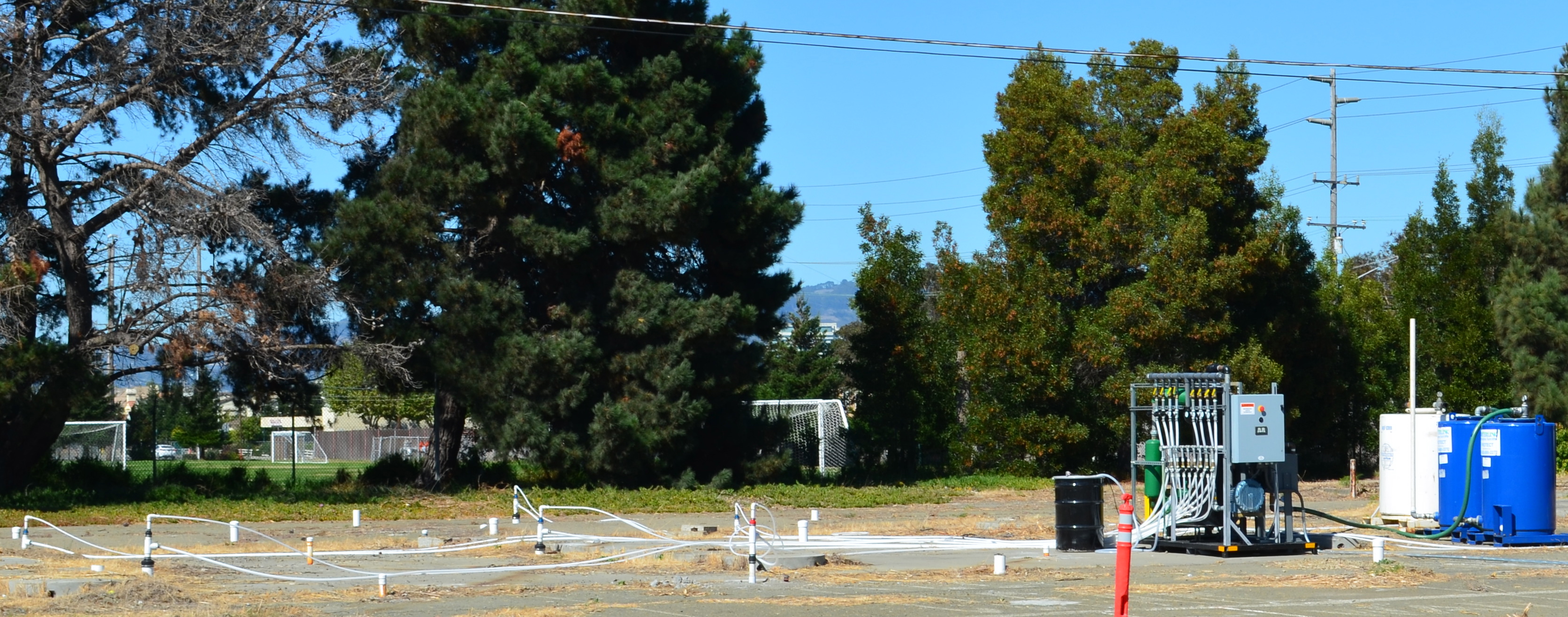
In July, the Navy’s contractor returned to the old gas station and car wash site on West Pacific Avenue at Main Street and to the old commissary gas station site at West Tower Avenue and Main Street across from Bayport. It’s the third visit to these sites to eliminate petroleum hydrocarbon contamination in groundwater, in addition to earlier removal of underground tanks, fuel lines, and soil. The contaminants are located from 2 to 16 feet below ground surface.
Workers at the old gas station and car wash site on West Pacific Avenue on July 13, 2015 preparing to inject cleanup solutions into the ground. The Navy operated a gas station and car wash on the site from 1971 to 1980. Green tank on truck contains non-potable water for on-site mixing of treatment solution. Soccer field is in the background.
The goal is to bring the property up to the public health and environmental standards required for the future commercial and residential uses previously determined by the city.
“When groundwater contamination is involved, such as at the two former gas stations, cleanups often involve multiple phases, each building upon earlier accomplishments,” said Dr. Peter Russell, who has been reviewing Navy cleanup plans and preparing cleanup-related documents on behalf of, and at the direction of, the city since 1997. “As long as all imminent health and environmental risks are eliminated early on, often the most cost-effective approach to complete remediation is incremental,” explained Russell. “In contrast, a massive initial remedial effort that is sure to achieve all remedial goals in one pass would likely involve over-sizing the treatment system, which is more disruptive and expensive than a phased approach.”
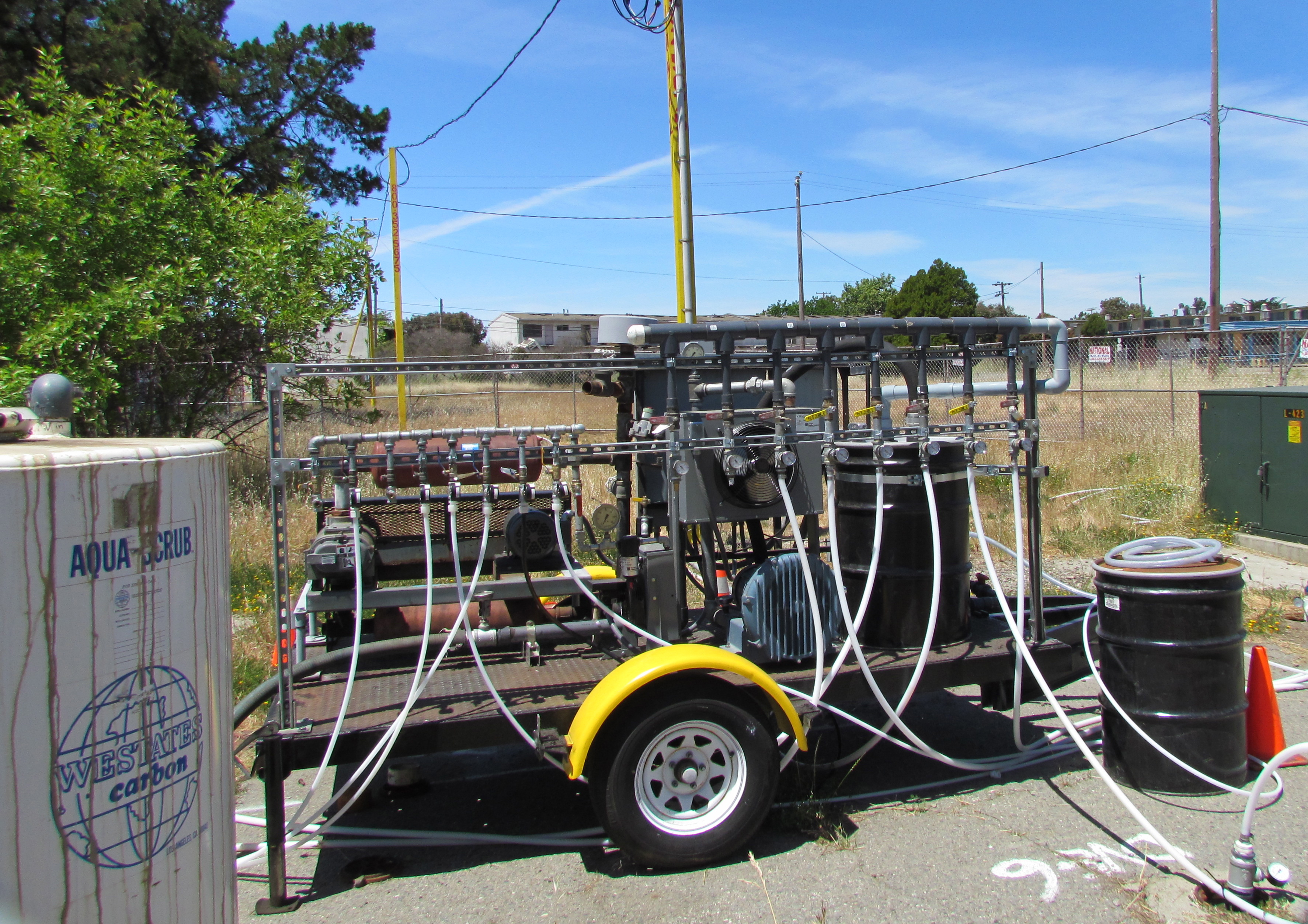
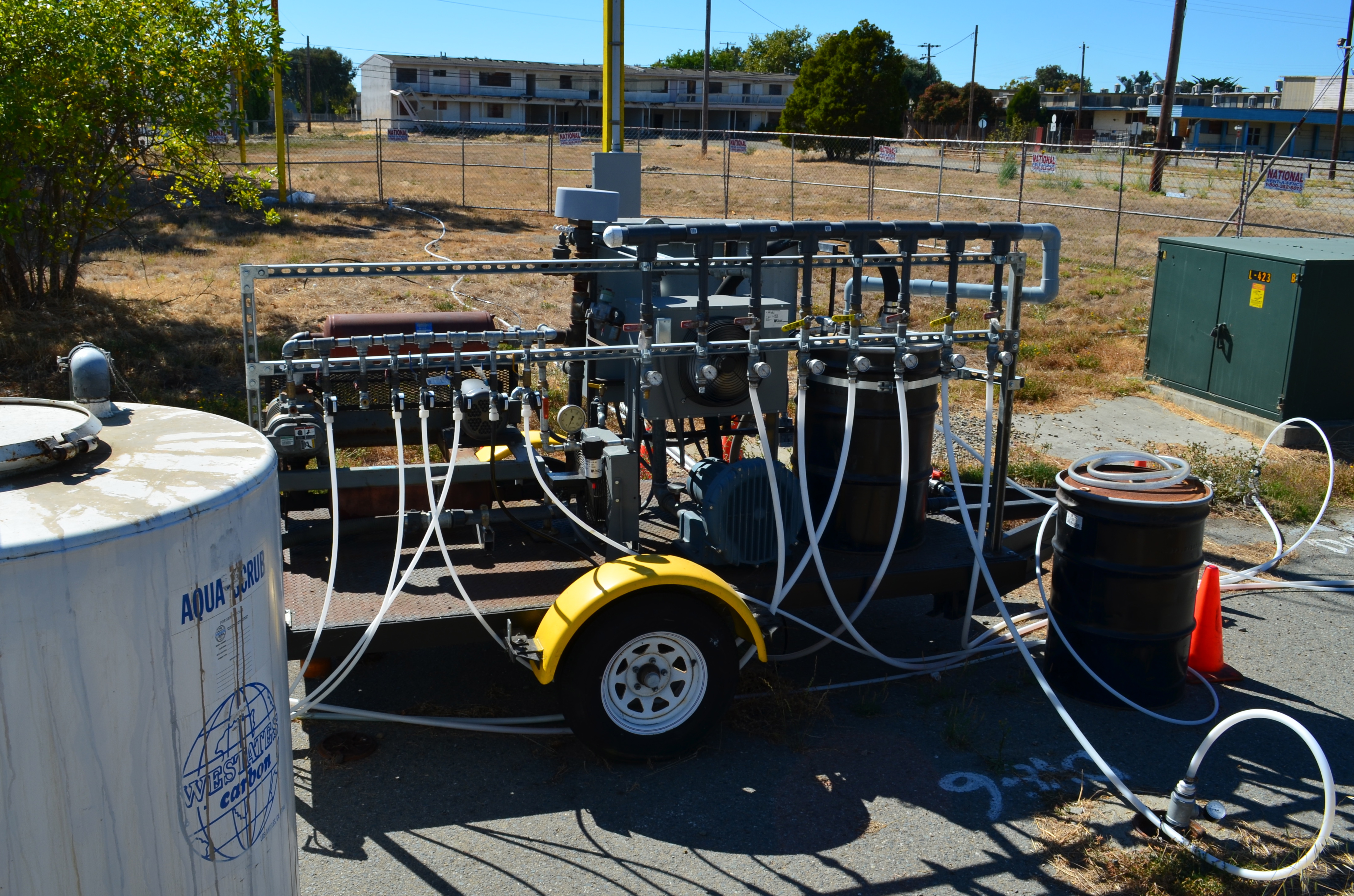
During previous cleanup visits, the Navy used a vapor extraction system to remove the bulk of the petroleum contamination. The process involves pumping air into numerous pipes, called wells, which extend into the water-saturated zone where the contamination is. The air pressure creates vapor that is part air, part water and part petroleum. The vapor is then sucked out through another set of wells, and the petroleum vapors are captured in drums of granulated charcoal, while the water is shunted off to a separate container.
Air injection/extraction system operating at W. Pacific Avenue gas station site in 2013 and 2014. System extracts and captures petroleum vapors.
The method of blowing bubbles in mud and sucking out the air sounds unsophisticated, but it works. After running the system in 2013 and 2014 at the West Pacific Avenue gas station site, for example, the level of one contaminant, benzene, went from around 1,000 micrograms per liter down to 58, bringing the contamination low enough to allow indigenous bacteria to finish the job.
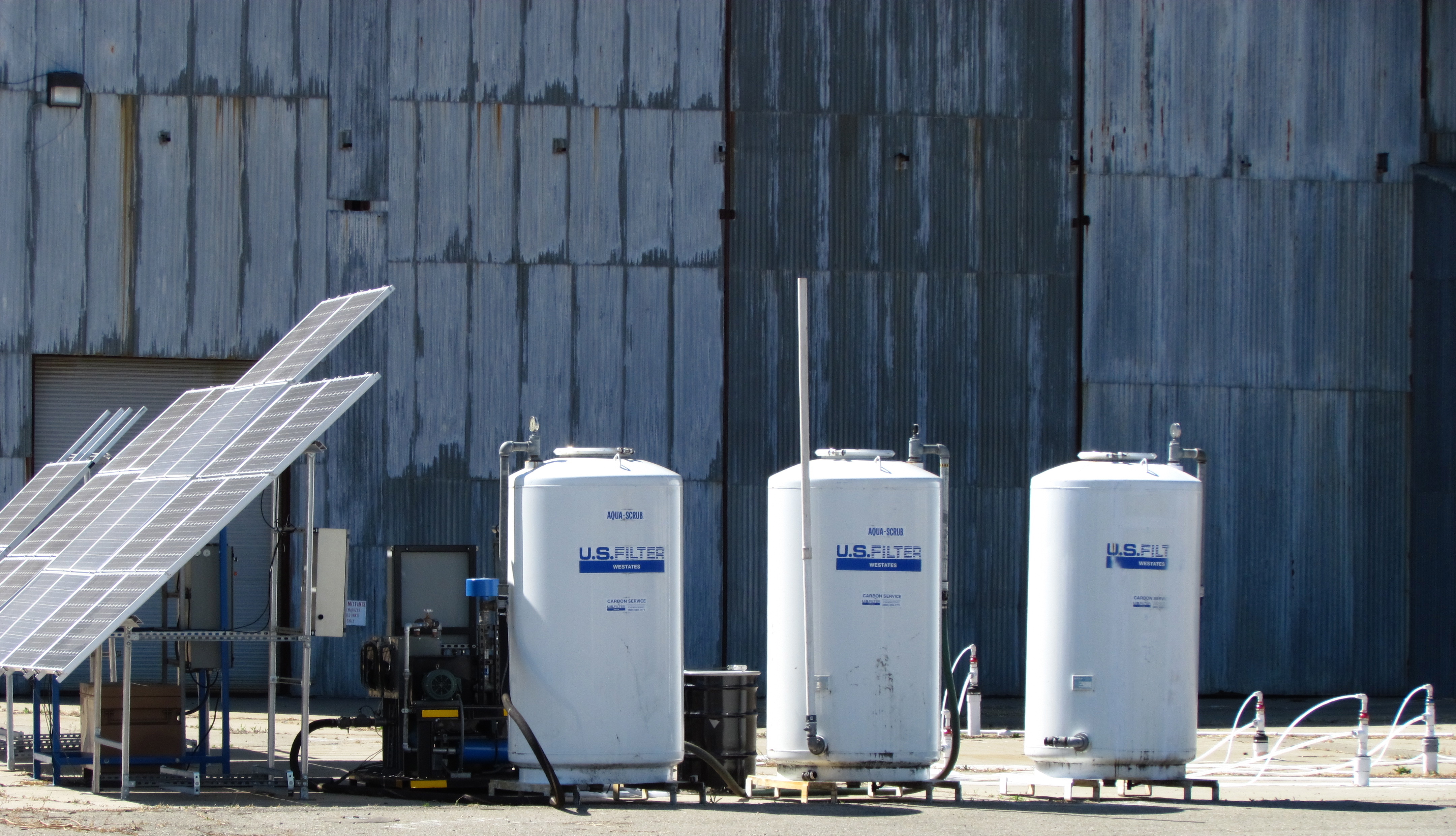
Air injection and vapor extraction system operating at former commissary gas station site in May 2013. Charcoal tank to capture vapors is at left.
The Navy returned to these sites in July and, in this phase, they came to help natural bacteria finish up the job. Allowing bacteria to clean up petro chemicals through natural digestion is called bioremediation. To be effective and not take a century to eliminate the problem, the bulk of the chemicals need to first be reduced to concentrations that do not overwhelm the bacteria.
At both gas station sites the Navy used a special product designed to foster growth of natural bacteria in the ground, which includes a form of time-release peroxide that turns into oxygen over a period of 12 months. An oxygen environment is necessary for the bacteria to digest petroleum. The bacteria utilize the hydrocarbons (hydrogen and carbon) in the petroleum chemicals as part of their metabolic processes and convert them into carbon dioxide, water, and microbial cell mass. Water samples will be taken at three, six, and nine months after the July injections to evaluate effectiveness.
“The Navy’s gas station remedial program is comparable to the private sector gas station cleanup program,” said Yemia Hashimoto, Engineering Geologist with the San Francisco Bay Water Board. “The cleanup requirements are similar and the required timelines for project completion are similar.” The Water Board is a California state agency and is the lead regulatory agency overseeing the Navy’s petroleum cleanup program.
The other type of groundwater contamination encountered at Alameda Point comes from a chlorinated solvent used in cleaning aircraft parts. Unlike lighter-than-water petroleum products, chlorinated solvents can sink through the upper water zone to a depth of 30 feet or more and complicate cleanup. But solvent cleanup still relies on a phased cleanup approach, often employing bacteria in the final phase.
Under the petroleum cleanup program the Navy has been removing tanks and fuel lines and cleaning up spills and fuel leaks dating back to the early 1990s before the base closed. Most of the tanks and fuel lines were removed within three years after the base closed in 1997.
Cleaning up leaked and spilled fuel has been slower, often involving running a vapor extraction pump 24/7 for years. In a few cases, a groundwater contamination site will require a callback after the initial work is completed. The Navy’s routine monitoring of groundwater, even after cleanup work has been completed, is aimed at determining whether there is a rebound in contamination readings and follow-up treatment is necessary. Three such sites needing more work, on land recently acquired by the city, are currently undergoing follow-up treatment at the Navy’s expense.
Two of the sites once served as automobile service stations. The other site is where fuel was removed from planes before they were serviced.
Former location of gasoline service station and car wash operated between 1971 and 1980 where fuel leaked into the ground. Part of the site is receiving follow-up cleanup work. Near intersection of Main St. and Pacific. Soccer field in background.
The treatment method is simple. Air is pumped into the ground where the contamination is the highest. This causes the petroleum products to vaporize, and then a suction system draws out the vapors into a barrel of charcoal. The air injected into the ground also helps natural petroleum-digesting bacteria to grow.
Petroleum cleanup site receiving follow-up cleanup next to Main St. across from Bayport. Site was former location of Navy auto service station.
Solar-powered cleanup for the first time at Alameda Point
Air injection/extraction pumps at the two former service station sites are running on electricity from the grid. At the former plane de-fueling site next to Building 410, however, the Navy is using a solar-powered pump for the first time anywhere at Alameda Point. Derek Robinson, the Navy’s Environmental Coordinator, explained the solar choice saying, “Electricity is not optimum because the overhead electrical tie-in is located too far away for the system to be tied in to the grid cost effectively. The solar units provide the power necessary to operate the air sparging and soil vapor extraction system at a competitive price.” The only other option was a combustion engine pump running on gas or diesel.
“The battery storage system is traditional lead/acid batteries,” said Robinson. “The solar array charges storage batteries allowing the system to store energy and operate in cloud cover and beyond strictly daylight hours; however, the system is designed to power off the blowers once the voltages drop below a preset level,” he said.
Sustainable Technologies, located just a block away at Alameda Point, constructed the entire rig. It consists of solar panels, a box full of lead-acid batteries, a circuit panel, and a pump. Ironically, Sustainable Technologies is located on a Superfund site that will take another six years to clean up.
Solar-powered cleanup at Building 410.
The area next to Building 410 where the fuel spills occurred has had a number of cleanup actions going back to 2002. “Corrective actions under the petroleum program were conducted in 2002 and 2011 and a remedial action under the CERCLA [Superfund] program was conducted between 2005 and 2006,” said Robinson.
Work will continue until the end of the year. The Navy will always be responsible for returning to do more cleanup work if groundwater testing shows some of the contamination was missed.
Locations of three petroleum cleanup sites currently undergoing more cleanup work.
Looking toward Berkeley Lab site.Conceptual buildout for Lab 2nd campus
The Site Management Plan (SMP) for the proposed site of the Berkeley Lab Second Campus at Alameda Point was finalized on November 18. Prepared by the city’s longtime environmental consultant, and signed off on by the Navy and regulatory agencies, the document was prepared in order to mitigate potential risks associated with development of the 45-acre parcel near the ship docks. Its primary purpose is to provide direction to construction contractors and workers so that their digging, dewatering, and soil handling activities do not jeopardize the environment or the health of the surrounding community.
Crash Course on Cleanup
The document offers a crash course on the 20-plus years of environmental cleanup of the area, including areas that barely intersect the Site on the margins. Even if the area were never to have been polluted by Navy activities, the SMP would still be required because of a decade-old city ordinance governing digging into a subsurface layer called the Marsh Crust that contains petroleum-related pollution.
What is the Marsh Crust?
Before 1900, the areas now occupied by Alameda Point and Bayport were tidal marshlands. In the late 1800s and early 1900s, before the health effects of industrial pollution were known, two industries nearby dumped their waste into the water. One of those industries was a coal gasification plant in Oakland. The other was the Pacific
Alameda in 1915
Coast Oil Refinery located at what was then the tip of Alameda, not far from Encinal High School. Much of the petroleum-related waste, classified as polynuclear aromatic hydrocarbons (PAHs), settled in the marsh. Between 1900 and 1940, these marshlands were filled with dredge material to create more land.
PAH contamination created the “marsh crust” layer at four to fifteen feet below ground surface, which is a thin layer of PAHs and oil believed to come from historical waste discharges prior to infill.
No one was concerned about this marsh crust caused by former private industrial activity until the Navy decided to close down the base.
Underground testing
By the time the Navy was ready to close down the base, including the area that is now Bayport and the future Alameda Landing, soil boring and groundwater testing was routine. Underground tests in the late 1990s are what led to the Remedial Action Plan and Record of Decision that were signed in 2000. (If these documents were drafted today, they would probably have the term “carbon sequestration” in them because this carbon waste is best left where it is – sequestered in the earth.)
Those two documents led to the creation of Alameda’s “permit-before-you-dig” Marsh Crust Ordinance. The city’s ordinance requires a permit only for digging projects that dig deep enough to potentially encounter the marsh crust — that is, for digging deeper than the threshold depth. The ordinance is in place so that excavated soil containing petroleum-related waste is properly handled. The Marsh Crust extends from the Bayport/Main Street area about halfway out onto the Point at 4 to 15 foot depths. A significant portion of the proposed Lab site (see maps below) does not have any Marsh Crust underneath.
Cleanup of Navy contamination at Site in final stages
Some work, including groundwater remediation, is in the final stages. And some groundwater is past the active remediation stage and now in the stage during which contaminants will be degraded by natural processes.
The land will be cleaned to commercial standards ahead of the Lab’s timeline for occupancy. If any digging, trenching or excavating encounters a treatment zone, then more stringent handling procedures and protocols would come into play.
It will be the duty of the contractors to develop a site-specific Health and Safety Plan for their workers based on the disclosures in the Site Management Plan. These health and safety plans have to be submitted to the Navy and regulatory agencies for review.
The Protocols
The SMP describes the protocols for handling soils from the Marsh Crust, such as dust and erosion control. The SMP includes protocols for dewatering excavated soil, handling of asbestos and lead-based paint during building demolition, and an air monitoring system. In certain areas, vapor intrusion measures will be required, which could include a vapor barrier, passive venting systems under slabs, and podium-level (partially above-ground) garages with natural venting.
Paint stripping building (Building 410) with white cleanup pipe stubs in ground. Active cleanup completed. Looking northwest.
Navy’s Environmental Investigations
The Navy began comprehensive investigations of the area being offered to the Lab starting in the late 1980s. They analyzed for metals, petroleum-related compounds, PCBs, pesticides, chemicals that evaporate, and a form of hydrocarbon called PAHs (polycyclic aromatic hydrocarbons.) More than a dozen above ground storage tanks containing paint stripping chemicals and fuel were removed from the area. Underground fuel storage tanks from an adjacent area were excavated. Soil has been excavated. Leaked jet and diesel fuel has been removed using vapor extraction, chemical neutralizers, and bioremediation. Monitoring wells and former injection/extraction wells (evident as PVC stubs in the ground) dot the area.
Concerted Cleanup Effort
Considering the contamination history, the concerted cleanup effort over the past two decades, starting before the EPA became involved, has come a long way. The suitability of the site for commercial or residential uses has been, or will be, satisfied by the remediation programs under the Comprehensive Environmental Response and Liability Act (CERCLA) and the Petroleum Program. Furthermore, when discounting the fact that no groundwater would ever be used for drinking water, the site would meet the even higher unrestricted residential use standard much sooner.
OU-2A cleanup area - Seaplane Lagoon and USS Hornet are to the left - numbered areas are individual site #s
After years of investigation, the Navy, along with the federal and state regulators, has come up with a remediation plan for 39 acres, encompassing five sites, called Operating Unit 2A. On Wednesday, August 31, the Navy will spell out its plan for remediation and solicit comments. The meeting will be at City Hall West at Alameda Point, 950 West Mall Square, Room 201 from 6:30 pm to 8:00 pm.
Operating Unit 2A is roughly one block away from the soccer fields on the south side of Alameda Point and one block away from the USS Hornet. The Unit has contamination issues that date back to 1879 when the Pacific Coast Oil Works Company began operating an oil refinery near Main Street.
The main two highlights up for discussion are:
Building 410
Building 410 is where the Navy operated an aircraft paint stripping facility. The soil was found to be clean, but toxic chemicals seeped into the groundwater. The conclusion reached by the Navy and regulators is that no active remediation efforts need to be conducted. Instead, they will rely on “natural attenuation,” which means to let nature take its course through dilution, dispersion, and biodegradation of the contaminants.
Building 410 - former paint stripping building
Their rationale for not undertaking a vigorous program to clean the groundwater to drinking water safety levels is that no one will ever be using it for drinking water, especially because of high salt content. No wells are permitted and, even if a well was desired for drinking water, there is pure water at the much deeper 100-foot depth. They also claim that vapors will not intrude into structures because it is in the second water-bearing zone and, therefore, the water zone above will act as a barrier. Continue reading “Navy Announces Cleanup Plans – Public Meeting August 31, 2011”
Cleanup at Alameda Point continues to unfold. Every month the Restoration Advisory Board meets to stay apprised of the happenings and offer comments. The public is invited to attend on the first Thursday of the month, 6:30 p.m. at the rear of City Hall West at Alameda Point. Here are some highlights from the February meeting and a “Point Being” video update on the Seaplane Lagoon.
Site 1 at western end of Alameda Point in Northwest Territories - burn area in background - Bay Bridge in distance
Site 1 – Burn Area Larger Than Expected
There’s a glitch in the ditch at Site 1 out at the northwestern tip, in the Northwest Territories. This is one of two of the Navy’s industrial dumps (aka disposal sites – the other one being Site 2 to the south on the Wildlife Refuge), and plans were on the calendar to begin the remediation plan on the 30-acre Site 1, which is set to become recreational open space, this year. But instead of 2013, it will now be 2015 before we are throwing Frisbees, riding the Bay Trail, or launching kayaks on the windy, incomparable western shore.
The plan was, and still is, to install a four-foot engineered soil capon top of the site, after digging out and hauling away refuse from the burn area, where things like railroad ties were burned, which makes up a small part of the site. But as the Navy contractor was doing prep work for a detailed work plan, they discovered that the old burn area is larger than expected and that soil under the burn area “exceeded remediation goals,” which at the very least means more testing to find out what else is there.