
On April 9, 2022, the first phase of the terraced Alameda Point Seaplane Lagoon waterfront park officially opened with cultural performances. One of the groups christening the new three-acre park was Fog Beast, in collaboration with the Shawl Anderson Youth Ensemble. Their performances captured the nature of the park, highlighting climate change and sea level rise.
Continue reading “Opening of park at Seaplane Lagoon highlights climate change”Tag: climate change
Bay Restoration Agency Denies Funding for DePave Park

Political favoritism may have affected the decision.
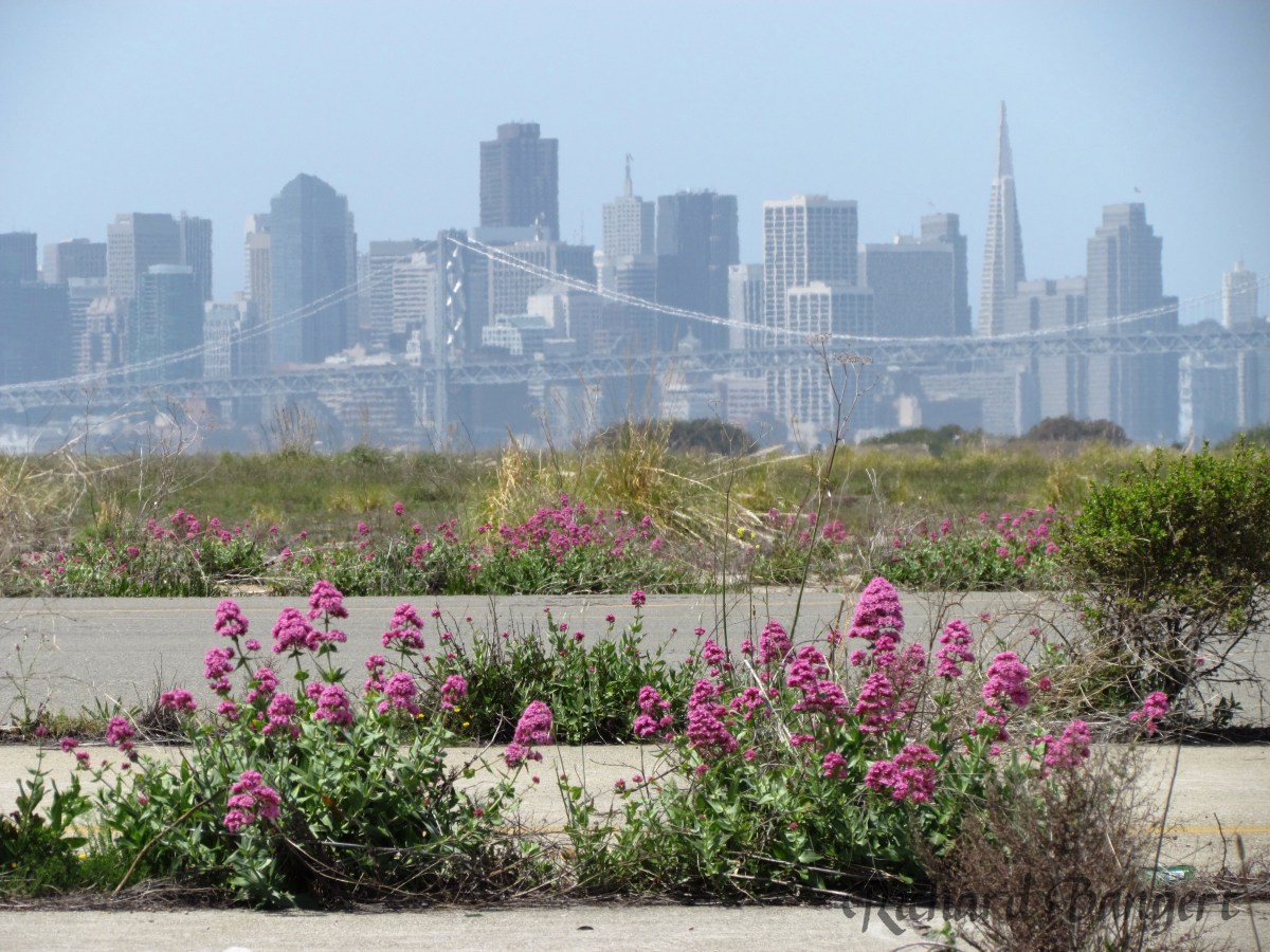
The San Francisco Bay Restoration Authority has denied the city’s request for a planning grant for DePave Park at Alameda Point (City to Seek Funding for Wetland Park at Alameda Point, Sept. 24, 2020). This ecological wetland park is proposed for the western side of the Seaplane Lagoon. The rejection letter and the agency’s ranking of applicants raise questions of fairness in awarding grants.
The Alameda City Council did not help matters when it rejected calls to include funds for a DePave Park master plan in the recently-adopted two-year budget.
In the recent round of grant awards from the Restoration Authority, Alameda’s request for $1.165 million for DePave Park planning was denied, while the East Bay Regional Park District (EBRPD) was awarded $500,000 for designing the Hayward Marsh Restoration Project. Whether or not a 2016 campaign contribution from EBRPD to the Restoration Authority’s ballot Measure AA gave them a bump in the rankings is unclear. But the optics are not good.
Continue reading “Bay Restoration Agency Denies Funding for DePave Park”VA project adds to legacy of letdowns on airfield
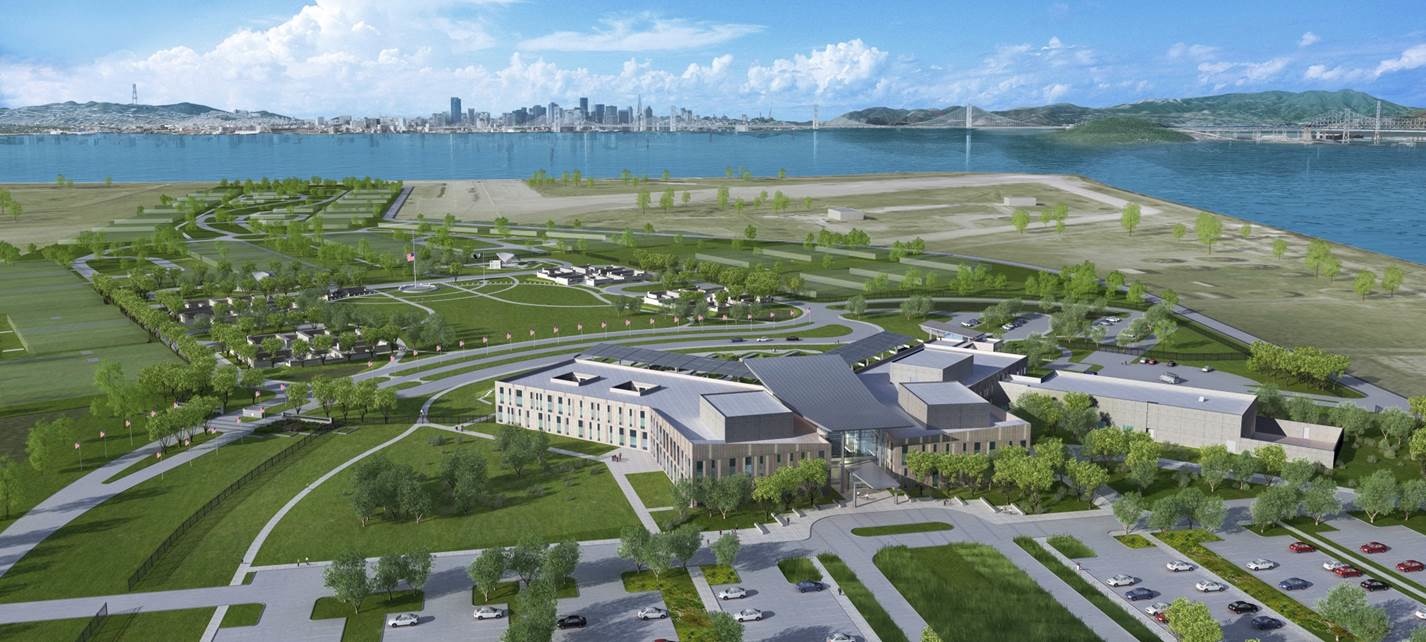
A legacy of disappointment continues on the aircraft runway area at Alameda Point. In the nearly 20 years since the Navy ended operations there, the community has lost 74 acres of open space that was once slated to become city property. The community has also lost the possibility for a 550-acre national wildlife refuge and a state-of-the-art community hospital to be run jointly with Alameda Healthcare District to serve veterans and non-veterans.
There is still no groundbreaking scheduled for the veterans’ clinic and columbarium.
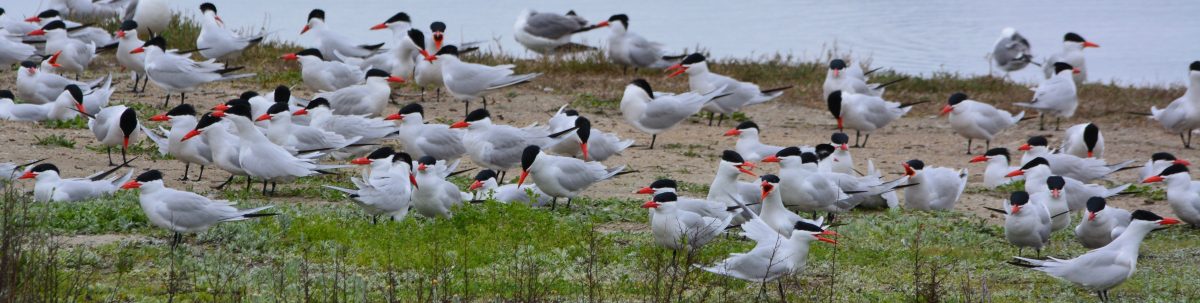
The only recent expenditures on the 624 acres of federal property, now owned by the Department of Veterans Affairs (VA), have been to fund landscaping over an underground dump and the management of the endangered least terns that nest on 10 acres, which includes the widespread application of herbicides and vegetation removal on 300 acres of pavement at the direction of the U.S. Fish and Wildlife Service.
Mitigating the loss of wetlands appears to be the only planning underway. Continue reading “VA project adds to legacy of letdowns on airfield”
Waterfront plan for Seaplane Lagoon sees value in nature

Returning part of the Seaplane Lagoon shoreline to nature is one of the biggest changes that have emerged in the planning process at Alameda Point. The design proposal for the western side of the Seaplane Lagoon echoes the major theme of the Greenspace Project of Golden Gate University’s Center on Urban Environmental Law – the interconnected ecosystem.

(click on map image to enlarge)
The draft Town Center and Waterfront Precise Plan for the Seaplane Lagoon and eastern entrance area, presented to the Planning Board on August 21, offers a number of new concepts, including moving the proposed marina from the west side of the lagoon to the east side. The waterfront plan is being refined concurrently with zoning changes, an environmental impact report, and a master infrastructure plan, which are all aimed at providing the level of detail necessary for the city to start marketing property to investors in 2014.
In reporting to the Planning Board on design plans of the city’s consultant, Skidmore, Owings and Merrill (SOM), city staff stated: “Due to the vast scale of the study area and the Seaplane Lagoon as its centerpiece, the Town Center will be able to support a wide variety of unique waterfront experiences—some of which build and expand upon existing assets and activities, some of which introduce entirely new opportunities. SOM proposes the following four waterfront zones and experiences:
1. Natural environment—along the western edge of the Seaplane Lagoon with trails, docks, camping, outdoor sculpture and wetlands.
2. Promenade and recreational opportunities—along the northern edge, with early phased soccer fields, food concessions, bike and pedestrian paths, open lawn, and kayak access.
3. Urban edge—along the eastern side and portions of northern edge with marinas, docks, eating patios, overlooks, and ferry service.
4. Industrial—further south on the eastern side with maritime uses located near the MARAD ships and the USS Hornet.”

Climate adaptation grant funding needed – As currently envisioned, however, the de-paving, removal of buildings, and alteration of the western Seaplane Lagoon shoreline area is put off into the distant Phase 3 future — a decade or more from now — when presumably a surplus of infrastructure funds will allow for implementation. One option available for timelier implementation would be to begin now seeking grant funding from agencies that focus on shoreline climate change adaptation. There will be no commercial development on the western side of the lagoon, and therefore the project would become a public asset.
Lying directly to the west on the Nature Reserve is the Runway Wetland, whose habitat value would be greatly enhanced by a connection to the Seaplane Lagoon. Additionally, the draft Master Infrastructure Plan predicts a $10 million savings if the area were allowed to become tidal wetland as sea level rises.


Unless otherwise noted, all photos are copyright Richard Bangert. Permission requests appreciated before reproducing. See “About” page for contact info.
