At its January 20, 2015 meeting, the city council will weigh-in on the preliminary layout proposed by developer Alameda Point Partners (APP) for a 68-acre residential and commercial parcel between Main Street and the Seaplane Lagoon.
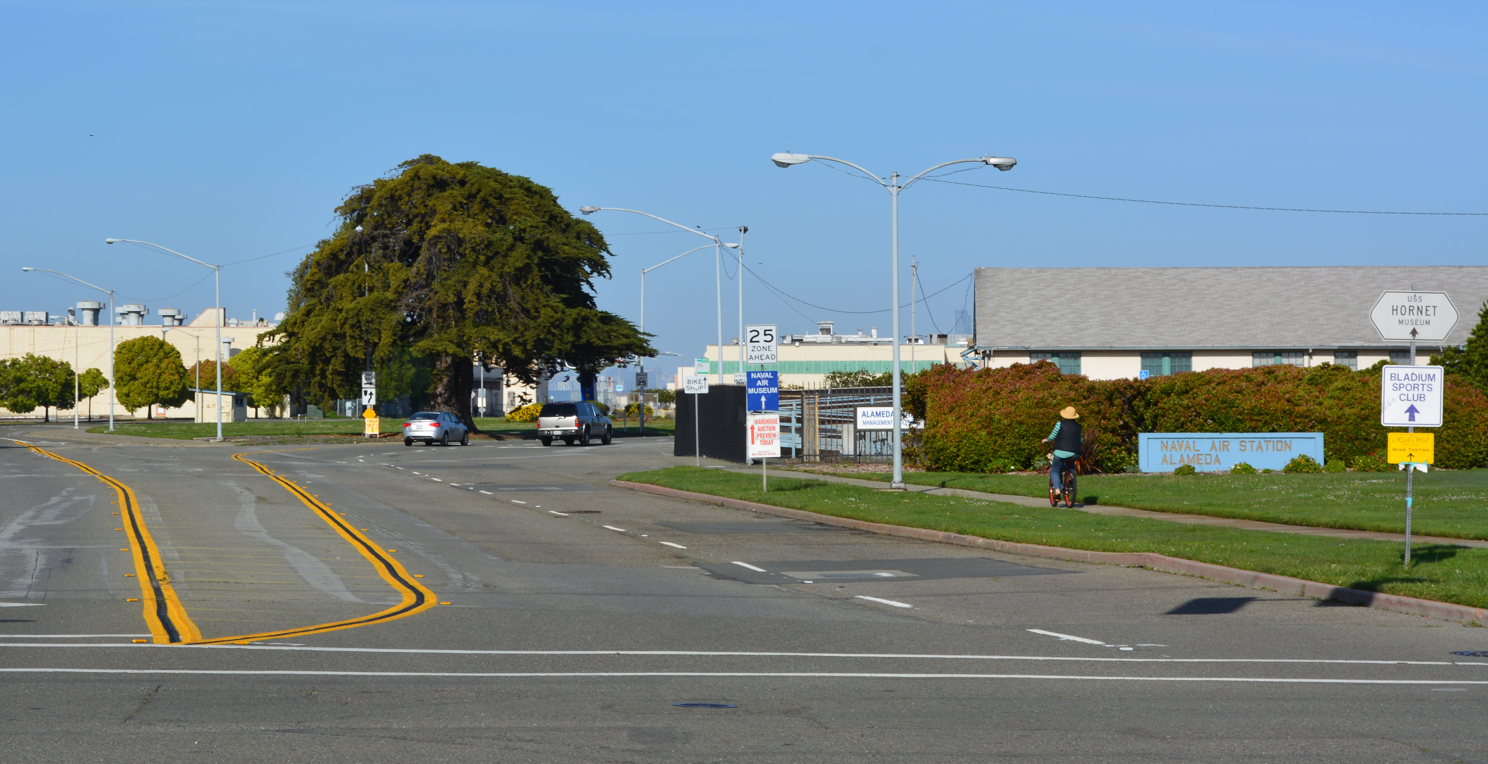
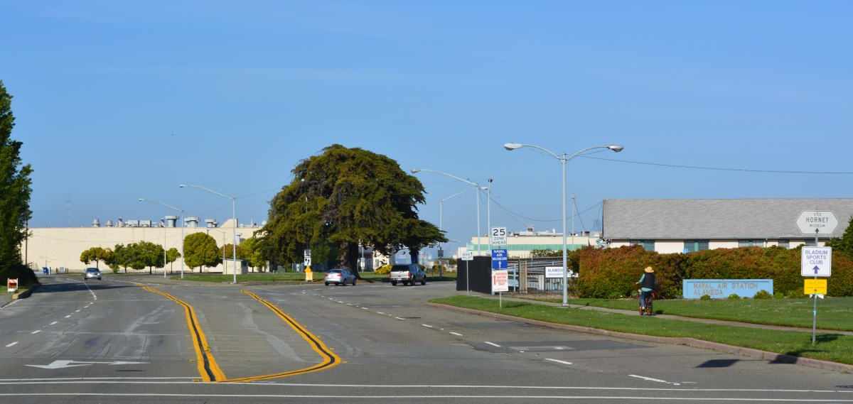
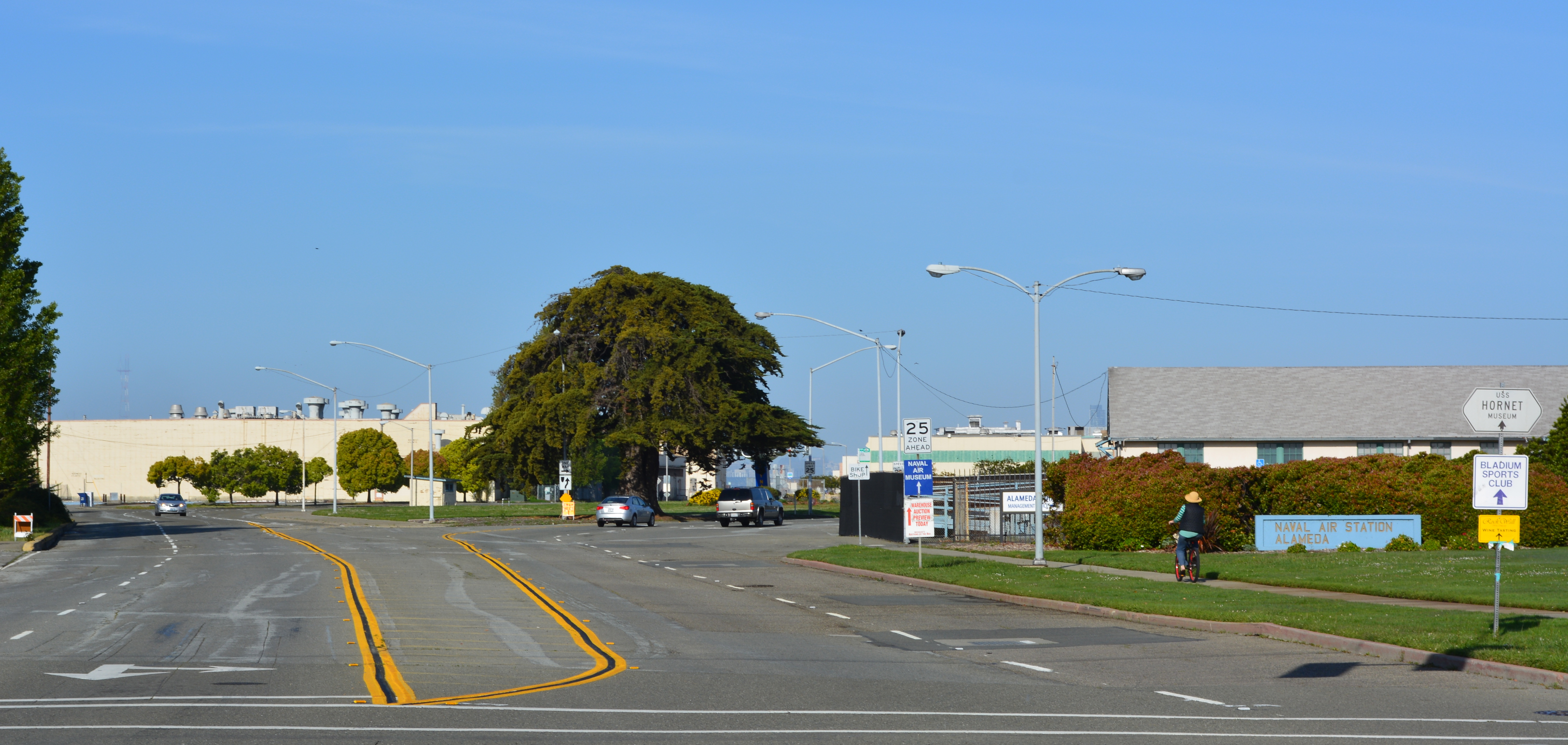
West Atlantic Avenue will be realigned as a four-lane divided street to the right of the big tree and become a continuation of Ralph Appezzato Memorial Parkway. Main Street in foreground.
APP was selected by the former city council on November 18, 2014, to work up a plan for 800 condos and apartments and 200,000 square feet of retail and commercial space. The developer will also be responsible for changing the gateway street alignment from an oval to a straight line leading to a new public plaza at the Seaplane Lagoon.Continue reading “Alameda Point gateway plan begins taking shape”
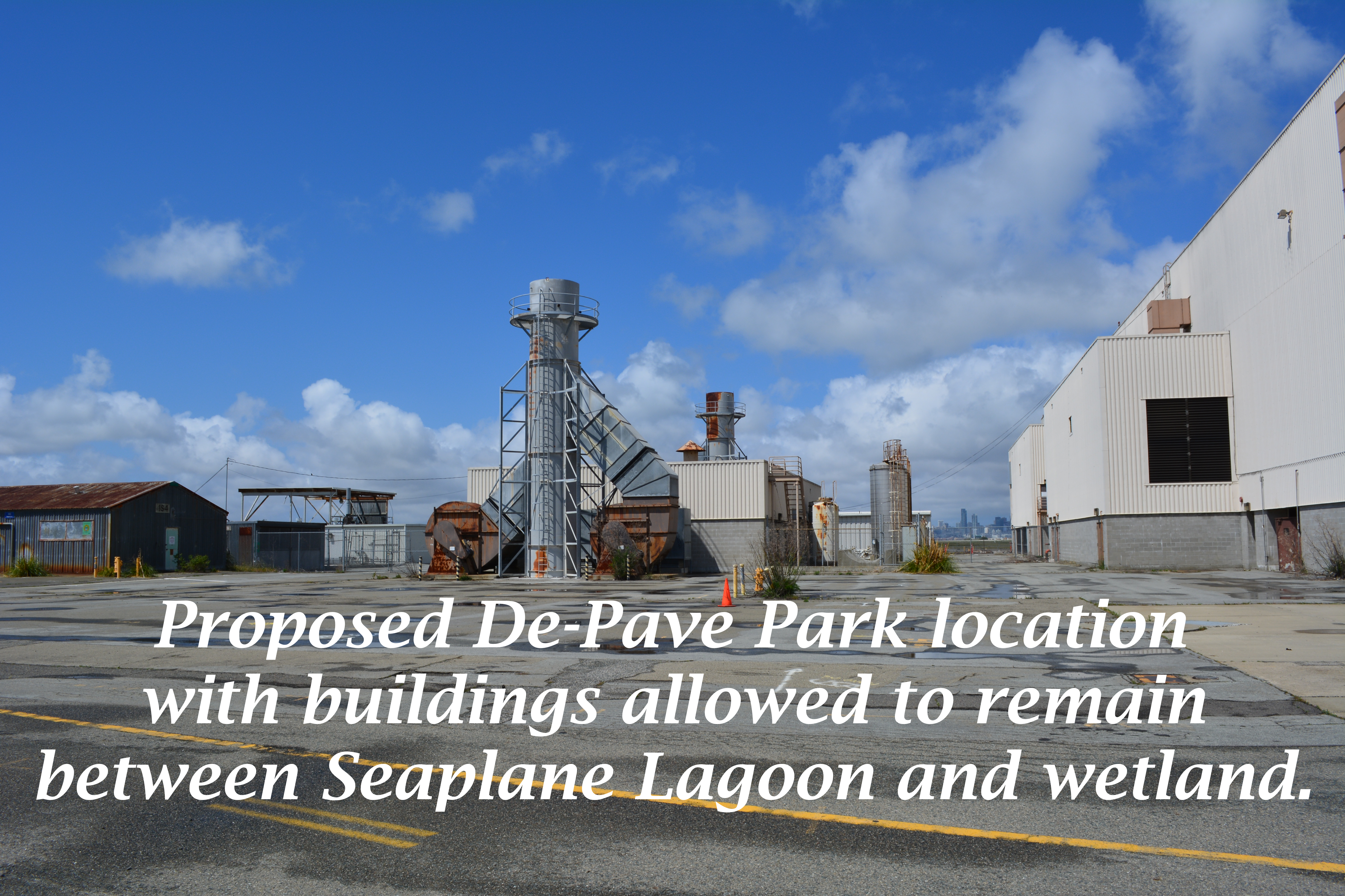
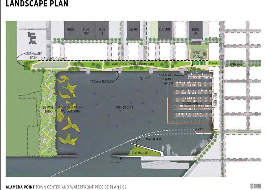
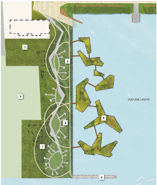
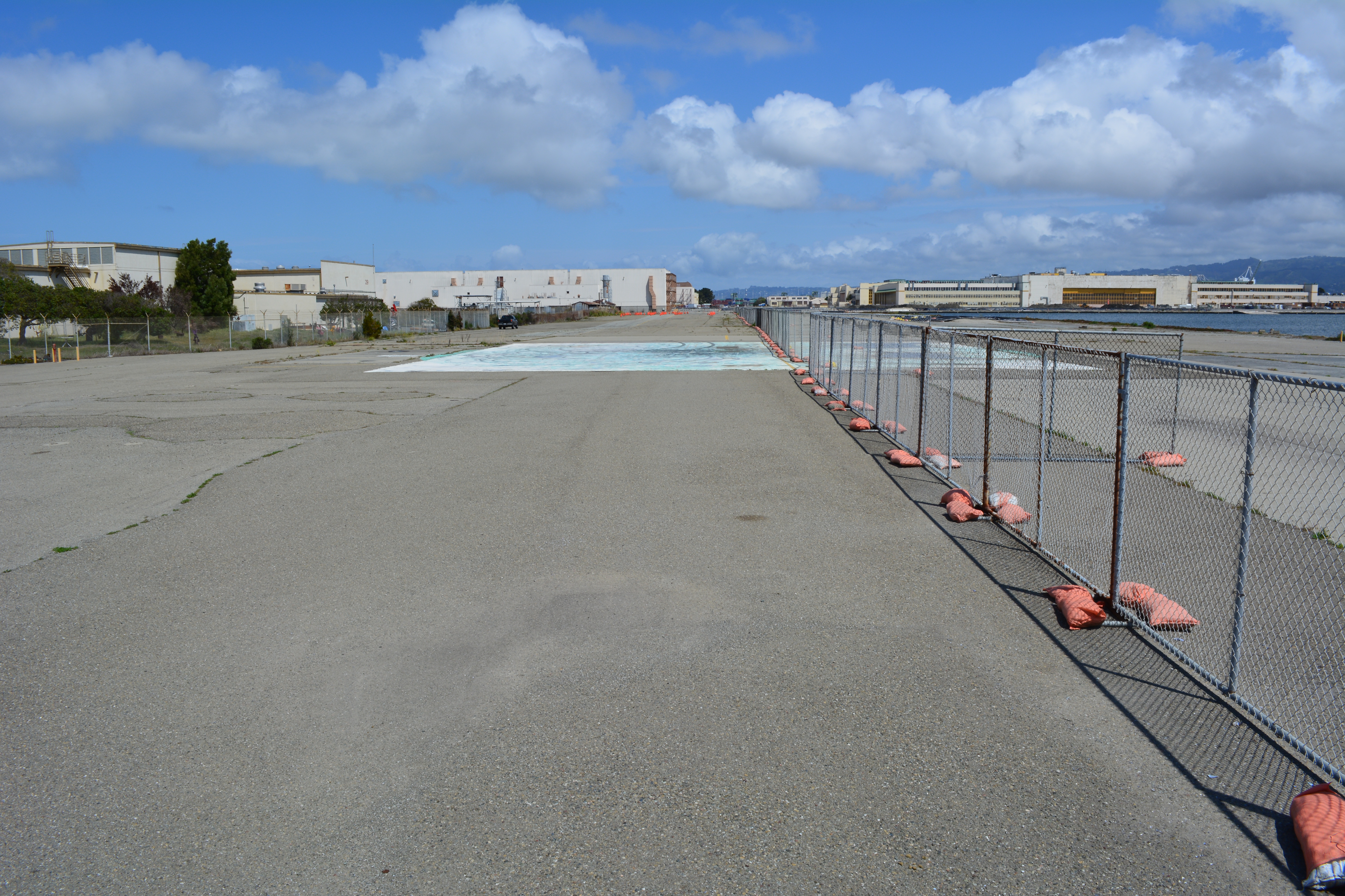
The drawing and images for the so-called “De-Pave Park” on the western side of the Seaplane Lagoon would be something to cheer about if the park had any chance of ever being created. The text of the city’s recently released Town Center and Waterfront Plan, however, allows existing industrial buildings along the western edge of De-Pave Park to remain “if needed.”
Such a caveat sets the framework for never moving forward with the plans. If the buildings are being leased, the buildings will be “needed.” If the buildings are needed, then the pavement around them will also be needed. The city is continuing to market these buildings to tenants and, thus, there’s not likely to come a day when we try to secure grant money to develop the park.
This is a change from the first presentation of De-Pave Park in 2013 when the Town Center and Waterfront Plan was rolled out. The existing structures were not shown in that drawing. The community was led to believe that all structures would be removed to provide a natural wetland-oriented transition to the existing Runway Wetland on federal property. Not so anymore. The structures can stay.
Conceptual plan presented in 2013 did not indicate that any buildings would remain between De-Pave Park and the Runway Wetland on the federal property.2014 De-Pave Park plan shows dashed lines indicating existing structures that will be allowed to remain “if needed.” Floating wetlands do not exist right now, and probably never will.
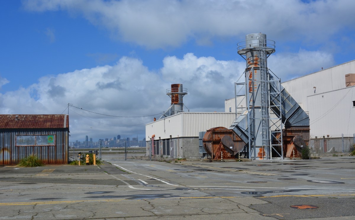
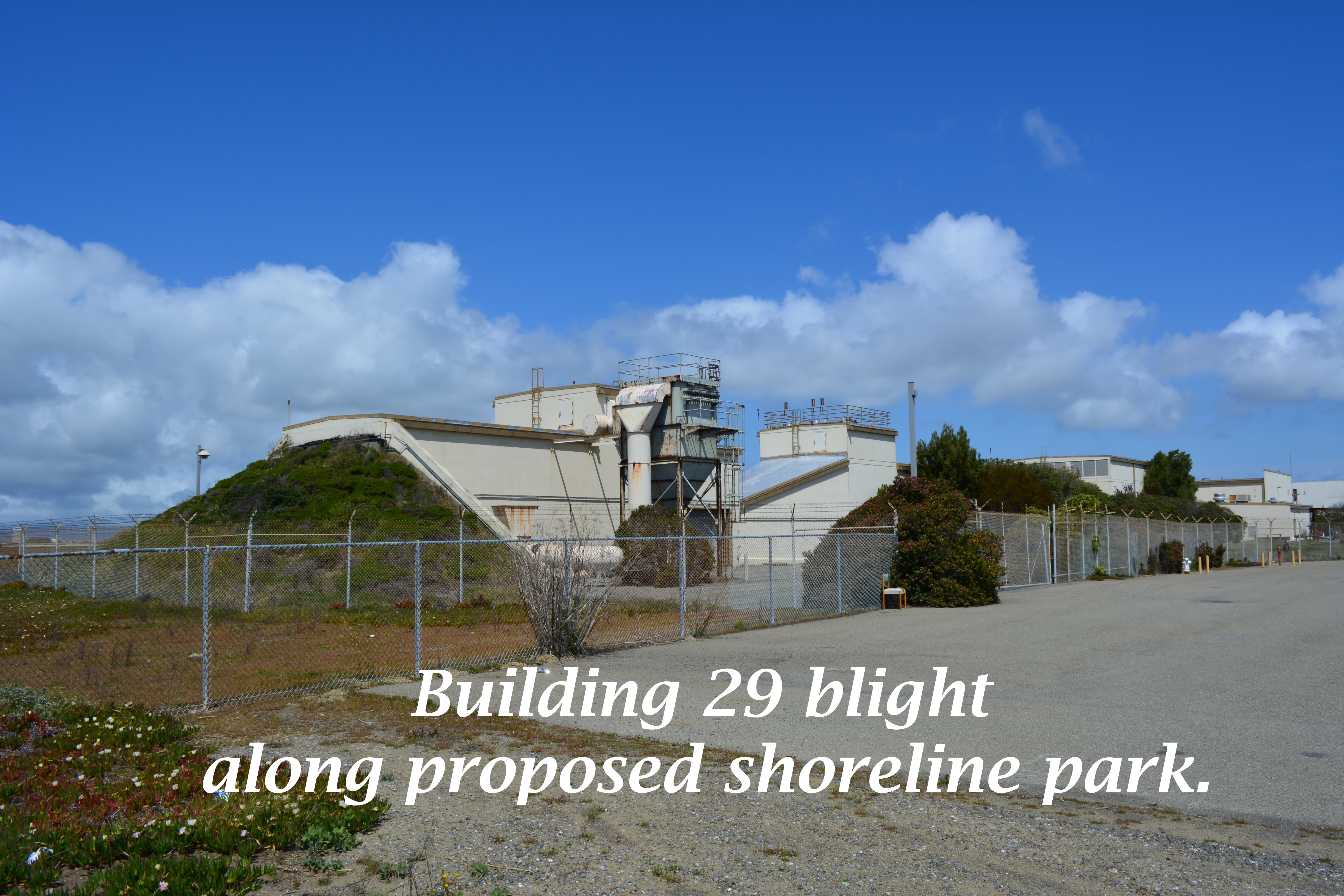
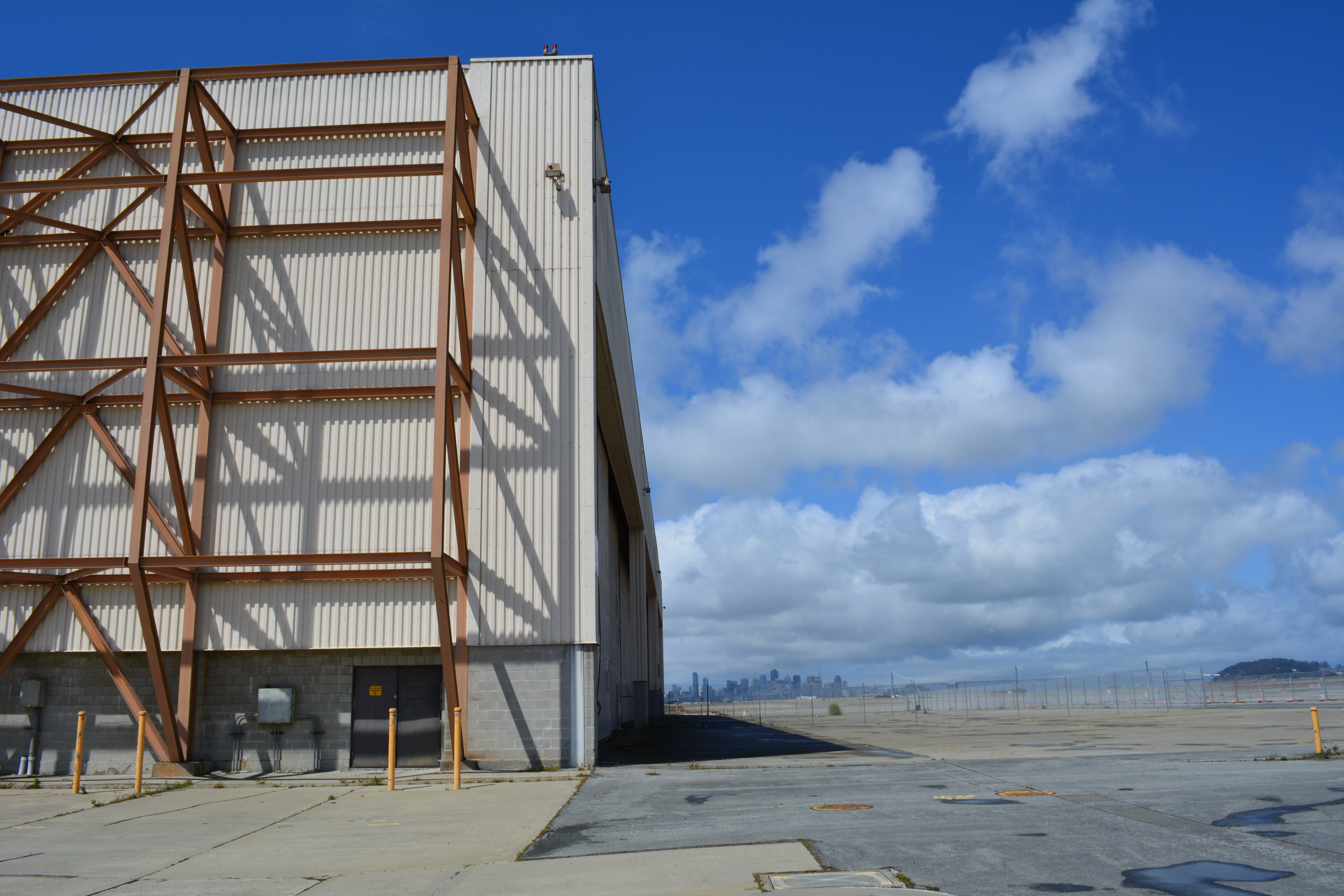
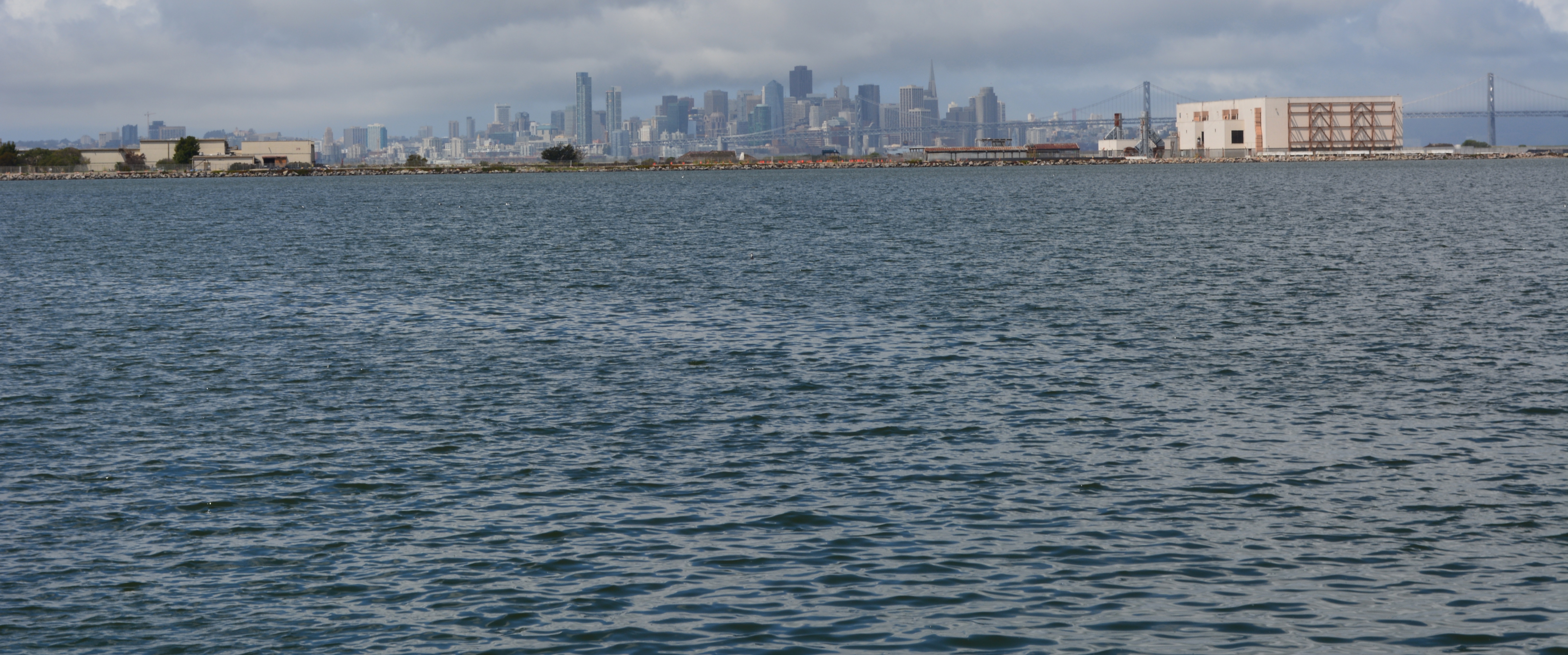
The infrastructure plan now has a levee protecting the 55-foot tall “Building 25” from sea level rise. There would be no reason to protect this eyesore if it was slated for permanent removal. Furthermore, the building is part of the mixed-use commercial and residential waterfront zone where even a hotel is permitted.
55-foot tall “Building 25” that will be protected by a levee, and remind campers that they are on an old military industrial site, as they gaze at the night stars.
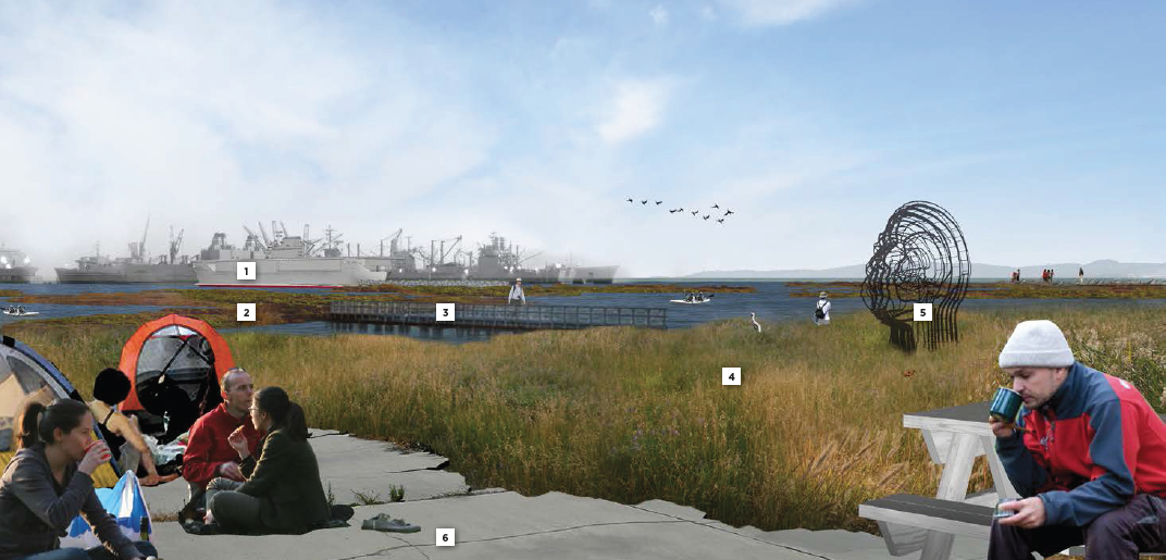
The plan’s conceptual drawing and photo collage showing campers, hikers, and grasslands does not include a view to the west, and with good reason. It would show the industrial legacy that will interrupt the potentially expansive views toward the west. It’s deceptive advertising.
Looking toward the Seaplane Lagoon in conceptual drawing for De-Pave Park. No drawings are offered to inform viewers that directly behind this vantage point are old industrial buildings that will be allowed to stay “if needed.” There is currently no plan to remove the industrial buildings.
Parks, as we’ve learned during the new zoning designations for Alameda Point, are zoned Open Space. This “park” is not zoned Open Space. It’s another indication that the so-called “De-Pave Park” is phony.
Changing the western shoreline of the Seaplane Lagoon to a wetland-grassland landscape connected to the Runway Wetland would implement climate change adaptation goals and carbon sequestration goals. Without a commitment by the city to implement De-Pave Park in the Town Center and Waterfront Plan – including removal of all buildings on the western side of the Seaplane Lagoon – a great opportunity to help rebalance the San Francisco Bay ecosystem will fall through the loopholes.
City Hall is requesting comments on the draft plans for the Town Center and Waterfront Plan by May 15, in preparation for a June 9 Planning Board meeting. The plan will be the guiding document on how, where, and what gets built around the Seaplane Lagoon. The city council is expected to approve the plan in July. Comments can be submitted to city planner Andrew Thomas at athomas@alamedaca.gov for forwarding to the Planning Board.
Red line indicates levee that will protect “Building 25.”Western side of the Seaplane Lagoon with potential for major improvements to the Bay ecosystem.Seaplane Lagoon looking west, with blighted viewscape that will be allowed to remain. San Francisco is in background. “Building 25” is the large building on the right that will be saved by a levee.
The city council will consider a staff proposal on April 15 to begin a major construction effort at the eastern entryway to Alameda Point, formerly known as the East Gate. The proposal seeks approval to solicit qualified developers for two parcels totaling 150 acres that would bring 800 new homes and a major sales tax generator.
West Atlantic Avenue on Alameda Point, looking west toward San Francisco.
The quest for developers is being proposed “in order to facilitate new residential and commercial mixed-use projects that are of a sufficient scale to support major infrastructure investment,” said Jennifer Ott, Chief Operating Officer for Alameda Point. “It will create a catalyst for additional new development and investment elsewhere” at Alameda Point.
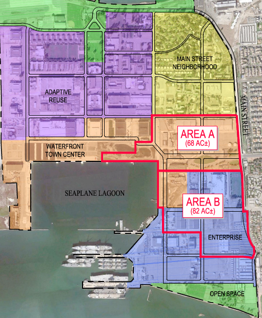
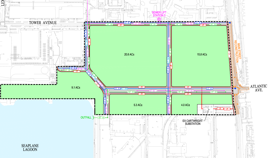
The proposal seeks a single developer for an entire 68-acre parcel, dubbed Site A, which extends along West Atlantic Avenue from Main Street to the Seaplane Lagoon. It would feature a mixed-use, 800-home development that is consistent with the recently approved Town Center Waterfront Plan. The plan requires ground-floor retail along certain blocks and public plazas and amenities at the heart of the area. Hotels and office development will also be highly encouraged.
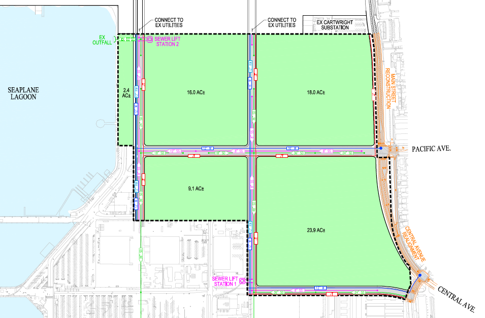
Site B is composed of 82 acres in southeastern Alameda Point. Part of the site is within the commercial Enterprise Zone and part is within the Town Center Waterfront Plan area. Unlike Site A, the proposal for Site B will entertain multiple developers. “This approach allows the city to potentially attract interest from a large corporate user or retail outlet operator, who may not be interested in the entire area,” says the staff report. Preference will be given to developers who furnish letters of interest from a corporate user or retail outlet operator.
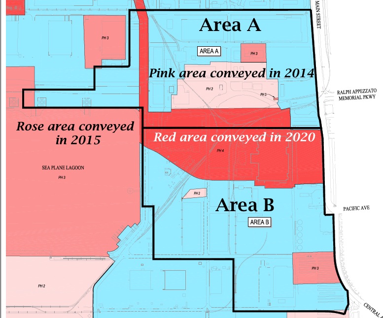
The staff report notes that significant early phases of development can commence around a 33-acre area that is undergoing environmental cleanup by the Navy. The groundwater cleanup area is not scheduled for transfer to the city until 2020. One of the early defining phases of development will be the realignment of West Atlantic Avenue so that Ralph Appezzato Parkway continues in a straight line to Ferry Point Road.
The staff proposal outlines an aggressive schedule, which calls for bringing a short list of developer candidates to the city council by September. In November, the council will be asked to approve exclusive negotiating agreements with developers. By the spring of 2015, the staff hopes to produce development contracts and development plans, with developers beginning their detailed site-specific infrastructure designs. By the end of 2015, the schedule calls for beginning infrastructure construction and drafting the building designs, according to Ott. By the spring and summer of 2016, the city hopes to see vertical construction.
West Atlantic Avenue Gateway to Alameda Point. Area B begins at far side of lawn area where all new construction is proposed. Looking south.
Developers will be required to submit a project description, but will be expressly prohibited from submitting site plans or any design renderings of any proposed development. “The selection of the developers/users will be solely based on the qualifications of the developers/users and the quality of their submittal, including past projects, not on the quality of any design drawings purporting to show the future of Alameda Point,” says the staff report. “Submission of a site plan or renderings at this stage of the process will result in disqualification of the responding entity.”
“City staff also receives significant interest in, and is actively pursuing, other long-term investment opportunities, such as the recently approved Google lease, in the other areas of the base, especially in the Historic District,” said Ott.
Current plans call for 1,425 housing units at complete build-out of Alameda Point, 25% of which are required to be affordable.
The Tuesday, April 15 city council meeting will be held at 7 PM at City Hall, 2263 Santa Clara Avenue, Council Chambers, 3rd Floor.
The city staff report and agenda exhibits can be found here.
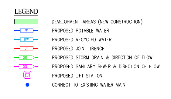
Proposed development areas A and B outlined on Navy land conveyance schedule map.Area A new street grid. See legend below. Click on image to enlarge.Proposed development Area B street grid. See legend below.Infrastructure legend for Areas A and B.
Returning part of the Seaplane Lagoon shoreline to nature is one of the biggest changes that have emerged in the planning process at Alameda Point. The design proposal for the western side of the Seaplane Lagoon echoes the major theme of the Greenspace Project of Golden Gate University’s Center on Urban Environmental Law – the interconnected ecosystem.
From Town Center and Waterfront Precise Plan presentation to Planning Board. (click on map image to enlarge)
The draft Town Center and Waterfront Precise Plan for the Seaplane Lagoon and eastern entrance area, presented to the Planning Board on August 21, offers a number of new concepts, including moving the proposed marina from the west side of the lagoon to the east side. The waterfront plan is being refined concurrently with zoning changes, an environmental impact report, and a master infrastructure plan, which are all aimed at providing the level of detail necessary for the city to start marketing property to investors in 2014.
In reporting to the Planning Board on design plans of the city’s consultant, Skidmore, Owings and Merrill (SOM), city staff stated: “Due to the vast scale of the study area and the Seaplane Lagoon as its centerpiece, the Town Center will be able to support a wide variety of unique waterfront experiences—some of which build and expand upon existing assets and activities, some of which introduce entirely new opportunities. SOM proposes the following four waterfront zones and experiences:
1. Natural environment—along the western edge of the Seaplane Lagoon with trails, docks, camping, outdoor sculpture and wetlands.
2. Promenade and recreational opportunities—along the northern edge, with early phased soccer fields, food concessions, bike and pedestrian paths, open lawn, and kayak access.
3. Urban edge—along the eastern side and portions of northern edge with marinas, docks, eating patios, overlooks, and ferry service.
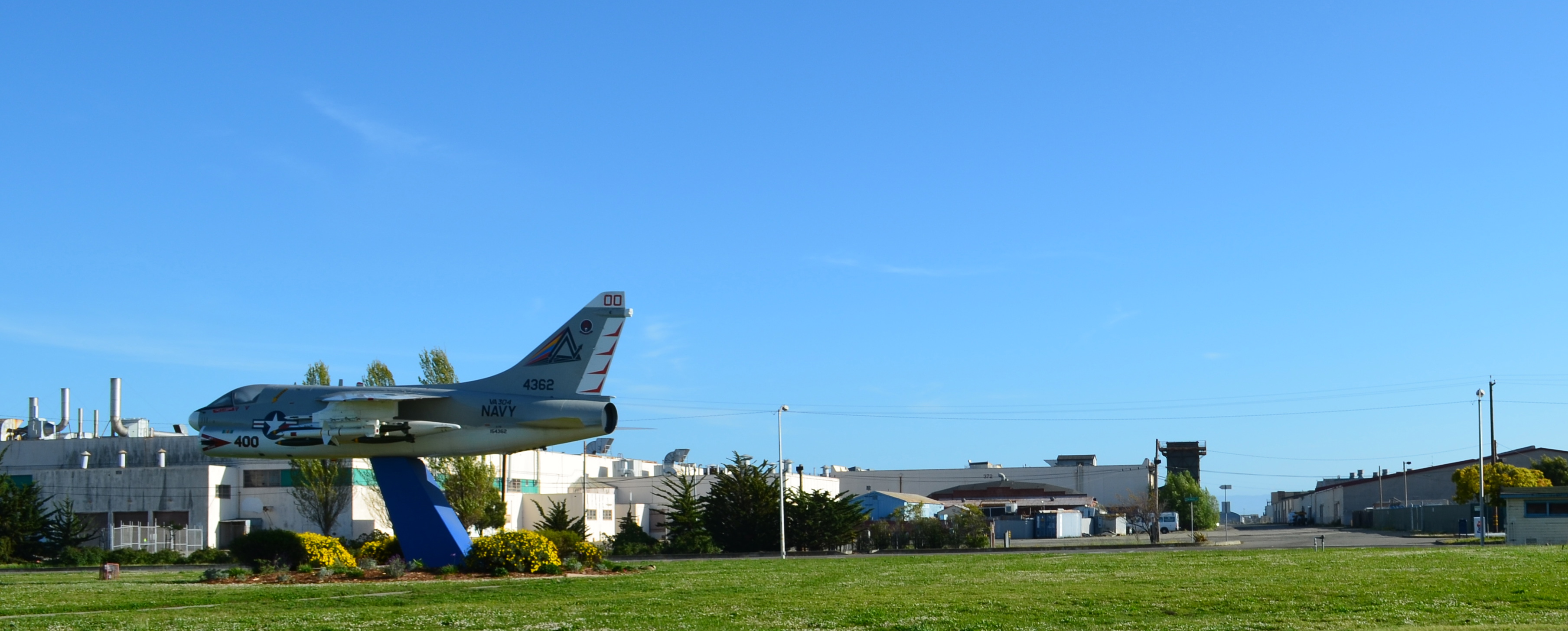
4. Industrial—further south on the eastern side with maritime uses located near the MARAD ships and the USS Hornet.”
From Town Center and Waterfront Precise Plan presentation to Planning Board.
Climate adaptation grant funding needed – As currently envisioned, however, the de-paving, removal of buildings, and alteration of the western Seaplane Lagoon shoreline area is put off into the distant Phase 3 future — a decade or more from now — when presumably a surplus of infrastructure funds will allow for implementation. One option available for timelier implementation would be to begin now seeking grant funding from agencies that focus on shoreline climate change adaptation. There will be no commercial development on the western side of the lagoon, and therefore the project would become a public asset.
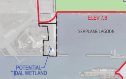
Lying directly to the west on the Nature Reserve is the Runway Wetland, whose habitat value would be greatly enhanced by a connection to the Seaplane Lagoon. Additionally, the draft Master Infrastructure Plan predicts a $10 million savings if the area were allowed to become tidal wetland as sea level rises.
Great Blue Herons with nest (left) and gulls on eastern jetty of Seaplane Lagoon. Heron is directly above proposed tidal marsh featured on map above. West shore of Seaplane Lagoon in background.Great Blue Heron standing in shallow Seaplane Lagoon area where tidal marsh is proposed.Sea Lion catching fish in Seaplane Lagoon. Floating haul out platforms would increase their presence.Black-crowned Night Heron poking around for food on eastern jetty of Seaplane Lagoon. One of the regular but seldom seen wildlife visitors.Alameda Point Channel in foreground that connects San Francisco Bay to the Seaplane Lagoon.
Unless otherwise noted, all photos are copyright Richard Bangert. Permission requests appreciated before reproducing. See “About” page for contact info.