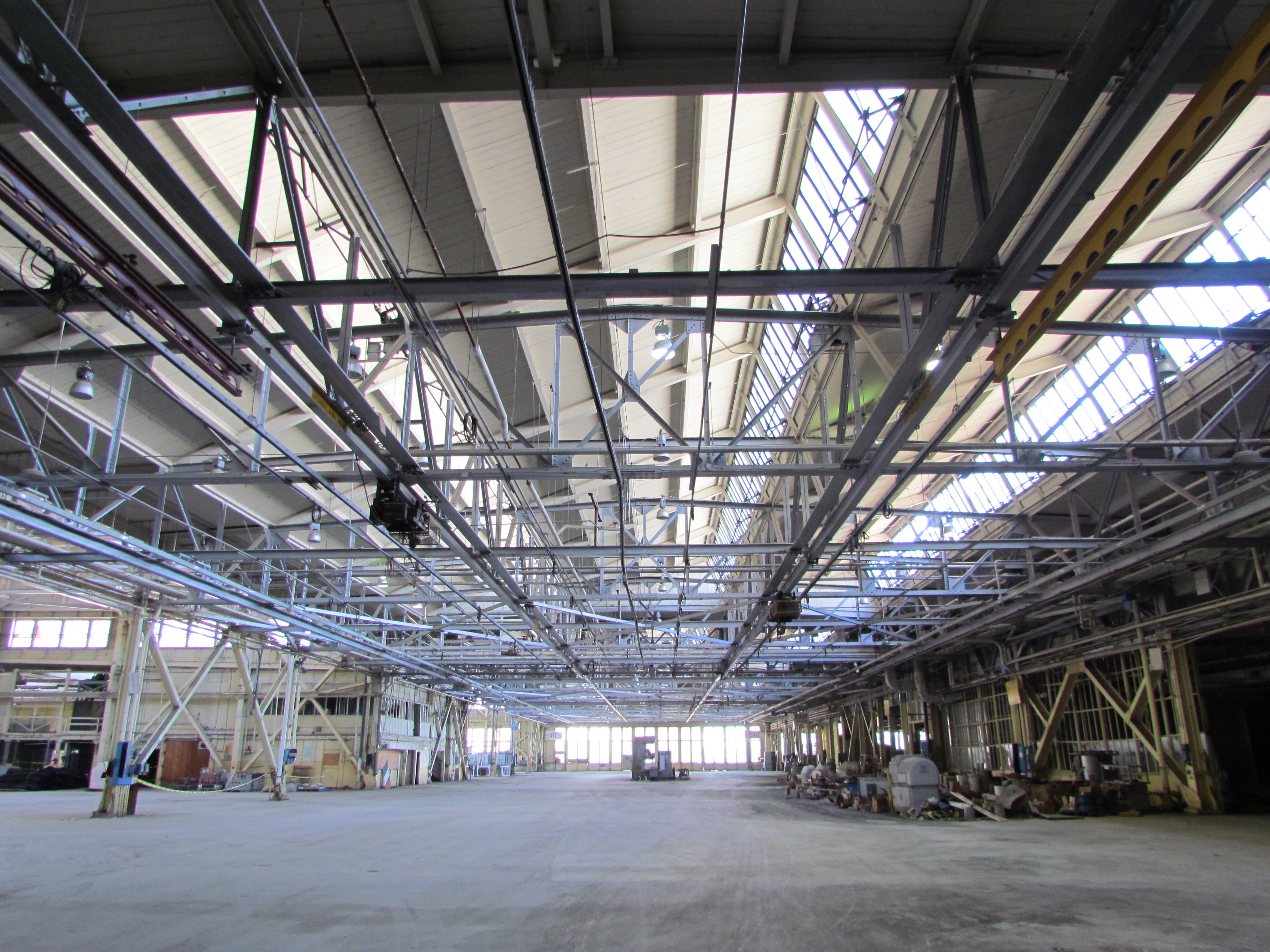
The massive aircraft hangar at the end of West Tower Avenue moved one step closer to commercial leasing last week. The California Department of Public Health (CDPH) performed random radiation scanning inside the building to certify that the Navy’s cleanup of paint residue containing radium-226 was complete. The other regulatory agencies have already signed off on the radiation cleanup after the Navy performed an inch-by-inch scanning effort.
As soon as this fall, CDPH could issue a letter that would allow the city to lease the building. The nearly million-square-foot building complex (Building 5) has been unavailable to the city for leasing for more than a decade. Other buildings on the base have been leased to the city by the Navy under what’s known as the Lease in Furtherance of Conveyance agreement, which has allowed the city to sublease the buildings until transfer of ownership. Continue reading “Word on the street about Alameda Point cleanup”
Around 50 people took part in the first city-sponsored tour across the old naval airfield to the western shoreline of San Francisco Bay on Monday, Oct. 26.
The convoy of automobiles stopped near the future site of the Department of Veterans Affairs (VA) clinic and at the shoreline next to a restored 30-acre wetland site. The wetlands are located within the Navy’s 100-acre cleanup site known as Site 2.
Tour group at the western shoreline listening to Dr. Peter Russell explaining environmental cleanup work the Navy has completed at Site 2.
While Site 2 has been known for the past 18 years as a mysterious off-limits environmental cleanup site, most of the visitors on Monday’s tour seemed more interested in the area as a scenic viewing site.
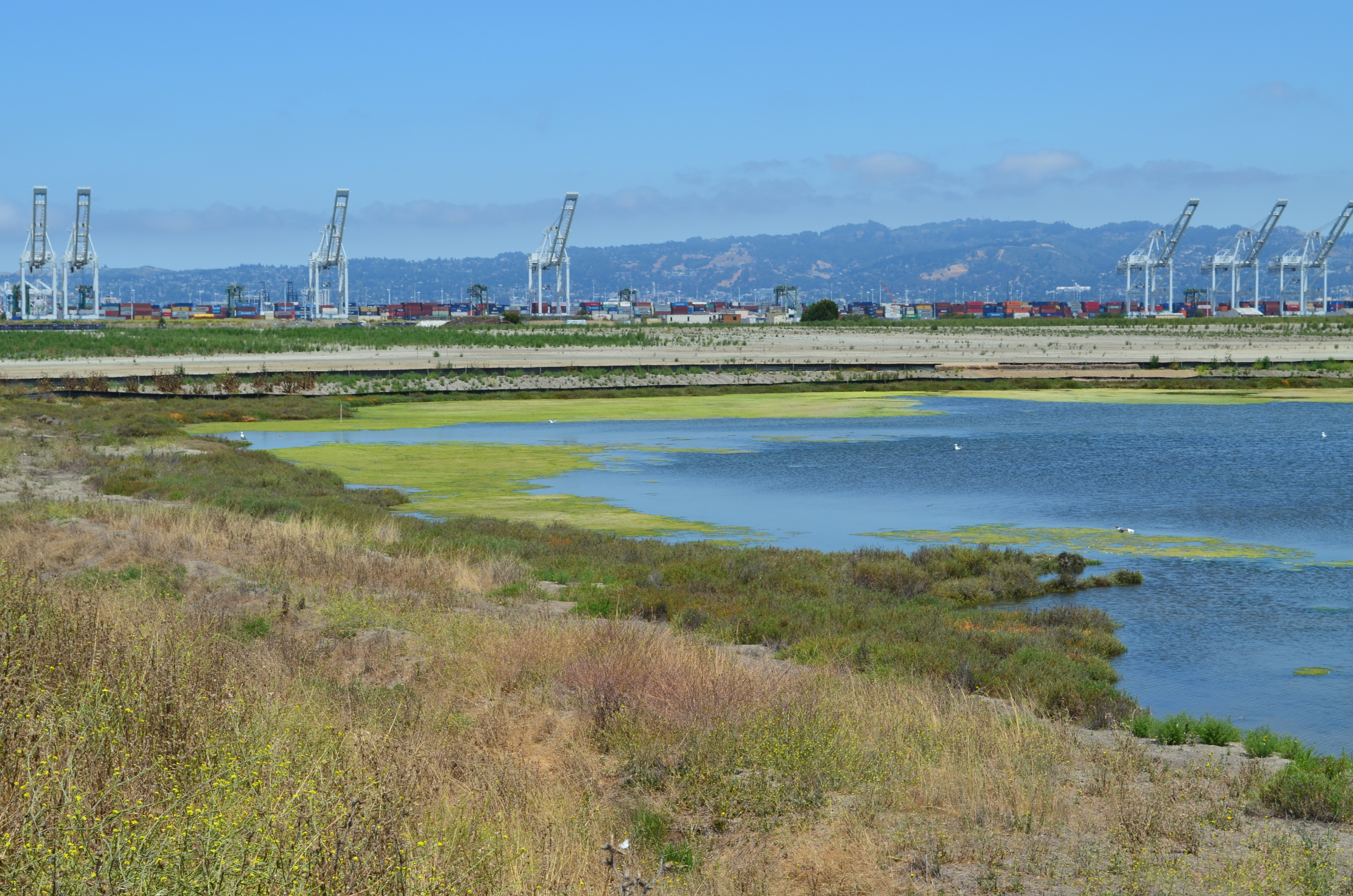
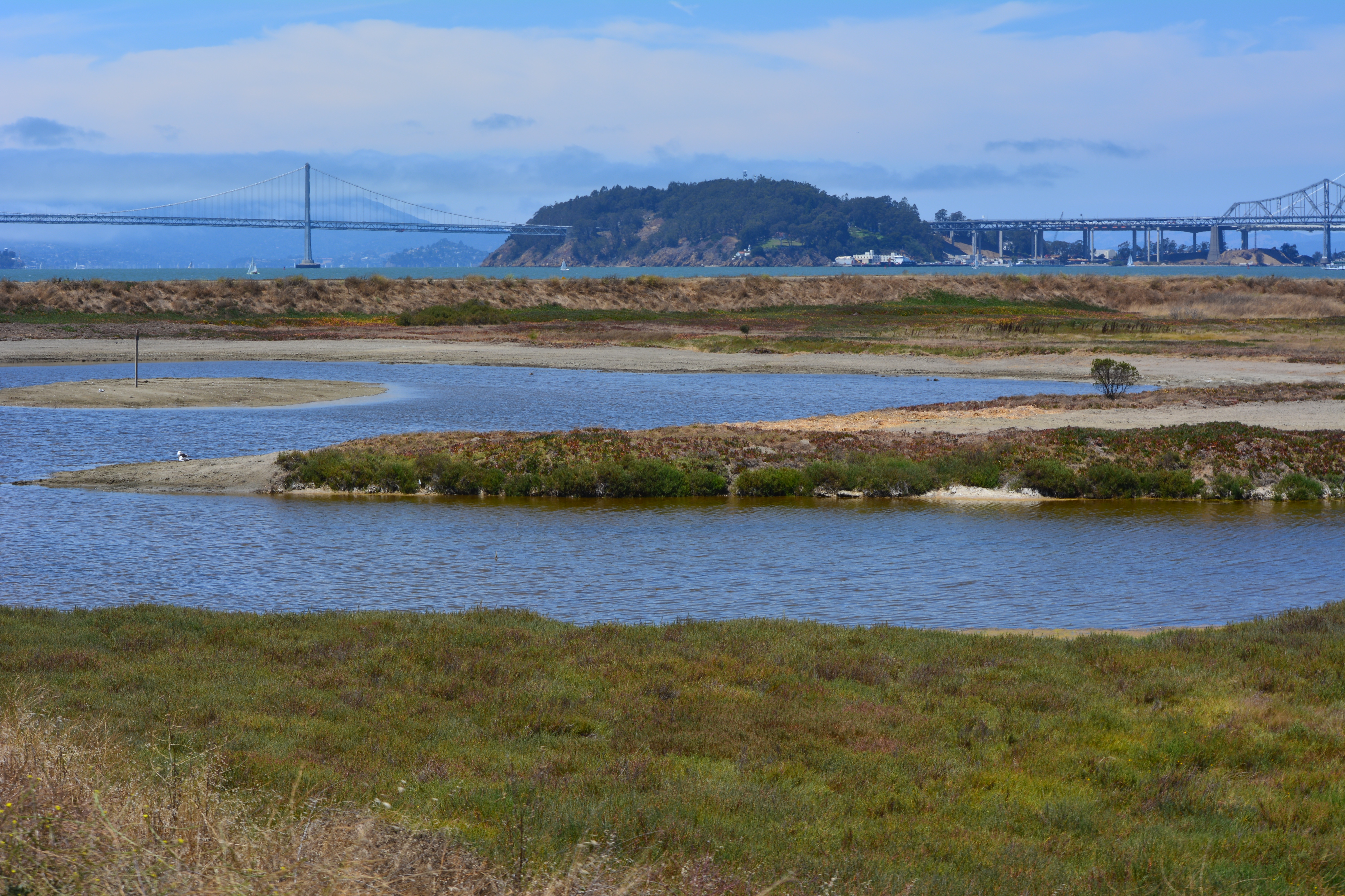
Despite the sparse showing of birds on the wetland during the visit, the group appeared awed by the vast expanse of land, water and sky that surrounded them as they stood on the embankment overlooking the wetland and the Bay.
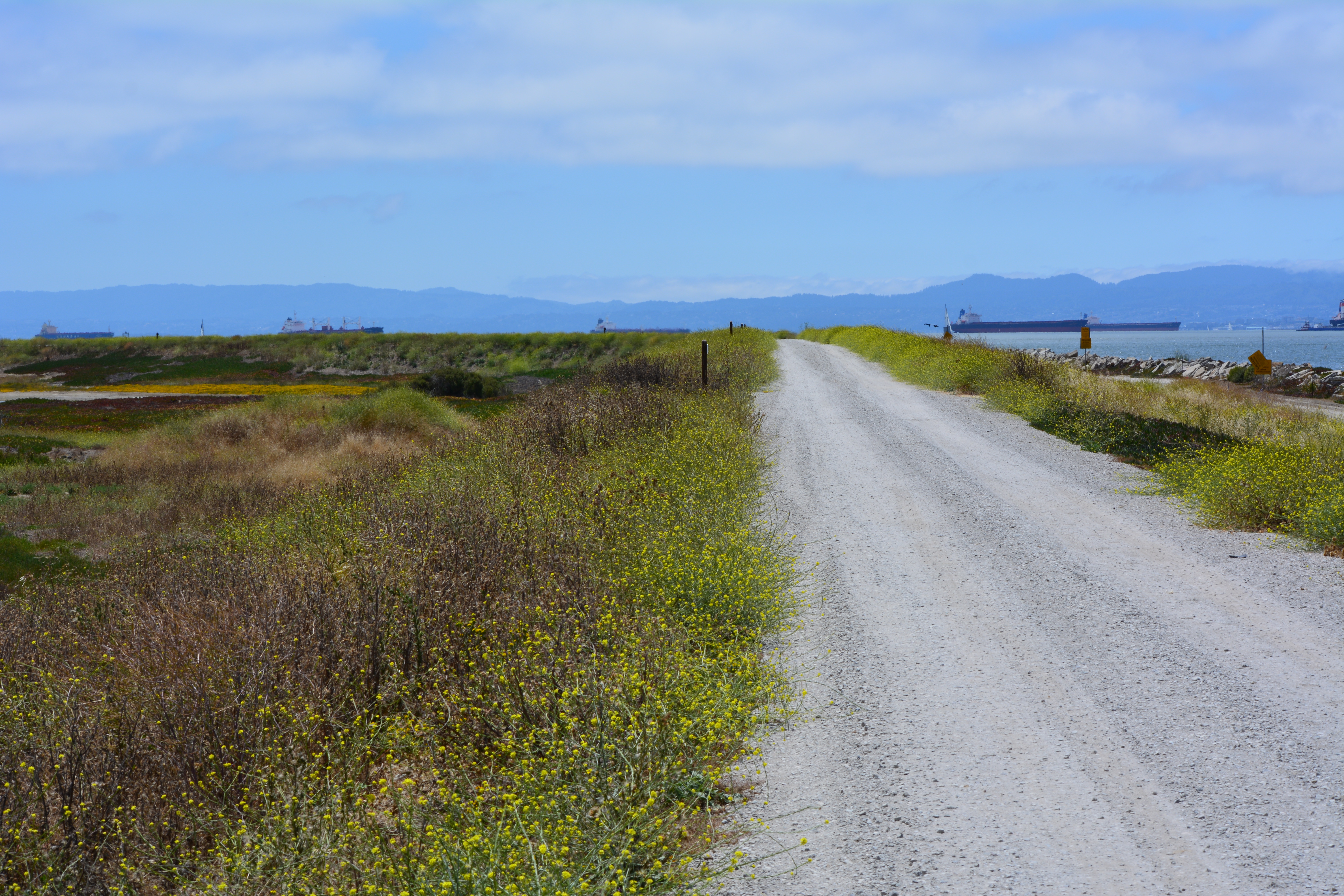
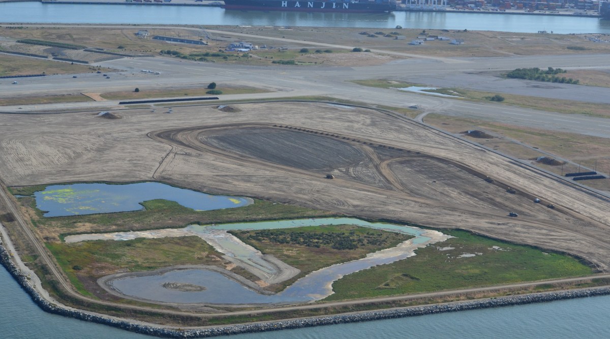
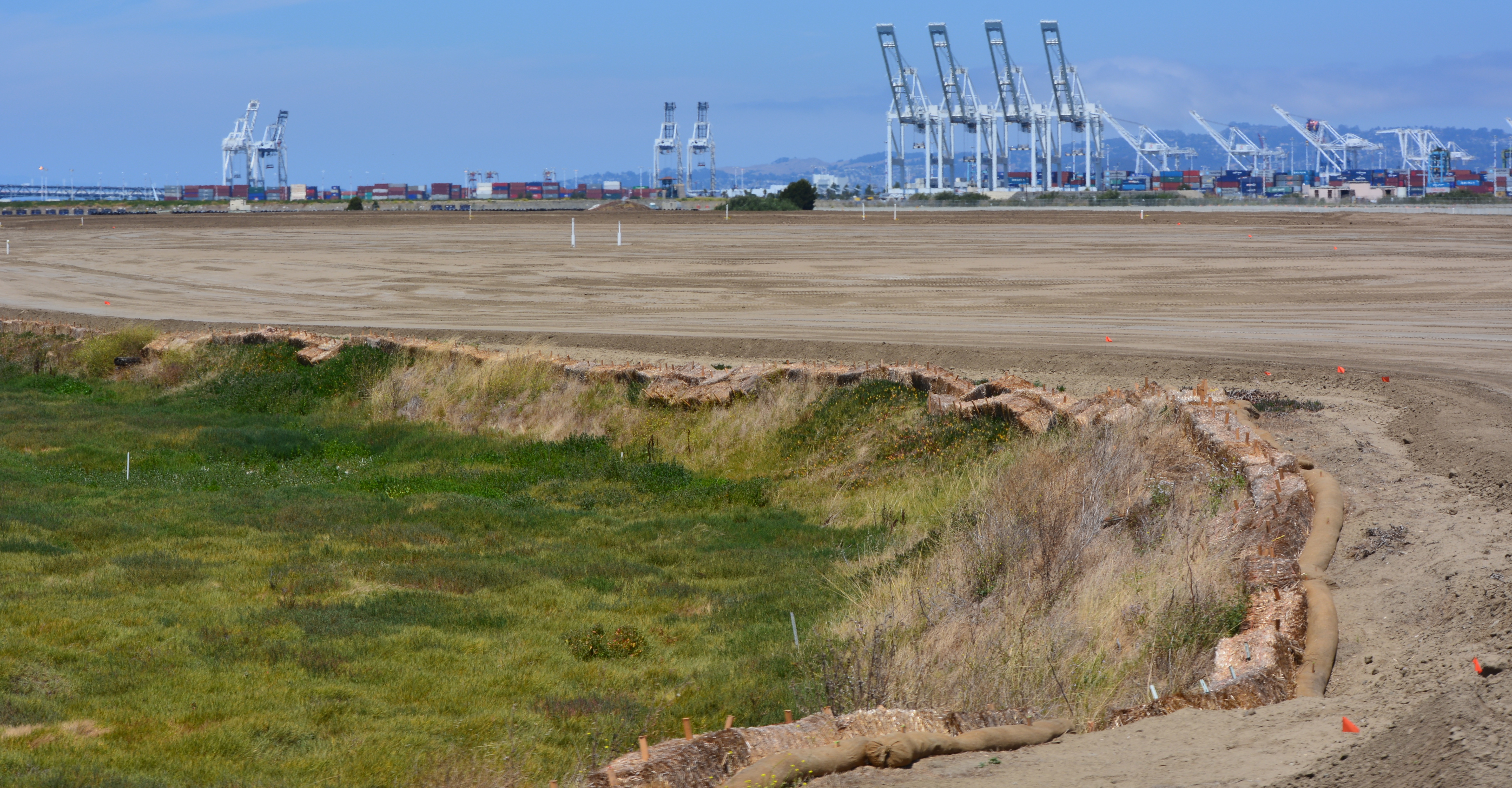
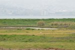
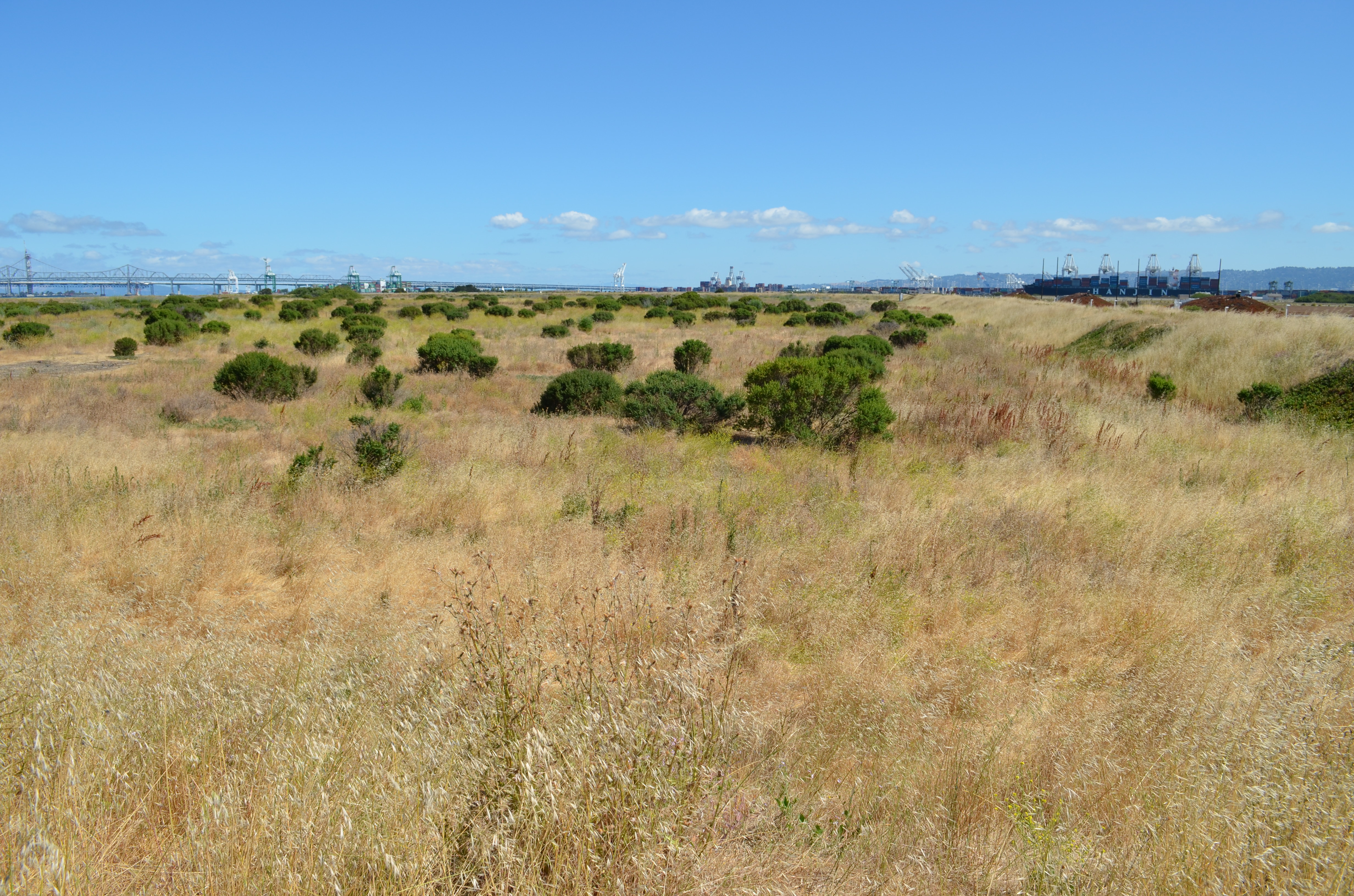
View of the trail on embankment, with tour group and Port of Oakland in the background. Wetlands are to the right. San Francisco Bay is to the left.
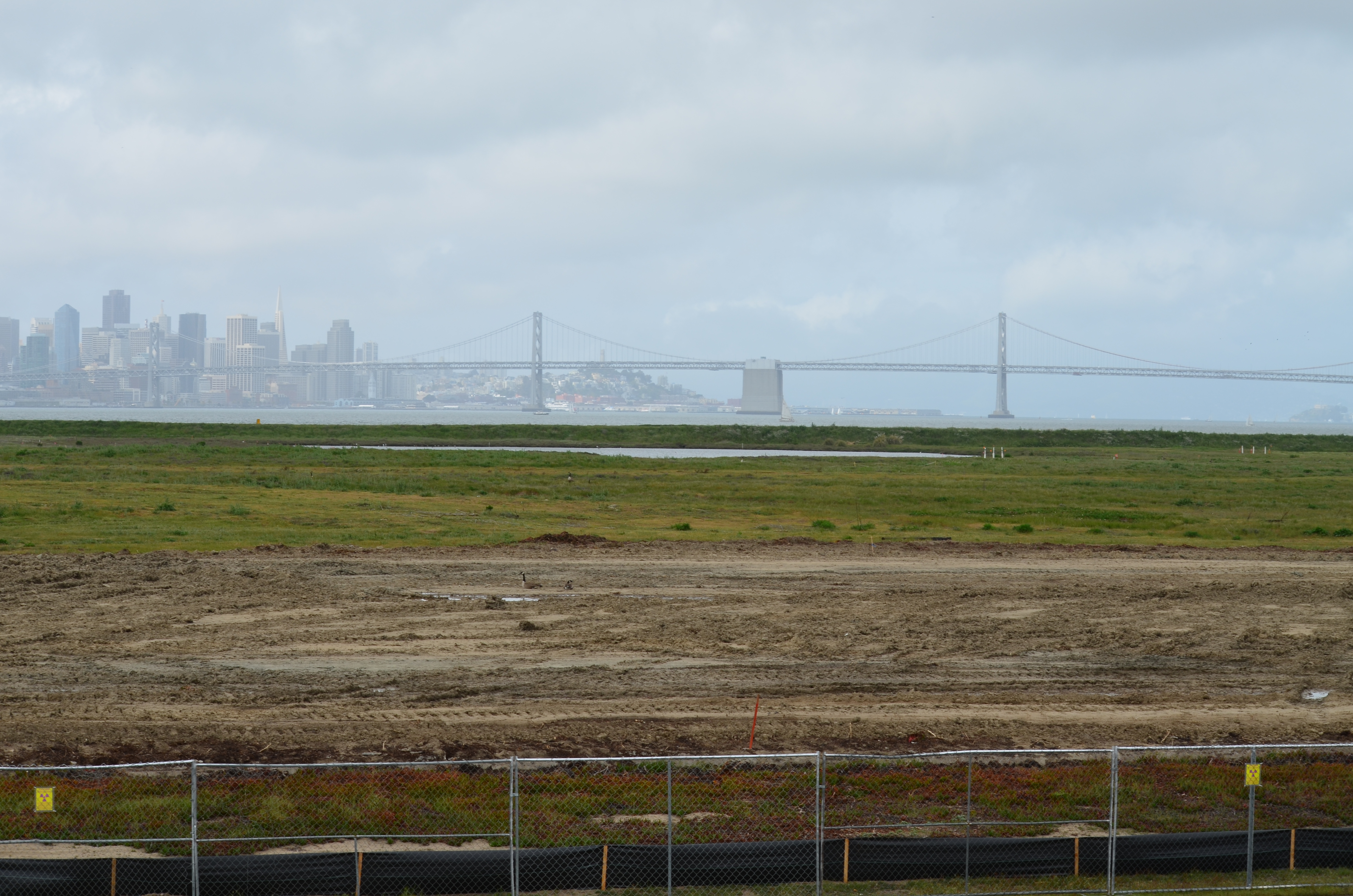
A future leg of the San Francisco Bay Trail will eventually pass between the wetland and the shoreline, with views all the way to the Golden Gate Bridge on a clear day. The state’s Bay Conservation and Development Commission requires the VA, via its shoreline authority, to grant an easement to the city for construction and operation of the trail. No date has been set for when this process will begin.
During the stop near to the future VA clinic site, Jennifer Ott, the city’s chief operating officer for Alameda Point, informed the group about the public roadway, including underground utilities, that the VA is going construct leading to the western shoreline. The roadway will provide public access and utility hook-ups for city-owned open space property along the Oakland Estuary. The group parked at the western shoreline where the future observation point and trail access parking lot will be located at the end of the road.
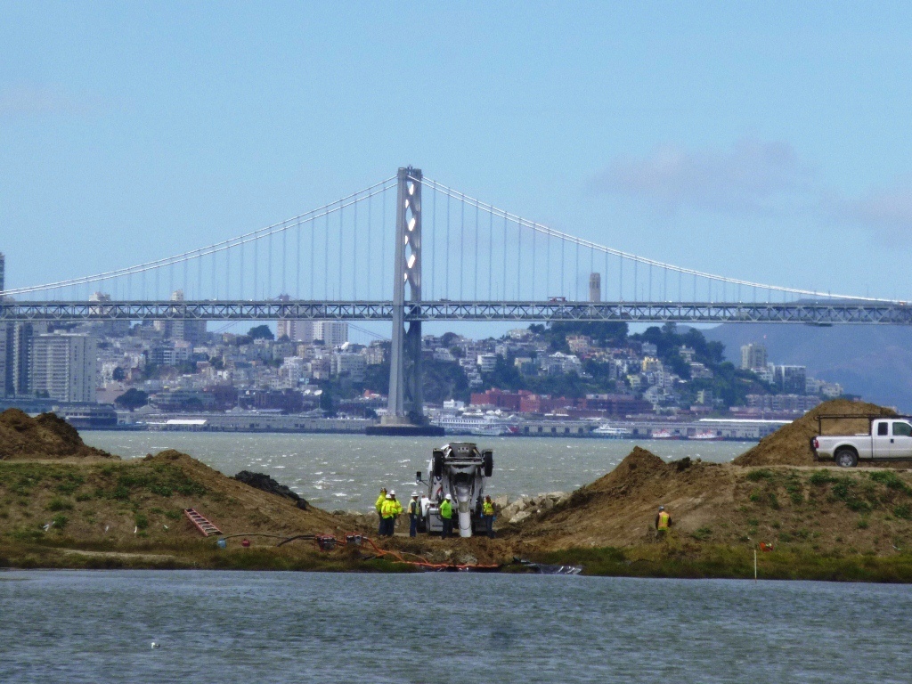
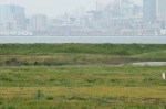
Tour group listening to Jennifer Ott explaining plans of the US Dept. of Veterans Affairs while stopped next to future clinic site. San Francisco skyline in the background.
The tour was arranged at the urging of Vice-Mayor Frank Matarrese. Also in attendance was Mayor Trish Spencer.
“The VA’s future home and the wetlands restoration area at Site 2 are key features of the old airfield surrounding the least tern nesting area,” said Matarrese. “It is absolutely important that people get a chance to see how these three assets work together in this huge tract of land.”
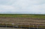
Another view from the stop next to the future VA clinic site. Small wetland in between runways can be seen in the background. VA is expected to enhance the wetland, which remains covered with water in the middle of the airfield despite a drought.
The Navy still retains some responsibilities at Site 2 — namely, for ensuring that the grassland vegetation on the landfill soil cover is successful.
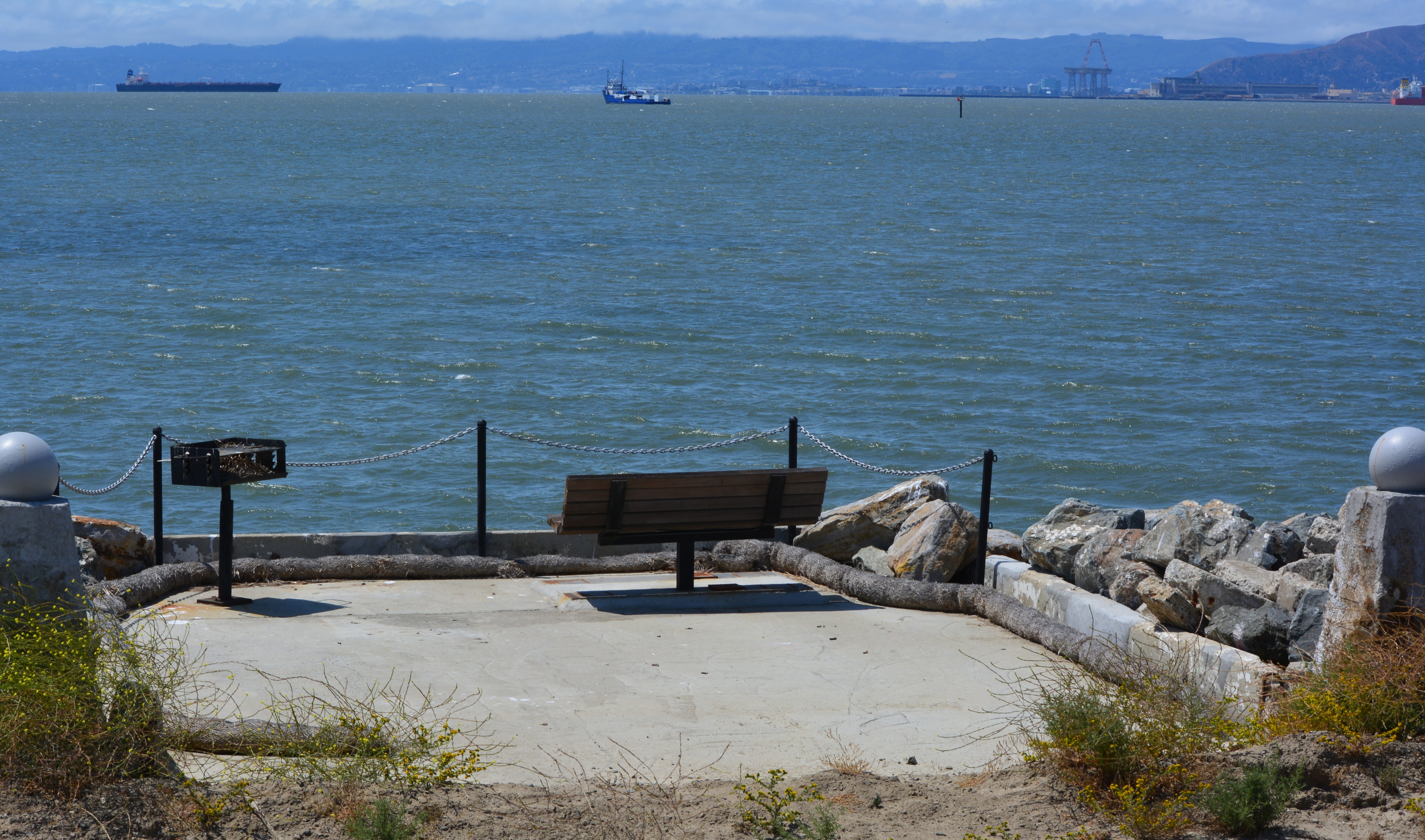
Jennifer Ott answering questions at the western shoreline. This location is where the VA’s future road will end, with a small parking lot, benches, and access to the Bay Trail.
“Seeing the wetlands makes me want to accelerate our wetlands efforts on city property,” said Matarrese.
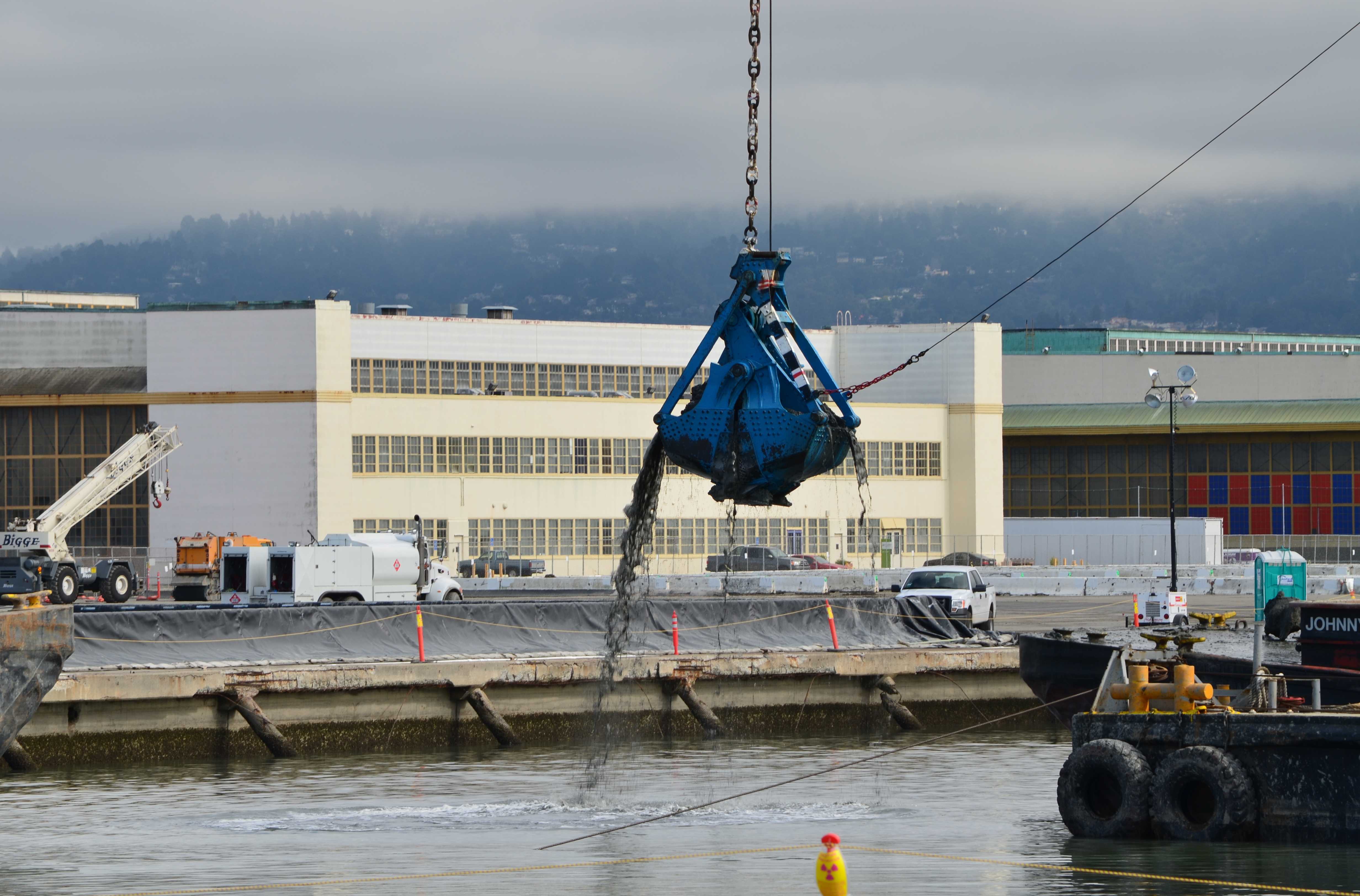
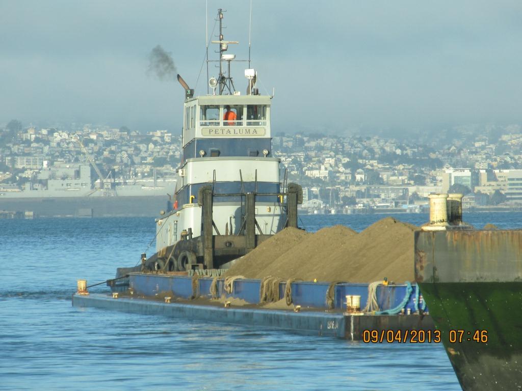
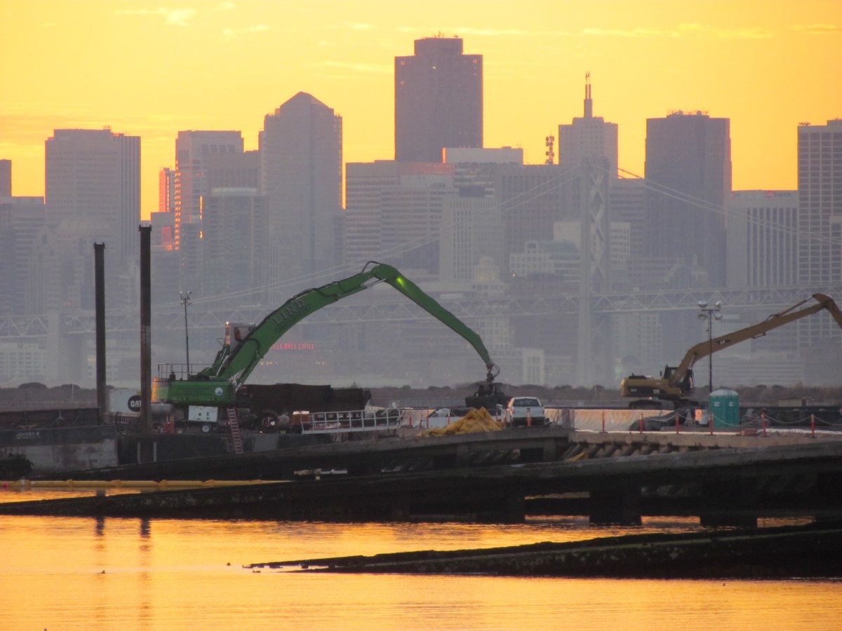
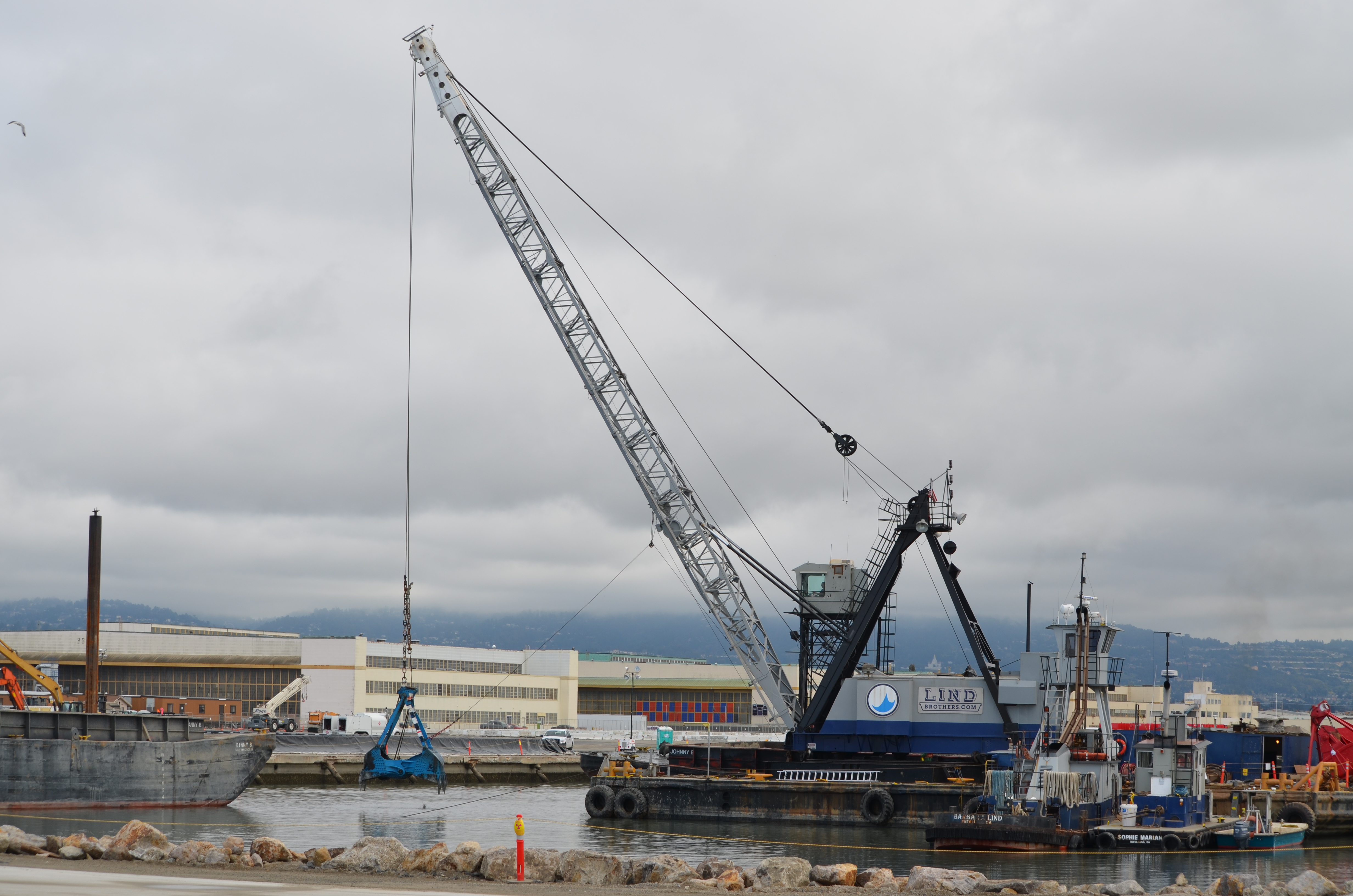
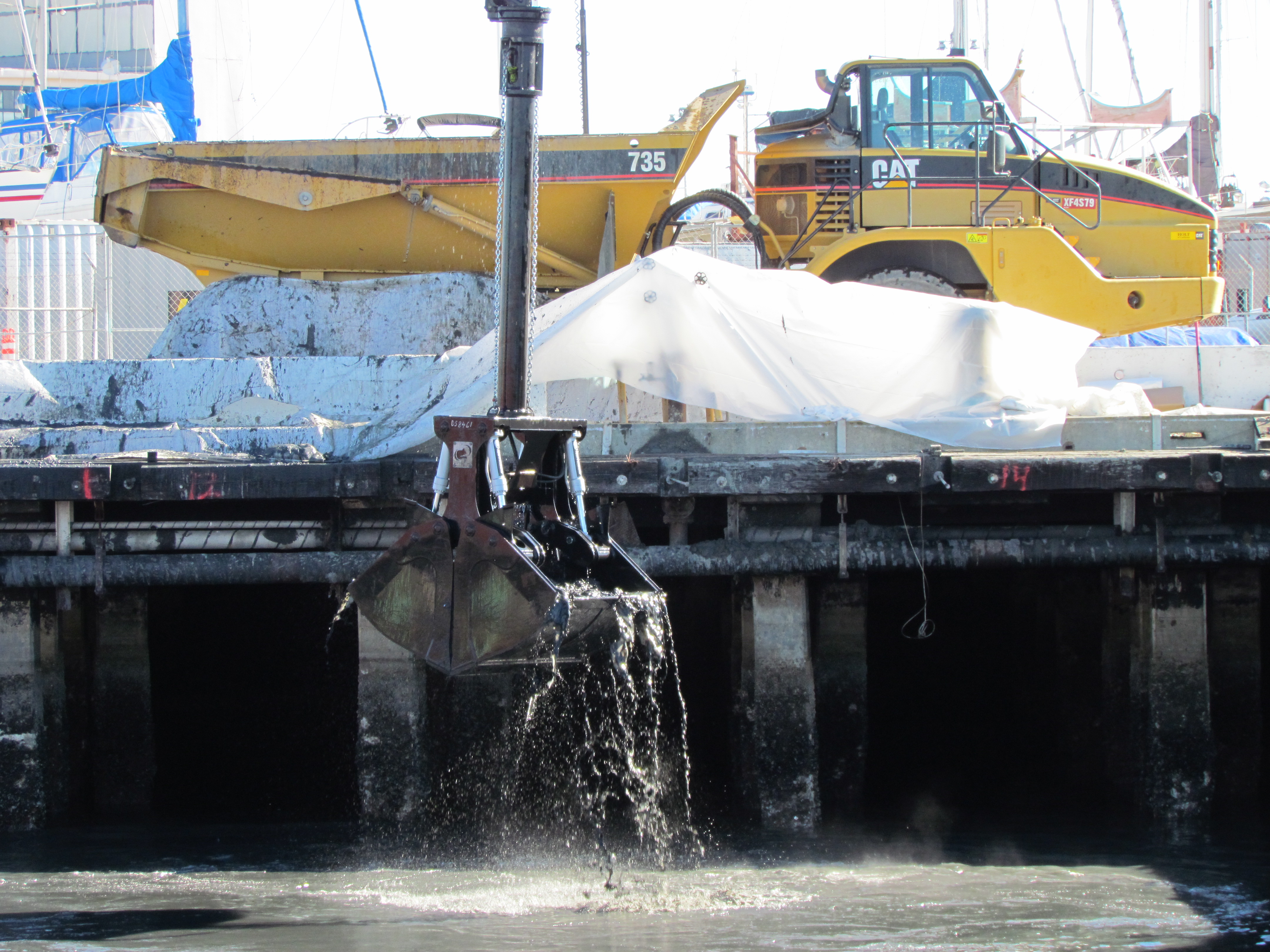
The Seaplane Lagoon’s north side will be looking like its old self in a few months. The Navy has begun dismantling the waterproof concrete-walled containment system that was used for three years for dewatering and testing of soil dredged from the Seaplane Lagoon, marking a major cleanup milestone. Prior to that dredging work, much of the lagoon’s north frontage served as a staging area for replacement of storm drain lines contaminated with radium-226.
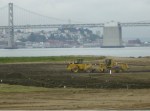
Construction of a new and improved soil cover over a waste disposal site concluded this spring, marking another milestone. The 110-acre site on the southwest corner of Alameda Point took 10 years of haggling about potential environmental impacts before a cleanup plan was adopted in 2010. Work began in early 2013. The dome-shaped soil cover required 500,000 cubic yards of barged-in soil to complete.
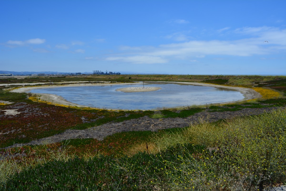
North Pond of West Wetland on southwest corner of Alameda Point. Pond is connected to San Francisco Bay via a new culvert near upper left of pond. Landfill soil cover is partially visible on far side of pond and will be seeded with flowering native grasses later this year.
At the far northwestern corner of the Point, work is about to begin on another long studied and analyzed waste disposal site. In a few months, the Navy will be installing an interlocking steel retaining wall along 200 yards of the Bay shoreline to contain contaminated burned waste material that was bulldozed into the Bay more than a half century ago. Water dye tests showed no toxics are leaching into the Bay, but members of the Restoration Advisory Board (RAB) questioned whether the barrier would withstand a catastrophic earthquake. Partially covered by runway pavement, the entire 30-acre site will receive a three-foot soil cover. The work is expected to be completed in 2015. The area will be available for passive recreational use such as hiking trails when the city receives the land.
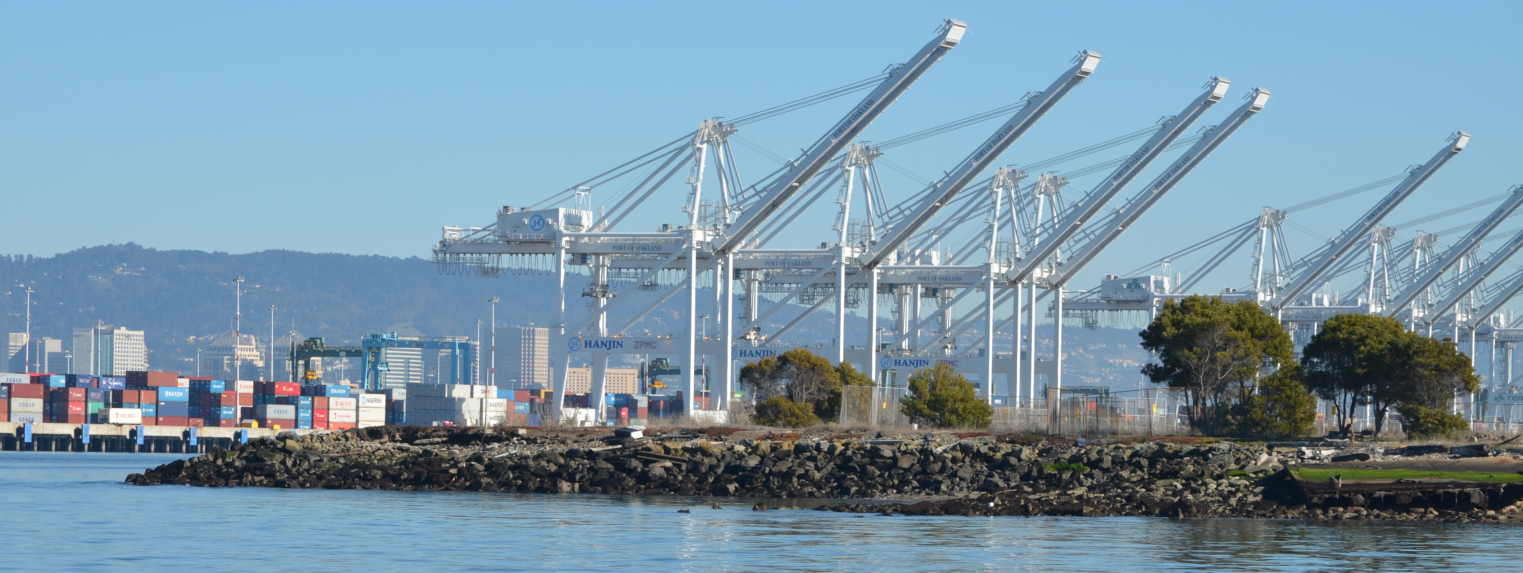
Northwest tip of Alameda Point where Site 1 is located. Waste burning area is here. Trees have been removed. Metal retaining wall will go here. Port of Oakland is in background.
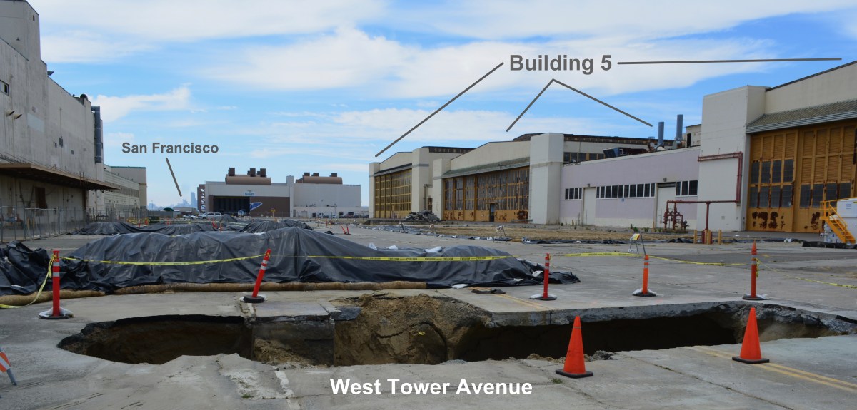
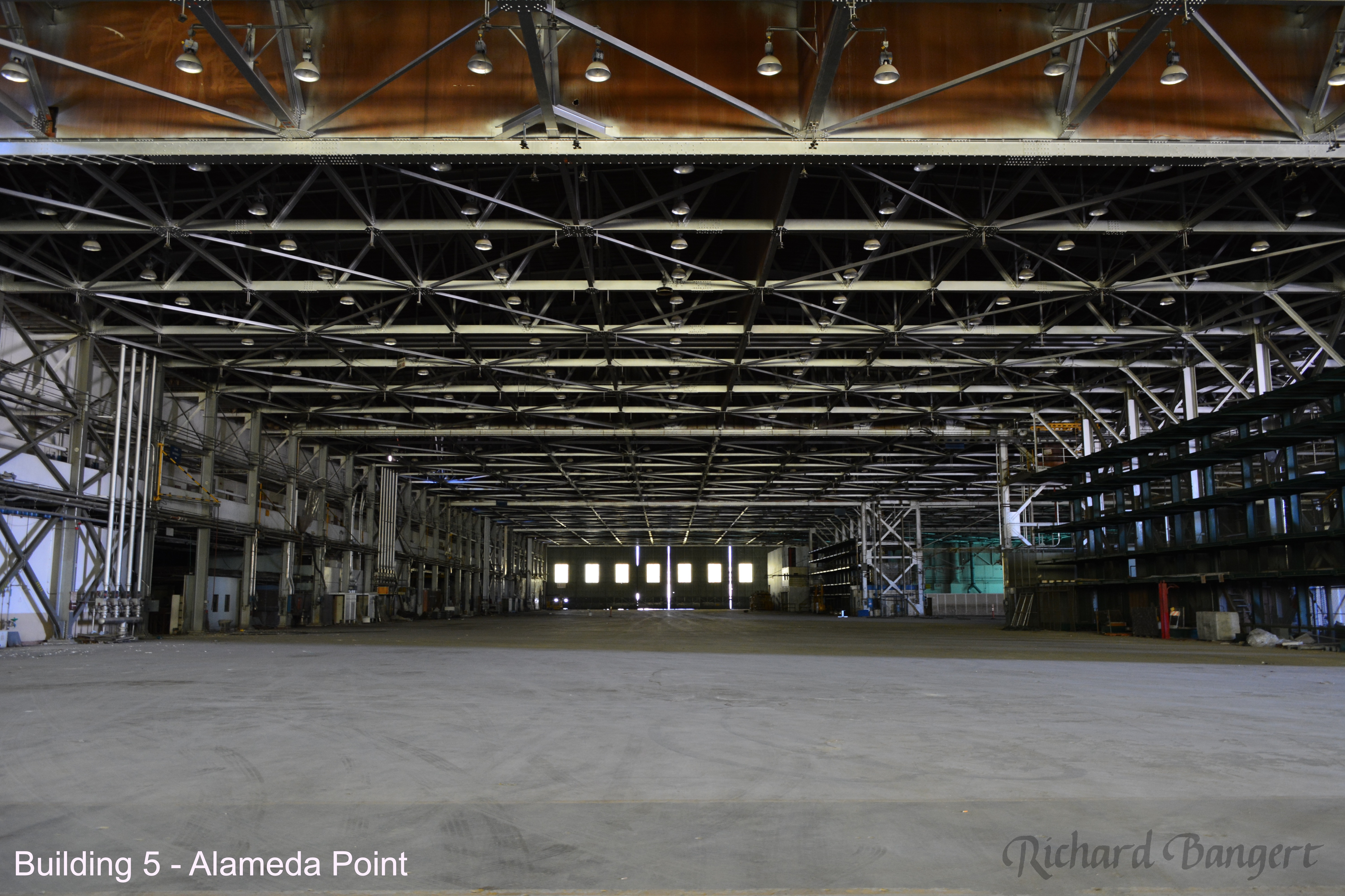
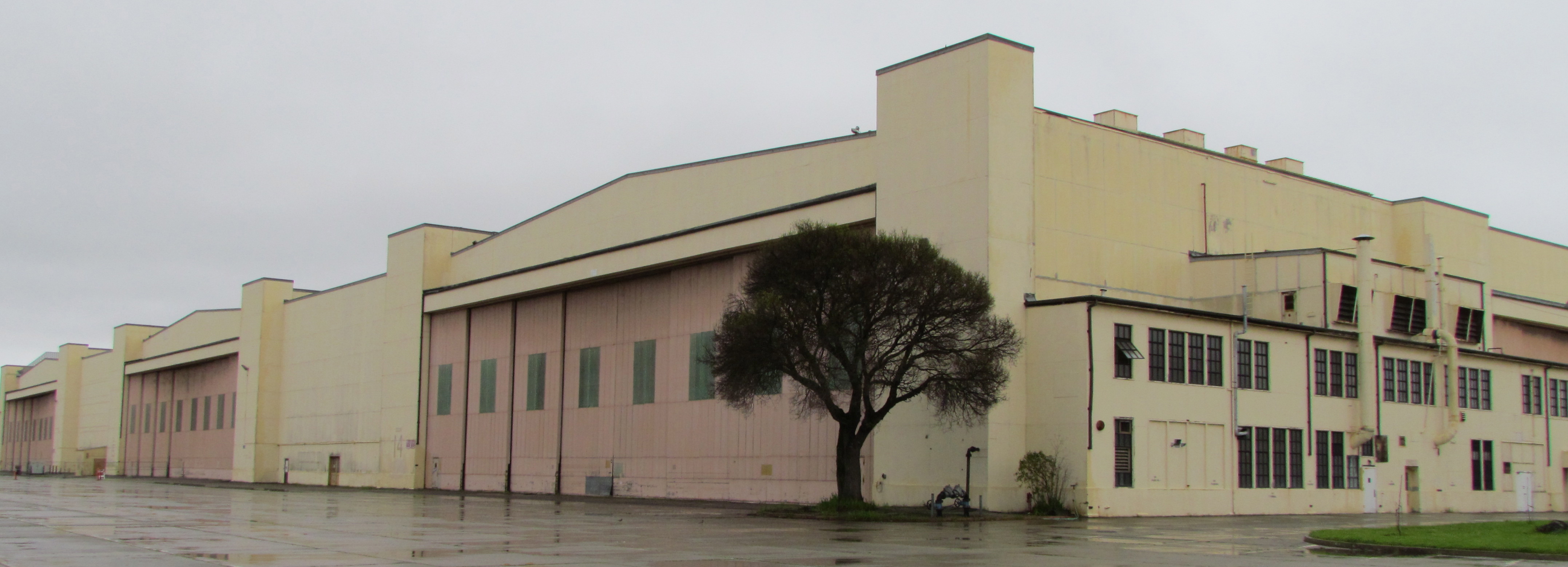
One of the longest-running and most problematic cleanup sites is at the old Naval Air Rework Facility (NARF), also known as Building 5, covering nearly one million square feet. Radium paint used for aircraft dial painting, and chemicals associated with engine repair work led to contamination that is still being remediated. The entire floor area will be scanned again for radiation in 2015, following up on at least three prior scanning surveys of walls, ceilings, pipes, and ducts. The year 2015 will also see the Navy returning to the site for a final round of groundwater cleanup treatments targeting contamination remaining after an intensive cleanup effort a decade ago.
Building 5, also known as Naval Air Rework Facility (NARF), where additional radium-226 and groundwater cleanup is planned. At the corner of West Tower Avenue and Monarch Street.
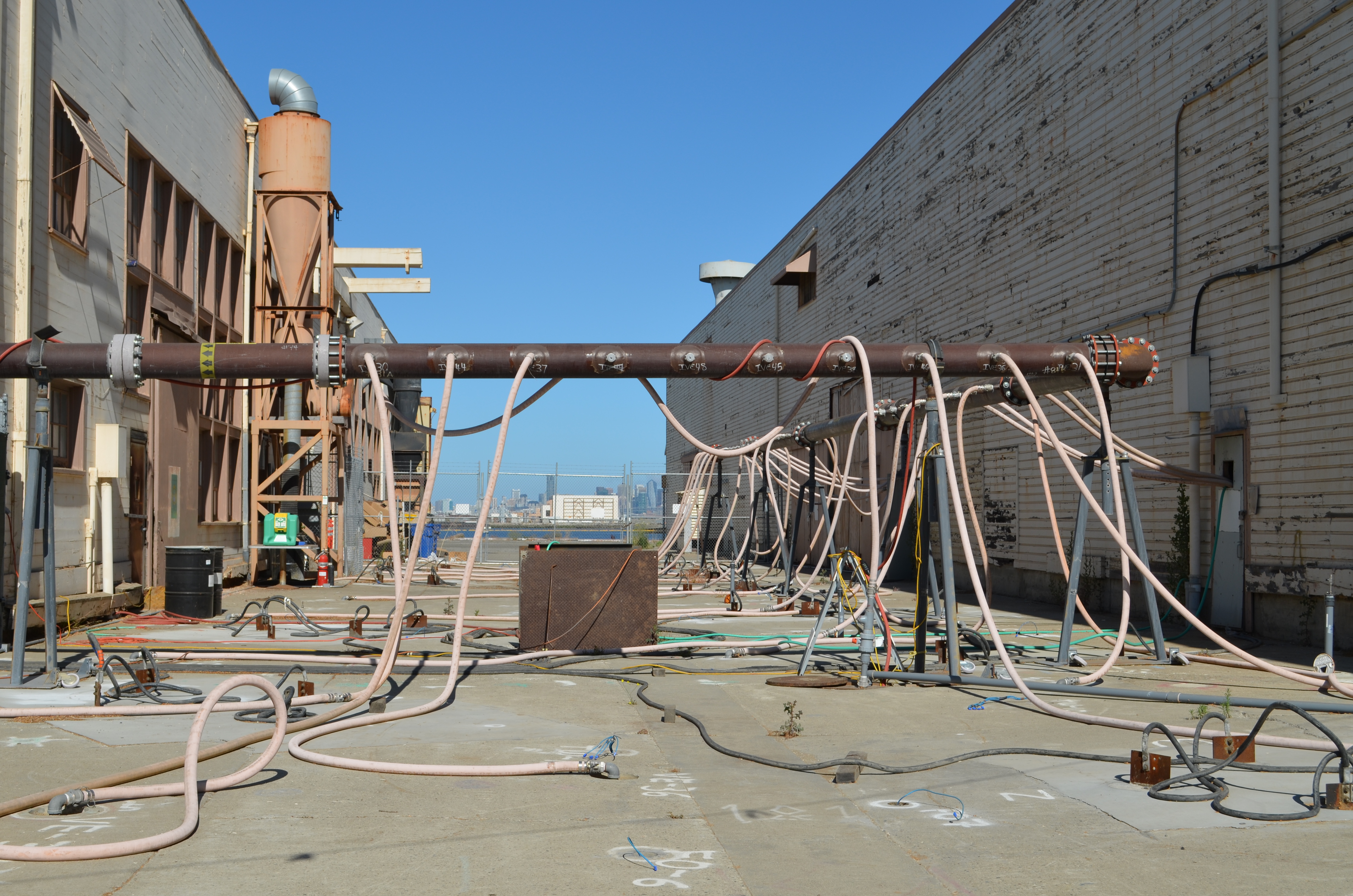
Next door to the Bladium Sports Club on West Tower Avenue, another previously treated groundwater cleanup site will be treated again. Workers have already begun boring holes in the pavement for a network of hoses that will be used for introducing contaminant-eating bacteria into groundwater along with a bacteria food source.
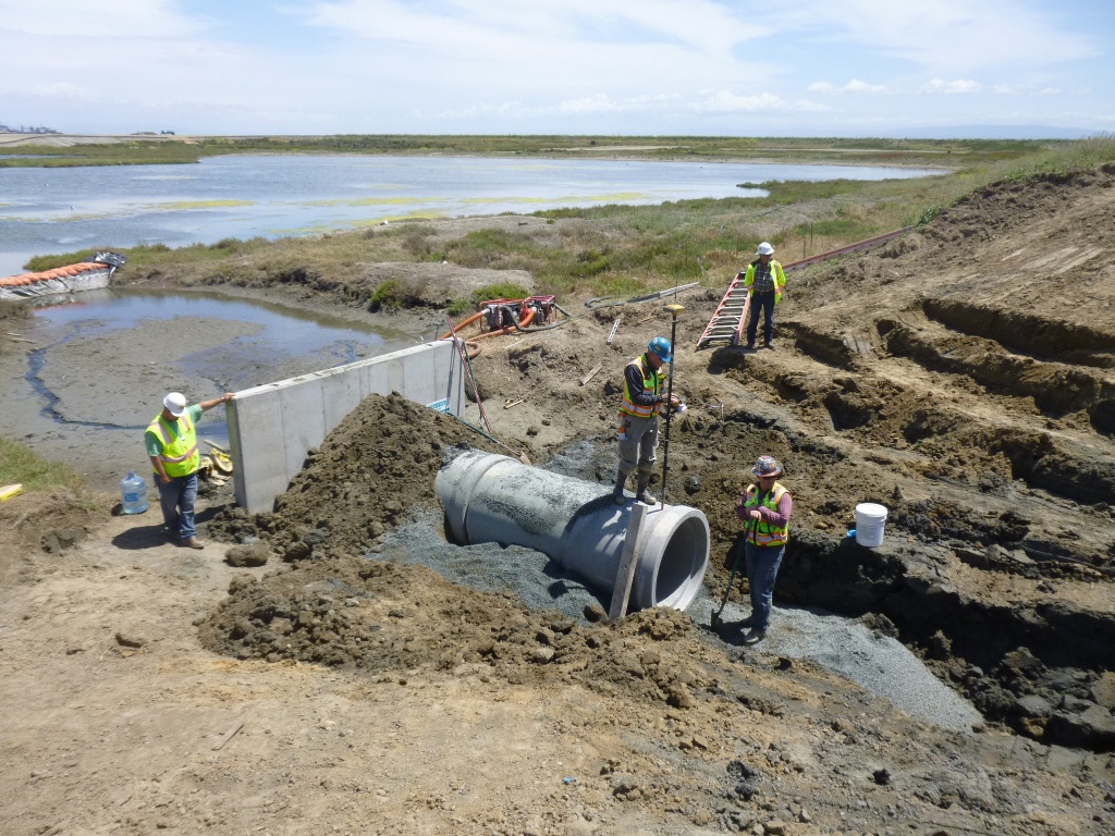
On Saturday, July 12, the Navy’s annual cleanup site tour visited four of the cleanup areas. The most impressive stop was the 110-acre landfill site mentioned above. For the first time in over 15 years, members of the public were allowed to walk around and enjoy the magnificent views from the embankment that is closer to San Francisco than to city hall. The fencing is all gone, and with it the radiological warning signs. The Navy replaced an aging metal culvert that connects the site’s North Pond to San Francisco Bay with a concrete culvert.
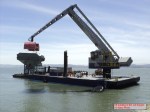
New culvert being installed connecting San Francisco Bay, which is to the right, and North Pond of the West Wetland at Alameda Point. Navy photo taken 5/22/14.New culvert being installed. North Pond of West Wetland at Alameda Point in foreground, San Francisco Bay in background. Navy photo.
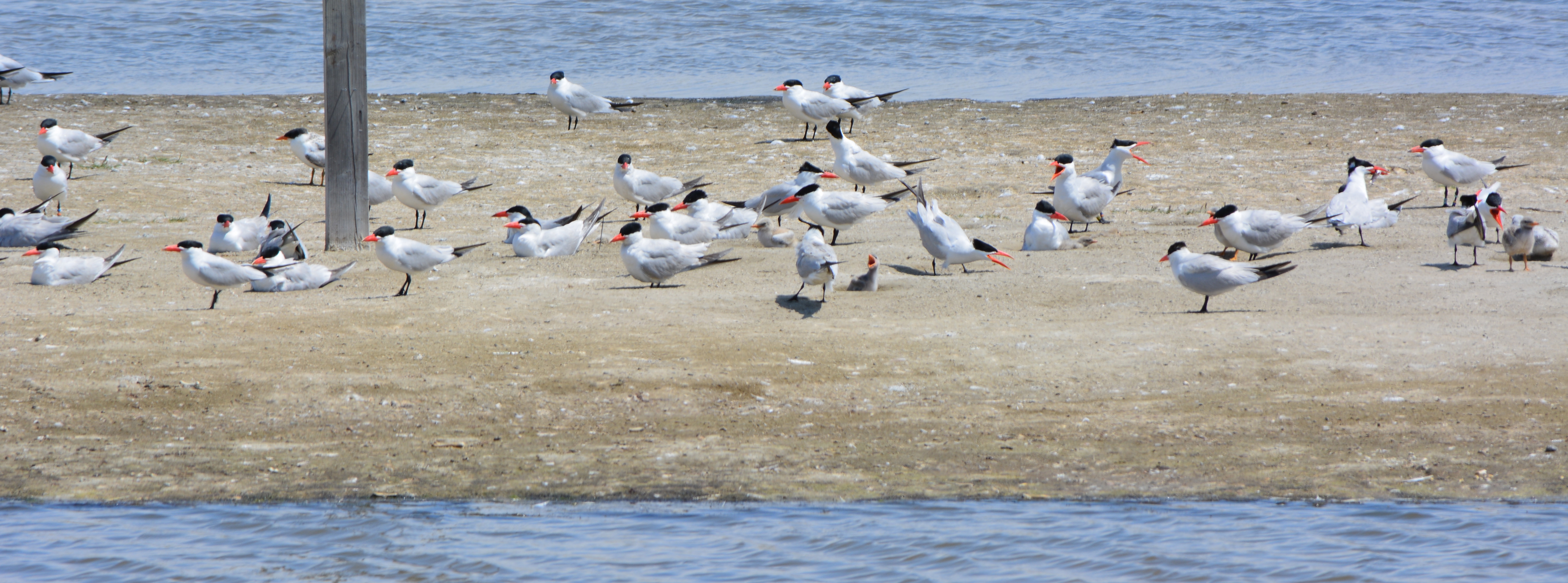
Tour participants were able to see the area’s expanded wetland with a new tiny island. Caspian Terns started nesting on the island a few months ago, another type of milestone. “The last time Caspian Terns were seen in that area nesting was in 1999 when only one nest was detected,” said Alameda wildlife biologist and Alameda Point bird surveyor Leora Feeney. The 79-acre soil cover on the landfill will be seeded with flowering native grasses later this year. The vegetation mix was chosen by the RAB.
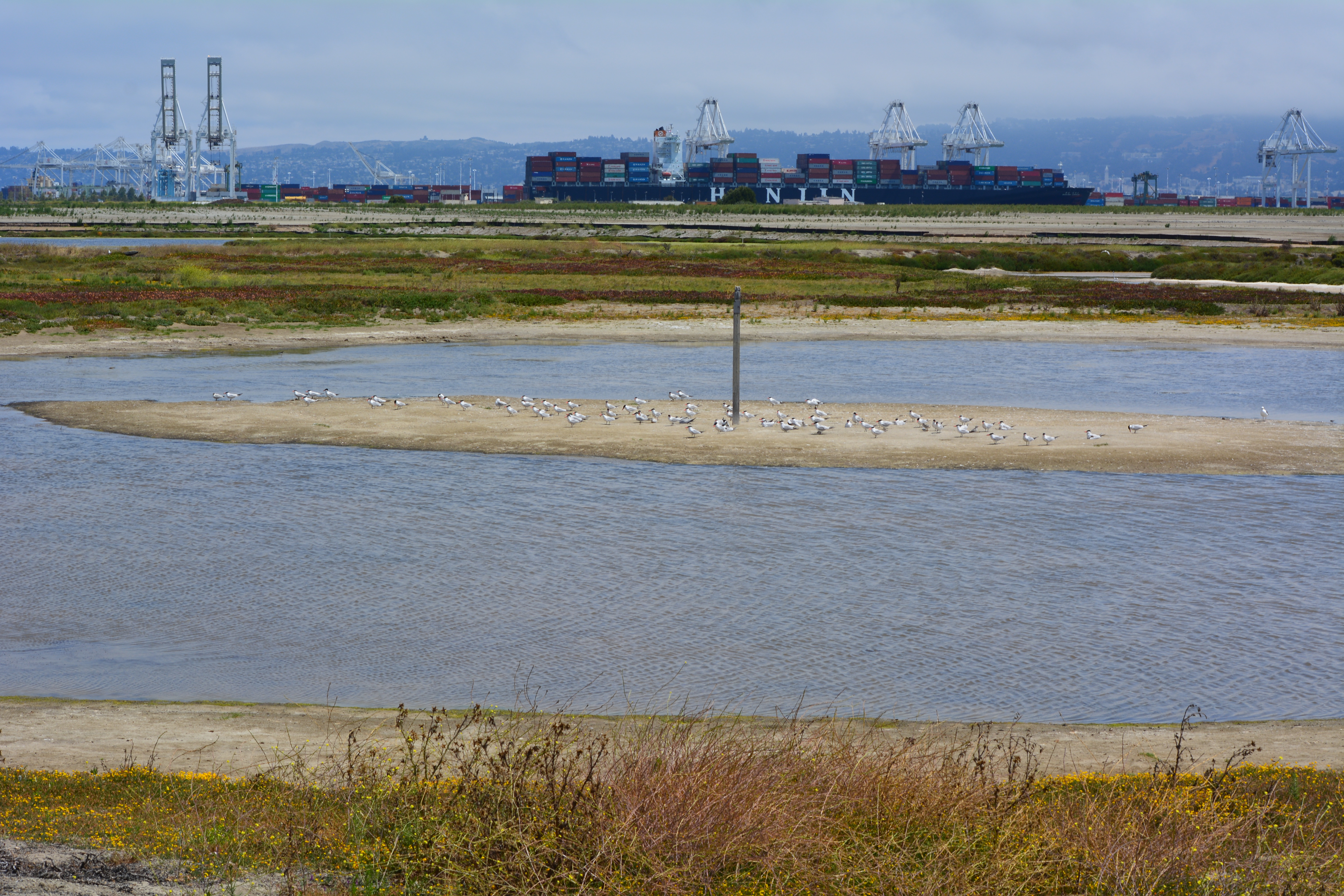
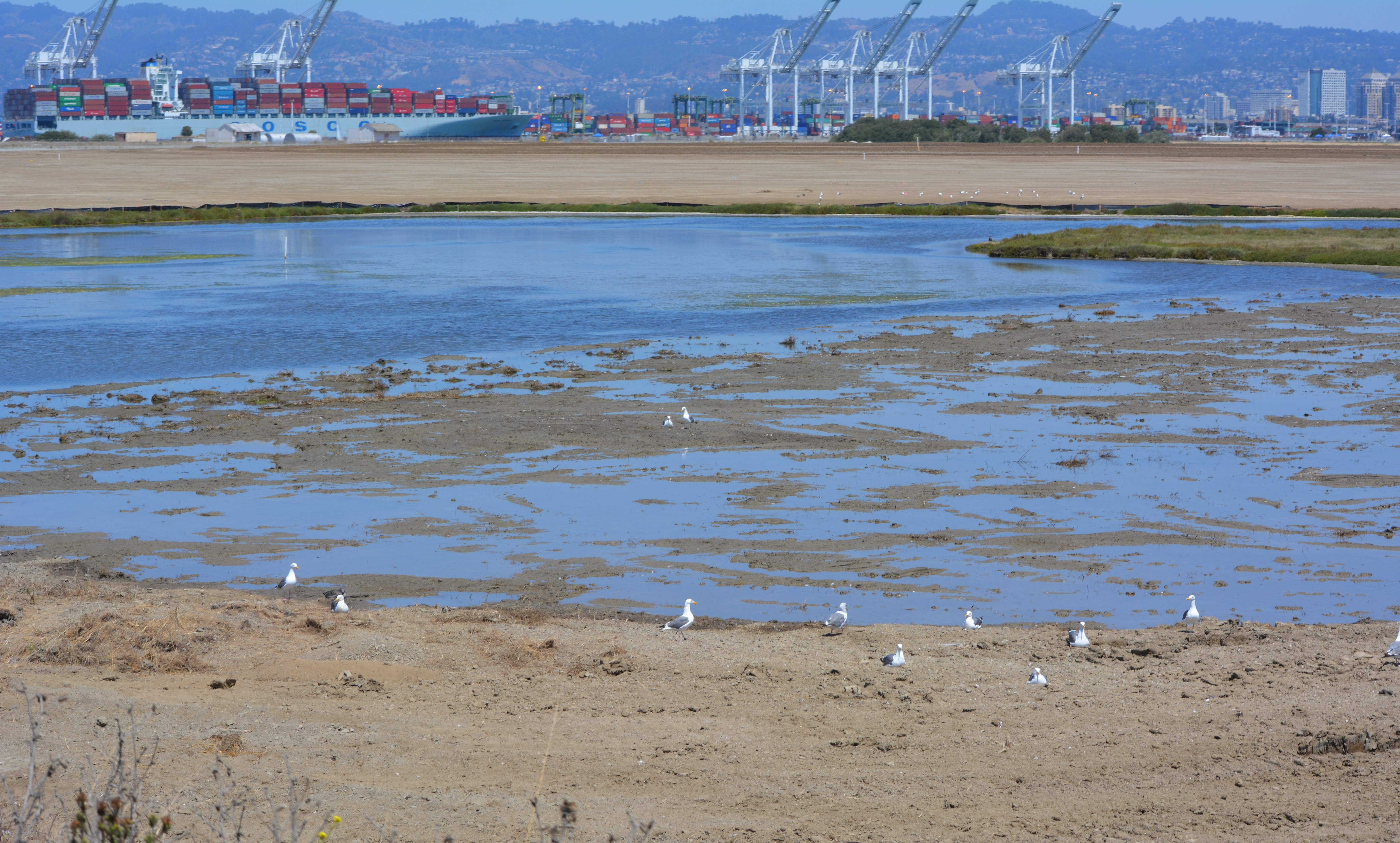
South Pond of West Wetland at Alameda Point. Island in pond has become a nesting site for Caspian Terns. Looking north toward Port of Oakland.
According to the Navy’s environmental cleanup coordinator, Derek Robinson, $513 million has been appropriated to date for Alameda Point cleanup, although some of it remains to be spent on upcoming work. His office, the Base Realignment and Closure Program, estimates another $80 million will be needed by the time remaining projects and follow-up monitoring are completed.
Later this year, the Navy is expected to transfer to the city the 33-acre North Housing site and seven-acre former Island High School site that sit next to Alameda Landing and Estuary Park, marking another milestone on the long and winding cleanup road to civilian use.
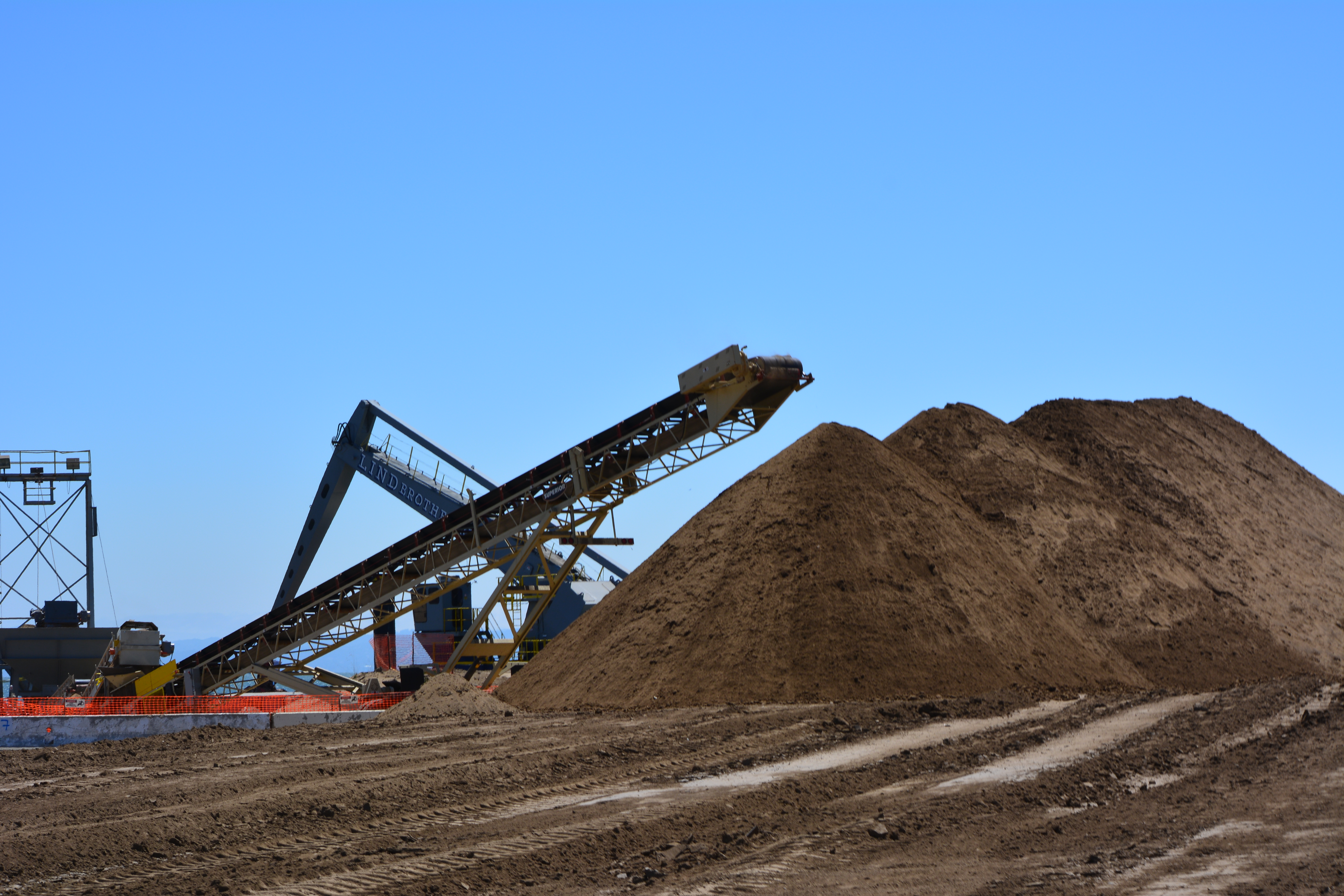
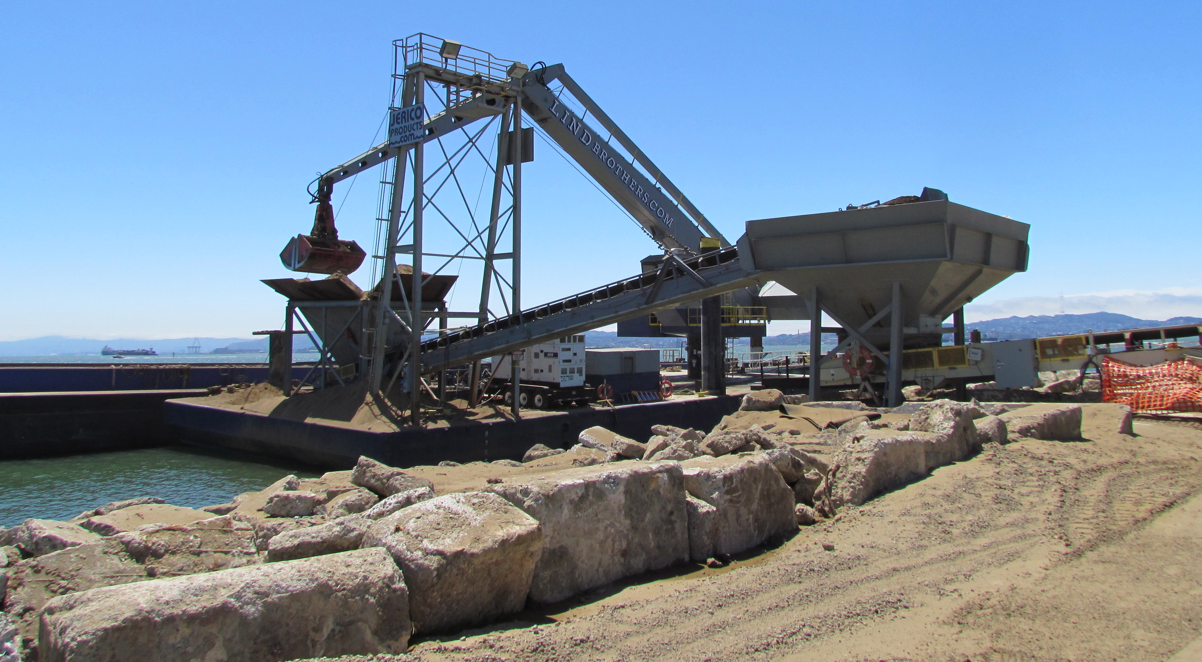
Caspian Terns and chicks at West Wetland, Alameda Point. Click on image to enlarge.Trail on embankment at southwest corner of Alameda Point. Looking south with San Francisco Bay to the right and ahead. Additional trail to the right at riprap elevation.Concrete pad served as a base for conveyor that transferred soil from barge to land for the soil cover at Site 2. Contractor left it in place and added a few amenities for future users of a place they had come to appreciate the beauty of as they worked here for a year. Thank you, TetraTech.Dredging the northwest corner of the Seaplane Lagoon at Alameda Point in February 2012. Tarmac dewatering, drying, and testing area behind black tarp is now being dismantled. All dredging work is completed.
Update notes: Subsequent criticism of the Navy as to the necessity of a security fence by members of the public and regulatory agencies led to the removal of the security fence from the final work plan design. The Navy also agreed to shorten the soil gas vents to two feet, since only trace amounts of methane gas are now emitted from the landfill waste, most of which is industrial and did not produce methane in the first place. Additionally, the Navy agreed to examine the aging metal culvert that connects the North Pond of the West Wetland to San Francisco Bay. The culvert provides the water lifeline for the North Pond habitat and was at risk of collapse and being stopped up with debris. The Navy replaced the metal culvert with a concrete culvert (see photo above) and debris screen.
Landscaping of the 100-acre landfill area on the southwest corner of Alameda Point is nearing completion. The seeding of the landfill site with flowering native grasses is almost ready to begin. Contouring of the site is complete. Stabilization of the shoulder around the wetland area is complete. Placement of the final soil cover is underway.
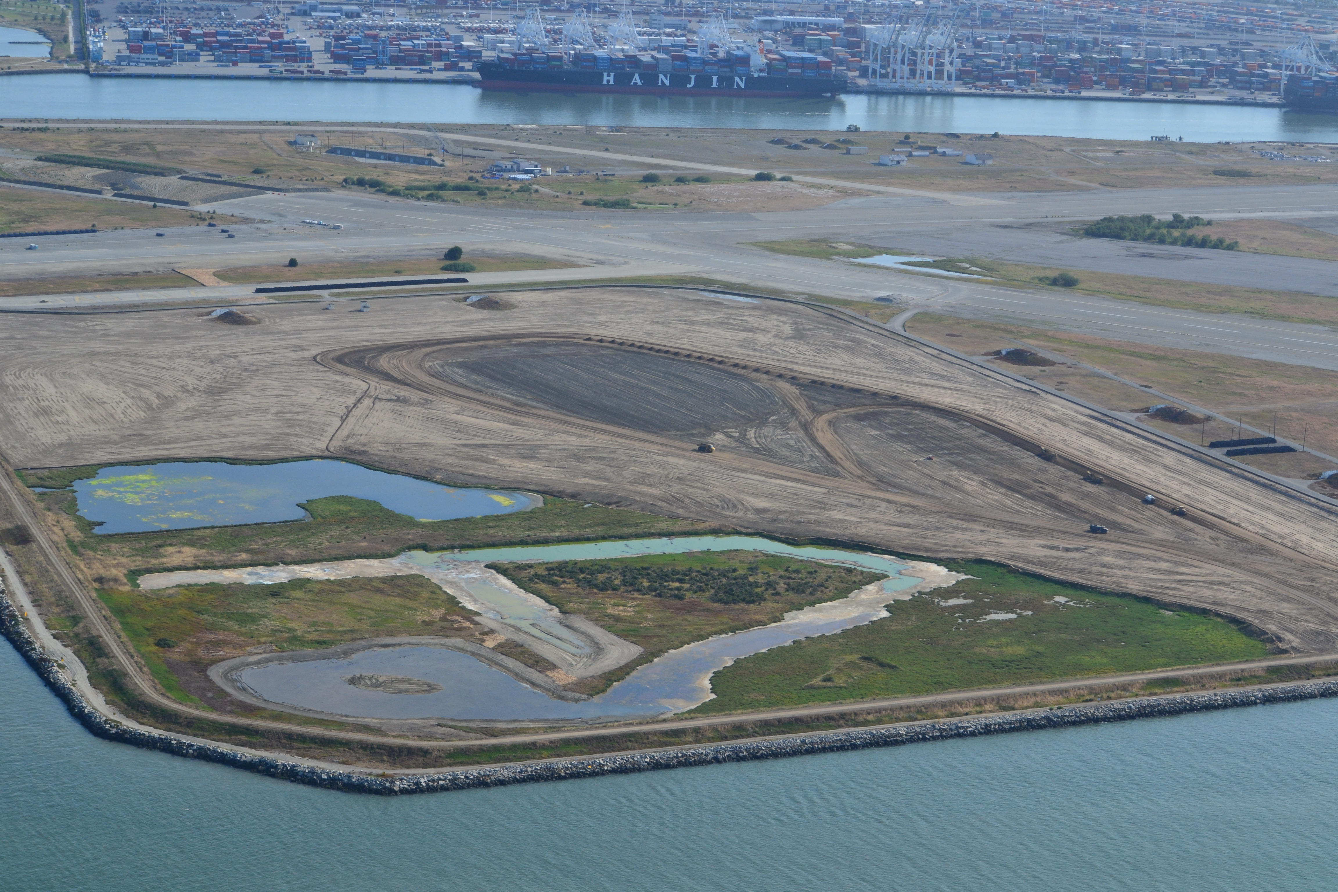
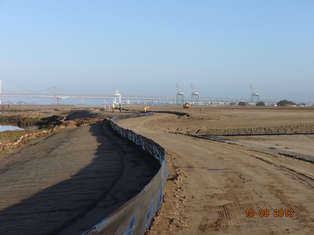
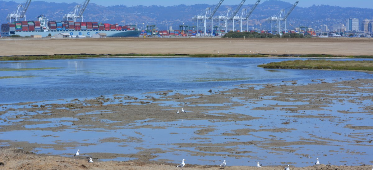
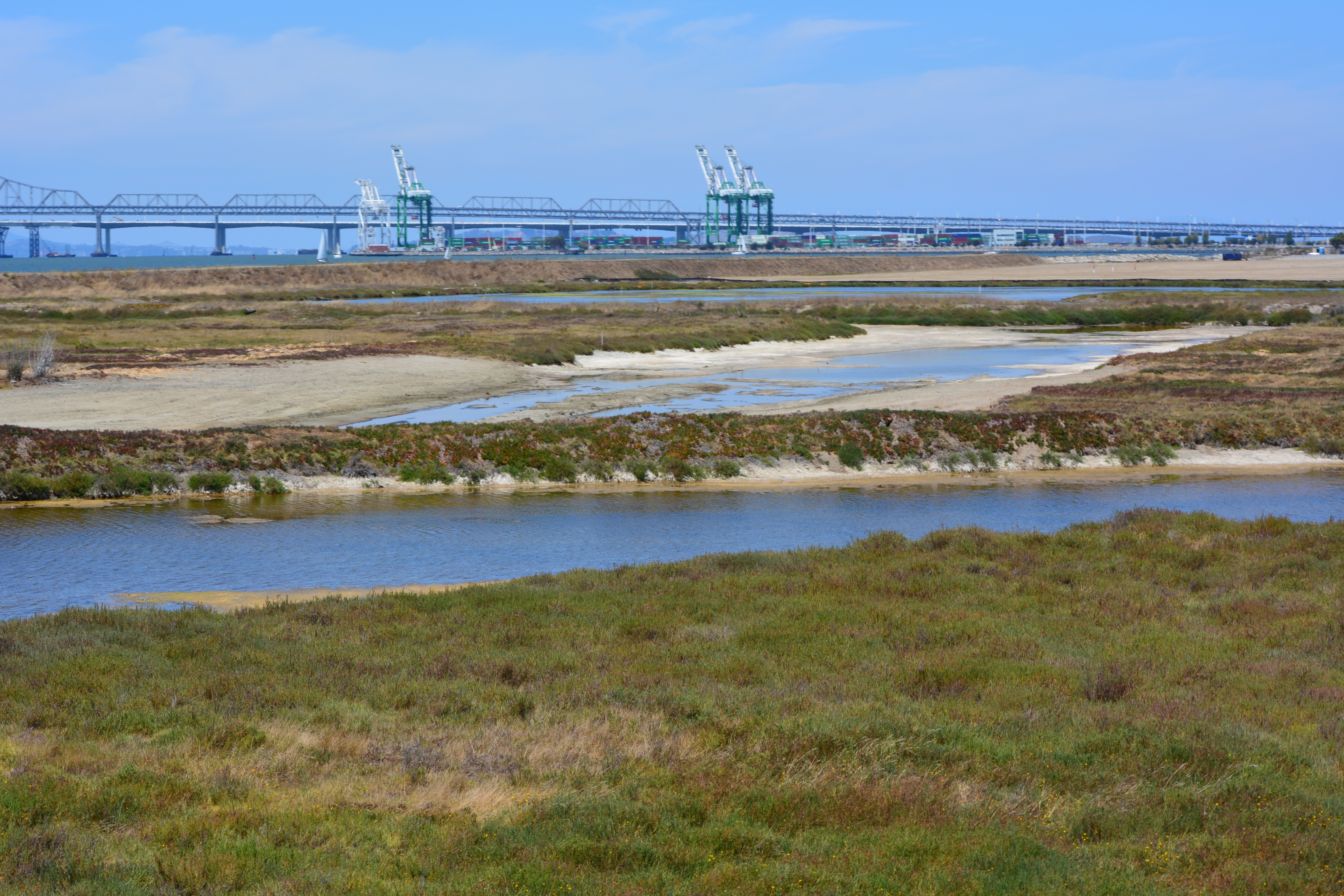
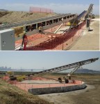
Site 2 wetland area and adjacent contouring underway in early July 2013. Wetland area has since been expanded by several acres. Port of Oakland is in the background. Bay Trail will eventually follow the foreground shoreline along the Bay. Funding and construction of the Bay Trail is not part of this project, and is yet to be funded.
The contouring of this industrial landfill site was completed on August 16, 2013. Approximately one-third of the contouring, or base layer, soil is clean soil recycled from Seaplane Lagoon dredging. The recycled soil stock was quickly exhausted, along with soil recycled after removing some of the berms and high areas. More than half of the base layer – 193,000 cubic yards – is soil barged in from Decker Island in the Sacramento River.
Soil being delivered from Decker Island.
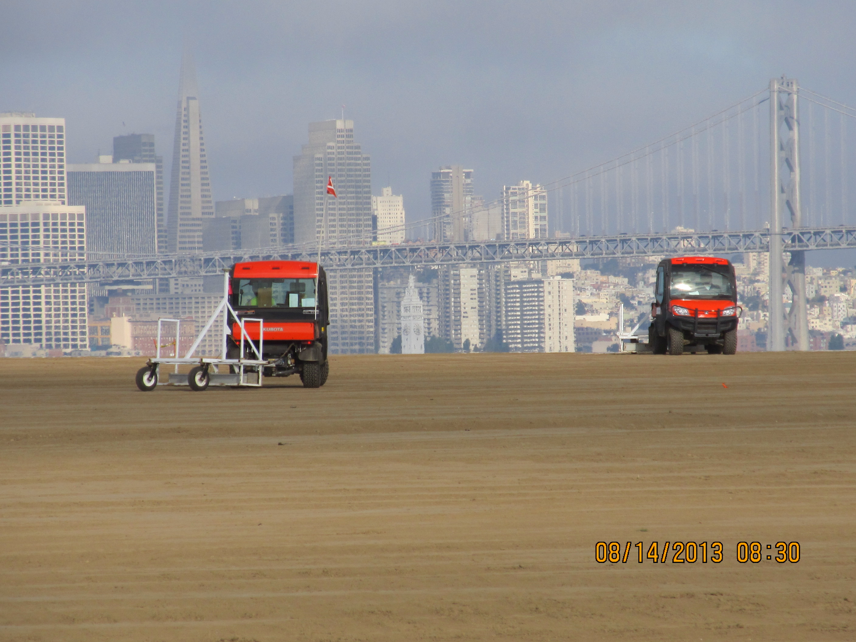
This contouring phase, which began in January of 2013, created the base layer with a specially-engineered slope. It was then scanned for radiation using scanners towed by a small vehicle, even though the site had been surveyed for radiation prior to placing the base layer.
Scanning the base layer for radiation.
Placement of the plastic biobarrier (see photo below) and the final soil cover using soil barged in from Decker Island began on August 19, 2013. The biobarrier is a plastic mesh that is designed to discourage burrowing animals from coming into contact with the waste area. The biobarrier installation is over 90% complete as of week #38 (October 24, 2013). The final two-foot soil cover is over 60% complete. The final soil cover includes six inches of soil amended to promote growth of vegetation.
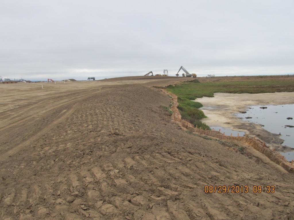
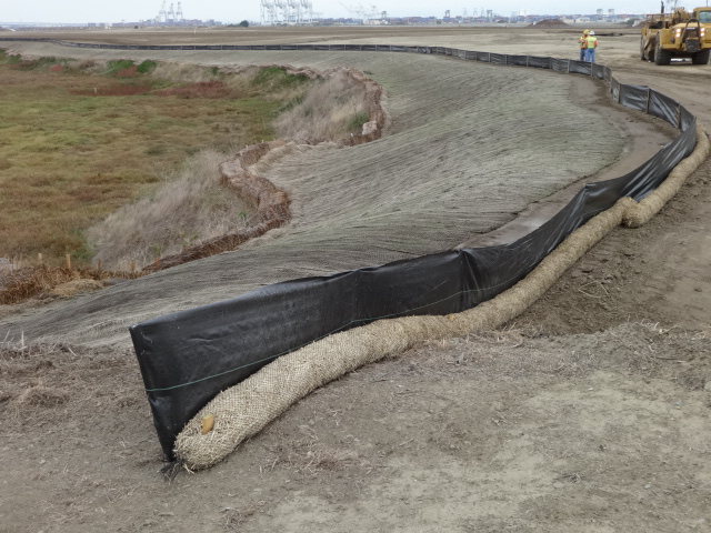
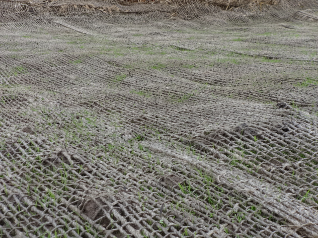
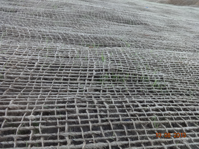
The soil stabilization and drainage work on the shoulder around the wetland area is also completed. It includes native rye grass seeding, a jute mesh cover, and a silt fence. Some of the rye grass has already started to sprout.
Stormwater controls near wetland area being created.
New monitoring wells will be installed starting in late November.
Hydroseeding of the site with an assortment of California native grasses will begin in late November or early December.
In 2014 the old culvert connecting the north side of the wetland with San Francisco Bay will be replaced with a new culvert.
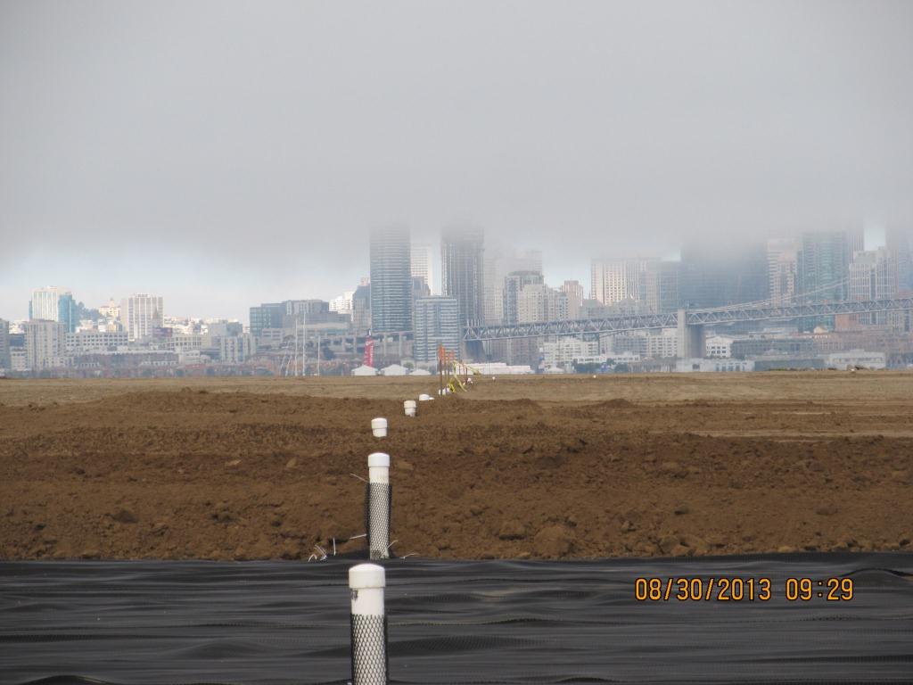
Fifty tons of old fence and metal have been recycled. The temporary work fence will be removed at the end of the job. The methane gas vents will be short and virtually unnoticeable (see photo below). Due to the age of the landfill and the fact that very little organic waste was deposited there, the methane gas produced is minor and will not require the 10-foot tall vent stacks proposed in an earlier workplan.
Methane gas vent pipes.
This site, along with adjacent land, will be transferred to the U.S. Department of Veterans Affairs in late 2013 or early 2014.
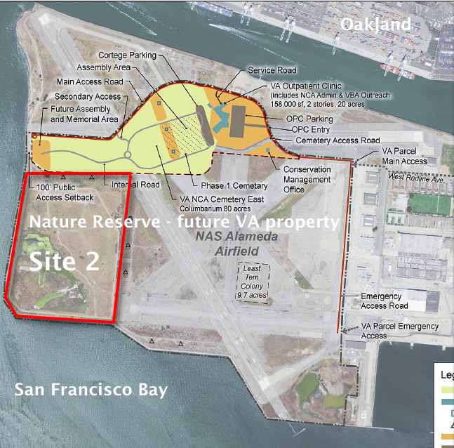
VA map, with Site 2 and Nature Reserve notations added by Alameda Point Environmental Report.Biobarrier to discourage burrowing animals. Photo credit: Alameda Point Environmental Report.
Silt fence installed above jute mesh around wetland area.Silt fence under construction.Jute mesh around wetland shoulder, with grass starting to sprout.Week 36 – Vegetation growing through jute mesh around shoulder of wetland area.
Source: The information in this update was gathered from the weekly progress reports for Installation Restoration Site 2 Remedial Action at Alameda Point. The progress reports are posted on the Envirostor website maintained by the California Department of Toxic Substances Control (DTSC). The source for all photos in this update, unless otherwise credited, is DTSC.
On August 3, 2013, the Navy’s annual environmental cleanup tour visited the worksite known as Site 2 on the southwest corner of Alameda Point. Work has been underway at the site since early this year, constructing a 79-acre soil cover atop the old waste disposal area. Due to budget cutbacks this year, only the Restoration Advisory Board was taken on the tour.
Transition from soil cover to wetland. Port of Oakland in background.
The site was closed for waste disposal in the mid-1980s and given a soil cover that did not meet landfill closure standards. For more than a decade after it was added to the Superfund cleanup program, the regulatory agencies and the Navy went back and forth about how best to close the site in an environmentally safe manner.
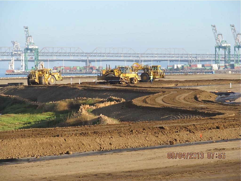
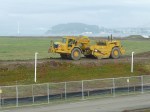
The slope of the soil cover is so important to the engineering design that the blades on the graders are not even controlled by the driver. Blades on the graders, and even the bulldozer, are controlled by an onboard computer that uses a GPS satellite to maintain a uniform elevation. The engineering concept for this soil cover is to minimize the slope so as to minimize movement in an earthquake, while at the same time providing for drainage.
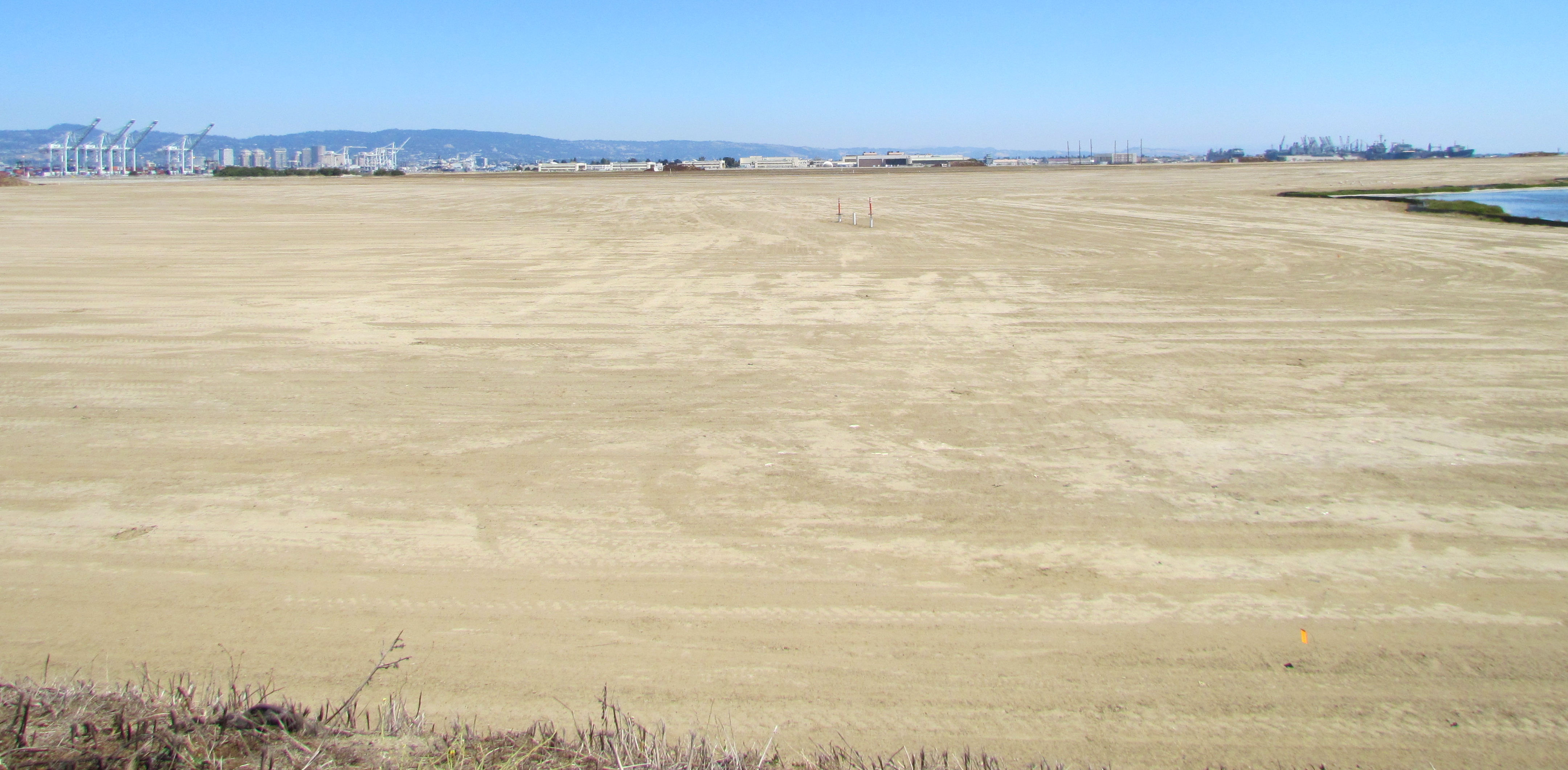
Looking east at partially completed soil cover from the western shoreline of Alameda Point.
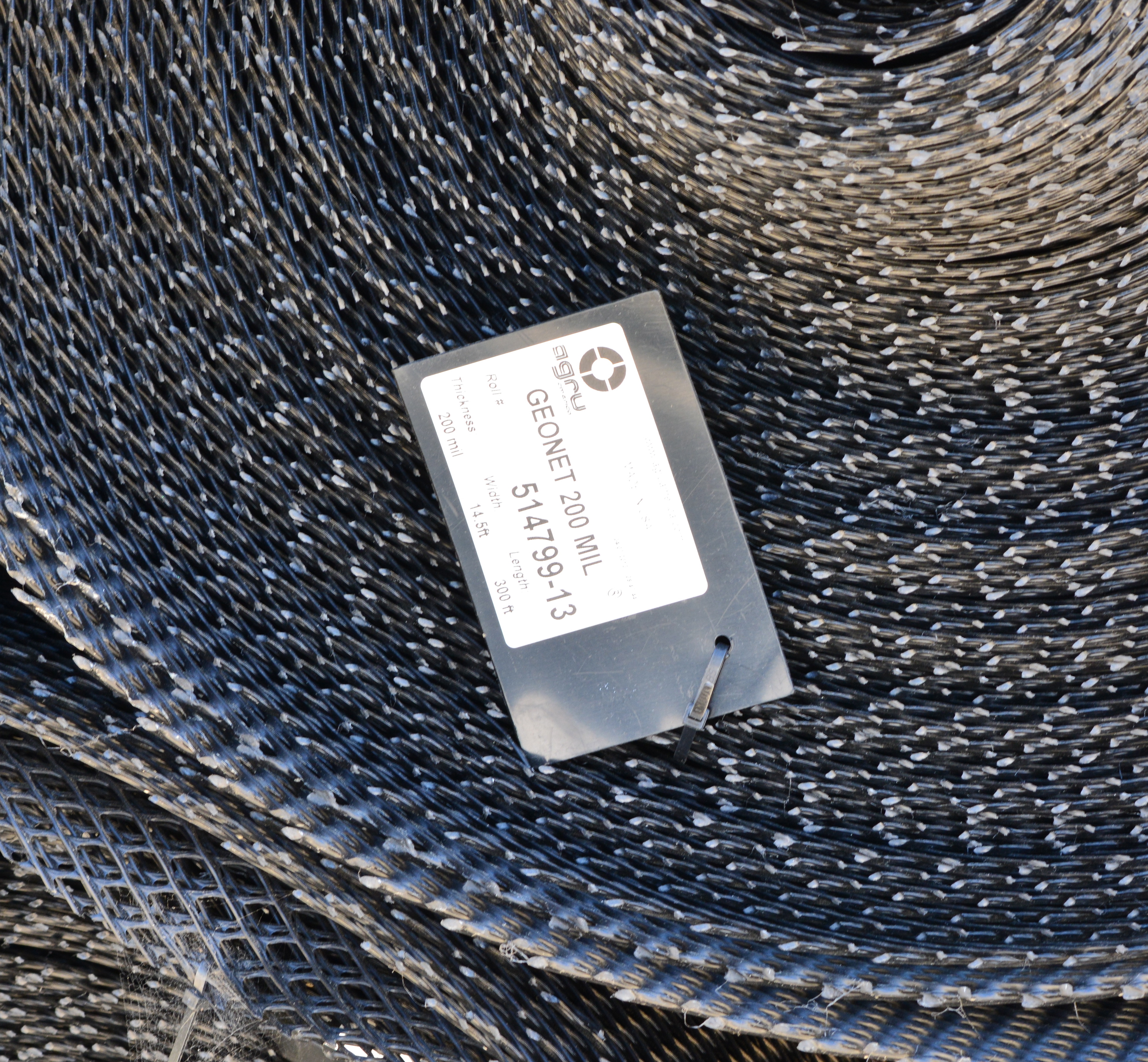
Soon the contractor will be laying down a 200-mil-thick HDPE geonetting material to act as a barrier to burrowing animals. Next, they will add two more feet of soil before installing monitoring equipment, drainage features, access road, and seeding the soil with a variety of California native grasses. Seeding is planned for this fall before the rainy season.
The 30-acre wetland area is not contaminated, but it will receive some upgrades with additional wetland. There is both a freshwater wetland area fed by rainwater, and a saltwater wetland area connected to San Francisco Bay via an underground culvert. The culvert will be replaced due to its age.
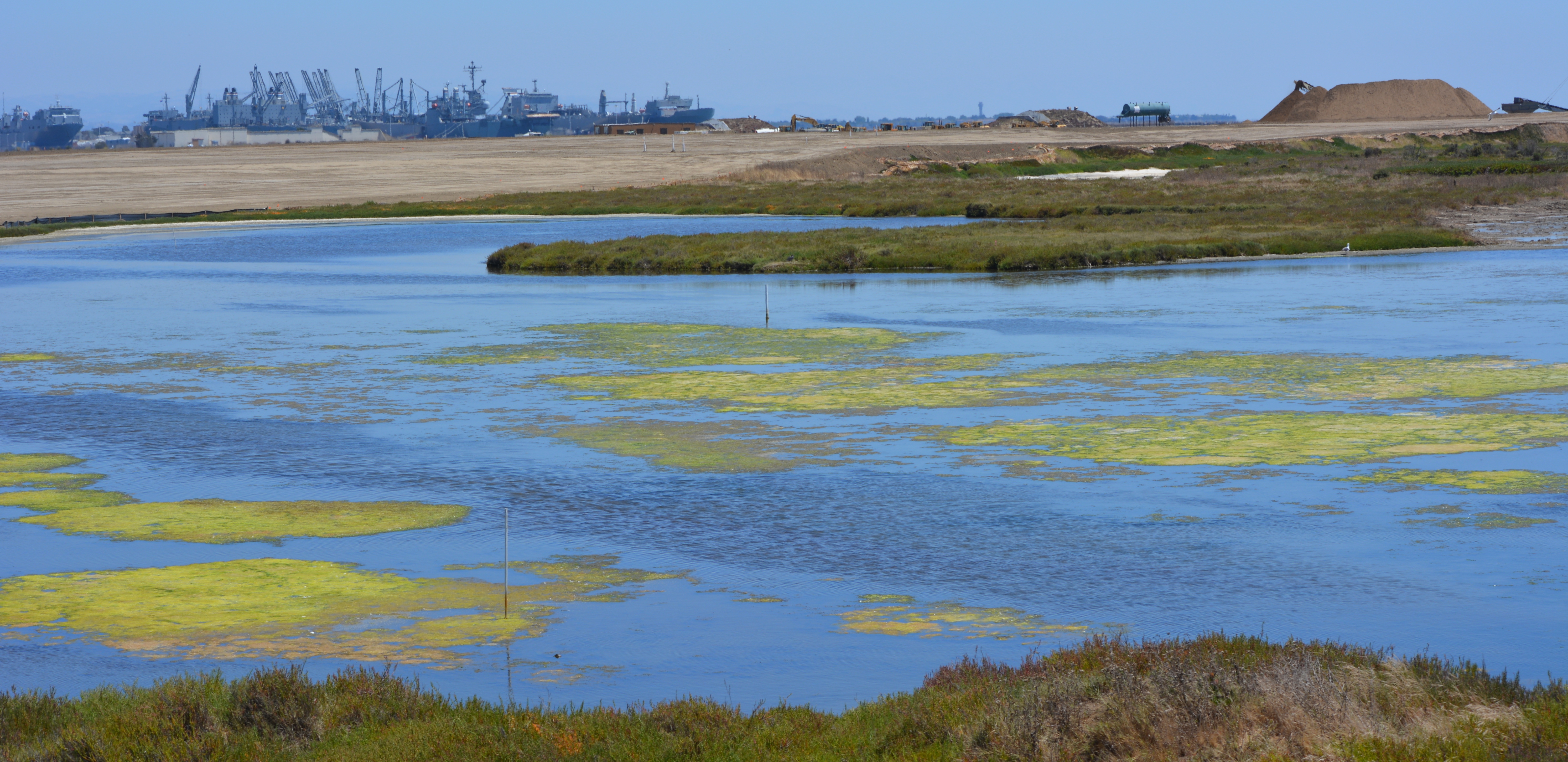
Partial view of wetland and soil cover on southwest corner of Alameda Point. Looking east with maritime ships in background.
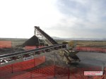
More than 600,000 cubic yards of soil is required to complete the project. Of that amount, 110,000 cubic yards have been recycled from the Seaplane Lagoon dredging after it tested clean. The rest is being barged in from Decker Island in the Sacramento River near the town of Rio Vista.
Soil from Decker Island being off loaded from barge at southwest corner of Alameda Point.
This 110-acre project site, featuring the most scenic viewpoint in all of Alameda, will be transferred to the U.S Department of Veterans Affairs (VA) along with another 400 acres of the Nature Reserve, and 112 acres for the VA’s clinic and columbarium. A nearby public access area on the western shoreline will be developed when the VA completes their road along the northern perimeter of the columbarium to the western shore. The Bay Trail will eventually run along the shoreline.
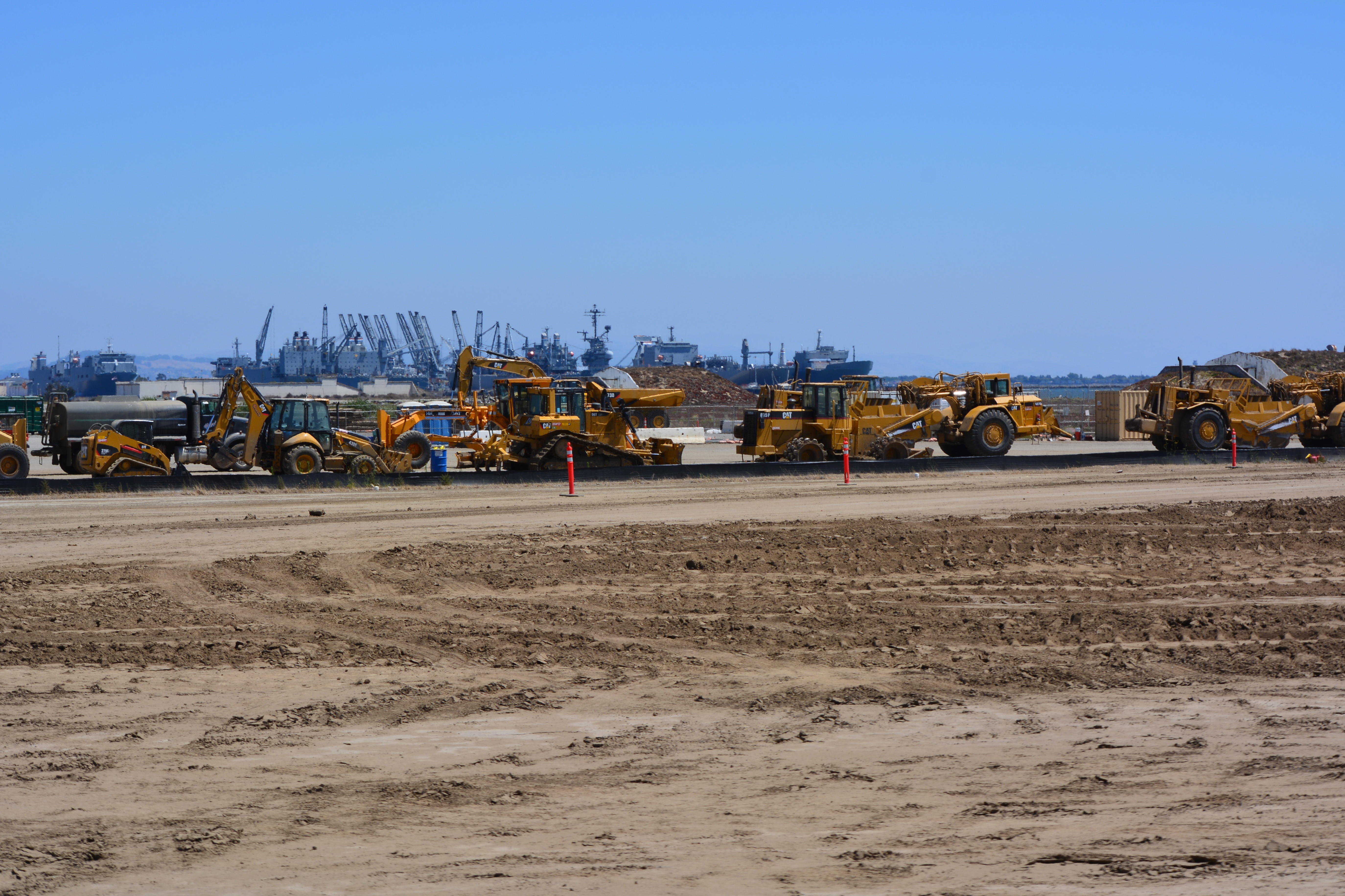
Partial view of wetland area on Site 2 – Alameda Point Nature Reserve. Bay Trail will be on the other side of the embankment that runs along the far side of wetland area.Wetland on the left connected to San Francisco Bay. The muddy part in the photo was recently added and will be allowed to naturally revegetate. Freshwater wetland to the right. Looking east toward hangars.North Pond wetland connected to San Francisco Bay. Port of Oakland in background.Wetland area on Site 2 looking north from southern perimeter of the site.Off loading soil from barge for Site 2 soil cover at Alameda Point. Southern shoreline.Construction equipment at Site 2. Looking east with maritime ships in background.VA project at Alameda Point with adjacent Nature Reserve that includes Site 2 remediation area.
Thirty-five years after the Navy stopped disposing of toxic waste in unlined pits next to San Francisco Bay on Alameda Point’s southwest shoreline, the final actions to comply with state and federal laws are finally being implemented this year.
Site 2 where industrial waste is buried. Area up to the wetland will be covered with two feet of additional soil.
Decades of wrangling between the Navy and regulatory agencies over how to handle the West Beach Landfill, dubbed Site 2, were finally ironed out this spring. The U.S. Environmental Protection Agency (EPA), the Regional Water Quality Control Board (Water Board), and the California Department of Toxic Substances Control (DTSC) have agreed to a plan that calls for leaving the estimated 1.6 million tons of industrial waste in place and adding more soil to the existing soil cover.
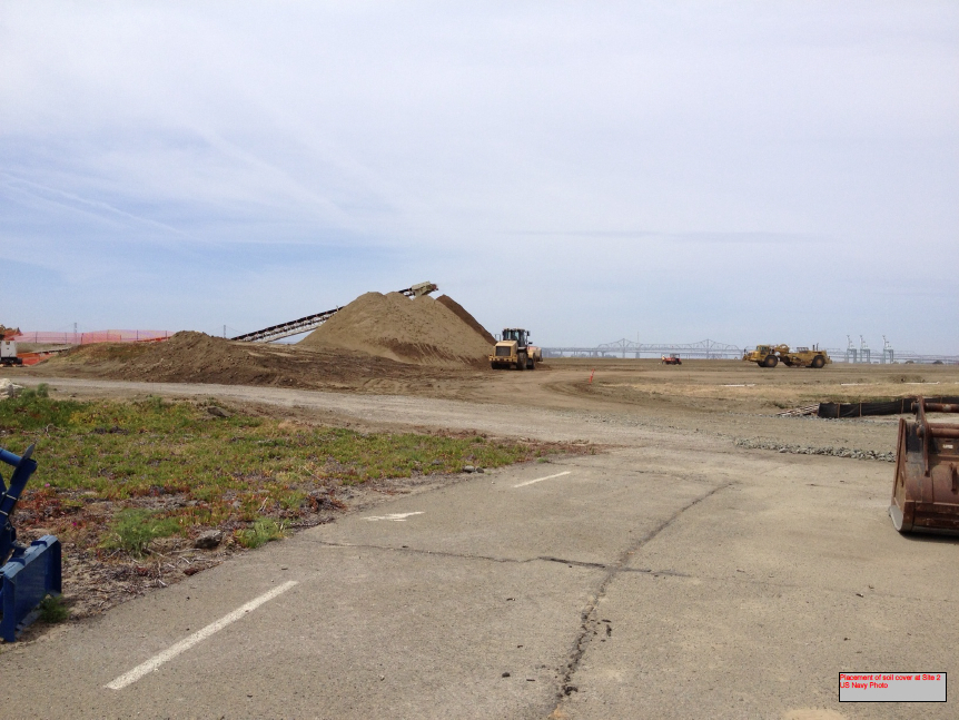
Placement of soil cover at Site 2 – May 2013. US Navy Photo.
The Navy began dumping waste in the area in 1952, four years before they surrounded the area with a seawall. The dump was closed in 1978, but early efforts to comply with state environmental laws for landfill closure were not to the satisfaction of the Water Board.
In its May 2012 draft engineering work plan for the landfill, the Navy cited a decade of groundwater monitoring along the shoreline that proved the toxic chemicals of concern are not migrating toward the Bay. Instead, the chemical concentrations are either stable or declining. The contents have been sitting in water-saturated subsurface soil since the disposal program began 60 years ago.
Radiological hotspots of debris and soil, including a small storage building, were removed after an earlier scan of Site 2. Before the current two feet of clean soil is put in place, the soil will again be scanned down to a depth of one foot, and elevated concentrations will be removed. Radium-226 paint waste was disposed of in the landfill.
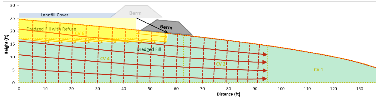
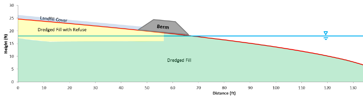
One of the major concerns about leaving this landfill in place is the consequence of a major earthquake. The Navy responded to a comment from a DTSC engineer by acknowledging that in the event of a maximum credible earthquake, the riprap boulders forming the “seawall is conservatively assumed to be non-existent, instantaneously whisked away and replaced with a 25-foot vertical face of liquefiable sand subject to plastic flow without being constrained by a rigid shell (sea wall).” The Navy’s earthquake model predicts that the earthen embankment above the seawall at the perimeter of the landfill, composed of clay and not sand, will glide into the Bay and “will not be overtopped by the waters of San Francisco Bay and freeboard of about 5 feet above mean sea level will remain, and so the refuse will remain isolated.”
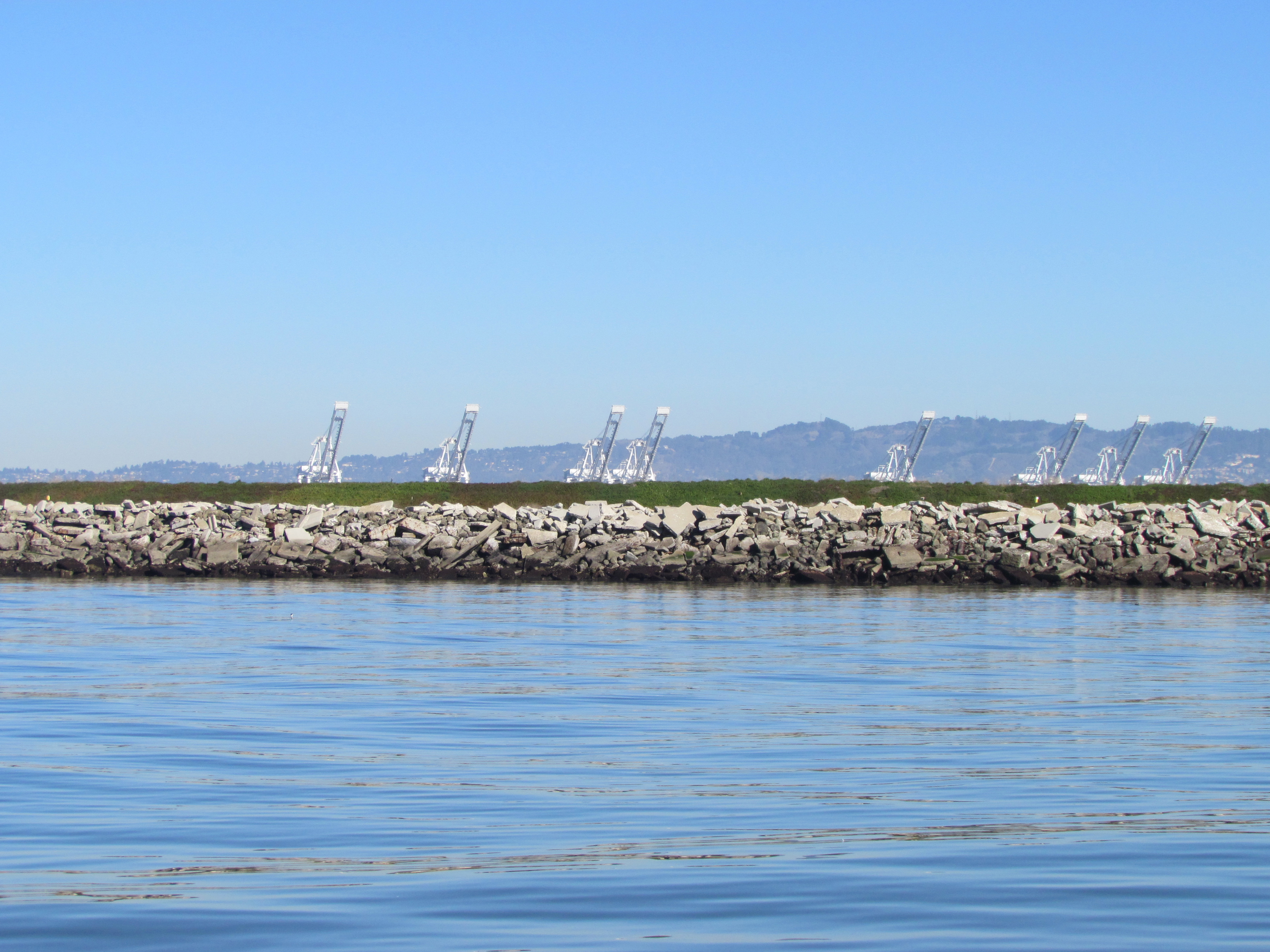
Navy graphic showing predicted movement of embankment berm into San Francisco Bay during an earthquake. Click on image to enlarge.Navy graphic depicting position of embankment berm at Bay shoreline following a catastrophic earthquake. Click on image to enlarge.Southwestern shoreline of Alameda Point at Site 2 landfill. Rock/cement riprap seawall, with green embankment berm above. Looking north toward Port of Oakland.
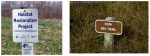
The Navy removed a perimeter security fence from their plans following objections from regulators and the public. “Navy’s design and [Superfund] requirements for this project do not preclude future use of the site for limited public access or passive recreational purposes,” said the Navy. Simple “Habitat Restoration Project” and “Stay on trail” signs were deemed adequate.
In an unusual move, the Navy offered the Restoration Advisory Board the opportunity to select the new vegetation that will anchor the 60 acres of clean soil. In the fall of 2013, the Navy will seed the new soil with 13 native grasses, most of them flowering. The Navy has permanently removed the 12-foot high embankment on the eastern, inland side of the landfill site, which will make the grassland visible from the mixed-use area.
The 30-acre wetland area on Site 2 was not contaminated, but will receive improvements to the quality of several acres. The culvert connecting the wetland to San Francisco Bay will be regularly inspected and permanently protected.
Bare soil is where the eastern embankment used to be.
Site 2 landfill with eastern embankment removed.
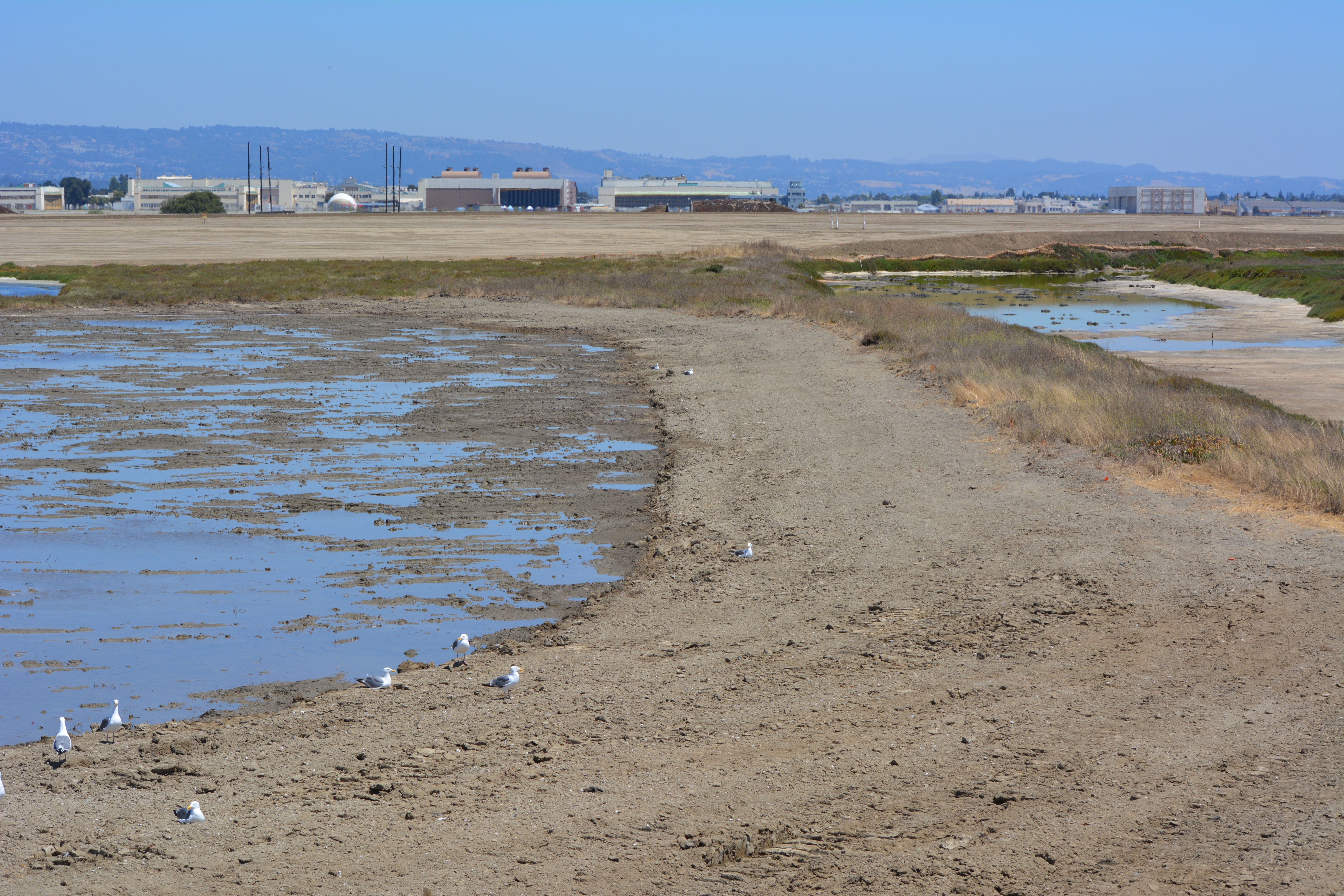
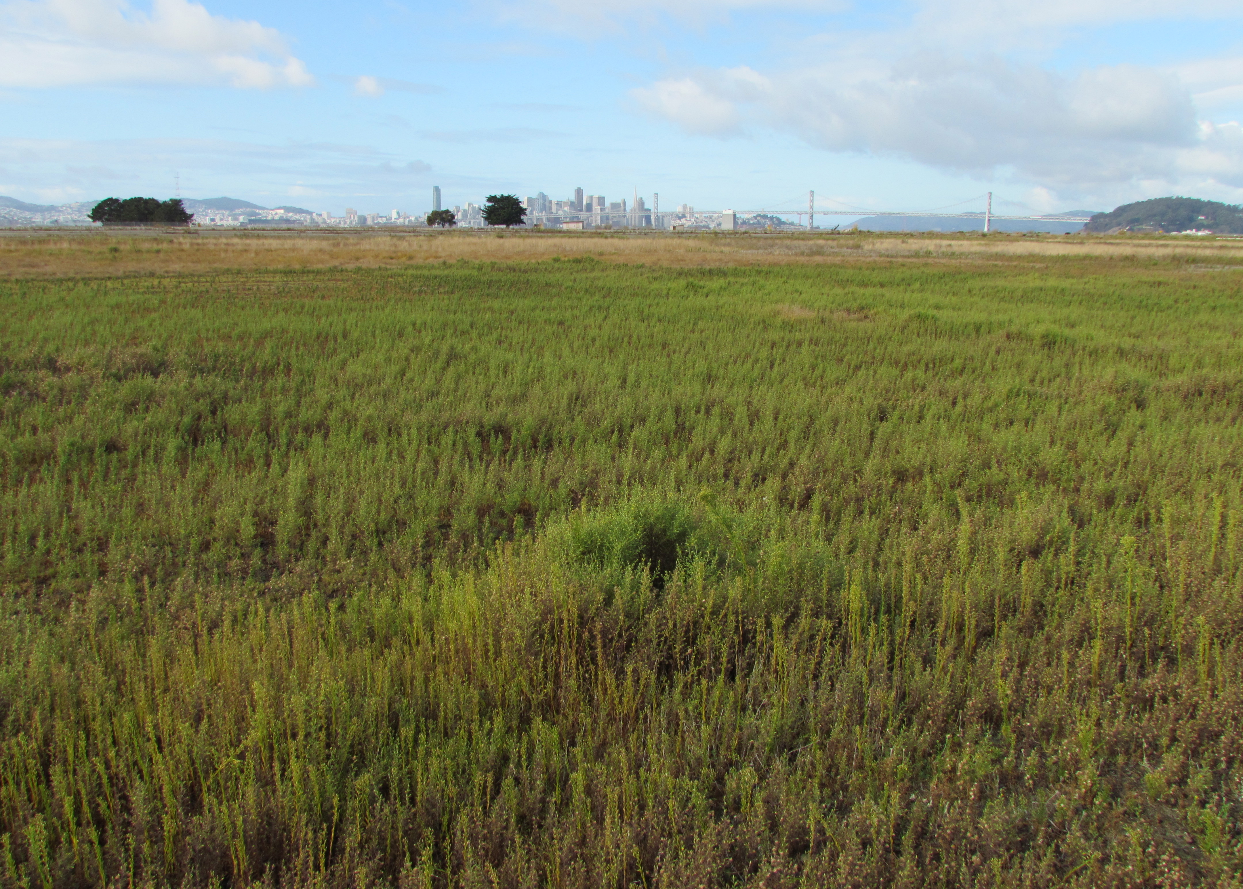
West Beach Wetland on southwestern Alameda Point. San Francisco in background.
West Beach Wetland with San Francisco Bay in the background. Part of wetland is connected to the Bay via metal culvert.
Off-loading of the soil hopper. US Navy Photo.
Off-loading of soil from barge to the soil hopper. US Navy Photo.
Soil conveyor at Site 2. US Navy Photo.
Imported soil stockpile. US Navy Photo
Water truck being filled. US Navy Photo.
Site 2 grading equipment. US Navy Photo.
Eastern (inland) embankment at Site 2 being removed. US Navy Photo.
Loading trucks with Site 17 (Seaplane Lagoon) dredge spoils that were cleared as non-hazardous and stockpiled on the runway north of Site 2. US Navy Photo.
Site 2 wetland mitigation plan. US Navy map.
Site 2 trail signage. US Navy images.
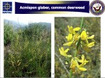
One of the native grasses to be hydroseeded on Site 2 in the fall of 2013.
One of the native grasses to be hydroseeded on Site 2 in the fall of 2013.
One of the native grasses to be hydroseeded on Site 2 in the fall of 2013.
One of the native grasses to be hydroseeded on Site 2 in the fall of 2013.
One of the native grasses to be hydroseeded on Site 2 in the fall of 2013.
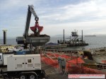
Cleanup activity at Alameda Point in 2012 started where it left off in 2011 — at the Seaplane Lagoon. The northwest corner of the lagoon was the site of the second and final phase of lagoon dredging, which targeted sediment that had been contaminated near storm drain outfalls. With dredging completed by spring, the sight of Americas Cup racing yachts arriving at their temporary dock in the lagoon seemed to be a harbinger of the approaching end of the Superfund era at the Point.
Dredging northwest corner of Seaplane Lagoon
Just outside the Seaplane Lagoon, another dredging operation was started and finished at one of the maritime ship piers where the Cape Orlando had been docked. By November, the massive ship was back at dockside, hull lights glowing at night.
Dredging Pier 1 wharf area
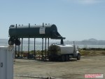
In one of the most complicated and contaminated areas to the east of the Seaplane Lagoon, cleanup work began at an area 30 feet below ground where a cleaning solvent used on aircraft parts had seeped into the groundwater. After driving a series of metal bars down to the contaminated area, the soil, groundwater, and solvent were heated to just below simmering by means of electricity. This turned the water and solvent into vapor, which was then vacuumed out into a filtering system through a series of pipes.
Heat treatment and vapor extraction – OU-2B
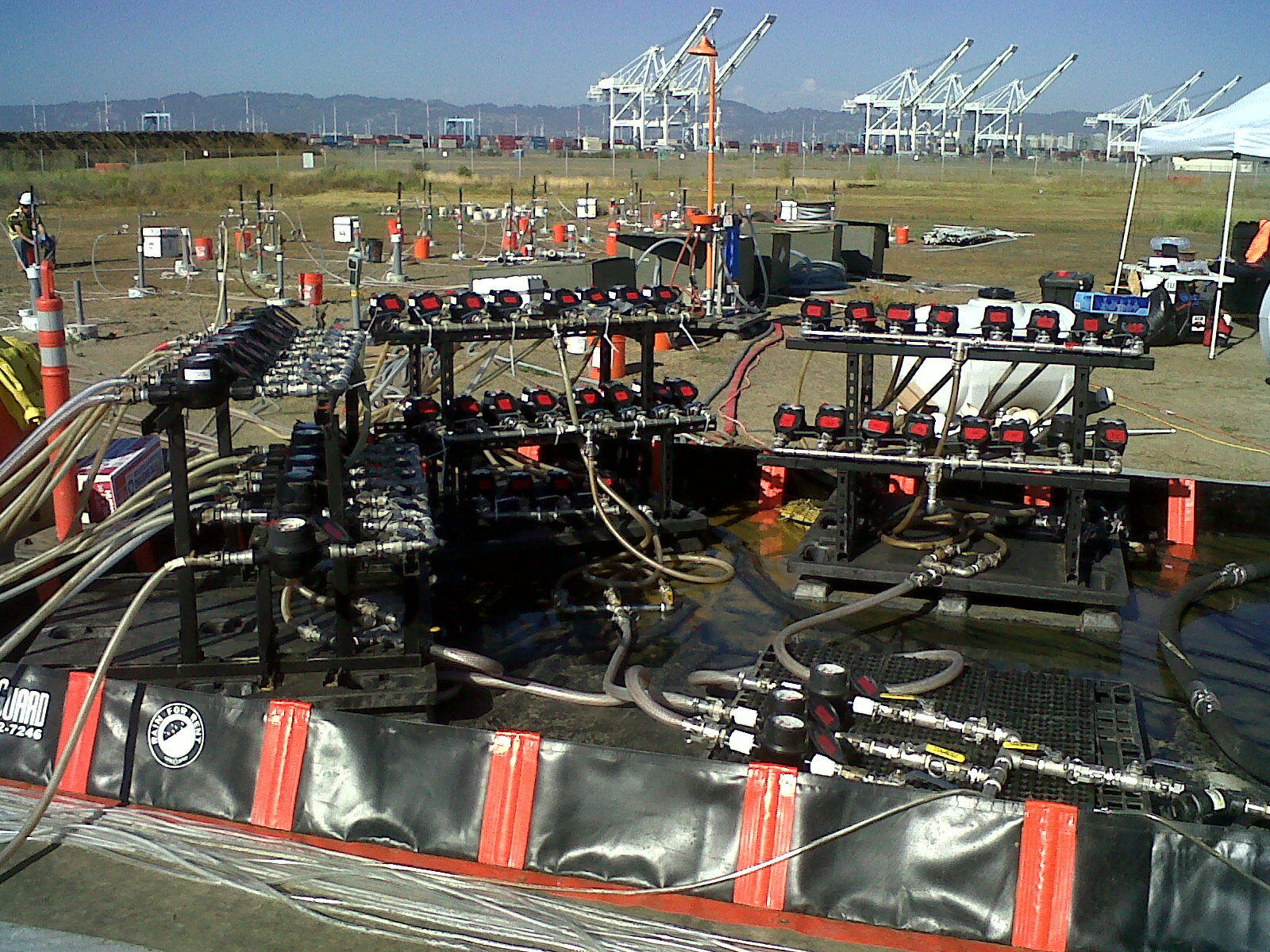
At the far end of Alameda Point on the northwest landfill, the Navy relied on chemicals, rather than heat, to do the cleanup on a small portion of the site. Dozens of hoses snaking around the site to the injection wells delivered an oxidizing mixture of neutralizing chemicals into a pocket of solvents. Without this remediation, the solvents had the potential to reach the Bay.
Injecting oxidizing chemical into solvent plume – Site 1. Navy photo.
The year ends with a cloud of controversy over the Navy’s plan for leaving drain pipes under the old Naval Air Rework Facility — Building 5. Letters from both the Restoration Advisory Board (RAB) and the city call for the complete removal of any lines containing radium paint waste. The Navy ruled out a more costly alternative that would remove all the contaminated pipes. The city challenged this decision, in part, on the ground that the Navy’s cost estimates for a thorough job are inflated and have asked that they reconsider.
Building 5
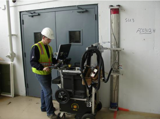
Also in Building 5, plans to remove above-ground radium contamination from floors, walls, and ceilings in the mezzanine area will get underway within weeks. This area is where aircraft dials and markers were painted with radium paint that provided visibility in the dark. A final scanning investigation to detect radium, using sophisticated equipment employed in the decommissioning of nuclear power plants, found dozens of pie-sized irregular areas where radium dust had embedded in the surfaces. This project will conclude two decades of scanning and radium removal efforts in Building 5 and other buildings. Around $50 million has already been spent replacing drain lines leading to the lagoon under the surrounding tarmac, and dredging the lagoon, due to the disposal of radium paint and other chemicals down storm drains.
Scanning a wall for radiological contamination. Navy photo.
2013
2013 will see the long-awaited final soil cover installed on the waste disposal site called Site 2 on the southwest corner of the wildlife refuge. It will be the largest engineering project since the runways were expanded in the 1950s, with over 200,000 cubic yards of clean soil being barged in from Decker Island in the Sacramento River. It will be seeded with California native flowering grasses selected by the RAB. This is the controversial dump that led the US Fish & Wildlife Service to balk at accepting the land for a wildlife refuge ten years ago. Since then, this dump has seen numerous reviews and a new plan that the US Environmental Protection Agency, regional Water Board, and state Department of Toxic Substances Control will be signing off on shortly.
Site 2 underground dump on southwest corner of Alameda Point.
2013 will end with commencement of a similar soil covering operation on the nearby landfill on the northwest corner of Alameda Point called Site 1. Both landfill areas will be safe for open space recreational activities when completed, but will be limited to hiking trails rather than mowed playing fields in order to maintain soil-stabilizing vegetation.
Northwest corner of Alameda Point where soil cover will be installed.