Recent revelations of falsified cleanup data at Hunters Point Naval Shipyard in San Francisco have caused many people to wonder about the integrity of cleanup at Alameda Point. Can we trust the Navy’s reports concluding that goals have been met and land is suitable for transfer to the City?
The Navy thinks we can. “To date, the Navy found no indication of data falsification at Alameda,” said Cecily Sabedra, Navy Environmental Coordinator for Alameda Point.
But more importantly, the rigorous and extensive testing requirements of cleanup at Superfund sites suggest that the process itself is what the public should look to for reassurance. The data review process is exactly why a couple of employees were caught handing in fake soil samples at Hunters Point.
Groundwater cleanup is a good place to look at how the process has been working at Alameda Point, considering that is where the majority of the contamination has been. The groundwater contamination resulted from releases of jet fuel and cleaning solvent and two leaky gas stations. This cleanup has left the base riddled with groundwater sampling wells and injection wells used for injecting cleanup solutions or extracting pollutants. Continue reading “Navy’s Cleanup Drawing Scrutiny”
~Lactose, veggie oil to stimulate toxic-eating bacteria
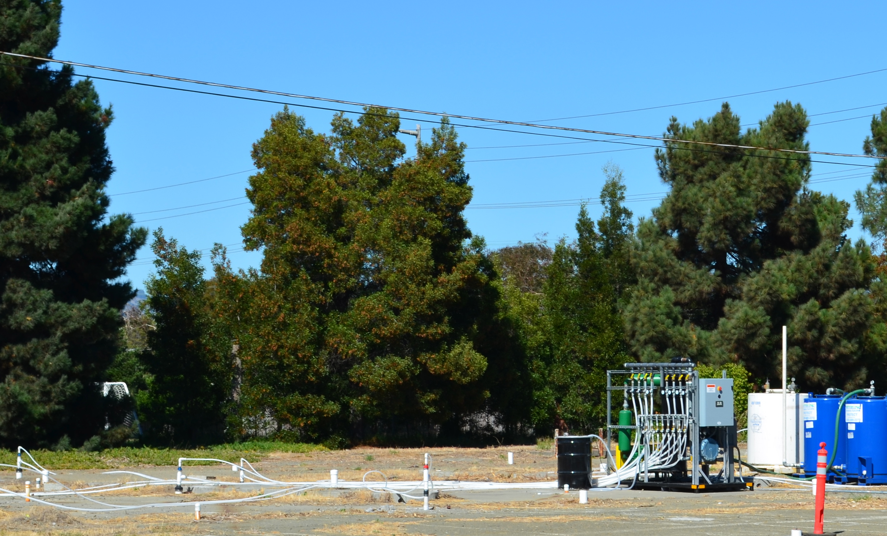
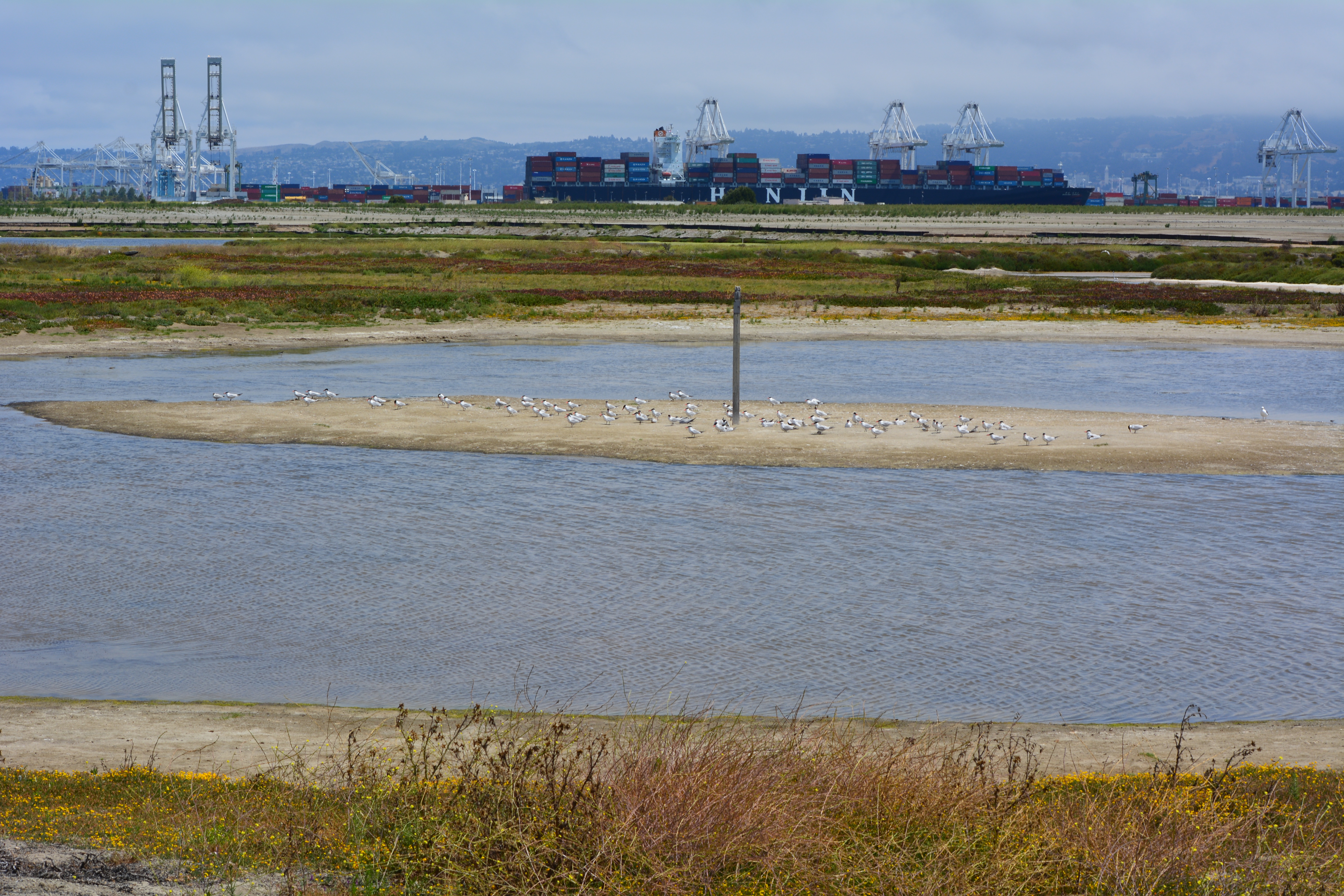
Cleanup of contaminated groundwater between Alameda Point’s Seaplane Lagoon and Main Street will begin later this year, according to the Navy. The cleanup area is directly south of the Site A residential and commercial parcel slated for groundbreaking in a few months. It is one of the most difficult environmental cleanup areas to remedy at Alameda Point, which is why it has taken 20 years to figure out what plan to implement. The Navy’s contractor presented the cleanup plan at the March 9, 2017 Restoration Advisory Board meeting at Alameda Point.
A cleaning solvent called trichloroethene was used in the Navy’s industrial repair and refurbishing operations in this area. The solvent leaked into the ground to depths of 70 feet and spread around nearly 19 acres. Industrial activities included the Aircraft Engine Test Facility in Building 360, which is the large building next to the Main Street soccer field, along with the Engine Test Cell in Building 14, and the Ship Fitting and Engine Repair Facility in Building 162.Continue reading “Toxic groundwater to be cleaned up using bacteria”
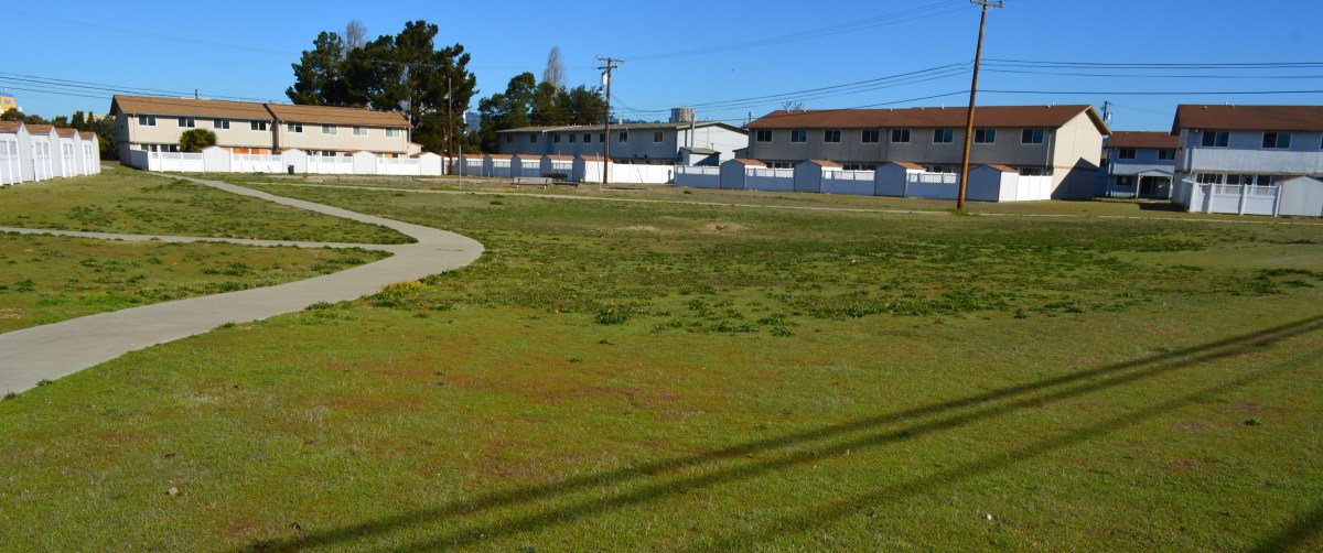
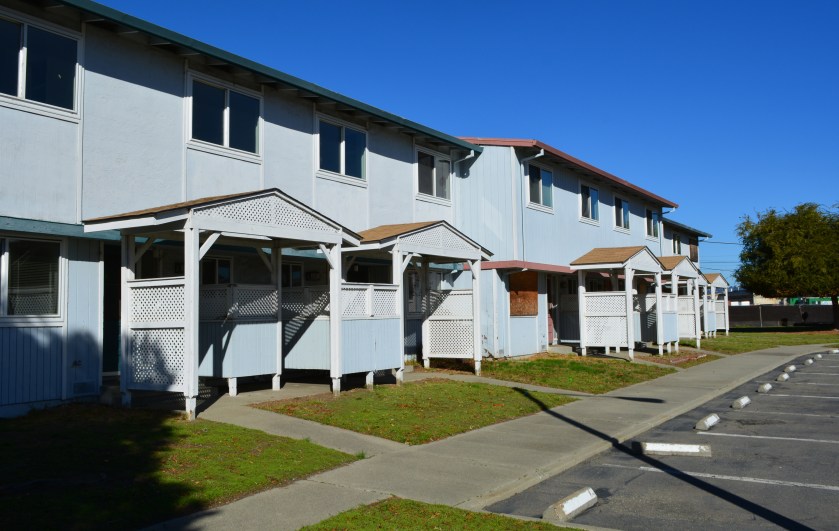
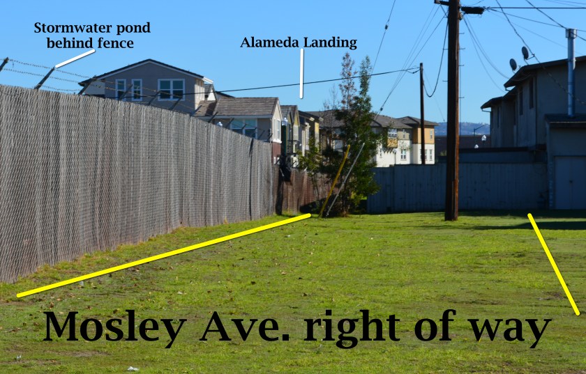
The vacated residential area known as North Housing—located between Alameda Point and Alameda Landing—has been deemed environmentally safe for transfer out of Navy hands. The approval comes after a four-year effort to clean up groundwater to drinking water standards was declared unnecessary and terminated.
Center courtyard in former Navy housing area called North Housing. Looking north/northeast.
The original overly cautious risk assumption in the 2007 cleanup plan—that humans might somehow ingest the salty groundwater 10 to 20 feet below the surface—is now seen as implausible. The vapor extraction system covering a six-acre area of benzene and naphthalene-contaminated groundwater was dismantled in 2014 after a new round of tests showed that there is no evidence of harmful vapors rising to the surface.
The land was originally slated for transfer to the Coast Guard. But the Coast Guard decided in 2008 that it no longer wanted the property. The Navy and the city then worked out a plan that incorporates a federal requirement for homeless accommodation and a for-profit development.
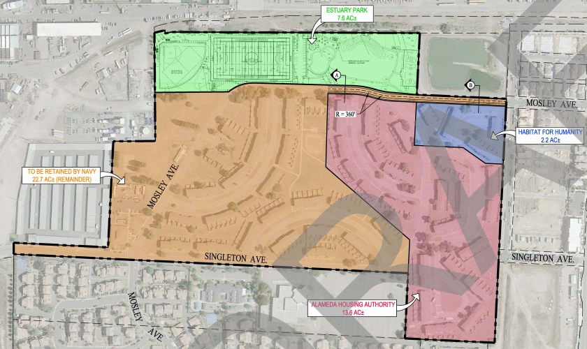
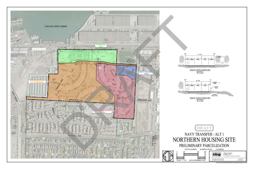
The 22.7 acres slated for auction to a private developer will be tagged with utility infrastructure costs—streets, drainage, utilities—on all of the North Housing area, except for the Housing Authority’s 13.6 acres and Habitat for Humanity’s 2.2 acres. The Housing Authority and Habitat for Humanity will be responsible for bringing new utility services from the nearest street to their housing units.
Draft map prepared by the city of Alameda showing proposed Housing Authority, Habitat for Humanity, and private developer parcels. Pending final approval. Dusty rose area going to Housing Authority, blue to Habitat for Humanity, tan to private developer. Click on map to enlarge.
Mosley Avenue will be connected between Alameda Landing and North Housing with 360 feet of new roadway.
In 2013, the Navy turned off its air pump and carbon filter vacuum cleanup system to see if it made any difference in the concentrations or movement of contaminants. It didn’t.
But before the U.S. Environmental Protection Agency (EPA) would sign off on a permanent shutdown of the cleanup system, it wanted a new set of tests at ground level to ensure there is no risk of harmful vapors. The Navy conducted tests inside the vacant housing, in the crawl spaces, and under the parking lot and basketball courts at the former Island High School property. The negative results satisfied the EPA.
In April the Navy officially amended its original 2007 Record of Decision cleanup plan, with regulatory agency concurrence, citing new evidence. It also cited city, county, and state regulations that prohibit intrusive activities and specifically prohibit well installation in the shallow groundwater where the contamination is located. The cleanup plan amendment said that results of the evaluations of extensive data for this cleanup area “show that there is no unacceptable risk for current residential and school uses and any potential future land uses.”
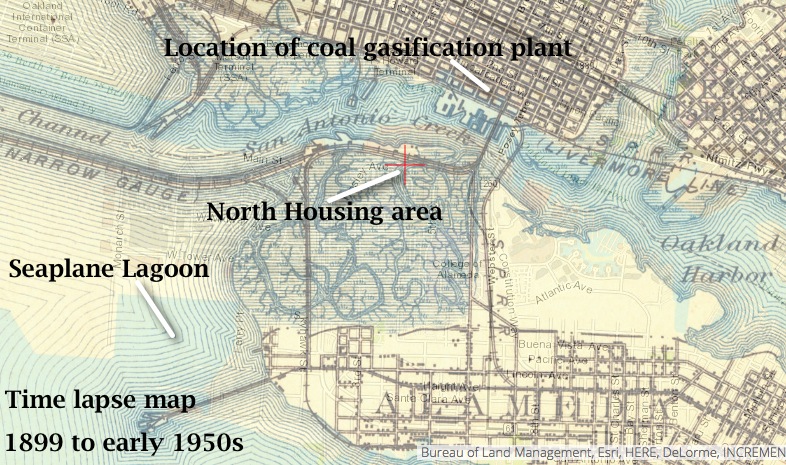
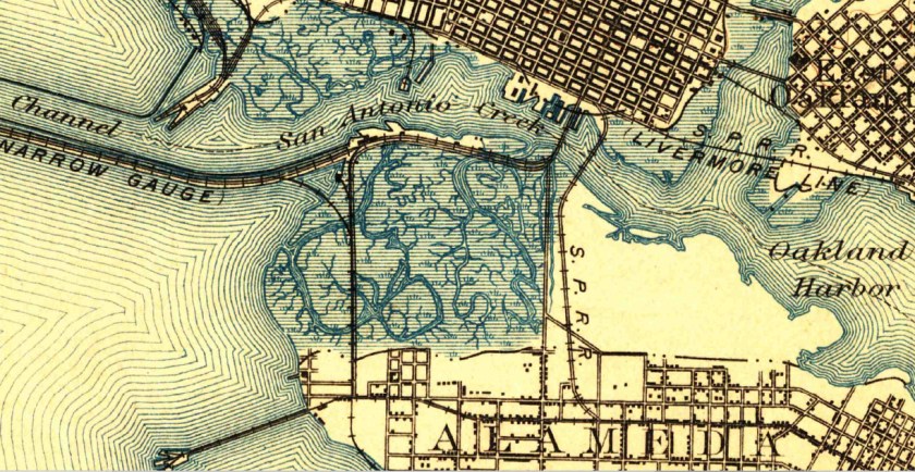
The amended plan also cited new evidence that suggested the contaminants were part of what is called the Marsh Crust at around 20 feet below ground and essentially stuck there. The Marsh Crust is a layer of “hydrocarbon gunk” that Oakland Gas Light Company’s coal gasification plant discharged from about 1880 to 1910. The waste discharges went into what was then San Antonio Creek, and much of it settled on the nearby marshland where North Housing now sits.
Time lapse map showing former marshland where North Housing is now located. Source: US Geological Survey Historical Topographic Map Explorer.
The land was never cleaned up before being filled in for use as San Francisco Bay Aerodrome—hangars and two runways—from 1930 to 1941. The Marsh Crust extends from the Oakland Estuary to Bayport and over to central Alameda Point. A city ordinance requires a permit before digging into the Marsh Crust to ensure safe handling.
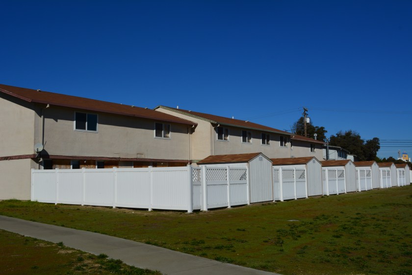
The 37-acre North Housing area lies adjacent to the new Alameda Landing residential neighborhood. The site currently contains 51 residential structures with 282 three- and four-bedroom units constructed in 1969. With the possible exception of the two acres going to Habitat for Humanity, all of the units will be demolished to make way for new construction.
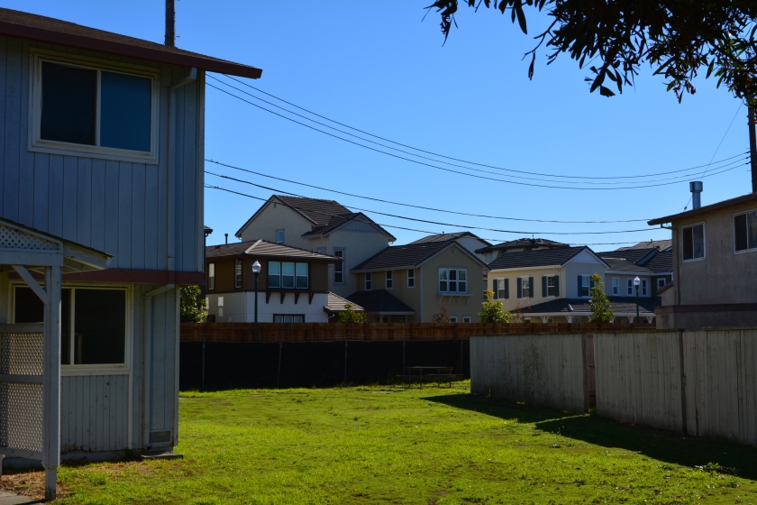
Future Housing Authority property, with new Alameda Landing houses in the background.
The Housing Authority will build 90 units of supportive housing that will include a community center.
It is not yet determined what Habitat for Humanity will do with its parcel. The private developer area is currently zoned for 315 units of multifamily residential housing and may exceed that number if the density bonus is applied for.
The transfer of properties is expected in 2016. The auctioning of the for-profit North Housing Navy property will follow, but no firm timeline has been announced.
Edited version of article first appearing in the Alameda Sun.
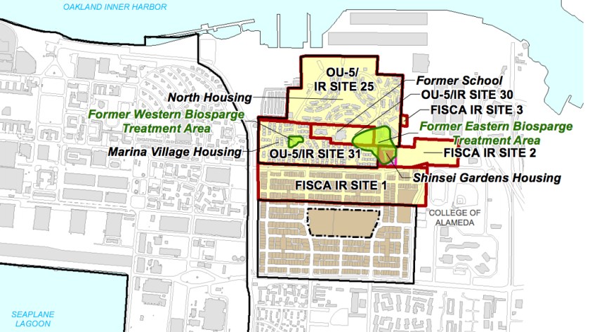
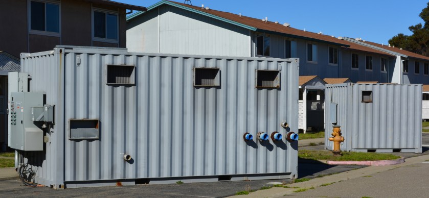
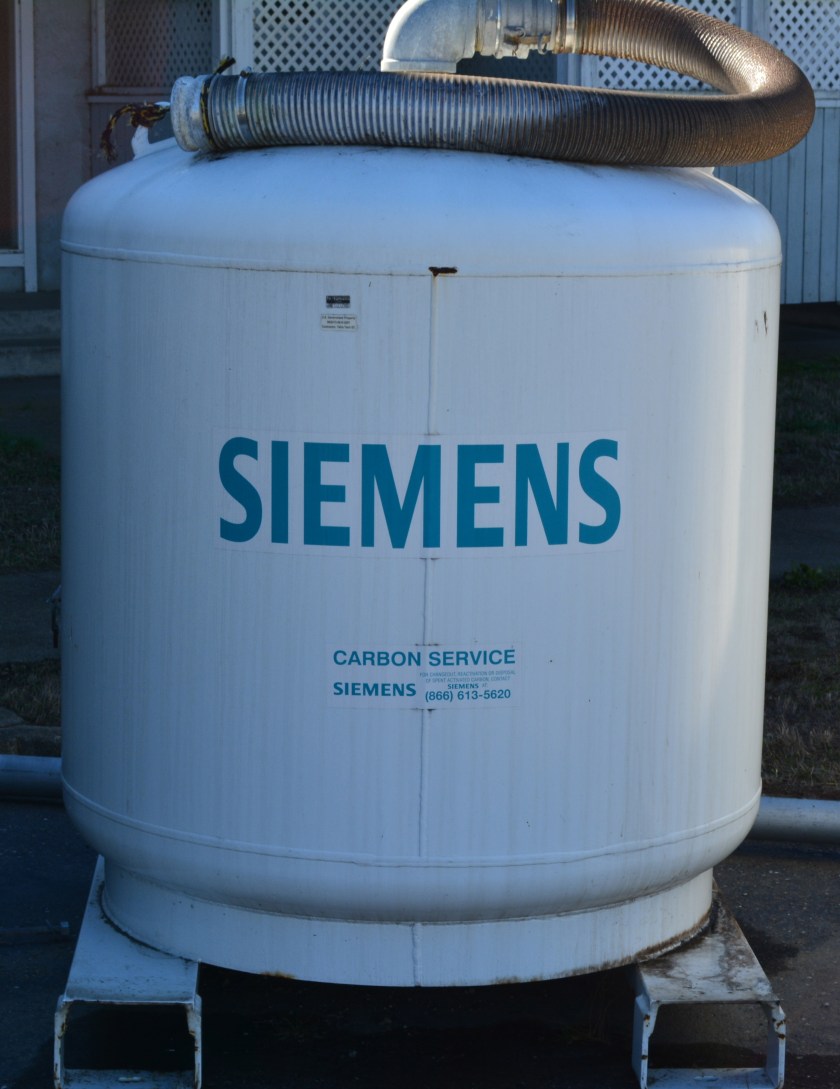
Map showing two groundwater cleanup areas in OU-5.Control module with pumps for groundwater cleanup system waiting to be hauled away from North Housing.Charcoal filter tank to remove benzene and naphthalene from groundwater vapors, waiting to be hauled away.
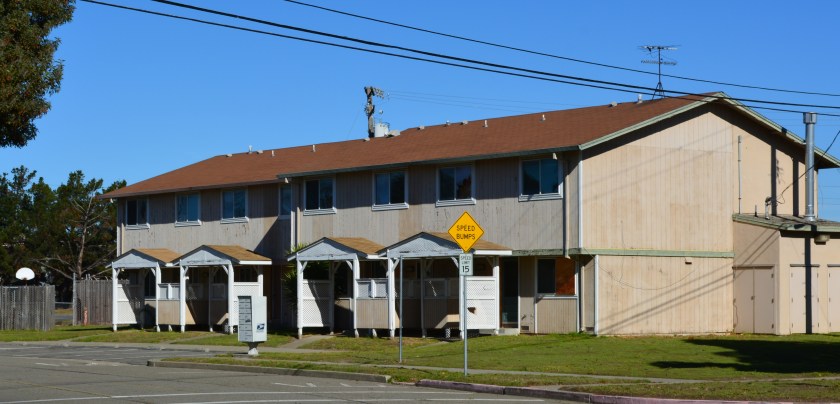
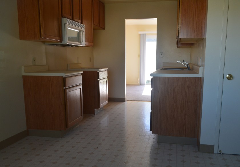
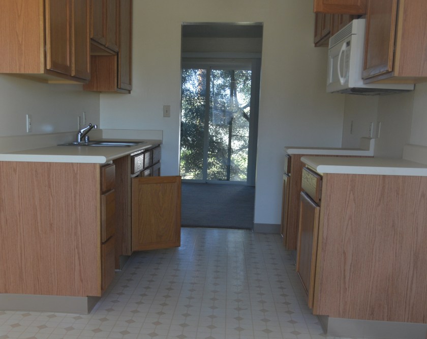
Typical current condition of North Housing interiors.Typical current condition of North Housing interiors. Photo date: November 19, 2015.
Draft North Housing site map, with Mosley Avenue connection details. Click on map to enlarge.1899 topographical map of western Alameda showing marshland. Source: US Geological Survey Historical Topographic Map Explorer.
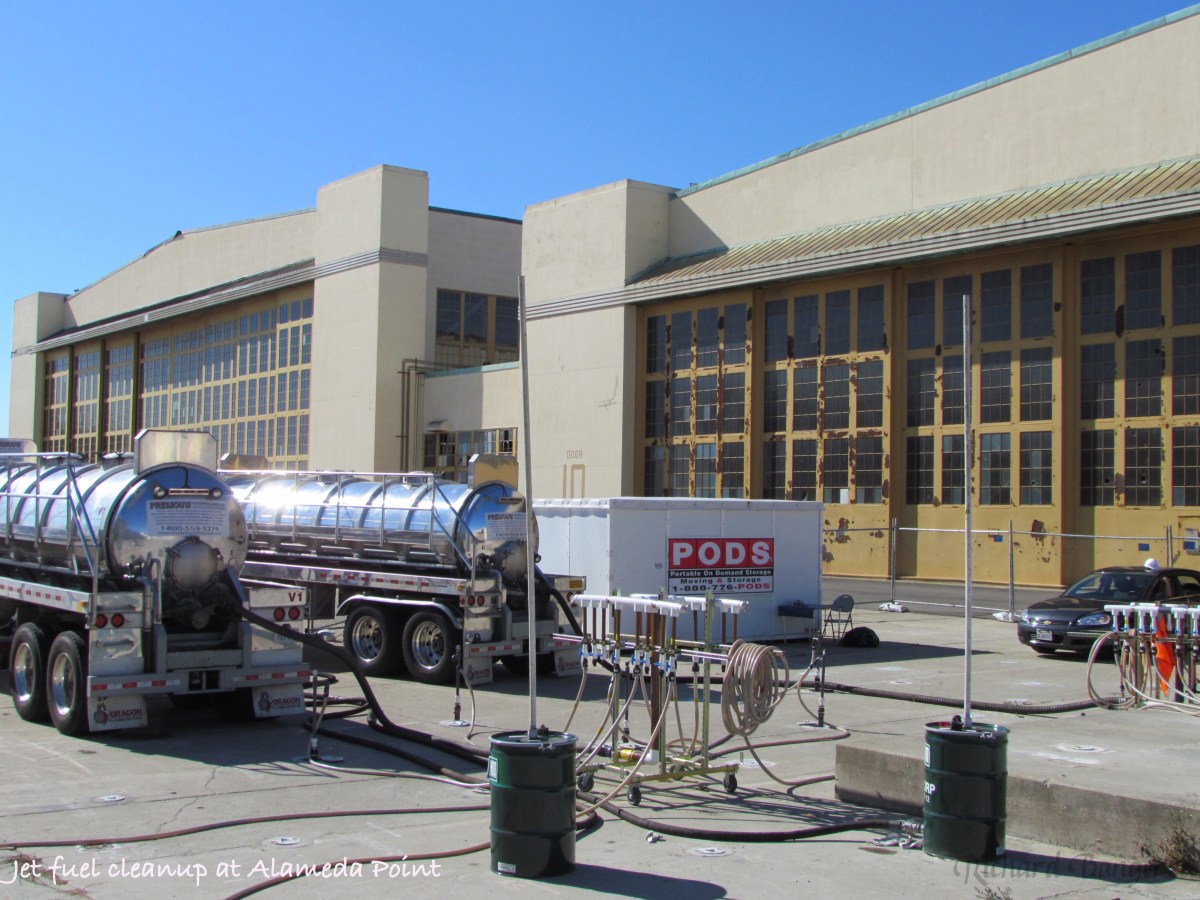
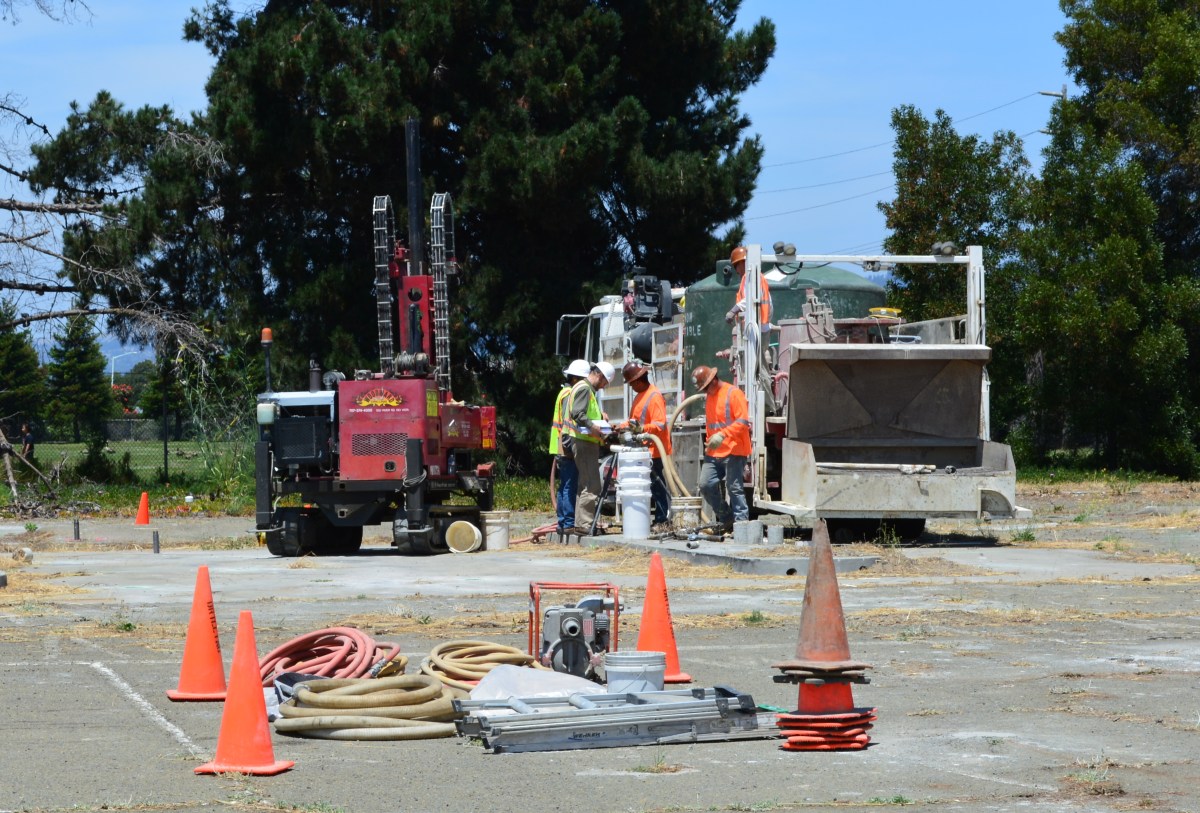
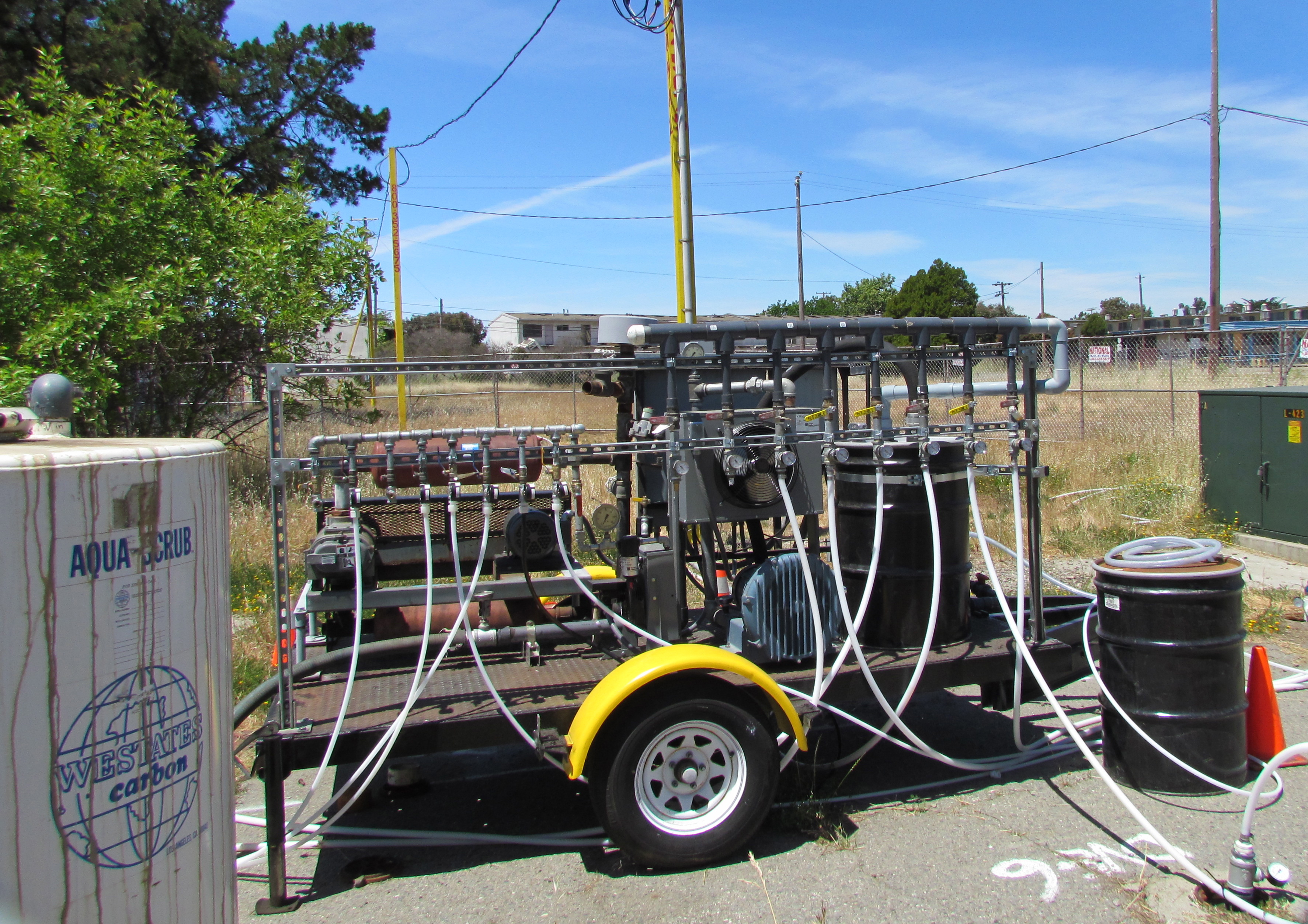
The Navy has spent more than 15 years cleaning up contaminated groundwater underneath two former gas station sites at Alameda Point. They are still at it, but it’s not because the Navy is slow or lacking in commitment and expertise. It’s the nature of groundwater cleanup, which involves intermittent treatment efforts.
In July, the Navy’s contractor returned to the old gas station and car wash site on West Pacific Avenue at Main Street and to the old commissary gas station site at West Tower Avenue and Main Street across from Bayport. It’s the third visit to these sites to eliminate petroleum hydrocarbon contamination in groundwater, in addition to earlier removal of underground tanks, fuel lines, and soil. The contaminants are located from 2 to 16 feet below ground surface.
Workers at the old gas station and car wash site on West Pacific Avenue on July 13, 2015 preparing to inject cleanup solutions into the ground. The Navy operated a gas station and car wash on the site from 1971 to 1980. Green tank on truck contains non-potable water for on-site mixing of treatment solution. Soccer field is in the background.
The goal is to bring the property up to the public health and environmental standards required for the future commercial and residential uses previously determined by the city.
“When groundwater contamination is involved, such as at the two former gas stations, cleanups often involve multiple phases, each building upon earlier accomplishments,” said Dr. Peter Russell, who has been reviewing Navy cleanup plans and preparing cleanup-related documents on behalf of, and at the direction of, the city since 1997. “As long as all imminent health and environmental risks are eliminated early on, often the most cost-effective approach to complete remediation is incremental,” explained Russell. “In contrast, a massive initial remedial effort that is sure to achieve all remedial goals in one pass would likely involve over-sizing the treatment system, which is more disruptive and expensive than a phased approach.”
During previous cleanup visits, the Navy used a vapor extraction system to remove the bulk of the petroleum contamination. The process involves pumping air into numerous pipes, called wells, which extend into the water-saturated zone where the contamination is. The air pressure creates vapor that is part air, part water and part petroleum. The vapor is then sucked out through another set of wells, and the petroleum vapors are captured in drums of granulated charcoal, while the water is shunted off to a separate container.
Air injection/extraction system operating at W. Pacific Avenue gas station site in 2013 and 2014. System extracts and captures petroleum vapors.
The method of blowing bubbles in mud and sucking out the air sounds unsophisticated, but it works. After running the system in 2013 and 2014 at the West Pacific Avenue gas station site, for example, the level of one contaminant, benzene, went from around 1,000 micrograms per liter down to 58, bringing the contamination low enough to allow indigenous bacteria to finish the job.
Air injection and vapor extraction system operating at former commissary gas station site in May 2013. Charcoal tank to capture vapors is at left.
The Navy returned to these sites in July and, in this phase, they came to help natural bacteria finish up the job. Allowing bacteria to clean up petro chemicals through natural digestion is called bioremediation. To be effective and not take a century to eliminate the problem, the bulk of the chemicals need to first be reduced to concentrations that do not overwhelm the bacteria.
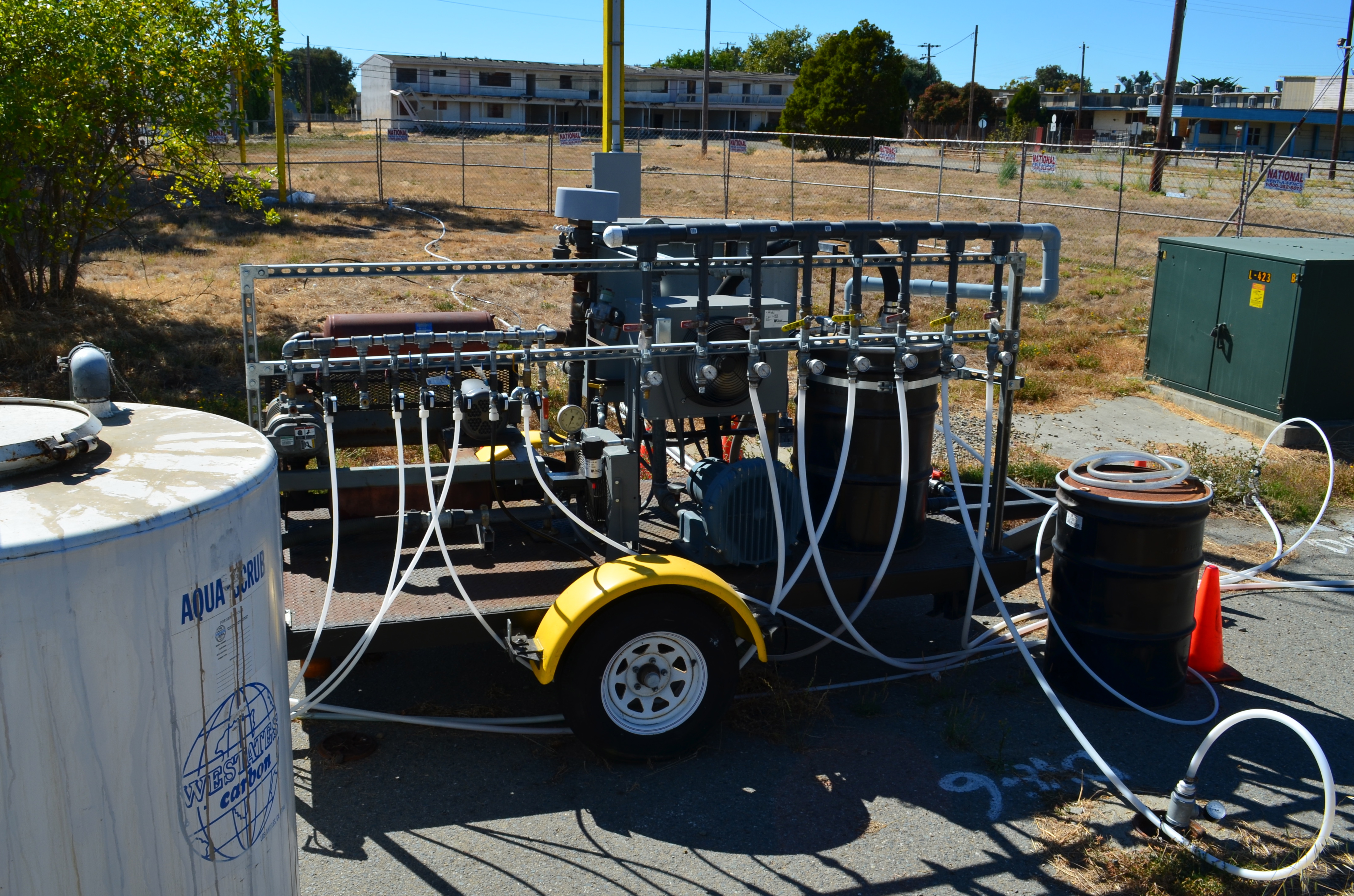
At both gas station sites the Navy used a special product designed to foster growth of natural bacteria in the ground, which includes a form of time-release peroxide that turns into oxygen over a period of 12 months. An oxygen environment is necessary for the bacteria to digest petroleum. The bacteria utilize the hydrocarbons (hydrogen and carbon) in the petroleum chemicals as part of their metabolic processes and convert them into carbon dioxide, water, and microbial cell mass. Water samples will be taken at three, six, and nine months after the July injections to evaluate effectiveness.
“The Navy’s gas station remedial program is comparable to the private sector gas station cleanup program,” said Yemia Hashimoto, Engineering Geologist with the San Francisco Bay Water Board. “The cleanup requirements are similar and the required timelines for project completion are similar.” The Water Board is a California state agency and is the lead regulatory agency overseeing the Navy’s petroleum cleanup program.
The other type of groundwater contamination encountered at Alameda Point comes from a chlorinated solvent used in cleaning aircraft parts. Unlike lighter-than-water petroleum products, chlorinated solvents can sink through the upper water zone to a depth of 30 feet or more and complicate cleanup. But solvent cleanup still relies on a phased cleanup approach, often employing bacteria in the final phase.
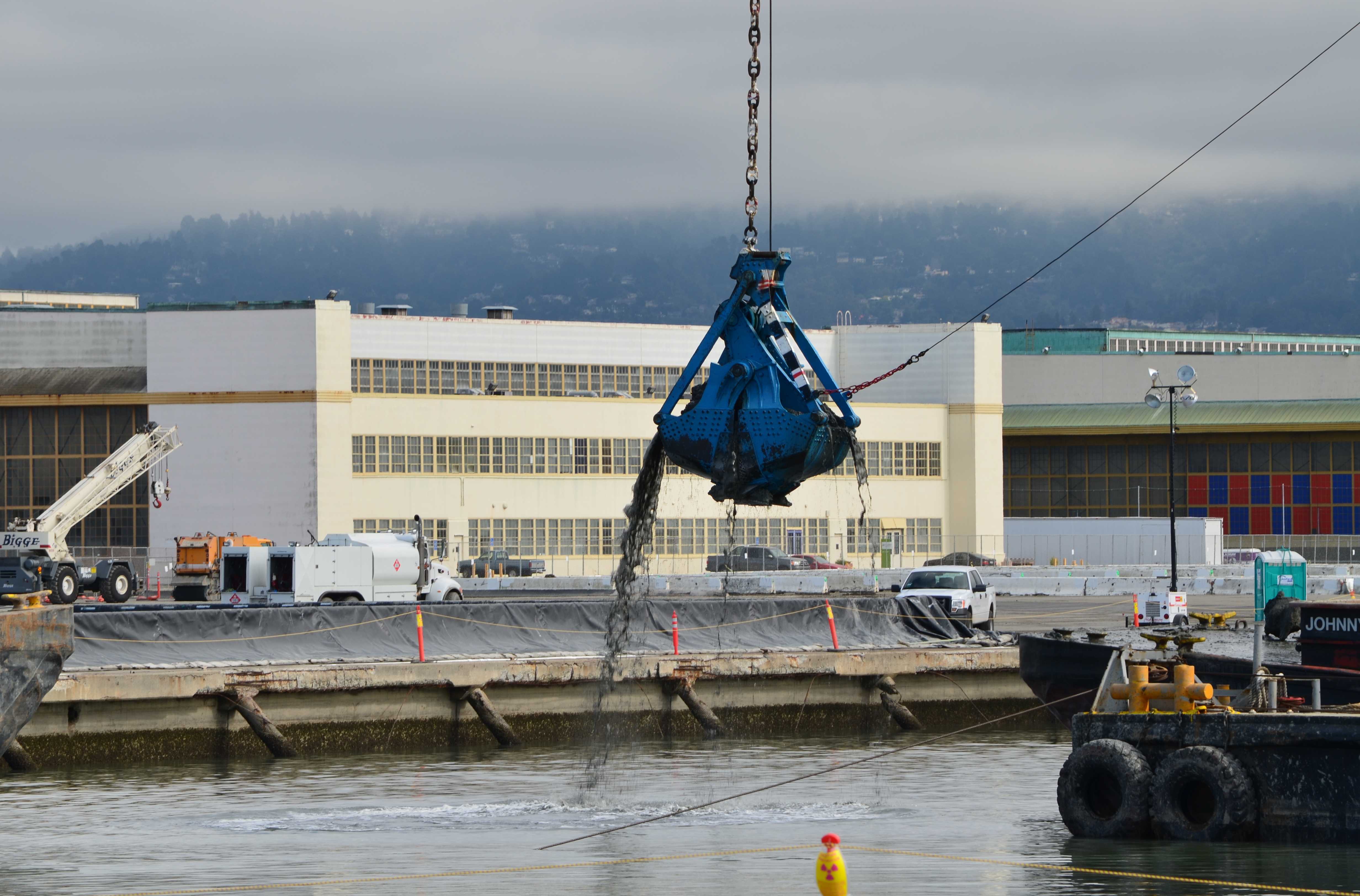
The Seaplane Lagoon’s north side will be looking like its old self in a few months. The Navy has begun dismantling the waterproof concrete-walled containment system that was used for three years for dewatering and testing of soil dredged from the Seaplane Lagoon, marking a major cleanup milestone. Prior to that dredging work, much of the lagoon’s north frontage served as a staging area for replacement of storm drain lines contaminated with radium-226.
Construction of a new and improved soil cover over a waste disposal site concluded this spring, marking another milestone. The 110-acre site on the southwest corner of Alameda Point took 10 years of haggling about potential environmental impacts before a cleanup plan was adopted in 2010. Work began in early 2013. The dome-shaped soil cover required 500,000 cubic yards of barged-in soil to complete.
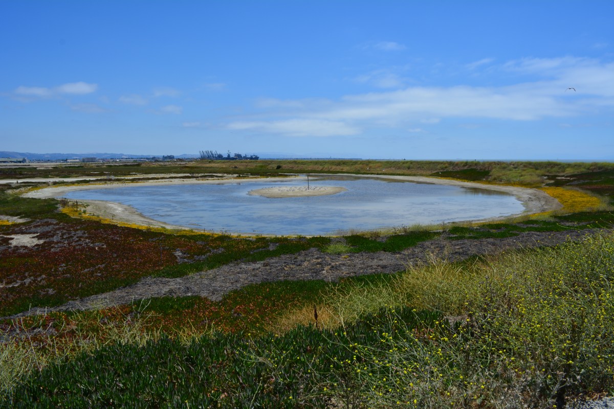
North Pond of West Wetland on southwest corner of Alameda Point. Pond is connected to San Francisco Bay via a new culvert near upper left of pond. Landfill soil cover is partially visible on far side of pond and will be seeded with flowering native grasses later this year.
At the far northwestern corner of the Point, work is about to begin on another long studied and analyzed waste disposal site. In a few months, the Navy will be installing an interlocking steel retaining wall along 200 yards of the Bay shoreline to contain contaminated burned waste material that was bulldozed into the Bay more than a half century ago. Water dye tests showed no toxics are leaching into the Bay, but members of the Restoration Advisory Board (RAB) questioned whether the barrier would withstand a catastrophic earthquake. Partially covered by runway pavement, the entire 30-acre site will receive a three-foot soil cover. The work is expected to be completed in 2015. The area will be available for passive recreational use such as hiking trails when the city receives the land.
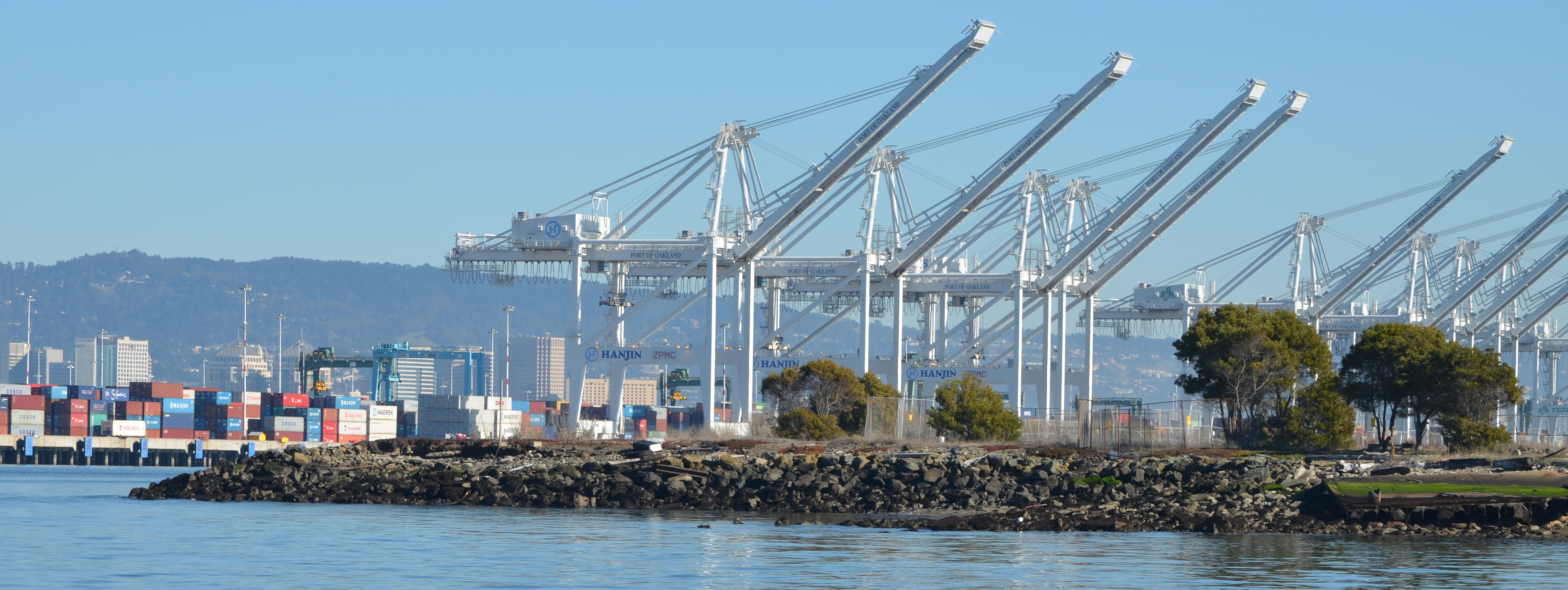
Northwest tip of Alameda Point where Site 1 is located. Waste burning area is here. Trees have been removed. Metal retaining wall will go here. Port of Oakland is in background.
One of the longest-running and most problematic cleanup sites is at the old Naval Air Rework Facility (NARF), also known as Building 5, covering nearly one million square feet. Radium paint used for aircraft dial painting, and chemicals associated with engine repair work led to contamination that is still being remediated. The entire floor area will be scanned again for radiation in 2015, following up on at least three prior scanning surveys of walls, ceilings, pipes, and ducts. The year 2015 will also see the Navy returning to the site for a final round of groundwater cleanup treatments targeting contamination remaining after an intensive cleanup effort a decade ago.
Building 5, also known as Naval Air Rework Facility (NARF), where additional radium-226 and groundwater cleanup is planned. At the corner of West Tower Avenue and Monarch Street.
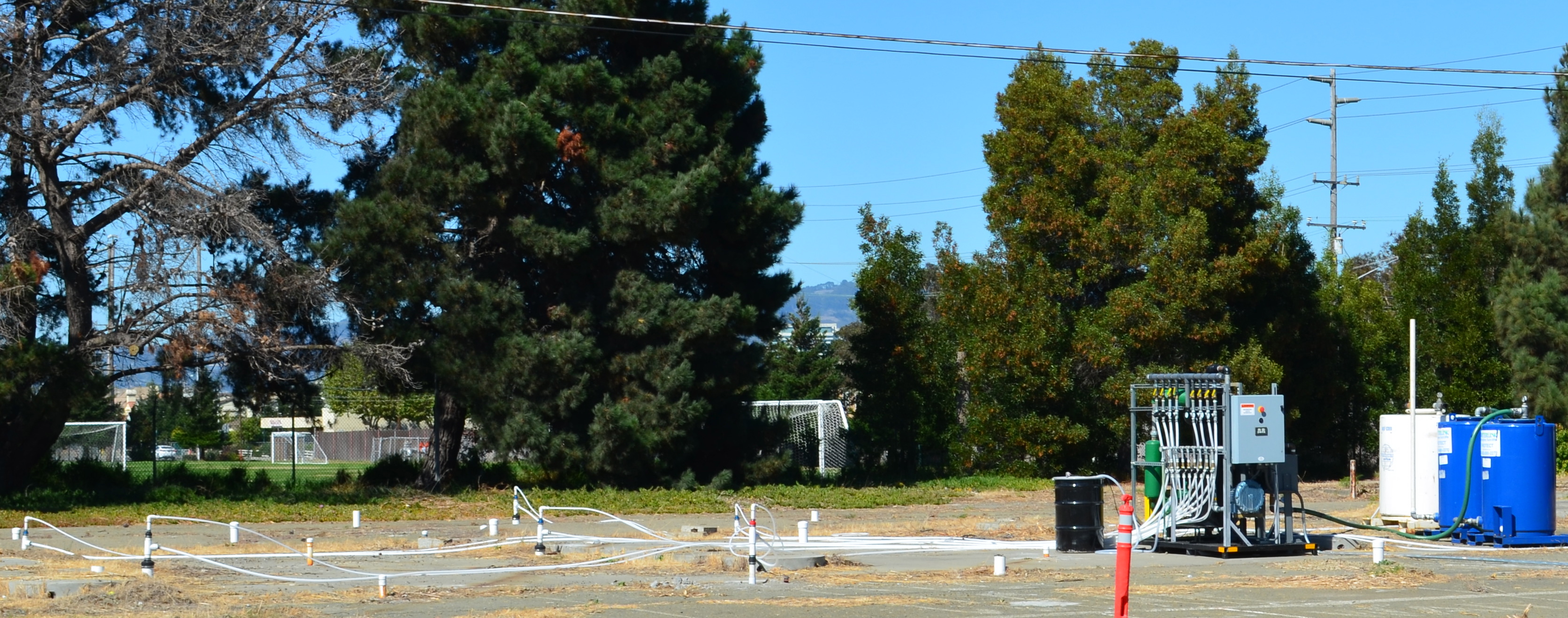
Next door to the Bladium Sports Club on West Tower Avenue, another previously treated groundwater cleanup site will be treated again. Workers have already begun boring holes in the pavement for a network of hoses that will be used for introducing contaminant-eating bacteria into groundwater along with a bacteria food source.
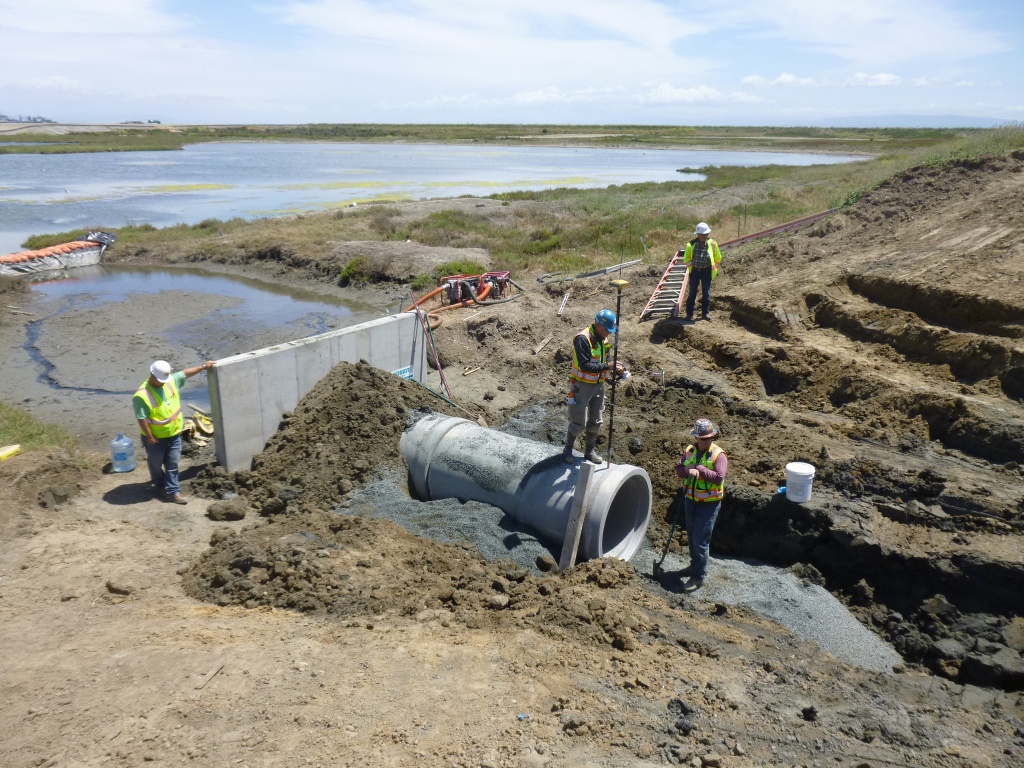
On Saturday, July 12, the Navy’s annual cleanup site tour visited four of the cleanup areas. The most impressive stop was the 110-acre landfill site mentioned above. For the first time in over 15 years, members of the public were allowed to walk around and enjoy the magnificent views from the embankment that is closer to San Francisco than to city hall. The fencing is all gone, and with it the radiological warning signs. The Navy replaced an aging metal culvert that connects the site’s North Pond to San Francisco Bay with a concrete culvert.
New culvert being installed connecting San Francisco Bay, which is to the right, and North Pond of the West Wetland at Alameda Point. Navy photo taken 5/22/14.New culvert being installed. North Pond of West Wetland at Alameda Point in foreground, San Francisco Bay in background. Navy photo.
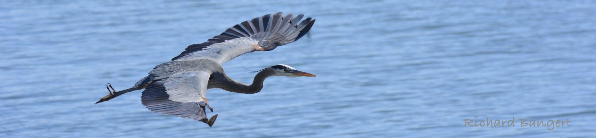
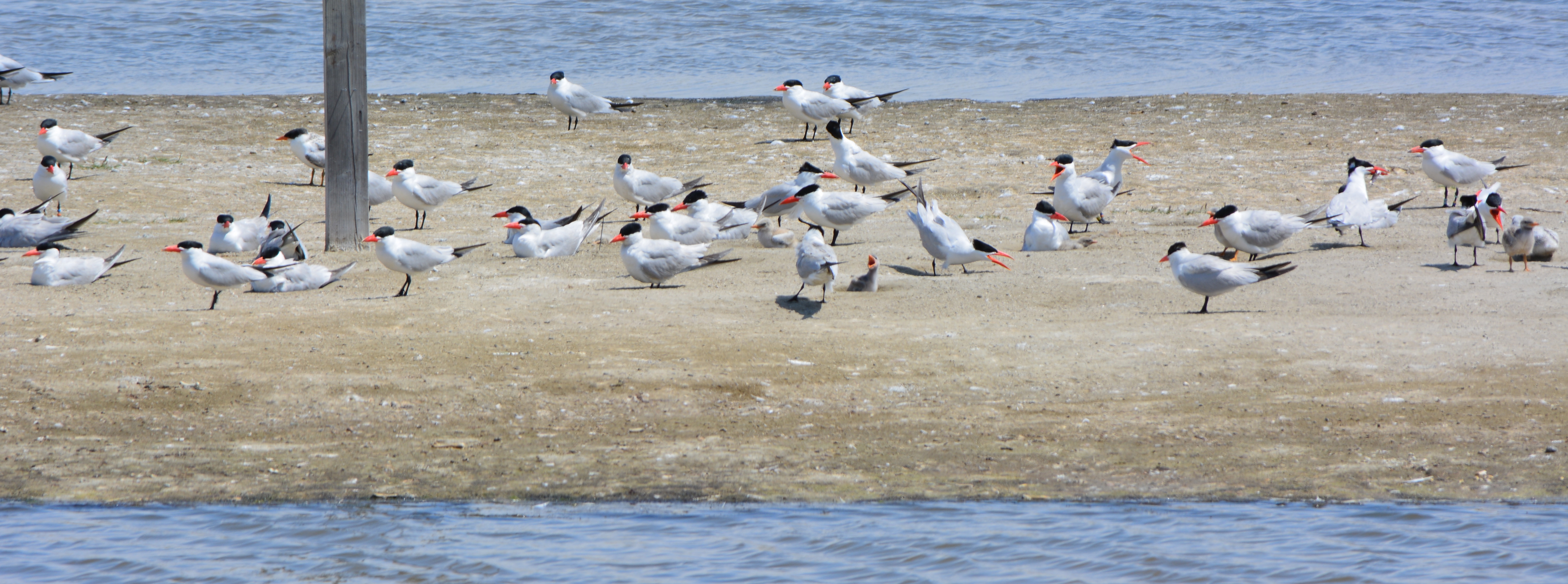
Tour participants were able to see the area’s expanded wetland with a new tiny island. Caspian Terns started nesting on the island a few months ago, another type of milestone. “The last time Caspian Terns were seen in that area nesting was in 1999 when only one nest was detected,” said Alameda wildlife biologist and Alameda Point bird surveyor Leora Feeney. The 79-acre soil cover on the landfill will be seeded with flowering native grasses later this year. The vegetation mix was chosen by the RAB.
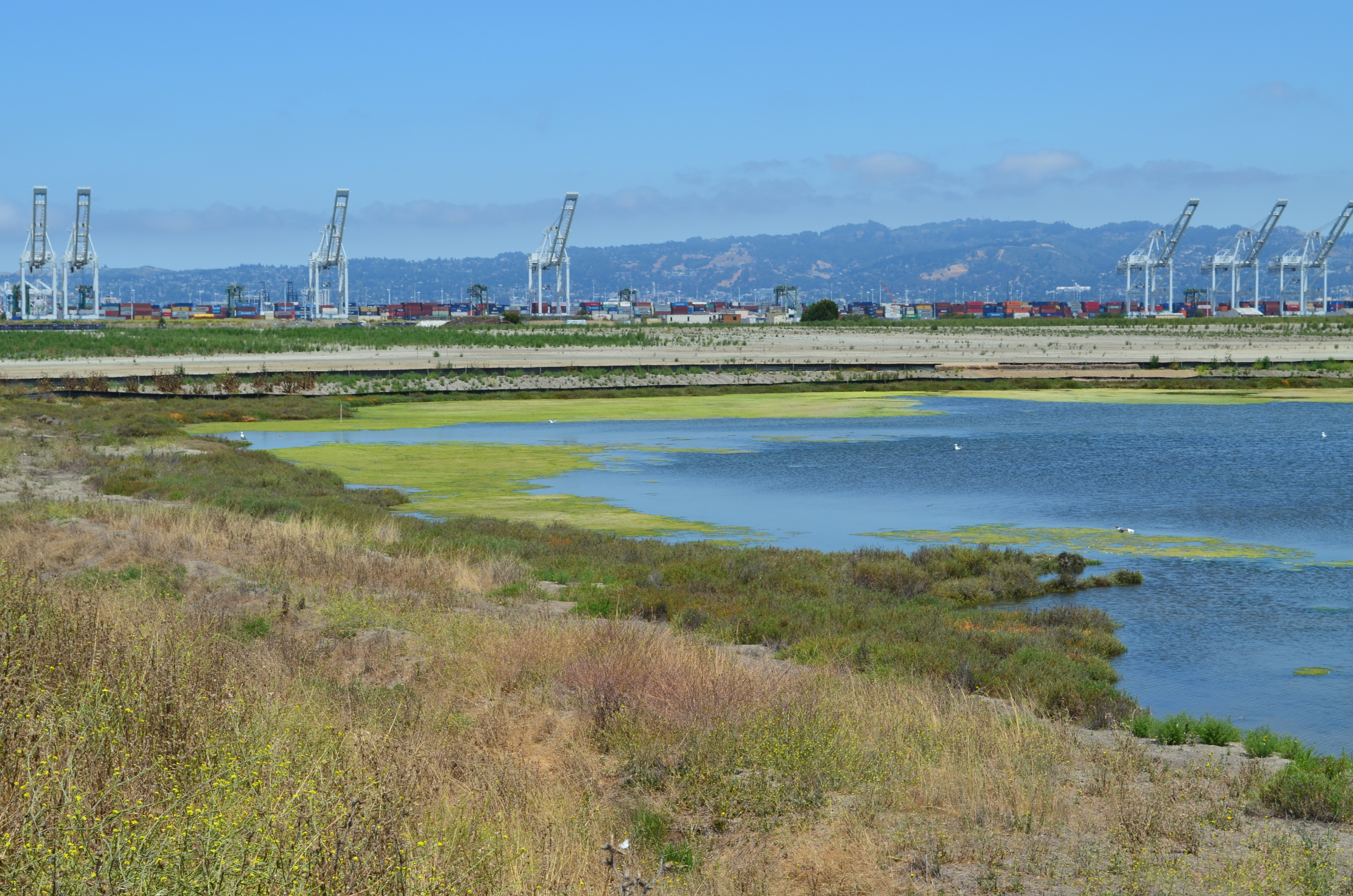
South Pond of West Wetland at Alameda Point. Island in pond has become a nesting site for Caspian Terns. Looking north toward Port of Oakland.
According to the Navy’s environmental cleanup coordinator, Derek Robinson, $513 million has been appropriated to date for Alameda Point cleanup, although some of it remains to be spent on upcoming work. His office, the Base Realignment and Closure Program, estimates another $80 million will be needed by the time remaining projects and follow-up monitoring are completed.
Later this year, the Navy is expected to transfer to the city the 33-acre North Housing site and seven-acre former Island High School site that sit next to Alameda Landing and Estuary Park, marking another milestone on the long and winding cleanup road to civilian use.
Caspian Terns and chicks at West Wetland, Alameda Point. Click on image to enlarge.Trail on embankment at southwest corner of Alameda Point. Looking south with San Francisco Bay to the right and ahead. Additional trail to the right at riprap elevation.Concrete pad served as a base for conveyor that transferred soil from barge to land for the soil cover at Site 2. Contractor left it in place and added a few amenities for future users of a place they had come to appreciate the beauty of as they worked here for a year. Thank you, TetraTech.Dredging the northwest corner of the Seaplane Lagoon at Alameda Point in February 2012. Tarmac dewatering, drying, and testing area behind black tarp is now being dismantled. All dredging work is completed.
Update notes: Subsequent criticism of the Navy as to the necessity of a security fence by members of the public and regulatory agencies led to the removal of the security fence from the final work plan design. The Navy also agreed to shorten the soil gas vents to two feet, since only trace amounts of methane gas are now emitted from the landfill waste, most of which is industrial and did not produce methane in the first place. Additionally, the Navy agreed to examine the aging metal culvert that connects the North Pond of the West Wetland to San Francisco Bay. The culvert provides the water lifeline for the North Pond habitat and was at risk of collapse and being stopped up with debris. The Navy replaced the metal culvert with a concrete culvert (see photo above) and debris screen.
Under the petroleum cleanup program the Navy has been removing tanks and fuel lines and cleaning up spills and fuel leaks dating back to the early 1990s before the base closed. Most of the tanks and fuel lines were removed within three years after the base closed in 1997.
Cleaning up leaked and spilled fuel has been slower, often involving running a vapor extraction pump 24/7 for years. In a few cases, a groundwater contamination site will require a callback after the initial work is completed. The Navy’s routine monitoring of groundwater, even after cleanup work has been completed, is aimed at determining whether there is a rebound in contamination readings and follow-up treatment is necessary. Three such sites needing more work, on land recently acquired by the city, are currently undergoing follow-up treatment at the Navy’s expense.
Two of the sites once served as automobile service stations. The other site is where fuel was removed from planes before they were serviced.
Former location of gasoline service station and car wash operated between 1971 and 1980 where fuel leaked into the ground. Part of the site is receiving follow-up cleanup work. Near intersection of Main St. and Pacific. Soccer field in background.
The treatment method is simple. Air is pumped into the ground where the contamination is the highest. This causes the petroleum products to vaporize, and then a suction system draws out the vapors into a barrel of charcoal. The air injected into the ground also helps natural petroleum-digesting bacteria to grow.
Petroleum cleanup site receiving follow-up cleanup next to Main St. across from Bayport. Site was former location of Navy auto service station.
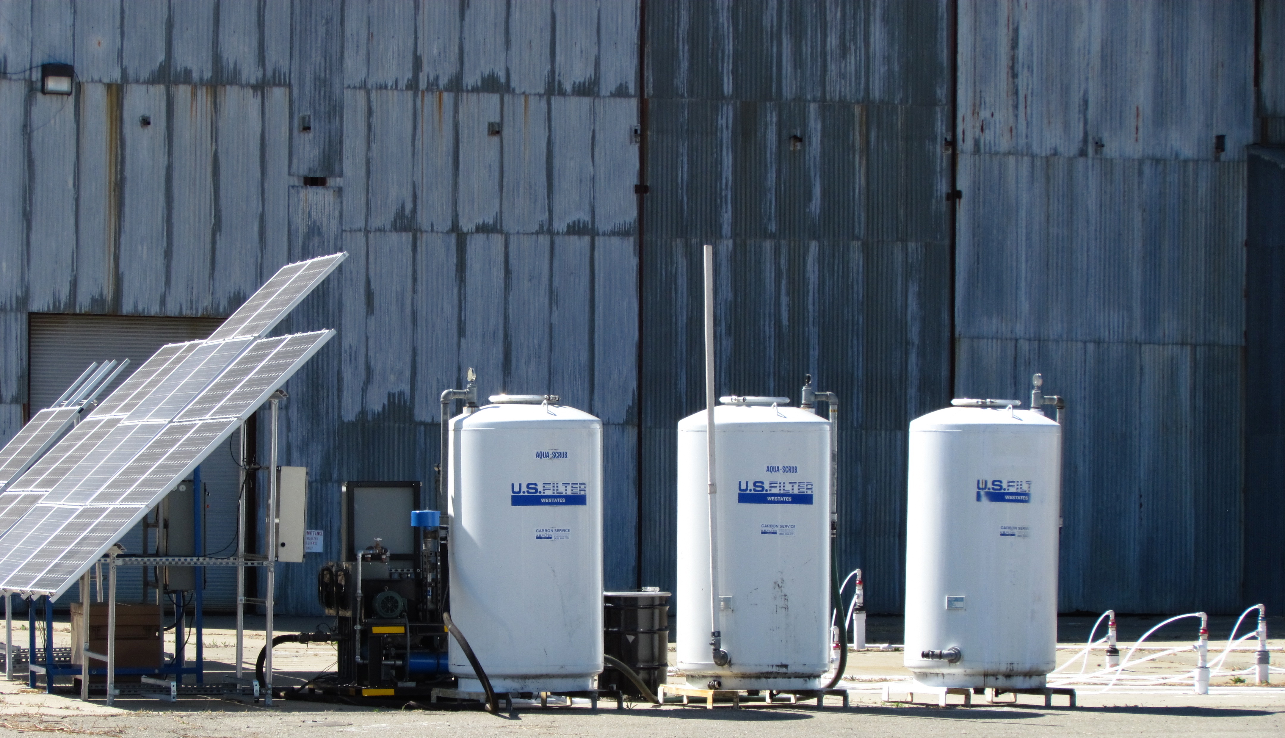
Solar-powered cleanup for the first time at Alameda Point
Air injection/extraction pumps at the two former service station sites are running on electricity from the grid. At the former plane de-fueling site next to Building 410, however, the Navy is using a solar-powered pump for the first time anywhere at Alameda Point. Derek Robinson, the Navy’s Environmental Coordinator, explained the solar choice saying, “Electricity is not optimum because the overhead electrical tie-in is located too far away for the system to be tied in to the grid cost effectively. The solar units provide the power necessary to operate the air sparging and soil vapor extraction system at a competitive price.” The only other option was a combustion engine pump running on gas or diesel.
“The battery storage system is traditional lead/acid batteries,” said Robinson. “The solar array charges storage batteries allowing the system to store energy and operate in cloud cover and beyond strictly daylight hours; however, the system is designed to power off the blowers once the voltages drop below a preset level,” he said.
Sustainable Technologies, located just a block away at Alameda Point, constructed the entire rig. It consists of solar panels, a box full of lead-acid batteries, a circuit panel, and a pump. Ironically, Sustainable Technologies is located on a Superfund site that will take another six years to clean up.
Solar-powered cleanup at Building 410.
The area next to Building 410 where the fuel spills occurred has had a number of cleanup actions going back to 2002. “Corrective actions under the petroleum program were conducted in 2002 and 2011 and a remedial action under the CERCLA [Superfund] program was conducted between 2005 and 2006,” said Robinson.
Work will continue until the end of the year. The Navy will always be responsible for returning to do more cleanup work if groundwater testing shows some of the contamination was missed.
Locations of three petroleum cleanup sites currently undergoing more cleanup work.
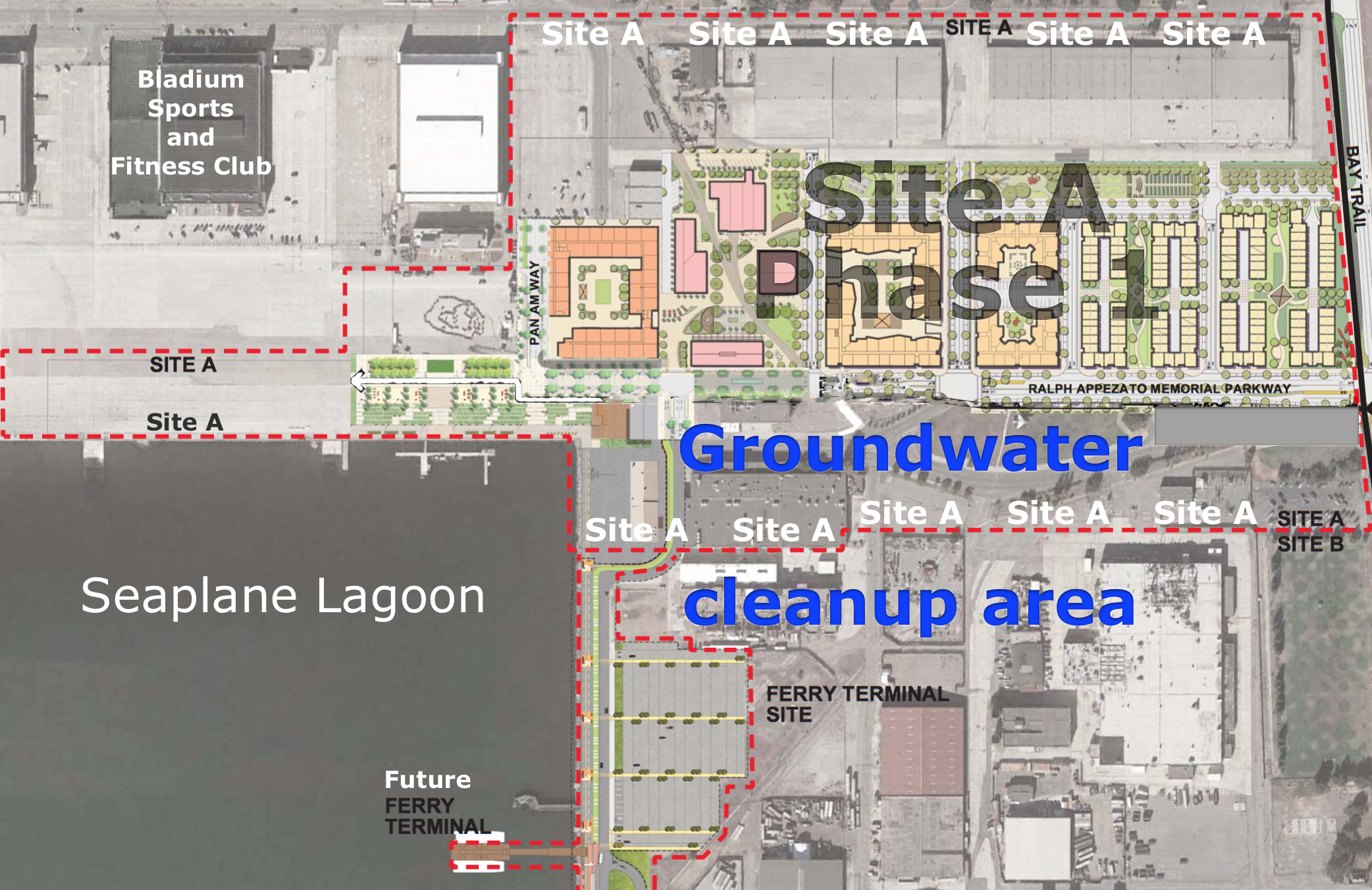
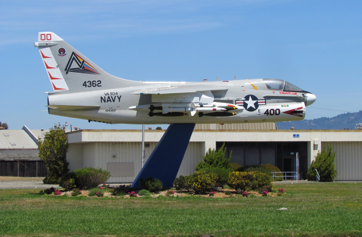
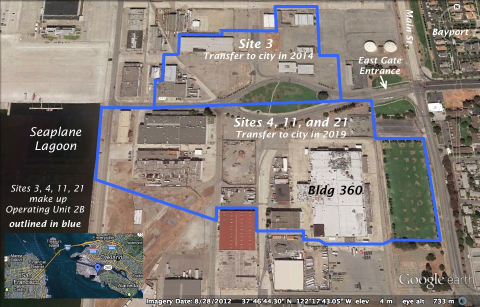
The city has announced that over 500 acres of land will be transferred from the Navy to the city on June 4, 2013. It will be the first – and largest – of a four-phase schedule of land transfers to the city. One of the areas that won’t be transferred this year is located at the main entryway into the future Town Center currently being designed.
Illustrations on map by Richard Bangert. Click on map to enlarge.
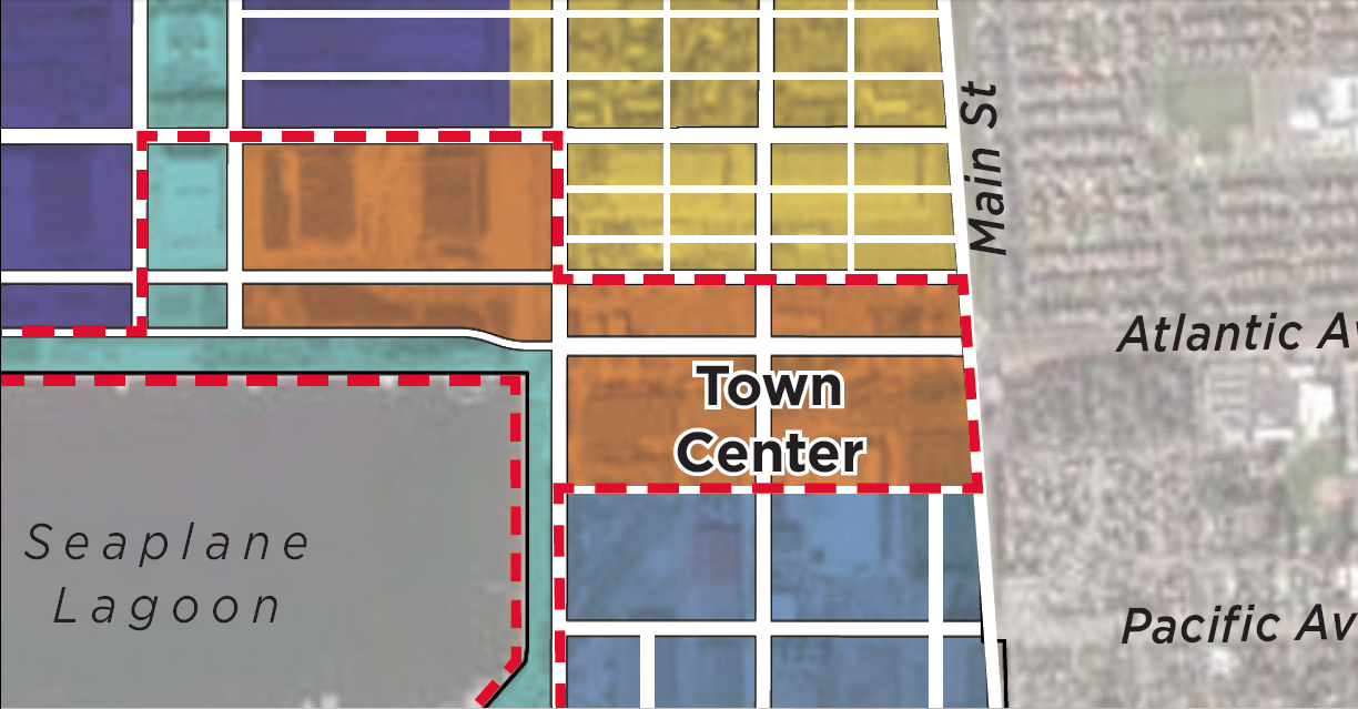
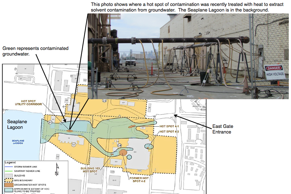
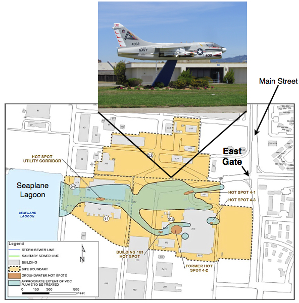
Driving into the “East Gate” on West Atlantic Avenue to Ferry Point Road at the Seaplane Lagoon takes you through part of the future Town Center – and through a major environmental cleanup area called Operating Unit (OU) 2B.
Plans for a vibrant mixed-use Town Center to kick off redevelopment are now in the design stage, but 33 acres on the south side of West Atlantic Avenue won’t be transferred to the city until 2019. That’s when contaminated groundwater is expected to be cleaned up to commercial standards, allowing the Navy to turn over the land.
The overhaul of aircraft and ship engines in this area led to major contamination of groundwater with trichloroethane and vinyl chloride, as well as pockets of soil contamination. After testing various cleanup methods on the contaminated groundwater area – called a plume – the Navy and regulatory agencies have decided to rely mainly on bioremediation – natural bacteria – to degrade the contamination.
Soil hot spots will be removed, except under buildings. Future developers will be responsible for soil under buildings once they are demolished.
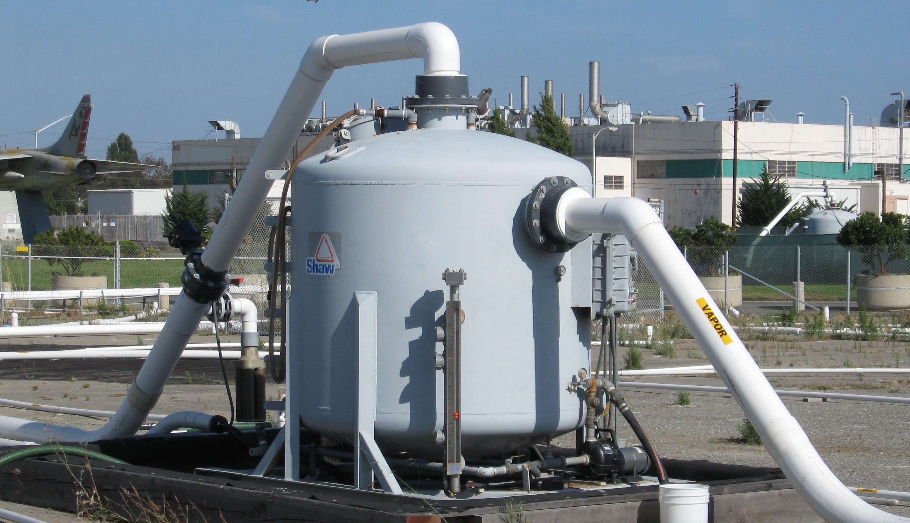
One of the groundwater hot spots close to the Seaplane Lagoon was successfully treated last year with a heat and vapor extraction system. Some of the other hot spots are impossible to treat with electrical heating because of underground power lines nearby.
Click on image to enlarge
The Navy has found bioremediation to be the most practical method to finish the job. Work details will be finalized later this year. Bioremediation can involve injecting new bacteria, but here it will likely mean injecting oxygen to spur the growth of existing bacteria. It’s the carbon atoms in the chemical contaminants that are attractive to bacteria, allowing them to naturally disassemble a chemical compound.
Someday, decades from now, the danger from vapors entering buildings will be low enough to permit ground floor residential use. Current restrictions imposed under the Navy’s cleanup plan will prohibit ground floor residential, but will allow residential use above the first floor, provided an approved vapor barrier and venting system is installed under any new construction. First floors will be allowed to have commercial uses once the city receives the land in 2019. Groundwater monitoring wells around the cleanup area will remain usable and accessible for regular monitoring for at least 20 years.
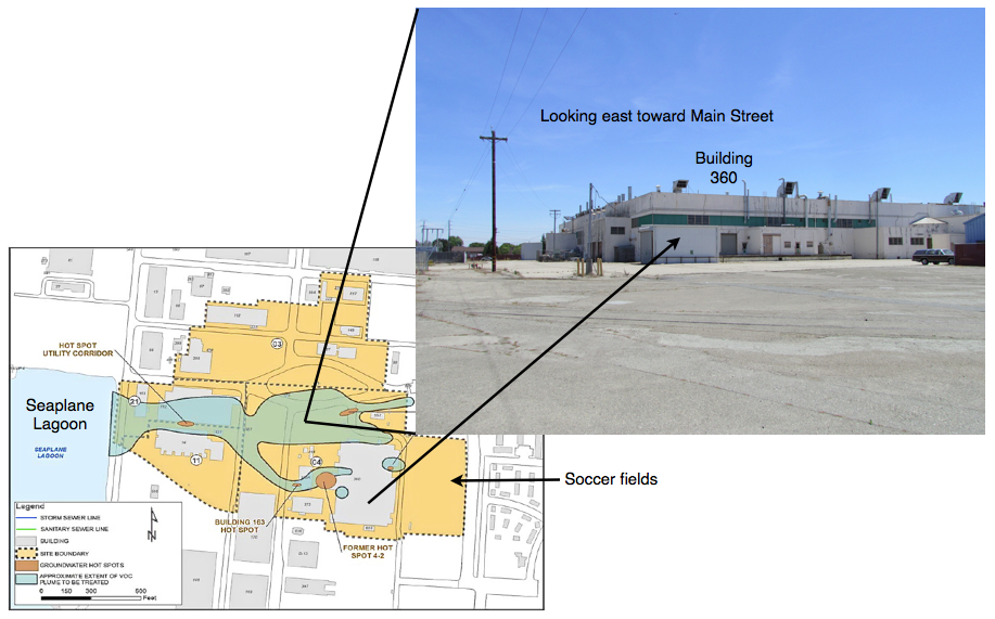
The cleanup area north of West Atlantic – 13 acres called Site 3 – will be turned over to the city next year following removal of several contaminated soil hot spots containing lead and other contaminants. Some of the contaminated soil areas are under building slabs on Site 3 and will be the responsibility of a future developer. All of the buildings in the East Gate cleanup area called Operating Unit (OU) 2B – 46 acres – are expected to be demolished rather than reused.
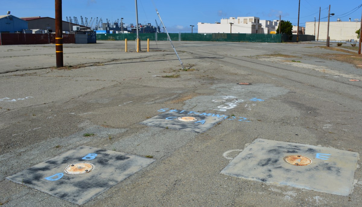
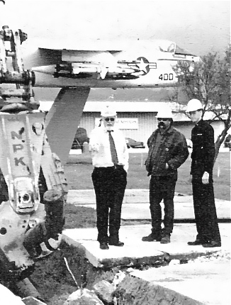
Site 3 north of West Atlantic was also heavily contaminated with jet fuel around an area where underground fuel storage tanks were once located. The former storage tank area is west of the jet monument and is still dotted with white pipe stubs once connected to a maze of cleanup pipes. The jet fuel cleanup was completed two years ago under the Navy’s Petroleum Program using a vapor extraction system. Removal of underground tanks and fuel lines was completed in 1999.
Vapor extraction system that operated for several years to clean up jet fuel in the ground on Site 3. Charcoal filter tank has been removed. Jet monument and Building 360 are in the background.Click on image to enlarge.
Removing jet fuel line in OU-2B cleanup area in 1999. Jet monument is in background. Source: Navy environmental newsletter, Winter 1999.