News About Cleanup, Sustainability, Parks, Open Space, and Wildlife at Alameda Point, Alameda, CA
Author: richard94501
My blog is Alameda Point Environmental Report covering parks and open space, environmental cleanup, wildlife, and sustainability at the former Navy base in Alameda now called Alameda Point.
Articles on my blog are frequently posted on the Alameda Post news site.
I also host a Flickr photo site, which is accessible via the sidebar wildlife photo gallery.
I hope you find my stories and photos of interest.
Richard Bangert
Alameda, California
Located between Alameda Point and Alameda Landing (where the new Target store has opened) is the Navy property known as North Housing. After years of low-key planning efforts, the city will soon be the recipient of a beautiful new park, and eventually see over 400 new affordable and market rate housing units, including 90 Housing Authority units for formerly homeless individuals.
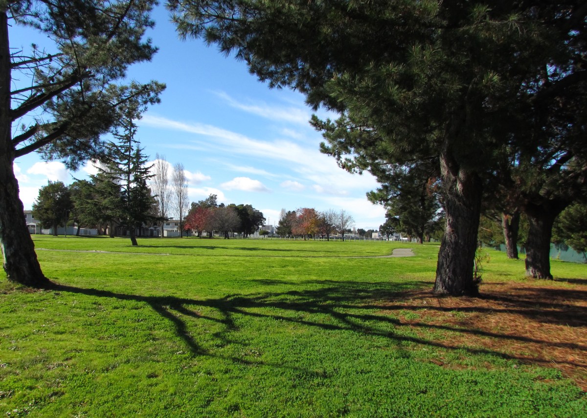
Estuary Park looking west. Past the trees in the distance is the baseball field.
A key administrative milestone was reached in August of 2013 when the U.S. Department of Housing and Urban Development (HUD) signed off on the city’s plan to accommodate homeless individuals.
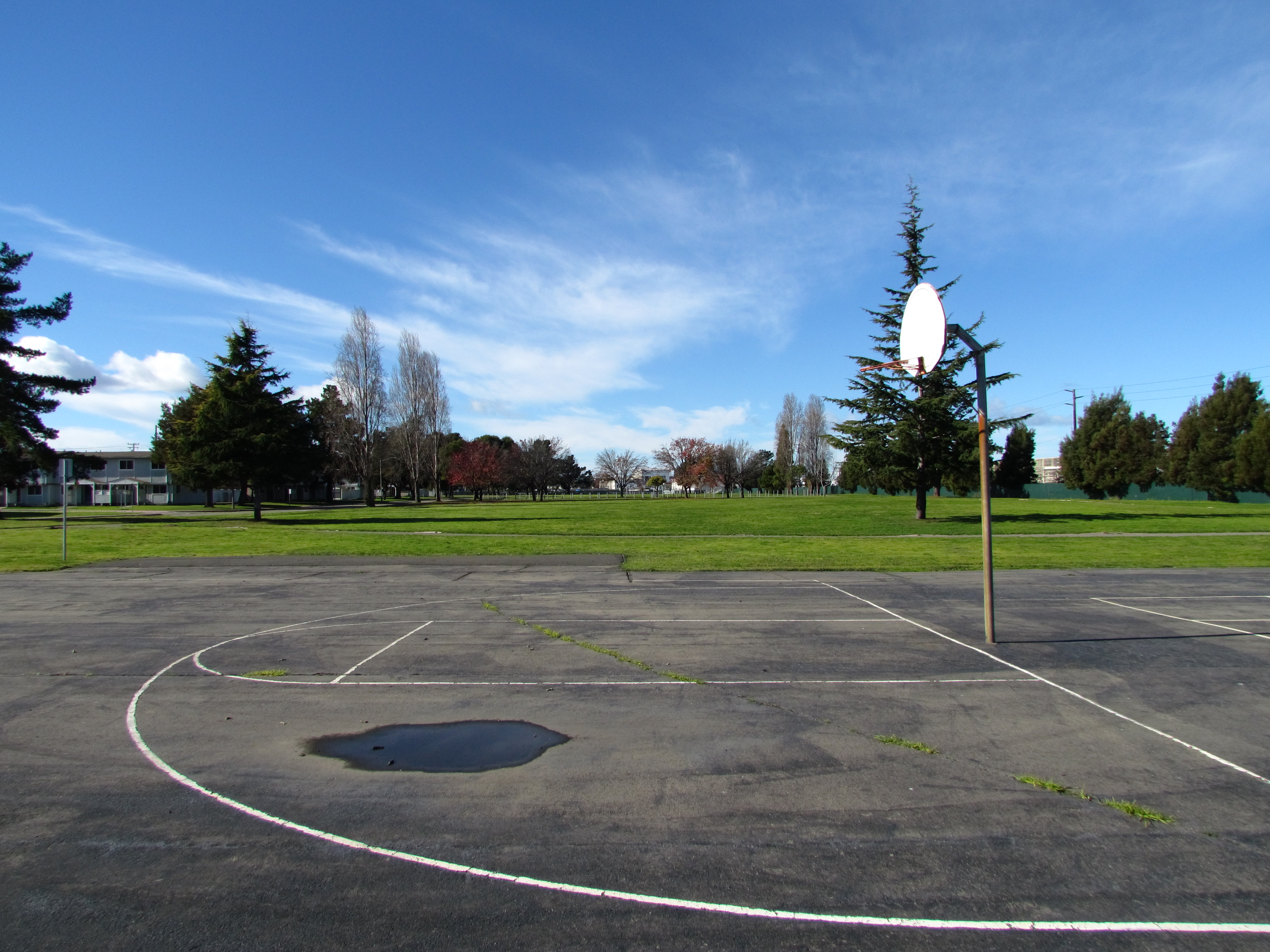
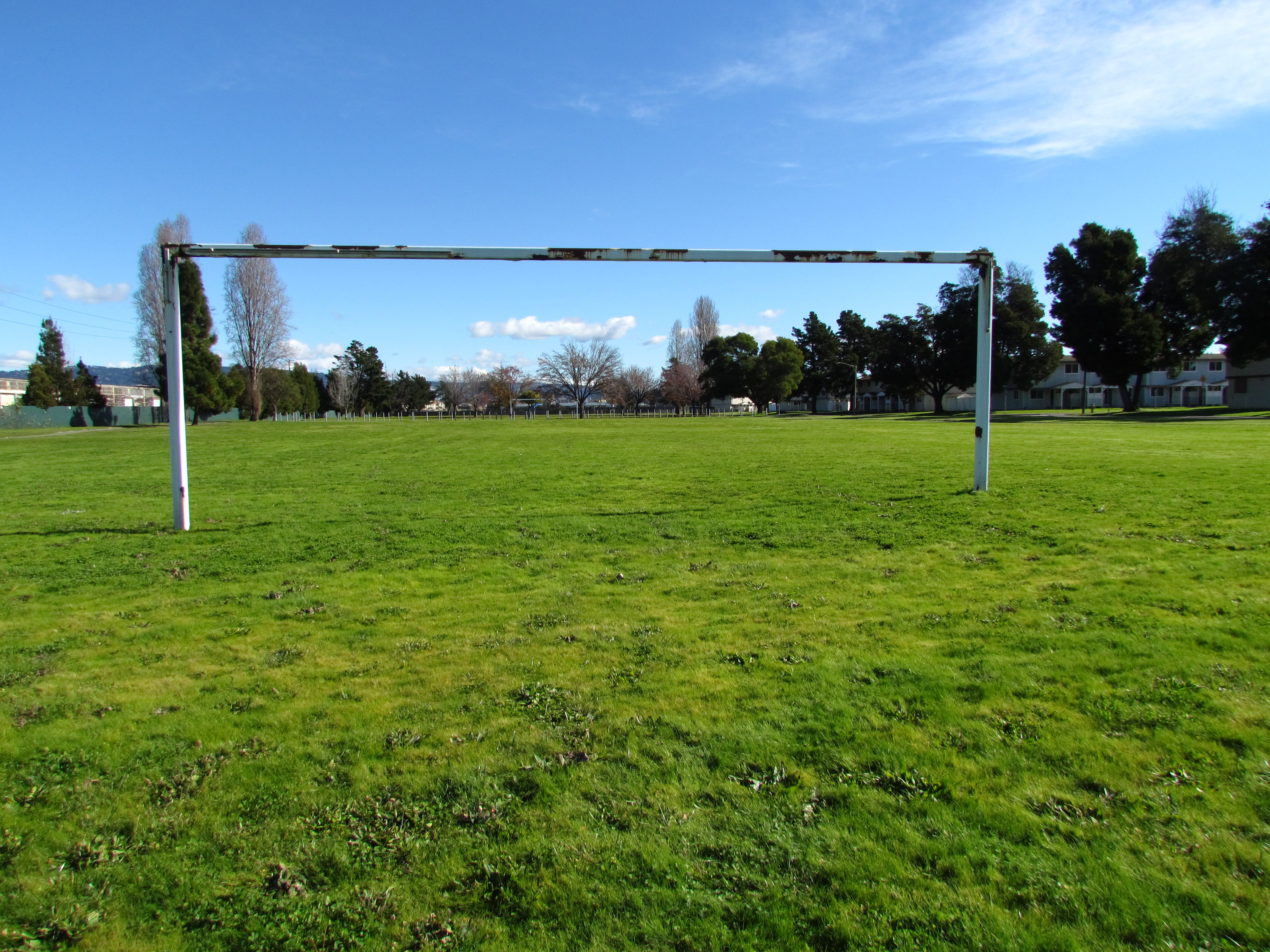
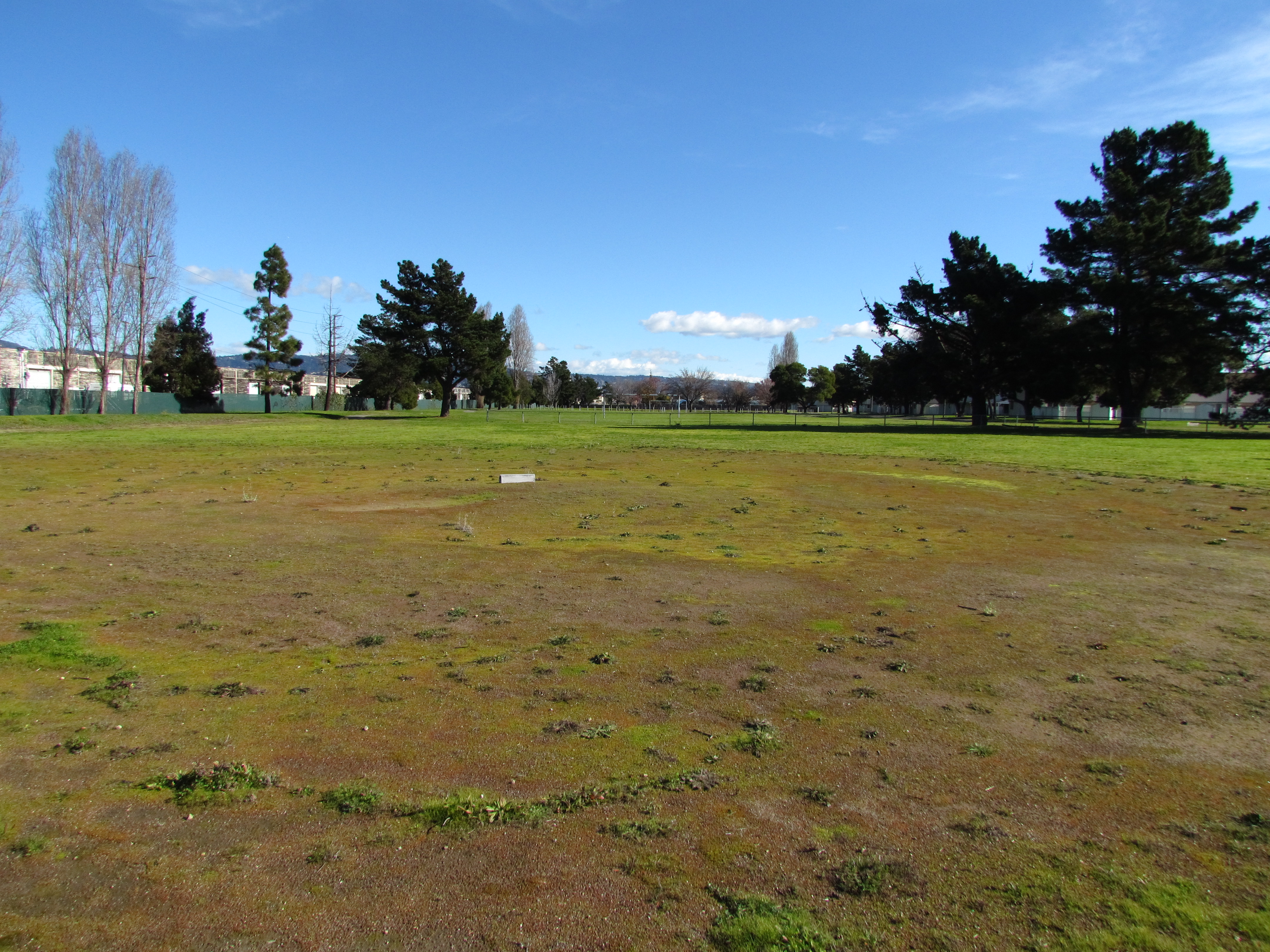
The 42-acre Navy parcel sits directly adjacent to Alameda Landing’s future residential neighborhood. It includes the 8-acre Estuary Park where a baseball field, soccer field, basketball court, perimeter trail, and an open meadow flanked by mature trees await minor sprucing up by our city’s Recreation and Park Department.
Existing housing units to be demolished
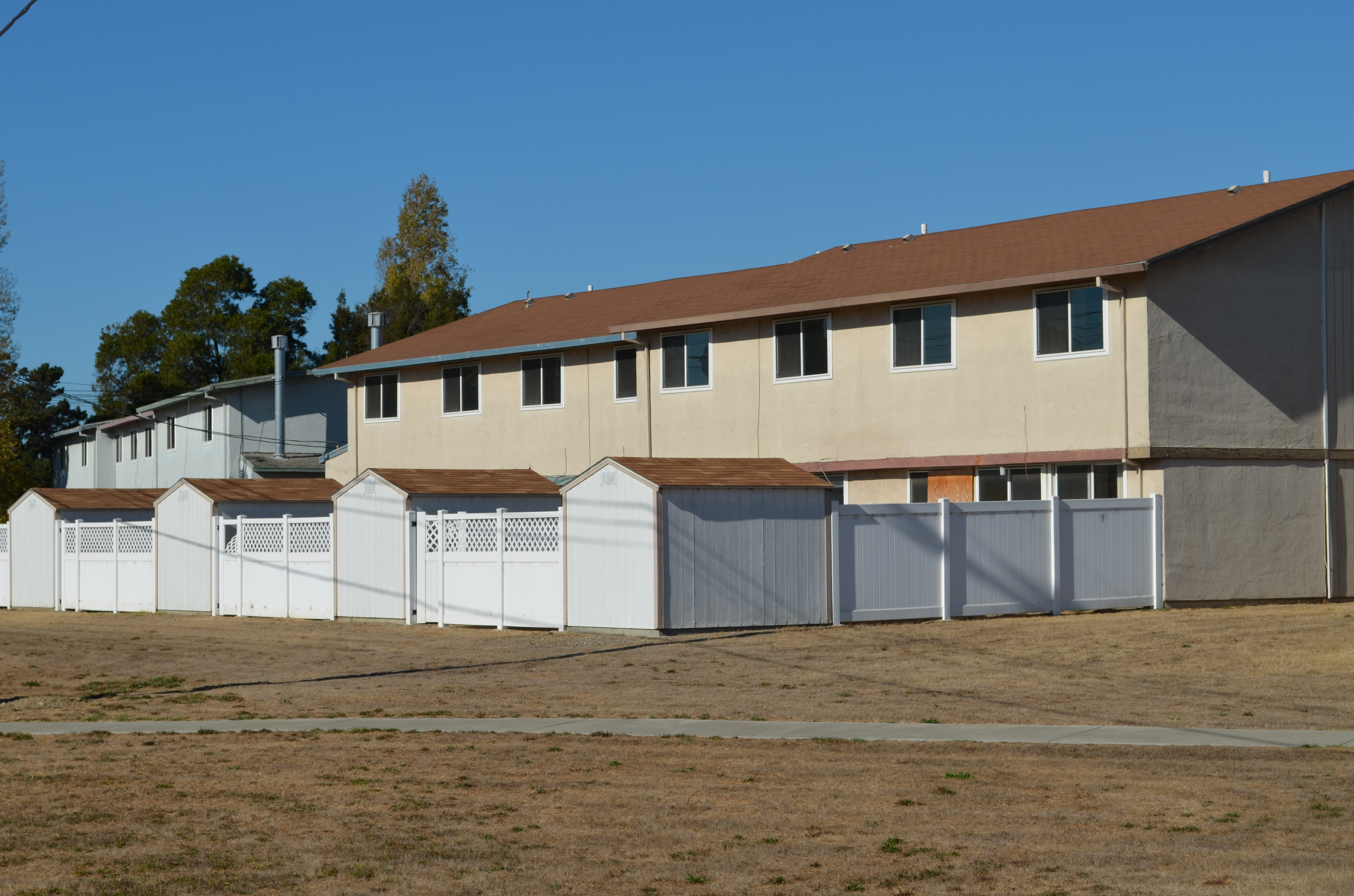
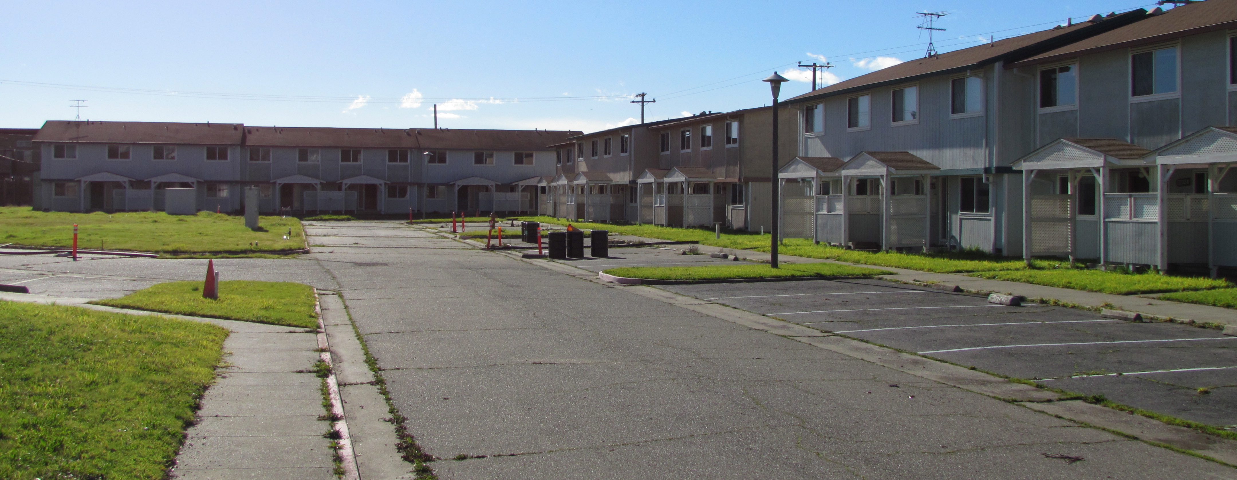
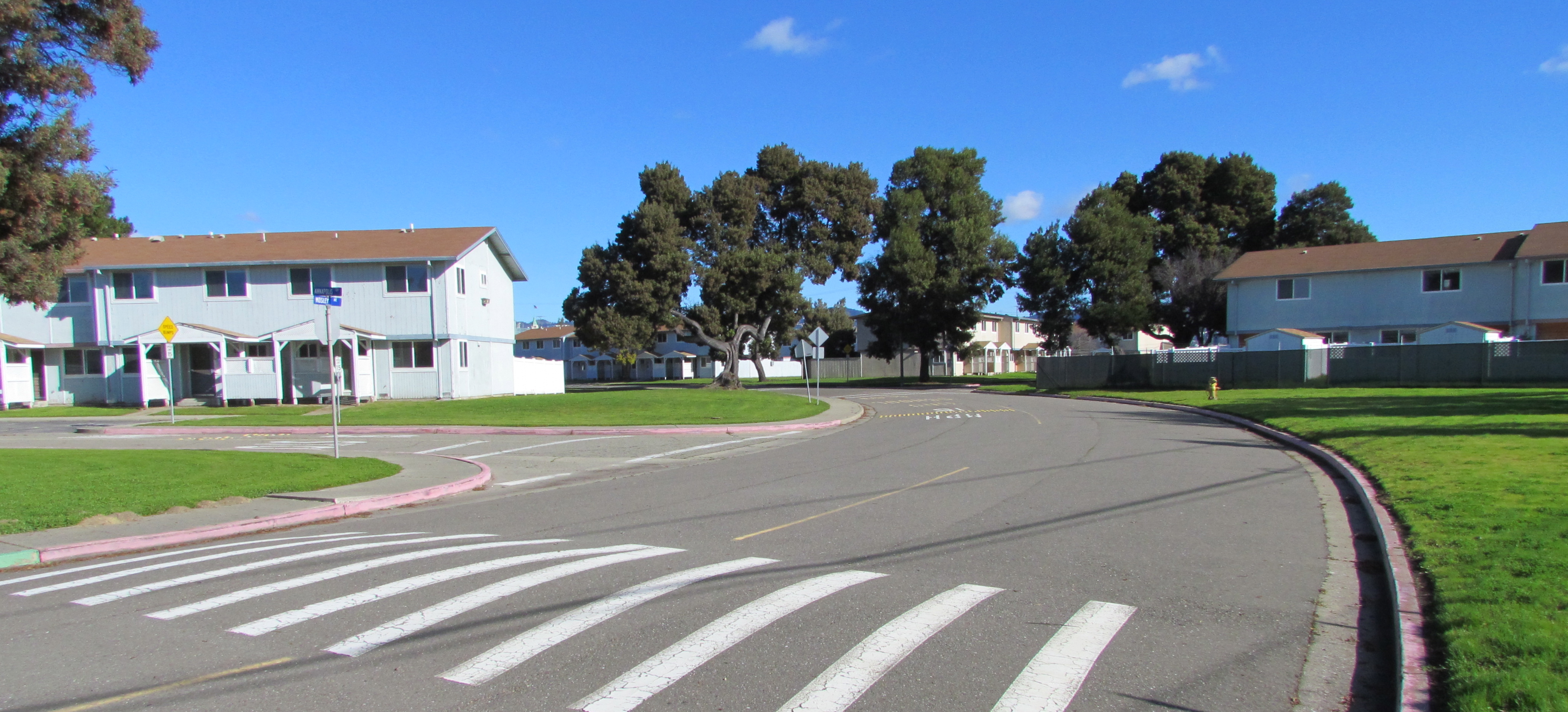
The site currently contains 51 residential structures: 39 six-plexes and 12 four-plexes for a total of 282 three- and four-bedroom units. All of the buildings were constructed in 1969. With the possible exception of the two acres going to Habitat for Humanity, all of the units will be demolished to make way for new construction, according to the city’s Interim Community Development Director Debbie Potter.
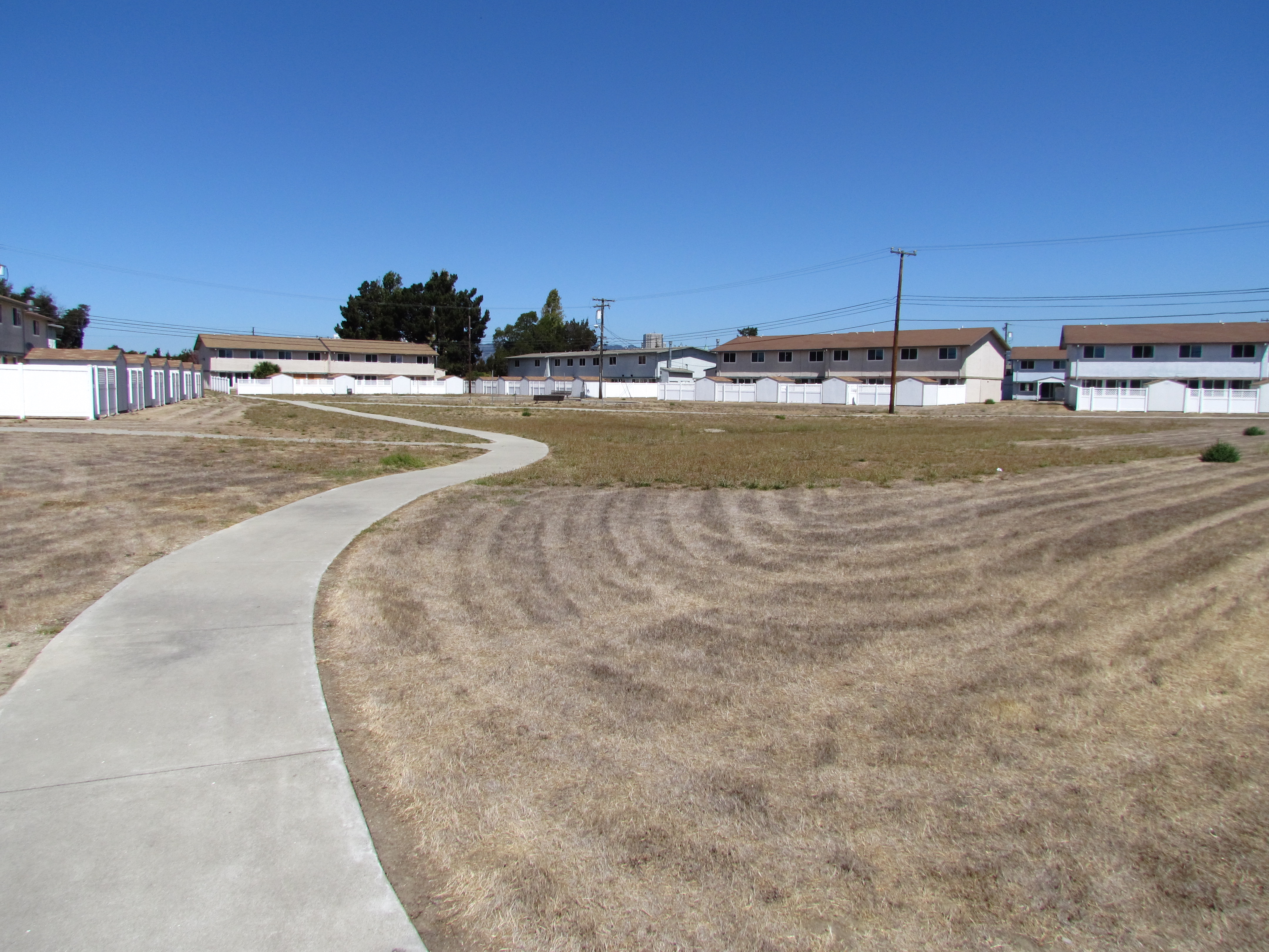
Central open space at North Housing. Looking north.
The 13 acres going to the city’s Housing Authority will have 90 units of new housing and two acres of open space. Two acres will go to Habitat for Humanity. The remaining 19 acres will be sold by the Navy to a private developer.
“The Reuse Plan notes the private housing developer could build 315 units,” said Potter. After the Reuse Plan Amendment was prepared in 2008 and approved in 2009, the city certified a Housing Element in 2012 that rezoned this property to provide a Multi-Family Overlay zone, “so the number of units that could potentially be developed at this site is more than the 435 listed in the Plan,” Potter stated.
One problem cited by Potter with trying to reuse the existing residences is that all of the multi-unit structures have single utility meters for the entire building. To re-meter all the units with individual meters for electric, gas, and water would be expensive, according to Potter.
Typical North Housing multiplex military housing (vacant) constructed in 1969.
“In addition,” said Potter, “the property is not laid out particularly efficiently, which is also a challenge. North Housing has a multi-family overlay designation and it would be extremely difficult to take advantage of that zoning (30 units to the acre) with the current building layout,” she said. “The only exception to all of this is that Habitat for Humanity East Bay has a Self-Help Housing Public Benefit Conveyance request pending with HUD which proposes an option of retaining 30-32 units to be renovated and sold as self-help housing.”
Housing Authority plays a key role
The Housing Authority will be partnering with the Alameda Point Collaborative and Building Futures with Women and Children who will provide services to residents of the Housing Authority’s 90 units. A community center is planned.
Funding to build the Housing Authority’s homeless assistance units has not yet been identified. However, Potter said she expects project financing would be packaged from a variety of sources, “with the primary funding coming from an award of Federal/State tax credits (equity raised through the sale of the tax credits to an investor),” she said. “Other sources are most likely Federal HOME funds and dedicated housing authority funds the City receives as inclusionary housing in lieu fees and Affordable Housing fees paid by non-residential developers,” said Potter.
Alameda Housing Authority Director Mike Pucci has a good idea where the homeless housing will go, but is not ready to release a map. “In our agreement that HUD has approved we did delineate a specific site comprising 13 acres, but a meets and bounds survey has yet to be conducted to establish it’s exact location,” said Pucci.
Checklist of regulations
The Navy completed its environmental review for the entire North Housing parcel in 2009 and issued a Finding of Suitability to Transfer (FOST) for Estuary Park. A FOST for the housing area is awaiting decisions concerning Superfund cleanup issues early next year.
The preparation of real estate transfer documents for just the park, however, could not proceed until HUD signed off on the city’s federally mandated homeless plan, according to the Navy’s Base Closure Manager Anthony Megliola. “Now that HUD has made its determination, real estate documentation supporting the transfer is being prepared with transfer [of Estuary Park] planned in late 2013,” said Megliola.
The remainder of the North Housing Parcel will be transferred in the 2015 timeframe, according to Megliola. Factors include completing the cleanup actions for the benzene plume under part of the site, executing a Covenant to Restrict Use of Property (CRUP) with the California Department of Toxic Substances Control, executing a Finding of Suitability to Transfer (FOST) document, and preparing required real estate conveyance documentation associated with transfer. “Although the National Environmental Policy Act (NEPA) Environmental Assessment (EA) was completed in 2009, receipt of the August 14, 2013 letter from the Department of Housing and Urban Development (HUD) was required before the Navy could complete the disposal actions for the North Housing area,” said Megliola.
Area where the Navy has been cleaning up benzene contamination at North Housing area.
Earlier in 2013, the Navy submitted a request to regulatory agencies to discontinue their vapor extraction work on the benzene plume hotspots, saying that vapor intrusion into buildings was not a risk. The benzene vapor pumps were turned off in the spring and a new round of interior vapor tests were conducted in some of the existing buildings. Results of these tests and a decision on whether to continue running the cleanup pumps for a few more years or terminate the program will be made in early 2014.
This former military housing site was originally to be conveyed to the Coast Guard and was not part of the city’s No-Cost Economic Conveyance deal with the Navy. (The new homes at North Housing will be in addition to the 1,425 units in the no-cost conveyance deal for Alameda Point.) Subsequently, the Coast Guard withdrew its request. In November 2007, the Navy notified the Alameda Reuse and Redevelopment Authority that it was going to declare an additional 42 acres of NAS Alameda – the North Housing parcel – as surplus property.
As part of its requirements as the local reuse authority, the city had to comply with the McKinney Homeless Assistance Act and reach out to homeless housing providers for proposals. In March of 2009, the city made its recommendations to HUD for compliance with the McKinney Act, approving the proposals from Habitat for Humanity, and the Alameda Housing Authority/Alameda Point Collaborative/Building Futures with Women and Children. They also recommended the Alameda Recreation and Park Department proposal to receive Estuary Park. These proposals became amendments to the 1996 Community Reuse Plan for Naval Air Station-Alameda.
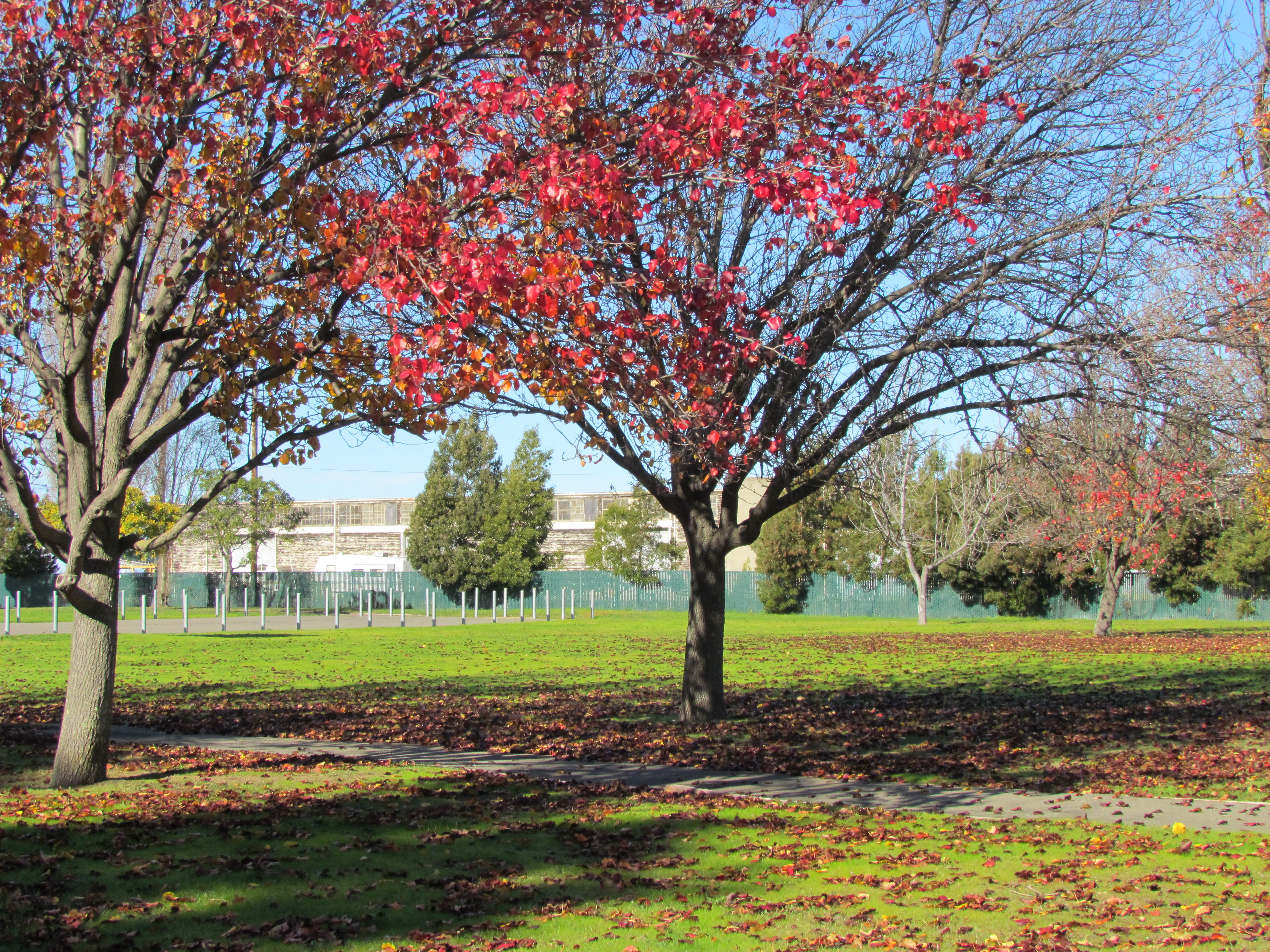
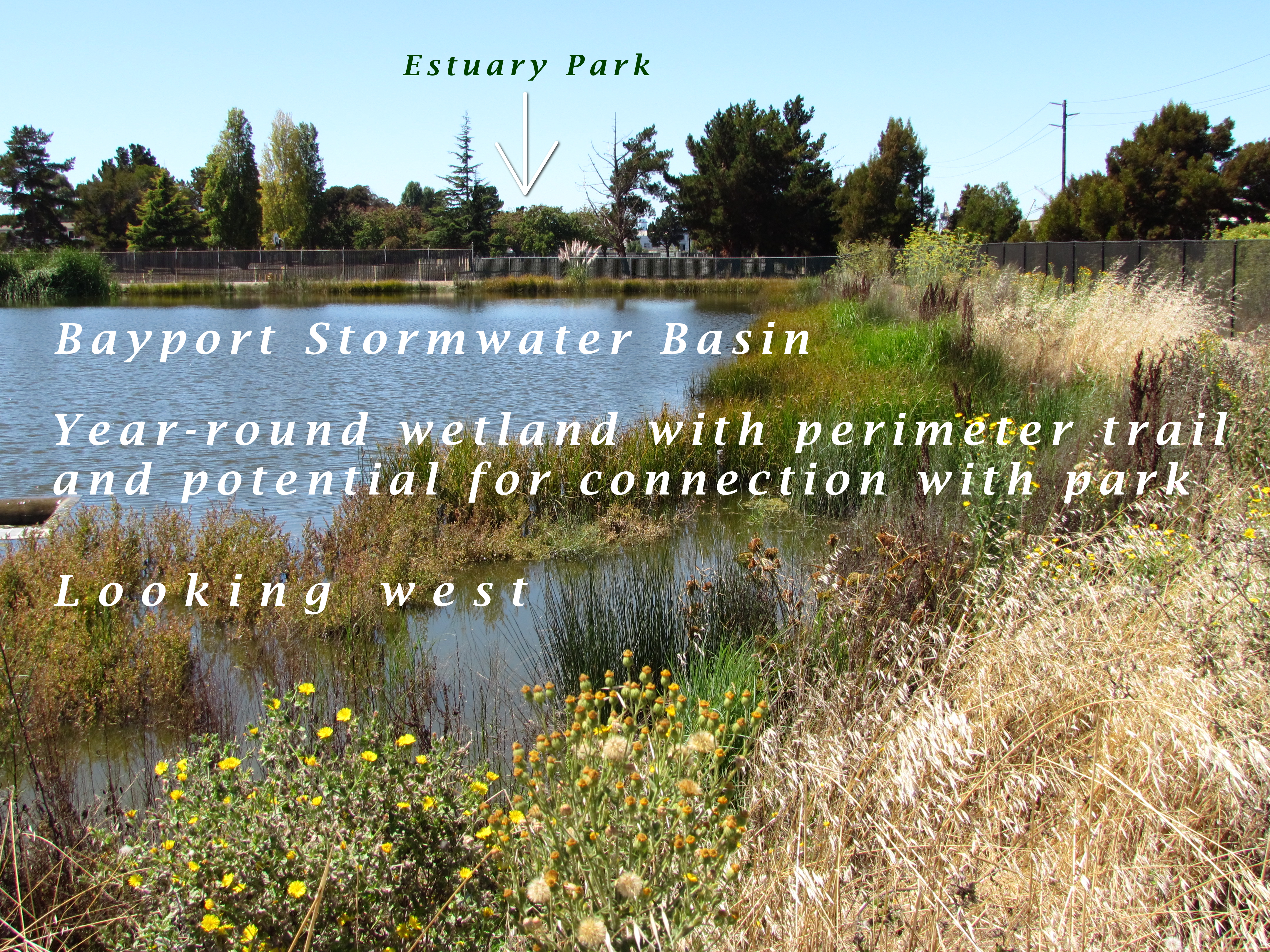
North Housing area. Existing housing slated for demolition to create a new, denser neighborhood with public and private investment.Estuary Park soccer field. Looking east. Alameda Landing is beyond the distant tree line.Estuary Park baseball field. Looking east.Estuary Park fall foliage.This stormwater basin was constructed by Catellus to serve the Bayport neighborhood. It remains full year-round due to groundwater being continuously pumped from the special pumping station next to Shinsei Gardens. Overflow is sent to the Oakland Estuary via another pump station.
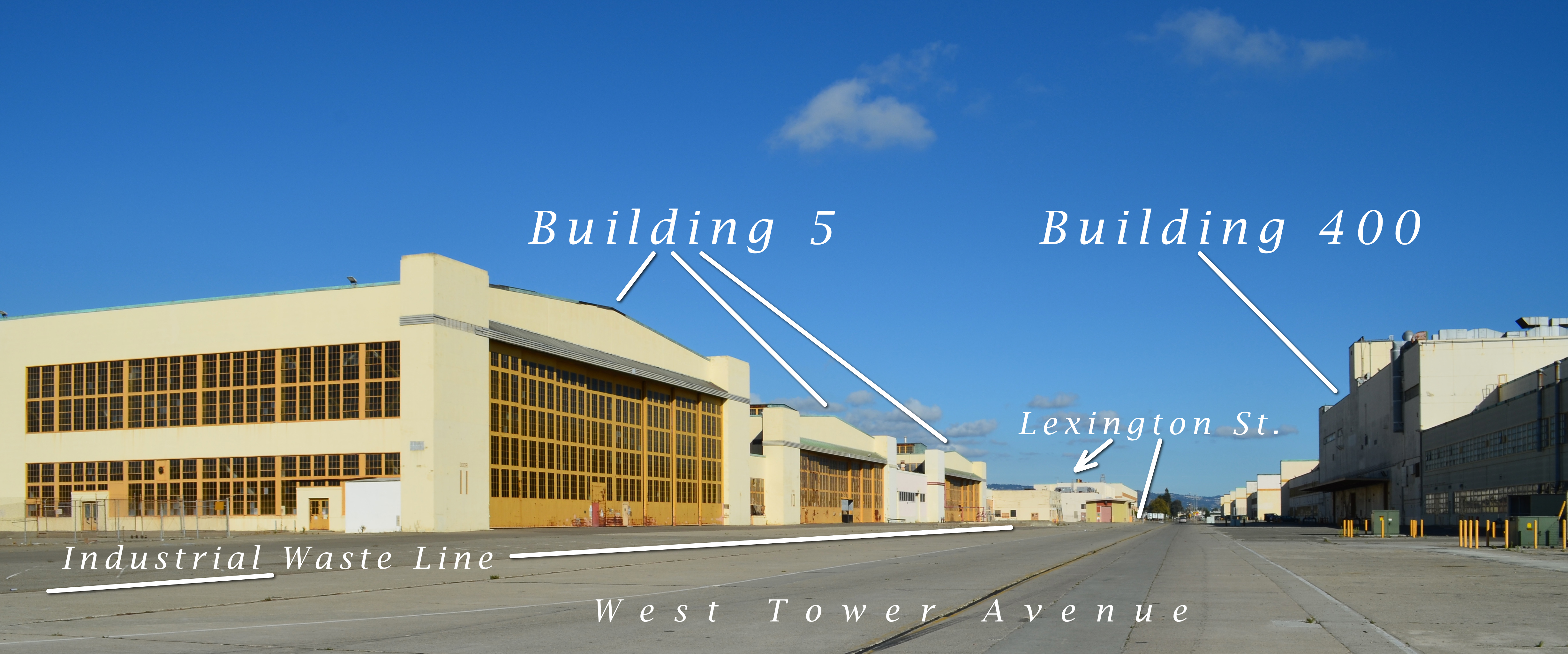
Looking east on West Tower Avenue. Buildings 5 and 400 are where radium-226 paint was applied to aircraft dials and markers. Paint waste contaminated thousands of feet of drain lines, most of which have been removed. The remaining radium-contaminated Industrial Waste Line is partially illustrated showing where it runs in front of Building 5, also known as the Naval Air Rework Facility.
The Industrial Waste Line of Operating Unit 2C
All of the drain lines containing radium-226 paint waste at Alameda Point have either been removed, cleaned, or are scheduled to be cleaned or removed, except for one: The Industrial Waste Line in the hangar area where aircraft dials were painted. This drain line was installed in the mid-1970s after passage of the Clean Water Act prohibited sending industrial waste into public waterways. It sent wastewater to a treatment facility, and is now lying dormant, broken in places, and no longer in use. The big question is what to do about it – leave it alone and create a special radiological license, a special exemption, or dig it up?
The Navy, regulatory agencies, and the city discussed this cleanup problem at their regular cleanup team meeting on June 11, 2013, the most recent date for which meeting minutes are available.
Clean area inside Building 5 where Navy aircraft were serviced. Radium painting occurred to the left and outside of this area.
Even though radium dial painting at Building 5 and Building 400 along West Tower Avenue had ended by the time the Industrial Waste Line was installed, drain lines inside and under these two buildings contained radium that may have been released down into the waste line.
The Navy doesn’t feel it should spend the extra money to remove the Industrial Waste Line, saying the contamination, some of which may have seeped into surrounding soil through breaks in the drain tiles, is trivial and should be left in place. The Navy’s Lead Remedial Project Manager Bill McGinnis said, “When risk was evaluated, the highest risk scenario was to an industrial worker at 225 days per year, 8 hours a day, for 25 years, through direct contact with soil. For the emergency worker the exposure and risk would be significantly less.”
The regulatory agencies aren’t sure how they will sign off on this waste line if it is left in place with elevated radium-226 levels inside the pipe or possibly in the soil where the pipe has deteriorated and leaked.
The city doesn’t want a perpetual worry about monitoring and digging precautions. The East Bay Municipal Utility District (EBMUD) would also be concerned about the presence of radium. The Navy’s Environmental Coordinator, Derek Robinson, asked the city’s engineering contractor, Angelo Obertello, if EBMUD was asked about routing around the existing industrial waste lines. Mr. Obertello said EBMUD is looking to upsize the lines in this corridor because of fire flow pressures. The city’s Chief Operating Officer for Alameda Point, Jennifer Ott, said that sewer and storm drain lines are planned for this area and that it is not realistic to expect EBMUD to work around existing rad-impacted lines.
The Navy is hoping to avoid the extra cleanup expense by asking the state to write a special document governing the drain line – essentially a warning label on a half-mile of two streets.
The Navy asked the city if they could work around the lines when installing new infrastructure. But even though the city’s new infrastructure plans call for using concrete utility corridors, or trenches, the plans drawn up by the city’s consulting engineer, Angelo Obertello, show that there would be future utility conflicts with the half-mile of the Industrial Waste Line on West Tower Avenue and Lexington Street. The Industrial Waste Line, including its connections to Buildings 5 and 400, is about a mile in length.
Right now, the idea of writing a special radiological license or granting a special exemption is an administrative headache because not enough soil samples have been taken from around the waste line to fashion such a document. Rob Terry of the U.S. Environmental Protection Agency pointed out that the whole licensing issue would go away if the drain line were removed.
From the meeting minutes: “Mr. Terry agreed with Mr. Miya’s description of the process, and said CDPH [California Department of Public Health] is looking at two issues: the rad dose remaining in place, and the quantity of rad materials present. The possibility of a rad license for AP [Alameda Point] is a very real one, and under CERCLA [Comprehensive Environmental Response, Compensation, and Liability Act, commonly known as Superfund] the cleanup should be as complete as possible. If everything is removed, the need for licensing goes away.”
A similar drain line at Hunter’s Point Shipyard in San Francisco was removed.
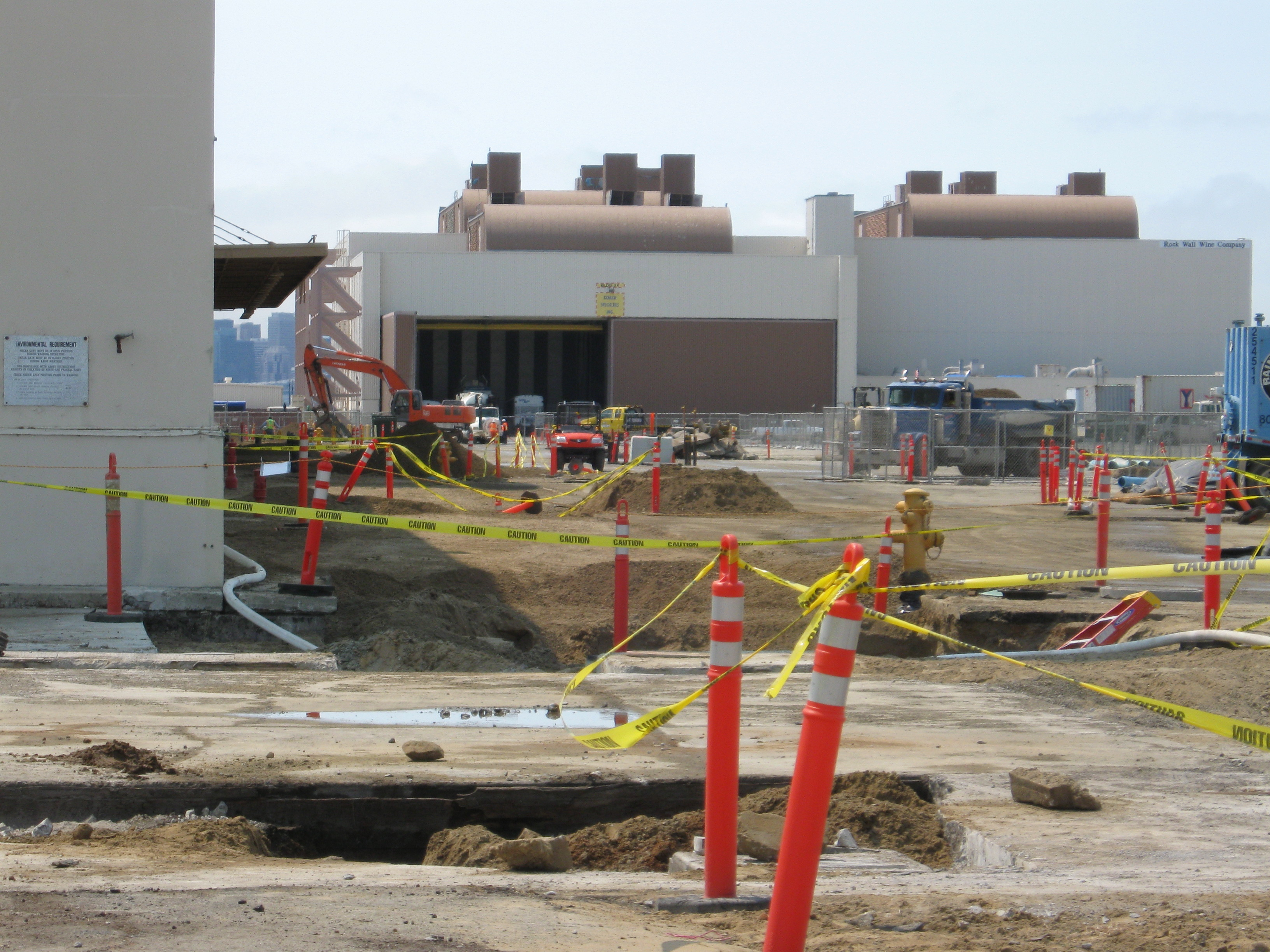
2009 removal of radium-226-contaminated storm drains next to Building 400. West Tower Avenue is to the right. Looking west.
Questions about future emergency repairs were highlighted at the meeting. Mr. Robinson asked if the main concern of the California Department of Toxic Substances Control (DTSC) is the “uncertainty of a license exemption.” Karen Toth said, “DTSC’s main concern is that if an emergency arises – e.g., a sinkhole occurs in the affected streets by a water or sewer line break – this could require hiring a rad contractor to address a sinkhole or line break, either by the City or by East Bay Municipal Utility District (EBMUD).”
The meeting ended with everyone agreeing to continue working together to solve the problem of what to do about the radium-impacted Industrial Waste Line and adjacent soil.
The minutes of the Industrial Waste Line agenda item at the June 11, 2013 cleanup team meeting are below.
Meeting Minutes
June 11, 2013 Meeting minutes of OU-2C Industrial Waste Line discussion Alameda Point Base Realignment and Closure (BRAC) Cleanup Team (BCT) Teleconference Meeting Attendees:
Navy Bill McGinnis – BRAC PMO-West Lead Remedial Project Manager (RPM) Jacques Lord – BRAC PMO-West Contracted RPM Sarah Ann Moore – BRAC PMO-West Deputy Base Closure Manager Marvin Norman – Legal Counsel Mary Parker – BRAC PMO-West Contracted RPM Derek Robinson – BRAC PMO-West BRAC Environmental Coordinator Cecily Sabedra – BRAC PMO-West RPM Matt Slack – Radiological Affairs Support Office (RASO)
Regulatory Agencies Isabella Alasti – California Department of Toxic Substances Control (DTSC) Bob Carr – U.S. Environmental Protection Agency (EPA) John Chesnutt – EPA David Elias – Regional Water Quality Control Board (Water Board) James Fyfe – DTSC Chris Lichens – EPA Ryan Miya – DTSC Rob Terry – EPA Karen Toth – DTSC Xuan-Mai Tran – EPA
City of Alameda Jennifer Ott – City of Alameda Peter Russell – Russell Resources
“Mr. Robinson said the Navy appreciated the City’s effort in preparing drawings of the industrial waste lines. Peter Russell (City) said the drawings show potential conflicts with infrastructure/utilities (existing and future) and thus are higher priority for addressing.
“Angelo Obertello (CBG), City contractor, explained that updated figures were prepared and overlain on as-built drawings of existing utilities. Areas were identified where existing utilities fall within the industrial waste line areas. The City has also re-evaluated placement of future utility lines in West Tower Avenue, Lexington Street, and Monarch Street, and preliminarily shifted the future lines about 15 feet away from the existing industrial waste lines. Based on the drawings presented, possible conflicts could occur along approximately 3,300 linear feet of line as follows: about 900 linear feet of 4-inch force main; and about 2,400 linear feet of gravity line feeding into the pump station in Lexington Street. This represents about 57 percent of the force main line in conflict with existing industrial waste lines and about 44 percent of the gravity line in conflict with existing industrial waste lines. The conflicts primarily in West Tower Avenue and Lexington Street are for future utilities and represent about 45 percent of the lines.
“Dr. Russell noted that as part of the petroleum program the Navy identified former fuel lines in Monarch Street, close to the industrial waste lines. Sampling of the fuel lines was interrupted and sampling locations were adjusted to avoid the industrial waste lines.
“Mr. Robinson asked if the City expects to put buildings on top of any the industrial waste lines. Mr. Obertello said a 300- to 400-foot area northeast of Building 12 contains industrial waste lines and potentially falls within a future development block. Jennifer Ott (City) said the area may be residential and is identified for intensified development to support the historic district. Dr. Russell noted this land would not be acquired until about 2019.
“Karen Toth (DTSC) said DTSC has discussed this with CDPH licensing staff. Until it is known what is left behind in the soil, CDPH cannot say whether a radiological (rad) license or license exemption is appropriate. Soil data are needed on what remains.
“Marvin Norman (Navy Legal) said the consensus is that the rad-impacted lines beneath the building slabs will remain in place and the question concerns the extent to which the Navy commits to removal of outlying lines. He acknowledged the issues of licensing will need to be dealt with regardless of which option the Navy pursues.
“Mr. Robinson asked if CDPH will work with the Navy in making its determinations. Ms. Toth said CDPH is available for further consultation. This is a new process for CDPH at a CERCLA facility, and the first rad license exemption will be for HPS. Bob Carr (EPA) said there have been discussions with CDPH and no decisions have been made yet. EPA asked for specifics and could not get them.
“Rob Terry (EPA) said he has some experience writing rad licenses and the more contamination, the harder it is to exempt a property and the more complex the license becomes. He envisioned an AP radioactive materials license and individual “storage and use areas” within the license. Ms. Toth said they are looking at the larger buildings and lines coming out of the buildings; there are two (or maybe three) areas still under evaluation.
“Bill McGinnis (Navy) asked what legal criteria/standards/requirements CDPH is using and where the process is now. Ms. Toth said the decision criteria are still up in the air. In talking with the CDPH Radiological Health Branch (RHB), they are looking at data from specific waste lines and more site-specific data are needed in those areas being left in place. CDPH/RHB is not making “impacted” v. “non-impacted” decisions for industrial waste lines. Ryan Miya (DTSC) explained the process for licensing/licensing exemption at HPS. RHB needs to understand what is being left in the ground to determine whether or not an exemption is appropriate. The activities remaining and boundaries in picocuries per gram (pCi/g) should be defined.
“The Navy drafted a “dose-modeling assessment” for HPS so RHB understood what it is issuing a license or exemption for. The Navy and DTSC worked together to prepare the assessment, which became a key component of the application. The assessment determined how much rad is left and how deep it is located. The City of San Francisco will file an application with a cover letter, the dose-modeling assessment, and supporting CERCLA documentation in about one month to CDPH/RHB. At HPS, a small landfill/debris area is what remains.
“If AP is proposing a buffer area for a utility corridor, then more information is needed for that buffer determination. Dr. Russell said it seems easier for CDPH to issue an exemption for buildings with concrete slabs in place, and wondered if an issue is being created by addressing lines under buildings together with lines in the streets. Mr. Miya said yes, lines under the buildings are much less likely to offer potential exposure, while the lines in the streets offer a more likely exposure pathway.
“Mr. Terry agreed with Mr. Miya’s description of the process, and said CDPH is looking at two issues: the rad dose remaining in place, and the quantity of rad materials present. The possibility of a rad license for AP is a very real one, and under CERCLA the cleanup should be as complete as possible. If everything is removed, the need for licensing goes away.
“Mr. Robinson said that the Navy modeled the industrial waste line exposure scenario very conservatively. The Navy is concerned about the uncertainty of a license versus an exemption. Mr. Miya said that knowing the potential exposure of what is left behind is important; at HPS what is left is very low in concentration and is covered by three feet of soil.
“Mr. Robinson asked if DTSC’s main concern is the uncertainty of a license exemption. Ms. Toth said DTSC’s main concern is that if an emergency arises – e.g., a sinkhole occurs in the affected streets by a water or sewer line break – this could require hiring a rad contractor to address a sinkhole or line break, either by the City or by East Bay Municipal Utility District (EBMUD).
“Mr. Norman asked if it would be considered a problem if the lines were grouted and sealed. Ms. Toth said the clay (gravity) pipelines are known to have integrity problems. The implementability of the remedy becomes a problem.
“Bob Carr (EPA) said what Ms. Toth described is a very real possibility, and the reality is that a break in the pipeline requires time-critical access to the area to repair. Mr. Norman asked for clarification about whether a sinkhole would be caused by the natural geology or the possibility of breaking lines.
“Mr. McGinnis said the CERCLA Institutional Controls (ICs) and Land Use Control-Remedial Design would state that repair work is subject to a soil management plan including rad control requirements. Ms. Toth said the City and EBMUD do not have the ability to comply with this in a timely manner. Mr. Robinson said the Navy appreciates Ms. Toth’s concerns.
“David Elias (Water Board) said that in early discussions with John West (Water Board), the project as envisioned indicated that the rad material was well defined, the risk was conservatively assessed, the lines left in the street would not be in contact with anyone, and the lines would be under concrete. However, with redevelopment the current scenario changed and the situation is different, creating small “waste management units.” With future changes it may become hard to address these issues. There is no real precedent for this approach. He said the agencies may become less comfortable with the new scenario. Mr. Robinson said it is difficult for the Navy to do things just for future development; however, the City needs to take into account the environmental disposition of the property. He suggested evaluating some options for relocating lines.
“A lot of good information was presented today and the Navy will look more closely at the drawings presented.
“Dr. Russell said even without the City’s redevelopment, when the Navy built AP the design standards were different and construction had shorter life cycles. Regardless of future development, the current infrastructure must be repaired and maintained for several years. Mr. Robinson said the Navy appreciates this, and justifying cleanup expenditures is tied to risk. The waste lines have been evaluated in a Remedial Investigation/Feasibility Study; the risk was determined to be low and within the risk management range. It is difficult for the Navy to consider complete removal of the lines when risk has been shown to be low.
“John Chesnutt (EPA) asked if there is a risk driver and what would make the agency members comfortable with the certainty of the risk. At HPS, after removing 20-plus miles of pipelines, breaks were found and sampling showed rad levels in catch basins were similar to intact pipeline areas. He asked if people would feel more comfortable if site-specific sampling was conducted at the breaks and data were collected that would enhance confidence in the risk level. Mr. Elias raised the issue of tarry refinery waste at AP, where it was left in place and the risk is low, but decision-makers have to manage the waste and the risk and communicate this to the public. This may be a messy issue long term.
“Mr. Norman said CERCLA is driven primarily by long-term human-health risk and the City may not be required to comply with long-term maintenance or handling in the event of a calamity. Dr. Russell said this is not true; the City will have to conduct routine maintenance, and emergency maintenance if needed, and will require funding for long-term rad maintenance. State and community acceptance of risk are also considered.
“Ms. Ott said EBMUD may not be comfortable working near the rad-impacted industrial waste lines. Mr. Chesnutt asked if new soil samples collected showed higher risk, would rad workers have to be hired and, if this happens, are people at risk. Mr. Robinson said no. Mr. Terry said the data from along the trench line show the risk is trivial. Mr. Carr said the highest levels detected now are about 30 pCi/g, and what is not known is what criteria other agencies (e.g, California Occupational Safety and Health) have for restricting access to this area. Mr. Terry said he did not know but it would likely depend upon the volume at 30 pCi/g.
“There was a question about whether the sediment is still present in the manholes. Mary Parker (Navy) said sediment was not removed from the industrial waste line manholes except for the small volume of sediment required for the laboratory analysis. Mr. Robinson said sediment in the manholes could be removed fairly easily and would help reduce the volume of soil.
“Mr. McGinnis said when risk was evaluated, the highest risk scenario was to an industrial worker at 225 days per year, 8 hours a day, for 25 years, through direct contact with soil. For the emergency worker the exposure and risk would be significantly less. Mr. Robinson said the Navy will evaluate the information provided today more thoroughly. He asked Mr. Obertello if EBMUD was asked about routing around the existing industrial waste lines. Mr. Obertello said EBMUD is looking to upsize the lines in this corridor because of fire flow pressures. Ms. Ott said sewer and storm drain lines are planned for this area. It is not realistic to expect EBMUD to work around existing rad-impacted lines.
“Mr. Norman said the Navy is taking the actions it needs to take and cannot take response actions to enhance development. He understands the City will have to maintain the existing lines and this could be more costly or more risky. Further, replacement of existing lines could cost more if the Navy abandons the lines with residual rad in place.
“Mr. Chesnutt said he is not sure it is a protectiveness issue. Ms. Ott asked if the risk is negligible, would a rad contractor be needed. Mr. Robinson said from a risk perspective, no rad contractor is needed. Ms. Ott asked if RASO concurred. Matt Slack (RASO) said he believed a rad contractor would be needed, but he agreed with the existing data and that the risk due to the sediment within the pipe is minimal.
“Mr. Terry said when something is left behind, there will always be a question whenever a hole needs to be dug in the street. Time and resources will be needed to respond to questions.
“Mr. Elias said the Navy usually looks at source control through removal, and that ICs are for residual contamination. Now, ICs are being looked at for source material and felt this is an unusual way of managing a contaminant source. Mr. Chesnutt said he was not sure this was a source area or just material left behind. Mr. Elias suggested the rad might be a de minimis source.
“Mr. Robinson asked if there are ARARs that address waste left in place with low risk. Ms. Toth said with ICs in place the area cannot be used as residential, and ICs are required if something is left in place. Mr. McGinnis said residential risk was evaluated and there is no exposure pathway for residential users.
“Mr. Miya said the pipeline was removed at HPS, which allowed free release. Ms. Toth suggested that if a quick resolution cannot be reached, the industrial waste lines might be removed from the Record of Decision (ROD) so the rest of the site can move forward. Mr. Robinson asked EPA and Water Board members how they feel about this suggestion. Mr. Elias said he is not sure, and Mr. Chesnutt said it is worth discussing but may be premature. Mr. Robinson suggested a follow-on call on July 2 or July 8 to discuss this further.”
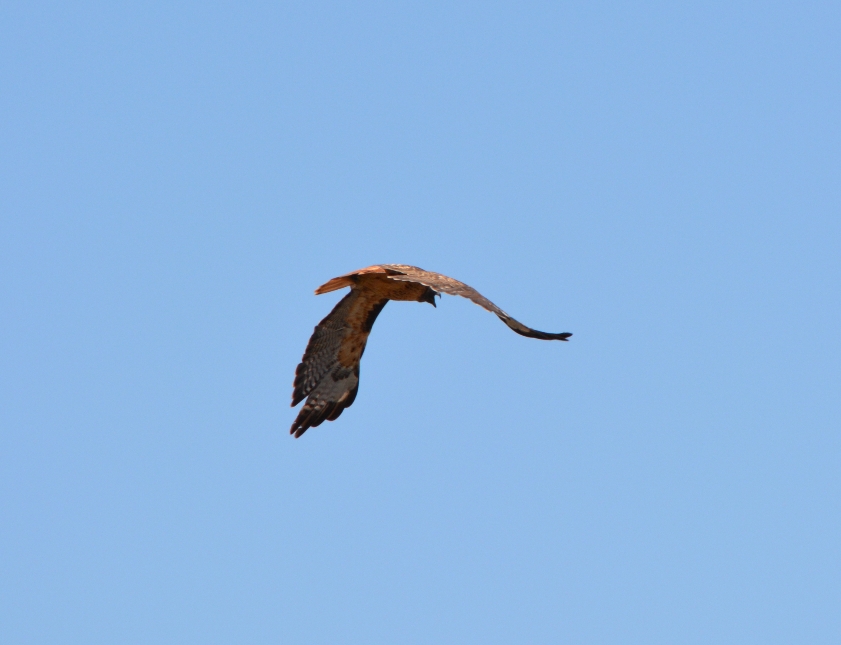
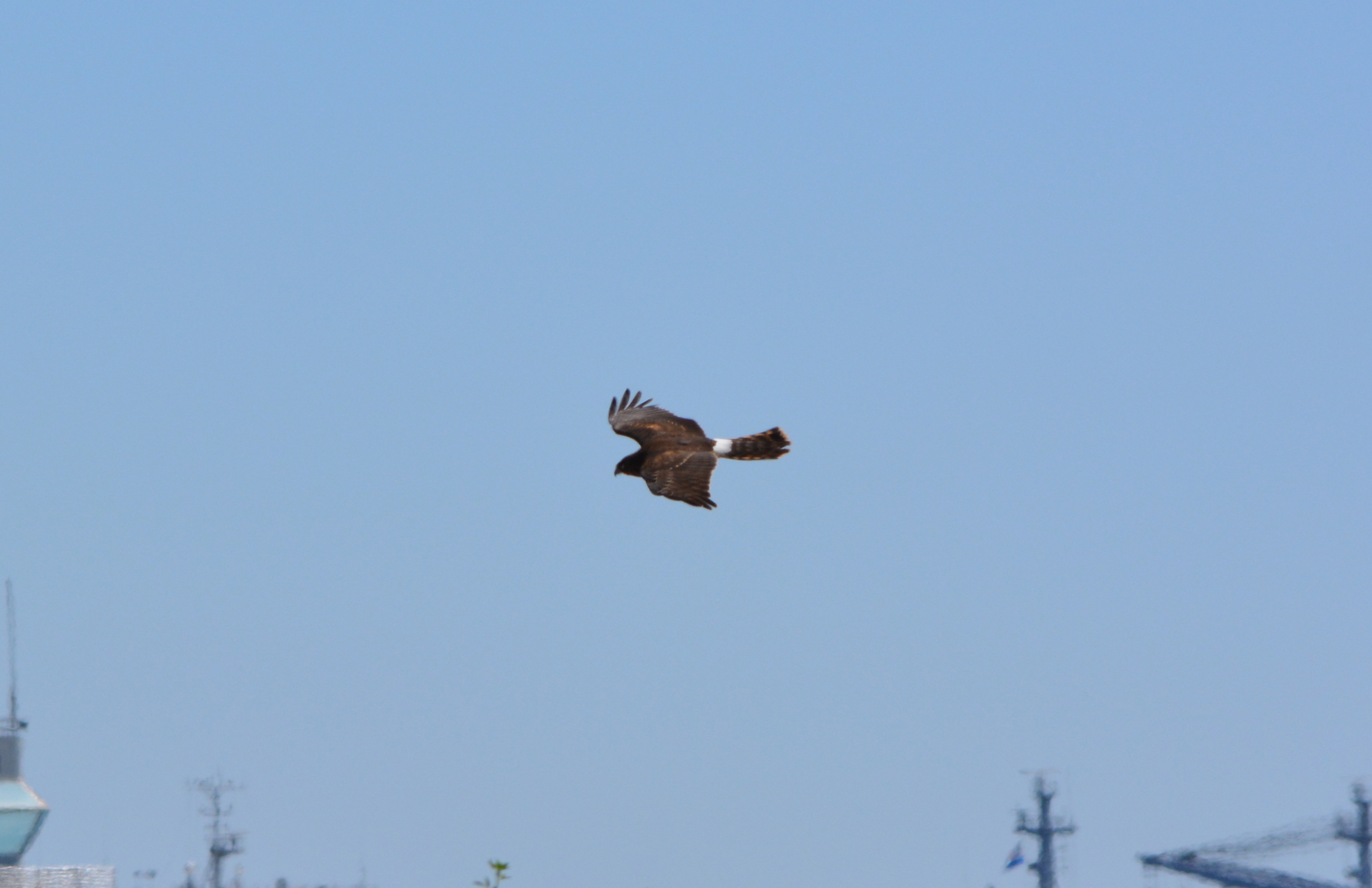
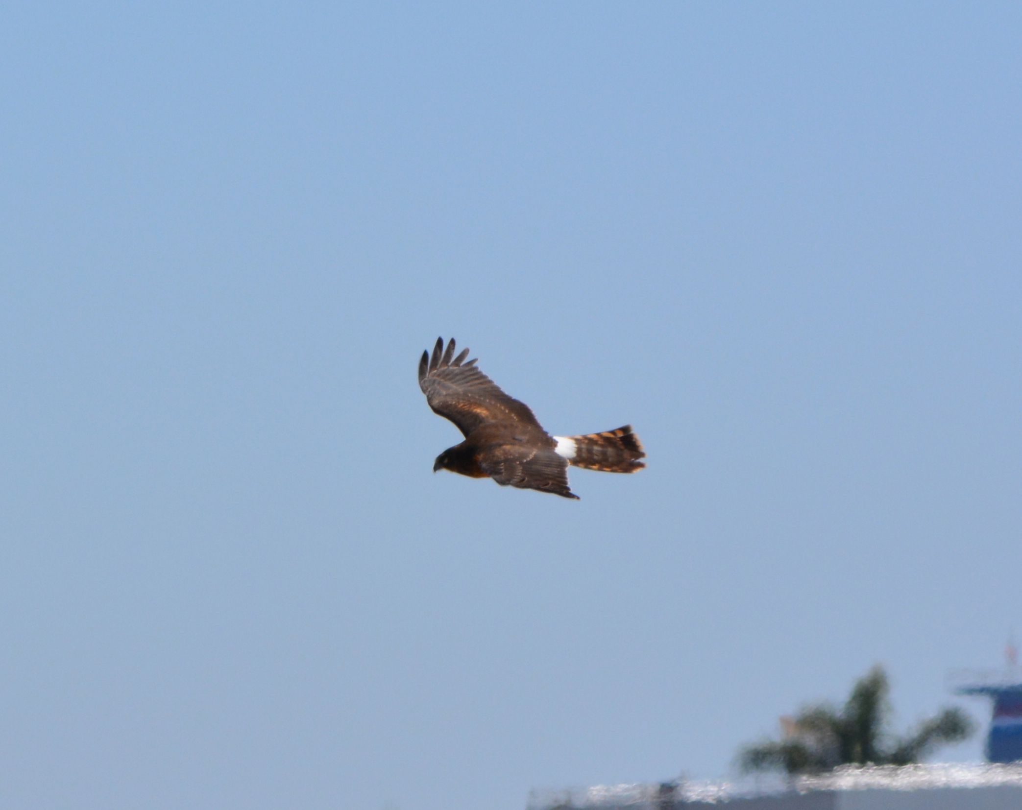
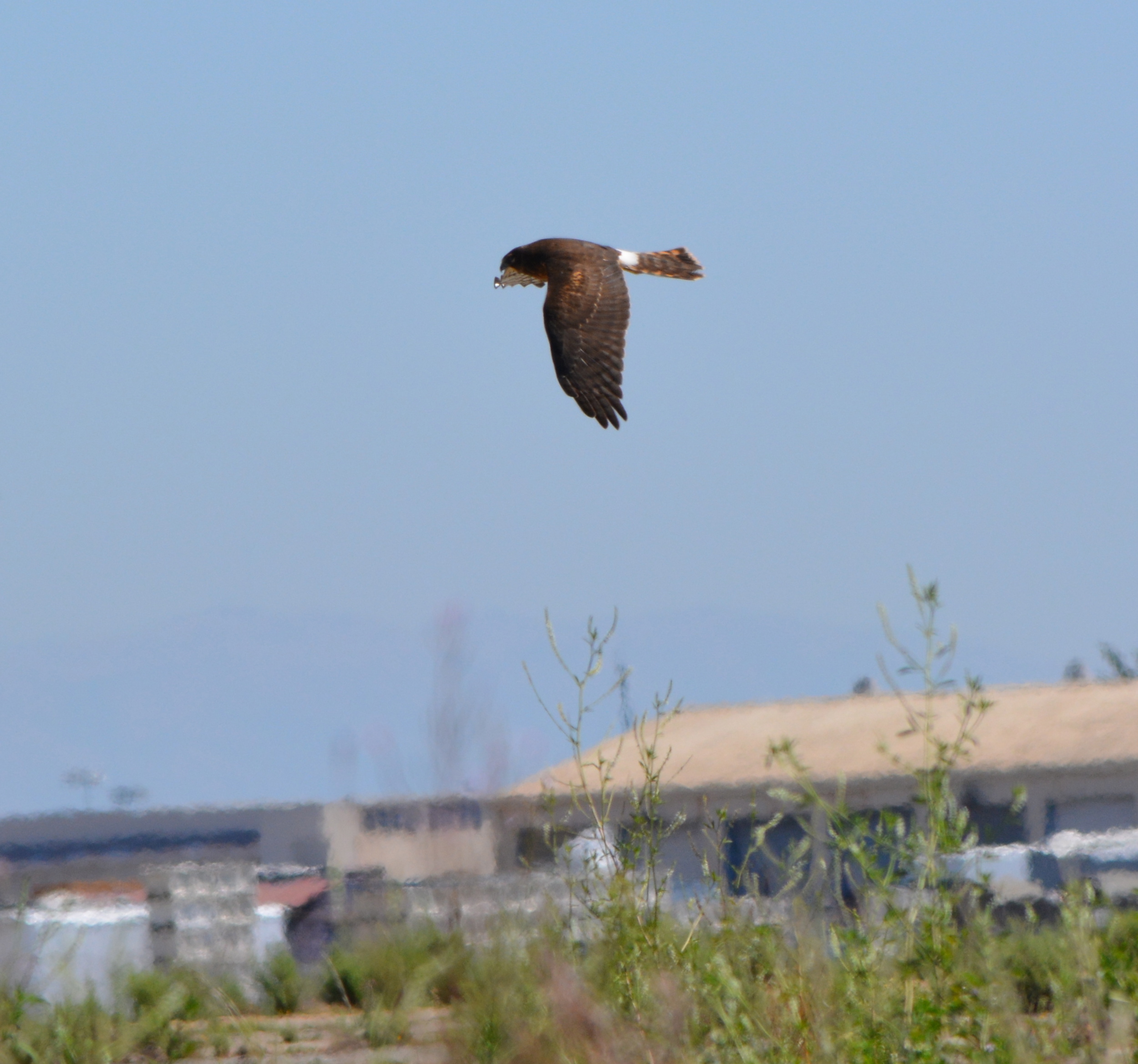
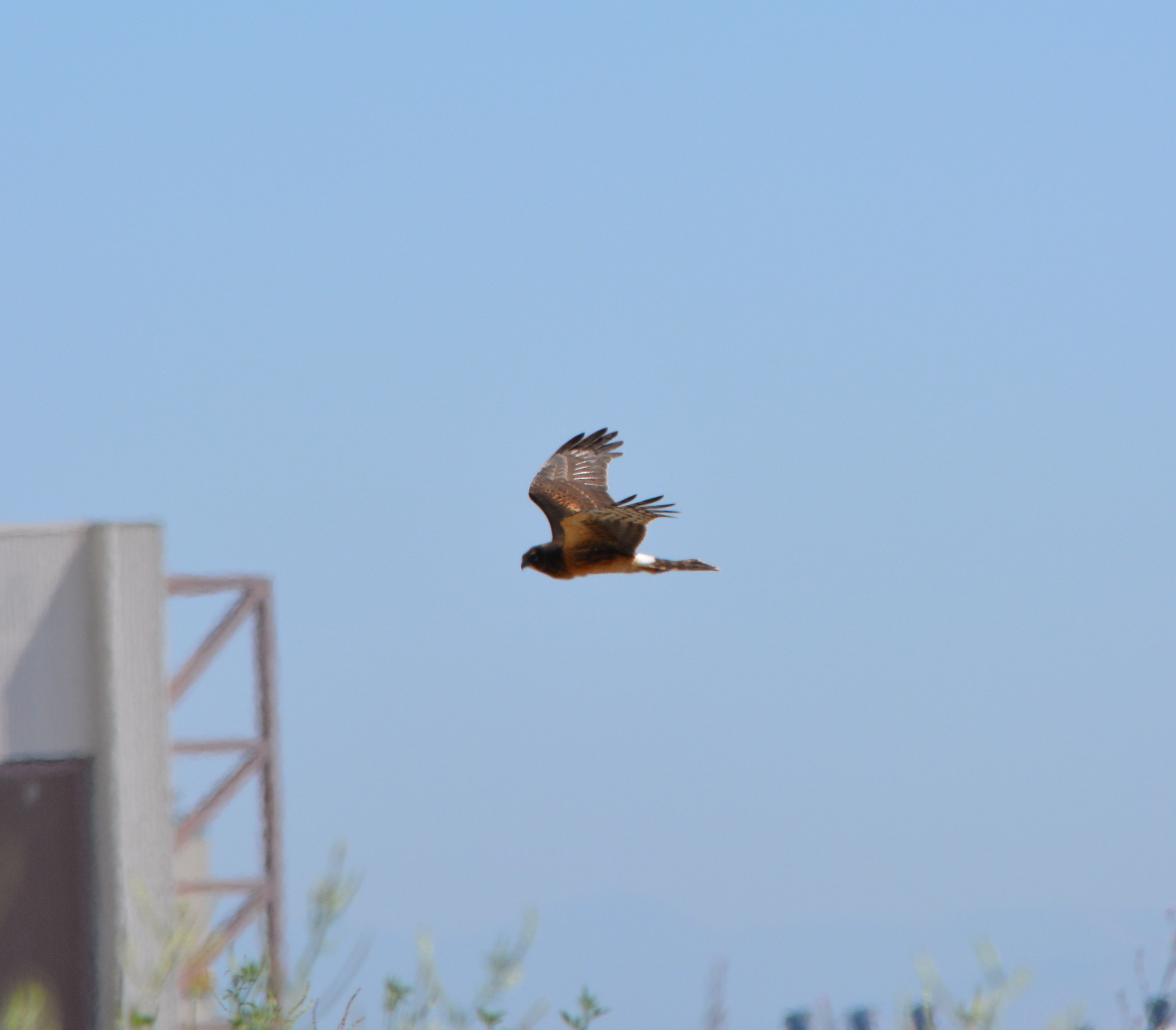
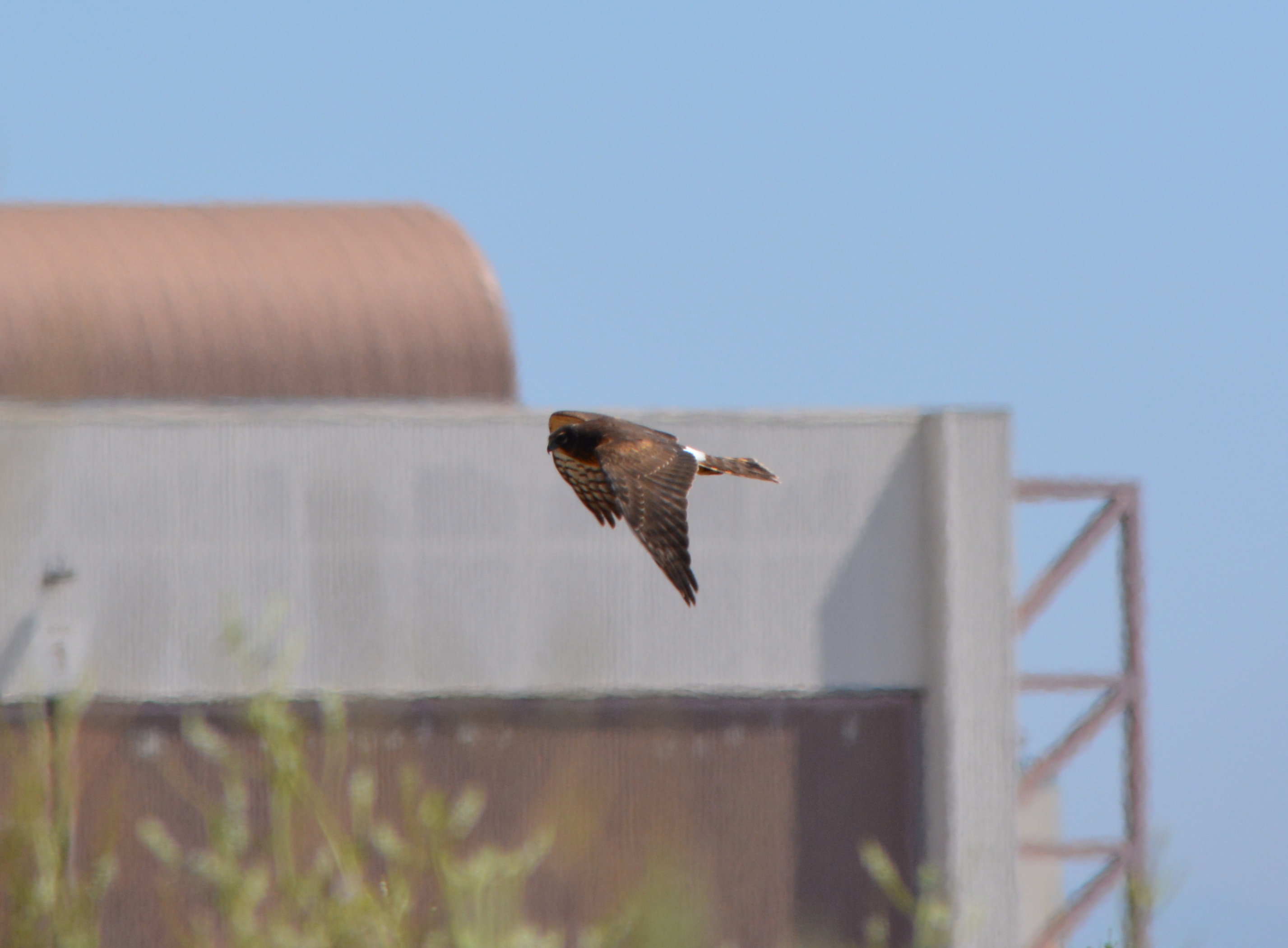
Red-tailed Hawks are regular visitors to the Nature Reserve on the former airfield at Alameda Point. The Northern Harrier, another type of hawk, also visits the reserve, but are fewer in number and harder to spot.
Red tails and harriers both like the wide open space and grassland where they hunt for prey, but they differ in their abilities to hunt. The red tails rely on keen vision and are able to hunt from great heights and distance. Harriers, on the other hand, rely on hearing in the same way that an owl does. The harrier’s face has characteristics similar to an owl that allows it to capture sounds and direct them to their ears. They have the ability to hear the sounds of small animals moving in the grass. They fly close to ground, sometimes within 10 feet, methodically moving about listening for movement.
Occasionally during the least tern nesting season red tails and harriers prey on the terns and have been trapped by the Fish & Wildlife Service and relocated further inland. Red tails can catch jackrabbits, but harriers might have a tough time with a full-grown rabbit and look instead for small rodents.
Adding more grassland on the periphery of the Nature Reserve would help the least terns by providing more hunting opportunities for predators away from the nesting site. These wild and magnificent birds are but two examples of why the Nature Reserve offers unique opportunities for wildlife habitat enhancement.
The two birds below were photographed in September of 2013.
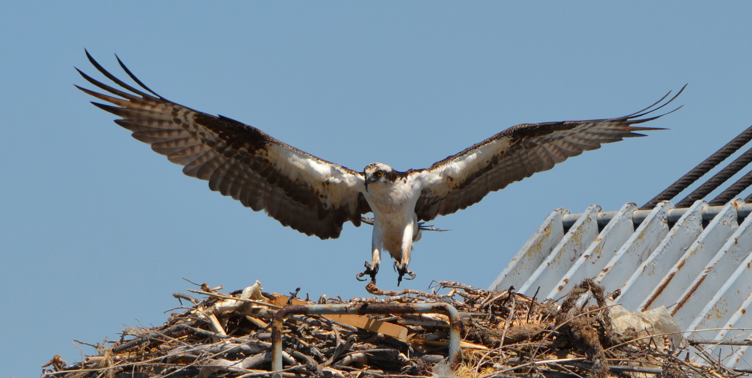
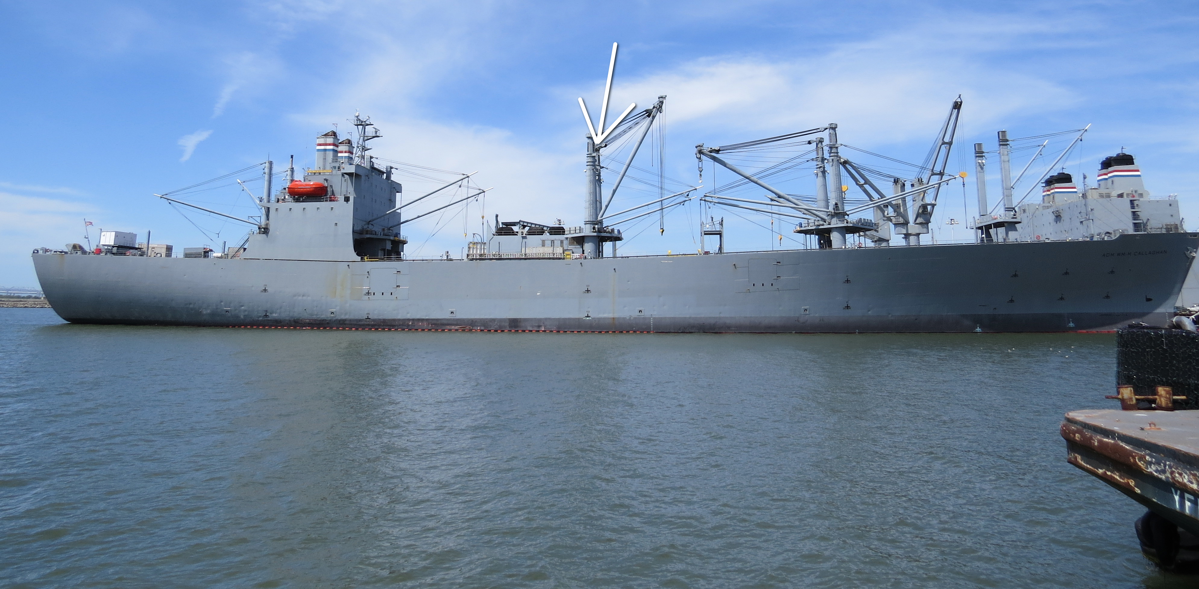
The ospreys returned to Alameda Point again in 2013 to nest, but not at their previous nesting site on the old light stand at the entrance to the Seaplane Lagoon. This year they settled atop one of the towering kingposts holding a cable and boom hoist on the maritime ship Admiral William Callaghan. Unfortunately, a third osprey interfered with the nesting pair.
Osprey landing on the kingpost nest on the maritime ship Admiral Callaghan docked at Alameda Point – May 2013.
As the month of March came in, Alameda wildlife biologist and birdwatcher Leora Feeney began checking to see if the ospreys had returned to their Seaplane Lagoon nest. While scoping out the surrounding area with her binoculars, Feeney spotted a returning osprey on one of the maritime ready reserve ships docked at Alameda Point. As the weeks went by, she noted that nest building and fishing were the order of business for the osprey pair on their new shipboard nest.
Osprey bringing in nest material for the Callaghan kingpost nest, with mate in nest – 2013.
On April 4, Feeney recorded in her osprey log that the female had settled deep into the nest as if incubating at least one egg. But a third osprey spotted two weeks earlier now became trouble, with the nesting male osprey seen escorting the interloper away.
“Incubation seemed the order of business during April, but on May 5th no birds were seen at the nest,” said Feeney. “This was not a good sign.” During following observations by Feeney, it became clear that another female osprey was visiting the pair often. “The pair tried to discourage her by flying around her and escorting her away,” said Feeney. But in doing so, the effort would leave the nest briefly unattended and vulnerable to the ever-present gulls looking to steal fish scraps or even an egg or a chick.
The maritime ready reserve ship Admiral William Callaghan stationed at Alameda Point. Arrow indicates nest location. Viewed from Pier 3 next to USS Hornet.
“The female interloper, however, was persistent. She appeared dirty, maybe oiled,” said Feeney. “And it became questionable if the nest had eggs or chicks. We were no longer seeing brooding,” said Feeney.
On May 20, the captain of the Callaghan generously agreed to allow a few interested parties to climb up to the bridge and higher to look down into the nest to gather more information. No eggs or chicks were seen. “But it didn’t help much to understand this year’s osprey story,” said Feeney. “A strong theory is that the interloper disturbed the nesting pair more often than my brief visits detected,” she said. “The other ‘woman’ may have allowed enough distraction for the active nest to be pirated by gulls.”
It was hoped that a second nesting attempt might occur, but it didn’t. “There is always concern about adequate food availability and sufficient experience when birds nest,” said Feeney. “And now we see competition is part of the game.”
No one can say for sure what caused the failure. “It is interesting, however,” said Feeney, “that two ospreys were still seen standing at both the 2012 nesting site that fledged one healthy big osprey and the 2013 ship nesting site as recently as August 23.” “This site tenacity gives us hope that they will return in 2014.”
2012 osprey nest at Seaplane Lagoon. Adult bringing in fish as young osprey watches.
Landing in the nest after earlier brooding behavior had ended.
Osprey mating activity.
Nestbuilding 2013 on the Callaghan maritime ship at Alameda Point.
Osprey in the nest after nesting effort was disrupted by a second female.
Osprey on the Admiral Callaghan hoist system – 2013 Alameda Point.
Video of osprey attempting to mate again after earlier nesting effort was disrupted by a second female.
Under the petroleum cleanup program the Navy has been removing tanks and fuel lines and cleaning up spills and fuel leaks dating back to the early 1990s before the base closed. Most of the tanks and fuel lines were removed within three years after the base closed in 1997.
Cleaning up leaked and spilled fuel has been slower, often involving running a vapor extraction pump 24/7 for years. In a few cases, a groundwater contamination site will require a callback after the initial work is completed. The Navy’s routine monitoring of groundwater, even after cleanup work has been completed, is aimed at determining whether there is a rebound in contamination readings and follow-up treatment is necessary. Three such sites needing more work, on land recently acquired by the city, are currently undergoing follow-up treatment at the Navy’s expense.
Two of the sites once served as automobile service stations. The other site is where fuel was removed from planes before they were serviced.
Former location of gasoline service station and car wash operated between 1971 and 1980 where fuel leaked into the ground. Part of the site is receiving follow-up cleanup work. Near intersection of Main St. and Pacific. Soccer field in background.
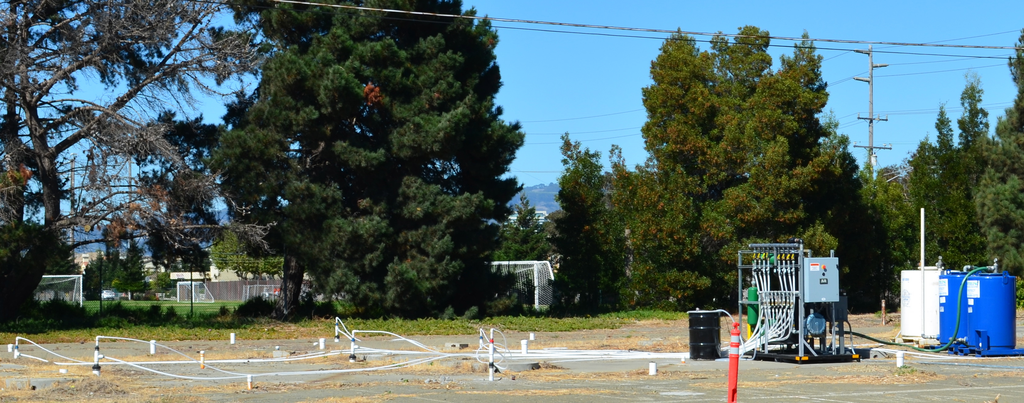
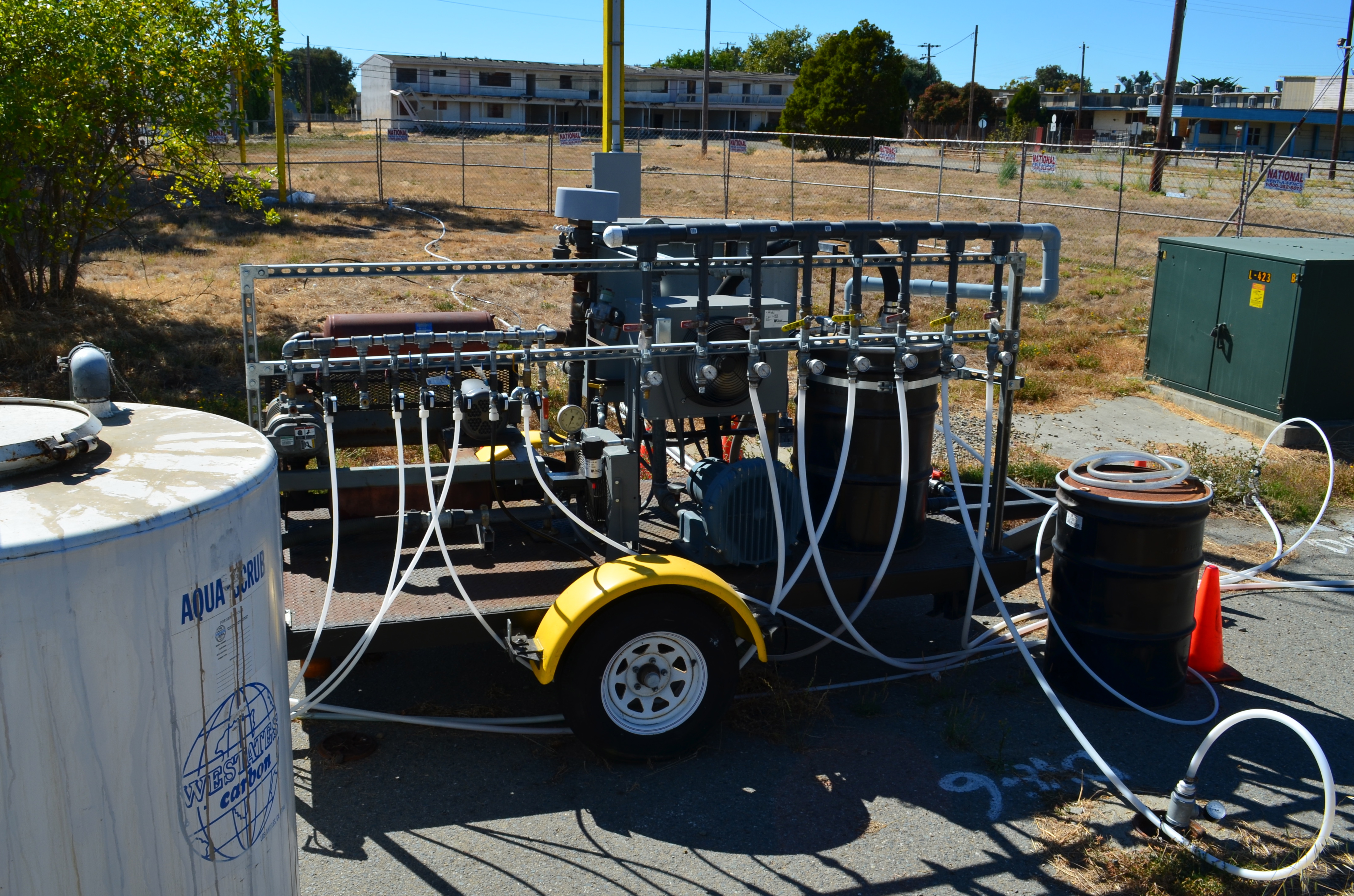
The treatment method is simple. Air is pumped into the ground where the contamination is the highest. This causes the petroleum products to vaporize, and then a suction system draws out the vapors into a barrel of charcoal. The air injected into the ground also helps natural petroleum-digesting bacteria to grow.
Petroleum cleanup site receiving follow-up cleanup next to Main St. across from Bayport. Site was former location of Navy auto service station.
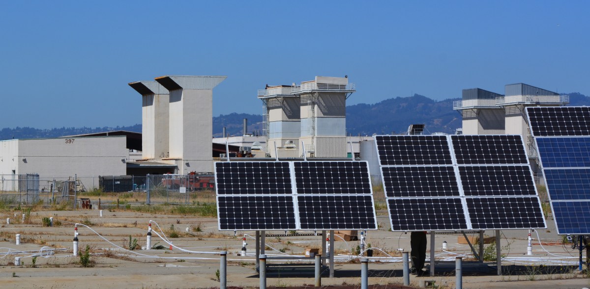
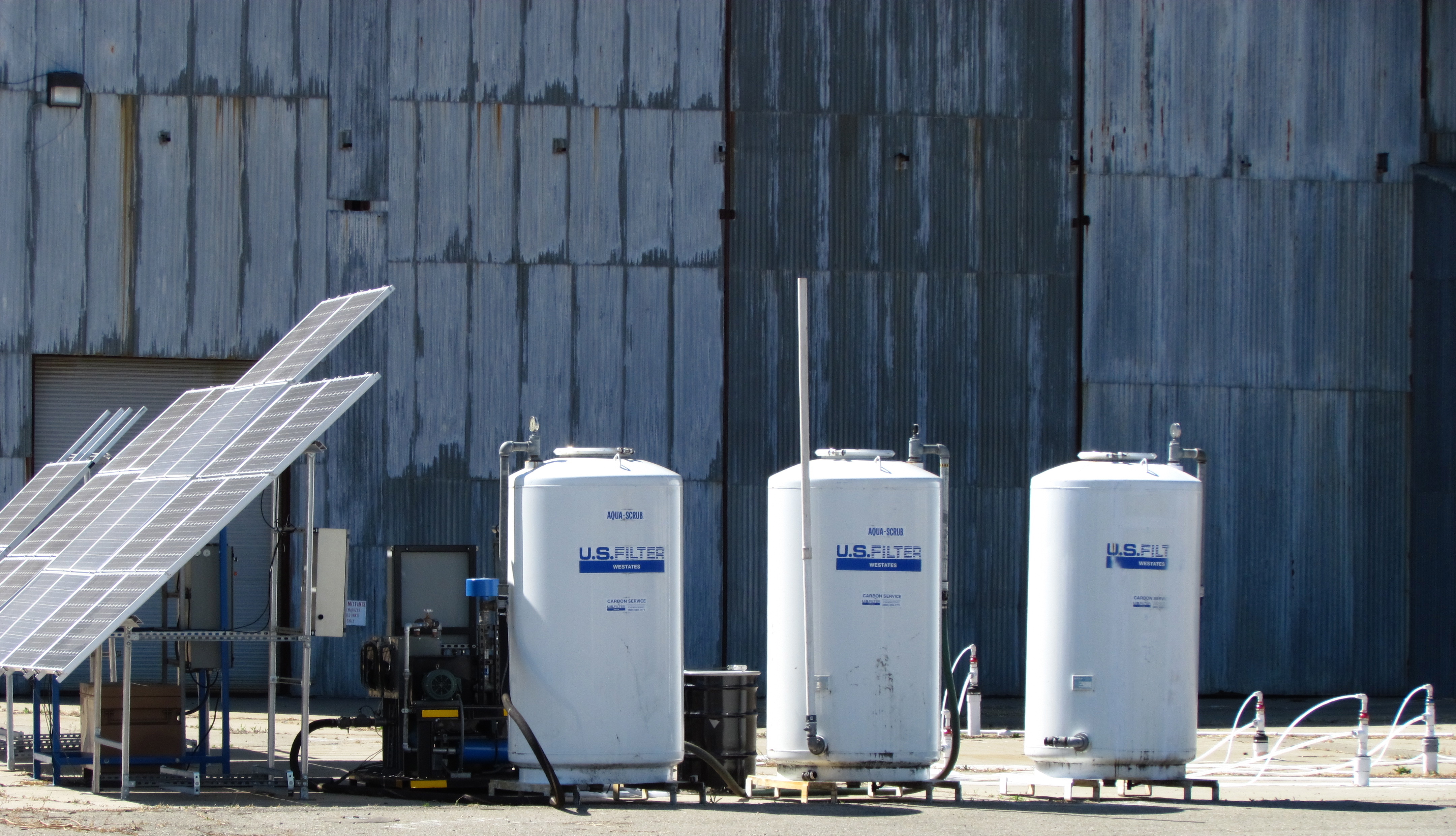
Solar-powered cleanup for the first time at Alameda Point
Air injection/extraction pumps at the two former service station sites are running on electricity from the grid. At the former plane de-fueling site next to Building 410, however, the Navy is using a solar-powered pump for the first time anywhere at Alameda Point. Derek Robinson, the Navy’s Environmental Coordinator, explained the solar choice saying, “Electricity is not optimum because the overhead electrical tie-in is located too far away for the system to be tied in to the grid cost effectively. The solar units provide the power necessary to operate the air sparging and soil vapor extraction system at a competitive price.” The only other option was a combustion engine pump running on gas or diesel.
“The battery storage system is traditional lead/acid batteries,” said Robinson. “The solar array charges storage batteries allowing the system to store energy and operate in cloud cover and beyond strictly daylight hours; however, the system is designed to power off the blowers once the voltages drop below a preset level,” he said.
Sustainable Technologies, located just a block away at Alameda Point, constructed the entire rig. It consists of solar panels, a box full of lead-acid batteries, a circuit panel, and a pump. Ironically, Sustainable Technologies is located on a Superfund site that will take another six years to clean up.
Solar-powered cleanup at Building 410.
The area next to Building 410 where the fuel spills occurred has had a number of cleanup actions going back to 2002. “Corrective actions under the petroleum program were conducted in 2002 and 2011 and a remedial action under the CERCLA [Superfund] program was conducted between 2005 and 2006,” said Robinson.
Work will continue until the end of the year. The Navy will always be responsible for returning to do more cleanup work if groundwater testing shows some of the contamination was missed.
Locations of three petroleum cleanup sites currently undergoing more cleanup work.
Returning part of the Seaplane Lagoon shoreline to nature is one of the biggest changes that have emerged in the planning process at Alameda Point. The design proposal for the western side of the Seaplane Lagoon echoes the major theme of the Greenspace Project of Golden Gate University’s Center on Urban Environmental Law – the interconnected ecosystem.
From Town Center and Waterfront Precise Plan presentation to Planning Board. (click on map image to enlarge)
The draft Town Center and Waterfront Precise Plan for the Seaplane Lagoon and eastern entrance area, presented to the Planning Board on August 21, offers a number of new concepts, including moving the proposed marina from the west side of the lagoon to the east side. The waterfront plan is being refined concurrently with zoning changes, an environmental impact report, and a master infrastructure plan, which are all aimed at providing the level of detail necessary for the city to start marketing property to investors in 2014.
In reporting to the Planning Board on design plans of the city’s consultant, Skidmore, Owings and Merrill (SOM), city staff stated: “Due to the vast scale of the study area and the Seaplane Lagoon as its centerpiece, the Town Center will be able to support a wide variety of unique waterfront experiences—some of which build and expand upon existing assets and activities, some of which introduce entirely new opportunities. SOM proposes the following four waterfront zones and experiences:
1. Natural environment—along the western edge of the Seaplane Lagoon with trails, docks, camping, outdoor sculpture and wetlands.
2. Promenade and recreational opportunities—along the northern edge, with early phased soccer fields, food concessions, bike and pedestrian paths, open lawn, and kayak access.
3. Urban edge—along the eastern side and portions of northern edge with marinas, docks, eating patios, overlooks, and ferry service.
4. Industrial—further south on the eastern side with maritime uses located near the MARAD ships and the USS Hornet.”
From Town Center and Waterfront Precise Plan presentation to Planning Board.
Climate adaptation grant funding needed – As currently envisioned, however, the de-paving, removal of buildings, and alteration of the western Seaplane Lagoon shoreline area is put off into the distant Phase 3 future — a decade or more from now — when presumably a surplus of infrastructure funds will allow for implementation. One option available for timelier implementation would be to begin now seeking grant funding from agencies that focus on shoreline climate change adaptation. There will be no commercial development on the western side of the lagoon, and therefore the project would become a public asset.
Lying directly to the west on the Nature Reserve is the Runway Wetland, whose habitat value would be greatly enhanced by a connection to the Seaplane Lagoon. Additionally, the draft Master Infrastructure Plan predicts a $10 million savings if the area were allowed to become tidal wetland as sea level rises.
Great Blue Herons with nest (left) and gulls on eastern jetty of Seaplane Lagoon. Heron is directly above proposed tidal marsh featured on map above. West shore of Seaplane Lagoon in background.Great Blue Heron standing in shallow Seaplane Lagoon area where tidal marsh is proposed.Sea Lion catching fish in Seaplane Lagoon. Floating haul out platforms would increase their presence.Black-crowned Night Heron poking around for food on eastern jetty of Seaplane Lagoon. One of the regular but seldom seen wildlife visitors.Alameda Point Channel in foreground that connects San Francisco Bay to the Seaplane Lagoon.
Unless otherwise noted, all photos are copyright Richard Bangert. Permission requests appreciated before reproducing. See “About” page for contact info.
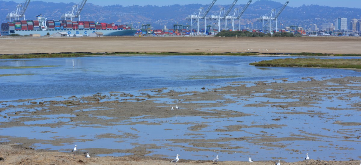
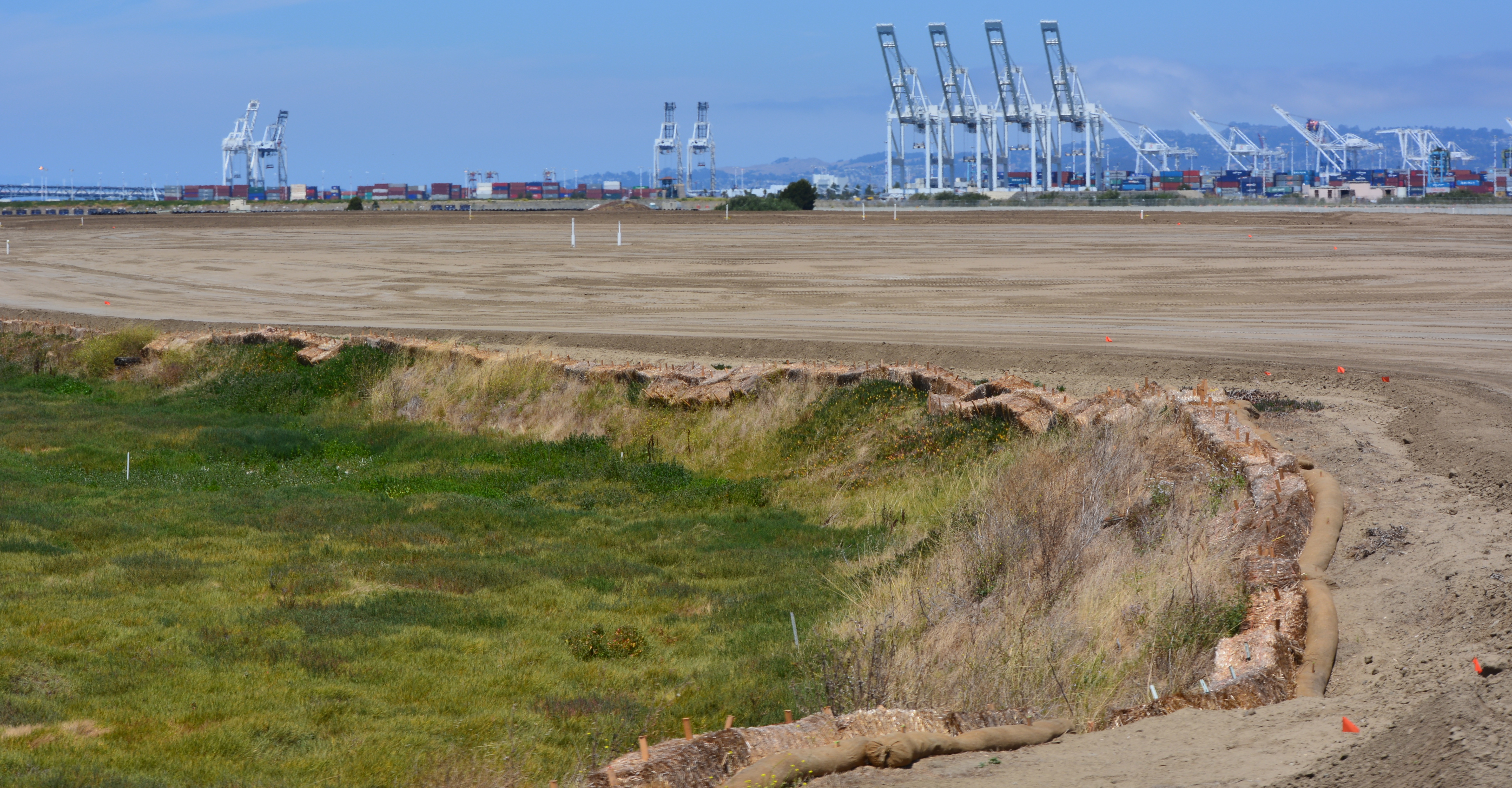
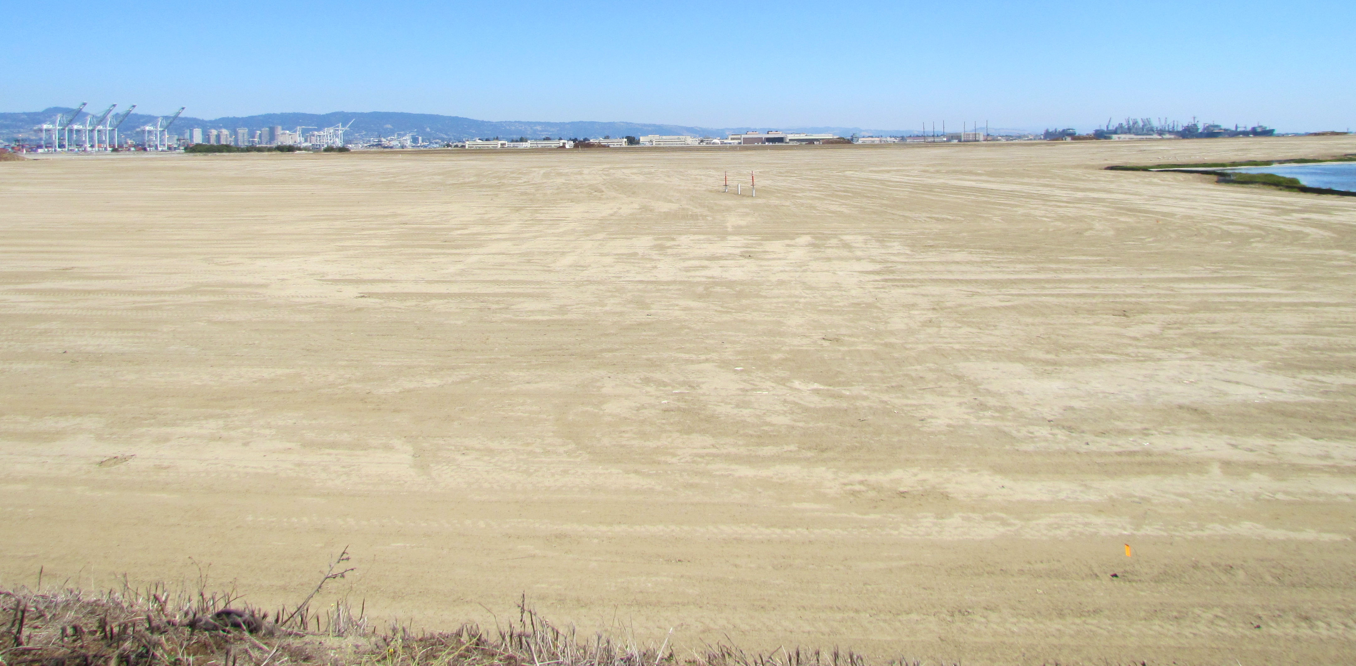
On August 3, 2013, the Navy’s annual environmental cleanup tour visited the worksite known as Site 2 on the southwest corner of Alameda Point. Work has been underway at the site since early this year, constructing a 79-acre soil cover atop the old waste disposal area. Due to budget cutbacks this year, only the Restoration Advisory Board was taken on the tour.
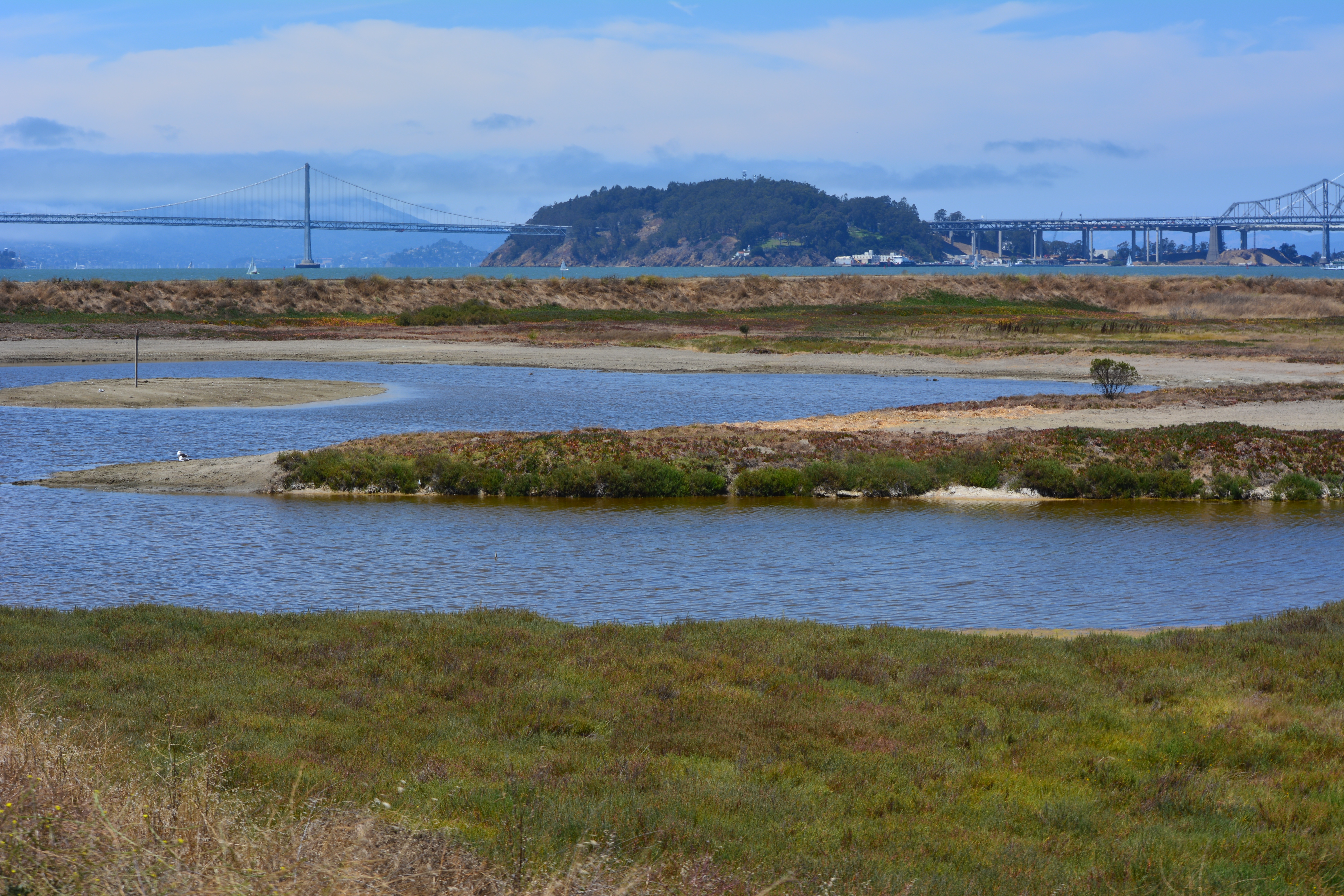
Transition from soil cover to wetland. Port of Oakland in background.
The site was closed for waste disposal in the mid-1980s and given a soil cover that did not meet landfill closure standards. For more than a decade after it was added to the Superfund cleanup program, the regulatory agencies and the Navy went back and forth about how best to close the site in an environmentally safe manner.
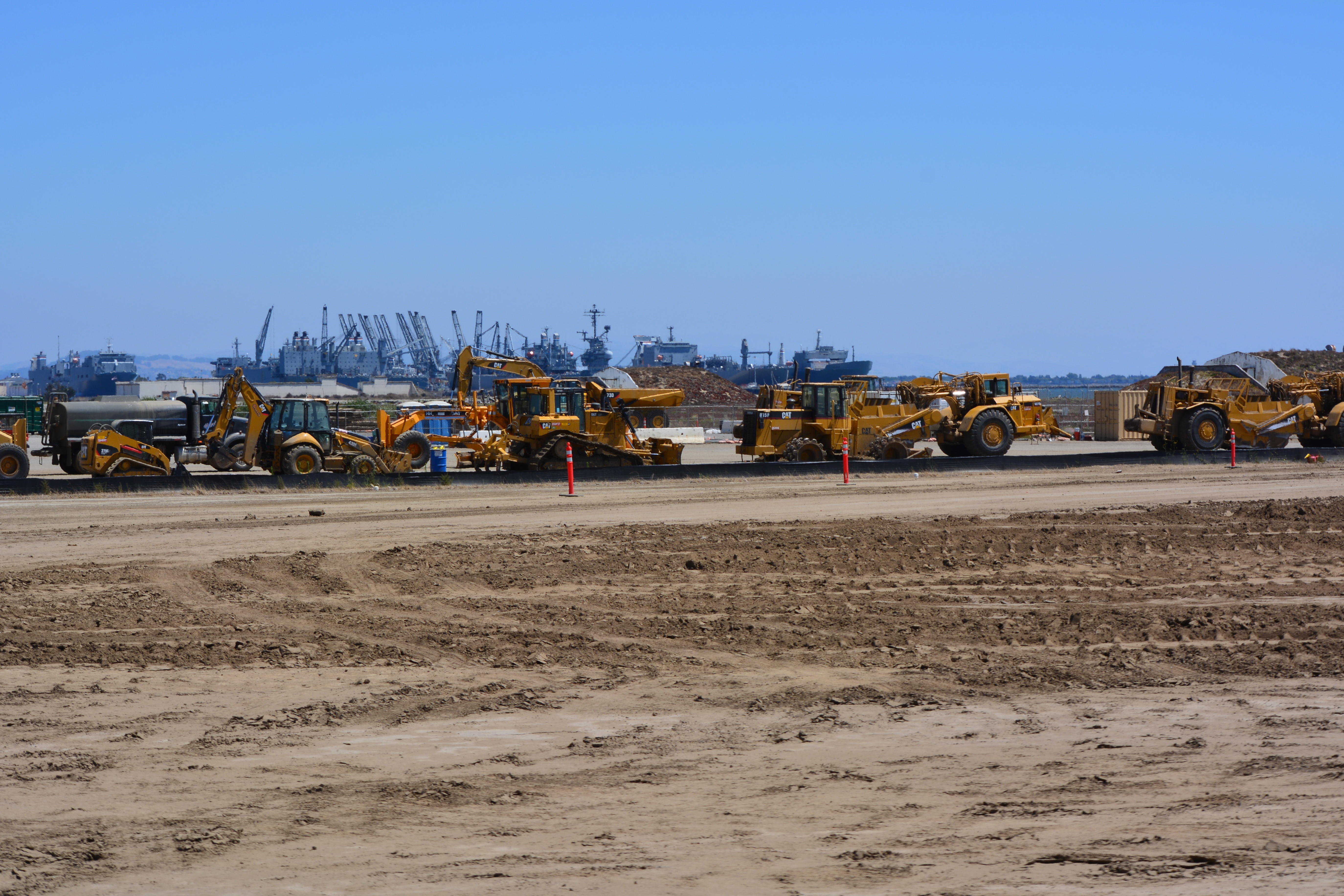
The slope of the soil cover is so important to the engineering design that the blades on the graders are not even controlled by the driver. Blades on the graders, and even the bulldozer, are controlled by an onboard computer that uses a GPS satellite to maintain a uniform elevation. The engineering concept for this soil cover is to minimize the slope so as to minimize movement in an earthquake, while at the same time providing for drainage.
Looking east at partially completed soil cover from the western shoreline of Alameda Point.
Soon the contractor will be laying down a 200-mil-thick HDPE geonetting material to act as a barrier to burrowing animals. Next, they will add two more feet of soil before installing monitoring equipment, drainage features, access road, and seeding the soil with a variety of California native grasses. Seeding is planned for this fall before the rainy season.
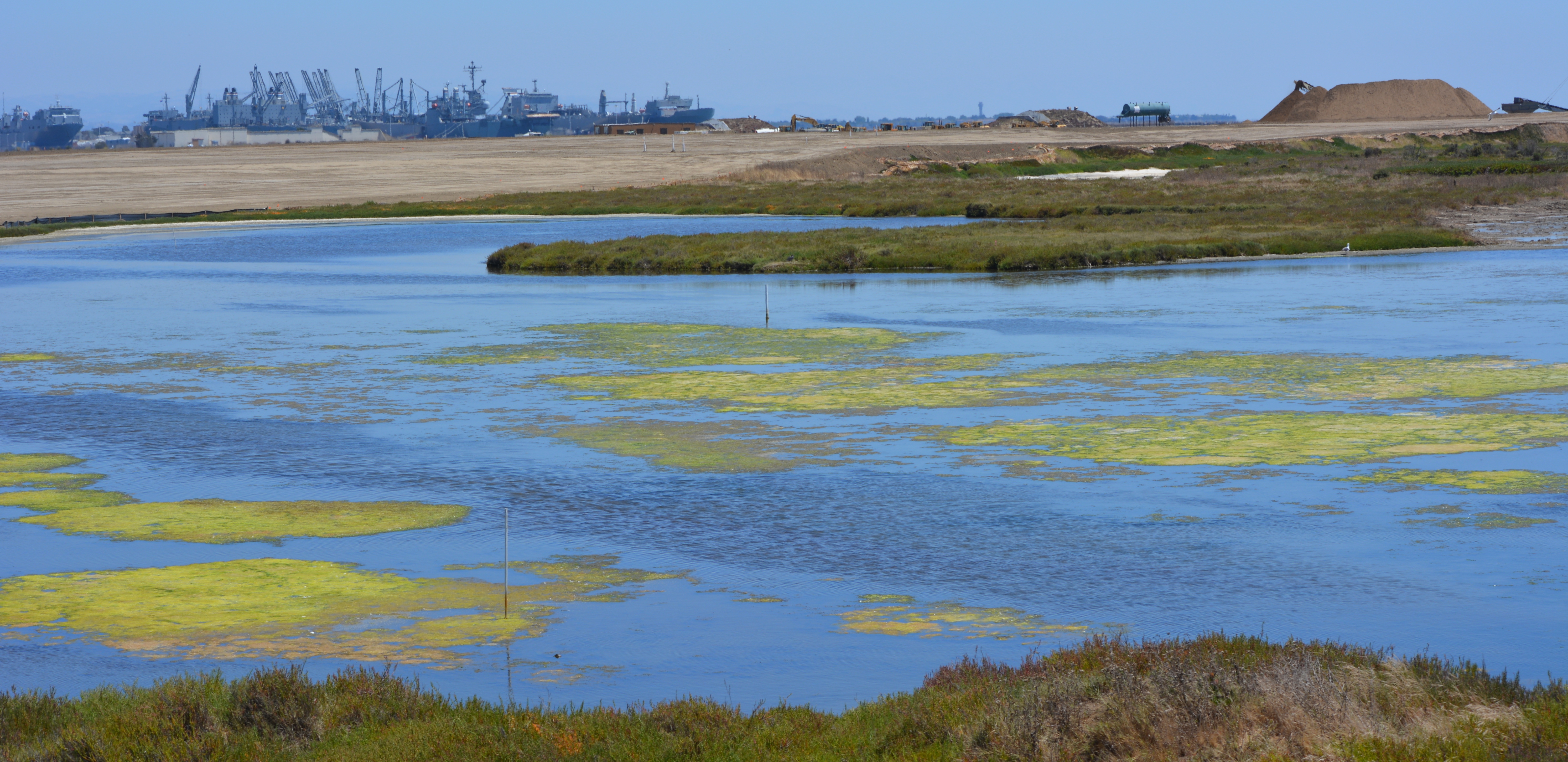
The 30-acre wetland area is not contaminated, but it will receive some upgrades with additional wetland. There is both a freshwater wetland area fed by rainwater, and a saltwater wetland area connected to San Francisco Bay via an underground culvert. The culvert will be replaced due to its age.
Partial view of wetland and soil cover on southwest corner of Alameda Point. Looking east with maritime ships in background.
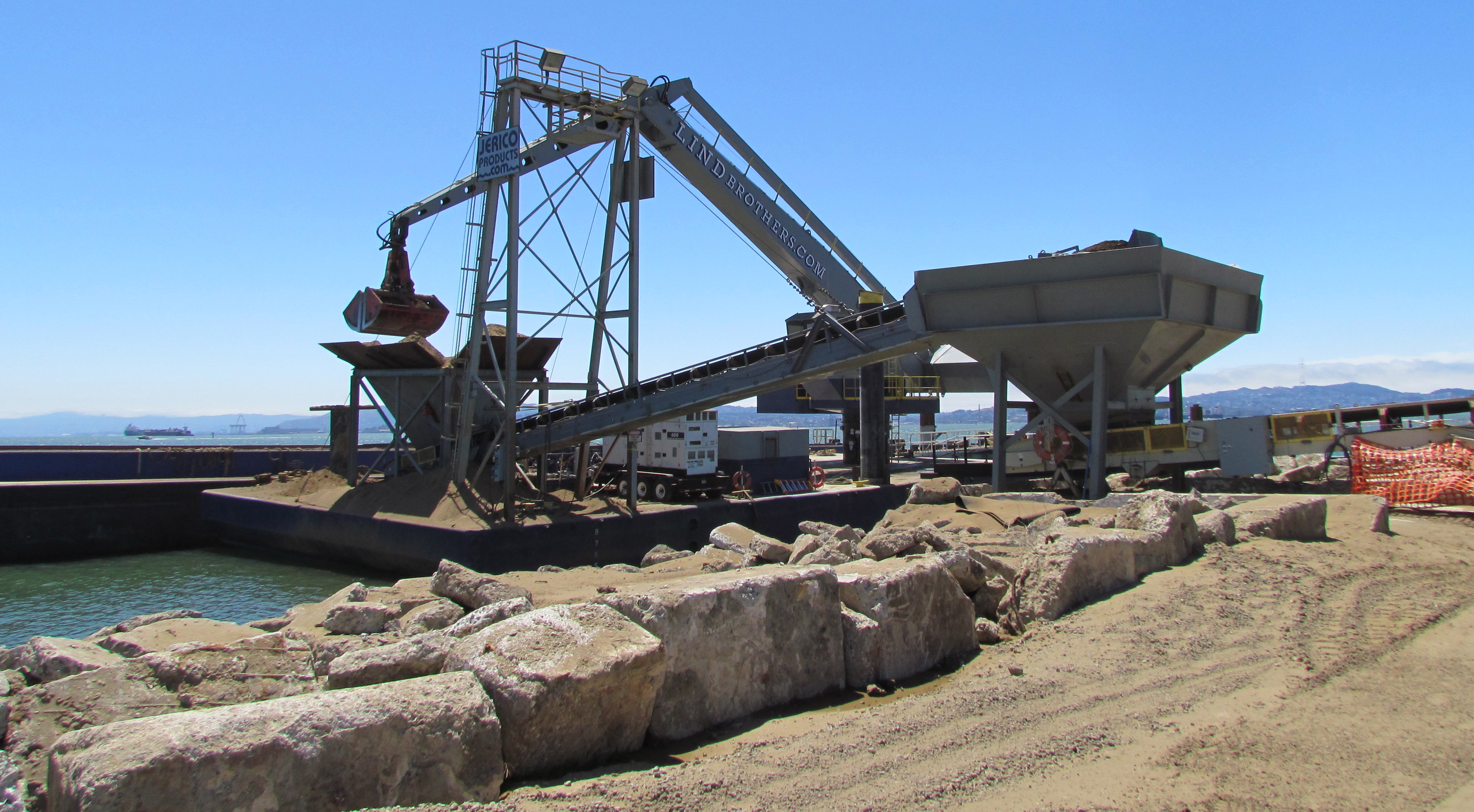
More than 600,000 cubic yards of soil is required to complete the project. Of that amount, 110,000 cubic yards have been recycled from the Seaplane Lagoon dredging after it tested clean. The rest is being barged in from Decker Island in the Sacramento River near the town of Rio Vista.
Soil from Decker Island being off loaded from barge at southwest corner of Alameda Point.
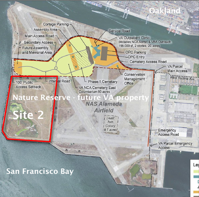
This 110-acre project site, featuring the most scenic viewpoint in all of Alameda, will be transferred to the U.S Department of Veterans Affairs (VA) along with another 400 acres of the Nature Reserve, and 112 acres for the VA’s clinic and columbarium. A nearby public access area on the western shoreline will be developed when the VA completes their road along the northern perimeter of the columbarium to the western shore. The Bay Trail will eventually run along the shoreline.
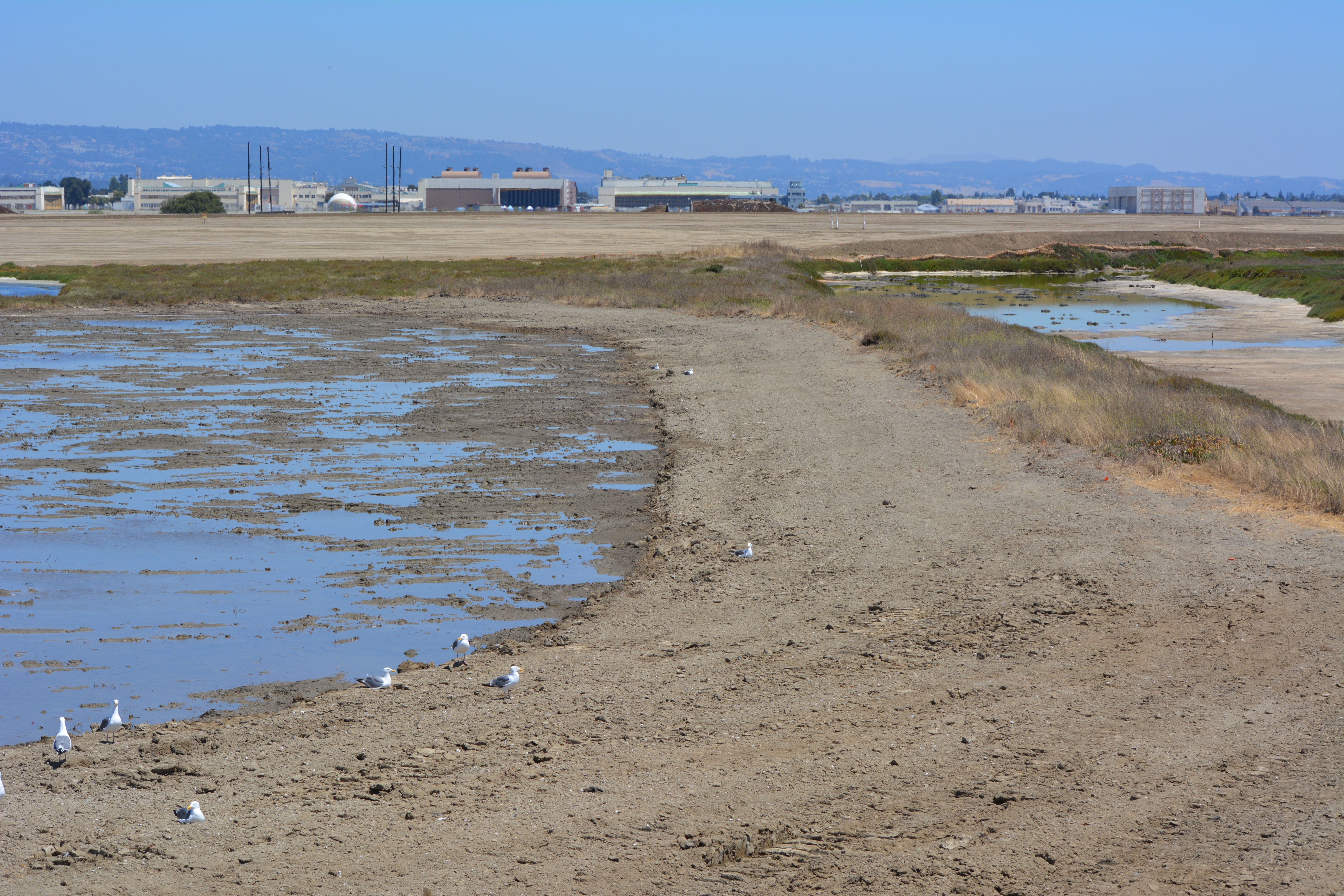
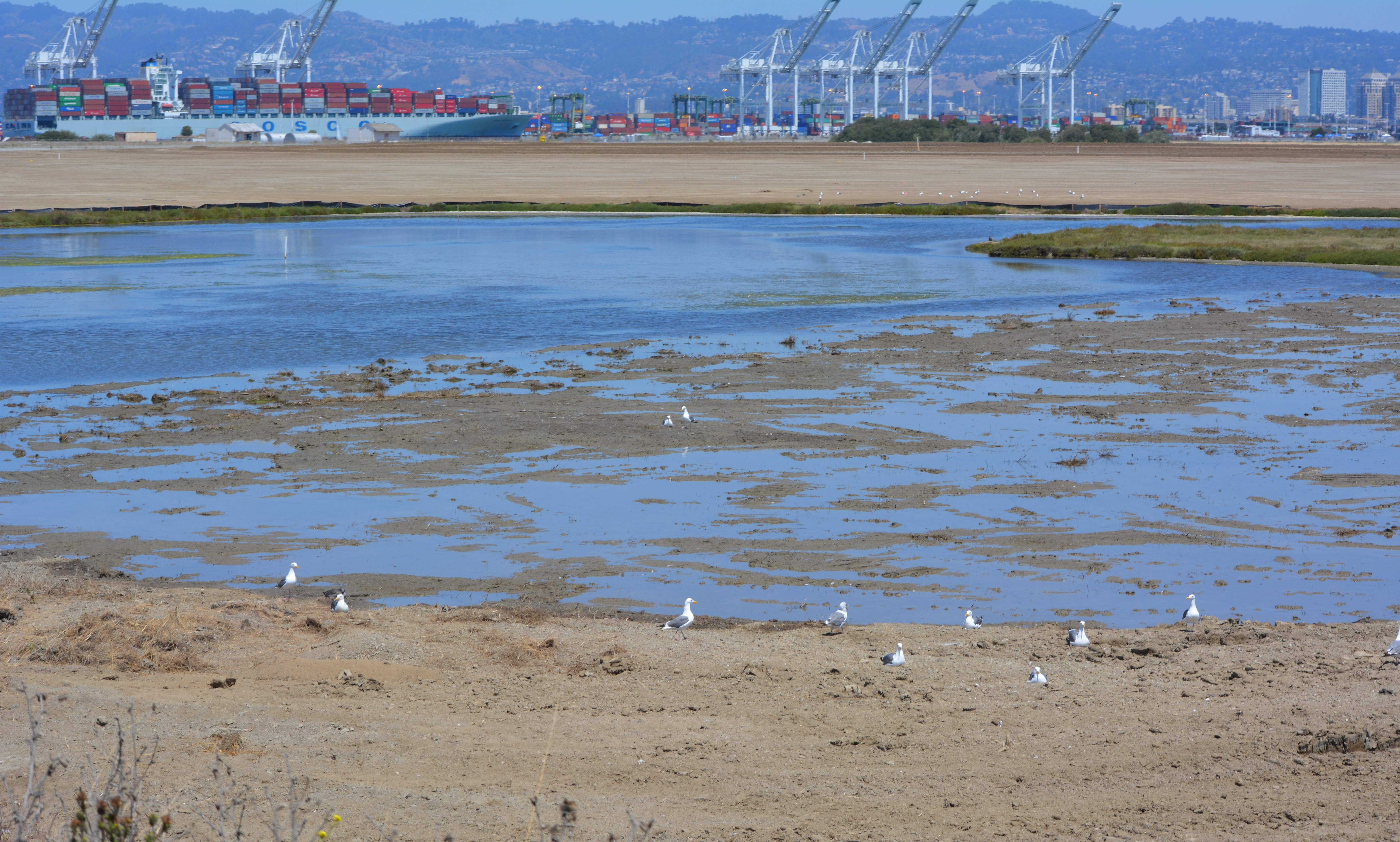
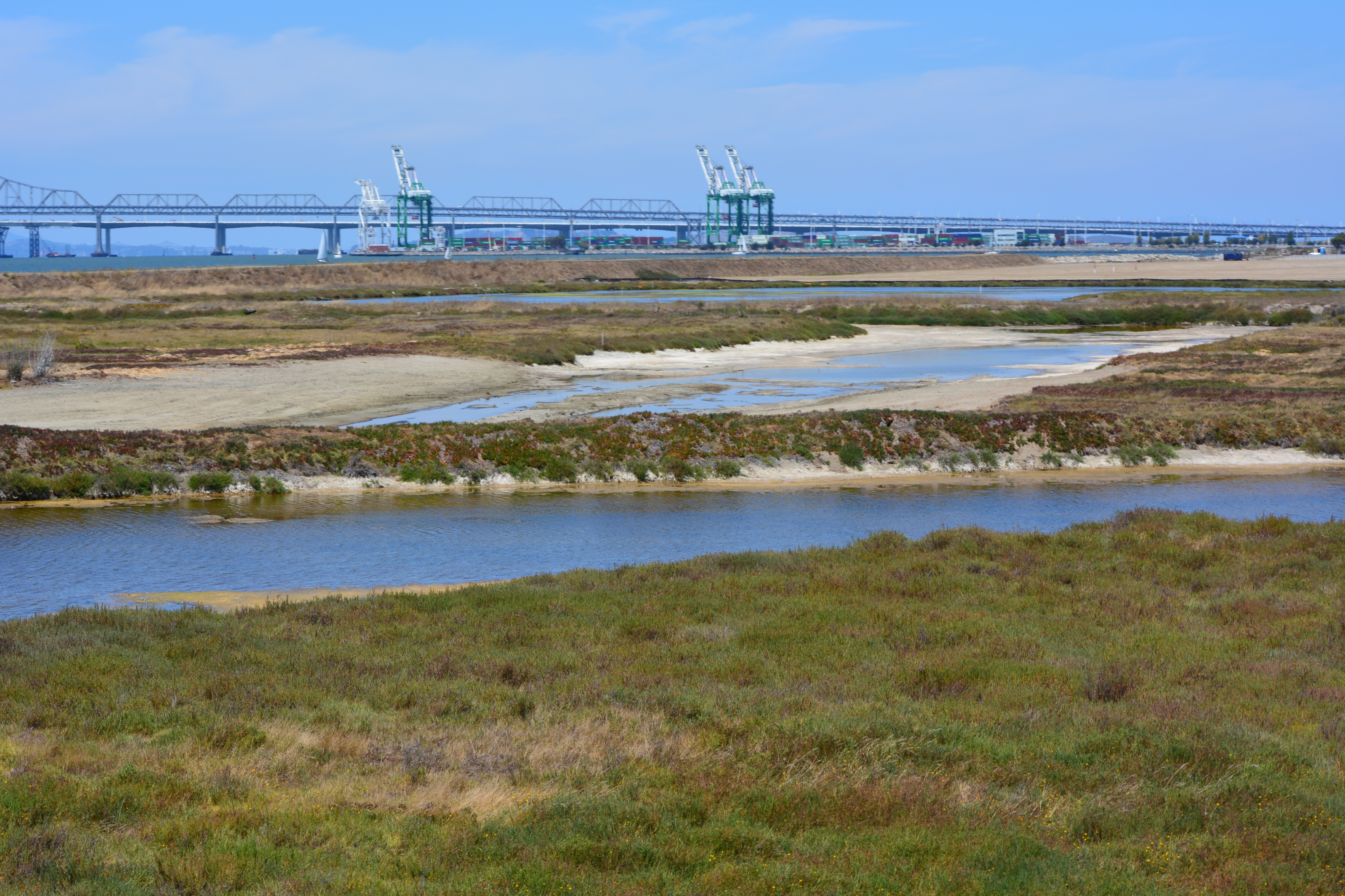
Partial view of wetland area on Site 2 – Alameda Point Nature Reserve. Bay Trail will be on the other side of the embankment that runs along the far side of wetland area.Wetland on the left connected to San Francisco Bay. The muddy part in the photo was recently added and will be allowed to naturally revegetate. Freshwater wetland to the right. Looking east toward hangars.North Pond wetland connected to San Francisco Bay. Port of Oakland in background.Wetland area on Site 2 looking north from southern perimeter of the site.Off loading soil from barge for Site 2 soil cover at Alameda Point. Southern shoreline.Construction equipment at Site 2. Looking east with maritime ships in background.VA project at Alameda Point with adjacent Nature Reserve that includes Site 2 remediation area.