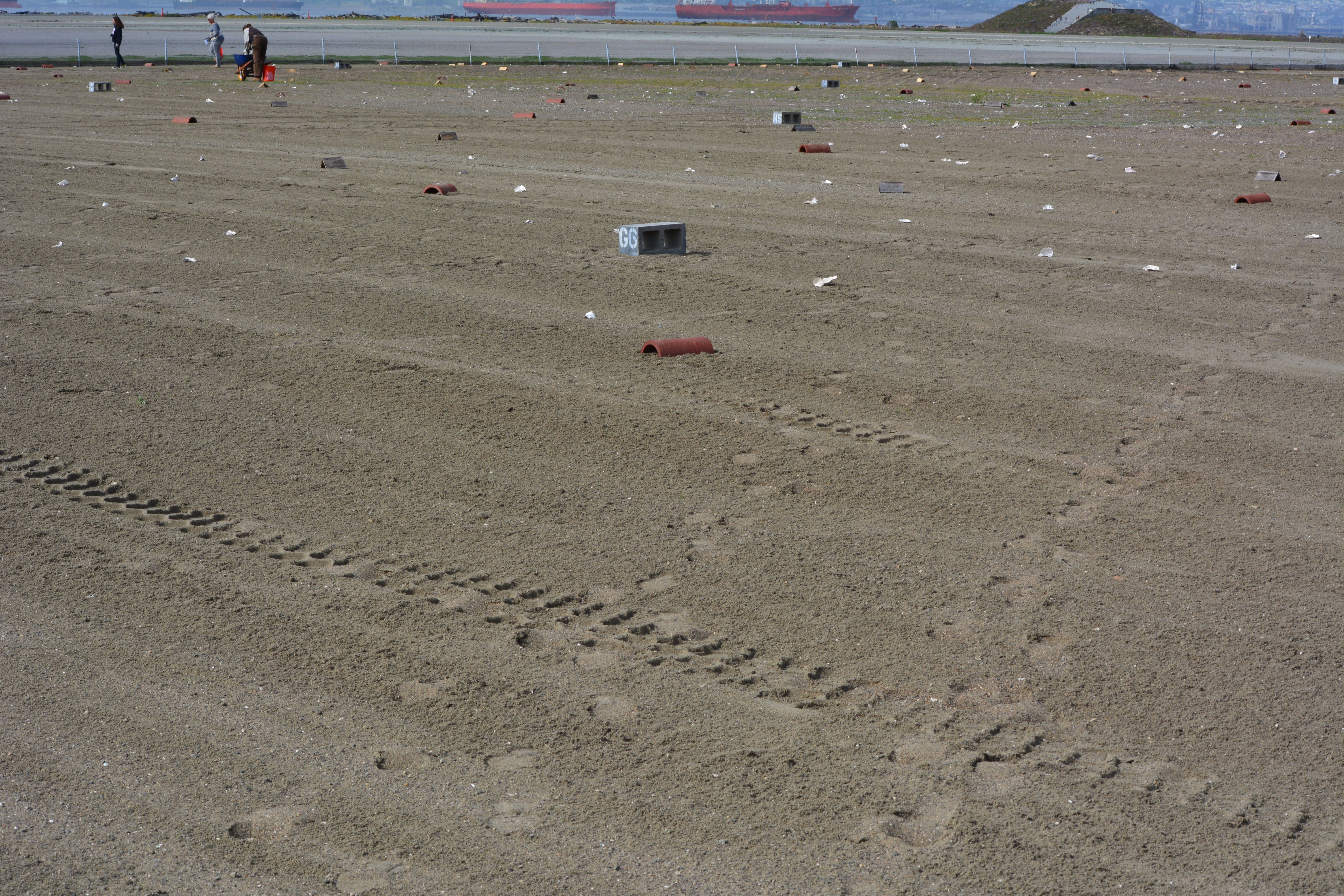
The 9.7-acre nesting area for the endangered California least terns at Alameda Point received a new layer of sand this year. Sixty dump truck loads of sand were delivered to the site on the old Navy airfield in March, paid for by the U.S. Fish & Wildlife Service (USFWS).
Fresh layer of sand on Alameda Point least tern nesting site. Looking south, with ships in San Francisco Bay in background.
After the sand was moved into place, USFWS and volunteers set up a numbered cinderblock grid system used for recording behavior and also distributed chick shelters and oyster shells for the chicks to use as protection from the elements and predators.
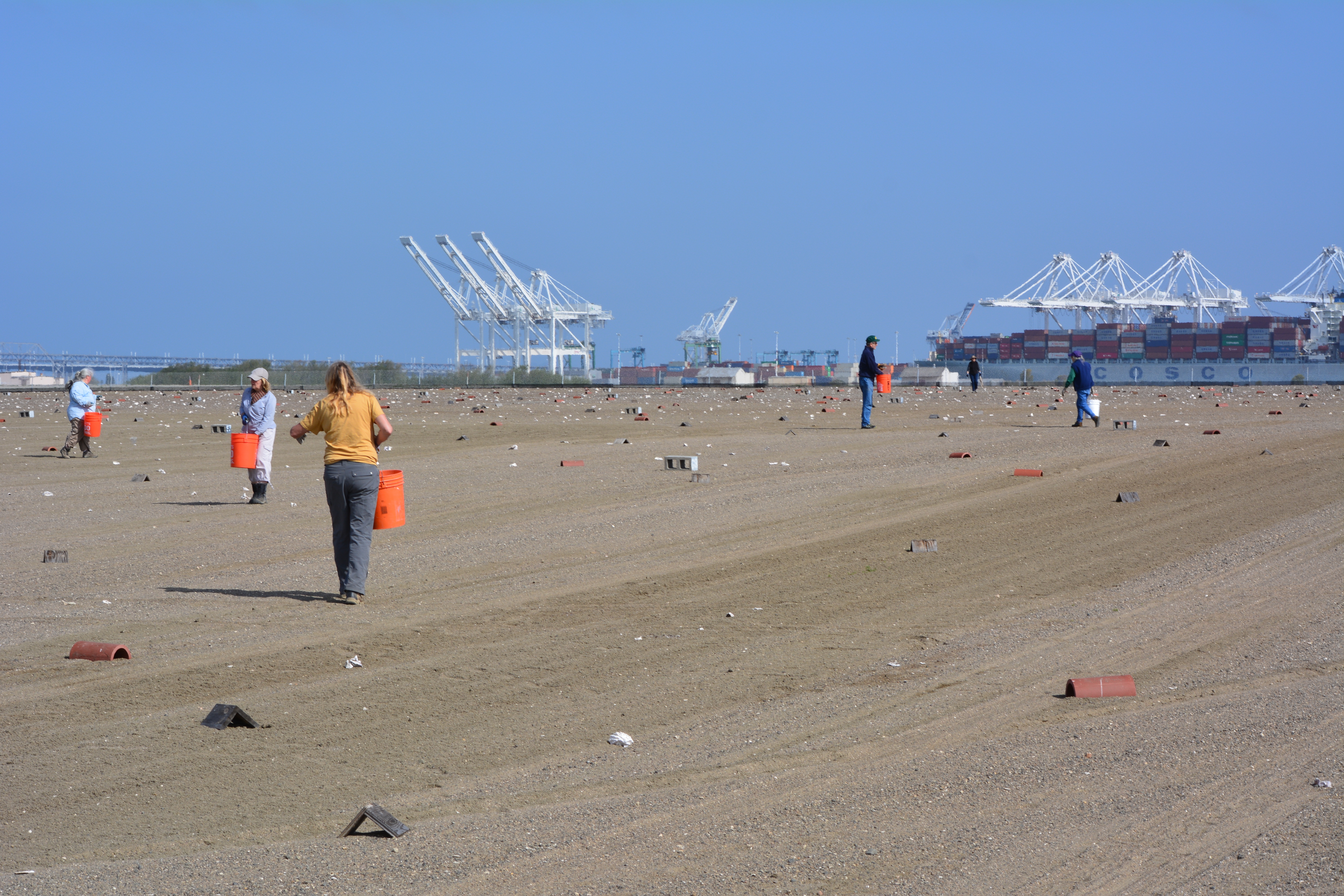
On Sunday, April 13 a dozen volunteers showed up for the last work party prior to nesting. The task of the day was distributing oyster shells around the site, which provide a nominal amount of sun protection for chicks and, in theory, helps make it more difficult for avian predators like red-tailed hawks and peregrine falcons to spot the chicks amongst all the white shells.
From now until the end of the nesting season in mid-August, volunteers will be participating in another program called the Tern Watch Program. Participants monitor behavior and watch for predators from their vehicles outside the nesting area.
Throughout the nesting season a USFWS biologist makes periodic walks through the site and places numbered plaster markers next to nests so that the number of eggs and success rates can be accurately recorded. If there are three eggs in a nest one week, for example, and one egg the next week with no chicks, it’s an indication that predators have grabbed the eggs.
Each year following the end of the nesting season in August, volunteers at monthly work parties gather up the oyster shells, the wooden A-frames, drain tiles, grid markers, and the hundreds of numbered markers used to identify nests. Clearing the site makes it easier to remove weeds and grade the sand, which can erode during rains. The volunteers pull weeds from inside and around the perimeter of the fenced-in site. The volunteer program during the non-nesting season is organized by the Golden Gate Audubon Society’s Friends of the Alameda Wildlife Reserve committee, in conjunction with the USFWS biologist in charge of the Alameda Point tern colony.
The effort to protect the least terns was begun by the Navy when nesting activities were first noticed in the 1980s. The likely reason for the terns choosing such an unlikely place to nest was the absence of people who might trample on the nests. The nesting site was chosen by the terns, not by the Navy or USFWS, and has been expanded to its current size as the colony expanded. The sandy substrate that approximates the traditional beach nesting habitat for terns is on top of old airfield pavement. Due to erosion caused by wind and rain, the sand has to be periodically replaced, as it was in 2009 and 2011.
Training sessions for this year’s Tern Watch Program will be held at the USFWS office at Alameda Point on April 26, April 30, May 28, and May 31. Volunteers do not have to be a bird expert, just be very interested in observing and reporting about them. Participants are required to attend one training session and commit to signing up for a minimum of three of the 3-hour shifts. Also required are binoculars, cell phone, and personal vehicle. Reservations for the training sessions can be made by calling Susan Euing at 510 521-9717 or by emailing susan_euing@yahoo.com. Directions and registration materials will be sent by email.
The annual Return of the Terns bus tour to the nesting area will be held on June 14 this year. The tour departs from the Crab Cove Visitor Center in Alameda. Registration required through the East Bay Regional Park District’s website or at the visitor center.
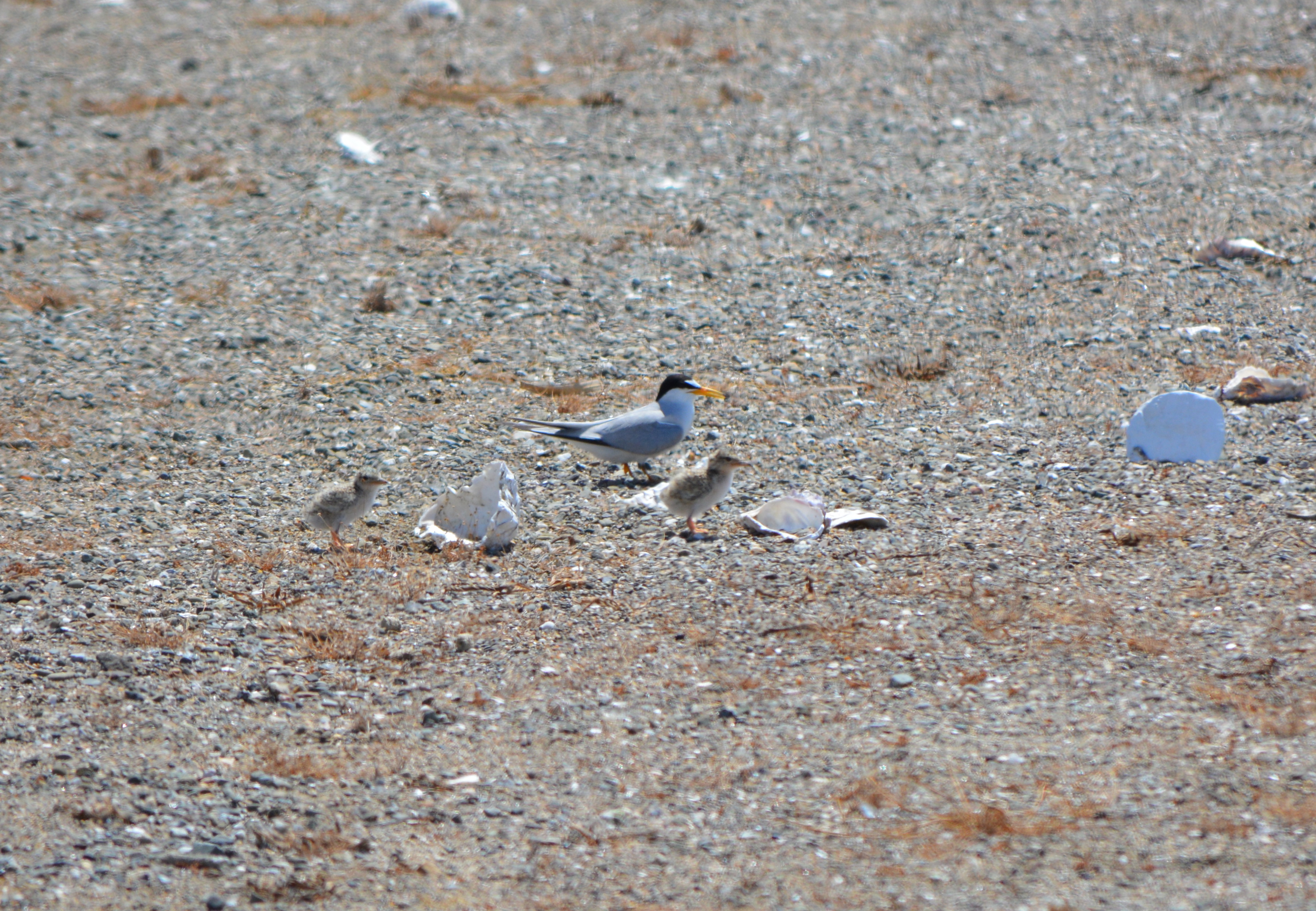
Adult least tern with chicks next to oyster shells at Alameda Point, June 15, 2013, during the Return of the Terns tour. Plaster marker with number on reverse side is to the right.April 13, 2014 work party, looking north, with Port of Oakland in background.Killdeer sitting on four eggs in the least tern nesting area on April 13, 2014. It is not uncommon for a few killdeer to nest among the terns. Killdeer lay their eggs about a month before the terns lay eggs.
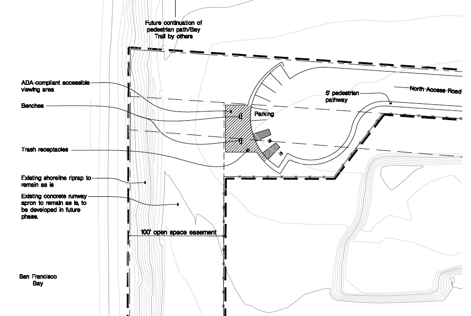
The San Francisco Bay Conservation and Development Commission (BCDC) gave its approval for the shoreline access provisions of the Veterans Affairs’ (VA) project at Alameda Point at its January 16, 2014 meeting. The VA submitted plans that include a public road with sidewalk and bike lane leading to the western shoreline, a one-acre parking and observation area at the shoreline, restrooms, drinking fountains, long term maintenance, and a shoreline easement for the city to construct the Bay Trail. The VA’s plan reflects collaboration with BCDC staff and the City of Alameda.
Some of the BCDC commissioners were concerned about the size of the undeveloped buffer area for the California Least Terns that nest on the former airfield, and the lack of public access on the proposed Bay Trail from April 1 to mid-August while the terns are present. Other commissioners were concerned that the VA and the Army Corps of Engineers had not finalized a plan to mitigate wetlands that the VA project will cover up.
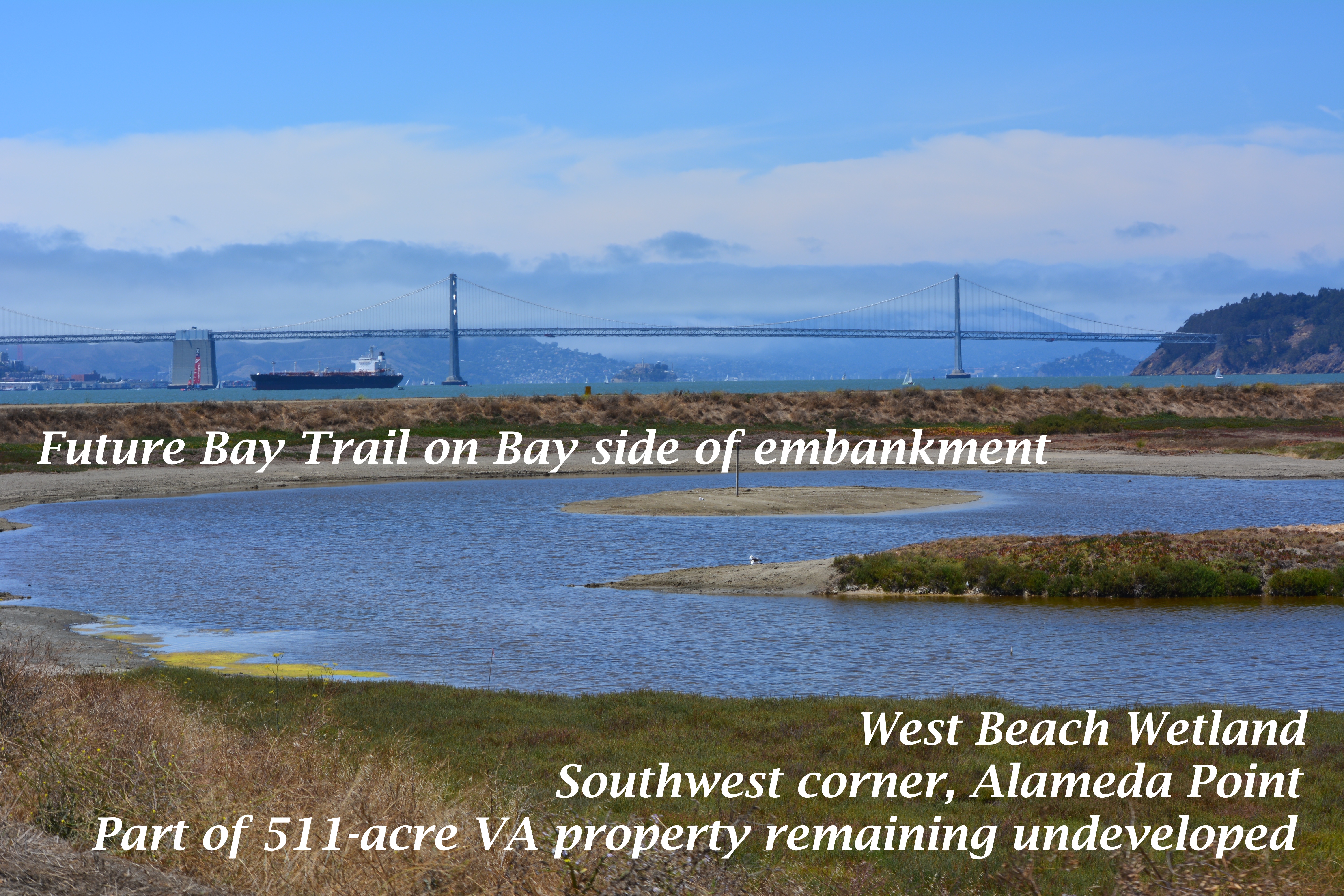
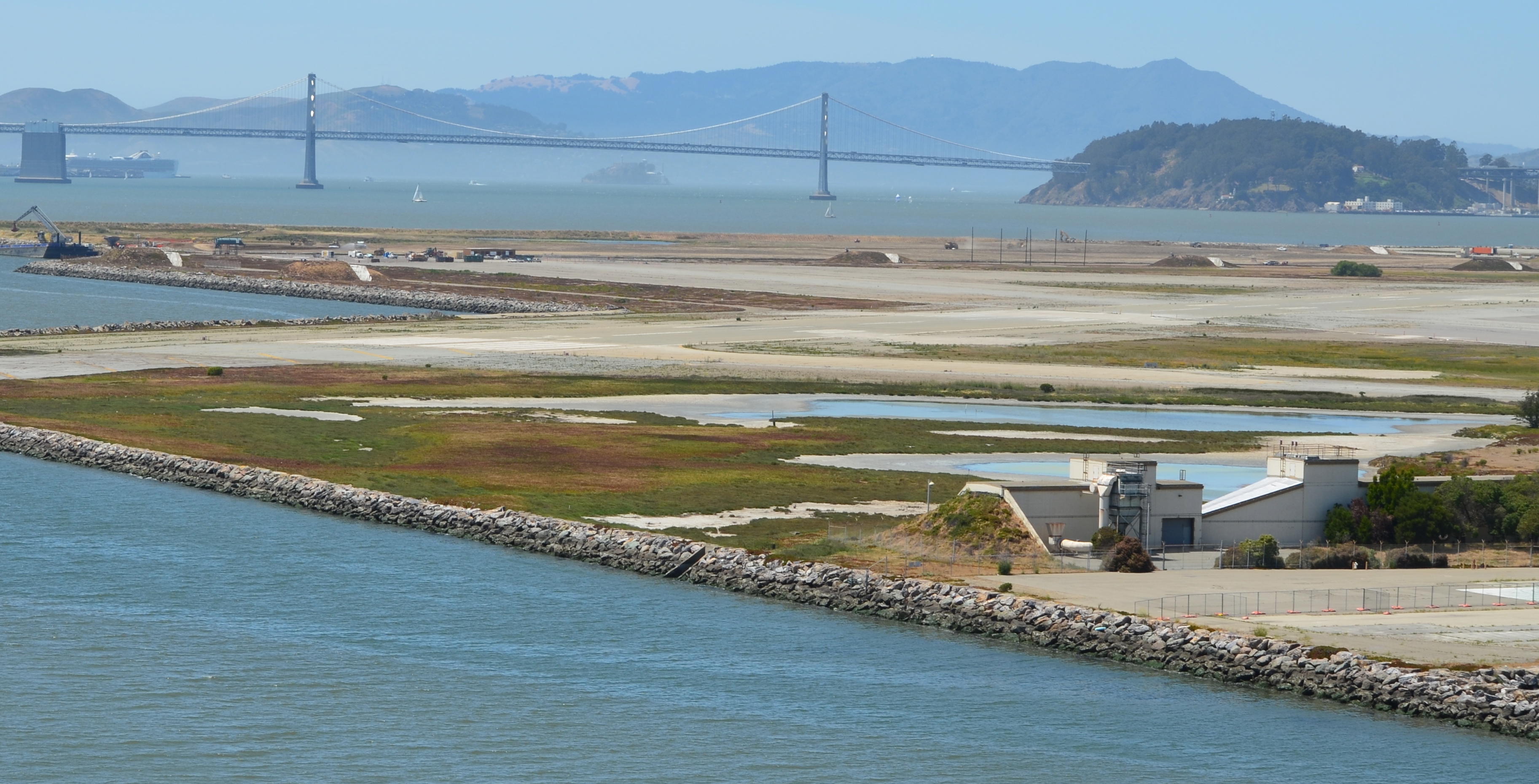
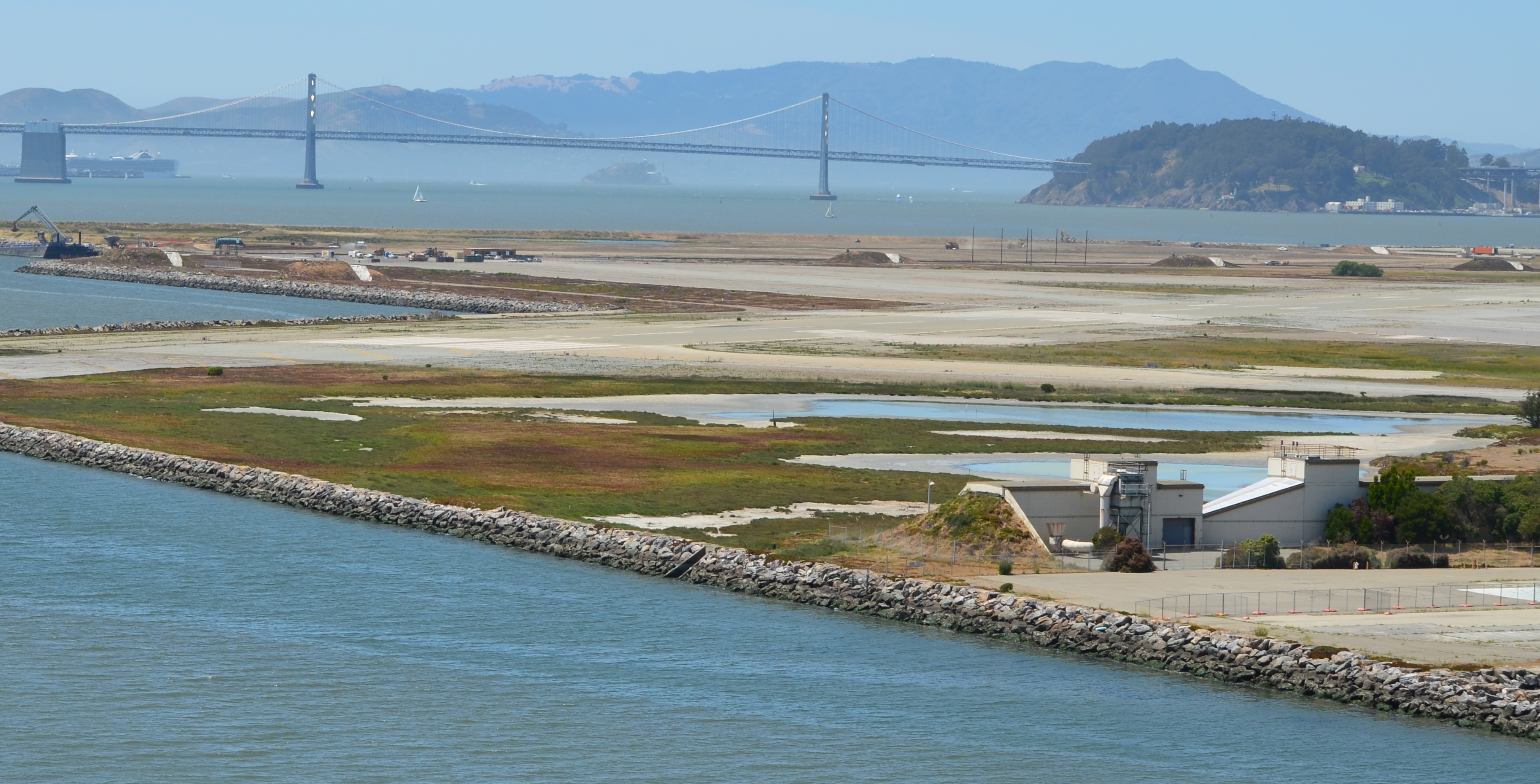
Part of the 511 acres that will be owned by the VA and remain undeveloped. Current restrictions call for prohibiting Bay Trail access to this area from April 1 to mid-August because of potential threats to least terns that nest about a half-mile to the east.
The following excerpts from the 18,000-word meeting minutes for this agenda item offer insight into the long and sometimes contentious effort to construct a VA outpatient clinic, offices, and a new national cemetery at Alameda Point.
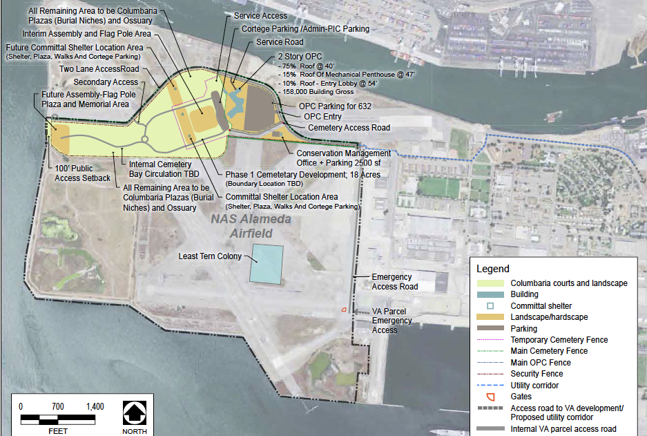
West Beach Wetland area (partially shown in photo above) is on the lower left portion of this map. Click on map to enlarge.
Commissioner Geoffrey Gibbs enquired, “I would like to know from the city of Alameda how these plans are consistent with the city’s hope for a mixed-use development on or near the site.” Alameda Point Chief Operating Officer Jennifer Ott responded, “We’ve been working with the VA for several years and they are consistent with our plans,” Ott said, “and the city has planned over 150 acres of additional park space, passive, open space that by building that road will actually help us bring down the cost of our development of that space to the north. It is a huge help to us to be able to implement additional significant regional open space facilities.”
Commissioner Jim McGrath questioned the VA about the need to prohibit access to the shoreline during the Least Tern breeding season from April 1 to mid-August. McGrath said, “I’m excited that something has been found to work in the long term to manage and preserve the wildlife area. I would love to see it expanded. When I began looking at the maps I said, boy, that Least Tern colony is a long way from the shoreline, over a mile.
“While I absolutely support science-based information that protects nesting areas for endangered species as warranting the highest level of protection, I don’t necessarily see the analytical gap bridged here between the potential for impact, the need for management and the need for, on a long term, restrictions of this nature.
“Some of the research that I’ve seen for the development of habitat areas within the restoration of the South Bay Salt Ponds, the research established that predation from avian species, particularly Western Gull, were the main threats to the Least Tern successful breeding.
“I know from my own experience that there has been successful breeding at fenced sites in southern California at Playa Del Rey and in Orange County; smaller sites on beaches with much less robust buffers.
“It raises in my mind the question of, would we not be better off with some active management of the Least Tern area that is science-based looking at the sources of predation, looks at the actual colony. I don’t want to pick on this project so much as say, if under the consistency review authority which is our single shot at trying to balance wildlife protection and provision of public access, we don’t ask those questions at this stage, we may miss the opportunity to try to achieve a better balance.
“I am a little bit troubled with a mile buffer.”
Mr. Richard Crowe from the VA responded: “We spent several years negotiating with the U.S. Fish and Wildlife Service. From our research, there is no science or an adequate buffer from a development to a colony. There is science on adequate buffer between colony nests. There is a paucity of research in that area.
“The U.S. Fish and Wildlife Service was adamant and we’ve negotiated in good faith and they felt that that quarter mile, 1674 linear feet, was the necessary buffer for the human impacts potential on the Least Tern.
“We’ve negotiated as much as we could and in order to get a favorable biological opinion that those were the final buffers.”
Commissioner McGrath continued the dialogue: “I understand and sympathize with your dilemma but adamancy does not constitute peer-reviewed science. And while we don’t have the U.S. Fish and Wildlife Service here, I guess to some degree I do think of that as the independent analytical role of the staff and the Commission.
“I have no trouble with the provisions and the burden with the VA with the exception of, that may end up being de facto management of this system on a hands-off basis when that, in fact, is not the best thing for either habitat or public access.
“I don’t know what to do with that concern. It certainly bothers me.”
Mr. Crowe responded: “The biological opinion is subject to negotiated modification should any other new science come up or new position by the current managers. The development was going to be below that little bulge but the U.S. Fish and Wildlife Service felt that that was going to jeopardize the Least Tern and they were going to issue a jeopardy opinion, which would kill the project. We negotiated very well and successfully with the city of Alameda to move that development up and that satisfied the U.S. Fish and Wildlife Service and all parties agreed to that and I think that was our way forward.”
This photo shows part of the area on the VA property that was recently zoned Nature Reserve by the city of Alameda. The Bay Trail will pass through this area. The fenced-in 10-acre Least Tern nesting site is nearby to the right. The adult terns roost on pavement near where this photo was taken, which is outside the fenced nesting area. Pedestrians and cyclists coming this close to roosting terns would cause them to flush, which is the reason for the trail closure during the nesting season. How close is too close has yet to be scientifically determined.
Jennifer Ott added, “From the City’s perspective we would have much rather have had a year-round trail. I can imagine the City approaching the VA at a future time, once things have settled, bringing this up again as an issue.”
Wetland Mitigation
The VA’s project will entail filling in about 11 acres of wetland. The VA will be required to mitigate the loss of wetland, but those plans have not yet been agreed to and approved by the U.S. Army Corps of Engineers. Some commissioners wanted to postpone the vote to approve the VA plans until they could see the wetland plans, even though the wetlands are outside BCDC’s jurisdiction.
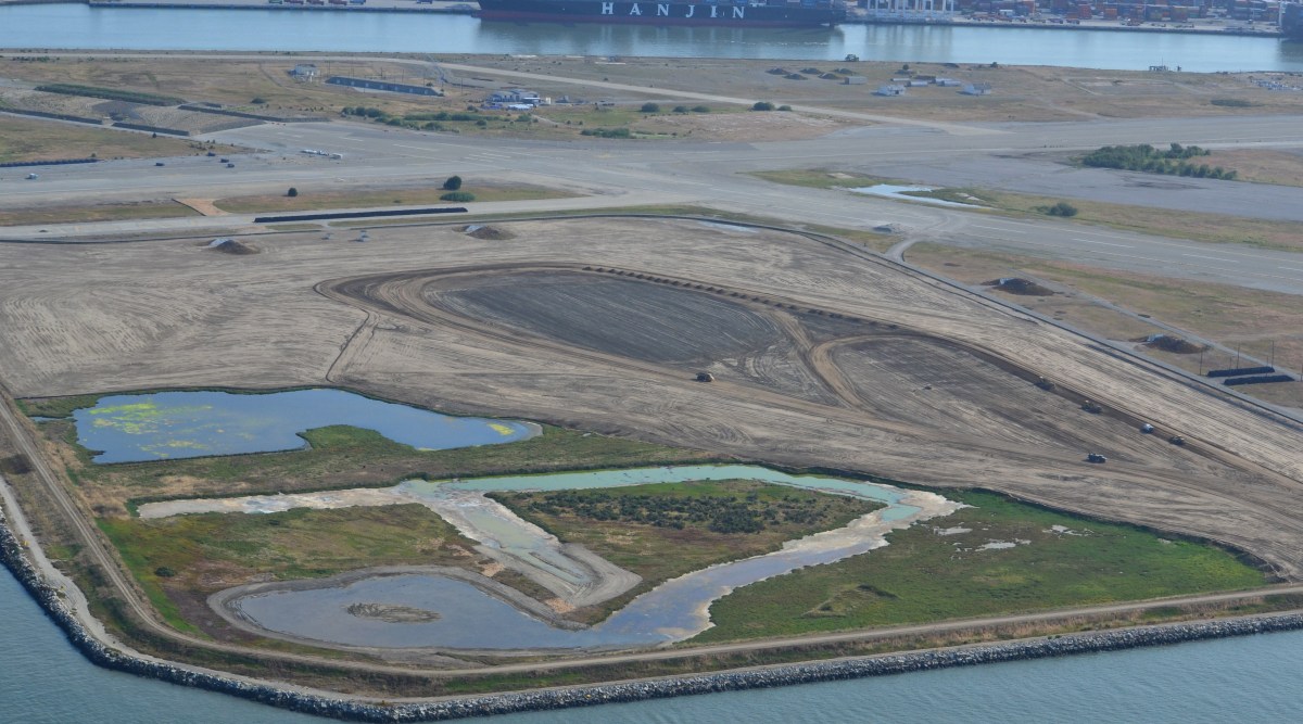
Runway Wetland in foreground is the best area in which to add additional wetland as mitigation for losses in the VA developed area to the far right on the airfield (outside of view).
Commissioner Kathrin Sears said, “We look at the Least Tern in a different way because the birds fly. Wetlands can become connected to the Bay and have a broader impact on areas in our jurisdiction as sea level rises. I think there are different issues there that might make it appropriate for us to look at the wetlands.
Commission Chair R. Zachary Wasserman said, “Coming back to the issue of the wetlands that are outside of our jurisdiction, that are within the Corps’ jurisdiction; the issue being raised is, will the Least Terns – we are legitimately taking that into consideration because they’re migratory, they use the Bay, they use our jurisdiction. The question that has been posed is for the wetland that is outside our jurisdiction, which theoretically is used by shore birds; is that sufficient then to bring it within our consideration just as the Least Tern issue is?”
The VA’s Doug Roaldson commented: “We appreciate the [U.S. Army] Corps [of Engineers] and we have had numerous talks with you. We are clearly interested in those wetlands. We’ve had numerous discussions about a strategy. We’re still evaluating that strategy. We don’t know what’s happening and this is outside of your jurisdictional discussion right now. What’s the VA going to do? We’re going to take care of those wetlands. We’re either going to move them and we’ve got two very high quality wetlands on the property and they are very easy to mitigate into. We’ve had these discussions with the Corps.
“We’ve had a discussion, if we mitigate do we mitigate by phase or do we mitigate the entire site?”
The last comment offers insight into why the VA and Corps of Engineers have not yet agreed on a plan. The Corps wants the entire 11 acres of wetland mitigated at the beginning of the project, even though some of those acres won’t be impacted for decades when more of the columbarium is built out. The VA, on the other hand, wants to pay for the mitigation when the wetlands are actually filled in.
Whether the wetlands are mitigated in phases or all at once, the plan will have to be agreed upon when the VA begins their project. BCDC’s approval contains special conditions that require Corps of Engineers approval of a wetland plan at the project’s commencement.
BCDC staff member Jaime Michaels said, “I just want to point out given the conversation we’ve been having [about wetland mitigation], there is also a condition and it’s Special Condition II.C that talks about the need for the VA to get other local, federal and state approvals before they begin their work. That would include the Corps of Engineers’ approval.”
A motion was made and seconded to approve the VA’s project as being consistent with state law, in this case the San Francisco Bay Plan, as required under the federal Coastal Zone Management Act. On a roll call vote, the motion passed with 13-Yes, 2-No, and 4-Abstain.
The property is slated to be transferred from the Navy to the Department of Veterans Affairs in 2014.
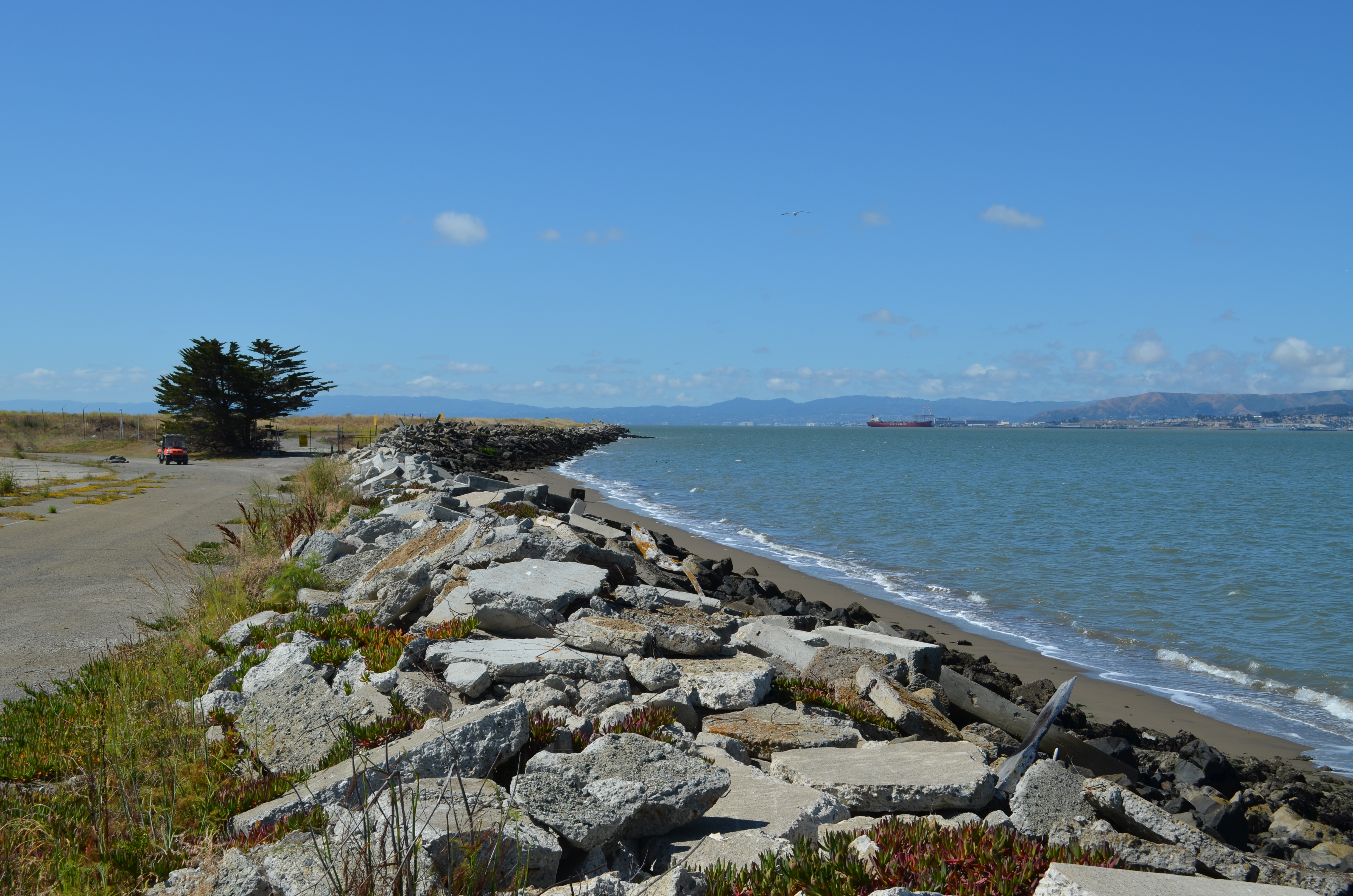
Alameda Point western shoreline where one-acre public access site with parking will be constructed on VA property. Looking south.Shoreline public access site on VA property. San Francisco Bay to the left.
The Department of Veterans Affairs (VA) and the Navy jointly issued their final Environmental Assessment on November 18, 2013 for the VA’s proposed Alameda Point outpatient clinic, offices, and columbarium cemetery. The report found that the 112-acre project on the northern part of the former Naval Air Station airfield would cause no significant impacts to the environment. The environmental review culminates years of debate over the project’s potential impacts on the endangered California Least Terns that nest on the nearby runway, and paves the way for the Navy to transfer 624 acres of the airfield to the VA in 2014.
Background
The VA began looking at the Alameda site in 2004 for expansion and consolidation of services from undersized and scattered facilities, which are currently leased by the VA until 2018. More than 9,000 veterans are enrolled in clinical services in the Oakland/Alameda area, with patient visits up 50% in the last five years. Approximately 543 veterans will be seen at the Alameda Point outpatient clinic each weekday and 70 on Saturday and Sunday. The VA anticipates employing a staff of 250, including 26 physicians and 34 nurses.
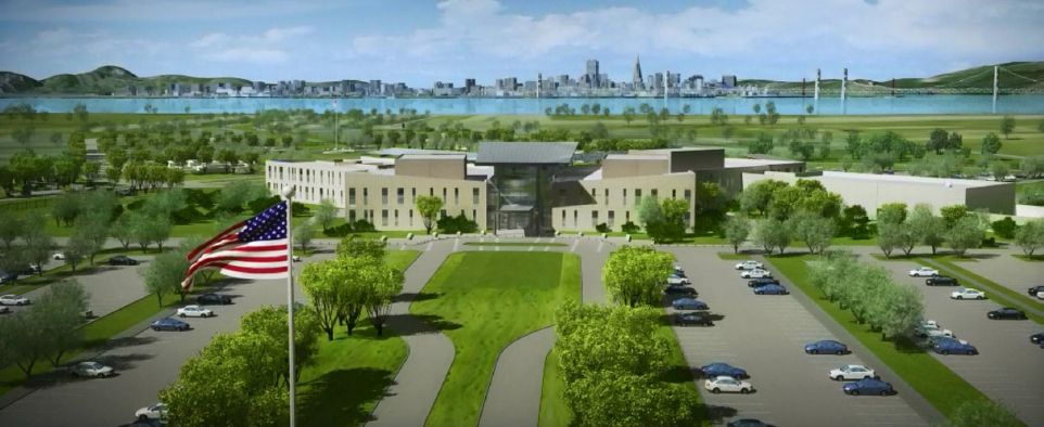
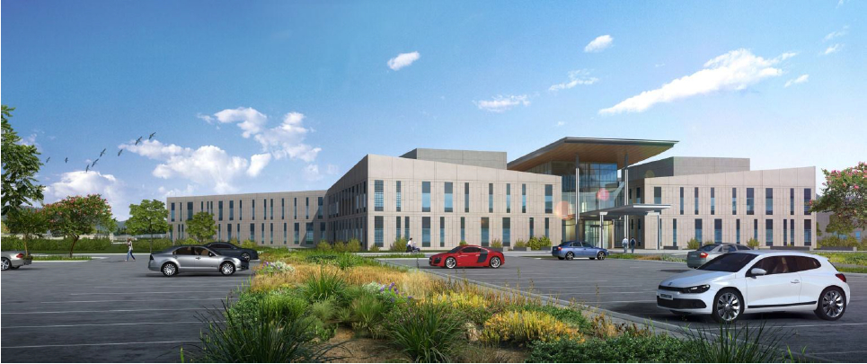
VA Lobby, looking toward San Francisco.
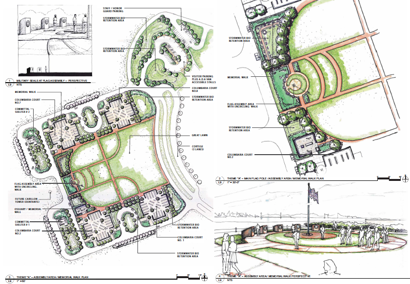
The VA will also establish a new national cemetery at Alameda Point. The two closest national cemeteries in San Bruno and San Francisco’s Presidio no longer accept new interments. Currently the closest burial options for Bay Area veterans are San Joaquin Valley National Cemetery in Santa Nella and Sacramento Valley National Cemetery in Dixon. The new columbarium cemetery will initially be 20 acres, with the remaining 60 acres built out in increments until completion in 2116. Approximately six services will take place Monday through Friday.
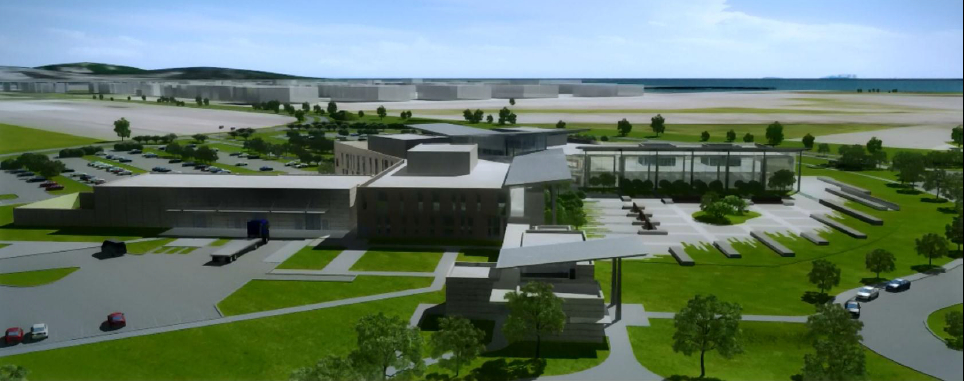
Columbarium in foreground, clinic/office building in background. Looking east, with Oakland Estuary on left.
Traffic and Transportation
The VA and Navy evaluated seven intersections in Oakland and four in Alameda, as well as the Posey/Webster Tube and segments of I-880, for traffic impacts. The report noted that two Oakland intersections and the Atlantic/Webster intersection would be performing at unacceptable levels regardless of the VA project because of other Alameda Point development. The assessment states, “The minimal additional traffic resulting from the Proposed Action would not, cumulatively, make the already unacceptable intersections significantly worse.”
The VA plans to operate a 24-person shuttle bus service between Alameda Point and the 12th Street Oakland City Center BART station every half hour, seven days a week. Extending AC Transit bus line 31 to the clinic would provide additional service if the transit agency decides to add service.
Wetland Mitigation
Several acres of seasonal wetland will be impacted by the VA’s project and will need mitigation, either through on-site replacement or paying into a wetland mitigation bank. The VA has not reached agreement yet with the Regional Water Quality Control Board and the U.S. Army Corps of Engineers on a mitigation plan. However, the VA has stated that their preference is to “enhance and expand existing conditions” at the Runway Wetland on the southeast corner of the runway area. Plans will be finalized before issuance of any permits for the VA’s project.
Alameda Point Runway Wetland in foreground, suitable for wetland enhancement as mitigation for wetland loss on VA developed area.
Nature Reserve, Least Tern Management
Most of the VA’s runway area will remain undeveloped. Initial plans allowed for periodic emergency preparedness training on the undeveloped area. The new plans allow training exercises only in the VA’s developed area about every 14 months between mid-August and April 1 when the terns are gone.
The influence of years of lobbying by the Golden Gate Audubon Society and open space advocates for wildlife stewardship in the undeveloped area is reflected in the VA’s final report. The VA states, “The remainder of the 512 acres of the Transfer Parcel will remain as a preserve for the California Least Tern or open space, with no plan for development, and will be available to wildlife for future generations.”
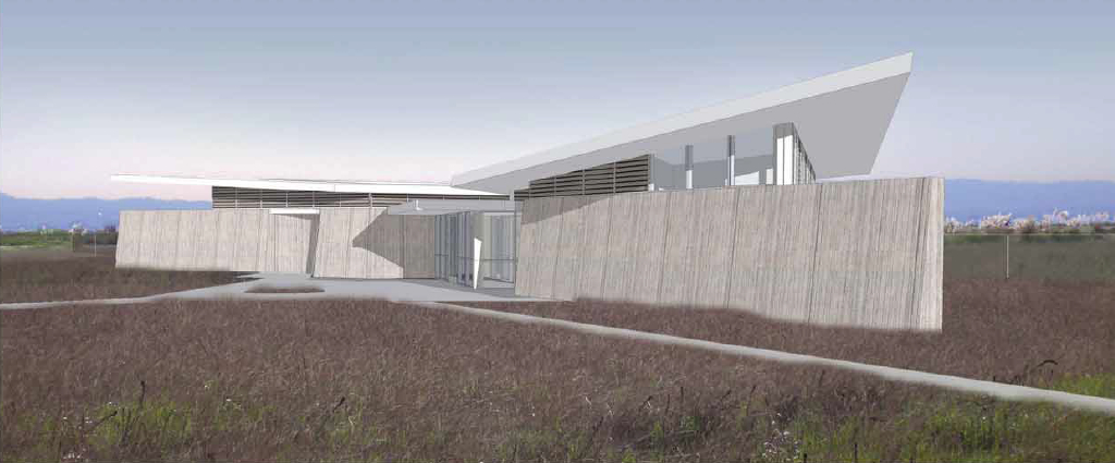
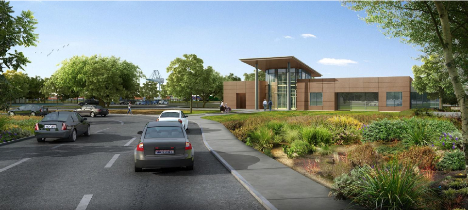
The VA will construct a 2,500-square-foot Conservation Management Office (CMO) near the entrance to their property. The CMO will provide office space for the U.S. Fish & Wildlife Service, meeting space for educational programs and volunteers, and public restrooms. The VA will fund the management of the Least Tern colony and the undeveloped area.
The winglike roof lines on the CMO and the main clinic/office building were inspired by the Least Tern colony and the site’s history as part of the Alameda Naval Air Station.
Conservation Management Office, with meeting room for nature education and Least Tern volunteer activities, U.S. Fish & Wildlife Service Office.
Public Access
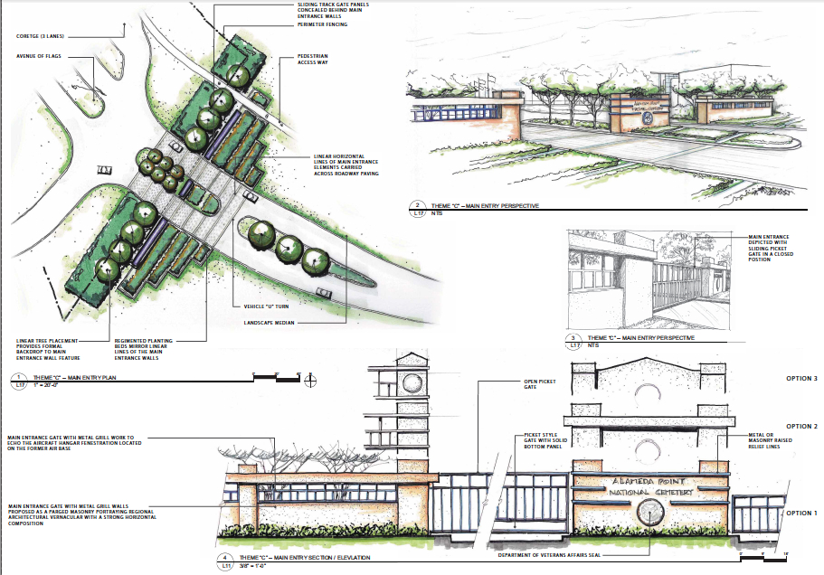
As part of their project, the VA will construct a pedestrian/bicycle/vehicle roadway along the northern border of their property all the way to a public viewpoint on the western shoreline. The roadway will include power, water, and sewer utilities that will be available for the city or a region-serving public park operator on the Northwest Territories to make connections to. The city will be granted a shoreline easement for constructing the Bay Trail. The VA will also be constructing a new north entryway to Alameda Point and laying oversized infrastructure, which the city can use, along Redline Avenue out to their site.
Raising Elevation
The VA plans to bring in over 400,000 cubic yards of clean fill material to raise the elevation of their site by as much as three feet, bringing the highest elevation to 13.5 feet above Mean Sea Level. Plans are based on a 2009 Bay Conservation and Development Commission sea level rise prediction of 16 inches by 2050 and 55 inches by 2099. The 18-month construction project is expected to begin by 2016 and be completed in 2017.
The VA is made up of three administrations: Veterans Health Administration, Veterans Benefits Administration, and National Cemetery Administration. All three will have offices at the Alameda Point VA.
The complete Environmental Assessment is on theVA website. A 30-day final public comment period began on November 18, 2013.
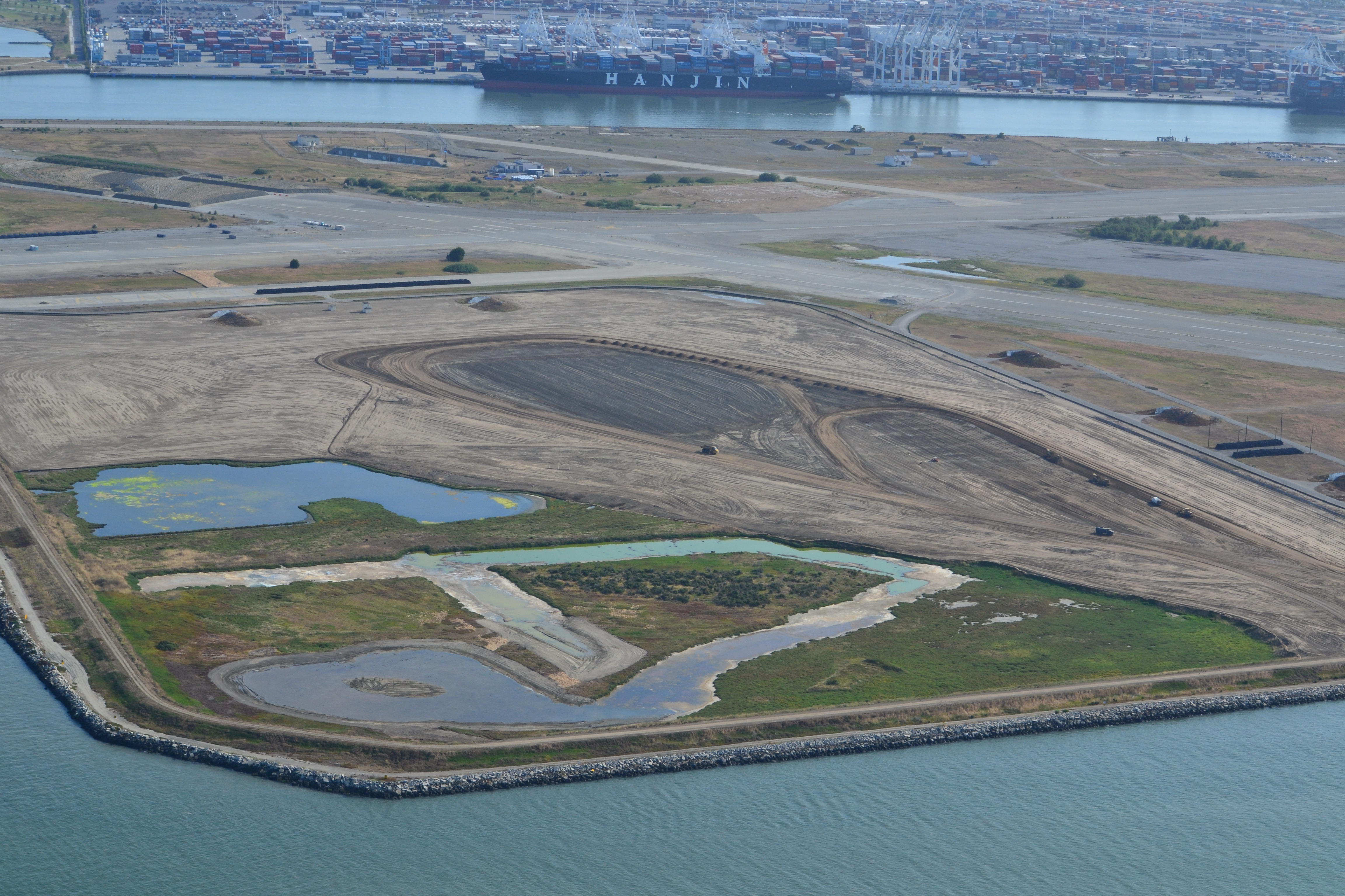
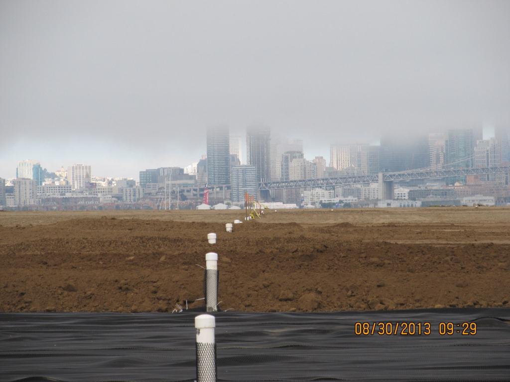
Landscaping of the 100-acre landfill area on the southwest corner of Alameda Point is nearing completion. The seeding of the landfill site with flowering native grasses is almost ready to begin. Contouring of the site is complete. Stabilization of the shoulder around the wetland area is complete. Placement of the final soil cover is underway.
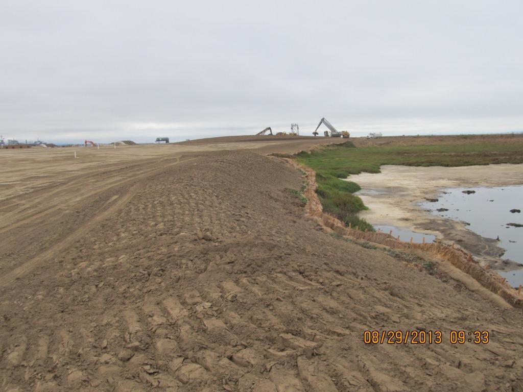
Site 2 wetland area and adjacent contouring underway in early July 2013. Wetland area has since been expanded by several acres. Port of Oakland is in the background. Bay Trail will eventually follow the foreground shoreline along the Bay. Funding and construction of the Bay Trail is not part of this project, and is yet to be funded.
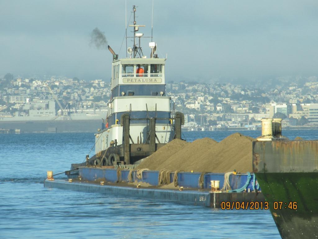
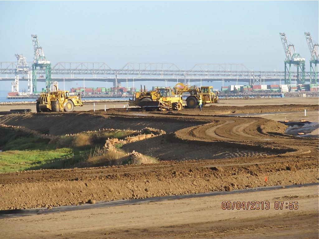
The contouring of this industrial landfill site was completed on August 16, 2013. Approximately one-third of the contouring, or base layer, soil is clean soil recycled from Seaplane Lagoon dredging. The recycled soil stock was quickly exhausted, along with soil recycled after removing some of the berms and high areas. More than half of the base layer – 193,000 cubic yards – is soil barged in from Decker Island in the Sacramento River.
Soil being delivered from Decker Island.
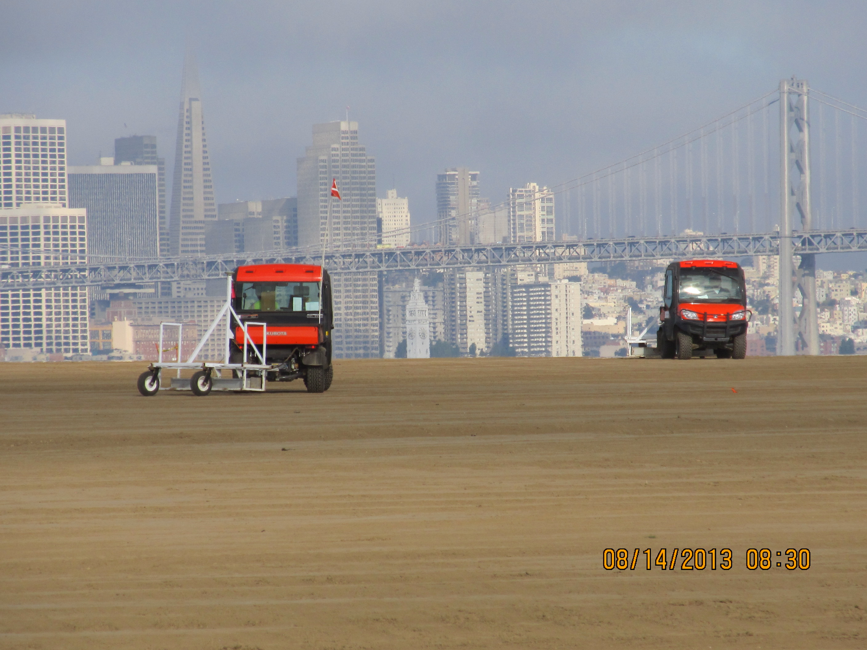
This contouring phase, which began in January of 2013, created the base layer with a specially-engineered slope. It was then scanned for radiation using scanners towed by a small vehicle, even though the site had been surveyed for radiation prior to placing the base layer.
Scanning the base layer for radiation.
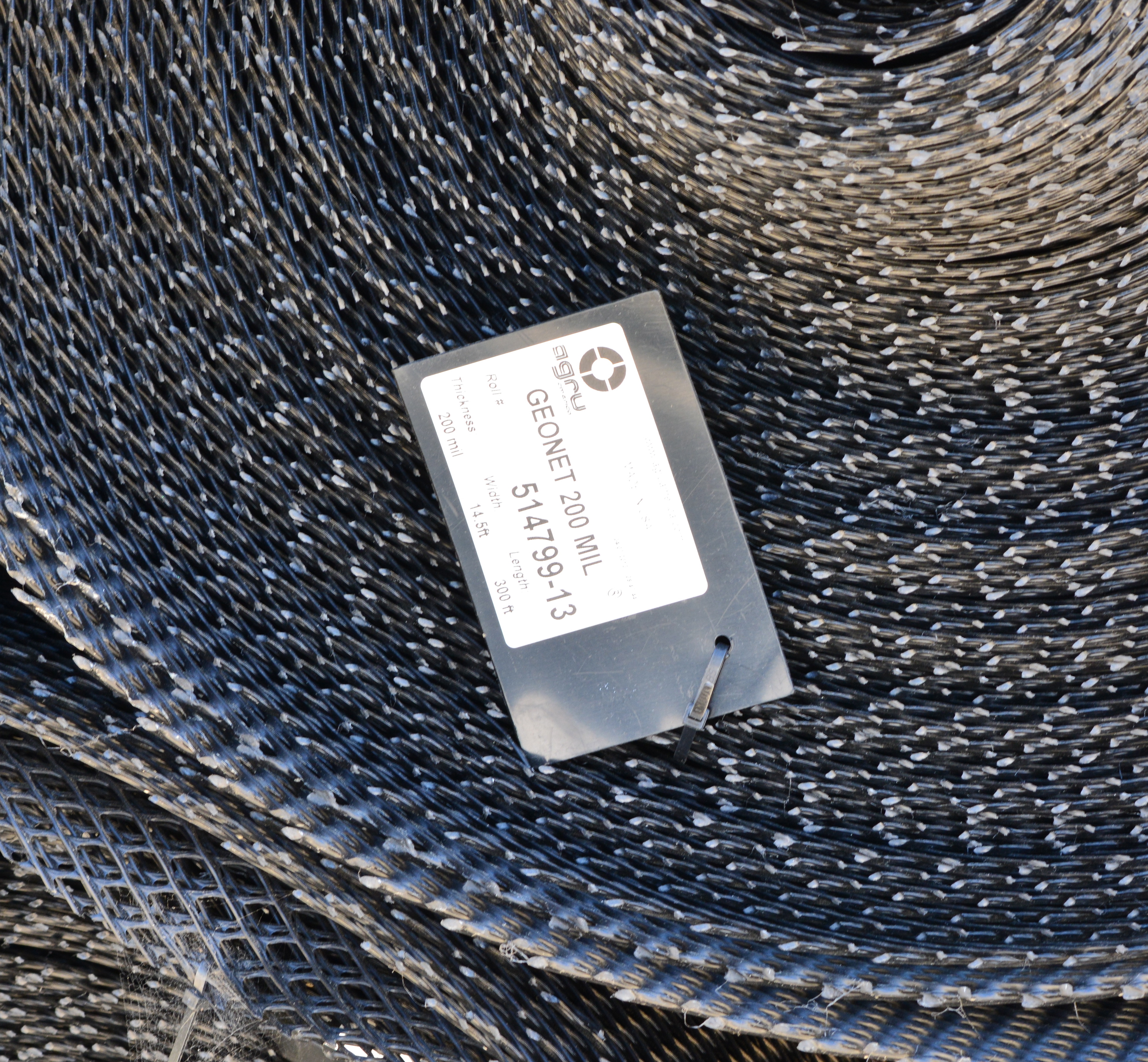
Placement of the plastic biobarrier (see photo below) and the final soil cover using soil barged in from Decker Island began on August 19, 2013. The biobarrier is a plastic mesh that is designed to discourage burrowing animals from coming into contact with the waste area. The biobarrier installation is over 90% complete as of week #38 (October 24, 2013). The final two-foot soil cover is over 60% complete. The final soil cover includes six inches of soil amended to promote growth of vegetation.
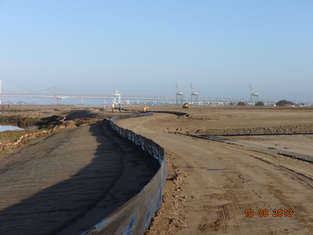
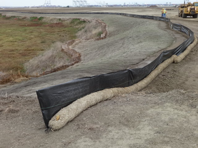
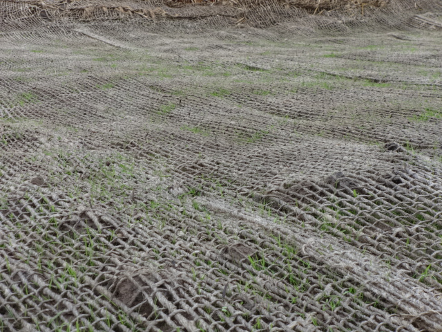
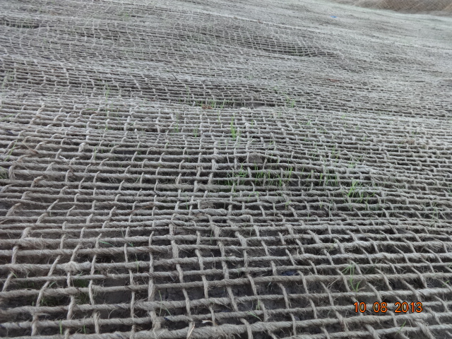
The soil stabilization and drainage work on the shoulder around the wetland area is also completed. It includes native rye grass seeding, a jute mesh cover, and a silt fence. Some of the rye grass has already started to sprout.
Stormwater controls near wetland area being created.
New monitoring wells will be installed starting in late November.
Hydroseeding of the site with an assortment of California native grasses will begin in late November or early December.
In 2014 the old culvert connecting the north side of the wetland with San Francisco Bay will be replaced with a new culvert.
Fifty tons of old fence and metal have been recycled. The temporary work fence will be removed at the end of the job. The methane gas vents will be short and virtually unnoticeable (see photo below). Due to the age of the landfill and the fact that very little organic waste was deposited there, the methane gas produced is minor and will not require the 10-foot tall vent stacks proposed in an earlier workplan.
Methane gas vent pipes.
This site, along with adjacent land, will be transferred to the U.S. Department of Veterans Affairs in late 2013 or early 2014.
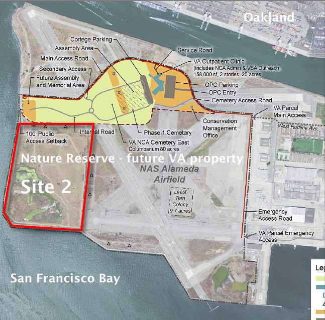
VA map, with Site 2 and Nature Reserve notations added by Alameda Point Environmental Report.Biobarrier to discourage burrowing animals. Photo credit: Alameda Point Environmental Report.
Silt fence installed above jute mesh around wetland area.Silt fence under construction.Jute mesh around wetland shoulder, with grass starting to sprout.Week 36 – Vegetation growing through jute mesh around shoulder of wetland area.
Source: The information in this update was gathered from the weekly progress reports for Installation Restoration Site 2 Remedial Action at Alameda Point. The progress reports are posted on the Envirostor website maintained by the California Department of Toxic Substances Control (DTSC). The source for all photos in this update, unless otherwise credited, is DTSC.
Located between Alameda Point and Alameda Landing (where the new Target store has opened) is the Navy property known as North Housing. After years of low-key planning efforts, the city will soon be the recipient of a beautiful new park, and eventually see over 400 new affordable and market rate housing units, including 90 Housing Authority units for formerly homeless individuals.
Estuary Park looking west. Past the trees in the distance is the baseball field.
A key administrative milestone was reached in August of 2013 when the U.S. Department of Housing and Urban Development (HUD) signed off on the city’s plan to accommodate homeless individuals.
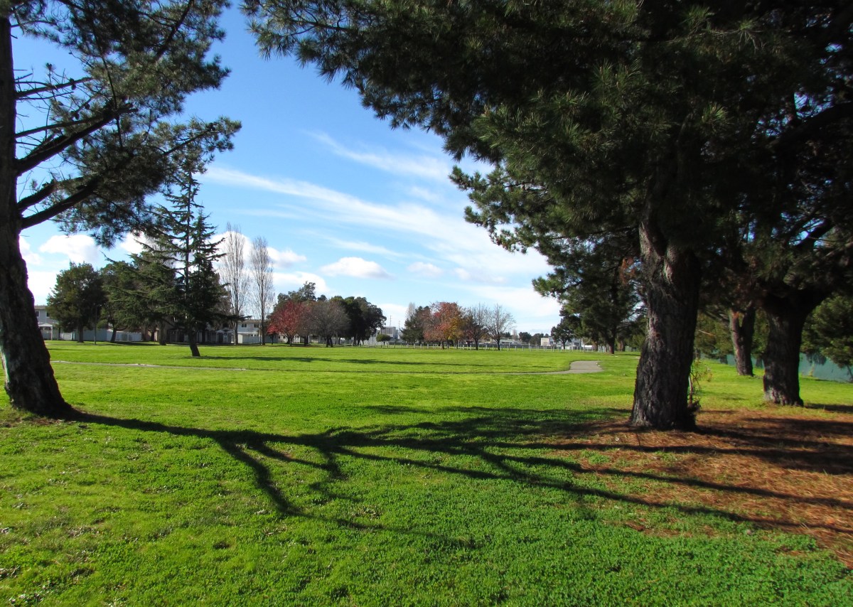
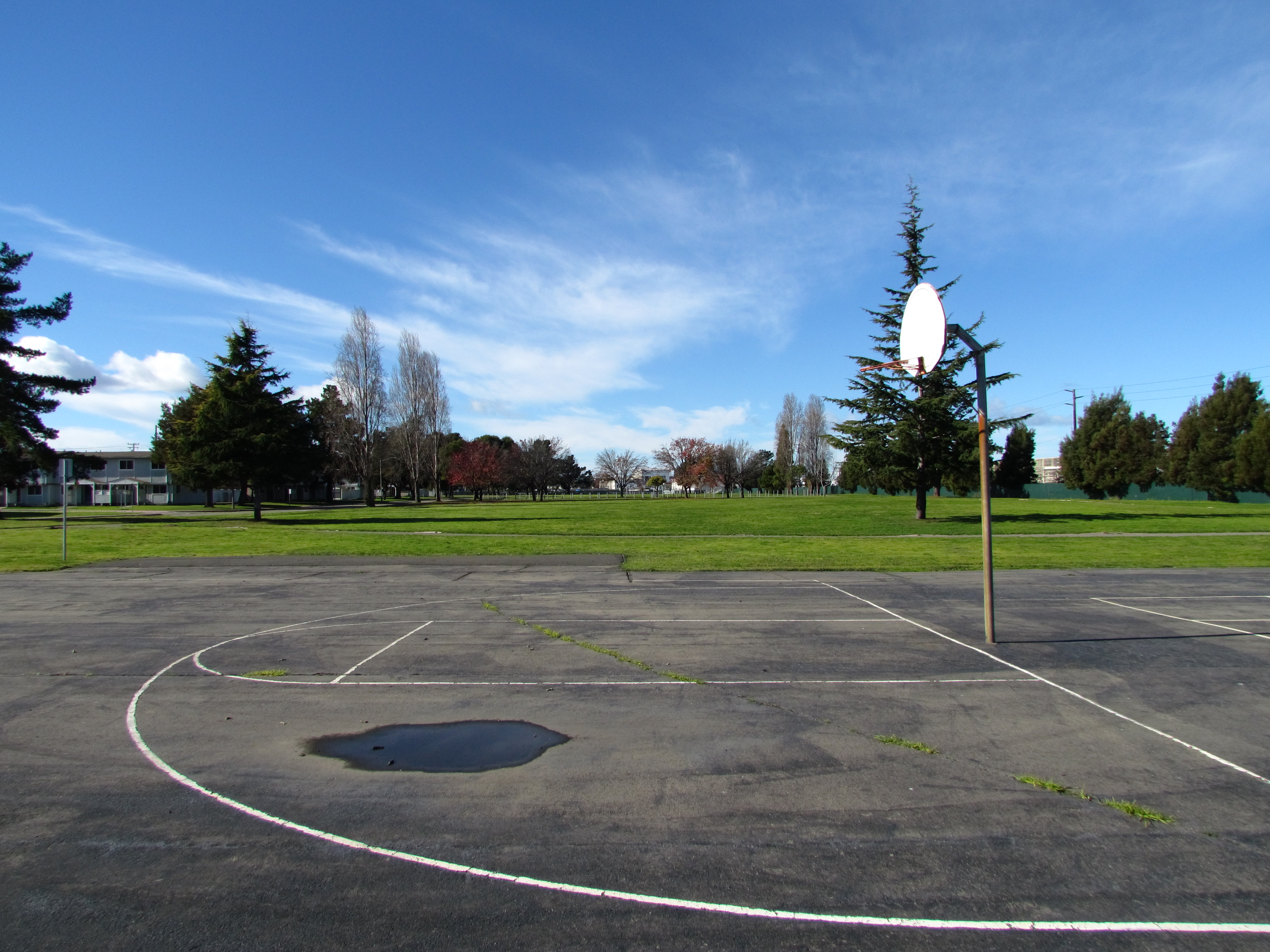
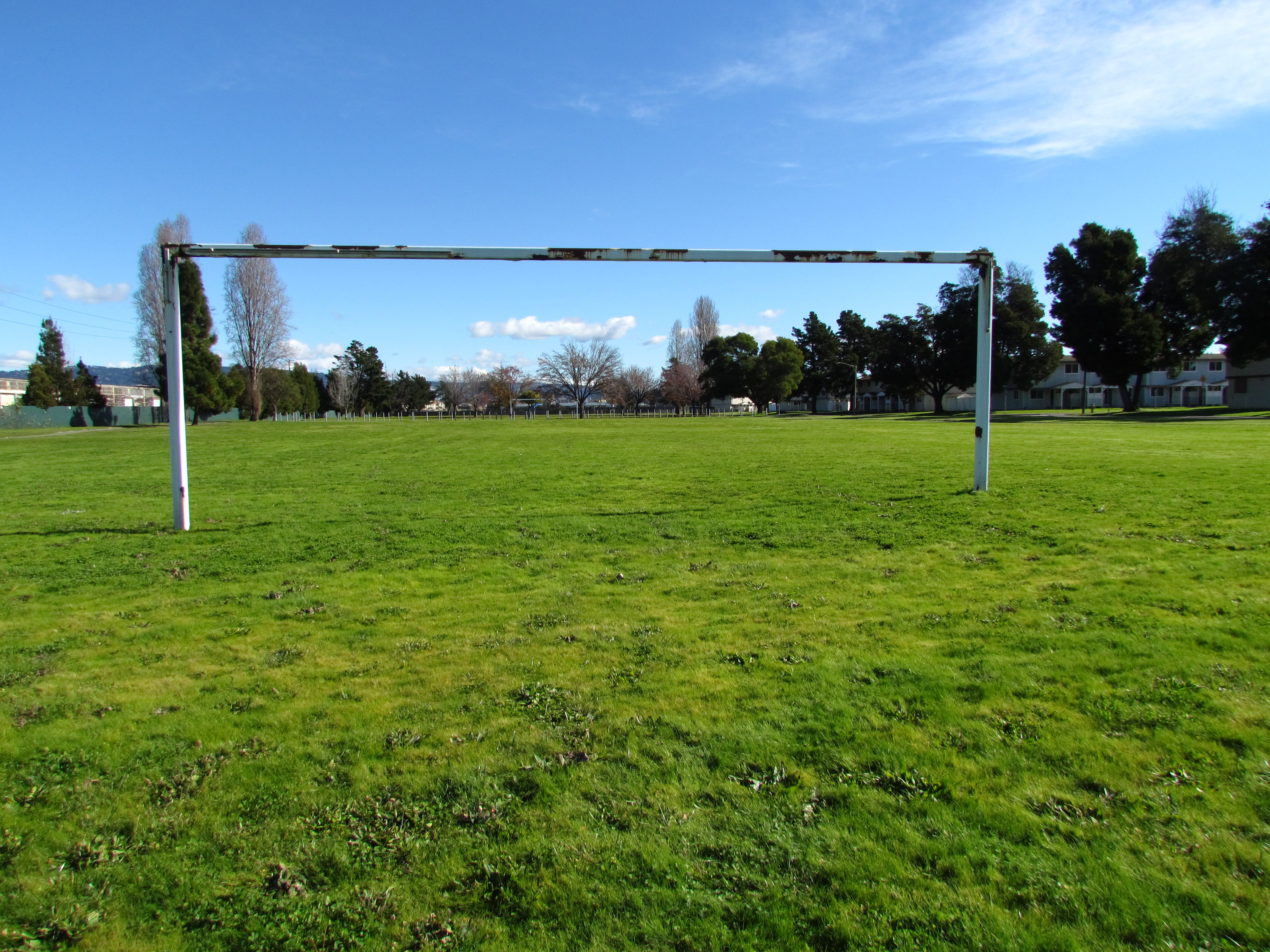
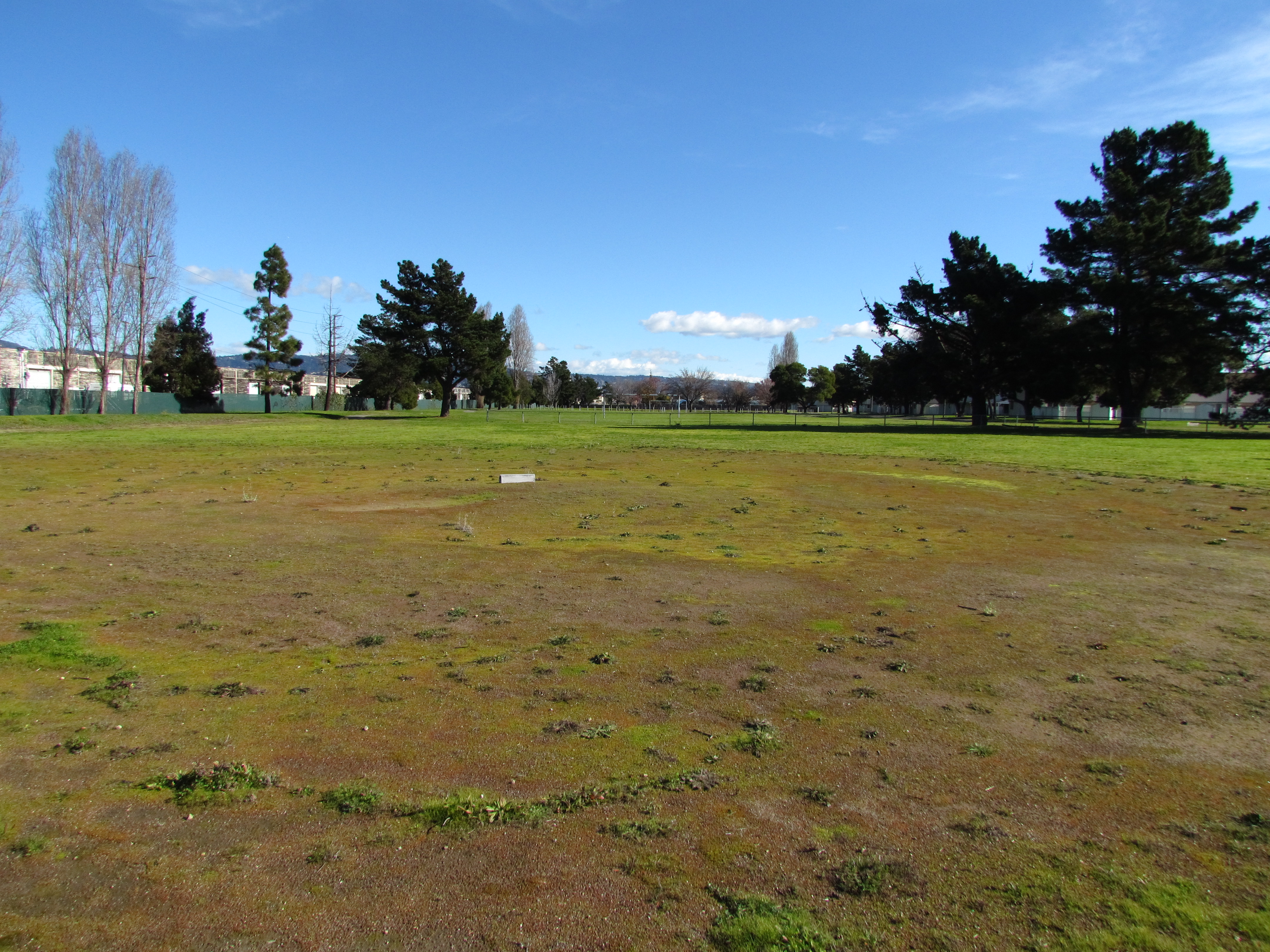
The 42-acre Navy parcel sits directly adjacent to Alameda Landing’s future residential neighborhood. It includes the 8-acre Estuary Park where a baseball field, soccer field, basketball court, perimeter trail, and an open meadow flanked by mature trees await minor sprucing up by our city’s Recreation and Park Department.
Existing housing units to be demolished
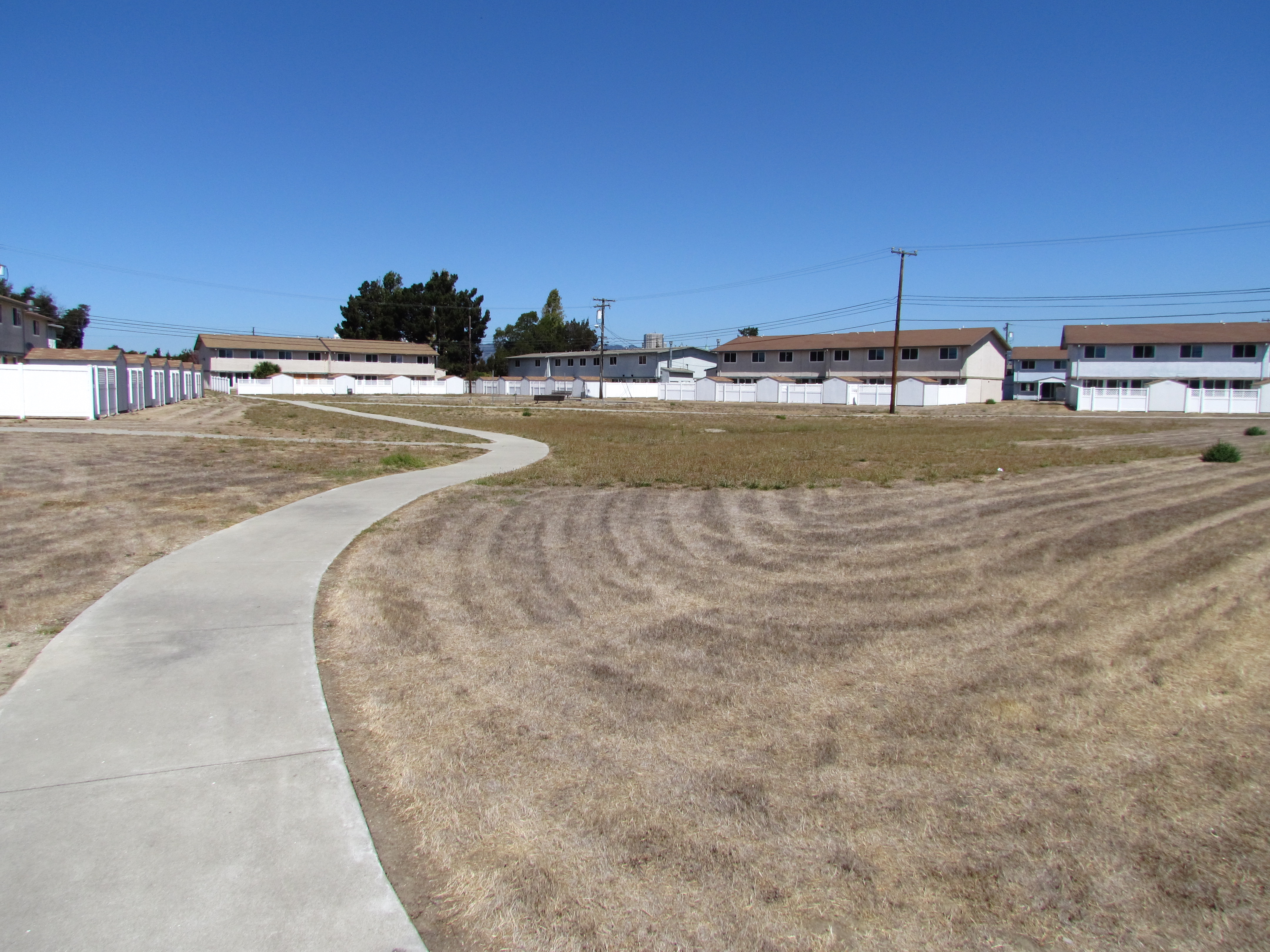
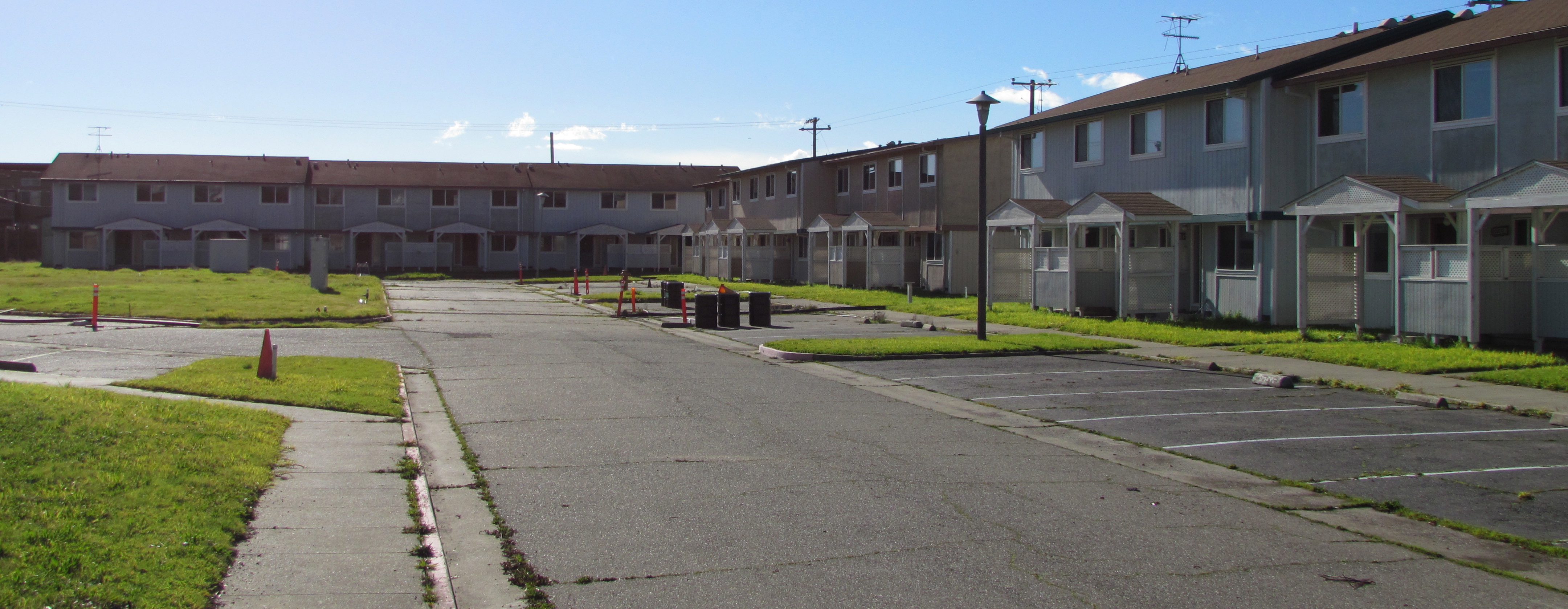
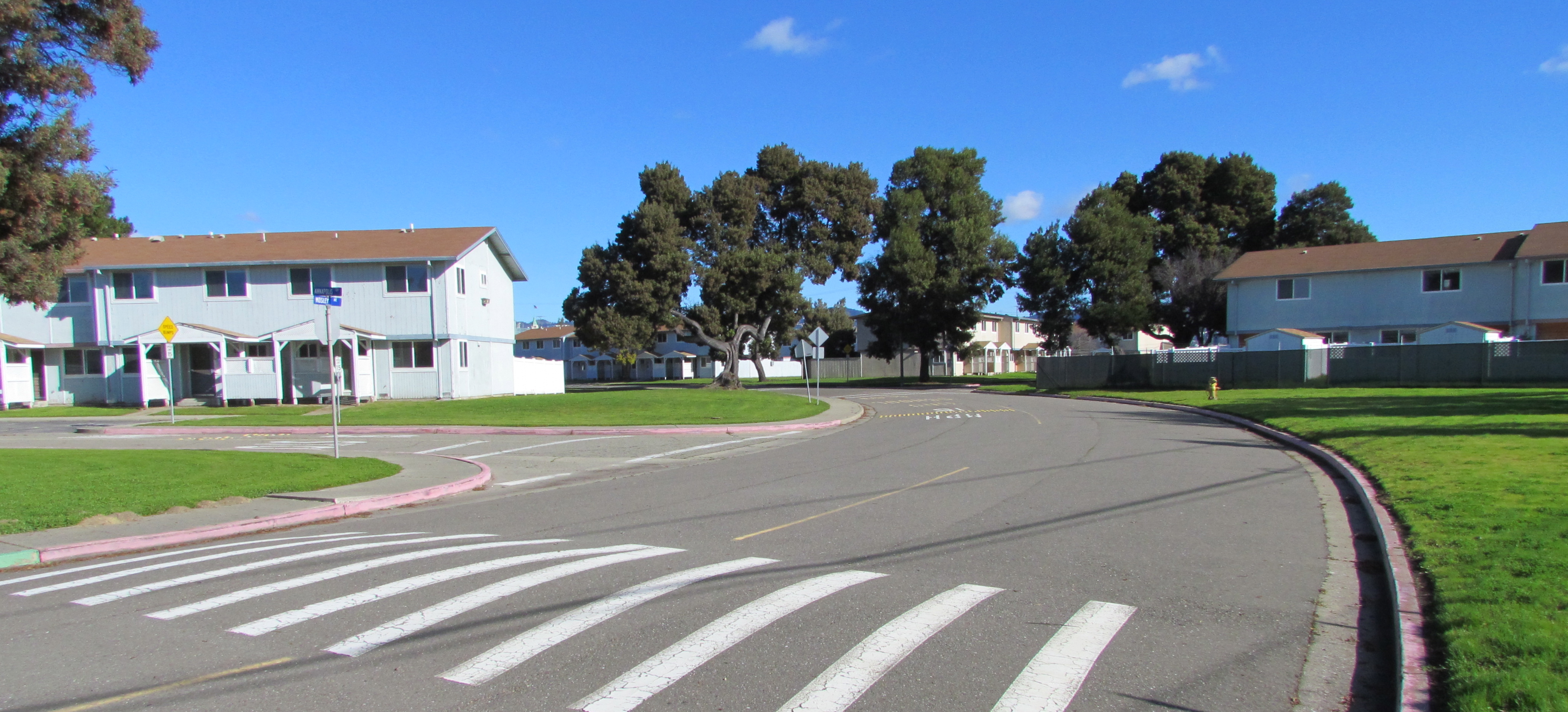
The site currently contains 51 residential structures: 39 six-plexes and 12 four-plexes for a total of 282 three- and four-bedroom units. All of the buildings were constructed in 1969. With the possible exception of the two acres going to Habitat for Humanity, all of the units will be demolished to make way for new construction, according to the city’s Interim Community Development Director Debbie Potter.
Central open space at North Housing. Looking north.
The 13 acres going to the city’s Housing Authority will have 90 units of new housing and two acres of open space. Two acres will go to Habitat for Humanity. The remaining 19 acres will be sold by the Navy to a private developer.
“The Reuse Plan notes the private housing developer could build 315 units,” said Potter. After the Reuse Plan Amendment was prepared in 2008 and approved in 2009, the city certified a Housing Element in 2012 that rezoned this property to provide a Multi-Family Overlay zone, “so the number of units that could potentially be developed at this site is more than the 435 listed in the Plan,” Potter stated.
One problem cited by Potter with trying to reuse the existing residences is that all of the multi-unit structures have single utility meters for the entire building. To re-meter all the units with individual meters for electric, gas, and water would be expensive, according to Potter.
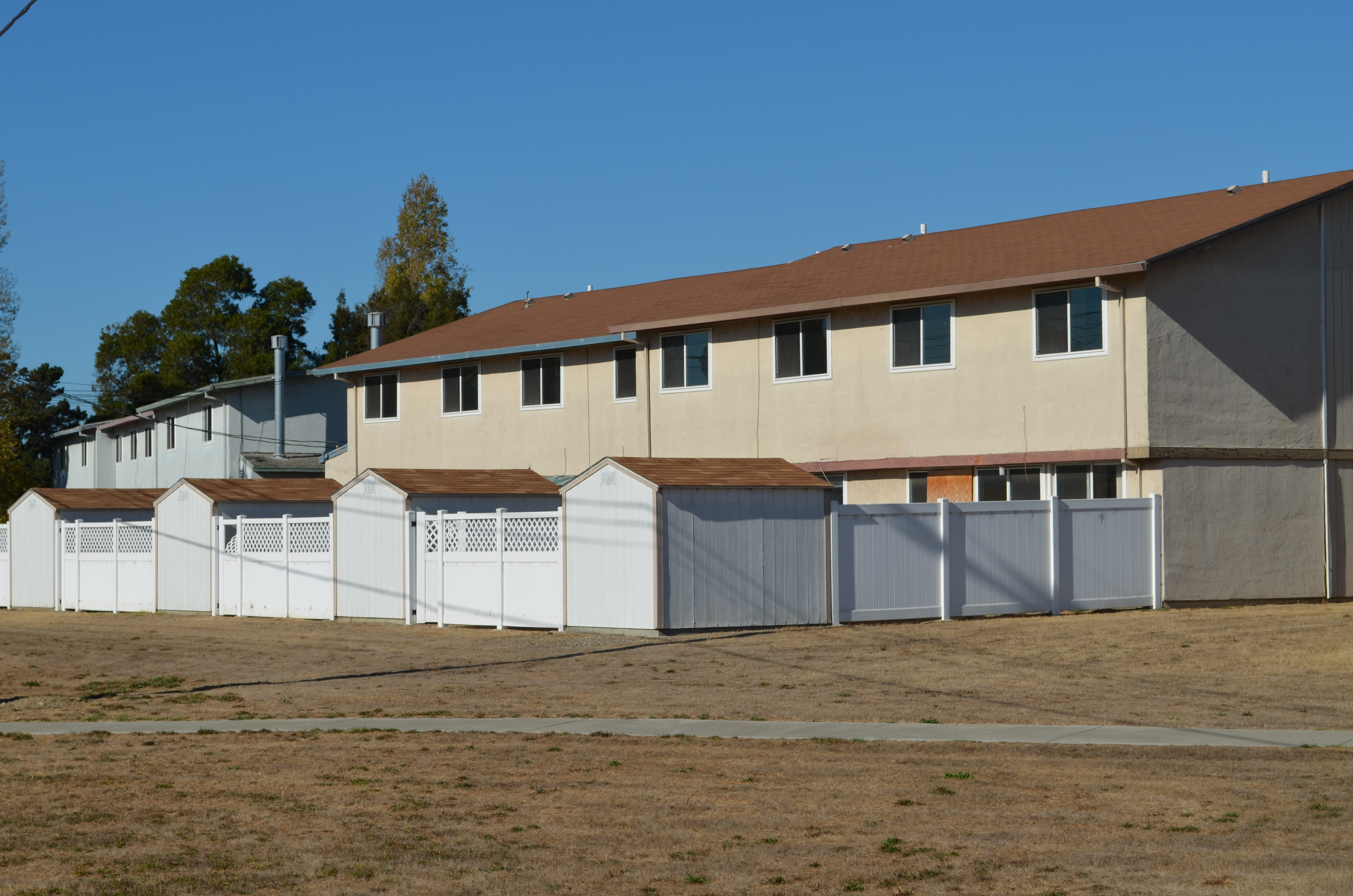
Typical North Housing multiplex military housing (vacant) constructed in 1969.
“In addition,” said Potter, “the property is not laid out particularly efficiently, which is also a challenge. North Housing has a multi-family overlay designation and it would be extremely difficult to take advantage of that zoning (30 units to the acre) with the current building layout,” she said. “The only exception to all of this is that Habitat for Humanity East Bay has a Self-Help Housing Public Benefit Conveyance request pending with HUD which proposes an option of retaining 30-32 units to be renovated and sold as self-help housing.”
Housing Authority plays a key role
The Housing Authority will be partnering with the Alameda Point Collaborative and Building Futures with Women and Children who will provide services to residents of the Housing Authority’s 90 units. A community center is planned.
Funding to build the Housing Authority’s homeless assistance units has not yet been identified. However, Potter said she expects project financing would be packaged from a variety of sources, “with the primary funding coming from an award of Federal/State tax credits (equity raised through the sale of the tax credits to an investor),” she said. “Other sources are most likely Federal HOME funds and dedicated housing authority funds the City receives as inclusionary housing in lieu fees and Affordable Housing fees paid by non-residential developers,” said Potter.
Alameda Housing Authority Director Mike Pucci has a good idea where the homeless housing will go, but is not ready to release a map. “In our agreement that HUD has approved we did delineate a specific site comprising 13 acres, but a meets and bounds survey has yet to be conducted to establish it’s exact location,” said Pucci.
Checklist of regulations
The Navy completed its environmental review for the entire North Housing parcel in 2009 and issued a Finding of Suitability to Transfer (FOST) for Estuary Park. A FOST for the housing area is awaiting decisions concerning Superfund cleanup issues early next year.
The preparation of real estate transfer documents for just the park, however, could not proceed until HUD signed off on the city’s federally mandated homeless plan, according to the Navy’s Base Closure Manager Anthony Megliola. “Now that HUD has made its determination, real estate documentation supporting the transfer is being prepared with transfer [of Estuary Park] planned in late 2013,” said Megliola.
The remainder of the North Housing Parcel will be transferred in the 2015 timeframe, according to Megliola. Factors include completing the cleanup actions for the benzene plume under part of the site, executing a Covenant to Restrict Use of Property (CRUP) with the California Department of Toxic Substances Control, executing a Finding of Suitability to Transfer (FOST) document, and preparing required real estate conveyance documentation associated with transfer. “Although the National Environmental Policy Act (NEPA) Environmental Assessment (EA) was completed in 2009, receipt of the August 14, 2013 letter from the Department of Housing and Urban Development (HUD) was required before the Navy could complete the disposal actions for the North Housing area,” said Megliola.
Area where the Navy has been cleaning up benzene contamination at North Housing area.
Earlier in 2013, the Navy submitted a request to regulatory agencies to discontinue their vapor extraction work on the benzene plume hotspots, saying that vapor intrusion into buildings was not a risk. The benzene vapor pumps were turned off in the spring and a new round of interior vapor tests were conducted in some of the existing buildings. Results of these tests and a decision on whether to continue running the cleanup pumps for a few more years or terminate the program will be made in early 2014.
This former military housing site was originally to be conveyed to the Coast Guard and was not part of the city’s No-Cost Economic Conveyance deal with the Navy. (The new homes at North Housing will be in addition to the 1,425 units in the no-cost conveyance deal for Alameda Point.) Subsequently, the Coast Guard withdrew its request. In November 2007, the Navy notified the Alameda Reuse and Redevelopment Authority that it was going to declare an additional 42 acres of NAS Alameda – the North Housing parcel – as surplus property.
As part of its requirements as the local reuse authority, the city had to comply with the McKinney Homeless Assistance Act and reach out to homeless housing providers for proposals. In March of 2009, the city made its recommendations to HUD for compliance with the McKinney Act, approving the proposals from Habitat for Humanity, and the Alameda Housing Authority/Alameda Point Collaborative/Building Futures with Women and Children. They also recommended the Alameda Recreation and Park Department proposal to receive Estuary Park. These proposals became amendments to the 1996 Community Reuse Plan for Naval Air Station-Alameda.
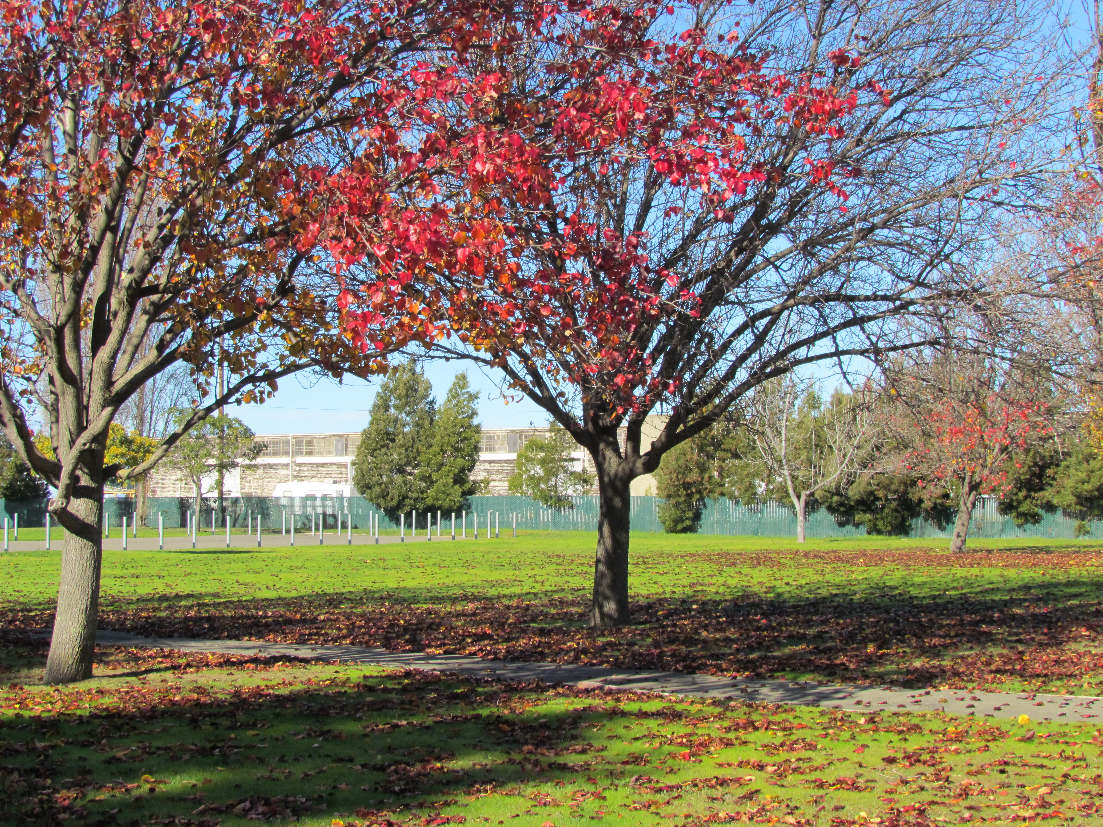
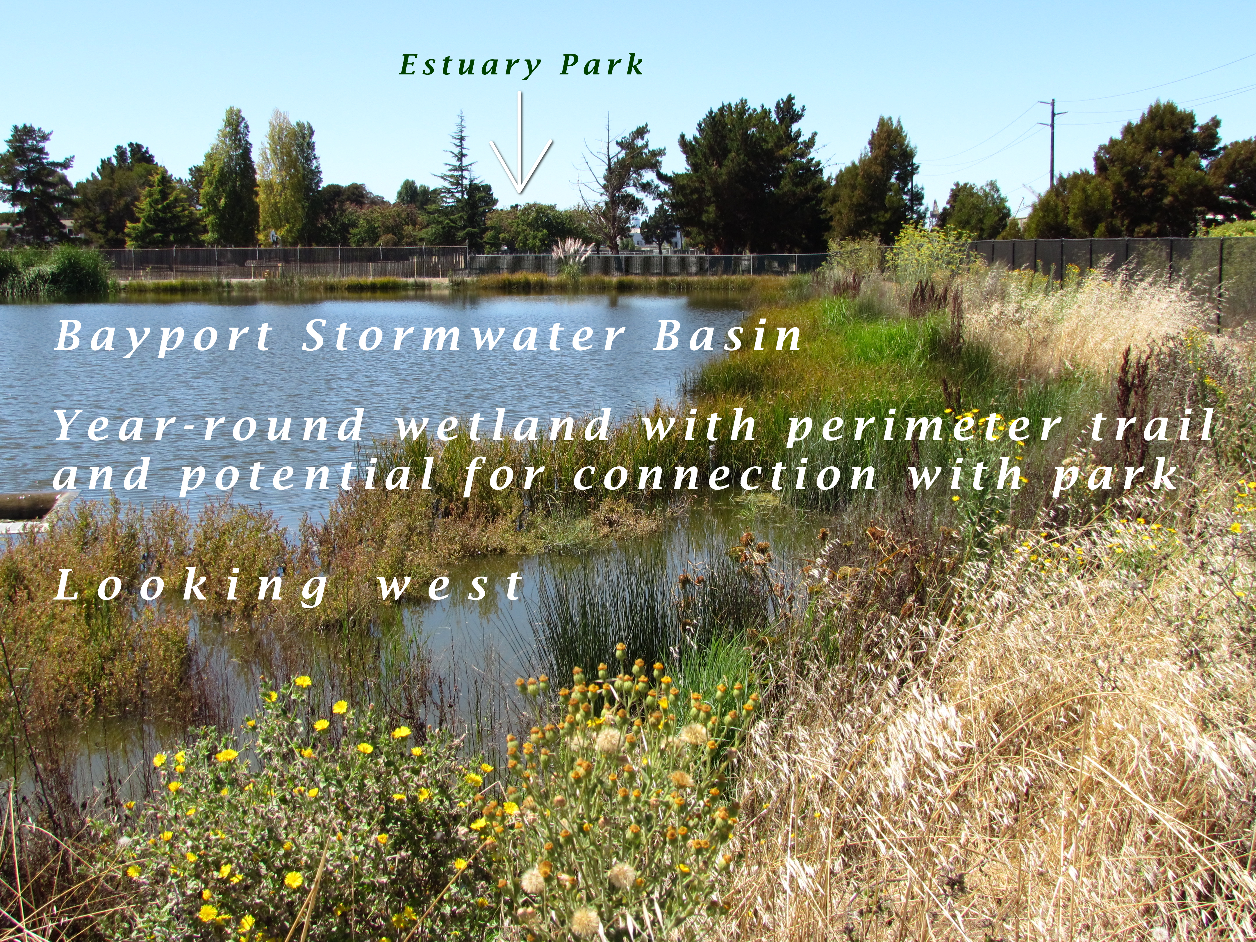
North Housing area. Existing housing slated for demolition to create a new, denser neighborhood with public and private investment.Estuary Park soccer field. Looking east. Alameda Landing is beyond the distant tree line.Estuary Park baseball field. Looking east.Estuary Park fall foliage.This stormwater basin was constructed by Catellus to serve the Bayport neighborhood. It remains full year-round due to groundwater being continuously pumped from the special pumping station next to Shinsei Gardens. Overflow is sent to the Oakland Estuary via another pump station.
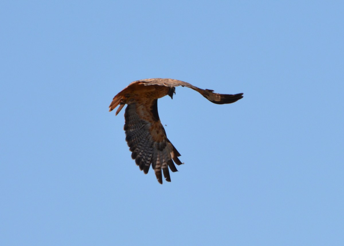
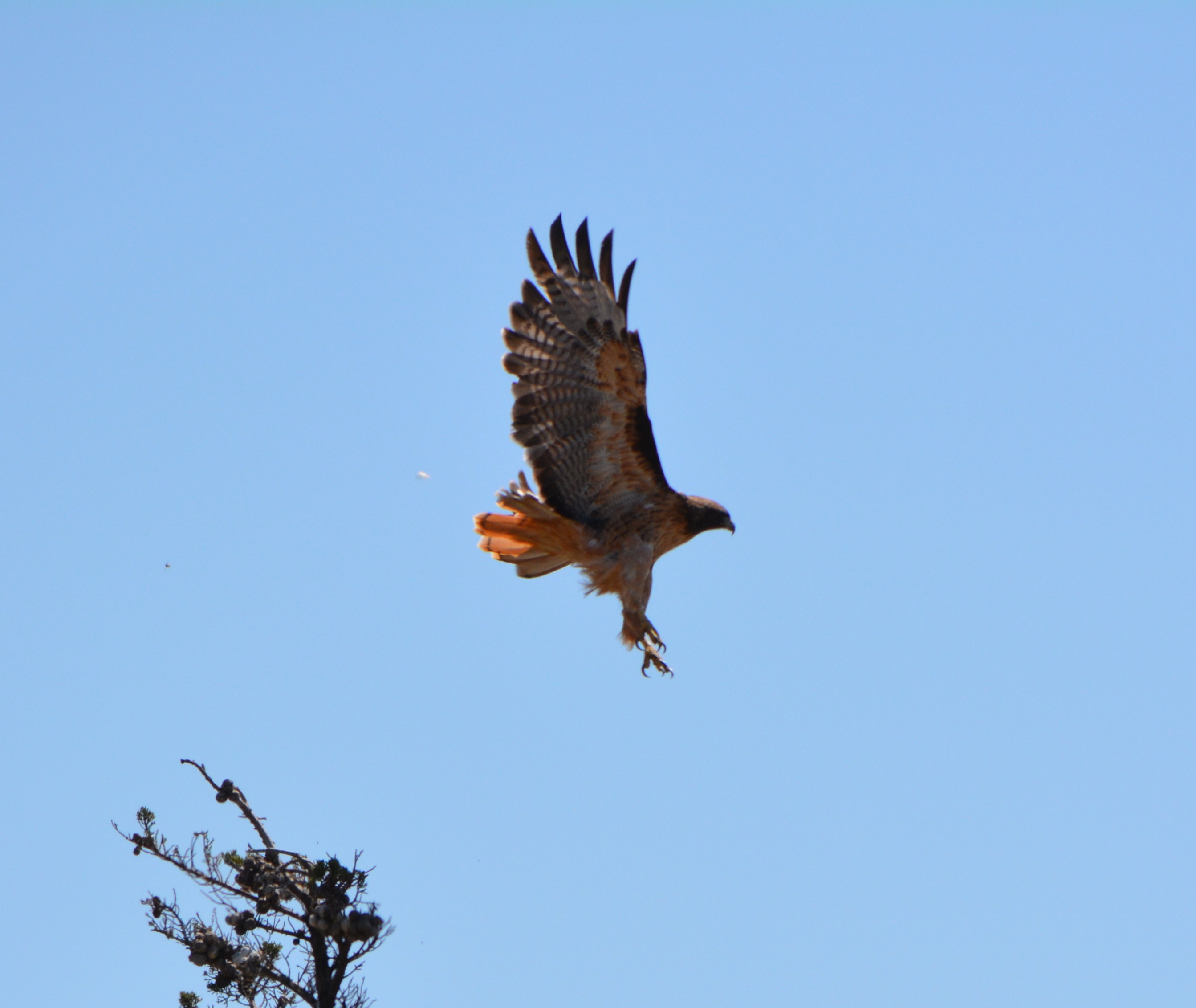
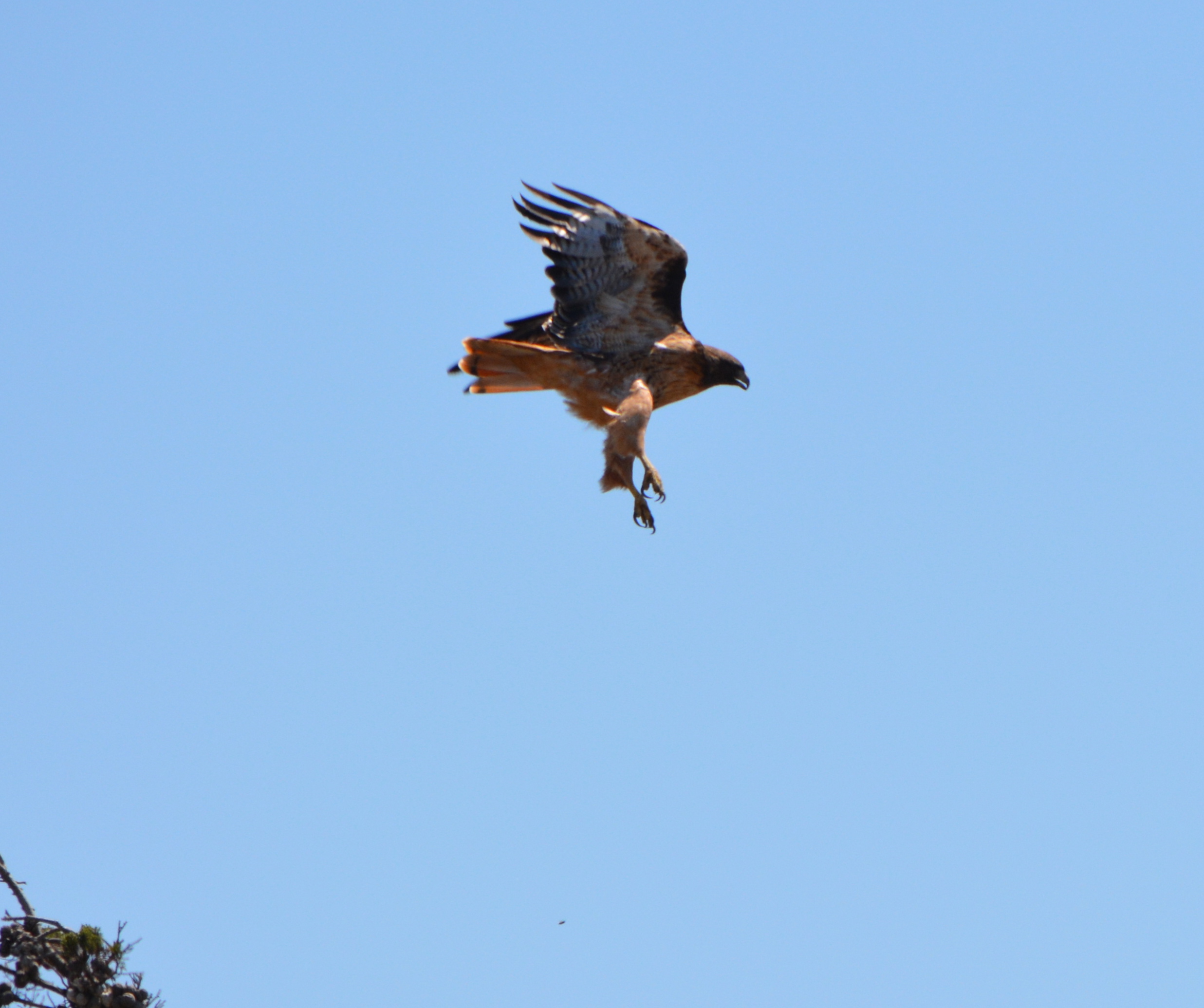
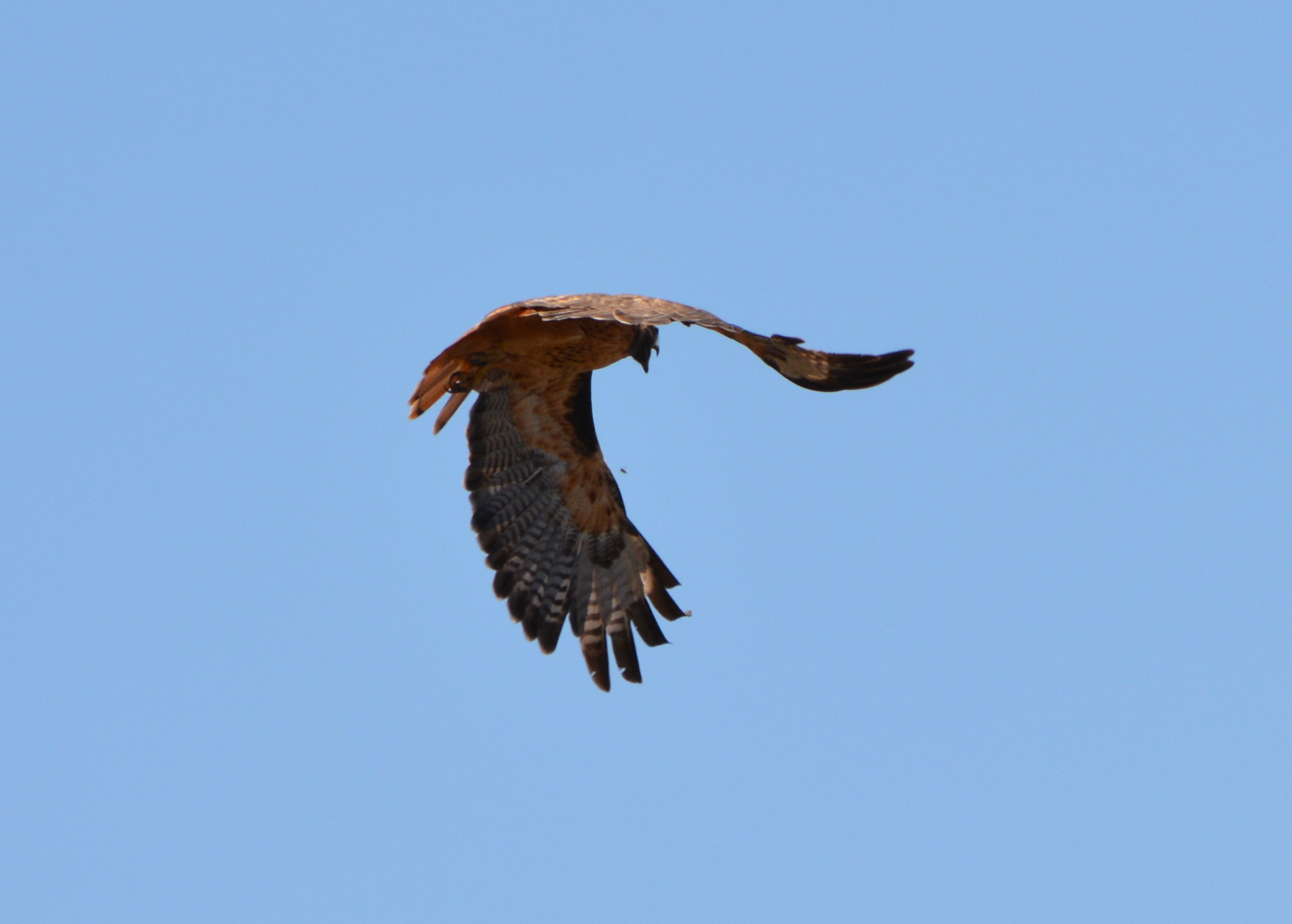
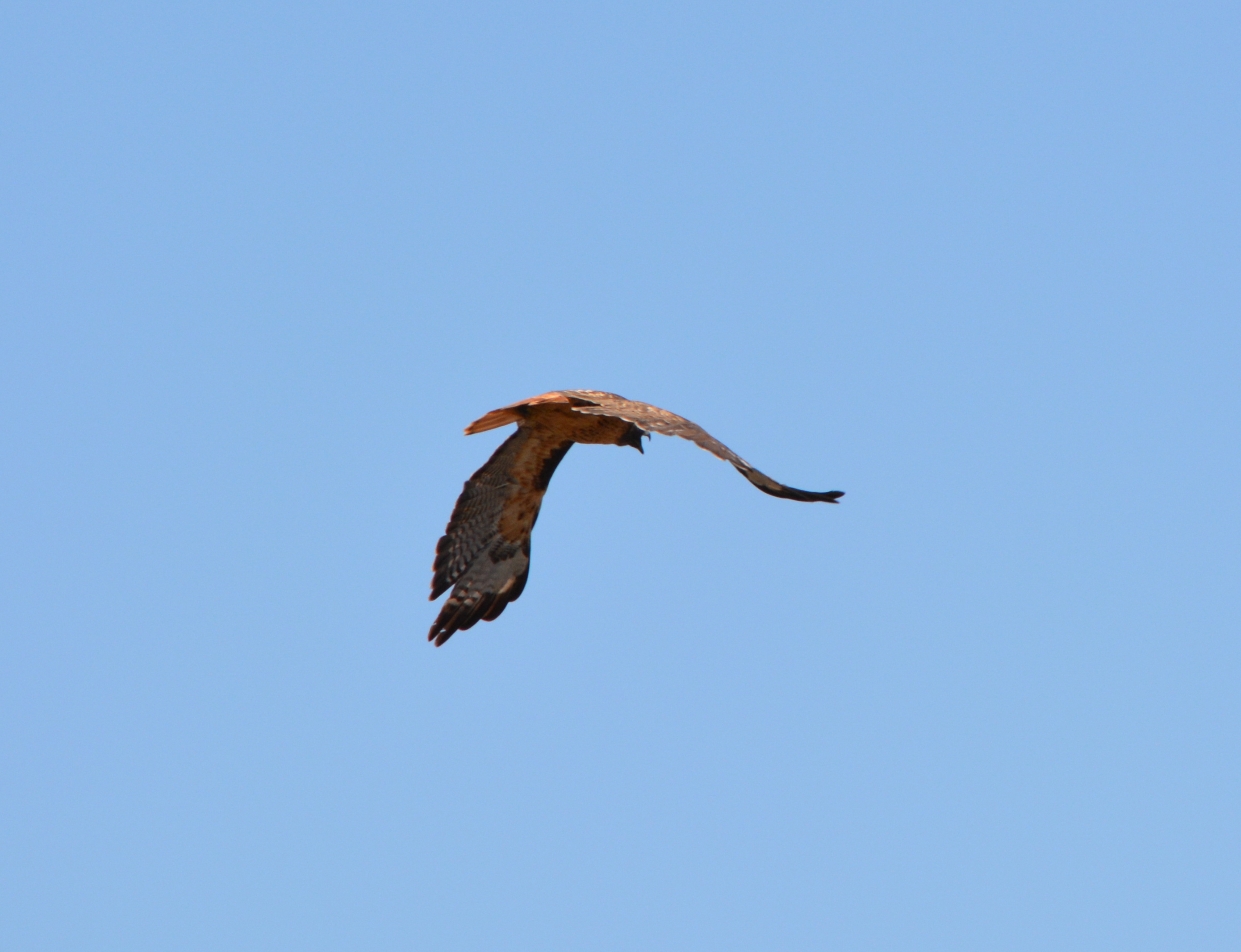
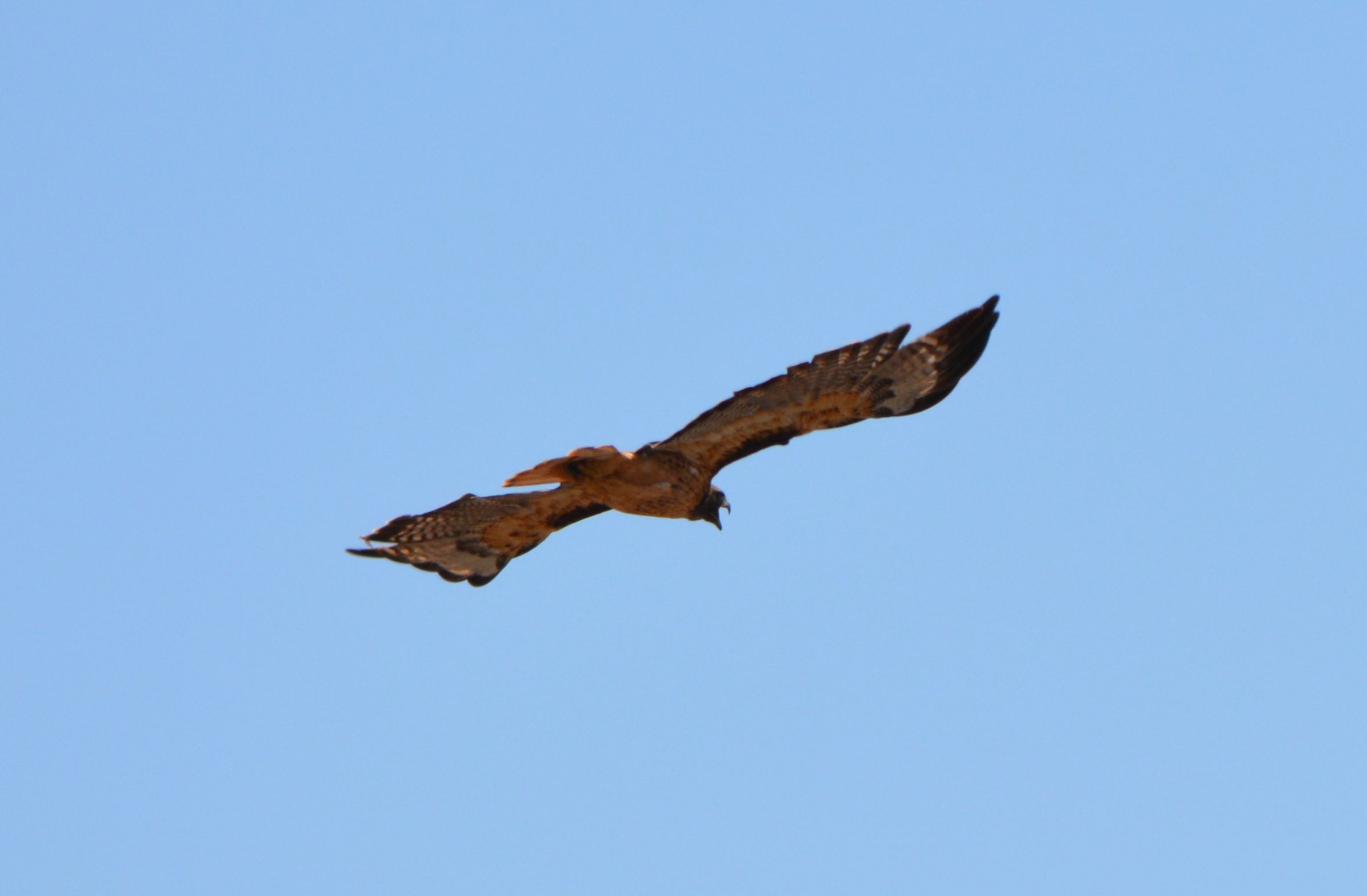
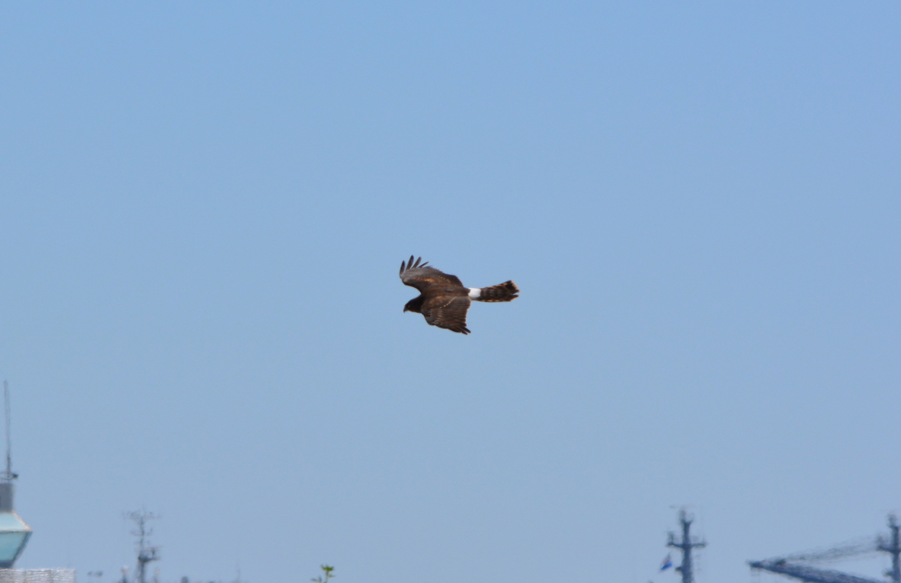
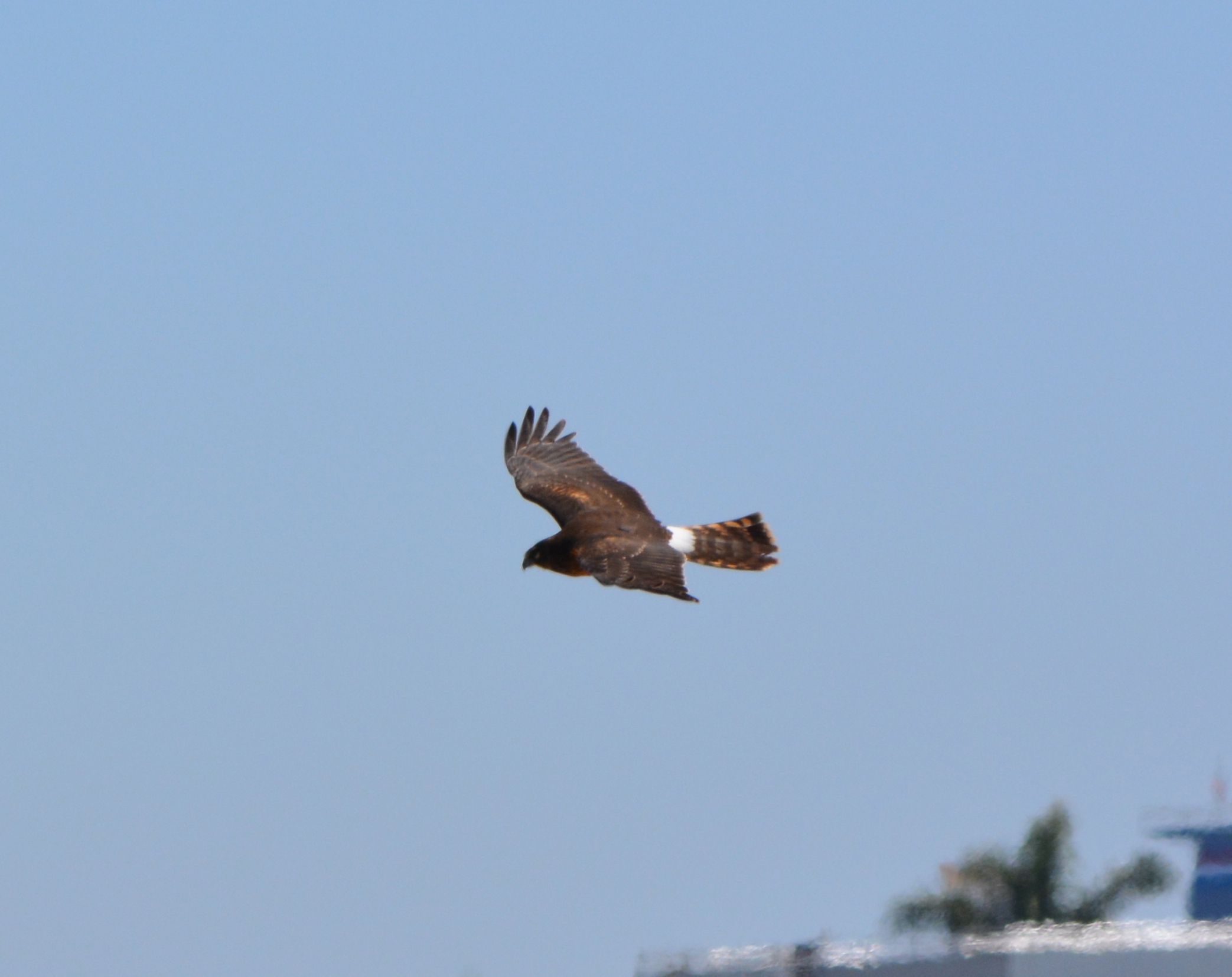
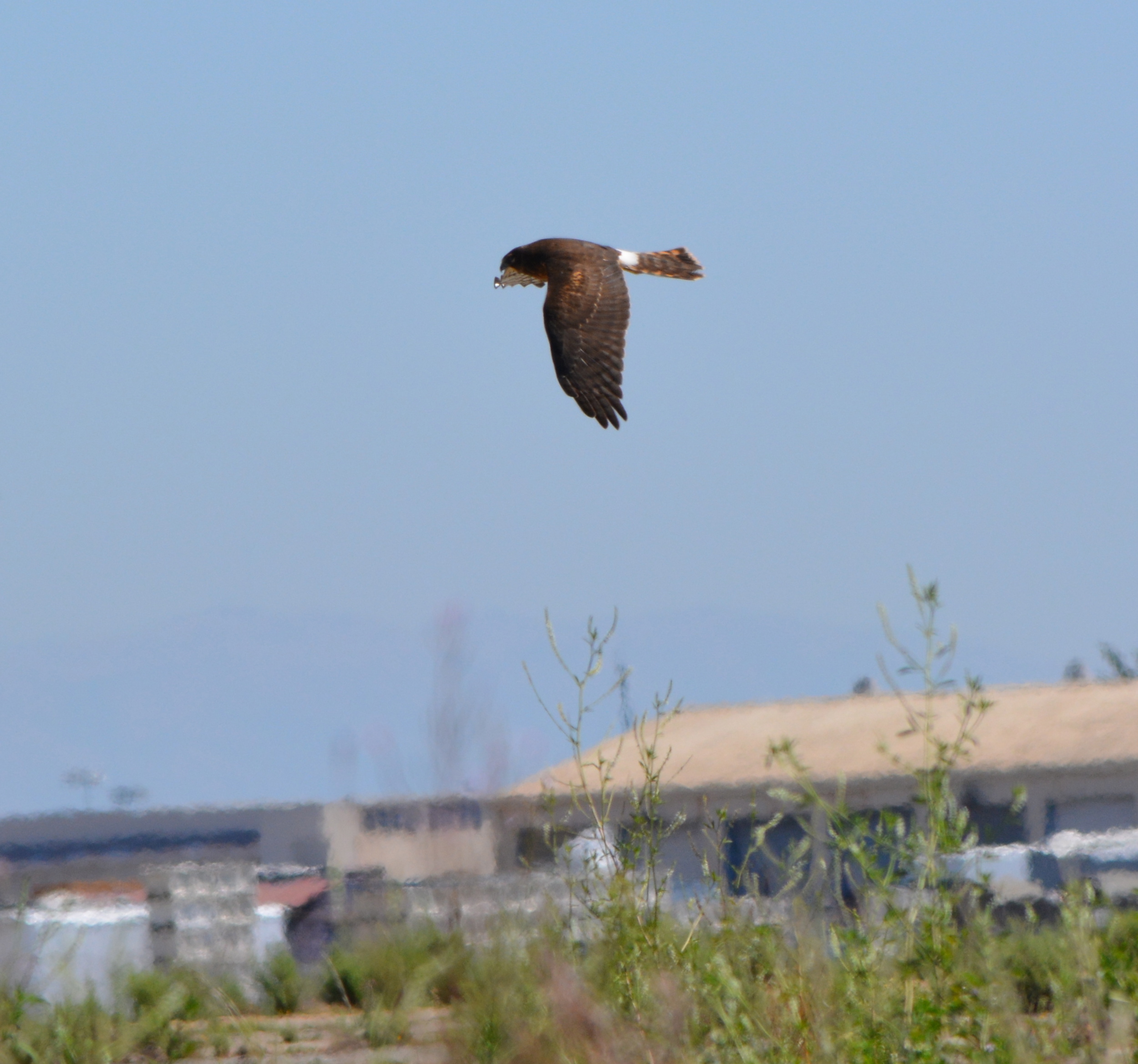
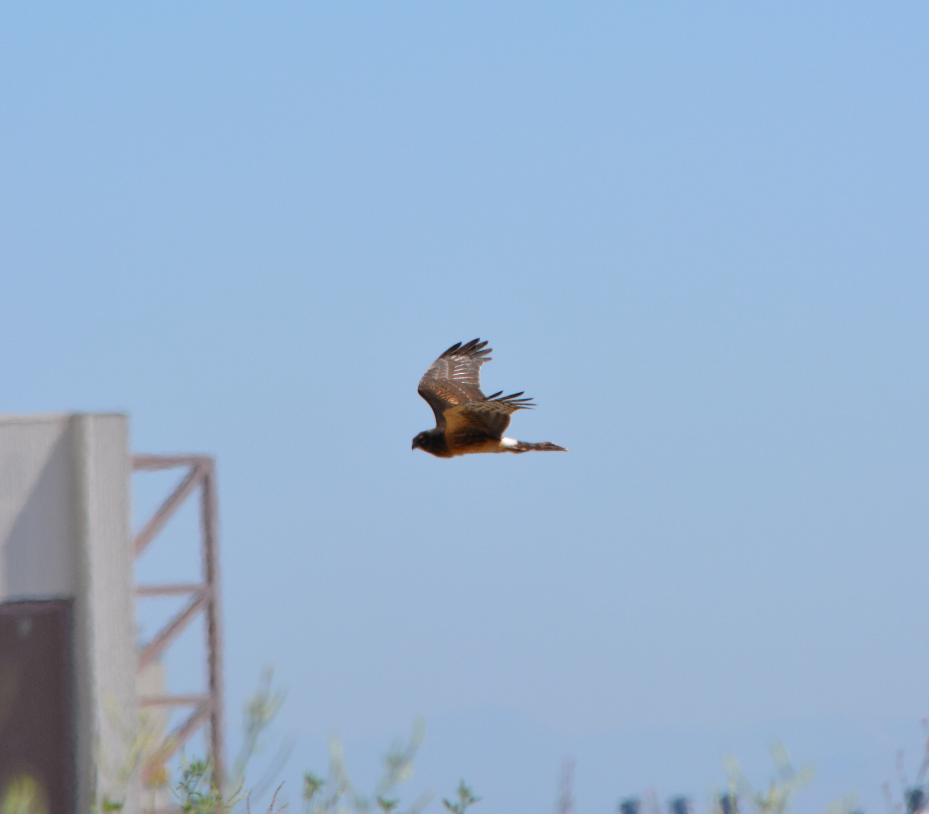
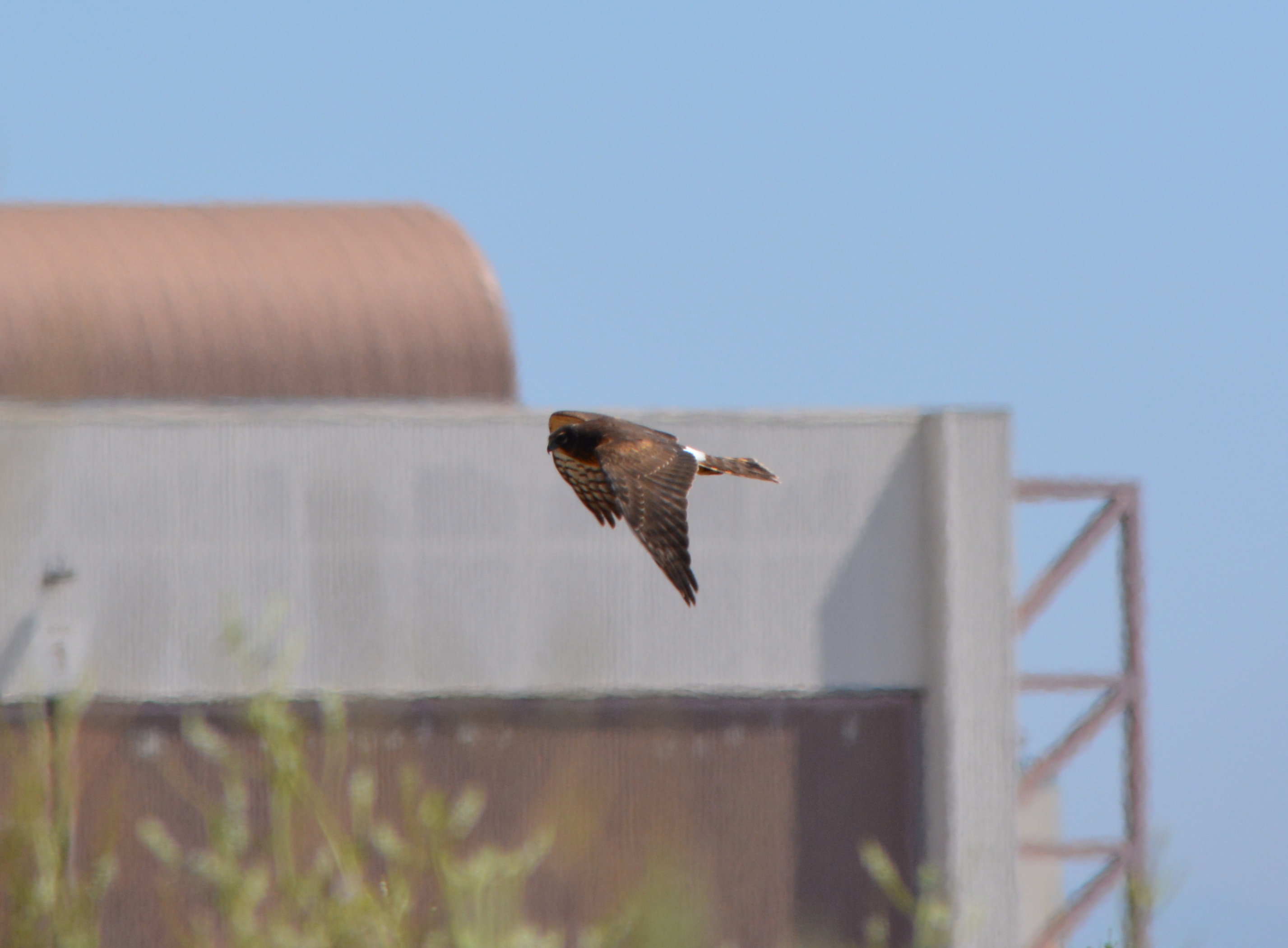
Red-tailed Hawks are regular visitors to the Nature Reserve on the former airfield at Alameda Point. The Northern Harrier, another type of hawk, also visits the reserve, but are fewer in number and harder to spot.
Red tails and harriers both like the wide open space and grassland where they hunt for prey, but they differ in their abilities to hunt. The red tails rely on keen vision and are able to hunt from great heights and distance. Harriers, on the other hand, rely on hearing in the same way that an owl does. The harrier’s face has characteristics similar to an owl that allows it to capture sounds and direct them to their ears. They have the ability to hear the sounds of small animals moving in the grass. They fly close to ground, sometimes within 10 feet, methodically moving about listening for movement.
Occasionally during the least tern nesting season red tails and harriers prey on the terns and have been trapped by the Fish & Wildlife Service and relocated further inland. Red tails can catch jackrabbits, but harriers might have a tough time with a full-grown rabbit and look instead for small rodents.
Adding more grassland on the periphery of the Nature Reserve would help the least terns by providing more hunting opportunities for predators away from the nesting site. These wild and magnificent birds are but two examples of why the Nature Reserve offers unique opportunities for wildlife habitat enhancement.
The two birds below were photographed in September of 2013.
Returning part of the Seaplane Lagoon shoreline to nature is one of the biggest changes that have emerged in the planning process at Alameda Point. The design proposal for the western side of the Seaplane Lagoon echoes the major theme of the Greenspace Project of Golden Gate University’s Center on Urban Environmental Law – the interconnected ecosystem.
From Town Center and Waterfront Precise Plan presentation to Planning Board. (click on map image to enlarge)
The draft Town Center and Waterfront Precise Plan for the Seaplane Lagoon and eastern entrance area, presented to the Planning Board on August 21, offers a number of new concepts, including moving the proposed marina from the west side of the lagoon to the east side. The waterfront plan is being refined concurrently with zoning changes, an environmental impact report, and a master infrastructure plan, which are all aimed at providing the level of detail necessary for the city to start marketing property to investors in 2014.
In reporting to the Planning Board on design plans of the city’s consultant, Skidmore, Owings and Merrill (SOM), city staff stated: “Due to the vast scale of the study area and the Seaplane Lagoon as its centerpiece, the Town Center will be able to support a wide variety of unique waterfront experiences—some of which build and expand upon existing assets and activities, some of which introduce entirely new opportunities. SOM proposes the following four waterfront zones and experiences:
1. Natural environment—along the western edge of the Seaplane Lagoon with trails, docks, camping, outdoor sculpture and wetlands.
2. Promenade and recreational opportunities—along the northern edge, with early phased soccer fields, food concessions, bike and pedestrian paths, open lawn, and kayak access.
3. Urban edge—along the eastern side and portions of northern edge with marinas, docks, eating patios, overlooks, and ferry service.
4. Industrial—further south on the eastern side with maritime uses located near the MARAD ships and the USS Hornet.”
From Town Center and Waterfront Precise Plan presentation to Planning Board.
Climate adaptation grant funding needed – As currently envisioned, however, the de-paving, removal of buildings, and alteration of the western Seaplane Lagoon shoreline area is put off into the distant Phase 3 future — a decade or more from now — when presumably a surplus of infrastructure funds will allow for implementation. One option available for timelier implementation would be to begin now seeking grant funding from agencies that focus on shoreline climate change adaptation. There will be no commercial development on the western side of the lagoon, and therefore the project would become a public asset.
Lying directly to the west on the Nature Reserve is the Runway Wetland, whose habitat value would be greatly enhanced by a connection to the Seaplane Lagoon. Additionally, the draft Master Infrastructure Plan predicts a $10 million savings if the area were allowed to become tidal wetland as sea level rises.
Great Blue Herons with nest (left) and gulls on eastern jetty of Seaplane Lagoon. Heron is directly above proposed tidal marsh featured on map above. West shore of Seaplane Lagoon in background.Great Blue Heron standing in shallow Seaplane Lagoon area where tidal marsh is proposed.Sea Lion catching fish in Seaplane Lagoon. Floating haul out platforms would increase their presence.Black-crowned Night Heron poking around for food on eastern jetty of Seaplane Lagoon. One of the regular but seldom seen wildlife visitors.Alameda Point Channel in foreground that connects San Francisco Bay to the Seaplane Lagoon.
Unless otherwise noted, all photos are copyright Richard Bangert. Permission requests appreciated before reproducing. See “About” page for contact info.