Observations by former Secretary of Veterans Affairs (VA) David Shulkin may shed light on why the VA Project at Alameda Point continues to be delayed and why the health clinic may never be built. Constructing a new clinic conflicts with the Trump Administration’s goal of privatizing VA healthcare services.
In his book “It Shouldn’t Be This Hard to Serve Your Country – Our Broken Government and the Plight of Veterans” (Public Affairs Books, October 2019), Shulkin recounts his experiences after being appointed to head the VA by President Trump in January 2017, and then fired by Tweet 15 months later. Shulkin asserts he was fired because he would not go along with efforts of White House insiders to privatize VA healthcare. Continue reading “Delays of VA Project tied to Trump Administration”
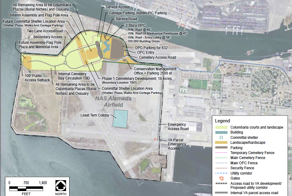
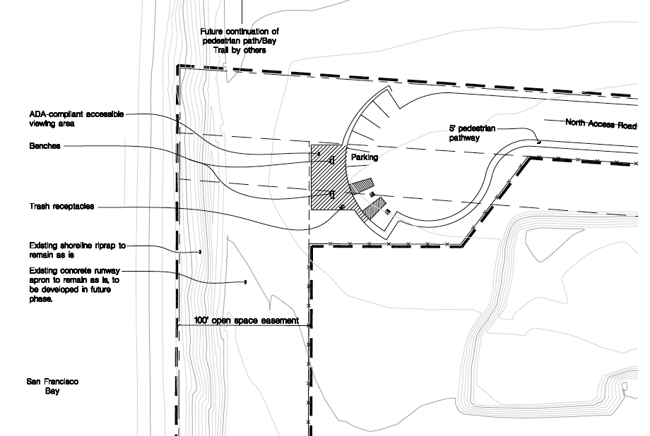
The San Francisco Bay Conservation and Development Commission (BCDC) gave its approval for the shoreline access provisions of the Veterans Affairs’ (VA) project at Alameda Point at its January 16, 2014 meeting. The VA submitted plans that include a public road with sidewalk and bike lane leading to the western shoreline, a one-acre parking and observation area at the shoreline, restrooms, drinking fountains, long term maintenance, and a shoreline easement for the city to construct the Bay Trail. The VA’s plan reflects collaboration with BCDC staff and the City of Alameda.
Some of the BCDC commissioners were concerned about the size of the undeveloped buffer area for the California Least Terns that nest on the former airfield, and the lack of public access on the proposed Bay Trail from April 1 to mid-August while the terns are present. Other commissioners were concerned that the VA and the Army Corps of Engineers had not finalized a plan to mitigate wetlands that the VA project will cover up.
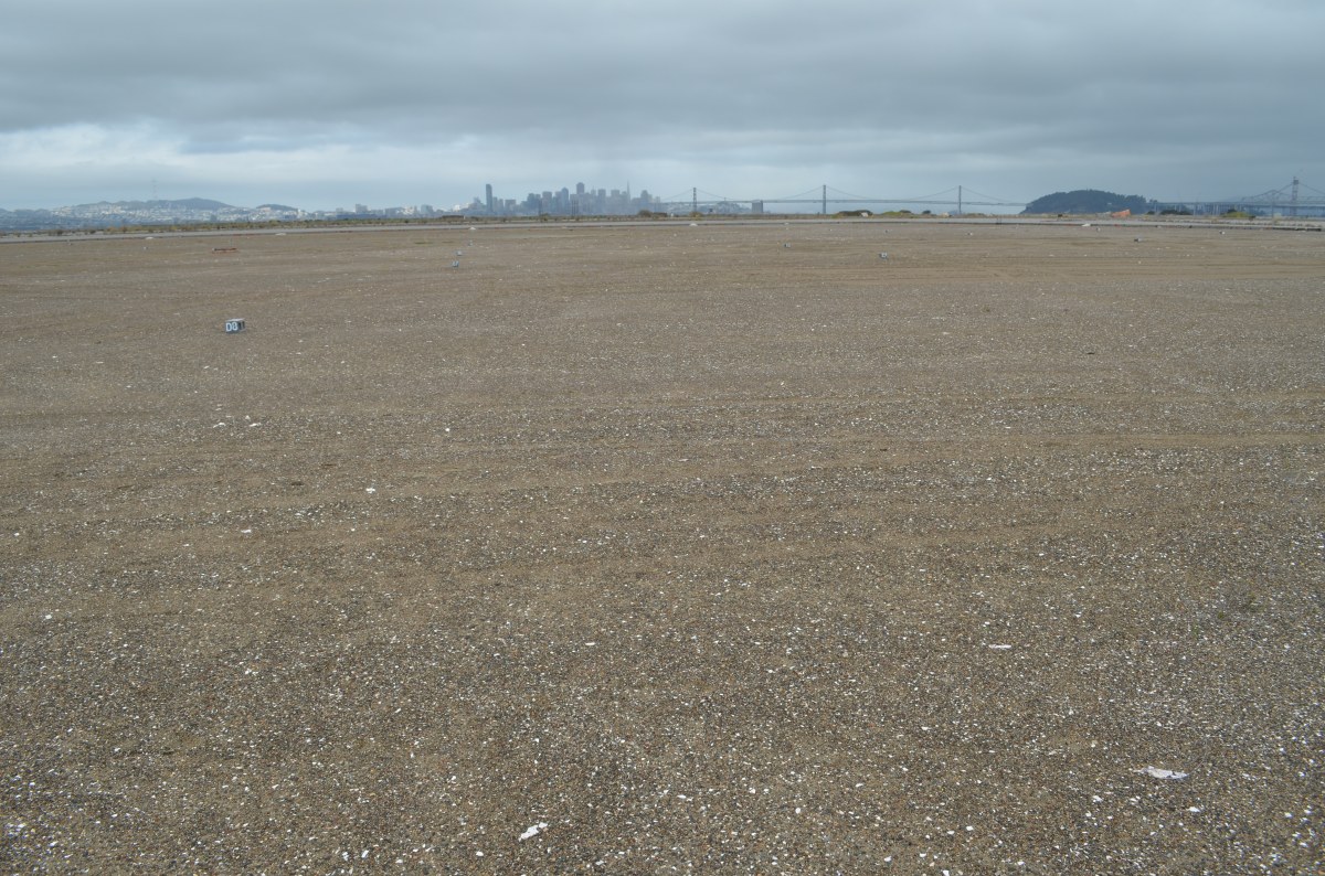
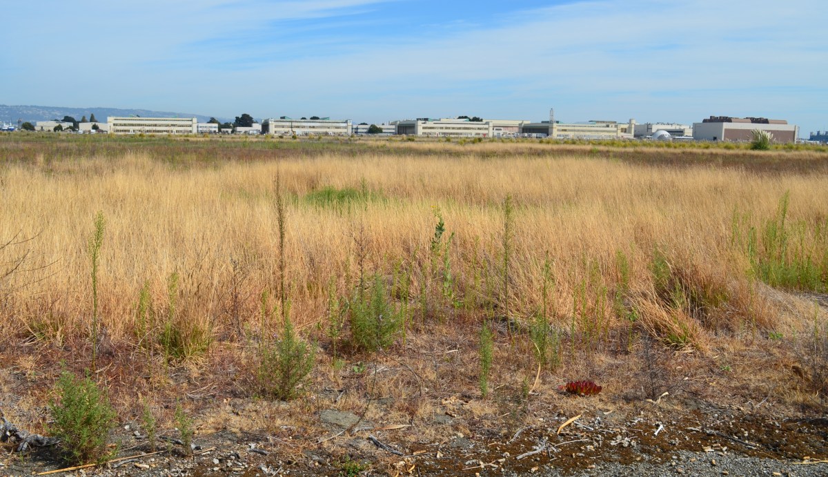
Part of the 511 acres that will be owned by the VA and remain undeveloped. Current restrictions call for prohibiting Bay Trail access to this area from April 1 to mid-August because of potential threats to least terns that nest about a half-mile to the east.
The following excerpts from the 18,000-word meeting minutes for this agenda item offer insight into the long and sometimes contentious effort to construct a VA outpatient clinic, offices, and a new national cemetery at Alameda Point.
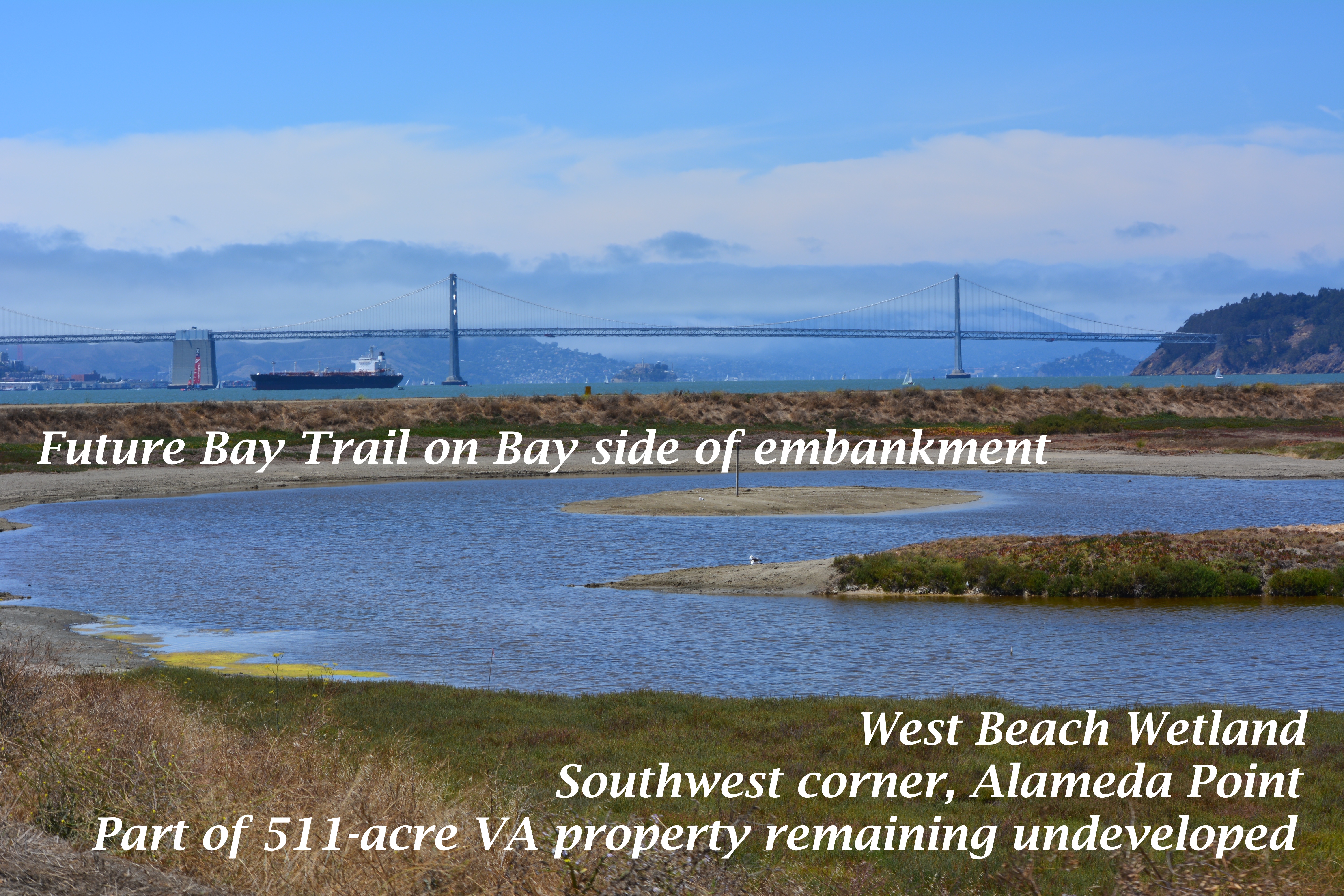
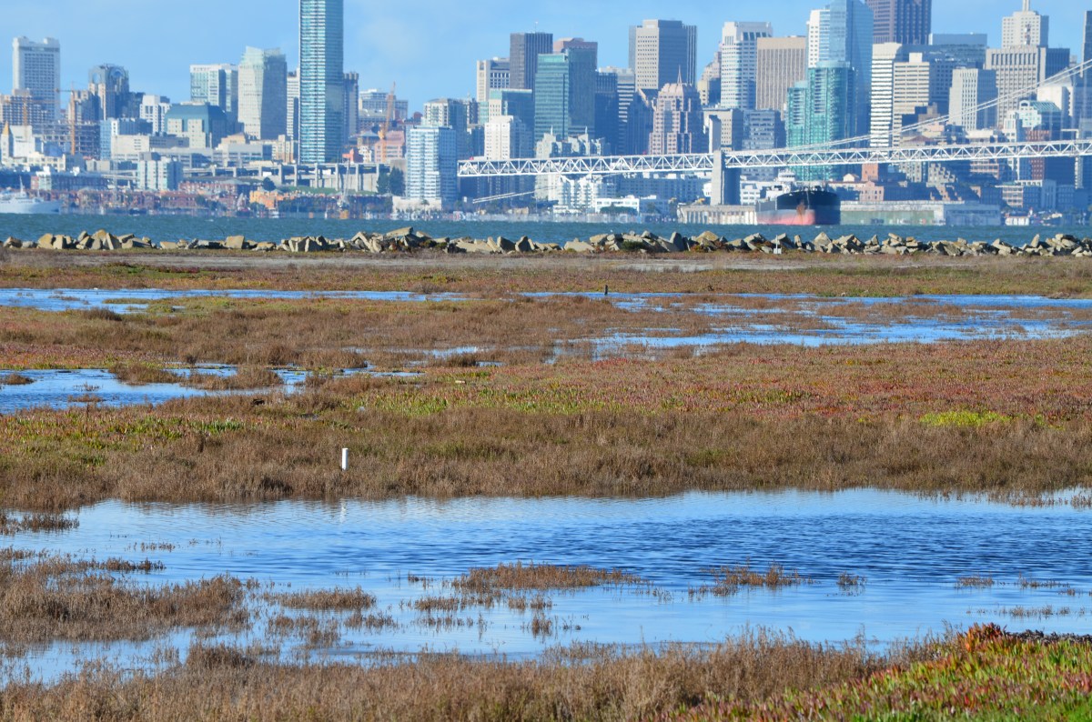
West Beach Wetland area (partially shown in photo above) is on the lower left portion of this map. Click on map to enlarge.
Commissioner Geoffrey Gibbs enquired, “I would like to know from the city of Alameda how these plans are consistent with the city’s hope for a mixed-use development on or near the site.” Alameda Point Chief Operating Officer Jennifer Ott responded, “We’ve been working with the VA for several years and they are consistent with our plans,” Ott said, “and the city has planned over 150 acres of additional park space, passive, open space that by building that road will actually help us bring down the cost of our development of that space to the north. It is a huge help to us to be able to implement additional significant regional open space facilities.”
Commissioner Jim McGrath questioned the VA about the need to prohibit access to the shoreline during the Least Tern breeding season from April 1 to mid-August. McGrath said, “I’m excited that something has been found to work in the long term to manage and preserve the wildlife area. I would love to see it expanded. When I began looking at the maps I said, boy, that Least Tern colony is a long way from the shoreline, over a mile.
“While I absolutely support science-based information that protects nesting areas for endangered species as warranting the highest level of protection, I don’t necessarily see the analytical gap bridged here between the potential for impact, the need for management and the need for, on a long term, restrictions of this nature.
“Some of the research that I’ve seen for the development of habitat areas within the restoration of the South Bay Salt Ponds, the research established that predation from avian species, particularly Western Gull, were the main threats to the Least Tern successful breeding.
“I know from my own experience that there has been successful breeding at fenced sites in southern California at Playa Del Rey and in Orange County; smaller sites on beaches with much less robust buffers.
“It raises in my mind the question of, would we not be better off with some active management of the Least Tern area that is science-based looking at the sources of predation, looks at the actual colony. I don’t want to pick on this project so much as say, if under the consistency review authority which is our single shot at trying to balance wildlife protection and provision of public access, we don’t ask those questions at this stage, we may miss the opportunity to try to achieve a better balance.
“I am a little bit troubled with a mile buffer.”
Mr. Richard Crowe from the VA responded: “We spent several years negotiating with the U.S. Fish and Wildlife Service. From our research, there is no science or an adequate buffer from a development to a colony. There is science on adequate buffer between colony nests. There is a paucity of research in that area.
“The U.S. Fish and Wildlife Service was adamant and we’ve negotiated in good faith and they felt that that quarter mile, 1674 linear feet, was the necessary buffer for the human impacts potential on the Least Tern.
“We’ve negotiated as much as we could and in order to get a favorable biological opinion that those were the final buffers.”
Commissioner McGrath continued the dialogue: “I understand and sympathize with your dilemma but adamancy does not constitute peer-reviewed science. And while we don’t have the U.S. Fish and Wildlife Service here, I guess to some degree I do think of that as the independent analytical role of the staff and the Commission.
“I have no trouble with the provisions and the burden with the VA with the exception of, that may end up being de facto management of this system on a hands-off basis when that, in fact, is not the best thing for either habitat or public access.
“I don’t know what to do with that concern. It certainly bothers me.”
Mr. Crowe responded: “The biological opinion is subject to negotiated modification should any other new science come up or new position by the current managers. The development was going to be below that little bulge but the U.S. Fish and Wildlife Service felt that that was going to jeopardize the Least Tern and they were going to issue a jeopardy opinion, which would kill the project. We negotiated very well and successfully with the city of Alameda to move that development up and that satisfied the U.S. Fish and Wildlife Service and all parties agreed to that and I think that was our way forward.”
This photo shows part of the area on the VA property that was recently zoned Nature Reserve by the city of Alameda. The Bay Trail will pass through this area. The fenced-in 10-acre Least Tern nesting site is nearby to the right. The adult terns roost on pavement near where this photo was taken, which is outside the fenced nesting area. Pedestrians and cyclists coming this close to roosting terns would cause them to flush, which is the reason for the trail closure during the nesting season. How close is too close has yet to be scientifically determined.
Jennifer Ott added, “From the City’s perspective we would have much rather have had a year-round trail. I can imagine the City approaching the VA at a future time, once things have settled, bringing this up again as an issue.”
Wetland Mitigation
The VA’s project will entail filling in about 11 acres of wetland. The VA will be required to mitigate the loss of wetland, but those plans have not yet been agreed to and approved by the U.S. Army Corps of Engineers. Some commissioners wanted to postpone the vote to approve the VA plans until they could see the wetland plans, even though the wetlands are outside BCDC’s jurisdiction.
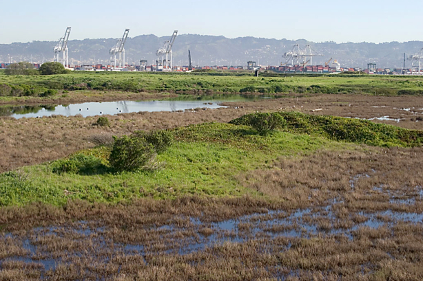
Runway Wetland in foreground is the best area in which to add additional wetland as mitigation for losses in the VA developed area to the far right on the airfield (outside of view).
Commissioner Kathrin Sears said, “We look at the Least Tern in a different way because the birds fly. Wetlands can become connected to the Bay and have a broader impact on areas in our jurisdiction as sea level rises. I think there are different issues there that might make it appropriate for us to look at the wetlands.
Commission Chair R. Zachary Wasserman said, “Coming back to the issue of the wetlands that are outside of our jurisdiction, that are within the Corps’ jurisdiction; the issue being raised is, will the Least Terns – we are legitimately taking that into consideration because they’re migratory, they use the Bay, they use our jurisdiction. The question that has been posed is for the wetland that is outside our jurisdiction, which theoretically is used by shore birds; is that sufficient then to bring it within our consideration just as the Least Tern issue is?”
The VA’s Doug Roaldson commented: “We appreciate the [U.S. Army] Corps [of Engineers] and we have had numerous talks with you. We are clearly interested in those wetlands. We’ve had numerous discussions about a strategy. We’re still evaluating that strategy. We don’t know what’s happening and this is outside of your jurisdictional discussion right now. What’s the VA going to do? We’re going to take care of those wetlands. We’re either going to move them and we’ve got two very high quality wetlands on the property and they are very easy to mitigate into. We’ve had these discussions with the Corps.
“We’ve had a discussion, if we mitigate do we mitigate by phase or do we mitigate the entire site?”
The last comment offers insight into why the VA and Corps of Engineers have not yet agreed on a plan. The Corps wants the entire 11 acres of wetland mitigated at the beginning of the project, even though some of those acres won’t be impacted for decades when more of the columbarium is built out. The VA, on the other hand, wants to pay for the mitigation when the wetlands are actually filled in.
Whether the wetlands are mitigated in phases or all at once, the plan will have to be agreed upon when the VA begins their project. BCDC’s approval contains special conditions that require Corps of Engineers approval of a wetland plan at the project’s commencement.
BCDC staff member Jaime Michaels said, “I just want to point out given the conversation we’ve been having [about wetland mitigation], there is also a condition and it’s Special Condition II.C that talks about the need for the VA to get other local, federal and state approvals before they begin their work. That would include the Corps of Engineers’ approval.”
A motion was made and seconded to approve the VA’s project as being consistent with state law, in this case the San Francisco Bay Plan, as required under the federal Coastal Zone Management Act. On a roll call vote, the motion passed with 13-Yes, 2-No, and 4-Abstain.
The property is slated to be transferred from the Navy to the Department of Veterans Affairs in 2014.
Alameda Point western shoreline where one-acre public access site with parking will be constructed on VA property. Looking south.Shoreline public access site on VA property. San Francisco Bay to the left.
Below is the draft of a city council resolution that has been introduced to the council by councilmembers Stewart Chen and Tony Daysog. It is on the council agenda for 7 PM, Tuesday, February 19, 2013. The community is urged to attend and voice their opinion.
The refuge has been home, harbor, and safe haven for many species, even during use as a military base. As the property transitions to VA ownership, the protective status of “Open Space” and “Wildlife Refuge” should travel with it on into the future. It is a rare piece of earth on the Bay that should be available for nature to reclaim. Proper zoning will reflect the level of commitment we have toward environmental stewardship in an era of growing demands on ecosystems everywhere.
Draft – City Council Resolution
Resolution re-affirming support for creation of the Alameda Wildlife Refuge at Alameda Point
Whereas, the 1996 Community Reuse Plan identifies the southern two-thirds of the Naval Air Station-Alameda airfield for preservation as a wildlife refuge;
Whereas, the 1996 Community Reuse Plan stipulates that this area “would remain as open space to provide for the preservation of wetlands, sensitive species, and regional open space uses”;
Whereas, the City of Alameda General Plan was amended in 2003 to add Chapter 9 on Alameda Point, which includes support and encouragement for funding and implementation of the U.S. Fish and Wildlife Service’s Comprehensive Conservation Plan for the Alameda National Wildlife Refuge;
Whereas, the General Plan amendment supports “a system of trails that provide public access to and within the Wildlife Refuge” that balances natural conservation with public access and education;
Whereas, the General Plan amendment supports the creation of education facilities and programs, similar to other conservation areas such as the Elsie D. Roemer Bird Sanctuary;
Whereas, the wildlife refuge is home to one of the most successful nesting sites in California for the endangered California Least Tern;
Whereas, Breakwater Island is part of the wildlife refuge vision in the 1996 Community Reuse Plan, and it is the only night roosting area of its kind in San Francisco Bay for California Brown Pelicans, which were only recently removed from the Endangered Species List;
Whereas, the wildlife refuge, and the entirety of Alameda Point and its adjacent waters, are subject to special restrictions for protection of the least terns by authority of the 2012 Biological Opinion issued by the US Fish & Wildlife Service, the responsible agency for enforcement of the Endangered Species Act;
Whereas, the 511-acre refuge area offers a rare and vast inner urban opportunity for public access and education, a respite and retreat from the built environment, introduction of native plant species, expansion of wetlands, and wildlife recovery and protection efforts;
Whereas, the Alameda Wildlife Refuge would complement the land uses contemplated for the mixed-use area of Alameda Point, as well as complementing the entire city and the Bay Area;
Whereas, numerous federal, state, and regional public agencies possess the experience and mission for collaboratively managing a wildlife conservation area;
Whereas, environmental cleanup and remediation will be completed by the Navy in compliance with federal and state environmental laws;
Whereas, ownership by the VA will ensure that potential environmental cleanup liabilities regarding the Site 2 landfill, and any other portion of the federal property, will be borne by the VA (unless retained by the Navy) regardless of the land uses;
Whereas, the wildlife refuge vision is compatible with, and complementary to, proposed plans for a VA clinic and columbarium;
Now be it therefore resolved:
The City Council of the City of Alameda re-affirms our commitment to and support for the creation of a wildlife conservation area known as the Alameda Wildlife Refuge at Alameda Point;
And be it further resolved that the adjacent waters of the Alameda Point Channel, and Breakwater Island, are to be included in the management plan for the refuge;
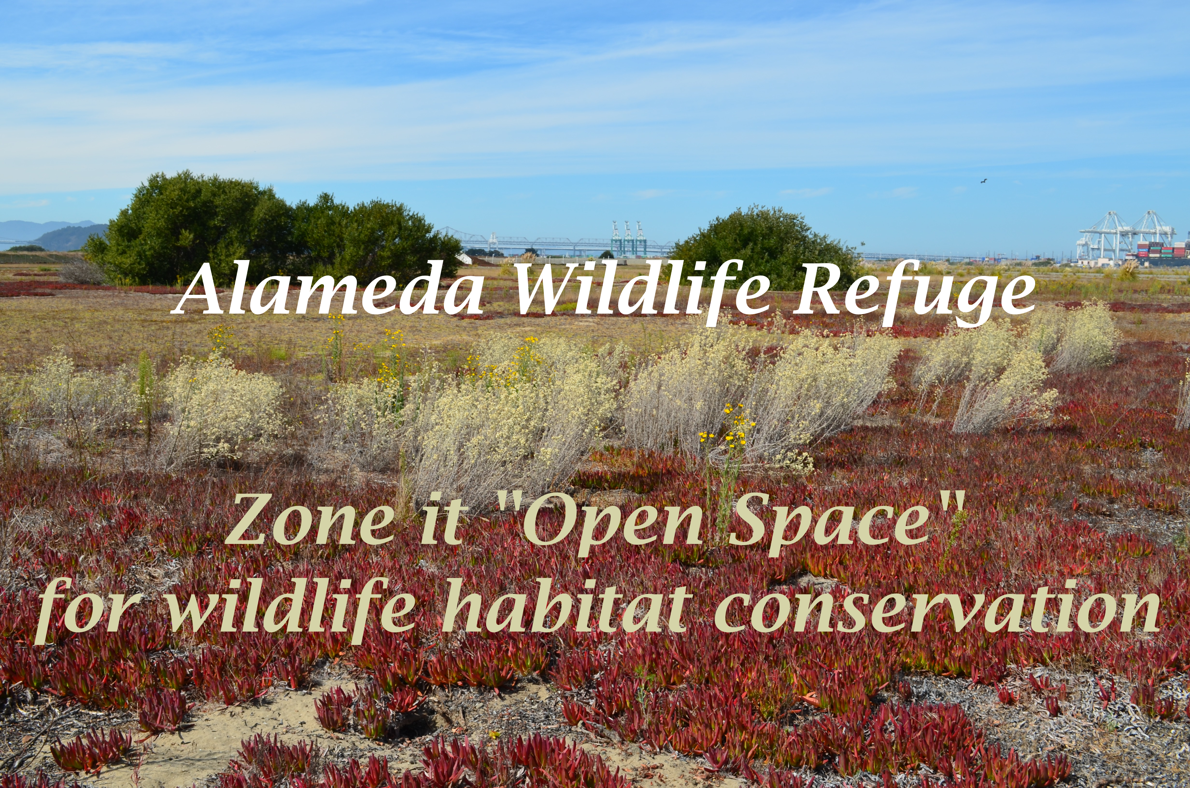
And be it further resolved that the City Council of the City of Alameda will support the zoning of the wildlife refuge property as “Open Space with a Refuge Overlay,” or similar conservation zoning designation, to promote the protection and implementation of the values and goals recited in this resolution.
Once upon a time there was talk about a national wildlife refuge at Alameda Point. It was included in the reuse plan for Naval Air Station (NAS)-Alameda that was accepted by the Department of Defense. It was added to Alameda’s General Plan. The US Fish & Wildlife Service was poised to be the owner and caretaker of the refuge.
But after talks broke down between the Navy and US Fish & Wildlife Service nearly a decade ago, the Navy arbitrarily decided to give the land to the Department of Veterans Affairs (VA) for a clinic and columbarium. The VA is counting on the City of Alameda to give them an additional 70 acres of land early next year so that their clinic can be located further away from the nesting site of the endangered California least terns. This would bring the VA’s property to roughly 620 acres, even though they need only 110 acres.
The city should impose a condition on this land deal: Before the city changes its reuse plan footprint to accommodate the VA, the city should insist that the Navy place a conservation easement on the 511 acres that the VA does not need. A conservation easement would lay the groundwork for creation of a wildlife refuge or wildlife conservation area to be operated by another agency.
Golden Gate Audubon Society 1995 study examines economic value
The benefits of creating a wildlife refuge at Alameda Point go beyond environmental stewardship. They also include economic benefits to Alameda and the region. The Golden Gate Audubon Society (GGAS) understood the economic angle back in 1995 when they were advocating for creation of a wildlife refuge. To provide substance to their views, they commissioneda studyby Robert Hrubes and Associates that was released in March of 1995. It’s called “The Potential Economic Benefits of the Proposed Alameda National Wildlife Refuge: An Overview.” The conclusion of the 1995 study—that a wildlife refuge will complement economic development—still holds true today.
The study went on to extol the intersecting virtues of wildlife habitat protection and economic value. “While important in their own right, the benefits that would be generated by establishment of the wildlife refuge are not limited to habitat and species protection,” stated Hrubes and Associates. “[T]here are indeed potential economic benefits that could derive from a wildlife refuge/day-use recreation area located in the central Bay Area. That is, the wildlife refuge proposal is not an ‘either/or’ choice between environmental quality and economic development. Rather, it constitutes a land use that not only will take optimal advantage of the environmental attributes the site has to offer but also will generate economic activity that benefits the local region. Further, it will enhance the economic value for development of the remainder of the NAS.”
VA’s project requires further study of impacts
The current proposal for the VA to own and control the 511-acre refuge area next to their 110-acre medical clinic and columbarium makes it all but impossible for this area to become the urban wildlife oasis that it could be. The VA’s proposed project map makes this clear by wiping out the words “Wildlife Refuge” and replacing them with “VA Undeveloped Area.”
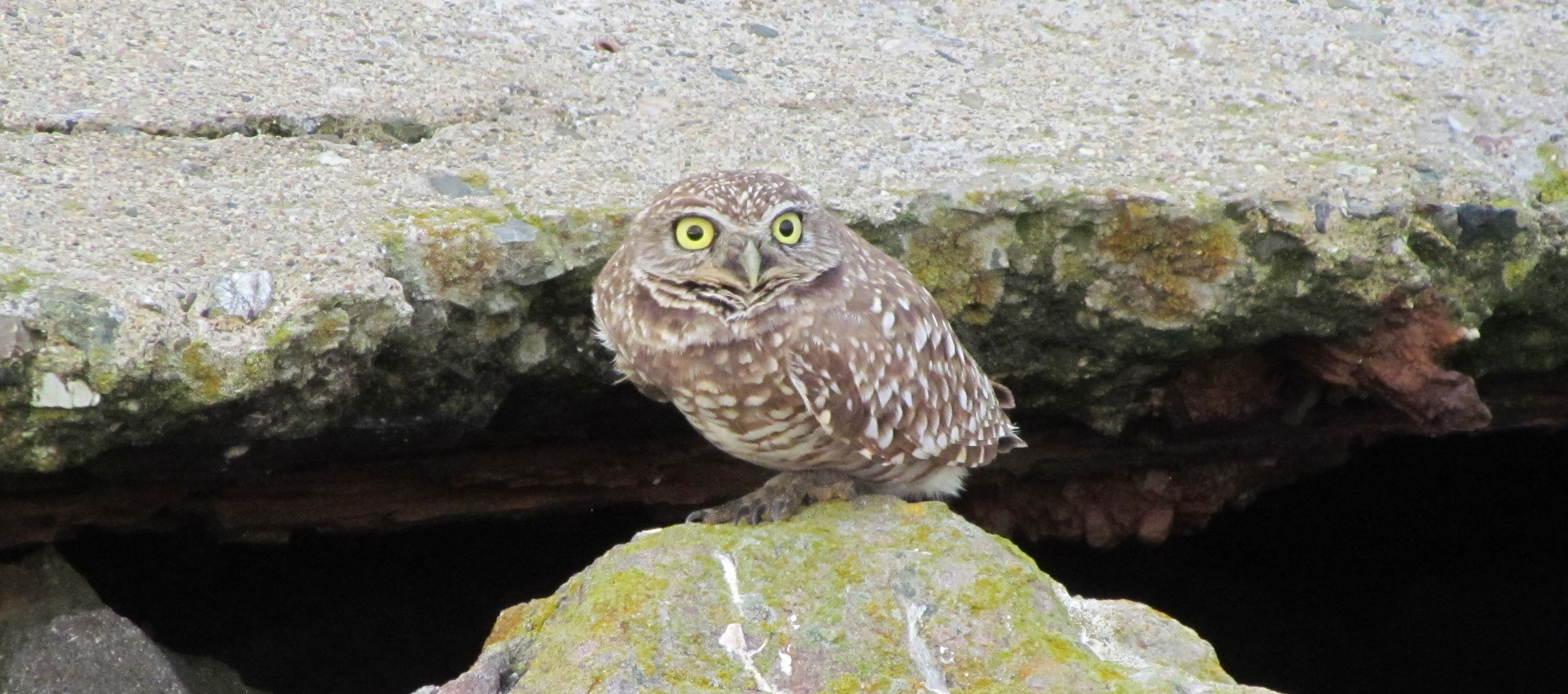
At this stage of the environmental review process, the only significant environmental requirement that has been imposed on the VA is that they provide predator management, housekeeping, and record-keeping for the California least terns during their four-and-a-half-month nesting season at Alameda Point from April to mid-August. This is because the Biological Opinion issued by the US Fish & Wildlife Service in the summer of 2012 focused only on one species – the least tern – due to its listing as an Endangered Species. It remains to be seen whether the VA and Navy will prepare a full Environmental Impact Statement (EIS) as typically required for a federal project of this size and scope. The National Environmental Policy Act provides for an impact report that is similar to California’s Environmental Impact Report. If the Navy and VA perform an EIS, they will then have to look at impacts to other species (such as the burrowing owl), habitat values, climate and traffic impacts, as well as identify alternative sites for all or part of their project.
However, based on public statements from the VA about their timeline for construction, it does not appear that they have any intention of doing a full EIS, and thus their environmental commitment will be limited. This will mean that rather than adding grasslands to perimeter areas that already have pockets of grasslands between runways and taxiways in order to divert hawks and other avian predators away from nesting terns, they will keep the refuge looking as much like a fenced-in stadium parking lot as possible (like it has been for the past decade). The pretext is that it removes habitat for predators, but in this case they would be torturing the concept by making the tern nesting site so conspicuous that it will invite predation. Virtually all of the least tern predation events have been from flying predators—like the peregrine falcons that come from miles away on the other side of Alameda.
The real reasons for maintaining the industrial look are to reduce maintenance and capital costs, and to exploit the paved areas forrevenue-generating usesthat don’t require construction. They have already said they will use the area for emergency preparedness training, disaster staging, and storage of supplies.
Over 180 different species of bird have been spotted on the refuge at one time or another. Some of the wetland area can easily be expanded and linked permanently to the Bay. Grasslands could be added. Instead, what we can expect to see added are auto driving events and RV shows.
Early in 2013, the Alameda city council will play a pivotal role on whether the VA is able to permanently kill the wildlife refuge vision. The city council must vote on an amendment to its no-cost conveyance deal with the Navy in order to allow the VA project to move forward. By their action, the city will decide whether the 1996 Community Reuse Plan for Alameda Point will be amended to remove the wildlife refuge as a goal, or if it remains.
Killing the wildlife refuge is not only a bad idea for the environment. It’s a bad idea for the economy.
Read more in the Conservation Actionsection of the Alameda Point Environmental Report.
Alameda Point with the Port of Oakland on the left. Yellow outline shows Site 2 cleanup area. Green outline shows area where waste is buried. All but the wetlands in the bottom right corner of yellow area will be covered with clean soil. Fence and gates will be on landward sides of yellow border. Photo-graphic credit: US Navy.
Even after all the cleanup work is completed, the Navy proposes to put a permanent chainlink fence topped with barbared wire around a scenic shoreline section of the wildlife refuge at Alameda Point.
“Good grief! If a fence is needed, will Site 2 be clean enough for our community?” Leora Feeney, co-chair of the Audubon Society’s Friends of the Alameda Wildlife Refuge, said upon first learning about the fence.
The Navy used the site for underground waste disposal from 1956 to 1978. According to representatives at the U.S. Environmental Protection Agency, the California Department of Toxic Substances Control, and the Regional Water Quality Control Board, the permanent fence has nothing to do with human health risks at the site.
According to the answer that the regulatory agencies provided collectively, “Potential human health exposure is unlikely to occur during recreational use on top of the soil cover such as walking or sitting.” The soil cover will be seeded with native grasses.
The fencing is aimed at reducing maintenance costs for the new landowner, the U.S. Department of Veterans Affairs (VA). “While the fence is not mandatory and recreational use without soil cover disturbance will not pose a risk to human health or the environment, the ongoing management of the protective cover in an area with public use without more direct supervision will increase risks and costs,” representatives from the agencies jointly stated.
The VA’s annual expense for operating, maintaining, monitoring, and compliance reporting for the cleanup site, without added supervision, is pegged at $101,715, according to an advisory paragraph in the work plan. ”There are numerous groundwater monitoring wellheads and landfill gas probes that require security to maintain monitoring integrity,” regulators stated.
The Navy’s plans indicate that access to the shoreline trail will remain open. But according to the regulators, “The perimeter road should have gates. This concern will be clarified with the Navy.”
A view that will be off limits to the public if security fence is installed. Photo by Eleanor Briccetti
The security fence, which will be inside the fenced off refuge area, departs from longstanding expectations for the refuge. Ironically, the off-limits wetlands area at this site is showcased on an Audubon Society brochure about the refuge. Docent and ranger-led bird watching and nature walks have been part of the expected uses at the wildlife refuge since the mid-1990s.
By 1998, the US Fish & Wildlife Service had drafted its guiding document for creating the Alameda National Wildlife Refuge. It envisioned supervised activity. It was to be run in the same manner as other refuges, with controlled and monitored use, two law enforcement officers, and a cooperative agreement with the East Bay Regional Park District “to augment [Fish & Wildlife] Service efforts.” Talks between the Fish & Wildlife Service and the Navy collapsed around 2004 over cleanup issues.
The shoreline restrictions imposed by the fence and gates are also at odds with the San Francisco Bay Plan, which is administered by the San Francisco Bay Conservation and Development Commission. While permits are not required for federal projects, the official “Record of Decision” for this cleanup site states that plans will be in accord “with substantive provisions of the San Francisco Bay Plan.” One of the keystones of the Bay Plan is maximum feasible shoreline public access. “The city is discussing the provisions of remedial design for Site 2 with the Navy to support a future perimeter trail around the shoreline of the fed-to-fed parcel, which the city is strongly committed to,” said Jennifer Ott, Chief Operating Officer for Alameda Point.
Another of the Bay Plan’s guidelines avoids undesirable visual impacts on the shoreline. One of the details in the work plan calls for 30 ten-foot tall, four-inch diameter, white PVC soil gas vent pipes for methane gas. This array of pipes will be visible from the outside seating areas behind beverage purveyors on Monarch Street such as St. George Spirits. “The city and Navy will discuss ways to minimize the visual impact of any new and/or replacement pipes, including the possibility of reducing their height,” Ott said.
Releasing methane into the environment has 21 times the greenhouse gas impact as burning it and turning it into carbon dioxide. The city currently burns off the methane gas produced at the city’s old municipal dump, Mt. Trashmore.
Public comments on the draft Remedial Action Work Plan for Site 2 will be accepted by the Navy until Monday, July 9. Responses to comments and a finalized plan will be announced in August. A copy of the plan is available in the information repository in City Hall West, 950 West Mall Square at Alameda Point. A rare opportunity to visit the site will take place on Saturday, June 23, when the Navy hosts the annual site tour. To comment, or to sign up for the tour, contact the Navy’s Environmental Coordinator Derek Robinson at derek.j.robinson1@navy.mil.
Site 2 details
The 110-acre cleanup site lies on the southwestern corner of Alameda Point within the 549-acre wildlife refuge, and includes 30 acres of wetlands and the 60-acre disposal area.
Remedial work at the site is expected to commence in the fall of 2012 and be completed by summer 2013. As a base layer for the soil cap, the Navy will use some 75,000 cubic yards of soil that it dredged from the Seaplane Lagoon and deemed clean enough for reuse. The Navy will then barge between 400,000 and 600,00 cubic yards of clean soil from Decker Island in the Sacramento River near the town of Rio Vista. The Navy says this will save at least 22,000 semi-truck trips.
The work plan document allays longstanding fears about underground toxic chemicals leaching into the Bay. According to groundwater monitoring results in 2011, and comparing them to 16 years of data, all chemicals of concern are below risk levels and either stable or trending downward. The plan includes the option of eliminating the groundwater monitoring wells in five years.
“Overall, the Navy believes that the soil cover remedy for IR Site 2 is directly compatible with the anticipated future reuse of the site.”
Alameda Point Open Space: East Bay Regional Park District’s Emerging Role and Where to Locate the VA Outpatient Facility
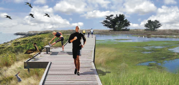
Boardwalk through proposed wetlands
Golden Gate University’s Center on Urban Environmental Law (CUEL) recently sent aletterto Robert Doyle, General Manager of the East Bay Regional Park District (EBRPD); John Russo, Alameda City Manager; and Larry Janes, Capital Assets Manager for the Veterans Administration Sierra Pacific Network commenting on the ongoing discussion about the location of a VA outpatient clinic at Alameda Point and the management of open space.
In the letter signed by co-director Paul Kibel, he states that a “more expansive role for EBRPD at Alameda Point aligns well and advances several of the proposals in CUEL’s September 2011 Flight Park Booklet. First, consistent with the Hannover Principles on Land Use, granting EBRPD authority to manage open space on both the City and federal portions of Alameda Point will help ensure that such management is based on integrated protection of habitats and viewsheds rather than arbitrary jurisdictional boundaries.”
“Second, and once again consistent with the Hannover Principles, allowing EBRPD to plan open space at Alameda Point on this broader geographic scale will facilitate the creation of self-regulating and self-adjusting habitats and landscapes (that require less maintenance costs down the road).”
Perimeter boardwalk (Bay Trail) through park
“Third, the appointment of one qualified agency (EPRPD) to coordinate and oversee all the wetlands at Alameda Point will help streamline the process for establishing a conservation mitigation bank to fund the design, enhancement and expansion of wetlands resources throughout the entire Alameda Point acreage.”
Unresolved issues – alternative site recommendation
Highlighted parcel at Alameda Point that was offered to the Berkeley Lab for a second campus. USS Hornet and Seaplane Lagoon to the left.
While supportive of locating a VA facility at Alameda Point, CUEL questions the wisdom of locating the VA building facilities on the Northwest Territories due to view impairment, earthquake seismic safety, traffic, and transit accessibility concerns. They suggest an alternative site: The one that the city was offering to the Berkeley Lab for its Second Campus.
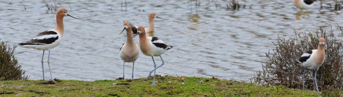
CA Least Tern nesting site at Alameda Point Wildlife Refuge
The following was prepared by Leora Feeney, co-chair of “Friends of the Alameda Wildlife Refuge,” a committee of the Golden Gate Audubon Society.
Delivered to the Alameda City Council on Monday, March 19, 2012, regarding the city-VA-park district proposal being considered for Alameda Point.
Alameda Point Collaboration
on
Veterans Health and Memorial Facilities
CA Least Tern Colony
Nature and Wildlife
Passive Open Space
Unsurpassed Inner-City Views and Experience
Subject: East Bay Regional Park District (EBRPD) proposal for Northwest Territories
Benefits to the City of Alameda
Preserves city resources – The proposal will help defer considerable Alameda Point related costs and responsibility to the city, already having multiple difficult challenges.
Meets land use challenges – The land is not suitable for uses beyond open space and water-related uses. Current wetlands will require mitigation. Several issues surround this property that will meet challenges with most development proposals.
Enhances Alameda’s identity – Alameda’s military history, well-recognized wildlife history and resources, and East Bay shoreline location make this project the perfect fit to further enhance Alameda’s identity.
Realizes payoff from stakeholder investments – Consider stakeholders’ investments that also benefit Alameda:
The VA has spent millions of dollars to move their city-supported project forward. The proposal would allow them to see an end to conflicts that have stalled this investment. Alameda would finally become the home to the VA’s Health and Memorial complex.
The City of Alameda has also invested time and thought to uphold a position that supports the VA facility and that endangered wildlife at Alameda Point are to have top priority.
The Navy and Fish & Wildlife Service have invested time and money to maintain endangered wildlife species.
EBRPD has spent time and money to develop a plan that would resolve difficulties in a way that would meet several positive goals.
Golden Gate Audubon Society since the 1980s and Friends of the Alameda Wildlife Refuge (FAWR) since 1997 have been steadfast supporters of endangered California Least Terns at The Alameda Naval Air Station, later Alameda Point, ensuring continuous success of the colony. FAWR also provides annual elementary school Least Tern education at Alameda Schools.
Others, like the Center for Urban Environmental Law (CUEL) at Golden Gate University, have worked to develop their Greenspace proposal for this beautiful location.
Initiates Park District investment – To design and carry out the project will require an investment of many millions of dollars. The city will benefit from this investment by EBRPD.
Enhances property values – Several studies show that wildlife refuges and natural areas increase values to nearby properties.
Attracts investors – The project will attract investors, spurring Alameda Point development.
Strengthens tenant relations – Current tenants will appreciate that habitat management will have a broader plan and operation.
Attracts tourism – The project – a San Francisco Bay destination point – will be a draw to local, state, national, and even world tourists.
Brings local spending – The site will attract many welcome and diverse activities (photography, birding, hiking) that will benefit local merchants.
Adopts a workable solution – This is the only solution available that will allow both CA Least Terns and the VA project to coexist as adjacent Alameda neighbors.
Satisfies community priorities – The project satisfies a strong wish of the public for natural areas and open space expressed during Alameda Point-Going Forward meetings held in 2010-2011.
Creates inner-city showcase – The site will serve the community and others as a unique opportunity for inner-city nature experience and education.
Enhances parks-to-resident ratio – Alameda’s Park Master Plan Summary (Draft, p. 25) states that the park-acreage-to-residents ratio is low (2 acres to 1000 residents; standard for CA cities is 3 to 6 acres/1000). This proposal would improve the ratio considerably.
Aligns with park master plan – The draft Park Master Plan also states (p. 37), “Alameda Point is anticipated to be the location for passive parks operated by EBRPD.”
Builds on existing park district partnership – EBRPD has been a good partner managing Crown Beach, relieving Alameda of difficult tidal shoreline and beach management. We can count on them for similar assistance at Alameda Point.
In conclusion: The CA Least Tern colony can’t be moved, and the VA facility can. The willingness of this unusual collaboration of stakeholders to work together is a testament to the importance of the project. It is rare and refreshing to see that people with diverse goals have the ability to work together to find a solution that satisfies multiple valued needs in difficult times. With the acceptance of this proposal Alameda will be a giant step closer to moving Alameda Point toward a promising future. We must not let this opportunity escape. The alternative would be tragic, a prolonged stalemate and unknown future. Alameda’s City Council can make this work. It will be a historical decision.

 In his book “It Shouldn’t Be This Hard to Serve Your Country – Our Broken Government and the Plight of Veterans” (Public Affairs Books, October 2019), Shulkin recounts his experiences after being appointed to head the VA by President Trump in January 2017, and then fired by Tweet 15 months later. Shulkin asserts he was fired because he would not go along with efforts of White House insiders to privatize VA healthcare. Continue reading “Delays of VA Project tied to Trump Administration”
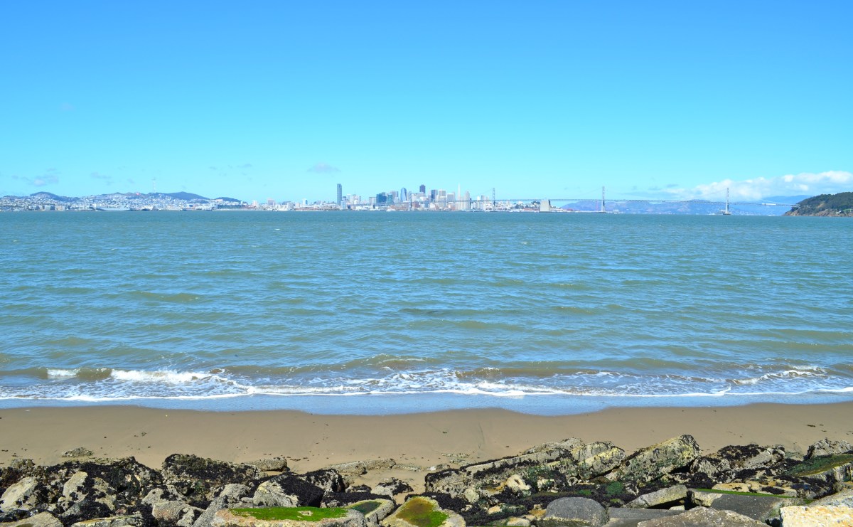

 The study went on to extol the intersecting virtues of wildlife habitat protection and economic value. “While important in their own right, the benefits that would be generated by establishment of the wildlife refuge are not limited to habitat and species protection,” stated Hrubes and Associates. “[T]here are indeed potential economic benefits that could derive from a wildlife refuge/day-use recreation area located in the central Bay Area. That is, the wildlife refuge proposal is not an ‘either/or’ choice between environmental quality and economic development. Rather, it constitutes a land use that not only will take optimal advantage of the environmental attributes the site has to offer but also will generate economic activity that benefits the local region. Further, it will enhance the economic value for development of the remainder of the NAS.”
 However, based on public statements from the VA about their timeline for construction, it does not appear that they have any intention of doing a full EIS, and thus their environmental commitment will be limited. This will mean that rather than adding grasslands to perimeter areas that already have pockets of grasslands between runways and taxiways in order to divert hawks and other avian predators away from nesting terns, they will keep the refuge looking as much like a fenced-in stadium parking lot as possible (like it has been for the past decade). The pretext is that it removes habitat for predators, but in this case they would be torturing the concept by making the tern nesting site so conspicuous that it will invite predation. Virtually all of the least tern predation events have been from flying predators—like the peregrine falcons that come from miles away on the other side of Alameda.
 The real reasons for maintaining the industrial look are to reduce maintenance and capital costs, and to exploit the paved areas for


 through park")