The City of Alameda became the new owner of the Seaplane Lagoon at Alameda Point on April 13, 2016. It came from the Navy with a new condition that exceeds normal protocols for dredging in San Francisco Bay.
As with all cleanup sites, the Navy, city and regulators agreed to what areas needed to be cleaned up in the Seaplane Lagoon. The cleanup plan approved in 2006 was based on testing the sediment throughout the 110-acre lagoon. The problem areas were confined to about 10 acres at the northeast and northwest corners of the lagoon where storm sewers dumped contaminants prior to 1970s environmental laws. The agreed upon plan said that there would be no restrictions on the lagoon when cleanup was done.
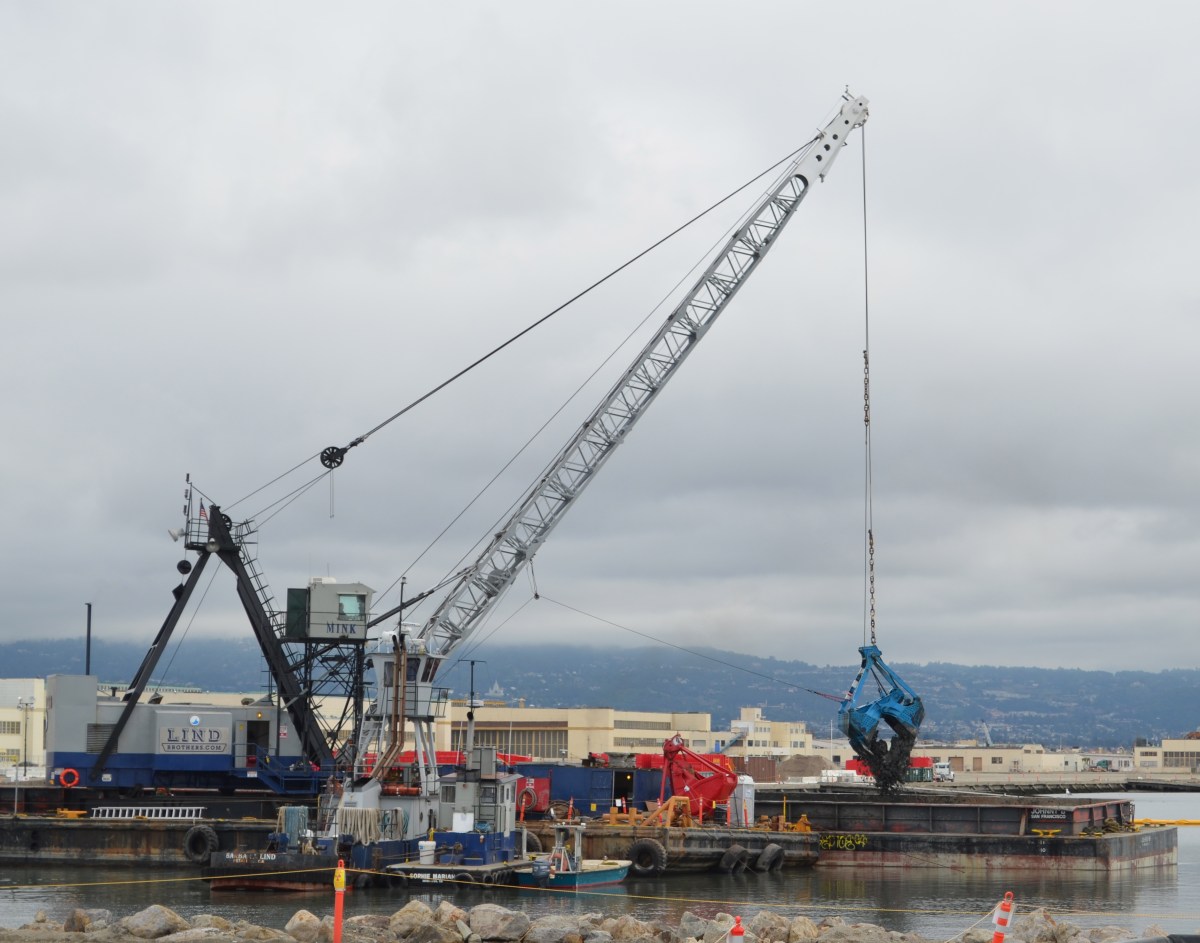
Dredging the northwest corner of the Seaplane Lagoon in February 2012.
After cleanup was completed, two years of discussions between the Navy, state and federal regulators, and the city led to an amendment to the official cleanup decision to include a detailed management plan for any future dredging in the Seaplane Lagoon. The city led the effort to create a sediment management plan. It stipulates that all dredge sediment brought to the surface will have to be spread out six inches thick on a drying pad and scanned for radium-226 radiation at a cost borne by the city.Continue reading “Radium safety enhanced at Seaplane Lagoon”
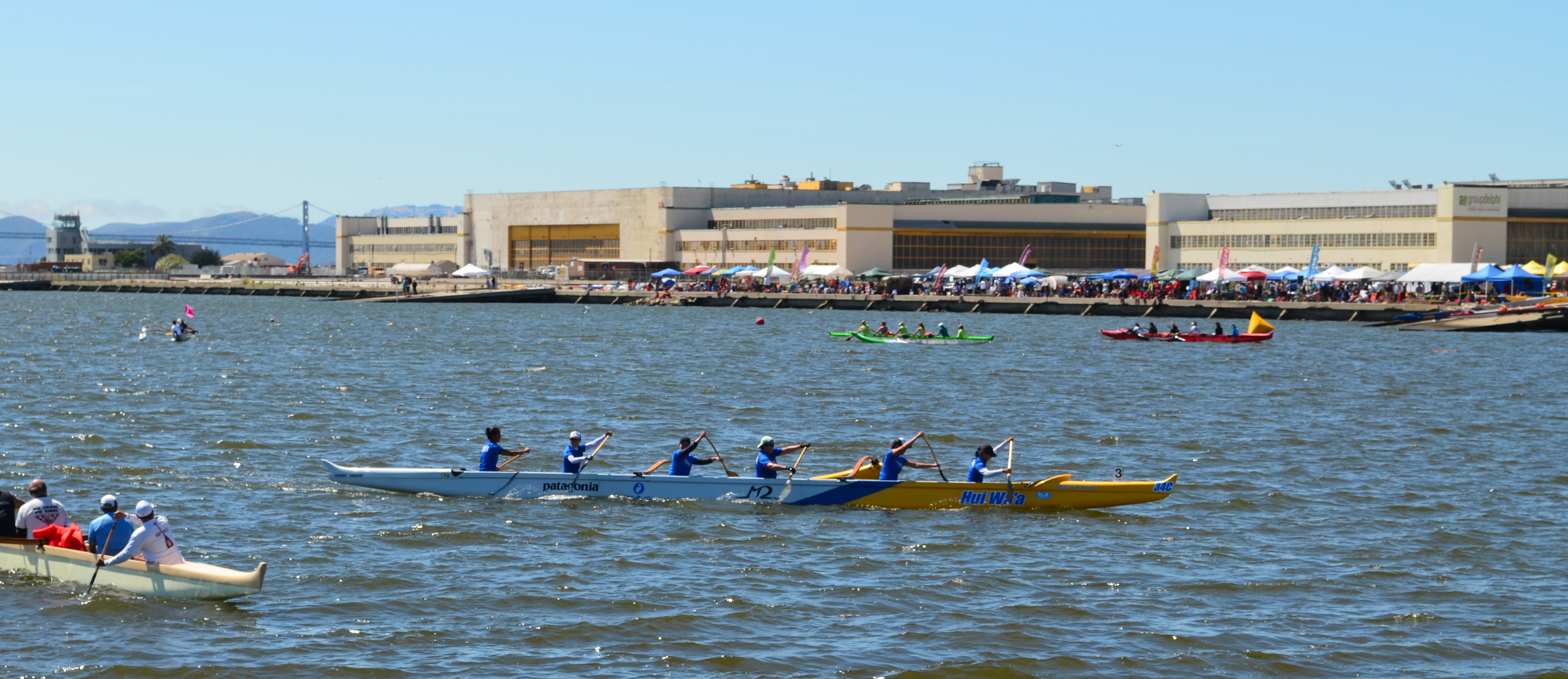
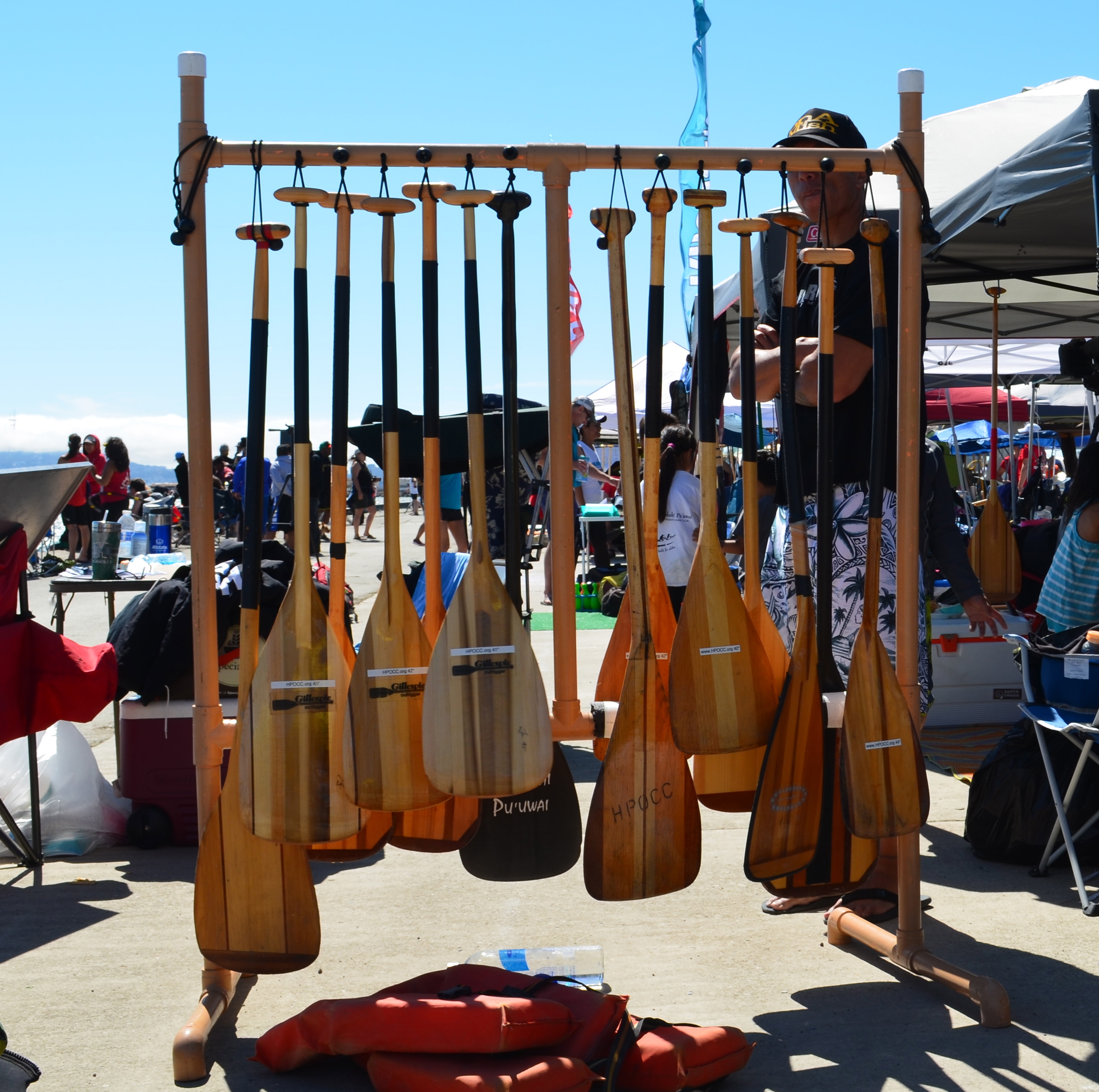
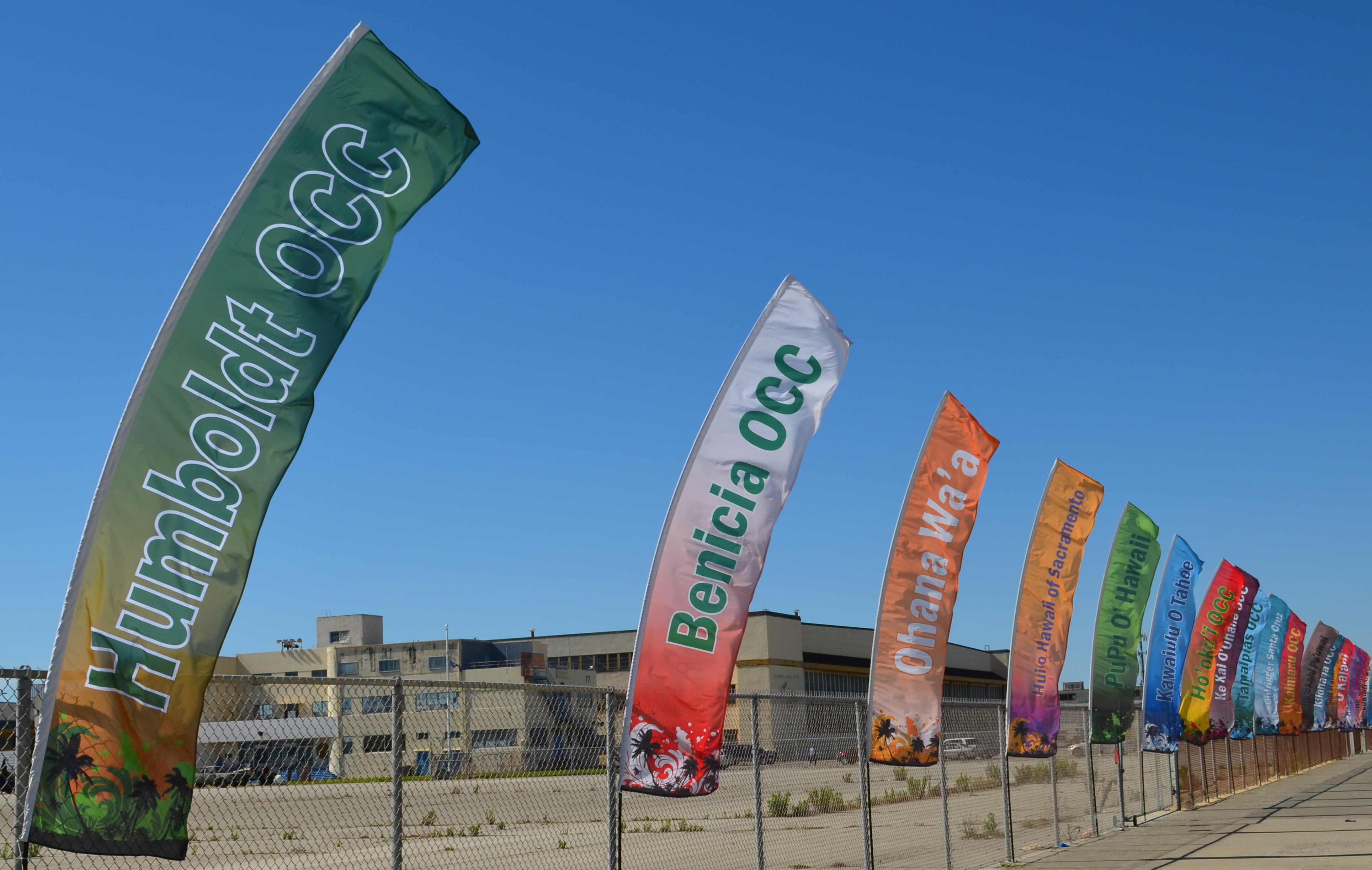
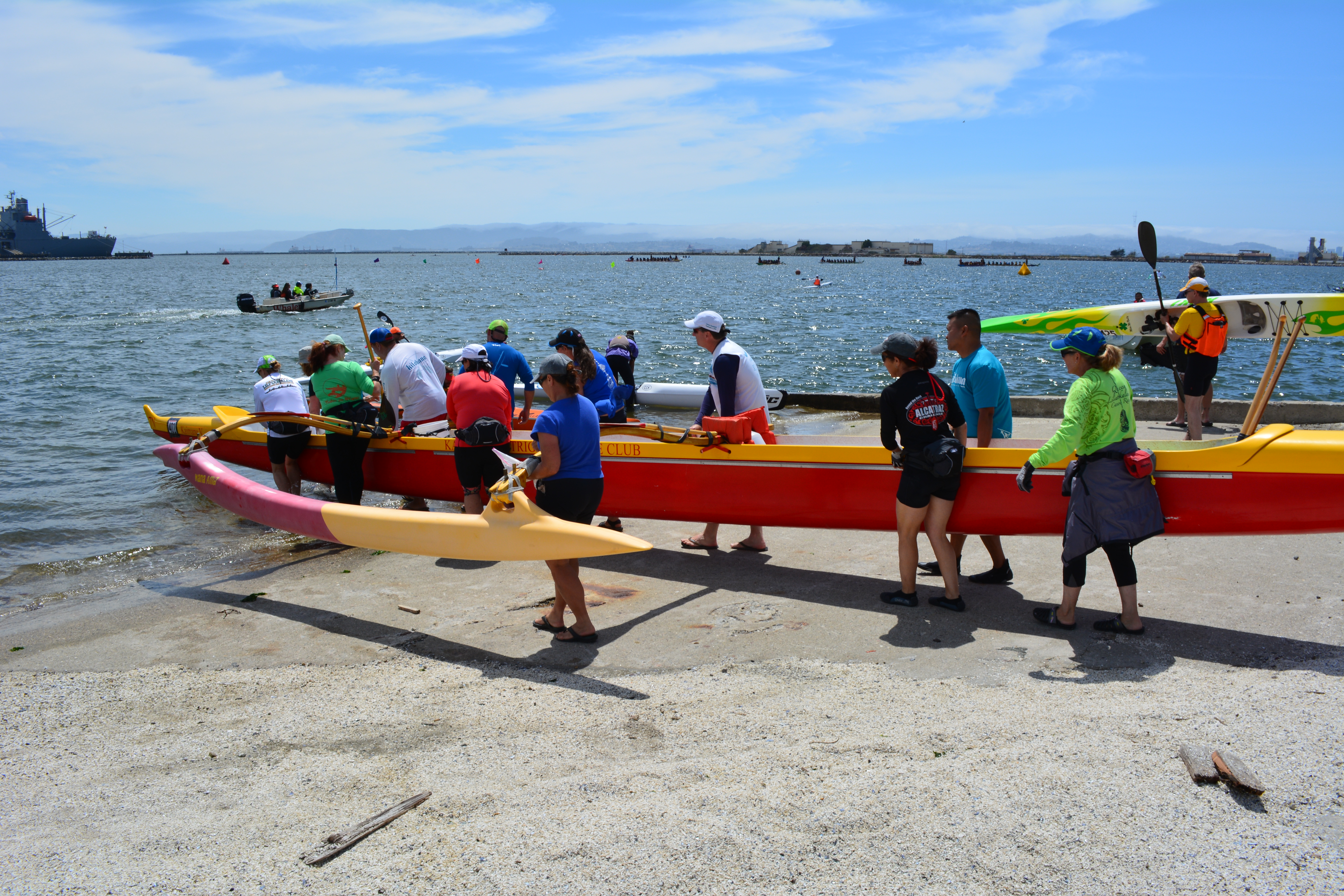
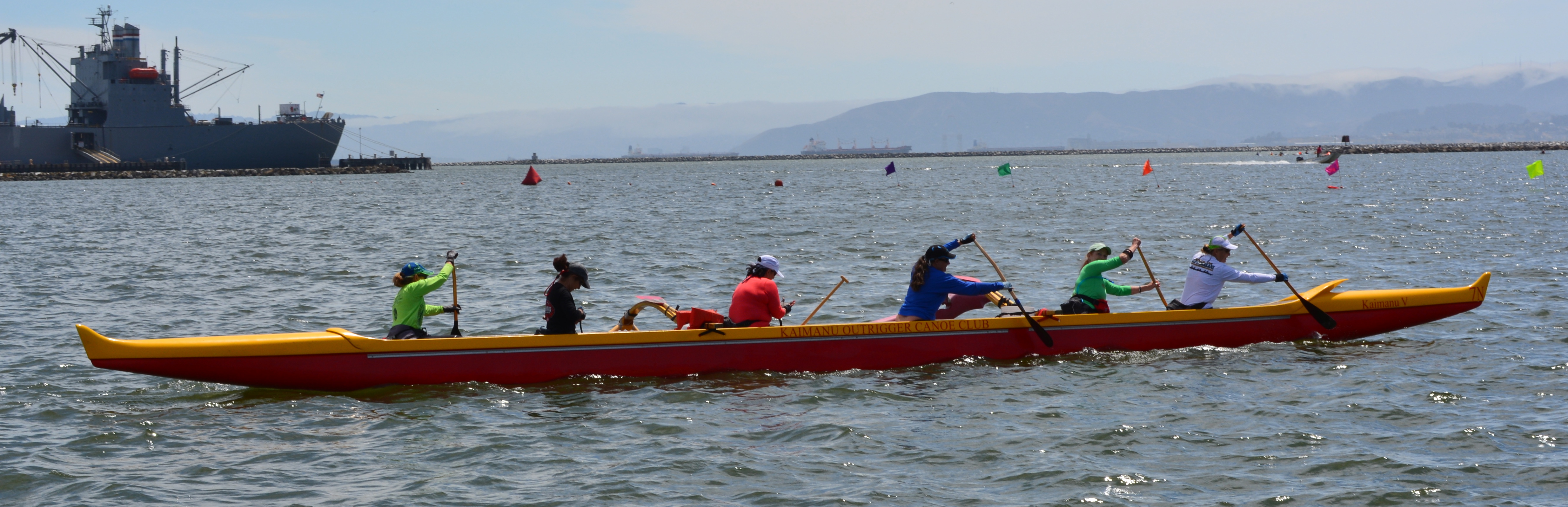
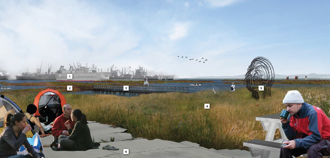
The Seaplane Lagoon was also the launch site on Sunday for outrigger canoes heading out to the tip of Alameda Point for a race to the San Leandro Marina. The Alameda-Point-to-San-Leandro race was sponsored by Wave Chaser.
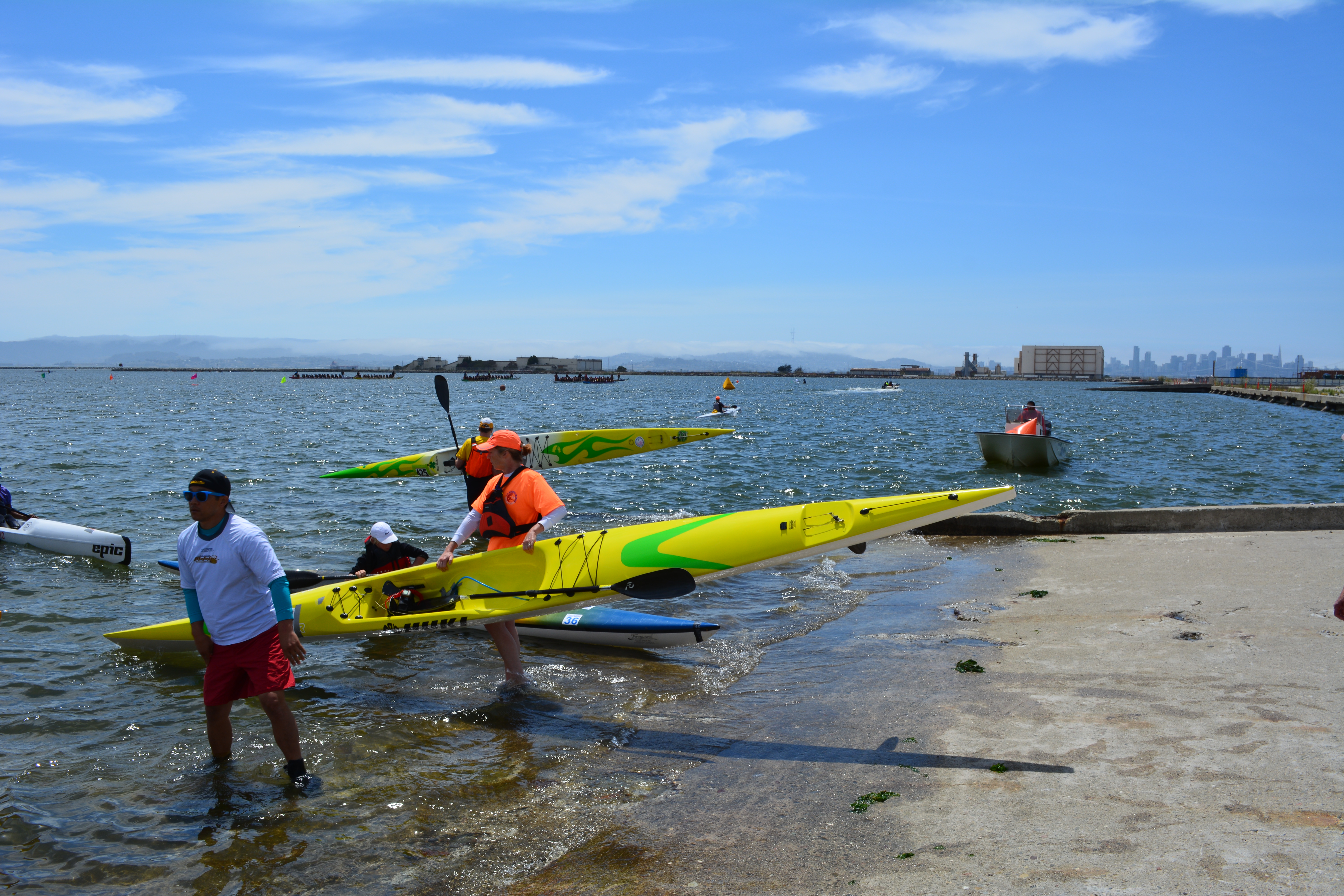
Here are some photos showing what a great venue the Seaplane Lagoon is for outdoor events like boating.
Note that the temporary dock facility used by the boaters was installed by Artemis Racing when they began training out of Alameda Point for 2013 Americas Cup.
Outrigger canoe race on July 12, 2014 at Alameda Point’s Seaplane Lagoon.
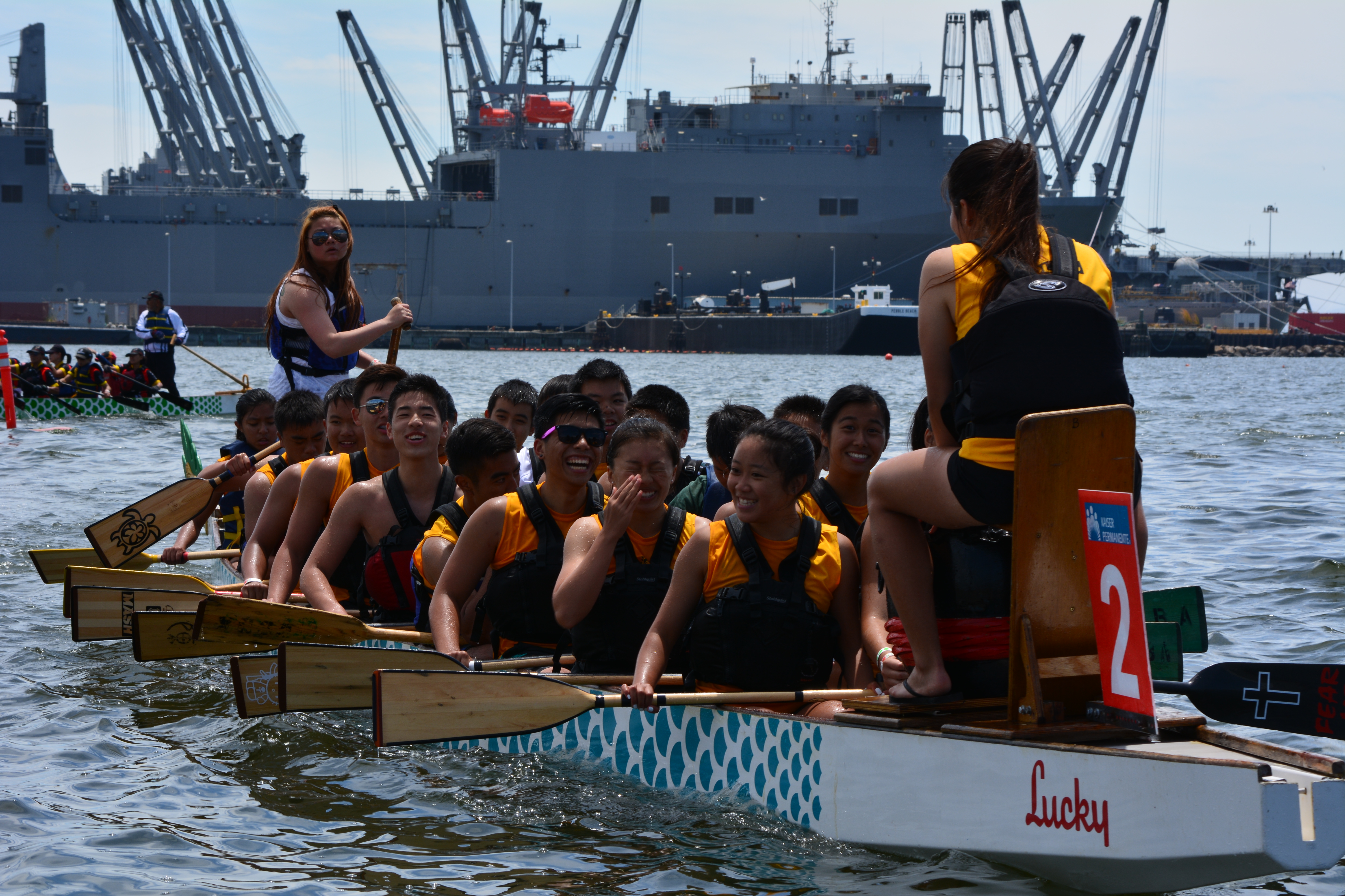
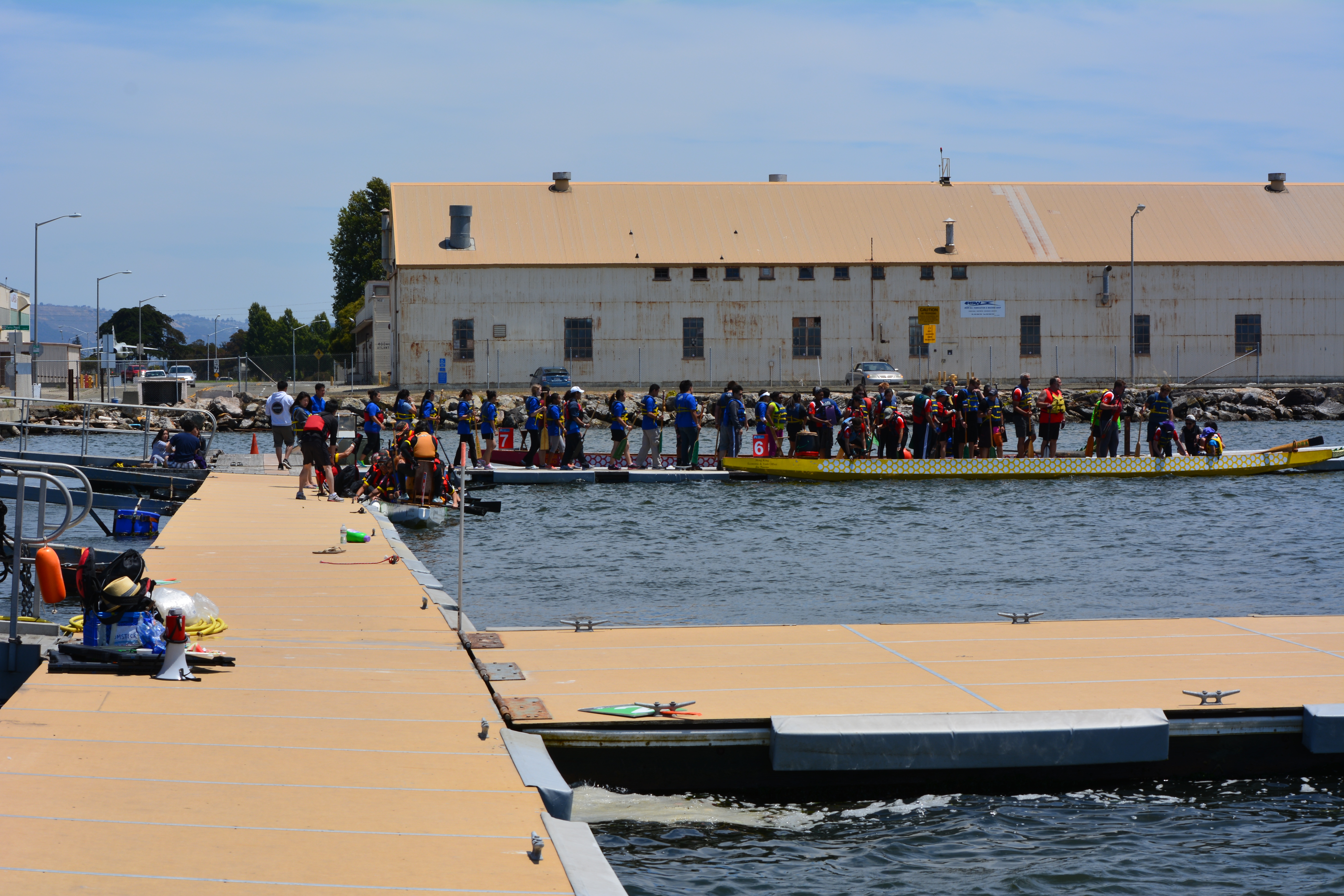
Dragon boat race on July13, 2014 at Alameda Point’s Seaplane Lagoon
Dragon boat team competing in race at Alameda Point’s Seaplane Lagoon.Dragon boat team heading to starting line.Dragon boat team returning to dock after race.
Dragon boat teams queuing up to board their boats for next race.
All-female Wave Chaser team launching boat for race to San Leandro Marina. Alameda Point Seaplane Lagoon.
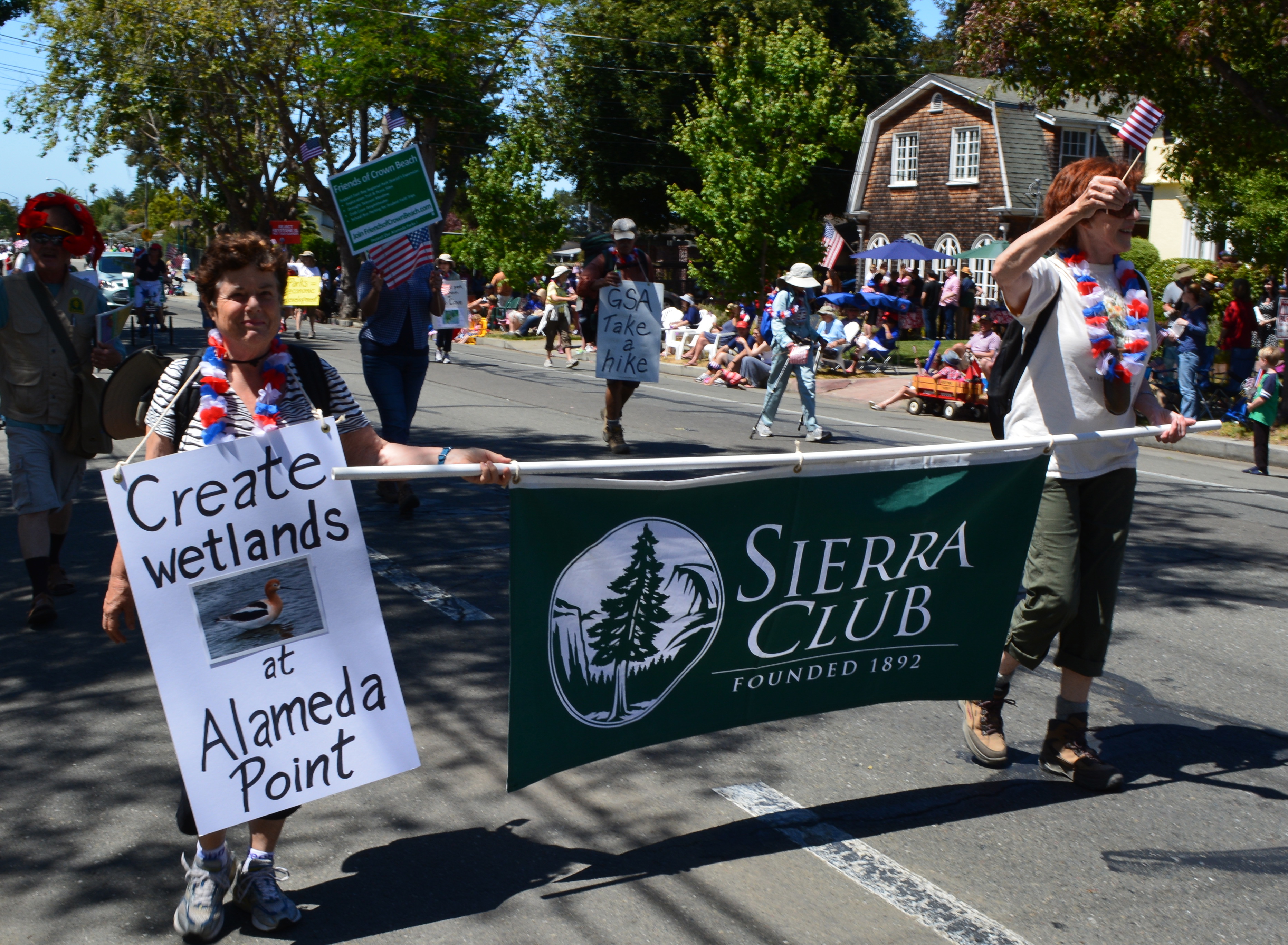
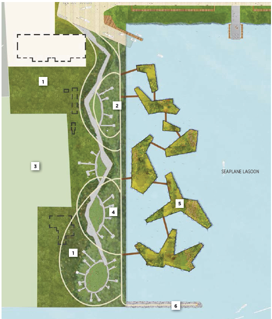
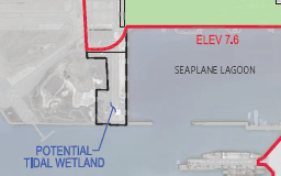
It’s more likely a new wetland will be created on the western shoreline of the Seaplane Lagoon at Alameda Point, thanks to lobbying efforts led by the Sierra Club.
Sierra Club in Alameda’s 4th of July Parade 2014
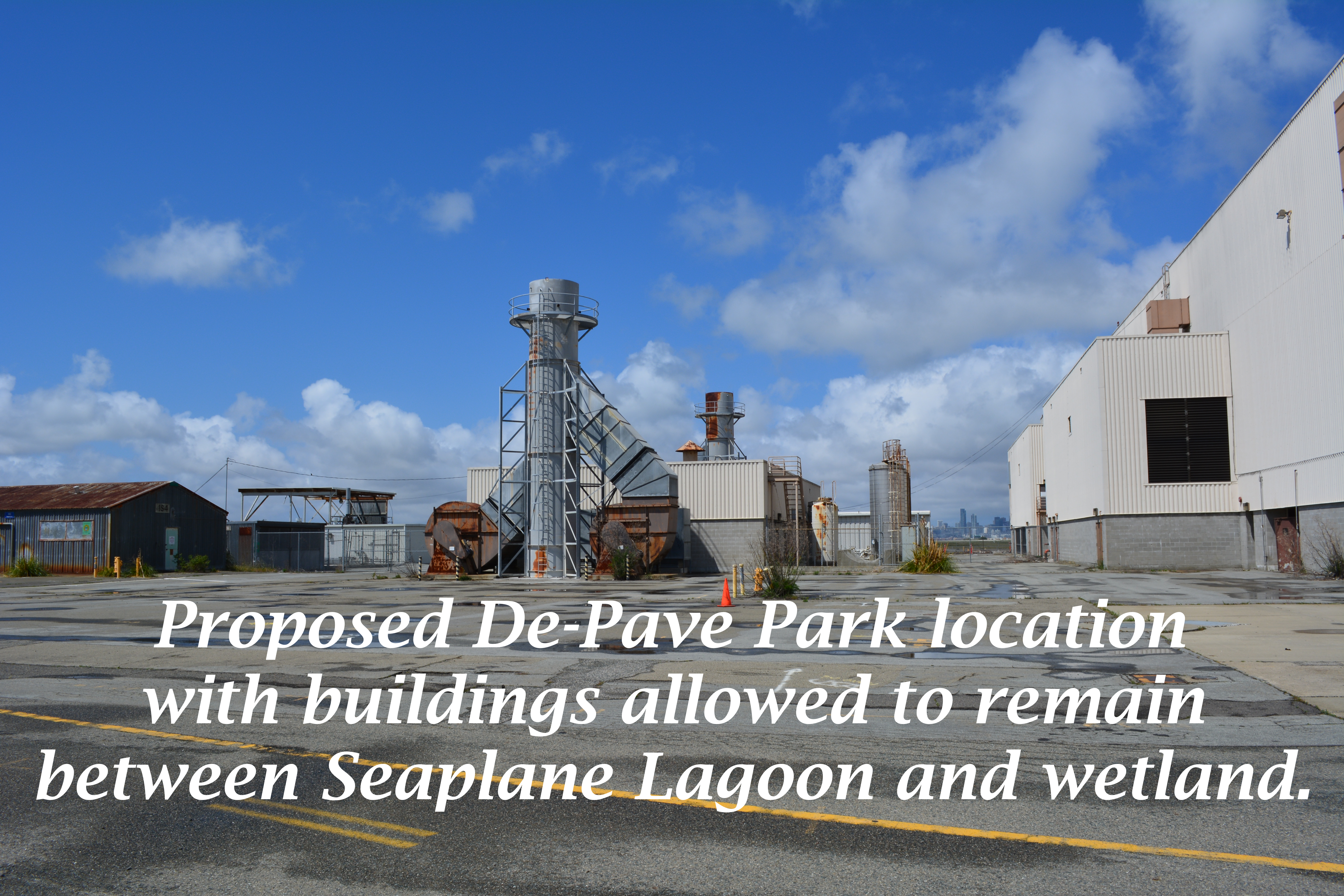
On July 1, 2014, the Alameda City Council added language to the Alameda Point Town Center and Waterfront Specific Plan that raises the commitment to remove pavement from the western side of the Seaplane Lagoon for wetland—an area called De-Pave Park. Lobbying efforts convinced the council to include the following options to help facilitate the wetland park creation: 1) creating a wetland mitigation bank; 2) adding the area to a possible national wildlife refuge on the federal property; and 3) working with local community members who may identify funding sources for creating the passive park area.Continue reading “Wetland park plan at Seaplane Lagoon gets a boost”
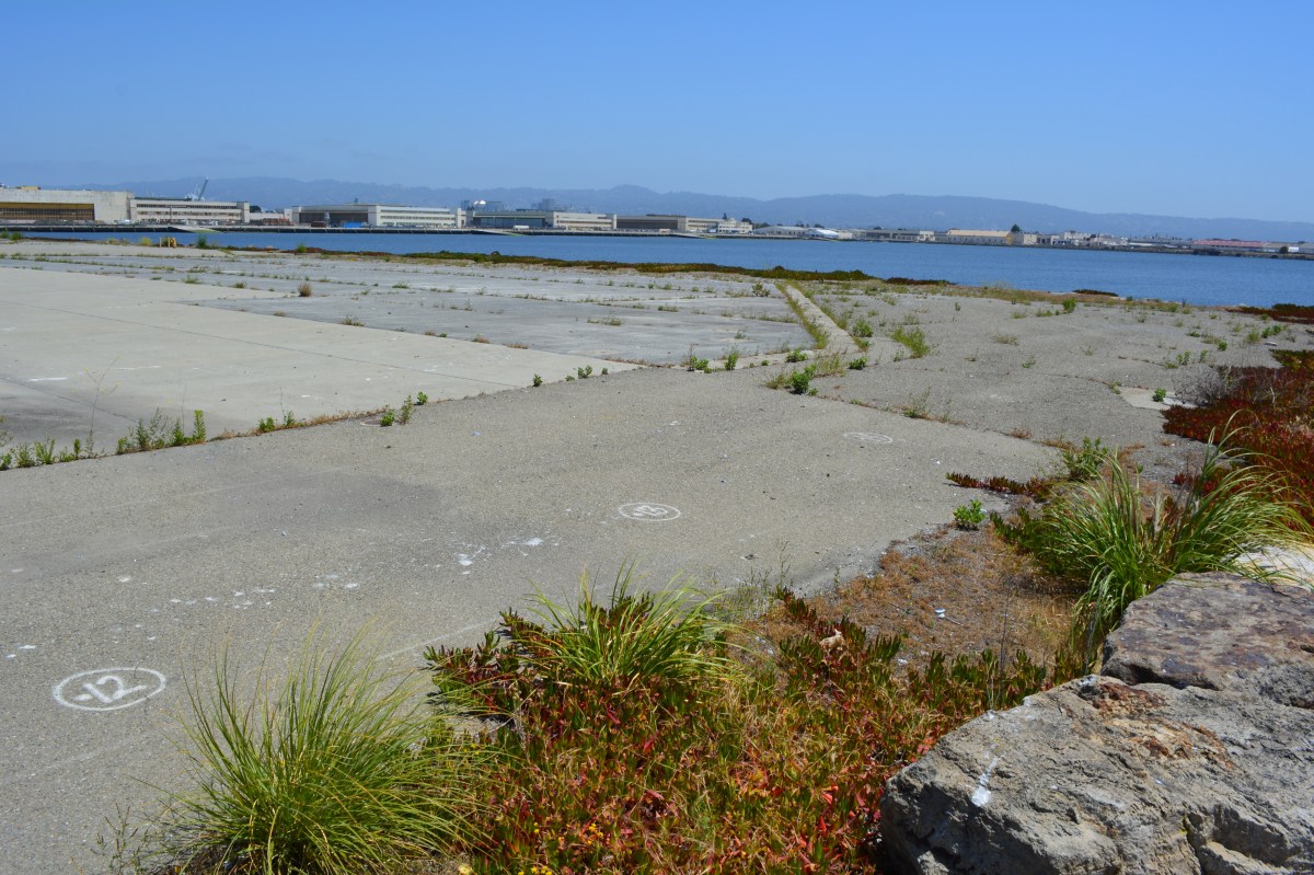
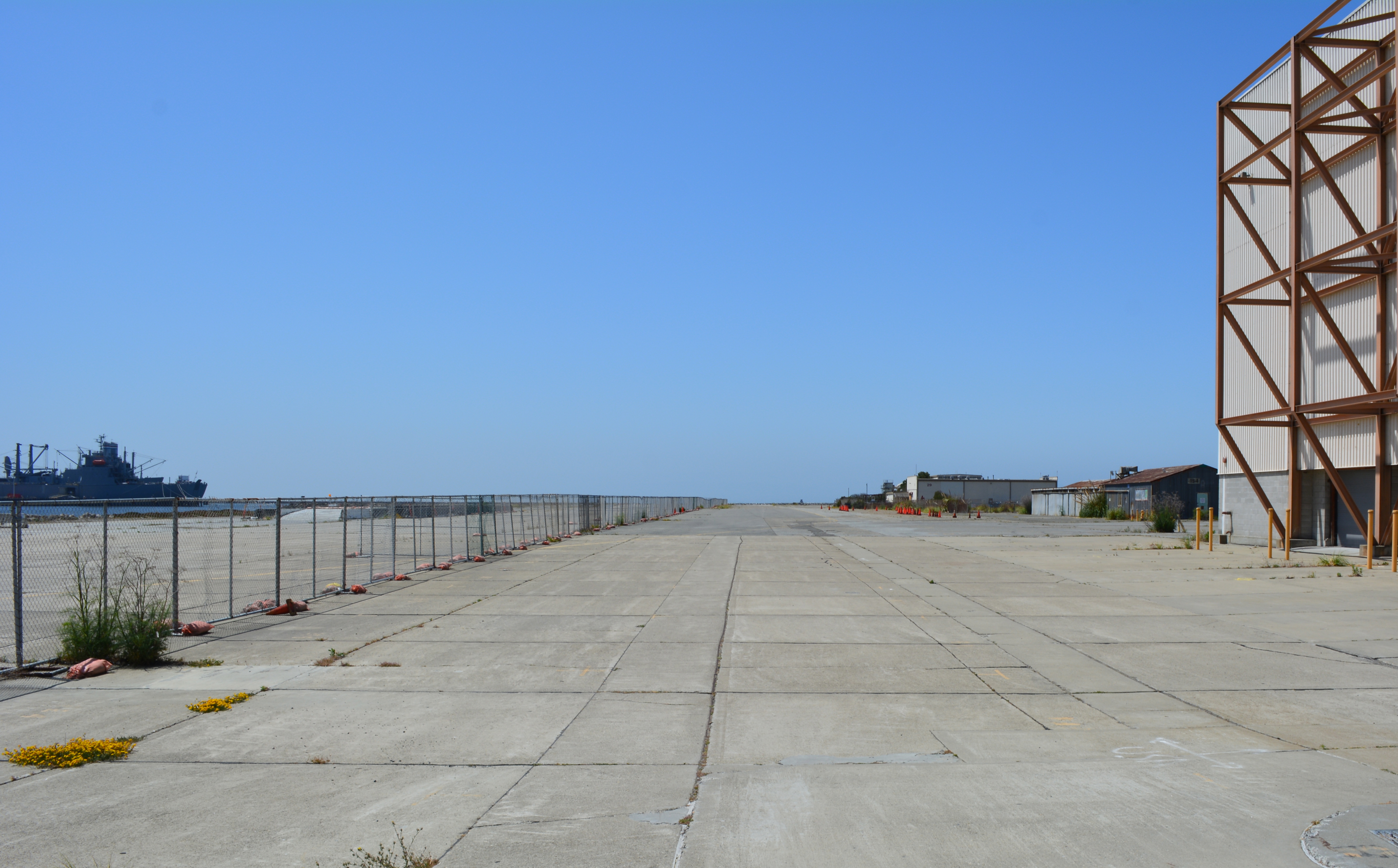
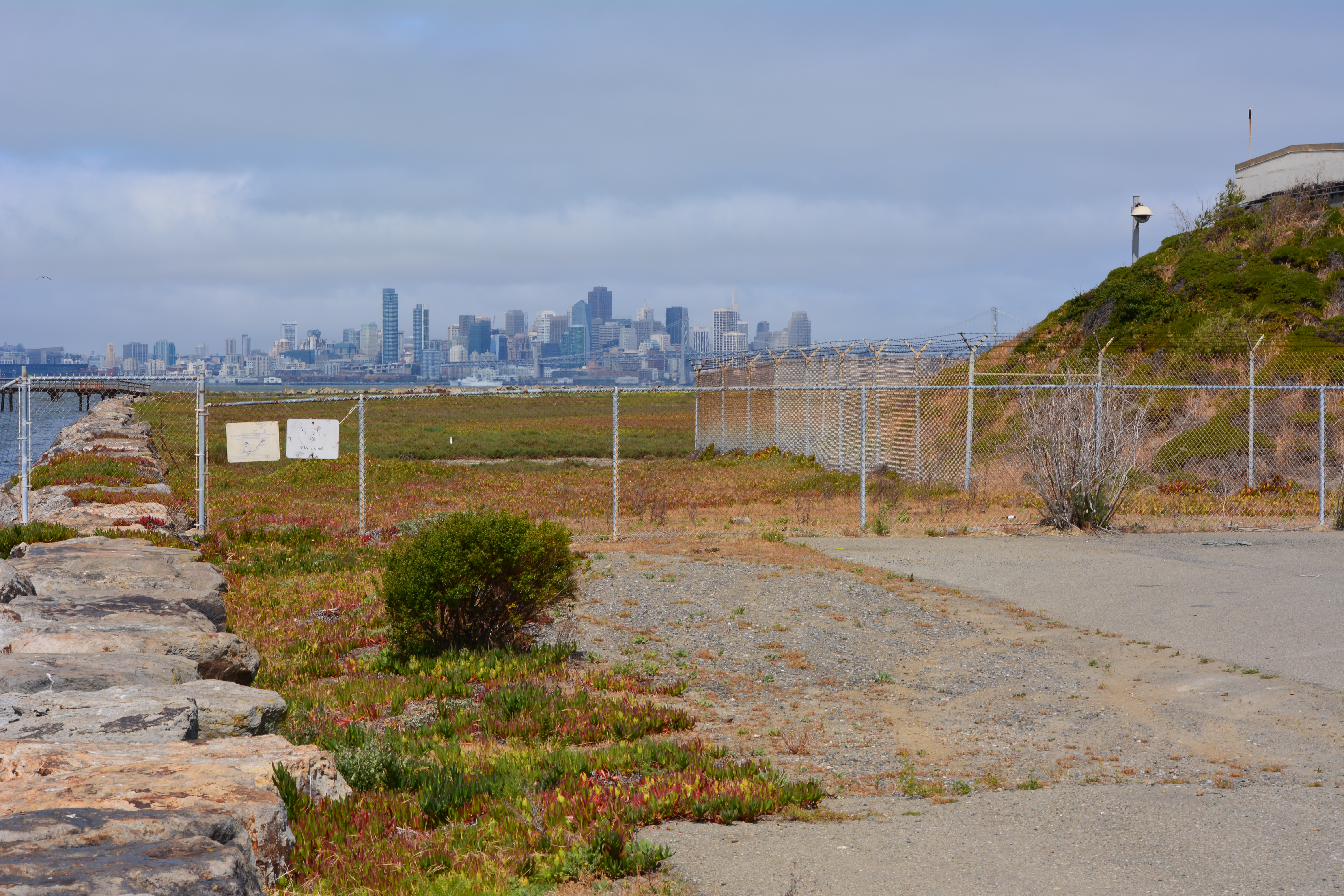
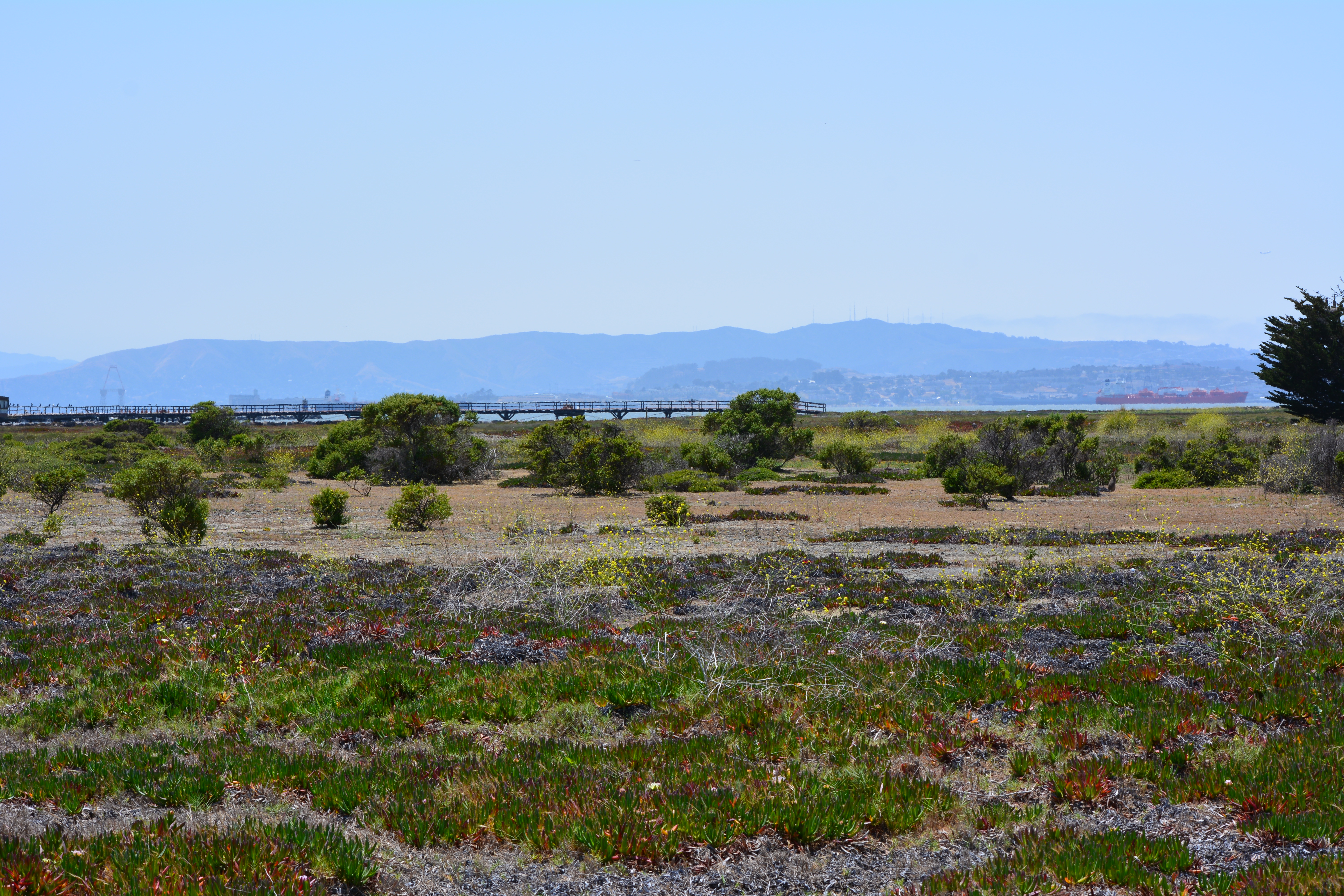
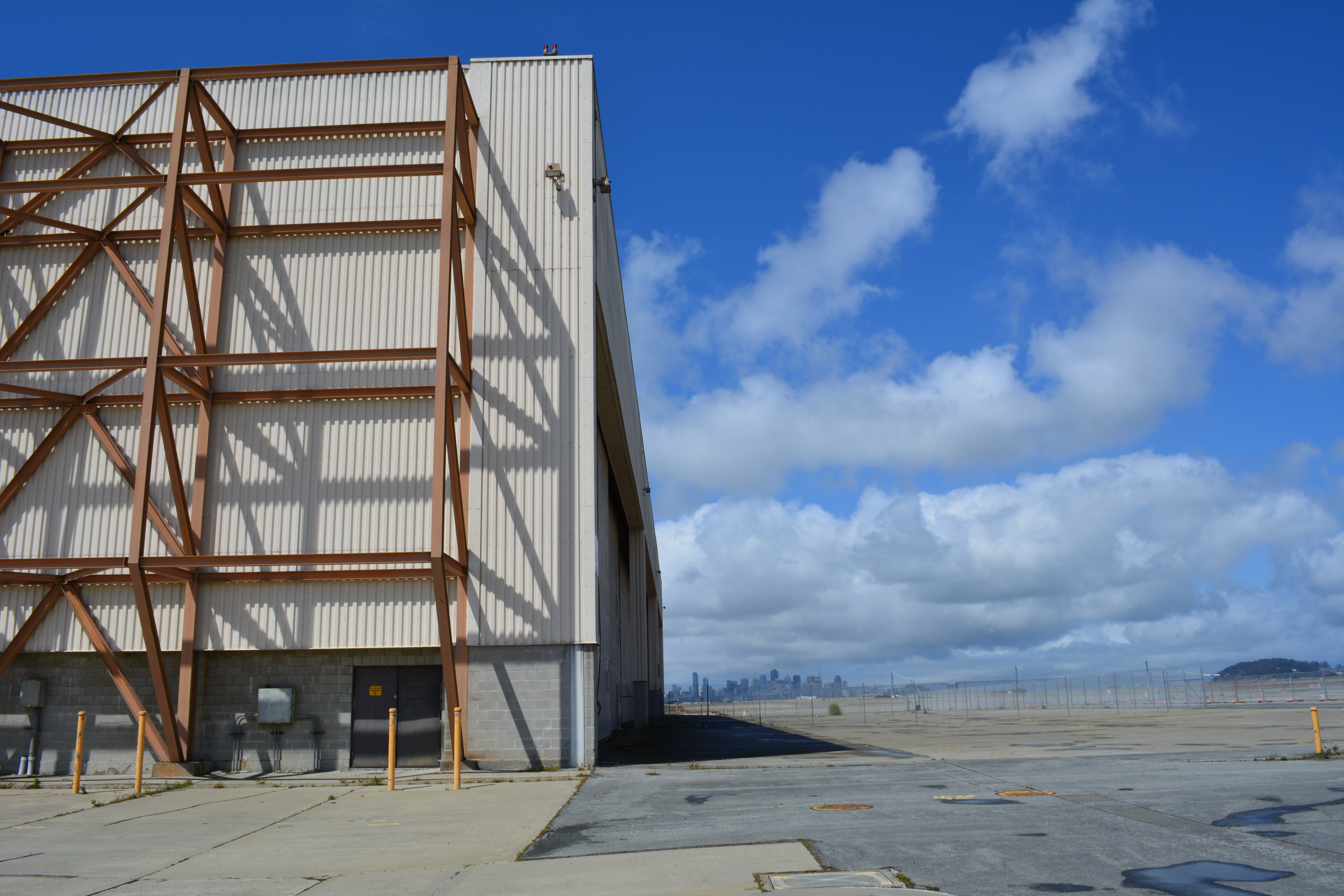
The city’s west side of the Seaplane Lagoon at Alameda Point is mostly pavement – acres of it – with a few old buildings abutting a wetland on the federal property. The city claims its long-range plan for this area features a conversion to a wetland habitat, but their only commitment is to continue leasing the buildings to generate revenue while allowing a sea of unnecessary pavement to remain as an environmental blight.
Seaplane Lagoon west side, looking south. Seaplane Lagoon on left, Alameda Point Channel and SF Bay in background. Temporary fence to be removed by end of 2014.
Opportunities for implementing ecosystem enhancement, both short and long term, have yet to be explored for this area. We need to start moving in a direction now that benefits the environment by reducing climate impacts, improves the atmosphere around nearby businesses, adds to public enjoyment, and increases wildlife habitat.
Proposal for ecosystem enhancement
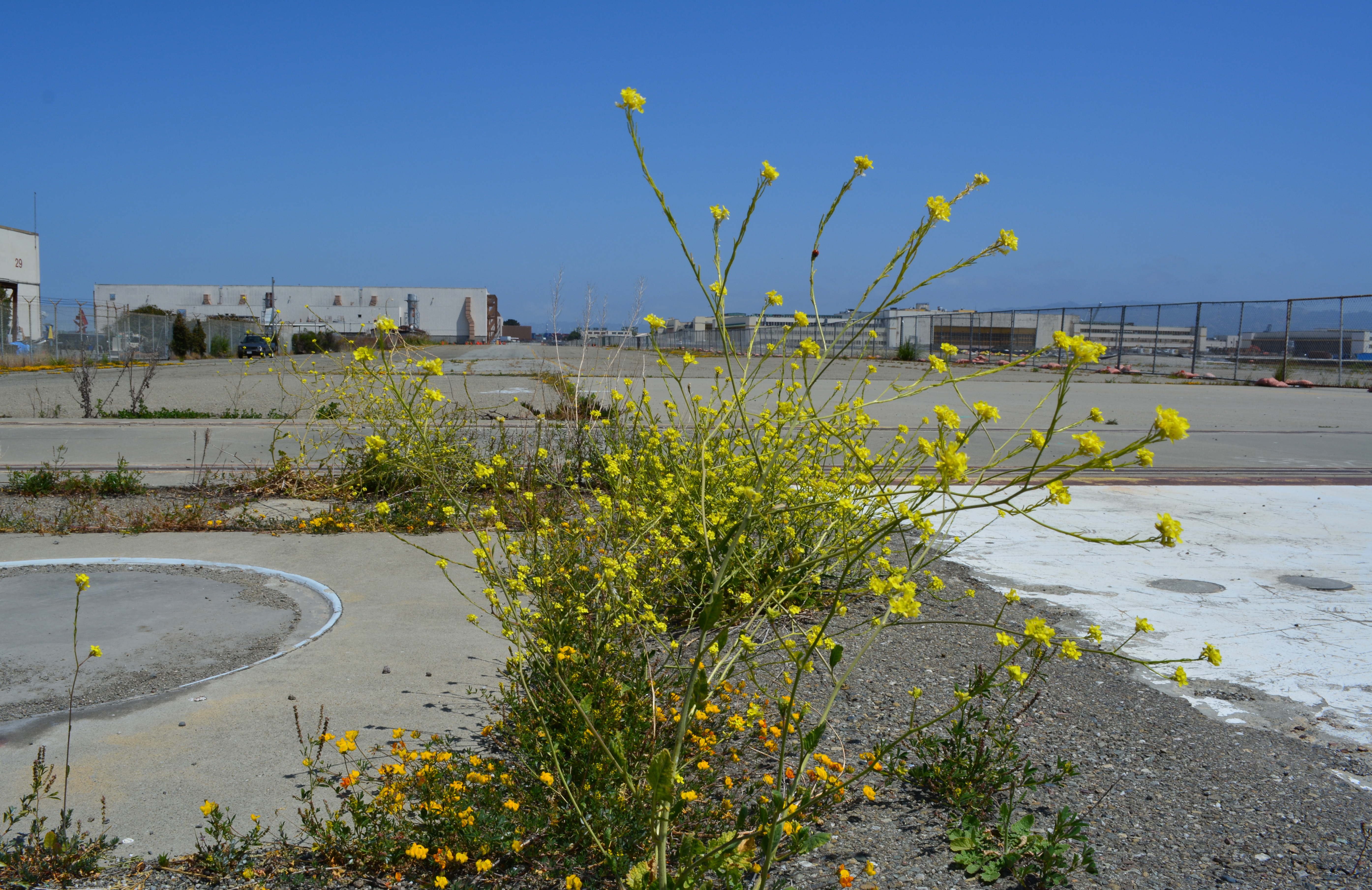
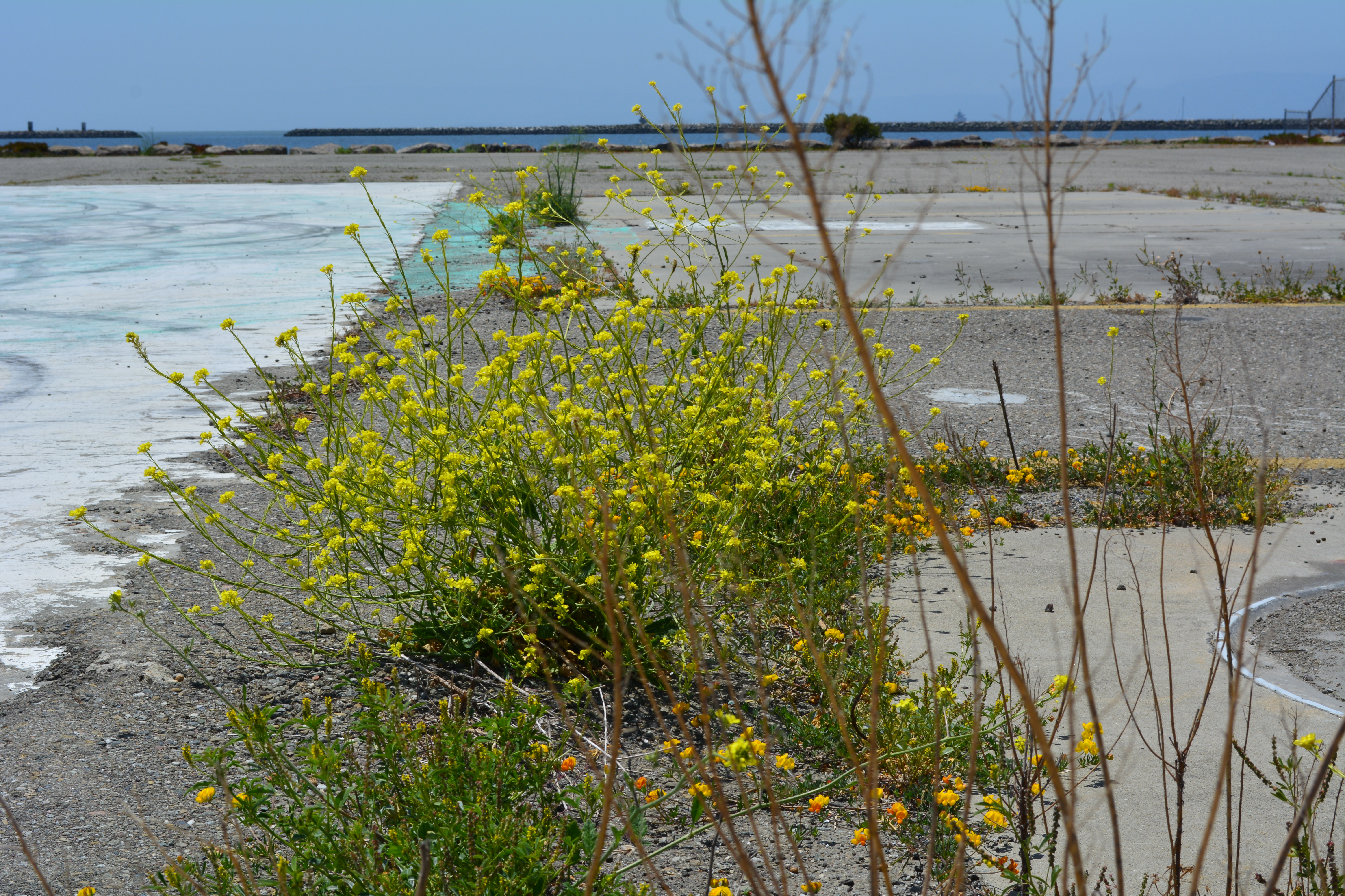
Short-term plan – Remove all pavement not required for commercial tenants. Recycle the pavement at the VA’s Alameda Point project site where they will be raising elevation and need base rock and fill. Once the pavement is removed and the soil exposed, native vegetation could be planted. Native vegetation will absorb CO2, produce oxygen, eliminate the heat island effect of the former pavement, add wildlife habitat, improve the aesthetic appearance of the property, and make it attractive as a hiking, jogging, and cycling destination.
Step 1 – Set aside money from lease revenue generated on the west side of the Seaplane Lagoon for pavement removal and introduction of native plant vegetation.
Step 2 – Explore recycling pavement at Alameda Point.
Step 3 – Explore grant sources for conversion of paved areas to native vegetation, i.e., state air quality board, EPA, State Lands Commission, etc.
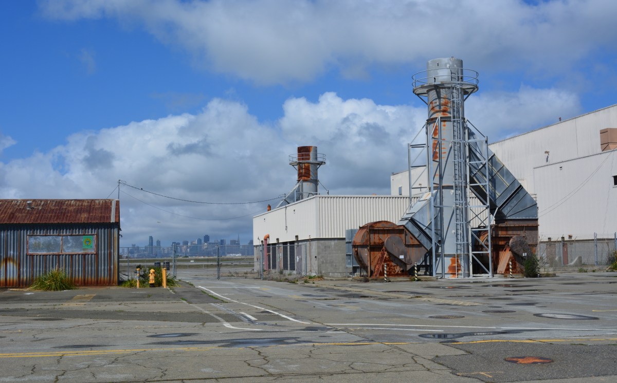
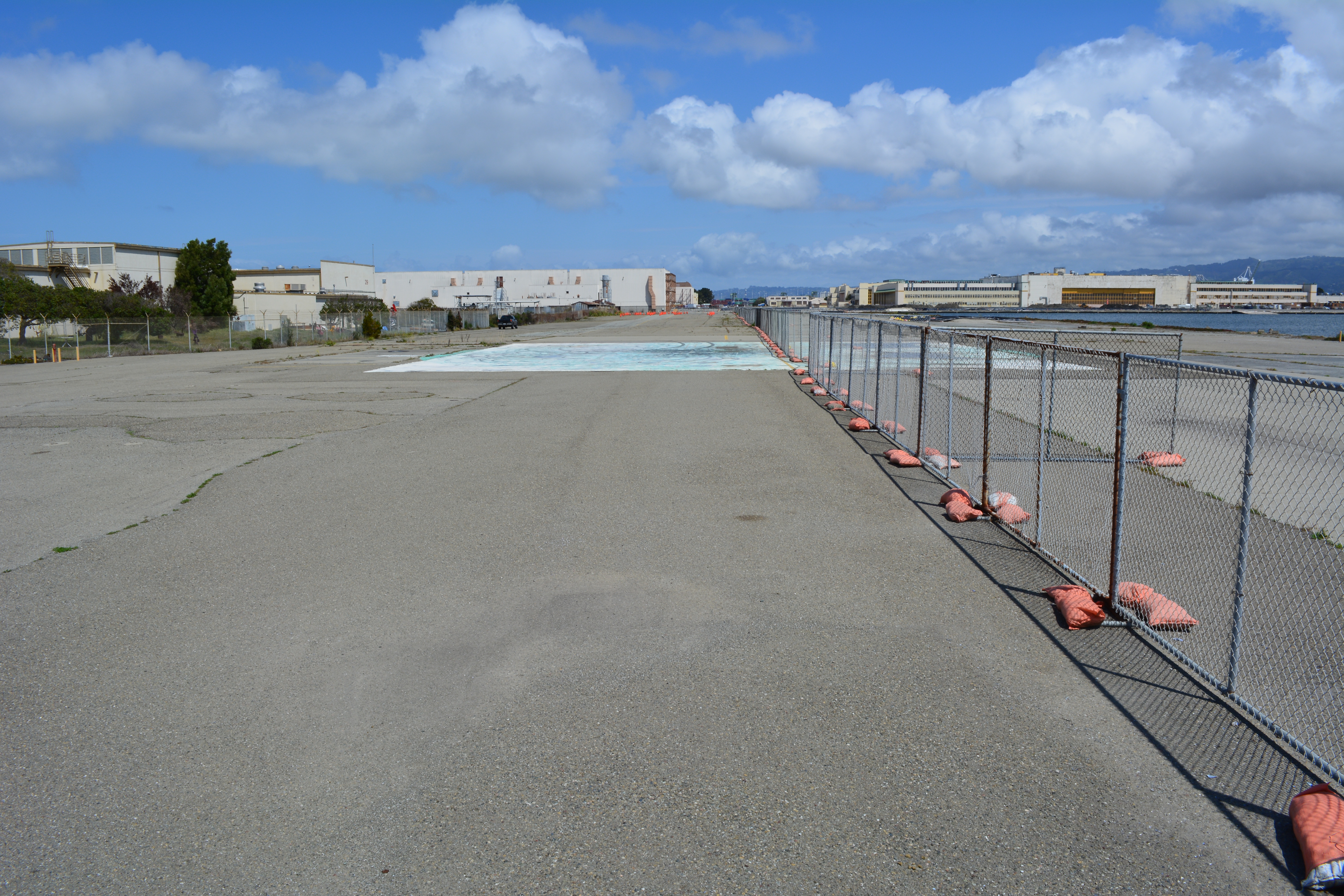
West side of Seaplane Lagoon, looking north. Seaplane Lagoon on right. Buildings 29 and 25 on left. Most of this area could be covered with native grasses with no negative effects on commercial leasing.
Long-term plan –Establish an Alameda Point Wetland Mitigation Bank, which would incorporate the west Seaplane Lagoon acreage along with 50 acres on the northwest side of Alameda Point (Northwest Territories). Investment money would provide the capital for wetland creation, with money being recouped when mitigation credits are sold to developers elsewhere in the Bay watershed to offset their project’s impacts. As a general rule, a tidal wetland is worth at least as much as it would cost to create it. That’s why businesses exist that specialize in mitigation banks. In theory at least, the wetland project could be self-funding.
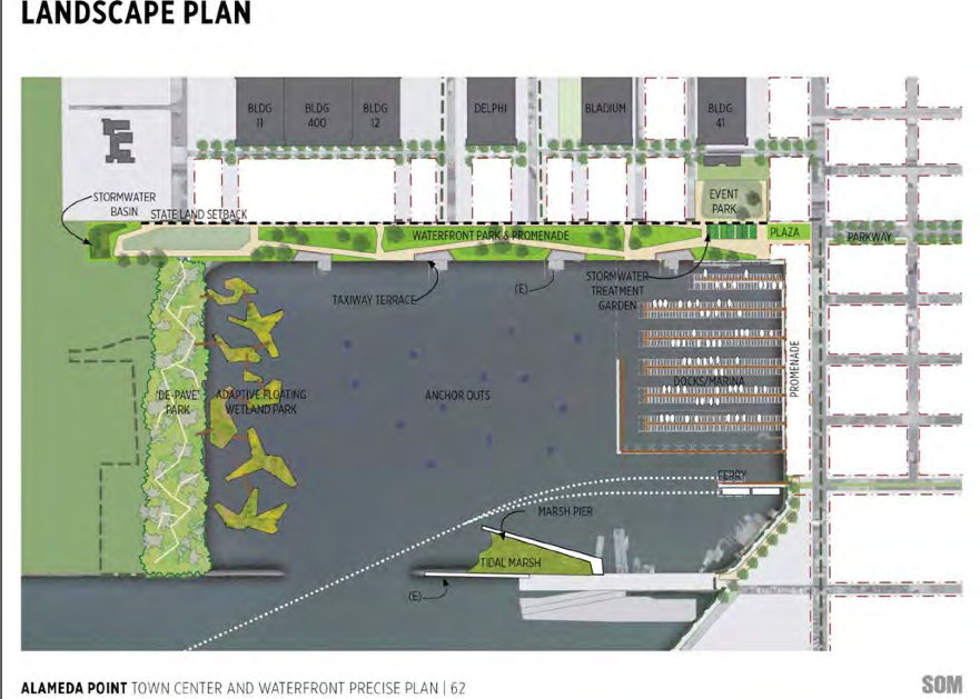
Step 1 – Commission a study on wetland mitigation bank formation using lease revenue from Buildings 25 and 29.
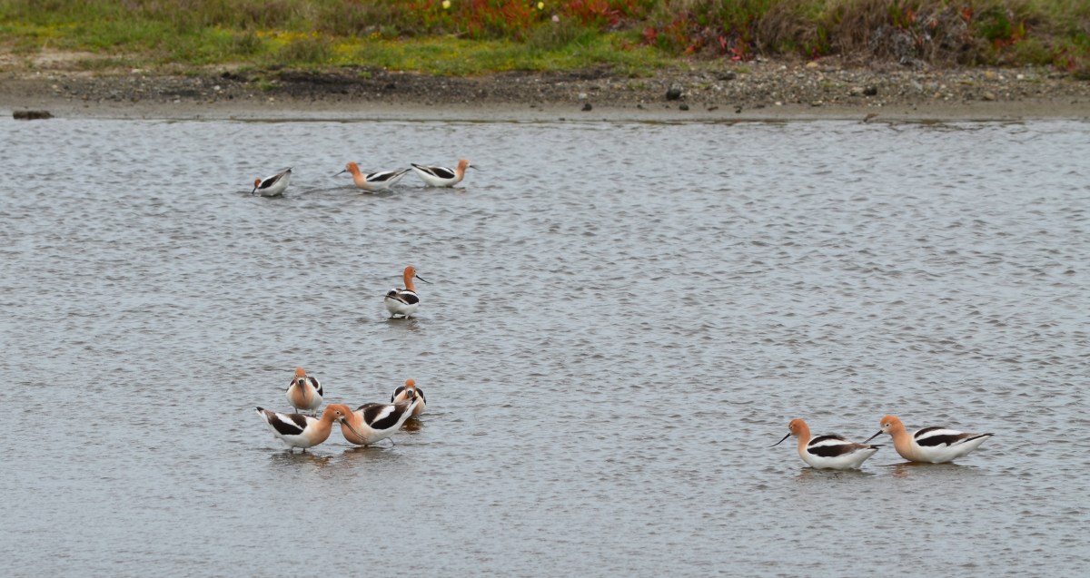
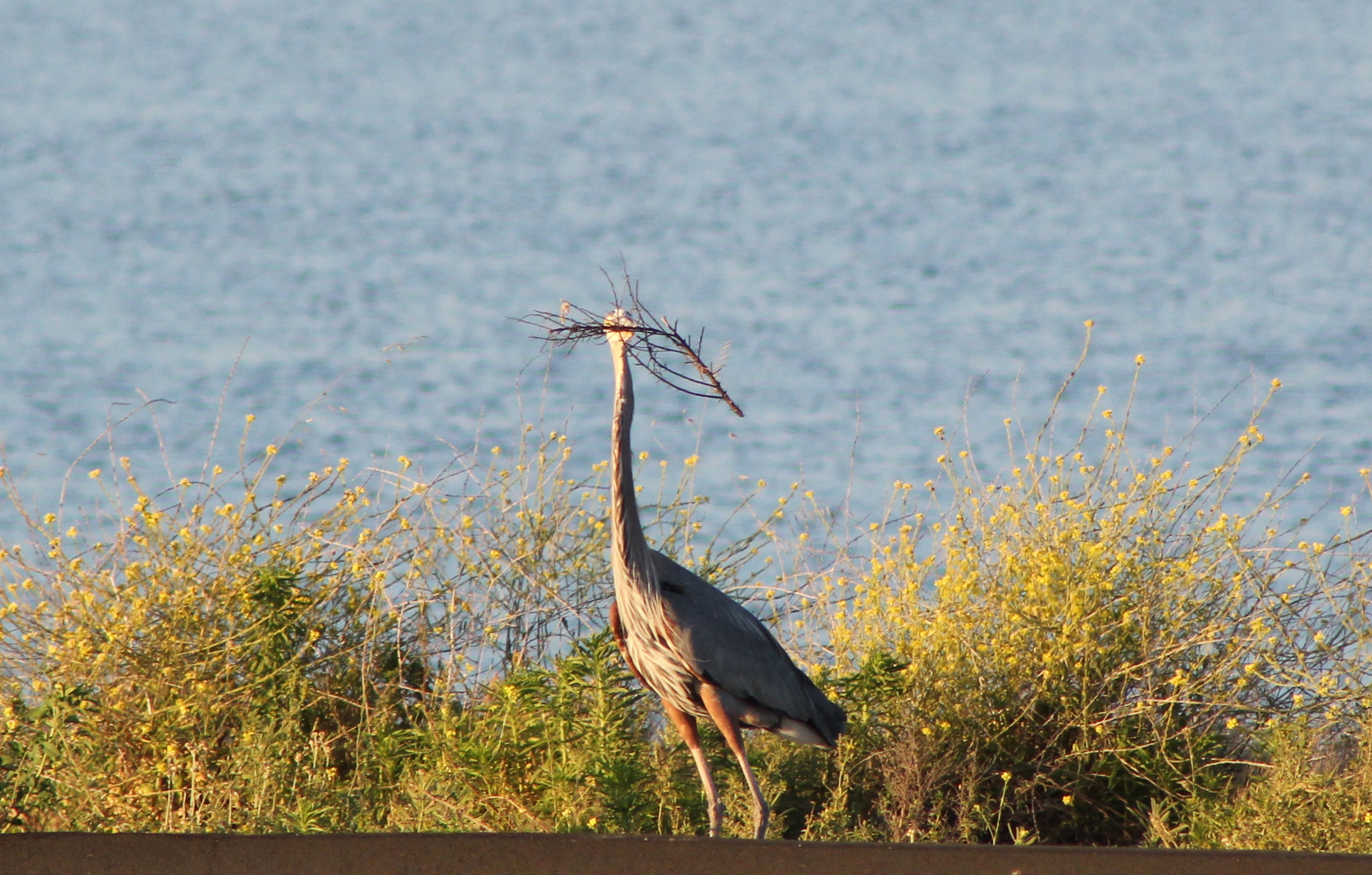
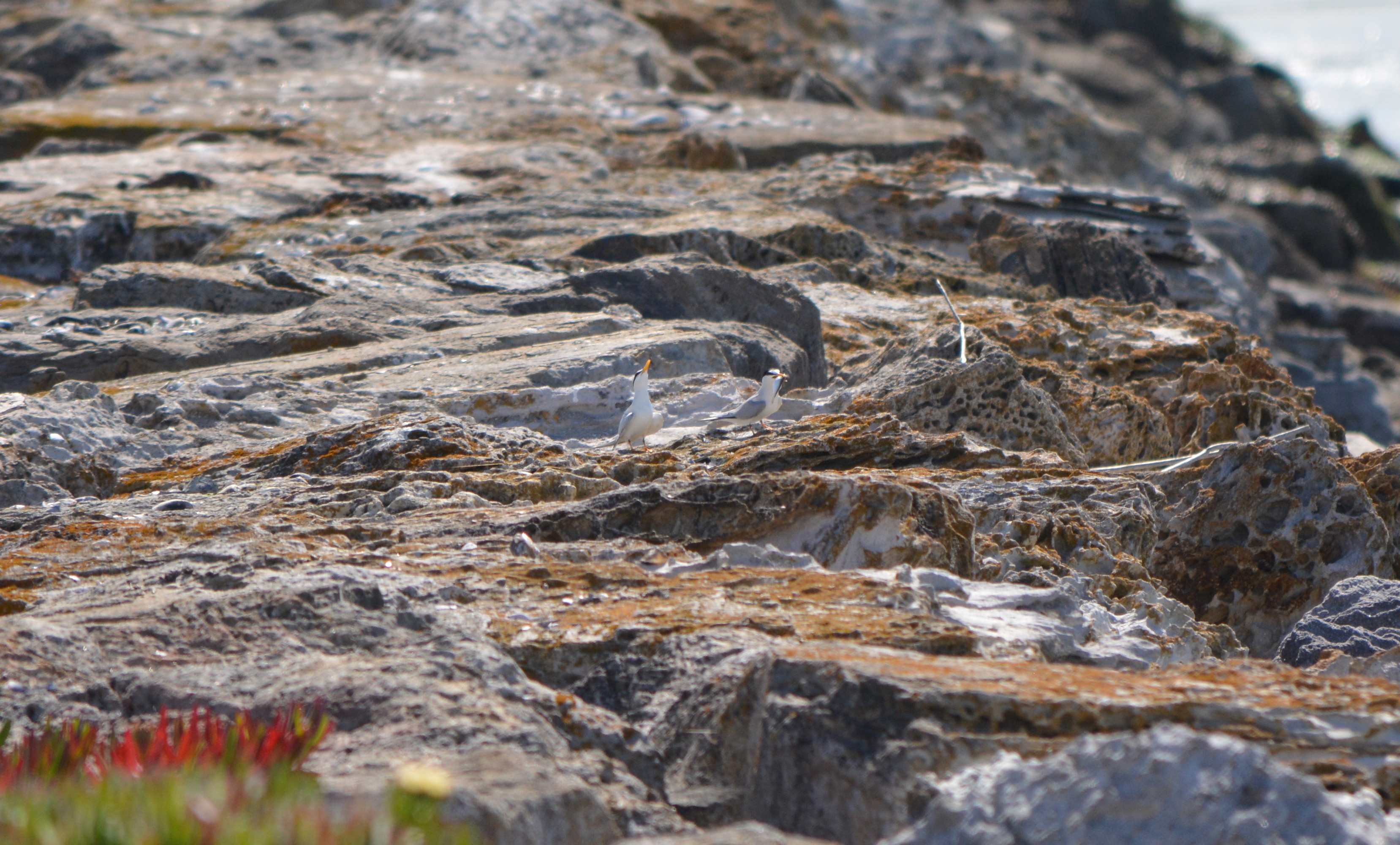
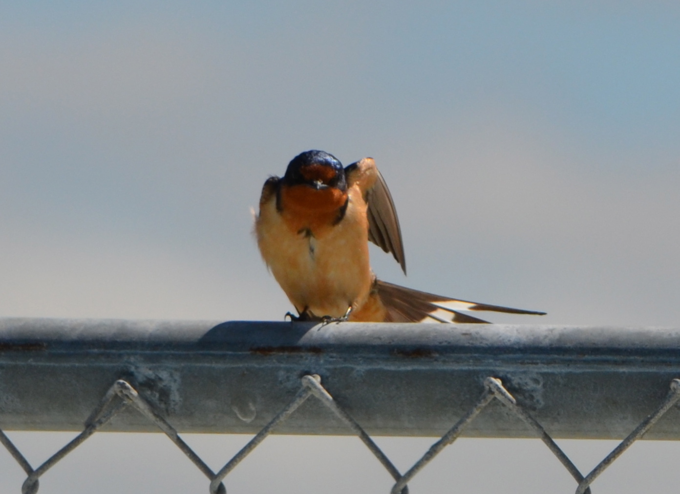
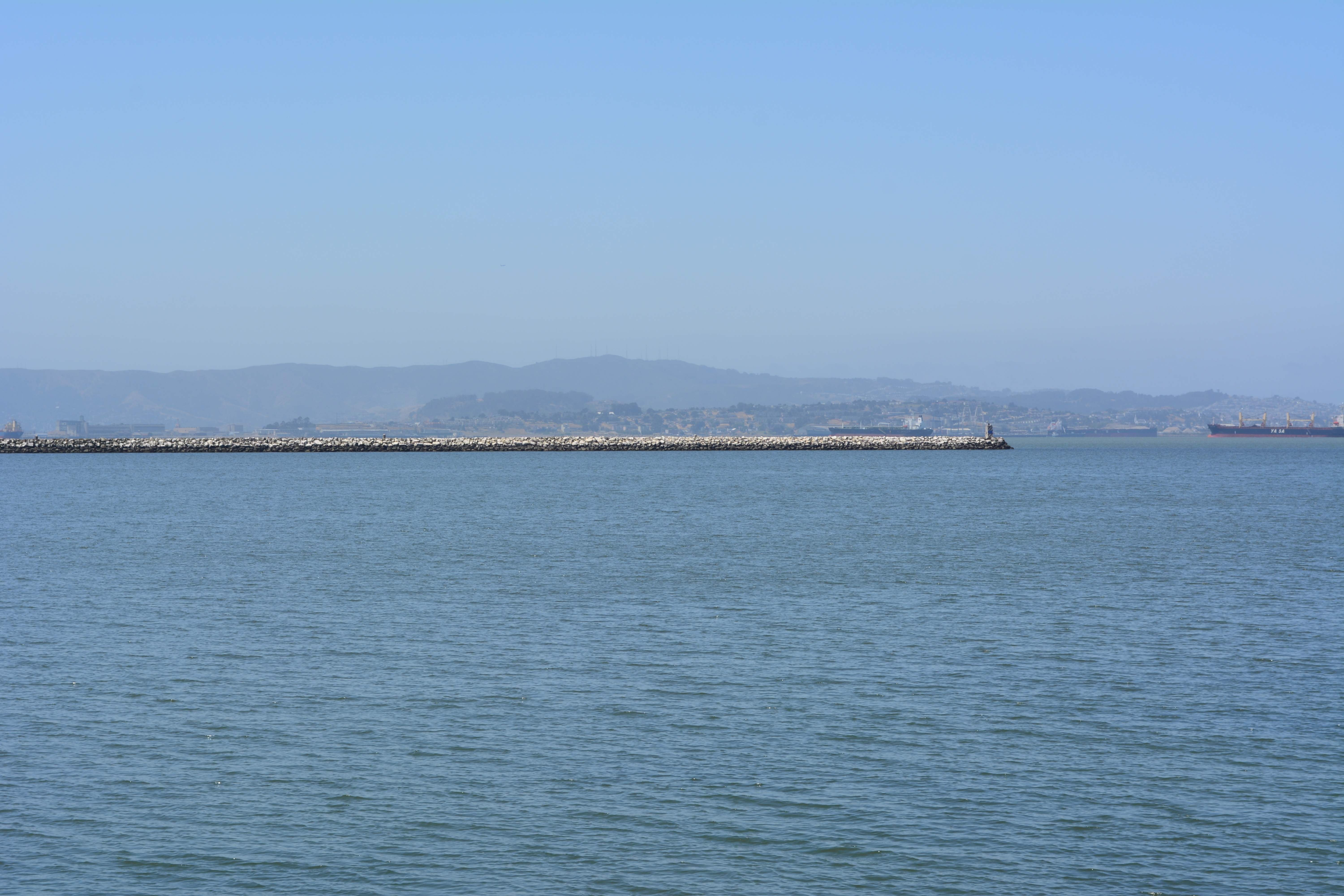
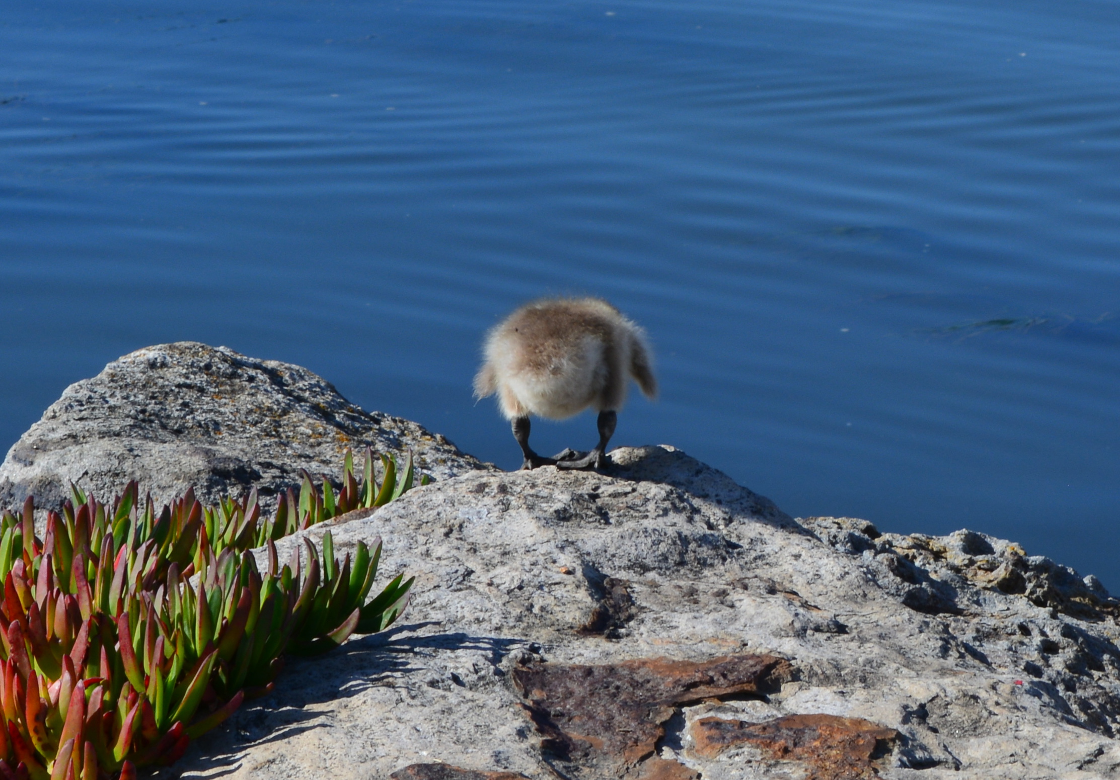
West side of Seaplane Lagoon looking south, with channel and Breakwater Island in background.West side of Seaplane Lagoon, looking northeast from shoreline riprap, with lagoon and hangars in background. Pavement here will serve no commercial purpose under current low-impact guidelines.Great Blue Heron gathering nesting material on western edge of Seaplane Lagoon for nearby nest. Increased vegetation will bring more birds along shoreline.CA Least Terns (center of photo) engaged in courtship ritual of exchanging a fish on jetty adjacent to west side of Seaplane Lagoon – May 2014.Barn Swallow on fence on west side of Seaplane Lagoon. Common to the area, often seen flying low over the water looking for flying insects, nesting almost exclusively on man-made structures, possibly Building 29.Breakwater Island viewed from shoreline on west side of Seaplane Lagoon. Breakwater Island is a roosting site for CA Brown Pelicans and other birds. Island owned by city of Alameda.Landscape plan from 2013 showing no buildings on west (left) side of Seaplane Lagoon. Buildings are now being recommended to stay. Floating wetlands are a very long-range option if funding is available.2014 plans for west side of Seaplane Lagoon show buildings in dashed lines. Active leasing of buildings currently underway suggests buildings should be in solid lines and wetland in gray.Looking west from west side of Seaplane Lagoon. Bay/Channel on left. Building 29 on right. City property extends beyond fence to far edge of Building 29 property line.Runway Wetland area on federal property adjacent to Buildings 25 and 29 on city property at west side of Seaplane Lagoon. A naturalized west shoreline of Seaplane Lagoon, with public access, would enhance the greater wildlife habitat in this area.
Take the plunge! Remove pavement on the west side of the Seaplane Lagoon and improve our environment.
Gosling ready to plunge onto rocks below, on west side of Seaplane Lagoon, to get to parents in the Alameda Point Channel. It was successful.
The drawing and images for the so-called “De-Pave Park” on the western side of the Seaplane Lagoon would be something to cheer about if the park had any chance of ever being created. The text of the city’s recently released Town Center and Waterfront Plan, however, allows existing industrial buildings along the western edge of De-Pave Park to remain “if needed.”
Such a caveat sets the framework for never moving forward with the plans. If the buildings are being leased, the buildings will be “needed.” If the buildings are needed, then the pavement around them will also be needed. The city is continuing to market these buildings to tenants and, thus, there’s not likely to come a day when we try to secure grant money to develop the park.
This is a change from the first presentation of De-Pave Park in 2013 when the Town Center and Waterfront Plan was rolled out. The existing structures were not shown in that drawing. The community was led to believe that all structures would be removed to provide a natural wetland-oriented transition to the existing Runway Wetland on federal property. Not so anymore. The structures can stay.
Conceptual plan presented in 2013 did not indicate that any buildings would remain between De-Pave Park and the Runway Wetland on the federal property.2014 De-Pave Park plan shows dashed lines indicating existing structures that will be allowed to remain “if needed.” Floating wetlands do not exist right now, and probably never will.
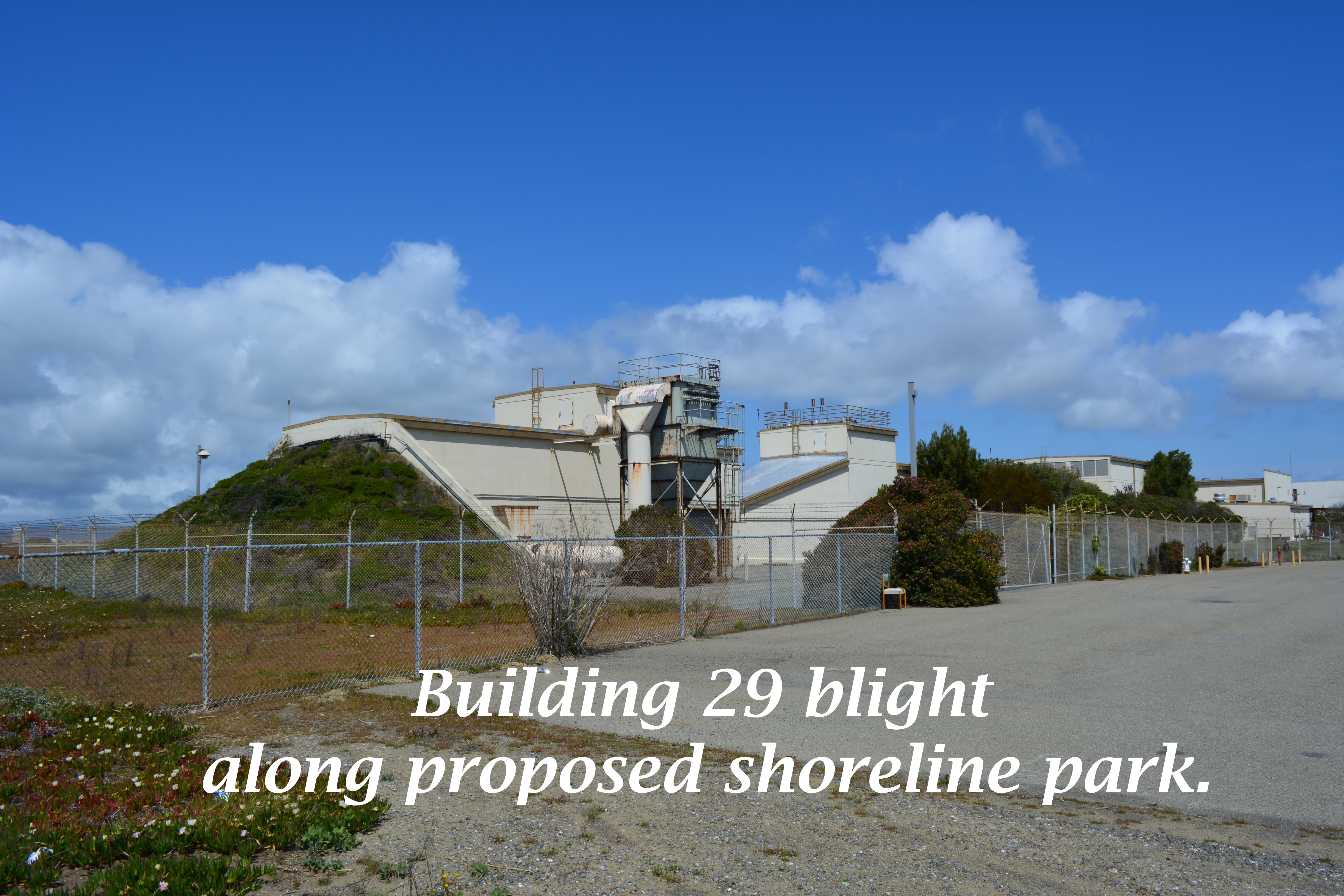
The infrastructure plan now has a levee protecting the 55-foot tall “Building 25” from sea level rise. There would be no reason to protect this eyesore if it was slated for permanent removal. Furthermore, the building is part of the mixed-use commercial and residential waterfront zone where even a hotel is permitted.
55-foot tall “Building 25” that will be protected by a levee, and remind campers that they are on an old military industrial site, as they gaze at the night stars.
The plan’s conceptual drawing and photo collage showing campers, hikers, and grasslands does not include a view to the west, and with good reason. It would show the industrial legacy that will interrupt the potentially expansive views toward the west. It’s deceptive advertising.
Looking toward the Seaplane Lagoon in conceptual drawing for De-Pave Park. No drawings are offered to inform viewers that directly behind this vantage point are old industrial buildings that will be allowed to stay “if needed.” There is currently no plan to remove the industrial buildings.
Parks, as we’ve learned during the new zoning designations for Alameda Point, are zoned Open Space. This “park” is not zoned Open Space. It’s another indication that the so-called “De-Pave Park” is phony.
Changing the western shoreline of the Seaplane Lagoon to a wetland-grassland landscape connected to the Runway Wetland would implement climate change adaptation goals and carbon sequestration goals. Without a commitment by the city to implement De-Pave Park in the Town Center and Waterfront Plan – including removal of all buildings on the western side of the Seaplane Lagoon – a great opportunity to help rebalance the San Francisco Bay ecosystem will fall through the loopholes.
City Hall is requesting comments on the draft plans for the Town Center and Waterfront Plan by May 15, in preparation for a June 9 Planning Board meeting. The plan will be the guiding document on how, where, and what gets built around the Seaplane Lagoon. The city council is expected to approve the plan in July. Comments can be submitted to city planner Andrew Thomas at athomas@alamedaca.gov for forwarding to the Planning Board.
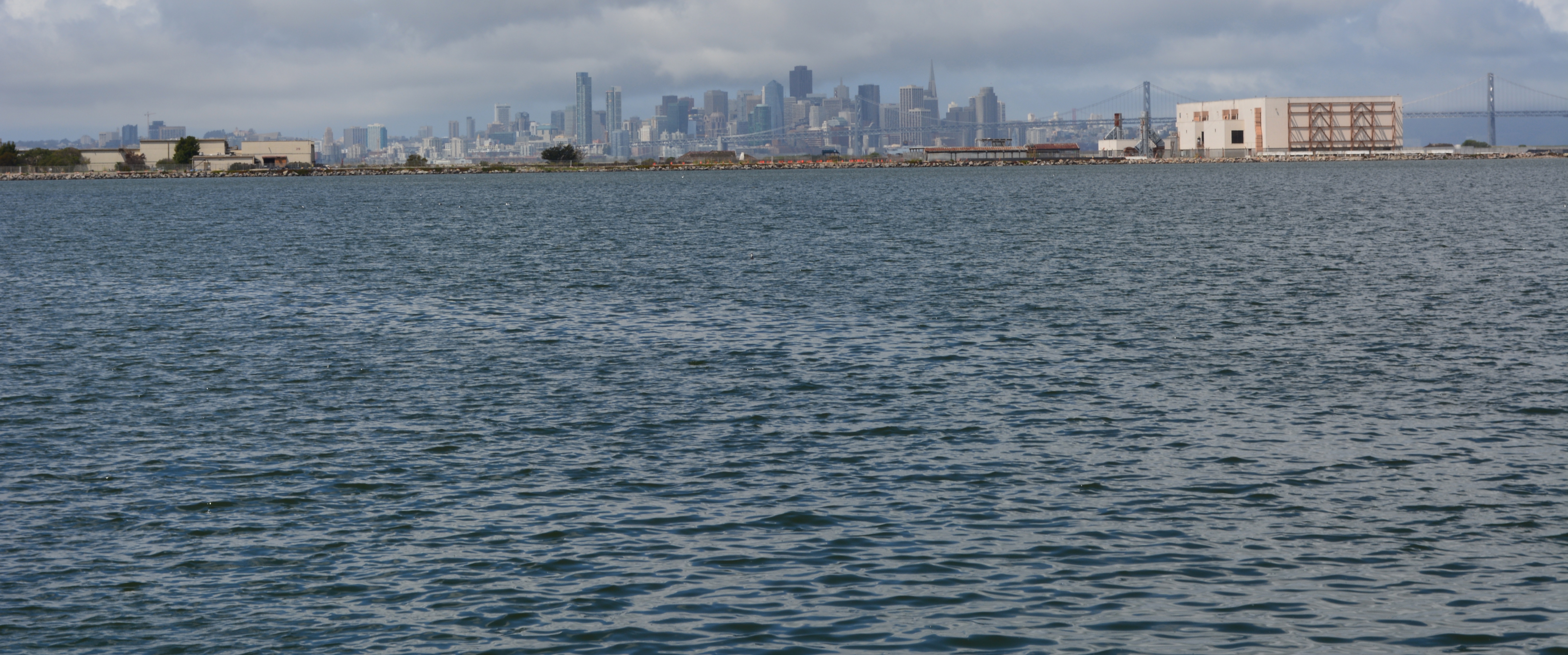
Red line indicates levee that will protect “Building 25.”Western side of the Seaplane Lagoon with potential for major improvements to the Bay ecosystem.Seaplane Lagoon looking west, with blighted viewscape that will be allowed to remain. San Francisco is in background. “Building 25” is the large building on the right that will be saved by a levee.
Environmental cleanup of the Seaplane Lagoon has centered on two areas where storm sewers drain into the lagoon. It was commonplace to discharge all sorts of chemicals down storm sewer lines prior to the passage of the federal Clean Water Act in the early 1970s. Contaminants such as PCBs, cadmium, lead, pesticides, and radium have been found in the sediment around the sewer discharge points.
Prior to dredging, sewer lines leading to the northeast and northwest corners were either replaced or flushed out. An underwater debris pile of metal and wood was also removed at the northeast corner before dredging.
The Northeast Corner
Setup for the 6.5-acre northeast dredging area began in late 2010, and dredging was completed in April of 2011. The total amount of sediment removed was 75,628 cubic yards. Even though the contamination depth was three feet, the dredging went to five feet.
Only 1,719 cubic yards of sediment were transported to hazardous waste disposal sites, of which 11 cubic yards went to a low-level radiological waste disposal site because of the radium-226. The rest of the sediment was determined to be safe enough for reuse, in large part because the contaminants were diluted by the over-dredging of clean sediment. The clean sediment has been stockpiled on the western end of the Wildlife Refuge for future use in capping the landfill disposal sites 1 and 2.
All of the drying pad materials for the northeast corner have been removed, which will allow for the fence to be moved.
The Northwest Corner
Concrete drying pad installed at northwest corner of Seaplane Lagoon
Setup for the 3.3-acre northwest corner began in October of 2011 with the construction of a concrete, waterproof drying pad. Prior to dredging, a sunken barge was demolished and removed. The barge pieces were scanned for radiation, but none was found. The 66 tons of scrap iron was sent to a recycling facility.
Dredging started on January 16 and ended on February 22. The dredging at the NW corner went much faster than the early dredging, partly because of the smaller area, and partly because of heftier dredging equipment.
Unlike the NE corner, however, the sediment here is expected to contain higher levels of radium-226 because the sewer line leading here was highly contaminated. As was the case at the NE corner, this sediment will have to dry out before being tested and disposed of. The project should be completed and everything removed by December.
The price tag for all of the Seaplane Lagoon dredging and hauling away sediment, when completed: $46 million.


![Seaplane Lagoon cleanup dredging completed [video and slideshow]](https://alamedapointenviro.com/wp-content/uploads/2012/03/img_9647.jpg?w=1200)