Phony green shoreline park plans for Seaplane Lagoon at Alameda Point

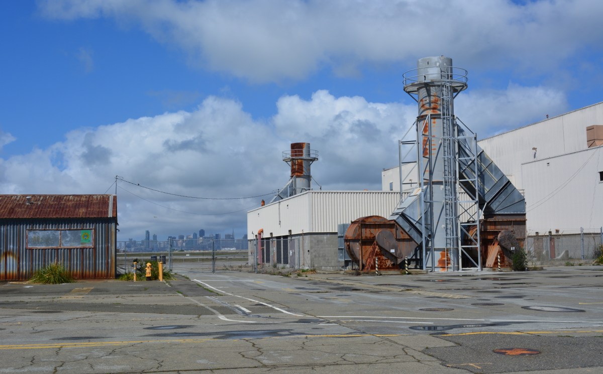
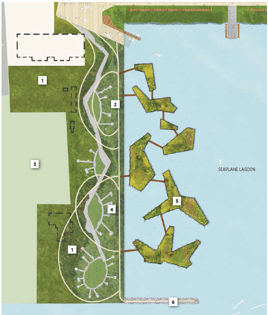
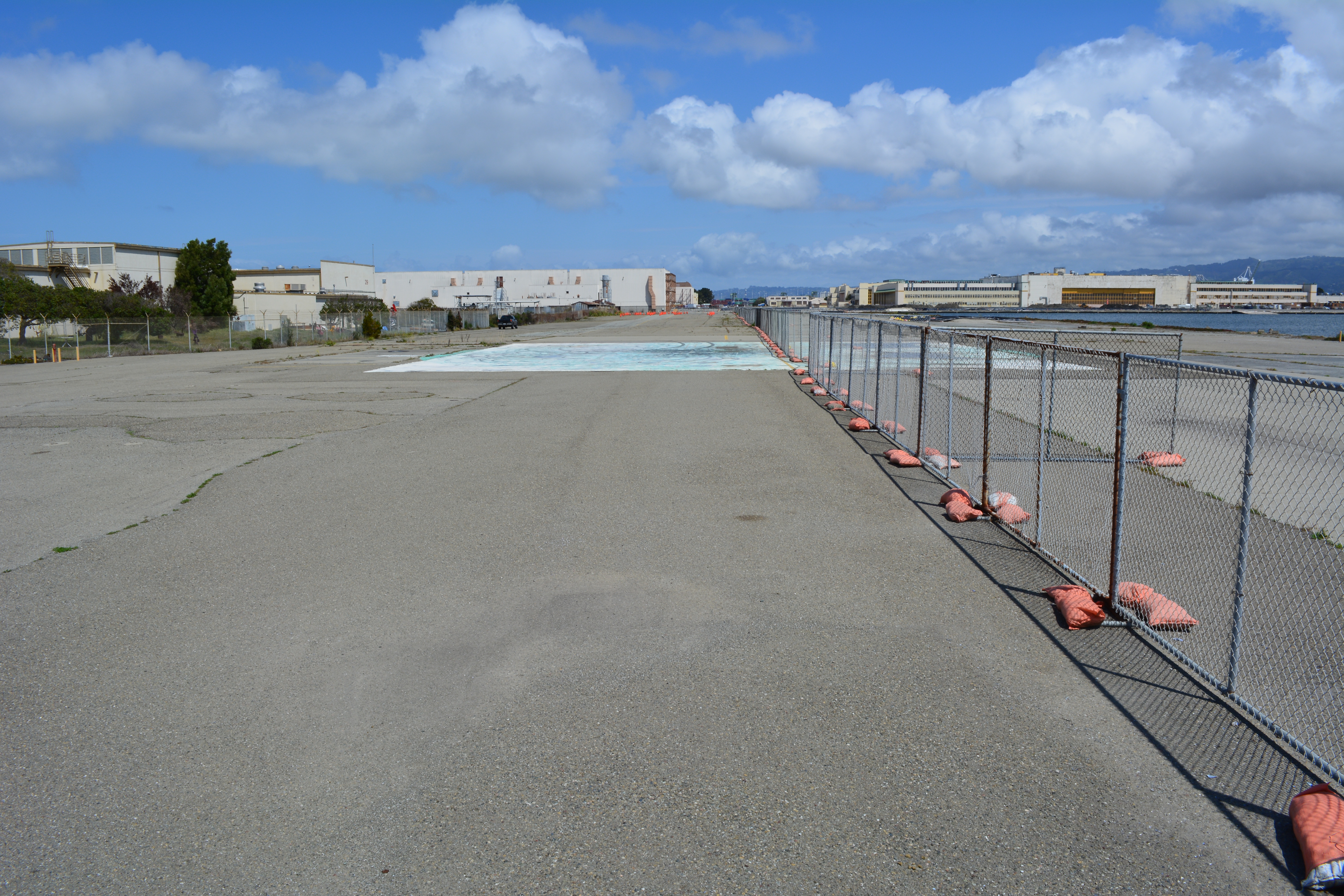
The drawing and images for the so-called “De-Pave Park” on the western side of the Seaplane Lagoon would be something to cheer about if the park had any chance of ever being created. The text of the city’s recently released Town Center and Waterfront Plan, however, allows existing industrial buildings along the western edge of De-Pave Park to remain “if needed.”

Proposed De-Pave Park location w:buildings

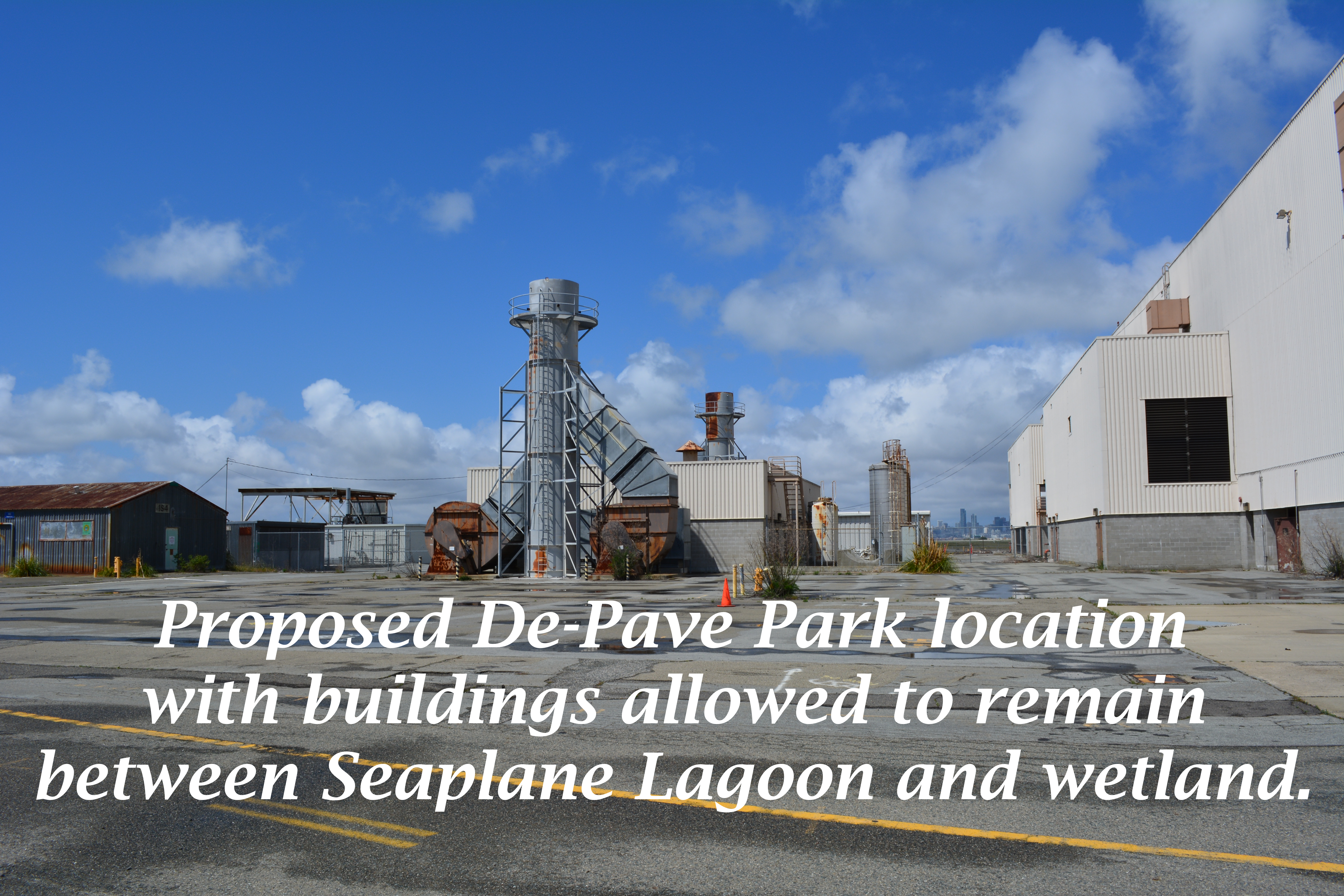
Such a caveat sets the framework for never moving forward with the plans. If the buildings are being leased, the buildings will be “needed.” If the buildings are needed, then the pavement around them will also be needed. The city is continuing to market these buildings to tenants and, thus, there’s not likely to come a day when we try to secure grant money to develop the park.

Building 29 blight

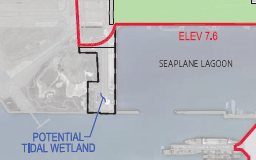
This is a change from the first presentation of De-Pave Park in 2013 when the Town Center and Waterfront Plan was rolled out. The existing structures were not shown in that drawing.  The community was led to believe that all structures would be removed to provide a natural wetland-oriented transition to the existing Runway Wetland on federal property. Not so anymore. The structures can stay.

Conceptual plan presented in 2013 did not indicate that any buildings would remain between De-Pave Park and the Runway Wetland on the federal property.
2014 De-Pave Park plan shows dashed lines indicating existing structures that will be allowed to remain "if needed."
2014 De-Pave Park plan shows dashed lines indicating existing structures that will be allowed to remain “if needed.”  Floating wetlands do not exist right now, and probably never will.

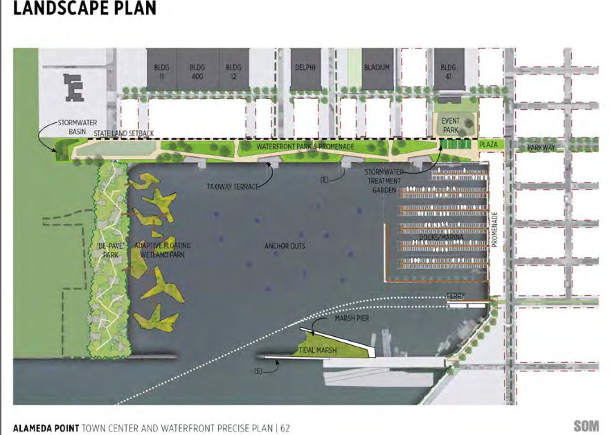
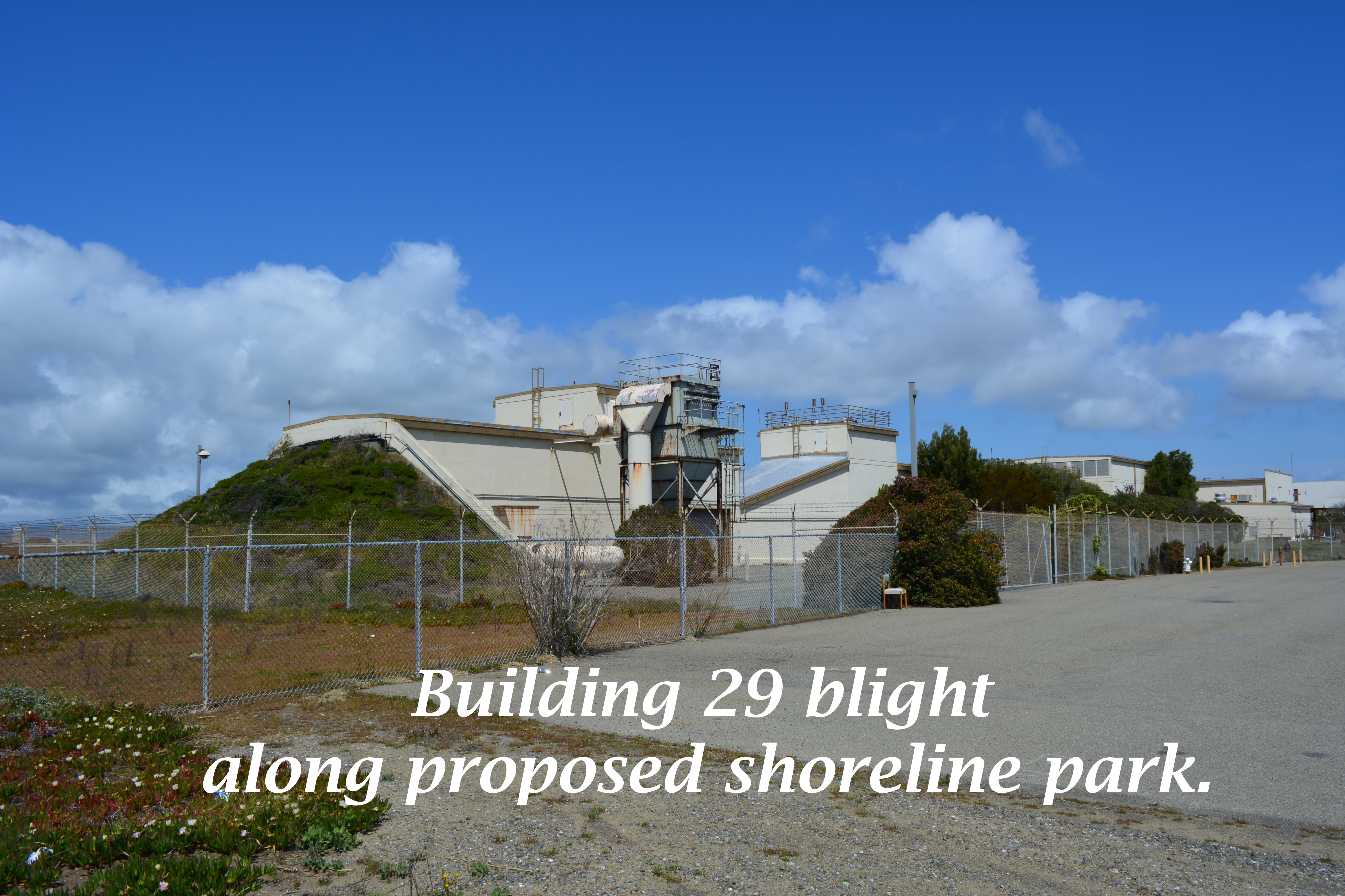
The infrastructure plan now has a levee protecting the 55-foot tall “Building 25” from sea level rise. There would be no reason to protect this eyesore if it was slated for permanent removal. Furthermore, the building is part of the mixed-use commercial and residential waterfront zone where even a hotel is permitted.

55-foot tall "Building 25" that will be protected by a levee, and remind campers that they are on an old military industrial site, as they gaze at the night stars.
55-foot tall “Building 25” that will be protected by a levee, and remind campers that they are on an old military industrial site, as they gaze at the night stars.

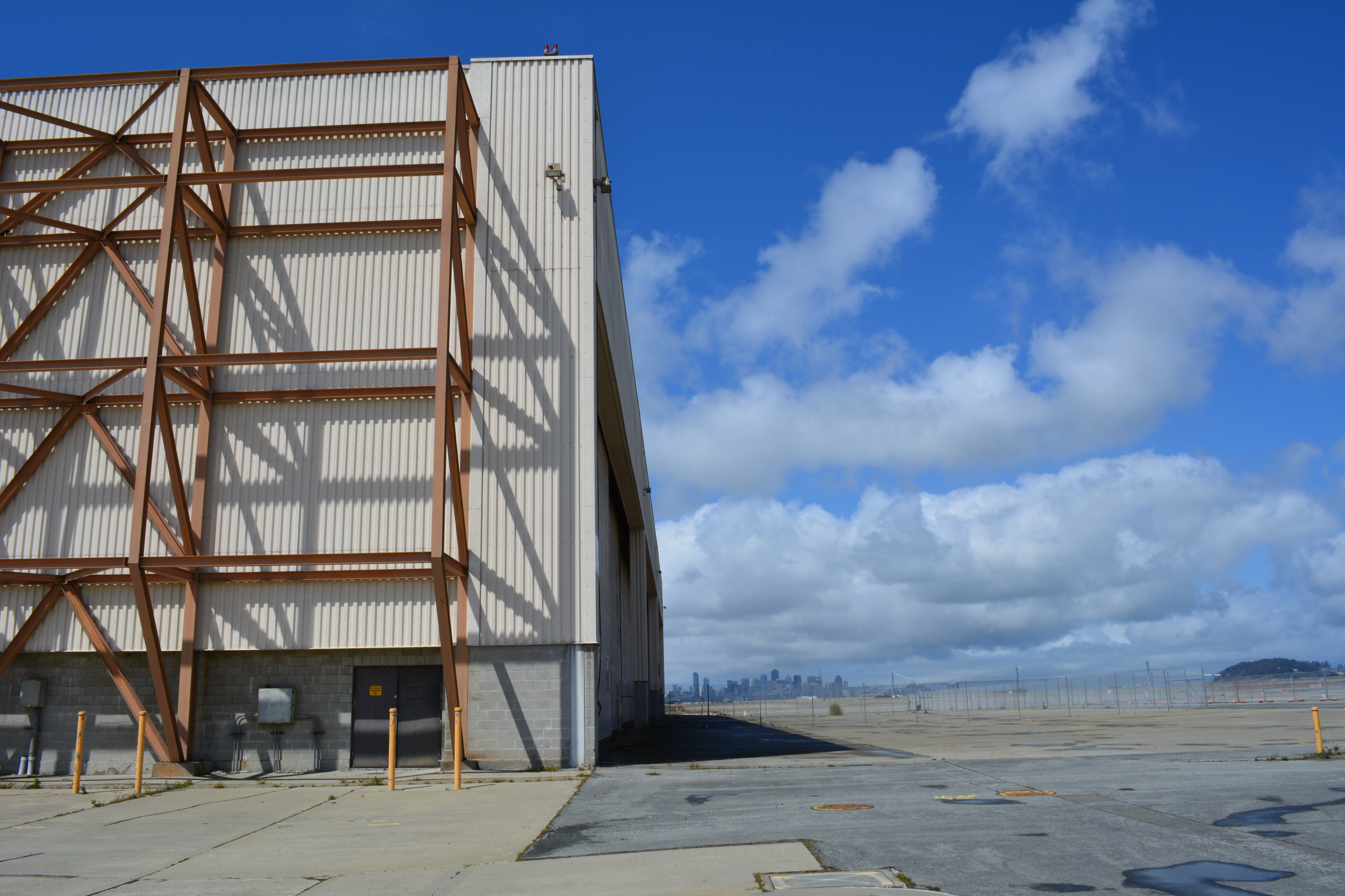
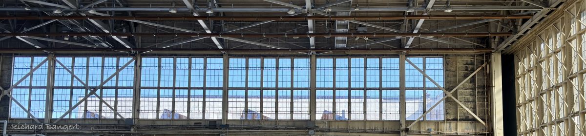
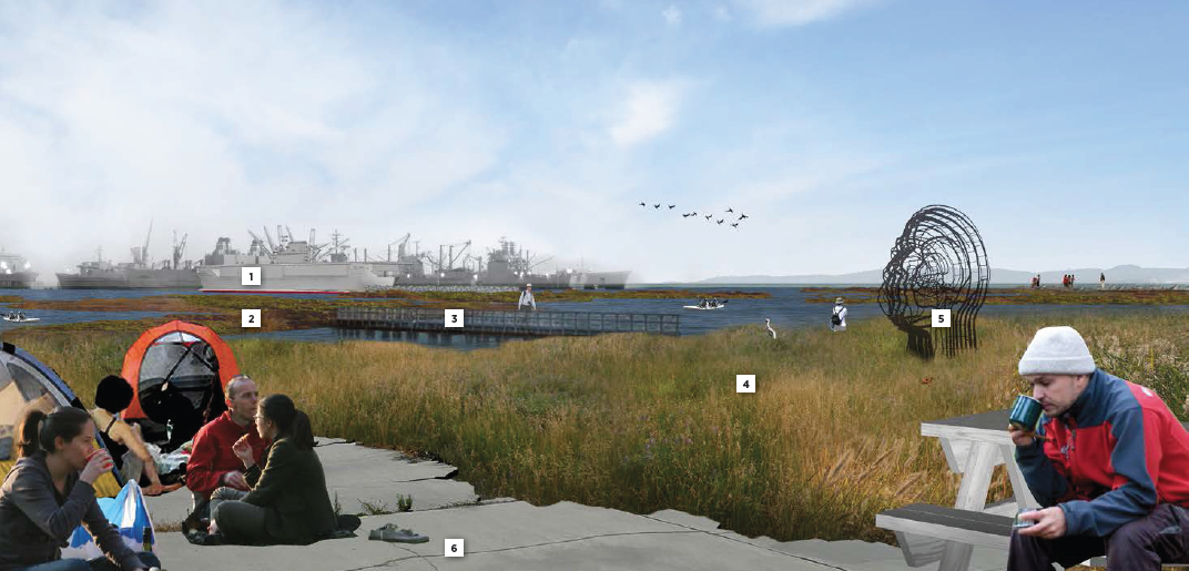
The plan’s conceptual drawing and photo collage showing campers, hikers, and grasslands does not include a view to the west, and with good reason.  It would show the industrial legacy that will interrupt the potentially expansive views toward the west. It’s deceptive advertising.

Looking toward the Seaplane Lagoon in conceptual drawing for De-Pave Park.  No drawings are offered to inform viewers that directly behind this vantage point are old industrial buildings that will be allowed to stay "if needed."  There is currently no plan to remove the industrial buildings.
Looking toward the Seaplane Lagoon in conceptual drawing for De-Pave Park. No drawings are offered to inform viewers that directly behind this vantage point are old industrial buildings that will be allowed to stay “if needed.” There is currently no plan to remove the industrial buildings.

Parks, as we’ve learned during the new zoning designations for Alameda Point, are zoned Open Space. This “park” is not zoned Open Space. It’s another indication that the so-called “De-Pave Park” is phony.

Changing the western shoreline of the Seaplane Lagoon to a wetland-grassland landscape connected to the Runway Wetland would implement climate change adaptation goals and carbon sequestration goals. Without a commitment by the city to implement De-Pave Park in the Town Center and Waterfront Plan – including removal of all buildings on the western side of the Seaplane Lagoon – a great opportunity to help rebalance the San Francisco Bay ecosystem will fall through the loopholes.

City Hall is requesting comments on the draft plans for the Town Center and Waterfront Plan by May 15, in preparation for a June 9 Planning Board meeting. The plan will be the guiding document on how, where, and what gets built around the Seaplane Lagoon. The city council is expected to approve the plan in July. Comments can be submitted to city planner Andrew Thomas at athomas@alamedaca.gov for forwarding to the Planning Board.

Red line indicates levee that will protect "Building 25."
Red line indicates levee that will protect “Building 25.”
Western side of the Seaplane Lagoon with potential for a major rebalancing of the Bay ecosystem.
Western side of the Seaplane Lagoon with potential for major improvements to the Bay ecosystem.
Seaplane Lagoon looking west, with blighted viewscape that will allowed to remain.  San Francisco is in background.  "Building 25" is the large building on the right that will be saved by a levee.
Seaplane Lagoon looking west, with blighted viewscape that will be allowed to remain. San Francisco is in background. “Building 25” is the large building on the right that will be saved by a levee.


Reference:  Open Space, Landscape, and Sustainability sectionDraft Town Center and Waterfront Precise Plan for Alameda Point.

Author: richard94501

My blog is Alameda Point Environmental Report covering environmental issues from wildlife to cleanup at the former Navy base in Alameda now called Alameda Point. Articles on my blog are frequently printed in the Alameda Sun newspaper. I also host a Twitter site and a Flickr photo site. I hope you find my stories and photos of interest. Richard Bangert Alameda, California

Leave a Reply

Fill in your details below or click an icon to log in:

WordPress.com Logo

You are commenting using your WordPress.com account. Log Out /  Change )

Twitter picture

You are commenting using your Twitter account. Log Out /  Change )

Facebook photo

You are commenting using your Facebook account. Log Out /  Change )

Connecting to %s

%d bloggers like this: