“Demilitarized Landscapes” is a nine-minute film about three San Francisco Bay Area communities in which the military has played a major role: San Francisco’s Bayview Hunters Point, Alameda Point, and the Richmond waterfront. The film was featured in a special exhibition called “Above and Below: Stories From Our Changing Bay” at the Oakland Museum of California. The exhibition, which ran from August 31, 2013 to February 23, 2014, explored the impacts of humans and natural forces on San Francisco Bay over the last 6,000 years.
The film played continuously in a special display area titled “Military Landscapes – Demilitarized Landscapes” and shows the transitions being made today. The Alameda Point segment focuses on the Nature Reserve and the recovery effort for the endangered California Least Tern.
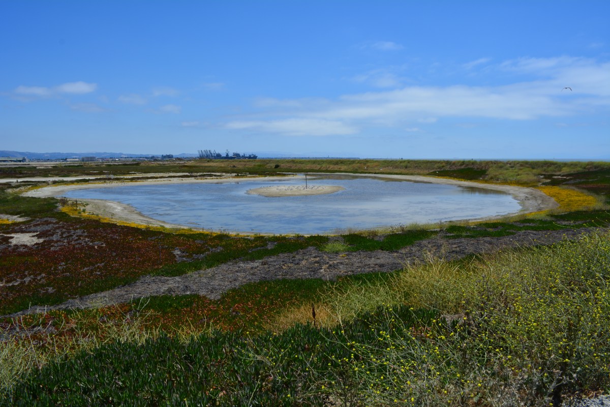
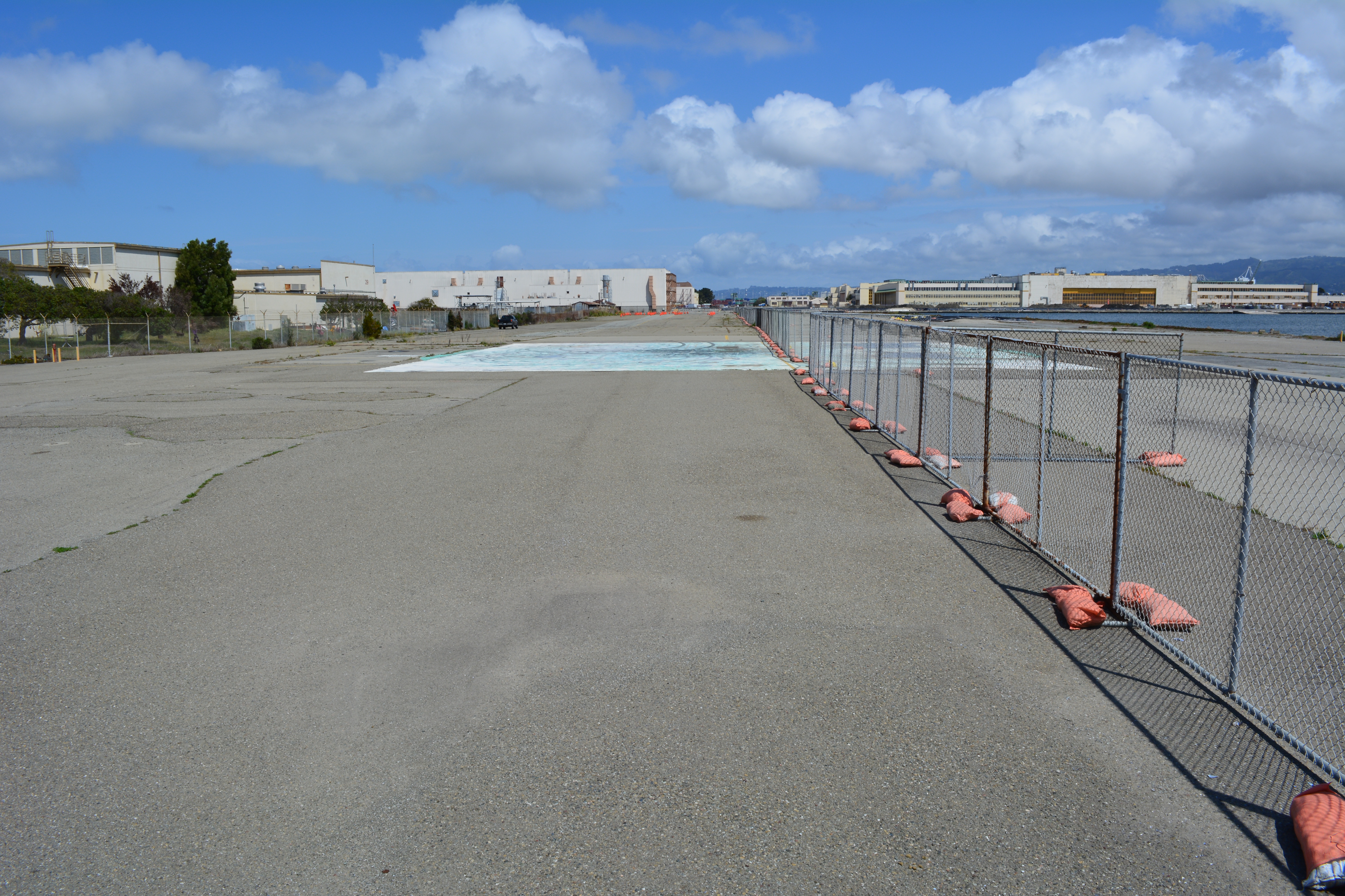
The Seaplane Lagoon’s north side will be looking like its old self in a few months. The Navy has begun dismantling the waterproof concrete-walled containment system that was used for three years for dewatering and testing of soil dredged from the Seaplane Lagoon, marking a major cleanup milestone. Prior to that dredging work, much of the lagoon’s north frontage served as a staging area for replacement of storm drain lines contaminated with radium-226.
Construction of a new and improved soil cover over a waste disposal site concluded this spring, marking another milestone. The 110-acre site on the southwest corner of Alameda Point took 10 years of haggling about potential environmental impacts before a cleanup plan was adopted in 2010. Work began in early 2013. The dome-shaped soil cover required 500,000 cubic yards of barged-in soil to complete.
North Pond of West Wetland on southwest corner of Alameda Point. Pond is connected to San Francisco Bay via a new culvert near upper left of pond. Landfill soil cover is partially visible on far side of pond and will be seeded with flowering native grasses later this year.
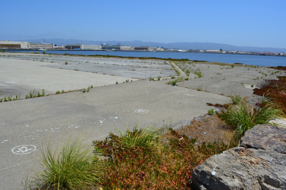
At the far northwestern corner of the Point, work is about to begin on another long studied and analyzed waste disposal site. In a few months, the Navy will be installing an interlocking steel retaining wall along 200 yards of the Bay shoreline to contain contaminated burned waste material that was bulldozed into the Bay more than a half century ago. Water dye tests showed no toxics are leaching into the Bay, but members of the Restoration Advisory Board (RAB) questioned whether the barrier would withstand a catastrophic earthquake. Partially covered by runway pavement, the entire 30-acre site will receive a three-foot soil cover. The work is expected to be completed in 2015. The area will be available for passive recreational use such as hiking trails when the city receives the land.
Northwest tip of Alameda Point where Site 1 is located. Waste burning area is here. Trees have been removed. Metal retaining wall will go here. Port of Oakland is in background.
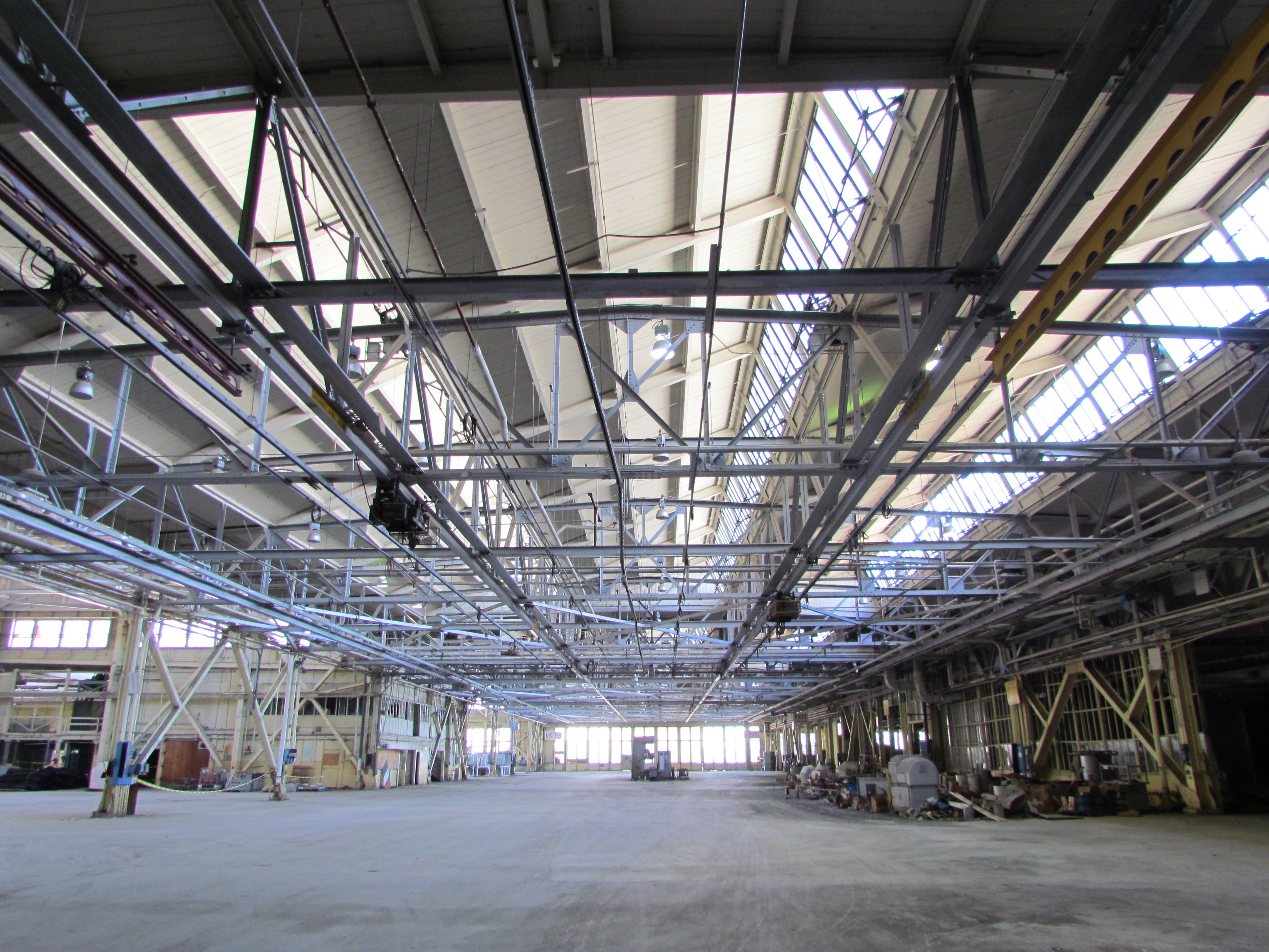
One of the longest-running and most problematic cleanup sites is at the old Naval Air Rework Facility (NARF), also known as Building 5, covering nearly one million square feet. Radium paint used for aircraft dial painting, and chemicals associated with engine repair work led to contamination that is still being remediated. The entire floor area will be scanned again for radiation in 2015, following up on at least three prior scanning surveys of walls, ceilings, pipes, and ducts. The year 2015 will also see the Navy returning to the site for a final round of groundwater cleanup treatments targeting contamination remaining after an intensive cleanup effort a decade ago.
Building 5, also known as Naval Air Rework Facility (NARF), where additional radium-226 and groundwater cleanup is planned. At the corner of West Tower Avenue and Monarch Street.
Next door to the Bladium Sports Club on West Tower Avenue, another previously treated groundwater cleanup site will be treated again. Workers have already begun boring holes in the pavement for a network of hoses that will be used for introducing contaminant-eating bacteria into groundwater along with a bacteria food source.
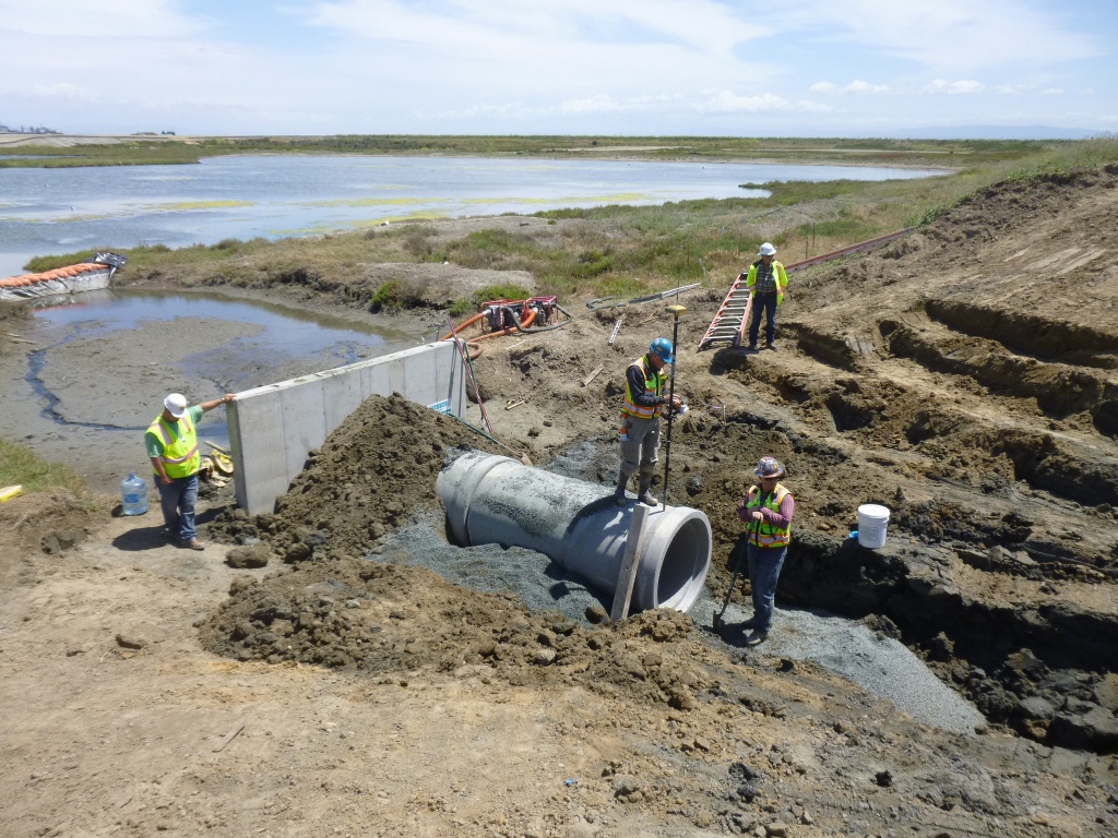
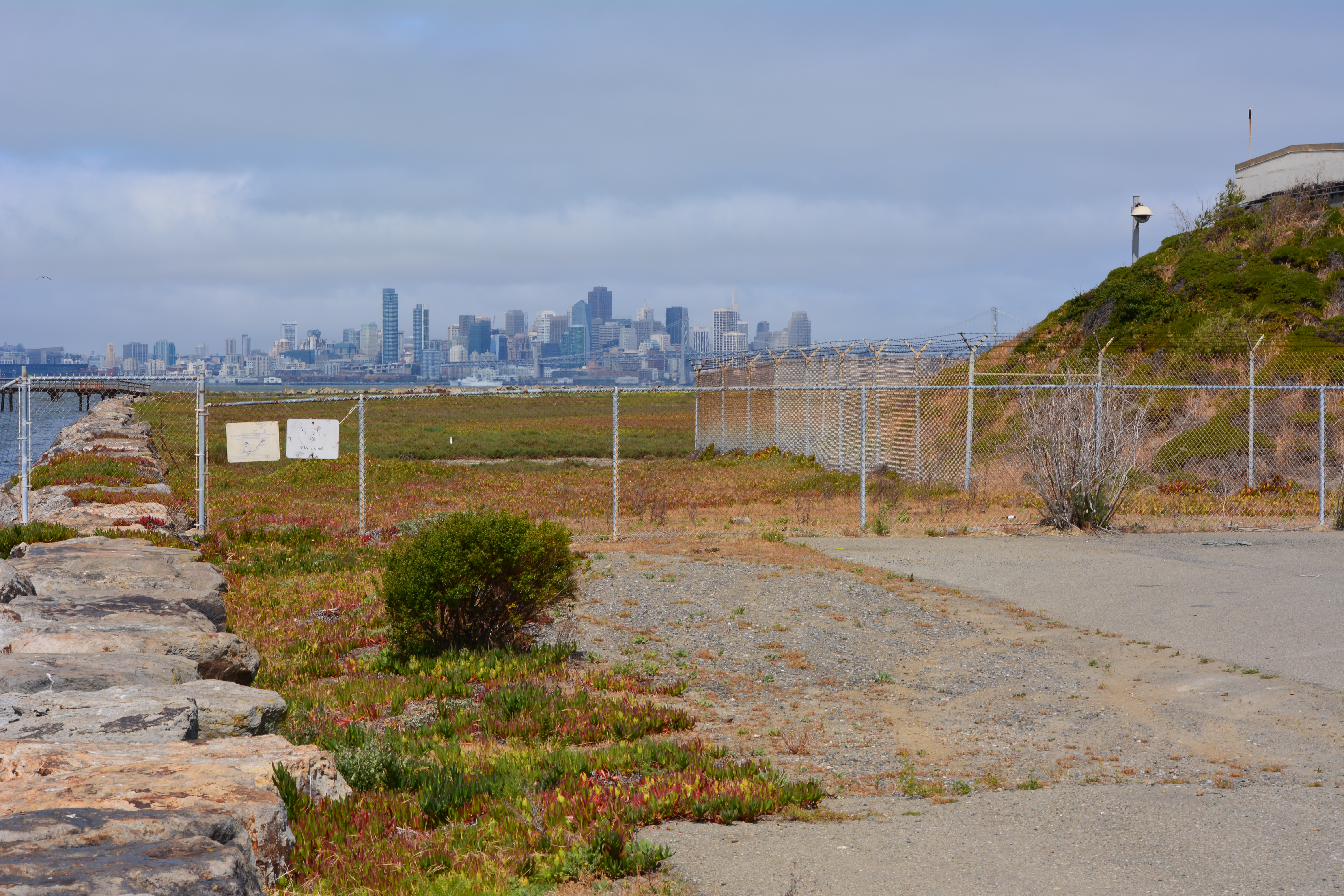
On Saturday, July 12, the Navy’s annual cleanup site tour visited four of the cleanup areas. The most impressive stop was the 110-acre landfill site mentioned above. For the first time in over 15 years, members of the public were allowed to walk around and enjoy the magnificent views from the embankment that is closer to San Francisco than to city hall. The fencing is all gone, and with it the radiological warning signs. The Navy replaced an aging metal culvert that connects the site’s North Pond to San Francisco Bay with a concrete culvert.
New culvert being installed connecting San Francisco Bay, which is to the right, and North Pond of the West Wetland at Alameda Point. Navy photo taken 5/22/14.New culvert being installed. North Pond of West Wetland at Alameda Point in foreground, San Francisco Bay in background. Navy photo.
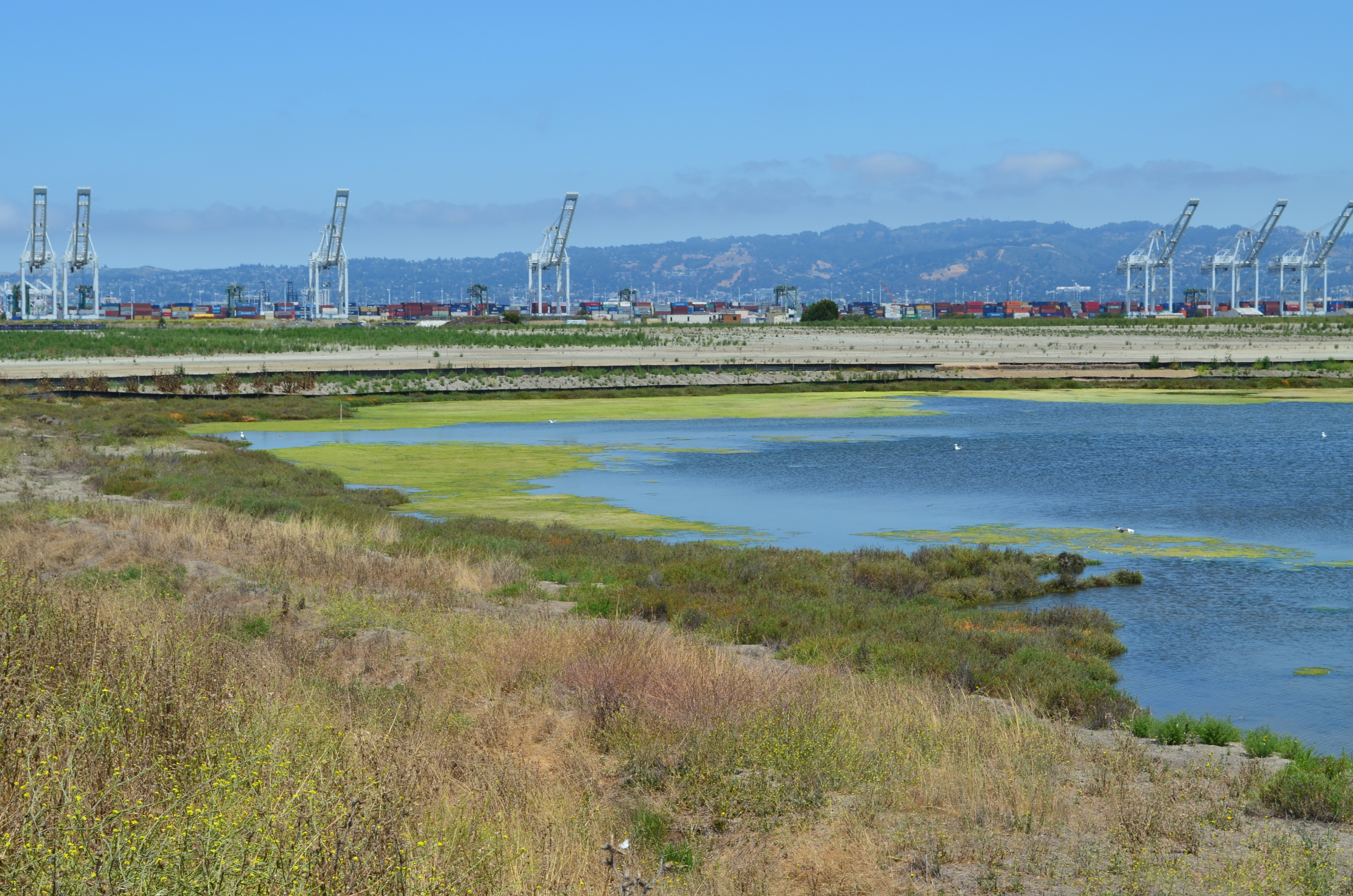
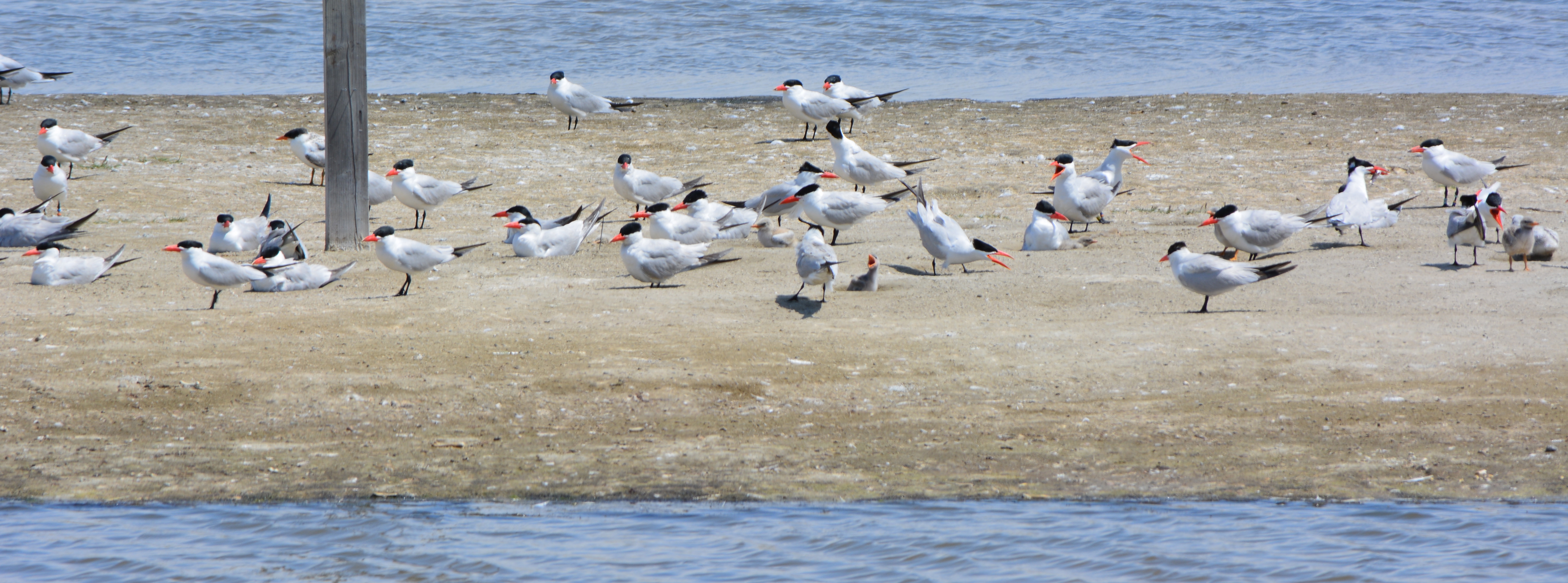
Tour participants were able to see the area’s expanded wetland with a new tiny island. Caspian Terns started nesting on the island a few months ago, another type of milestone. “The last time Caspian Terns were seen in that area nesting was in 1999 when only one nest was detected,” said Alameda wildlife biologist and Alameda Point bird surveyor Leora Feeney. The 79-acre soil cover on the landfill will be seeded with flowering native grasses later this year. The vegetation mix was chosen by the RAB.
South Pond of West Wetland at Alameda Point. Island in pond has become a nesting site for Caspian Terns. Looking north toward Port of Oakland.
According to the Navy’s environmental cleanup coordinator, Derek Robinson, $513 million has been appropriated to date for Alameda Point cleanup, although some of it remains to be spent on upcoming work. His office, the Base Realignment and Closure Program, estimates another $80 million will be needed by the time remaining projects and follow-up monitoring are completed.
Later this year, the Navy is expected to transfer to the city the 33-acre North Housing site and seven-acre former Island High School site that sit next to Alameda Landing and Estuary Park, marking another milestone on the long and winding cleanup road to civilian use.
Caspian Terns and chicks at West Wetland, Alameda Point. Click on image to enlarge.Trail on embankment at southwest corner of Alameda Point. Looking south with San Francisco Bay to the right and ahead. Additional trail to the right at riprap elevation.Concrete pad served as a base for conveyor that transferred soil from barge to land for the soil cover at Site 2. Contractor left it in place and added a few amenities for future users of a place they had come to appreciate the beauty of as they worked here for a year. Thank you, TetraTech.Dredging the northwest corner of the Seaplane Lagoon at Alameda Point in February 2012. Tarmac dewatering, drying, and testing area behind black tarp is now being dismantled. All dredging work is completed.
Update notes: Subsequent criticism of the Navy as to the necessity of a security fence by members of the public and regulatory agencies led to the removal of the security fence from the final work plan design. The Navy also agreed to shorten the soil gas vents to two feet, since only trace amounts of methane gas are now emitted from the landfill waste, most of which is industrial and did not produce methane in the first place. Additionally, the Navy agreed to examine the aging metal culvert that connects the North Pond of the West Wetland to San Francisco Bay. The culvert provides the water lifeline for the North Pond habitat and was at risk of collapse and being stopped up with debris. The Navy replaced the metal culvert with a concrete culvert (see photo above) and debris screen.
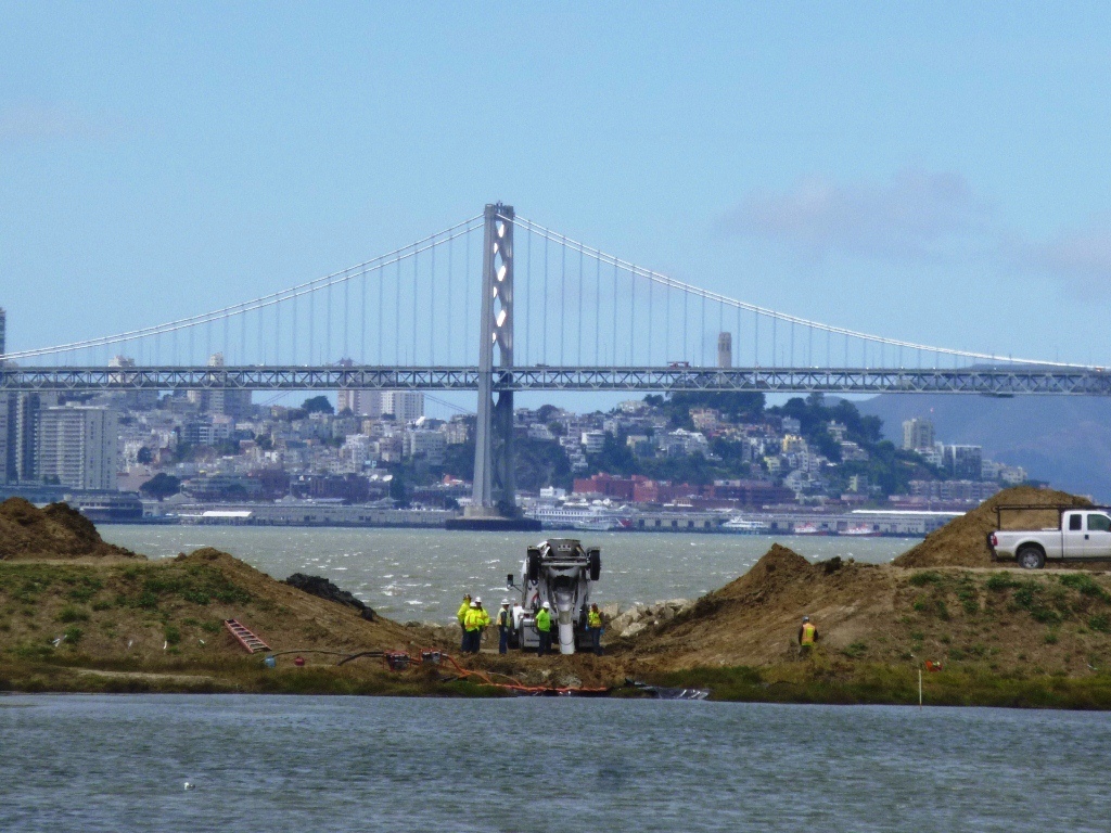
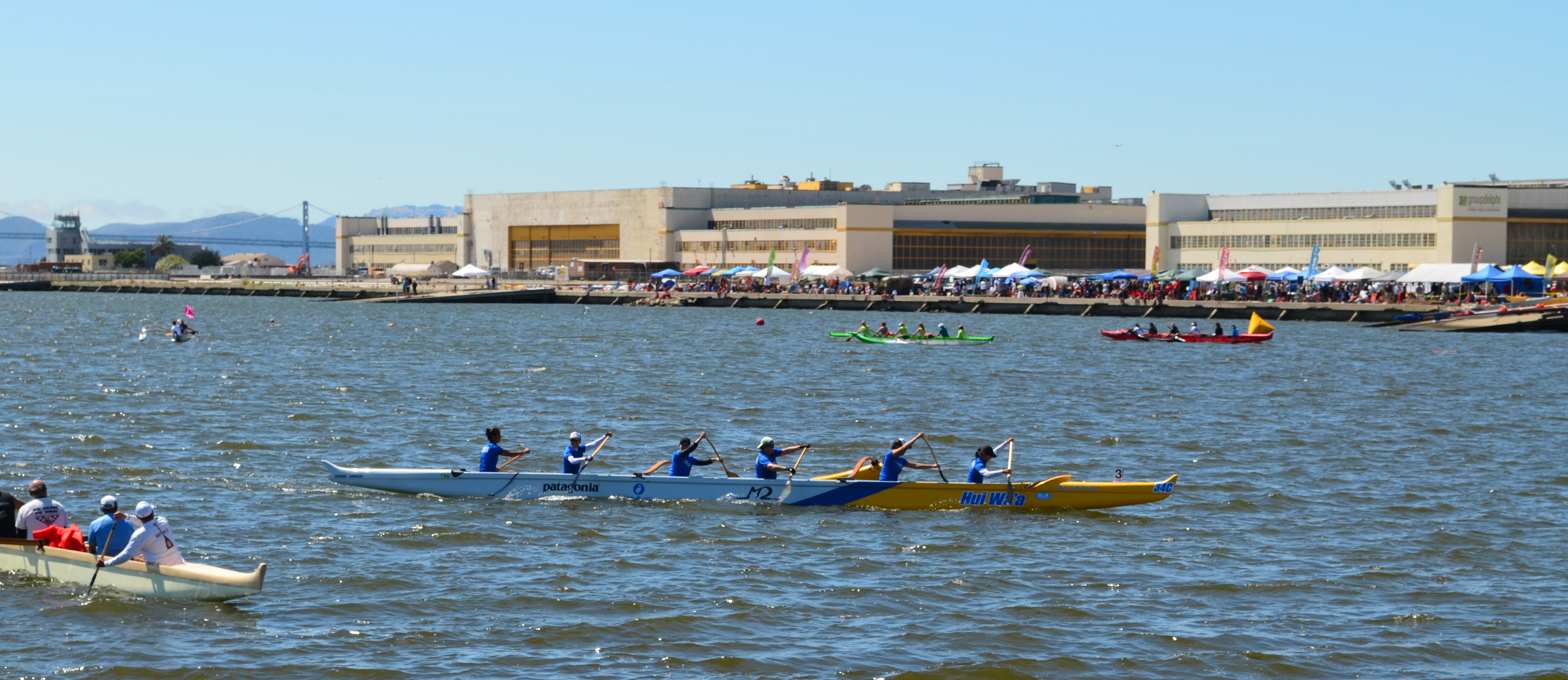
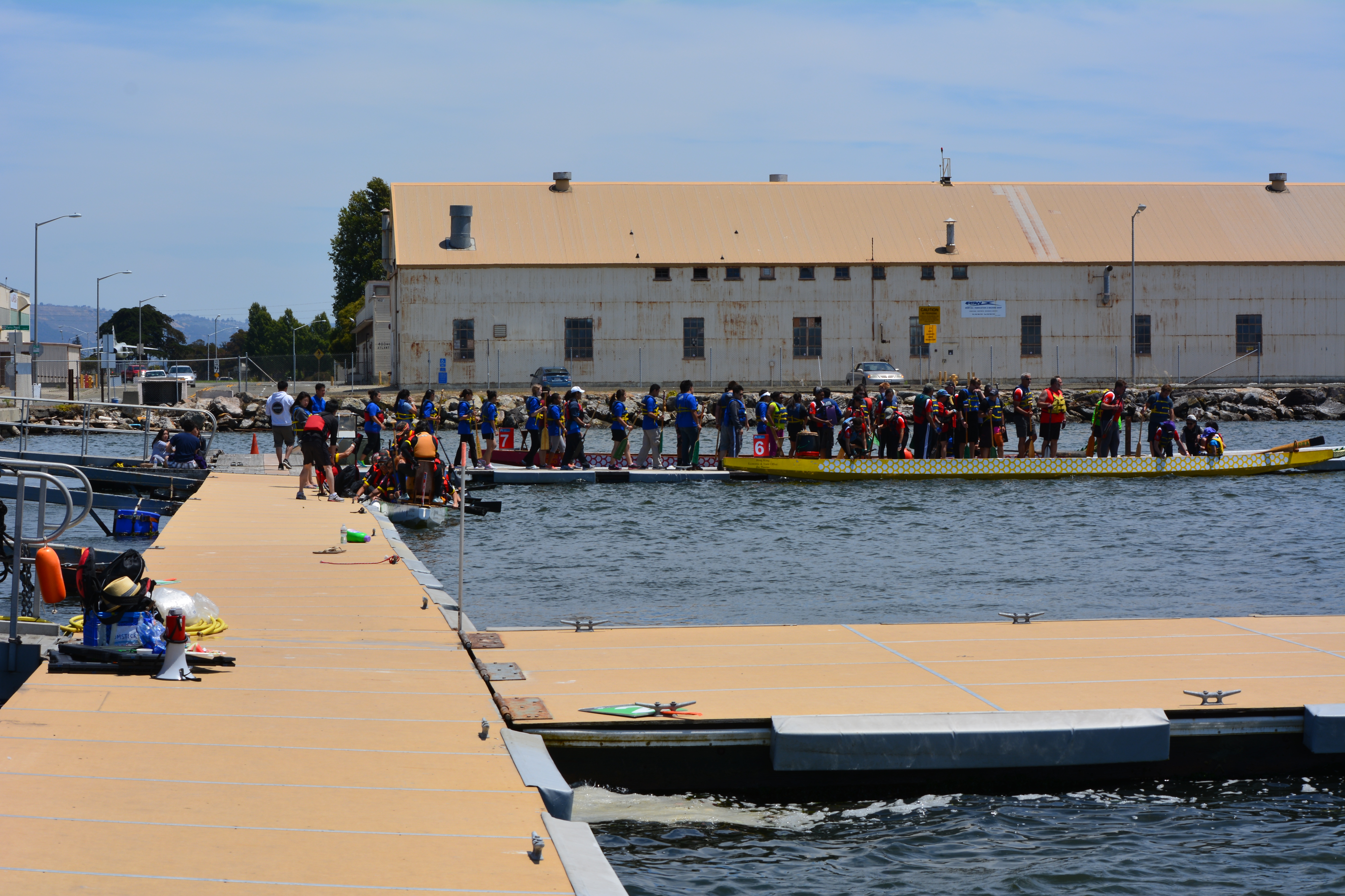
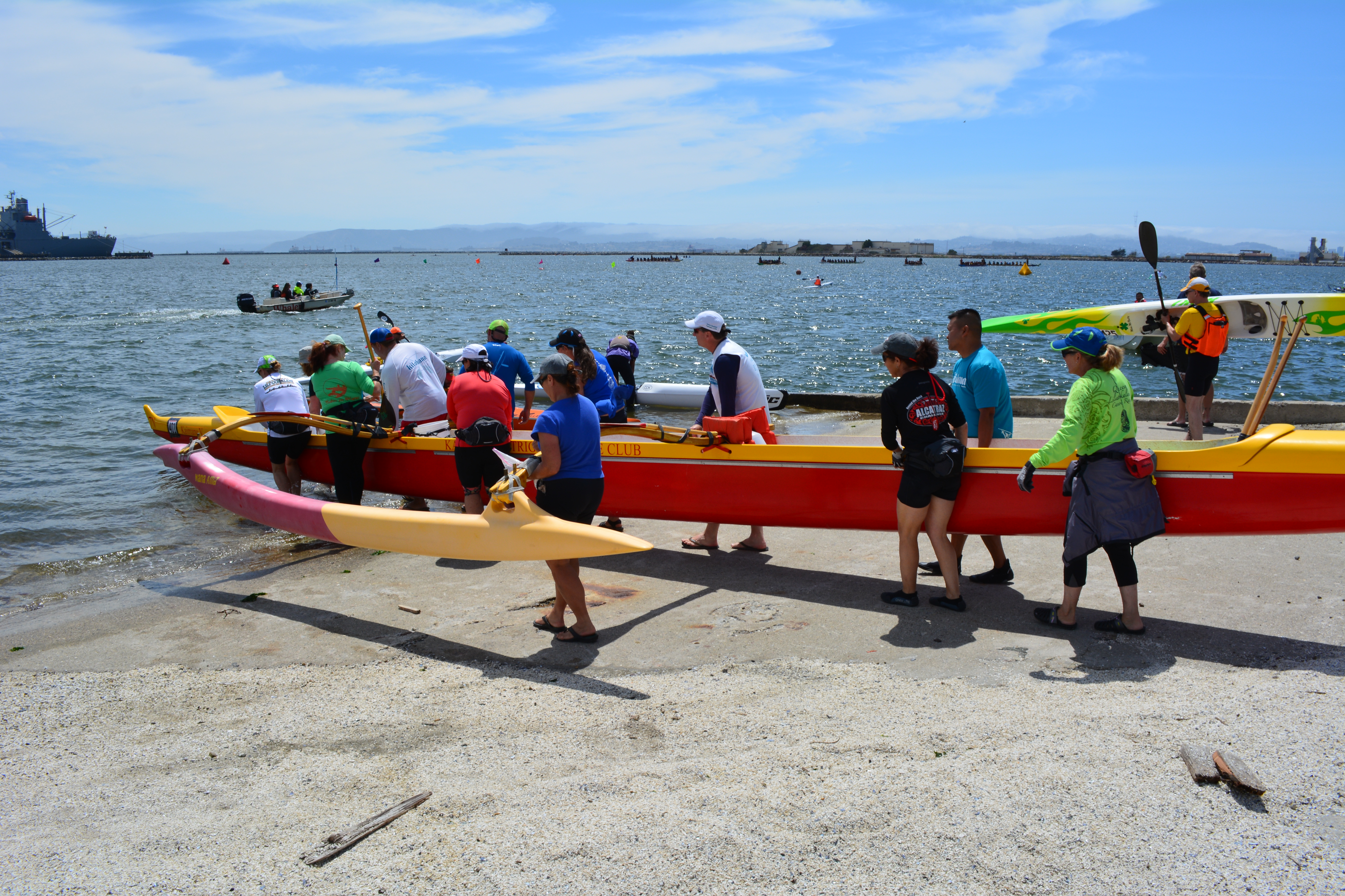
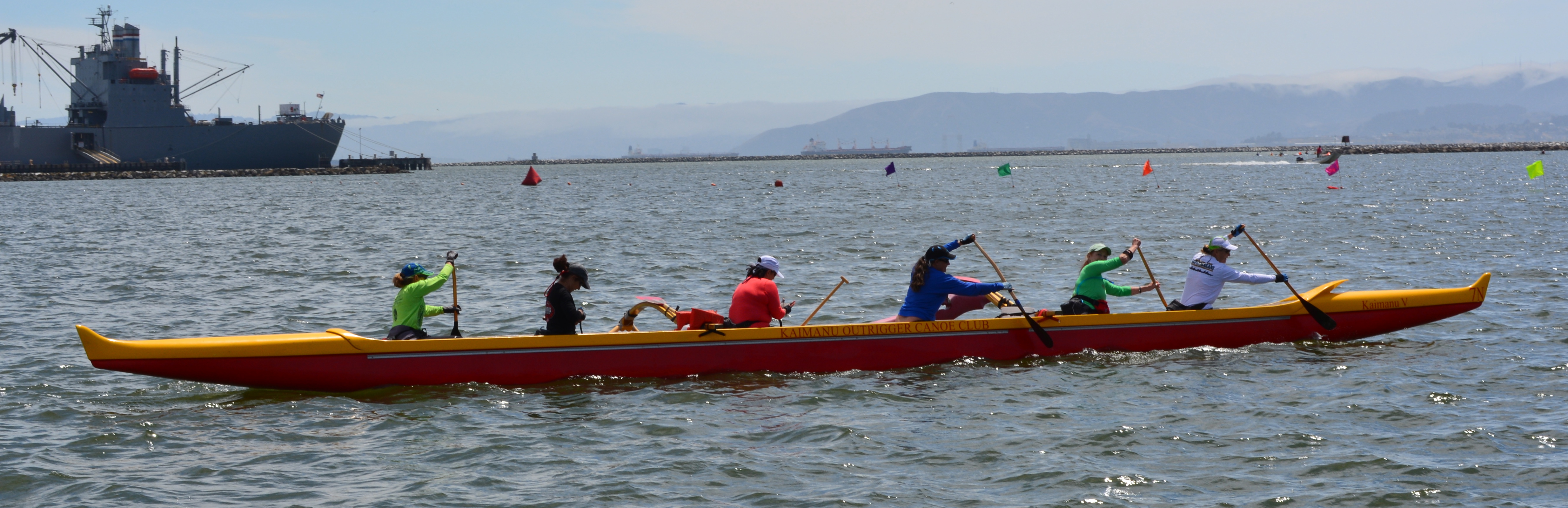
The Seaplane Lagoon was also the launch site on Sunday for outrigger canoes heading out to the tip of Alameda Point for a race to the San Leandro Marina. The Alameda-Point-to-San-Leandro race was sponsored by Wave Chaser.
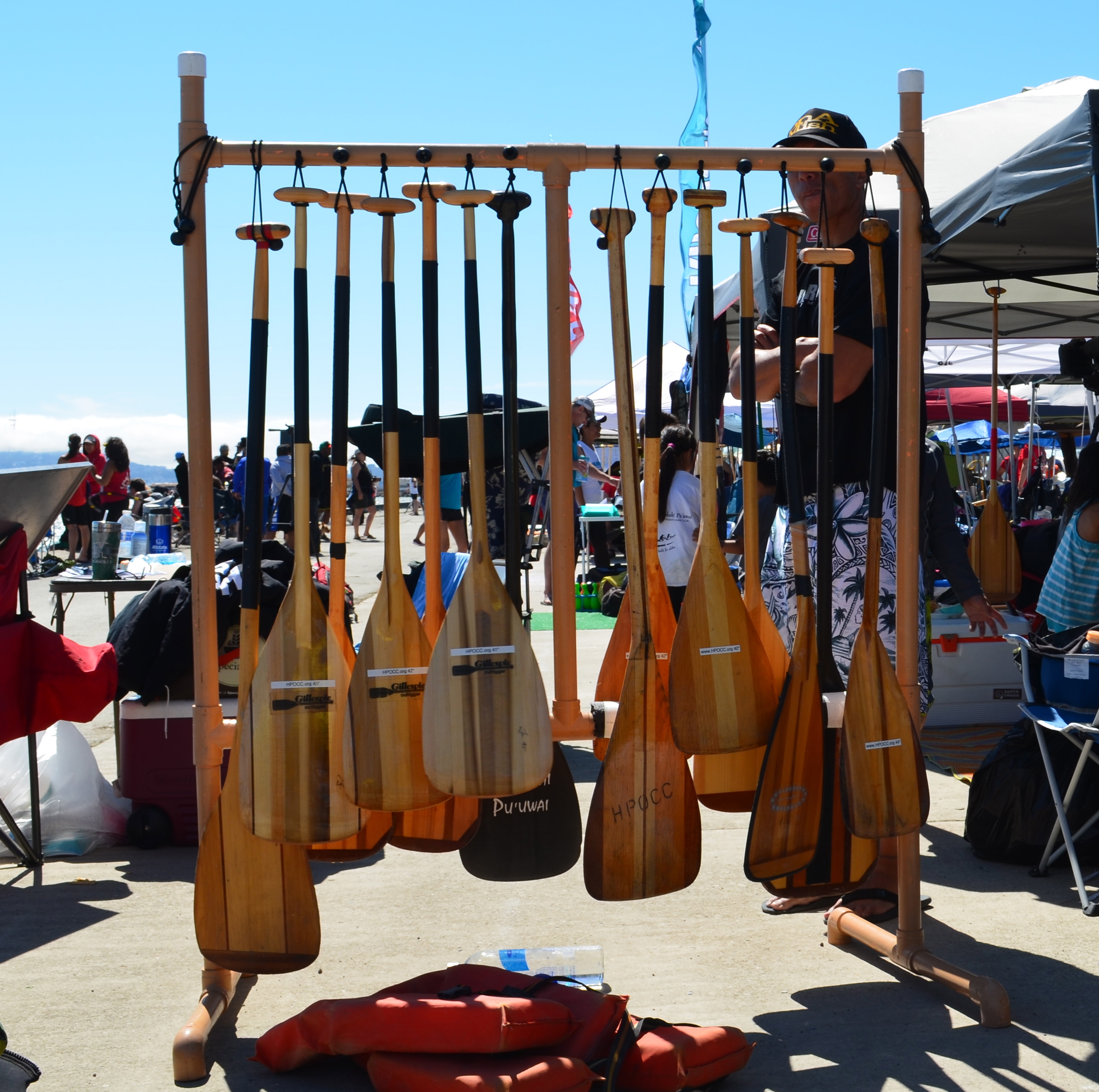
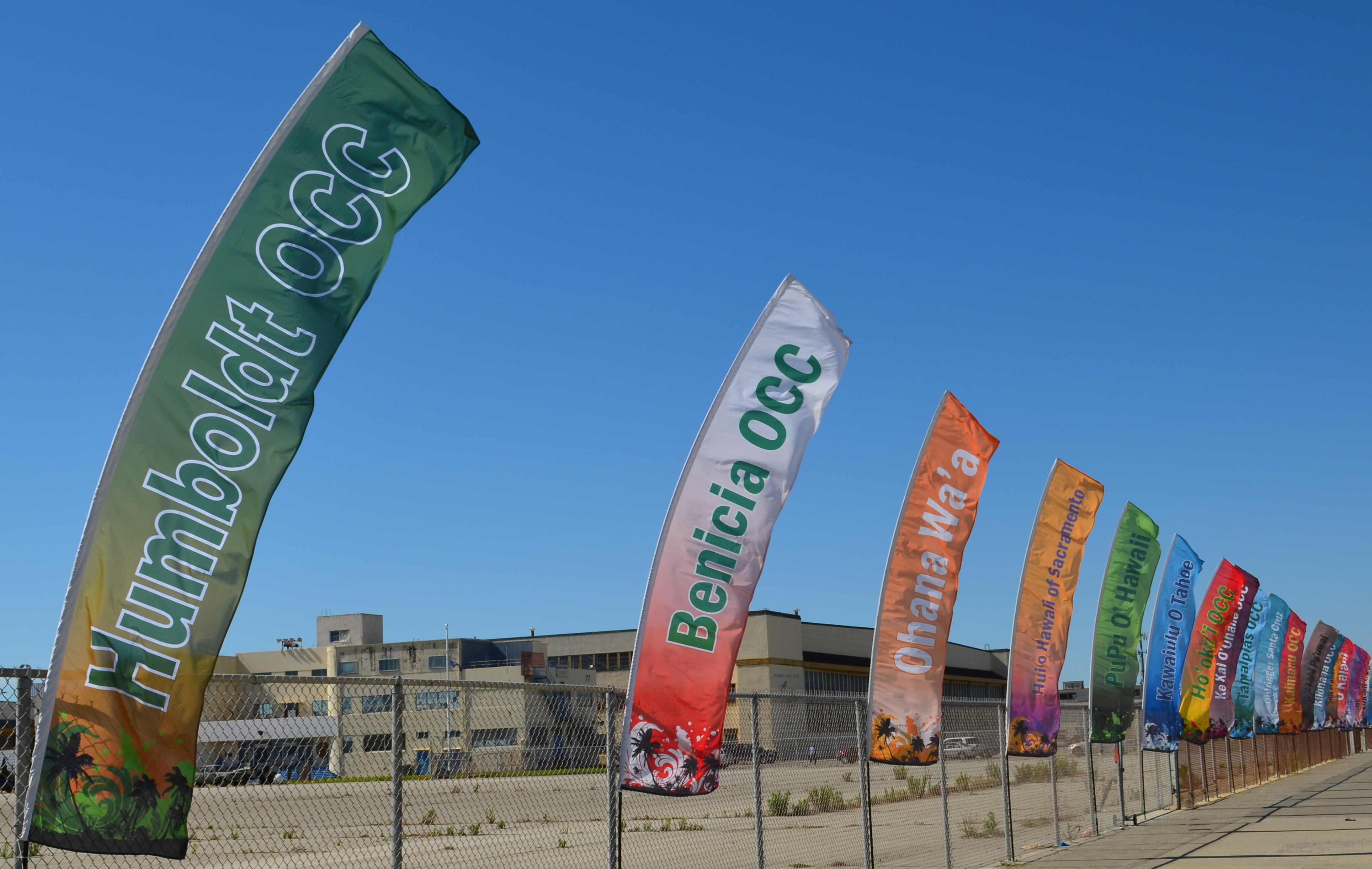
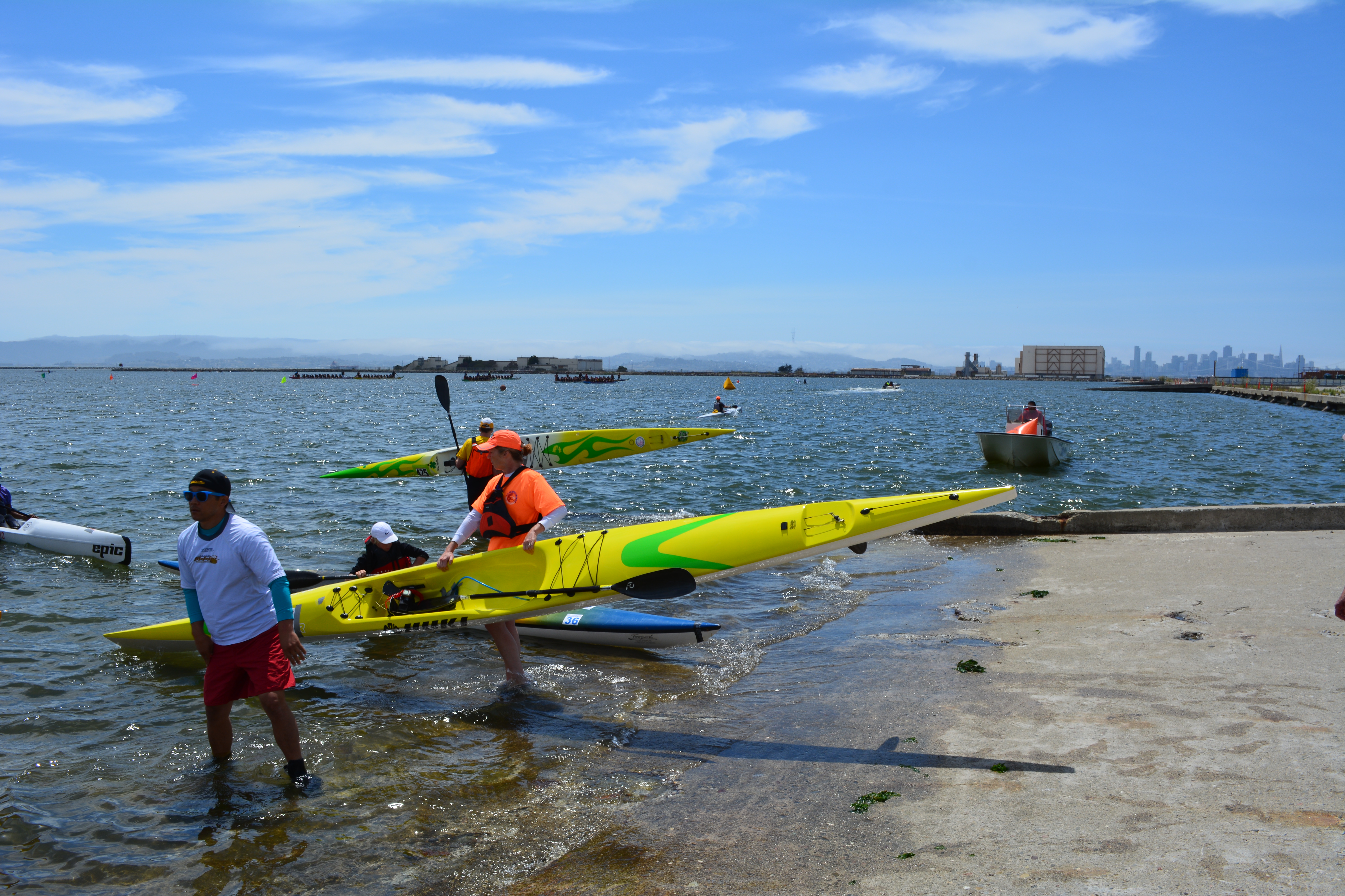
Here are some photos showing what a great venue the Seaplane Lagoon is for outdoor events like boating.
Note that the temporary dock facility used by the boaters was installed by Artemis Racing when they began training out of Alameda Point for 2013 Americas Cup.
Outrigger canoe race on July 12, 2014 at Alameda Point’s Seaplane Lagoon.
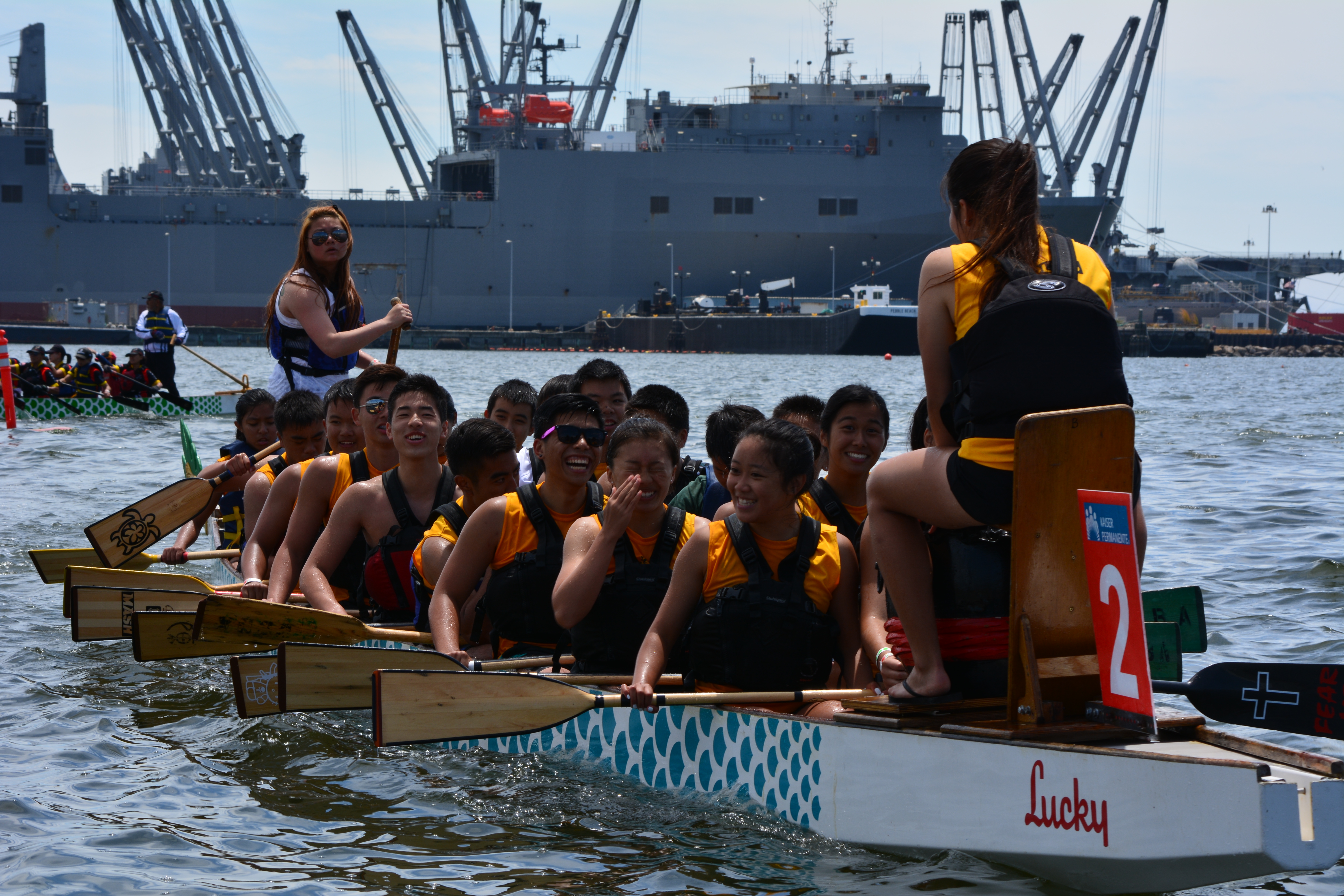
Dragon boat race on July13, 2014 at Alameda Point’s Seaplane Lagoon
Dragon boat team competing in race at Alameda Point’s Seaplane Lagoon.Dragon boat team heading to starting line.Dragon boat team returning to dock after race.
Dragon boat teams queuing up to board their boats for next race.
All-female Wave Chaser team launching boat for race to San Leandro Marina. Alameda Point Seaplane Lagoon.
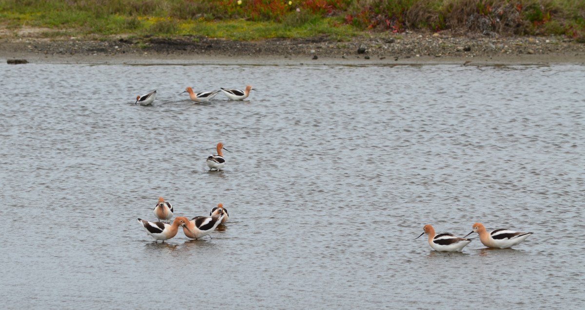
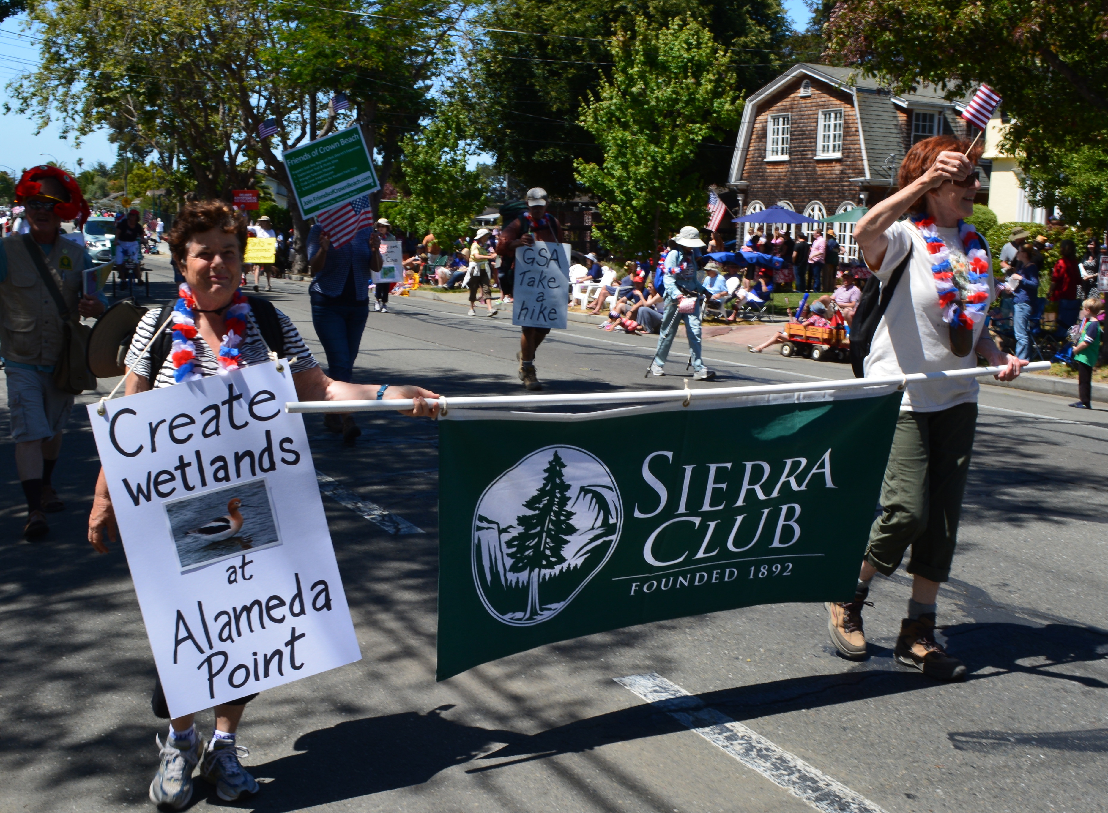
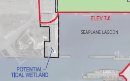
It’s more likely a new wetland will be created on the western shoreline of the Seaplane Lagoon at Alameda Point, thanks to lobbying efforts led by the Sierra Club.
Sierra Club in Alameda’s 4th of July Parade 2014
On July 1, 2014, the Alameda City Council added language to the Alameda Point Town Center and Waterfront Specific Plan that raises the commitment to remove pavement from the western side of the Seaplane Lagoon for wetland—an area called De-Pave Park. Lobbying efforts convinced the council to include the following options to help facilitate the wetland park creation: 1) creating a wetland mitigation bank; 2) adding the area to a possible national wildlife refuge on the federal property; and 3) working with local community members who may identify funding sources for creating the passive park area.Continue reading “Wetland park plan at Seaplane Lagoon gets a boost”
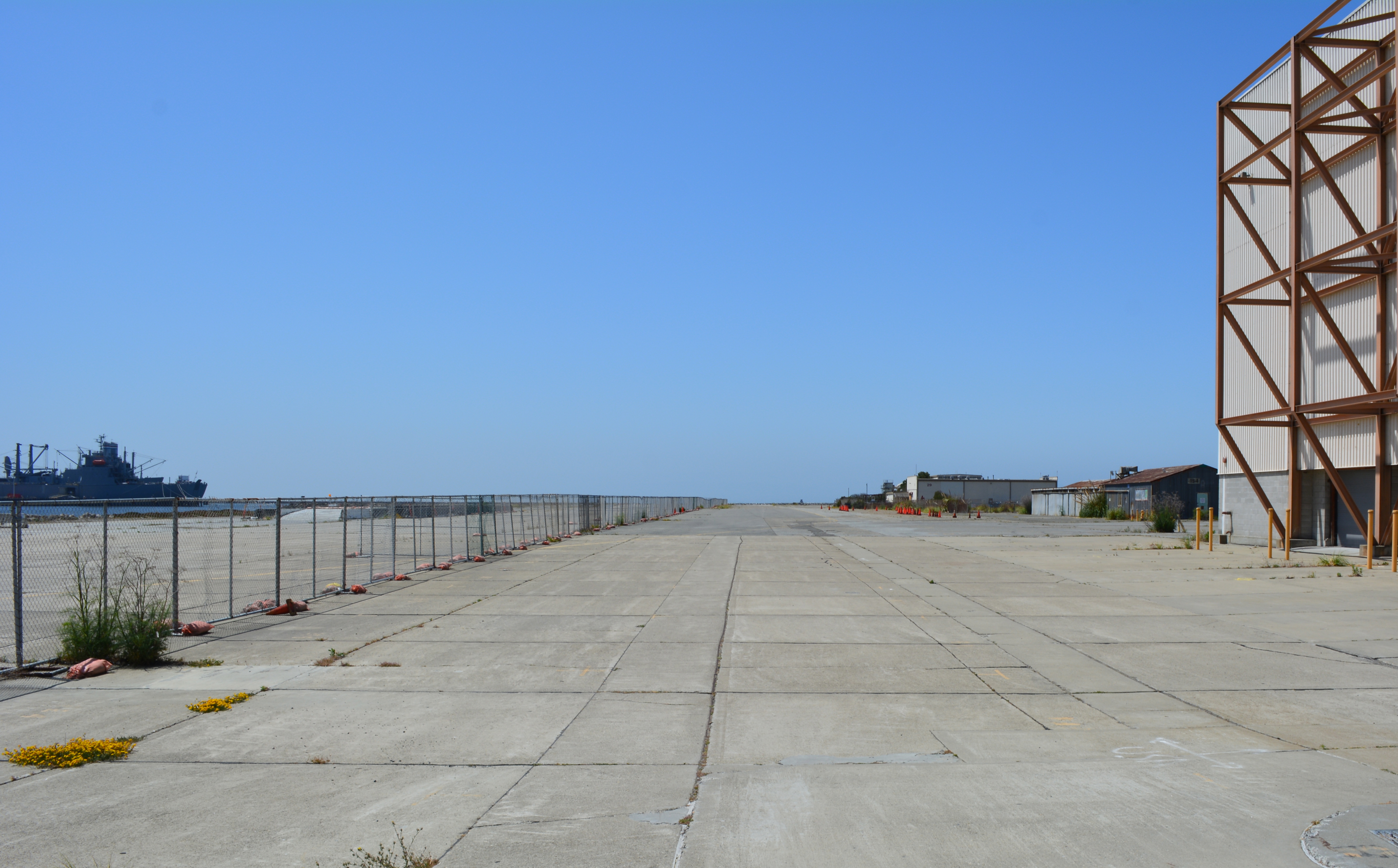
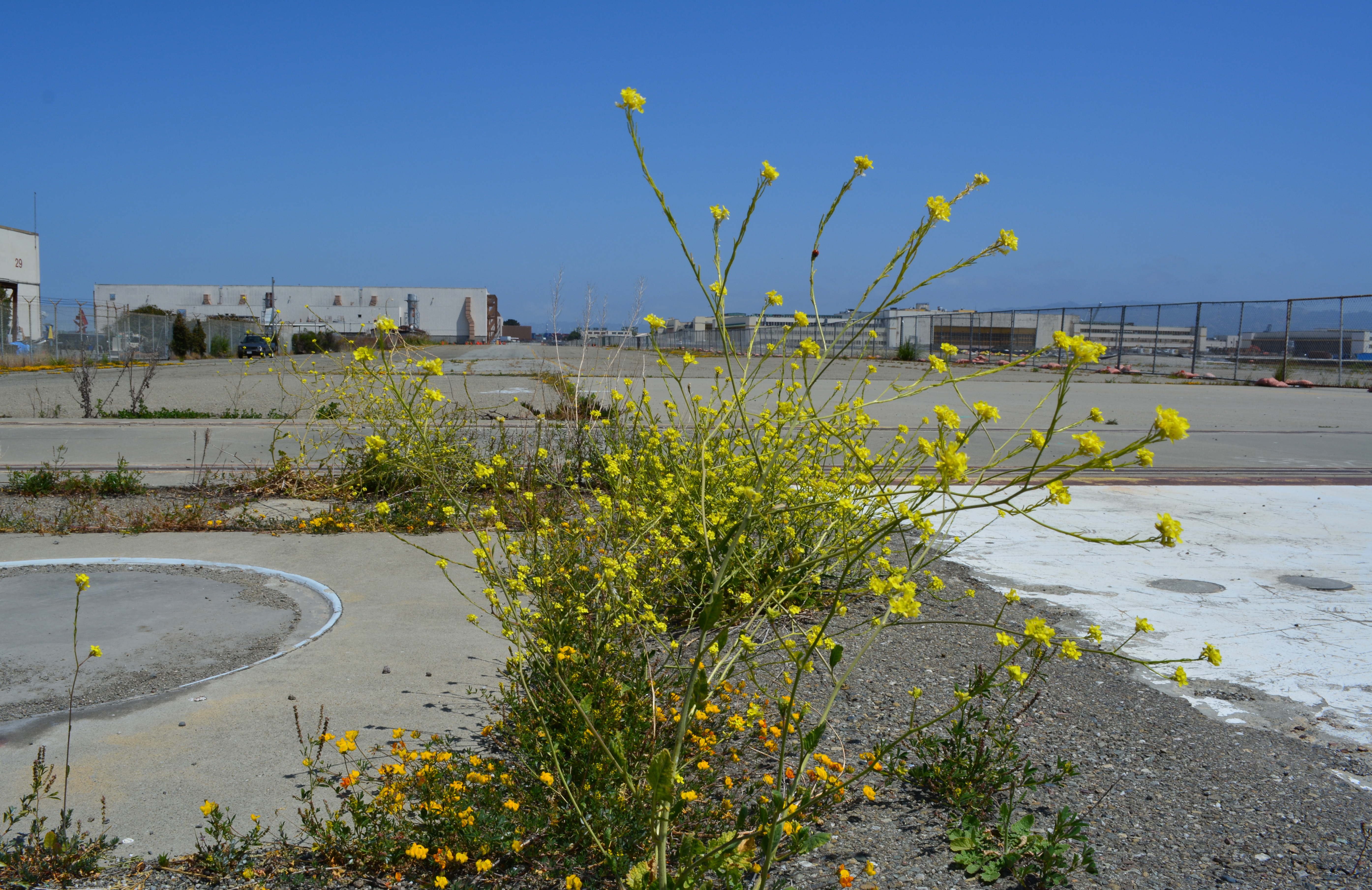
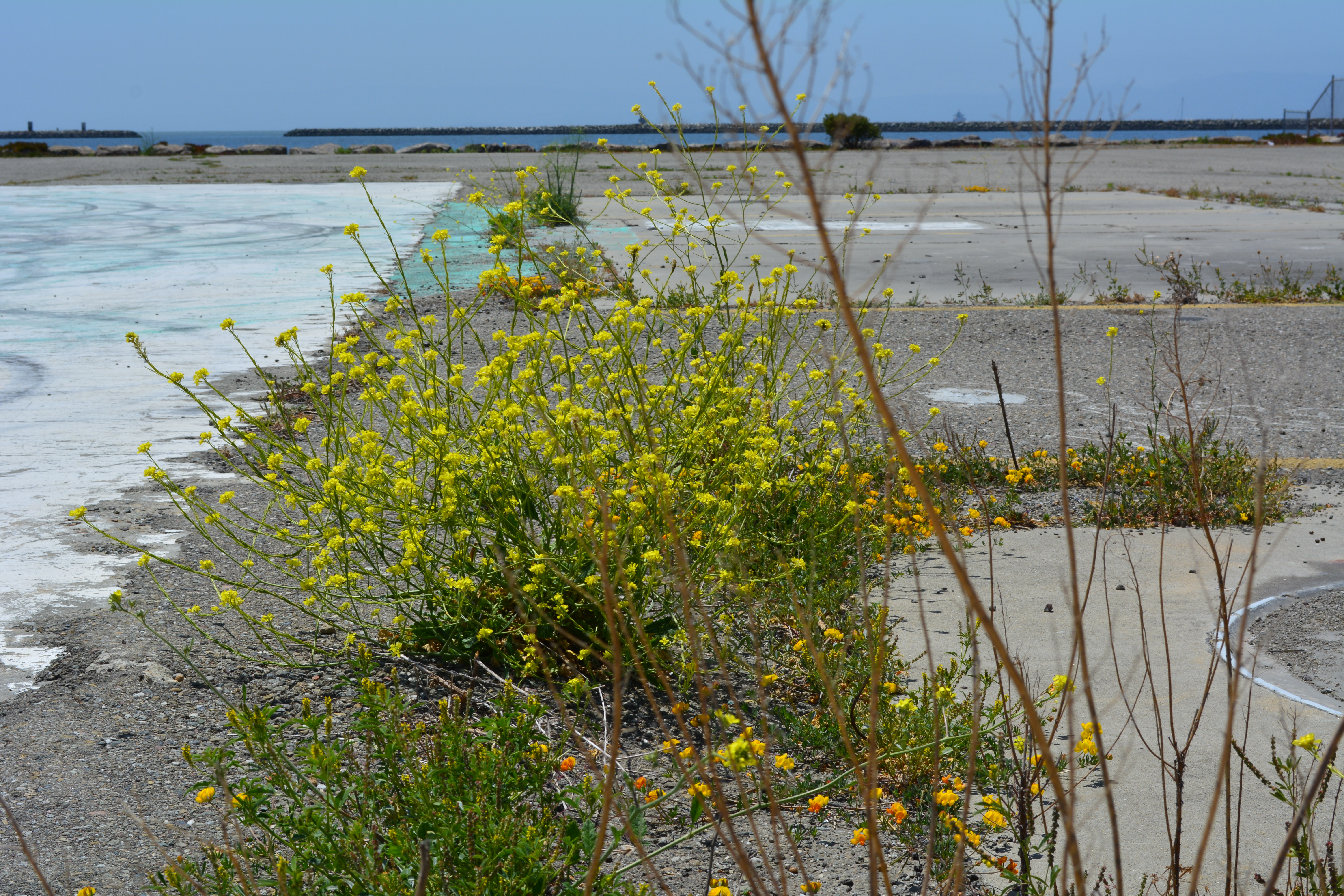
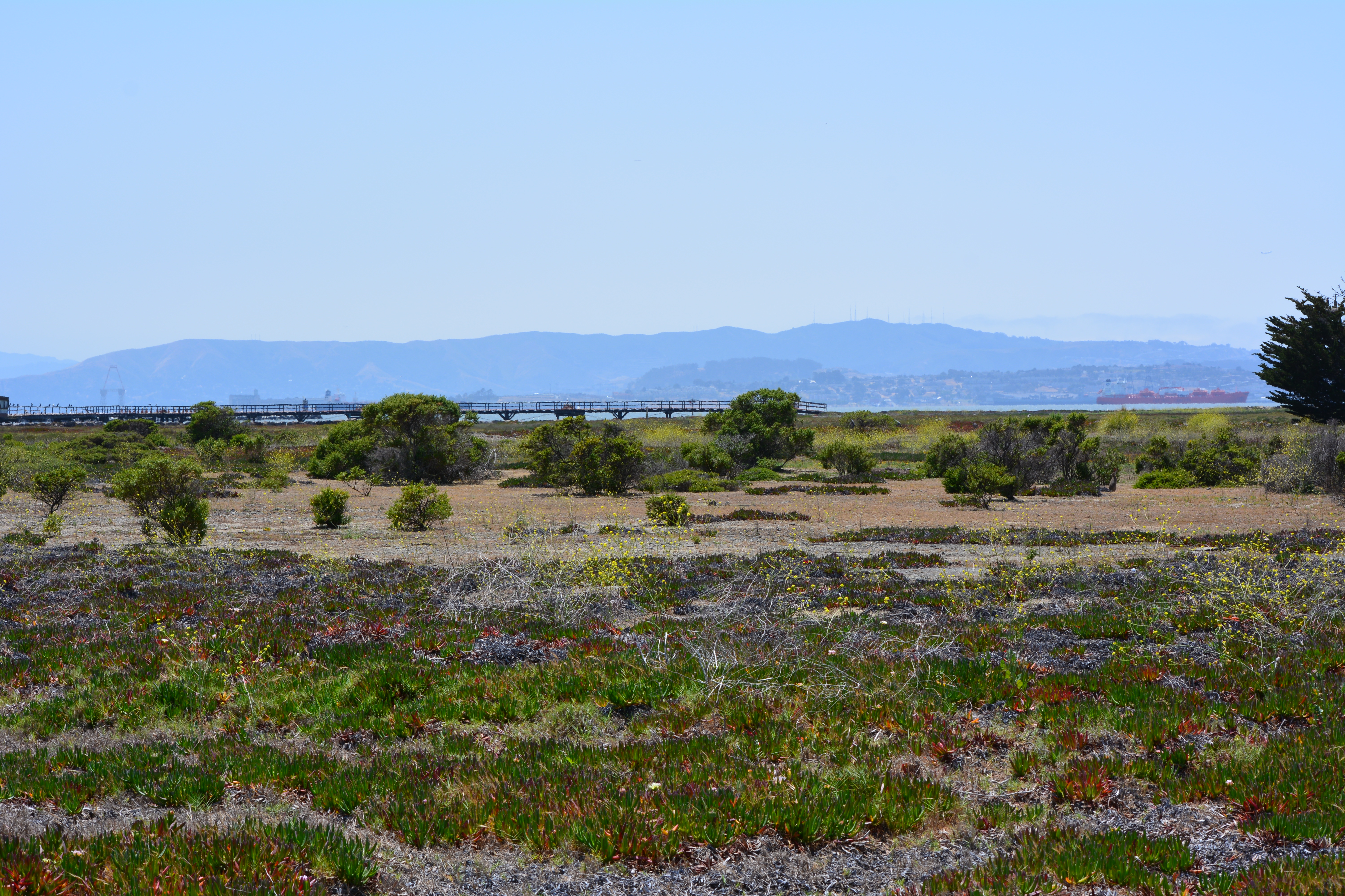
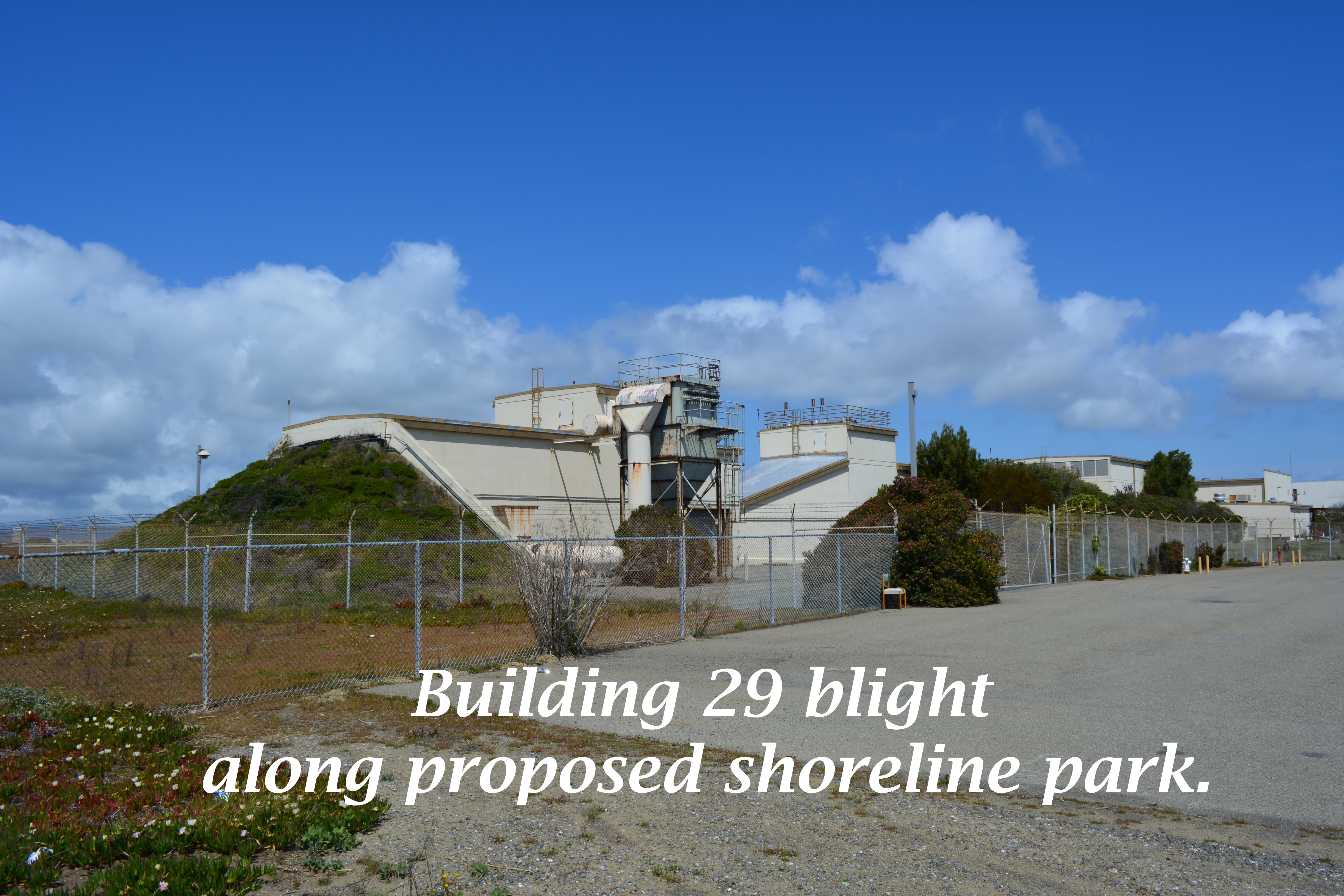
The city’s west side of the Seaplane Lagoon at Alameda Point is mostly pavement – acres of it – with a few old buildings abutting a wetland on the federal property. The city claims its long-range plan for this area features a conversion to a wetland habitat, but their only commitment is to continue leasing the buildings to generate revenue while allowing a sea of unnecessary pavement to remain as an environmental blight.
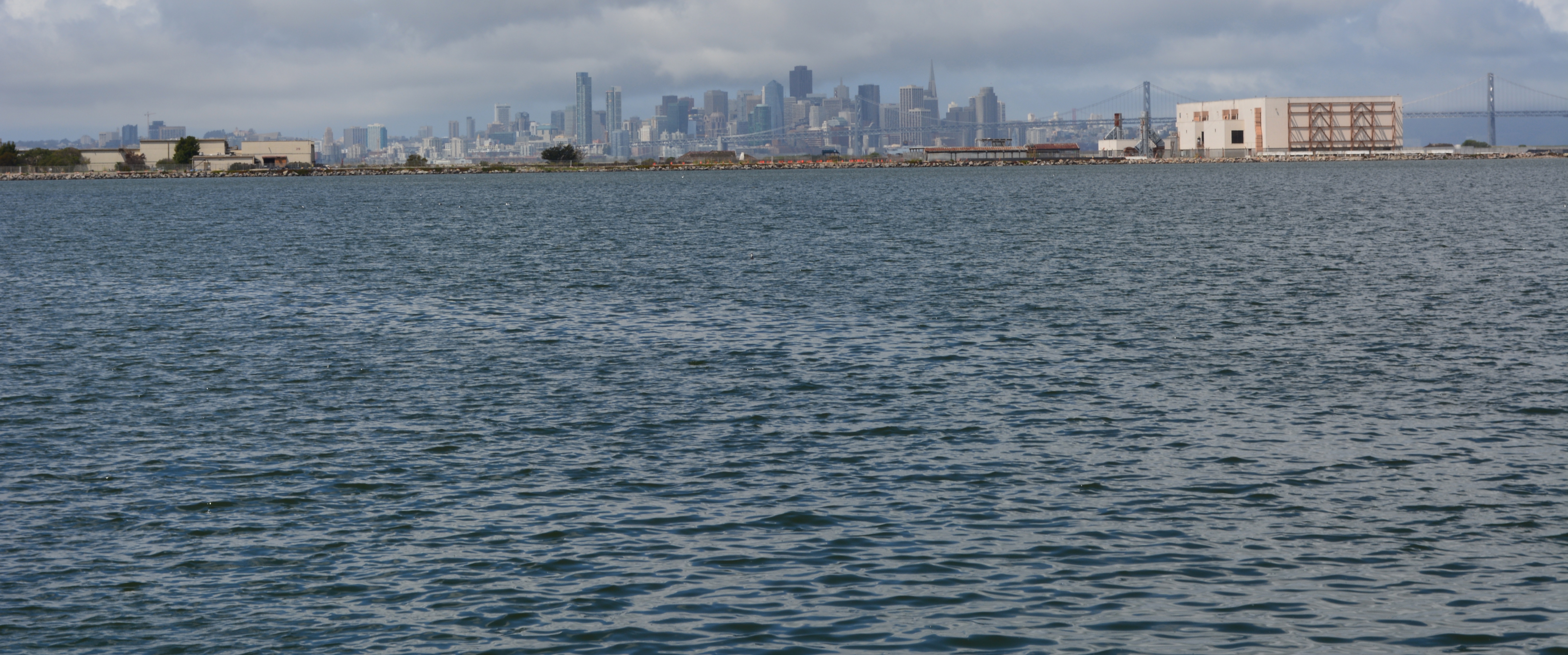
Seaplane Lagoon west side, looking south. Seaplane Lagoon on left, Alameda Point Channel and SF Bay in background. Temporary fence to be removed by end of 2014.
Opportunities for implementing ecosystem enhancement, both short and long term, have yet to be explored for this area. We need to start moving in a direction now that benefits the environment by reducing climate impacts, improves the atmosphere around nearby businesses, adds to public enjoyment, and increases wildlife habitat.
Proposal for ecosystem enhancement
Short-term plan – Remove all pavement not required for commercial tenants. Recycle the pavement at the VA’s Alameda Point project site where they will be raising elevation and need base rock and fill. Once the pavement is removed and the soil exposed, native vegetation could be planted. Native vegetation will absorb CO2, produce oxygen, eliminate the heat island effect of the former pavement, add wildlife habitat, improve the aesthetic appearance of the property, and make it attractive as a hiking, jogging, and cycling destination.
Step 1 – Set aside money from lease revenue generated on the west side of the Seaplane Lagoon for pavement removal and introduction of native plant vegetation.
Step 2 – Explore recycling pavement at Alameda Point.
Step 3 – Explore grant sources for conversion of paved areas to native vegetation, i.e., state air quality board, EPA, State Lands Commission, etc.
West side of Seaplane Lagoon, looking north. Seaplane Lagoon on right. Buildings 29 and 25 on left. Most of this area could be covered with native grasses with no negative effects on commercial leasing.
Long-term plan –Establish an Alameda Point Wetland Mitigation Bank, which would incorporate the west Seaplane Lagoon acreage along with 50 acres on the northwest side of Alameda Point (Northwest Territories). Investment money would provide the capital for wetland creation, with money being recouped when mitigation credits are sold to developers elsewhere in the Bay watershed to offset their project’s impacts. As a general rule, a tidal wetland is worth at least as much as it would cost to create it. That’s why businesses exist that specialize in mitigation banks. In theory at least, the wetland project could be self-funding.
Step 1 – Commission a study on wetland mitigation bank formation using lease revenue from Buildings 25 and 29.
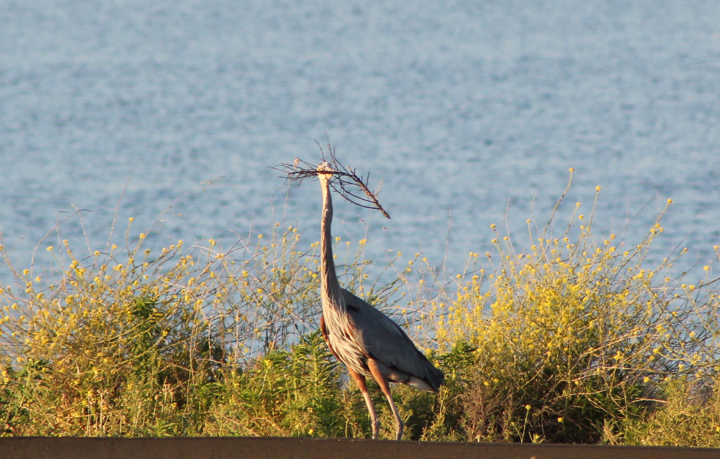
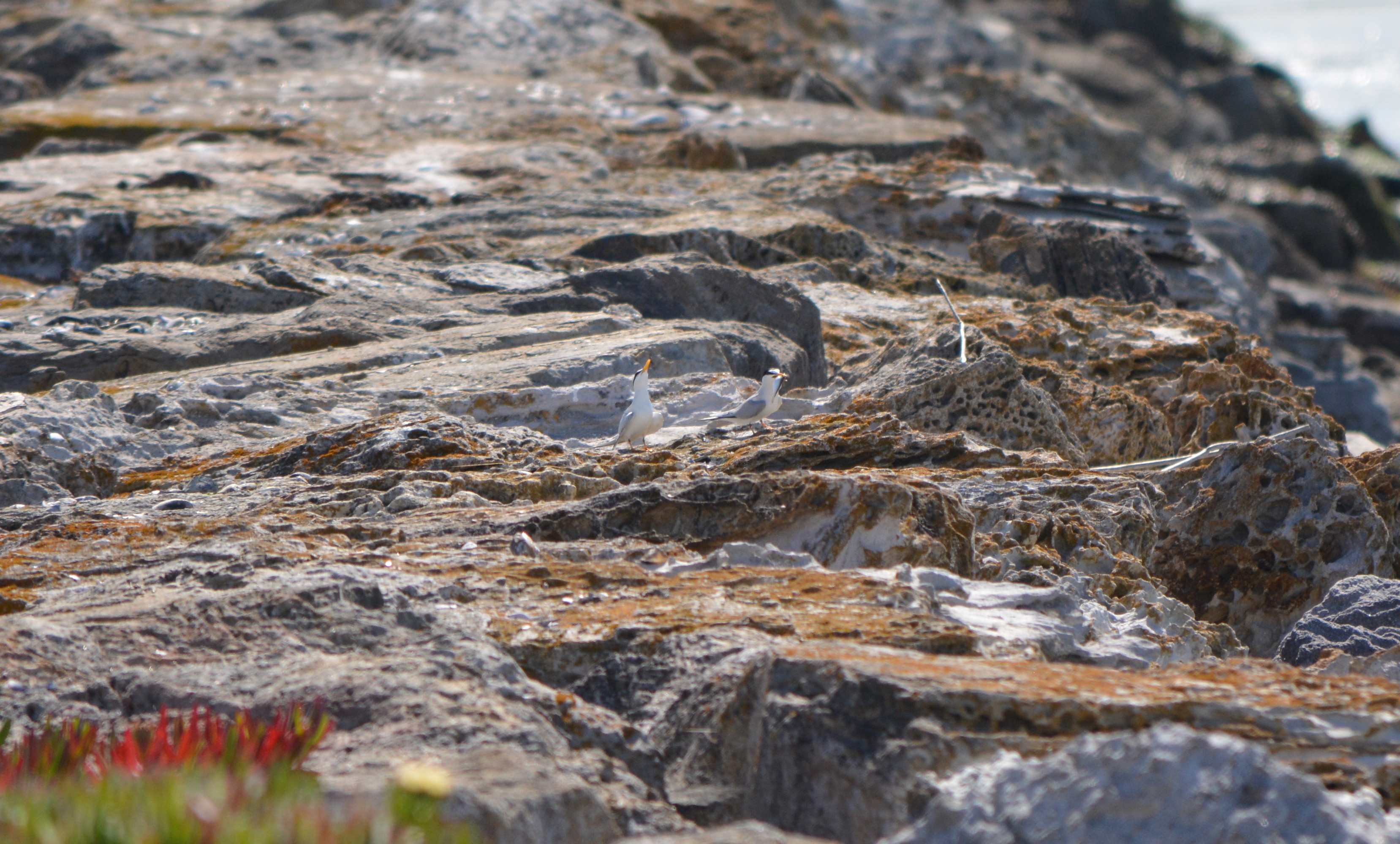
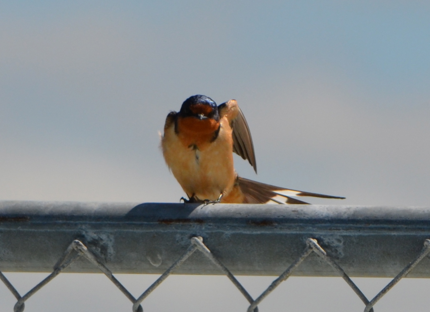
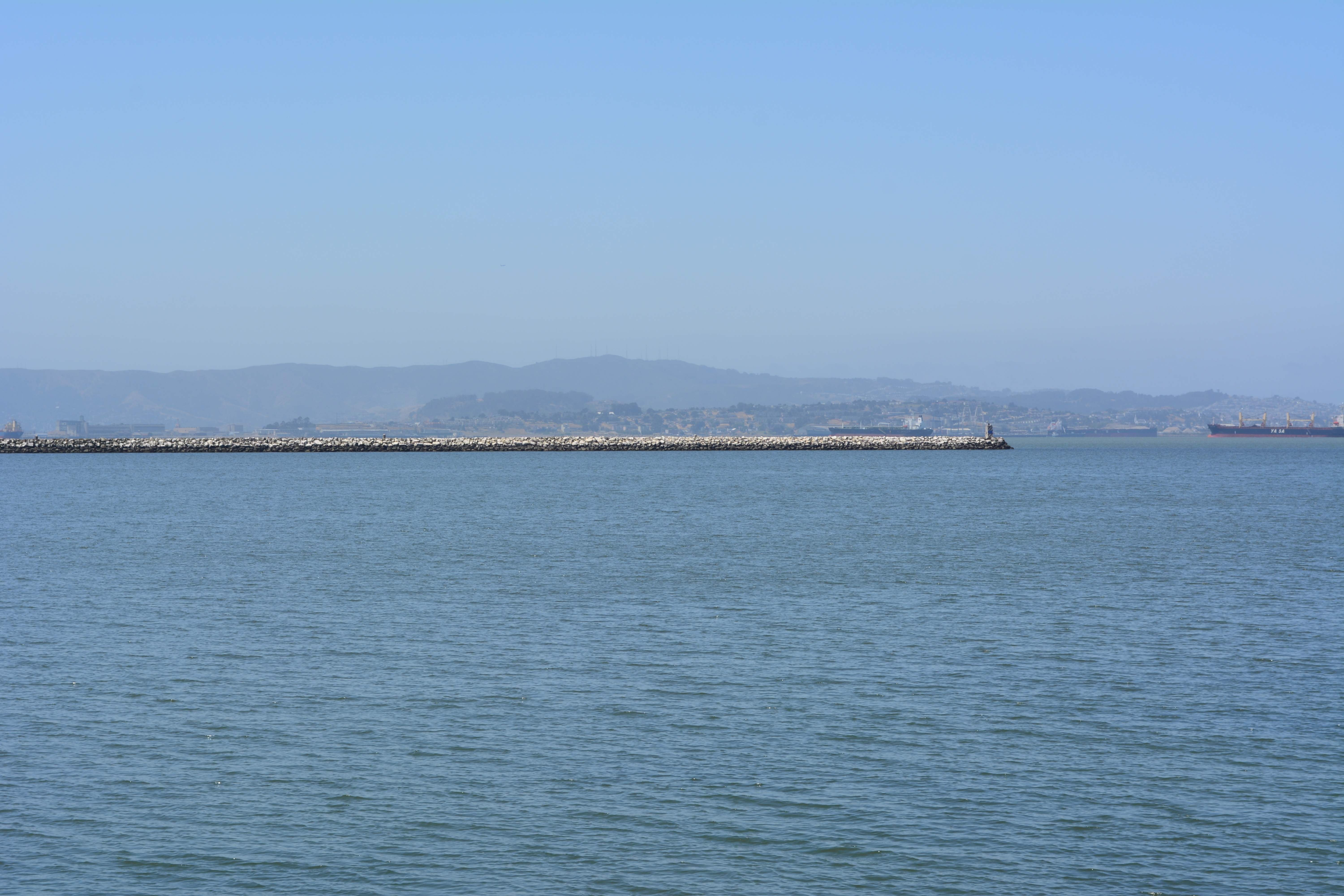
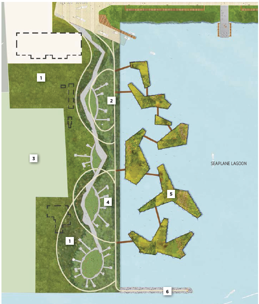
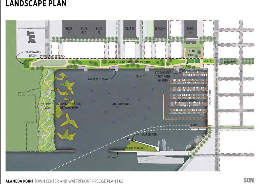
West side of Seaplane Lagoon looking south, with channel and Breakwater Island in background.West side of Seaplane Lagoon, looking northeast from shoreline riprap, with lagoon and hangars in background. Pavement here will serve no commercial purpose under current low-impact guidelines.Great Blue Heron gathering nesting material on western edge of Seaplane Lagoon for nearby nest. Increased vegetation will bring more birds along shoreline.CA Least Terns (center of photo) engaged in courtship ritual of exchanging a fish on jetty adjacent to west side of Seaplane Lagoon – May 2014.Barn Swallow on fence on west side of Seaplane Lagoon. Common to the area, often seen flying low over the water looking for flying insects, nesting almost exclusively on man-made structures, possibly Building 29.Breakwater Island viewed from shoreline on west side of Seaplane Lagoon. Breakwater Island is a roosting site for CA Brown Pelicans and other birds. Island owned by city of Alameda.Landscape plan from 2013 showing no buildings on west (left) side of Seaplane Lagoon. Buildings are now being recommended to stay. Floating wetlands are a very long-range option if funding is available.2014 plans for west side of Seaplane Lagoon show buildings in dashed lines. Active leasing of buildings currently underway suggests buildings should be in solid lines and wetland in gray.Looking west from west side of Seaplane Lagoon. Bay/Channel on left. Building 29 on right. City property extends beyond fence to far edge of Building 29 property line.Runway Wetland area on federal property adjacent to Buildings 25 and 29 on city property at west side of Seaplane Lagoon. A naturalized west shoreline of Seaplane Lagoon, with public access, would enhance the greater wildlife habitat in this area.
Take the plunge! Remove pavement on the west side of the Seaplane Lagoon and improve our environment.
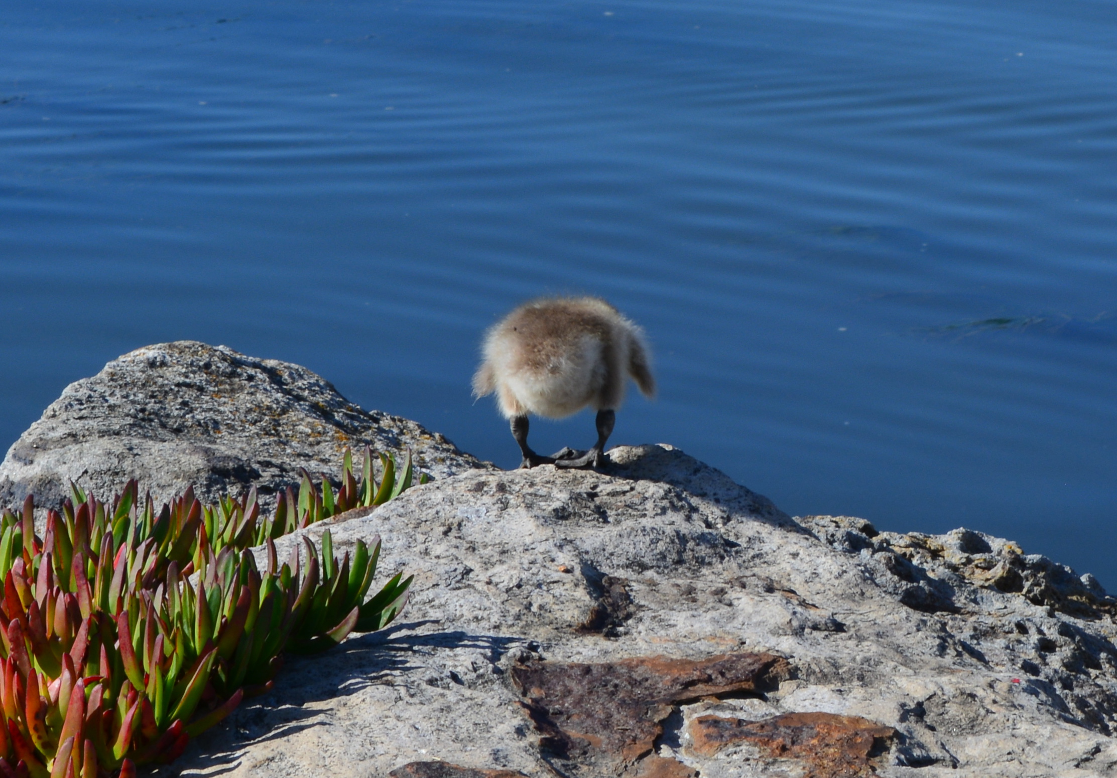
Gosling ready to plunge onto rocks below, on west side of Seaplane Lagoon, to get to parents in the Alameda Point Channel. It was successful.
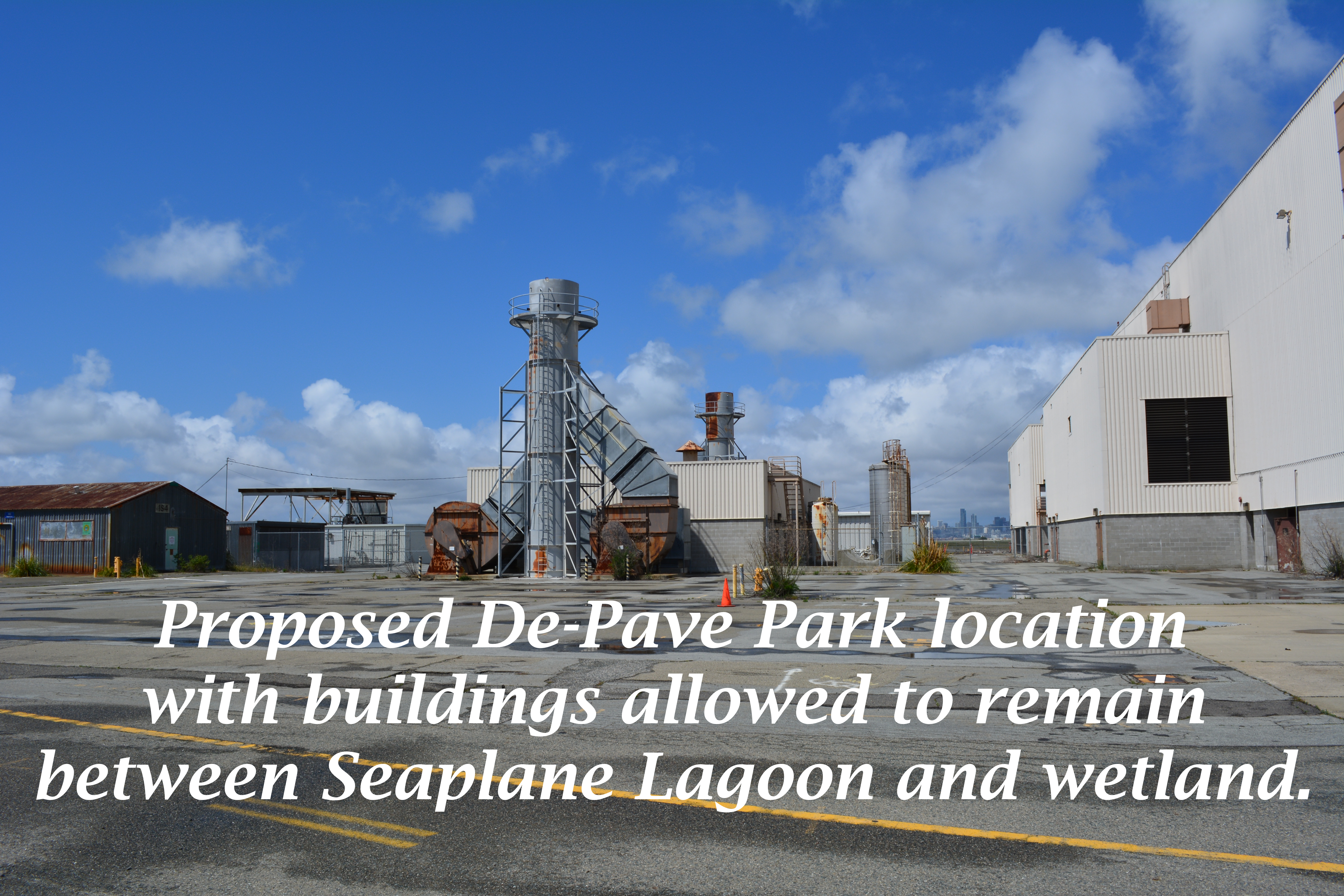
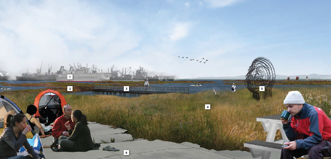
The drawing and images for the so-called “De-Pave Park” on the western side of the Seaplane Lagoon would be something to cheer about if the park had any chance of ever being created. The text of the city’s recently released Town Center and Waterfront Plan, however, allows existing industrial buildings along the western edge of De-Pave Park to remain “if needed.”
Such a caveat sets the framework for never moving forward with the plans. If the buildings are being leased, the buildings will be “needed.” If the buildings are needed, then the pavement around them will also be needed. The city is continuing to market these buildings to tenants and, thus, there’s not likely to come a day when we try to secure grant money to develop the park.
This is a change from the first presentation of De-Pave Park in 2013 when the Town Center and Waterfront Plan was rolled out. The existing structures were not shown in that drawing. The community was led to believe that all structures would be removed to provide a natural wetland-oriented transition to the existing Runway Wetland on federal property. Not so anymore. The structures can stay.
Conceptual plan presented in 2013 did not indicate that any buildings would remain between De-Pave Park and the Runway Wetland on the federal property.2014 De-Pave Park plan shows dashed lines indicating existing structures that will be allowed to remain “if needed.” Floating wetlands do not exist right now, and probably never will.
The infrastructure plan now has a levee protecting the 55-foot tall “Building 25” from sea level rise. There would be no reason to protect this eyesore if it was slated for permanent removal. Furthermore, the building is part of the mixed-use commercial and residential waterfront zone where even a hotel is permitted.
55-foot tall “Building 25” that will be protected by a levee, and remind campers that they are on an old military industrial site, as they gaze at the night stars.
The plan’s conceptual drawing and photo collage showing campers, hikers, and grasslands does not include a view to the west, and with good reason. It would show the industrial legacy that will interrupt the potentially expansive views toward the west. It’s deceptive advertising.
Looking toward the Seaplane Lagoon in conceptual drawing for De-Pave Park. No drawings are offered to inform viewers that directly behind this vantage point are old industrial buildings that will be allowed to stay “if needed.” There is currently no plan to remove the industrial buildings.
Parks, as we’ve learned during the new zoning designations for Alameda Point, are zoned Open Space. This “park” is not zoned Open Space. It’s another indication that the so-called “De-Pave Park” is phony.
Changing the western shoreline of the Seaplane Lagoon to a wetland-grassland landscape connected to the Runway Wetland would implement climate change adaptation goals and carbon sequestration goals. Without a commitment by the city to implement De-Pave Park in the Town Center and Waterfront Plan – including removal of all buildings on the western side of the Seaplane Lagoon – a great opportunity to help rebalance the San Francisco Bay ecosystem will fall through the loopholes.
City Hall is requesting comments on the draft plans for the Town Center and Waterfront Plan by May 15, in preparation for a June 9 Planning Board meeting. The plan will be the guiding document on how, where, and what gets built around the Seaplane Lagoon. The city council is expected to approve the plan in July. Comments can be submitted to city planner Andrew Thomas at athomas@alamedaca.gov for forwarding to the Planning Board.
Red line indicates levee that will protect “Building 25.”Western side of the Seaplane Lagoon with potential for major improvements to the Bay ecosystem.Seaplane Lagoon looking west, with blighted viewscape that will be allowed to remain. San Francisco is in background. “Building 25” is the large building on the right that will be saved by a levee.
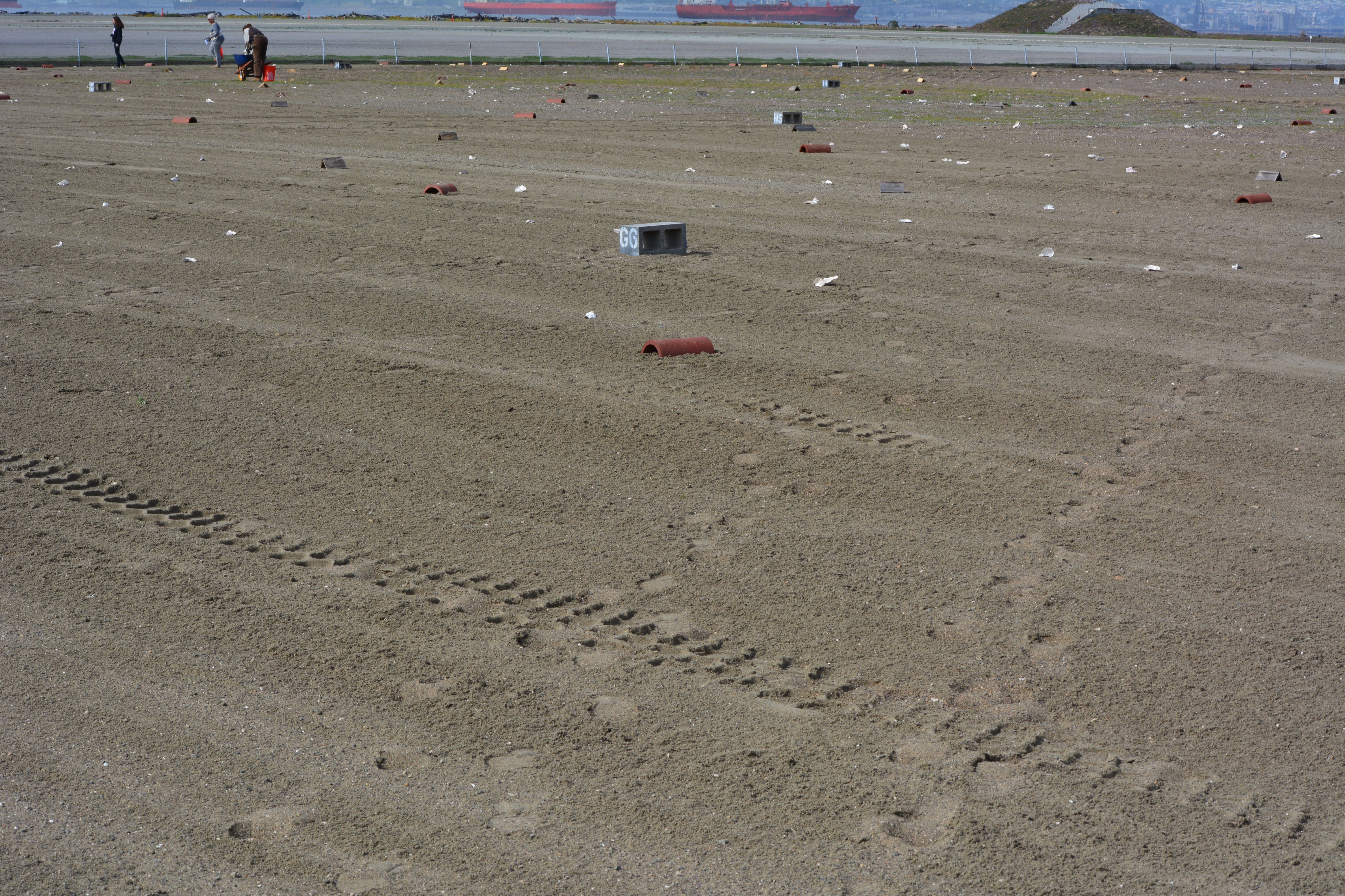
The 9.7-acre nesting area for the endangered California least terns at Alameda Point received a new layer of sand this year. Sixty dump truck loads of sand were delivered to the site on the old Navy airfield in March, paid for by the U.S. Fish & Wildlife Service (USFWS).
Fresh layer of sand on Alameda Point least tern nesting site. Looking south, with ships in San Francisco Bay in background.
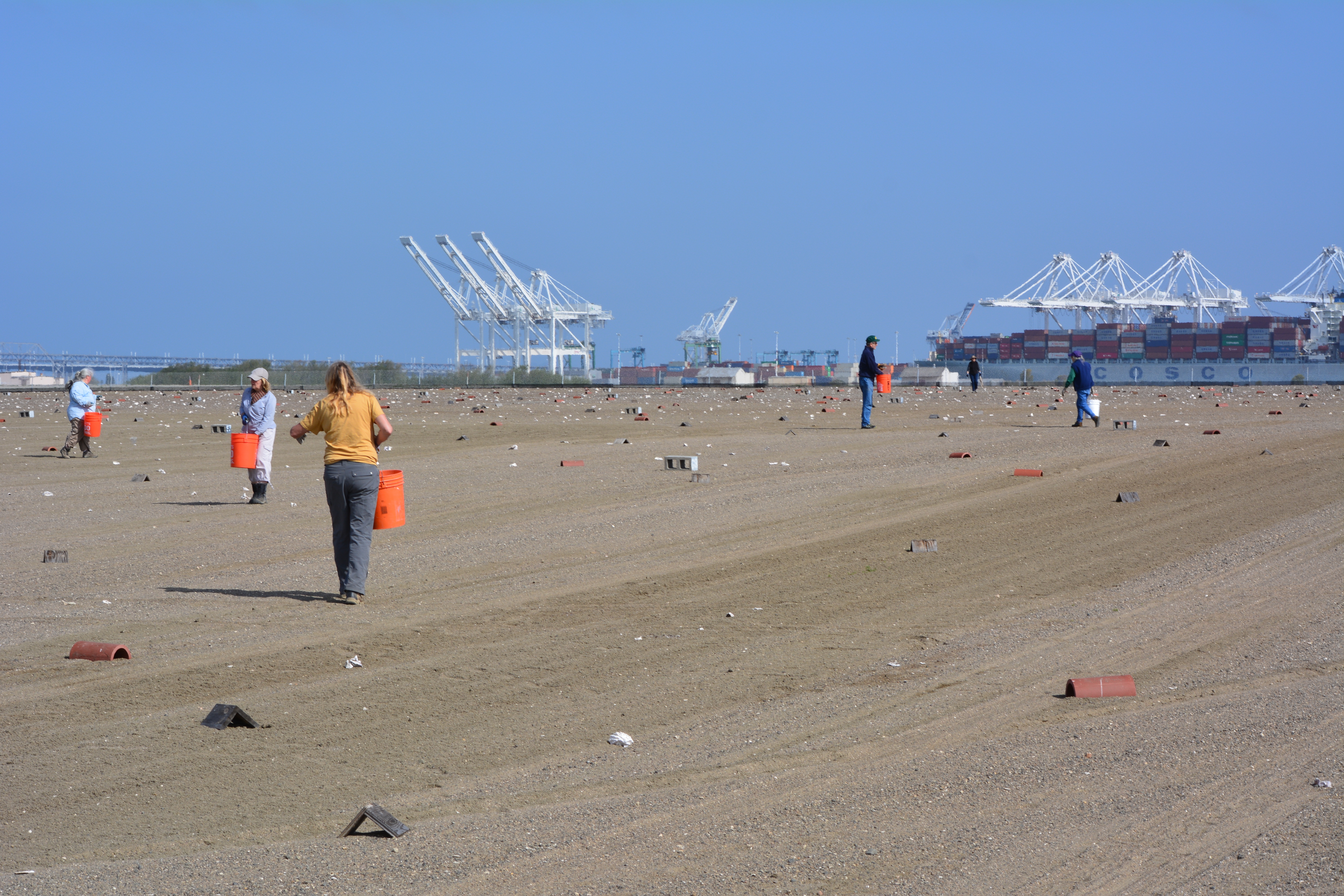
After the sand was moved into place, USFWS and volunteers set up a numbered cinderblock grid system used for recording behavior and also distributed chick shelters and oyster shells for the chicks to use as protection from the elements and predators.
On Sunday, April 13 a dozen volunteers showed up for the last work party prior to nesting. The task of the day was distributing oyster shells around the site, which provide a nominal amount of sun protection for chicks and, in theory, helps make it more difficult for avian predators like red-tailed hawks and peregrine falcons to spot the chicks amongst all the white shells.
From now until the end of the nesting season in mid-August, volunteers will be participating in another program called the Tern Watch Program. Participants monitor behavior and watch for predators from their vehicles outside the nesting area.
Throughout the nesting season a USFWS biologist makes periodic walks through the site and places numbered plaster markers next to nests so that the number of eggs and success rates can be accurately recorded. If there are three eggs in a nest one week, for example, and one egg the next week with no chicks, it’s an indication that predators have grabbed the eggs.
Each year following the end of the nesting season in August, volunteers at monthly work parties gather up the oyster shells, the wooden A-frames, drain tiles, grid markers, and the hundreds of numbered markers used to identify nests. Clearing the site makes it easier to remove weeds and grade the sand, which can erode during rains. The volunteers pull weeds from inside and around the perimeter of the fenced-in site. The volunteer program during the non-nesting season is organized by the Golden Gate Audubon Society’s Friends of the Alameda Wildlife Reserve committee, in conjunction with the USFWS biologist in charge of the Alameda Point tern colony.
The effort to protect the least terns was begun by the Navy when nesting activities were first noticed in the 1980s. The likely reason for the terns choosing such an unlikely place to nest was the absence of people who might trample on the nests. The nesting site was chosen by the terns, not by the Navy or USFWS, and has been expanded to its current size as the colony expanded. The sandy substrate that approximates the traditional beach nesting habitat for terns is on top of old airfield pavement. Due to erosion caused by wind and rain, the sand has to be periodically replaced, as it was in 2009 and 2011.
Training sessions for this year’s Tern Watch Program will be held at the USFWS office at Alameda Point on April 26, April 30, May 28, and May 31. Volunteers do not have to be a bird expert, just be very interested in observing and reporting about them. Participants are required to attend one training session and commit to signing up for a minimum of three of the 3-hour shifts. Also required are binoculars, cell phone, and personal vehicle. Reservations for the training sessions can be made by calling Susan Euing at 510 521-9717 or by emailing susan_euing@yahoo.com. Directions and registration materials will be sent by email.
The annual Return of the Terns bus tour to the nesting area will be held on June 14 this year. The tour departs from the Crab Cove Visitor Center in Alameda. Registration required through the East Bay Regional Park District’s website or at the visitor center.
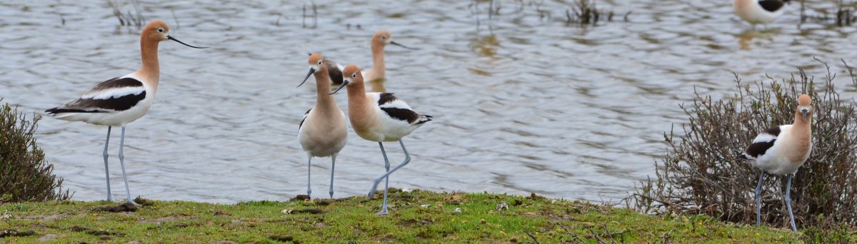
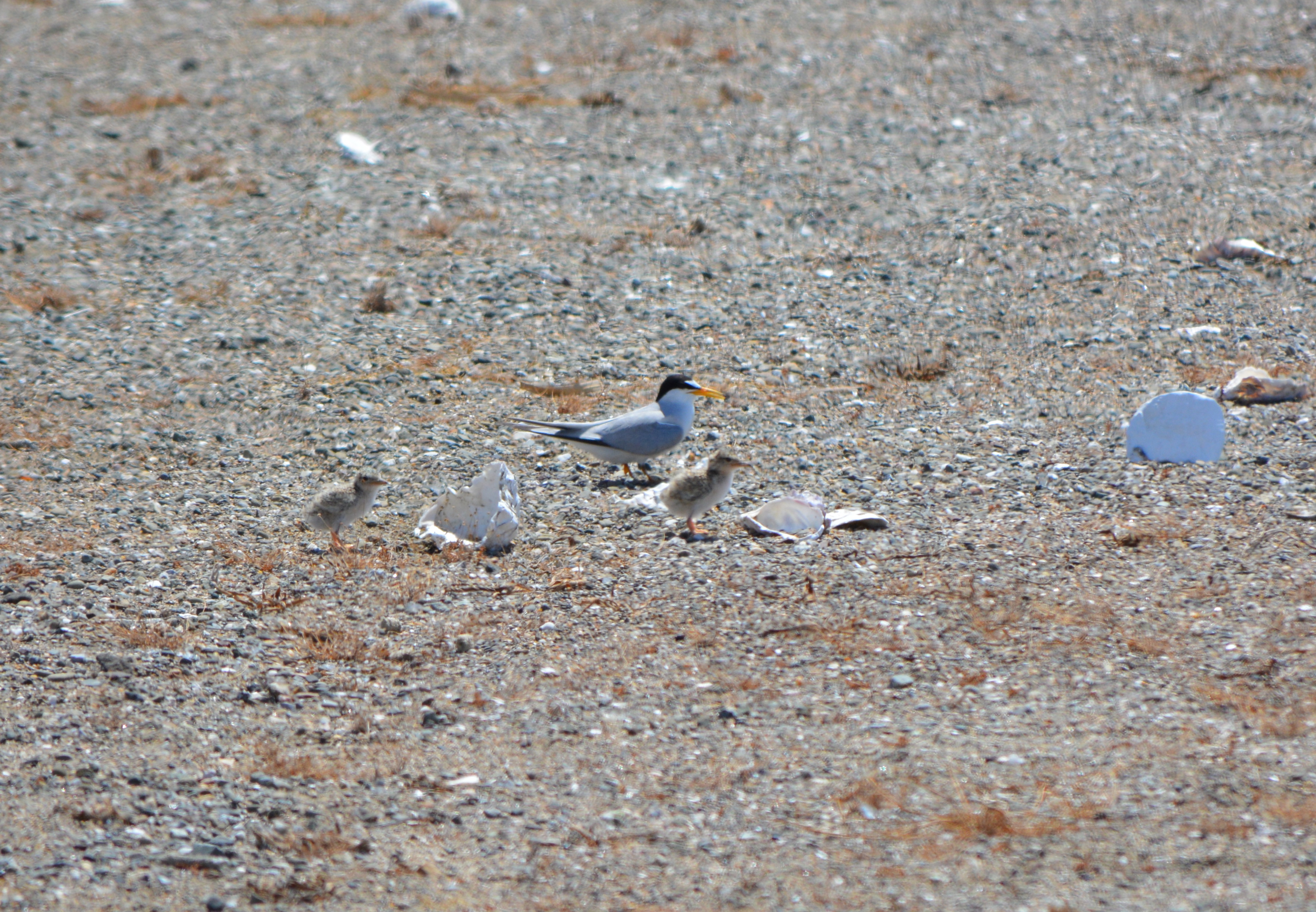
Adult least tern with chicks next to oyster shells at Alameda Point, June 15, 2013, during the Return of the Terns tour. Plaster marker with number on reverse side is to the right.April 13, 2014 work party, looking north, with Port of Oakland in background.Killdeer sitting on four eggs in the least tern nesting area on April 13, 2014. It is not uncommon for a few killdeer to nest among the terns. Killdeer lay their eggs about a month before the terns lay eggs.