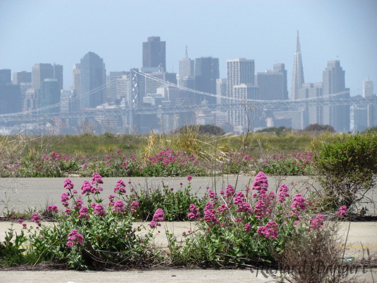
A legacy of disappointment continues on the aircraft runway area at Alameda Point. In the nearly 20 years since the Navy ended operations there, the community has lost 74 acres of open space that was once slated to become city property. The community has also lost the possibility for a 550-acre national wildlife refuge and a state-of-the-art community hospital to be run jointly with Alameda Healthcare District to serve veterans and non-veterans.
There is still no groundbreaking scheduled for the veterans’ clinic and columbarium.
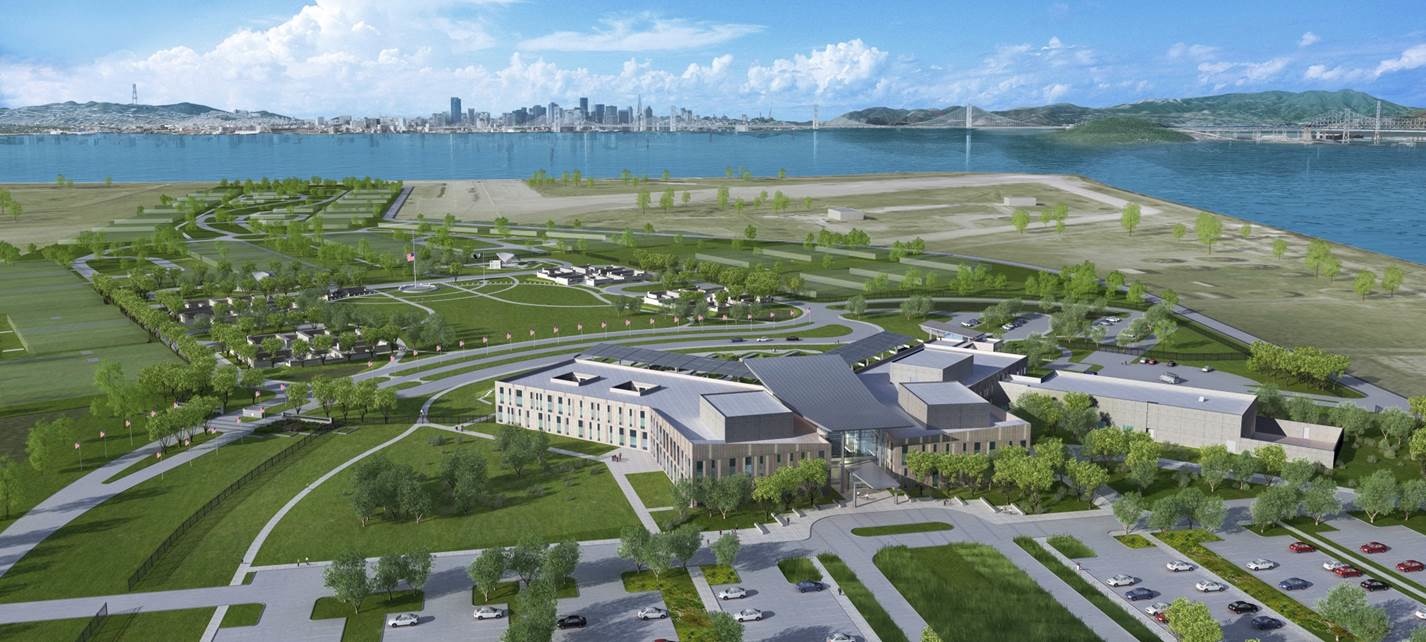
U.S. Department of Veterans Affairs (VA) plans for outpatient clinic, medical and benefits offices, and a national cemetery at Alameda Point. San Francisco in background.
The only recent expenditures on the 624 acres of federal property, now owned by the Department of Veterans Affairs (VA), have been to fund landscaping over an underground dump and the management of the endangered least terns that nest on 10 acres, which includes the widespread application of herbicides and vegetation removal on 300 acres of pavement at the direction of the U.S. Fish and Wildlife Service.
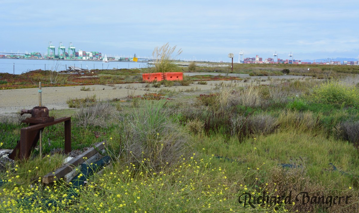
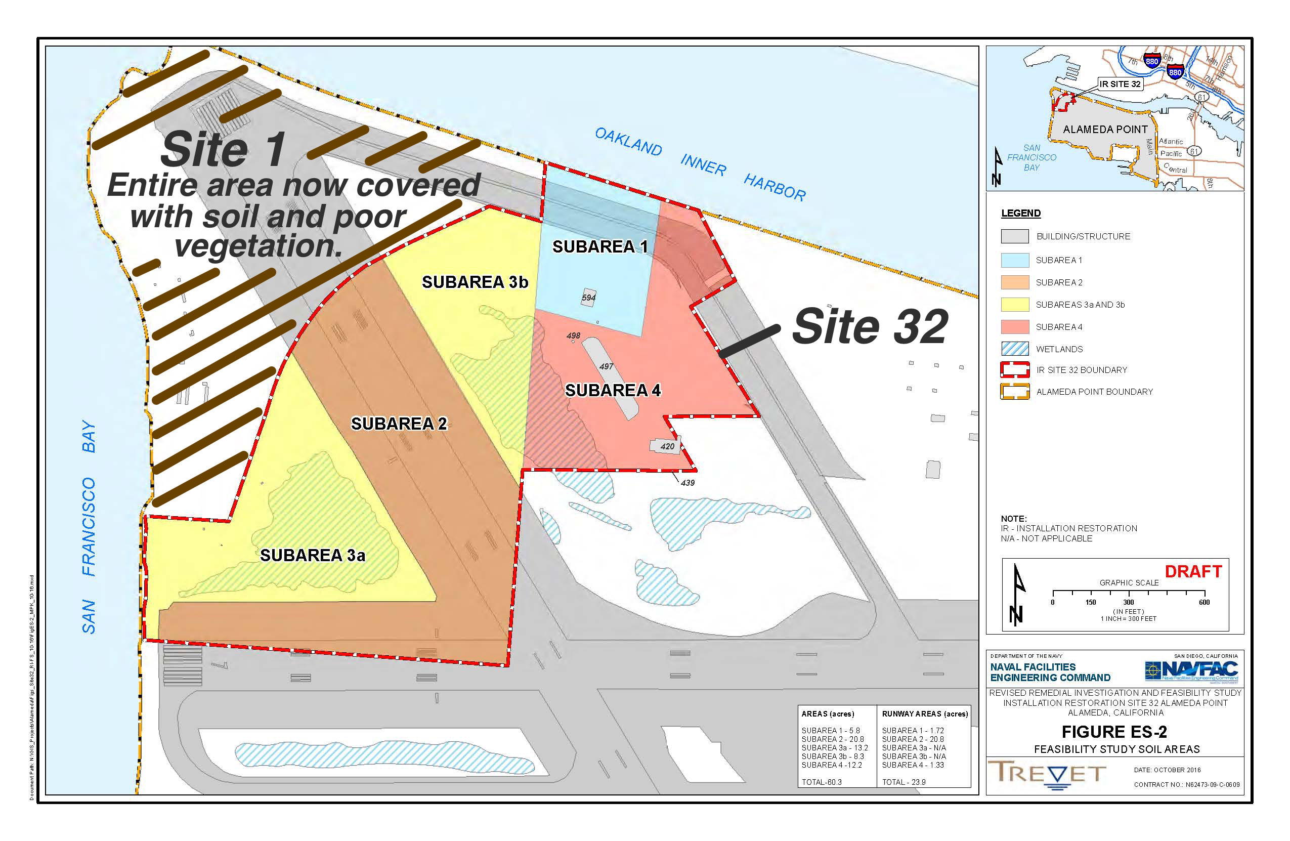
The Navy will present options on possible ways to clean up 60 acres at Alameda Point slated for a regional park on Thursday night. The draft cleanup options for Site 32 represent the culmination of 25 years of groundwater and soil studies that began before base closure was announced. Only five acres have been flagged for cleanup, but uncertainty about what lies beneath the pavement and structures requires a conservative approach.
The site lies in the northwest portion of the old airfield along the Oakland Estuary and features open grassland, seasonal wetlands, runway, a large concrete bunker and two buildings. Input from the community and regulatory agencies on the cleanup plan will have a major impact on the design and use of the future park.Continue reading “Navy presents parkland cleanup plans”
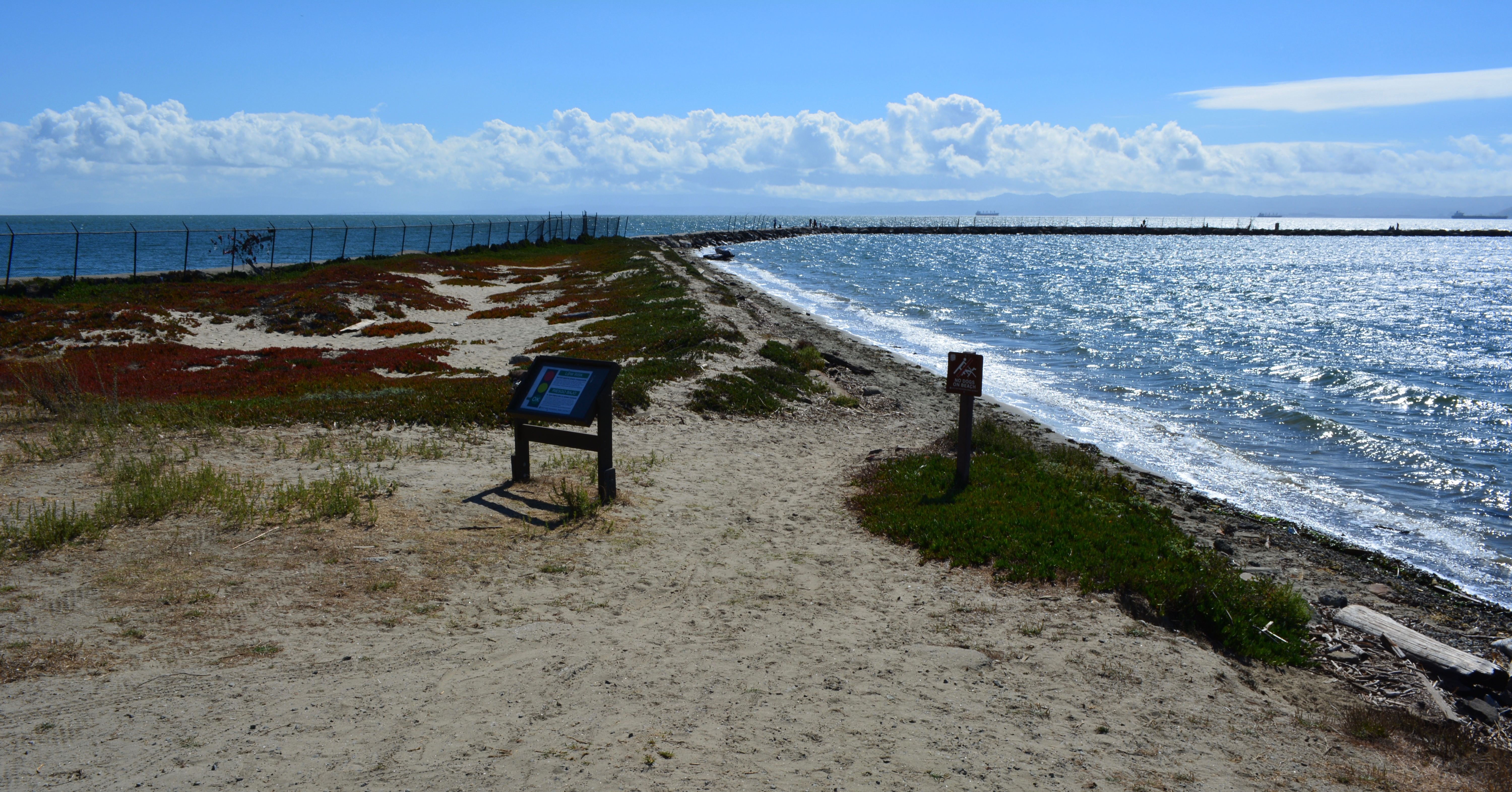
The beach at the eastern end of Alameda Point near the dormant campground will undergo a major renovation in 2017. The East Bay Regional Park District (EBRPD) is planning to create a natural dune landscape. They are also planning to bring in more sand to the beach in order to raise the elevation to allow use of the beach at high tide.
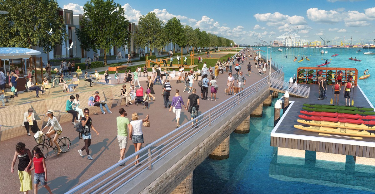
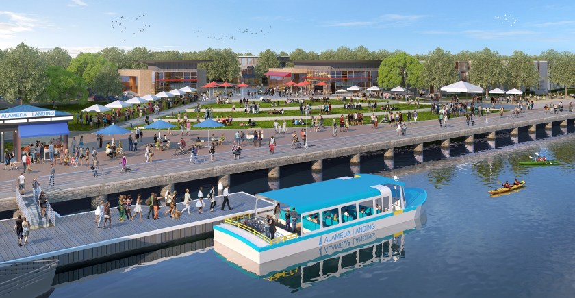
~ Developer proposes housing, hotel, and plaza at former Navy supply center
Alameda Landing is about to enter its final phase of development. A 2006 plan that once called for all commercial on the 41-acre waterfront parcel behind Target is being replaced with a new plan. It includes an additional 375 housing units, a 124-room hotel, restaurants, and a small amount of commercial space. An eight-acre waterfront park and promenade remain as the centerpiece.
Proposed Fifth Street Plaza with water shuttle. Courtesy of Catellus.
The developer, Catellus, decided to shelve the all-commercial plan due to lack of demand, coupled with high costs to develop the seismically challenged site.
Sean Whiskeman, senior vice president of development for Catellus, points to the fact that zero new office construction is underway along the Interstate 880 and Interstate 80 office corridor. The lack of demand “is a very compelling statistic in our opinion,” said Whiskeman, “especially given the alternative office sites available within Alameda.”Continue reading “Waterfront plans change at Alameda Landing”
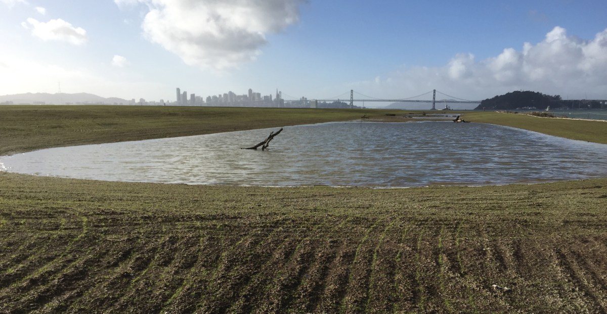
The Navy’s cleanup program has not only removed toxic substances from below ground, it has dramatically improved some of the above ground environment by creating new native grassland and wetlands. January rains filled the Navy’s new seasonal wetland on the northwest shoreline corner of Alameda Point and fostered growth of newly planted native grass seed on the surrounding soil.
New Site 1 wetland on January 13, 2016, with San Francisco in background. Rows in soil with emerging growth were created during sowing of seeds. Navy photo.
The 2.25-acre wetland lies within an approximately 37-acre shoreline cleanup area known as Site 1 at the confluence of the Oakland Estuary and San Francisco Bay. It is where the Navy buried its waste between 1943 and 1956. Most of the waste pits were covered by pavement in the mid-1950s when a new runway was added.Continue reading “Navy adds a wetland and grassland”
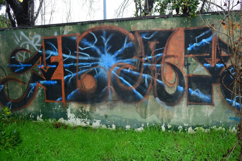
The viewer is left to decide where graffiti ends and art begins in the following images. Regardless of opinion, one thing is clear: There are people looking for an opportunity to artistically express themselves. And Alameda Point has plenty of abandoned interior and exterior walls to accommodate them.
“Art in the park”
Artist Sam Norton created the mural below at City View Skate Park at Alameda Point in 2015 to honor and remember his friend and fellow skateboarder Clay Harding who died the previous year. Continue reading “Artistic expression at Alameda Point”
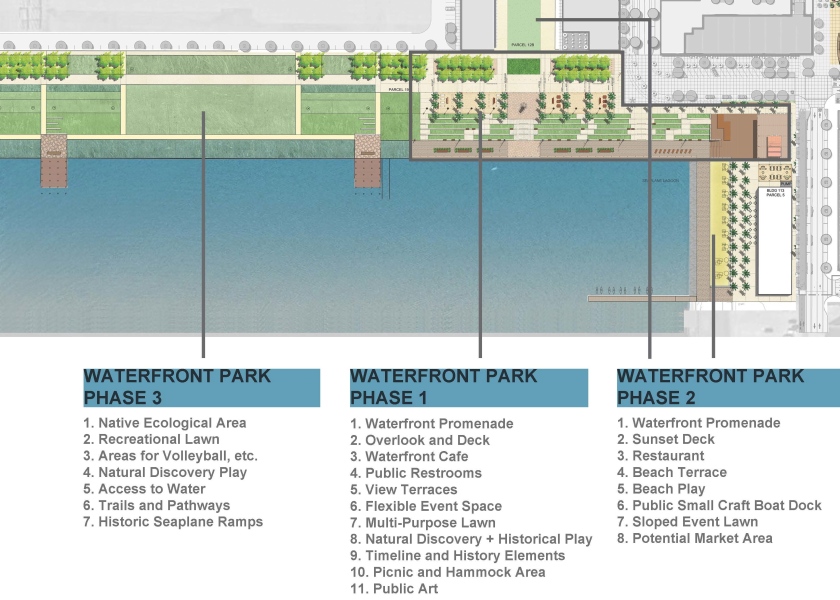
The Planning Board and the Recreation and Park Commission will be making comments this week on the first phase of a waterfront park being planned for the north side of the Seaplane Lagoon at Alameda Point. The public is invited to offer comments.
The Planning Board meeting is on Monday at 7 PM at City Hall. The Recreation and Park Commission meeting is on Thursday at 7 PM at City Hall.
Below are excerpts from the city staff report, along with a series of images in an easy-to-examine format excerpted from the complete design proposal. Click on any image to enlarge.
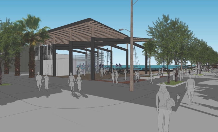
“Alameda Point Partners (APP) has been working with their design consultants, park planners, a Planning Board Subcommittee and City staff to prepare detailed designs for the individual buildings and parks within Site A. APP has submitted an application for design review for a 2.63-acre Phase 1 of the waterfront park along the northern edge of the Seaplane Lagoon that is intended to be constructed concurrent with Block 11.”
“Phase 1 Waterfront Park is designed to provide a variety of public spaces for passive recreation and opportunities for the public to enjoy the waterfront location and special events, and appreciate the views of the San Francisco skyline and the historic row of seaplane hangar buildings at the entrance to the Historic District, along the northern edge of the Seaplane Lagoon.”
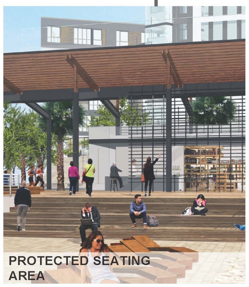
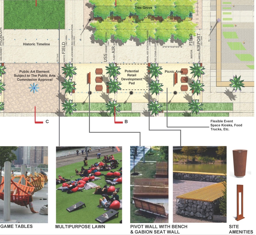
“The 2.63-acre Phase 1 Waterfront Park is designed to create three primary sub-areas (i.e., the Overlook, the Promenade & Terraces, and the Taxiway).”
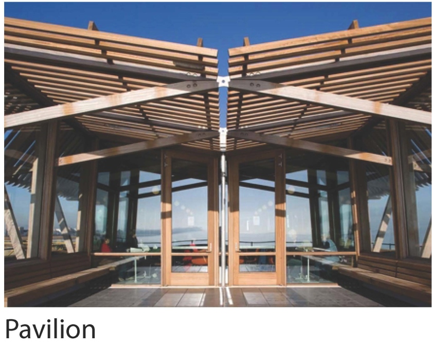
“The Overlook includes a pavilion for a café with outdoor seating and restrooms, as well as an elevated salvaged or reclaimed wood outdoor area for overlooking the promenade at the water’s edge, as well as portions of the promenade adjacent to the water. The Overlook also accommodates flexible event and programmable space.”
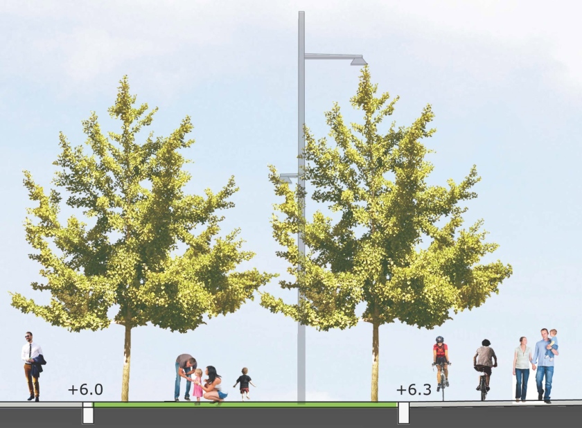
“The Promenade and Terraces consists of a series of terraces and promenade spaces leading down to the water’s edge that provide for a variety of more passive spaces for enjoying and experiencing the waterfront. Access to the waterfront promenade allows for universal design through slightly sloped walkways and seating elements that provide for a variety of all age groups and needs.”
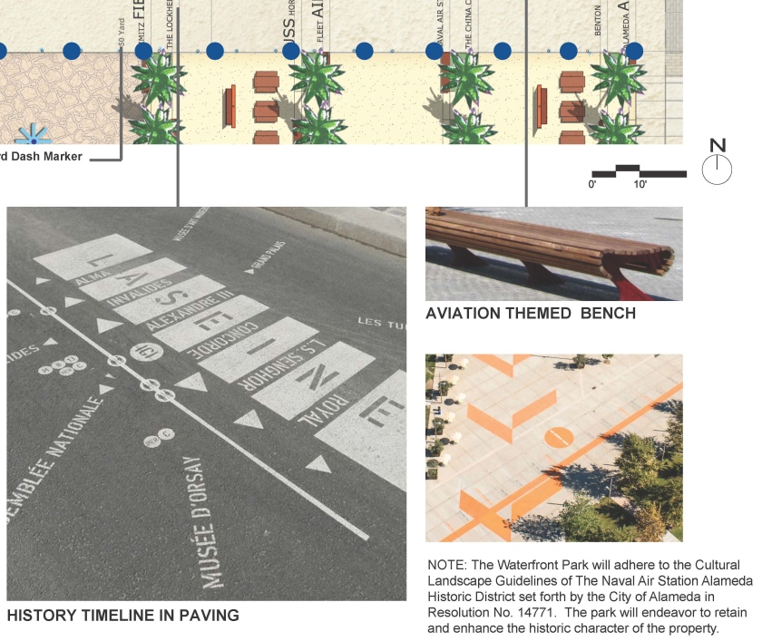
“The Taxiway area is intended to pay homage and respect to the historic elements of the former NAS Alameda by engraving a timeline along the major east west gathering area into the concrete to remind and educate the public about the history of the site and the Historic District, and by minimizing tree plantings and planted areas to preserve the ‘openness’ of the historic taxiways consistent with the Historic District guidelines. This area includes open and unobstructed areas planned for special events and food trucks and future retail buildings as conceived in the Site A Development Plan and a temporary multi-purpose lawn for active recreation uses until future phases of the Waterfront Park are constructed and this area is designed consistent with the areas to the north.”
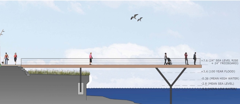
“Address Sea-Level Rise. With anticipated sea level rise, the existing taxiways will flood. Consistent with the approved MIP and San Francisco Bay Conservation and Development Commission (BCDC) policies, the Phase 1 Waterfront Park is designed to address 24-inches of sea level rise and additional sea level rise in future years beyond 24 inches through adaptive management strategies.”
“The Phase 1 Waterfront Park design maintains the “horizontality” of the space and minimizes the use of walls in order to respect the cultural landscape guidelines for the Historic District.
“Additionally, the sea level rise strategy is designed around a series of short terraces spread over a larger space to minimize the impression of changes in elevation. This approach also allows for the preservation of the existing bulkhead, which is a character defining feature of the Historic District. During storm events and “King Tides” (unusually high tides), the bulkhead and adjacent promenade will flood occasionally as the sea level rises over time, but major portions of the public park and Bay Trail will remain above the flooded areas behind the stepped terraces. As such, the design balances the competing needs to address sea-level rise, preserve the bulkhead, and maintain the horizontality of the site.”