
~ Developer proposes housing, hotel, and plaza at former Navy supply center
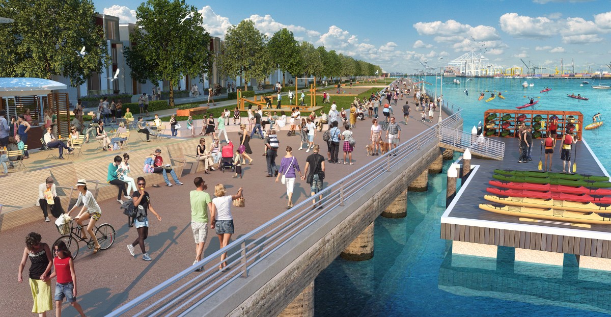
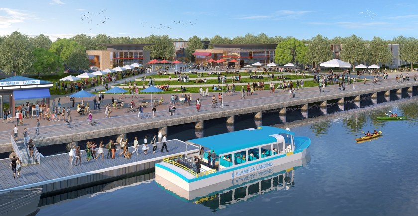
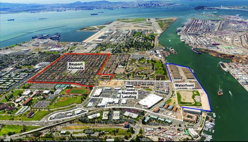
Alameda Landing is about to enter its final phase of development. A 2006 plan that once called for all commercial on the 41-acre waterfront parcel behind Target is being replaced with a new plan. It includes an additional 375 housing units, a 124-room hotel, restaurants, and a small amount of commercial space. An eight-acre waterfront park and promenade remain as the centerpiece.
The developer, Catellus, decided to shelve the all-commercial plan due to lack of demand, coupled with high costs to develop the seismically challenged site.
Sean Whiskeman, senior vice president of development for Catellus, points to the fact that zero new office construction is underway along the Interstate 880 and Interstate 80 office corridor. The lack of demand “is a very compelling statistic in our opinion,” said Whiskeman, “especially given the alternative office sites available within Alameda.”
In addition, current rents would not support the upfront investment of $90 million in land preparation costs, according to Whiskeman. “Asking rents on the island are approximately $16.50 per square foot,” said Whiskeman. “Rents would have to be close to $55 per square foot to justify building the office park on our waterfront site.” Assuming a 3 percent average annual growth rate of commercial rents, it would only pencil out if construction began 41 years from now, according to Whiskeman.
Another challenge is the seismic stability of the massive concrete wharf and the soft shoreline. The park and waterfront promenade will be built on the wharf. There is currently a warehouse on the wharf, but it will be demolished to make way for the public open space.

The wharf was constructed in the 1940s to handle train cars and cranes for Navy supply operations. There are over 4,000 piers underneath the wharf, and they have eroded and lost their structural integrity, according to Whiskeman.
The site is built with mud dredged from the Estuary, which is subject to liquefaction during an earthquake. The edges are stabilized with a rocky riprap, which creates the shoreline.
“In a seismic event of any size, that Bay Mud is going to build up a lot of energy, and it’s going to want to go somewhere,” said Whiskeman. “It’s going to want to go to the weakest point, which is the water’s edge,” continued Whiskeman. “That Bay Mud is going to explode out into the water and with a ton of force. It’s going to take with it anything in its path, including those piers and the wharf.”
The shoreline seismic plan will incorporate a system of several hundred underground columns of cement and soil mixed together, which could serve to both stabilize the shoreline and provide lateral restraint to the wharf structure.
The city currently owns the property. The city will continue to own the wharf after Catellus creates the eight-acre park and public space.
The 2006 development agreement for the former Navy supply center property allows for changes in land use, as long as no additional impacts are generated.

“We’re not generating any more trips than were already approved,” said Whiskeman. “We are net neutral, and in some respects we are net positive as far as trips because peak trips are about the same in the morning, and the evening peak trips are less than what was approved.” Transportation consulting firm Fehr & Peers provided the traffic impact analysis for Catellus.
The consultant’s data does not factor in the traffic reduction measures currently in place, according to Whiskeman. Alameda Landing residents and businesses already fund a BART shuttle to and from the 12th Street Station during weekday peak commute times.
“Part of the beauty of this next phase is that the transportation program gets more robust as more revenue is able to be put into the program to help fund the shuttle program,” said Whiskeman. It will also fund a new water shuttle to Jack London Square. Whiskeman said that the owners of the Alameda-based Commodore fleet would operate the water shuttle.
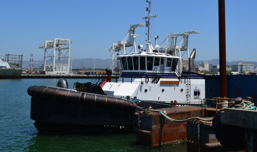
On May 23, Catellus sought input from the Planning Board. Board members suggested Catellus include more commercial space, smaller and more affordable housing units, and space for existing tenant Starlight Marine Services to continue operating its tugboat business there.
Catellus expects to return to the planning board with revisions to the plan on June 27 for final approval of the land-use change.
If approval of the new plan is granted, Catellus could begin work early next year and complete demolition and seismic work within 12 months.
Originally published in the Alameda Sun.


Excited to check it out and take the ferry and just stay put and go for a walk or eat a meal at a restaurant.
LikeLike