The proposed ecological wetland park at Alameda Point, known as DePave Park, is another step closer to becoming a reality. On Sept. 15, 2020, four members of the city council gave thumbs up to moving forward with seeking a $2 million grant to pay for a master planning process.
“I am super-stoked about this project; it’s better than I ever imagined,” said Councilmember Jim Oddie, who has led recent efforts at City Hall to get action on this park. “I was really touched when I saw the drawing. I broke down in tears it was so beautiful.”
As currently envisioned, park construction will entail removing old pavement and softening the edge of the western side of the Seaplane Lagoon which will allow water into the park and become adaptable to sea level rise. A tidal channel through the park will connect the Seaplane Lagoon with the existing wetland on the federal property, thereby creating a combined wetland ecosystem with multiplied benefits. Continue reading “City to seek funding for wetland park at Alameda Point”
The city and its consultant recently released a report outlining what will be included in the new climate action plan for Alameda. What it reveals, unfortunately, is their resistance to thinking big.
The process for updating Alameda’s climate action plan began as a promising effort for a comprehensive look at what it means to adapt our entire environment to climate change. It is winding up with a narrow focus on protecting local real estate, which they refer to as “vulnerable assets.”
The city has rejected a broader scope of action that would include “opportunity assets,” as in opportunities to improve the natural environment, not just the built environment. Areas at Alameda Point not slated for development must be viewed as an opportunity asset that can be re-purposed for the good of the environment. Continue reading “City misses chance to embrace wetlands at Alameda Point”
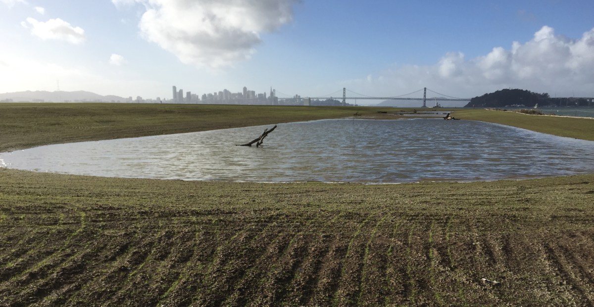
On July 28, representatives of the city and the East Bay Regional Park District (EBRPD), along with members of the public, toured the future site of a regional park on the former Navy runway area at Alameda Point. The 158-acre area runs along the Oakland Estuary out to the western shoreline with its sweeping views of San Francisco Bay out to the Golden Gate Bridge.
View from the proposed regional park on May 11, 2017, during Restoration Advisory Board tour.
Bob Nisbet, assistant general manager of EBRPD, and Jennifer Ott, base reuse manager for the city, explained that the city and park district are working on a joint agreement called a Memorandum of Understanding (MOU) that will allow EBRPD to build and operate the park. The land is being transferred from the Navy to the city in phases as environmental remediation is completed. Following the final land transfer in about four years, the city would then lease the land to EBRPD for 66 years, the maximum allowable under state law for tidelands along state waterways. Continue reading “Regional park district and city negotiate land deal for park”
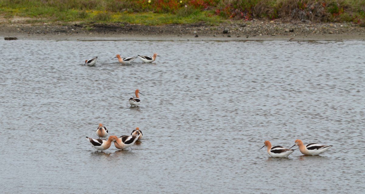
The Navy’s cleanup program has not only removed toxic substances from below ground, it has dramatically improved some of the above ground environment by creating new native grassland and wetlands. January rains filled the Navy’s new seasonal wetland on the northwest shoreline corner of Alameda Point and fostered growth of newly planted native grass seed on the surrounding soil.
New Site 1 wetland on January 13, 2016, with San Francisco in background. Rows in soil with emerging growth were created during sowing of seeds. Navy photo.
The 2.25-acre wetland lies within an approximately 37-acre shoreline cleanup area known as Site 1 at the confluence of the Oakland Estuary and San Francisco Bay. It is where the Navy buried its waste between 1943 and 1956. Most of the waste pits were covered by pavement in the mid-1950s when a new runway was added.Continue reading “Navy adds a wetland and grassland”
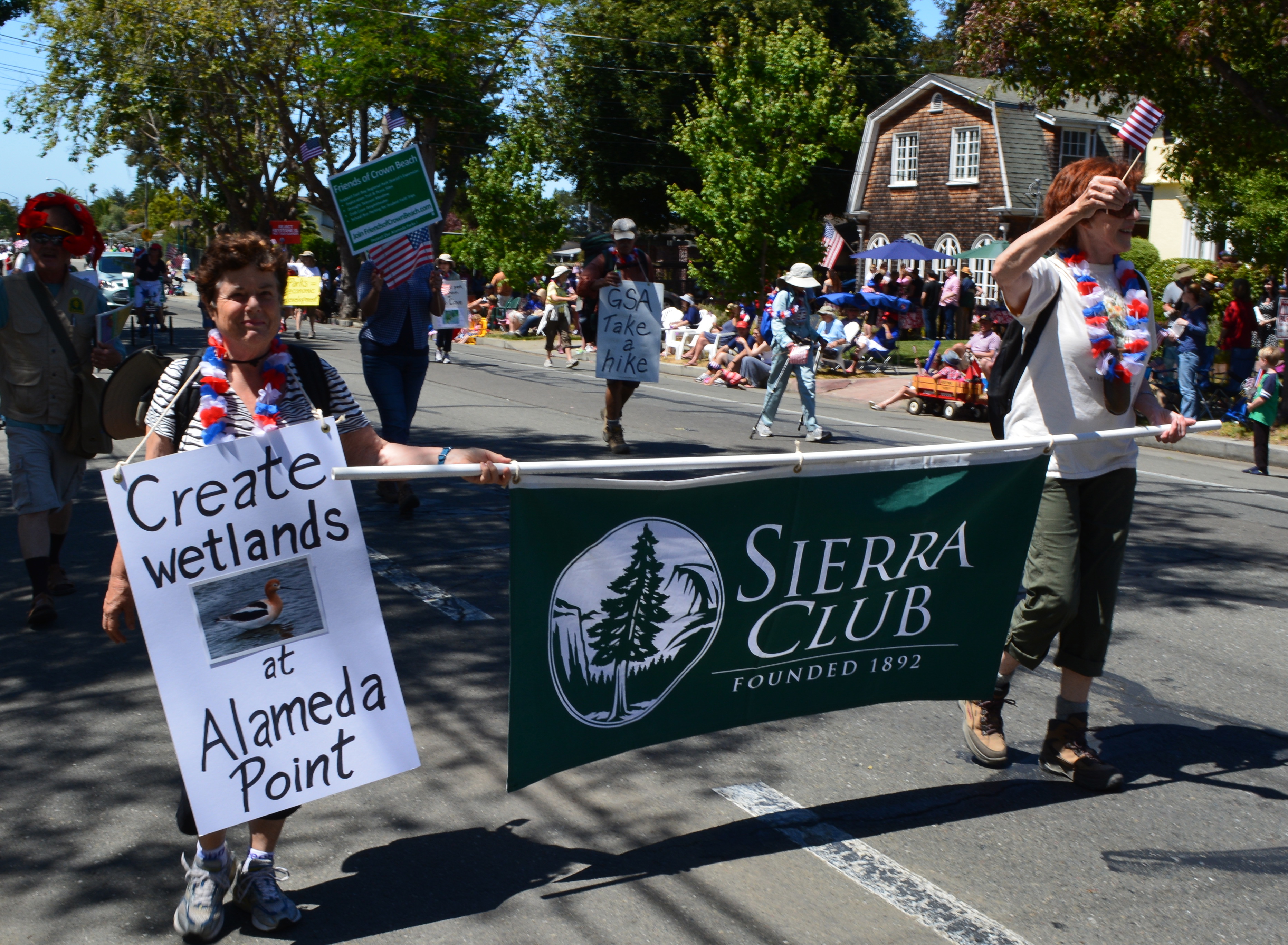
It’s more likely a new wetland will be created on the western shoreline of the Seaplane Lagoon at Alameda Point, thanks to lobbying efforts led by the Sierra Club.
Sierra Club in Alameda’s 4th of July Parade 2014
On July 1, 2014, the Alameda City Council added language to the Alameda Point Town Center and Waterfront Specific Plan that raises the commitment to remove pavement from the western side of the Seaplane Lagoon for wetland—an area called De-Pave Park. Lobbying efforts convinced the council to include the following options to help facilitate the wetland park creation: 1) creating a wetland mitigation bank; 2) adding the area to a possible national wildlife refuge on the federal property; and 3) working with local community members who may identify funding sources for creating the passive park area.Continue reading “Wetland park plan at Seaplane Lagoon gets a boost”
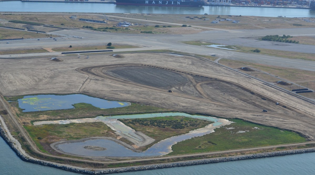
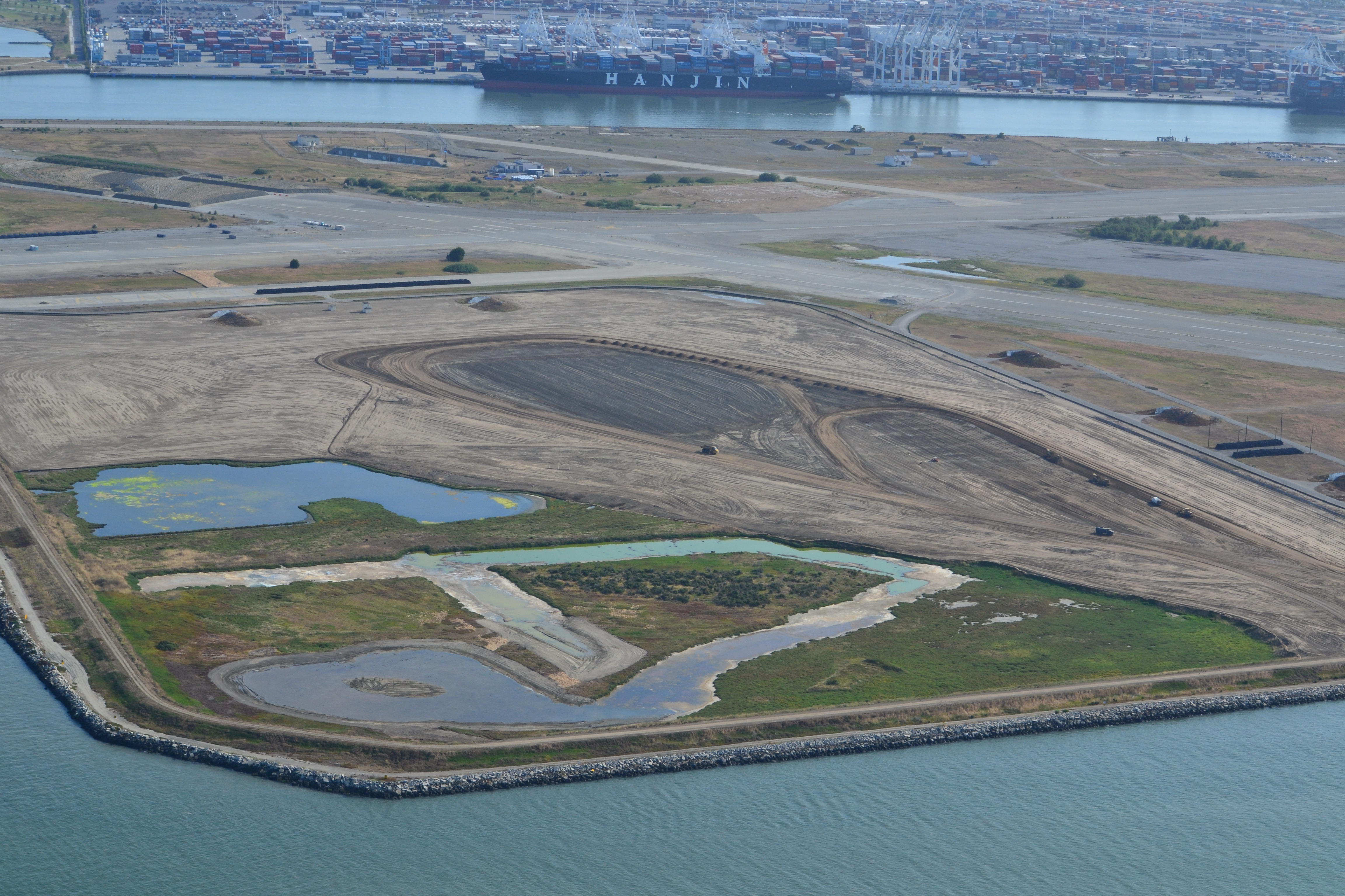
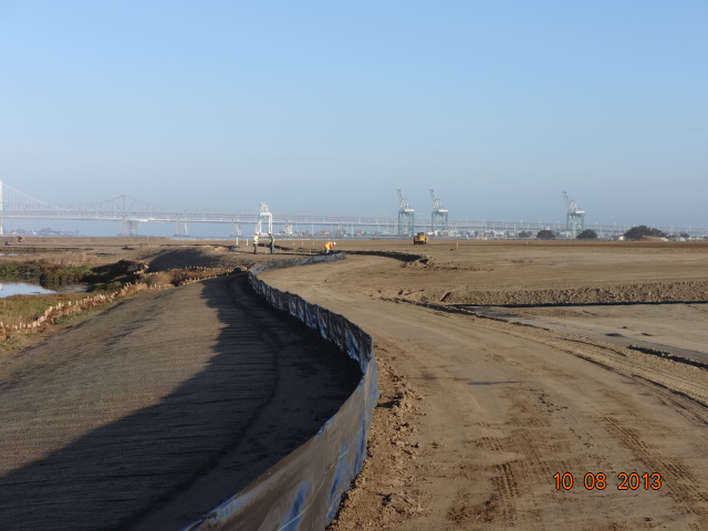
Landscaping of the 100-acre landfill area on the southwest corner of Alameda Point is nearing completion. The seeding of the landfill site with flowering native grasses is almost ready to begin. Contouring of the site is complete. Stabilization of the shoulder around the wetland area is complete. Placement of the final soil cover is underway.
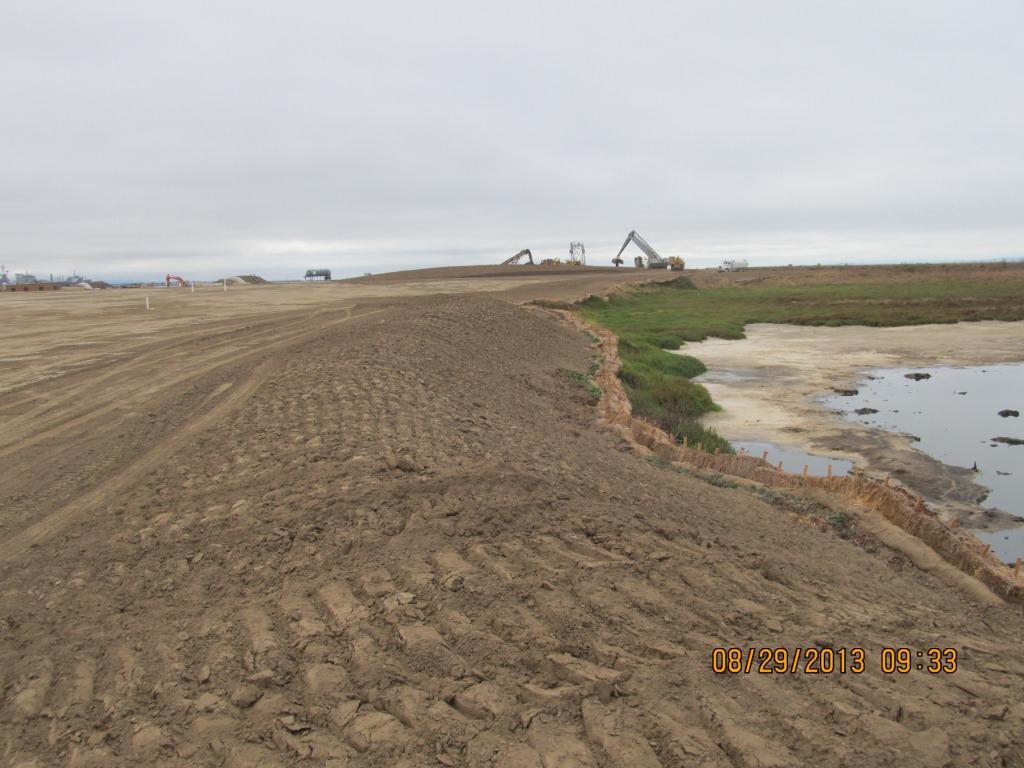
Site 2 wetland area and adjacent contouring underway in early July 2013. Wetland area has since been expanded by several acres. Port of Oakland is in the background. Bay Trail will eventually follow the foreground shoreline along the Bay. Funding and construction of the Bay Trail is not part of this project, and is yet to be funded.
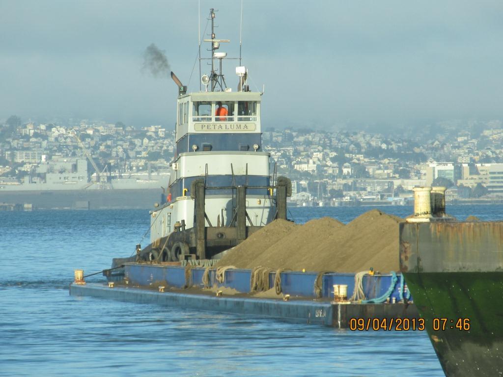
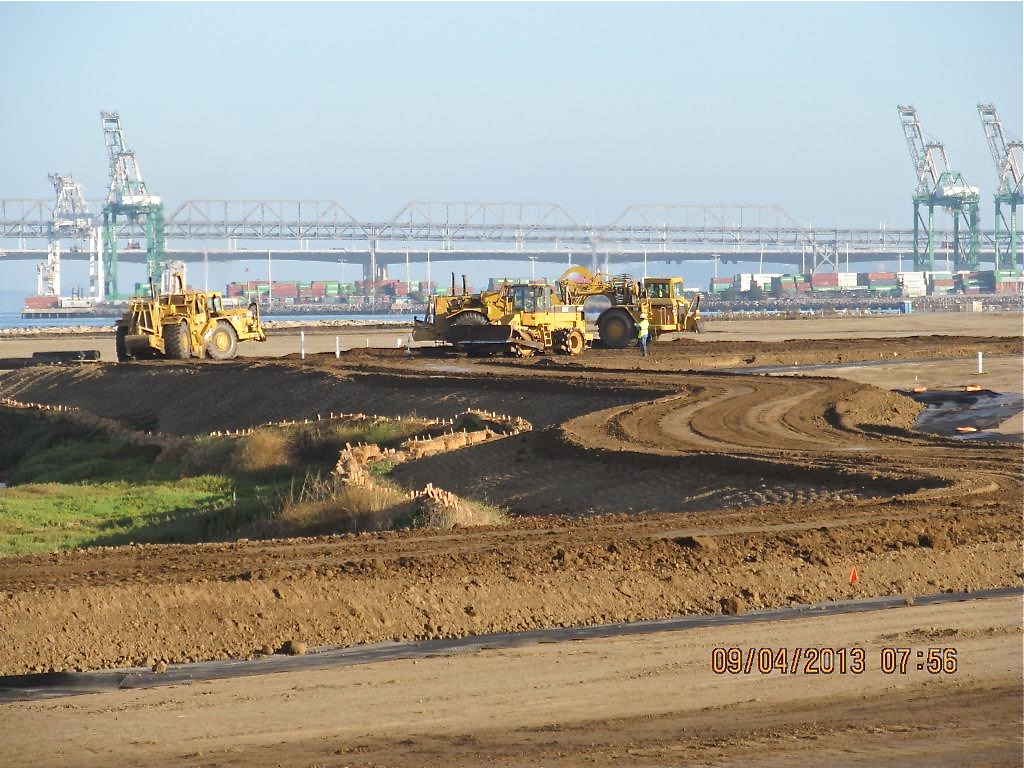
The contouring of this industrial landfill site was completed on August 16, 2013. Approximately one-third of the contouring, or base layer, soil is clean soil recycled from Seaplane Lagoon dredging. The recycled soil stock was quickly exhausted, along with soil recycled after removing some of the berms and high areas. More than half of the base layer – 193,000 cubic yards – is soil barged in from Decker Island in the Sacramento River.
Soil being delivered from Decker Island.
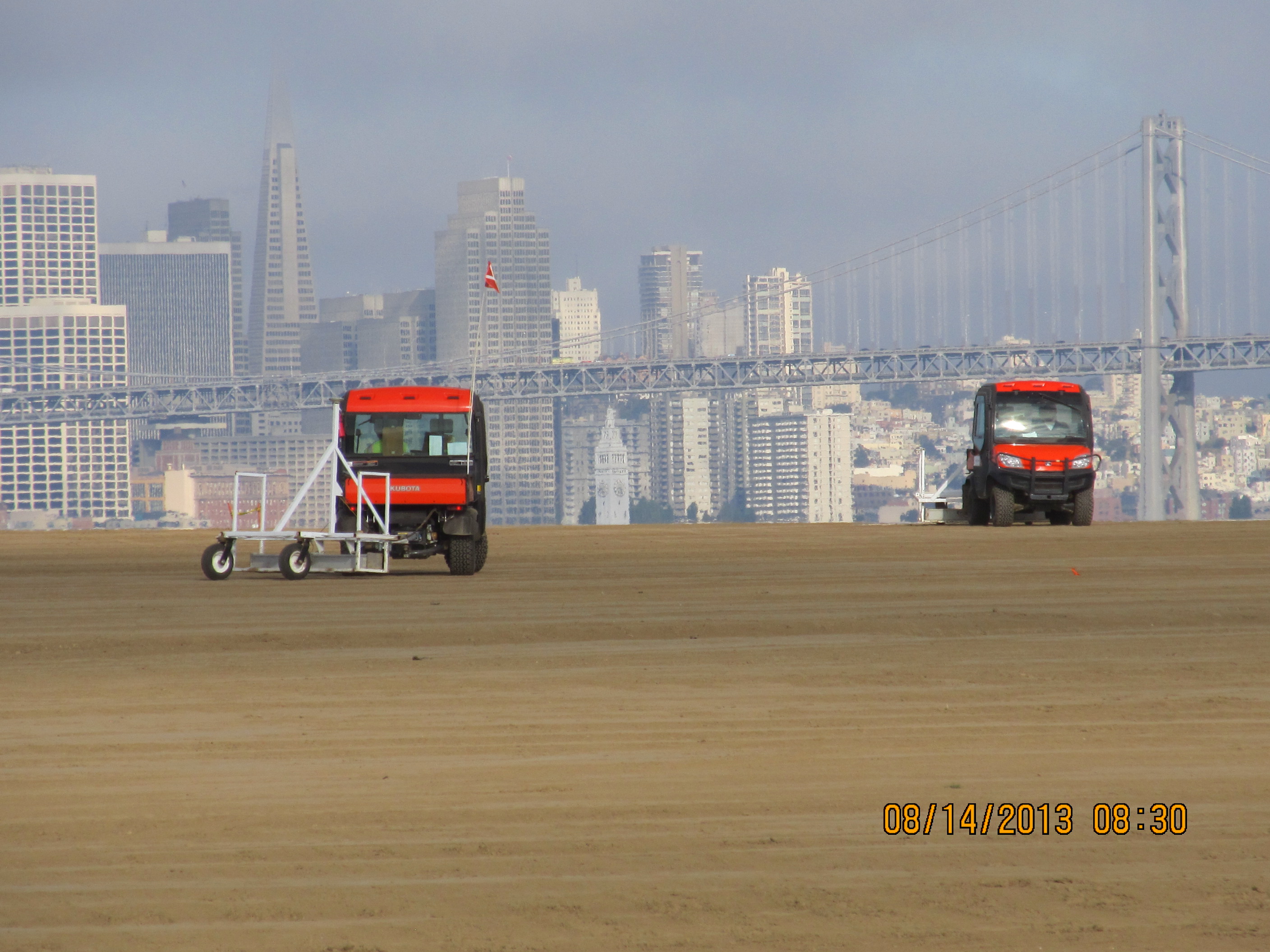
This contouring phase, which began in January of 2013, created the base layer with a specially-engineered slope. It was then scanned for radiation using scanners towed by a small vehicle, even though the site had been surveyed for radiation prior to placing the base layer.
Scanning the base layer for radiation.
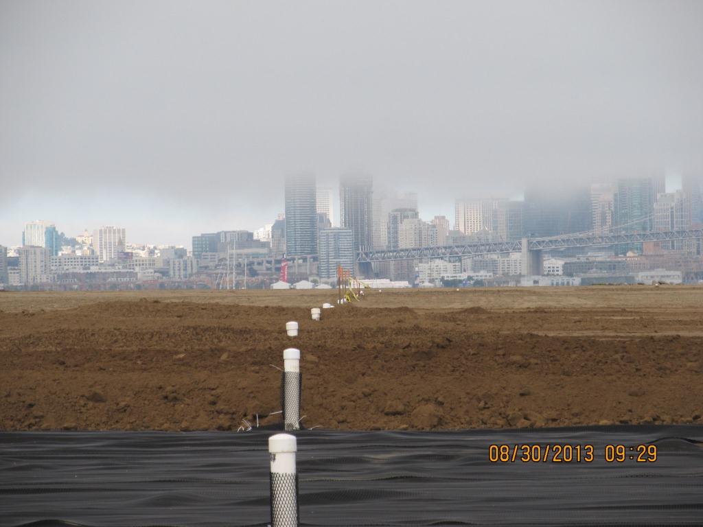
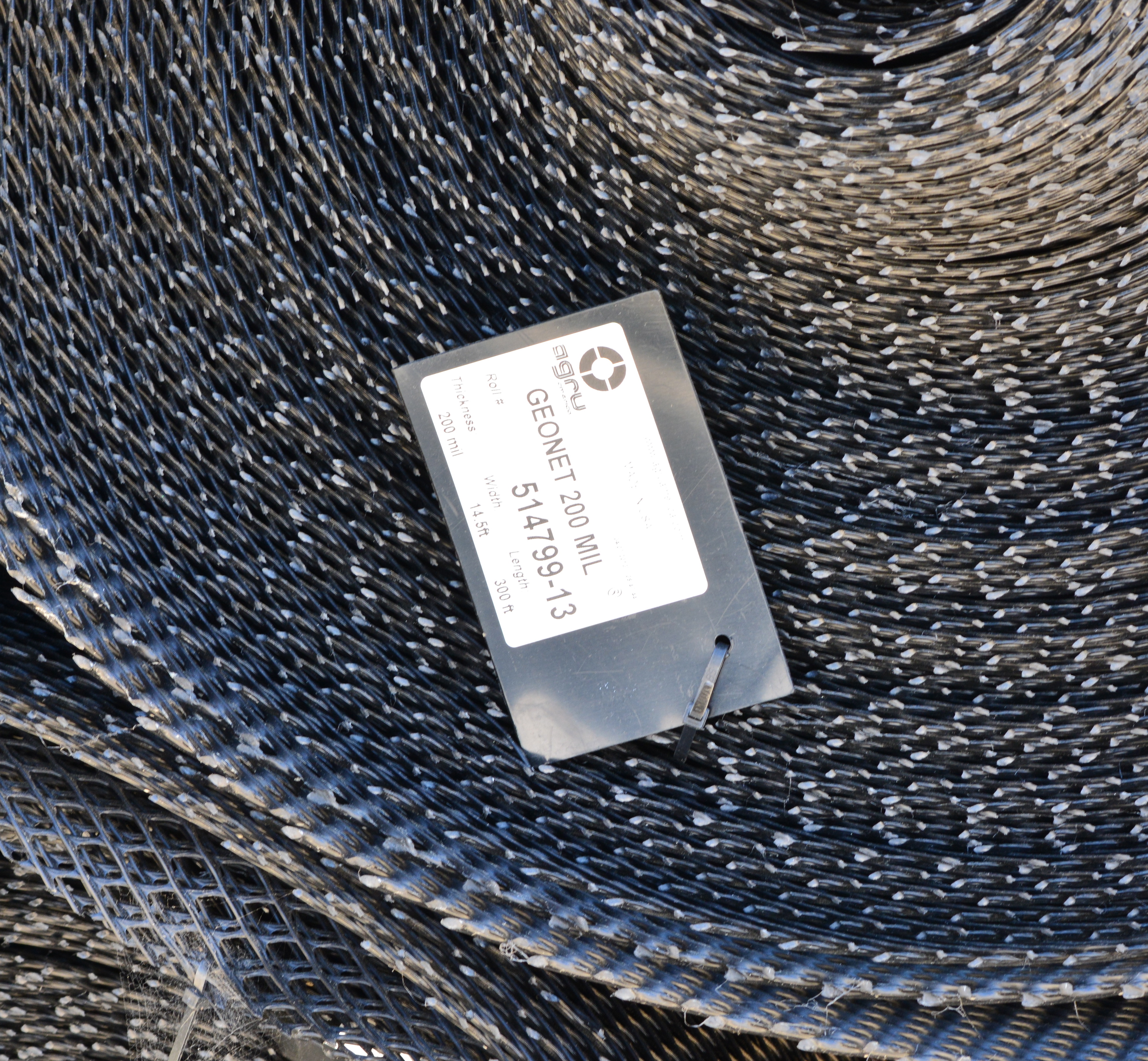
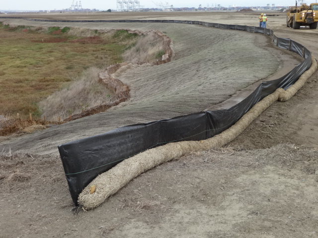
Placement of the plastic biobarrier (see photo below) and the final soil cover using soil barged in from Decker Island began on August 19, 2013. The biobarrier is a plastic mesh that is designed to discourage burrowing animals from coming into contact with the waste area. The biobarrier installation is over 90% complete as of week #38 (October 24, 2013). The final two-foot soil cover is over 60% complete. The final soil cover includes six inches of soil amended to promote growth of vegetation.
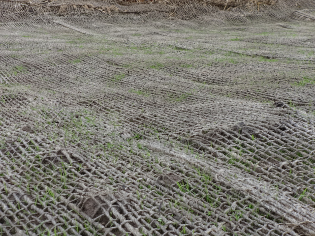
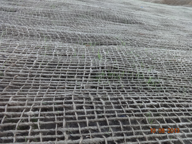
The soil stabilization and drainage work on the shoulder around the wetland area is also completed. It includes native rye grass seeding, a jute mesh cover, and a silt fence. Some of the rye grass has already started to sprout.
Stormwater controls near wetland area being created.
New monitoring wells will be installed starting in late November.
Hydroseeding of the site with an assortment of California native grasses will begin in late November or early December.
In 2014 the old culvert connecting the north side of the wetland with San Francisco Bay will be replaced with a new culvert.
Fifty tons of old fence and metal have been recycled. The temporary work fence will be removed at the end of the job. The methane gas vents will be short and virtually unnoticeable (see photo below). Due to the age of the landfill and the fact that very little organic waste was deposited there, the methane gas produced is minor and will not require the 10-foot tall vent stacks proposed in an earlier workplan.
Methane gas vent pipes.
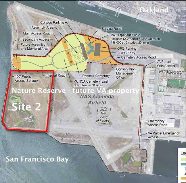
This site, along with adjacent land, will be transferred to the U.S. Department of Veterans Affairs in late 2013 or early 2014.
VA map, with Site 2 and Nature Reserve notations added by Alameda Point Environmental Report.Biobarrier to discourage burrowing animals. Photo credit: Alameda Point Environmental Report.
Silt fence installed above jute mesh around wetland area.Silt fence under construction.Jute mesh around wetland shoulder, with grass starting to sprout.Week 36 – Vegetation growing through jute mesh around shoulder of wetland area.
Source: The information in this update was gathered from the weekly progress reports for Installation Restoration Site 2 Remedial Action at Alameda Point. The progress reports are posted on the Envirostor website maintained by the California Department of Toxic Substances Control (DTSC). The source for all photos in this update, unless otherwise credited, is DTSC.
Returning part of the Seaplane Lagoon shoreline to nature is one of the biggest changes that have emerged in the planning process at Alameda Point. The design proposal for the western side of the Seaplane Lagoon echoes the major theme of the Greenspace Project of Golden Gate University’s Center on Urban Environmental Law – the interconnected ecosystem.
From Town Center and Waterfront Precise Plan presentation to Planning Board. (click on map image to enlarge)
The draft Town Center and Waterfront Precise Plan for the Seaplane Lagoon and eastern entrance area, presented to the Planning Board on August 21, offers a number of new concepts, including moving the proposed marina from the west side of the lagoon to the east side. The waterfront plan is being refined concurrently with zoning changes, an environmental impact report, and a master infrastructure plan, which are all aimed at providing the level of detail necessary for the city to start marketing property to investors in 2014.
In reporting to the Planning Board on design plans of the city’s consultant, Skidmore, Owings and Merrill (SOM), city staff stated: “Due to the vast scale of the study area and the Seaplane Lagoon as its centerpiece, the Town Center will be able to support a wide variety of unique waterfront experiences—some of which build and expand upon existing assets and activities, some of which introduce entirely new opportunities. SOM proposes the following four waterfront zones and experiences:
1. Natural environment—along the western edge of the Seaplane Lagoon with trails, docks, camping, outdoor sculpture and wetlands.
2. Promenade and recreational opportunities—along the northern edge, with early phased soccer fields, food concessions, bike and pedestrian paths, open lawn, and kayak access.
3. Urban edge—along the eastern side and portions of northern edge with marinas, docks, eating patios, overlooks, and ferry service.
4. Industrial—further south on the eastern side with maritime uses located near the MARAD ships and the USS Hornet.”
From Town Center and Waterfront Precise Plan presentation to Planning Board.
Climate adaptation grant funding needed – As currently envisioned, however, the de-paving, removal of buildings, and alteration of the western Seaplane Lagoon shoreline area is put off into the distant Phase 3 future — a decade or more from now — when presumably a surplus of infrastructure funds will allow for implementation. One option available for timelier implementation would be to begin now seeking grant funding from agencies that focus on shoreline climate change adaptation. There will be no commercial development on the western side of the lagoon, and therefore the project would become a public asset.
Lying directly to the west on the Nature Reserve is the Runway Wetland, whose habitat value would be greatly enhanced by a connection to the Seaplane Lagoon. Additionally, the draft Master Infrastructure Plan predicts a $10 million savings if the area were allowed to become tidal wetland as sea level rises.
Great Blue Herons with nest (left) and gulls on eastern jetty of Seaplane Lagoon. Heron is directly above proposed tidal marsh featured on map above. West shore of Seaplane Lagoon in background.Great Blue Heron standing in shallow Seaplane Lagoon area where tidal marsh is proposed.Sea Lion catching fish in Seaplane Lagoon. Floating haul out platforms would increase their presence.Black-crowned Night Heron poking around for food on eastern jetty of Seaplane Lagoon. One of the regular but seldom seen wildlife visitors.Alameda Point Channel in foreground that connects San Francisco Bay to the Seaplane Lagoon.
Unless otherwise noted, all photos are copyright Richard Bangert. Permission requests appreciated before reproducing. See “About” page for contact info.