Ending threat of solvents in groundwater leaching into San Francisco Bay

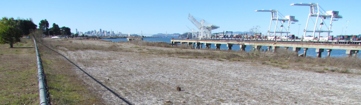
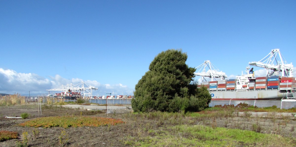
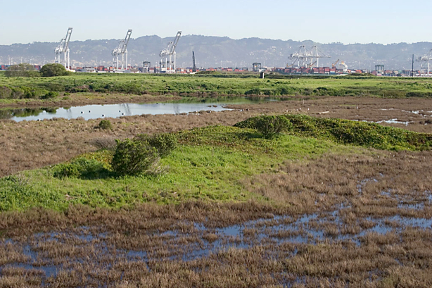
Site 1 at the northwestern tip of Alameda Point was used as the principal disposal area for all waste generated at Naval Air Station-Alameda from 1943 to 1956.  This disposal area, which was once part of the Bay, was created by sinking pontoons and barges in the Bay and backfilling with dredge soil.

Disposal of cleaning solvents and petroleum products at one unlined pit within the landfill resulted in a groundwater plume that poses a threat of leaching into San Francisco Bay today.

In the 1990s the Navy installed an underground barrier system, called a funnel and gate permeable reactive barrier, to stem the flow of contaminants into the Bay.  It was not a permanent solution.  In July of this year the permanent solution began with the injection of neutralizing chemicals into the plume.

Protecting marine life

San Francisco Bay at Alameda Point western shoreline where threat of solvent leaching exists.

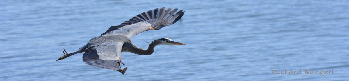
Most cleanup activities around the base are aimed at eliminating direct health risks to humans, such as from soil or from vapors that could enter a building.  In a few cases, the cleanup is focused first on direct impacts to marine life such as fish, which could in turn cause health problems for people who eat them.

The cleanup effort at the Site 1 plume is one of those cases.  This effort will keep toxins — solvents, petroleum products, and metals — from ever leaching into the Bay, being ingested by fish, and then consumed by humans.  The effort will also reduce unacceptable levels of vapors that are escaping directly above the plume.  The future use of the site will be restricted to open space recreational.

The process

July 2012 – Manifold system of hose lines that send oxidant chemicals to individual wells that go into the underground plume contamination area. Navy photo.

The chemical injection process, called In Situ Chemical Oxidation (ISCO), is accomplished by injecting oxidants (catalyzed hydrogen-peroxide and sodium persulfate) into the plume through injection wells.  “These oxidants produce short-lived reactions that directly destroy the targeted contaminants,” according to the Navy.  Groundwater tests will determine if further treatments are necessary.

Tanks of chemicals for neutralizing solvent plume. Shown as work area being set up in June 2012.

Treatments will continue until either the groundwater is clean enough, or the solvent and petroleum concentration has been reduced by 75%.  Once they get to 75% reduction, further injections are more or less a waste of money.  From then on, the contaminant concentration is low enough that the remainder will either degrade or disperse and dilute naturally without posing a risk to fish or humans.  This process is called natural attenuation and is often relied upon to finish the job when the bulk of contaminants are neutralized and treatment methods no longer yield effective results.

The groundwater plume is also contaminated with metals consisting of arsenic, copper, mercury, nickel, silver, and zinc.  The metals problem will, in theory, be taken care of when the solvents and petroleum products are eliminated.  This will cause the chemistry of the groundwater to change, which in turn will cause the metals to no longer remain dissolved in the water.  The metals will return to their solid state and remain where they are.  That’s the theory.

But to make sure it’s working, there will be a long-term groundwater monitoring program to make sure the metals aren’t moving.  If problems arise in the future, the Navy will have to come back and design a new remedy.  The Navy is responsible for the landfill’s contents staying in place in perpetuity.

Map of Site 1 disposal area with arrow from left indicating plume treatment area. Map also shows outlines of individual unlined pits that were used for disposal of waste. Half of the area is now covered by runway.

The Navy opted not to remove the landfill contents because of the $93 million price tag and because the risk of contaminant releases was deemed low.  A new set of environmental concerns associated with digging up and hauling away a landfill was also cited during the decision process.

The groundwater plume being treated is approximately 30 feet wide by 160 feet long, and it occurs mainly between depths of 5 and 10 feet below the ground surface.

Site 1 groundwater treatment work underway in July. San Francisco in background. Navy photo.

Delay on soil cover

All of 30-acre Site 1 will eventually be covered with soil and seeded with native grasses.  Work on the soil cover was delayed when the contractor discovered that the part of the landfill once used for burning waste was larger than expected.  The documentation has to go back through the review process, with a work plan for the soil cover hopefully prepared and ready to implement by 2014.
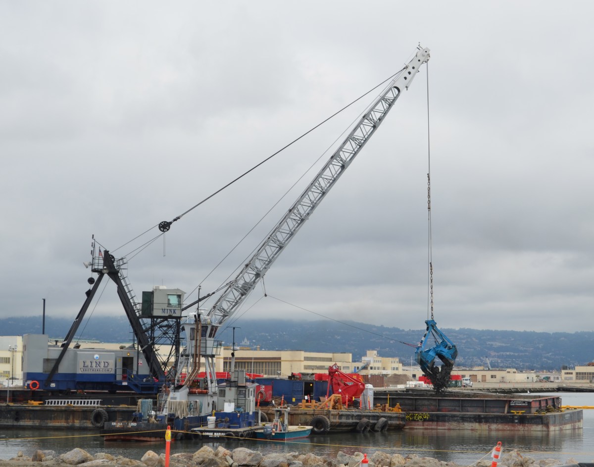
Soil cleanup planned at runway workshops area

Future recreational open space

The 4.18-acre cleanup Site 34 in the old runway area next to the Oakland estuary looks barren from a distance.  But up close there are concrete slabs and pavement, reminders of its bygone days as a bustling workshop area.

This area was once part of the division known as the Naval Air Rework Facility (NARF).  Everything from sandblasting and painting, to metal working, woodworking, and scaffold maintenance went on out there. More than 40 years of activity left soil around buildings contaminated with lead, arsenic, pesticides, PCBs, and aircraft and diesel fuel.  Above ground fuel storage tanks and electrical transformers contributed to the contamination.

The Navy will clean up the soil in this area next year.  Their draft work plan, which will be released on July 31, was discussed during a Navy presentation at the July 2012 Restoration Advisory Board (RAB) meeting. 

Site 34 aerial view. Old fuel dock to left of site. Runway at bottom is part of area where antiques faire is held.  Navy photo/graphic.

Based on more than 200 soil samples taken in prior years and this year, the contractor created the draft work plan.  Separate groundwater samples indicate contamination from the solvent trichloroethane. No remedial action is being taken on the trichloroethane, however, because 1) vapor intrusion into residences is not a factor, as this land will become Public Trust Land on which housing is not permitted; and 2) water monitoring has shown that the chemical is not migrating toward the estuary.

The northern edge of this site is part of the early westward land extension of Alameda, which allowed trains carrying freight and passengers to get out to a point where the water was deep enough for ferry connections.  More fill was later added to the area.  According to the Navy’s Remedial Investigation report, “In the 1920s, most of IR Site 34 was filled with estuary dredging material during construction of the Posey Tube.” 

Site 34 starts at concrete slab on far side of tree. Port of Oakland on right.  In late 1800s and early 1900s, trains travelled on tracks along the estuary where tree and slab are.

By the time the closure of the Navy base was announced in 1993, this workshop area had 12 buildings, 7 aboveground storage tanks, 2 “generator accumulation points” (waste storage), 15 transformers, and over 7,000 feet of aviation fuel line.  Between 1996 and 2000 everything except the concrete pads and pavement was removed. 

Building demolitions ended shortly after Alameda Point became a Superfund site in July 1999.  The Superfund program, officially called the Comprehensive Environmental Response, Compensation, and Liability Act (CERCLA), does not allow for land improvements such as building demolition.

Most of the soil cleanup locations are adjacent to the exterior edges of old building slabs. Much of the lead in the soil came from sandblasting lead-based paint.  Other contamination came from lubricants used for metals fabrications, and the use of oils and solvents for woodwork and metal work.  In addition to removing soil next to the slabs, the contractor will dig under the slabs at the hot spots to take what is called a sidewall sample to confirm that all contaminated soil is removed.  They have to keep digging as long as contamination is found. Clean soil will be brought in to the areas where soil is removed.

A strip of coastal marshland running along the Oakland Estuary on the north end of the site has no contamination.  Its habitat quality, however, is marred by discarded concrete, wood, and trash.  It will be up to the city to initiate wetlands restoration efforts there.

Coastal marsh on Oakland estuary at Alameda Point Site 34. Port of Oakland on left. Old runway area on right. Looking east toward Alameda Main Ferry Terminal.

A 60-day public comment period on the work plan begins when it’s released on July 31.  The work plan will be finalized in January 2013.  Fieldwork is anticipated to take place January through April 2013.

Site 34, located in the Northwest Territories, is expected to be given to the City of Alameda in 2014.

Click here > Site 34 RAB Presentation  for more details.

Announcing the new reference tab at the very top of this blog called “Cleanup document libraries.”

Scenic Alameda Point wildlife refuge section to be off limits with security fence

Alameda Point with the Port of Oakland on the left. Yellow outline shows Site 2 cleanup area. Green outline shows area where waste is buried. All but the wetlands in the bottom right corner of yellow area will be covered with clean soil. Fence and gates will be on landward sides of yellow border. Photo-graphic credit: US Navy.

Even after all the cleanup work is completed, the Navy proposes to put a permanent chainlink fence topped with barbared wire around a scenic shoreline section of the wildlife refuge at Alameda Point.

“Good grief!  If a fence is needed, will Site 2 be clean enough for our community?” Leora Feeney, co-chair of the Audubon Society’s Friends of the Alameda Wildlife Refuge, said upon first learning about the fence.   

The Navy used the site for underground waste disposal from 1956 to 1978.  According to representatives at the U.S. Environmental Protection Agency, the California Department of Toxic Substances Control, and the Regional Water Quality Control Board, the permanent fence has nothing to do with human health risks at the site.

According to the answer that the regulatory agencies provided collectively, “Potential human health exposure is unlikely to occur during recreational use on top of the soil cover such as walking or sitting.”  The soil cover will be seeded with native grasses.

The fencing is aimed at reducing maintenance costs for the new landowner, the U.S. Department of Veterans Affairs (VA).   “While the fence is not mandatory and recreational use without soil cover disturbance will not pose a risk to human health or the environment, the ongoing management of the protective cover in an area with public use without more direct supervision will increase risks and costs,” representatives from the agencies jointly stated.  

The VA’s annual expense for operating, maintaining, monitoring, and compliance reporting for the cleanup site, without added supervision, is pegged at $101,715, according to an advisory paragraph in the work plan.  ”There are numerous groundwater monitoring wellheads and landfill gas probes that require security to maintain monitoring integrity,” regulators stated. 

The Navy’s plans indicate that access to the shoreline trail will remain open.  But according to the regulators, “The perimeter road should have gates.  This concern will be clarified with the Navy.”

A view that will be off limits to the public if security fence is installed.
Photo by Eleanor Briccetti

The security fence, which will be inside the fenced off refuge area, departs from longstanding expectations for the refuge. Ironically, the off-limits wetlands area at this site is showcased on an Audubon Society brochure about the refuge.  Docent and ranger-led bird watching and nature walks have been part of the expected uses at the wildlife refuge since the mid-1990s.

By 1998, the US Fish & Wildlife Service had drafted its guiding document for creating the Alameda National Wildlife Refuge.  It envisioned supervised activity.  It was to be run in the same manner as other refuges, with controlled and monitored use, two law enforcement officers, and a cooperative agreement with the East Bay Regional Park District “to augment [Fish & Wildlife] Service efforts.”  Talks between the Fish & Wildlife Service and the Navy collapsed around 2004 over cleanup issues.

The shoreline restrictions imposed by the fence and gates are also at odds with the San Francisco Bay Plan, which is administered by the San Francisco Bay Conservation and Development Commission.  While permits are not required for federal projects, the official “Record of Decision” for this cleanup site states that plans will be in accord “with substantive provisions of the San Francisco Bay Plan.”  One of the keystones of the Bay Plan is maximum feasible shoreline public access.   “The city is discussing the provisions of remedial design for Site 2 with the Navy to support a future perimeter trail around the shoreline of the fed-to-fed parcel, which the city is strongly committed to,” said Jennifer Ott, Chief Operating Officer for Alameda Point.

Another of the Bay Plan’s guidelines avoids undesirable visual impacts on the shoreline.  One of the details in the work plan calls for 30 ten-foot tall, four-inch diameter, white PVC soil gas vent pipes for methane gas.  This array of pipes will be visible from the outside seating areas behind beverage purveyors on Monarch Street such as St. George Spirits.  “The city and Navy will discuss ways to minimize the visual impact of any new and/or replacement pipes, including the possibility of reducing their height,” Ott said.

Releasing methane into the environment has 21 times the greenhouse gas impact as burning it and turning it into carbon dioxide.  The city currently burns off the methane gas produced at the city’s old municipal dump, Mt. Trashmore.

Public comments on the draft Remedial Action Work Plan for Site 2 will be accepted by the Navy until Monday, July 9.  Responses to comments and a finalized plan will be announced in August.  A copy of the plan is available in the information repository in City Hall West, 950 West Mall Square at Alameda Point.  A rare opportunity to visit the site will take place on Saturday, June 23, when the Navy hosts the annual site tour.  To comment, or to sign up for the tour, contact the Navy’s Environmental Coordinator Derek Robinson at derek.j.robinson1@navy.mil.

 Site 2 details

The 110-acre cleanup site lies on the southwestern corner of Alameda Point within the 549-acre wildlife refuge, and includes 30 acres of wetlands and the 60-acre disposal area. 

Remedial work at the site is expected to commence in the fall of 2012 and be completed by summer 2013.  As a base layer for the soil cap, the Navy will use some 75,000 cubic yards of soil that it dredged from the Seaplane Lagoon and deemed clean enough for reuse.  The Navy will then barge between 400,000 and 600,00 cubic yards of clean soil from Decker Island in the Sacramento River near the town of Rio Vista.  The Navy says this will save at least 22,000 semi-truck trips.

The work plan document allays longstanding fears about underground toxic chemicals leaching into the Bay.  According to groundwater monitoring results in 2011, and comparing them to 16 years of data, all chemicals of concern are below risk levels and either stable or trending downward.  The plan includes the option of eliminating the groundwater monitoring wells in five years.

“Overall, the Navy believes that the soil cover remedy for IR Site 2 is directly compatible with the anticipated future reuse of the site.”

Navy, in Record of Decision, 2010

Seaplane Lagoon cleanup dredging completed [video and slideshow]

Dredging northwest corner of Seaplane Lagoon

Environmental cleanup of the Seaplane Lagoon has centered on two areas where storm sewers drain into the lagoon.  It was commonplace to discharge all sorts of chemicals down storm sewer lines prior to the passage of the federal Clean Water Act in the early 1970s.  Contaminants such as PCBs, cadmium, lead, pesticides, and radium have been found in the sediment around the sewer discharge points.

Prior to dredging, sewer lines leading to the northeast and northwest corners were either replaced or flushed out.  An underwater debris pile of metal and wood was also removed at the northeast corner before dredging.

The Northeast Corner

Setup for the 6.5-acre northeast dredging area began in late 2010, and dredging was completed in April of 2011.  The total amount of sediment removed was 75,628 cubic yards.  Even though the contamination depth was three feet, the dredging went to five feet.

Only 1,719 cubic yards of sediment were transported to hazardous waste disposal sites, of which 11 cubic yards went to a low-level radiological waste disposal site because of the radium-226.  The rest of the sediment was determined to be safe enough for reuse, in large part because the contaminants were diluted by the over-dredging of clean sediment.  The clean sediment has been stockpiled on the western end of the Wildlife Refuge for future use in capping the landfill disposal sites 1 and 2.

All of the drying pad materials for the northeast corner have been removed, which will allow for the fence to be moved.

The Northwest Corner

Concrete drying pad installed at northwest corner of Seaplane Lagoon

Setup for the 3.3-acre northwest corner began in October of 2011 with the construction of a concrete, waterproof drying pad.  Prior to dredging, a sunken barge was demolished and removed.  The barge pieces were scanned for radiation, but none was found.  The 66 tons of scrap iron was sent to a recycling facility.

Dredging started on January 16 and ended on February 22.  The dredging at the NW corner went much faster than the early dredging, partly because of the smaller area, and partly because of heftier dredging equipment.

Unlike the NE corner, however, the sediment here is expected to contain higher levels of radium-226 because the sewer line leading here was highly contaminated.  As was the case at the NE corner, this sediment will have to dry out before being tested and disposed of.  The project should be completed and everything removed by December.

The price tag for all of the Seaplane Lagoon dredging and hauling away sediment, when completed:  $46 million.


This slideshow requires JavaScript.

March cleanup meeting announced

Restoration Advisory Board

Naval Air Station, Alameda (Alameda Point)

March 8, 2012       6:30 PM

Location: Alameda Point – 950 West Mall Square (Alameda City Hall West) Room 140 – Community Conference Room

Enter from West Midway Avenue at rear of building. 

 Agenda


6:30 – 6:35     Welcome and Introductions    

                              Community and RAB

6:35 – 6:45     Co-Chair Announcements     

                             Navy: Derek Robinson

                             Community: Dale Smith

6:45 – 7:05     Site 17 – Seaplane Lagoon     

                             Dredging Update

                             Navy Project Manager: Mary Parker

7:05 – 7:25     Site 24 – Pier 1 dock area     

                             Dredging Update

                             Navy Project Manager: Lora Battaglia

7:25 – 7:45     Operating Unit – 2B  near East Gate     

                             Underground vapor extraction using heat

                             Navy Project Manager: Curtis Moss

7:45 – 7:55     Update from regulatory agencies     

                             Pankaj Arora, US EPA

7:55 – 8:15     Community and RAB Comment Period

8:15 – 8:30     Approval of Minutes     Review Action Items

                             Dale Smith

8:30                 RAB Meeting Adjournment

Alameda Point Map

Restoration Advisory Board Responds to Navy’s Meeting Cutbacks

Alameda Point RAB meeting

At the October 2011 Alameda Point Restoration Advisory Board (RAB) meeting, the Navy announced that Alameda Point’s monthly RAB meetings would be reduced to quarterly meetings due to budget cutbacks.  The Navy said it would welcome a written response from the RAB on how the Navy might continue to carry out its responsibilities for community dialogue during difficult budgetary times.

On February 22, 2012, the RAB sent a letter to the Navy’s Environmental Coordinator for Alameda Point cleanup, Derek Robinson.  The letter cited the magnitude of the cleanup effort at Alameda Point – 25 percent of the Navy’s nationwide cleanup budget in Fiscal Year 2011 – as justification for having more than four meetings per year.  The RAB offered a reasonable compromise schedule that would add two meetings, bringing the total number of meetings this year to six.  The Navy has already indicated that it would continue to host its annual tour of cleanup sites at Alameda Point, which would be in addition to the six meetings being proposed by the RAB.

The RAB also suggested having more than one cleanup site presentation at a meeting in order to make more efficient use of the Navy’s time and money spent on hosting the meetings.  In past years, multiple presentations were made at meetings, but this practice ended because of the Navy’s concern that the meetings were too long and community members in attendance would leave before the end.

The complete letter is here.

Todd Shipyards copper cleanup

Todd Shipyards/Site 28. Dog Park to left of fence, Port of Oakland on right.

Right next to the Main Street Ferry Terminal, between the Oakland Estuary and the Dog Park, is the Navy’s cleanup Site 28, also known as the Todd Shipyards site.  The contamination at this site — copper and arsenic, and to a lesser extent lead and hydrocarbons — was not the result of Navy activities, even though the Navy owns the property.

Background

Filling in the land with estuary dredge soil contaminated with hydrocarbons from the coal gasification plant that once operated in Oakland was likely responsible for the petroleum-related hydrocarbons in the ground.  The Alameda Mole Railroad operated along this route from 1883 until 1939 and was also a possible contributor to the hydrocarbon residue in the soil.  Non-Navy shipbuilding and repair between 1941 and the 1980s was responsible for lead, arsenic, and copper contamination.

According to the Navy fact sheet, “The property was leased to various entities for non-Navy shipbuilding and repair between 1941 and 1970. The property was purchased from the Navy in 1970 by the Todd Shipyards Corporation, which used the land as an extension of its adjoining shipyard property until 1983, when the property was then sold to Alameda Gateway Limited.  The IR Site 28 portion of the former shipyard reverted to Navy ownership in 1995.”

Paint used on ships

The copper contamination came from paint used on the bottoms of ships.  The paint was an anti-fouling paint that served to prevent the growth of barnacles.  Copper in the paint acted as the biocide, which is why possible leaching into the estuary is a big concern.

Emerging cleanup technology

Todd Shipyard/Site 28 groundwater monitoring well. Alameda Main Street Ferry Terminal in background.

Even though the Navy did not cause the contamination, they are responsible for the cleanup, which it performed in 2010.  They are also responsible for monitoring the groundwater for 10 years to make sure their methods are permanent.  Some of the methods used here were straightforward:  Digging up soil and replacing with new soil.

The copper at groundwater level, however, is being dealt with by an emerging technology called metals immobilization.  In this process a proprietary non-toxic compound is injected into the ground to bind to the copper and cause it to be absorbed into soil particles, which will prevent it from leaching into the estuary and harming aquatic life.  Hence, the term immobilization – the copper is no longer mobile, or able to move.  Water and natural microbes in the ground are what activates this immobilization compound.  A helpful byproduct of this reaction is that food (carbon) for natural microbes is released, further enhancing the effectiveness of this process.

So-called emerging cleanup technologies are halfway between experimental and mainstream.  They have been proven effective in the short term, or in some locations, but have not been in widespread use long enough to be considered 100% effective in every soil type.  No one knows for certain if the binding effect will hold, but pilot lab tests were done on soil from Site 28, and the Navy and regulators fully expect it will work.  If groundwater monitoring indicates that it’s not working, the Navy will have to come up with another plan since there is no statute of limitations on their responsibility for cleanup.

This slideshow requires JavaScript.