The City of Alameda became the new owner of the Seaplane Lagoon at Alameda Point on April 13, 2016. It came from the Navy with a new condition that exceeds normal protocols for dredging in San Francisco Bay.
As with all cleanup sites, the Navy, city and regulators agreed to what areas needed to be cleaned up in the Seaplane Lagoon. The cleanup plan approved in 2006 was based on testing the sediment throughout the 110-acre lagoon. The problem areas were confined to about 10 acres at the northeast and northwest corners of the lagoon where storm sewers dumped contaminants prior to 1970s environmental laws. The agreed upon plan said that there would be no restrictions on the lagoon when cleanup was done.
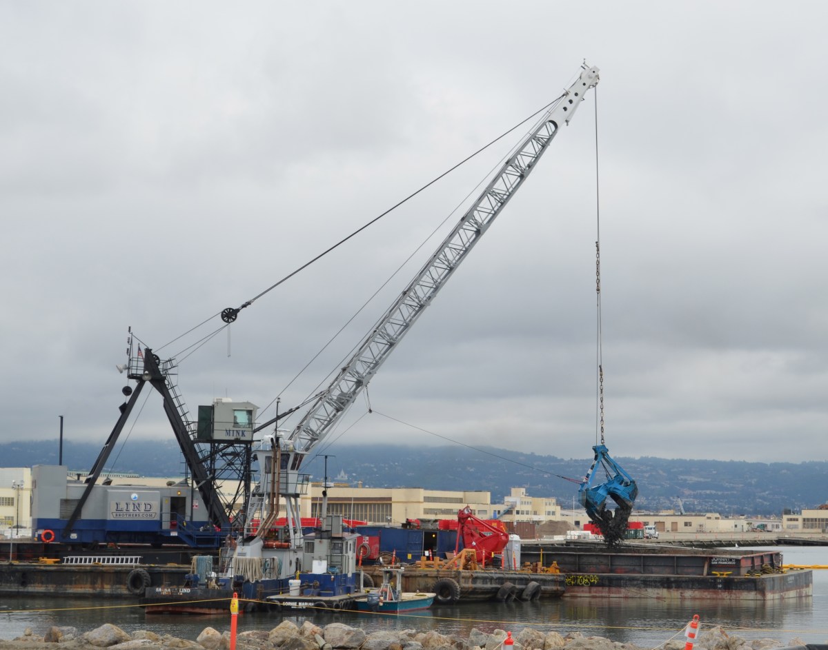
Dredging the northwest corner of the Seaplane Lagoon in February 2012.
After cleanup was completed, two years of discussions between the Navy, state and federal regulators, and the city led to an amendment to the official cleanup decision to include a detailed management plan for any future dredging in the Seaplane Lagoon. The city led the effort to create a sediment management plan. It stipulates that all dredge sediment brought to the surface will have to be spread out six inches thick on a drying pad and scanned for radium-226 radiation at a cost borne by the city.Continue reading “Radium safety enhanced at Seaplane Lagoon”
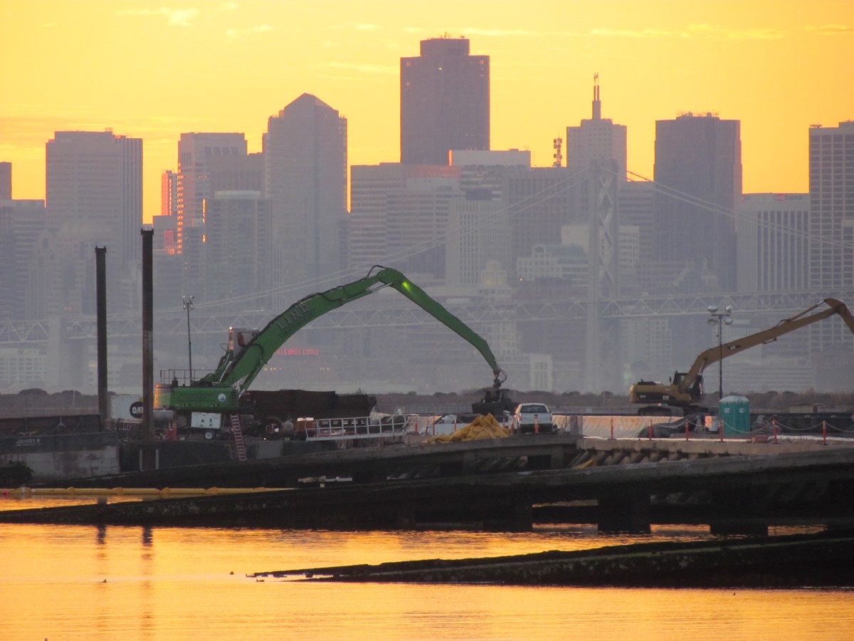
Cleanup activity at Alameda Point in 2012 started where it left off in 2011 — at the Seaplane Lagoon. The northwest corner of the lagoon was the site of the second and final phase of lagoon dredging, which targeted sediment that had been contaminated near storm drain outfalls. With dredging completed by spring, the sight of Americas Cup racing yachts arriving at their temporary dock in the lagoon seemed to be a harbinger of the approaching end of the Superfund era at the Point.
Dredging northwest corner of Seaplane Lagoon
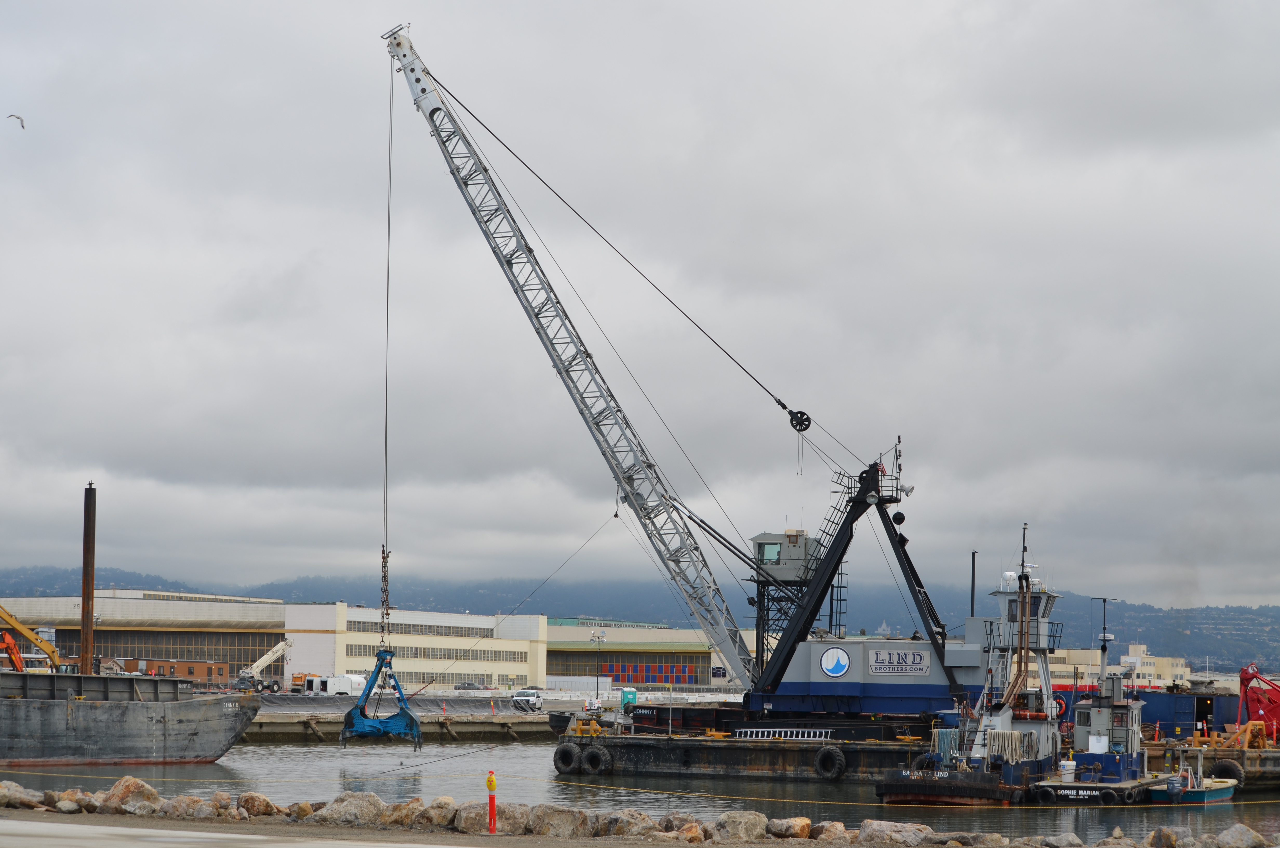
Just outside the Seaplane Lagoon, another dredging operation was started and finished at one of the maritime ship piers where the Cape Orlando had been docked. By November, the massive ship was back at dockside, hull lights glowing at night.
Dredging Pier 1 wharf area
In one of the most complicated and contaminated areas to the east of the Seaplane Lagoon, cleanup work began at an area 30 feet below ground where a cleaning solvent used on aircraft parts had seeped into the groundwater. After driving a series of metal bars down to the contaminated area, the soil, groundwater, and solvent were heated to just below simmering by means of electricity. This turned the water and solvent into vapor, which was then vacuumed out into a filtering system through a series of pipes.
Heat treatment and vapor extraction – OU-2B
At the far end of Alameda Point on the northwest landfill, the Navy relied on chemicals, rather than heat, to do the cleanup on a small portion of the site. Dozens of hoses snaking around the site to the injection wells delivered an oxidizing mixture of neutralizing chemicals into a pocket of solvents. Without this remediation, the solvents had the potential to reach the Bay.
Injecting oxidizing chemical into solvent plume – Site 1. Navy photo.
The year ends with a cloud of controversy over the Navy’s plan for leaving drain pipes under the old Naval Air Rework Facility — Building 5. Letters from both the Restoration Advisory Board (RAB) and the city call for the complete removal of any lines containing radium paint waste. The Navy ruled out a more costly alternative that would remove all the contaminated pipes. The city challenged this decision, in part, on the ground that the Navy’s cost estimates for a thorough job are inflated and have asked that they reconsider.
Building 5
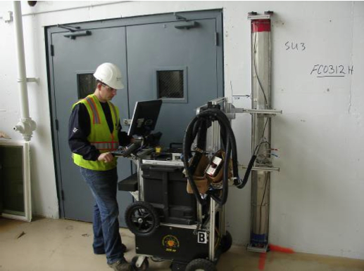
Also in Building 5, plans to remove above-ground radium contamination from floors, walls, and ceilings in the mezzanine area will get underway within weeks. This area is where aircraft dials and markers were painted with radium paint that provided visibility in the dark. A final scanning investigation to detect radium, using sophisticated equipment employed in the decommissioning of nuclear power plants, found dozens of pie-sized irregular areas where radium dust had embedded in the surfaces. This project will conclude two decades of scanning and radium removal efforts in Building 5 and other buildings. Around $50 million has already been spent replacing drain lines leading to the lagoon under the surrounding tarmac, and dredging the lagoon, due to the disposal of radium paint and other chemicals down storm drains.
Scanning a wall for radiological contamination. Navy photo.
2013
2013 will see the long-awaited final soil cover installed on the waste disposal site called Site 2 on the southwest corner of the wildlife refuge. It will be the largest engineering project since the runways were expanded in the 1950s, with over 200,000 cubic yards of clean soil being barged in from Decker Island in the Sacramento River. It will be seeded with California native flowering grasses selected by the RAB. This is the controversial dump that led the US Fish & Wildlife Service to balk at accepting the land for a wildlife refuge ten years ago. Since then, this dump has seen numerous reviews and a new plan that the US Environmental Protection Agency, regional Water Board, and state Department of Toxic Substances Control will be signing off on shortly.
Site 2 underground dump on southwest corner of Alameda Point.
2013 will end with commencement of a similar soil covering operation on the nearby landfill on the northwest corner of Alameda Point called Site 1. Both landfill areas will be safe for open space recreational activities when completed, but will be limited to hiking trails rather than mowed playing fields in order to maintain soil-stabilizing vegetation.
Northwest corner of Alameda Point where soil cover will be installed.
Environmental cleanup of the Seaplane Lagoon has centered on two areas where storm sewers drain into the lagoon. It was commonplace to discharge all sorts of chemicals down storm sewer lines prior to the passage of the federal Clean Water Act in the early 1970s. Contaminants such as PCBs, cadmium, lead, pesticides, and radium have been found in the sediment around the sewer discharge points.
Prior to dredging, sewer lines leading to the northeast and northwest corners were either replaced or flushed out. An underwater debris pile of metal and wood was also removed at the northeast corner before dredging.
The Northeast Corner
Setup for the 6.5-acre northeast dredging area began in late 2010, and dredging was completed in April of 2011. The total amount of sediment removed was 75,628 cubic yards. Even though the contamination depth was three feet, the dredging went to five feet.
Only 1,719 cubic yards of sediment were transported to hazardous waste disposal sites, of which 11 cubic yards went to a low-level radiological waste disposal site because of the radium-226. The rest of the sediment was determined to be safe enough for reuse, in large part because the contaminants were diluted by the over-dredging of clean sediment. The clean sediment has been stockpiled on the western end of the Wildlife Refuge for future use in capping the landfill disposal sites 1 and 2.
All of the drying pad materials for the northeast corner have been removed, which will allow for the fence to be moved.
The Northwest Corner
Concrete drying pad installed at northwest corner of Seaplane Lagoon
Setup for the 3.3-acre northwest corner began in October of 2011 with the construction of a concrete, waterproof drying pad. Prior to dredging, a sunken barge was demolished and removed. The barge pieces were scanned for radiation, but none was found. The 66 tons of scrap iron was sent to a recycling facility.
Dredging started on January 16 and ended on February 22. The dredging at the NW corner went much faster than the early dredging, partly because of the smaller area, and partly because of heftier dredging equipment.
Unlike the NE corner, however, the sediment here is expected to contain higher levels of radium-226 because the sewer line leading here was highly contaminated. As was the case at the NE corner, this sediment will have to dry out before being tested and disposed of. The project should be completed and everything removed by December.
The price tag for all of the Seaplane Lagoon dredging and hauling away sediment, when completed: $46 million.
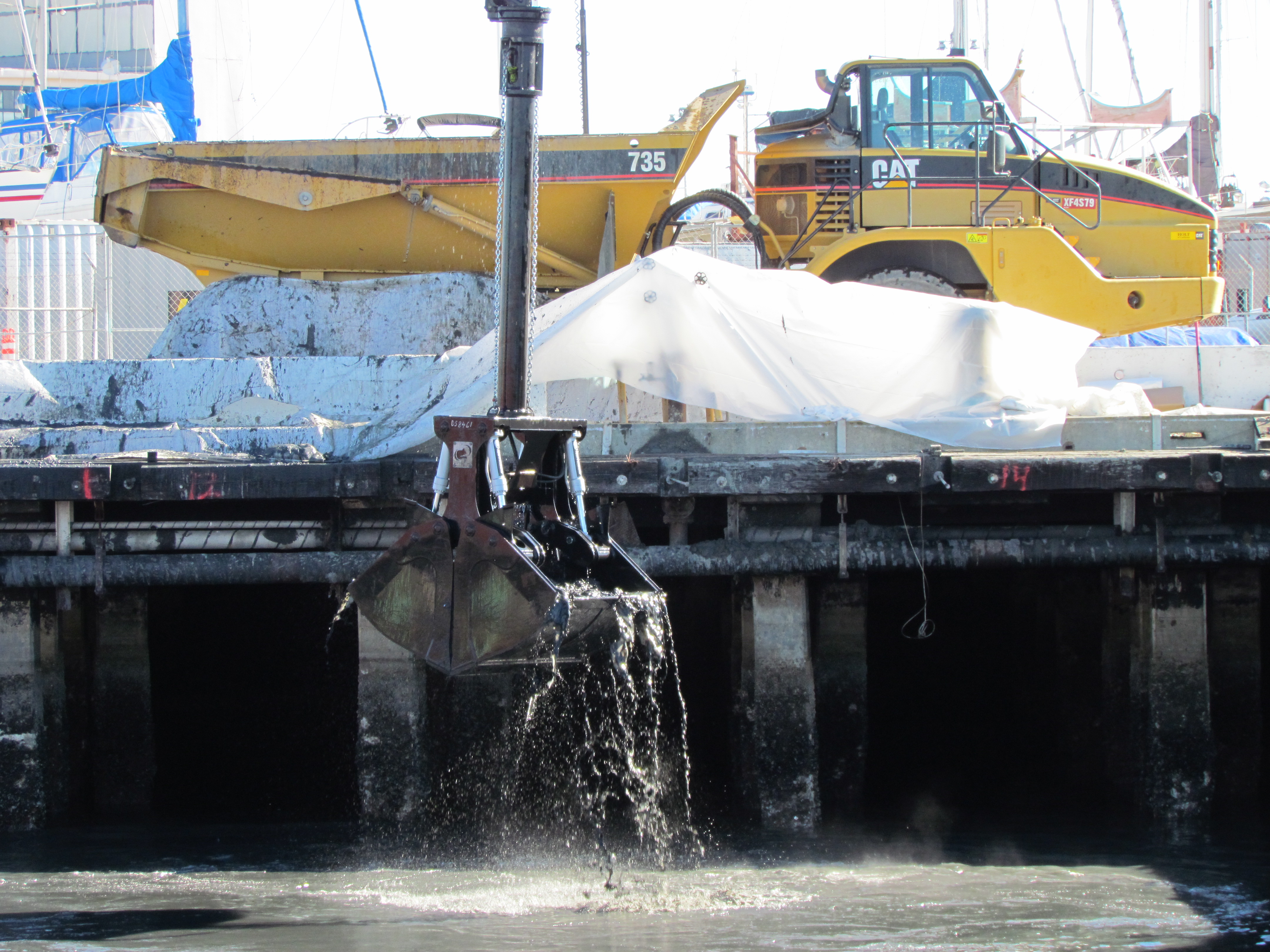
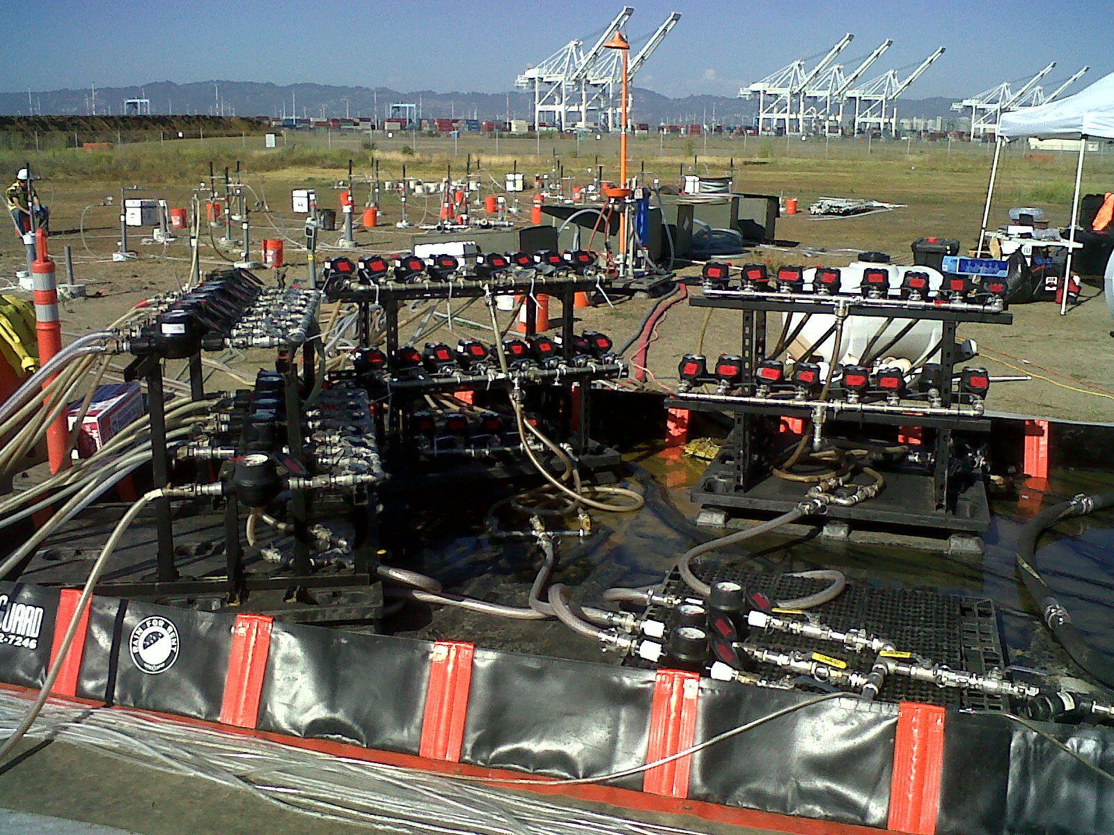
Designing the workplan for dredging toxic sediment next to Pier 1 at Alameda Point required precision so as not to undermine the stability of the concrete posts supporting the roadway that passes along the pier area. The ground under the water slopes down nearly 40 feet from the cement parking slab adjacent to Wharf Road. Six-foot sediment core samples were obtained during investigations. The varying depths of contamination were charted and used to plot a computer program showing a slope profile that not only would accomplish cleanup, but also maintain the stability of Wharf Road. This means that in some case they are dredging deeper than the contamination.
Dredging toxic mud at the pier area, in what is known as Site 24, got underway in early January 2012. The Maritime Administration had to temporarily vacate this berth. Prior Navy activities east of the pier area, which used solvents, paints, sandblasting materials, and hydrocarbons such as fuels and lubricants, led to contamination when waste products, including pesticides, were disposed of down three storm water drains. The contamination chemicals of concern are cadmium, pesticides, lead, and PCBs. The dredging process requires two methods – vacuuming mud from under the wharf road that is supported by concrete posts, and dredging with a clamshell scoop in the open water.
Vacuuming mud under roadway
Raft with dredging pump. Hose connects to 4" valve at rear for vacuum dredging under wharf.
The first stage of work, now completed, was vacuuming mud from under the roadway. The specially built dredge pump, equipped with an agitator where the hose contacts the mud, was held in position by a barge-mounted crane that was custom built for this application. The mud went through a large hose, across the roadway, into a drainage basin and into special geotextile tubes that retain the mud.
The water that drained off of the mud, however, was too muddy to immediately send to a filtration system. It was first pumped into a large above ground pool of water in order to dilute it. From there the water was pumped through a series of filtration tanks. The water is being used for dust control and can also be pumped back into the harbor.
Open water precision dredging
Open water dredging. Sediment deposited into dump truck.
The open water dredging is conducted from a barge using a special clamshell scoop that allows virtually no mud to drip out of the jaws when hoisted out of the water. This helps to minimize dispersing fine contaminated sediment in surrounding water, which could necessitate repeat dredging. The scoops of mud are held in the air for about 30 seconds to drain the water before being hoisted over to a dump truck. The trucks are driven a few hundred yards to a special drying pad to dump the mud. As the dredge barge moves out of arms length of the wharf, it will have to deposit the mud in a hopper barge that will then be moved next to the wharf where the mud will be unloaded and put into the dump trucks.
Yellow boom holding turbidity curtain to contain disturbed mud, with raft containing turbidity sensors.
The operator of the dredging rig has a real time computer picture of the contour of the underwater ground surface. The image is aided by positioning sensors on the scoop. This allows the operator to follow precisely the slope design. There is also a floating curtain to keep any disturbed contamination within the work area. At the curtain boom and outside the work area are two floating rafts that detect turbidity, or muddiness, in the water. These rafts send real time measurements to the dredge operator. If the turbidity exceeds a certain limit, the dredging is temporarily halted.
Although the Navy periodically dredged the berthing areas for ship and submarine access when the base was open, their dredging was not able to get close to the wharf or under it, leaving the current legacy of contamination. In the health risk assessment conducted by the Navy, they used the Least Tern as an indicator species since they are the most sensitive birds to forage here, and protecting them would therefore protect all other birds. Fish consumption by humans was also used to determine that remediation was warranted. The investigation process that led to this dredging project began with sediment core samples collected in 2005 and 2006. About 4,000 cubic yards of mud will be dredged.
The past year had some high points and low points in the cleanup process at Alameda Point. Added delays, including a pile-driving surprise, were balanced out by steady progress.
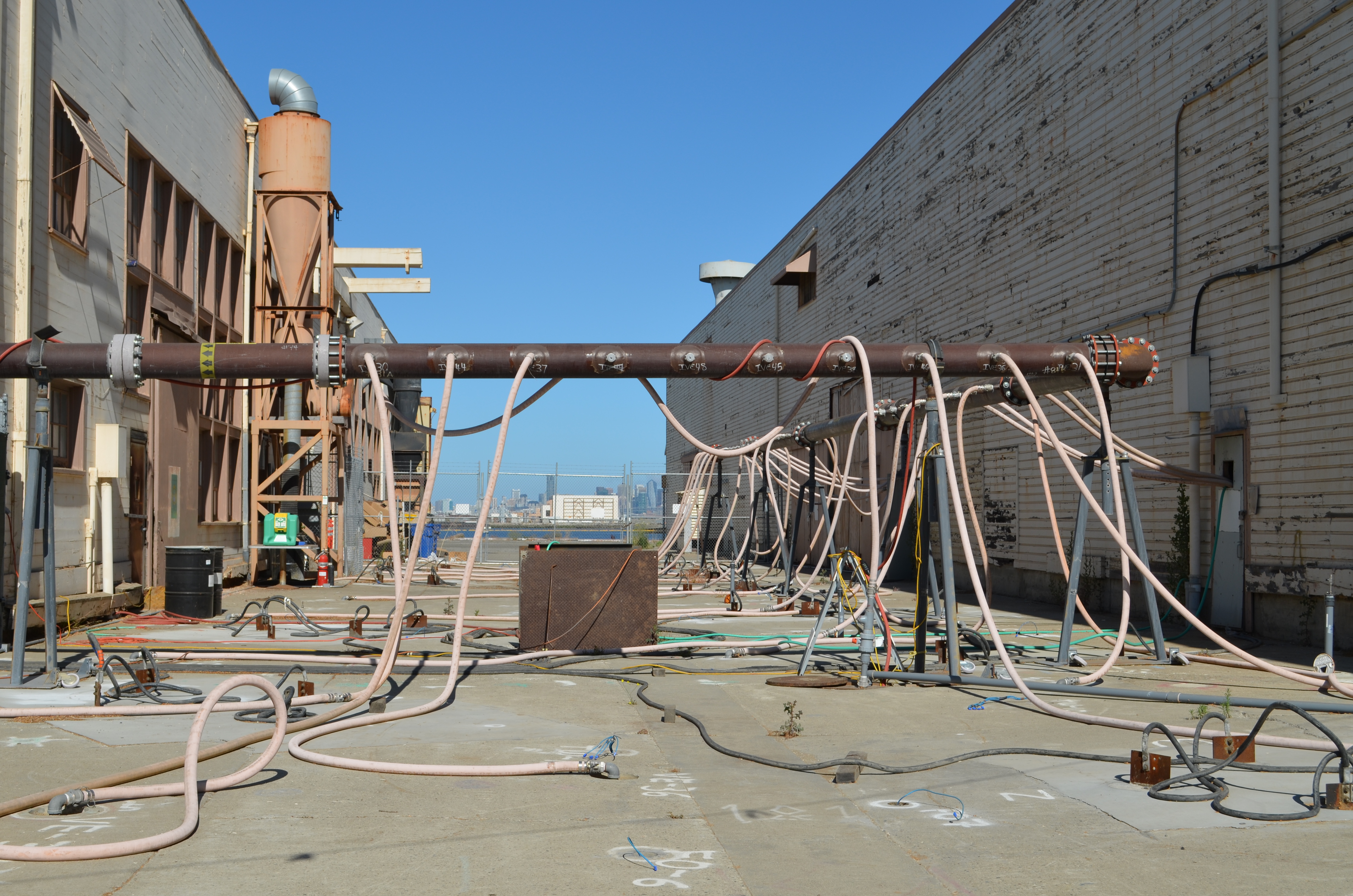
The year saw, among other things, completion of a second Point-wide radiological survey of buildings and structures that identified two building interiors needing radium remediation, a new soil scan for radium on a section of the western runway area, replacement of a storm drain segment next to the Seaplane Lagoon, and preparation of the environmental document for the Berkeley Lab site, which will be useful whether we get the Lab or not.
Northwest Territories - Site 1 dump area, partly covered by runway
The contractor preparing to cover the old dump with rocks and soil at the northwest tip of Alameda Point delivered some embarrassing news to the Navy. In the normal course of their duties, work-plan design testing revealed that the shape of part of the contamination did not match the official description. You would think they could just process a work-order change. But the Superfund law requires an additional two-year review process, which will push the completion of this open space opportunity to 2015.
At another cleanup project, the Navy drove over four dozen 30-foot steel electrodes into the ground to heat up the toxins and capture the vapor. But before turning on the electricity, the contractor discovered they had hit a sewer line. The project has since been idle for months awaiting a decision on how to proceed.
Seaplane Lagoon dredge dewatering pad - northwest corner
The big Seaplane Lagoon dredging project that began in January is certainly one of the most dramatic displays of cleanup. Both the northeast and northwest corners of the lagoon were supposed to have been dredged by April and final soil disposal completed by year’s end. But the contractor failed to meet the deadline and was let go. A new contractor has been testing and removing existing soil, as well as doing extensive set-up over the past two months for the dredging of the northwest corner that will begin in January.
Another dredging project has just begun under the dock area next to the maritime ships. They’re removing mud contaminated from two storm drain lines. That project is on schedule. It’s worth visiting the area to get a glimpse of the elaborate engineering needed to capture and clean water runoff from the mud.
Shinsei Gardens low-income housing located above ongoing groundwater cleanup
Less dramatic and seldom seen work is always ongoing. Groundwater is monitored at cleanup sites to ensure cleanup goals are being met. One example is the monitoring of the removal of benzene and naphthalene under Shinsei Gardens and vicinity.
Evidence of the Petroleum Program is also seldom seen, other than some white PVC pipes in the ground. But besides the big fuel extraction projects, there is ongoing testing of pipelines and oil/water separators in order to develop a remedial plan.
Finally, and perhaps most important, getting the first, very large, no-cost land conveyance from the Navy next year appears to be on schedule. To help make it happen, the Navy and regulators are planning on modifying cleanup goals by enacting restrictions against future ground-floor residential development near the east entrance to Alameda Point.
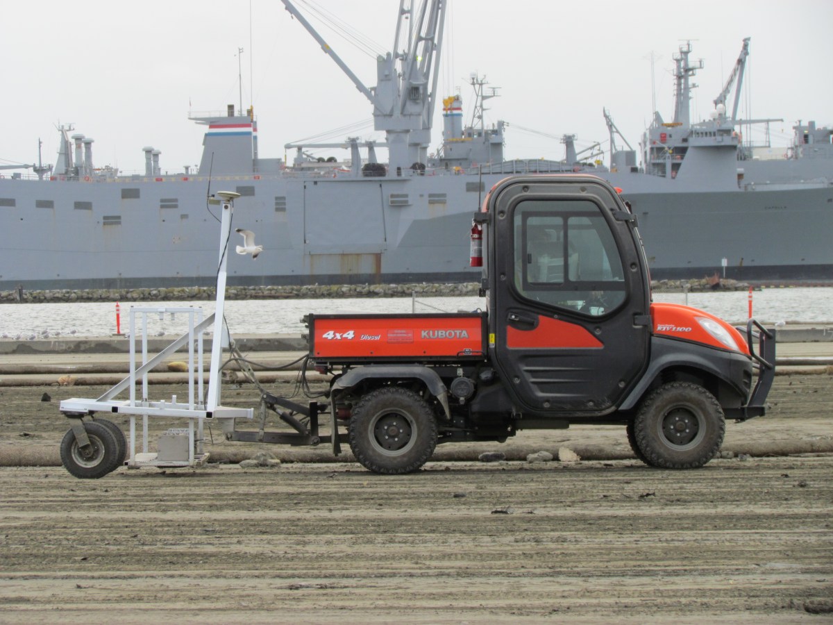
Radiation scanner with Seaplane Lagoon in backgroundTesting compartments for metals, PCBs, and DDT
Every scoop of dirt that was dredged from the Seaplane Lagoon earlier this year is first sorted into premeasured compartments. The piles are then tested for heavy metals, PCBs, and pesticides. But the piles cannot be tested for radium 226.
In order to test for radium, every pile has to be scooped back into a dump truck, dumped into a screening area the size of a tennis court, and graded smooth to a depth no greater than 12 inches.
Grading soil for the radiation scanner
Then an electric vehicle with a scanning rig and GPS mapping system drives back and forth over every inch at the pace of a turtle. If any radiation is detected, it is mapped onto a computer, and then this area is scooped up and placed in a special dumpster. This already time-consuming process was slowed even more with unexpected rains in the fall because the soil cannot be scanned for radiation when it’s wet.
There are no final numbers on how many dumpster loads have gone to a radiological disposal facility. Most of the other soil, however, that was tested for heavy metals, PCBs, and pesticides is not even leaving Alameda Point —it now meets screening standards for clean soil, and it’s being hauled out to the runway area to eventually be reused to cover the old dump known as Site 2.
Recycled soil stockpiled on Wildlife Refuge for use on Site 2 dump.
2012 – More Dredging
When the existing piles of dirt are all gone in a few weeks, it might seem like they are finally done. But they won’t be. In January, the second phase of dredging begins on the northwest corner of the Seaplane Lagoon.


![Seaplane Lagoon cleanup dredging completed [video and slideshow]](https://alamedapointenviro.com/wp-content/uploads/2012/03/img_9647.jpg?w=1200)