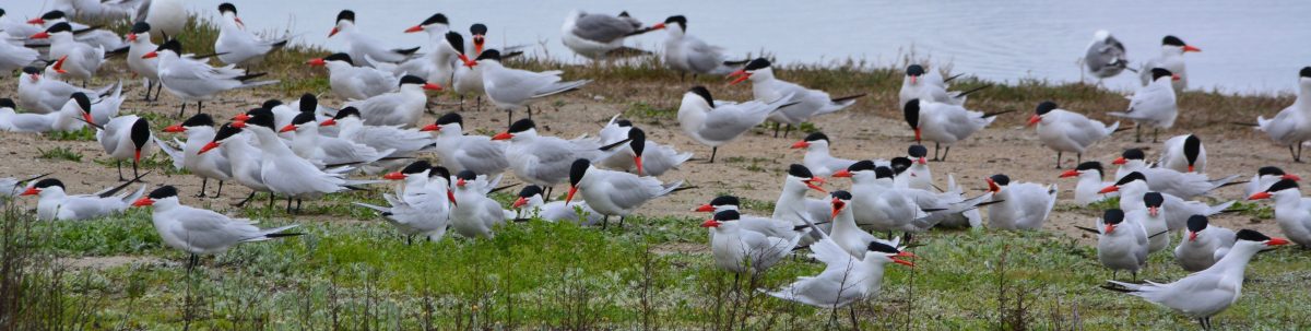
The City of Alameda became the new owner of the Seaplane Lagoon at Alameda Point on April 13, 2016. It came from the Navy with a new condition that exceeds normal protocols for dredging in San Francisco Bay.
As with all cleanup sites, the Navy, city and regulators agreed to what areas needed to be cleaned up in the Seaplane Lagoon. The cleanup plan approved in 2006 was based on testing the sediment throughout the 110-acre lagoon. The problem areas were confined to about 10 acres at the northeast and northwest corners of the lagoon where storm sewers dumped contaminants prior to 1970s environmental laws. The agreed upon plan said that there would be no restrictions on the lagoon when cleanup was done.
Dredging the northwest corner of the Seaplane Lagoon in February 2012.
After cleanup was completed, two years of discussions between the Navy, state and federal regulators, and the city led to an amendment to the official cleanup decision to include a detailed management plan for any future dredging in the Seaplane Lagoon. The city led the effort to create a sediment management plan. It stipulates that all dredge sediment brought to the surface will have to be spread out six inches thick on a drying pad and scanned for radium-226 radiation at a cost borne by the city.Continue reading “Radium safety enhanced at Seaplane Lagoon”
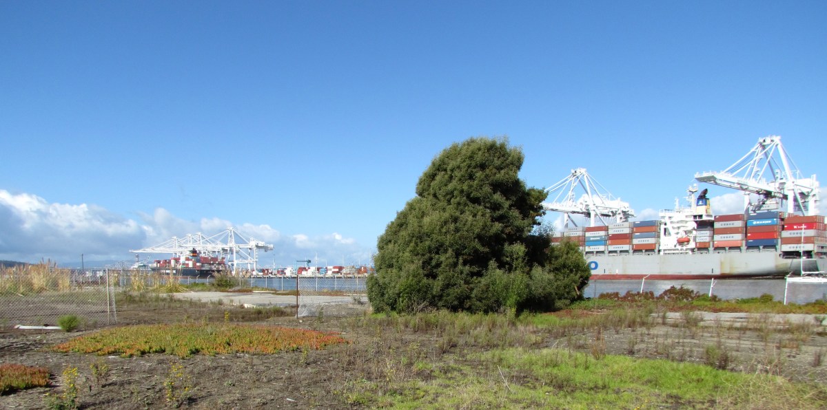
The 4.18-acre cleanup Site 34 in the old runway area next to the Oakland estuary looks barren from a distance. But up close there are concrete slabs and pavement, reminders of its bygone days as a bustling workshop area.
This area was once part of the division known as the Naval Air Rework Facility (NARF). Everything from sandblasting and painting, to metal working, woodworking, and scaffold maintenance went on out there. More than 40 years of activity left soil around buildings contaminated with lead, arsenic, pesticides, PCBs, and aircraft and diesel fuel. Above ground fuel storage tanks and electrical transformers contributed to the contamination.
The Navy will clean up the soil in this area next year. Their draft work plan, which will be released on July 31, was discussed during a Navy presentation at the July 2012 Restoration Advisory Board (RAB) meeting.
Site 34 aerial view. Old fuel dock to left of site. Runway at bottom is part of area where antiques faire is held. Navy photo/graphic.
Based on more than 200 soil samples taken in prior years and this year, the contractor created the draft work plan. Separate groundwater samples indicate contamination from the solvent trichloroethane. No remedial action is being taken on the trichloroethane, however, because 1) vapor intrusion into residences is not a factor, as this land will become Public Trust Land on which housing is not permitted; and 2) water monitoring has shown that the chemical is not migrating toward the estuary.
The northern edge of this site is part of the early westward land extension of Alameda, which allowed trains carrying freight and passengers to get out to a point where the water was deep enough for ferry connections. More fill was later added to the area. According to the Navy’s Remedial Investigation report, “In the 1920s, most of IR Site 34 was filled with estuary dredging material during construction of the Posey Tube.”
Site 34 starts at concrete slab on far side of tree. Port of Oakland on right. In late 1800s and early 1900s, trains travelled on tracks along the estuary where tree and slab are.
By the time the closure of the Navy base was announced in 1993, this workshop area had 12 buildings, 7 aboveground storage tanks, 2 “generator accumulation points” (waste storage), 15 transformers, and over 7,000 feet of aviation fuel line. Between 1996 and 2000 everything except the concrete pads and pavement was removed.
Building demolitions ended shortly after Alameda Point became a Superfund site in July 1999. The Superfund program, officially called the Comprehensive Environmental Response, Compensation, and Liability Act (CERCLA), does not allow for land improvements such as building demolition.
Most of the soil cleanup locations are adjacent to the exterior edges of old building slabs. Much of the lead in the soil came from sandblasting lead-based paint. Other contamination came from lubricants used for metals fabrications, and the use of oils and solvents for woodwork and metal work. In addition to removing soil next to the slabs, the contractor will dig under the slabs at the hot spots to take what is called a sidewall sample to confirm that all contaminated soil is removed. They have to keep digging as long as contamination is found. Clean soil will be brought in to the areas where soil is removed.
A strip of coastal marshland running along the Oakland Estuary on the north end of the site has no contamination. Its habitat quality, however, is marred by discarded concrete, wood, and trash. It will be up to the city to initiate wetlands restoration efforts there.
Coastal marsh on Oakland estuary at Alameda Point Site 34. Port of Oakland on left. Old runway area on right. Looking east toward Alameda Main Ferry Terminal.
A 60-day public comment period on the work plan begins when it’s released on July 31. The work plan will be finalized in January 2013. Fieldwork is anticipated to take place January through April 2013.
Site 34, located in the Northwest Territories, is expected to be given to the City of Alameda in 2014.
Designing the workplan for dredging toxic sediment next to Pier 1 at Alameda Point required precision so as not to undermine the stability of the concrete posts supporting the roadway that passes along the pier area. The ground under the water slopes down nearly 40 feet from the cement parking slab adjacent to Wharf Road. Six-foot sediment core samples were obtained during investigations. The varying depths of contamination were charted and used to plot a computer program showing a slope profile that not only would accomplish cleanup, but also maintain the stability of Wharf Road. This means that in some case they are dredging deeper than the contamination.
Dredging toxic mud at the pier area, in what is known as Site 24, got underway in early January 2012. The Maritime Administration had to temporarily vacate this berth. Prior Navy activities east of the pier area, which used solvents, paints, sandblasting materials, and hydrocarbons such as fuels and lubricants, led to contamination when waste products, including pesticides, were disposed of down three storm water drains. The contamination chemicals of concern are cadmium, pesticides, lead, and PCBs. The dredging process requires two methods – vacuuming mud from under the wharf road that is supported by concrete posts, and dredging with a clamshell scoop in the open water.
Vacuuming mud under roadway
Raft with dredging pump. Hose connects to 4" valve at rear for vacuum dredging under wharf.
The first stage of work, now completed, was vacuuming mud from under the roadway. The specially built dredge pump, equipped with an agitator where the hose contacts the mud, was held in position by a barge-mounted crane that was custom built for this application. The mud went through a large hose, across the roadway, into a drainage basin and into special geotextile tubes that retain the mud.
The water that drained off of the mud, however, was too muddy to immediately send to a filtration system. It was first pumped into a large above ground pool of water in order to dilute it. From there the water was pumped through a series of filtration tanks. The water is being used for dust control and can also be pumped back into the harbor.
Open water precision dredging
Open water dredging. Sediment deposited into dump truck.
The open water dredging is conducted from a barge using a special clamshell scoop that allows virtually no mud to drip out of the jaws when hoisted out of the water. This helps to minimize dispersing fine contaminated sediment in surrounding water, which could necessitate repeat dredging. The scoops of mud are held in the air for about 30 seconds to drain the water before being hoisted over to a dump truck. The trucks are driven a few hundred yards to a special drying pad to dump the mud. As the dredge barge moves out of arms length of the wharf, it will have to deposit the mud in a hopper barge that will then be moved next to the wharf where the mud will be unloaded and put into the dump trucks.
Yellow boom holding turbidity curtain to contain disturbed mud, with raft containing turbidity sensors.
The operator of the dredging rig has a real time computer picture of the contour of the underwater ground surface. The image is aided by positioning sensors on the scoop. This allows the operator to follow precisely the slope design. There is also a floating curtain to keep any disturbed contamination within the work area. At the curtain boom and outside the work area are two floating rafts that detect turbidity, or muddiness, in the water. These rafts send real time measurements to the dredge operator. If the turbidity exceeds a certain limit, the dredging is temporarily halted.
Although the Navy periodically dredged the berthing areas for ship and submarine access when the base was open, their dredging was not able to get close to the wharf or under it, leaving the current legacy of contamination. In the health risk assessment conducted by the Navy, they used the Least Tern as an indicator species since they are the most sensitive birds to forage here, and protecting them would therefore protect all other birds. Fish consumption by humans was also used to determine that remediation was warranted. The investigation process that led to this dredging project began with sediment core samples collected in 2005 and 2006. About 4,000 cubic yards of mud will be dredged.
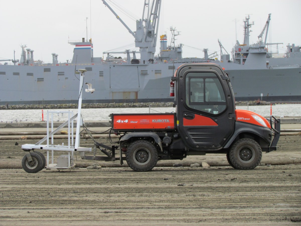
Radiation scanner with Seaplane Lagoon in backgroundTesting compartments for metals, PCBs, and DDT
Every scoop of dirt that was dredged from the Seaplane Lagoon earlier this year is first sorted into premeasured compartments. The piles are then tested for heavy metals, PCBs, and pesticides. But the piles cannot be tested for radium 226.
In order to test for radium, every pile has to be scooped back into a dump truck, dumped into a screening area the size of a tennis court, and graded smooth to a depth no greater than 12 inches.
Grading soil for the radiation scanner
Then an electric vehicle with a scanning rig and GPS mapping system drives back and forth over every inch at the pace of a turtle. If any radiation is detected, it is mapped onto a computer, and then this area is scooped up and placed in a special dumpster. This already time-consuming process was slowed even more with unexpected rains in the fall because the soil cannot be scanned for radiation when it’s wet.
There are no final numbers on how many dumpster loads have gone to a radiological disposal facility. Most of the other soil, however, that was tested for heavy metals, PCBs, and pesticides is not even leaving Alameda Point —it now meets screening standards for clean soil, and it’s being hauled out to the runway area to eventually be reused to cover the old dump known as Site 2.
Recycled soil stockpiled on Wildlife Refuge for use on Site 2 dump.
2012 – More Dredging
When the existing piles of dirt are all gone in a few weeks, it might seem like they are finally done. But they won’t be. In January, the second phase of dredging begins on the northwest corner of the Seaplane Lagoon.