Environmental cleanup reaches milestones as work continues

The Seaplane Lagoon’s north side will be looking like its old self in a few months. The Navy has begun dismantling the waterproof concrete-walled containment system that was used for three years for dewatering and testing of soil dredged from the Seaplane Lagoon, marking a major cleanup milestone. Prior to that dredging work, much of the lagoon’s north frontage served as a staging area for replacement of storm drain lines contaminated with radium-226.

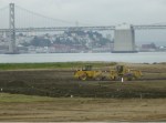
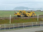
Construction of a new and improved soil cover over a waste disposal site concluded this spring, marking another milestone. The 110-acre site on the southwest corner of Alameda Point took 10 years of haggling about potential environmental impacts before a cleanup plan was adopted in 2010. Work began in early 2013. The dome-shaped soil cover required 500,000 cubic yards of barged-in soil to complete.
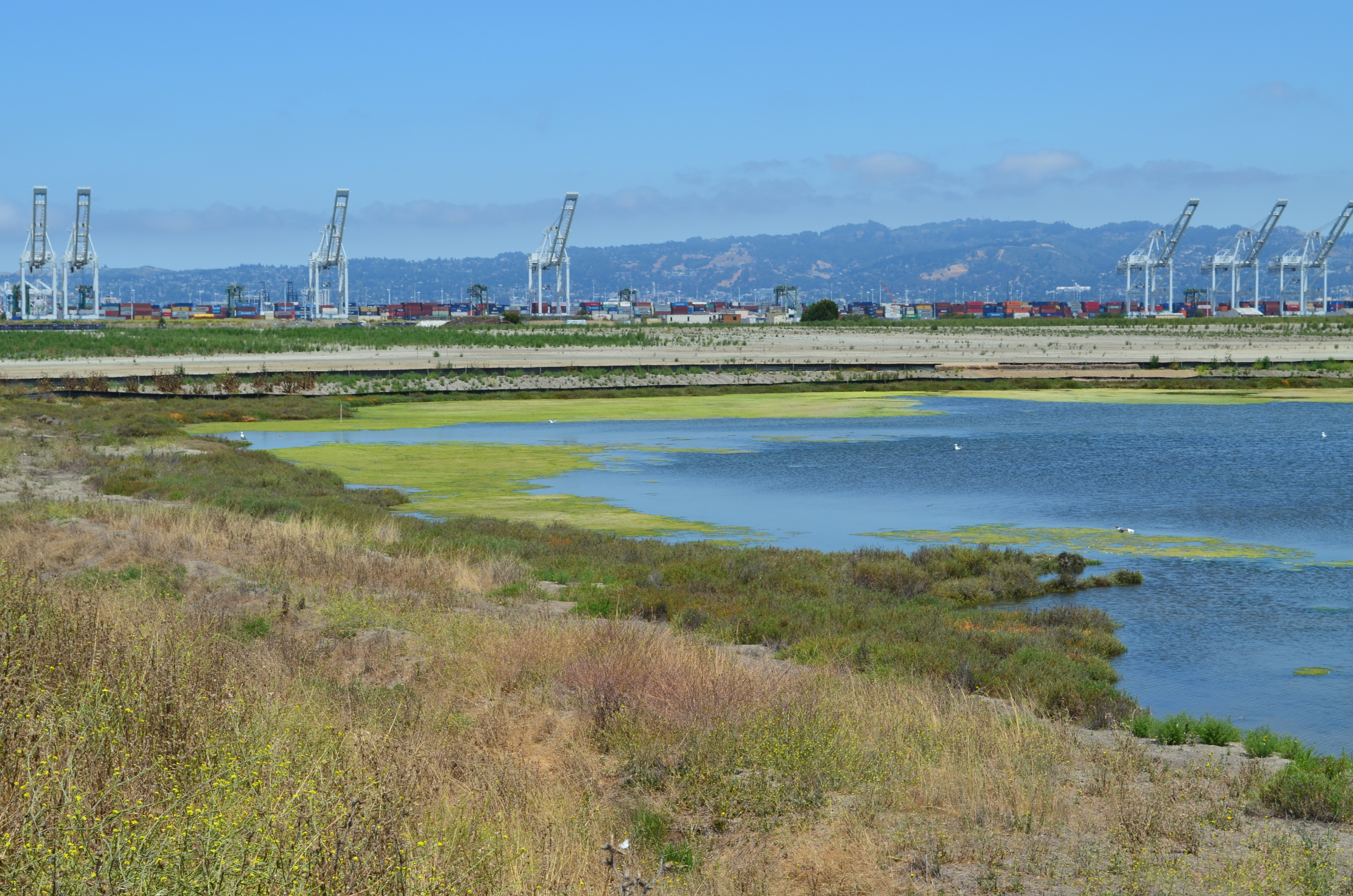
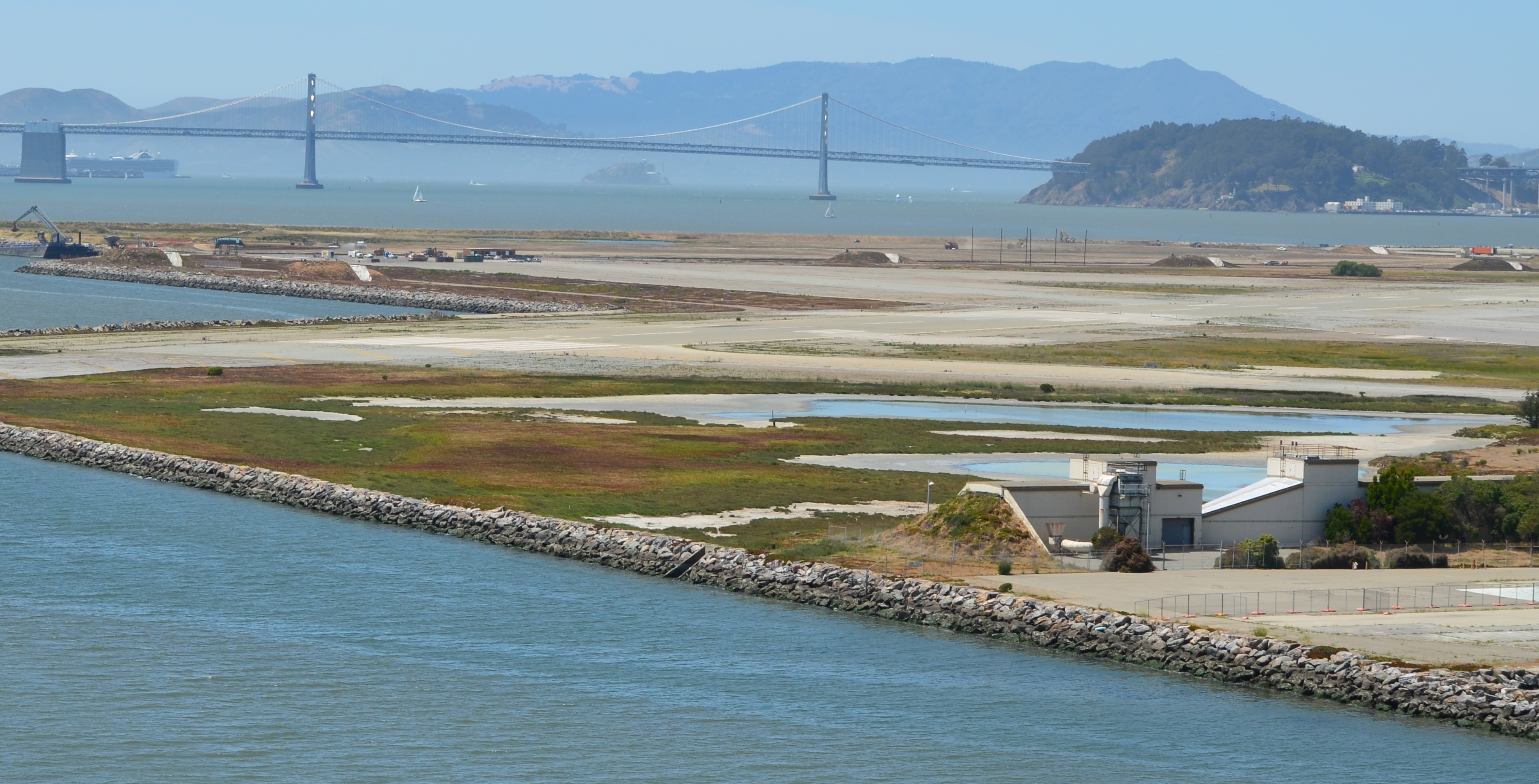
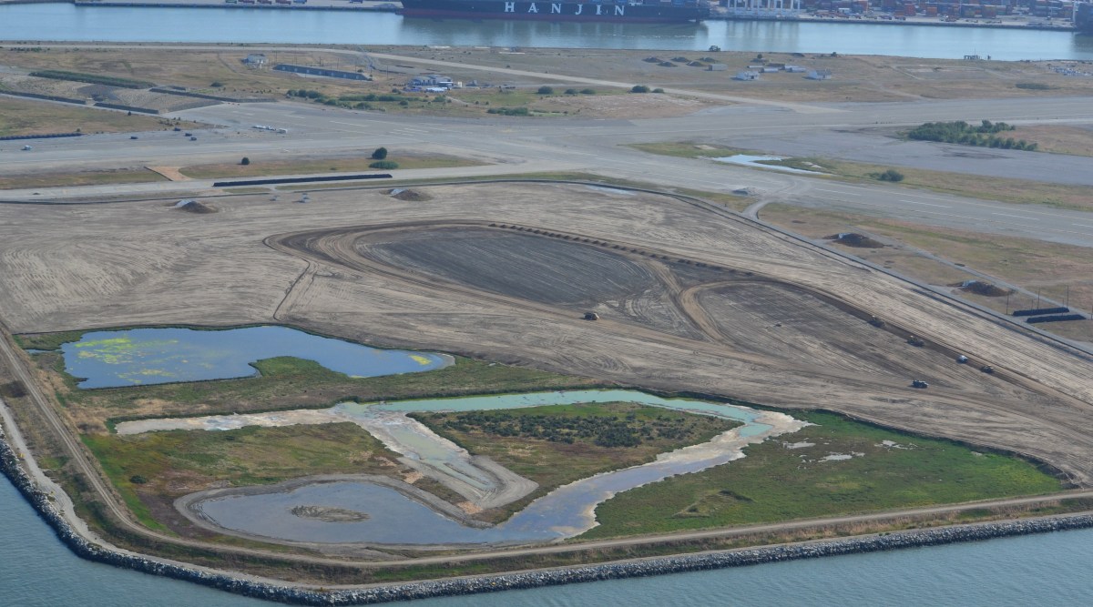
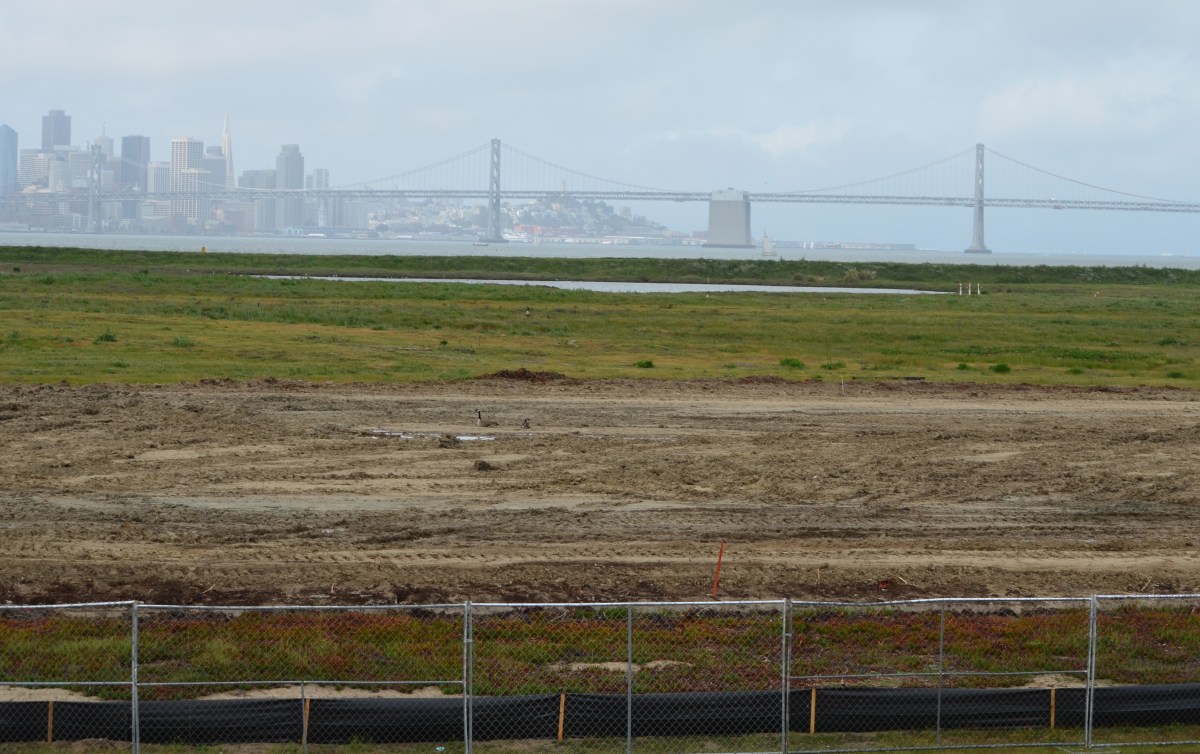
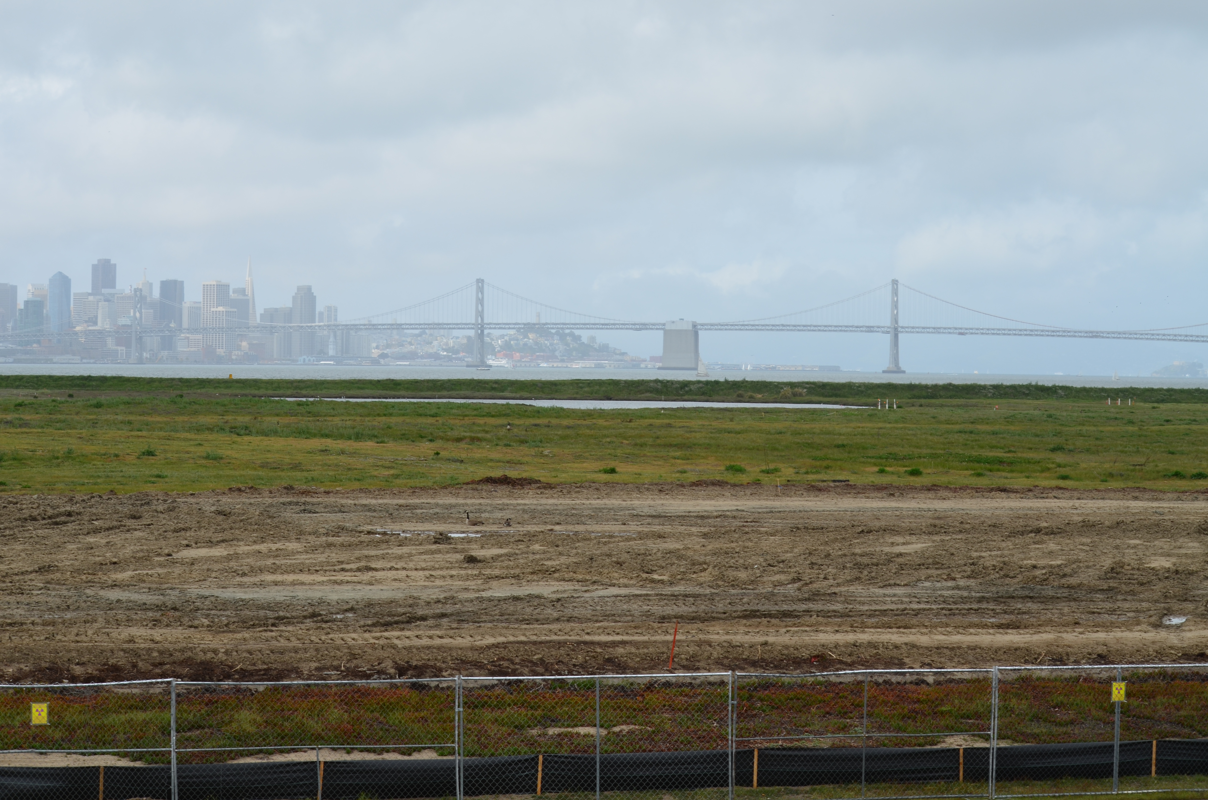
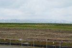
North Pond of West Wetland on southwest corner of Alameda Point.  Pond is connected to San Francisco Bay via a new culvert near upper left of pond.  Landfill soil cover is partially visible on far side of pond and will be seeded with flowering native grasses later this year.
North Pond of West Wetland on southwest corner of Alameda Point. Pond is connected to San Francisco Bay via a new culvert near upper left of pond. Landfill soil cover is partially visible on far side of pond and will be seeded with flowering native grasses later this year.

At the far northwestern corner of the Point, work is about to begin on another long studied and analyzed waste disposal site. In a few months, the Navy will be installing an interlocking steel retaining wall along 200 yards of the Bay shoreline to contain contaminated burned waste material that was bulldozed into the Bay more than a half century ago. Water dye tests showed no toxics are leaching into the Bay, but members of the Restoration Advisory Board (RAB) questioned whether the barrier would withstand a catastrophic earthquake. Partially covered by runway pavement, the entire 30-acre site will receive a three-foot soil cover. The work is expected to be completed in 2015. The area will be available for passive recreational use such as hiking trails when the city receives the land.
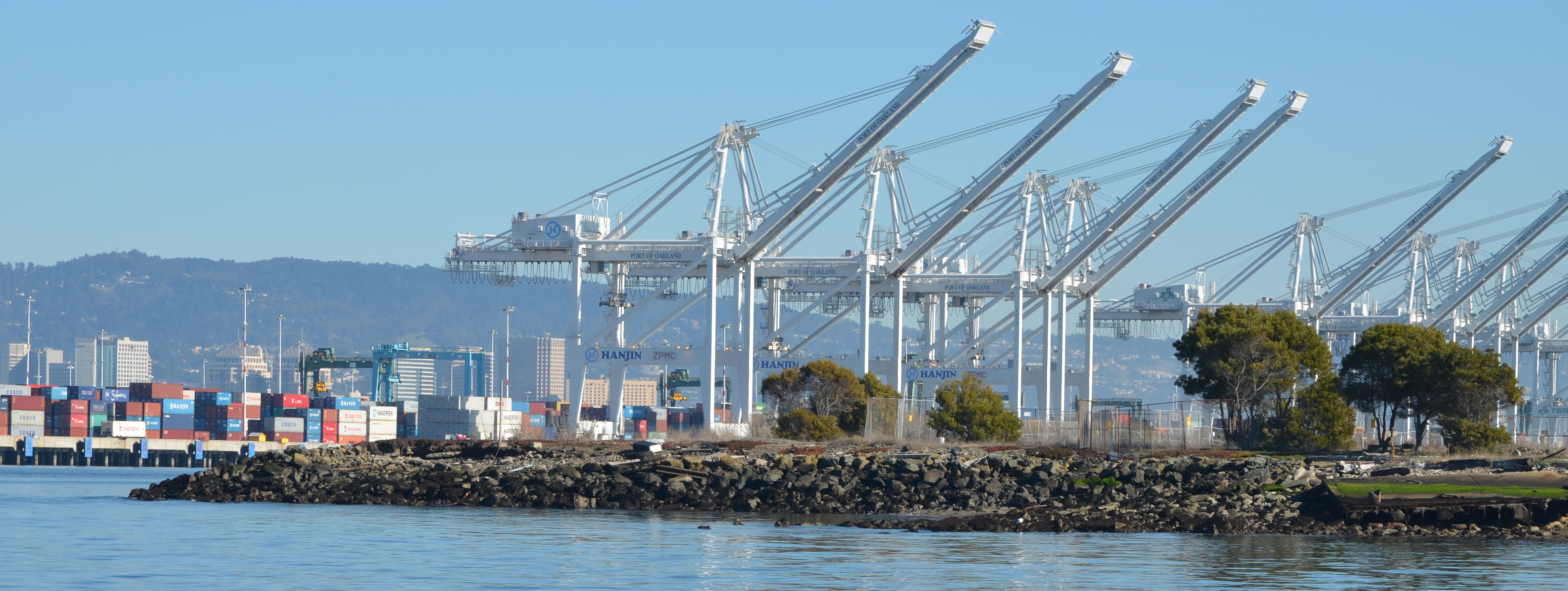
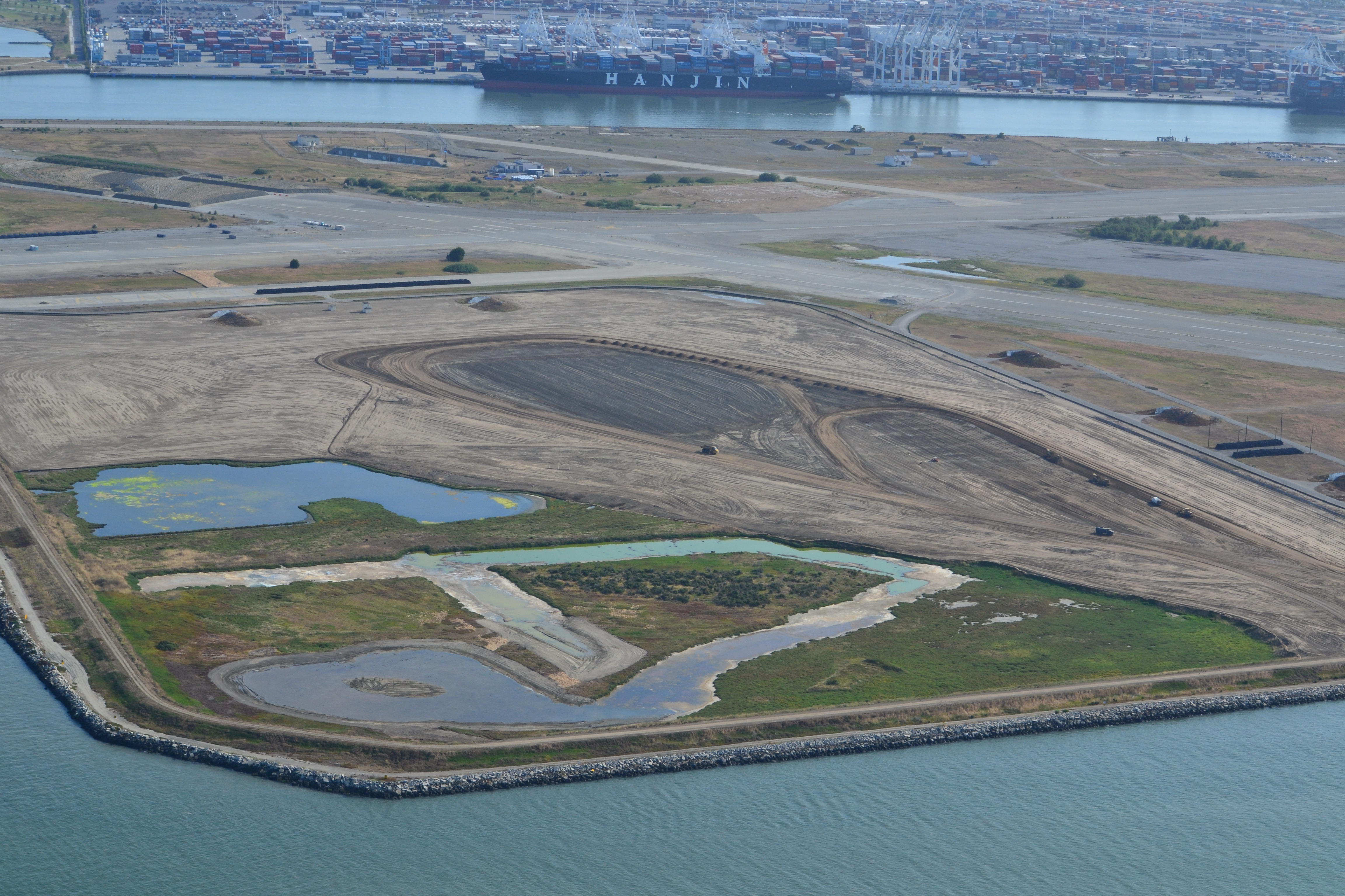
Northwest tip of Alameda Point where Site 1 is located.  Waste burning area is here.  Trees have been removed.  Port of Oakland is in background.
Northwest tip of Alameda Point where Site 1 is located. Waste burning area is here. Trees have been removed. Metal retaining wall will go here.  Port of Oakland is in background.

One of the longest-running and most problematic cleanup sites is at the old Naval Air Rework Facility (NARF), also known as Building 5, covering nearly one million square feet. Radium paint used for aircraft dial painting, and chemicals associated with engine repair work led to contamination that is still being remediated. The entire floor area will be scanned again for radiation in 2015, following up on at least three prior scanning surveys of walls, ceilings, pipes, and ducts. The year 2015 will also see the Navy returning to the site for a final round of groundwater cleanup treatments targeting contamination remaining after an intensive cleanup effort a decade ago.
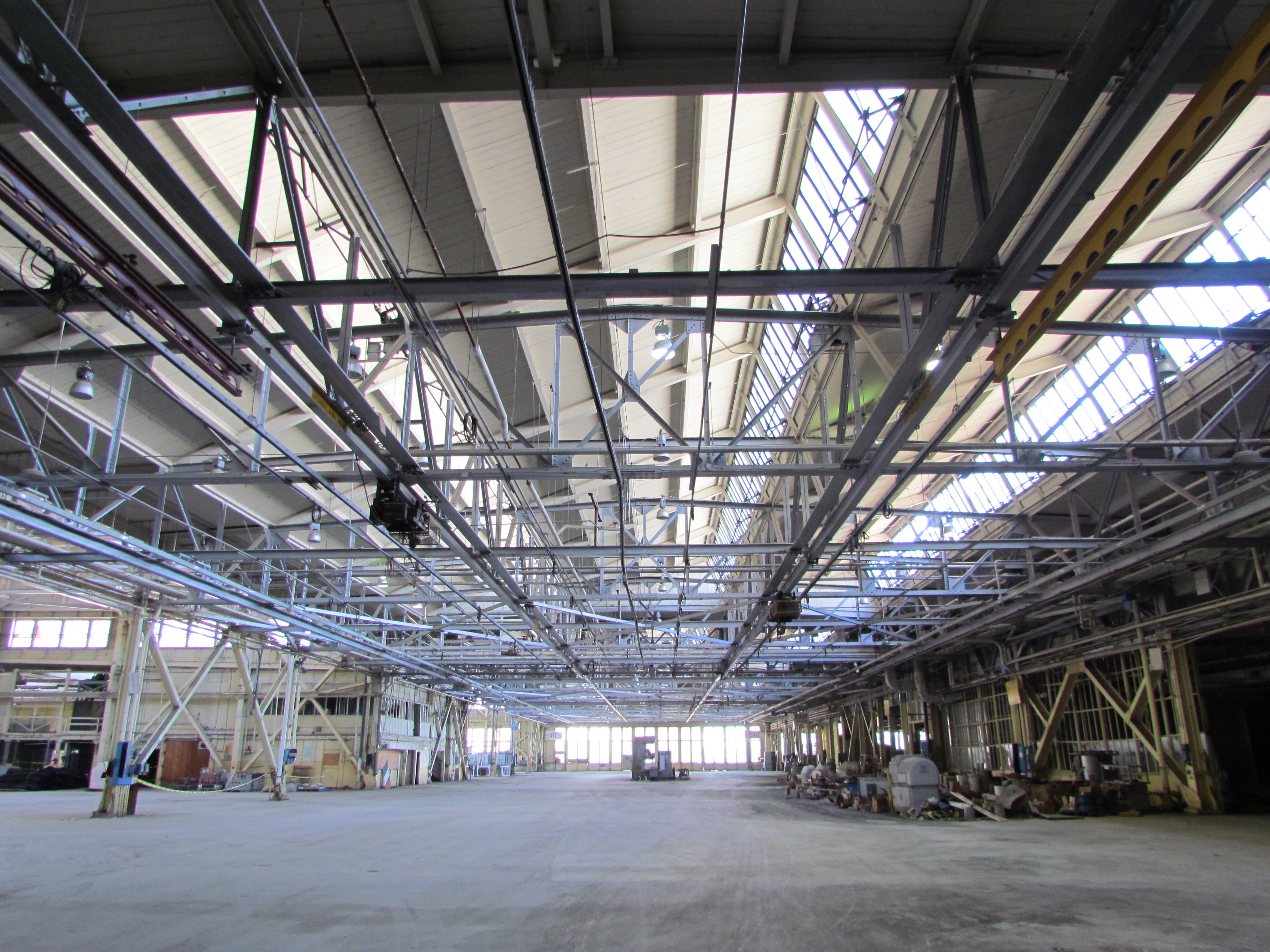
Building 5, also known as Naval Air Rework Facility (NARF), where additional radium-226 and groundwater cleanup is planned.  At the corner of West Tower Avenue and Monarch Street.
Building 5, also known as Naval Air Rework Facility (NARF), where additional radium-226 and groundwater cleanup is planned. At the corner of West Tower Avenue and Monarch Street.

Next door to the Bladium Sports Club on West Tower Avenue, another previously treated groundwater cleanup site will be treated again. Workers have already begun boring holes in the pavement for a network of hoses that will be used for introducing contaminant-eating bacteria into groundwater along with a bacteria food source.

On Saturday, July 12, the Navy’s annual cleanup site tour visited four of the cleanup areas. The most impressive stop was the 110-acre landfill site mentioned above. For the first time in over 15 years, members of the public were allowed to walk around and enjoy the magnificent views from the embankment that is closer to San Francisco than to city hall. The fencing is all gone, and with it the radiological warning signs. The Navy replaced an aging metal culvert that connects the site’s North Pond to San Francisco Bay with a concrete culvert.
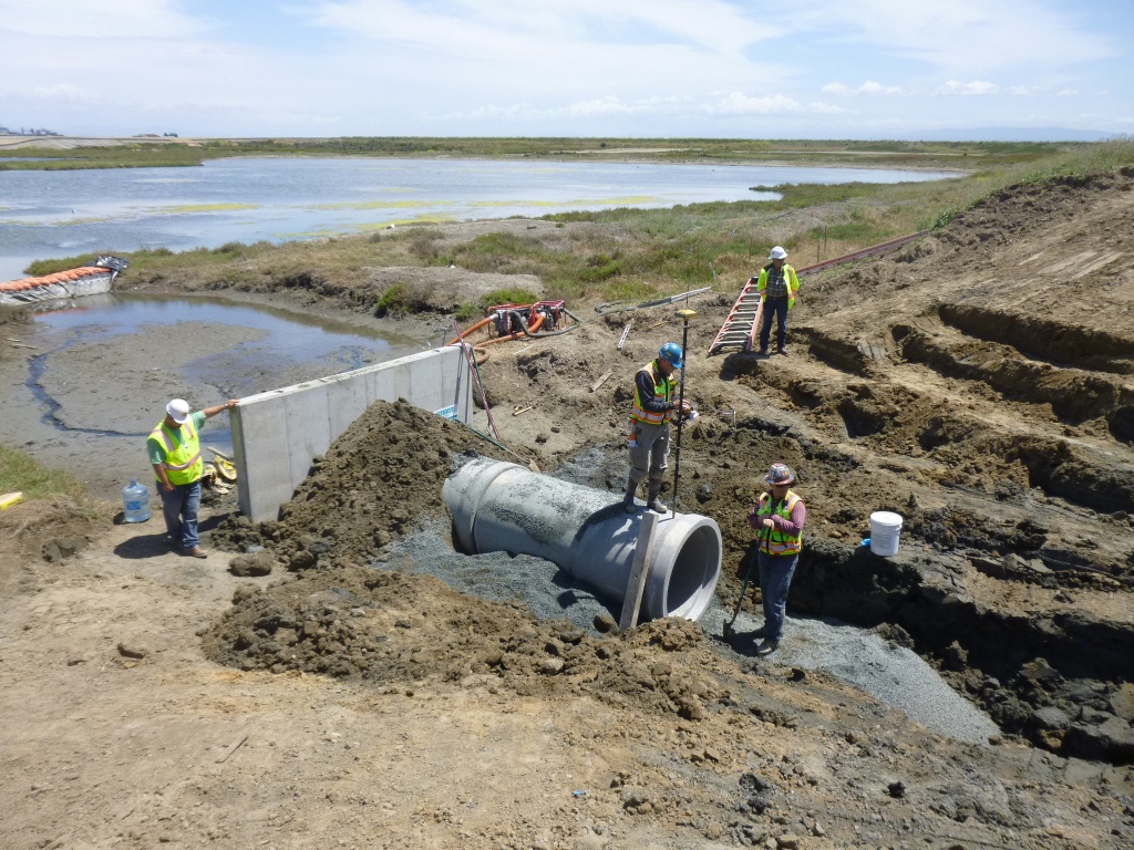
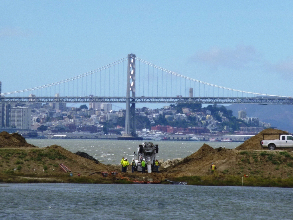
New culvert being installed connecting San Francisco Bay, which is to the right, and North Pond of the West Wetland at Alameda Point.  Navy photo taken 5/22/14.
New culvert being installed connecting San Francisco Bay, which is to the right, and North Pond of the West Wetland at Alameda Point. Navy photo taken 5/22/14.
New culvert being installed.  North Pond of West Wetland at Alameda Point in foreground, San Francisco Bay in background.  Navy photo.
New culvert being installed. North Pond of West Wetland at Alameda Point in foreground, San Francisco Bay in background. Navy photo.

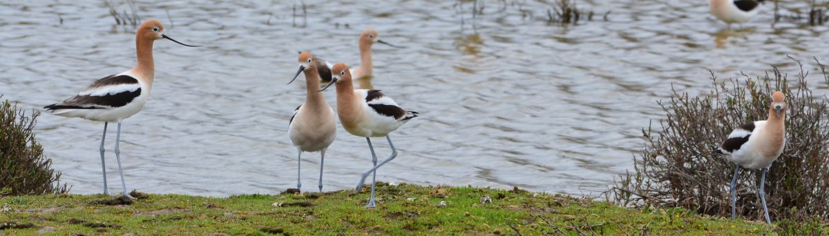
Tour participants were able to see the area’s expanded wetland with a new tiny island. Caspian Terns started nesting on the island a few months ago, another type of milestone. “The last time Caspian Terns were seen in that area nesting was in 1999 when only one nest was detected,” said Alameda wildlife biologist and Alameda Point bird surveyor Leora Feeney. The 79-acre soil cover on the landfill will be seeded with flowering native grasses later this year. The vegetation mix was chosen by the RAB.
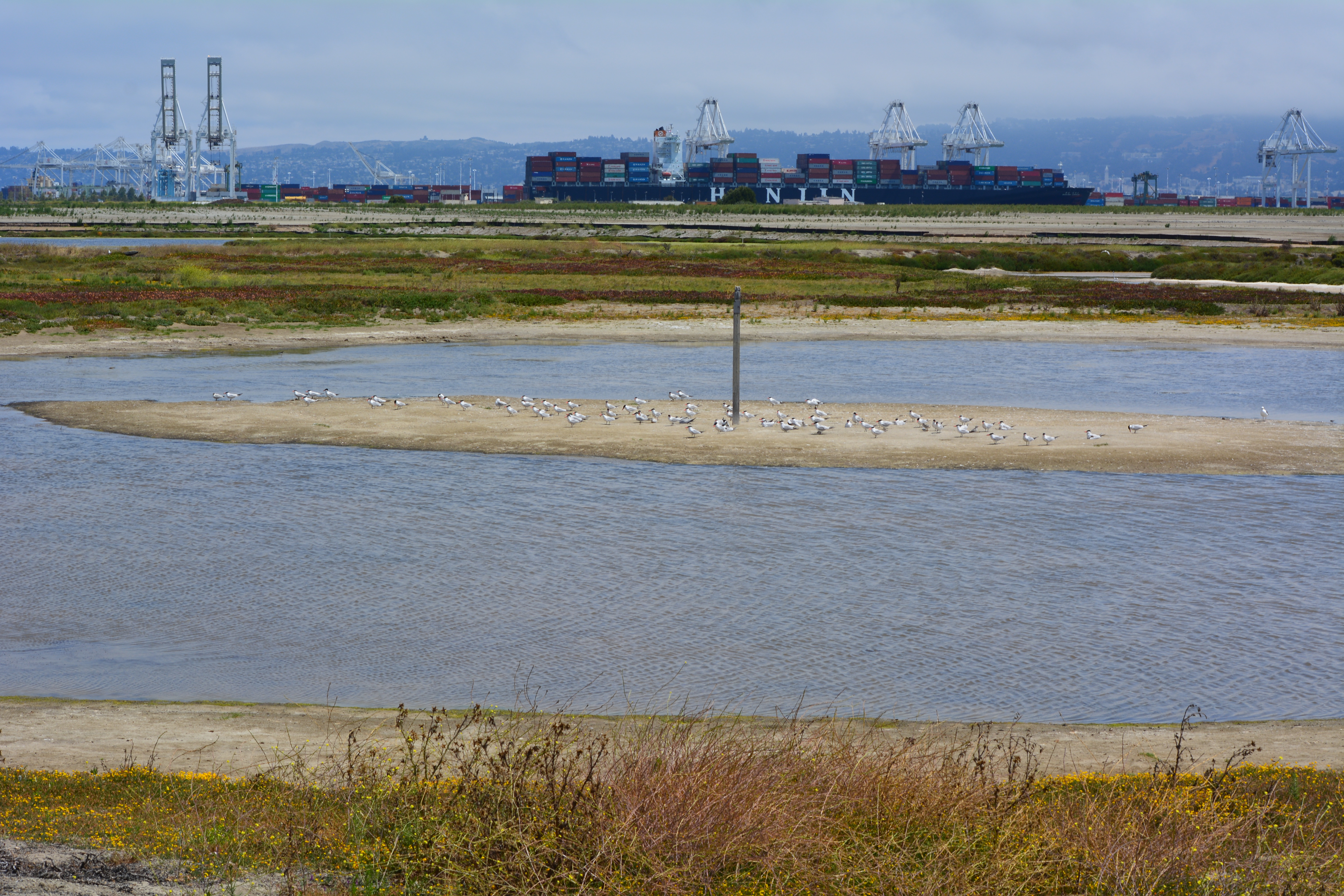
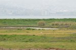
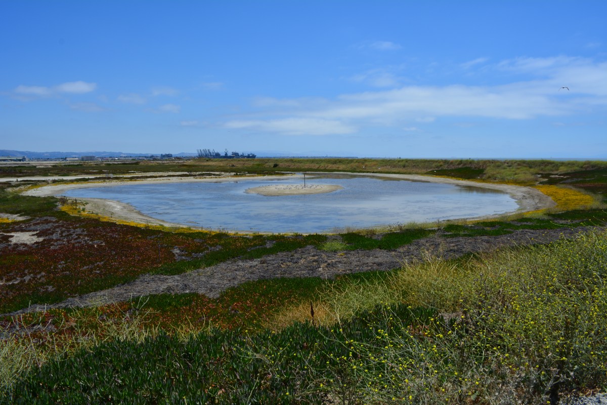
South Pond of West Wetland at Alameda Point.  Island in pond has become a nesting site for Caspian Terns.  Looking north toward Port of Oakland.
South Pond of West Wetland at Alameda Point. Island in pond has become a nesting site for Caspian Terns. Looking north toward Port of Oakland.

According to the Navy’s environmental cleanup coordinator, Derek Robinson, $513 million has been appropriated to date for Alameda Point cleanup, although some of it remains to be spent on upcoming work. His office, the Base Realignment and Closure Program, estimates another $80 million will be needed by the time remaining projects and follow-up monitoring are completed.

Later this year, the Navy is expected to transfer to the city the 33-acre North Housing site and seven-acre former Island High School site that sit next to Alameda Landing and Estuary Park, marking another milestone on the long and winding cleanup road to civilian use.

This story appeared in the Alameda Sun:  Print edition front page and online edition.

Navy Environmental Tour Guide July 12, 2014 – Cleanup Fact Sheets

Navy Presentation Environmental Cleanup Program Review July 12, 2014 to Restoration Advisory Board

More photos and a map
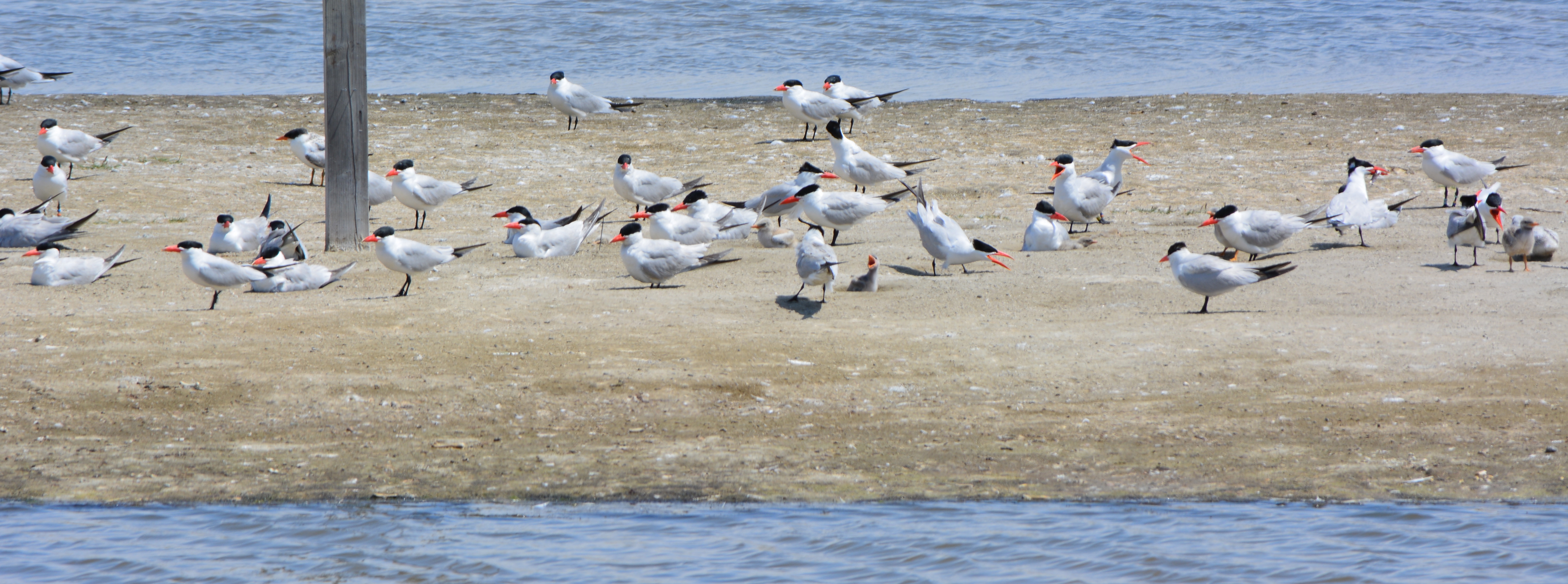
Caspian Terns and chicks at West Wetland, Alameda Point.
Caspian Terns and chicks at West Wetland, Alameda Point.  Click on image to enlarge.
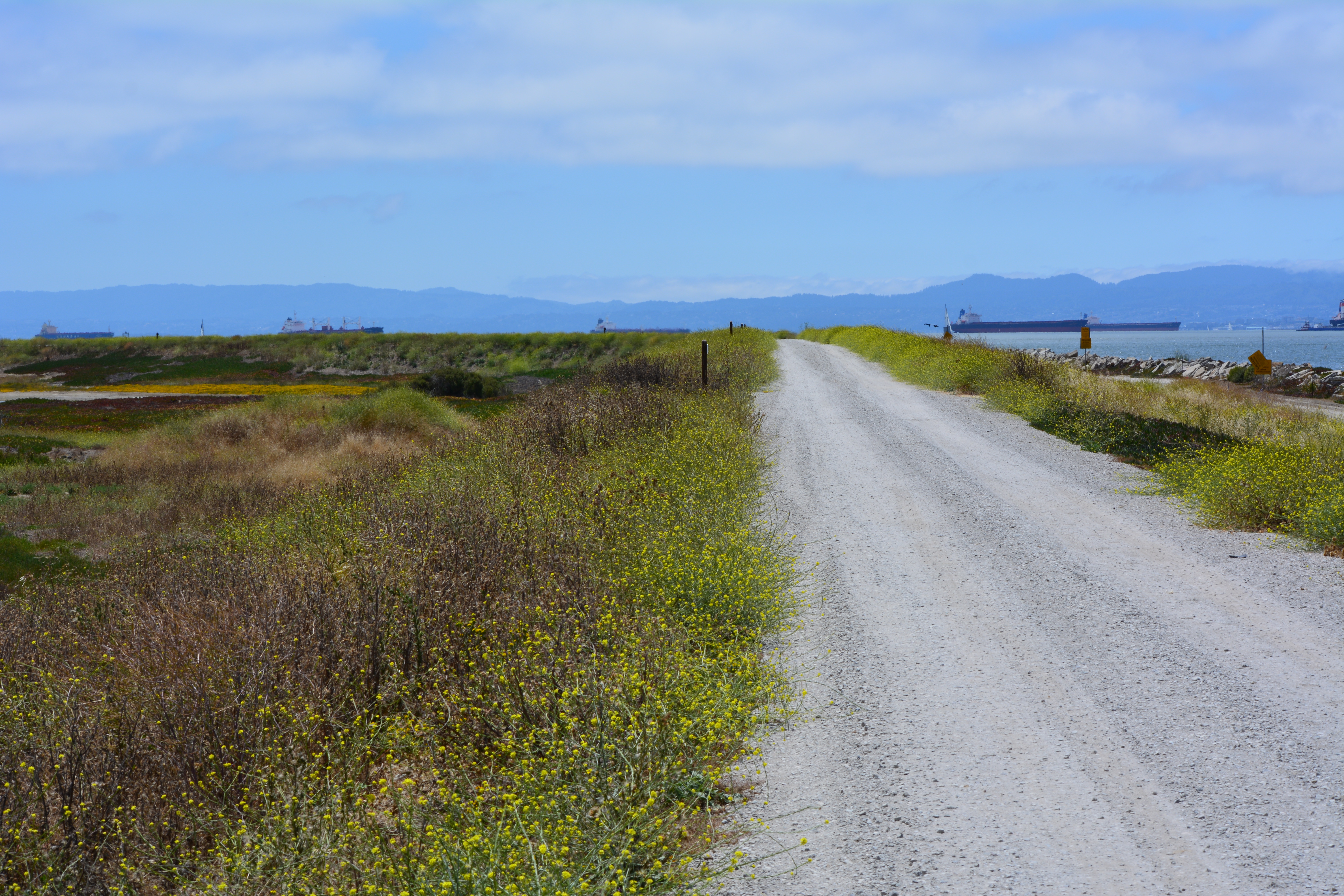
Trail on embankment at southwest corner of Alameda Point.  Looking south with San Francisco Bay to the right and ahead.  Additional trail to the right at riprap elevation.
Trail on embankment at southwest corner of Alameda Point. Looking south with San Francisco Bay to the right and ahead. Additional trail to the right at riprap elevation.
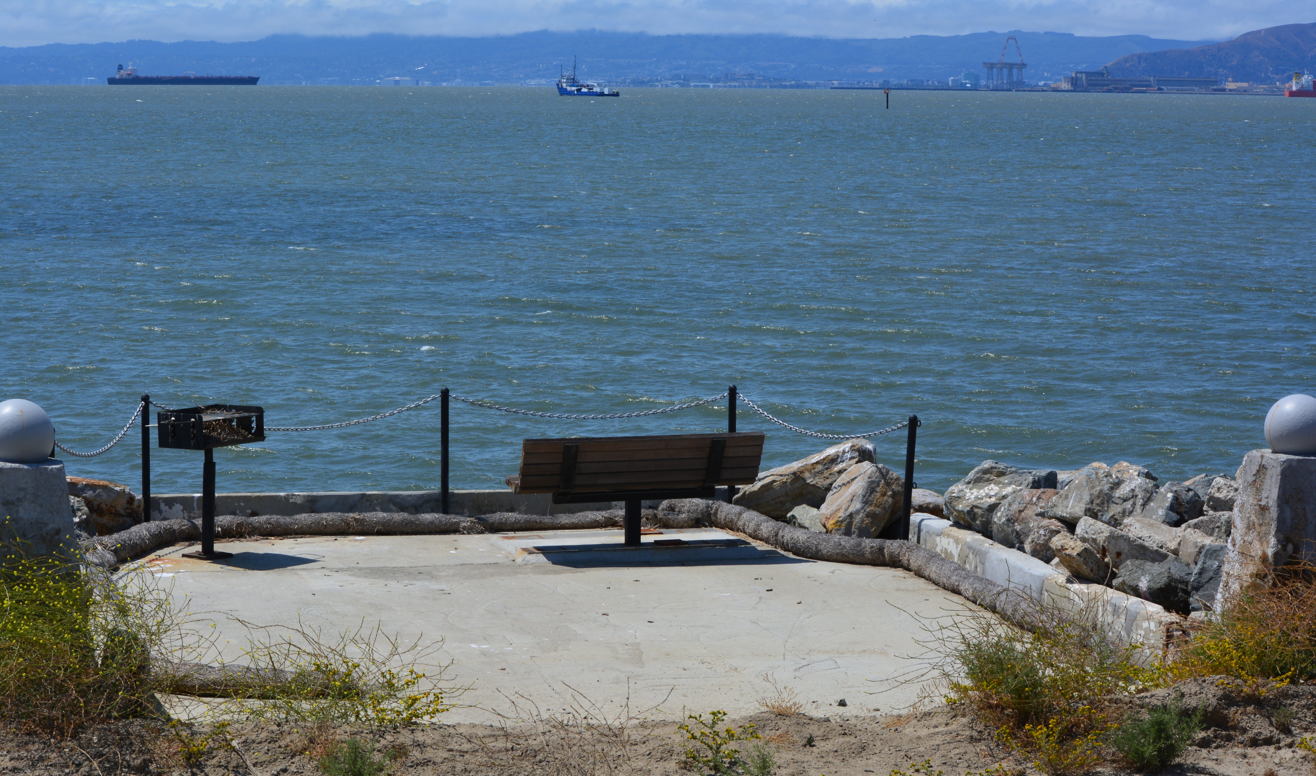
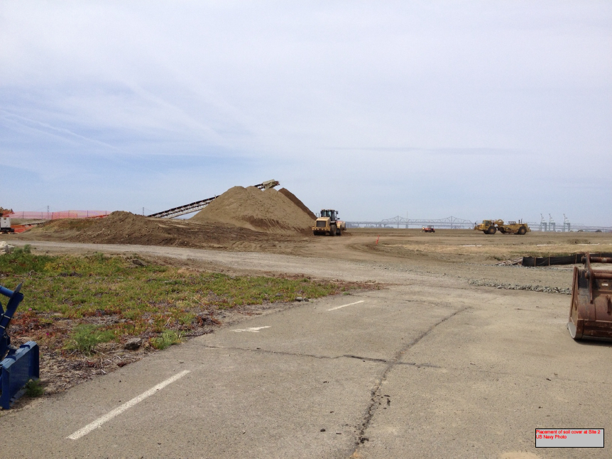
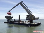
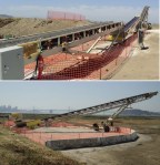
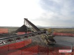
Concrete pad served as a base for conveyor that transferred soil from barge to land for the soil cover at Site 2.  Contractor left it in place and added a few amenities for future users of a place they had come to appreciate the beauty of as they worked here for a year.  Thank you, TetraTech.
Concrete pad served as a base for conveyor that transferred soil from barge to land for the soil cover at Site 2. Contractor left it in place and added a few amenities for future users of a place they had come to appreciate the beauty of as they worked here for a year. Thank you, TetraTech.
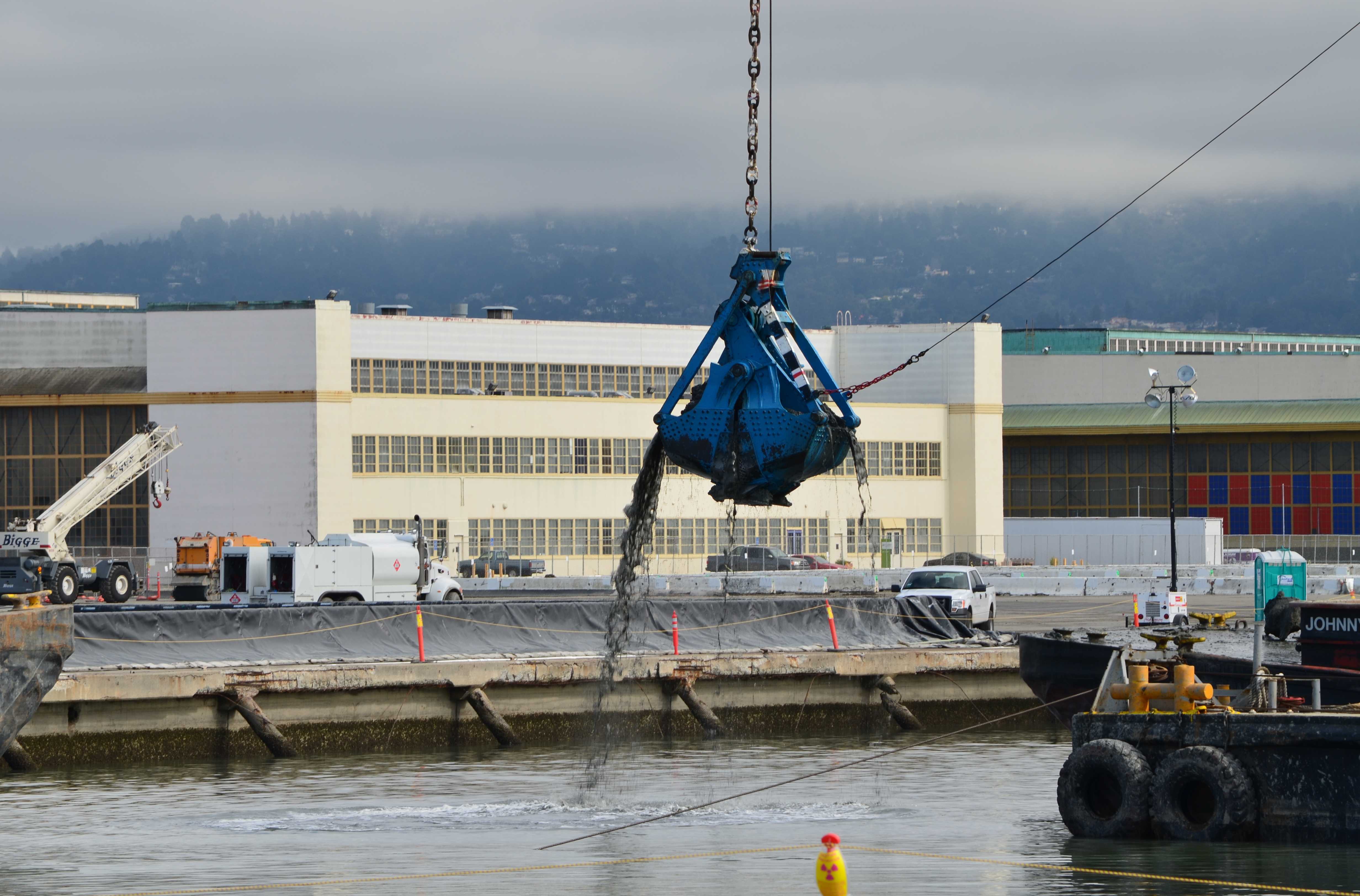
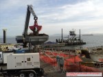
Dredging the northwest corner of the Seaplane Lagoon at Alameda Point in February 2012.  Tarmac dewatering, drying, and testing area behind black tarp is now being dismantled.  All dredging work is completed.
Dredging the northwest corner of the Seaplane Lagoon at Alameda Point in February 2012. Tarmac dewatering, drying, and testing area behind black tarp is now being dismantled. All dredging work is completed.

Previous stories about waste disposal areas: 

Scenic Alameda Point wildlife refuge section to be off limits with security fence (May 31, 2012)

Update notes: Subsequent criticism of the Navy as to the necessity of a security fence by members of the public and regulatory agencies led to the removal of the security fence from the final work plan design. The Navy also agreed to shorten the soil gas vents to two feet, since only trace amounts of methane gas are now emitted from the landfill waste, most of which is industrial and did not produce methane in the first place.  Additionally, the Navy agreed to examine the aging metal culvert that connects the North Pond of the West Wetland to San Francisco Bay.  The culvert provides the water lifeline for the North Pond habitat and was at risk of collapse and being stopped up with debris.  The Navy replaced the metal culvert with a concrete culvert (see photo above) and debris screen.

Navy receives comments on landfill/wetlands plans on Alameda Point wildlife refuge (July 15, 2012)

Ending threat of solvents in groundwater leaching into San Francisco Bay (August 31, 2012)

Cleanup plan changes at waste burning area (April 5, 2013)

Landscaping the Navy’s underground waste disposal site (June 4, 2013)

Massive landscaping project changing scenic area on Nature Reserve (August 5, 2013)

Landfill landscaping on Nature Reserve – Update October 2013 (October 26, 2013)
Groundwater solvent cleanup will use cheese whey and veggie oil to feed natural bacteria

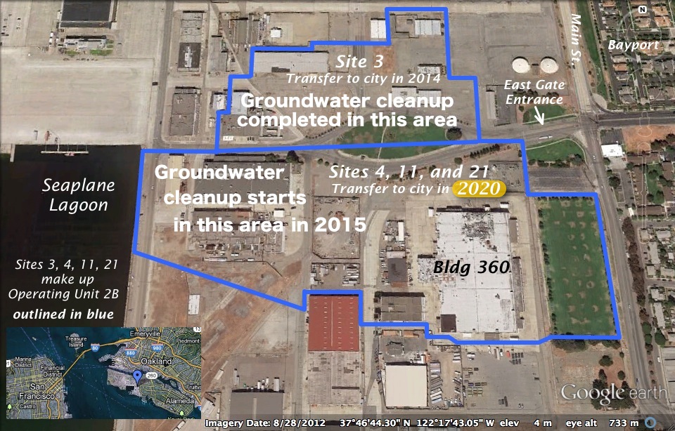
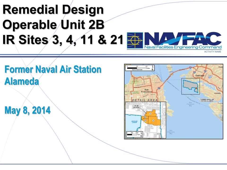
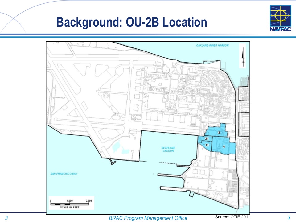
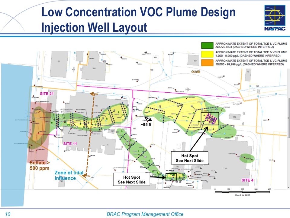
Cleanup Operating Unit 2B at east entry to proposed Town Center - Alameda Point.    Graphics by Alameda Point Environmental Report.
Cleanup Operating Unit 2B at east entry to proposed Town Center – Alameda Point. Graphics by Alameda Point Environmental Report.

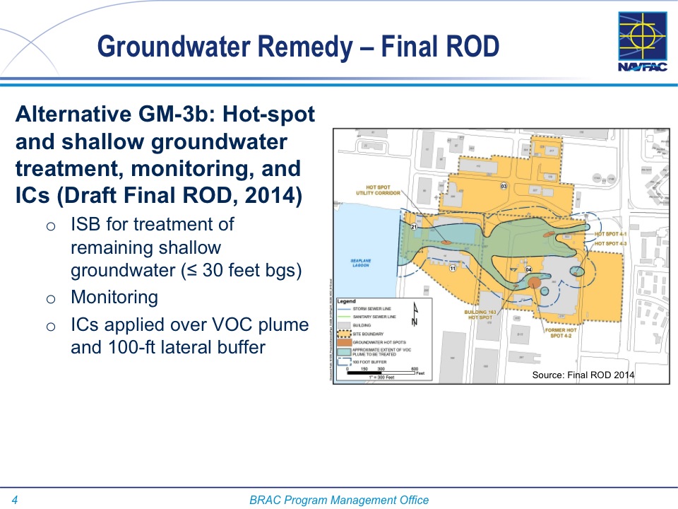
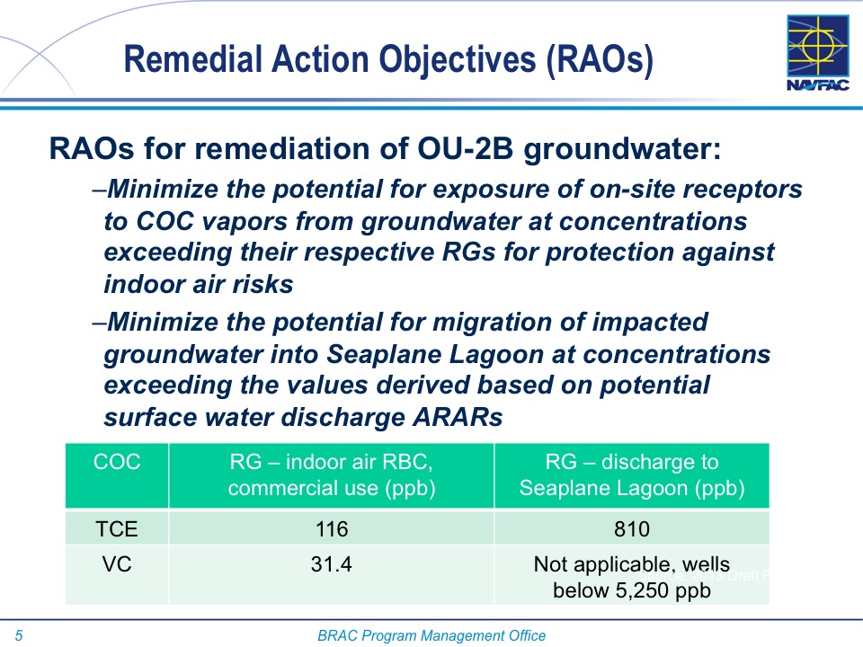
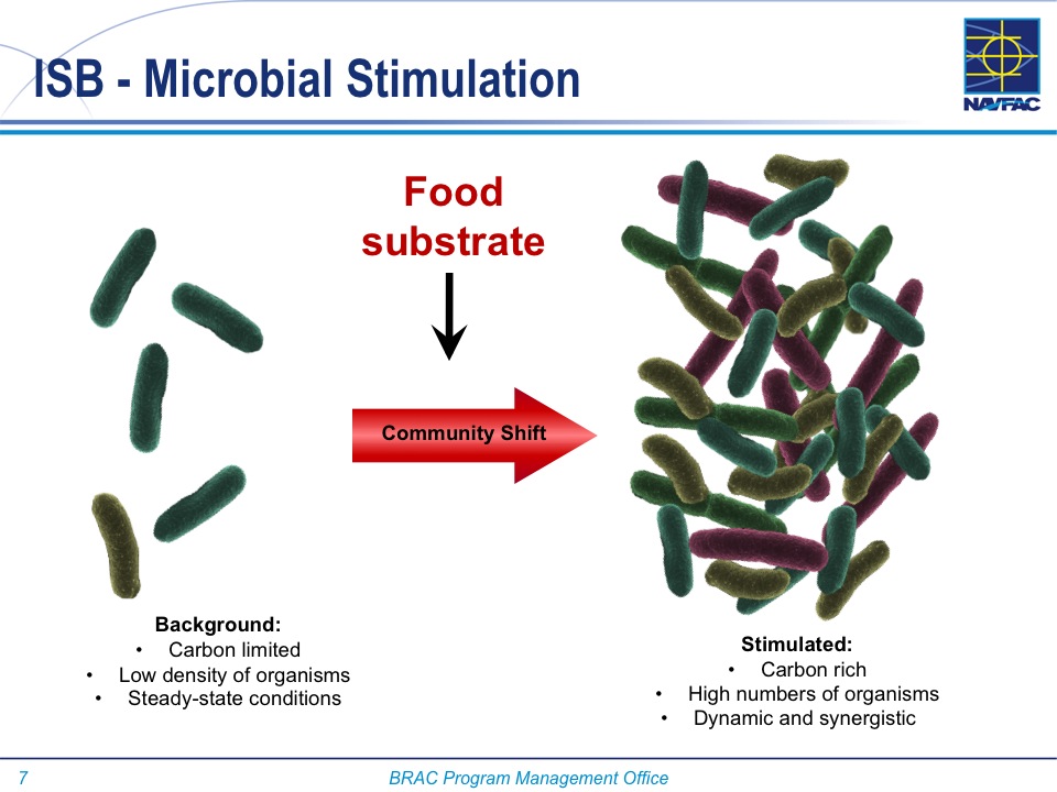
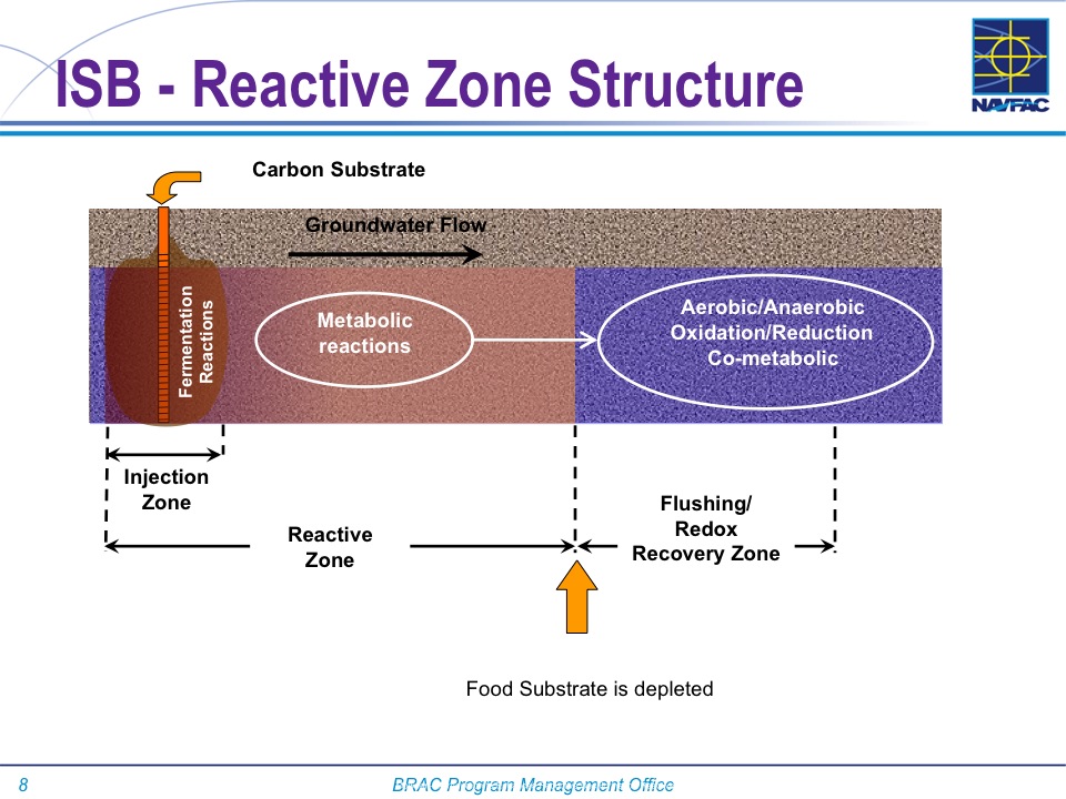
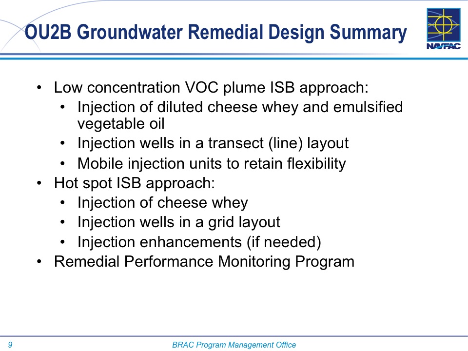
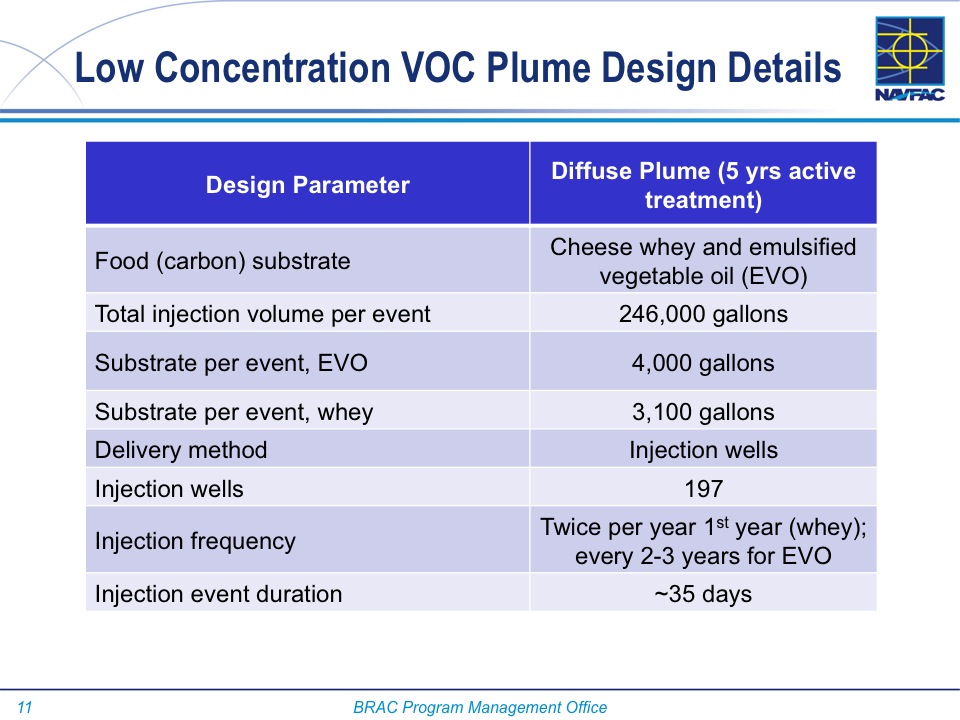
A Navy contractor will be cleaning up groundwater in part of the Town Center area next to the Seaplane Lagoon by injecting a solution of cheese whey, emulsified vegetable oil and water into nearly 200 wells that go down between 30 and 40 feet. The whey and vegetable oil will cause natural bacteria to flourish that will feed on the toxic trichloroethene (TCE) solvent causing it to break down.
According to the Navy, this type of food-stimulated bacterial bioremediation is common. The cheese whey is similar to the powdered whey products found in grocery stores. It will be delivered to the site already diluted in water. A hose will be connected to a fire hydrant and hooked to a metering device that will mix the whey and oil solution with municipal water as it is pumped into the wellheads.

The work is expected to begin in 2015, with periodic visits and testing until 2020. The first year of operation the contractor will make two visits of 35 days each. During each of these work periods they will inject 246,000 gallons of whey, oil, and water solution into the ground, allowing gravity to disperse the liquid.

The goal of the cleanup is to minimize the potential for hazardous vapors entering buildings, and chemicals migrating into the Seaplane Lagoon. TCE is an industrial solvent used to degrease metal parts. It was heavily used at aircraft and ship engine repair facilities on the site. A leak from a rail car is believed to be one of the major sources of the plume.

The 33-acre cleanup area is immediately to the south of the Navy jet on West Atlantic Avenue at the east entry to Alameda Point near Main Street. It is within the 150 acres of the Town Center that the city is seeking to develop in the near future.  In April, the city council sent out requests seeking qualified developers interested in residential and commercial projects. The cheese and veggie oil cleanup area will not be transferred to the city until at least 2020 when cleanup has been certified to have met its goals.

Cleanup of fuel in groundwater ended about four years ago at an old fuel distribution point on the north side of the jet monument.

Below is an audio and image presentation from the Alameda Point Restoration Advisory Board meeting on May 8, 2014.

voice graphic w:text

Slide01

Slide02

Slide03

Slide04

Slide05

Slide06

Slide07

Slide08

Slide09

Slide10

Slide11

Slide12

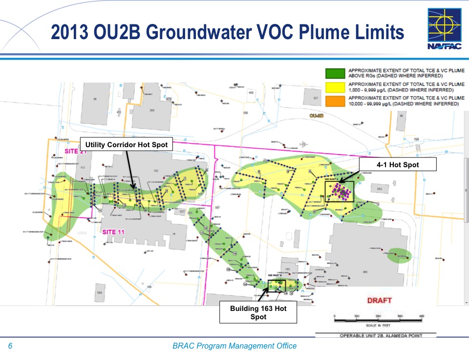
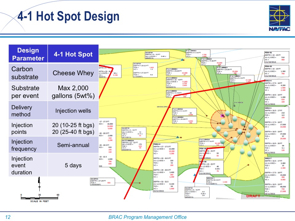
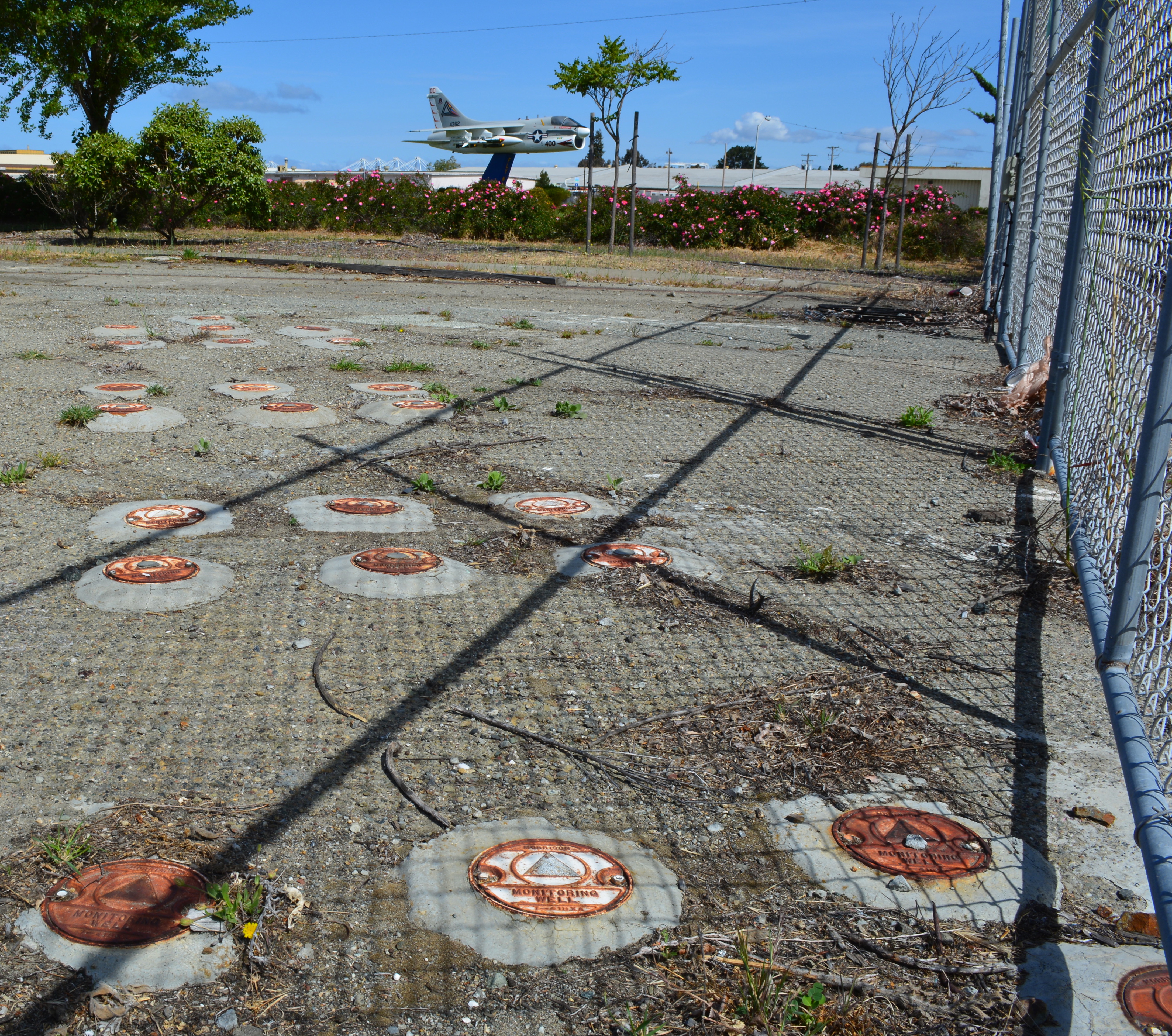
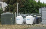
One of the high contamination "hot spots" that will get extra treatment to cleanup trichlorethene solvent in groundwater 30 to 40 feet deep.
One of the high contamination “hot spots” that will get extra treatment to cleanup trichloroethene solvent in groundwater 30 to 40 feet deep.
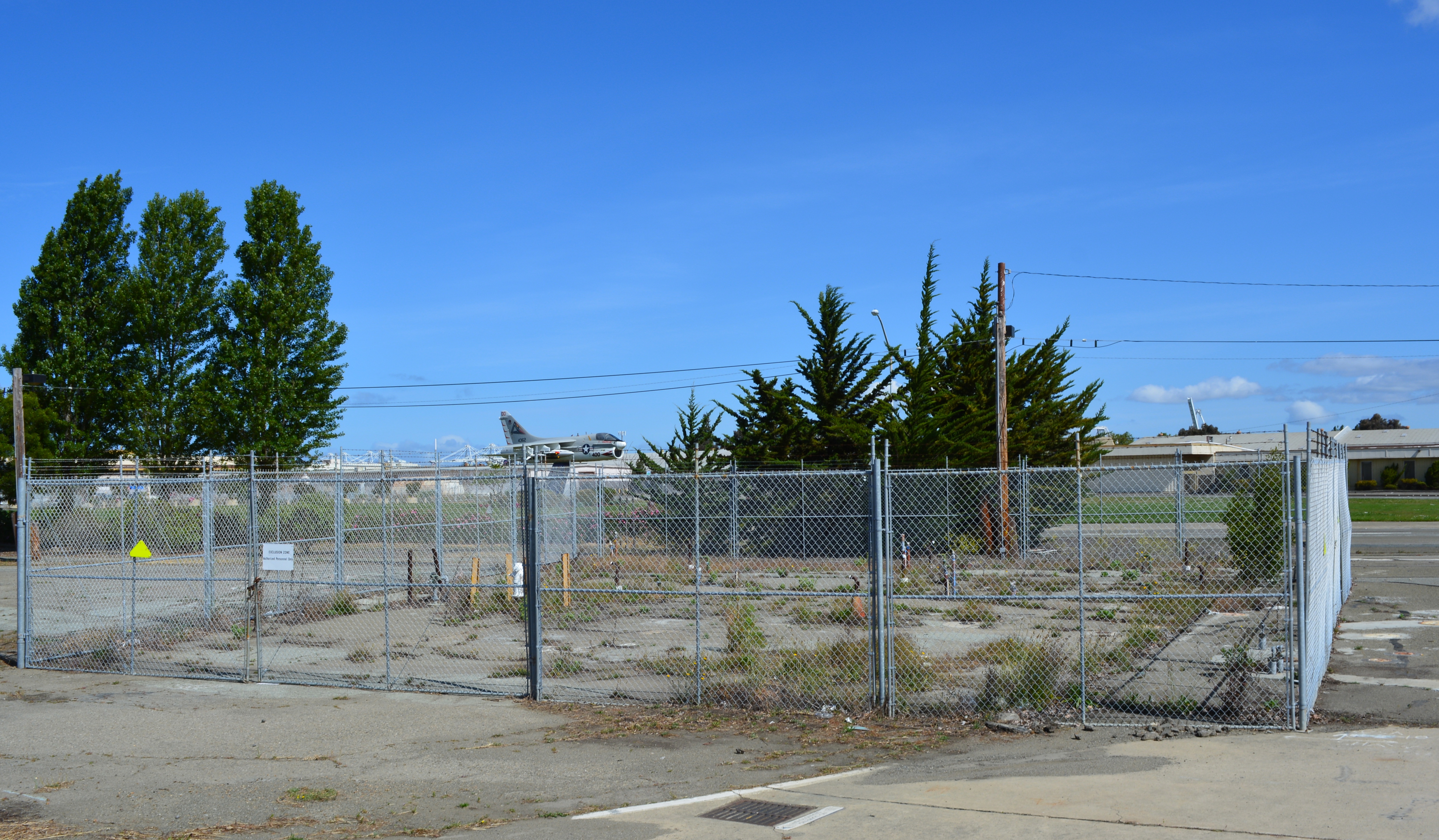
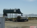
Fenced area is where testing was conducted.  This is one of the hot spot areas that will get extra attention to clean up trichloroethene in groundwater.
Fenced area is where testing was conducted. This is one of the hot spot areas that will get extra attention to clean up trichloroethene in groundwater.
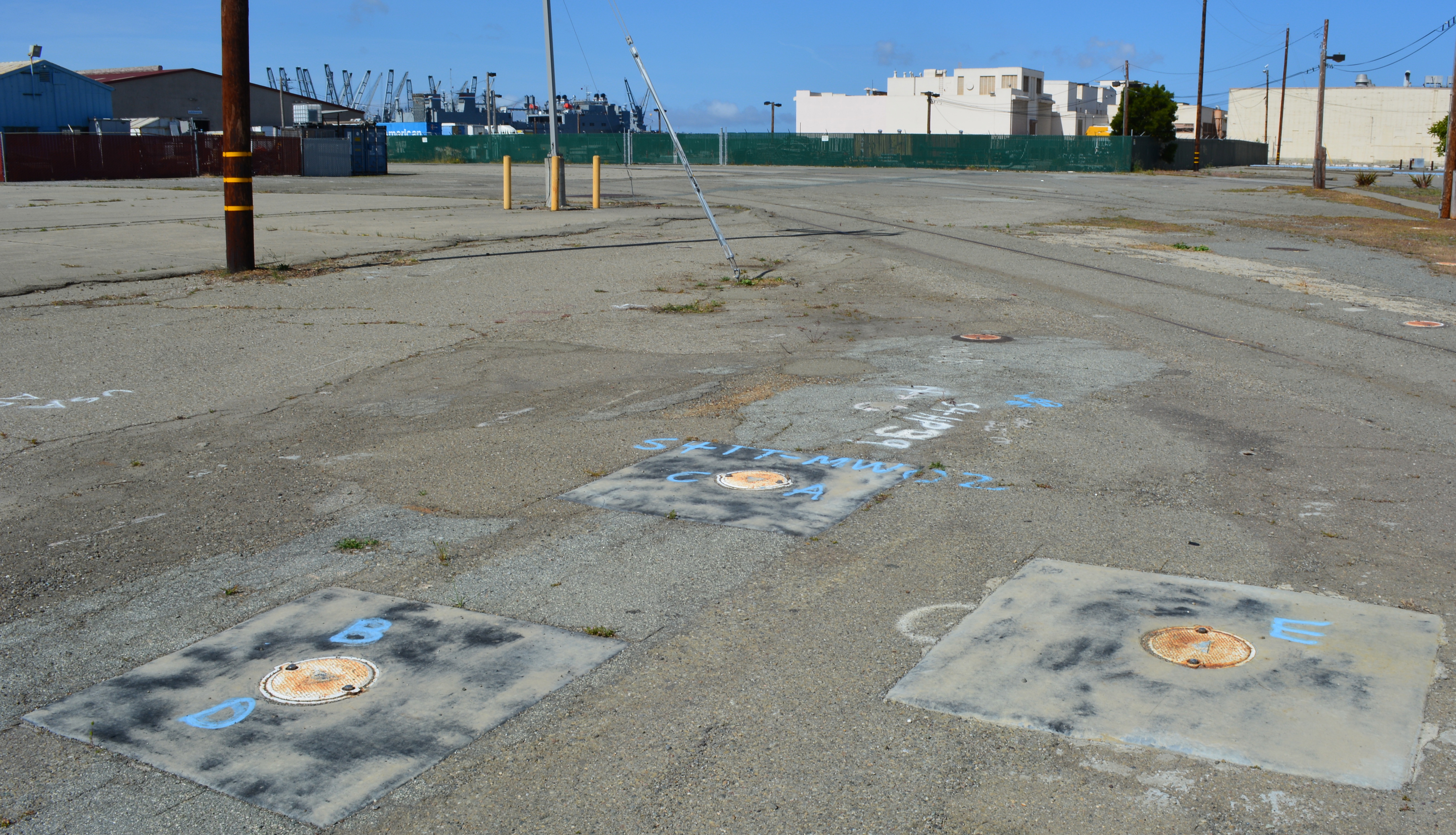
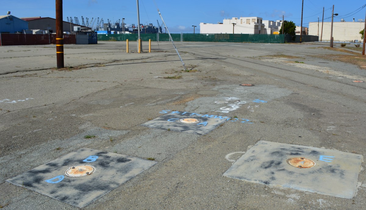
Groundwater cleanup area on OU-2B.  Cleanup will not be completed until 2020.  Looking west with maritime ships in background in Seaplane Lagoon.
Groundwater cleanup area on OU-2B. Cleanup will not be completed until 2020. Looking west with maritime ships in background in Seaplane Lagoon.

Alameda Point VA Project – Final Environmental Assessment Released

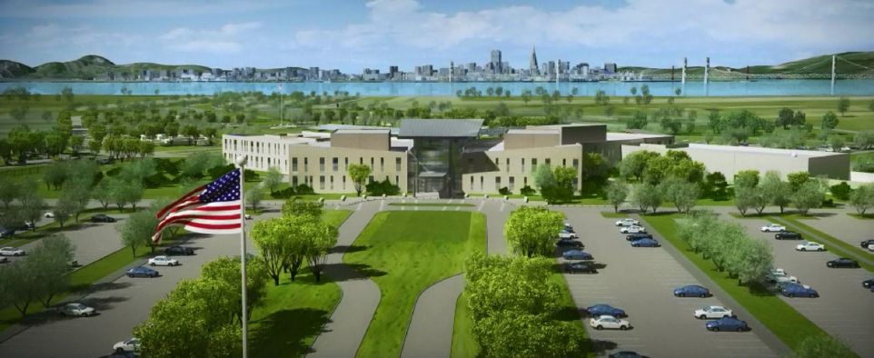
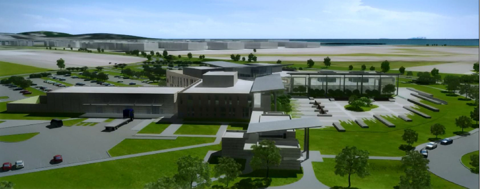
VA Alameda Point aerial view toward SF

The Department of Veterans Affairs (VA) and the Navy jointly issued their final Environmental Assessment on November 18, 2013 for the VA’s proposed Alameda Point outpatient clinic, offices, and columbarium cemetery.  The report found that the 112-acre project on the northern part of the former Naval Air Station airfield would cause no significant impacts to the environment.  The environmental review culminates years of debate over the project’s potential impacts on the endangered California Least Terns that nest on the nearby runway, and paves the way for the Navy to transfer 624 acres of the airfield to the VA in 2014.

Background

The VA began looking at the Alameda site in 2004 for expansion and consolidation of services from undersized and scattered facilities, which are currently leased by the VA until 2018.  More than 9,000 veterans are enrolled in clinical services in the Oakland/Alameda area, with patient visits up 50% in the last five years.  Approximately 543 veterans will be seen at the Alameda Point outpatient clinic each weekday and 70 on Saturday and Sunday.  The VA anticipates employing a staff of 250, including 26 physicians and 34 nurses.

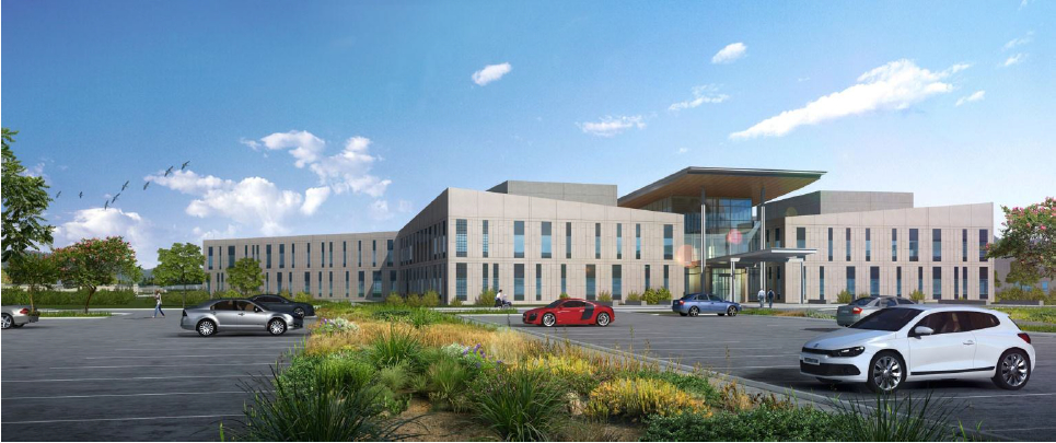
VA Lobby, looking toward San Francisco.

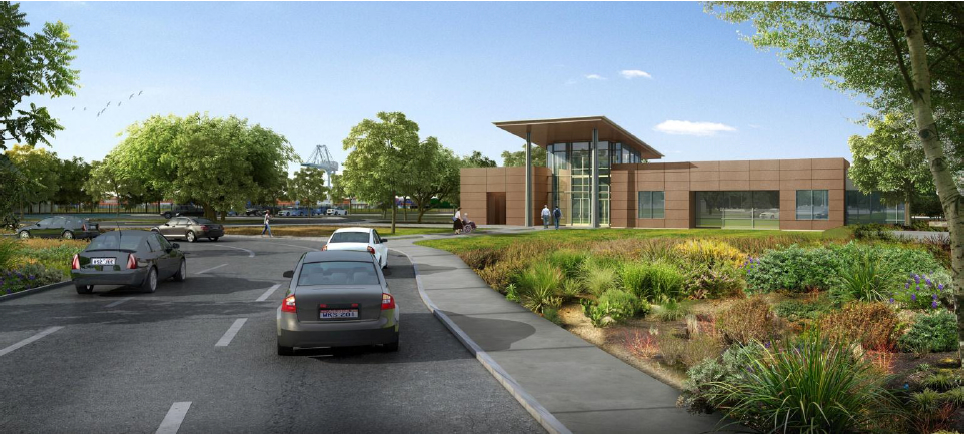
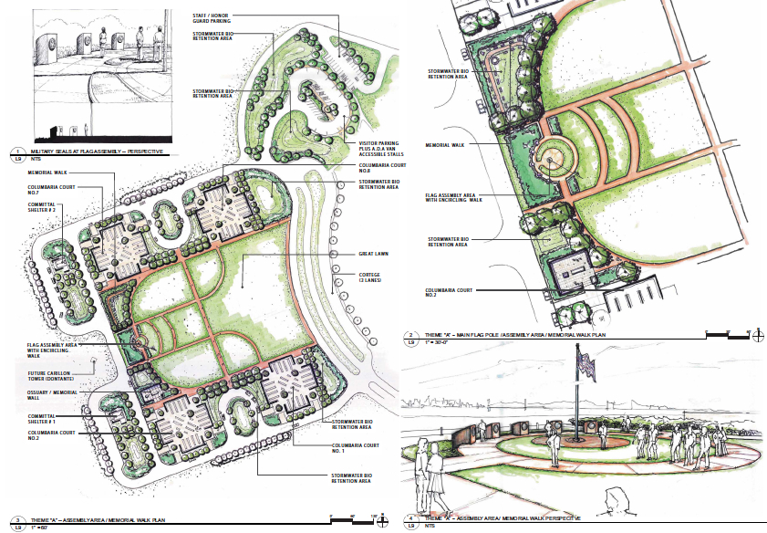
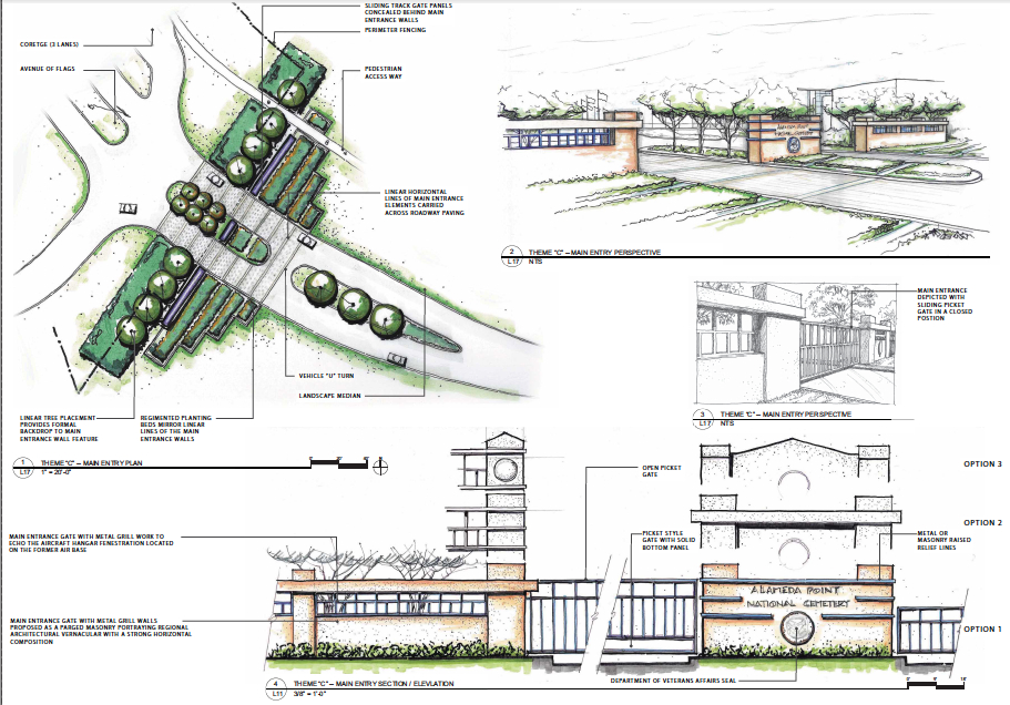
The VA will also establish a new national cemetery at Alameda Point.  The two closest national cemeteries in San Bruno and San Francisco’s Presidio no longer accept new interments.  Currently the closest burial options for Bay Area veterans are San Joaquin Valley National Cemetery in Santa Nella and Sacramento Valley National Cemetery in Dixon.  The new columbarium cemetery will initially be 20 acres, with the remaining 60 acres built out in increments until completion in 2116.  Approximately six services will take place Monday through Friday. 

Columbarium in foreground, clinic/office building in background.  Looking east, with Oakland Estuary on left.
Columbarium in foreground, clinic/office building in background. Looking east, with Oakland Estuary on left.

Traffic and Transportation

The VA and Navy evaluated seven intersections in Oakland and four in Alameda, as well as the Posey/Webster Tube and segments of I-880, for traffic impacts.  The report noted that two Oakland intersections and the Atlantic/Webster intersection would be performing at unacceptable levels regardless of the VA project because of other Alameda Point development.  The assessment states, “The minimal additional traffic resulting from the Proposed Action would not, cumulatively, make the already unacceptable intersections significantly worse.”  

The VA plans to operate a 24-person shuttle bus service between Alameda Point and the 12th Street Oakland City Center BART station every half hour, seven days a week.  Extending AC Transit bus line 31 to the clinic would provide additional service if the transit agency decides to add service.

Wetland Mitigation

Several acres of seasonal wetland will be impacted by the VA’s project and will need mitigation, either through on-site replacement or paying into a wetland mitigation bank.  The VA has not reached agreement yet with the Regional Water Quality Control Board and the U.S. Army Corps of Engineers on a mitigation plan.  However, the VA has stated that their preference is to “enhance and expand existing conditions” at the Runway Wetland on the southeast corner of the runway area.  Plans will be finalized before issuance of any permits for the VA’s project.

Alameda Point Runway Wetland in foreground, suitable for wetland enhancement as mitigation for wetland loss on VA developed area.

Nature Reserve, Least Tern Management

Most of the VA’s runway area will remain undeveloped.  Initial plans allowed for periodic emergency preparedness training on the undeveloped area.  The new plans allow training exercises only in the VA’s developed area about every 14 months between mid-August and April 1 when the terns are gone.

The influence of years of lobbying by the Golden Gate Audubon Society and open space advocates for wildlife stewardship in the undeveloped area is reflected in the VA’s final report.  The VA states, “The remainder of the 512 acres of the Transfer Parcel will remain as a preserve for the California Least Tern or open space, with no plan for development, and will be available to wildlife for future generations.” 

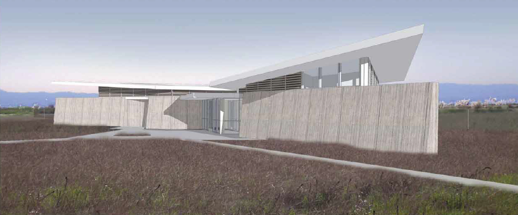
The VA will construct a 2,500-square-foot Conservation Management Office (CMO) near the entrance to their property.  The CMO will provide office space for the U.S. Fish & Wildlife Service, meeting space for educational programs and volunteers, and public restrooms.  The VA will fund the management of the Least Tern colony and the undeveloped area.

The winglike roof lines on the CMO and the main clinic/office building were inspired by the Least Tern colony and the site’s history as part of the Alameda Naval Air Station.

Conservation Management Office, with meeting room for nature education and Least Tern volunteer activities, U.S. Fish & Wildlife Service Office.

Public Access

As part of their project, the VA will construct a pedestrian/bicycle/vehicle roadway along the northern border of their property all the way to a public viewpoint on the western shoreline.  The roadway will include power, water, and sewer utilities that will be available for the city or a region-serving public park operator on the Northwest Territories to make connections to.  The city will be granted a shoreline easement for constructing the Bay Trail.  The VA will also be constructing a new north entryway to Alameda Point and laying oversized infrastructure, which the city can use, along Redline Avenue out to their site.

Raising Elevation

The VA plans to bring in over 400,000 cubic yards of clean fill material to raise the elevation of their site by as much as three feet, bringing the highest elevation to 13.5 feet above Mean Sea Level.  Plans are based on a 2009 Bay Conservation and Development Commission sea level rise prediction of 16 inches by 2050 and 55 inches by 2099.  The 18-month construction project is expected to begin by 2016 and be completed in 2017.

The VA is made up of three administrations:  Veterans Health Administration, Veterans Benefits Administration, and National Cemetery Administration.  All three will have offices at the Alameda Point VA.

The complete Environmental Assessment is on the VA website.  A 30-day final public comment period began on November 18, 2013.

Looking southeast.
Looking southeast.

VA Alameda Point landscaping #2

VA exterior

VA Alameda Point landscaping

Conservation Management Office

Phase 1 Plan VA Alameda Point

Cemetery Main Entry

Columbarium courtyard

Cemetery Entrance

Memorial Wall at Columbarium.

VA Project Site - Alameda Point

Landfill landscaping on Nature Reserve – Update October 2013

Landscaping of the 100-acre landfill area on the southwest corner of Alameda Point is nearing completion.  The seeding of the landfill site with flowering native grasses is almost ready to begin.  Contouring of the site is complete.  Stabilization of the shoulder around the wetland area is complete.  Placement of the final soil cover is underway.

Site 2 wetland area and adjacent contouring underway in early July 2013.  Wetland area has since been expanded by several acres.  Port of Oakland is in the background.  Bay Trail will eventually follow the foreground shoreline along the Bay.  Funding and construction of the Bay Trail is not part of this project, and is yet to be funded.
Site 2 wetland area and adjacent contouring underway in early July 2013. Wetland area has since been expanded by several acres. Port of Oakland is in the background. Bay Trail will eventually follow the foreground shoreline along the Bay. Funding and construction of the Bay Trail is not part of this project, and is yet to be funded.

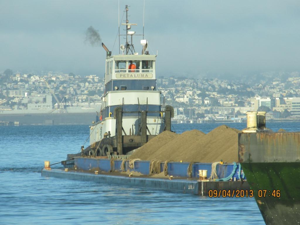
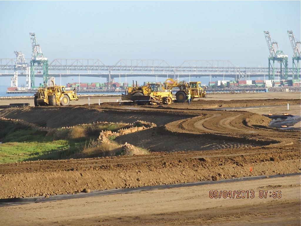
The contouring of this industrial landfill site was completed on August 16, 2013.  Approximately one-third of the contouring, or base layer, soil is clean soil recycled from Seaplane Lagoon dredging.  The recycled soil stock was quickly exhausted, along with soil recycled after removing some of the berms and high areas.  More than half of the base layer – 193,000 cubic yards – is soil barged in from Decker Island in the Sacramento River. 

Soil being delivered from Decker Island.

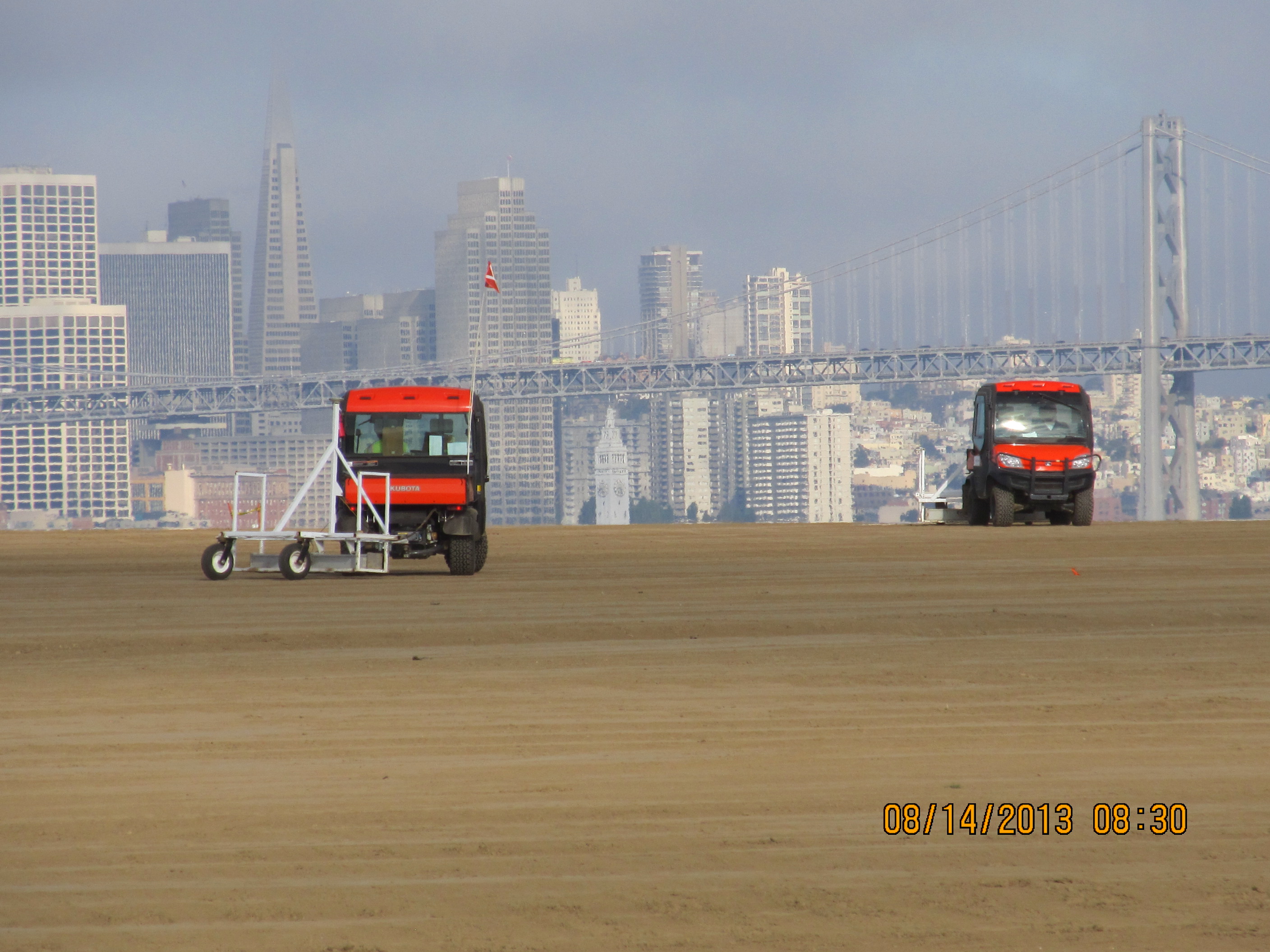
This contouring phase, which began in January of 2013, created the base layer with a specially-engineered slope.  It was then scanned for radiation using scanners towed by a small vehicle, even though the site had been surveyed for radiation prior to placing the base layer.

Scanning the base layer for radiation.

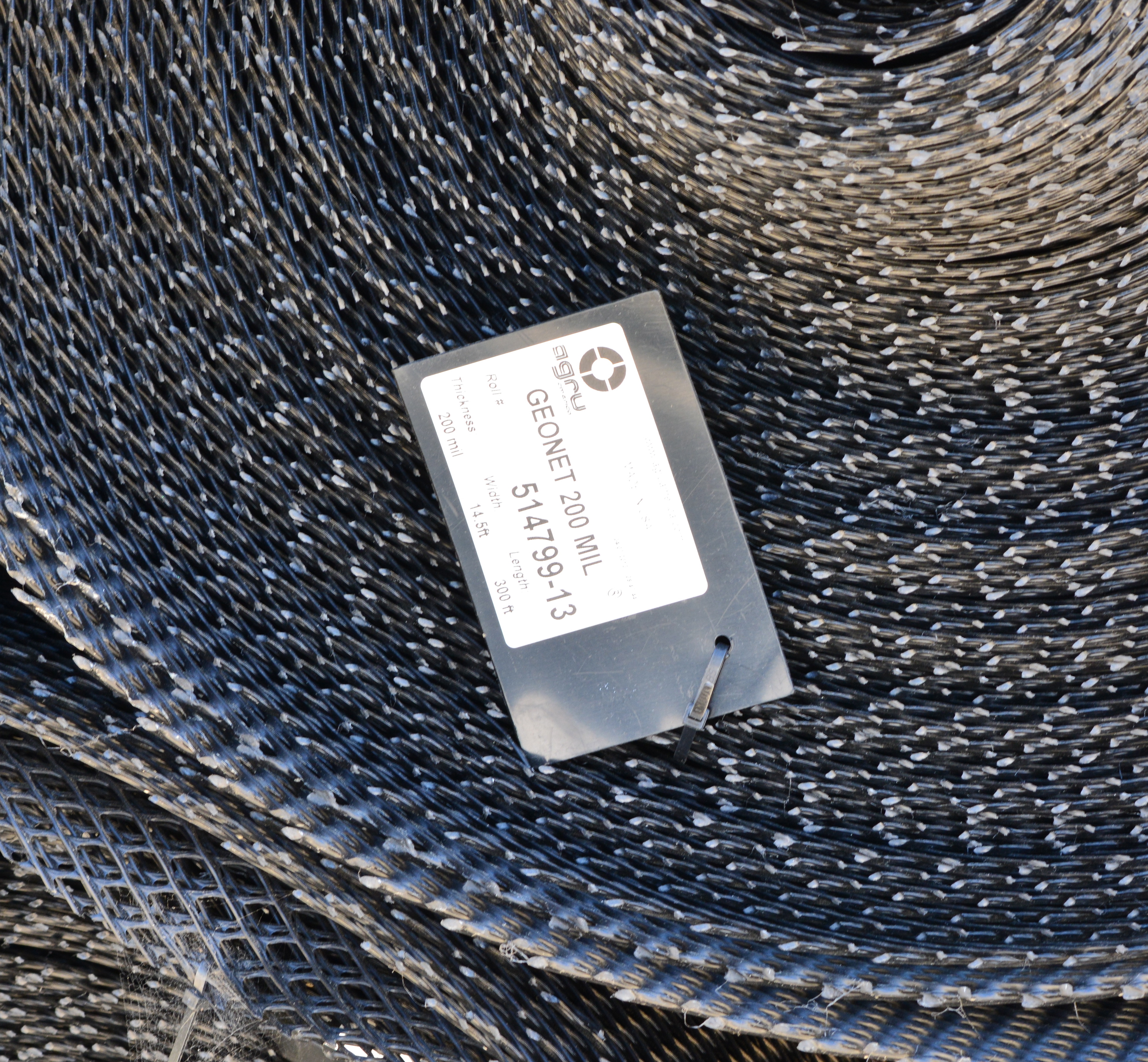
Placement of the plastic biobarrier (see photo below) and the final soil cover using soil barged in from Decker Island began on August 19, 2013.  The biobarrier is a plastic mesh that is designed to discourage burrowing animals from coming into contact with the waste area.  The biobarrier installation is over 90% complete as of week #38 (October 24, 2013).  The final two-foot soil cover is over 60% complete.  The final soil cover includes six inches of soil amended to promote growth of vegetation. 

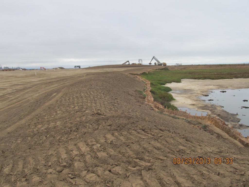
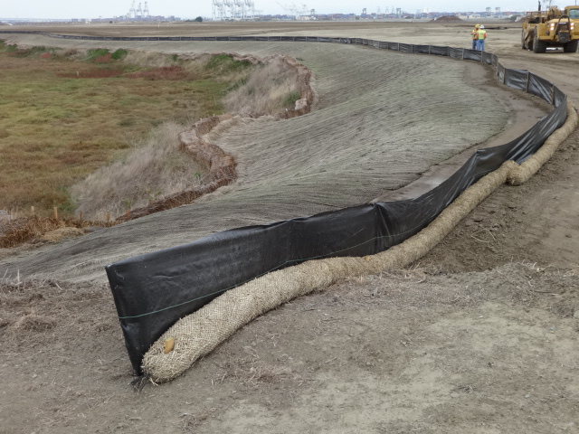
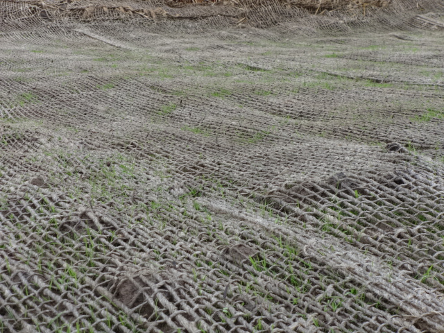
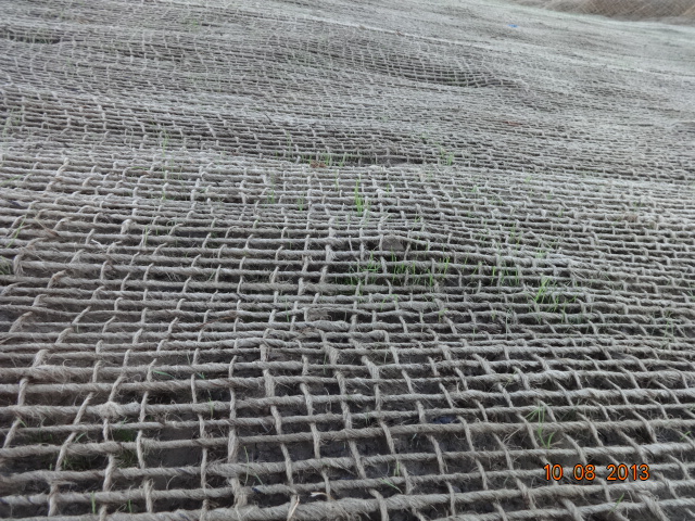
The soil stabilization and drainage work on the shoulder around the wetland area is also completed.  It includes native rye grass seeding, a jute mesh cover, and a silt fence.  Some of the rye grass has already started to sprout.

Stormwater controls near wetland area being created.

New monitoring wells will be installed starting in late November. 

Hydroseeding of the site with an assortment of California native grasses will begin in late November or early December. 

In 2014 the old culvert connecting the north side of the wetland with San Francisco Bay will be replaced with a new culvert.

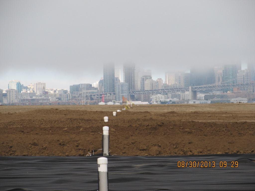
Fifty tons of old fence and metal have been recycled.  The temporary work fence will be removed at the end of the job.  The methane gas vents will be short and virtually unnoticeable (see photo below).  Due to the age of the landfill and the fact that very little organic waste was deposited there, the methane gas produced is minor and will not require the 10-foot tall vent stacks proposed in an earlier workplan.

Methane gas vent pipes.

This site, along with adjacent land, will be transferred to the U.S. Department of Veterans Affairs in late 2013 or early 2014.

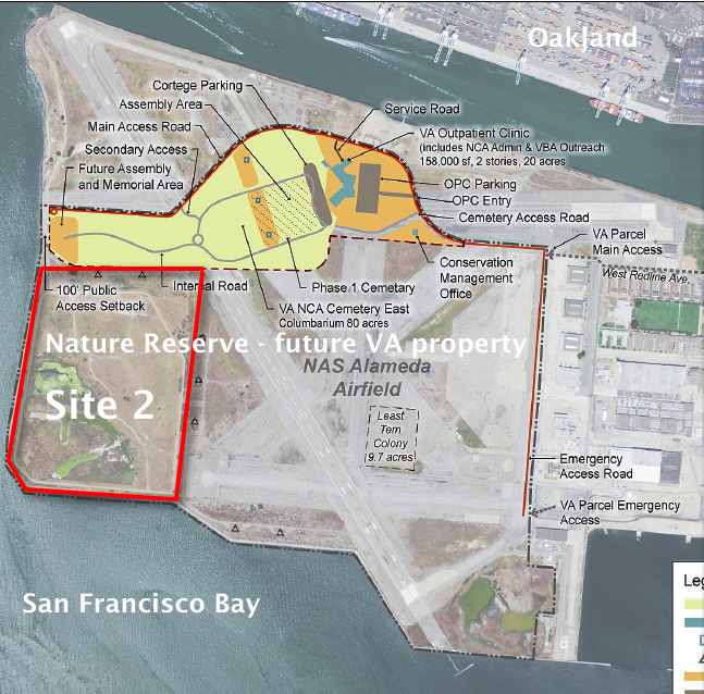
VA map, with Site 2 and Nature Reserve notations added by Alameda Point Environmental Report.
Biobarrier to discourage burrowing animals.  Photo credit:  Alameda Point Environmental Report.
Biobarrier to discourage burrowing animals. Photo credit: Alameda Point Environmental Report.

Interim stormwater controls - tracked slope.

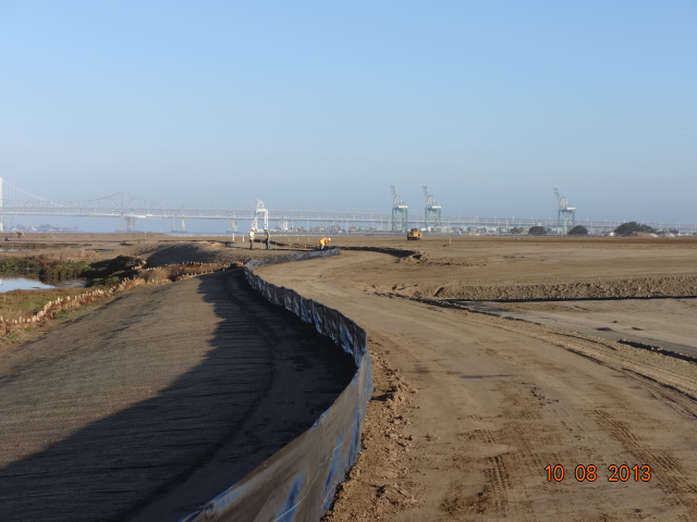
Silt fence installed above jute mesh around wetland area.
Silt fence under construction.
Jute mesh around wetland should, with grass starting to sprout.
Jute mesh around wetland shoulder, with grass starting to sprout.
Week 36 - Vegetation growing through jute mesh around shoulder of wetland area.
Week 36 – Vegetation growing through jute mesh around shoulder of wetland area.

Source:   The information in this update was gathered from the weekly progress reports for Installation Restoration Site 2 Remedial Action at Alameda Point.  The progress reports are posted on the Envirostor website maintained by the California Department of Toxic Substances Control (DTSC).  The source for all photos in this update, unless otherwise credited, is DTSC.

Parkland and housing land coming soon from the Navy

Located between Alameda Point and Alameda Landing (where the new Target store has opened) is the Navy property known as North Housing.  After years of low-key planning efforts, the city will soon be the recipient of a beautiful new park, and eventually see over 400 new affordable and market rate housing units, including 90 Housing Authority units for formerly homeless individuals.

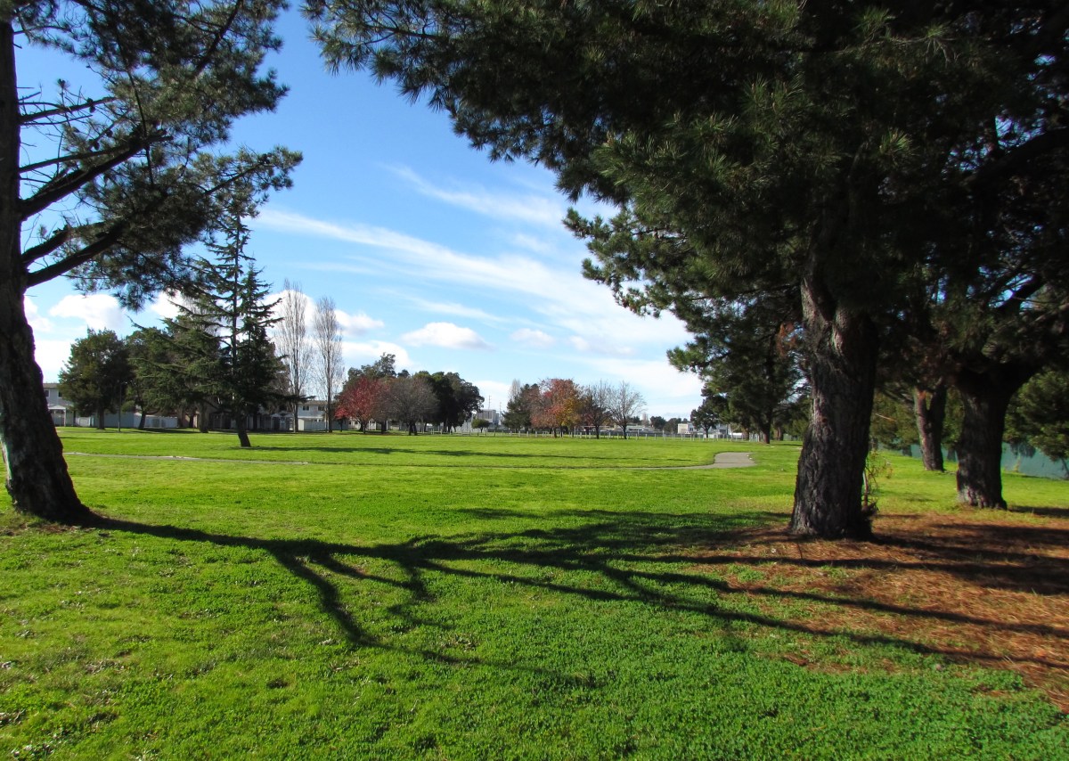
Estuary Park looking west.  Past the trees in the distance is the baseball field.
Estuary Park looking west. Past the trees in the distance is the baseball field.

A key administrative milestone was reached in August of 2013 when the U.S. Department of Housing and Urban Development (HUD) signed off on the city’s plan to accommodate homeless individuals.

The 42-acre Navy parcel sits directly adjacent to Alameda Landing’s future residential neighborhood.  It includes the 8-acre Estuary Park where a baseball field, soccer field, basketball court, perimeter trail, and an open meadow flanked by mature trees await minor sprucing up by our city’s Recreation and Park Department.

Existing housing units to be demolished

The site currently contains 51 residential structures:  39 six-plexes and 12 four-plexes for a total of 282 three- and four-bedroom units.  All of the buildings were constructed in 1969.  With the possible exception of the two acres going to Habitat for Humanity, all of the units will be demolished to make way for new construction, according to the city’s Interim Community Development Director Debbie Potter. 

Central open space at North Housing.  Looking north.
Central open space at North Housing. Looking north.

The 13 acres going to the city’s Housing Authority will have 90 units of new housing and two acres of open space.  Two acres will go to Habitat for Humanity.  The remaining 19 acres will be sold by the Navy to a private developer.

“The Reuse Plan notes the private housing developer could build 315 units,” said Potter.  After the Reuse Plan Amendment was prepared in 2008 and approved in 2009, the city certified a Housing Element in 2012 that rezoned this property to provide a Multi-Family Overlay zone, “so the number of units that could potentially be developed at this site is more than the 435 listed in the Plan,” Potter stated.   

One problem cited by Potter with trying to reuse the existing residences is that all of the multi-unit structures have single utility meters for the entire building.  To re-meter all the units with individual meters for electric, gas, and water would be expensive, according to Potter.

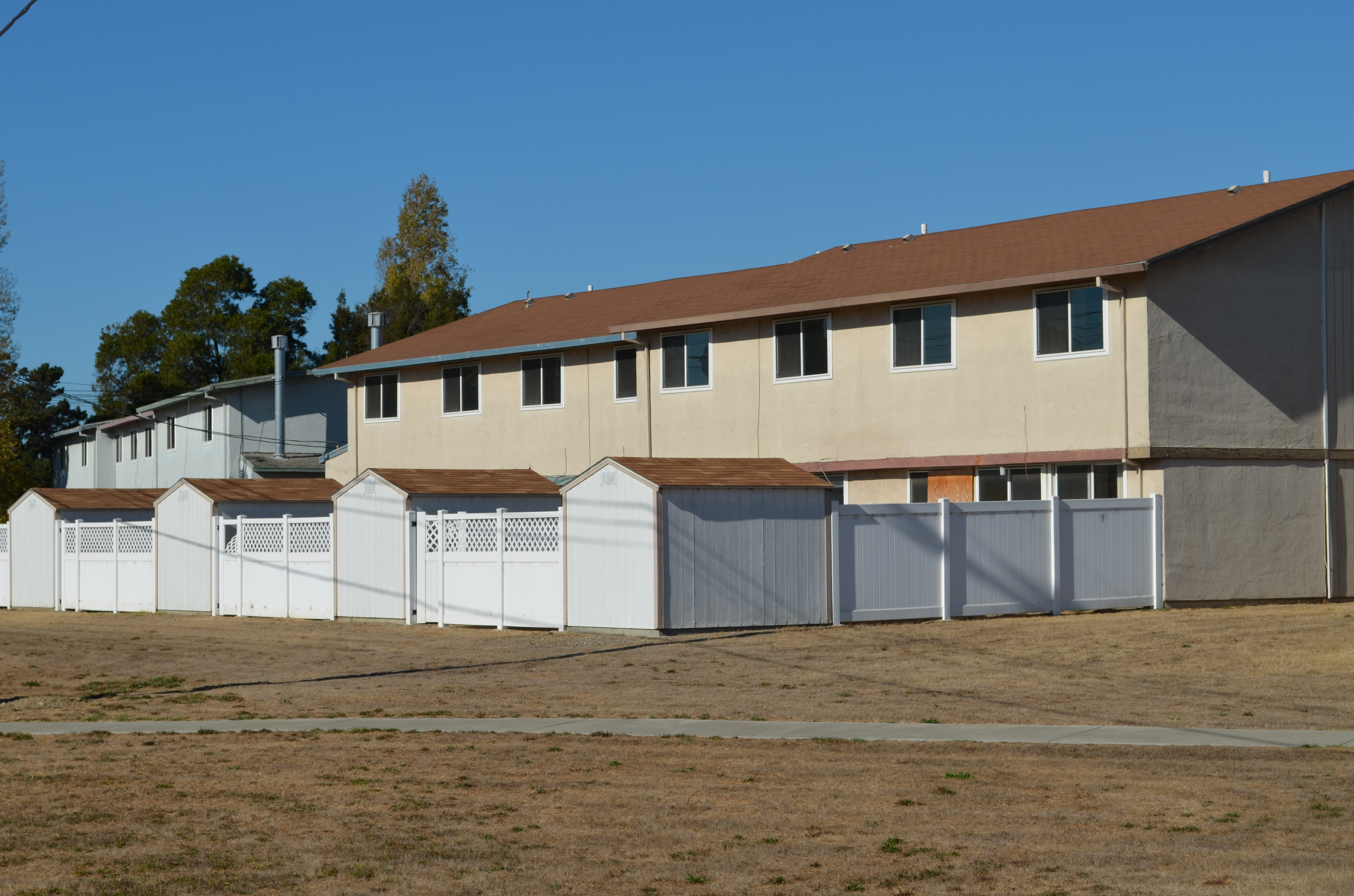
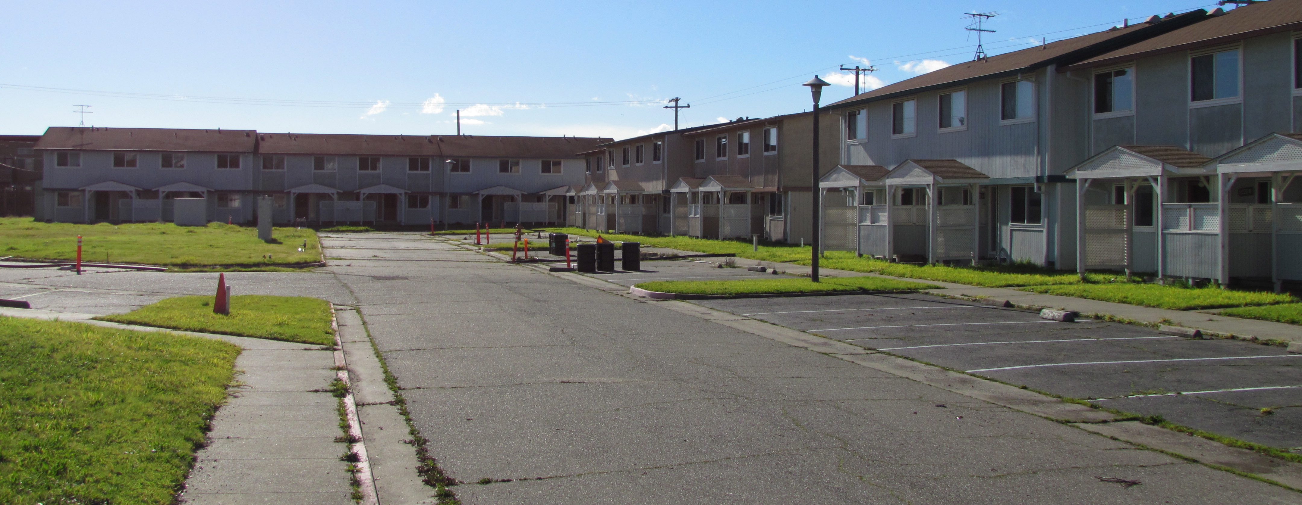
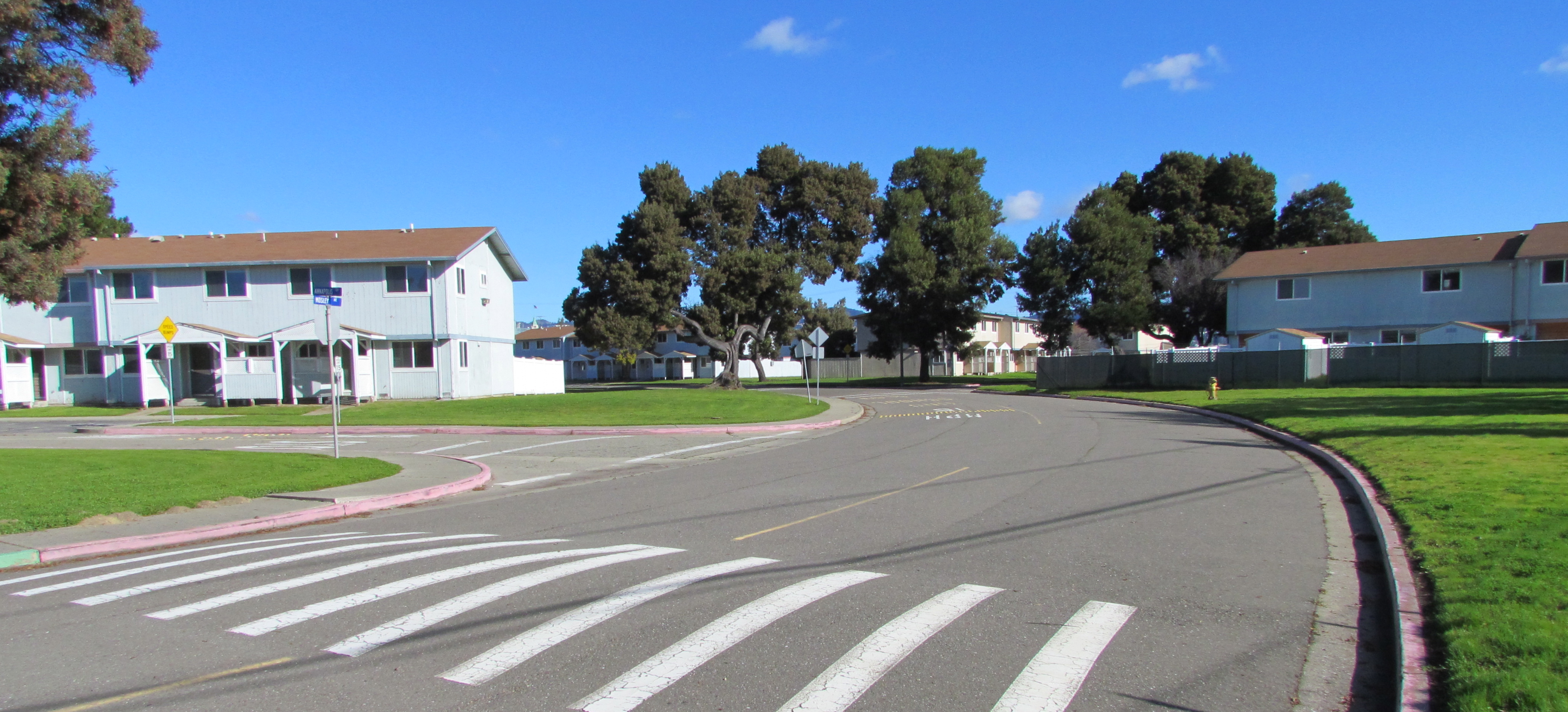
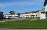
Typical North Housing multiplex military housing (vacant) constructed in 1969.

 “In addition,” said Potter, “the property is not laid out particularly efficiently, which is also a challenge.  North Housing has a multi-family overlay designation and it would be extremely difficult to take advantage of that zoning (30 units to the acre) with the current building layout,” she said.  “The only exception to all of this is that Habitat for Humanity East Bay has a Self-Help Housing Public Benefit Conveyance request pending with HUD which proposes an option of retaining 30-32 units to be renovated and sold as self-help housing.”

Housing Authority plays a key role

The Housing Authority will be partnering with the Alameda Point Collaborative and Building Futures with Women and Children who will provide services to residents of the Housing Authority’s 90 units.  A community center is planned.

Funding to build the Housing Authority’s homeless assistance units has not yet been identified.  However, Potter said she expects project financing would be packaged from a variety of sources, “with the primary funding coming from an award of Federal/State tax credits (equity raised through the sale of the tax credits to an investor),” she said.  “Other sources are most likely Federal HOME funds and dedicated housing authority funds the City receives as inclusionary housing in lieu fees and Affordable Housing fees paid by non-residential developers,” said Potter.

Alameda Housing Authority Director Mike Pucci has a good idea where the homeless housing will go, but is not ready to release a map.  “In our agreement that HUD has approved we did delineate a specific site comprising 13 acres, but a meets and bounds survey has yet to be conducted to establish it’s exact location,” said Pucci.

Checklist of regulations

The Navy completed its environmental review for the entire North Housing parcel in 2009 and issued a Finding of Suitability to Transfer (FOST) for Estuary Park.  A FOST for the housing area is awaiting decisions concerning Superfund cleanup issues early next year. 

The preparation of real estate transfer documents for just the park, however, could not proceed until HUD signed off on the city’s federally mandated homeless plan, according to the Navy’s Base Closure Manager Anthony Megliola.  “Now that HUD has made its determination, real estate documentation supporting the transfer is being prepared with transfer [of Estuary Park] planned in late 2013,” said Megliola. 

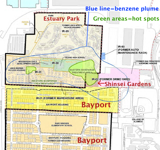
The remainder of the North Housing Parcel will be transferred in the 2015 timeframe, according to Megliola.   Factors include completing the cleanup actions for the benzene plume under part of the site, executing a Covenant to Restrict Use of Property (CRUP) with the California Department of Toxic Substances Control, executing a Finding of Suitability to Transfer (FOST) document, and preparing required real estate conveyance documentation associated with transfer.  “Although the National Environmental Policy Act (NEPA) Environmental Assessment (EA) was completed in 2009, receipt of the August 14, 2013 letter from the Department of Housing and Urban Development (HUD) was required before the Navy could complete the disposal actions for the North Housing area,” said Megliola.

Area where the Navy has been cleaning up benzene contamination at North Housing area.

Earlier in 2013, the Navy submitted a request to regulatory agencies to discontinue their vapor extraction work on the benzene plume hotspots, saying that vapor intrusion into buildings was not a risk.  The benzene vapor pumps were turned off in the spring and a new round of interior vapor tests were conducted in some of the existing buildings.  Results of these tests and a decision on whether to continue running the cleanup pumps for a few more years or terminate the program will be made in early 2014. 

This former military housing site was originally to be conveyed to the Coast Guard and was not part of the city’s No-Cost Economic Conveyance deal with the Navy.  (The new homes at North Housing will be in addition to the 1,425 units in the no-cost conveyance deal for Alameda Point.)  Subsequently, the Coast Guard withdrew its request.  In November 2007, the Navy notified the Alameda Reuse and Redevelopment Authority that it was going to declare an additional 42 acres of NAS Alameda – the North Housing parcel  – as surplus property.

As part of its requirements as the local reuse authority, the city had to comply with the McKinney Homeless Assistance Act and reach out to homeless housing providers for proposals.  In March of 2009, the city made its recommendations to HUD for compliance with the McKinney Act, approving the proposals from Habitat for Humanity, and the Alameda Housing Authority/Alameda Point Collaborative/Building Futures with Women and Children.  They also recommended the Alameda Recreation and Park Department proposal to receive Estuary Park.  These proposals became amendments to the 1996 Community Reuse Plan for Naval Air Station-Alameda.

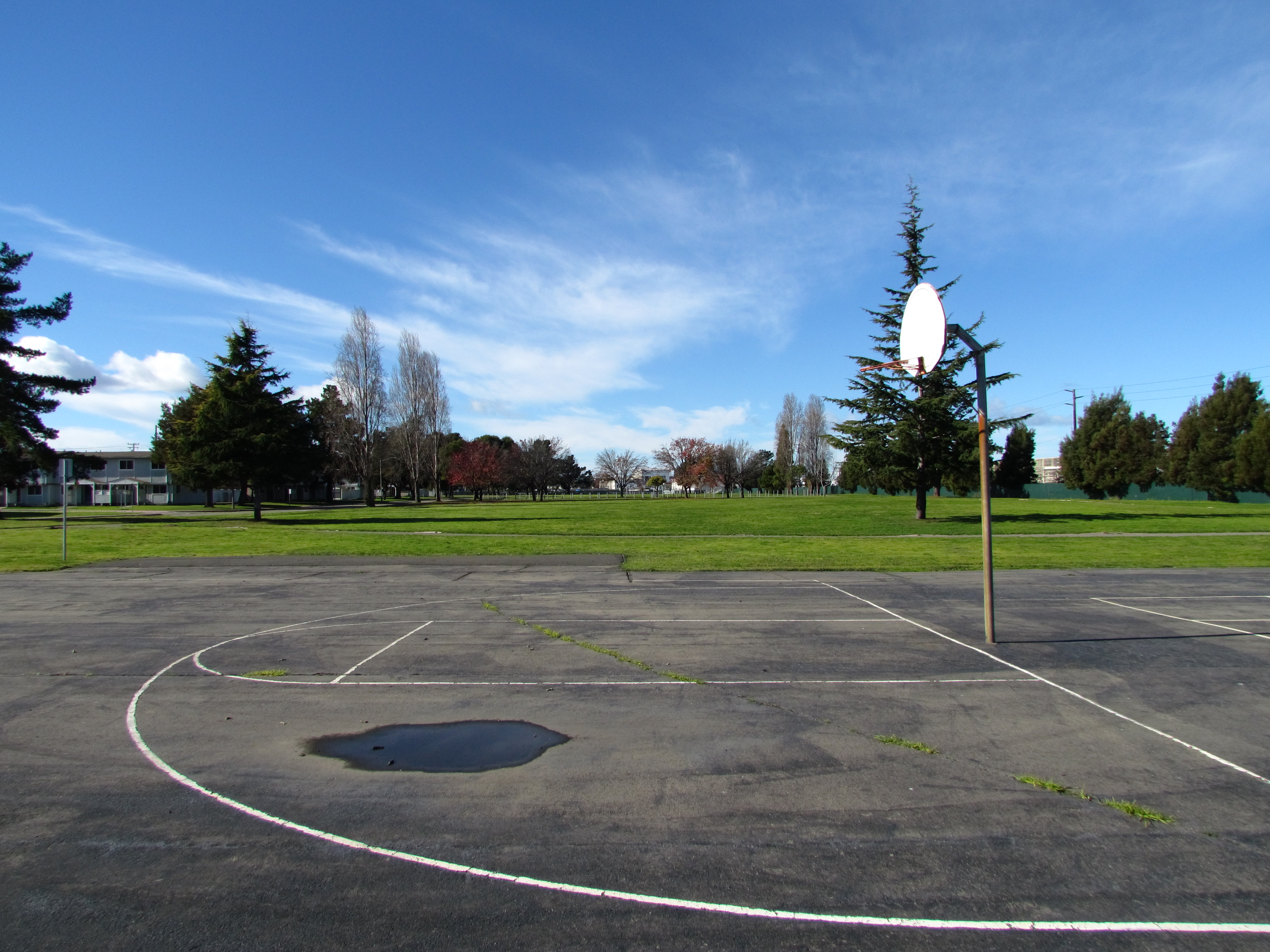
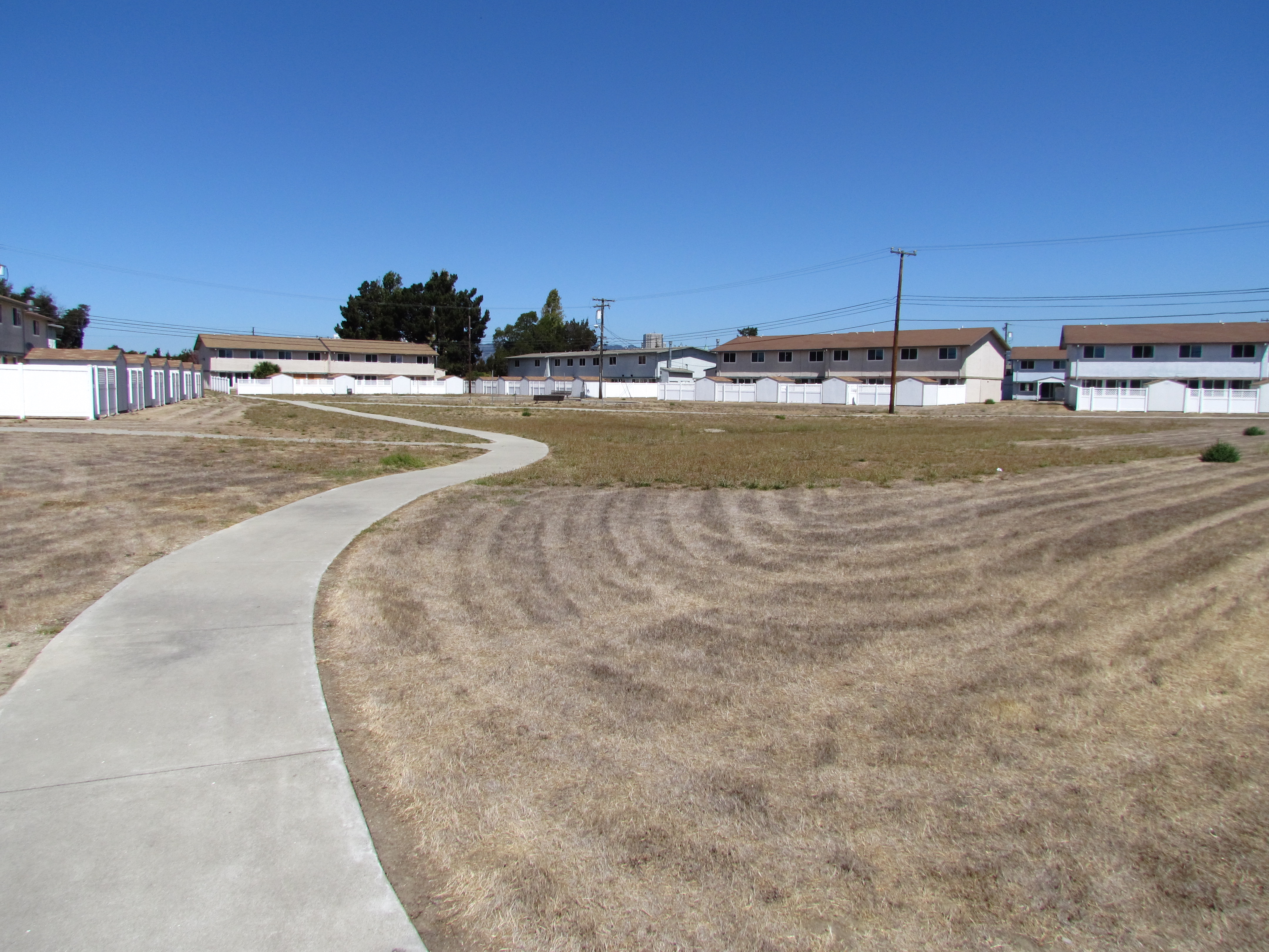
North Housing area.  Existing housing slated for demolition for create new, denser neighborhood.
North Housing area. Existing housing slated for demolition to create a new, denser neighborhood with public and private investment.
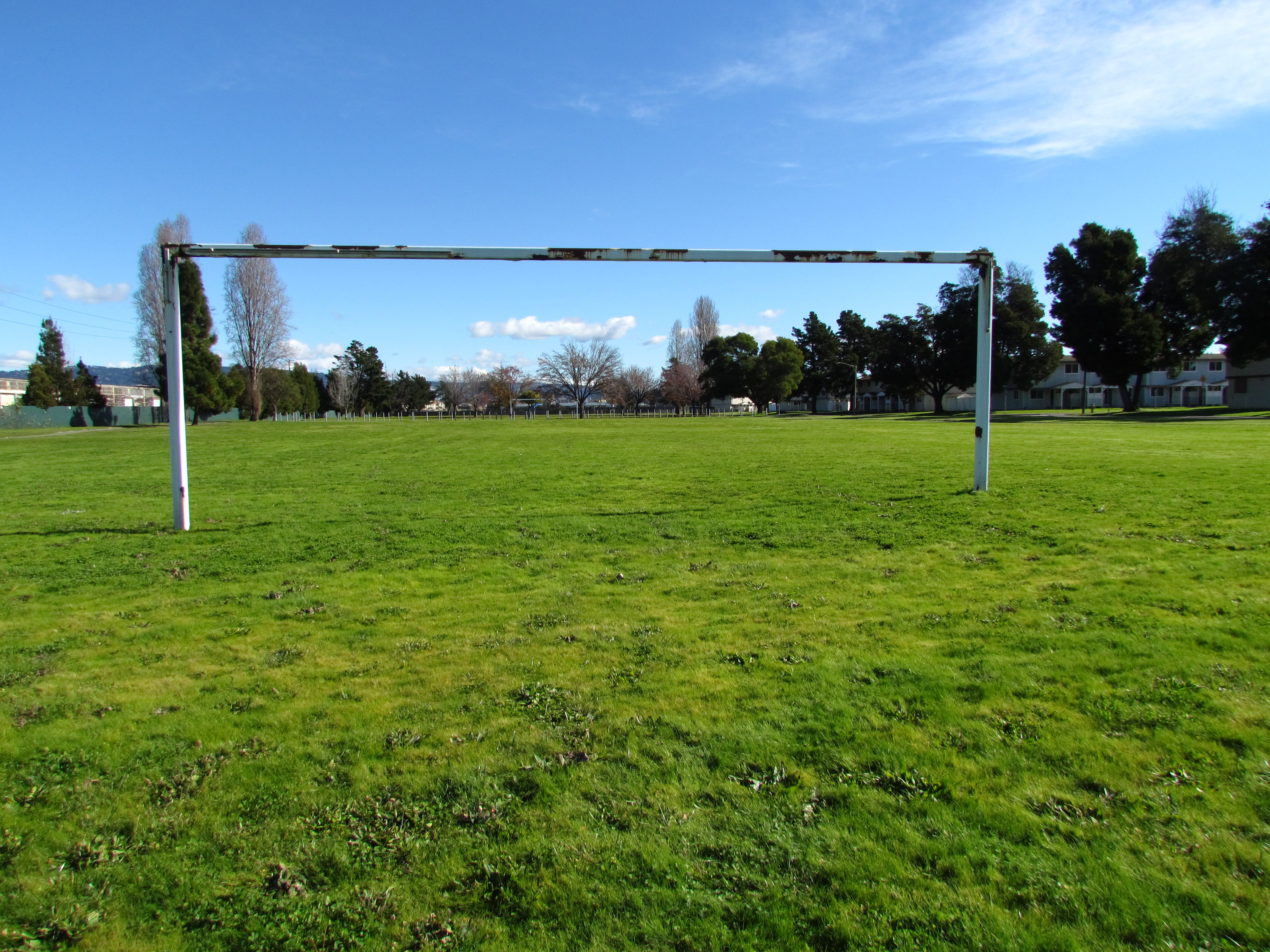
Estuary Park soccer field.  Looking east.  Alameda Landing and new Target store is past the tree line in the distance.
Estuary Park soccer field. Looking east. Alameda Landing is beyond the distant tree line.
Estuary Park baseball field.  Looking east.
Estuary Park baseball field. Looking east.
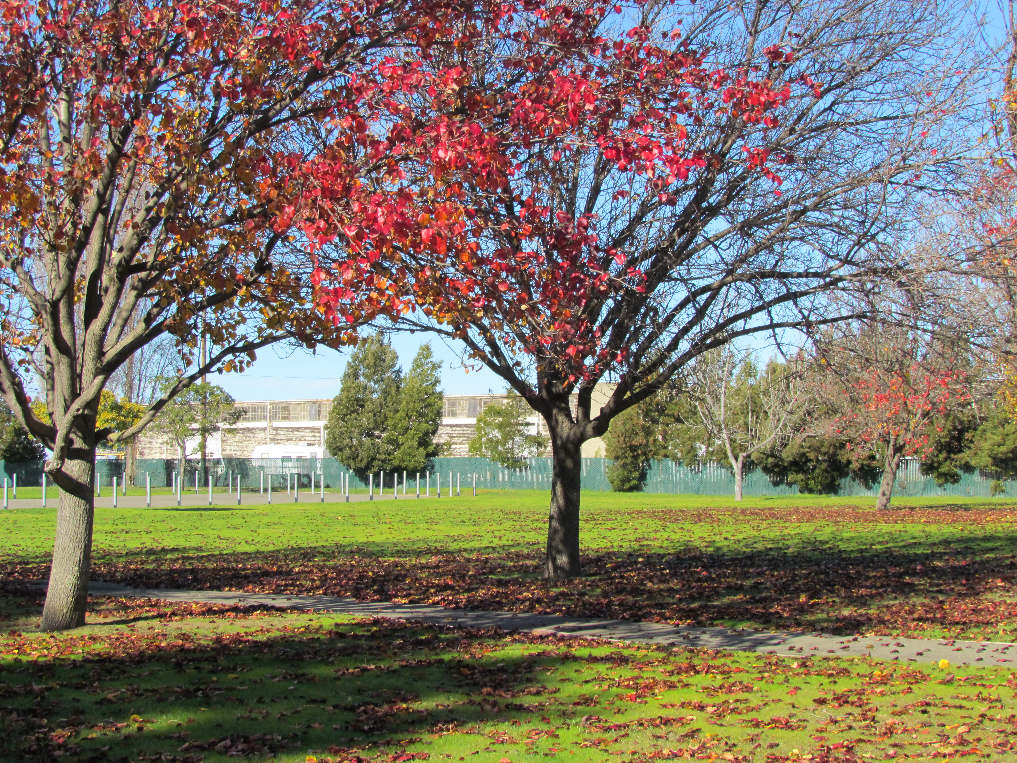
Estuary Park fall foliage.
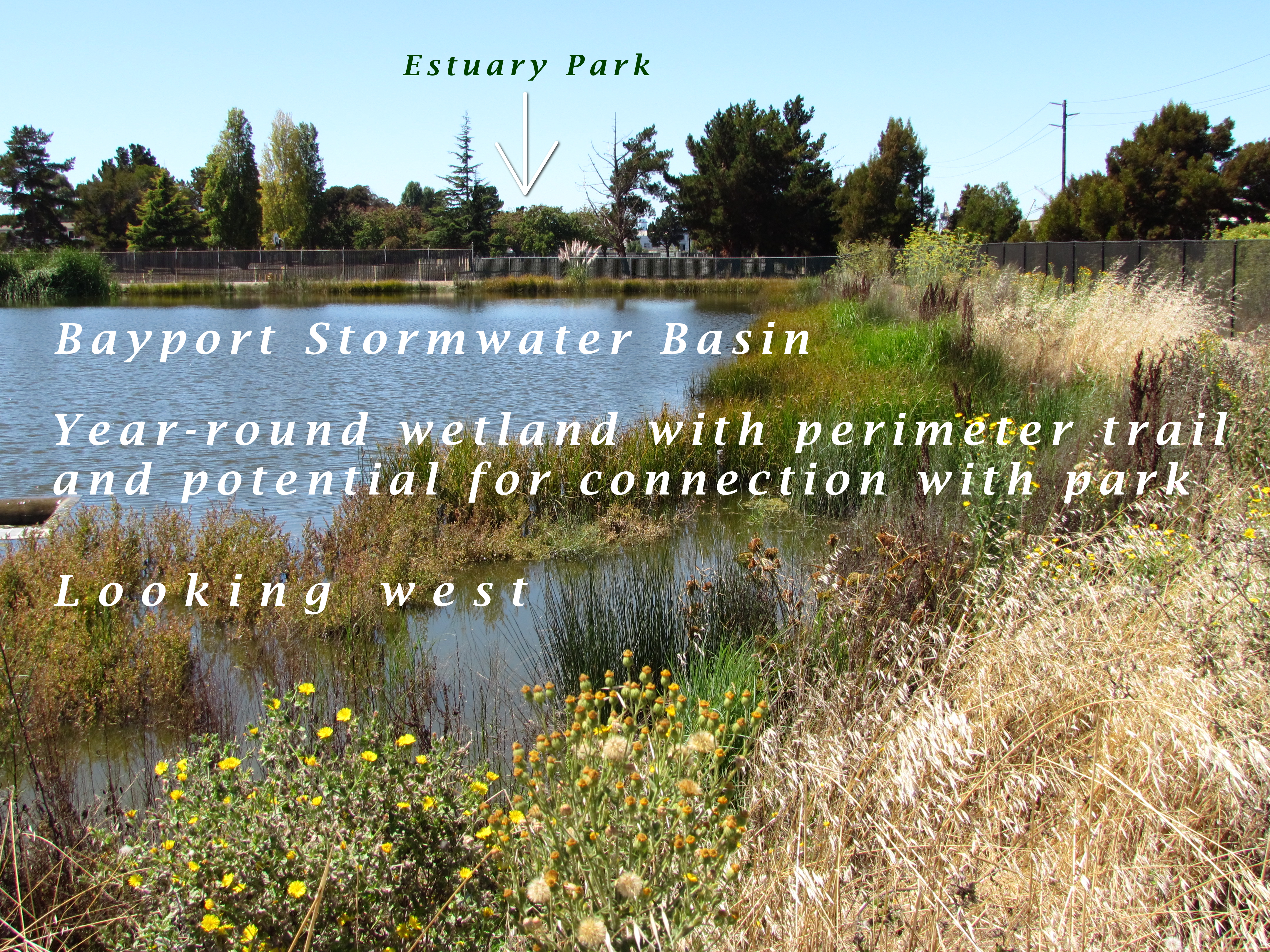
This stormwater basin was constructed by Catellus to serve the Bayport neighborhood.  It remains full year-round due to groundwater being continuously pumped from the special pumping station next to Shinsei Gardens.  Overflow is sent to the Oakland Estuary via another pump station.
This stormwater basin was constructed by Catellus to serve the Bayport neighborhood. It remains full year-round due to groundwater being continuously pumped from the special pumping station next to Shinsei Gardens. Overflow is sent to the Oakland Estuary via another pump station.

Landscaping the Navy’s underground waste disposal site

Thirty-five years after the Navy stopped disposing of toxic waste in unlined pits next to San Francisco Bay on Alameda Point’s southwest shoreline, the final actions to comply with state and federal laws are finally being implemented this year. 

Site 2 where industrial waste is buried.  Area up to the wetland will be covered with two feet of additional soil.
Site 2 where industrial waste is buried. Area up to the wetland will be covered with two feet of additional soil.

Decades of wrangling between the Navy and regulatory agencies over how to handle the West Beach Landfill, dubbed Site 2, were finally ironed out this spring.  The U.S. Environmental Protection Agency (EPA), the Regional Water Quality Control Board (Water Board), and the California Department of Toxic Substances Control (DTSC) have agreed to a plan that calls for leaving the estimated 1.6 million tons of industrial waste in place and adding more soil to the existing soil cover.  

Placement of soil cover at Site 2 - May 2013.  US Navy Photo.
Placement of soil cover at Site 2 – May 2013. US Navy Photo.

The Navy began dumping waste in the area in 1952, four years before they surrounded the area with a seawall.  The dump was closed in 1978, but early efforts to comply with state environmental laws for landfill closure were not to the satisfaction of the Water Board.

In its May 2012 draft engineering work plan for the landfill, the Navy cited a decade of groundwater monitoring along the shoreline that proved the toxic chemicals of concern are not migrating toward the Bay.  Instead, the chemical concentrations are either stable or declining.  The contents have been sitting in water-saturated subsurface soil since the disposal program began 60 years ago. 

Radiological hotspots of debris and soil, including a small storage building, were removed after an earlier scan of Site 2.  Before the current two feet of clean soil is put in place, the soil will again be scanned down to a depth of one foot, and elevated concentrations will be removed.  Radium-226 paint waste was disposed of in the landfill.

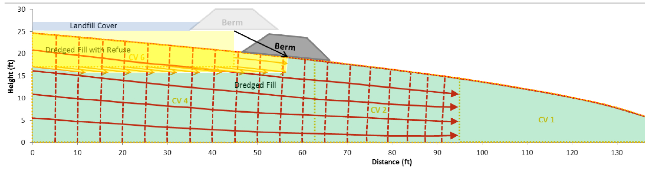
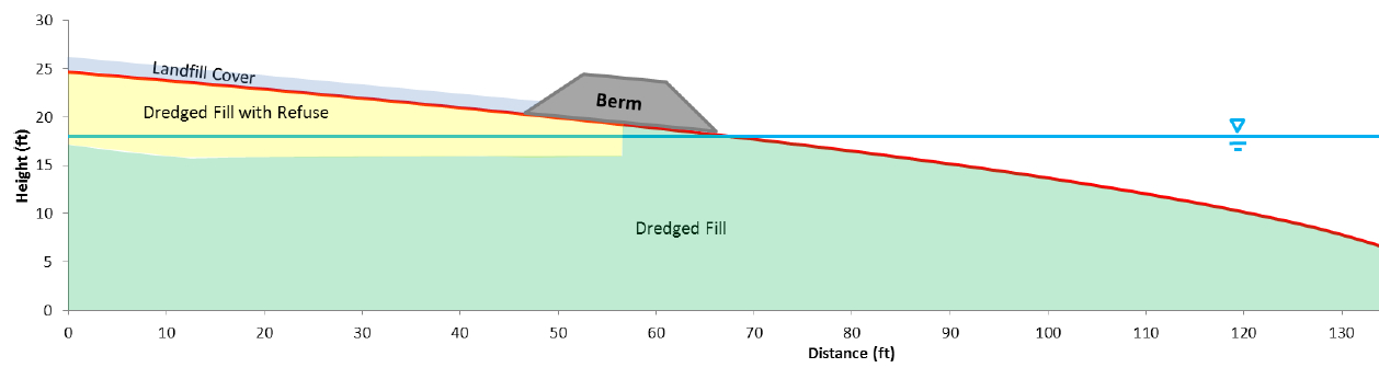
One of the major concerns about leaving this landfill in place is the consequence of a major earthquake.  The Navy responded to a comment from a DTSC engineer by acknowledging that in the event of a maximum credible earthquake, the riprap boulders forming the “seawall is conservatively assumed to be non-existent, instantaneously whisked away and replaced with a 25-foot vertical face of liquefiable sand subject to plastic flow without being constrained by a rigid shell (sea wall).”  The Navy’s earthquake model predicts that the earthen embankment above the seawall at the perimeter of the landfill, composed of clay and not sand, will glide into the Bay and “will not be overtopped by the waters of San Francisco Bay and freeboard of about 5 feet above mean sea level will remain, and so the refuse will remain isolated.”

Navy graphic showing predicted movement of embankment berm into San Francisco Bay during an earthquake.
Navy graphic showing predicted movement of embankment berm into San Francisco Bay during an earthquake. Click on image to enlarge.
Navy graphic depicting position of embankment berm at Bay shoreline a following catastrophic earthquake.
Navy graphic depicting position of embankment berm at Bay shoreline following a catastrophic earthquake. Click on image to enlarge.
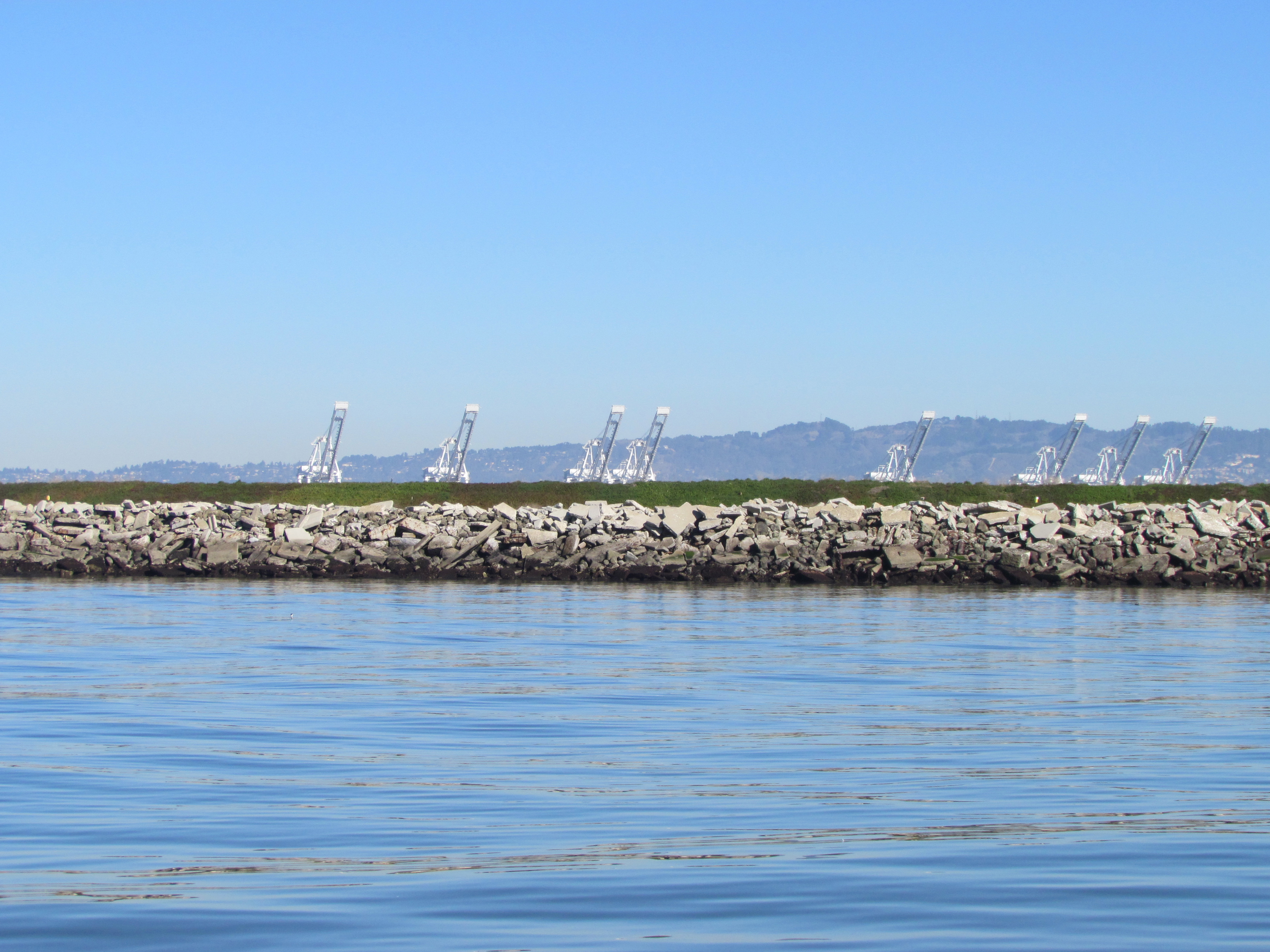
Southwestern shoreline of Alameda Point at Site 2 landfill.  Rock/cement riprap seawall, with green embankment berm above.  Looking north toward Port of Oakland.
Southwestern shoreline of Alameda Point at Site 2 landfill. Rock/cement riprap seawall, with green embankment berm above. Looking north toward Port of Oakland.

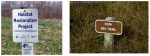
The Navy removed a perimeter security fence from their plans following objections from regulators and the public.  “Navy’s design and [Superfund] requirements for this project do not preclude future use of the site for limited public access or passive recreational purposes,” said the Navy.  Simple “Habitat Restoration Project” and “Stay on trail” signs were deemed adequate.

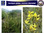
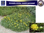
In an unusual move, the Navy offered the Restoration Advisory Board the opportunity to select the new vegetation that will anchor the 60 acres of clean soil.  In the fall of 2013, the Navy will seed the new soil with 13 native grasses, most of them flowering.  The Navy has permanently removed the 12-foot high embankment on the eastern, inland side of the landfill site, which will make the grassland visible from the mixed-use area.

The 30-acre wetland area on Site 2 was not contaminated, but will receive improvements to the quality of several acres.  The culvert connecting the wetland to San Francisco Bay will be regularly inspected and permanently protected.

Final Remedial Action Work Plan for Site 2 – Alameda Point – April 2013

Navy could shut down groundwater treatment at housing site

The Navy often hears calls to increase its environmental cleanup effort.  Now, the community and regulators are hearing a call from the Navy to eliminate one cleanup effort altogether.

North Housing area next to Island High School where benzene plume is located.

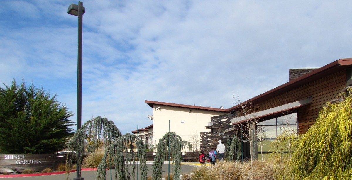
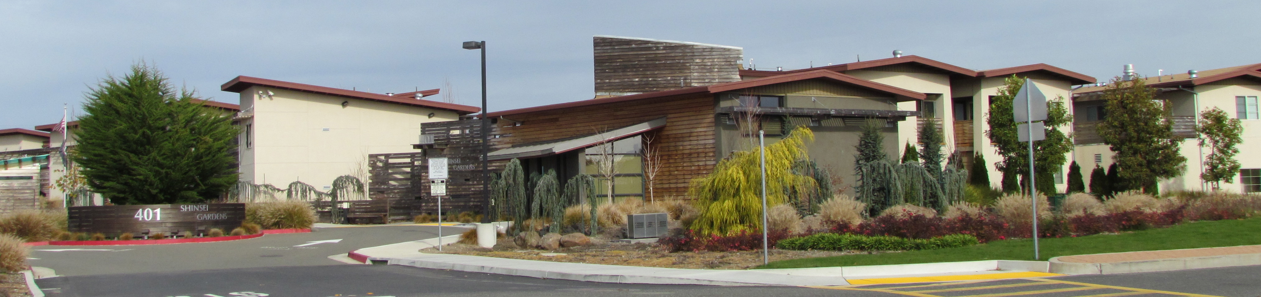
Since 2009, several acres of the area north of Bayport that includes the Shinsei Gardens affordable housing development, former Coast Guard and military housing, the closed Island High School, and the Woodstock Child Development Center have been undergoing groundwater treatment to eliminate hot spots of benzene and naphthalene vapors.  Shinsei Gardens also included special building slab engineering in its design as an extra precaution against vapor intrusion.  The Navy now says that its groundwater treatment system is unnecessary and should be shut down.

Shinsei Gardens
Shinsei Gardens

In a report issued in December 2012, the Navy said the underground vapor extraction system called biosparging is not making the area any safer for human habitation.  Biosparging is a form of bioremediation that uses air and oxygen injections to stimulate the growth of naturally occurring bacteria, which break down toxics.  In this case, the contamination is composed of waste material discharged from an Oakland coal gasification plant and an Alameda oil refinery that operated long before the area was filled in.  The contamination layer has been dubbed the Marsh Crust.

OU-5 map with plume & landmarks

The Navy’s report points to the initial studies in the area that showed no risk from vapors.  The only justification for the remediation in the first place was the limited risk of contact with water through non-potable uses, since drinking water will always be supplied by East Bay Municipal Utility District. 

Now the Navy says that even non-potable uses are impractical and off the table due to high levels of minerals such as salt.  With no way of coming in contact with water containing benzene and naphthalene, the Navy decided to review the data for vapor exposure and concluded there is plenty of evidence to turn off the pumps.  The biosparge system was designed to run for eight years in order to reach its cleanup goals.

The Navy’s December 2012 Technical Memorandum is seeking to amend the original cleanup decision — known as the Record of Decision (ROD) — for this cleanup area.  They will need the concurrence of the regulatory agencies:  the regional Water Board, state Department of Toxic Substances Control (DTSC), and the Environmental Protection Agency (EPA).  But the EPA and DTSC are not ready to agree without further testing. 

According to EPA’s Chris Lichens, “The Navy’s conclusions are not based on current data, site conditions, or investigation methods.  Before proceeding with a ROD Amendment,” he said, “the agencies would like the Navy to collect additional data to verify that vapor intrusion would not present a significant risk in the absence of biosparging.”  Lichens added, “Along those lines, EPA and DTSC jointly prepared recommendations for additional groundwater, soil vapor, and indoor air sampling and provided those recommendations to the Navy.  The Navy has not yet agreed to collect additional data, although we are still discussing it with them,” he said.

Originally published in the Alameda Sun.