Some of the toxic contamination at Alameda Point is not the result of Naval operations.
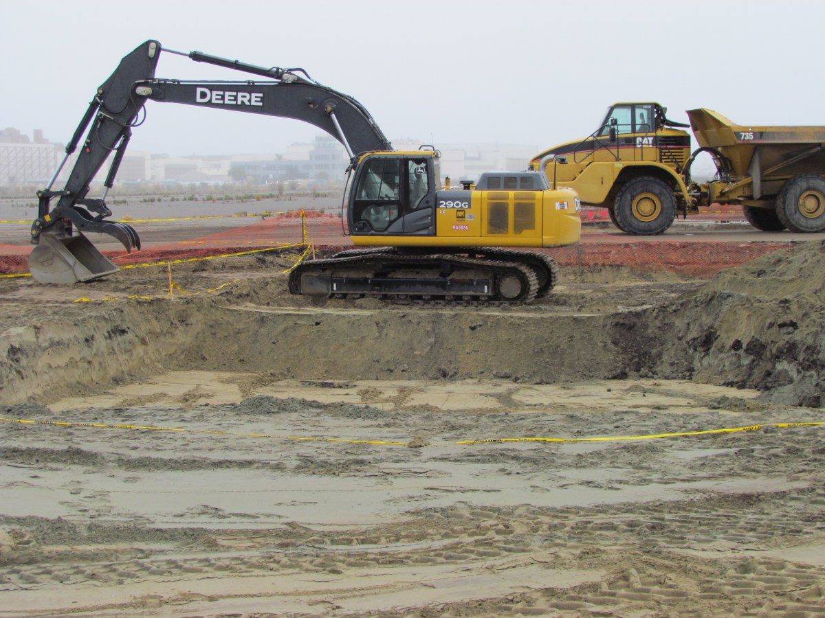
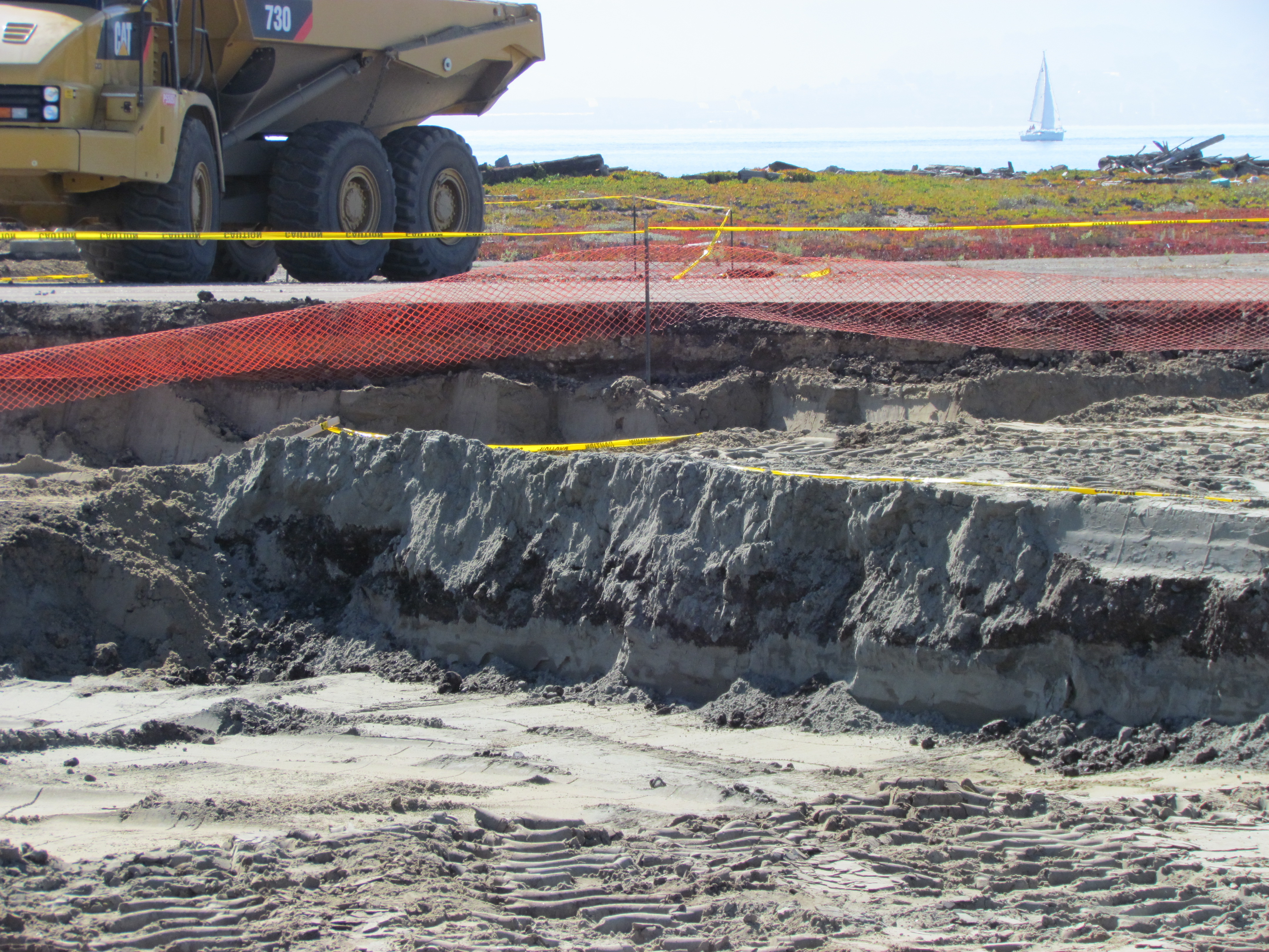
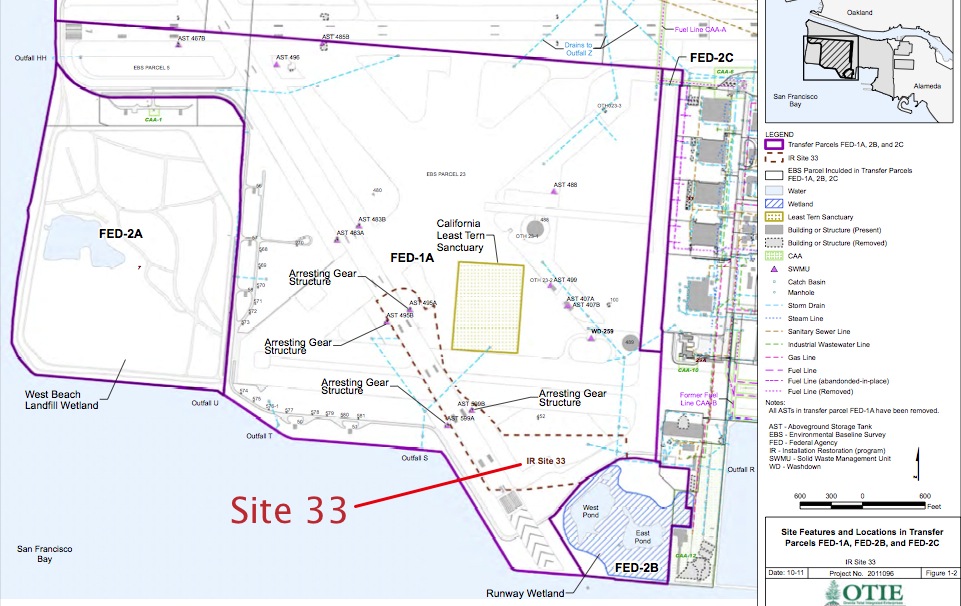
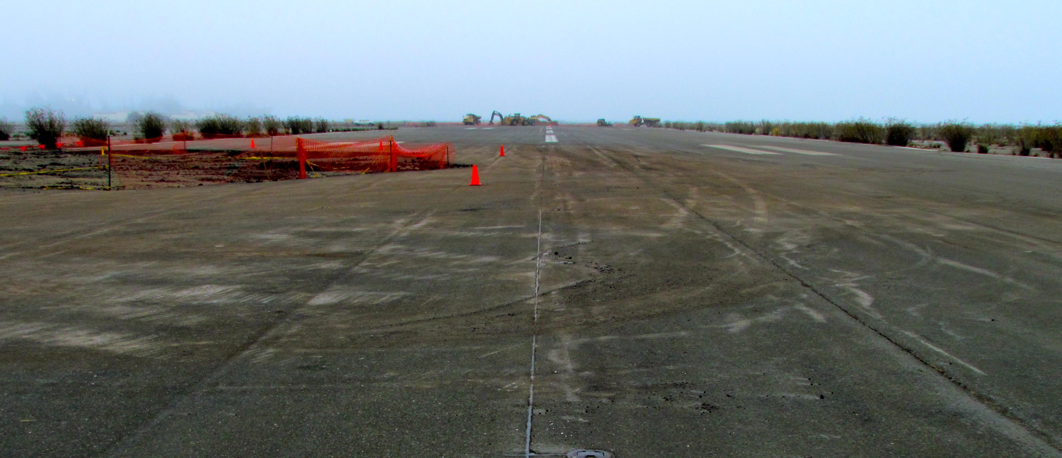
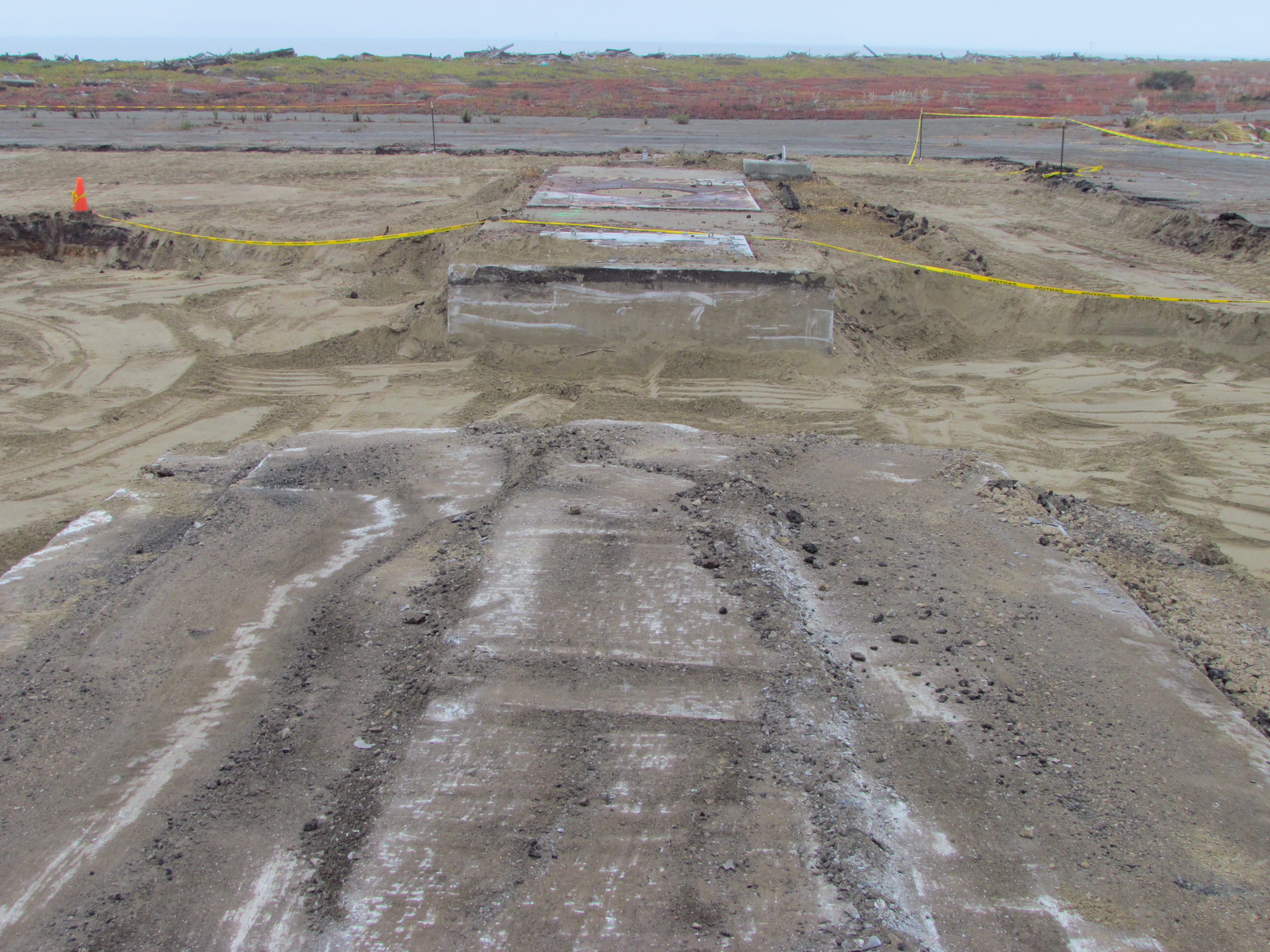
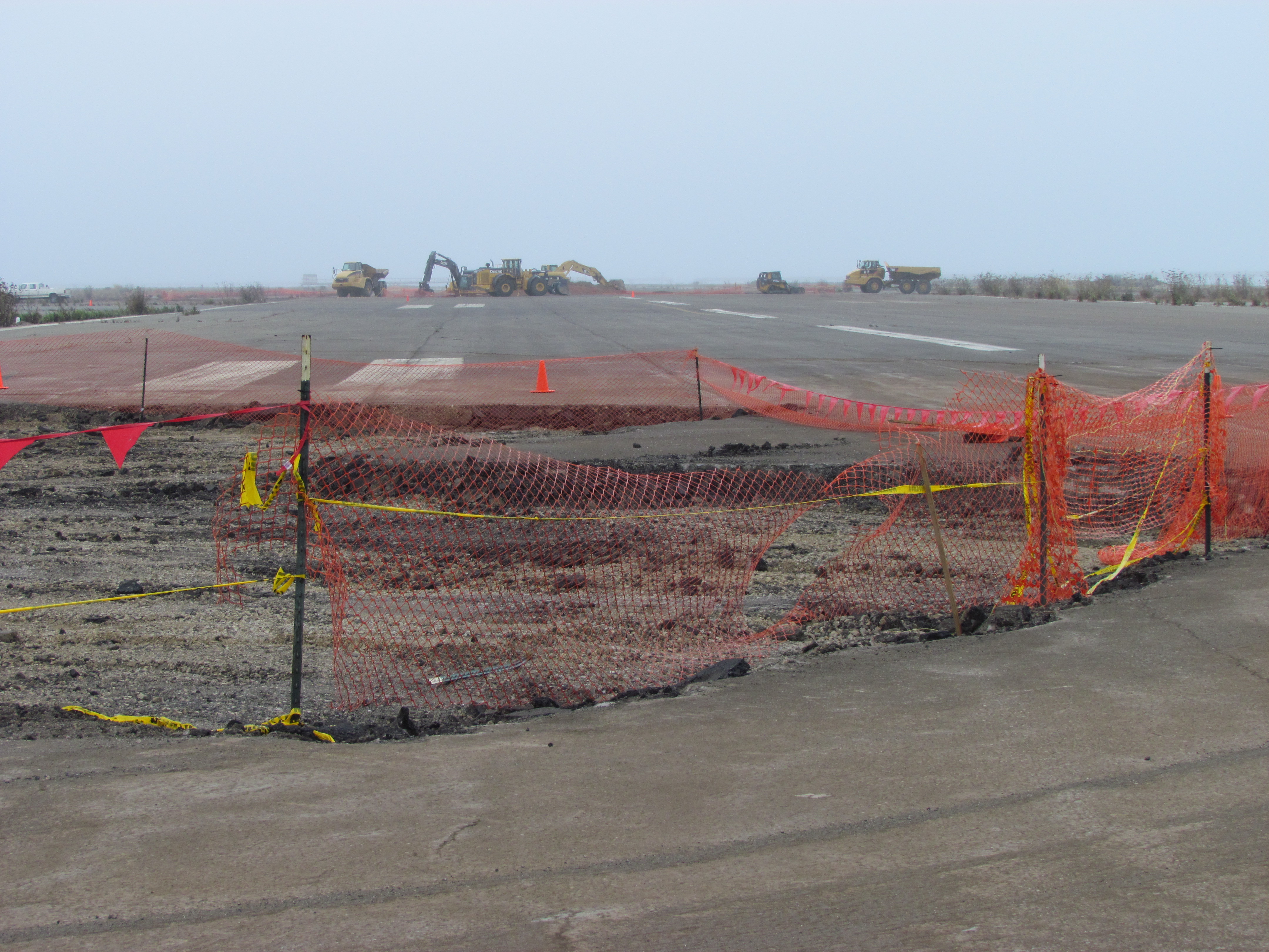
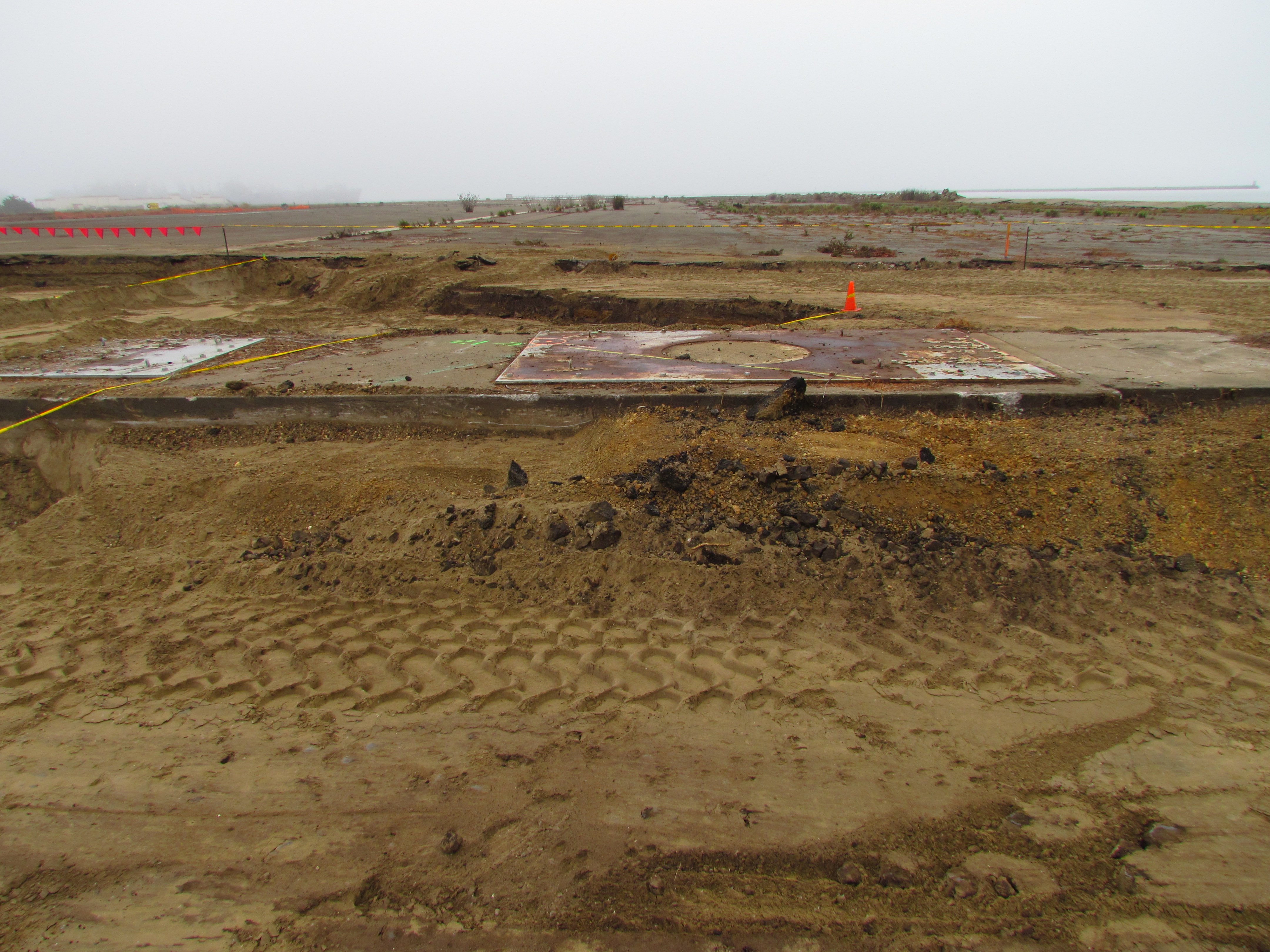
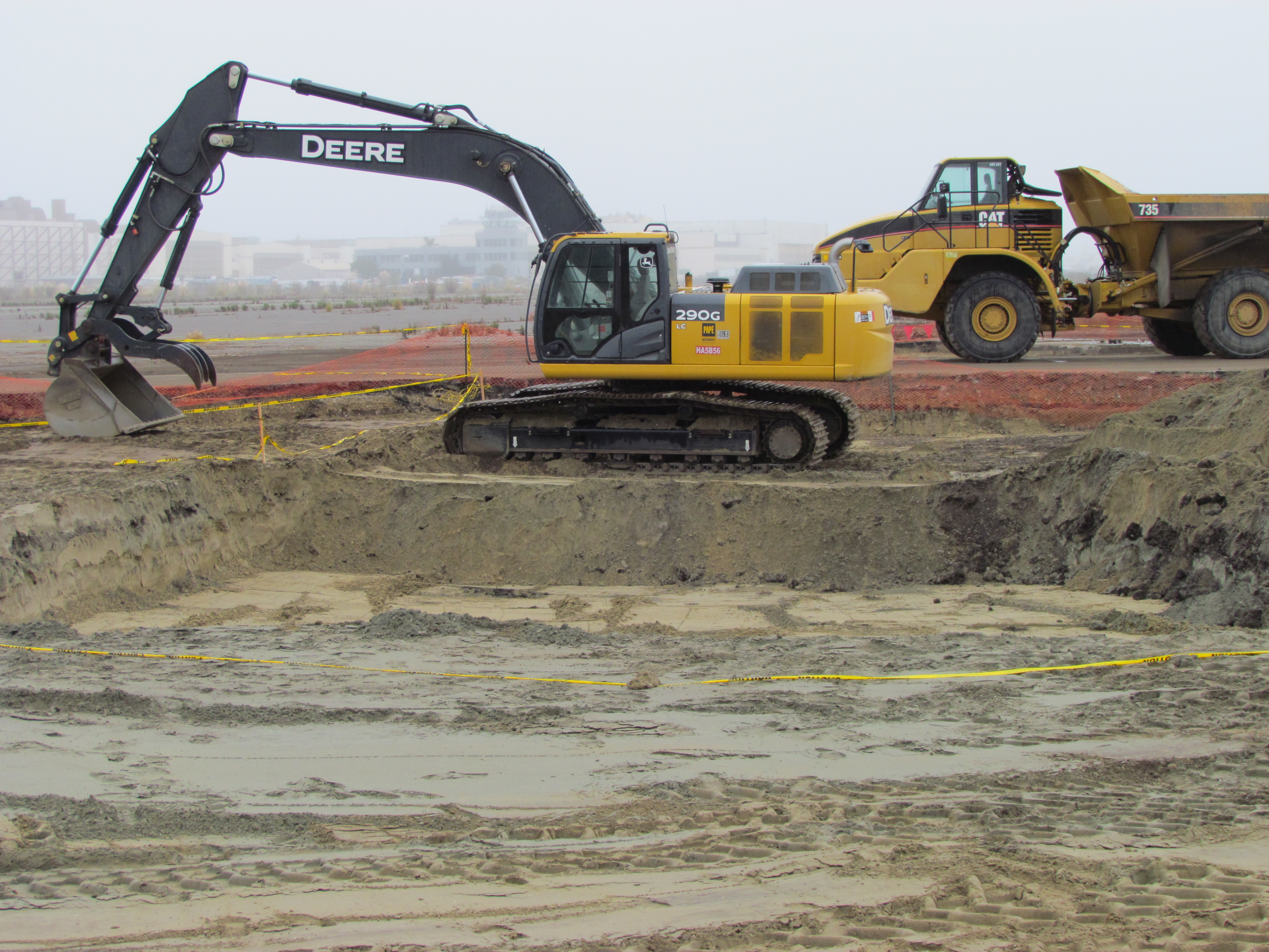
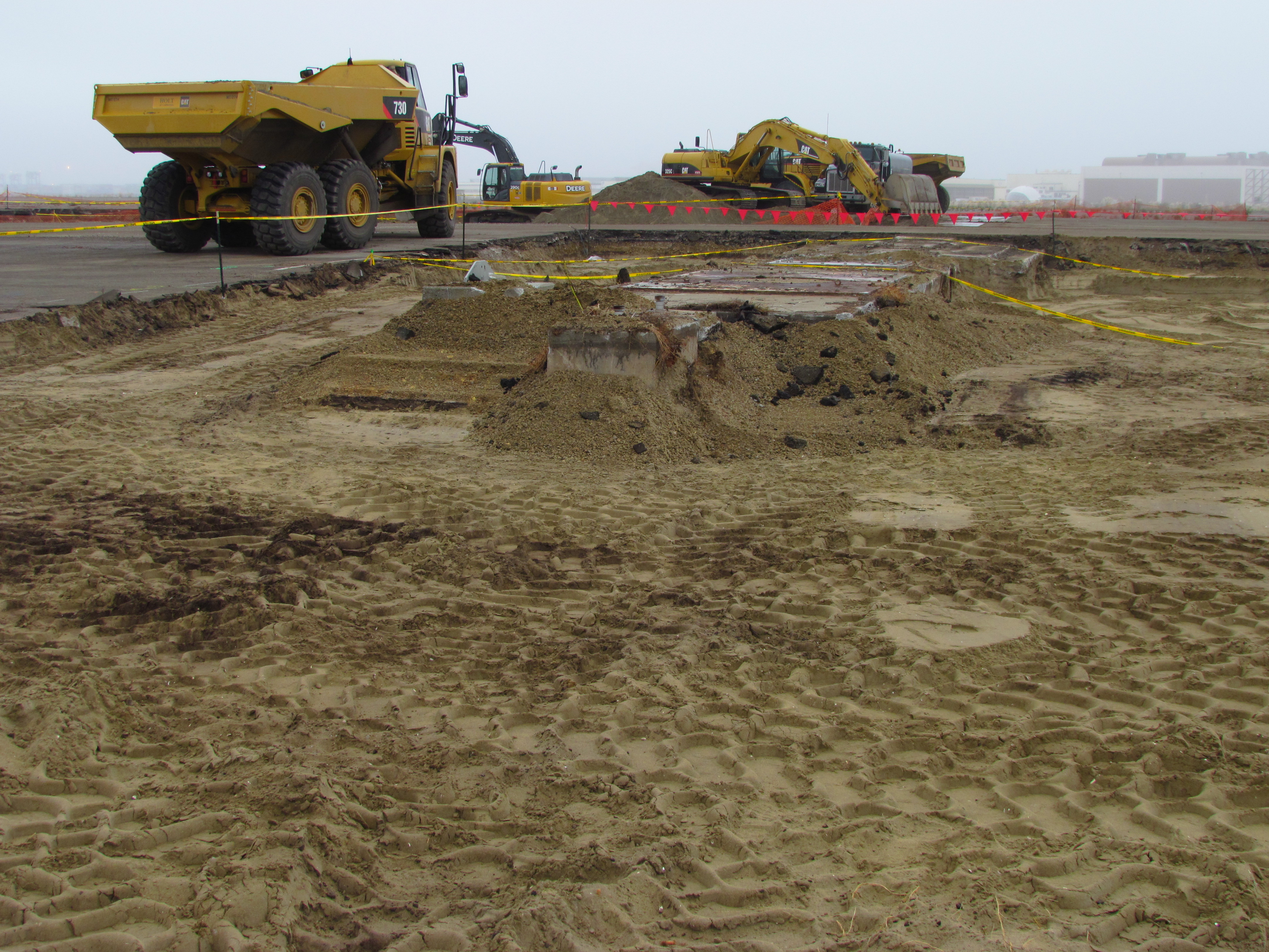
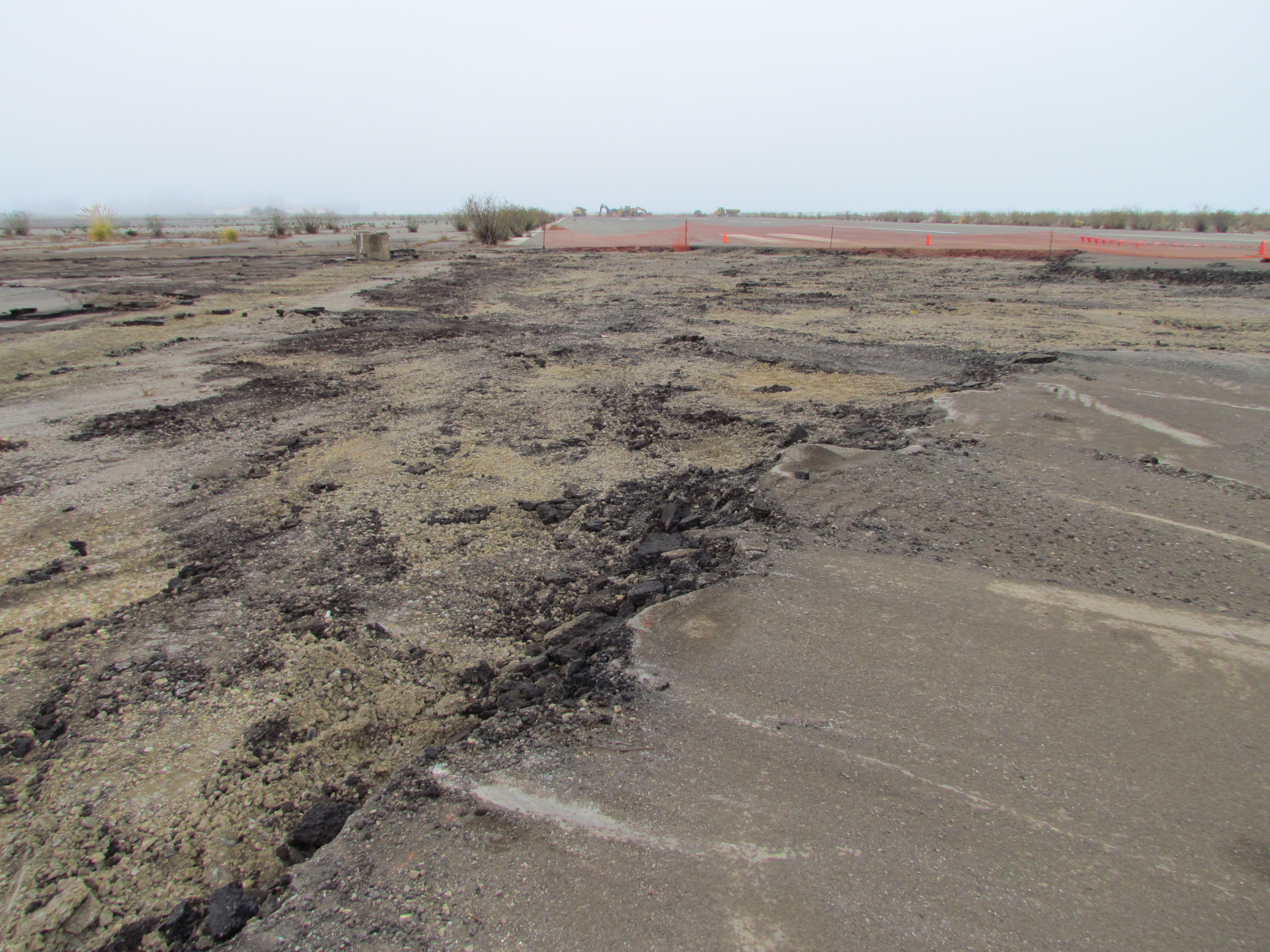
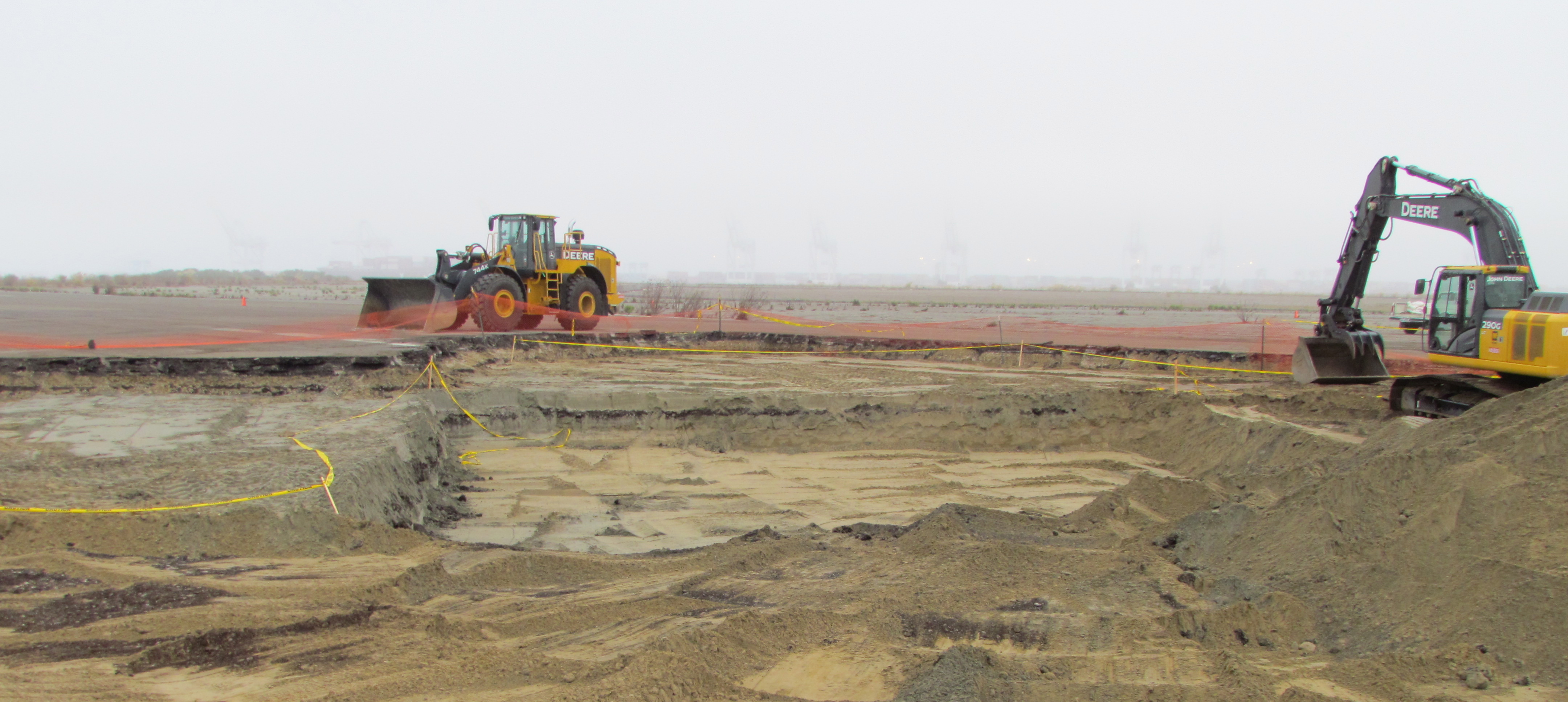
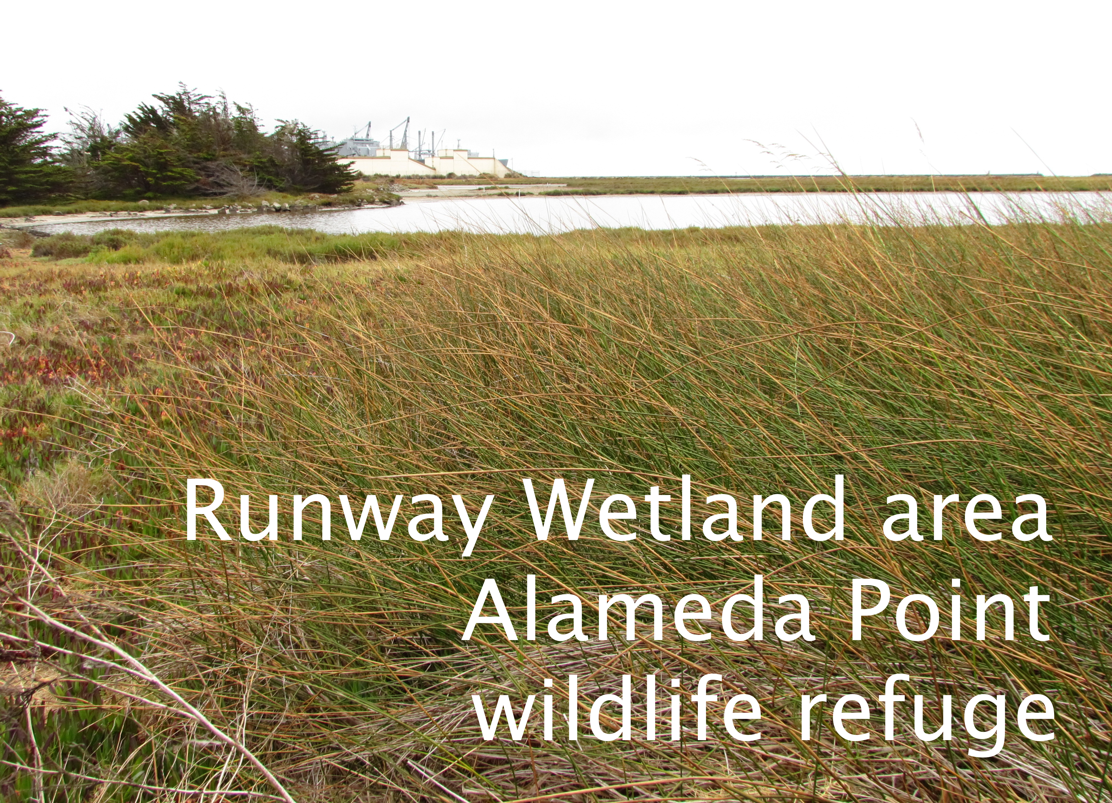
The Navy began cleaning up contaminated soil at five hot spots in the airplane runway area of Alameda Point in October. Cleanup Site 33 – on the area commonly referred to as the wildlife refuge – encompasses the southern end of the main north-south runway and adjacent tarmac, and is near the Least Tern nesting site and a wetland area.
The soil here became contaminated with PAHs (polycyclic aromatic hydrocarbons) before it ever became part of Alameda Point. The fill material used for creating this land mass was dredged from the Oakland Estuary primarily between 1936 and 1941 by means of a pumping system. It was contaminated by a coal gasification plant, which operated in Oakland around 100 years ago that disposed of waste into the waterway. Some of the sediment contamination may also have originated at the Pacific Coast Oil Refinery that once operated on the west end of Alameda.
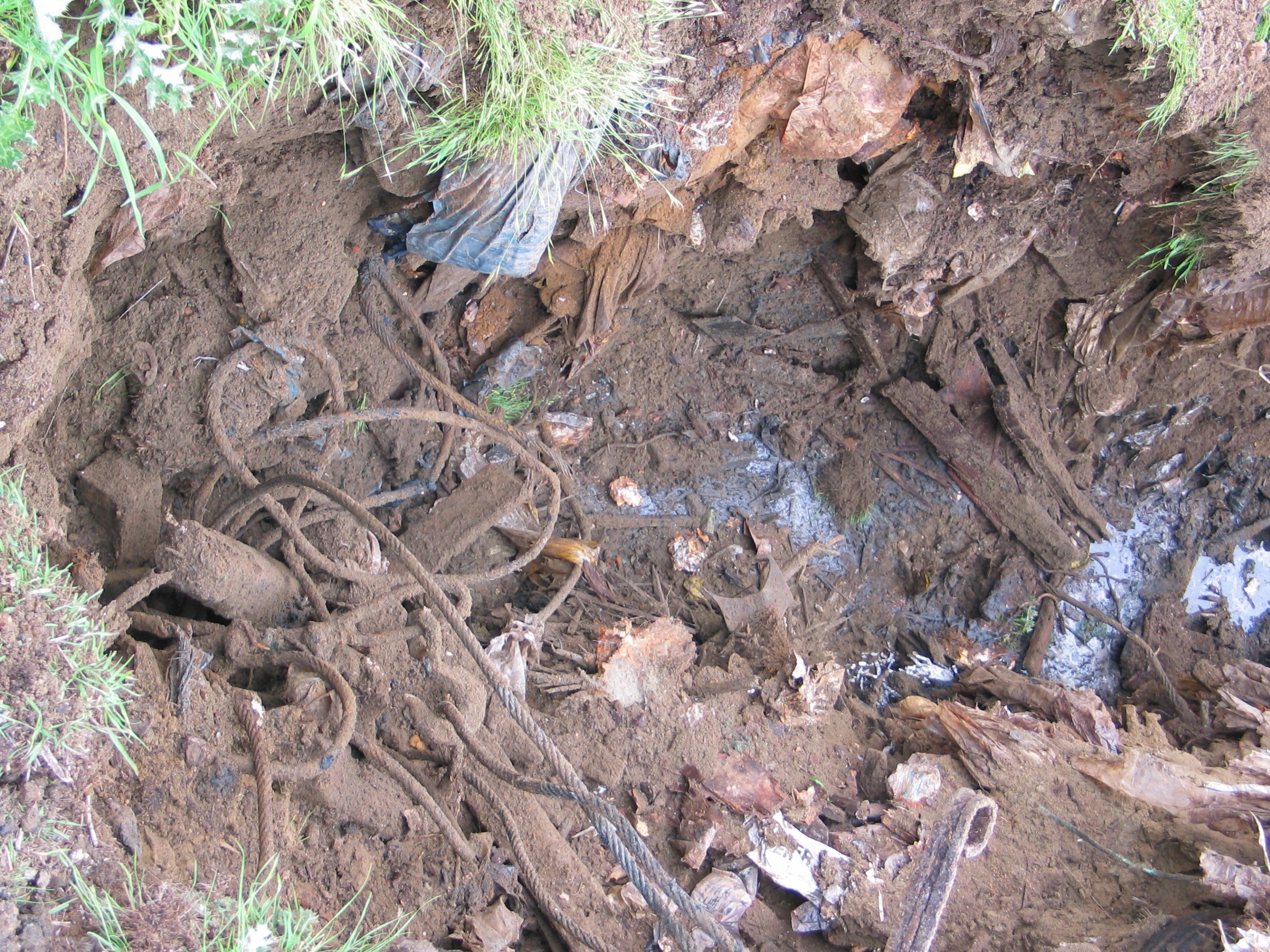
Site 33 arresting gear structure remnant
The potential health risk from PAHs, normally through ingestion of dust, has been part of cleanup evaluations for over a decade. The Navy and regulatory agencies agreed to the EPA’s residential soil standard in 2001.
PAH soil sampling began in 2002 at 300 locations throughout Alameda Point, including Site 33, producing over 1,200 samples. The 500-plus acre wildlife refuge parcel had 79 soil borings that produced 316 samples. Five boreholes exceeded residential use standards.
A 2008 report recommended additional testing at Site 33 that was done in 2010, leading to the current cleanup work at the five hot spot areas.
Over the past 22 years, more than 28 environmental studies have been conducted on the “refuge parcel,” looking at everything from volatile organic compounds, petroleum byproducts, PAHs, pesticides, PCBs, dioxins, explosives, metals, and radium. They analyzed surface sediment, soil, surface water, underground water, manhole sediment, and animal and plant tissue samples. Aerial photographs were also reviewed.
Talks between the Navy and US Fish & Wildlife Service for establishing a national wildlife refuge reached an impasse a decade ago, before many of these studies were completed, due to Fish & Wildlife’s concerns about liability for unforeseen cleanup expenses.
Refuge runway – Site 33 – one of five soil excavation areas
Today, the refuge parcel is slated to be transferred to the US Department of Veterans Affairs. Only about 40 acres of the refuge will be needed for their national cemetery and clinic if plans are approved to move most of the project northward onto the city’s Northwest Territories parcel.
The Navy will present an update on Site 33’s soil cleanup at the next Restoration Advisory Board meeting, 6:30 PM, Thursday, Nov. 8 at 950 West Mall Square, Community Conference Room at rear of building.
Site 33 arresting gear structure remnant
Refuge runway – Site 33 – one of five soil excavation areas
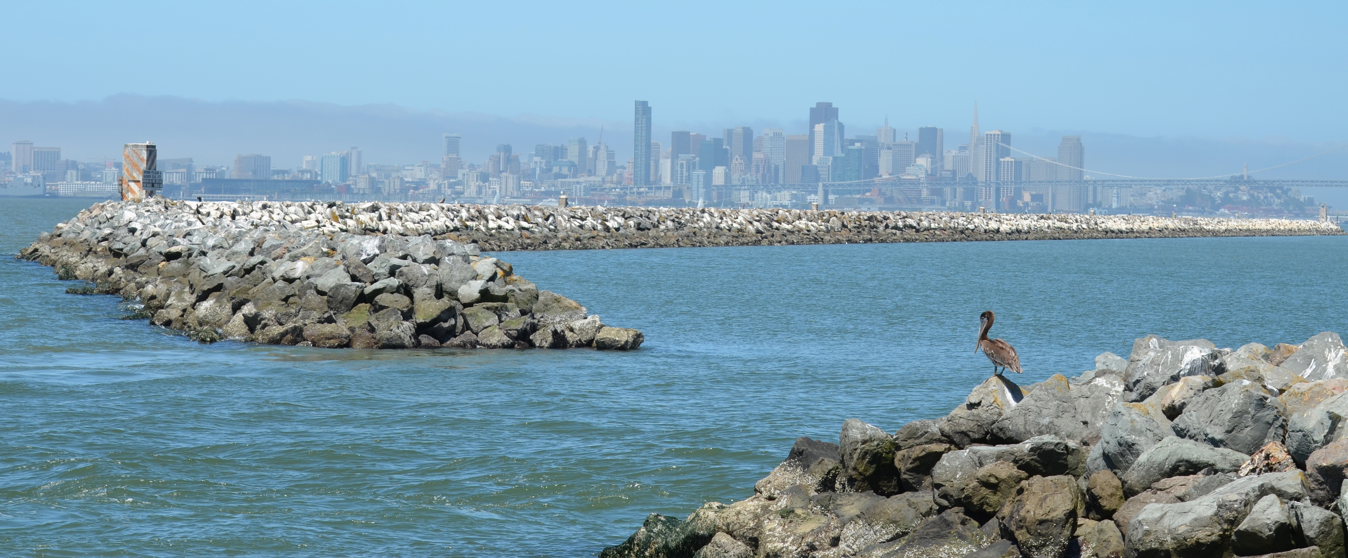
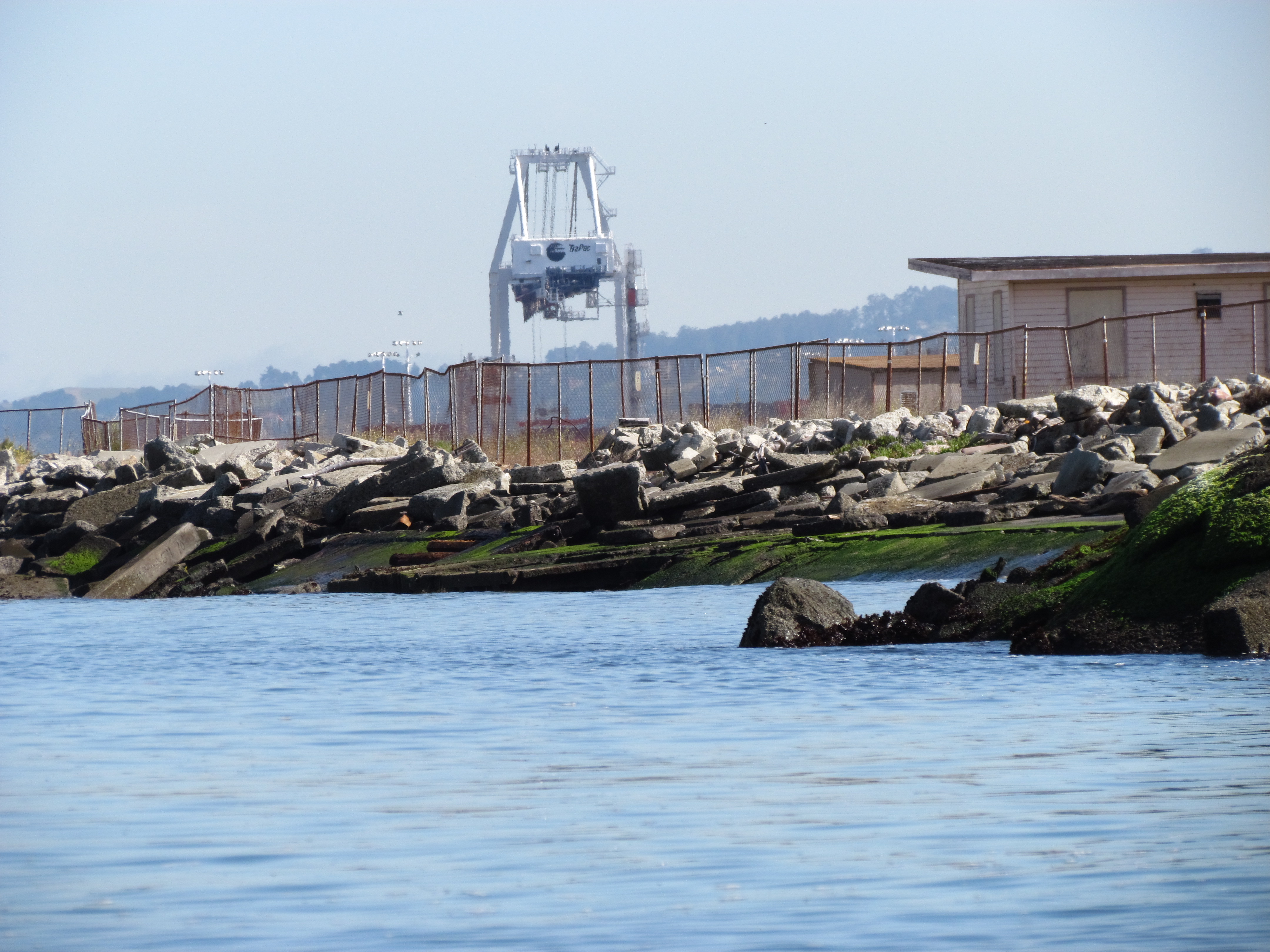
L-shaped Breakwater Island – largest brown pelican roosting site in San Francisco Bay – with San Francisco in background. Breakwater rocks in foreground extend back to Encinal Boat Ramp. Former Naval Air Station is located to the right.
The successful recovery effort for the once endangered California brown pelican is evident every summer through fall on Breakwater Island, an area which forms the beginning of the Alameda Point Channel leading to the ship docks and Seaplane Lagoon. The breakwater is a wall of boulders built up from the Bay floor to reduce wave action in the harbor.
California brown pelicans were listed as an endangered species in 1970. The pesticide DDT was identified as the cause of their decline. It caused reproductive harm, and altered the birds’ calcium absorption, which led to thin eggshells that would break under the parents’ weight. Use of DDT was banned in the United States 1972.
A recovery effort was launched in the 1970s on Channel Islands National Park off the coast of Santa Barbara. The only breeding colonies of California brown pelicans in the western United States are within Channel Islands National Park on West Anacapa and Santa Barbara islands.
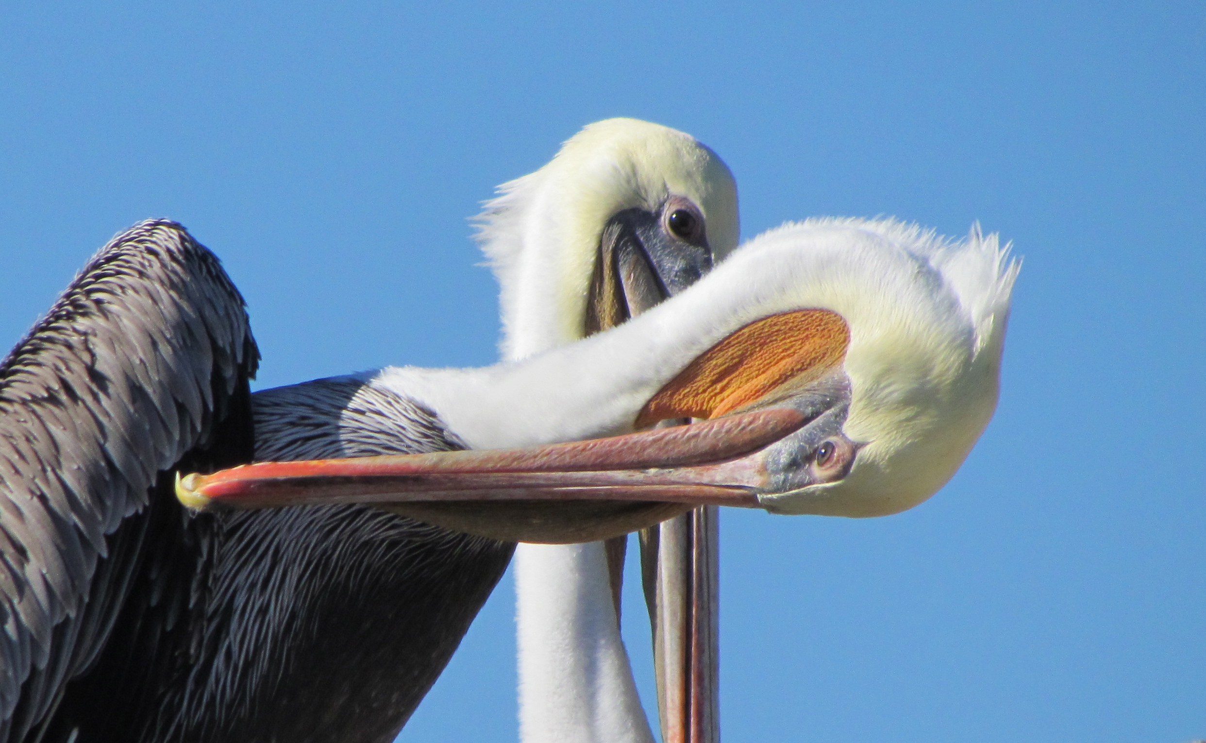
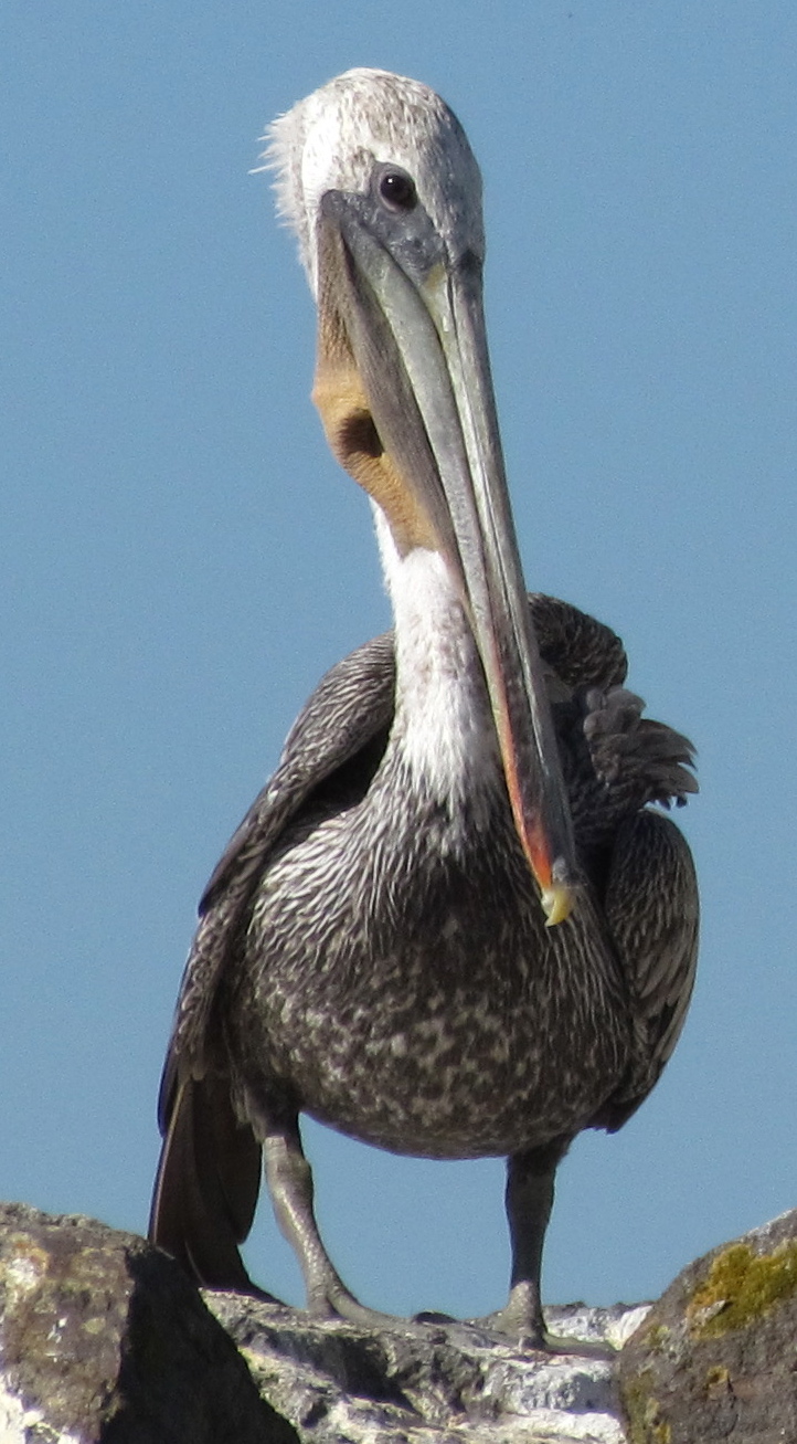
California brown pelican preening on Breakwater Island.
In the summer and fall, the brown pelicans can range from nesting colonies in Mexico and the Channel Islands all the way up to British Columbia. Alameda Point’s Breakwater Island is the largest roosting site in San Francisco Bay. A safe, secure roosting area is essential for pelicans to rest, preen, dry their feathers, maintain body temperature, and socialize.
When the Naval Air Station was still active, the Navy enforced restrictions against boats landing on the Island and posted signs that warn against disturbing the birds. Since the base closed, there has been no one to enforce regulations against disturbing the pelicans.
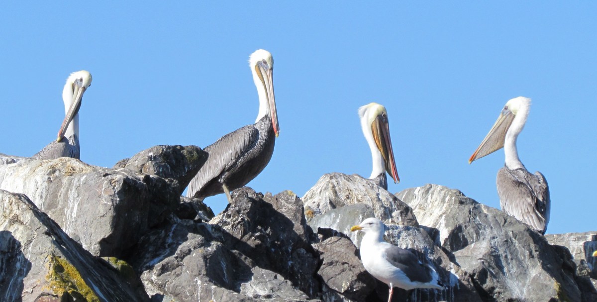
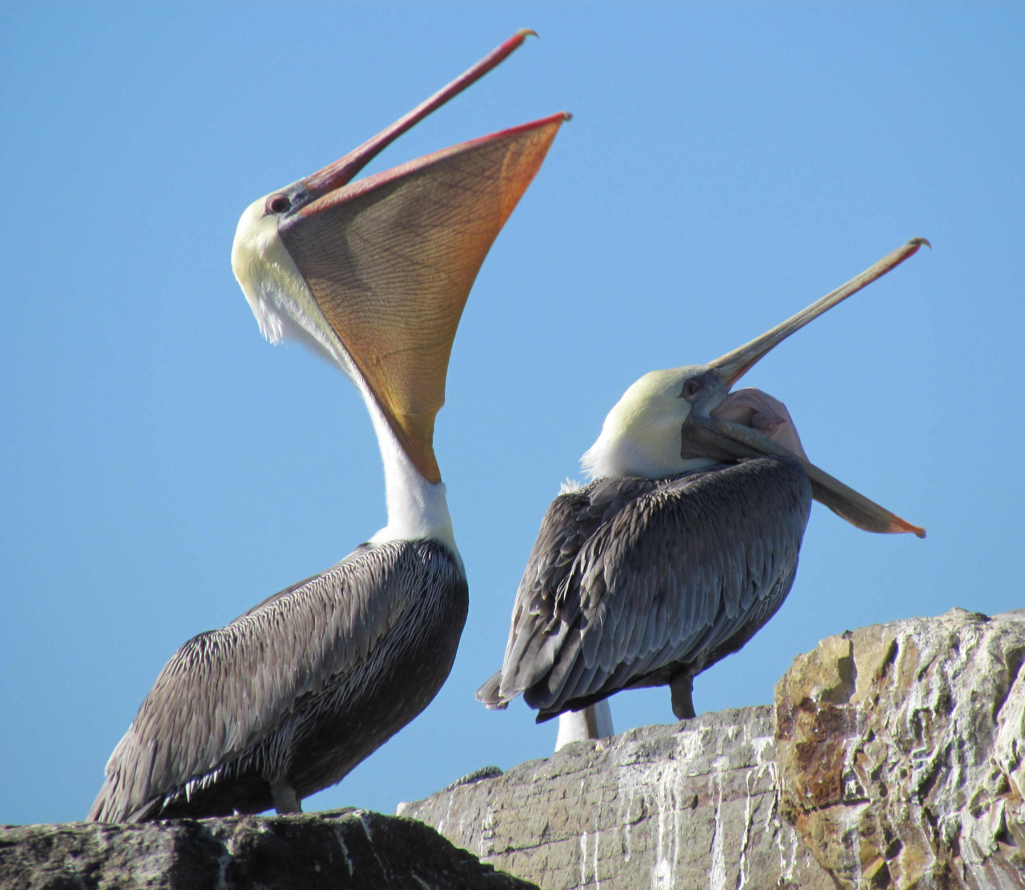
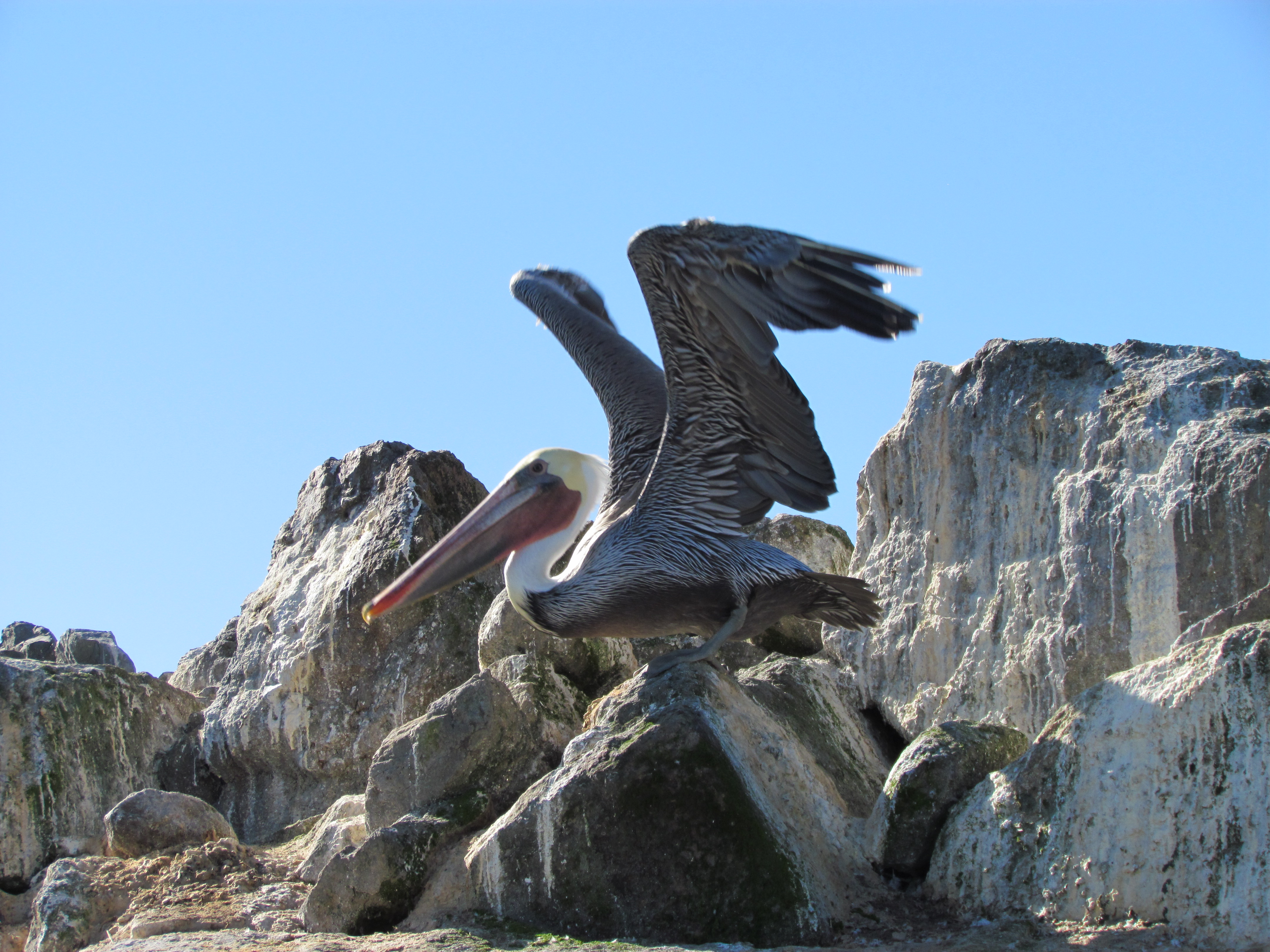
California brown pelicans relaxing on Breakwater Island on sunny fall day. Their mouth sack is the largest of any bird and is used to scoop fish when they plunge into the water.
The California Brown Pelican was removed from the Endangered Species List in 2009 after an almost 40-year recovery. There is currently no plan to look out for the welfare of these magnificent birds after the base is transferred out of Navy ownership. One way to ensure adequate protection and provide public education and appreciation of this unique ecological asset is to have it be part of an “Alameda Point Wildlife Conservation Area.” The East Bay Regional Park District would be an excellent agency to manage it; they already have a marine conservation area at nearby Crab Cove.
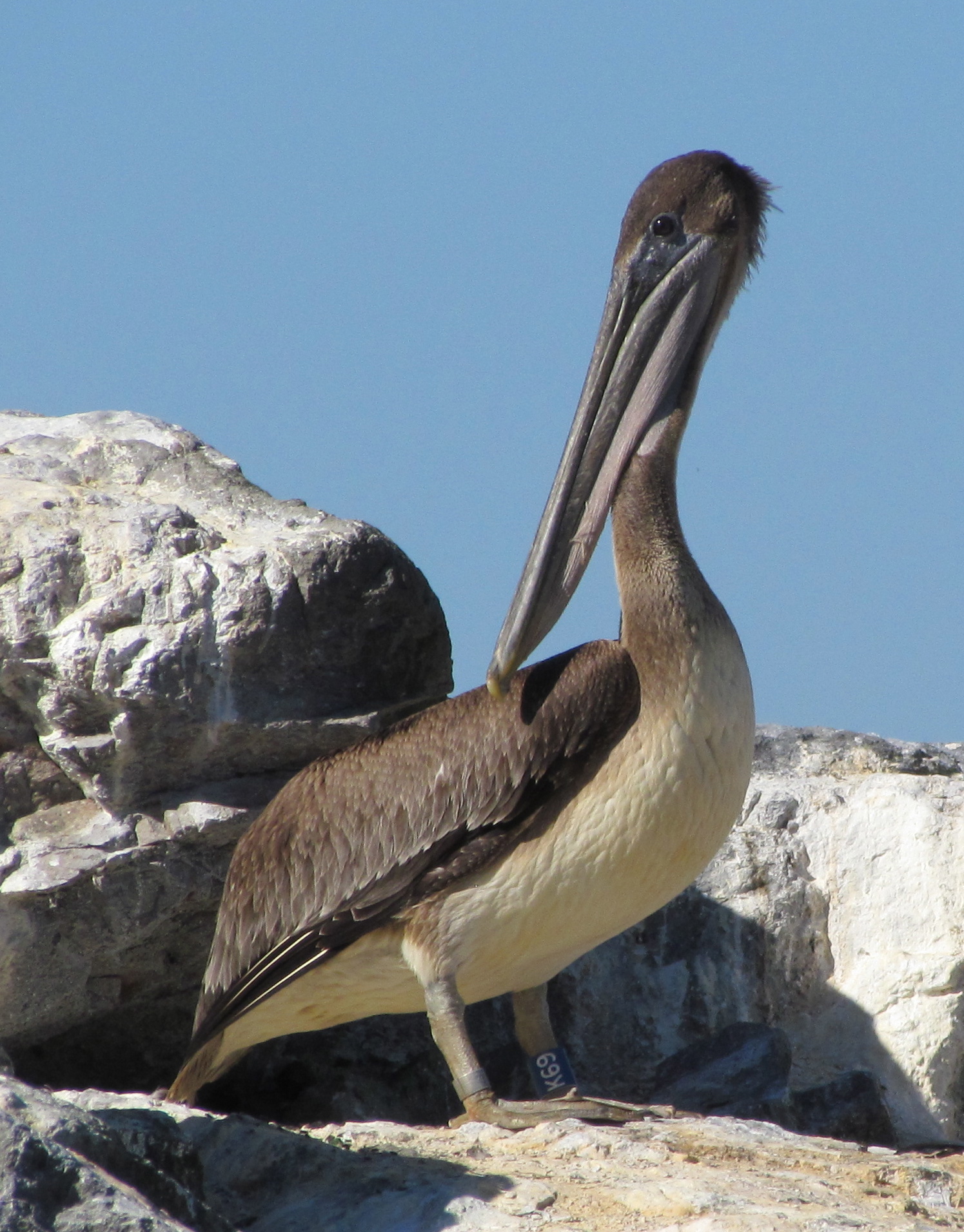
Young California brown pelican with leg band.
Young brown pelicanOld-timer. Brown pelicans can live to 30 years.
Close-up photos of Breakwater Island pelicans were taken in October 2012 from a kayak.
View more Breakwater Island pelican photos in the Flickr photo set.
This story is reprinted on the Golden Gate Audubon Society’s blog Golden Gate Birder.
Update – October 23, 2012
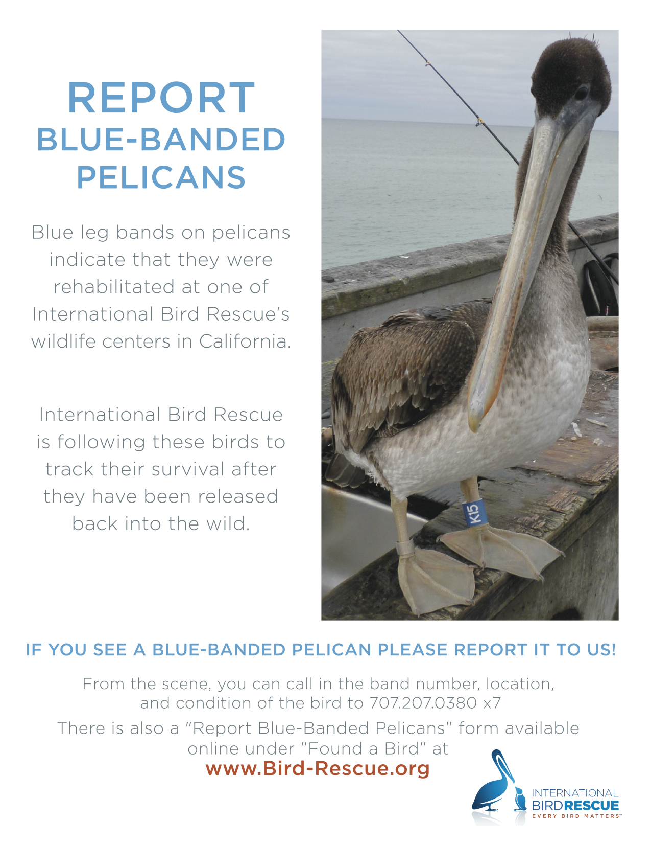
The brown pelican pictured above with a leg band reading “K69” was brought to the International Bird Rescue clinic in Cordelia near Fairfield, CA on July 9, 2012 in a thin and weak condition. It is less than a year old. After a one-month rehab, it was released at the Elkhorn Slough Estuarine Reserve near Watsonville on August 10. A blue band on a pelican leg means it was given a helping hand at one of thetwo clinics operated byInternational Bird Rescue– located in the San Francisco Bay Area and Los Angeles. Some of their released pelicans have been spotted in Oregon and Washington. If you see a pelican with a blue leg band, they’d like to hear about it.
The least tern nesting season ended in mid-August much as it usually does – a lonely and dangerous place for young terns. There were three of four pairs of adults flying back and forth with food for their young chicks. These late nesters are often the ones whose eggs or chicks were attacked by avian predators and have re-nested. Their vulnerability is only compounded as the weeks wear on because the rest of the adults and their flight-ready young have left, leaving the remaining families without the strength of numbers to mob a predator.
Volunteers arrived at the nesting site on September 9th to begin gathering up the oyster shells, wooden A-frame shelters, and clay tiles randomly arrayed about the site that serve as camouflage and chick shelters from predators.
They also carefully gathered up over 300 numbered nest markers that were placed near the nests by the US Fish & Wildlife biologist. A tern nest consists of a small depression in the gravel – no twigs. The four-inch white nest marker rings are set upright in a plaster base and each have a number. This allows Fish & Wildlife to monitor breeding success and record predator activity such as taking of eggs. Between now and next April when the terns return, the site’s substrate of gravel will be groomed and weeds removed.
On September 16th, volunteers returned to continue gathering oyster shells and taking care of another task: Removing a pernicious weed call stinkwort. It is virtually impossible to eradicate stinkwort with herbicides and must be removed by hand. Pulling the tough sticky weed out by its roots is usually not successful, and volunteers were limited to chopping the weed off at its base. If not removed by fall, the weed would begin releasing seeds that find their way through the gravel and into small crevices in the old pavement underneath. The weed is so prolific that it can quickly inundate an area.
It is undesirable to have any weeds in the nesting site or in the immediate vicinity of the nesting site. The historic nesting habitat of the terns is on beaches. The presence of vegetation in close proximity to the nesting area signals possible hiding places for predators and may cause the terns to look elsewhere for safe nesting.
On both days, volunteers included members of the Key Club at Encinal High School in Alameda, a student organization that encourages volunteerism.
Monthly work parties organized by the Friends of the Alameda Wildlife Refuge will continue through March of next year. The terns arrive in April. To get involved, contact FAWR.
The last egg, abandoned at the end of the season.
Picking up oyster shells
Least Tern chick sheltering next to clay tile – Summer 2012
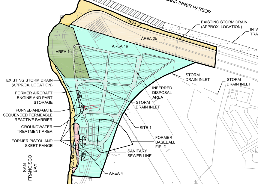
Site 1 at the northwestern tip of Alameda Point was used as the principal disposal area for all waste generated at Naval Air Station-Alameda from 1943 to 1956. This disposal area, which was once part of the Bay, was created by sinking pontoons and barges in the Bay and backfilling with dredge soil.
Disposal of cleaning solvents and petroleum products at one unlined pit within the landfill resulted in a groundwater plume that poses a threat of leaching into San Francisco Bay today.
In the 1990s the Navy installed an underground barrier system, called a funnel and gate permeable reactive barrier, to stem the flow of contaminants into the Bay. It was not a permanent solution. In July of this year the permanent solution began with the injection of neutralizing chemicals into the plume.
Protecting marine life
San Francisco Bay at Alameda Point western shoreline where threat of solvent leaching exists.
Most cleanup activities around the base are aimed at eliminating direct health risks to humans, such as from soil or from vapors that could enter a building. In a few cases, the cleanup is focused first on direct impacts to marine life such as fish, which could in turn cause health problems for people who eat them.
The cleanup effort at the Site 1 plume is one of those cases. This effort will keep toxins — solvents, petroleum products, and metals — from ever leaching into the Bay, being ingested by fish, and then consumed by humans. The effort will also reduce unacceptable levels of vapors that are escaping directly above the plume. The future use of the site will be restricted to open space recreational.
The process
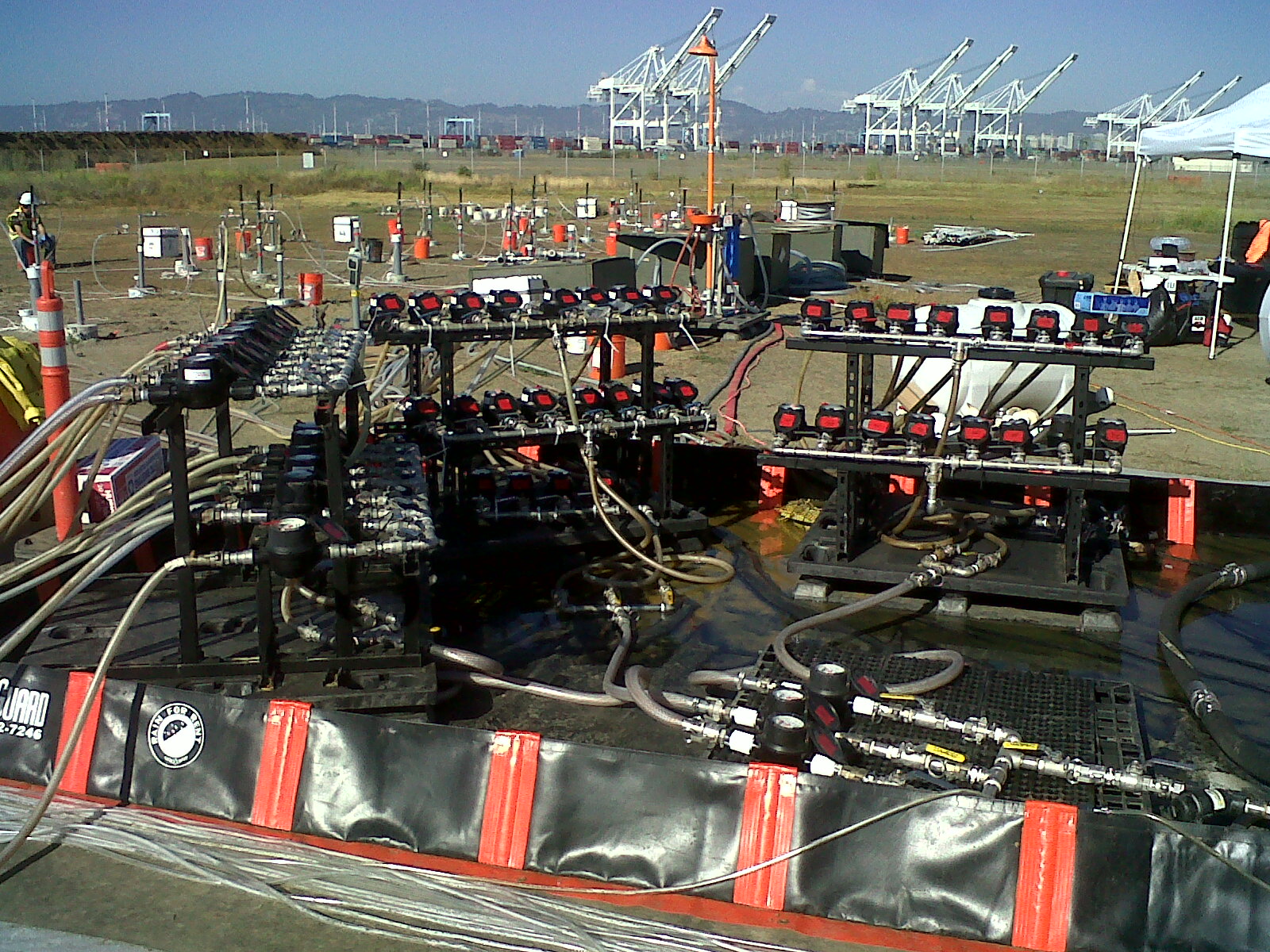
July 2012 – Manifold system of hose lines that send oxidant chemicals to individual wells that go into the underground plume contamination area. Navy photo.
The chemical injection process, called In Situ Chemical Oxidation (ISCO), is accomplished by injecting oxidants (catalyzed hydrogen-peroxide and sodium persulfate) into the plume through injection wells. “These oxidants produce short-lived reactions that directly destroy the targeted contaminants,” according to the Navy. Groundwater tests will determine if further treatments are necessary.
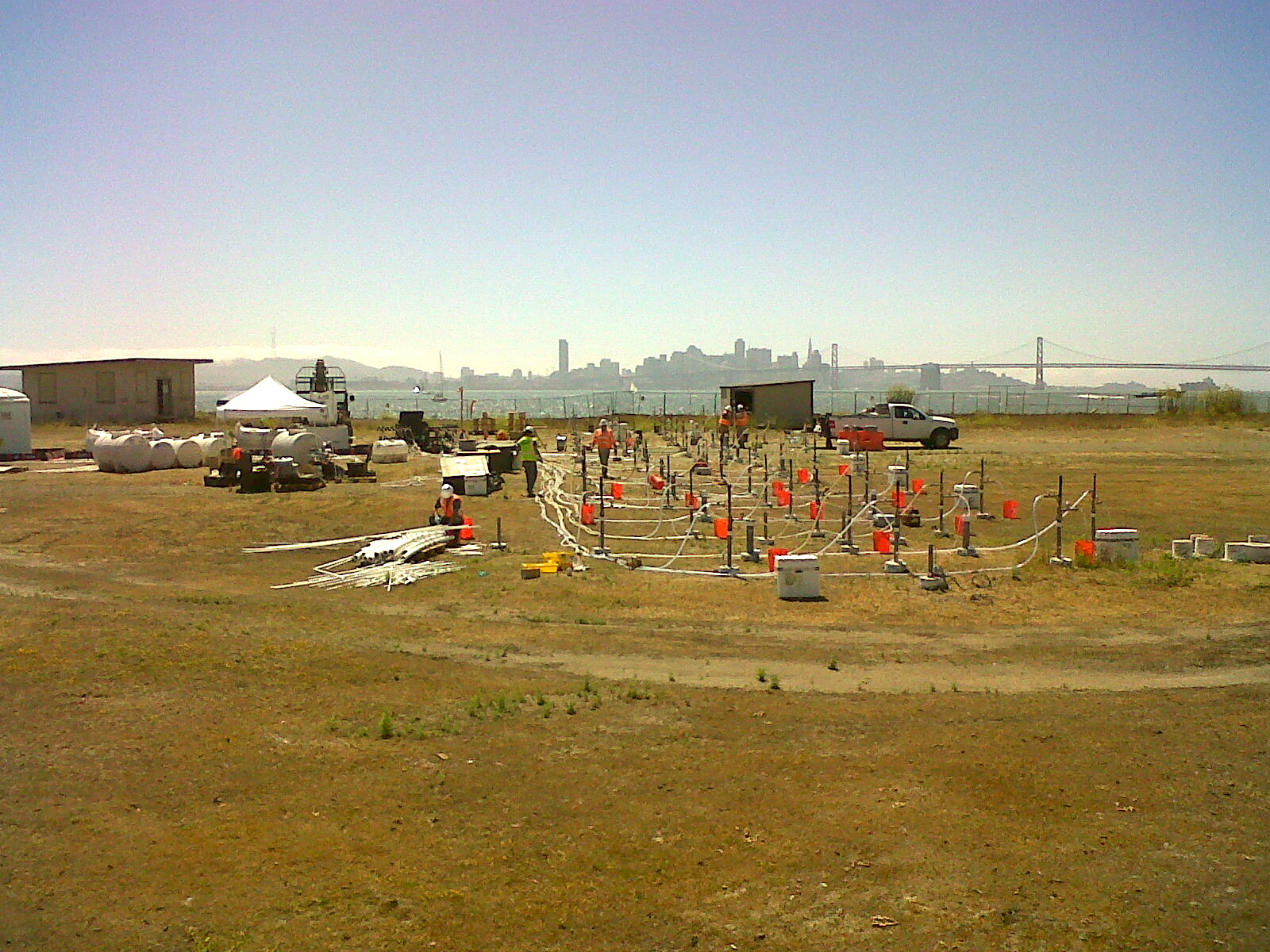
Tanks of chemicals for neutralizing solvent plume. Shown as work area being set up in June 2012.
Treatments will continue until either the groundwater is clean enough, or the solvent and petroleum concentration has been reduced by 75%. Once they get to 75% reduction, further injections are more or less a waste of money. From then on, the contaminant concentration is low enough that the remainder will either degrade or disperse and dilute naturally without posing a risk to fish or humans. This process is called natural attenuation and is often relied upon to finish the job when the bulk of contaminants are neutralized and treatment methods no longer yield effective results.
The groundwater plume is also contaminated with metals consisting of arsenic, copper, mercury, nickel, silver, and zinc. The metals problem will, in theory, be taken care of when the solvents and petroleum products are eliminated. This will cause the chemistry of the groundwater to change, which in turn will cause the metals to no longer remain dissolved in the water. The metals will return to their solid state and remain where they are. That’s the theory.
But to make sure it’s working, there will be a long-term groundwater monitoring program to make sure the metals aren’t moving. If problems arise in the future, the Navy will have to come back and design a new remedy. The Navy is responsible for the landfill’s contents staying in place in perpetuity.
Map of Site 1 disposal area with arrow from left indicating plume treatment area. Map also shows outlines of individual unlined pits that were used for disposal of waste. Half of the area is now covered by runway.
The Navy opted not to remove the landfill contents because of the $93 million price tag and because the risk of contaminant releases was deemed low. A new set of environmental concerns associated with digging up and hauling away a landfill was also cited during the decision process.
The groundwater plume being treated is approximately 30 feet wide by 160 feet long, and it occurs mainly between depths of 5 and 10 feet below the ground surface.
Site 1 groundwater treatment work underway in July. San Francisco in background. Navy photo.
Delay on soil cover
All of 30-acre Site 1 will eventually be covered with soil and seeded with native grasses. Work on the soil cover was delayed when the contractor discovered that the part of the landfill once used for burning waste was larger than expected. The documentation has to go back through the review process, with a work plan for the soil cover hopefully prepared and ready to implement by 2014.
Alameda resident Leora Feeney is one of three finalists in KTVU’s annual Cox Conserves Heroes contest. KTVU, owned by Cox Media, is partnering with The Trust for Public Land to honor local environmental activists for their work and inspire others. The winner will be determined through online voting that is underway now through September 24.
KTVU will donate $10,000 to the nonprofit of the winner’s choice. Feeney’s choice will be the Friends of the Alameda Wildlife Refuge, a committee of the Golden Gate Audubon Society. Feeney hopes that some of the money will go toward a video camera system on the perimeter of the Least Tern nesting area that would help with monitoring activity and public education. The Friends of the Alameda Wildlife Refuge helps maintain the site during the non-nesting season and conducts educational programs in schools.
You can vote for Feeney, and help our wildlife refuge, by going toKTVU’s Cox Conserves Heroes pageand clicking on the headline ***Vote now through September 24***.
Feeney first got involved with the Least Terns at Alameda Point in the 1980s when it was still an active naval air station. She was managing a small California Least Tern colony on the Oakland Airport property when she offered to help the Navy’s biologist overseeing the recently established tern colony at the Navy base.
When the announcement came down in 1993 that the base was closing, Feeney helped organize asymposiumat the College of Alameda on “Alameda Naval Air Station’s Natural Resources and Base Closure.” This symposium was instrumental in laying the groundwork for setting aside over 500 acres for a wildlife refuge in the 1996 Community Reuse Plan.
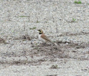
Horned Larks arrived shortly after weeds were pulled from this area near the tern nesting site in early 2012 to forage for food.
TheFriends of the Alameda Wildlife Refugebecame an official committee of the Golden Gate Audubon Society in 1997, the same year that Navy lowered the flag for the last time. She has been working to protect the terns ever since. She, along with other experienced birders, began doing twice-monthly bird surveys on the refuge in 2004, which she shares with the US Fish & Wildlife Service and the Navy. One object of the surveys is to document predators of the Least Tern.
To date, Feeney has seen over 176 different species of birds on the refuge. About 26 of these species, according to Feeney, have been documented as breeding on the refuge. One of her most unusual sitings was of a Golden Eagle that came in one spring to eat goslings. “When the eagle was hunting at the refuge, adult geese would be out on the Bay waters,” Feeney said. “That was our clue to look for the eagle.”
The wildlife refuge property is slated for transfer to the US Department of Veterans Affairs next year.
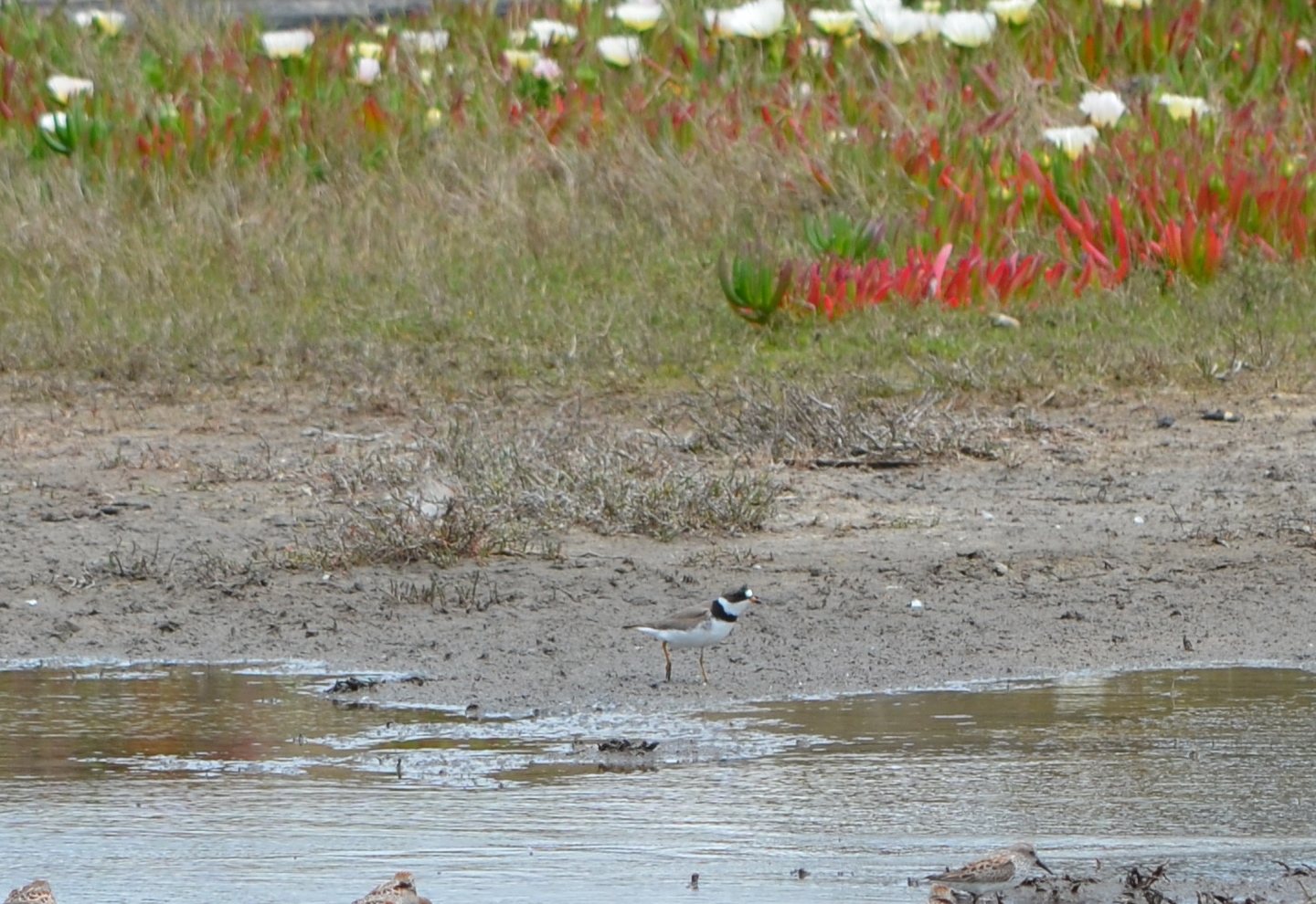
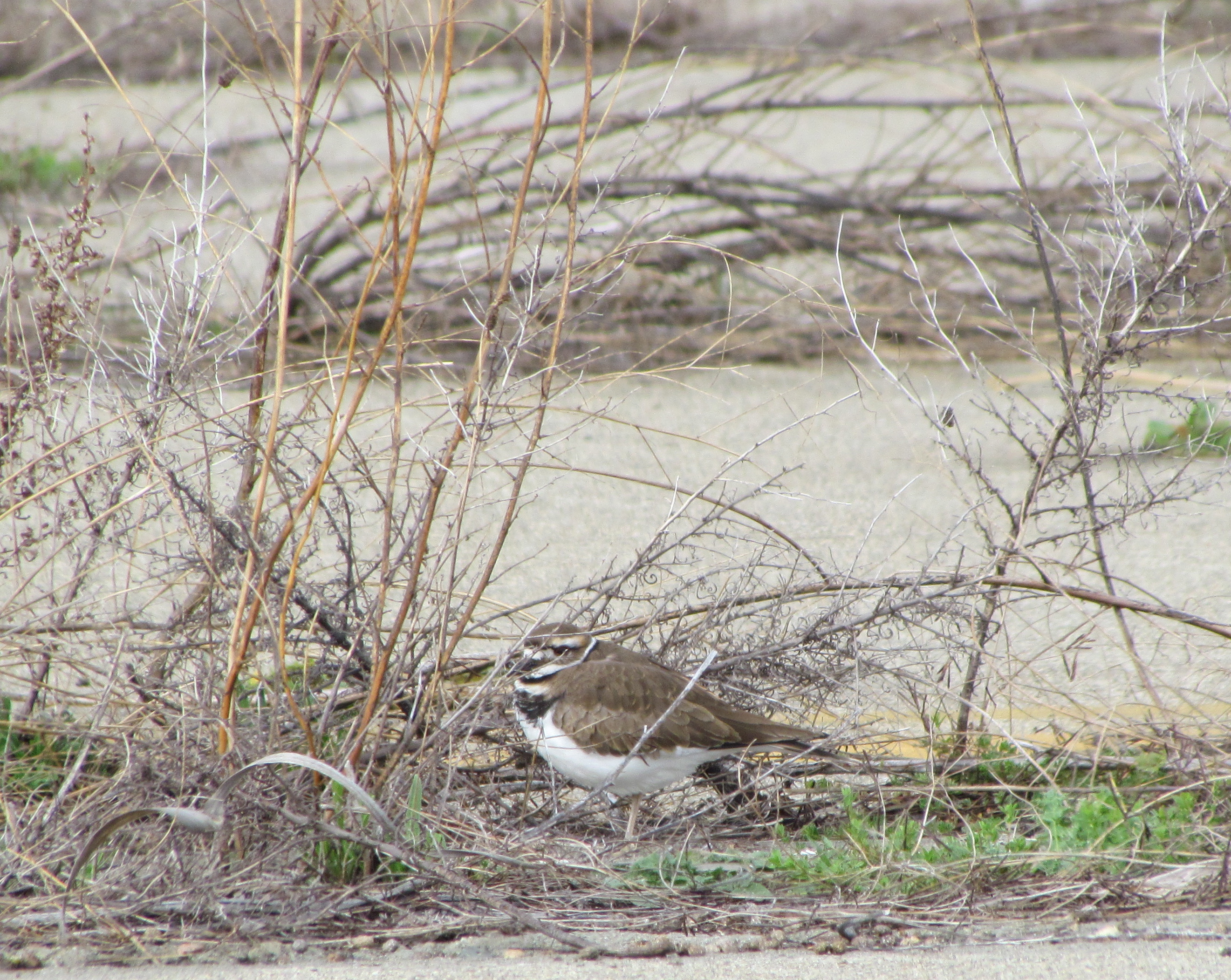
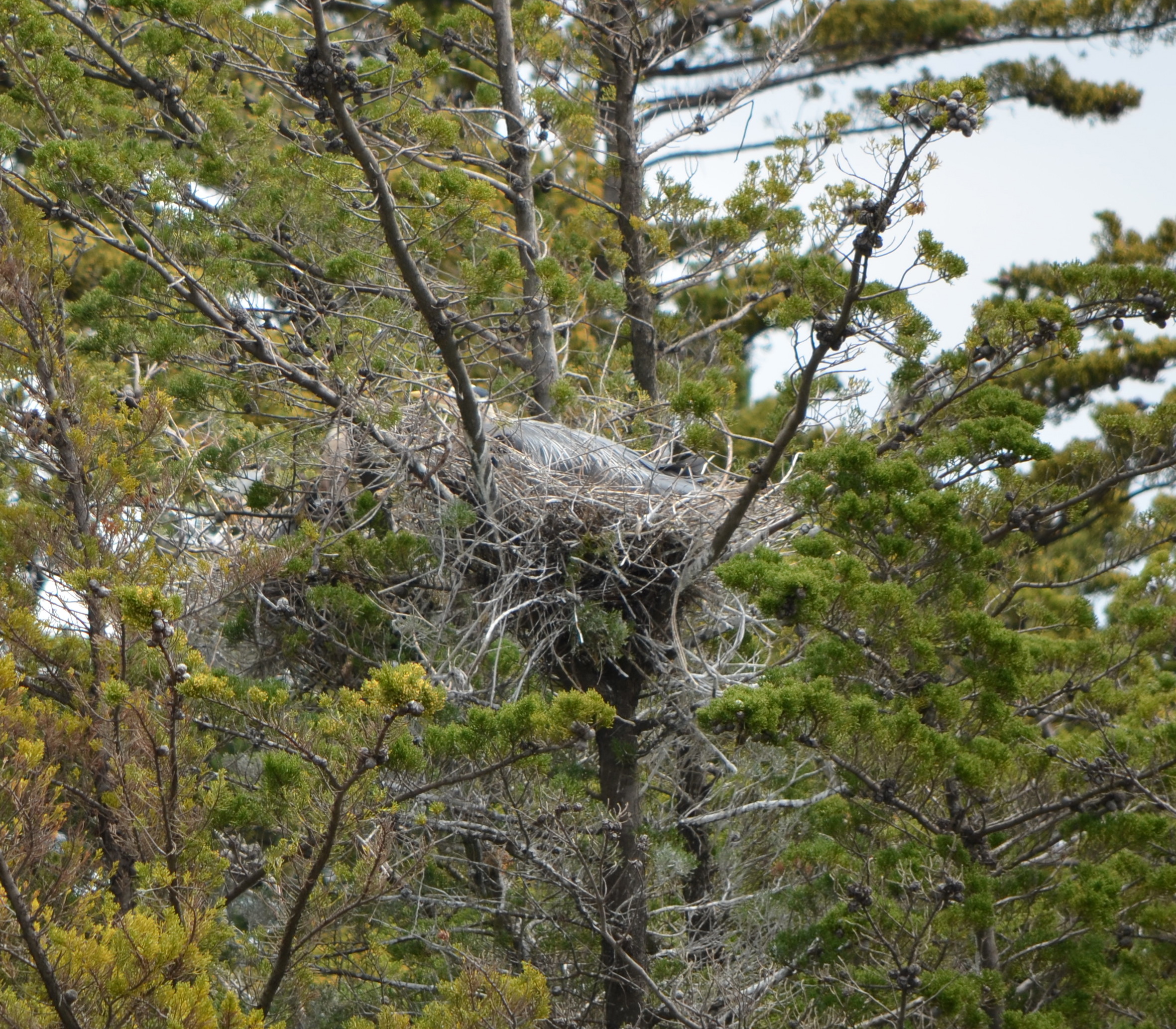
Semi-palmated Plover at Runway Wetlands – Alameda Point wildlife refugePlants growing between pavement cracks are a popular hiding place for Kildeer at Alameda Point’s wildlife refuge.Great Blue Heron nesting in cypress tree on Alameda Point wildlife refuge – April 2012.
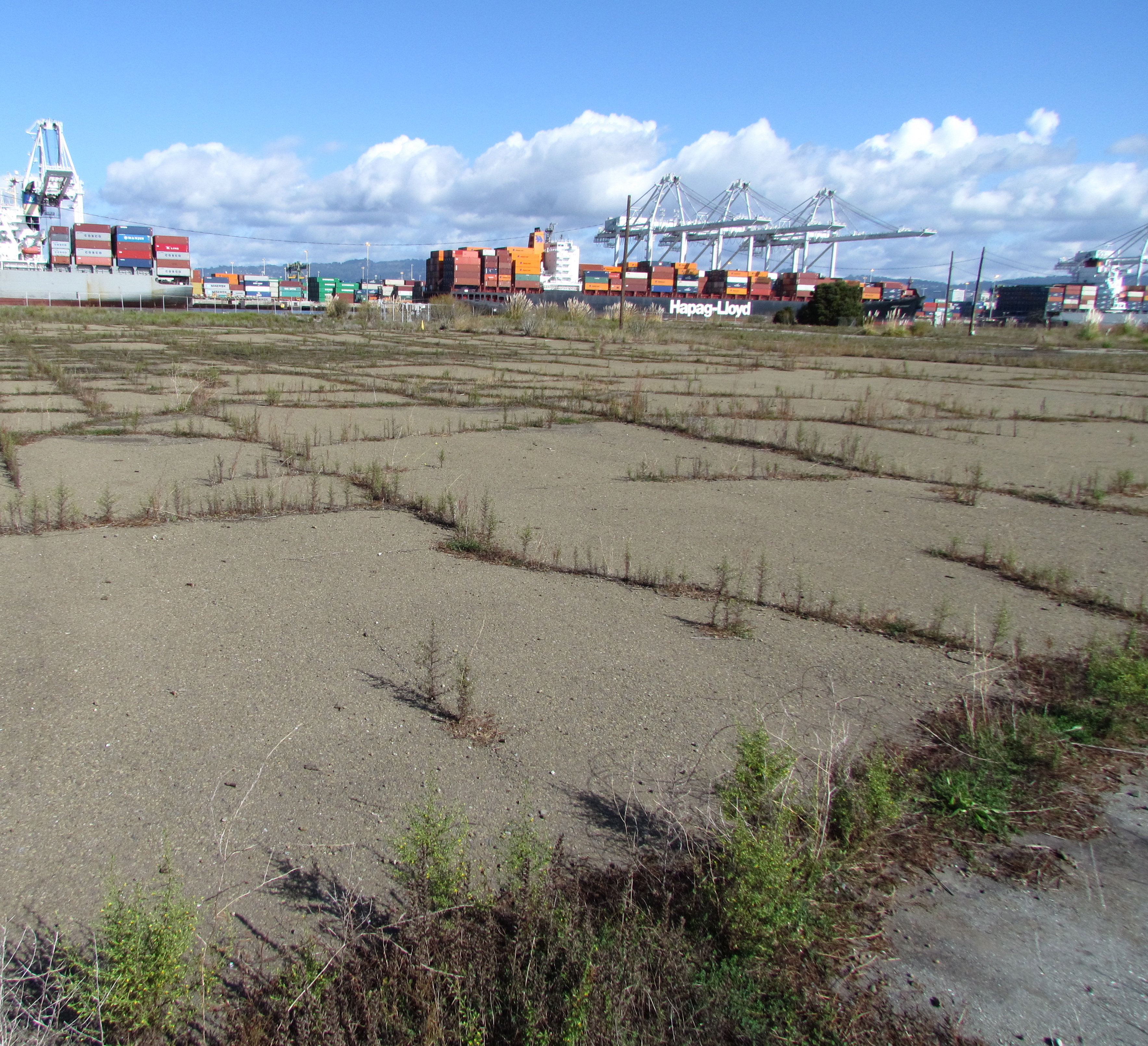
The 4.18-acre cleanup Site 34 in the old runway area next to the Oakland estuary looks barren from a distance. But up close there are concrete slabs and pavement, reminders of its bygone days as a bustling workshop area.
This area was once part of the division known as the Naval Air Rework Facility (NARF). Everything from sandblasting and painting, to metal working, woodworking, and scaffold maintenance went on out there. More than 40 years of activity left soil around buildings contaminated with lead, arsenic, pesticides, PCBs, and aircraft and diesel fuel. Above ground fuel storage tanks and electrical transformers contributed to the contamination.
The Navy will clean up the soil in this area next year. Their draft work plan, which will be released on July 31, was discussed during a Navy presentation at the July 2012 Restoration Advisory Board (RAB) meeting.
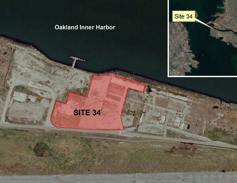
Site 34 aerial view. Old fuel dock to left of site. Runway at bottom is part of area where antiques faire is held. Navy photo/graphic.
Based on more than 200 soil samples taken in prior years and this year, the contractor created the draft work plan. Separate groundwater samples indicate contamination from the solvent trichloroethane. No remedial action is being taken on the trichloroethane, however, because 1) vapor intrusion into residences is not a factor, as this land will become Public Trust Land on which housing is not permitted; and 2) water monitoring has shown that the chemical is not migrating toward the estuary.
The northern edge of this site is part of the early westward land extension of Alameda, which allowed trains carrying freight and passengers to get out to a point where the water was deep enough for ferry connections. More fill was later added to the area. According to the Navy’s Remedial Investigation report, “In the 1920s, most of IR Site 34 was filled with estuary dredging material during construction of the Posey Tube.”
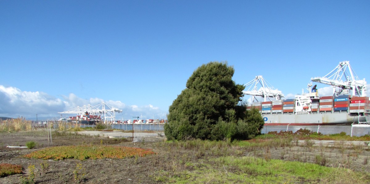
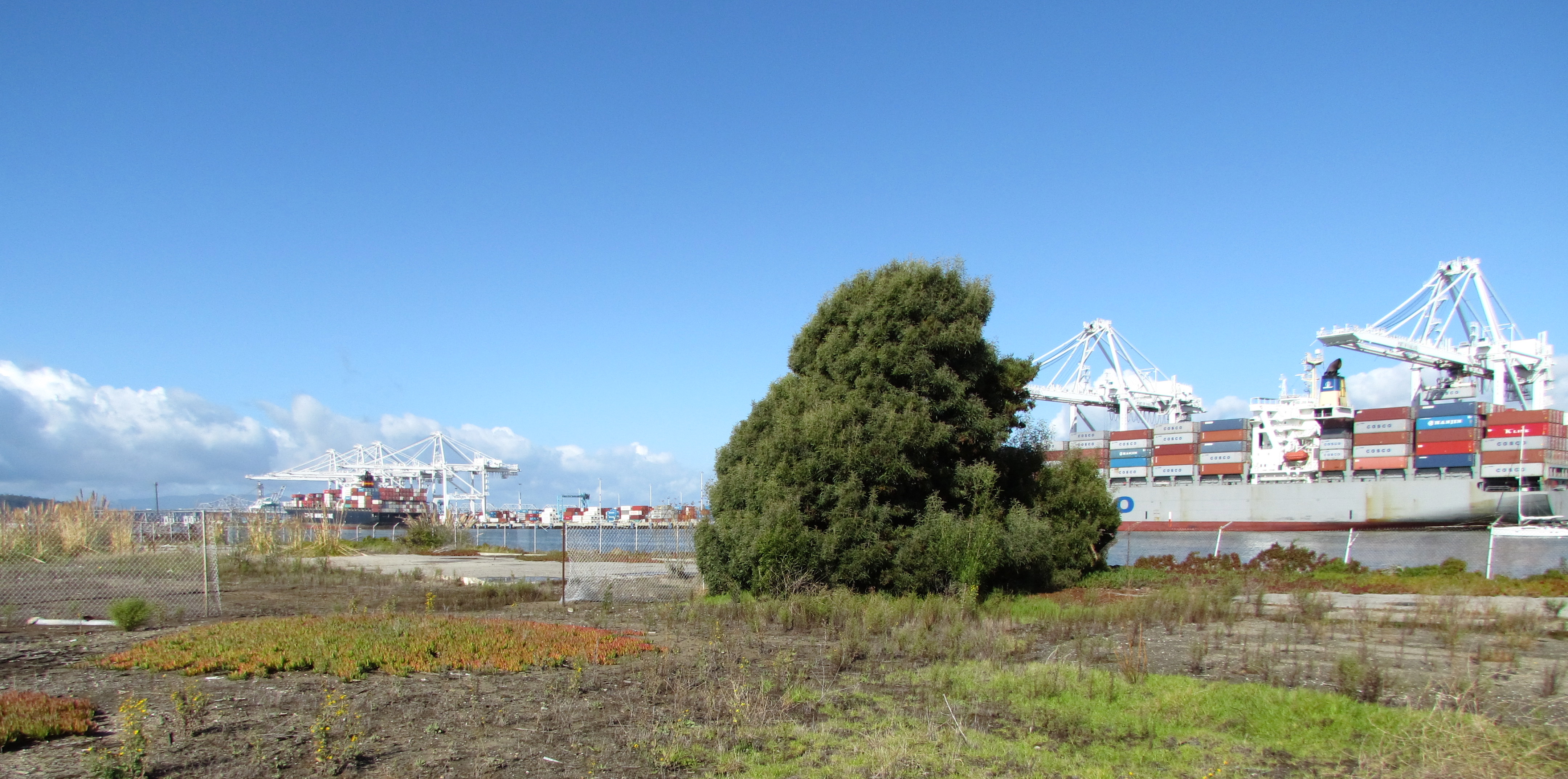
Site 34 starts at concrete slab on far side of tree. Port of Oakland on right. In late 1800s and early 1900s, trains travelled on tracks along the estuary where tree and slab are.
By the time the closure of the Navy base was announced in 1993, this workshop area had 12 buildings, 7 aboveground storage tanks, 2 “generator accumulation points” (waste storage), 15 transformers, and over 7,000 feet of aviation fuel line. Between 1996 and 2000 everything except the concrete pads and pavement was removed.
Building demolitions ended shortly after Alameda Point became a Superfund site in July 1999. The Superfund program, officially called the Comprehensive Environmental Response, Compensation, and Liability Act (CERCLA), does not allow for land improvements such as building demolition.
Most of the soil cleanup locations are adjacent to the exterior edges of old building slabs. Much of the lead in the soil came from sandblasting lead-based paint. Other contamination came from lubricants used for metals fabrications, and the use of oils and solvents for woodwork and metal work. In addition to removing soil next to the slabs, the contractor will dig under the slabs at the hot spots to take what is called a sidewall sample to confirm that all contaminated soil is removed. They have to keep digging as long as contamination is found. Clean soil will be brought in to the areas where soil is removed.
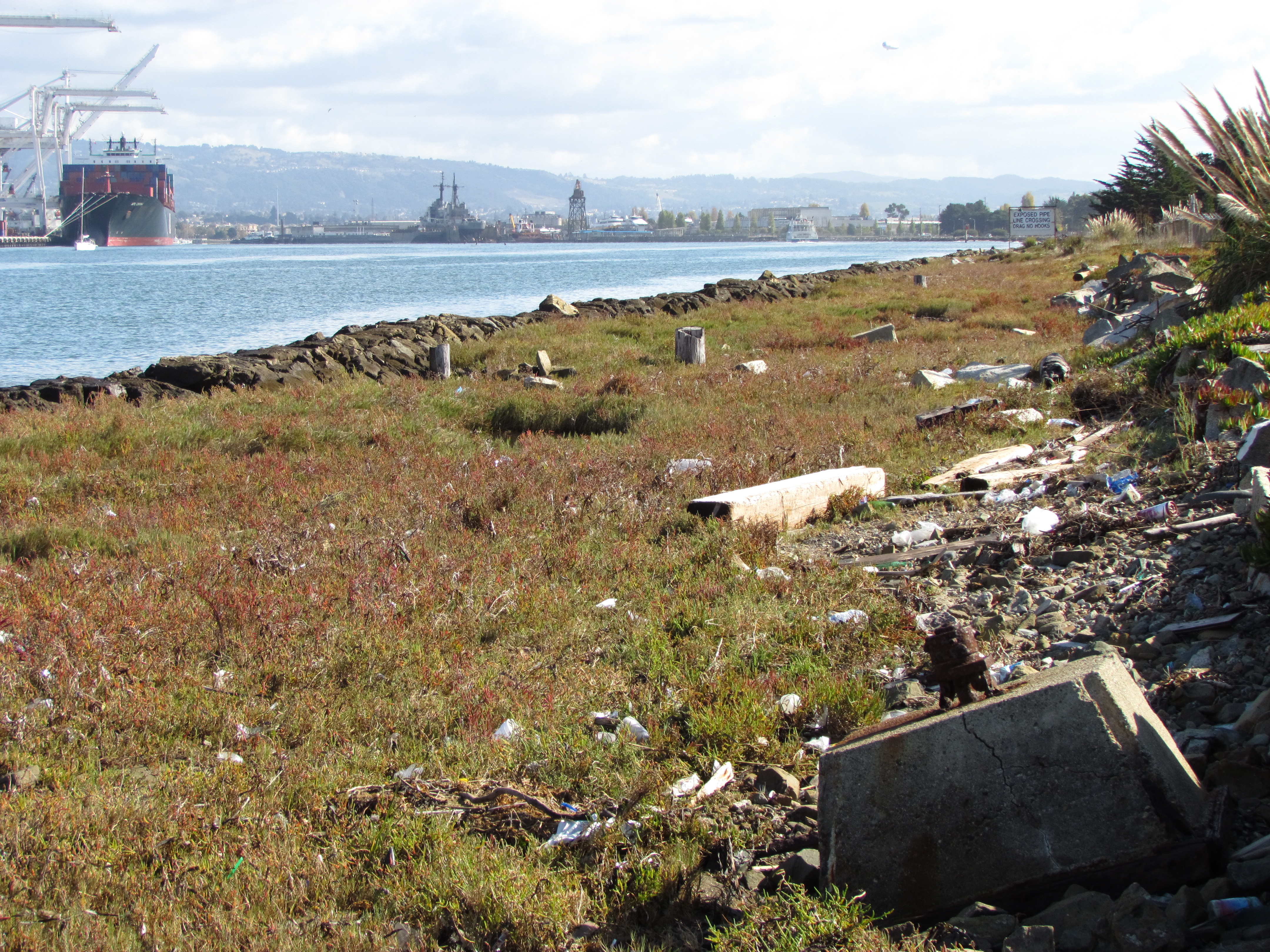
A strip of coastal marshland running along the Oakland Estuary on the north end of the site has no contamination. Its habitat quality, however, is marred by discarded concrete, wood, and trash. It will be up to the city to initiate wetlands restoration efforts there.
Coastal marsh on Oakland estuary at Alameda Point Site 34. Port of Oakland on left. Old runway area on right. Looking east toward Alameda Main Ferry Terminal.
A 60-day public comment period on the work plan begins when it’s released on July 31. The work plan will be finalized in January 2013. Fieldwork is anticipated to take place January through April 2013.
Site 34, located in the Northwest Territories, is expected to be given to the City of Alameda in 2014.
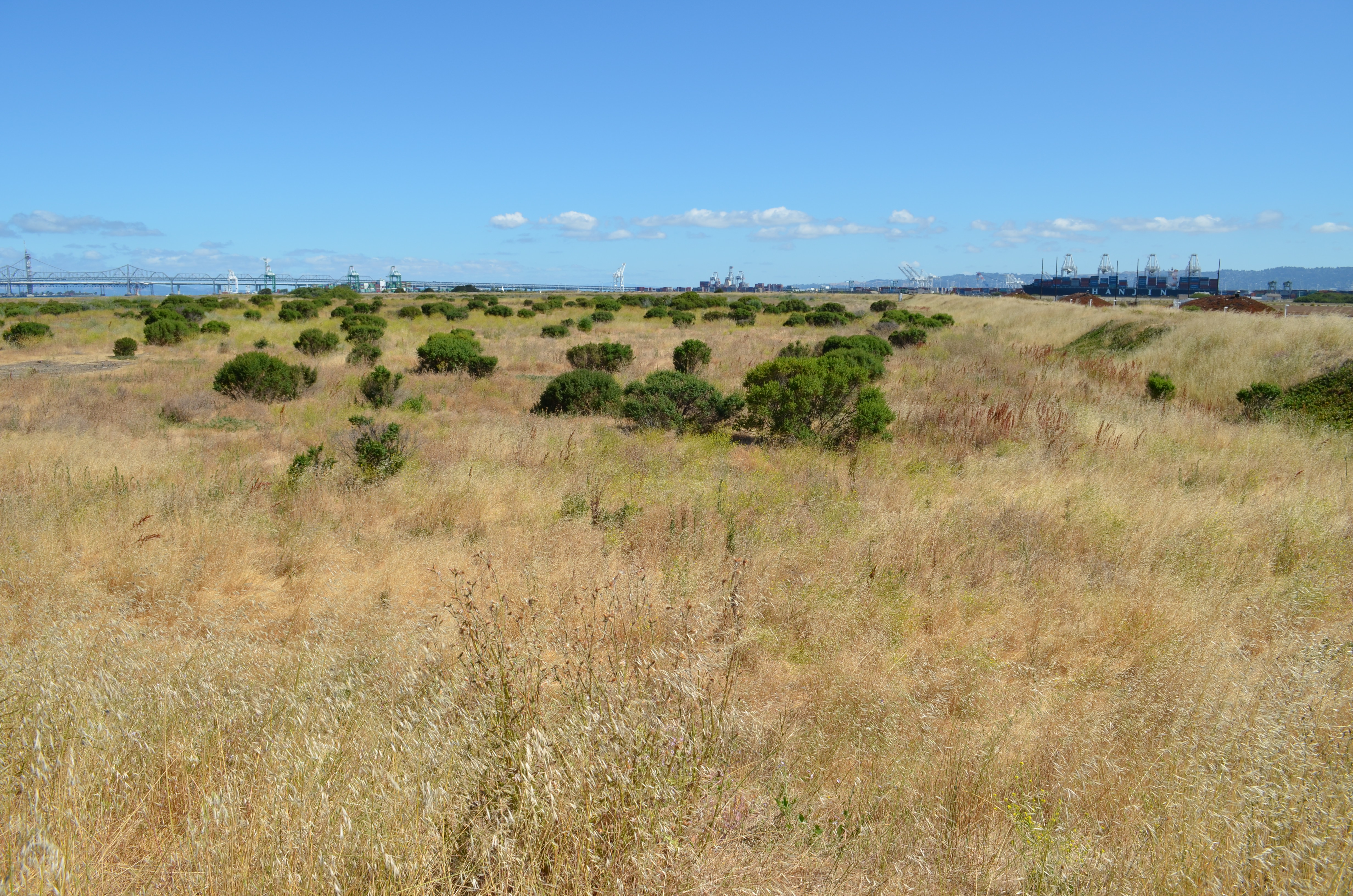
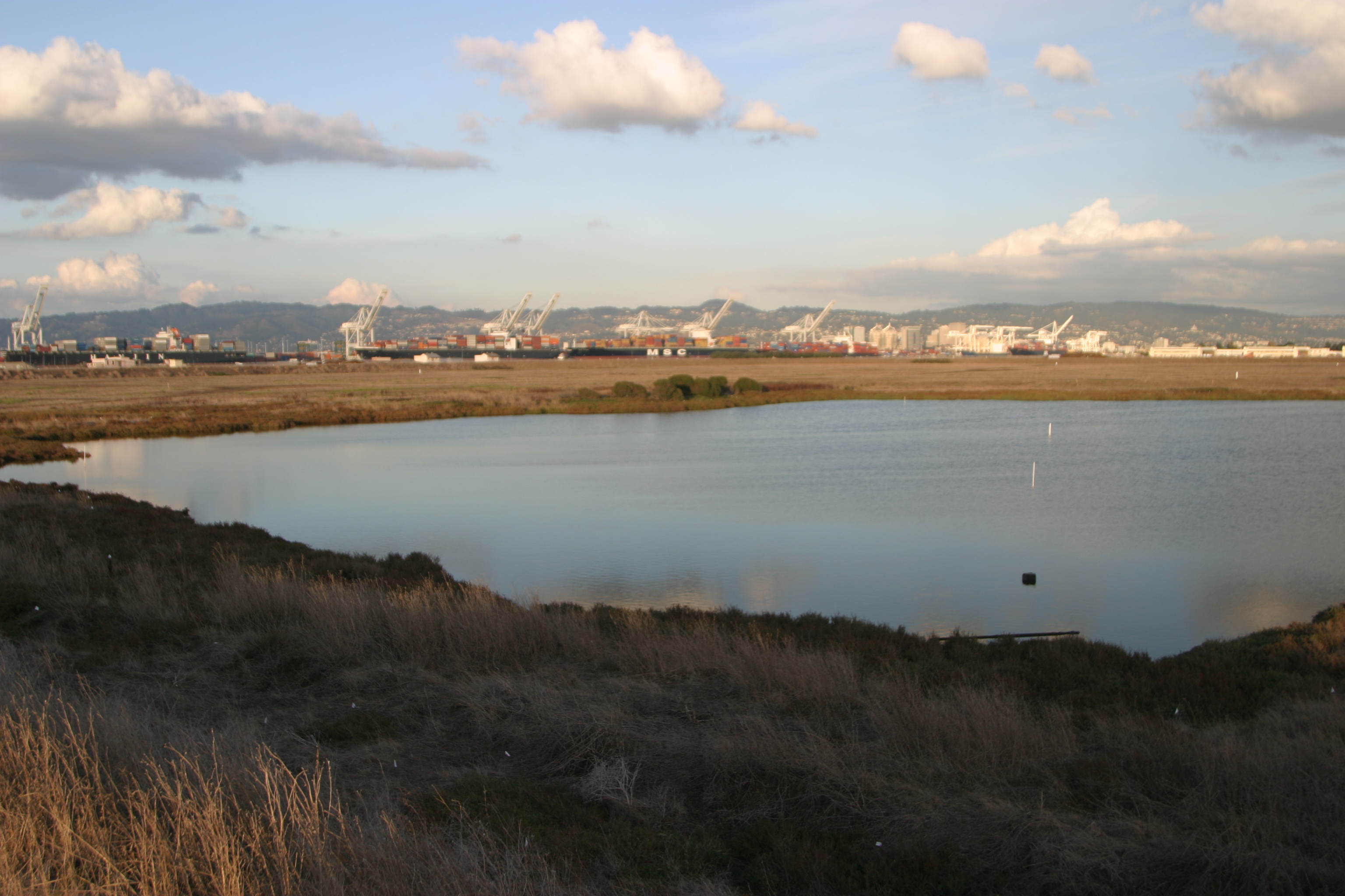
Looking north across Site 2 with Port of Oakland and Bay Bridge in background. Area to the left of landfill embankment will be covered with clean soil. Unlined industrial waste disposal pits lie underground.
The environmental remediation work plan for the Site 2 waste disposal area was finally introduced for public comment in early May after a decade on the Superfund list. During the 60-day public comment period that ended July 9, numerous agencies, groups, and individuals offered their critique of the Navy’s plans to install a suitable soil cover over the substandard soil cover that currently overlays the waste. Digging up the waste and hauling it away was ruled out in 2010 because of the $900 million price tag. Exclusionary security fencing, soil gas vents, wetlands, and geological/seismic stability due to close proximity to the Bay are issues receiving attention.
Taking samples of Site 2 landfill contents in 2005. Navy contractor photo.
The Navy’s industrial waste dump on Alameda Point’s southwestern corner has been the subject of environmental concern since the 1980s when the Water Board ordered the dump closed. The mid-1980s were a little more than a decade after passage of the federal Clean Water Act and the emerging environmental awareness and new regulations requiring underground waste sites to be lined. The Alameda Point dump is composed of various unlined cells, or pits, where all manner of aircraft parts and maintenance chemicals and debris were dumped, along with waste material from the luminescent dial and marker painting that used radium-226.
Exclusionary fencing
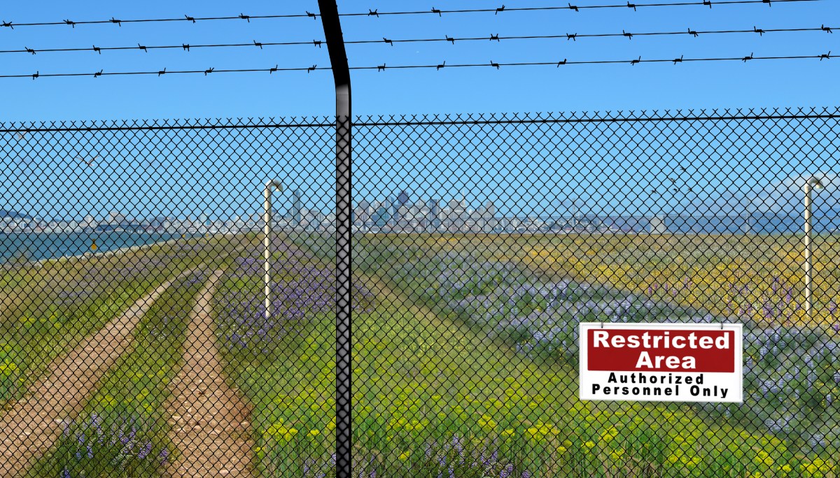
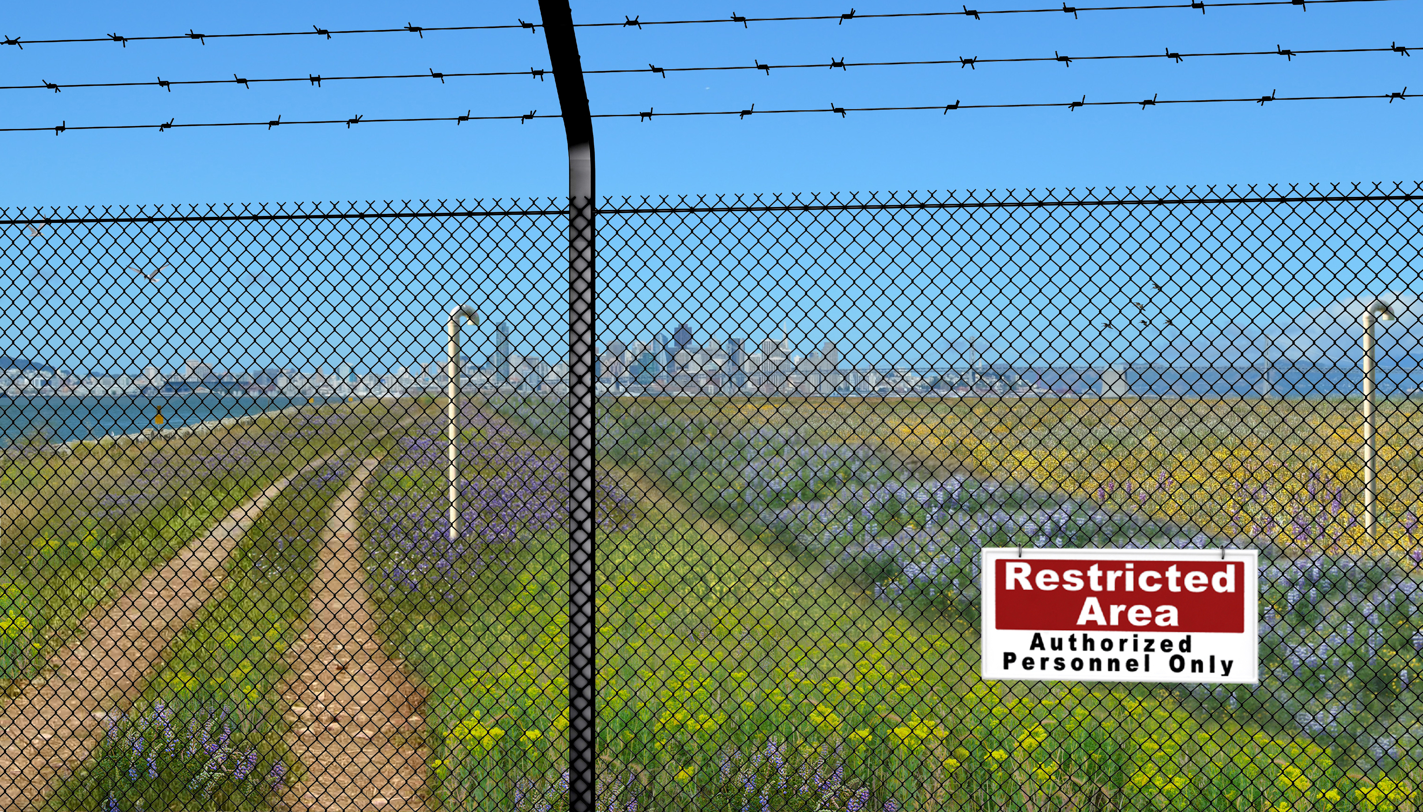
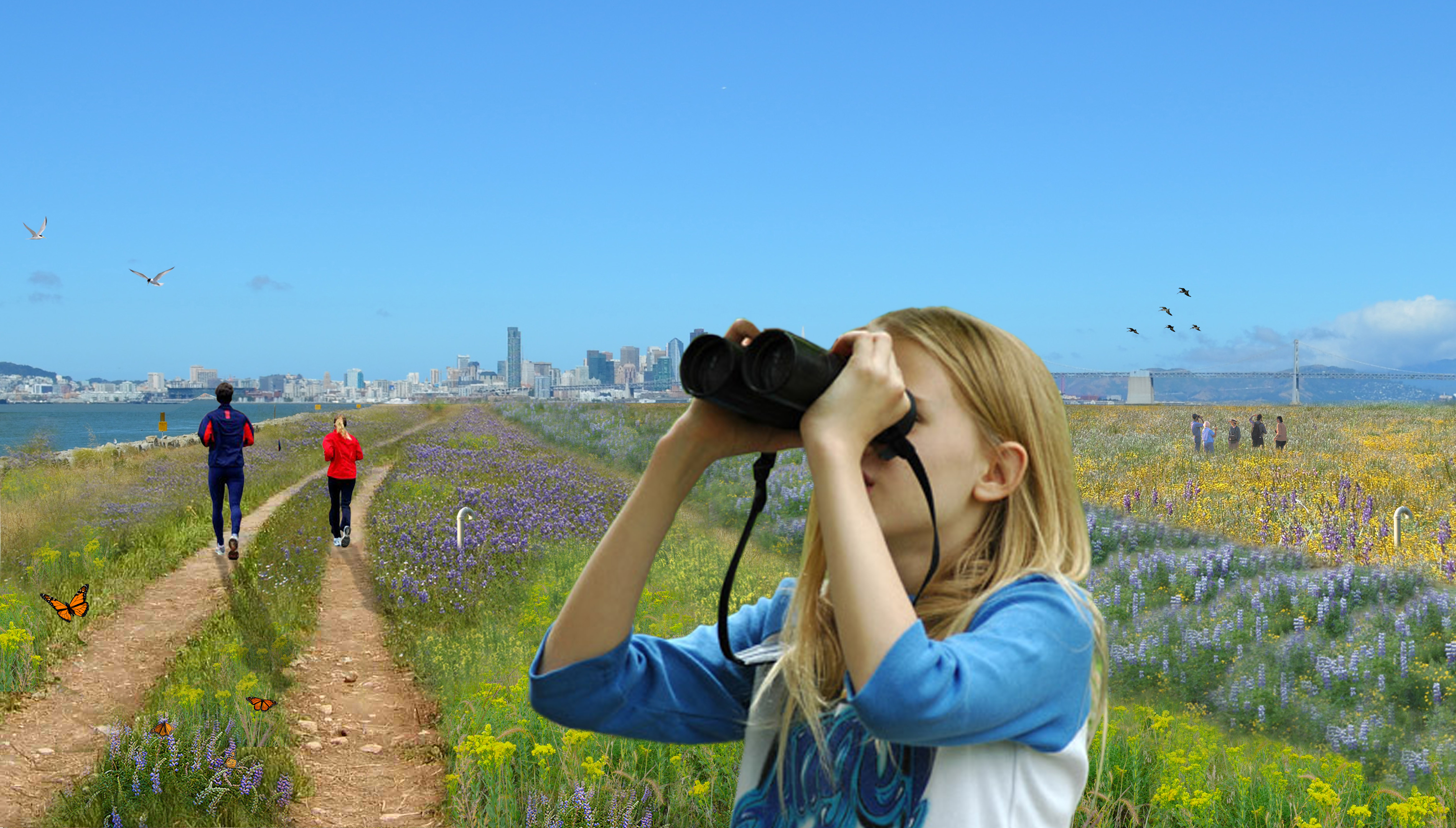
The Navy’s work plan includes a security fence and tall PVC pipes to vent methane gas. Golden Gate University’s Center on Urban Environmental Law (CUEL) has been following open space planning at Alameda Point and offered comments on the proposed security fence and the 10-foot tall soil gas vents. With collaboration from UCLA’s Landscape Architecture Department they created two composite drawings illustrating the stigmatizing effect that a fence would have on this wild open space with the Bay and San Francisco skyline in the background. The Navy has proposed the fence, even though the newly seeded clean soil cap will be safe to walk on. Protection of the soil, gas vents, and monitoring equipment was the reason given for the fence.
Composite drawing illustrating fence and 10-foot tall soil gas vents at Site 2 when Navy completes work. Image simulations produced for Center on Urban Environmental Law by Janet Wolsborn and Natural Resource Planning and Design.Image simulation of Site 2 without security fence. Showing two-foot gas vents, trail, and soil cover and embankment seeded with native grasses and wildflowers. Produced for Center on Urban Environmental Law by Janet Wolsborn and Natural Resource Planning and Design.
The law group also secured the help of Pangea Environmental Services to investigate the necessity of the security fence and obtrusive gas vents. Pangea interviewed city employees and other personnel responsible for oversight of four closed Bay Area landfills that have been converted to open space and recreational uses: Shoreline Park in the City of Mountain View; Sunnyvale Landfill in Sunnyvale; Oyster Point Park in San Leandro; and Cesar Chavez Park in Berkeley. Only the Sunnyvale site has a fence, but the gates are open during the day and allow free access. “The interviewees all reported that they could not recall encountering any vandalism or other damage associated with public use to either monitoring wells/vapor probes, landfill cover materials or landfill gas venting systems during the periods (generally exceeding a decade) for which they had roles in managing the landfills.”
Pangea goes on to say, “[T]he proposed post-construction installation of permanent exclusionary fencing surrounding Site 2 is considered to contradict the ‘open space and recreational use’ land use restriction proposed in the RAWP (Remedial Action Work Plan), since a closed fenced area cannot be considered open space or be used for recreation. [T]here appears to be no technical basis for installation of a permanent exclusionary fence restricting public access to Site 2.”
The City of Alameda pointed to the Record of Decision for Site 2 that specifies certain land use restrictions such as “land disturbing activities,” which would prohibit digging, disturbing monitoring equipment, or building construction. Referring to the proposed fence, the city said that these restrictions “explicitly do not prohibit recreational uses.”
Site 2 (outlined in yellow on map above), comprising 110 acres, lies within the larger 549-acre parcel commonly known as the wildlife refuge in the runway area of the former Naval Air Station. The refuge is home to a nesting site for the endangered California Least Tern, which lies a few hundred yards east of Site 2. The US Fish & Wildlife Service currently manages the refuge and the tern colony. Continuing management of the refuge to protect the terns and their nesting area will mean that a fence and gates will always be necessary around the greater refuge boundaries to limit the introduction of mammals such as raccoons, opossums, skunks, and feral cats that could pose a threat to the terns during nesting season. The perimeter fence will also serve to control human access. Thus, a secondary fence within the refuge would be redundant in controlling access.
Both the US Environmental Protection Agency (EPA) and the Regional Water Quality Control Board (Water Board) called on the Navy to look for alternatives to the fence. The Water Board stated, “Although protection of human health and the environment is our primary goal, we request that alternatives be evaluated for the fence line and methane gas venting so that public concerns and environmental health might more naturally coexist with the other beneficial uses that are planned for the area.”
Landfill gas venting
PVC piping will be installed to vent methane gas created by decay of organic matter. Thirty of the proposed vents will be 10 feet high. However, since the predominant waste is industrial and not organic, the amount of methane produced is minimal. And after more than 25 years, methane production would be expected to be near the end of its life. The Navy’s project manager recently said that the current methane out-gassing is so low that it wouldn’t keep a flame lit if there was a flaring system, calling into question the number of vents required and their height.
The Water Board questioned the gas vents saying, “[I]t is unclear why the methane vents need to be so high.” The EPA, Pangea, and the City of Alameda echoed this concern suggesting that the methane gas venting system could be reengineered into a lower profile system.
The Bay Conservation and Development Commission (BCDC) had similar concerns about shoreline access and the visual experience of future trail users. They also called for more specifics on the overall design, including how the shoreline is suited to withstand sea level rise impacts, and specifics about drainage and other impacts on the wetlands from the new soil cover.
Wetlands connection to Bay
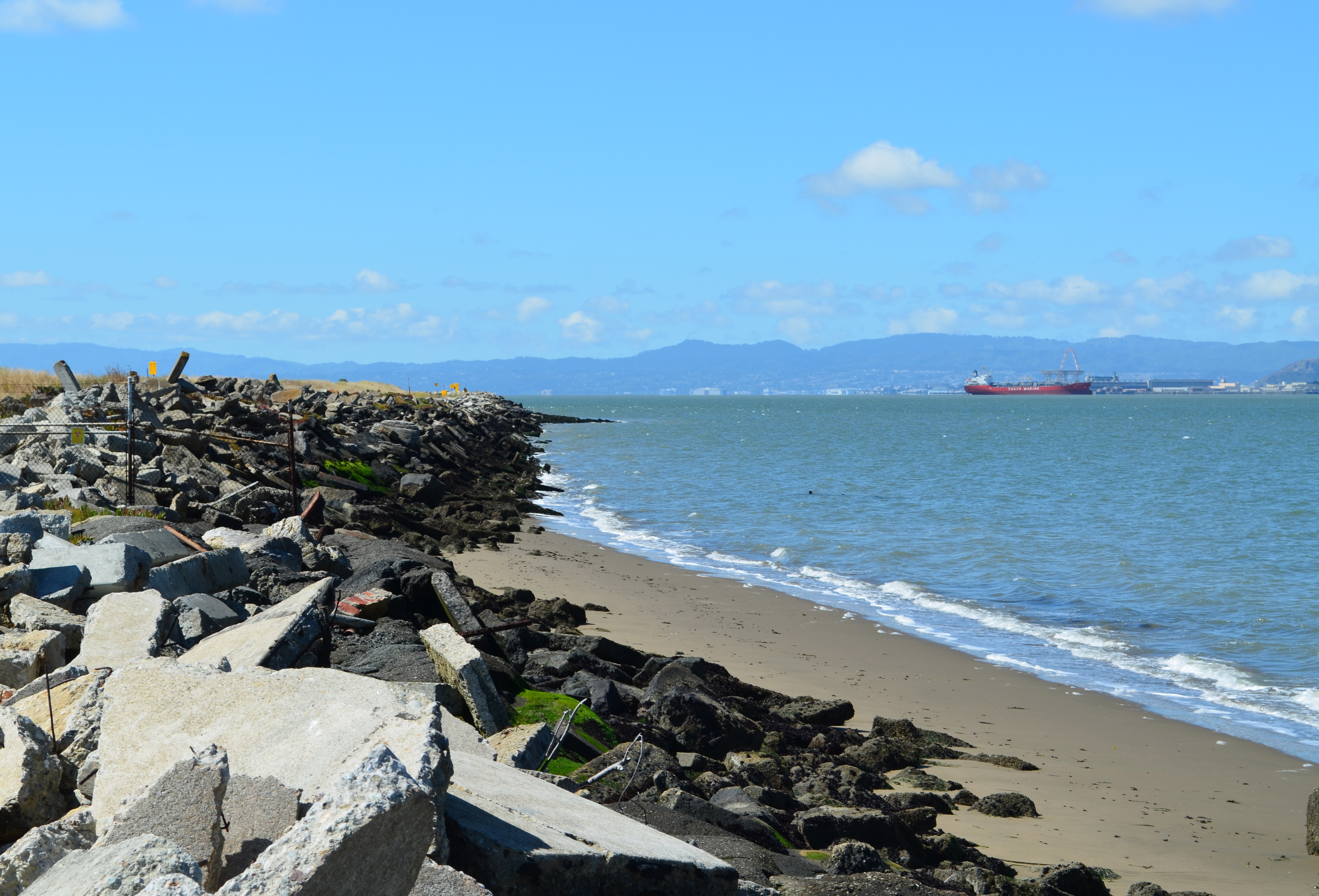
Western shore of Alameda Point looking south with San Francisco Bay on right. Site 2 begins where beach ends. Culvert connecting wetlands is in rip rap shore levee further south.
When the Navy extended the size of the base over 50 years ago to create the landfill site, they installed an underground 36” metal culvert that connects the North Pond on Site 2 to San Francisco Bay. Because the aging culvert does not enter the landfill portion of the site, the Navy is not addressing the soundness of the culvert, even though they are addressing wetlands issues at the site. The Navy’s presumed argument is that culvert improvements would be a “land improvement” that is outside the scope of environmental remediation requirements.
Both the Water Board and the EPA are arguing for the Navy to address the culvert issue. The Water Board stated, “We are very concerned about the age and integrity of the culvert that is the sole source of Bay water to the tidal wetlands. It is our understanding that the aged culvert is in very poor shape and may collapse any time. The value of this culvert became painfully apparent a year ago when some driftwood or other material clogged it up and impeded all tidal flow of brackish water to the wetland. In a matter of days the tidal wetland started drying up. Should that culvert collapse, the delays in rebuilding, from getting contracts to actual physical work, could be devastating and even fatal to the wetland flora and fauna.”
Partial view of Site 2 wetlands. Navy contractor photo.
The EPA said, “[T]here is no evaluation of the culvert to demonstrate that the culvert is appropriately sized or constructed to minimize the potential for future blockages, nor is there any provision for the periodic inspection and maintenance.” EPA went on to say, “Either the connection to the Bay needs to be reconstructed to reduce the potential for blockage or an obligation to periodically inspect the culvert and clear blockages needs to be included in the Operations and Maintenance plan. The details for the inspection and maintenance should be reviewed with BCDC as part of the Navy’s compliance with the substantive provisions of Bay Plan.”
Further addressing wetlands issues, the Water Board questioned, “Will there be an adequate number of wells effectively placed to monitor landfill leachate concentrations that might adversely affect the adjacent wetland species?”
Seismic stability
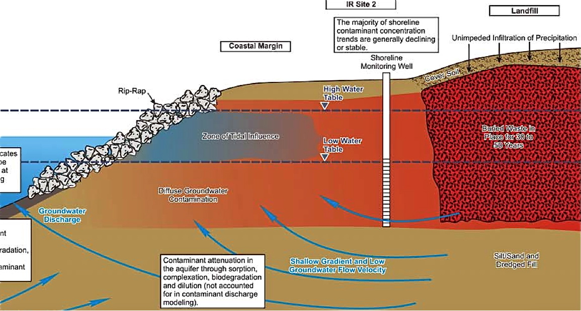
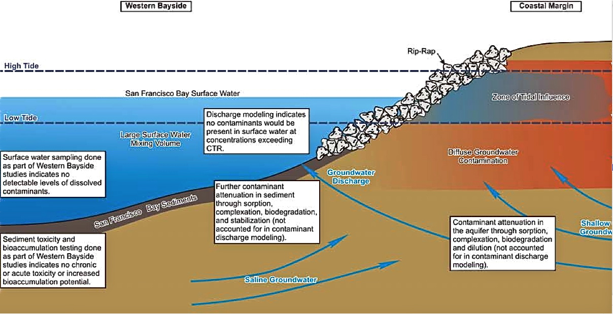
The hazardous waste pits on the south end of the site come within a few dozen yards of the Bay. The two longstanding concerns about proximity to the Bay have been chemical leaching into the water table, and failure of the seawall during an earthquake along the Hayward Fault. Well monitoring over the past 16 years shows that toxic chemical leaching is not a problem. However, the EPA is questioning the stability of the seawall and the earthen berm that surrounds the landfill containment area.
The EPA said, “It should be noted that based on the presented analyses the seawall along the southern coastal margin which is founded on liquefiable hydraulic fill and coarse-grained Young Bay Mud is prone to edge failure and lateral spreading.” They go on to say, “No remedial actions are proposed in the [Work Plan] to address these issues,” and they continue by saying, “[I]f the seawall is prone to failure and lateral spreading, it is unclear how further lateral spreading will be localized and will not distort the cover and result in depressions, drainage reversals or similar effects. Please address potential edge failure on spreading on southern coastal margin.” They also point out that the soil make-up of the berm around the landfill has not been characterized, leaving another question mark about seismic stability.
Site 2 geology cross section depicting western shoreline with features similar to southern shoreline addressed in EPA comments. 1 of 2 images. Navy illustration from 2007.Illustration of geologic features looking north along western shoreline showing features similar to southern shoreline that raised concerns with EPA over seismic readiness. Navy illustration from 2007.
The EPA mentions reinforcement options such as “cement deep soil mixing and jet-grouting,” and calls on the Navy to clarify whether they think perimeter slope failure in an earthquake is an acceptable long term risk, in lieu of underground seismic reinforcements. They also point out that the work plan does not analyze consequences of future expected sea level rise.
The Navy has until August 24 to respond to comments and incorporate changes or additions to the plan in their final draft. The regulators and the Navy will meet periodically prior to the August 24 deadline. A 30-day final review by the Navy and regulatory agencies will follow. Work on the site is scheduled to begin on October 1 and be completed by summer of 2013. Completion could be delayed if the seeding of the soil cover cannot be accomplished during the rainy season.
Below is a photo gallery of Palo Alto’s Byxbee Park, which is built over a landfill waste site at the edge of San Francisco Bay. No exclusionary fencing.
“The Navy provided a more current explanation of the future redevelopment of IR Site 2, indicating that even under Department of Veterans Affairs (VA) ownership that IR Site 2 would be a wildlife refuge.”
“[T]he purpose of the multilayer soil cover is to control specific site risk through the prevention of direct contact by either humans or ecological receptors (e.g., burrowing animals).”
January 15, 2008, Minutes from regulatory agency and Navy “Resolution Meeting” on the Feasibility Study for Site 2







 Alameda Point Environmental Report