Radium-impacted drain line becomes regulatory cleanup headache

Looking east on West Tower Avenue.  Buildings 5 and 400 are where radium-226 paint was applied to aircraft dials and marker.  Paint waste contaminated thousands of feet of drain lines.   Industrial Waste Line is partially illustrated showing where it runs in front of Bldg. 5.
Looking east on West Tower Avenue. Buildings 5 and 400 are where radium-226 paint was applied to aircraft dials and markers. Paint waste contaminated thousands of feet of drain lines, most of which have been removed. The remaining radium-contaminated Industrial Waste Line is partially illustrated showing where it runs in front of Building 5, also known as the Naval Air Rework Facility.

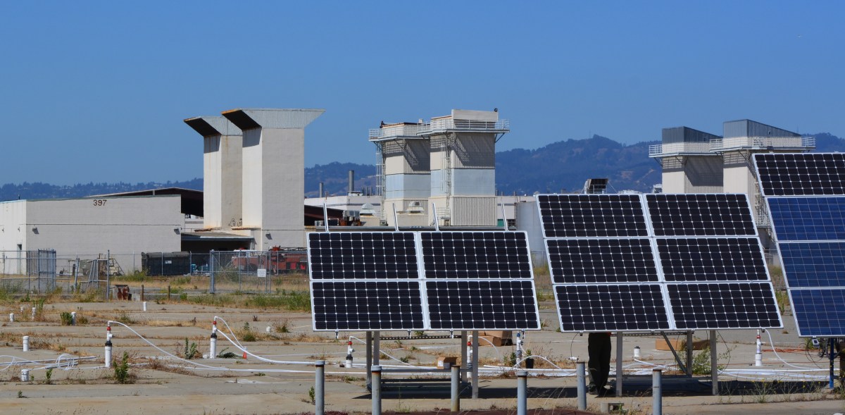
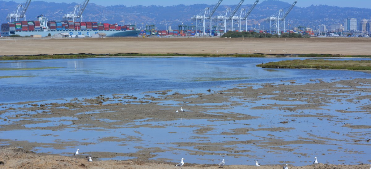
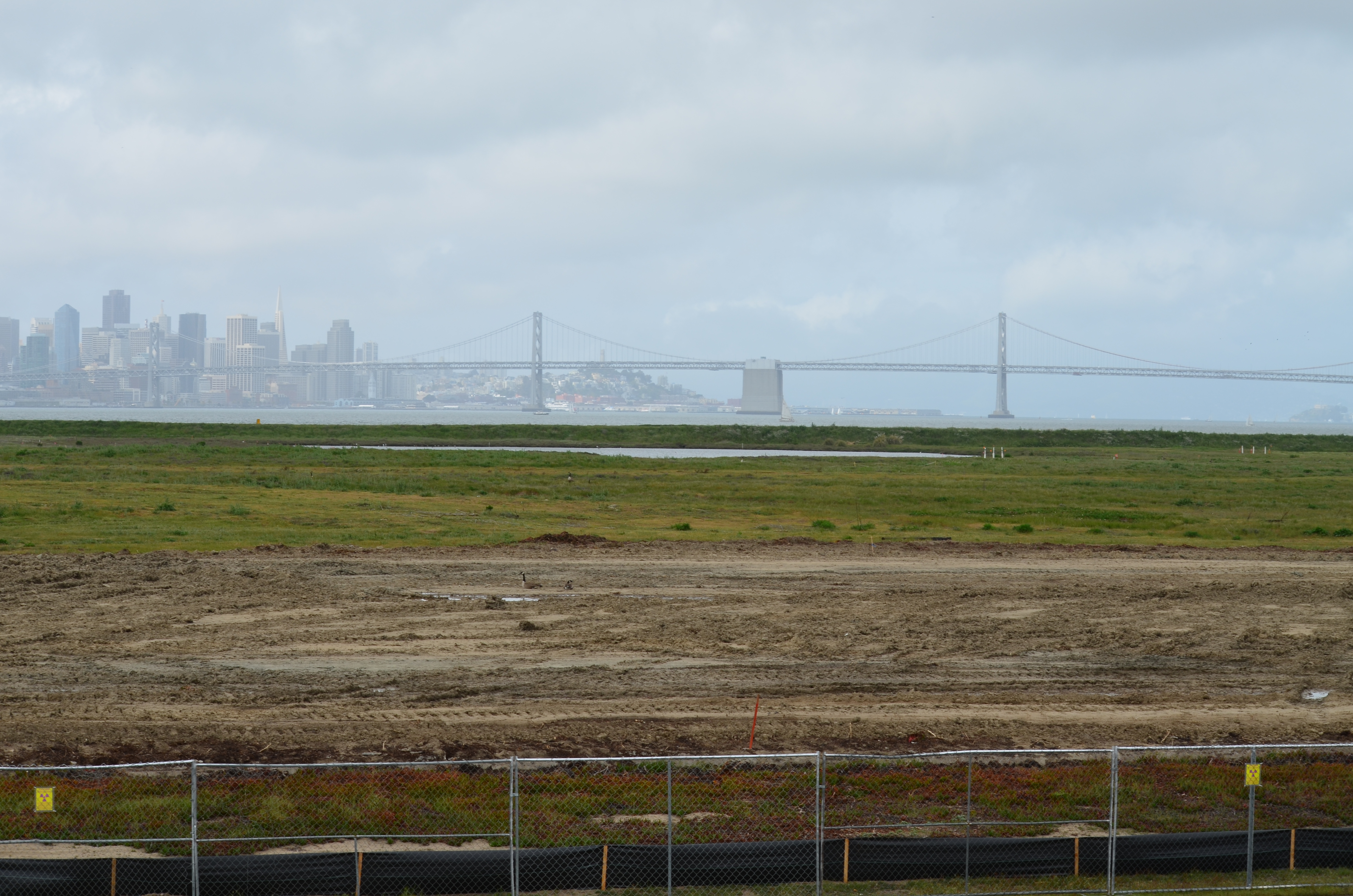
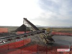
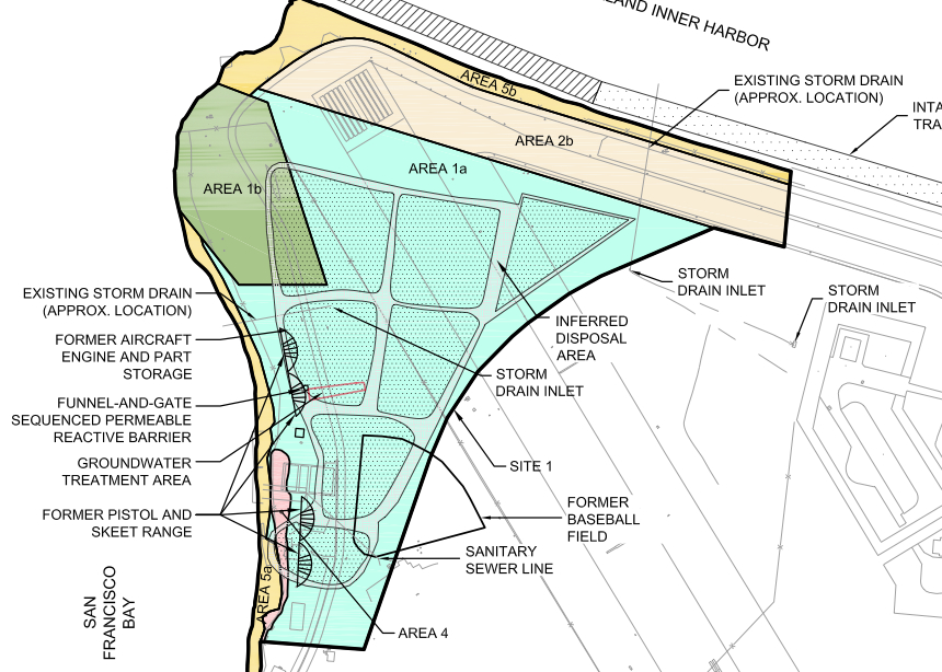
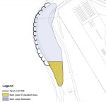
The Industrial Waste Line of Operating Unit 2C

All of the drain lines containing radium-226 paint waste at Alameda Point have either been removed, cleaned, or are scheduled to be cleaned or removed, except for one:  The Industrial Waste Line in the hangar area where aircraft dials were painted.  This drain line was installed in the mid-1970s after passage of the Clean Water Act prohibited sending industrial waste into public waterways.  It sent wastewater to a treatment facility, and is now lying dormant, broken in places, and no longer in use.  The big question is what to do about it – leave it alone and create a special radiological license, a special exemption, or dig it up? 

The Navy, regulatory agencies, and the city discussed this cleanup problem at their regular cleanup team meeting on June 11, 2013, the most recent date for which meeting minutes are available.

Clean area inside Building 5 where Navy aircraft were serviced.  Radium painting operations to the left and outside of this area.
Clean area inside Building 5 where Navy aircraft were serviced. Radium painting occurred to the left and outside of this area.

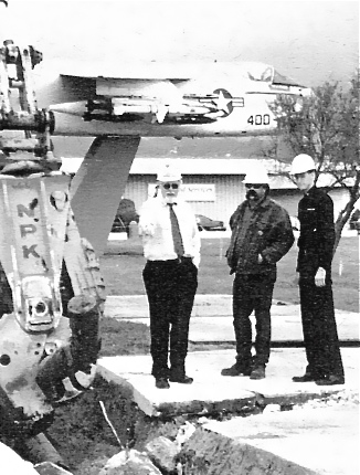
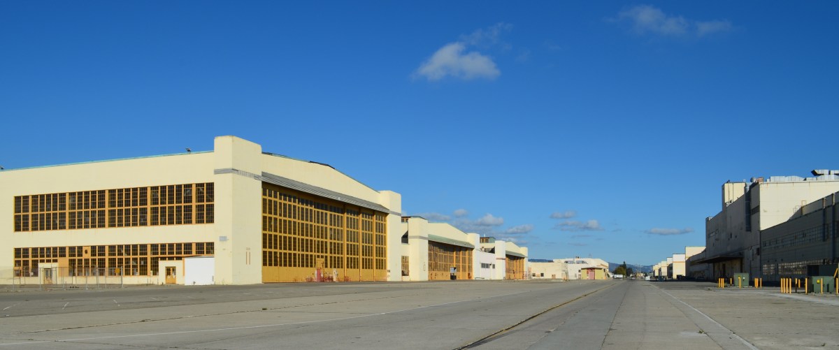
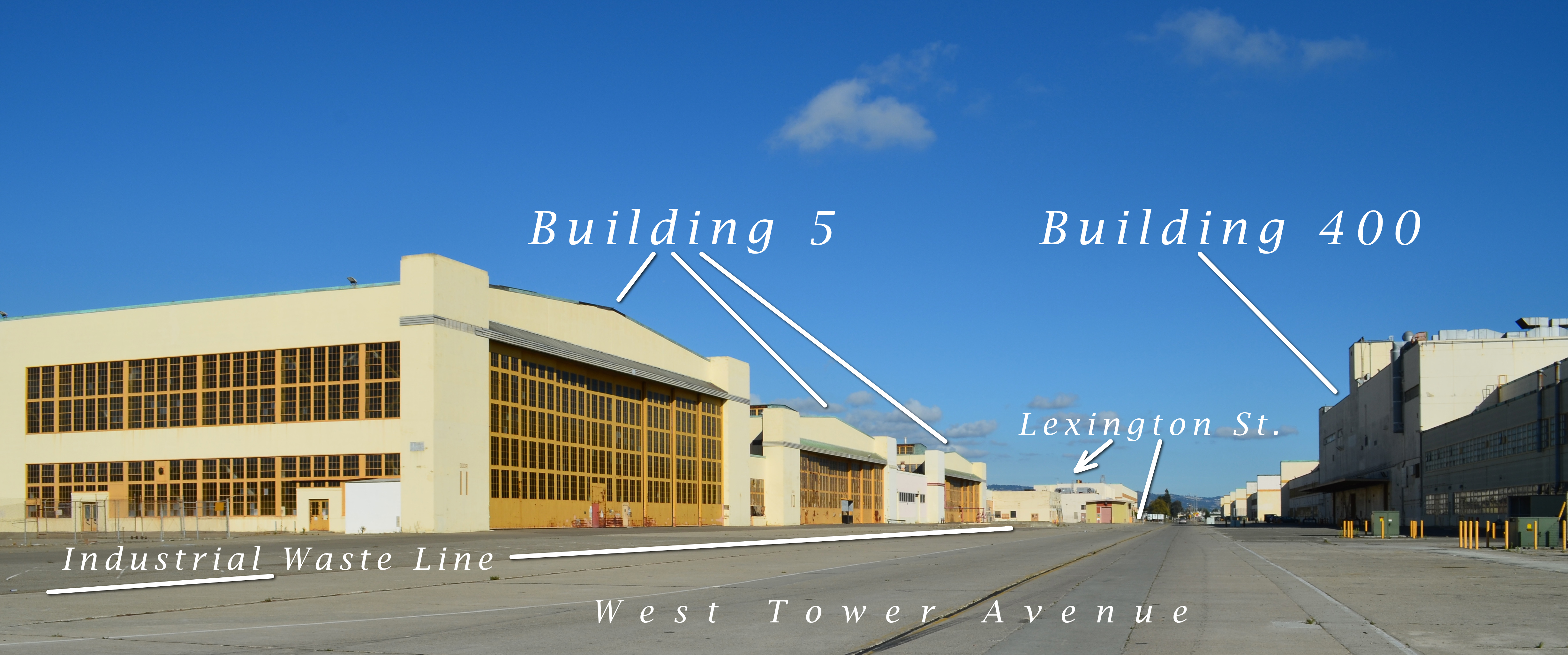
Even though radium dial painting at Building 5 and Building 400 along West Tower Avenue had ended by the time the Industrial Waste Line was installed, drain lines inside and under these two buildings contained radium that may have been released down into the waste line. 

The Navy doesn’t feel it should spend the extra money to remove the Industrial Waste Line, saying the contamination, some of which may have seeped into surrounding soil through breaks in the drain tiles, is trivial and should be left in place.  The Navy’s Lead Remedial Project Manager Bill McGinnis said,  “When risk was evaluated, the highest risk scenario was to an industrial worker at 225 days per year, 8 hours a day, for 25 years, through direct contact with soil. For the emergency worker the exposure and risk would be significantly less.”

The regulatory agencies aren’t sure how they will sign off on this waste line if it is left in place with elevated radium-226 levels inside the pipe or possibly in the soil where the pipe has deteriorated and leaked.

The city doesn’t want a perpetual worry about monitoring and digging precautions.  The East Bay Municipal Utility District (EBMUD) would also be concerned about the presence of radium.  The Navy’s Environmental Coordinator, Derek Robinson, asked the city’s engineering contractor, Angelo Obertello, if EBMUD was asked about routing around the existing industrial waste lines.  Mr. Obertello said EBMUD is looking to upsize the lines in this corridor because of fire flow pressures.  The city’s Chief Operating Officer for Alameda Point, Jennifer Ott, said that sewer and storm drain lines are planned for this area and that it is not realistic to expect EBMUD to work around existing rad-impacted lines.

The Navy is hoping to avoid the extra cleanup expense by asking the state to write a special document governing the drain line – essentially a warning label on a half-mile of two streets. 

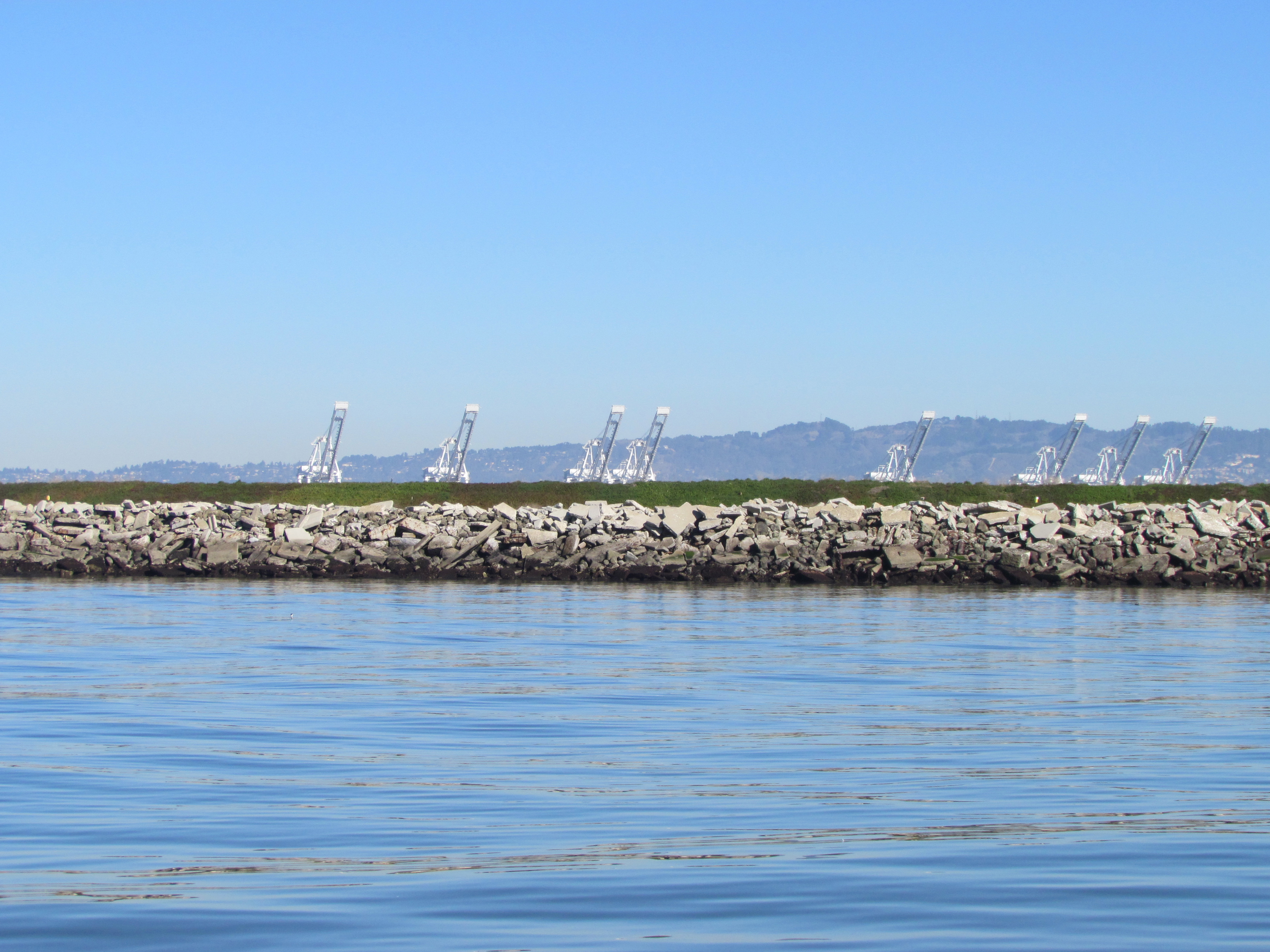
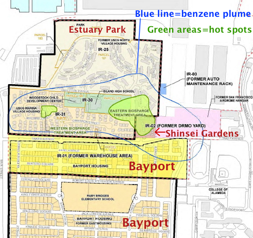
The Navy asked the city if they could work around the lines when installing new infrastructure.  But even though the city’s new infrastructure plans call for using concrete utility corridors, or trenches, the plans drawn up by the city’s consulting engineer, Angelo Obertello, show that there would be future utility conflicts with the half-mile of the Industrial Waste Line on West Tower Avenue and Lexington Street.  The Industrial Waste Line, including its connections to Buildings 5 and 400, is about a mile in length.

Right now, the idea of writing a special radiological license or granting a special exemption is an administrative headache because not enough soil samples have been taken from around the waste line to fashion such a document.  Rob Terry of the U.S. Environmental Protection Agency pointed out that the whole licensing issue would go away if the drain line were removed.

From the meeting minutes:  “Mr. Terry agreed with Mr. Miya’s description of the process, and said CDPH [California Department of Public Health] is looking at two issues: the rad dose remaining in place, and the quantity of rad materials present. The possibility of a rad license for AP [Alameda Point] is a very real one, and under CERCLA [Comprehensive Environmental Response, Compensation, and Liability Act, commonly known as Superfund] the cleanup should be as complete as possible. If everything is removed, the need for licensing goes away.”

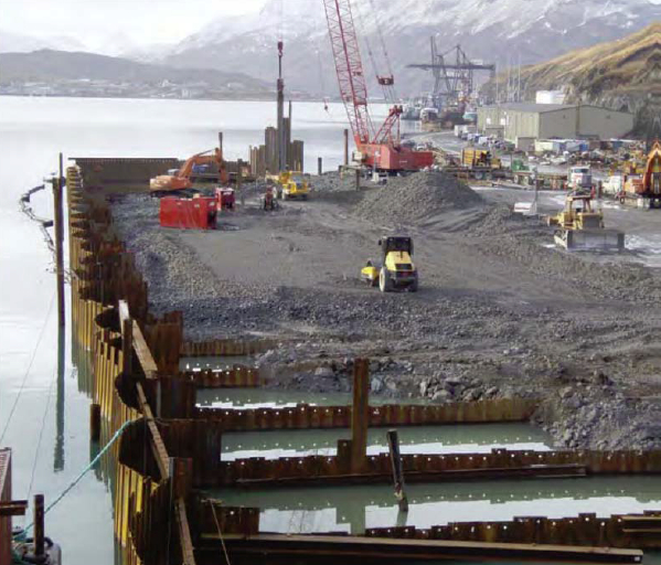
A similar drain line at Hunter’s Point Shipyard in San Francisco was removed.

2009 removal of radium-226-contaminated storm drains next to Building 400.  West Tower Avenue is to the right.  Looking west.
2009 removal of radium-226-contaminated storm drains next to Building 400. West Tower Avenue is to the right. Looking west.

Questions about future emergency repairs were highlighted at the meeting.  Mr. Robinson asked if the main concern of the California Department of Toxic Substances Control (DTSC) is the “uncertainty of a license exemption.”  Karen Toth said, “DTSC’s main concern is that if an emergency arises – e.g., a sinkhole occurs in the affected streets by a water or sewer line break – this could require hiring a rad contractor to address a sinkhole or line break, either by the City or by East Bay Municipal Utility District (EBMUD).”

The meeting ended with everyone agreeing to continue working together to solve the problem of what to do about the radium-impacted Industrial Waste Line and adjacent soil.

The minutes of the Industrial Waste Line agenda item at the June 11, 2013 cleanup team meeting are below.

Meeting Minutes

June 11, 2013 Meeting minutes of OU-2C Industrial Waste Line discussion
Alameda Point Base Realignment and Closure (BRAC) Cleanup Team (BCT)
Teleconference Meeting Attendees:

Navy
Bill McGinnis – BRAC PMO-West Lead Remedial Project Manager (RPM)
Jacques Lord – BRAC PMO-West Contracted RPM
Sarah Ann Moore – BRAC PMO-West Deputy Base Closure Manager
Marvin Norman – Legal Counsel
Mary Parker – BRAC PMO-West Contracted RPM
Derek Robinson – BRAC PMO-West BRAC Environmental Coordinator
Cecily Sabedra – BRAC PMO-West RPM
Matt Slack – Radiological Affairs Support Office (RASO)

Regulatory Agencies
Isabella Alasti – California Department of Toxic Substances Control (DTSC)
Bob Carr – U.S. Environmental Protection Agency (EPA)
John Chesnutt – EPA
David Elias – Regional Water Quality Control Board (Water Board)
James Fyfe – DTSC
Chris Lichens – EPA
Ryan Miya – DTSC
Rob Terry – EPA
Karen Toth – DTSC
Xuan-Mai Tran – EPA

City of Alameda
Jennifer Ott – City of Alameda
Peter Russell – Russell Resources

Contractors
Angelo Obertello – CBG
Betty Schmucker – Trevet

“Mr. Robinson said the Navy appreciated the City’s effort in preparing drawings of the industrial waste lines. Peter Russell (City) said the drawings show potential conflicts with infrastructure/utilities (existing and future) and thus are higher priority for addressing.

“Angelo Obertello (CBG), City contractor, explained that updated figures were prepared and overlain on as-built drawings of existing utilities. Areas were identified where existing utilities fall within the industrial waste line areas. The City has also re-evaluated placement of future utility lines in West Tower Avenue, Lexington Street, and Monarch Street, and preliminarily shifted the future lines about 15 feet away from the existing industrial waste lines. Based on the drawings presented, possible conflicts could occur along approximately 3,300 linear feet of line as follows:  about 900 linear feet of 4-inch force main; and about 2,400 linear feet of gravity line feeding into the pump station in Lexington Street. This represents about 57 percent of the force main line in conflict with existing industrial waste lines and about 44 percent of the gravity line in conflict with existing industrial waste lines. The conflicts primarily in West Tower Avenue and Lexington Street are for future utilities and represent about 45 percent of the lines. 

“Dr. Russell noted that as part of the petroleum program the Navy identified former fuel lines in Monarch Street, close to the industrial waste lines. Sampling of the fuel lines was interrupted and sampling locations were adjusted to avoid the industrial waste lines. 

“Mr. Robinson asked if the City expects to put buildings on top of any the industrial waste lines.  Mr. Obertello said a 300- to 400-foot area northeast of Building 12 contains industrial waste lines and potentially falls within a future development block. Jennifer Ott (City) said the area may be residential and is identified for intensified development to support the historic district.  Dr. Russell noted this land would not be acquired until about 2019. 

“Karen Toth (DTSC) said DTSC has discussed this with CDPH licensing staff.  Until it is known what is left behind in the soil, CDPH cannot say whether a radiological (rad) license or license exemption is appropriate. Soil data are needed on what remains.

“Marvin Norman (Navy Legal) said the consensus is that the rad-impacted lines beneath the building slabs will remain in place and the question concerns the extent to which the Navy commits to removal of outlying lines.  He acknowledged the issues of licensing will need to be dealt with regardless of which option the Navy pursues.

“Mr. Robinson asked if CDPH will work with the Navy in making its determinations. Ms. Toth said CDPH is available for further consultation. This is a new process for CDPH at a CERCLA facility, and the first rad license exemption will be for HPS.  Bob Carr (EPA) said there have been discussions with CDPH and no decisions have been made yet. EPA asked for specifics and could not get them.

“Rob Terry (EPA) said he has some experience writing rad licenses and the more contamination, the harder it is to exempt a property and the more complex the license becomes. He envisioned an AP radioactive materials license and individual “storage and use areas” within the license. Ms. Toth said they are looking at the larger buildings and lines coming out of the buildings; there are two (or maybe three) areas still under evaluation. 

“Bill McGinnis (Navy) asked what legal criteria/standards/requirements CDPH is using and where the process is now. Ms. Toth said the decision criteria are still up in the air. In talking with the CDPH Radiological Health Branch (RHB), they are looking at data from specific waste lines and more site-specific data are needed in those areas being left in place. CDPH/RHB is not making “impacted” v. “non-impacted” decisions for industrial waste lines.  Ryan Miya (DTSC) explained the process for licensing/licensing exemption at HPS. RHB needs to understand what is being left in the ground to determine whether or not an exemption is appropriate. The activities remaining and boundaries in picocuries per gram (pCi/g) should be defined.

“The Navy drafted a “dose-modeling assessment” for HPS so RHB understood what it is issuing a license or exemption for. The Navy and DTSC worked together to prepare the assessment, which became a key component of the application. The assessment determined how much rad is left and how deep it is located. The City of San Francisco will file an application with a cover letter, the dose-modeling assessment, and supporting CERCLA documentation in about one month to CDPH/RHB. At HPS, a small landfill/debris area is what remains.

“If AP is proposing a buffer area for a utility corridor, then more information is needed for that buffer determination.  Dr. Russell said it seems easier for CDPH to issue an exemption for buildings with concrete slabs in place, and wondered if an issue is being created by addressing lines under buildings together with lines in the streets. Mr. Miya said yes, lines under the buildings are much less likely to offer potential exposure, while the lines in the streets offer a more likely exposure pathway.

“Mr. Terry agreed with Mr. Miya’s description of the process, and said CDPH is looking at two issues: the rad dose remaining in place, and the quantity of rad materials present. The possibility of a rad license for AP is a very real one, and under CERCLA the cleanup should be as complete as possible. If everything is removed, the need for licensing goes away. 

“Mr. Robinson said that the Navy modeled the industrial waste line exposure scenario very conservatively. The Navy is concerned about the uncertainty of a license versus an exemption.  Mr. Miya said that knowing the potential exposure of what is left behind is important; at HPS what is left is very low in concentration and is covered by three feet of soil.

“Mr. Robinson asked if DTSC’s main concern is the uncertainty of a license exemption. Ms. Toth said DTSC’s main concern is that if an emergency arises – e.g., a sinkhole occurs in the affected streets by a water or sewer line break – this could require hiring a rad contractor to address a sinkhole or line break, either by the City or by East Bay Municipal Utility District (EBMUD).

“Mr. Norman asked if it would be considered a problem if the lines were grouted and sealed. Ms. Toth said the clay (gravity) pipelines are known to have integrity problems. The implementability of the remedy becomes a problem.

“Bob Carr (EPA) said what Ms. Toth described is a very real possibility, and the reality is that a break in the pipeline requires time-critical access to the area to repair. Mr. Norman asked for clarification about whether a sinkhole would be caused by the natural geology or the possibility of breaking lines.

“Mr. McGinnis said the CERCLA Institutional Controls (ICs) and Land Use Control-Remedial Design would state that repair work is subject to a soil management plan including rad control requirements. Ms. Toth said the City and EBMUD do not have the ability to comply with this in a timely manner. Mr. Robinson said the Navy appreciates Ms. Toth’s concerns. 

“David Elias (Water Board) said that in early discussions with John West (Water Board), the project as envisioned indicated that the rad material was well defined, the risk was conservatively assessed, the lines left in the street would not be in contact with anyone, and the lines would be under concrete. However, with redevelopment the current scenario changed and the situation is different, creating small “waste management units.” With future changes it may become hard to address these issues. There is no real precedent for this approach. He said the agencies may become less comfortable with the new scenario. Mr. Robinson said it is difficult for the Navy to do things just for future development; however, the City needs to take into account the environmental disposition of the property. He suggested evaluating some options for relocating lines.

“A lot of good information was presented today and the Navy will look more closely at the drawings presented. 

“Dr. Russell said even without the City’s redevelopment, when the Navy built AP the design standards were different and construction had shorter life cycles. Regardless of future development, the current infrastructure must be repaired and maintained for several years. Mr. Robinson said the Navy appreciates this, and justifying cleanup expenditures is tied to risk. The waste lines have been evaluated in a Remedial Investigation/Feasibility Study; the risk was determined to be low and within the risk management range. It is difficult for the Navy to consider complete removal of the lines when risk has been shown to be low. 

“John Chesnutt (EPA) asked if there is a risk driver and what would make the agency members comfortable with the certainty of the risk. At HPS, after removing 20-plus miles of pipelines, breaks were found and sampling showed rad levels in catch basins were similar to intact pipeline areas. He asked if people would feel more comfortable if site-specific sampling was conducted at the breaks and data were collected that would enhance confidence in the risk level. Mr. Elias raised the issue of tarry refinery waste at AP, where it was left in place and the risk is low, but decision-makers have to manage the waste and the risk and communicate this to the public. This may be a messy issue long term. 

“Mr. Norman said CERCLA is driven primarily by long-term human-health risk and the City may not be required to comply with long-term maintenance or handling in the event of a calamity. Dr. Russell said this is not true; the City will have to conduct routine maintenance, and emergency maintenance if needed, and will require funding for long-term rad maintenance. State and community acceptance of risk are also considered.

“Ms. Ott said EBMUD may not be comfortable working near the rad-impacted industrial waste lines. Mr. Chesnutt asked if new soil samples collected showed higher risk, would rad workers have to be hired and, if this happens, are people at risk. Mr. Robinson said no. Mr. Terry said the data from along the trench line show the risk is trivial. Mr. Carr said the highest levels detected now are about 30 pCi/g, and what is not known is what criteria other agencies (e.g, California Occupational Safety and Health) have for restricting access to this area. Mr. Terry said he did not know but it would likely depend upon the volume at 30 pCi/g. 

“There was a question about whether the sediment is still present in the manholes. Mary Parker (Navy) said sediment was not removed from the industrial waste line manholes except for the small volume of sediment required for the laboratory analysis. Mr. Robinson said sediment in the manholes could be removed fairly easily and would help reduce the volume of soil.

“Mr. McGinnis said when risk was evaluated, the highest risk scenario was to an industrial worker at 225 days per year, 8 hours a day, for 25 years, through direct contact with soil. For the emergency worker the exposure and risk would be significantly less. Mr. Robinson said the Navy will evaluate the information provided today more thoroughly. He asked Mr. Obertello if EBMUD was asked about routing around the existing industrial waste lines. Mr. Obertello said EBMUD is looking to upsize the lines in this corridor because of fire flow pressures. Ms. Ott said sewer and storm drain lines are planned for this area. It is not realistic to expect EBMUD to work around existing rad-impacted lines. 

“Mr. Norman said the Navy is taking the actions it needs to take and cannot take response actions to enhance development. He understands the City will have to maintain the existing lines and this could be more costly or more risky. Further, replacement of existing lines could cost more if the Navy abandons the lines with residual rad in place.

“Mr. Chesnutt said he is not sure it is a protectiveness issue. Ms. Ott asked if the risk is negligible, would a rad contractor be needed.  Mr. Robinson said from a risk perspective, no rad contractor is needed. Ms. Ott asked if RASO concurred. Matt Slack (RASO) said he believed a rad contractor would be needed, but he agreed with the existing data and that the risk due to the sediment within the pipe is minimal.

“Mr. Terry said when something is left behind, there will always be a question whenever a hole needs to be dug in the street. Time and resources will be needed to respond to questions.

“Mr. Elias said the Navy usually looks at source control through removal, and that ICs are for residual contamination. Now, ICs are being looked at for source material and felt this is an unusual way of managing a contaminant source. Mr. Chesnutt said he was not sure this was a source area or just material left behind. Mr. Elias suggested the rad might be a de minimis source.

“Mr. Robinson asked if there are ARARs that address waste left in place with low risk. Ms. Toth said with ICs in place the area cannot be used as residential, and ICs are required if something is left in place. Mr. McGinnis said residential risk was evaluated and there is no exposure pathway for residential users.

“Mr. Miya said the pipeline was removed at HPS, which allowed free release.  Ms. Toth suggested that if a quick resolution cannot be reached, the industrial waste lines might be removed from the Record of Decision (ROD) so the rest of the site can move forward. Mr. Robinson asked EPA and Water Board members how they feel about this suggestion. Mr. Elias said he is not sure, and Mr. Chesnutt said it is worth discussing but may be premature. Mr. Robinson suggested a follow-on call on July 2 or July 8 to discuss this further.”

Fuel contamination in groundwater flagged for more cleanup work

Under the petroleum cleanup program the Navy has been removing tanks and fuel lines and cleaning up spills and fuel leaks dating back to the early 1990s before the base closed.  Most of the tanks and fuel lines were removed within three years after the base closed in 1997. 

Cleaning up leaked and spilled fuel has been slower, often involving running a vapor extraction pump 24/7 for years.  In a few cases, a groundwater contamination site will require a callback after the initial work is completed.  The Navy’s routine monitoring of groundwater, even after cleanup work has been completed, is aimed at determining whether there is a rebound in contamination readings and follow-up treatment is necessary.  Three such sites needing more work, on land recently acquired by the city, are currently undergoing follow-up treatment at the Navy’s expense.

Two of the sites once served as automobile service stations.  The other site is where fuel was removed from planes before they were serviced. 

Former location of auto service station and car wash where fuel leaked into the ground.  Part of the site is receiving follow-up cleanup work.  Near Main St. and Pacific.  Soccer field in background.
Former location of gasoline service station and car wash operated between 1971 and 1980 where fuel leaked into the ground. Part of the site is receiving follow-up cleanup work. Near intersection of Main St. and Pacific. Soccer field in background.

The treatment method is simple.  Air is pumped into the ground where the contamination is the highest.  This causes the petroleum products to vaporize, and then a suction system draws out the vapors into a barrel of charcoal.  The air injected into the ground also helps natural petroleum-digesting bacteria to grow.

Petroleum cleanup site receiving follow-up cleanup next to Main St. across from Bayport.  Site was former location of Navy auto service station.
Petroleum cleanup site receiving follow-up cleanup next to Main St. across from Bayport. Site was former location of Navy auto service station.

Solar-powered cleanup for the first time at Alameda Point  

Air injection/extraction pumps at the two former service station sites are running on electricity from the grid.  At the former plane de-fueling site next to Building 410, however, the Navy is using a solar-powered pump for the first time anywhere at Alameda Point.  Derek Robinson, the Navy’s Environmental Coordinator, explained the solar choice saying, “Electricity is not optimum because the overhead electrical tie-in is located too far away for the system to be tied in to the grid cost effectively.  The solar units provide the power necessary to operate the air sparging and soil vapor extraction system at a competitive price.”  The only other option was a combustion engine pump running on gas or diesel.  

“The battery storage system is traditional lead/acid batteries,” said Robinson.  “The solar array charges storage batteries allowing the system to store energy and operate in cloud cover and beyond strictly daylight hours; however, the system is designed to power off the blowers once the voltages drop below a preset level,” he said.  

Sustainable Technologies, located just a block away at Alameda Point, constructed the entire rig.  It consists of solar panels, a box full of lead-acid batteries, a circuit panel, and a pump.  Ironically, Sustainable Technologies is located on a Superfund site that will take another six years to clean up.  

Solar-powered cleanup at Building 410.

The area next to Building 410 where the fuel spills occurred has had a number of cleanup actions going back to 2002.  “Corrective actions under the petroleum program were conducted in 2002 and 2011 and a remedial action under the CERCLA [Superfund] program was conducted between 2005 and 2006,” said Robinson.

Work will continue until the end of the year.  The Navy will always be responsible for returning to do more cleanup work if groundwater testing shows some of the contamination was missed.

Locations of three petroleum cleanup sites currently undergoing more cleanup work.


Massive landscaping project changing scenic area on Nature Reserve

On August 3, 2013, the Navy’s annual environmental cleanup tour visited the worksite known as Site 2 on the southwest corner of Alameda Point.  Work has been underway at the site since early this year, constructing a 79-acre soil cover atop the old waste disposal area.  Due to budget cutbacks this year, only the Restoration Advisory Board was taken on the tour.

Transition from soil cover to wetland.  Port of Oakland in background.
Transition from soil cover to wetland. Port of Oakland in background.

The site was closed for waste disposal in the mid-1980s and given a soil cover that did not meet landfill closure standards.  For more than a decade after it was added to the Superfund cleanup program, the regulatory agencies and the Navy went back and forth about how best to close the site in an environmentally safe manner.

The slope of the soil cover is so important to the engineering design that the blades on the graders are not even controlled by the driver.  Blades on the graders, and even the bulldozer, are controlled by an onboard computer that uses a GPS satellite to maintain a uniform elevation.  The engineering concept for this soil cover is to minimize the slope so as to minimize movement in an earthquake, while at the same time providing for drainage.

Looking east at partially completed soil cover from the western shoreline of Alameda Point.

Soon the contractor will be laying down a 200-mil-thick HDPE geonetting material to act as a barrier to burrowing animals.  Next, they will add two more feet of soil before installing monitoring equipment, drainage features, access road, and seeding the soil with a variety of California native grasses.  Seeding is planned for this fall before the rainy season.

The 30-acre wetland area is not contaminated, but it will receive some upgrades with additional wetland.  There is both a freshwater wetland area fed by rainwater, and a saltwater wetland area connected to San Francisco Bay via an underground culvert.  The culvert will be replaced due to its age.

Partial view of wetland on southwest corner of Alameda Point.       Maritime ships and USS Hornet in background.
Partial view of wetland and soil cover on southwest corner of Alameda Point. Looking east with maritime ships in background.

More than 600,000 cubic yards of soil is required to complete the project.  Of that amount, 110,000 cubic yards have been recycled from the Seaplane Lagoon dredging after it tested clean.  The rest is being barged in from Decker Island in the Sacramento River near the town of Rio Vista.

Soil from Decker Island being off loaded from barge at southwest corner of Alameda Point.

This 110-acre project site, featuring the most scenic viewpoint in all of Alameda, will be transferred to the U.S Department of Veterans Affairs (VA) along with another 400 acres of the Nature Reserve, and 112 acres for the VA’s clinic and columbarium.  A nearby public access area on the western shoreline will be developed when the VA completes their road along the northern perimeter of the columbarium to the western shore.  The Bay Trail will eventually run along the shoreline.

Partial view of wetland area on Site 2 - Alameda Point Nature Reserve.
Partial view of wetland area on Site 2 – Alameda Point Nature Reserve. Bay Trail will be on the other side of the embankment that runs along the far side of wetland area.
Showing wetland on the left that was added and will be allowed to naturally revegetate.  Wetland on the left connected to San Francisco Bay.  Freshwater wetland is to the right.  Looking east toward hangars.
Wetland on the left connected to San Francisco Bay. The muddy part in the photo was recently added and will be allowed to naturally revegetate. Freshwater wetland to the right. Looking east toward hangars.
North Pond wetland connected to San Francisco Bay.  Port of Oakland in background.
North Pond wetland connected to San Francisco Bay. Port of Oakland in background.
Wetland area on Site 2 looking north from southern perimeter of the site.
Off loading soil from barge for Site 2 soil cover at Alameda Point.  Southern shoreline.
Off loading soil from barge for Site 2 soil cover at Alameda Point. Southern shoreline.
Construction equipment at Site 2.  Looking east with maritime ships in background.
Construction equipment at Site 2. Looking east with maritime ships in background.
VA project at Alameda Point with adjacent Nature Reserve that includes Site 2 remediation area.
VA project at Alameda Point with adjacent Nature Reserve that includes Site 2 remediation area. 

Google map showing Site 2 is here.

For more background, see previous story “Landscaping the Navy’s underground waste disposal site.”

Landscaping the Navy’s underground waste disposal site

Thirty-five years after the Navy stopped disposing of toxic waste in unlined pits next to San Francisco Bay on Alameda Point’s southwest shoreline, the final actions to comply with state and federal laws are finally being implemented this year. 

Site 2 where industrial waste is buried.  Area up to the wetland will be covered with two feet of additional soil.
Site 2 where industrial waste is buried. Area up to the wetland will be covered with two feet of additional soil.

Decades of wrangling between the Navy and regulatory agencies over how to handle the West Beach Landfill, dubbed Site 2, were finally ironed out this spring.  The U.S. Environmental Protection Agency (EPA), the Regional Water Quality Control Board (Water Board), and the California Department of Toxic Substances Control (DTSC) have agreed to a plan that calls for leaving the estimated 1.6 million tons of industrial waste in place and adding more soil to the existing soil cover.  

Placement of soil cover at Site 2 - May 2013.  US Navy Photo.
Placement of soil cover at Site 2 – May 2013. US Navy Photo.

The Navy began dumping waste in the area in 1952, four years before they surrounded the area with a seawall.  The dump was closed in 1978, but early efforts to comply with state environmental laws for landfill closure were not to the satisfaction of the Water Board.

In its May 2012 draft engineering work plan for the landfill, the Navy cited a decade of groundwater monitoring along the shoreline that proved the toxic chemicals of concern are not migrating toward the Bay.  Instead, the chemical concentrations are either stable or declining.  The contents have been sitting in water-saturated subsurface soil since the disposal program began 60 years ago. 

Radiological hotspots of debris and soil, including a small storage building, were removed after an earlier scan of Site 2.  Before the current two feet of clean soil is put in place, the soil will again be scanned down to a depth of one foot, and elevated concentrations will be removed.  Radium-226 paint waste was disposed of in the landfill.

One of the major concerns about leaving this landfill in place is the consequence of a major earthquake.  The Navy responded to a comment from a DTSC engineer by acknowledging that in the event of a maximum credible earthquake, the riprap boulders forming the “seawall is conservatively assumed to be non-existent, instantaneously whisked away and replaced with a 25-foot vertical face of liquefiable sand subject to plastic flow without being constrained by a rigid shell (sea wall).”  The Navy’s earthquake model predicts that the earthen embankment above the seawall at the perimeter of the landfill, composed of clay and not sand, will glide into the Bay and “will not be overtopped by the waters of San Francisco Bay and freeboard of about 5 feet above mean sea level will remain, and so the refuse will remain isolated.”

Navy graphic showing predicted movement of embankment berm into San Francisco Bay during an earthquake.
Navy graphic showing predicted movement of embankment berm into San Francisco Bay during an earthquake. Click on image to enlarge.
Navy graphic depicting position of embankment berm at Bay shoreline a following catastrophic earthquake.
Navy graphic depicting position of embankment berm at Bay shoreline following a catastrophic earthquake. Click on image to enlarge.
Southwestern shoreline of Alameda Point at Site 2 landfill.  Rock/cement riprap seawall, with green embankment berm above.  Looking north toward Port of Oakland.
Southwestern shoreline of Alameda Point at Site 2 landfill. Rock/cement riprap seawall, with green embankment berm above. Looking north toward Port of Oakland.

The Navy removed a perimeter security fence from their plans following objections from regulators and the public.  “Navy’s design and [Superfund] requirements for this project do not preclude future use of the site for limited public access or passive recreational purposes,” said the Navy.  Simple “Habitat Restoration Project” and “Stay on trail” signs were deemed adequate.

In an unusual move, the Navy offered the Restoration Advisory Board the opportunity to select the new vegetation that will anchor the 60 acres of clean soil.  In the fall of 2013, the Navy will seed the new soil with 13 native grasses, most of them flowering.  The Navy has permanently removed the 12-foot high embankment on the eastern, inland side of the landfill site, which will make the grassland visible from the mixed-use area.

The 30-acre wetland area on Site 2 was not contaminated, but will receive improvements to the quality of several acres.  The culvert connecting the wetland to San Francisco Bay will be regularly inspected and permanently protected.

Final Remedial Action Work Plan for Site 2 – Alameda Point – April 2013

Cleanup at future Town Center – Alameda Point East Gate area

The city has announced that over 500 acres of land will be transferred from the Navy to the city on June 4, 2013.  It will be the first – and largest – of a four-phase schedule of land transfers to the city.  One of the areas that won’t be transferred this year is located at the main entryway into the future Town Center currently being designed.

OU-2B cleanup area
Illustrations on map by Richard Bangert. Click on map to enlarge.

Driving into the “East Gate” on West Atlantic Avenue to Ferry Point Road at the Seaplane Lagoon takes you through part of the future Town Center – and through a major environmental cleanup area called Operating Unit (OU) 2B.

Town Center close-upPlans for a vibrant mixed-use Town Center to kick off redevelopment are now in the design stage, but 33 acres on the south side of West Atlantic Avenue won’t be transferred to the city until 2019.  That’s when contaminated groundwater is expected to be cleaned up to commercial standards, allowing the Navy to turn over the land.

The overhaul of aircraft and ship engines in this area led to major contamination of groundwater with trichloroethane and vinyl chloride, as well as pockets of soil contamination.  After testing various cleanup methods on the contaminated groundwater area – called a plume – the Navy and regulatory agencies have decided to rely mainly on bioremediation – natural bacteria – to degrade the contamination. 

Soil hot spots will be removed, except under buildings.  Future developers will be responsible for soil under buildings once they are demolished.

One of the groundwater hot spots close to the Seaplane Lagoon was successfully treated last year with a heat and vapor extraction system.  Some of the other hot spots are impossible to treat with electrical heating because of underground power lines nearby.

UO-2B plume map w:photo overlay
Click on image to enlarge

The Navy has found bioremediation to be the most practical method to finish the job.  Work details will be finalized later this year.  Bioremediation can involve injecting new bacteria, but here it will likely mean injecting oxygen to spur the growth of existing bacteria.  It’s the carbon atoms in the chemical contaminants that are attractive to bacteria, allowing them to naturally disassemble a chemical compound.

Someday, decades from now, the danger from vapors entering buildings will be low enough to permit ground floor residential use.  Current restrictions imposed under the Navy’s cleanup plan will prohibit ground floor residential, but will allow residential use above the first floor, provided an approved vapor barrier and venting system is installed under any new construction.  First floors will be allowed to have commercial uses once the city receives the land in 2019.  Groundwater monitoring wells around the cleanup area will remain usable and accessible for regular monitoring for at least 20 years.

The cleanup area north of West Atlantic – 13 acres called Site 3 – will be turned over to the city next year following removal of several contaminated soil hot spots containing lead and other contaminants.  Some of the contaminated soil areas are under building slabs on Site 3 and will be the responsibility of a future developer.  All of the buildings in the East Gate cleanup area called Operating Unit (OU) 2B – 46 acres – are expected to be demolished rather than reused.

Site 3 north of West Atlantic was also heavily contaminated with jet fuel around an area where underground fuel storage tanks were once located.  The former storage tank area is west of the jet monument and is still dotted with white pipe stubs once connected to a maze of cleanup pipes.  The jet fuel cleanup was completed two years ago under the Navy’s Petroleum Program using a vapor extraction system.  Removal of underground tanks and fuel lines was completed in 1999.

Vapor extraction system that operated for several years to clean up jet fuel in the ground on Site 3.
Vapor extraction system that operated for several years to clean up jet fuel in the ground on Site 3. Charcoal filter tank has been removed. Jet monument and Building 360 are in the background.
OU-2B looking east toward Bldg 360
Click on image to enlarge.

Jet at East Gate w OU-2B

Removing jet fuel line in OU-2B cleanup area in 1999.  Jet monument is in background.
Removing jet fuel line in OU-2B cleanup area in 1999. Jet monument is in background. Source: Navy environmental newsletter, Winter 1999.

Navy’s Proposed Cleanup Plan for OU-2B.

Cleanup plan changes at waste burning area

Northwest tip of Alameda Point.  Waste burning area is immediately to the right of trees.  Port of Oakland is in background.
Northwest tip of Alameda Point. Waste burning area is immediately to the right of trees.  Port of Oakland is in background.

It was the 1950s, before the environmental movement of the 1970s and the laws that followed in its wake.  Hauling waste materials out to the western shoreline of Alameda Point to be burned and bulldozed into the Bay was not considered irresponsible.  The “Burn Area,” as it is called, lies next to the shore near the entrance to the Oakland Estuary.

Burn Area on Site 1.  San Francisco Bay to the left.  Oakland Estuary to the north.
Burn Area on Site 1. San Francisco Bay to the left. Oakland Estuary to the north.

By 2009, the Navy was ready with a plan to finally remove several acres of contaminated Burn Area soil and haul it away.  In 2010, testing by the cleanup contractor preparing to do the work, however, revealed additional burn residue that extends over a longer area and under the shoreline slope.  The new information triggered a complete re-evaluation of the plan.

Excavation and removal at the greater depth and under the shore would drive the cost up from the original $5 million to $40 million.  Fortunately for the Navy, a new and lower cost option became available just as the Navy and regulatory agencies were gathering more soil and groundwater data and discussing options.

In 2011, the US Army Corps of Engineers approved a shoreline steel containment system called an “open cell vertical confined disposal facility.”  Primarily used for harbor and waterway reinforcement and as a containment area for dredge sediment, the system is also suitable for permanently isolating and containing the toxic burn material along several hundred feet of Bay shoreline.  This option will cost $13 million.

Open cell sheet pile containment system under construction at Dutch Harbor, Alaska.  Photo source:  US Army Corps of Engineers 2011 report.
Open cell sheet pile containment system under construction at Dutch Harbor, Alaska.  The same system is proposed for the Alameda Point Burn Area.  Photo source: US Army Corps of Engineers 2011 report.

The Navy calls the open cell system a “waste isolation bulkhead.”  It consists of a wall of interlocked steel plates embedded in the earth along the shoreline.  Perpendicular steel walls extend toward the shoreline to form cells, or compartments, and provide anchorage.  The absence of welding to hold the system together allows it to flex without failing and eliminates the problem of welds corroding.

Tests around the Burn Area were conducted in 2010, 2011, and 2012 to determine if any of the chemicals in the burn residue were entering San Francisco Bay.  None were found to be entering the Bay.  Nevertheless, the Burn Area’s proximity to the Bay requires that it either be removed or permanently isolated.

The Burn Area is located on the 37-acre Site 1 cleanup area.  The site includes about a half dozen unlined underground pits that were used for waste disposal and are now partially covered by runway pavement.

Site 1 landfill map.  Area 1b is the Burn Area as it was originally configured.
Site 1 landfill map. Area 1b is the Burn Area as it was originally configured.  Click to enlarge.

Cleanup of a solvent plume on Site 1 that posed a potential threat to the Bay took place last year.  Previous cleanup on the site included removal of debris and soil contaminated by radium-226 used in painting luminescent aircraft dials.

When the Navy is finished with the Burn Area bulkhead barrier, the Burn Area will again be tested for radiological contamination.  All 37 acres of Site 1 will then be covered by at least two feet of clean soil and seeded with native grasses.

Site 1 will be available for passive recreational use as part of the proposed 147-acre regional park along the northern shoreline.  Site 1 will be part of the final conveyance of land to the city slated for 2019.  The VA’s property is adjacent and to the south and east.

The Navy’s project manager along with the cleanup contractor for Site 1 will be present at a special public meeting to answer questions and take comments on the new proposed plan for the Burn Area.  The meeting is on April 9 at the Alameda Main Library, 1550 Oak Street, from 6:30 pm to 8:00 pm.

Originally published in the Alameda Sun.

Further Reading on the Navy’s Burn Area Study

The Navy’s recently-completed soil and groundwater study for the Burn Area is called a Focused Feasibility Study (FFS) and is located on the state Envirostor website.

The FFS is very large and is divided into parts.  Recommended parts to look at first:

Part 1, Part 3 (cool maps), Part 4 (mostly raw data, but has trench photos), and Part 8 (descriptive letters from PND Engineers that own the patent on the open cell system, and all the comments by the regulatory agencies and the responses to comments.)  Part 5 has a lot of technical data and description of the groundwater model in relation to the Bay.

Reference material on the open cell barrier proposed for the Burn Area:

US Army Corps of Engineers 2011 report on the use of the Open Cell Sheet Pile Containment System for contaminated dredge material.

Overview of the Open Cell Confinement Disposal Facility system by PND Engineers.

2012 report to the Alaska Legislature on the Open Cell system.

Image highlights from the Focused Feasibility Study for the Site 1 Burn Area

Click on images to enlarge.

Navy could shut down groundwater treatment at housing site

The Navy often hears calls to increase its environmental cleanup effort.  Now, the community and regulators are hearing a call from the Navy to eliminate one cleanup effort altogether.

North Housing area next to Island High School where benzene plume is located.

Since 2009, several acres of the area north of Bayport that includes the Shinsei Gardens affordable housing development, former Coast Guard and military housing, the closed Island High School, and the Woodstock Child Development Center have been undergoing groundwater treatment to eliminate hot spots of benzene and naphthalene vapors.  Shinsei Gardens also included special building slab engineering in its design as an extra precaution against vapor intrusion.  The Navy now says that its groundwater treatment system is unnecessary and should be shut down.

Shinsei Gardens
Shinsei Gardens

In a report issued in December 2012, the Navy said the underground vapor extraction system called biosparging is not making the area any safer for human habitation.  Biosparging is a form of bioremediation that uses air and oxygen injections to stimulate the growth of naturally occurring bacteria, which break down toxics.  In this case, the contamination is composed of waste material discharged from an Oakland coal gasification plant and an Alameda oil refinery that operated long before the area was filled in.  The contamination layer has been dubbed the Marsh Crust.

OU-5 map with plume & landmarks

The Navy’s report points to the initial studies in the area that showed no risk from vapors.  The only justification for the remediation in the first place was the limited risk of contact with water through non-potable uses, since drinking water will always be supplied by East Bay Municipal Utility District. 

Now the Navy says that even non-potable uses are impractical and off the table due to high levels of minerals such as salt.  With no way of coming in contact with water containing benzene and naphthalene, the Navy decided to review the data for vapor exposure and concluded there is plenty of evidence to turn off the pumps.  The biosparge system was designed to run for eight years in order to reach its cleanup goals.

The Navy’s December 2012 Technical Memorandum is seeking to amend the original cleanup decision — known as the Record of Decision (ROD) — for this cleanup area.  They will need the concurrence of the regulatory agencies:  the regional Water Board, state Department of Toxic Substances Control (DTSC), and the Environmental Protection Agency (EPA).  But the EPA and DTSC are not ready to agree without further testing. 

According to EPA’s Chris Lichens, “The Navy’s conclusions are not based on current data, site conditions, or investigation methods.  Before proceeding with a ROD Amendment,” he said, “the agencies would like the Navy to collect additional data to verify that vapor intrusion would not present a significant risk in the absence of biosparging.”  Lichens added, “Along those lines, EPA and DTSC jointly prepared recommendations for additional groundwater, soil vapor, and indoor air sampling and provided those recommendations to the Navy.  The Navy has not yet agreed to collect additional data, although we are still discussing it with them,” he said.

Originally published in the Alameda Sun.