Federal Fisheries Service turns its back on harbor seals at Alameda Point

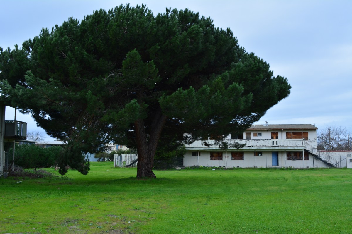
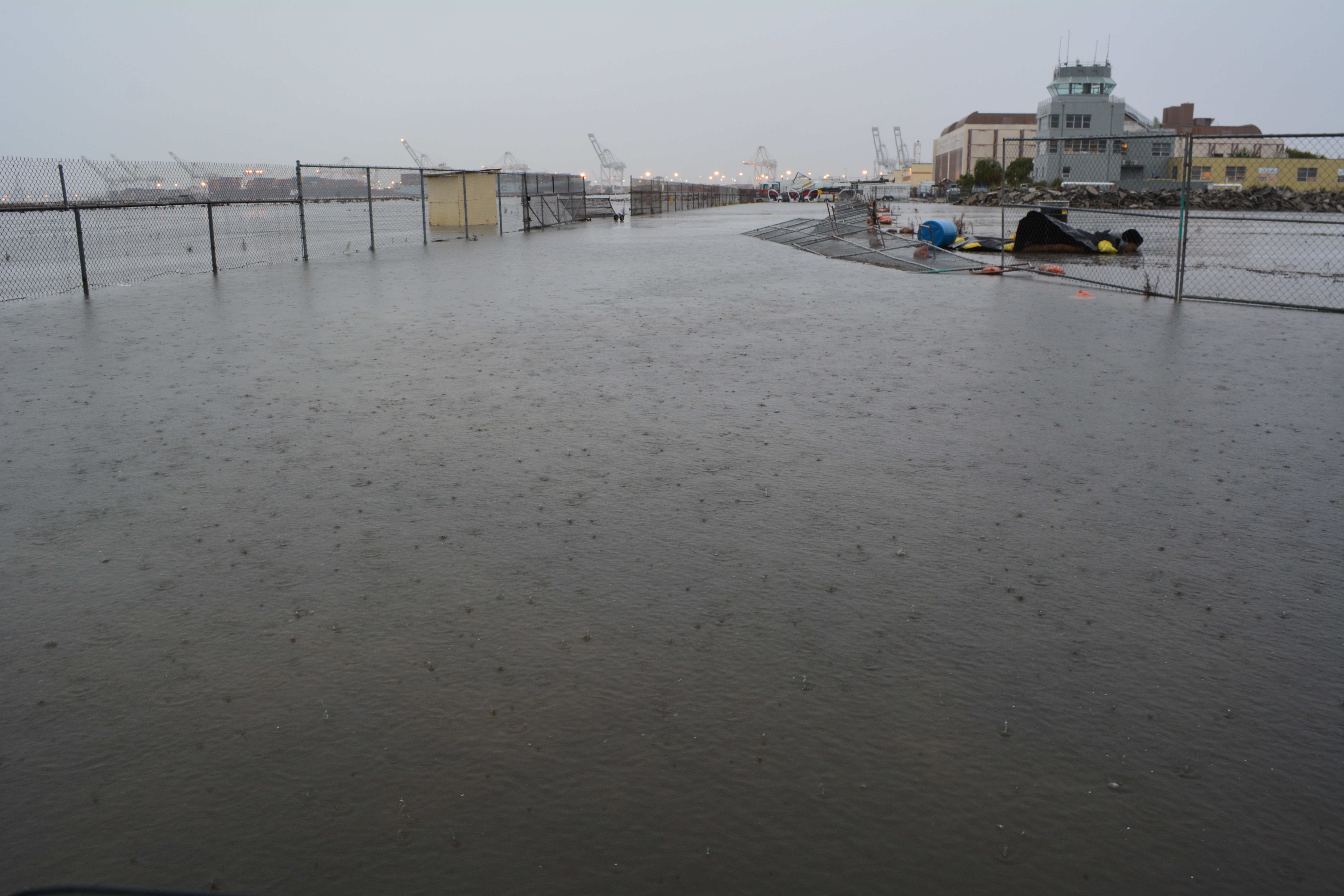
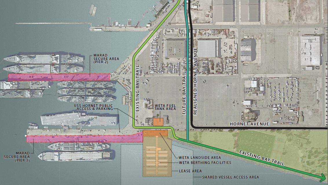
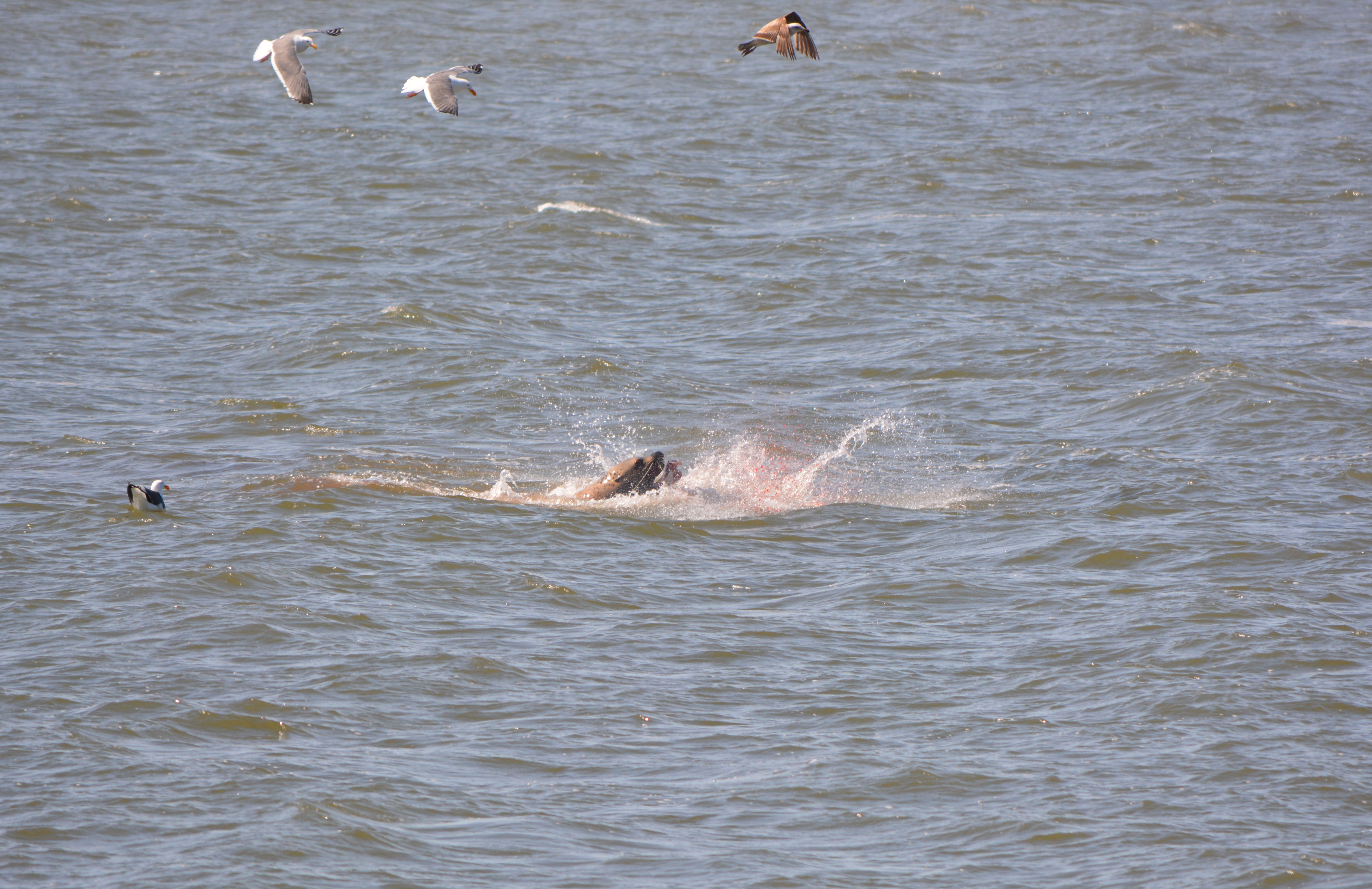
The National Marine Fisheries Service (NMFS or Fisheries Service) issued a permit to the Water Emergency Transportation Authority (WETA) on February 25, 2015, for proposed in-water dock construction activities at Alameda Point that may impact resident harbor seals.

WETA site plan and vicinity Oct. 2014

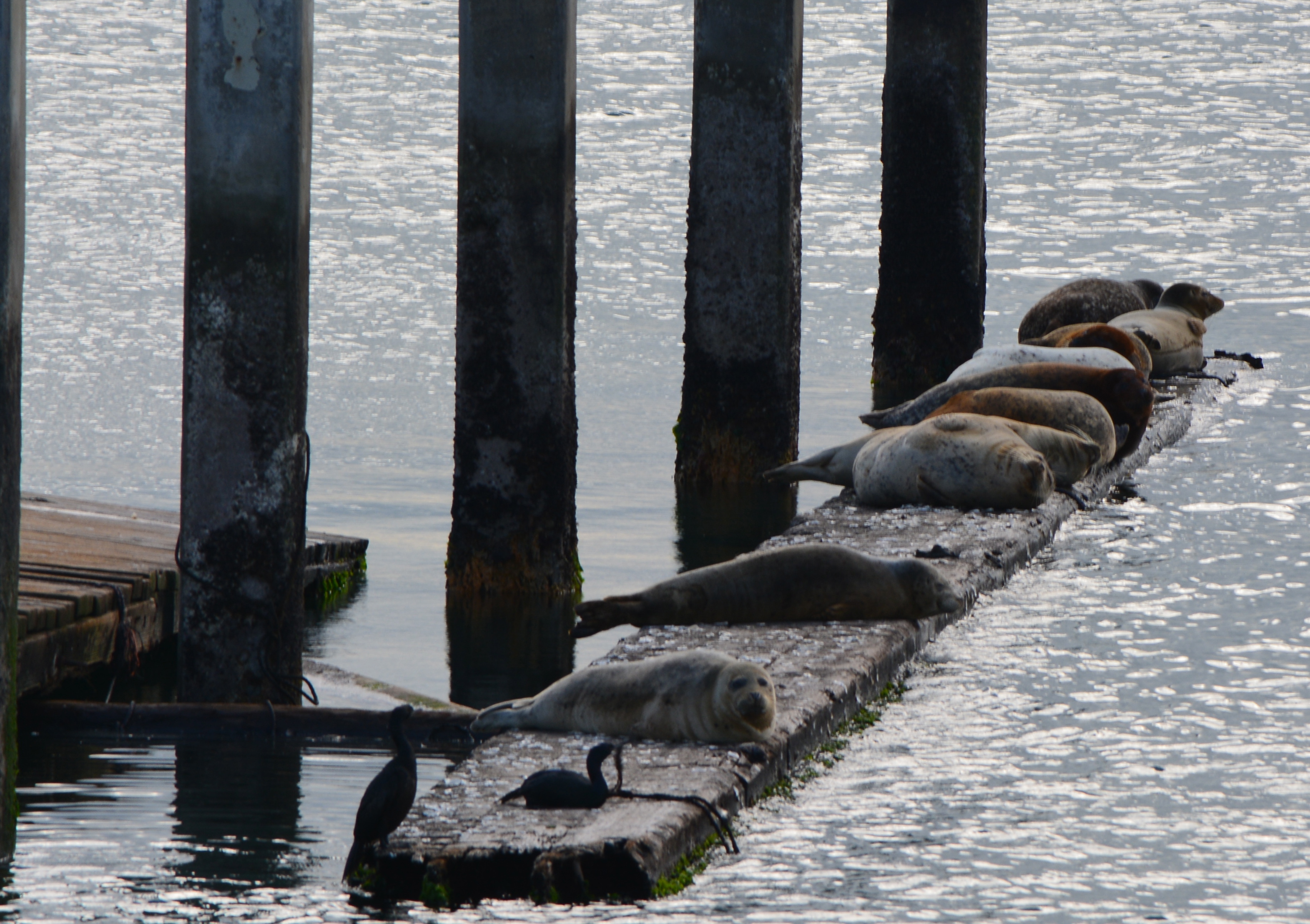
In its permit, they brushed off concerns of the Sierra Club, the San Francisco Bay Conservation and Development Commission (BCDC), and many residents that removal of the old dock used by harbor seals as a haul out could cause them to abandon the area.

Harbor seals on Alameda Point haul out

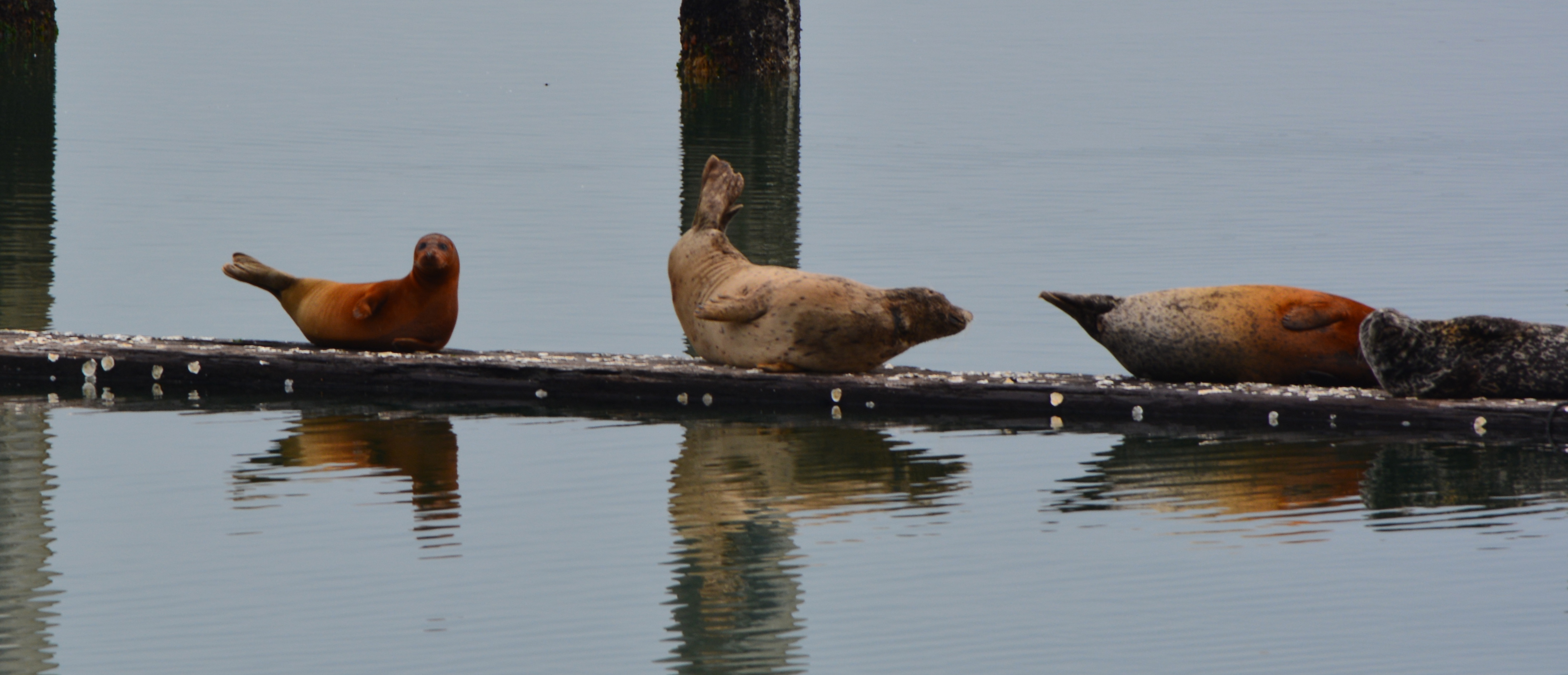
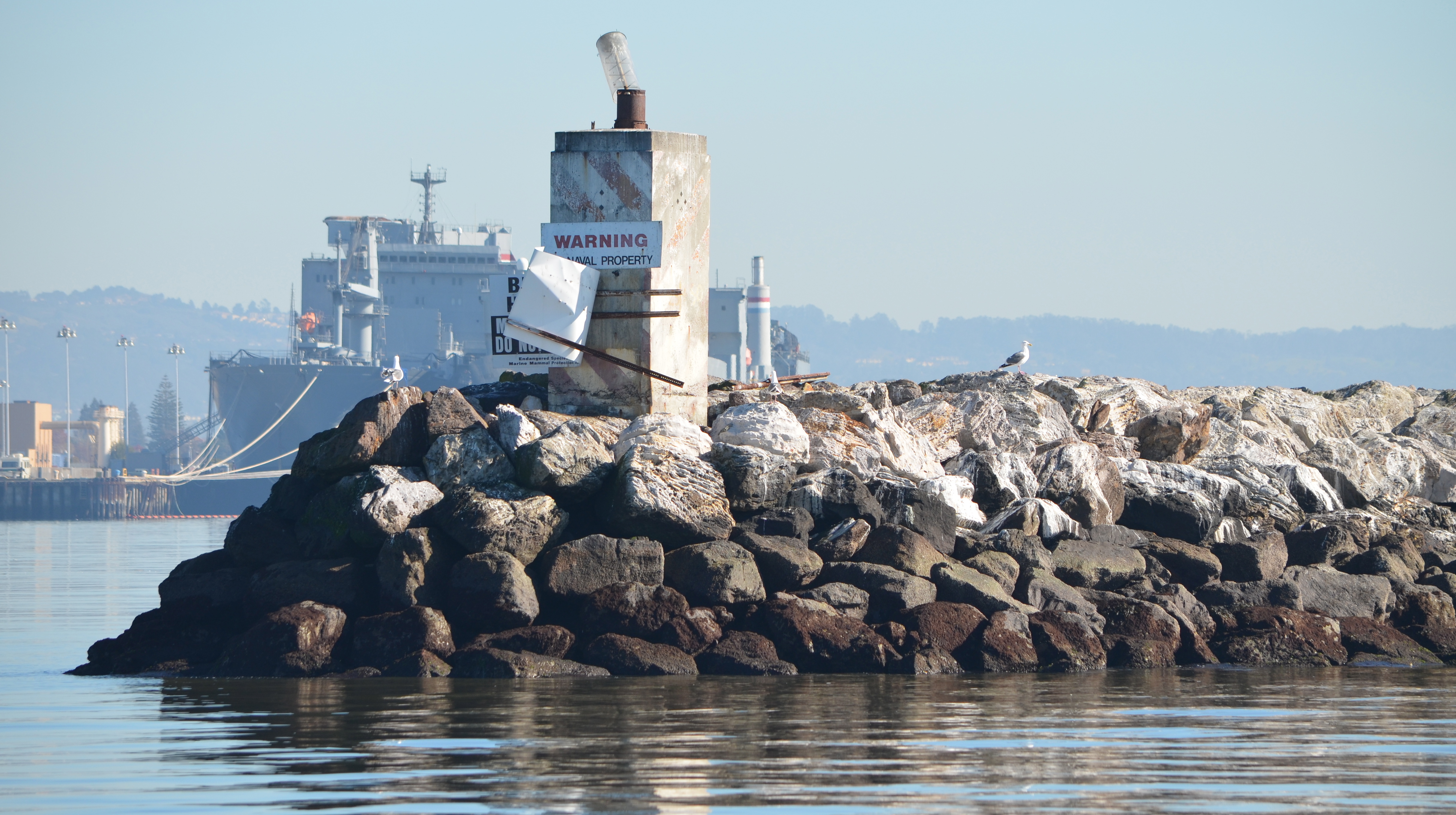
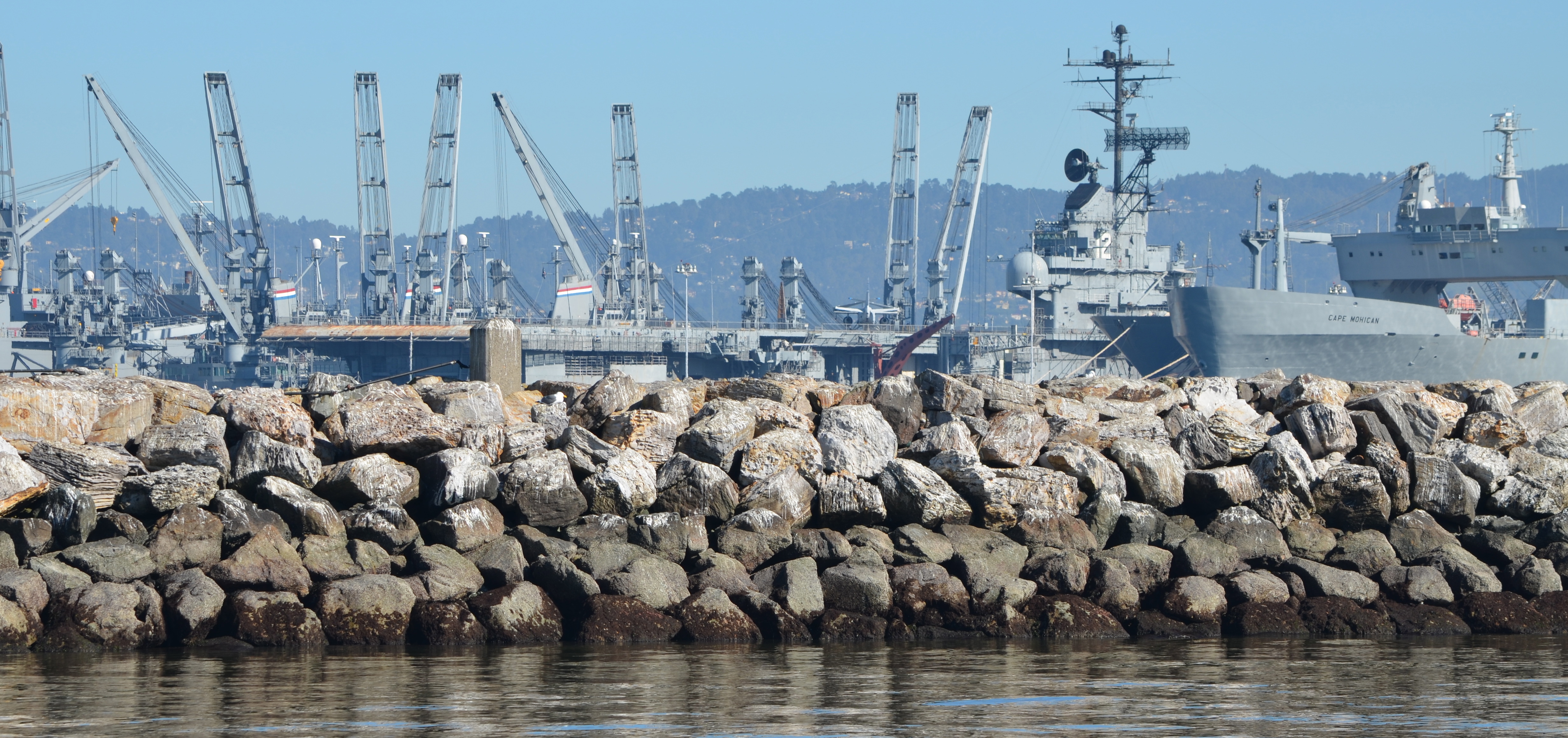
The Fisheries Service doesn’t seem bothered that the seals might abandon the area. They suggest the harbor seals could use a nearby rocky breakwater or a beach on Yerba Buena Island about four miles away. The Fisheries Service even went as far as belittling the dock structure and location preferred by the harbor seals as being “artificial” and “manmade,” even though examples of artificial wildlife habitat enhancements are widespread, some of them sanctioned by the Fisheries Service.

Western tip of Breakwater Island where Fisheries Service said harbor seals should go.  This city-owned property is ill-suited to raising seal pups and not inviting as a resting site, as evidenced by where the seals currently go.
Western tip of Breakwater Island where Fisheries Service said harbor seals should go. This city-owned property is ill-suited to raising seal pups and not inviting as a resting site, as evidenced by where the seals currently go.

The Fisheries Service stated, “NMFS does not consider building an artificial harbor seal haul-out is a good conservation measure to compensate for the loss of the old floating dock that is being used as a haul-out by 10-20 harbor seals. The floating dock proposed to be removed is a manmade structure that is bound to disappear as it deteriorates and falls apart. To build another new structure without maintenance will likely have the same issue in the near future. Therefore, NMFS considers it better conservation practice not to construct a new structure just to replace the current deteriorating artificial one.”

The one remaining beam moored to old dock - similar to log booms used by harbor seals elsewhere to haul out.
The one remaining beam moored to old dock – similar to log booms used by harbor seals elsewhere to haul out.

No one suggested that conservation measures come “without maintenance.” Some periodic maintenance would obviously be necessary.

Fisheries Service philosophy out of touch

If “manmade” artificial landscape features were poor conservation measures, then we would have to assume the Fisheries Service would not approve of fish ladders in rivers and streams to aid fish migration. Nor would they have approved of the artificial reef constructed off the coast of Texas using decommissioned and cleaned ships, and decommissioned oil rigs. A thriving marine reef habitat — through artificial means — has been the result.

At Alameda Point, the entire least tern nesting site is artificial, from the imported sand, oyster shells, shelters and fence to the entire land mass underneath it created by filling in a marsh. Likewise, the least tern nesting island in the Hayward Shoreline marsh is artificially constructed and may someday be underwater. Both of these artificial sites are successful in aiding endangered birds by replacing habitat lost due to human development and uses.

The Fisheries Service response to the comments on the impacts of the ferry maintenance facility gives the appearance of being out of touch. Instead of calling for a small mitigation measure in the form of a new haul out by the agency that is altering the ecosystem, they have shifted the burden to the harbor seals. This is backwards. It sets the baseline conditions as “tomorrow” rather than “yesterday” before modern development ruined most of the shoreline habitat in the Bay.

But there is still hope. The Alameda City Council will have an opportunity at its Tuesday, March 3 meeting to rectify the pending lease agreement with WETA that fails to include provisions for the harbor seals. And a few weeks later, BCDC will have an opportunity to ensure that its permit for the project contains harbor seal haul-out requirements.

Appendix pelican graphic

Harbor seal feeding on bat ray in Alameda Point Channel where new haul out could potentially be located.
Breakwater Island landscape that Fisheries Service and city of Alameda say is suitable harbor seal haul-out habitat.

Sierra Club comment letter to Alameda City Council on WETA lease

BCDC comment letter to National Marine Fisheries Service on WETA permit

Sierra Club comment letter to National Marine Fisheries Service on WETA permit

News updates: Main St. neighborhood planning, Veteran Affairs project, ferry service

Alameda Point is on the cusp of a new era in civilian reuse. Plans for construction of residential neighborhoods and commercial space are taking form, alongside growing productive reuse of aircraft hangars. The U.S. Department of Veterans Affairs (VA) is poised to begin the first phase of their $240 million clinic and columbarium project. In addition, the Water Emergency Transportation Authority (WETA) is studying plans for accommodating their increasing ferry ridership.

Designing the Main Street neighborhood

Alameda Point zoning - Main St. neighborhood

At next Tuesday’s city council meeting, the council will be updated on the pending 68-acre Site A residential and retail plan. They will also consider authorizing an urban design firm to draft detailed plans for a 100-acre residential neighborhood along Main Street near the ferry terminal. Continue reading “News updates: Main St. neighborhood planning, Veteran Affairs project, ferry service”

Alameda Point gateway plan begins taking shape

At its January 20, 2015 meeting, the city council will weigh-in on the preliminary layout proposed by developer Alameda Point Partners (APP) for a 68-acre residential and commercial parcel between Main Street and the Seaplane Lagoon.

West Atlantic Avenue will be realigned as a four-lane divided street to the right of the big tree and become a continuation of Ralph Appezzato Memorial Parkway.  Main Street in foreground.
West Atlantic Avenue will be realigned as a four-lane divided street to the right of the big tree and become a continuation of Ralph Appezzato Memorial Parkway. Main Street in foreground.

APP was selected by the former city council on November 18, 2014, to work up a plan for 800 condos and apartments and 200,000 square feet of retail and commercial space. The developer will also be responsible for changing the gateway street alignment from an oval to a straight line leading to a new public plaza at the Seaplane Lagoon. Continue reading “Alameda Point gateway plan begins taking shape”

Volunteers help maintain successful least tern nesting site at Alameda Point

Volunteers at the Alameda Point nesting site of the endangered California Least Tern continued their efforts this fall after a successful 2014 nesting season.

Tau Beta Pi members help out during the November 2014 work party.  Port of Oakland in background.
Tau Beta Pi members help out during the November 2014 work party. Port of Oakland in background.

The Alameda Point colony produced over 350 least tern fledglings this year, and a record number of the nests had three eggs, as opposed to the usual two. The 45 nests with three eggs may be due to in part to better than normal availability of small fish in nearby waters. The terns arrive at the airfield site in early April. By mid-August the terns have headed south to Mexico and Central America.

Least Tern adult with two chicks - June 2014.  Viewed through chainlink fence.
Least Tern adult with two chicks – June 2014. Viewed through chainlink fence.

Continue reading “Volunteers help maintain successful least tern nesting site at Alameda Point”

Find the wetland near Building 25 at Alameda Point

(Hint: It’s behind Building 25 and was temporarily enlarged on Thursday.)

Rain on Thursday, December 11, led to flooding on three sides of Building 25 at 1951 Monarch Street, as well as on the south side of the Control Tower.  Building 25 is adjacent to the wetland on federal VA property called Runway Wetland.   

Flooding next to Building 25 (behind camera), looking toward Control Tower and Port of Oakland.  VA federal property on the left.
Flooding next to Building 25 (behind camera), looking toward Control Tower and Port of Oakland. VA federal property on the left.

Building 25 was slated for removal in the original Waterfront Town Center conceptual drawing to make way for a wetland park called De-pave Park.  By early 2014, city staff decided instead to lease the building, convincing the city council to follow.  The plan now calls for protecting the building with a levee, which could be decades away.   Continue reading “Find the wetland near Building 25 at Alameda Point”

Bird sightings at Alameda Point – Fall 2014

A photo gallery of birds sighted at Alameda Point during the Fall of 2014.  They include:  Black-necked Stilt, Red-shouldered Hawk, Northern Flicker, White-crowned Sparrow, Cedar Waxwing, Chestnut-backed Chickadee, Northern Shoveler, Black-crowned Night Heron, and Western Bluebird.

Black-necked Stilt

Black-necked Stilt

Red-shouldered Hawk

Red-shouldered Hawk

Continue reading “Bird sightings at Alameda Point – Fall 2014”

Environmental cleanup update – November 2014

Navy environmental cleanup operations at Alameda Point ran the gamut during the summer and fall of 2014.

Operations included using bacteria to clean up groundwater, grinding radium out of a building floor, digging up lead-contaminated soil, constructing a metal shoreline waste barrier, digging up shoreline waste, preparing to install a 30-acre soil cover, constructing a new shoreline wetland, checking drain lines for contamination with cameras, and demolishing a several-acre temporary concrete drying pad near the old Control Tower.

Aerial view of Site 1 cleanup area at northwest tip of Alameda Point, showing newly installed waste isolation barrier along Bay shoreline, piles of contaminated soil in horseshoe shaped area that were excavated from watery pit on right, and stockpiled soil on old runway to be used for soil cover.  A wetland area will be constructed on clear strip on left along Oakland Estuary.  Navy photo.
Aerial view of Site 1 cleanup area at northwest tip of Alameda Point, showing newly installed waste isolation barrier along Bay shoreline, piles of contaminated soil in horseshoe shaped area that were excavated from watery pit on right, and stockpiled soil on old runway to be used for soil cover. A wetland area will be constructed on clear strip on left along Oakland Estuary. Navy photo.

Continue reading “Environmental cleanup update – November 2014”