News About Cleanup, Sustainability, Parks, Open Space, and Wildlife at Alameda Point, Alameda, CA
Find the wetland near Building 25 at Alameda Point
(Hint: It’s behind Building 25 and was temporarily enlarged on Thursday.)
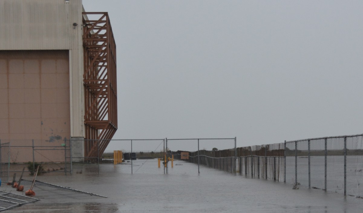
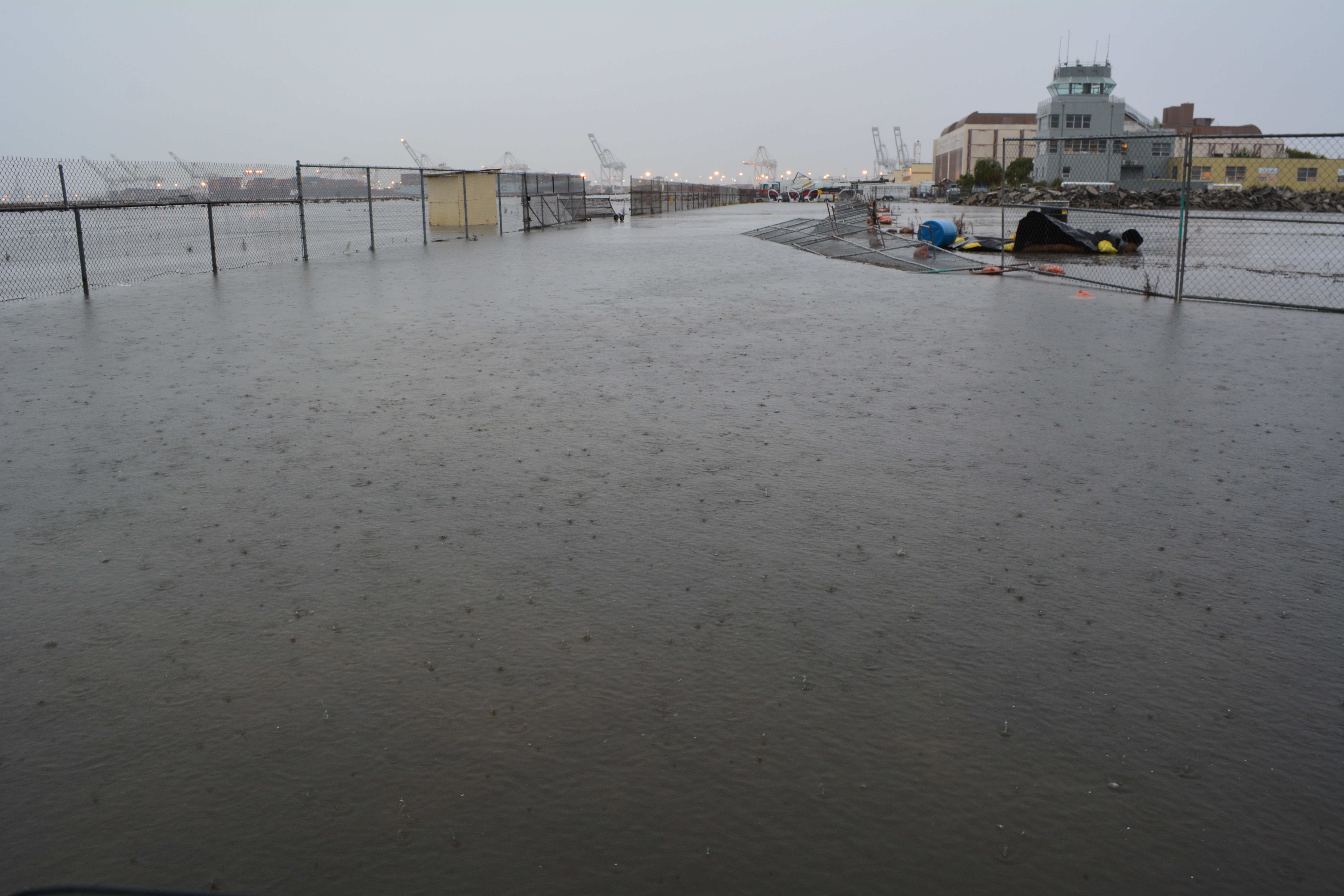
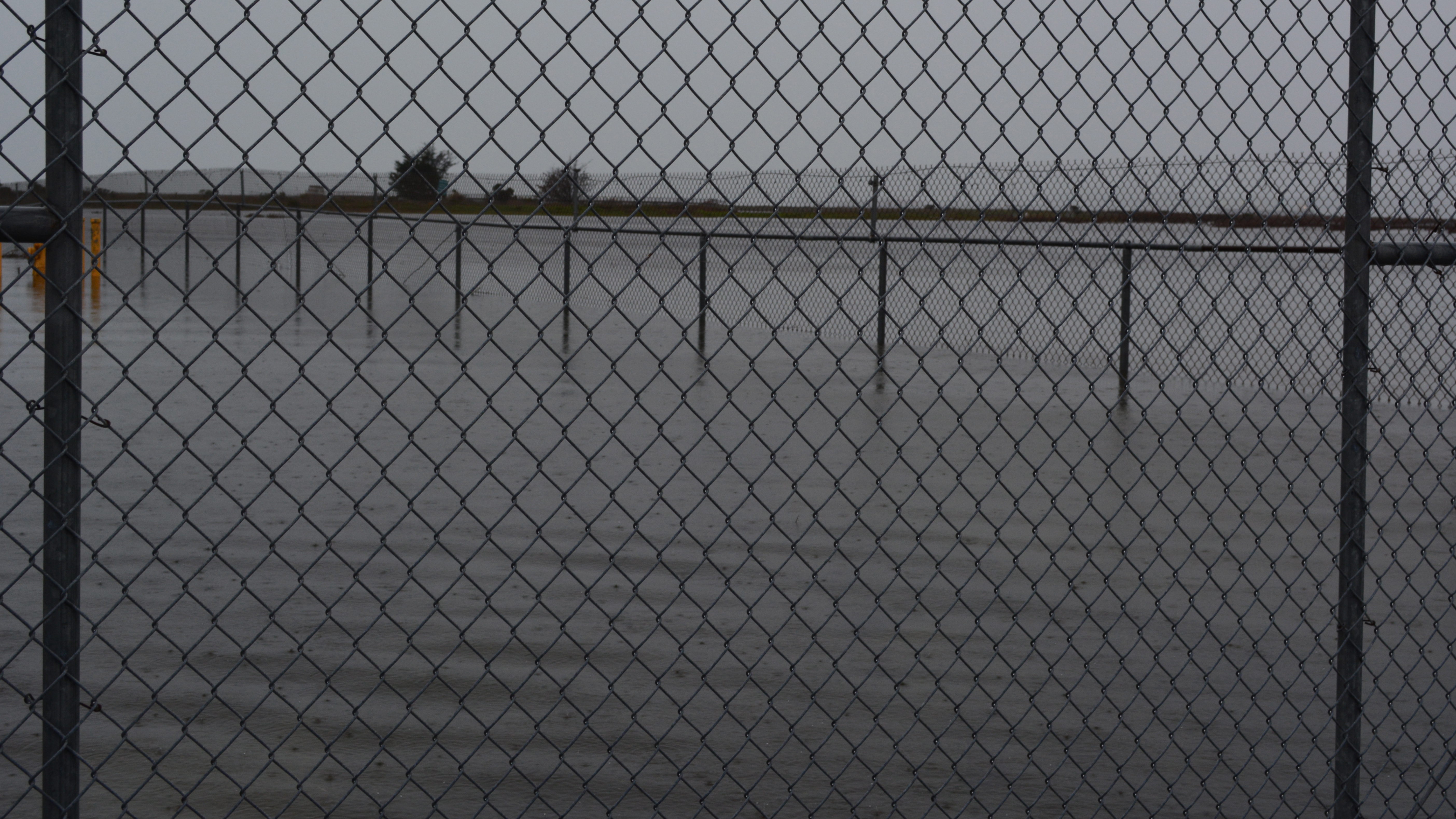
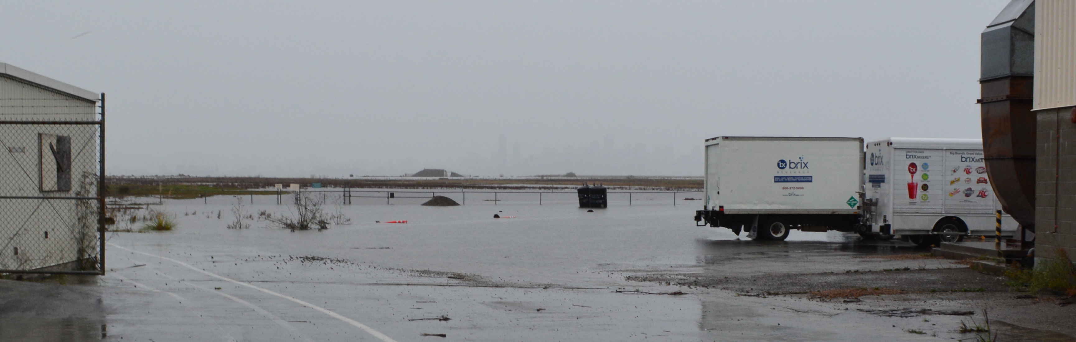
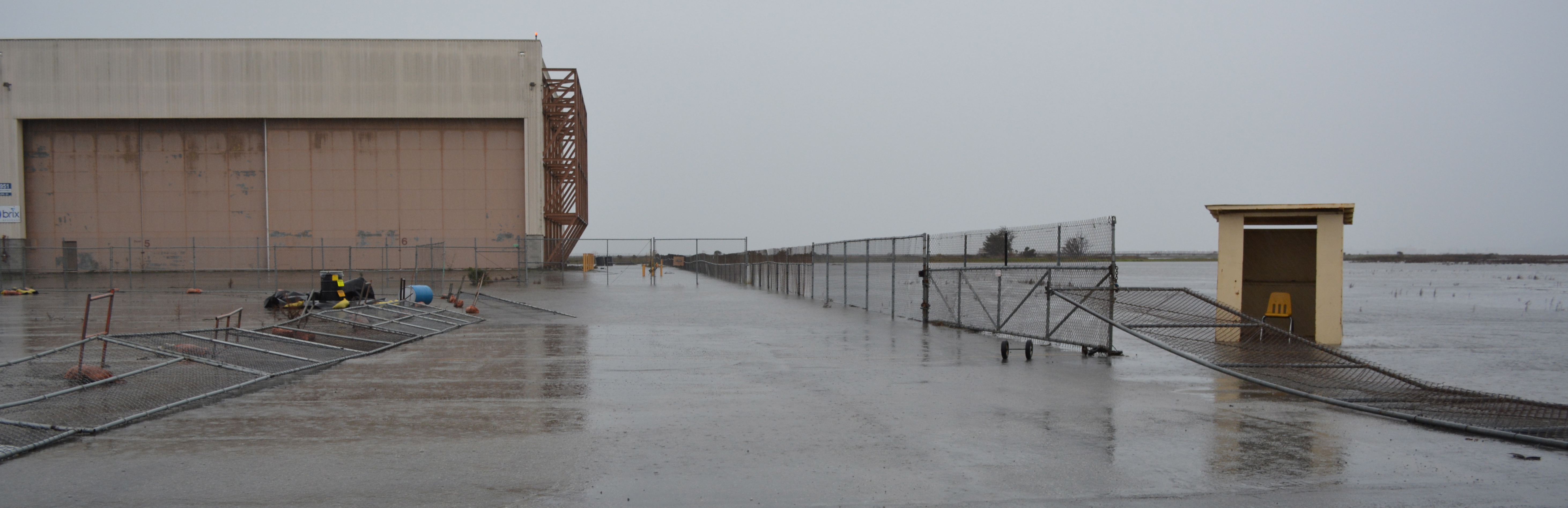
Rain on Thursday, December 11, led to flooding on three sides of Building 25 at 1951 Monarch Street, as well as on the south side of the Control Tower. Building 25 is adjacent to the wetland on federal VA property called Runway Wetland.
Flooding next to Building 25 (behind camera), looking toward Control Tower and Port of Oakland. VA federal property on the left.
Building 25 was slated for removal in the original Waterfront Town Center conceptual drawing to make way for a wetland park called De-pave Park. By early 2014, city staff decided instead to lease the building, convincing the city council to follow. The plan now calls for protecting the building with a levee, which could be decades away.
Building 25 is divided into three 18,000 square-foot bays. Brix Beverage earlier this year signed a five-year lease for one of the bays, with an option to renew for five years. The other two bays are listed as available.
Flooding on west side (rear) of Building 25. Looking south with Runway Wetland in background.Flooding at rear of Building 25. Fence in background is VA boundary. On the other side is the Runway Wetland.Flooding on south and west sides of Building 25 used by Brix Beverage. Looking west.Building 25 and the Runway Wetland are in the background. VA property begins on the right.
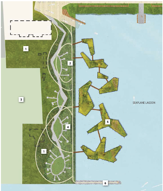
Landscape Plan 2013
showing no buildings on west side of Seaplane Lagoon
Landscape Plan for Seaplane Lagoon from 2013 showing buildings removed from west side of Seaplane Lagoon for a naturalized park.
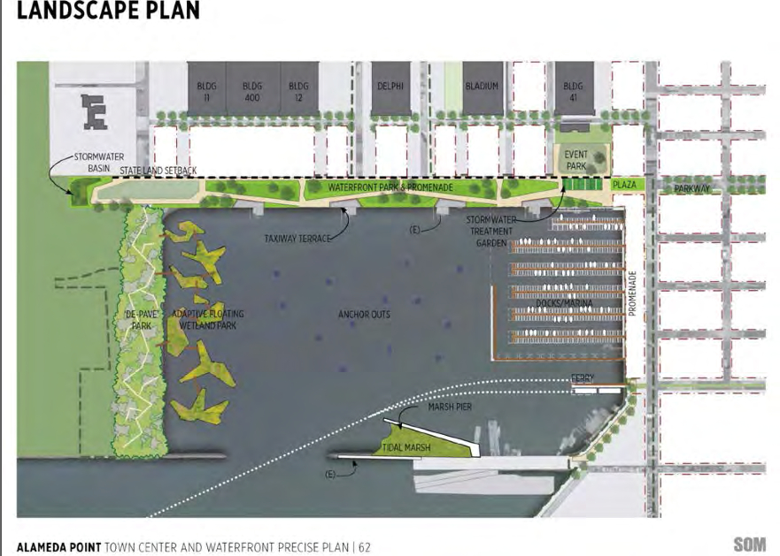
Landscape Plan 2014
showing buildings (in dashed lines) being retained on west side of Seaplane Lagoon
Landscape Plan for west side of Seaplane Lagoon adopted in July 2014 showing buildings (dashed lines) remaining. Building 25 is at upper left in light-colored area.
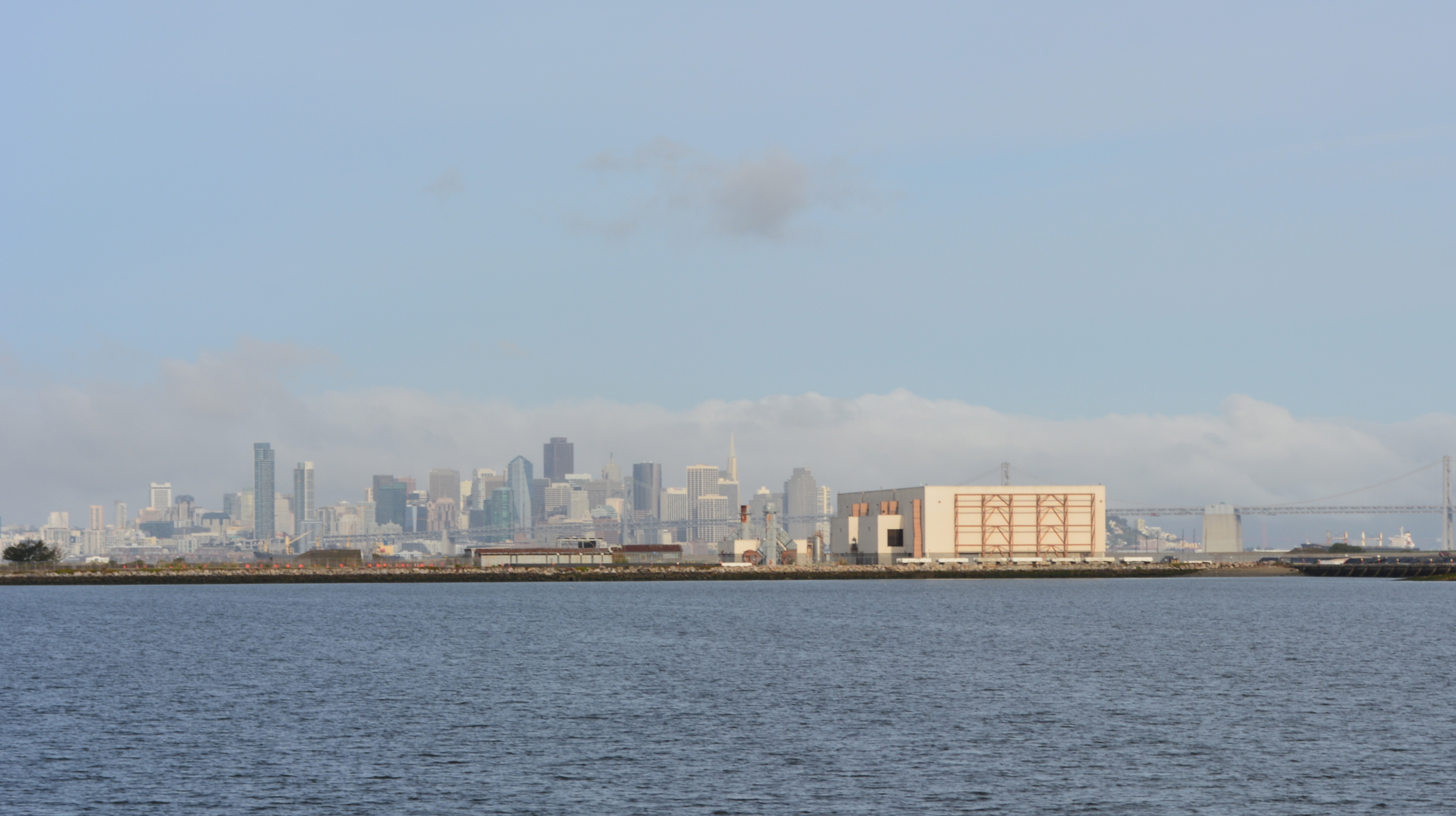
Building 25 – An eyesore between a lagoon and a wetland
My blog is Alameda Point Environmental Report covering parks and open space, environmental cleanup, wildlife, and sustainability at the former Navy base in Alameda now called Alameda Point.
Articles on my blog are frequently posted on the Alameda Post news site.
I also host a Flickr photo site, which is accessible via the sidebar wildlife photo gallery.
I hope you find my stories and photos of interest.
Richard Bangert
Alameda, California
View all posts by richard94501
One thought on “Find the wetland near Building 25 at Alameda Point”
Thought you might want to know that the flooding around building 25 was due to an unmaintained storm drain “duck” bill valve. This caused seawater to fill the storm drains during high tides leaving no capacity for storm water. We believe that that problem is ow resolved.


Thought you might want to know that the flooding around building 25 was due to an unmaintained storm drain “duck” bill valve. This caused seawater to fill the storm drains during high tides leaving no capacity for storm water. We believe that that problem is ow resolved.
LikeLike