Radium safety enhanced at Seaplane Lagoon

The City of Alameda became the new owner of the Seaplane Lagoon at Alameda Point on April 13, 2016. It came from the Navy with a new condition that exceeds normal protocols for dredging in San Francisco Bay.

As with all cleanup sites, the Navy, city and regulators agreed to what areas needed to be cleaned up in the Seaplane Lagoon. The cleanup plan approved in 2006 was based on testing the sediment throughout the 110-acre lagoon. The problem areas were confined to about 10 acres at the northeast and northwest corners of the lagoon where storm sewers dumped contaminants prior to 1970s environmental laws. The agreed upon plan said that there would be no restrictions on the lagoon when cleanup was done.

Dredging the northwest corner of the Seaplane Lagoon in February 2012.

After cleanup was completed, two years of discussions between the Navy, state and federal regulators, and the city led to an amendment to the official cleanup decision to include a detailed management plan for any future dredging in the Seaplane Lagoon. The city led the effort to create a sediment management plan. It stipulates that all dredge sediment brought to the surface will have to be spread out six inches thick on a drying pad and scanned for radium-226 radiation at a cost borne by the city. Continue reading “Radium safety enhanced at Seaplane Lagoon”

Ferry agency, volunteers help the least terns

Three thousand tons of sand was added to the nesting grounds for the least terns at Alameda Point in late February and early March. In the weeks that followed, volunteers from St. George Spirits and the Boy Scouts and Cub Scouts came out to help make the site ready for the arrival of the terns in mid-April.

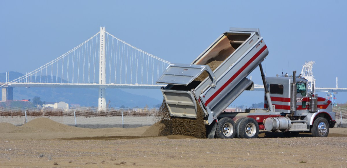
Sand being delivered to the least tern nesting grounds at Alameda Point on February 25, 2016. Bay Bridge in the background.

The Water Emergency Transportation Authority (WETA) paid for enough sand to cover half of the 9.6-acre nesting area with three inches of sand, as well as for grading. The weeklong delivery of sand was a conservation mitigation requirement for the impact that WETA’s new ferry maintenance facility will have on the terns’ feeding area. As many as 12 ferries will make up to four passes per weekday through the Alameda Point Channel where the terns frequently dive for small fish.

Wind and water erosion take their toll on the sand substrate lying atop old airfield taxiway pavement, requiring periodic replenishment. This latest delivery of Angel Island coarse sand has built up the sand depth on much of the site to the point that it’s starting to feel like a real beach underfoot. Beaches are the traditional nesting habitat for terns. Continue reading “Ferry agency, volunteers help the least terns”

Demolition of former Navy apartments begins

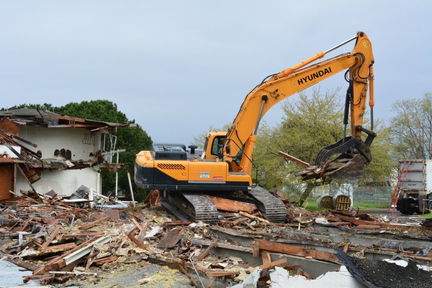
The demolition of 16 former Navy apartment buildings at Alameda Point has begun. On January 5, 2016, the City Council awarded a $547,000 contract to Asbestos Management Group of Oakland to perform the demolition.

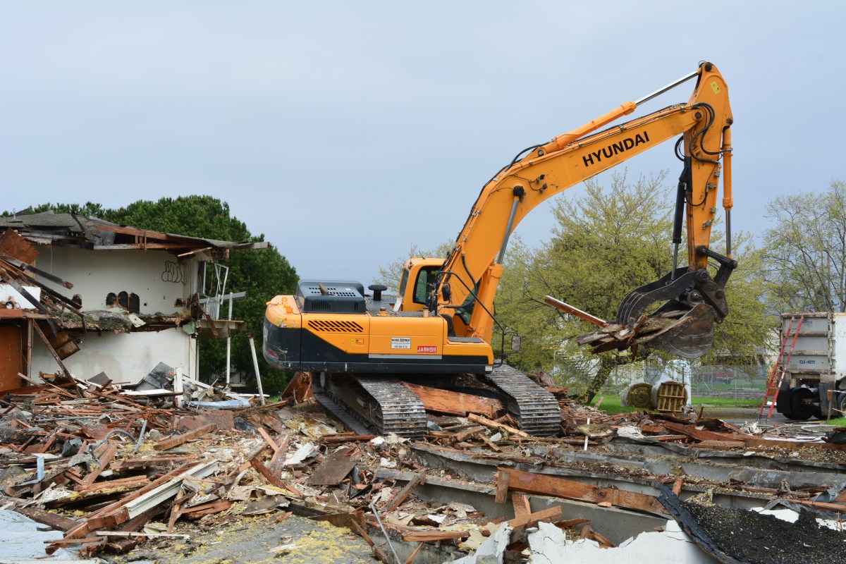
Demolition of Navy apartment buildings at West Tower Avenue and Orion Street, Alameda Point.

In April of 2015, the city council directed city staff to come up with a plan to address safety and blight issues after KTVU Channel 2 aired a story about unsafe conditions at the abandoned housing area.

The structures are located on Orion Street, West Tower Avenue, Stardust Place and Pearl Harbor Road. Demolition began during the second week of March and is expected to be completed within 60 days. The job is being paid for out of Alameda Point base reuse funds.
Continue reading “Demolition of former Navy apartments begins”

Navy adds a wetland and grassland

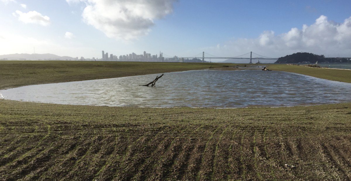
The Navy’s cleanup program has not only removed toxic substances from below ground, it has dramatically improved some of the above ground environment by creating new native grassland and wetlands. January rains filled the Navy’s new seasonal wetland on the northwest shoreline corner of Alameda Point and fostered growth of newly planted native grass seed on the surrounding soil.

New Site 1 wetland on January 13, 2016, with San Francisco in background. Rows in soil with emerging growth were created during sowing of seeds. Navy photo.

The 2.25-acre wetland lies within an approximately 37-acre shoreline cleanup area known as Site 1 at the confluence of the Oakland Estuary and San Francisco Bay. It is where the Navy buried its waste between 1943 and 1956. Most of the waste pits were covered by pavement in the mid-1950s when a new runway was added. Continue reading “Navy adds a wetland and grassland”

Seaplane Lagoon ferry service in limbo

The new residential and commercial developer at Alameda Point has set aside $10 million toward the construction of a passenger ferry terminal at the Seaplane Lagoon. The Bay Area’s ferry agency – the Water Emergency Transportation Authority (WETA) – however, has made it clear there is currently no funding to operate a ferry there.

WETA “will entirely exhaust its available operating subsidies on an annual basis, relying upon projected increases in ridership and fares to cover increasing operating costs for existing services,” stated a draft 10-year Short Range Transit Plan that WETA issued in January for public comment. “WETA’s ability to increase service levels and meet future demand for ferry service will be restricted until new regional or local sources of operating subsidy are secured,” the draft stated.

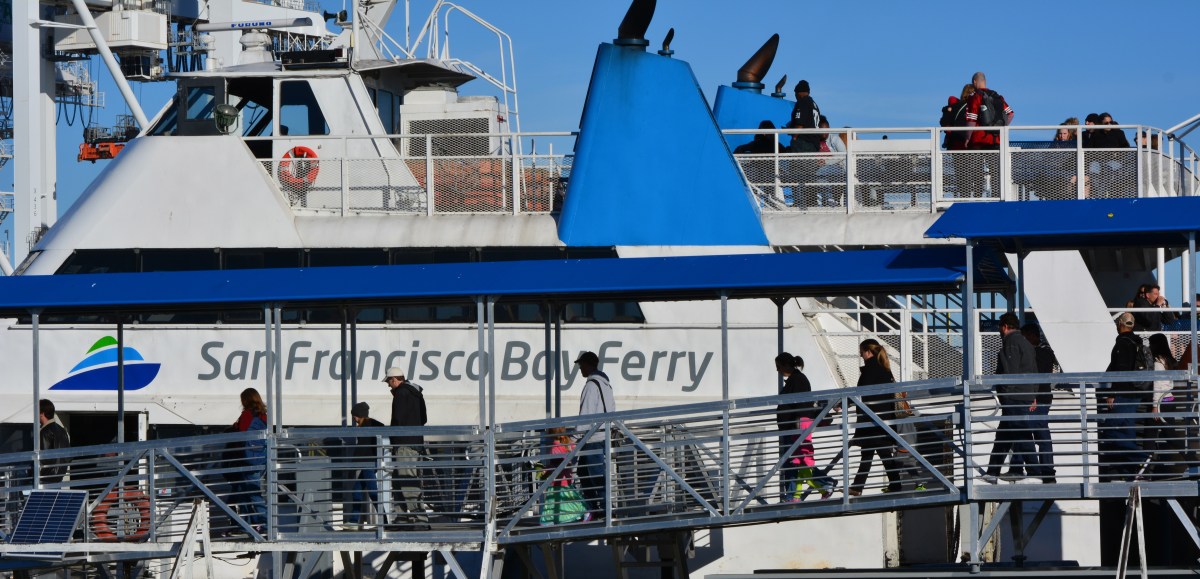
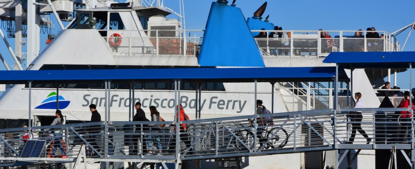
Ferry passengers boarding at the Alameda Main Street Terminal bound for San Francisco. The popular Main Street Terminal at the north side of Alameda Point on the Oakland Estuary will continue in operation, even if new ferry service comes to the Seaplane Lagoon. Parking here will be expanded in mid-2016.

WETA’s revenue picture is more limited than other regional transit agencies, such as BART. In WETA’s case, half of its operations funding comes from fares. Most of the other half — $15.3 million — comes from bridge tolls through Regional Measure 2, which was passed in 2005 adding a $1 bridge toll. A Harbor Bay parcel assessment funds 10 percent of the Harbor Bay service.  Continue reading “Seaplane Lagoon ferry service in limbo”

Artistic expression at Alameda Point

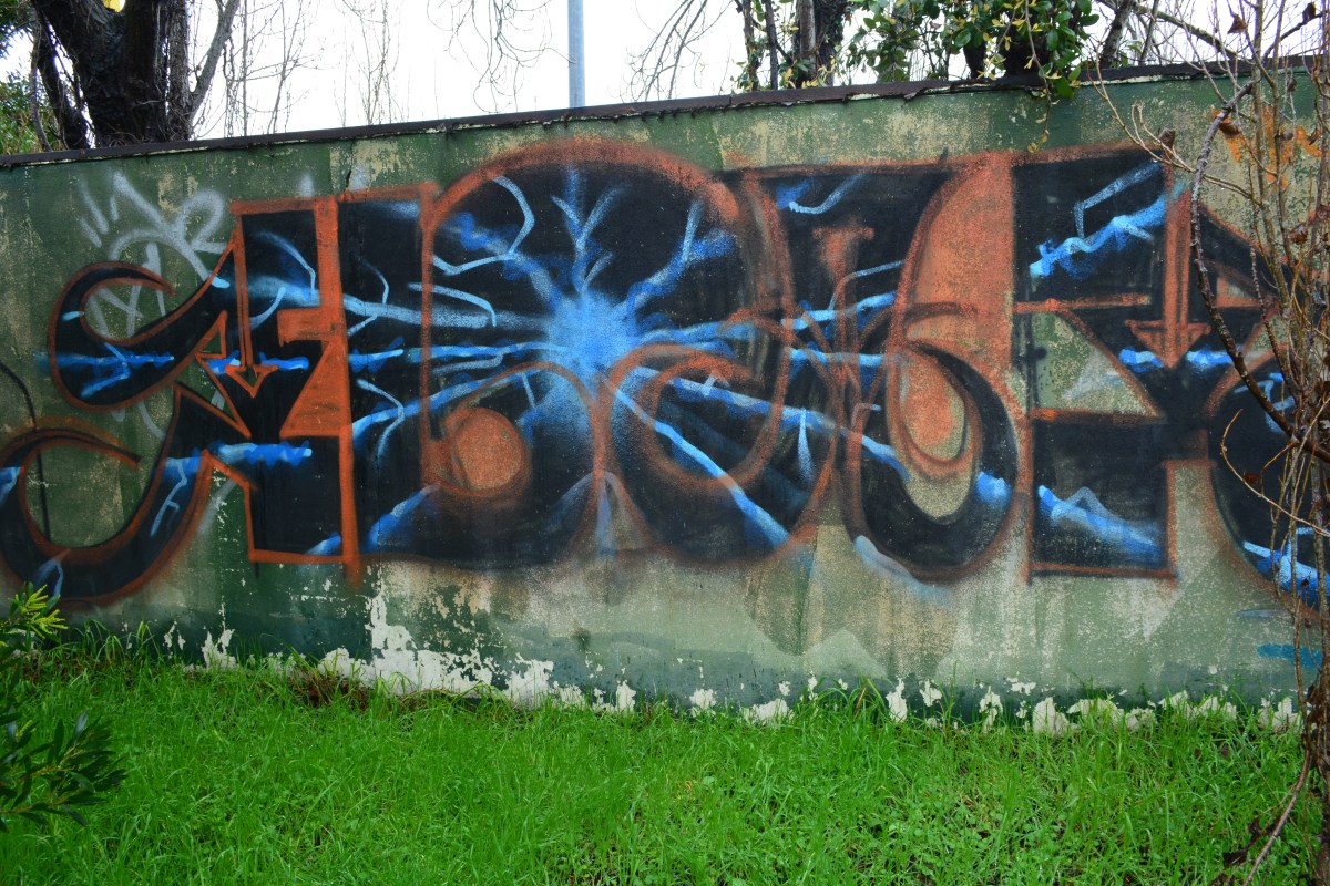
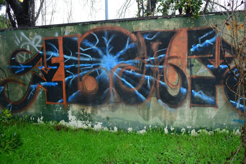
The viewer is left to decide where graffiti ends and art begins in the following images. Regardless of opinion, one thing is clear: There are people looking for an opportunity to artistically express themselves.  And Alameda Point has plenty of abandoned interior and exterior walls to accommodate them.

"Art in the park"
“Art in the park”

Artist Sam Norton created the mural below at City View Skate Park at Alameda Point in 2015 to honor and remember his friend and fellow skateboarder Clay Harding who died the previous year. Continue reading “Artistic expression at Alameda Point”

Waterfront Park plans – Public comment welcomed

The Planning Board and the Recreation and Park Commission will be making comments this week on the first phase of a waterfront park being planned for the north side of the Seaplane Lagoon at Alameda Point.  The public is invited to offer comments.

AP Waterfront Plans

The Planning Board meeting is on Monday at 7 PM at City Hall.  The Recreation and Park Commission meeting is on Thursday at 7 PM at City Hall.

Below are excerpts from the city staff report, along with a series of images in an easy-to-examine format excerpted from the complete design proposal.  Click on any image to enlarge.

“Alameda Point Partners (APP) has been working with their design consultants, park planners, a Planning Board Subcommittee and City staff to prepare detailed designs for the individual buildings and parks within Site A.  APP has submitted an application for design review for a 2.63-acre Phase 1 of the waterfront park along the northern edge of the Seaplane Lagoon that is intended to be constructed concurrent with Block 11.”

“Phase 1 Waterfront Park is designed to provide a variety of public spaces for passive recreation and opportunities for the public to enjoy the waterfront location and special events, and appreciate the views of the San Francisco skyline and the historic row of seaplane hangar buildings at the entrance to the Historic District, along the northern edge of the Seaplane Lagoon.”

AP Waterfront Plans

“The 2.63-acre Phase 1 Waterfront Park is designed to create three primary sub-areas (i.e., the Overlook, the Promenade & Terraces, and the Taxiway).”

AP Waterfront Plans

The Overlook includes a pavilion for a café with outdoor seating and restrooms, as well as an elevated salvaged or reclaimed wood outdoor area for overlooking the promenade at the water’s edge, as well as portions of the promenade adjacent to the water.  The Overlook also accommodates flexible event and programmable space.”

AP Waterfront Plans

The Promenade and Terraces consists of a series of terraces and promenade spaces leading down to the water’s edge that provide for a variety of more passive spaces for enjoying and experiencing the waterfront.  Access to the waterfront promenade allows for universal design through slightly sloped walkways and seating elements that provide for a variety of all age groups and needs.”

AP Waterfront Plans

The Taxiway area is intended to pay homage and respect to the historic elements of the former NAS Alameda by engraving a timeline along the major east west gathering area into the concrete to remind and educate the public about the history of the site and the Historic District, and by minimizing tree plantings and planted areas to preserve the ‘openness’ of the historic taxiways consistent with the Historic District guidelines.  This area includes open and unobstructed areas planned for special events and food trucks and future retail buildings as conceived in the Site A Development Plan and a temporary multi-purpose lawn for active recreation uses until future phases of the Waterfront Park are constructed and this area is designed consistent with the areas to the north.”

AP Waterfront Plans

Address Sea-Level Rise.  With anticipated sea level rise, the existing taxiways will flood.  Consistent with the approved MIP and San Francisco Bay Conservation and Development Commission (BCDC) policies, the Phase 1 Waterfront Park is designed to address 24-inches of sea level rise and additional sea level rise in future years beyond 24 inches through adaptive management strategies.”

“The Phase 1 Waterfront Park design maintains the “horizontality” of the space and minimizes the use of walls in order to respect the cultural landscape guidelines for the Historic District.

“Additionally, the sea level rise strategy is designed around a series of short terraces spread over a larger space to minimize the impression of changes in elevation.  This approach also allows for the preservation of the existing bulkhead, which is a character defining feature of the Historic District.   During storm events and “King Tides” (unusually high tides), the bulkhead and adjacent promenade will flood occasionally as the sea level rises over time, but major portions of the public park and Bay Trail will remain above the flooded areas behind the stepped terraces.  As such, the design balances the competing needs to address sea-level rise, preserve the bulkhead, and maintain the horizontality of the site.”

AP Waterfront Plans

AP Waterfront Plans

AP Waterfront Plans

AP Waterfront Plans

AP Waterfront Plans

AP Waterfront Plans

AP Waterfront Plans


AP Waterfront Plans

AP Waterfront Plans

Later phase. Not part of Phase 1.

AP Waterfront Plans

AP Waterfront Plans

Click on any image to enlarge.

AP Waterfront Plans

AP Waterfront Plans

AP Waterfront Plans

AP Waterfront Plans

AP Waterfront Plans

AP Waterfront Plans

AP Waterfront Plans

AP Waterfront Plans

AP Waterfront Plans

AP Waterfront Plans

AP Waterfront Plans

AP Waterfront Plans

AP Waterfront Plans

AP Waterfront Plans

AP Waterfront Plans

AP Waterfront Plans

AP Waterfront Plans

AP Waterfront Plans

AP Waterfront Plans

AP Waterfront Plans

Click on image to enlarge.

AP Waterfront Plans

AP Waterfront Plans

AP Waterfront Plans

AP Waterfront Plans

AP Waterfront Plans

AP Waterfront Plans

AP Waterfront Plans

AP Waterfront Plans

AP Waterfront Plans

AP Waterfront Plans

AP Waterfront Plans