Harbor seal dock, ferry depot plans on track

The Water Emergency Transportation Authority (WETA) is aiming for the delivery of a new dock for harbor seals at Alameda Point as early as April, ahead of the start of construction of its new ferry maintenance facility this summer.
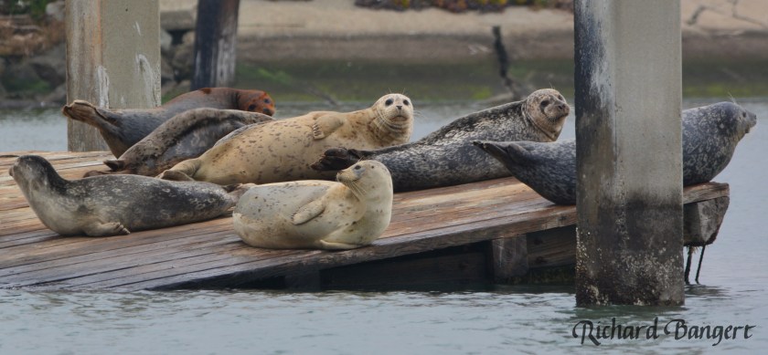
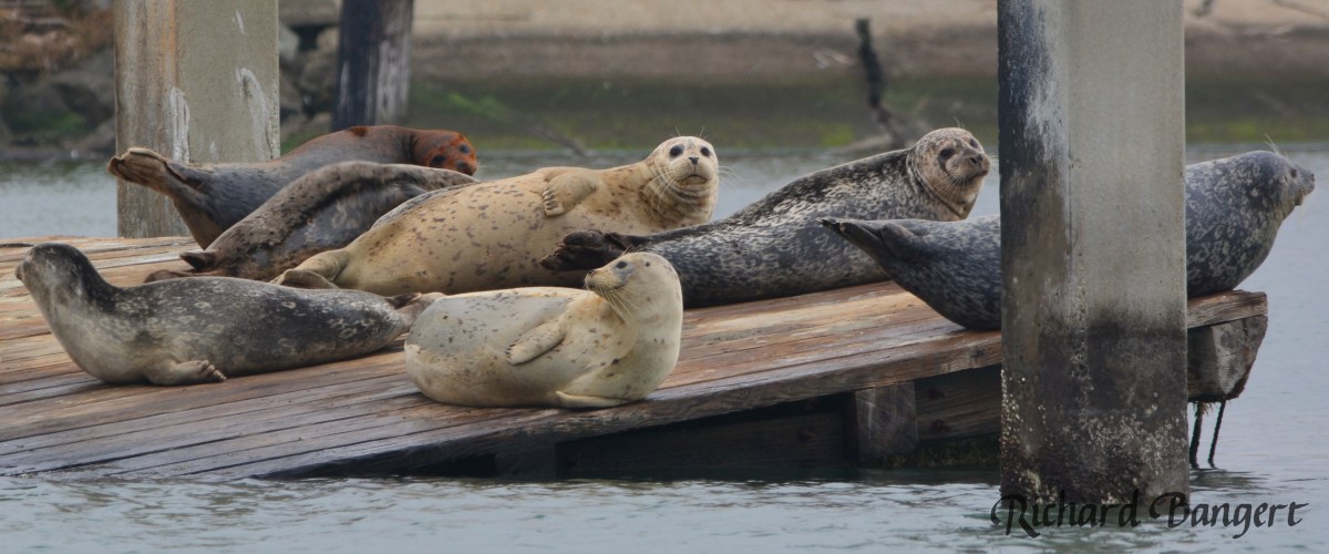
Harbor seals on old dock

Because the maintenance facility’s new berthing dock would displace the seals’ current resting spot, a provision was approved for a new harbor seal dock as a condition for permitting the new facility. WETA, the city council, and the Bay Conservation and Development Commission (BCDC) approved the provision at the urging of community activists.

WETA issued design specifications for its 12-berth maintenance facility and administrative offices to prospective contractors in December. It expects to award the contract on March 31, with work commencing as soon as May 6. The estimated cost is pegged at $45 million, $9 million of which is for design work and the remaining $36 million going for construction, according to Chad Mason, senior planner at WETA. Funding for the project is coming from federal, state, and regional funds.

The facility will include a 70-foot-tall four-story building and is expected to be complete in 2018.

The project will also fund other benefits, among them, a new water line from Main Street, park enhancements, and sand for the least tern nesting area on the airfield.
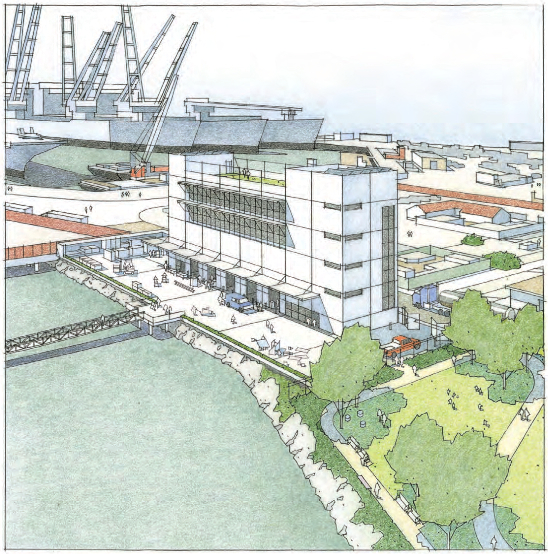
WETA artist's drawing - Alameda Point

WETA will construct a shoreline viewing terrace, bicycle parking, interpretive signage, improved lighting and landscaping, and seating on an adjacent half-acre of parkland on West Hornet Avenue.

WETA will also be providing some assistance for the California least terns, an endangered bird species that nests at Alameda Point and dives for fish in surrounding waters. As a mitigation for the impacts of the new ferry traffic on the terns’ foraging waters, WETA will be delivering enough truckloads of sand to the terns’ nesting area on the airfield in February to add a few inches of depth. Erosion of the 9.6-acre beach-like nesting landscape necessitates periodic replenishment.

The replacement harbor seal dock, also referred to as a haul-out, will be the first time such a structure has been built on San Francisco Bay specifically to retain or attract harbor seals. It will be located a short distance to the east of the old dock. Time will tell whether this experimental effort is successful.
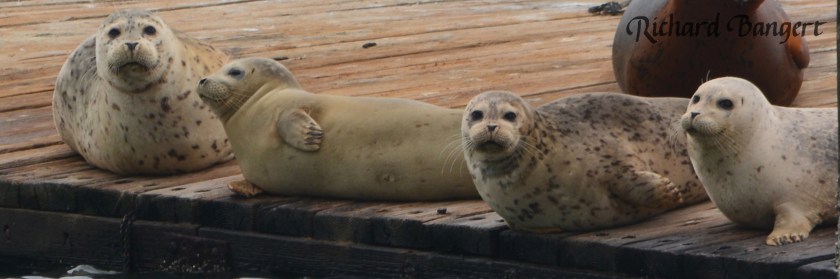
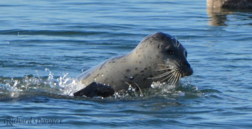
Young harbor seals Alameda Point Dec. 30, 2015

“Meeting the permitting requirements for the new harbor seal haul-out is underway,” said Mason. BCDC is the state permitting agency for all Bay shoreline and in-water projects. It requires assurances from other agencies that the harbor seal dock does not introduce any unwanted environmental impacts before granting approval.

“With the help of the environmental consulting firm Dudek, the harbor seal haul-out is on a fast-track approval timeline,” said Mason. “The only regulatory delay is due to the herring spawning season. Regulations require that the pilings for the new haul-out be installed after the end of the herring spawning season in late March of 2016.”
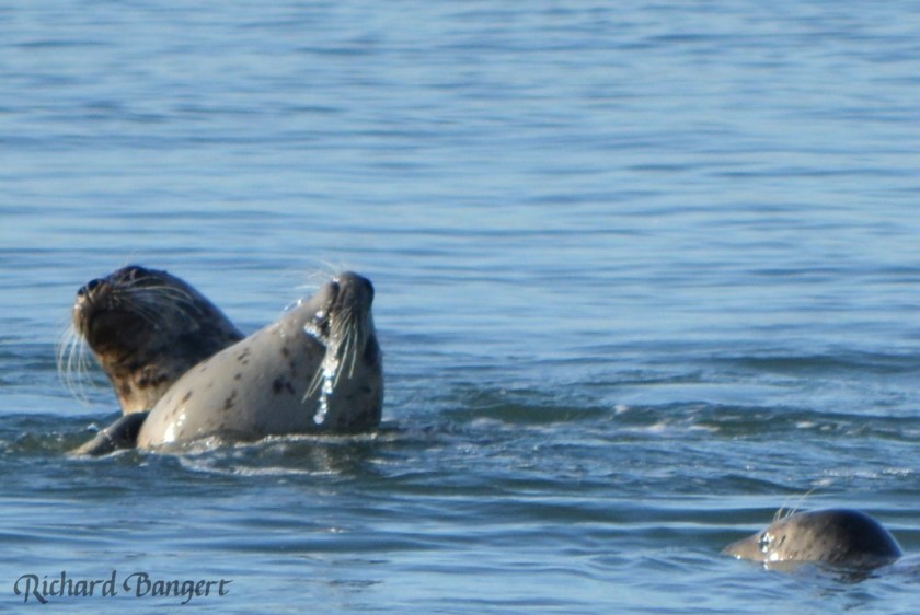
Harbor seals near the old dock in December 2015.

“We are currently reviewing two options for providing the new harbor seal haul-out: Build a new one from scratch, or modify an existing mobile dock if we can find one that meets our needs,” said Mason. “We hope to issue the contract for the haul-out in January.” WETA will be responsible for constructing, maintaining and replacing the harbor seal dock when necessary for the 60-year term of its lease.

WETA has been working with a citizen advisory group of local harbor seal advocates who spearheaded the effort for the new haul-out. The group gained the support of the Sierra Club and the Audubon Society. The location for the new seal dock was chosen with the help of marine mammal expert Dr. Jim Harvey, Director of California State Universities’ Moss Landing Marine Laboratories.
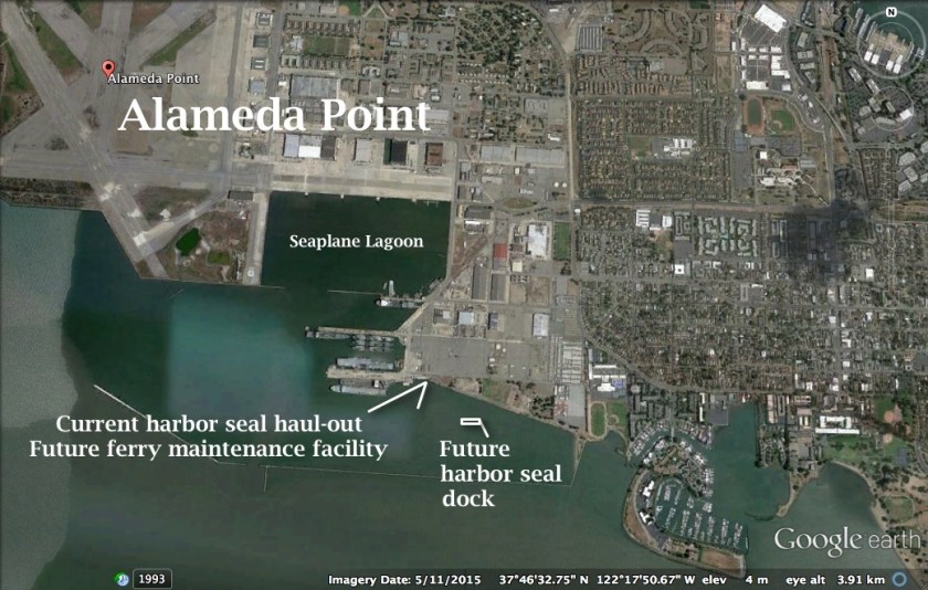
Alameda Point south with harbor seal haul-out

This winter, the seals favor the afternoon for getting out of the water. Their numbers can vary from a dozen to a recent high of over three dozen. It is the only haul-out site in the East Bay between Yerba Buena Island and the marshlands of Fremont and Newark near the Dumbarton Bridge, both of which require watercraft for public viewing access. The seals at Alameda Point can be viewed from the Bay Trail.

Originally published in the Alameda Sun.

Additional photos and video
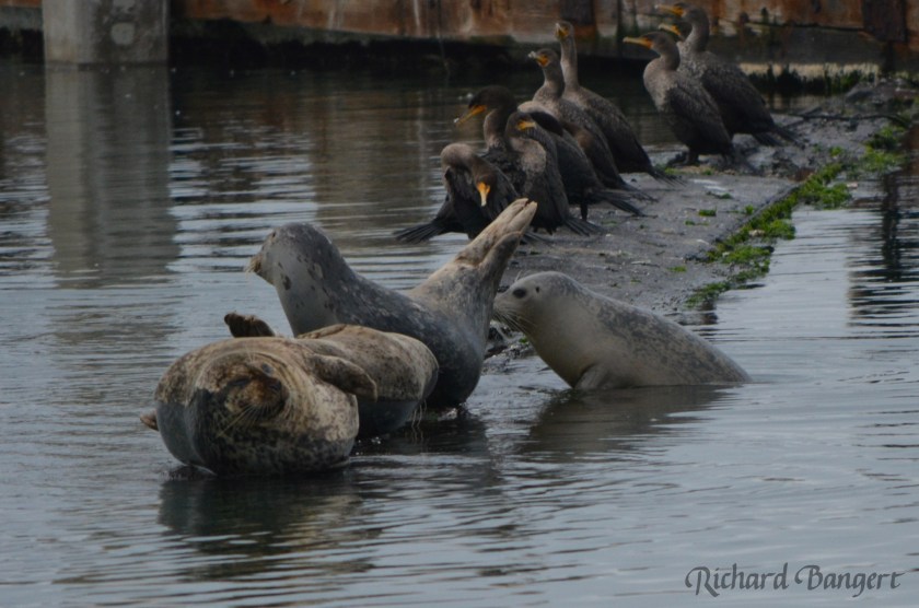
Harbor seals using old plank for hauling out.
Harbor seal near old dock in December 2015.
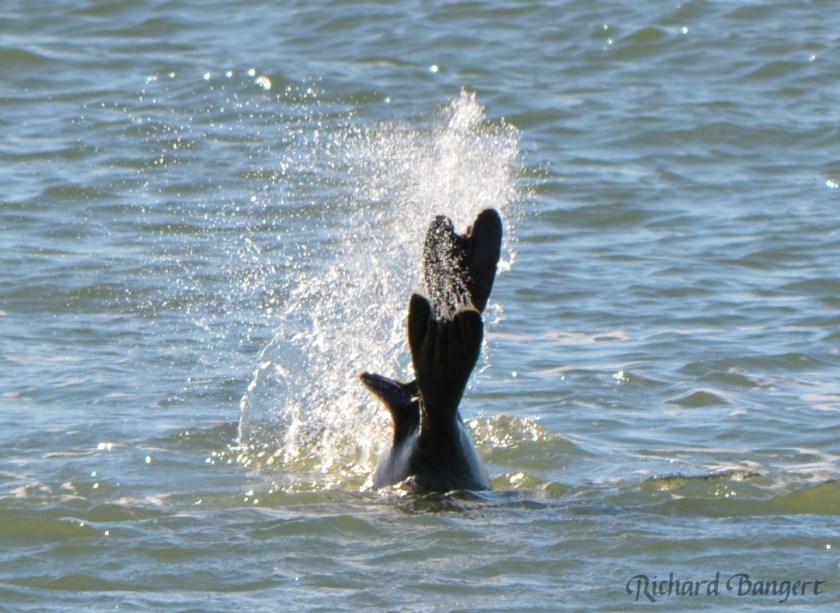
Two harbor seals diving together near the old dock in December 2015.

Brown pelicans display beauty during trying times

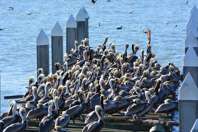
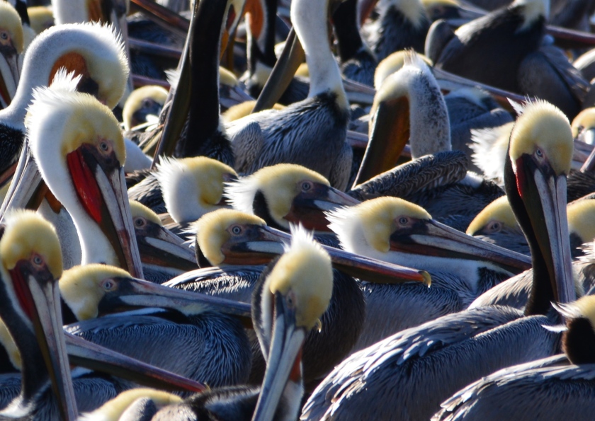
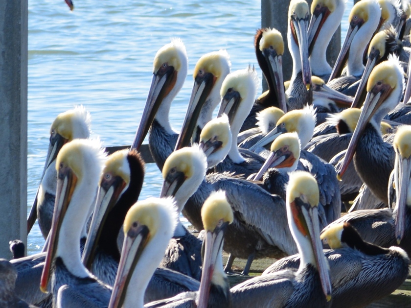
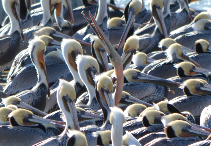
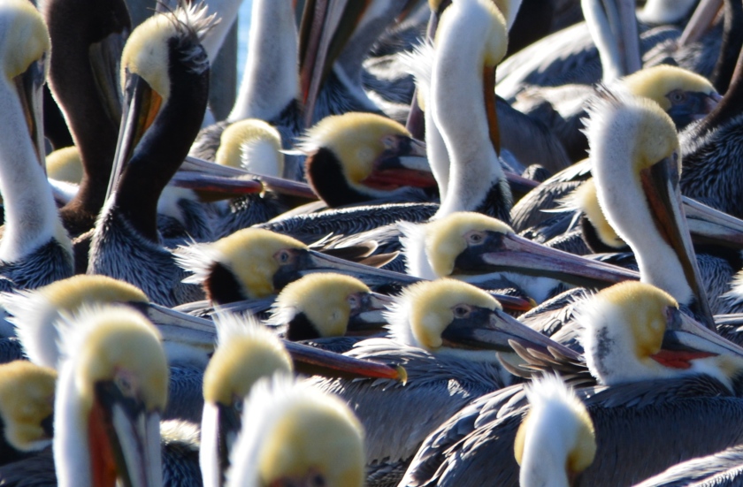
About 100 California Brown Pelicans made an unusual appearance on the old wooden dock on the south side of Alameda Point near the U.S.S. Hornet on December 23. The visit provided a rare close-up view of this colorful and iconic bird, but also a reminder of their struggle to survive as a species. Only one of the pelicans could be identified as a one- or two-year-old.

Brown Pelicans resting on old recreational boating dock on south side of Alameda Point in December.

During the past four years, the breeding rate for California Brown Pelicans has been dismal. This recent trend has been directly attributable to the dwindling supply of sardines along the California coast, according to a Brown Pelican status report issued in October by the Washington State Department of Fish and Wildlife. The sardine population has dropped so low that in April of 2015, the agency responsible for managing Pacific Coast fisheries banned commercial fishing of sardines until the end of June 2016.

In May, the U.S. Fish and Wildlife Service urged the same agency to consider additional management measures to stave off a decline in northern anchovy, another important food source for pelicans and other marine life.

California brown pelicans resting on Alameda Point dock

Brown Pelicans were removed from the federal endangered species list in 2009 with great fanfare after recovering from the devastating effects of the agricultural pesticide DDT on their eggs. But they no sooner recovered from chemical contamination than they fell victim to a plunge in food supply.

“Although most essential nesting and roosting habitat throughout the subspecies’ range is protected, the California Brown Pelican has experienced unusual mortality events and a multi-year decline in breeding success since delisting, both of which appear to be due to the lack of adequate forage,” wrote the U.S. Fish and Wildlife Service to the Pacific Fishery Management Council on May 14, 2015.

Brown pelicans roosting on the dock

About 10 percent of California Brown Pelicans nest on two islands in Channel Islands National Park off the coast of Southern California. The remainder nest and rear their young off the western coast of Mexico.

The University of California at Davis and the Mexican national conservation agency conducted a study of the 2014 nesting season off the coast of Mexico. The U.C. Davis news summary of the study results stated, “The scientists found that this year, areas that typically host hundreds or thousands of nesting pairs held only a few hundred at most, and in some cases zero nesting pairs.” Co-author of the study, U.C. Davis wildlife biologist Dan Anderson, is quoted in the story saying, “That’s what we call a failure, a bust. The bottom dropped out.” Anderson has been monitoring Brown Pelicans for 46 years.

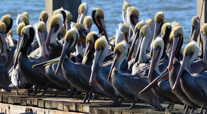
Brown Pelicans soaking up the sun during a rare visit to an old dock on Alameda Point's south shore.
Brown Pelicans soaking up the sun during a rare visit to an old dock on Alameda Point’s south shore.

Breeding normally begins in January. Whether the pelicans currently at Alameda Point will make the journey south is yet to be seen.

Breakwater Island along the south side of the Alameda Point Channel serves as the most popular resting site for Brown Pelicans on San Francisco Bay during the warmer months.

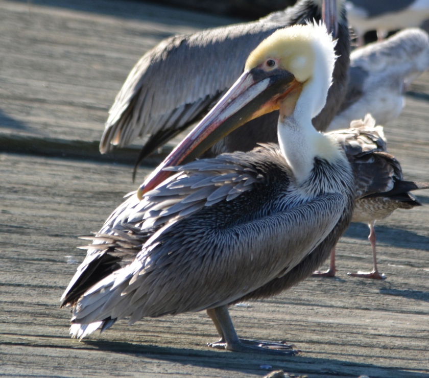
Immature (1 or 2 years old) Brown Pelican with all-brown head and neck, the only one spotted among about 100 pelicans on the dock on December 23, 2015.

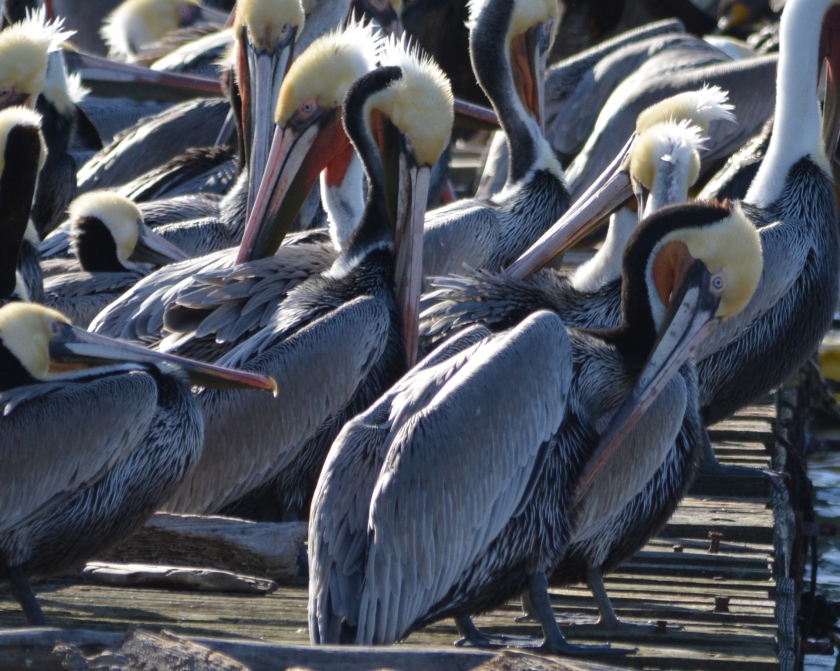
Immature Brown Pelicans are distinguishable by being entirely brown, except for their whitish underbelly.  By their third year, the neck becomes white and the head yellow.  During breeding season, the neck of adults becomes dark chestnut and the pouch under their bill becomes red. 

Reprinted on Golden Gate Birder, Golden Gate Audubon Society’s blog.

Featured on Bay Nature’s Nature News.

Further reading:

“Periodic Status Review for the Brown Pelican,” October 2015, State of Washington Department of Fish and Wildlife.

“Failure to launch:  California brown pelicans’ breeding rate dismal,” June 2, 2014, UC Davis News and Information.

“Letter from U.S. Fish and Wildlife Service to Pacific Fishery Management Council,” May 14, 2015.

Additional photos and video from December 23, 2015, Alameda Point:
California brown pelicans in breeding plumage at Alameda Point

California brown pelicans huddled on the dock

California brown pelican at Alameda Point

California brown pelicans in breeding plumage, Dec. 23, 2015, Alameda Point

Brown pelican stretching at Alameda Point

Navy housing site safe to transfer
The vacated residential area known as North Housing—located between Alameda Point and Alameda Landing—has been deemed environmentally safe for transfer out of Navy hands. The approval comes after a four-year effort to clean up groundwater to drinking water standards was declared unnecessary and terminated.

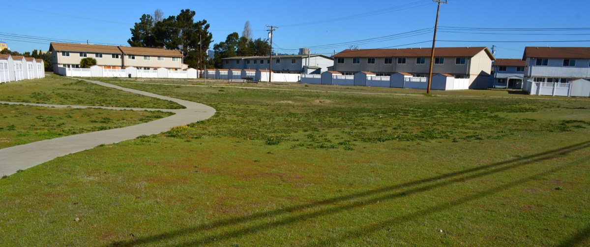
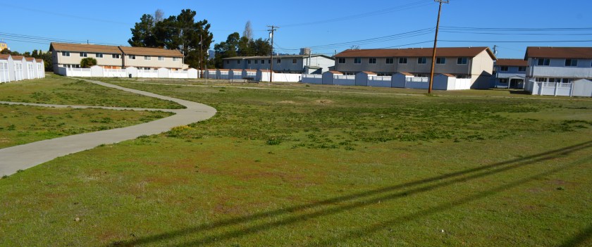
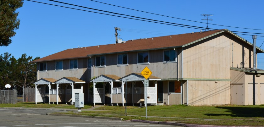
Center courtyard in former Navy housing area called North Housing. Looking north/northeast.

The original overly cautious risk assumption in the 2007 cleanup plan—that humans might somehow ingest the salty groundwater 10 to 20 feet below the surface—is now seen as implausible. The vapor extraction system covering a six-acre area of benzene and naphthalene-contaminated groundwater was dismantled in 2014 after a new round of tests showed that there is no evidence of harmful vapors rising to the surface.

The land was originally slated for transfer to the Coast Guard. But the Coast Guard decided in 2008 that it no longer wanted the property. The Navy and the city then worked out a plan that incorporates a federal requirement for homeless accommodation and a for-profit development.

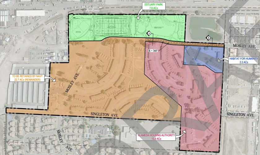
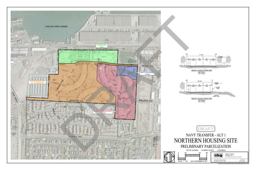
The 22.7 acres slated for auction to a private developer will be tagged with utility infrastructure costs—streets, drainage, utilities—on all of the North Housing area, except for the Housing Authority’s 13.6 acres and Habitat for Humanity’s 2.2 acres. The Housing Authority and Habitat for Humanity will be responsible for bringing new utility services from the nearest street to their housing units.

Draft map prepared by the city of Alameda showing proposed Housing Authority, Habitat for Humanity, and private developer parcels. Pending final approval. Dusty rose area going to Housing Authority, blue to Habitat for Humanity, tan to private developer. Click on map to enlarge.

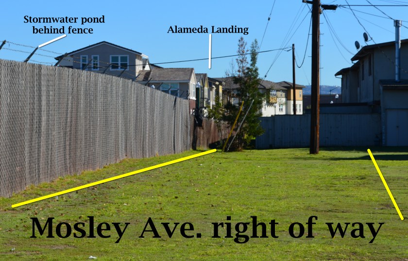
Mosley Avenue will be connected between Alameda Landing and North Housing with 360 feet of new roadway.

In 2013, the Navy turned off its air pump and carbon filter vacuum cleanup system to see if it made any difference in the concentrations or movement of contaminants. It didn’t.

But before the U.S. Environmental Protection Agency (EPA) would sign off on a permanent shutdown of the cleanup system, it wanted a new set of tests at ground level to ensure there is no risk of harmful vapors. The Navy conducted tests inside the vacant housing, in the crawl spaces, and under the parking lot and basketball courts at the former Island High School property. The negative results satisfied the EPA.

In April the Navy officially amended its original 2007 Record of Decision cleanup plan, with regulatory agency concurrence, citing new evidence. It also cited city, county, and state regulations that prohibit intrusive activities and specifically prohibit well installation in the shallow groundwater where the contamination is located. The cleanup plan amendment said that results of the evaluations of extensive data for this cleanup area “show that there is no unacceptable risk for current residential and school uses and any potential future land uses.”

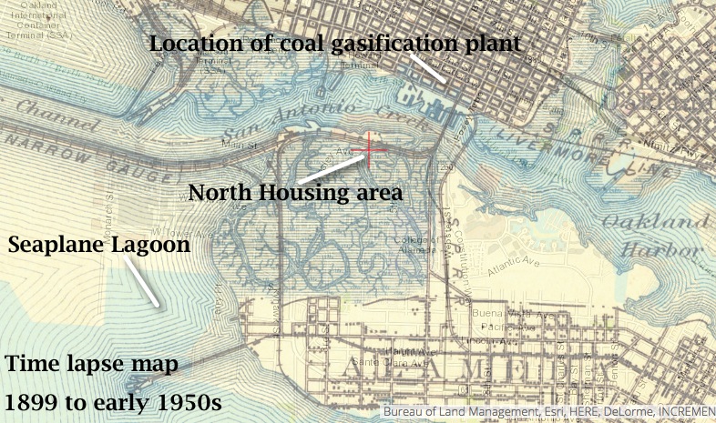
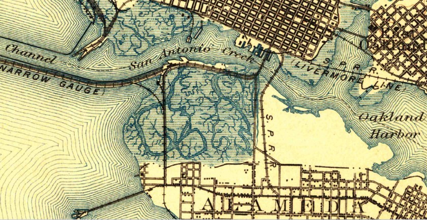
The amended plan also cited new evidence that suggested the contaminants were part of what is called the Marsh Crust at around 20 feet below ground and essentially stuck there. The Marsh Crust is a layer of “hydrocarbon gunk” that Oakland Gas Light Company’s coal gasification plant discharged from about 1880 to 1910. The waste discharges went into what was then San Antonio Creek, and much of it settled on the nearby marshland where North Housing now sits.

Time lapse map showing former marshland where North Housing is now located. Source: US Geological Survey Historical Topographic Map Explorer.

The land was never cleaned up before being filled in for use as San Francisco Bay Aerodrome—hangars and two runways—from 1930 to 1941. The Marsh Crust extends from the Oakland Estuary to Bayport and over to central Alameda Point. A city ordinance requires a permit before digging into the Marsh Crust to ensure safe handling.

The 37-acre North Housing area lies adjacent to the new Alameda Landing residential neighborhood. The site currently contains 51 residential structures with 282 three- and four-bedroom units constructed in 1969.  With the possible exception of the two acres going to Habitat for Humanity, all of the units will be demolished to make way for new construction.

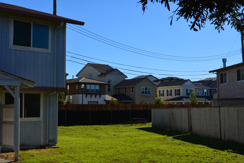
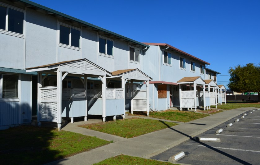
Future Housing Authority property, with new Alameda Landing houses in the background.

The Housing Authority will build 90 units of supportive housing that will include a community center.

It is not yet determined what Habitat for Humanity will do with its parcel. The private developer area is currently zoned for 315 units of multifamily residential housing and may exceed that number if the density bonus is applied for.

The transfer of properties is expected in 2016. The auctioning of the for-profit North Housing Navy property will follow, but no firm timeline has been announced.

Edited version of article first appearing in the Alameda Sun.

Appendix pelican graphic

Record of Decision Amendment for groundwater cleanup at OU5 – April 2015

North Housing amendment to NAS-Alameda Community Reuse Plan

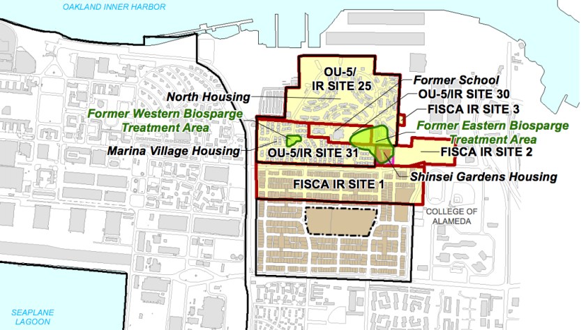
Map showing two groundwater cleanup areas in OU-5.
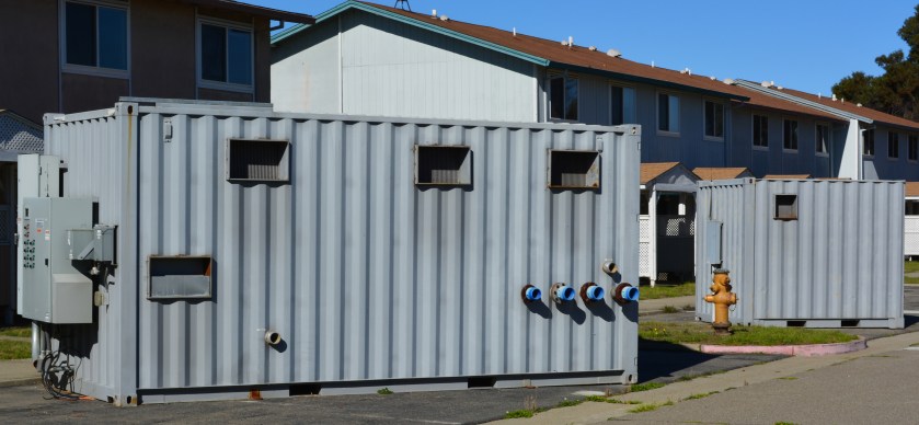
Control module with pumps for groundwater cleanup system waiting to be hauled away from North Housing.
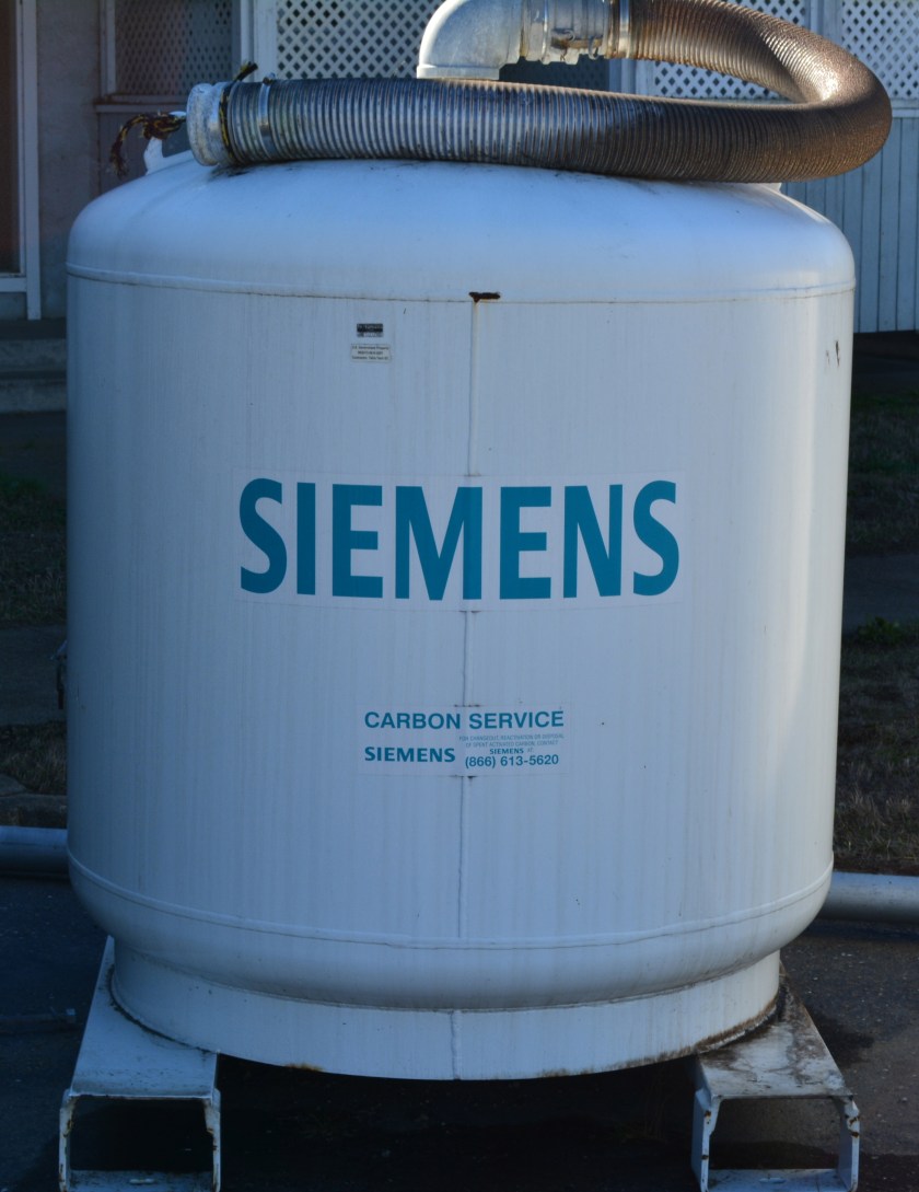
Charcoal filter tank to remove benzene and naphthalene from groundwater vapors, waiting to be hauled away.

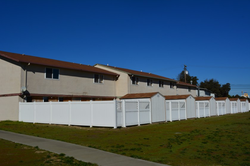
North Housing

North Housing, Alameda

North Housing

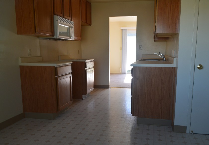
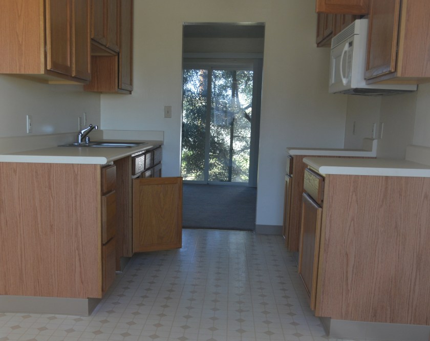
Typical current condition of North Housing interiors.
Typical current condition of North Housing interiors. Photo date: November 19, 2015.

Mosley Ave. right of way

Draft North Housing site map, with Mosley Avenue connection details. Click on map to enlarge.
1899 topographical map of western Alameda showing marshland. Source: US Geological Survey Historical Topographic Map Explorer.

City leads tour across airfield to SF Bay shoreline

Around 50 people took part in the first city-sponsored tour across the old naval airfield to the western shoreline of San Francisco Bay on Monday, Oct. 26.

The convoy of automobiles stopped near the future site of the Department of Veterans Affairs (VA) clinic and at the shoreline next to a restored 30-acre wetland site. The wetlands are located within the Navy’s 100-acre cleanup site known as Site 2.  

Tour group at the western shoreline listening to Dr. Peter Russell explaining environmental cleanup work the Navy has completed at Site 2.

While Site 2 has been known for the past 18 years as a mysterious off-limits environmental cleanup site, most of the visitors on Monday’s tour seemed more interested in the area as a scenic viewing site.

Despite the sparse showing of birds on the wetland during the visit, the group appeared awed by the vast expanse of land, water and sky that surrounded them as they stood on the embankment overlooking the wetland and the Bay.

View of the trail on embankment, with tour group and Port of Oakland in the background. Wetlands are to the right. San Francisco Bay is to the left.

A future leg of the San Francisco Bay Trail will eventually pass between the wetland and the shoreline, with views all the way to the Golden Gate Bridge on a clear day. The state’s Bay Conservation and Development Commission requires the VA, via its shoreline authority, to grant an easement to the city for construction and operation of the trail. No date has been set for when this process will begin.

During the stop near to the future VA clinic site, Jennifer Ott, the city’s chief operating officer for Alameda Point, informed the group about the public roadway, including underground utilities, that the VA is going construct leading to the western shoreline. The roadway will provide public access and utility hook-ups for city-owned open space property along the Oakland Estuary. The group parked at the western shoreline where the future observation point and trail access parking lot will be located at the end of the road.

Tour group listening to Jennifer Ott explaining plans of the US Dept. of Veterans Affairs while stopped next to future clinic site. San Francisco skyline in the background.

The tour was arranged at the urging of Vice-Mayor Frank Matarrese. Also in attendance was Mayor Trish Spencer.

“The VA’s future home and the wetlands restoration area at Site 2 are key features of the old airfield surrounding the least tern nesting area,” said Matarrese.  “It is absolutely important that people get a chance to see how these three assets work together in this huge tract of land.”

Another view from the stop next to the future VA clinic site. Small wetland in between runways can be seen in the background. VA is expected to enhance the wetland, which remains covered with water in the middle of the airfield despite a drought.

The Navy still retains some responsibilities at Site 2 — namely, for ensuring that the grassland vegetation on the landfill soil cover is successful.

Jennifer Ott answering questions at the western shoreline. This location is where the VA's future road will end, with a small parking lot, benches, and access to the Bay Trail.
Jennifer Ott answering questions at the western shoreline. This location is where the VA’s future road will end, with a small parking lot, benches, and access to the Bay Trail.

“Seeing the wetlands makes me want to accelerate our wetlands efforts on city property,” said Matarrese.

Google wind energy kite nears launch date

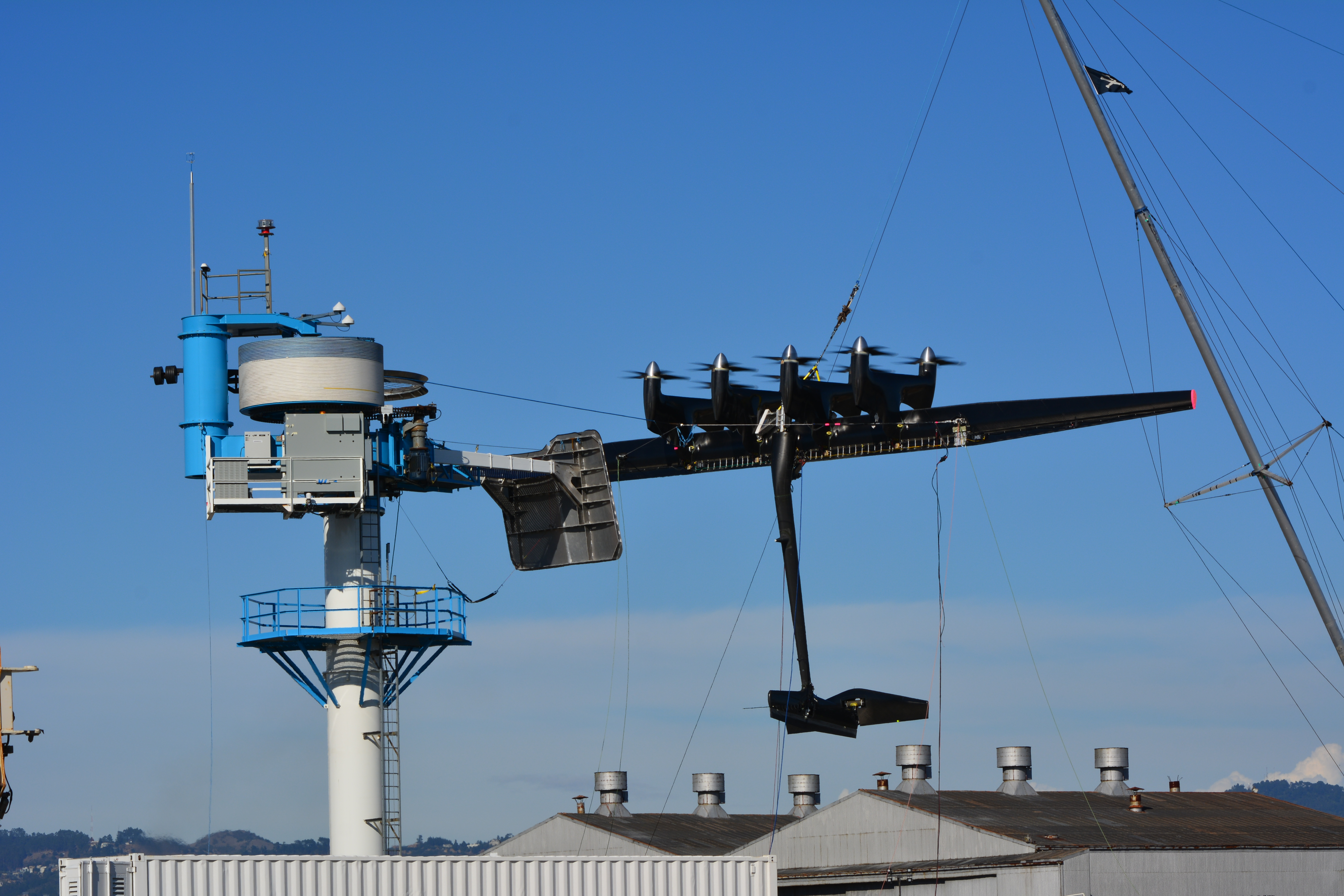
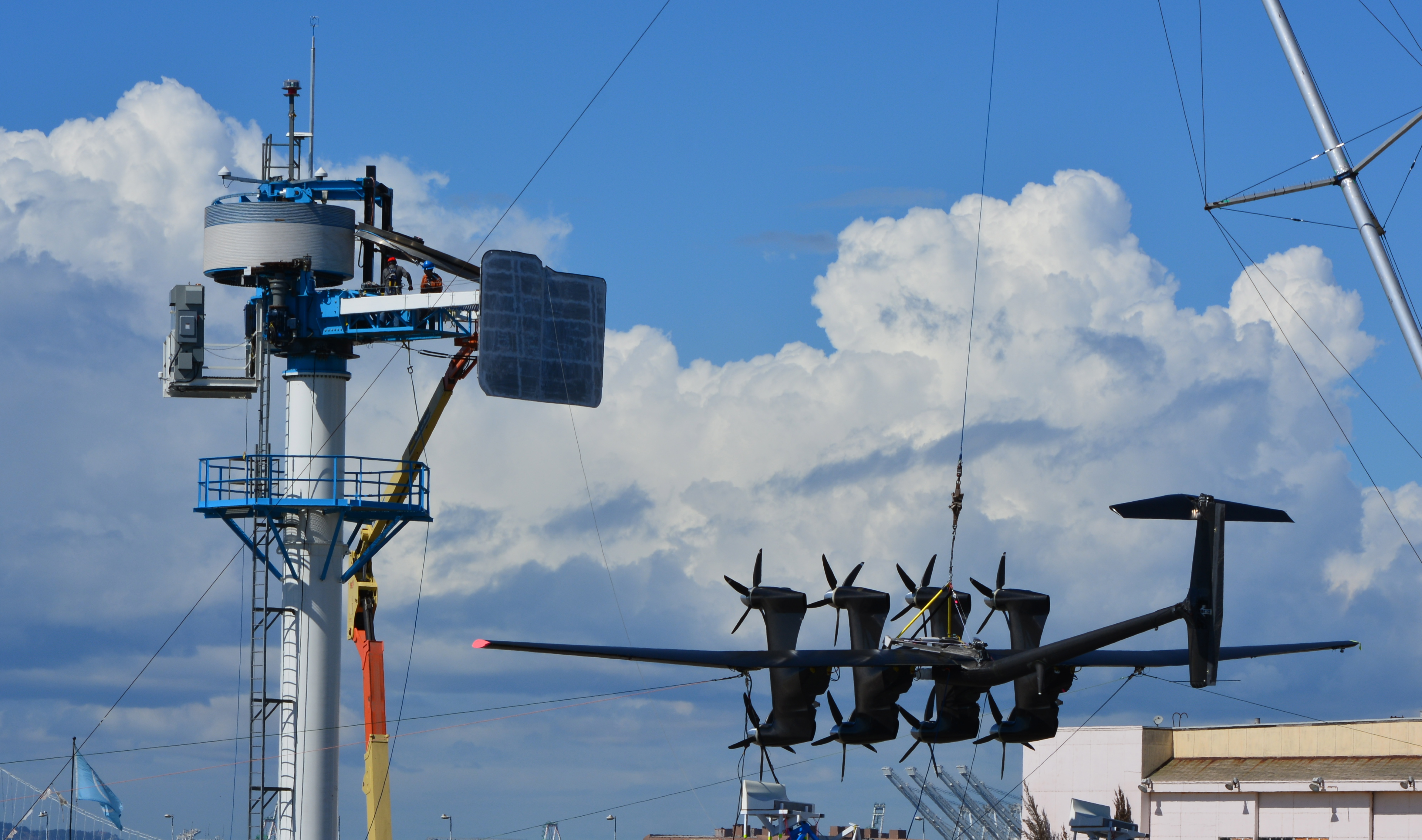
Google-owned Makani, a wind energy company at Alameda Point, moved one step closer last week to full-scale testing of its flying electricity kite. The novel invention made a rare public appearance at the company’s test site near the USS Hornet to fine-tune the docking maneuver. It will be deployed at a test site being readied in Hawaii where it will reach an altitude of 1,100 feet.

Makani energy kite undergoing testing at Alameda Point on October 1, 2015. Kite is suspended by mast on right. Tower on left is where the kite will be docked with propellers facing upward.

The wind energy craft was pioneered at Alameda Point. It employs the same principle as a stationary wind turbine, using the wind to rotate a blade connected to a generator. But unlike a traditional wind turbine, the tethered energy kite can soar to twice the height, accessing stronger wind force, while using a fraction of the materials. Electricity is transmitted to the base through the tether.

One of the big engineering challenges has been to design how the kite will launch itself into the air from a docking tower and then return when the wind dies down. An earlier prototype was tested on the former Navy airfield while tethered to a truck-mounted base.

The new model has three times the wingspan and twice as many motors and generators as its predecessor. The 84-foot carbon fiber craft uses eight motors to vertically take off and land on its base tower. Once airborne, the motors turn off, and the blades begin driving generators as the kite rotates in the wind.

Makani energy kite on transport trailer at Alameda Point test site.

Makani found an ideal spot to launch its kite at Parker Ranch in Waimea, Hawaii. The 250,000-acre cattle ranch is diversifying into clean energy projects. At a workshop on alternative energy hosted by Parker Ranch in July 2015, they referred to the local wind corridor on the Big Island as a world-class resource. A traditional wind turbine farm is on the drawing board.

Before Makani can send its kite into the sky, it must first gain approval from the Federal Aviation Administration (FAA). Makani representatives have met with local pilots in Hawaii to get their input, according to a story published on October 2 in West Hawaii Today, a daily newspaper circulated on the west side of the Big Island. The test site is five miles from the Waimea Airport.

“Makani has laid out its plans to local groups on the Big Island, including pilots last year who wanted to make sure every measure possible is taken to make sure the kite and tether are visible,” wrote West Hawaii Today’s Bret Yager. Citing Makani project manager Alden Woodrow, Yager stated, “Woodrow said on Thursday the kite will be lighted, the tether will be marked for visibility and that the FAA may provide other guidance for how the kite’s visibility should be enhanced.”

Kite with tether cable extending from tower to belly of kite, with mast suspending the kite during testing. Vertical platform extending from tower is the docking pad for the kite when not flying.

Google’s experimental product division acquired Makani in 2013. Last year they signed a leasing deal with the city for Building 400, the hangar across the street from their office in the old Air Control Tower, where the company is betting on producing a commercially viable clean energy product.

The company’s website points out that conventional wind turbines are limited by height and the available locations where prevailing winds make economic sense. “The wind moves faster and offers exponentially greater power at higher altitudes,” states Makani’s website. “When the wind speed doubles, the amount of available power increases eightfold.” One kite will produce enough electricity to power 300 homes.


Originally published in the Alameda Sun.

Additional reading:

“Google’s Makani:  From Regulatory To Technical To Wildlife Challenges”  by Mike Barnard, February 19, 2014, published on the CleanTechnica website.

Excerpt:

“Finally, a little about wildlife. While the Makani device will be better than fossil fuel generation for wildlife, the reality is that they require a thin, invisible cable to be flying from ground level to 350 meters (1000 feet) for the onshore model or 650 meters (2000 feet) for the offshore product. That cable will be flying through a cone at a speed of around 130-140 kph near the wing, and slowing as it nears the ground. This is likely to be much more difficult to perceive and avoid than any wind turbine blade for birds. The best evidence is that many species of birds including seabirds and many raptors simply adapt to wind farms and avoid them, as there are highly visible masts and blades that they perceive as they do jutting islands and trees. There is no evidence to suggest that this is true for Makani’s relatively small masts, long tethers, and flying wings. The tethers will cover a much, much greater volume of airspace than wind turbine blades. It is difficult to not see greater avian mortality as a likely outcome, with resultant challenges for safe siting.”

Makani submission to Federal Aviation Authority

Navy cleans long-gone gas stations

The Navy has spent more than 15 years cleaning up contaminated groundwater underneath two former gas station sites at Alameda Point. They are still at it, but it’s not because the Navy is slow or lacking in commitment and expertise. It’s the nature of groundwater cleanup, which involves intermittent treatment efforts.

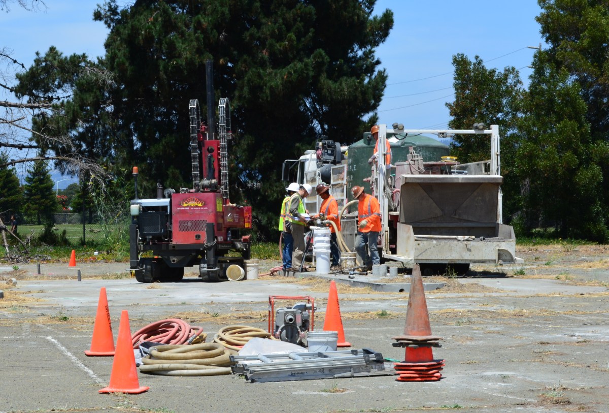
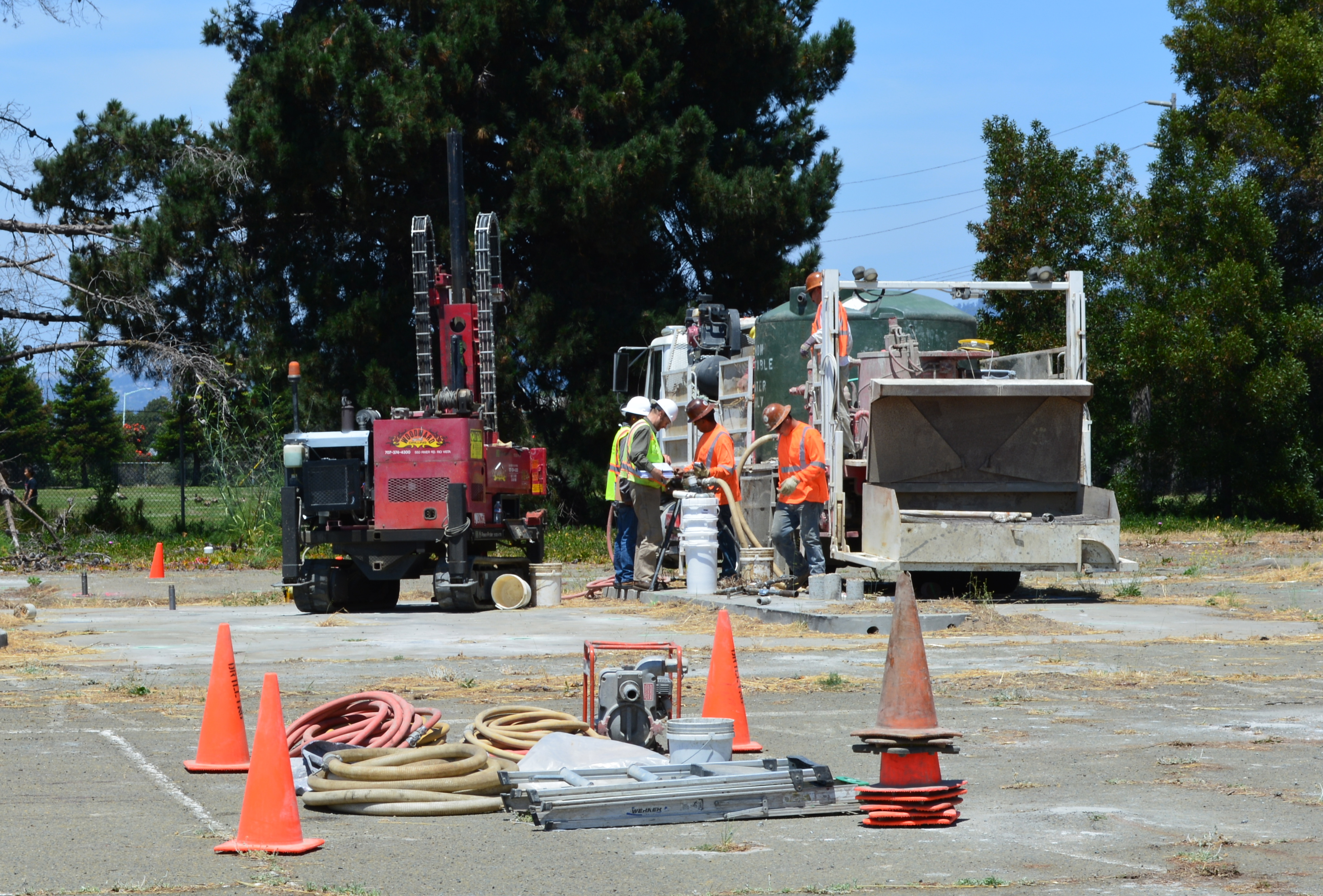
In July, the Navy’s contractor returned to the old gas station and car wash site on West Pacific Avenue at Main Street and to the old commissary gas station site at West Tower Avenue and Main Street across from Bayport. It’s the third visit to these sites to eliminate petroleum hydrocarbon contamination in groundwater, in addition to earlier removal of underground tanks, fuel lines, and soil. The contaminants are located from 2 to 16 feet below ground surface.

Workers at the old gas station and car wash site on West Pacific Avenue on July 13, 2015 preparing to inject cleanup solutions into the ground. The Navy operated a gas station and car wash on the site from 1971 to 1980. Green tank on truck contains non-potable water for on-site mixing of treatment solution. Soccer field is in the background.

The goal is to bring the property up to the public health and environmental standards required for the future commercial and residential uses previously determined by the city.

“When groundwater contamination is involved, such as at the two former gas stations, cleanups often involve multiple phases, each building upon earlier accomplishments,” said Dr. Peter Russell, who has been reviewing Navy cleanup plans and preparing cleanup-related documents on behalf of, and at the direction of, the city since 1997. “As long as all imminent health and environmental risks are eliminated early on, often the most cost-effective approach to complete remediation is incremental,” explained Russell. “In contrast, a massive initial remedial effort that is sure to achieve all remedial goals in one pass would likely involve over-sizing the treatment system, which is more disruptive and expensive than a phased approach.”

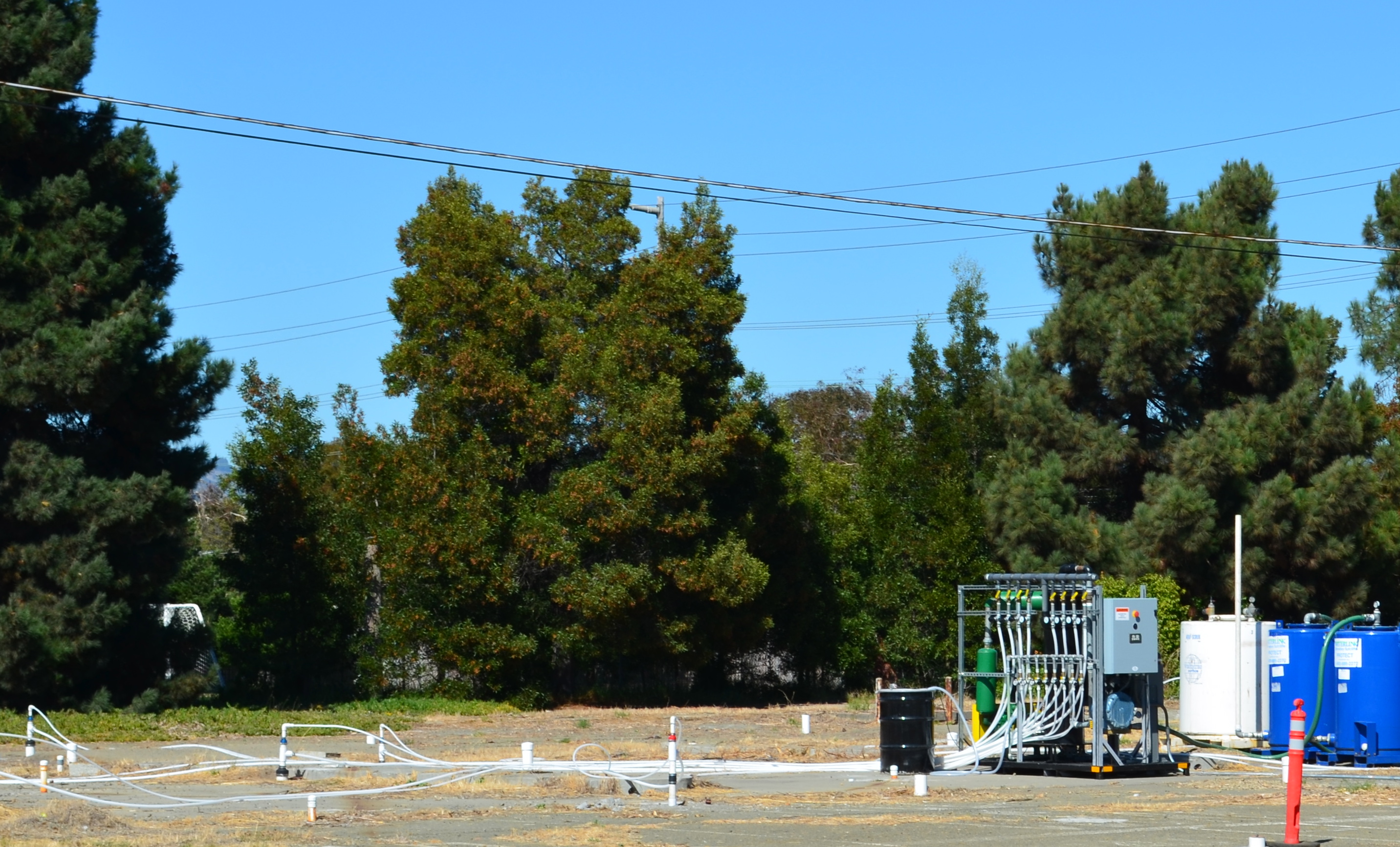
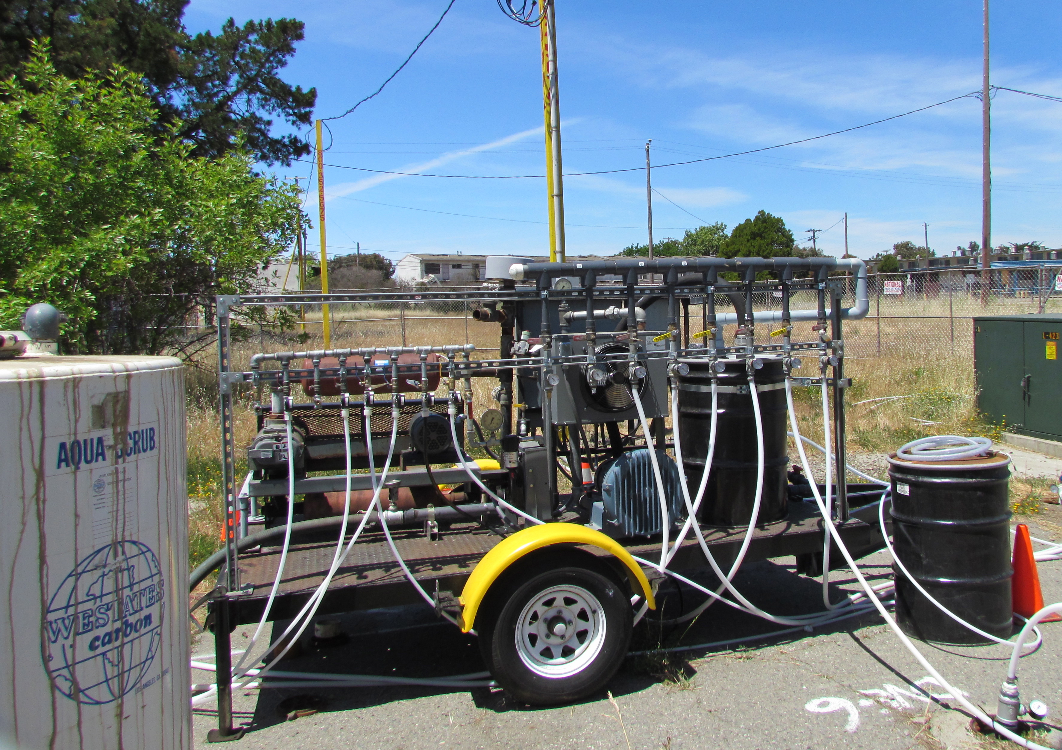
During previous cleanup visits, the Navy used a vapor extraction system to remove the bulk of the petroleum contamination. The process involves pumping air into numerous pipes, called wells, which extend into the water-saturated zone where the contamination is. The air pressure creates vapor that is part air, part water and part petroleum. The vapor is then sucked out through another set of wells, and the petroleum vapors are captured in drums of granulated charcoal, while the water is shunted off to a separate container.

Air injection/extraction system operating at W. Pacific Avenue gas station site in 2013 and 2014. System extracts and captures petroleum vapors.

The method of blowing bubbles in mud and sucking out the air sounds unsophisticated, but it works. After running the system in 2013 and 2014 at the West Pacific Avenue gas station site, for example, the level of one contaminant, benzene, went from around 1,000 micrograms per liter down to 58, bringing the contamination low enough to allow indigenous bacteria to finish the job.

Air injection and vapor extraction system operating at former commissary gas station site in May 2013. Charcoal tank to capture vapors is at left.

The Navy returned to these sites in July and, in this phase, they came to help natural bacteria finish up the job.   Allowing bacteria to clean up petro chemicals through natural digestion is called bioremediation. To be effective and not take a century to eliminate the problem, the bulk of the chemicals need to first be reduced to concentrations that do not overwhelm the bacteria.

At both gas station sites the Navy used a special product designed to foster growth of natural bacteria in the ground, which includes a form of time-release peroxide that turns into oxygen over a period of 12 months. An oxygen environment is necessary for the bacteria to digest petroleum. The bacteria utilize the hydrocarbons (hydrogen and carbon) in the petroleum chemicals as part of their metabolic processes and convert them into carbon dioxide, water, and microbial cell mass. Water samples will be taken at three, six, and nine months after the July injections to evaluate effectiveness.

“The Navy’s gas station remedial program is comparable to the private sector gas station cleanup program,” said Yemia Hashimoto, Engineering Geologist with the San Francisco Bay Water Board. “The cleanup requirements are similar and the required timelines for project completion are similar.” The Water Board is a California state agency and is the lead regulatory agency overseeing the Navy’s petroleum cleanup program.

The other type of groundwater contamination encountered at Alameda Point comes from a chlorinated solvent used in cleaning aircraft parts. Unlike lighter-than-water petroleum products, chlorinated solvents can sink through the upper water zone to a depth of 30 feet or more and complicate cleanup. But solvent cleanup still relies on a phased cleanup approach, often employing bacteria in the final phase.

Originally published in the Alameda Sun.

Complete background and a detailed description of the cleanup process at the two gas station sites is in the Bioremediation Work Plan issued in July 2015.

Main Street Ferry Terminal getting more parking, no buses

Ferry commuters driving to the Main Street Ferry Terminal will find a new parking lot option this fall, pending timely work plan approvals by the city.

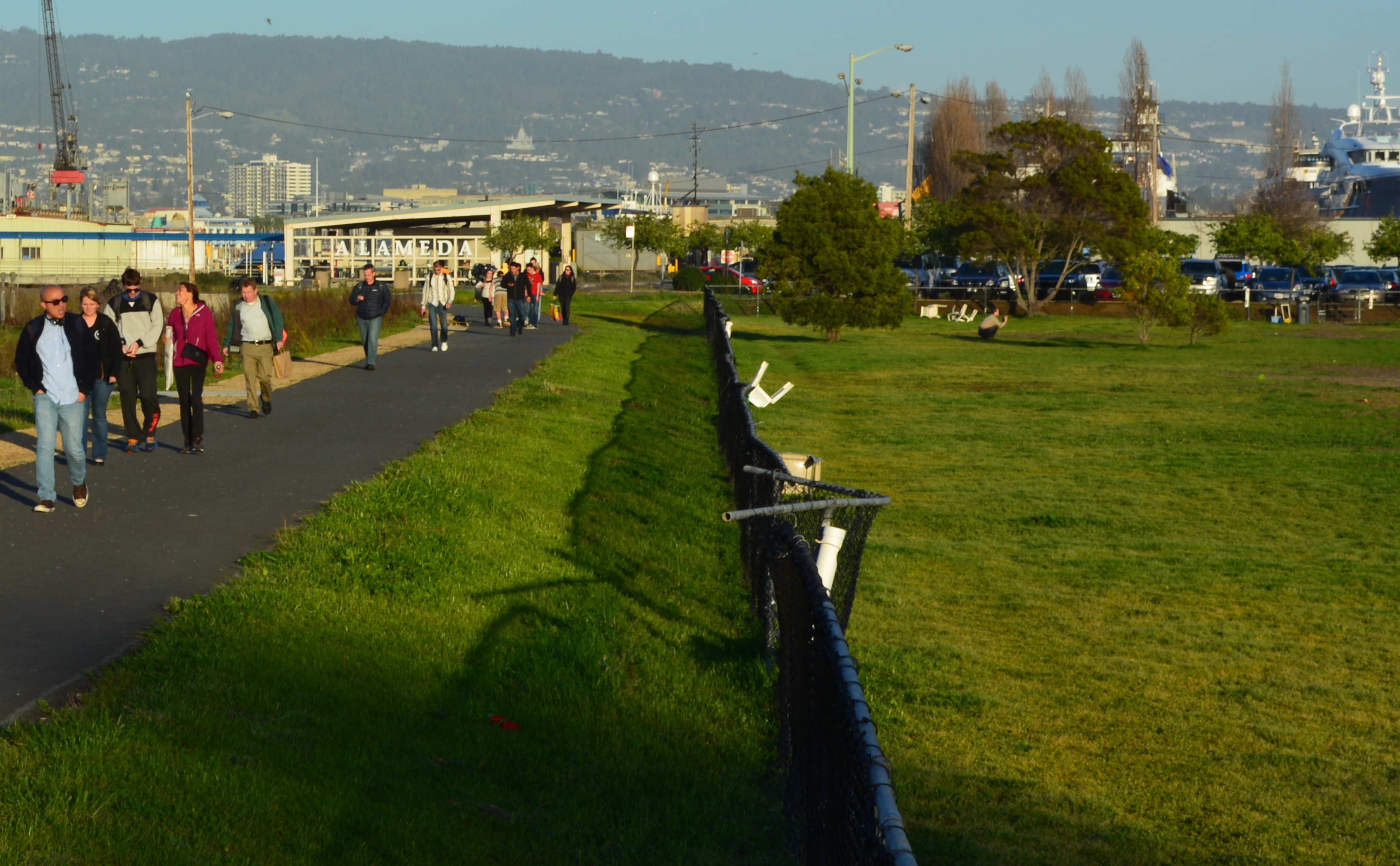
Since 2013, passenger boardings have increased by over 50 percent at the Main Street ferry terminal, far exceeding the capacity of the parking lot. Commuters have been filling up an adjacent unpaved parcel next to the dog park, as well as the shoulders of Main Street.

Ferry riders leaving the Main Street Ferry Terminal in the background and walking toward makeshift parking lot.  Dog park is on the right.
Ferry riders leaving the Main Street Ferry Terminal in the background and walking toward makeshift parking lot. Dog park is on the right.

The Water Emergency Transportation Authority (WETA) initiated a ferry terminal access study for the Main Street and Harbor Bay terminals in 2014. They have been discussing access improvements with city staff, the Transportation Commission, and the community.

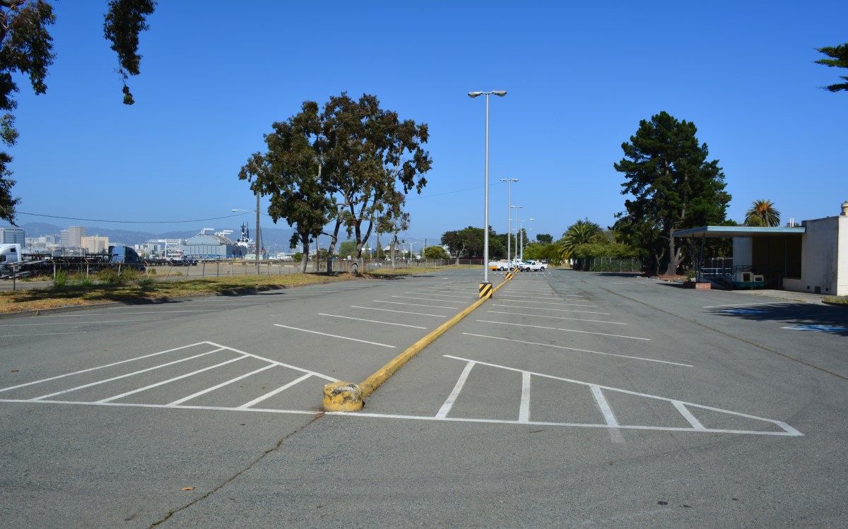
As a result of the dialogue, the city has offered the use of the nearby O’ Club parking lot, across the street from the terminal, to WETA through a license agreement. The lot is currently used to park city vehicles.

O Club parking lot.  Main Street to the left.
O Club parking lot. Main Street to the left.

At its June 4 meeting, the WETA board of directors approved spending $250,000 to make improvements, in exchange for free use of the lot. WETA will resurface and stripe the lot, construct ADA-compliant walkways that lead to a new crosswalk that WETA will also construct across Main Street.

The crosswalk will connect with an existing paved pathway on the western end of the main parking lot. An existing vehicle entryway on Main Street will become the entrance to the O Club lot.

Main Street entrance to O Club parking lot.  Oakland Estuary and arriving ferry on the left.
Main Street entrance to O Club parking lot. Oakland Estuary and arriving ferry on the left.

“In terms of the mid-term improvements at Main Street, the city has let us know that the dog park cannot be converted to parking until a replacement at Estuary Park is open,” said Kevin Connolly, WETA’s manager of Planning & Development. The new home for the dog park at Estuary Park on Mosley Avenue between Singleton Avenue and Alameda Landing is tied to the availability of funds for the second phase of the park. Those funds will be secured through a combination of developer fees and grants.

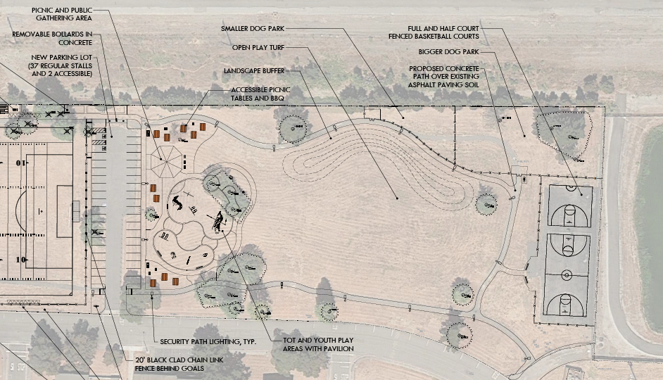
The first phase, four acres of sports fields, is expected to begin in 2016. The four acres of the second phase is designed as a community park space with restrooms, playgrounds, picnic areas, basketball courts, open lawn, and a dog park with sections for big dogs and small dogs.  

Close-up of community park section of Estuary Park, with dog park located in upper portion.

WETA was working with AC Transit to re-introduce bus service to the terminal. However, Connolly said that AC Transit recently scuttled plans for a Line 50 that would have carried passengers in a loop around the Island City to the Main Street ferry terminal. The city learned of this last Wednesday. In explaining its decision, AC Transit told Connolly that when it ran buses to the ferry terminal in 2009 “nobody rode them.”

Connolly points out that in 2009 the ferry carried 350 passengers a day with hourly departures. Today the ferry provides service to some 1,800 passengers with departures every 30 minutes. AC Transit also told Connolly that the bus service was not feasible because WETA does not charge for parking. Connolly questioned that criterion, pointing out that South Shore Center and other shopping malls do not charge for parking and AC Transit serves South Shore Center and these other malls.

“WETA is disappointed that AC Transit cannot see that demand warrants local bus service at the Main Street Terminal,” Connolly said. He added that AC Transit’s proposal would have offered ferry riders more choice in how they get to the terminal.

With parking relief in the pipeline, WETA plans to focus on more non-auto options for getting riders to and from the ferry terminal. “The implementation of an overflow parking lot, in addition to future improvements for pedestrian, bicycle, and transit access are vitally important in terms of WETA’s ability to continue accommodating future ridership demand at the Main Street ferry terminal,” said Nina Rannells, WETA’s executive director, in a June 4, 2015 staff report.

Originally published in the Alameda Sun.

Additional notes:

Measure BB: Voters approved Alameda County Transportation Commission’s Sales Tax, Measure BB on November 4, 2014. It’s priorities are to expand mass transit, improve highway infrastructure, improve local streets and roads, improve bicycle and pedestrian safety, and expand special transportation for seniors and people with disabilities.

Line 50 added, then removed: Line 50 was added in AC Transit’s March 2015 draft alignment plan. At the July 8 meeting of the City of Alameda – AC Transit Liaison Committee, AC Transit announced that is was removing the line. If brought into service, Line 50-Encinal would run between the Fruitvale BART Station and the Alameda Main Street Ferry Terminal every 20 to 30 minutes between 6 am and 10 pm. The route, subject to city approval, would enter Alameda via the Fruitvale Bridge and turn from Tilden Way onto Fernside Blvd. It will continue down Fernside Boulevard, right on High Street, right on Encinal Avenue, into Central Avenue, right on Webster Street, left on Appezzato Memorial Parkway, and right on Main Street to the terminal.  

Line 50 service to schools:  Line 50 would provide bus service to these schools along the route:  Alameda Community Learning Center on 3rd Street at Appezzato Memorial Parkway; Academy of Alameda Middle School on Pacific Avenue on 4th Street; College of Alameda on Appezzato Memorial Parkway at Webster Street; Encinal High School on Central Avenue at 3rd Street.

WETA 2009 Transition Plan: In 2007, WETA was created by passage of SB 976 as the successor to the Water Transit Authority. In June of 2009, WETA issued its transition plan in conjunction with the cities of Alameda and Vallejo, and the Metropolitan Transportation Commission. The 2009 plan anticipated closing down the Main Street Ferry Terminal once a new ferry terminal is built nearby in the Seaplane Lagoon at Alameda Point.  2009 Transition Plan

Due to a surge in ridership, current plans assume that the Main Street Ferry Terminal will continue to operate after the Seaplane Lagoon Terminal is constructed. The recently approved development agreement for Site A, adjacent to the Seaplane Lagoon, includes a $10 million commitment from the developer toward the new terminal. WETA has yet to complete its feasibility study for the new terminal.

Alameda Point vs. Main Street: Alameda Point development will attempt to discourage automobile usage. Residents will be able to walk to the Seaplane Lagoon ferry terminal. Shuttles will offer rides from Alameda Point to Oakland BART stations. AC Transit is expected to operate a rapid transit bus from Alameda Point through the Tube into Oakland. Meanwhile, at the Main Street ferry terminal a mile away, AC Transit will provide no assistance in discouraging automobile usage.