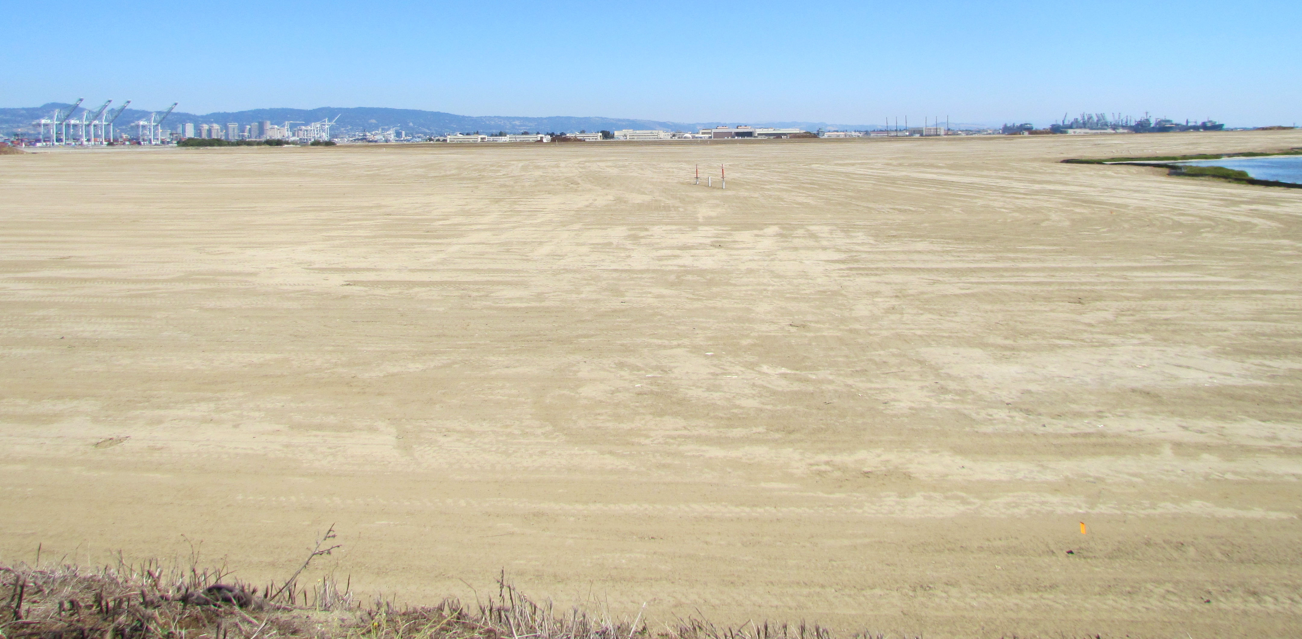
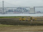
On August 3, 2013, the Navy’s annual environmental cleanup tour visited the worksite known as Site 2 on the southwest corner of Alameda Point. Work has been underway at the site since early this year, constructing a 79-acre soil cover atop the old waste disposal area. Due to budget cutbacks this year, only the Restoration Advisory Board was taken on the tour.
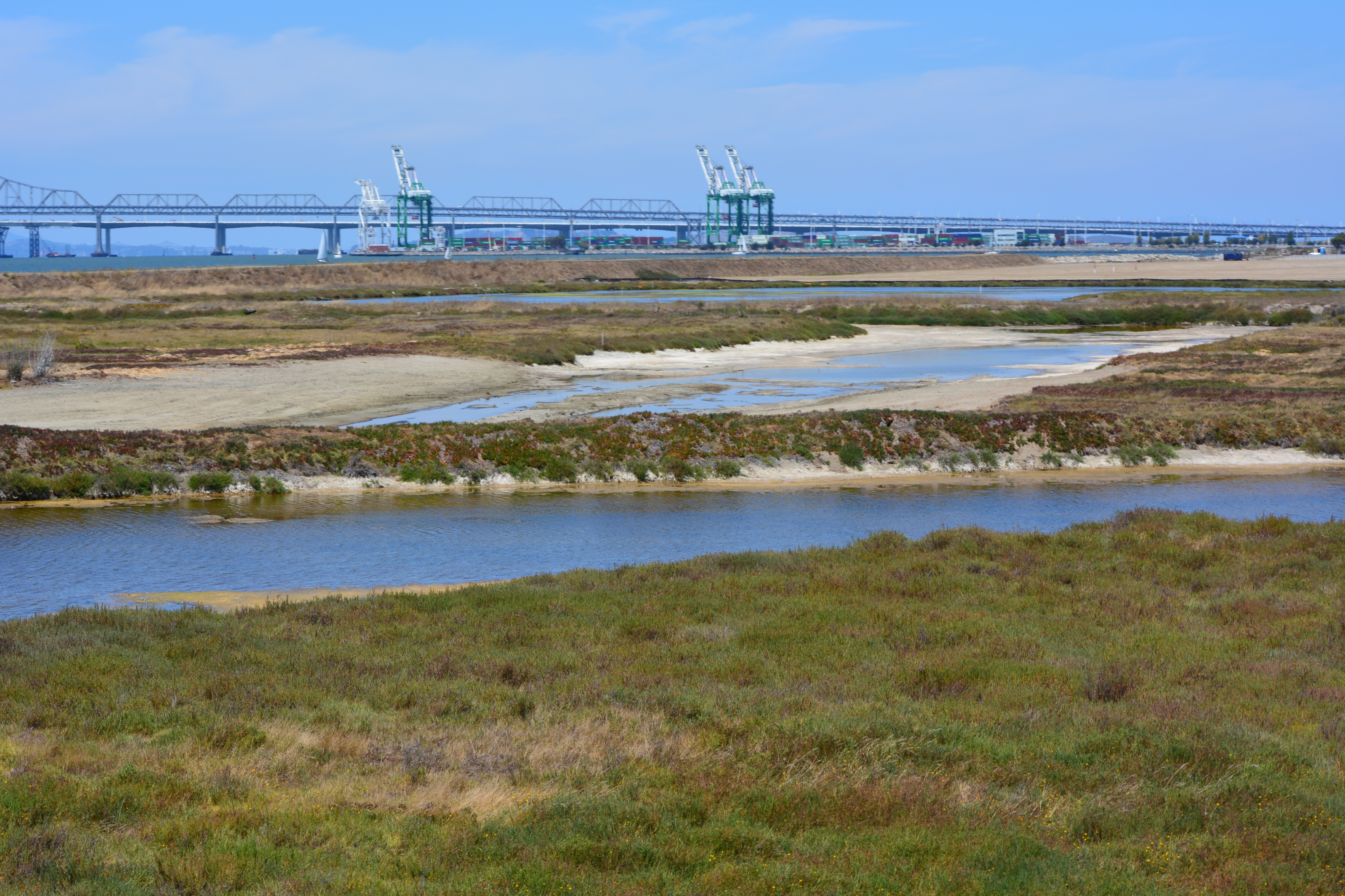
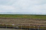
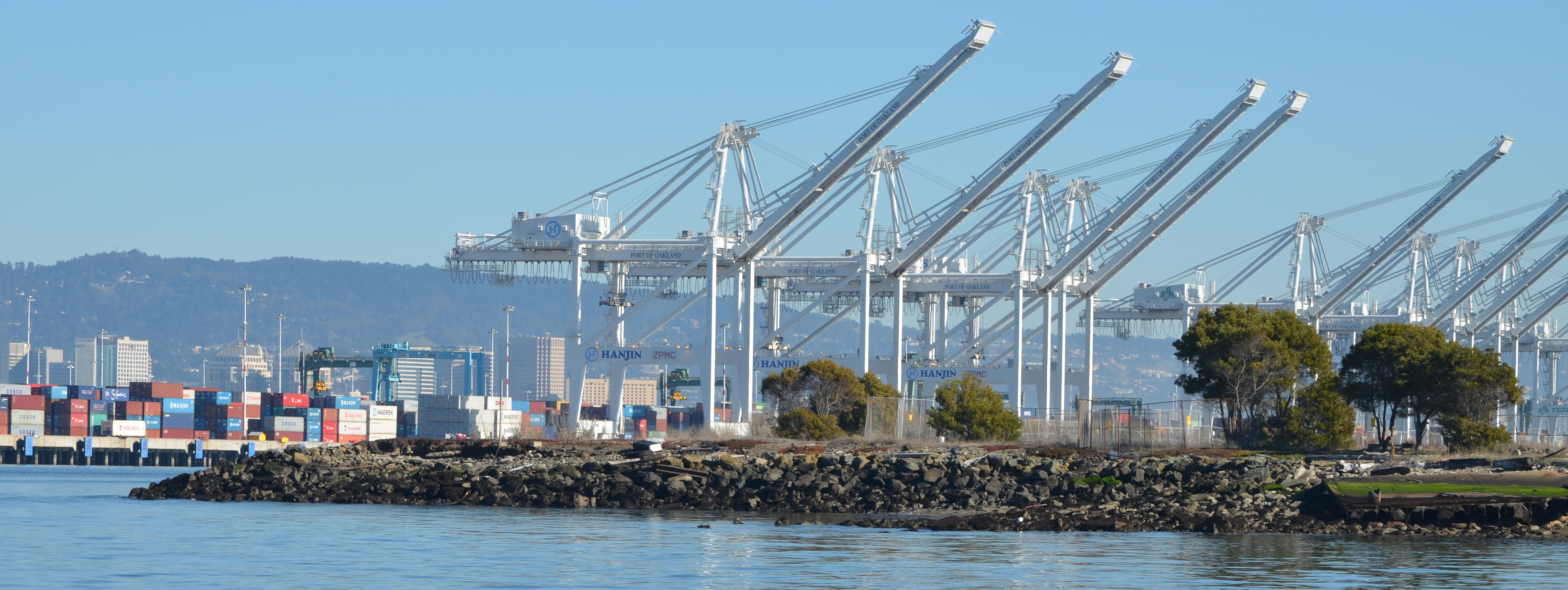
Transition from soil cover to wetland. Port of Oakland in background.
The site was closed for waste disposal in the mid-1980s and given a soil cover that did not meet landfill closure standards. For more than a decade after it was added to the Superfund cleanup program, the regulatory agencies and the Navy went back and forth about how best to close the site in an environmentally safe manner.
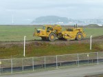
The slope of the soil cover is so important to the engineering design that the blades on the graders are not even controlled by the driver. Blades on the graders, and even the bulldozer, are controlled by an onboard computer that uses a GPS satellite to maintain a uniform elevation. The engineering concept for this soil cover is to minimize the slope so as to minimize movement in an earthquake, while at the same time providing for drainage.
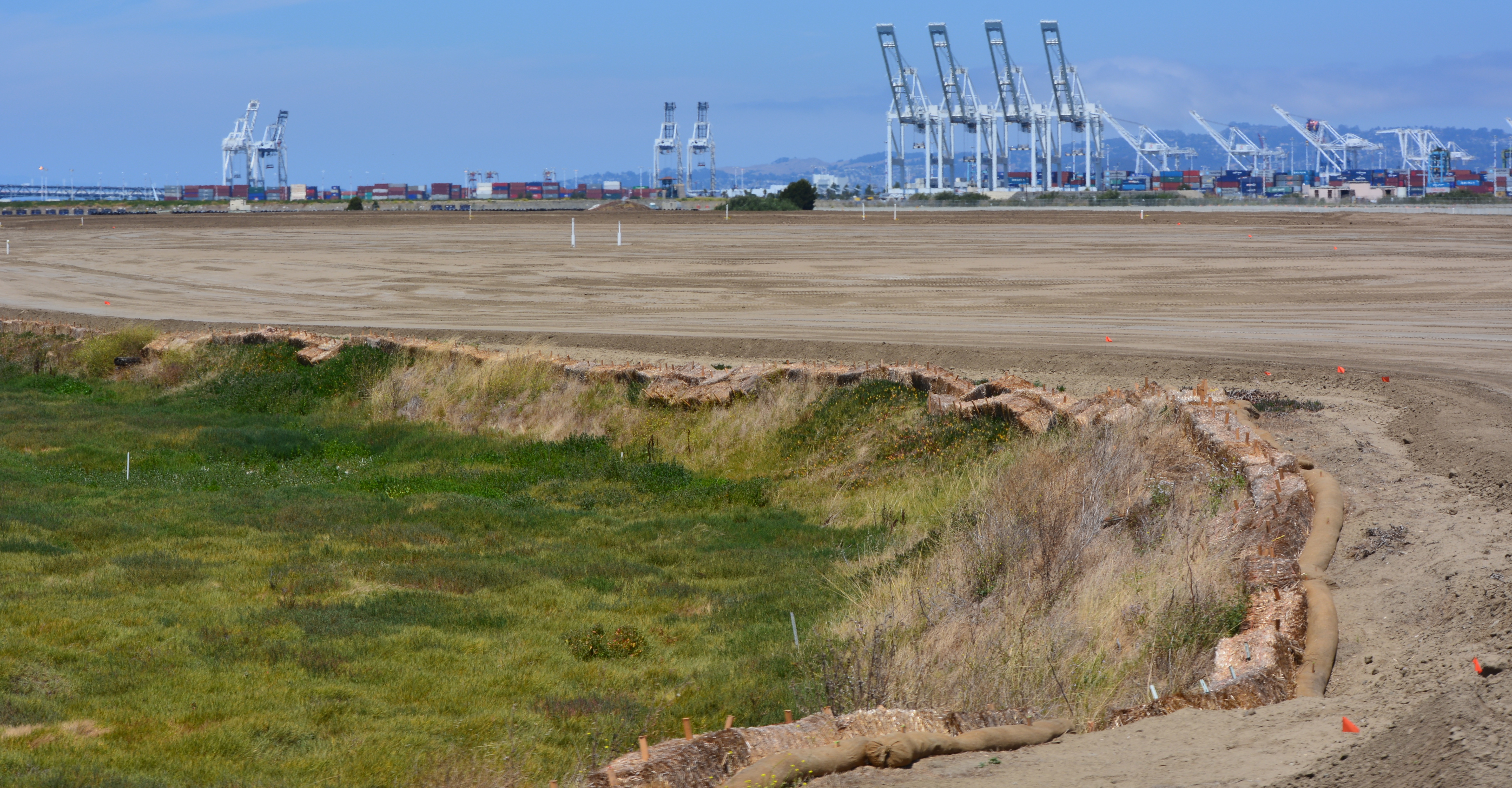
Looking east at partially completed soil cover from the western shoreline of Alameda Point.
Soon the contractor will be laying down a 200-mil-thick HDPE geonetting material to act as a barrier to burrowing animals. Next, they will add two more feet of soil before installing monitoring equipment, drainage features, access road, and seeding the soil with a variety of California native grasses. Seeding is planned for this fall before the rainy season.
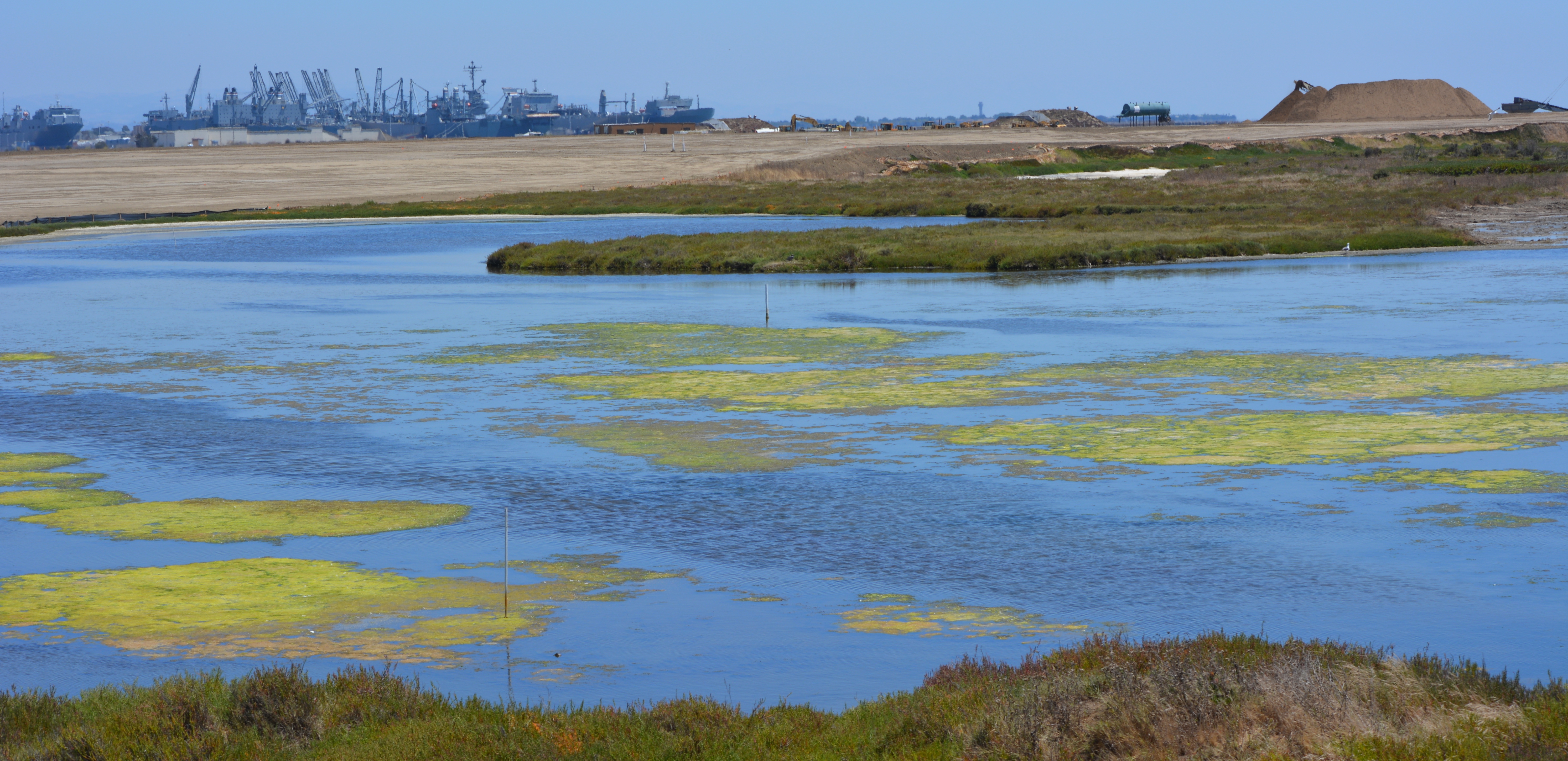
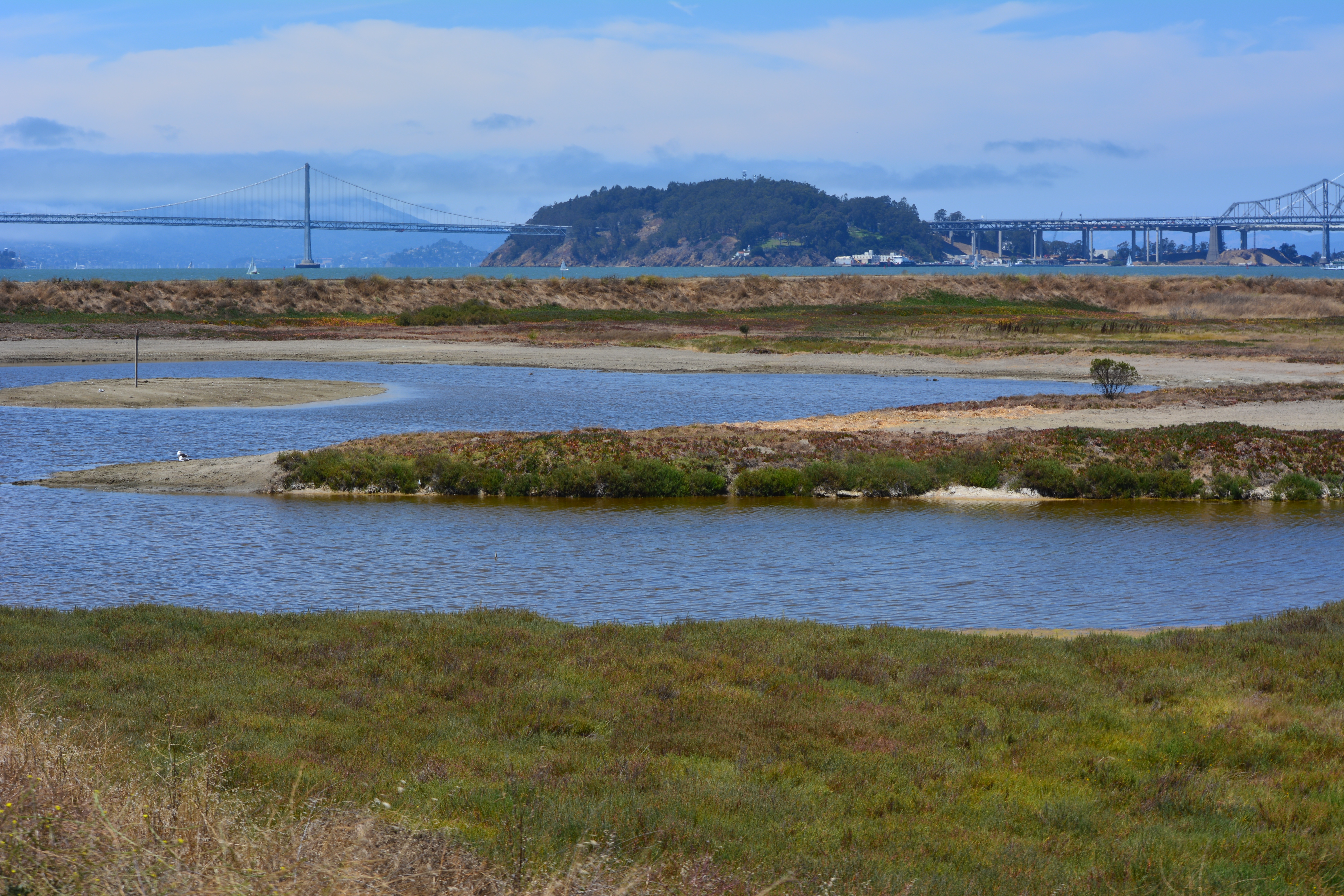
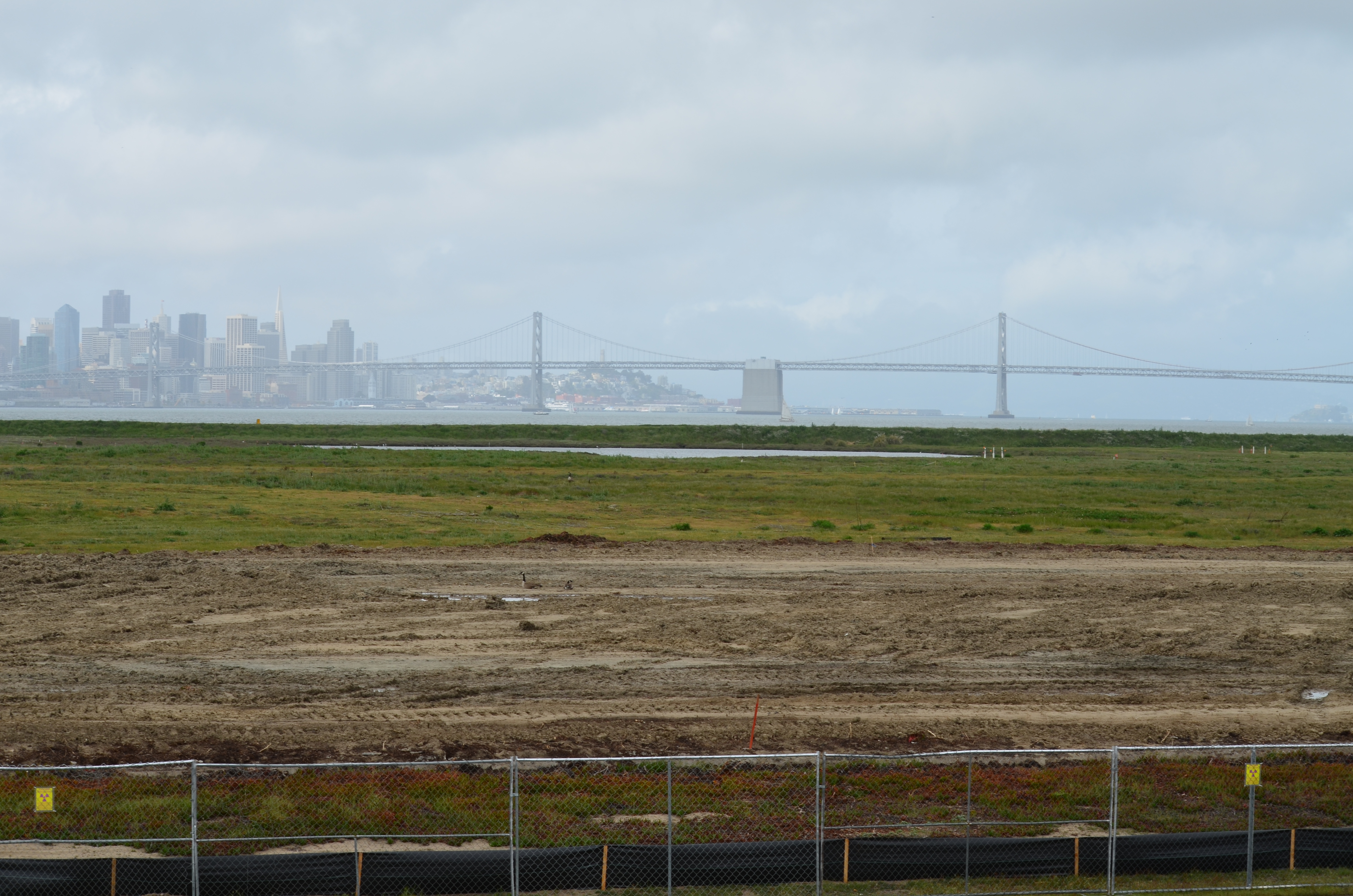
The 30-acre wetland area is not contaminated, but it will receive some upgrades with additional wetland. There is both a freshwater wetland area fed by rainwater, and a saltwater wetland area connected to San Francisco Bay via an underground culvert. The culvert will be replaced due to its age.
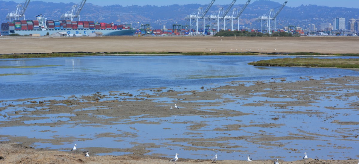
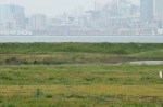
Partial view of wetland and soil cover on southwest corner of Alameda Point. Looking east with maritime ships in background.
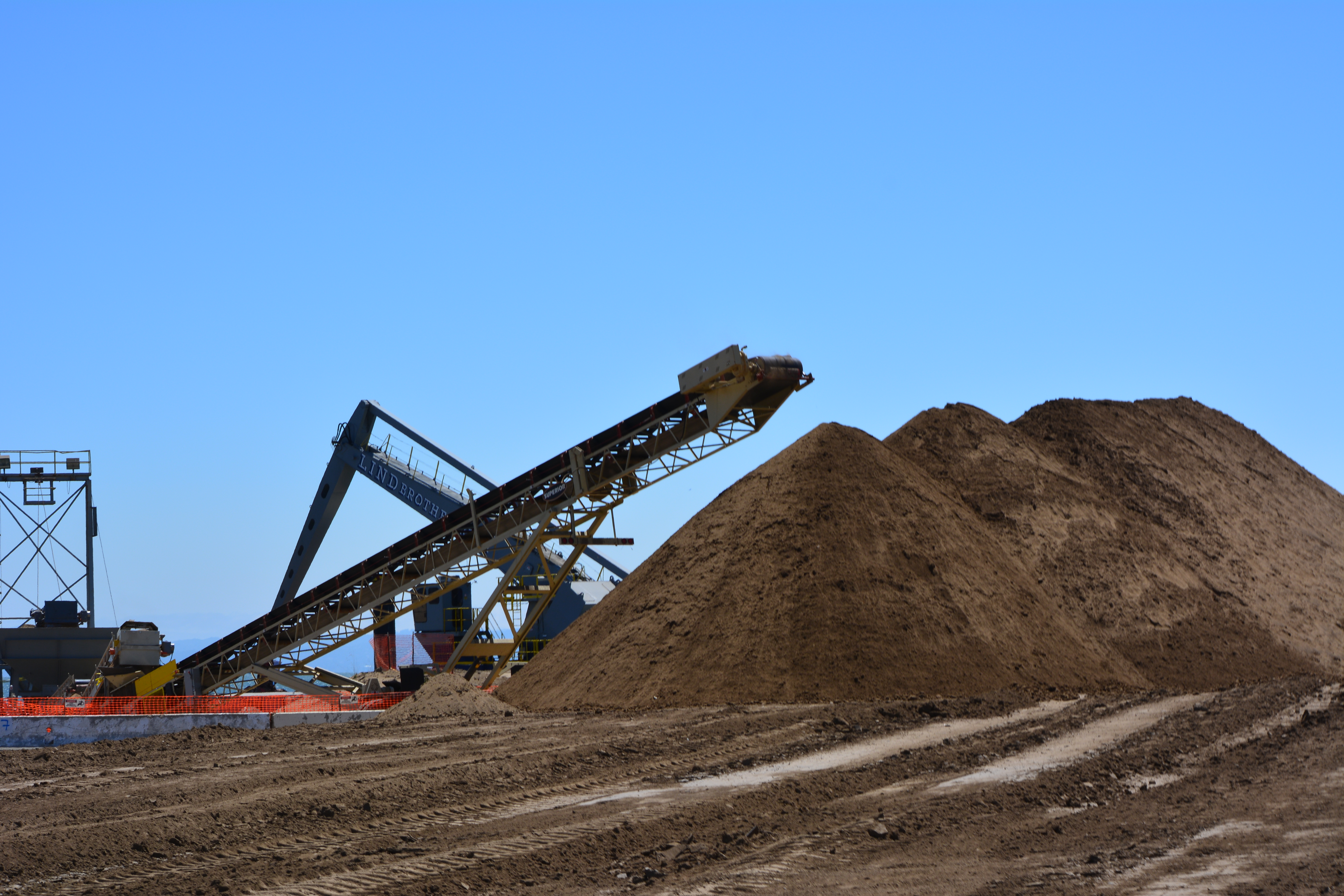
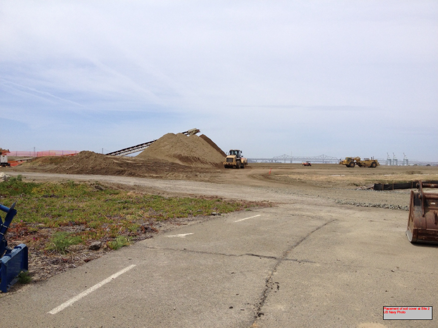
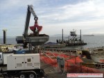
More than 600,000 cubic yards of soil is required to complete the project. Of that amount, 110,000 cubic yards have been recycled from the Seaplane Lagoon dredging after it tested clean. The rest is being barged in from Decker Island in the Sacramento River near the town of Rio Vista.
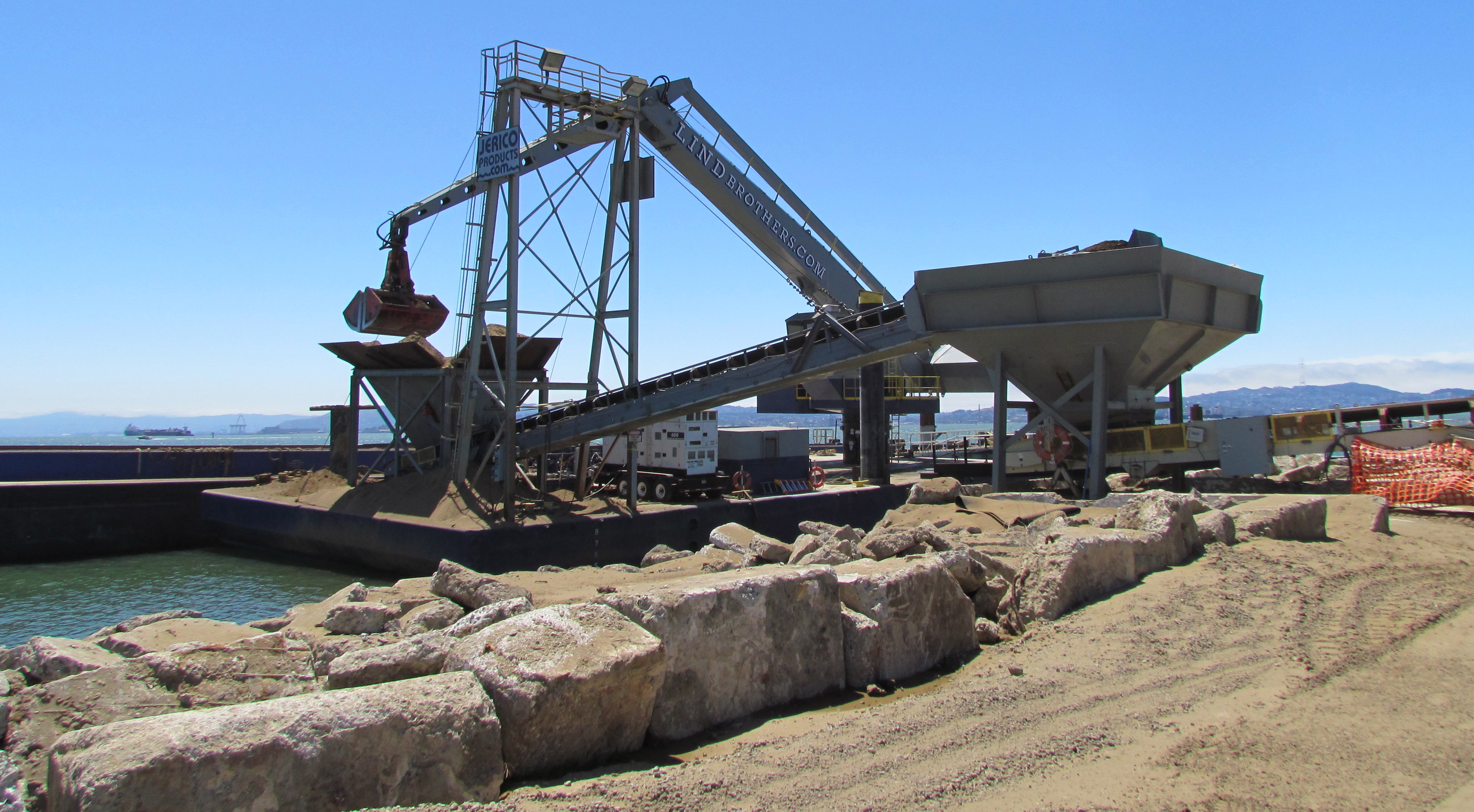
Soil from Decker Island being off loaded from barge at southwest corner of Alameda Point.
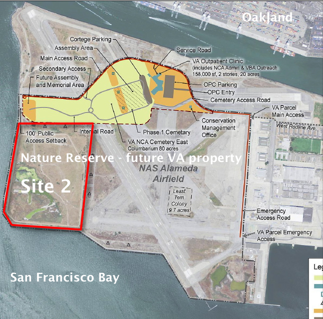
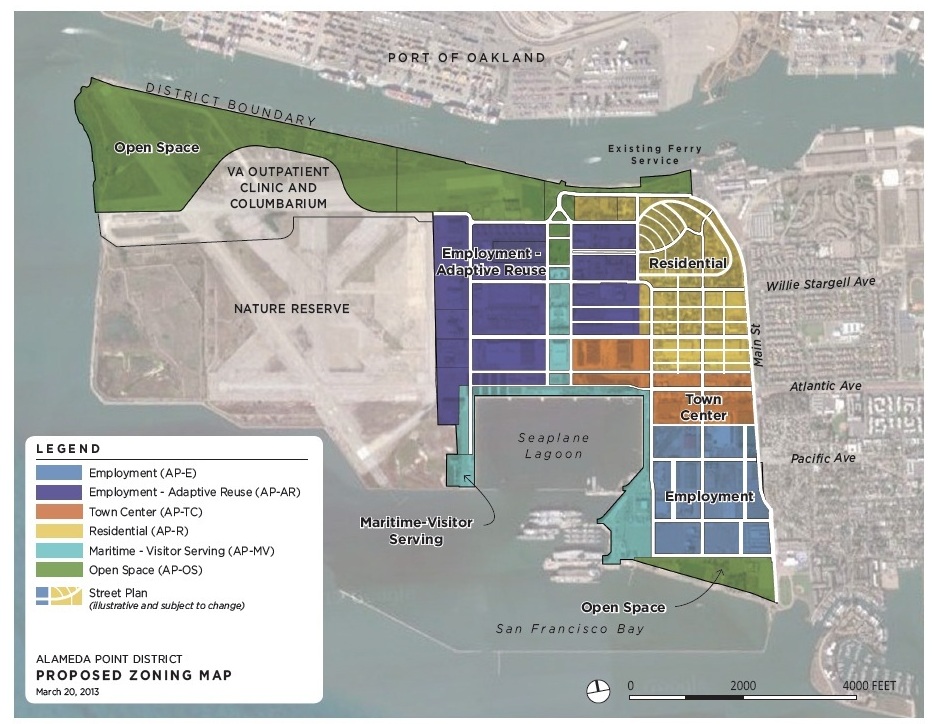
This 110-acre project site, featuring the most scenic viewpoint in all of Alameda, will be transferred to the U.S Department of Veterans Affairs (VA) along with another 400 acres of the Nature Reserve, and 112 acres for the VA’s clinic and columbarium. A nearby public access area on the western shoreline will be developed when the VA completes their road along the northern perimeter of the columbarium to the western shore. The Bay Trail will eventually run along the shoreline.
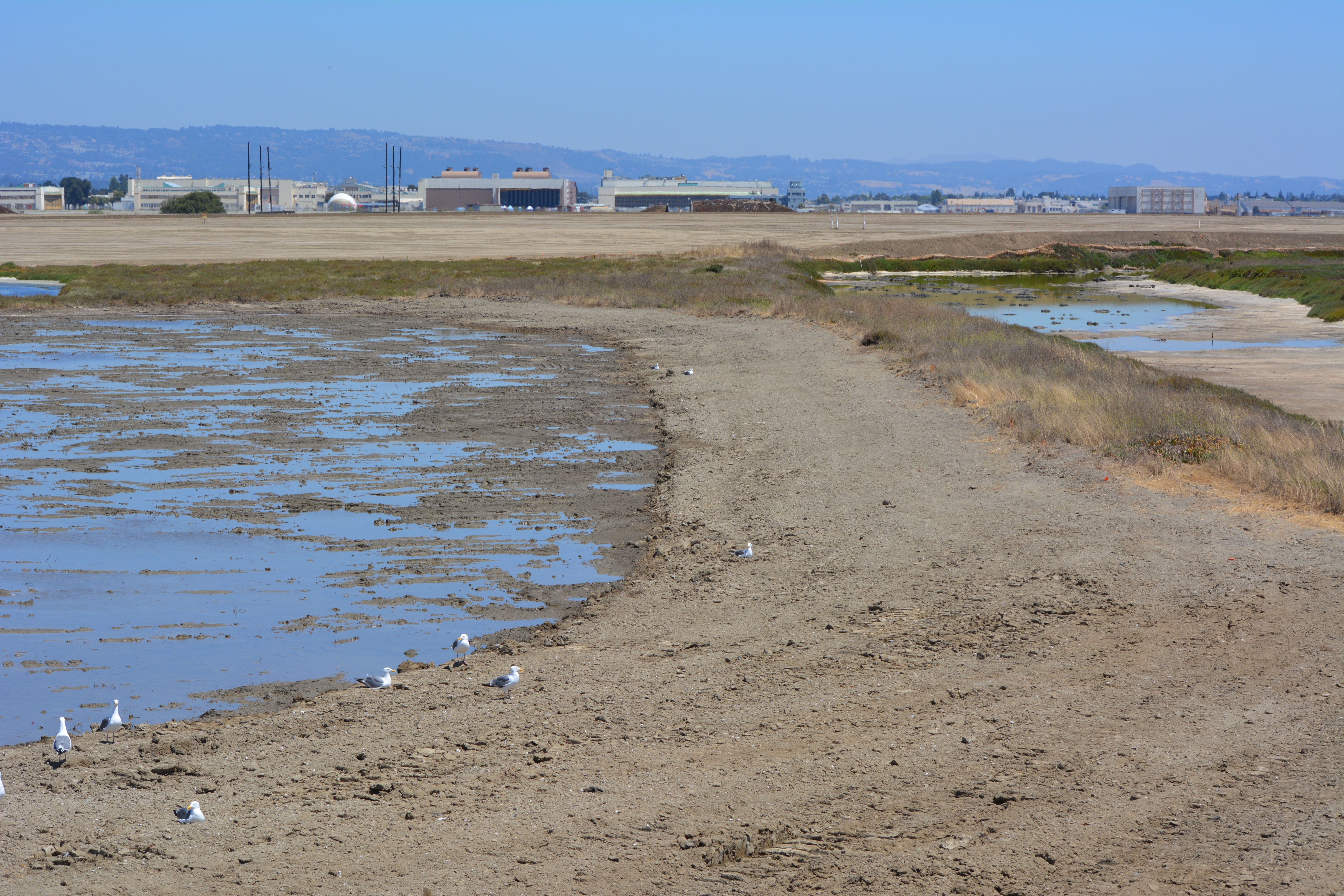
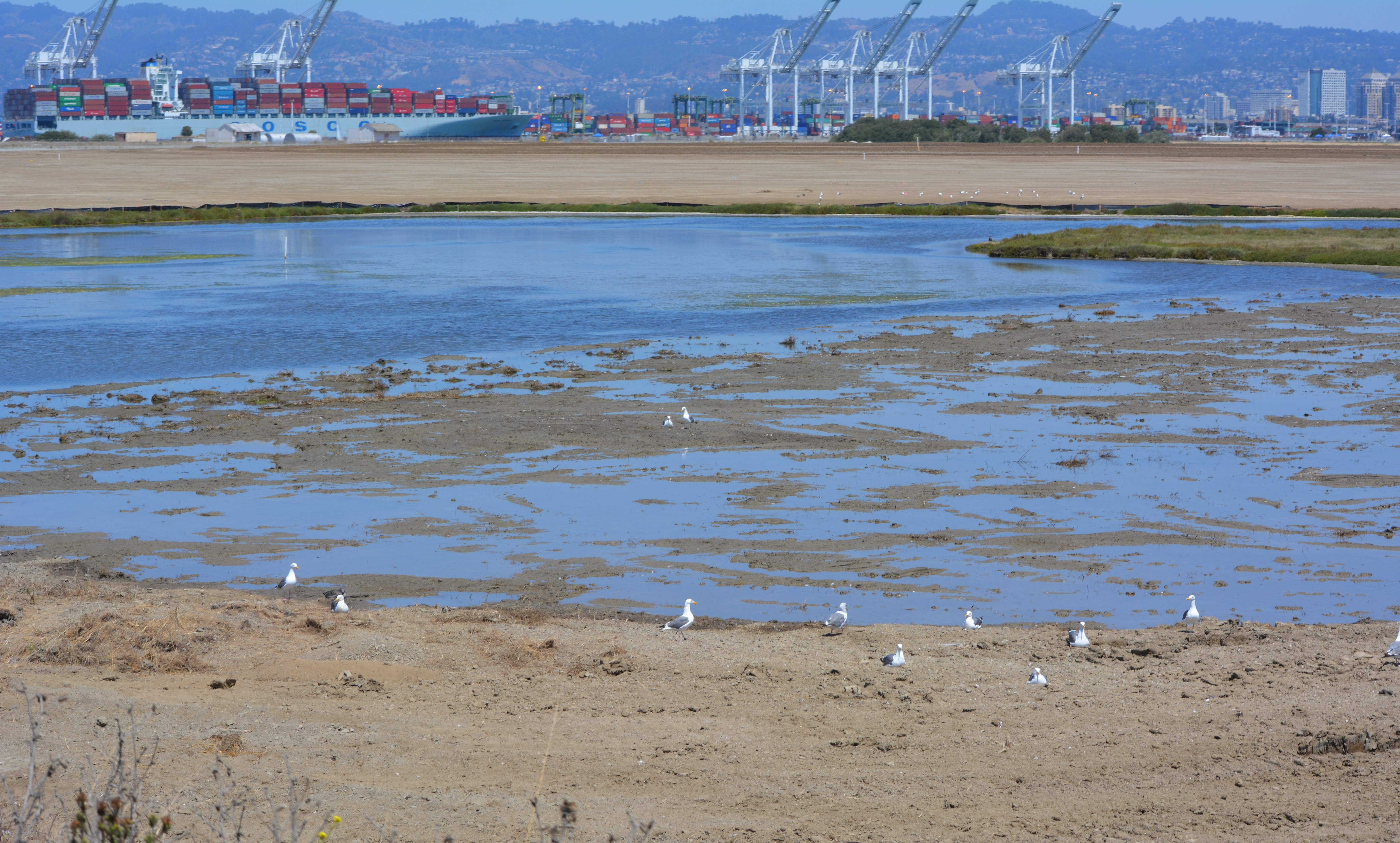
Partial view of wetland area on Site 2 – Alameda Point Nature Reserve. Bay Trail will be on the other side of the embankment that runs along the far side of wetland area.Wetland on the left connected to San Francisco Bay. The muddy part in the photo was recently added and will be allowed to naturally revegetate. Freshwater wetland to the right. Looking east toward hangars.North Pond wetland connected to San Francisco Bay. Port of Oakland in background.Wetland area on Site 2 looking north from southern perimeter of the site.Off loading soil from barge for Site 2 soil cover at Alameda Point. Southern shoreline.Construction equipment at Site 2. Looking east with maritime ships in background.VA project at Alameda Point with adjacent Nature Reserve that includes Site 2 remediation area.
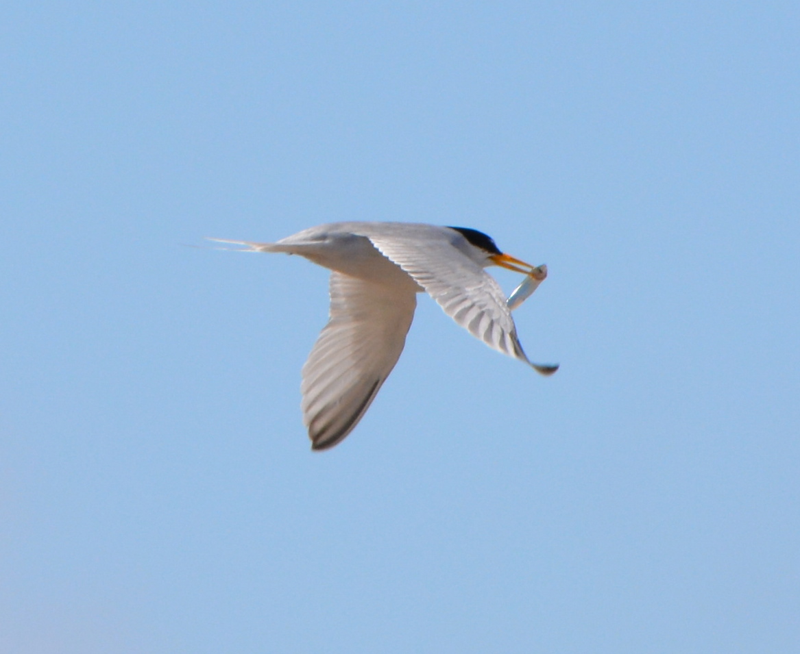
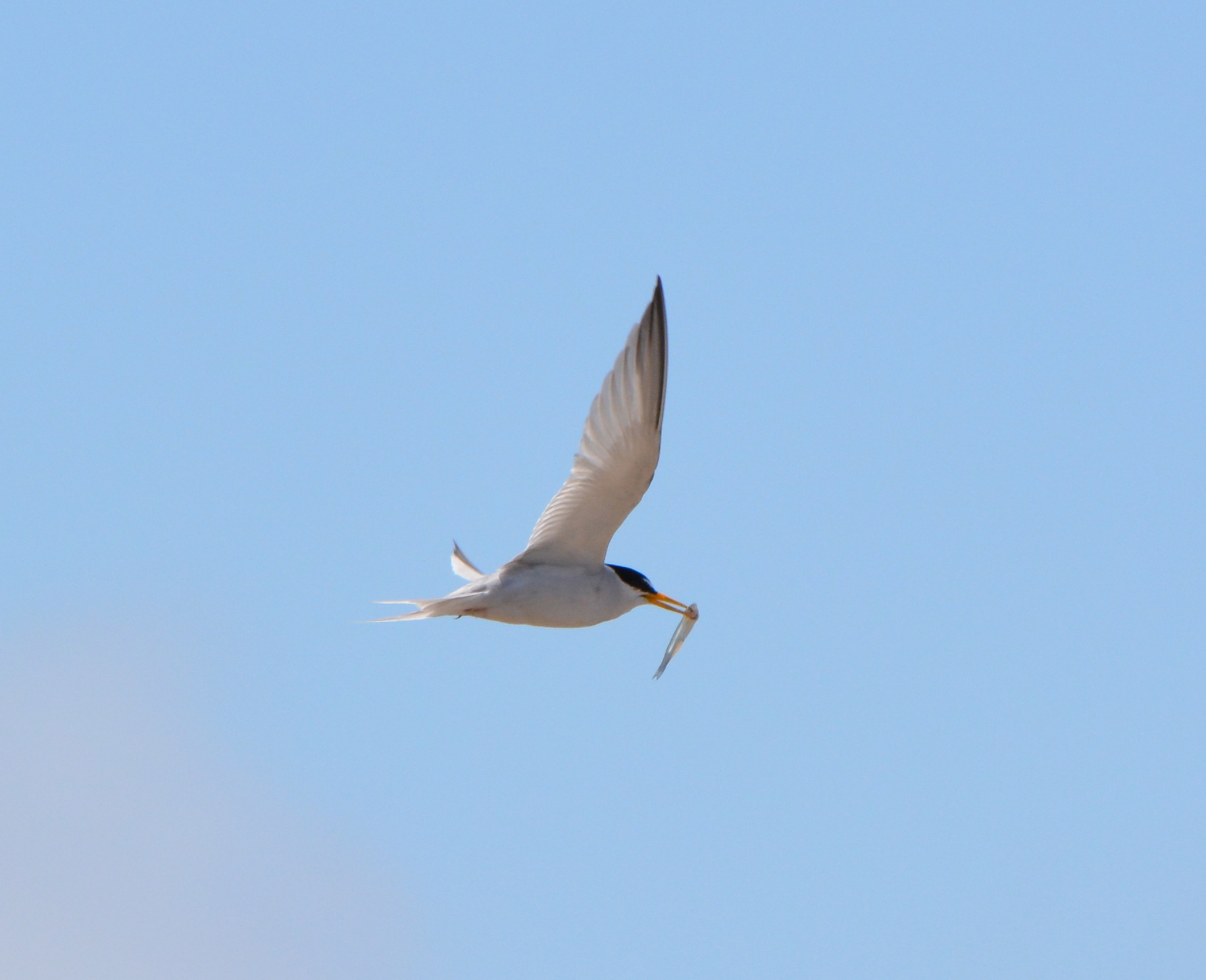
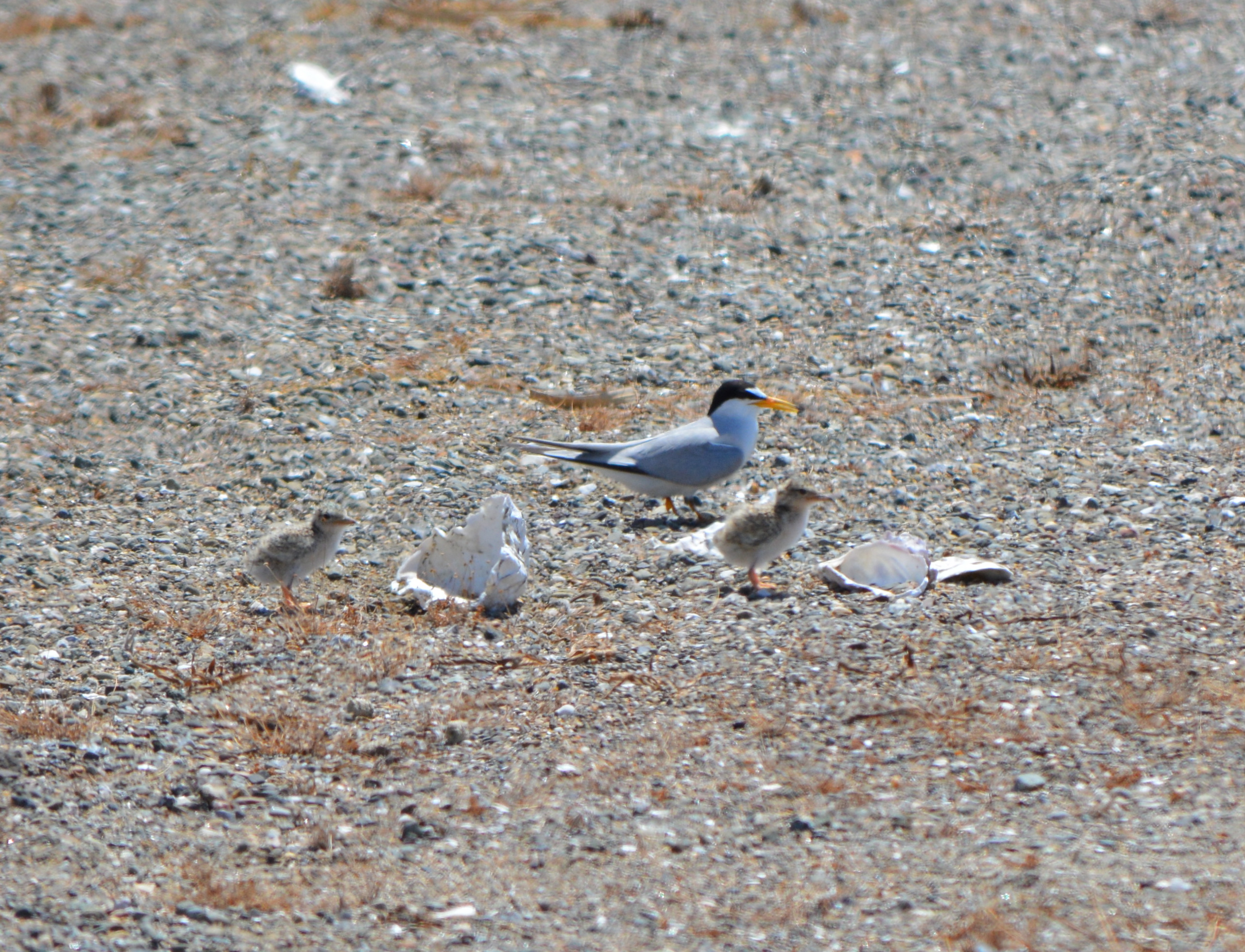
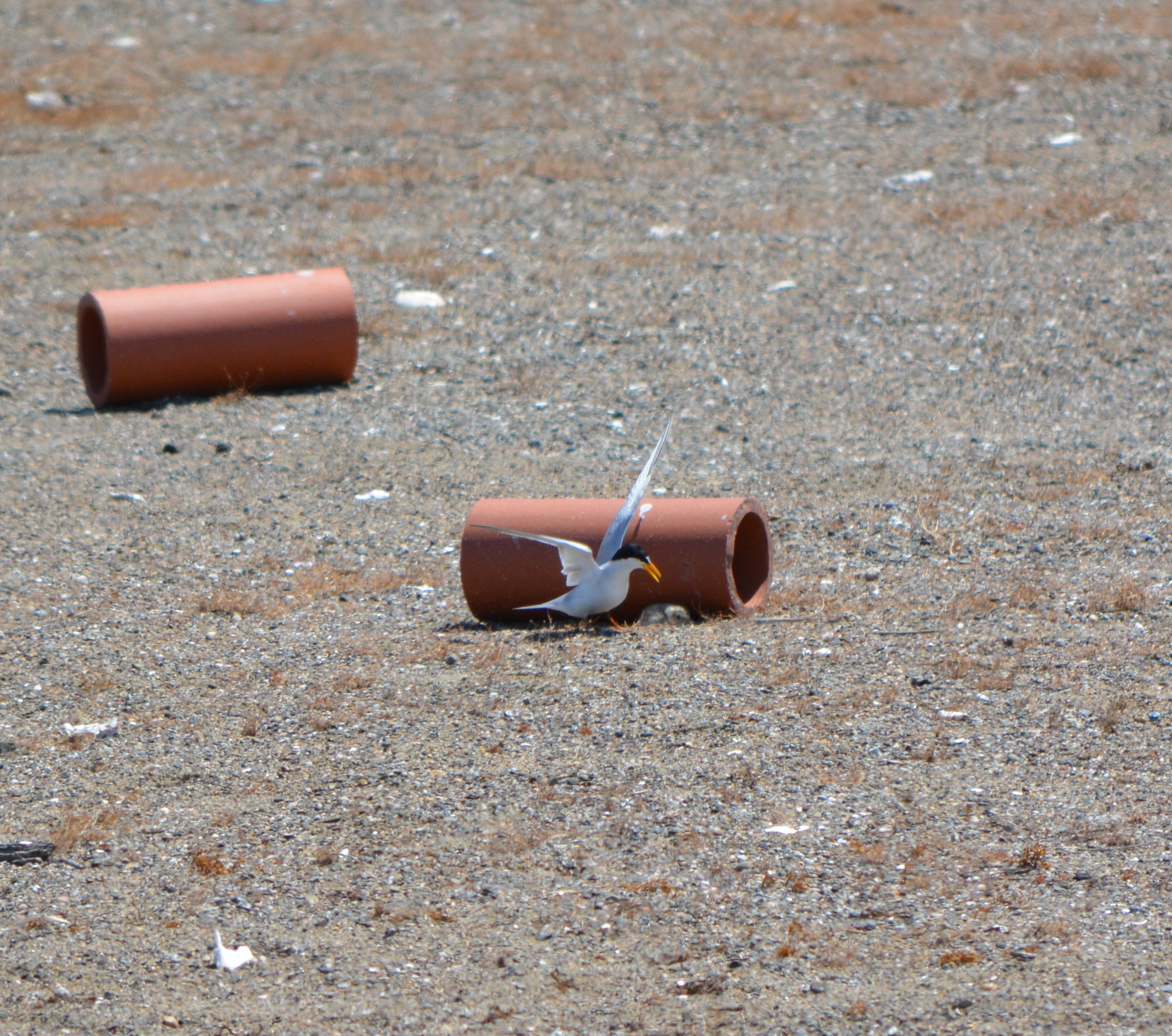
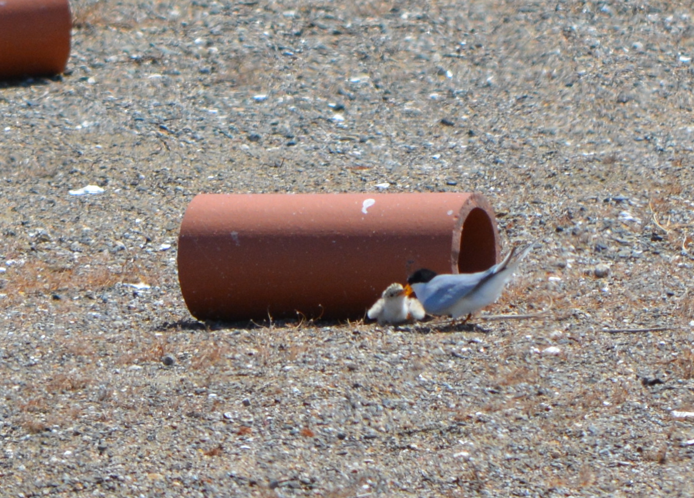
Three busloads of visitors to the nesting area were treated to a great show on the annual “Return of the Terns” day, June 15. The nesting area is on the Nature Reserve, located on the airfield of the former naval air station. Adult terns could be seen busily bringing small fish to their young, and doting on the young chicks as they scampered around the sandy colony. The cool temperatures of the day made it less stressful for the young birds.
The adults will continue bringing fish to their young and watching over them until they’re ready to fly south in early August. It looks like it will turn out to be a very good year for Alameda’s least tern colony, the largest in Northern California. Another tern colony is on the Hayward shoreline. The California Least Tern is an endangered species. The colony at Alameda Point is managed by the U.S. Fish & Wildlife Service.
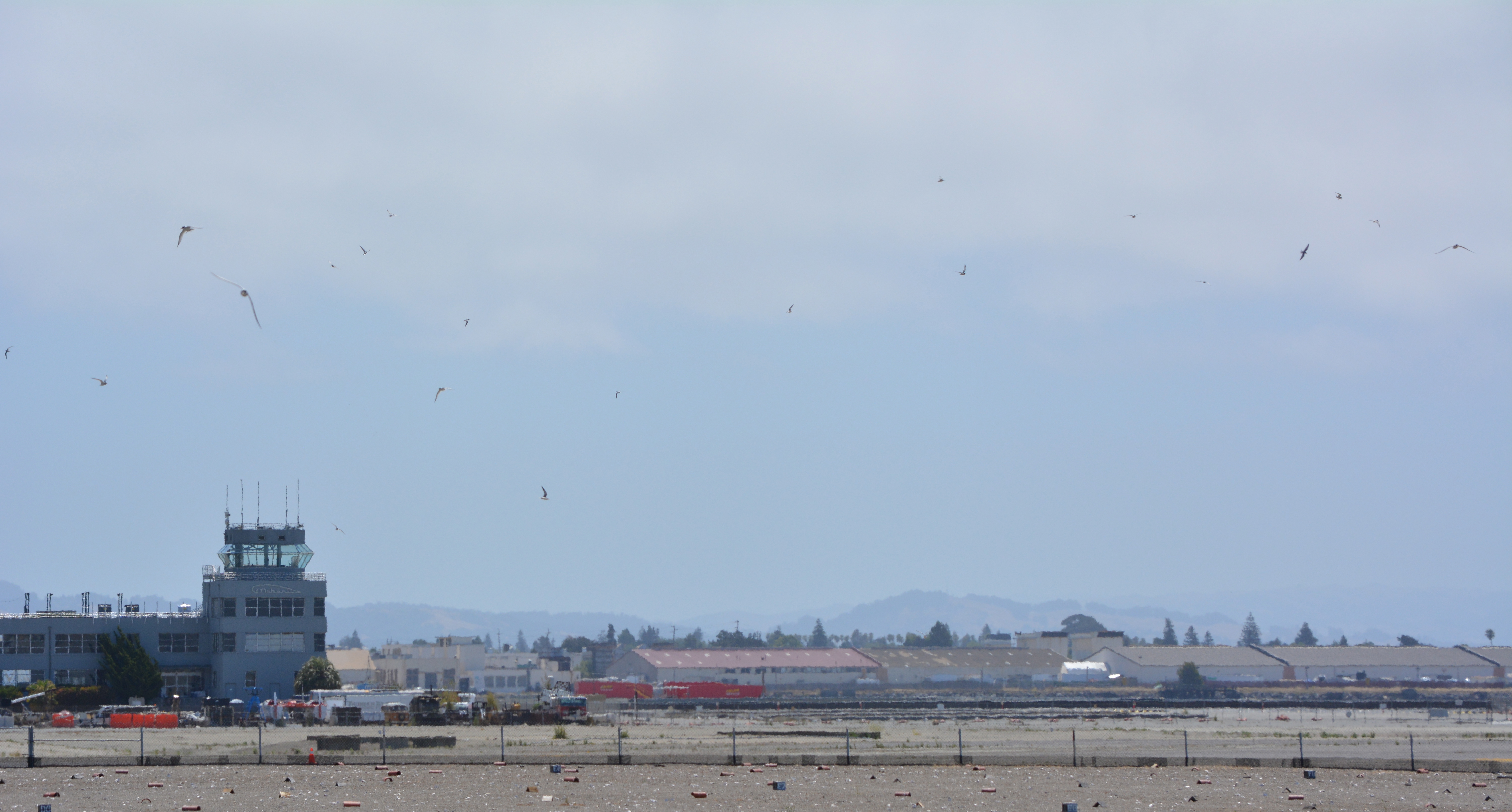
CA Least Tern @ Alameda Point – June 15, 2013CA Least Tern with fish at Alameda PointLeast Terns flying above the colony site at Alameda Point. Control Tower in background.
Thirty-five years after the Navy stopped disposing of toxic waste in unlined pits next to San Francisco Bay on Alameda Point’s southwest shoreline, the final actions to comply with state and federal laws are finally being implemented this year.
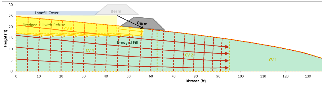
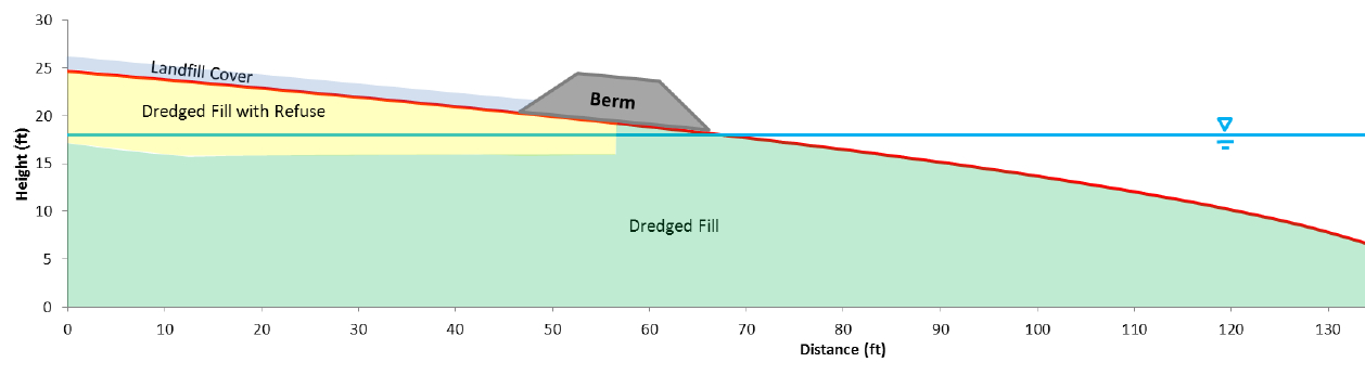
Site 2 where industrial waste is buried. Area up to the wetland will be covered with two feet of additional soil.
Decades of wrangling between the Navy and regulatory agencies over how to handle the West Beach Landfill, dubbed Site 2, were finally ironed out this spring. The U.S. Environmental Protection Agency (EPA), the Regional Water Quality Control Board (Water Board), and the California Department of Toxic Substances Control (DTSC) have agreed to a plan that calls for leaving the estimated 1.6 million tons of industrial waste in place and adding more soil to the existing soil cover.
Placement of soil cover at Site 2 – May 2013. US Navy Photo.
The Navy began dumping waste in the area in 1952, four years before they surrounded the area with a seawall. The dump was closed in 1978, but early efforts to comply with state environmental laws for landfill closure were not to the satisfaction of the Water Board.
In its May 2012 draft engineering work plan for the landfill, the Navy cited a decade of groundwater monitoring along the shoreline that proved the toxic chemicals of concern are not migrating toward the Bay. Instead, the chemical concentrations are either stable or declining. The contents have been sitting in water-saturated subsurface soil since the disposal program began 60 years ago.
Radiological hotspots of debris and soil, including a small storage building, were removed after an earlier scan of Site 2. Before the current two feet of clean soil is put in place, the soil will again be scanned down to a depth of one foot, and elevated concentrations will be removed. Radium-226 paint waste was disposed of in the landfill.
One of the major concerns about leaving this landfill in place is the consequence of a major earthquake. The Navy responded to a comment from a DTSC engineer by acknowledging that in the event of a maximum credible earthquake, the riprap boulders forming the “seawall is conservatively assumed to be non-existent, instantaneously whisked away and replaced with a 25-foot vertical face of liquefiable sand subject to plastic flow without being constrained by a rigid shell (sea wall).” The Navy’s earthquake model predicts that the earthen embankment above the seawall at the perimeter of the landfill, composed of clay and not sand, will glide into the Bay and “will not be overtopped by the waters of San Francisco Bay and freeboard of about 5 feet above mean sea level will remain, and so the refuse will remain isolated.”
Navy graphic showing predicted movement of embankment berm into San Francisco Bay during an earthquake. Click on image to enlarge.Navy graphic depicting position of embankment berm at Bay shoreline following a catastrophic earthquake. Click on image to enlarge.Southwestern shoreline of Alameda Point at Site 2 landfill. Rock/cement riprap seawall, with green embankment berm above. Looking north toward Port of Oakland.
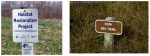
The Navy removed a perimeter security fence from their plans following objections from regulators and the public. “Navy’s design and [Superfund] requirements for this project do not preclude future use of the site for limited public access or passive recreational purposes,” said the Navy. Simple “Habitat Restoration Project” and “Stay on trail” signs were deemed adequate.
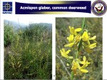
In an unusual move, the Navy offered the Restoration Advisory Board the opportunity to select the new vegetation that will anchor the 60 acres of clean soil. In the fall of 2013, the Navy will seed the new soil with 13 native grasses, most of them flowering. The Navy has permanently removed the 12-foot high embankment on the eastern, inland side of the landfill site, which will make the grassland visible from the mixed-use area.
The 30-acre wetland area on Site 2 was not contaminated, but will receive improvements to the quality of several acres. The culvert connecting the wetland to San Francisco Bay will be regularly inspected and permanently protected.
Bare soil is where the eastern embankment used to be.
Site 2 landfill with eastern embankment removed.
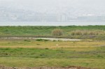
West Beach Wetland on southwestern Alameda Point. San Francisco in background.
West Beach Wetland with San Francisco Bay in the background. Part of wetland is connected to the Bay via metal culvert.
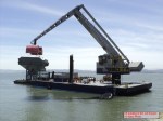
Off-loading of the soil hopper. US Navy Photo.
Off-loading of soil from barge to the soil hopper. US Navy Photo.
Soil conveyor at Site 2. US Navy Photo.
Imported soil stockpile. US Navy Photo
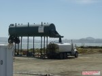
Water truck being filled. US Navy Photo.
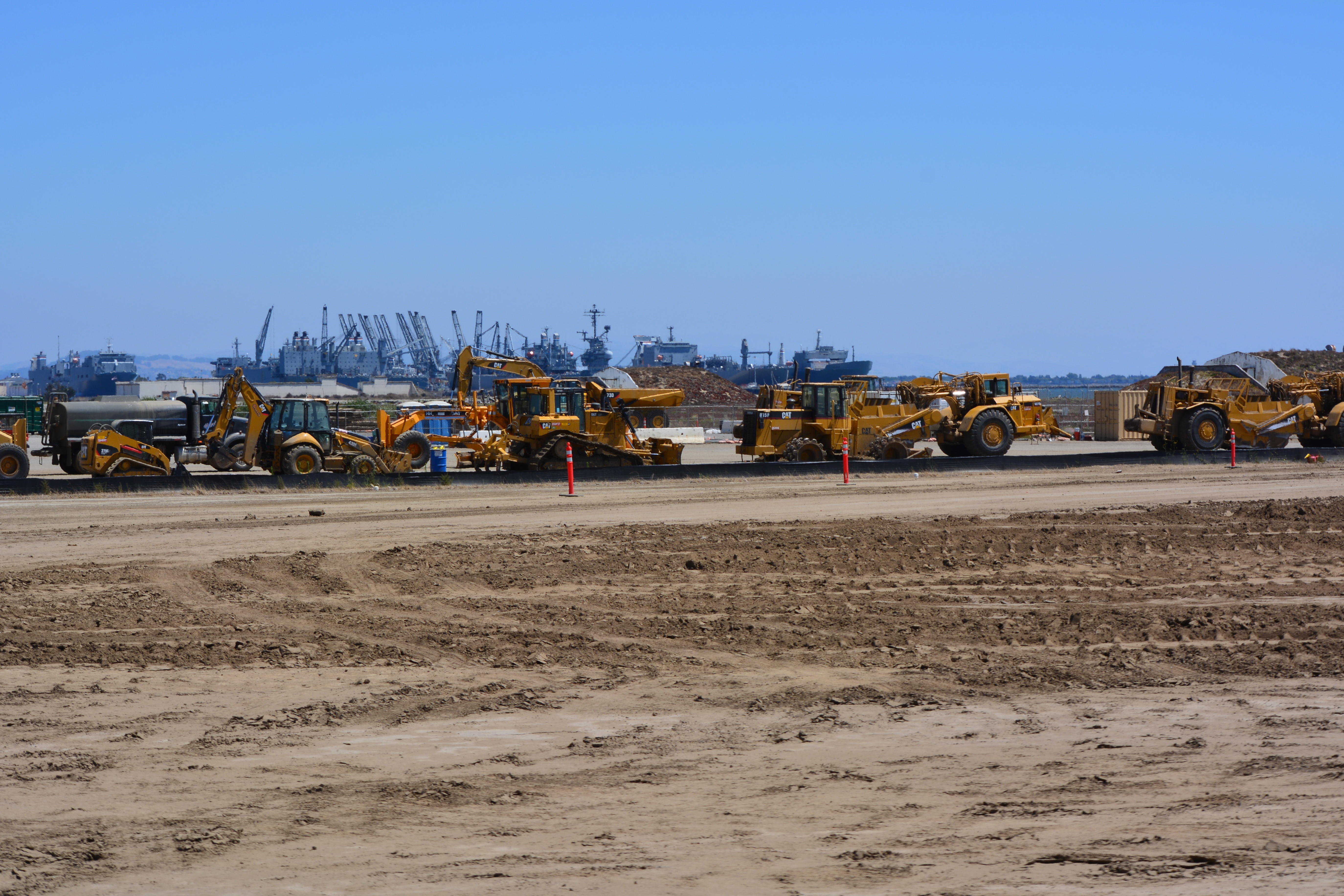
Site 2 grading equipment. US Navy Photo.
Eastern (inland) embankment at Site 2 being removed. US Navy Photo.
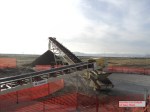
Loading trucks with Site 17 (Seaplane Lagoon) dredge spoils that were cleared as non-hazardous and stockpiled on the runway north of Site 2. US Navy Photo.
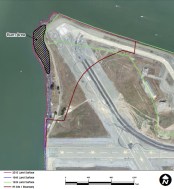
Site 2 wetland mitigation plan. US Navy map.
Site 2 trail signage. US Navy images.
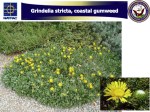
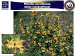
One of the native grasses to be hydroseeded on Site 2 in the fall of 2013.
One of the native grasses to be hydroseeded on Site 2 in the fall of 2013.
One of the native grasses to be hydroseeded on Site 2 in the fall of 2013.
One of the native grasses to be hydroseeded on Site 2 in the fall of 2013.
One of the native grasses to be hydroseeded on Site 2 in the fall of 2013.
The endangered least terns have returned. Committed volunteers prepare and maintain this unique site during the non-nesting season. The public can see the fruits of their work on June 15.
2013 maintenance work began on January 13th by clearing weeds from the outer perimeter of the nesting area. The terns need a clear view of their surroundings to feel comfortable that predators are not lurking nearby. Trimming vegetation near the nesting area is a high priority on work party checklists.
January work party
Volunteers were at the site again in February, March, and early April prior to the terns’ mid-April arrival. Tasks included replacing deteriorated plastic mesh along the base of the fence around the nesting site. The plastic mesh keeps chicks from wandering out through openings in the chain link fence. The chain link fence is there to keep out predators, and to keep out rabbits that might easily trample eggs.
Replacing black mesh “chick fence.”
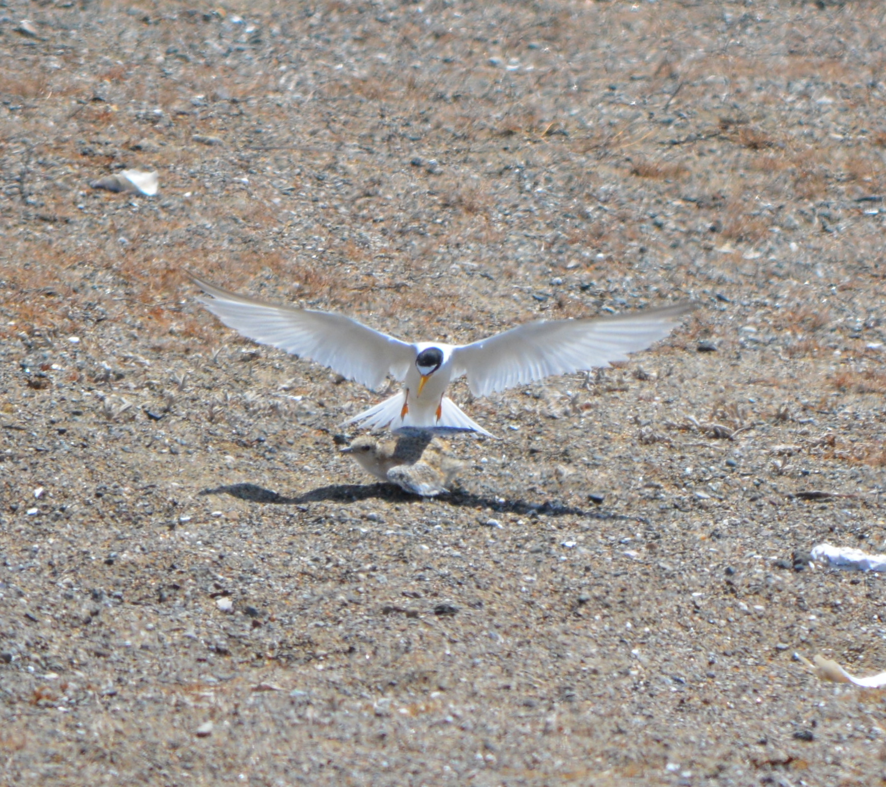
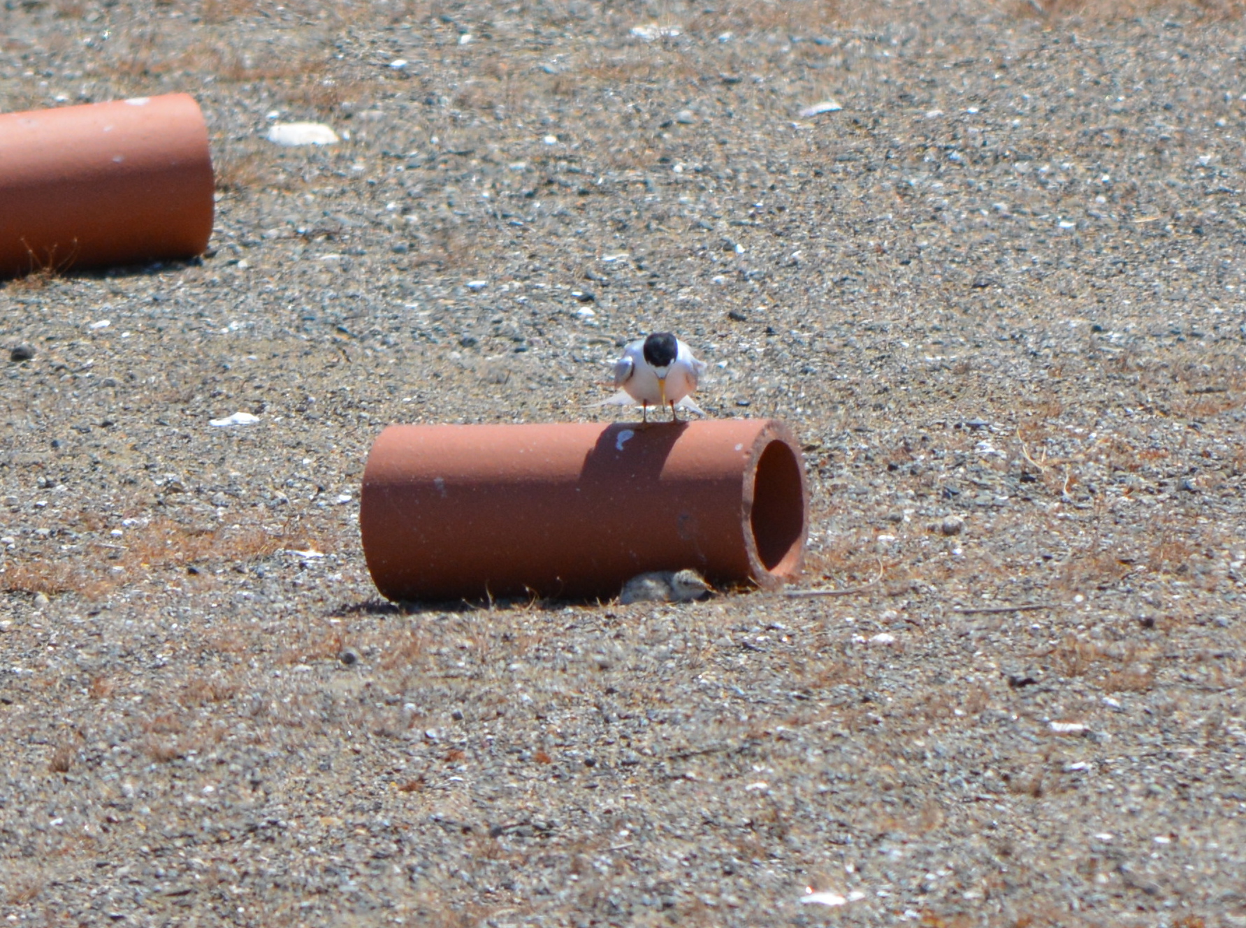
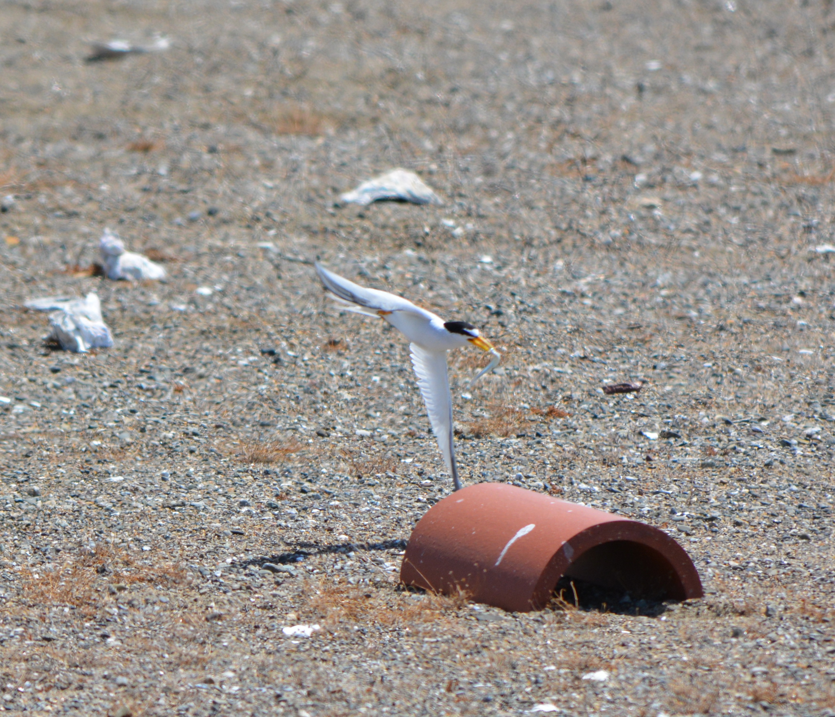
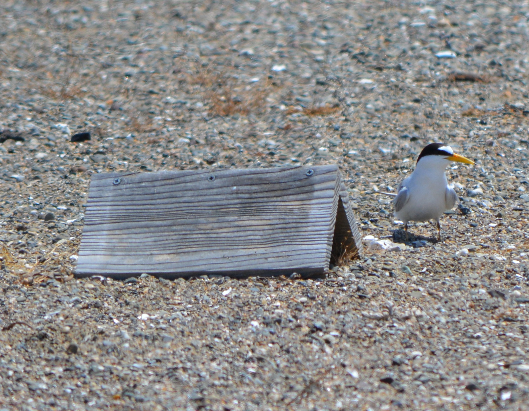
Another of set of tasks involves randomly placing wooden A-frames and half-round clay tiles that serve as shelters for the chicks from predators like hawks. One of the senior volunteers has been working to help the terns since the base closed. This year he brought 48 wooden chick shelters that he made at his home. Another task is the distribution of oyster shells that make it harder for flying predators to distinguish where the chicks are located.
Going for another load of oyster shells to distribute on the nesting area.
The number of volunteers ranged from 12 to as many as 30 each month. Among the volunteers this season were members of the Tau Beta Pi engineering fraternity at UC Berkeley, which has been sending volunteers for many years, and members of the Encinal High School Key Club.
Setting out the chick shelters.
Volunteers will return in September after the terns are gone. They will gather up the A-frames, clay tiles, oyster shells, and the numbered plaster markers that the US Fish & Wildlife Service uses to keep track of nesting success. Picking up the “tern furniture” allows for weed control and periodic grading of the sand and gravel.
During May, June, and July, another set of volunteers participate in the “Tern Watch Program.” Volunteers are trained in recording observations as they watch from their vehicle near the nesting site. A cinder block grid system helps in recording feeding activity, among other things. If predators are threatening the colony, the volunteers alert the Fish & Wildlife Service in the office nearby.
Work parties, organized by Golden Gate Audubon Society: ContactJoyce Larrick at jmlarrick@yahoo.comNext work party is the second Sunday in September.
Return of the Terns tours
On June 15th, the general public gets an opportunity to observe the nesting activity of the terns during a bus tour to the site. The tours leave from Crab Cove Visitor Center in Alameda.Registrationand a fee are required. More info is on theReturn of the Terns flyer.
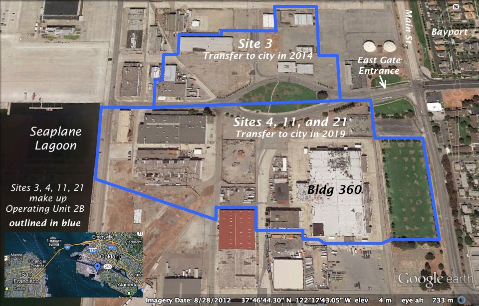
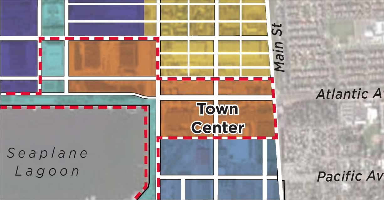
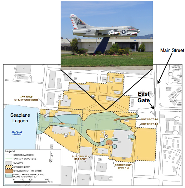
The city has announced that over 500 acres of land will be transferred from the Navy to the city on June 4, 2013. It will be the first – and largest – of a four-phase schedule of land transfers to the city. One of the areas that won’t be transferred this year is located at the main entryway into the future Town Center currently being designed.
Illustrations on map by Richard Bangert. Click on map to enlarge.
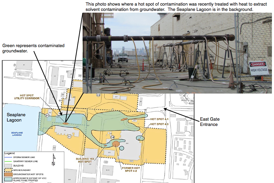
Driving into the “East Gate” on West Atlantic Avenue to Ferry Point Road at the Seaplane Lagoon takes you through part of the future Town Center – and through a major environmental cleanup area called Operating Unit (OU) 2B.
Plans for a vibrant mixed-use Town Center to kick off redevelopment are now in the design stage, but 33 acres on the south side of West Atlantic Avenue won’t be transferred to the city until 2019. That’s when contaminated groundwater is expected to be cleaned up to commercial standards, allowing the Navy to turn over the land.
The overhaul of aircraft and ship engines in this area led to major contamination of groundwater with trichloroethane and vinyl chloride, as well as pockets of soil contamination. After testing various cleanup methods on the contaminated groundwater area – called a plume – the Navy and regulatory agencies have decided to rely mainly on bioremediation – natural bacteria – to degrade the contamination.
Soil hot spots will be removed, except under buildings. Future developers will be responsible for soil under buildings once they are demolished.
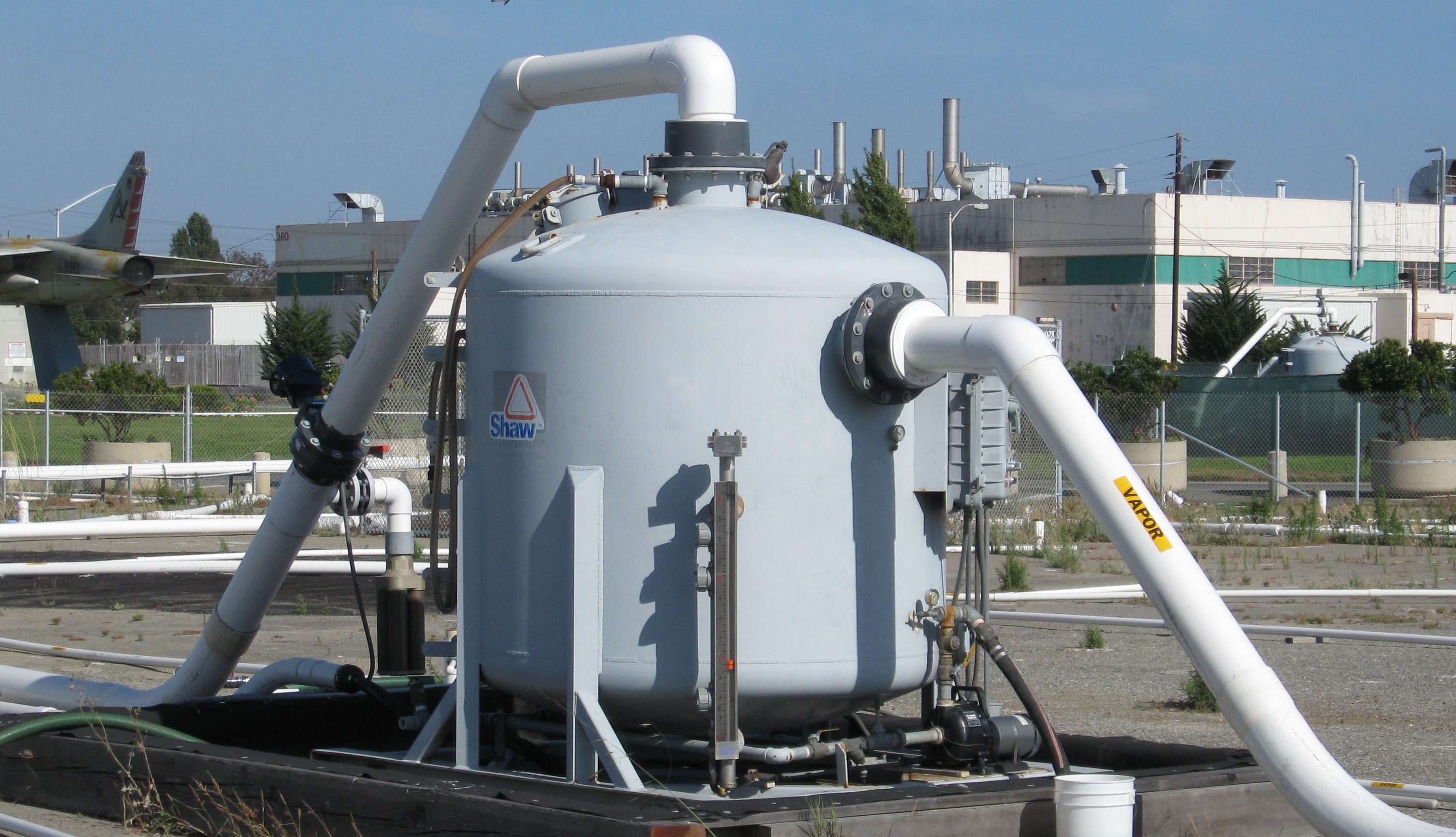
One of the groundwater hot spots close to the Seaplane Lagoon was successfully treated last year with a heat and vapor extraction system. Some of the other hot spots are impossible to treat with electrical heating because of underground power lines nearby.
Click on image to enlarge
The Navy has found bioremediation to be the most practical method to finish the job. Work details will be finalized later this year. Bioremediation can involve injecting new bacteria, but here it will likely mean injecting oxygen to spur the growth of existing bacteria. It’s the carbon atoms in the chemical contaminants that are attractive to bacteria, allowing them to naturally disassemble a chemical compound.
Someday, decades from now, the danger from vapors entering buildings will be low enough to permit ground floor residential use. Current restrictions imposed under the Navy’s cleanup plan will prohibit ground floor residential, but will allow residential use above the first floor, provided an approved vapor barrier and venting system is installed under any new construction. First floors will be allowed to have commercial uses once the city receives the land in 2019. Groundwater monitoring wells around the cleanup area will remain usable and accessible for regular monitoring for at least 20 years.
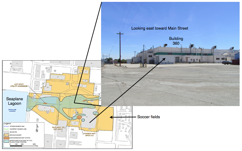
The cleanup area north of West Atlantic – 13 acres called Site 3 – will be turned over to the city next year following removal of several contaminated soil hot spots containing lead and other contaminants. Some of the contaminated soil areas are under building slabs on Site 3 and will be the responsibility of a future developer. All of the buildings in the East Gate cleanup area called Operating Unit (OU) 2B – 46 acres – are expected to be demolished rather than reused.
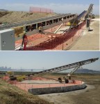
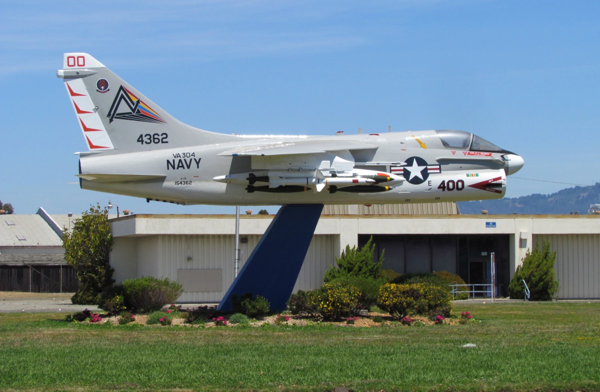
Site 3 north of West Atlantic was also heavily contaminated with jet fuel around an area where underground fuel storage tanks were once located. The former storage tank area is west of the jet monument and is still dotted with white pipe stubs once connected to a maze of cleanup pipes. The jet fuel cleanup was completed two years ago under the Navy’s Petroleum Program using a vapor extraction system. Removal of underground tanks and fuel lines was completed in 1999.
Vapor extraction system that operated for several years to clean up jet fuel in the ground on Site 3. Charcoal filter tank has been removed. Jet monument and Building 360 are in the background.Click on image to enlarge.
Removing jet fuel line in OU-2B cleanup area in 1999. Jet monument is in background. Source: Navy environmental newsletter, Winter 1999.
The Alameda City Council, on March 19, 2013, unanimously approved a resolution affirming support for a nature reserve at Alameda Point. The resolution calls for a zoning designation of “Nature Reserve” for the runway area formerly proposed for a national wildlife refuge.
After an impasse was reached in negotiations between the Navy and the US Fish & Wildlife Service for creation of a national wildlife refuge in 2004, the property was offered to the Department of Veterans Affairs (VA). The VA plans to build an outpatient clinic and columbarium on 112 acres of its land, but the remaining 511 acres of VA land will remain undeveloped. The undeveloped area is where the endangered California Least Terns come to nest from early April to mid-August every year.
The city’s nature reserve zoning designation will not have any mandatory impact on the VA, but rather is intended to convey the continuing value that the community places on wildlife conservation at Alameda Point.
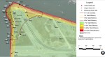
March and April 2013 bird sightings on the Nature Reserve at Alameda Point.
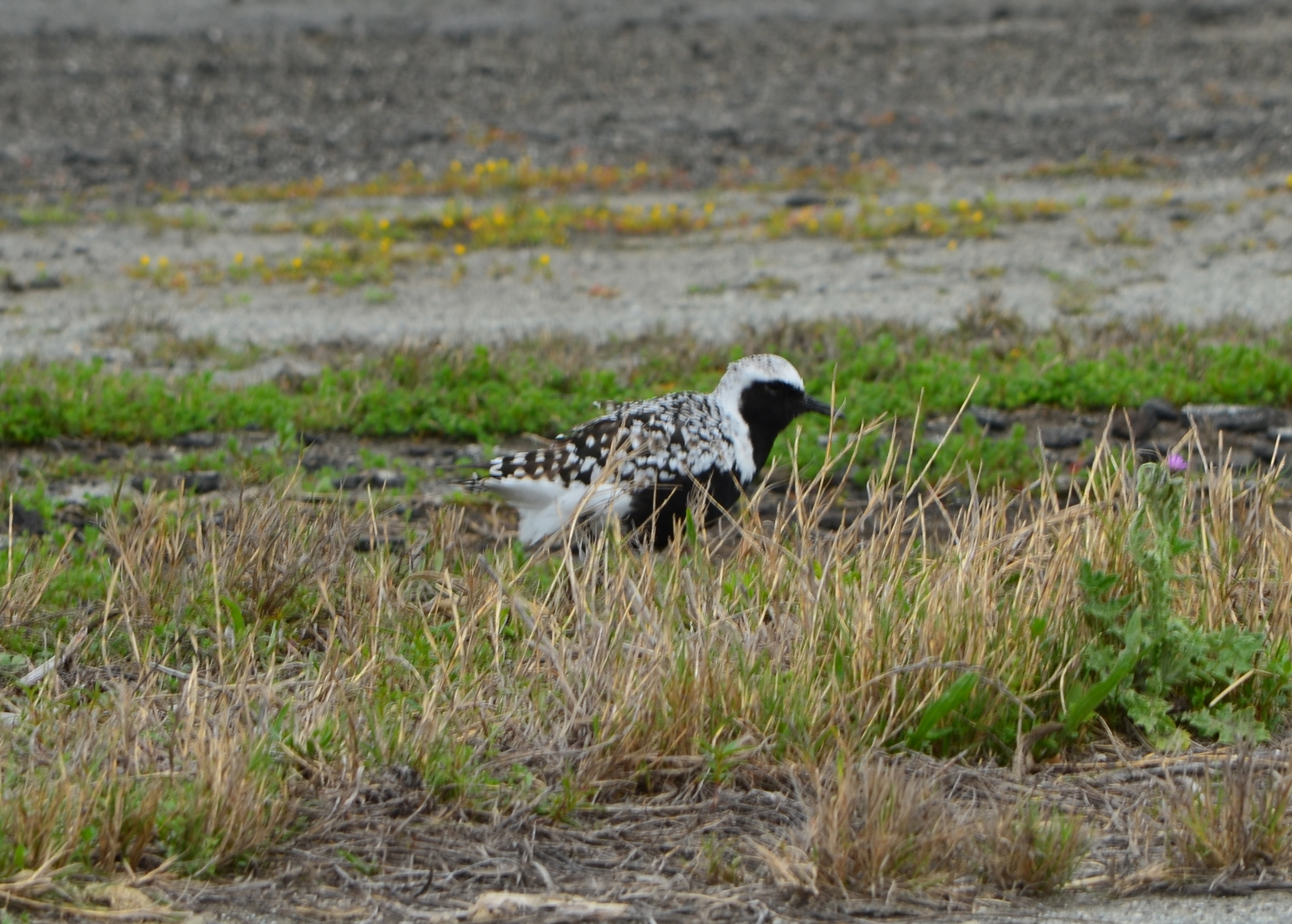
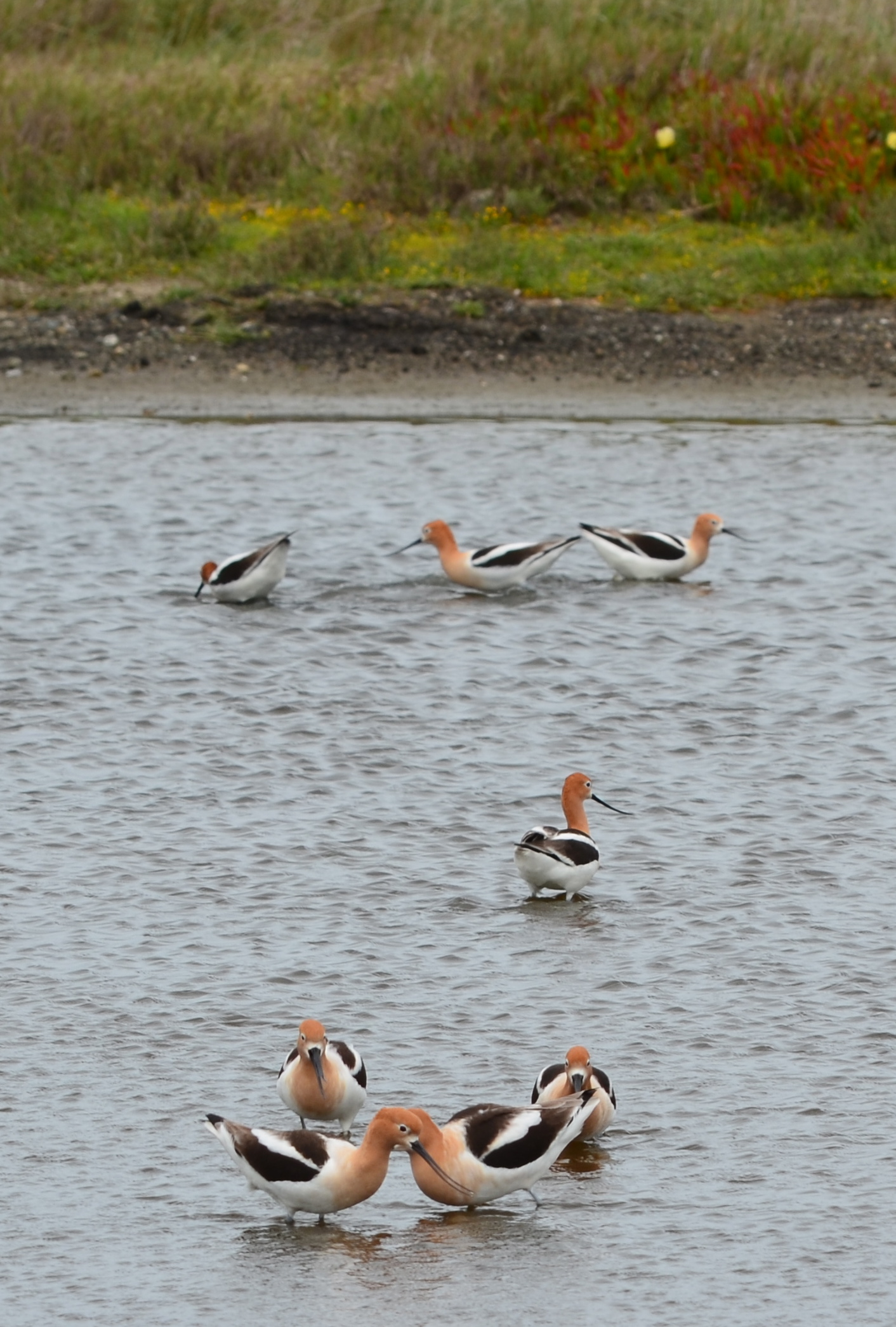
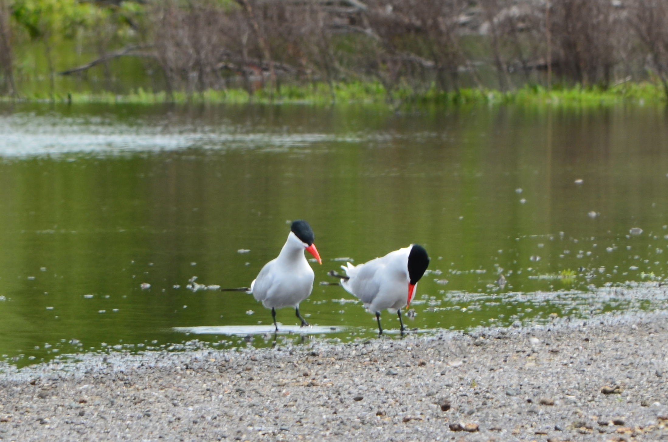
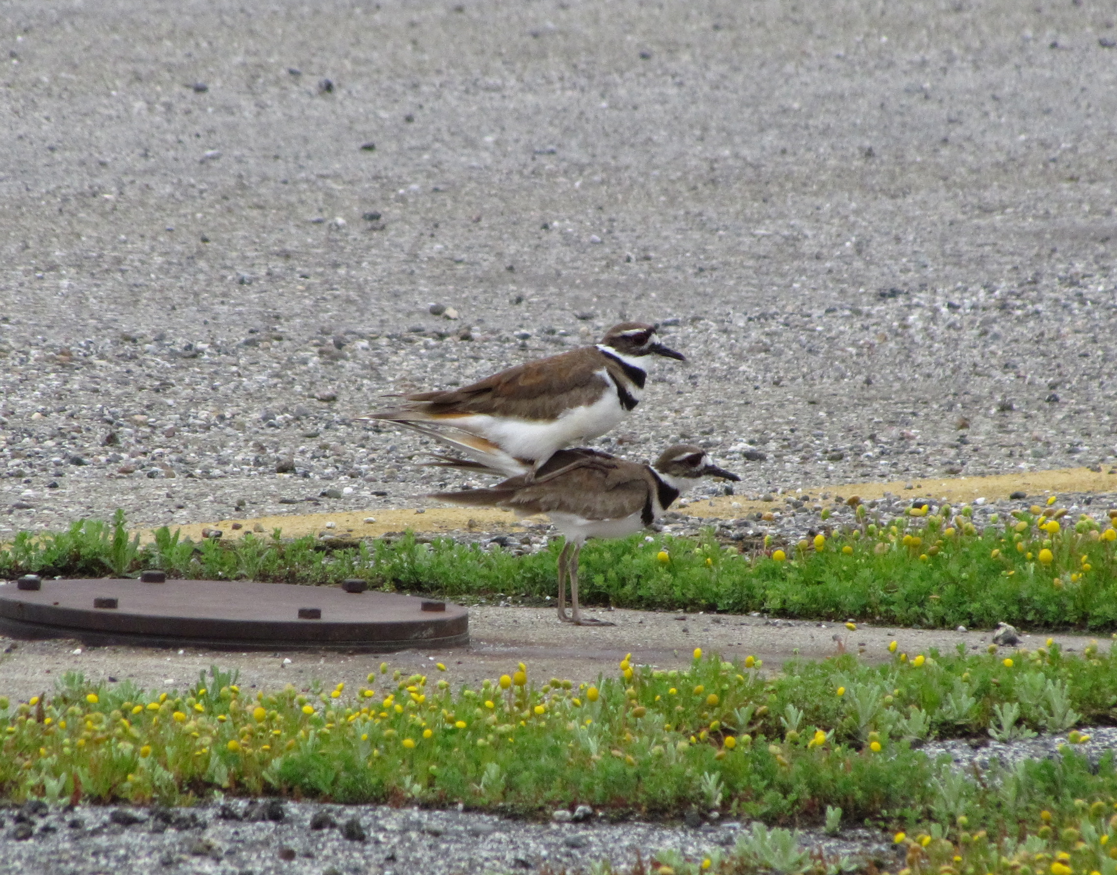
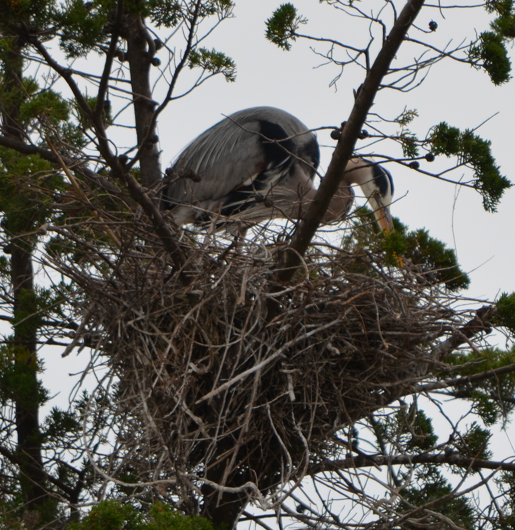
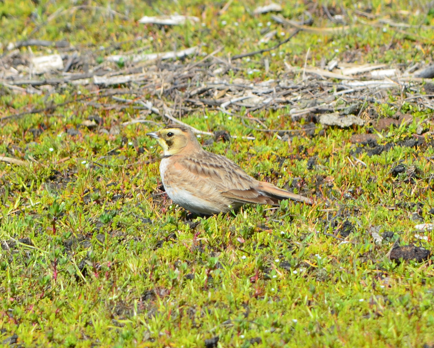
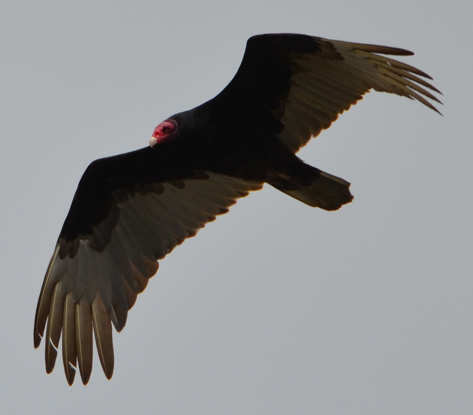
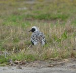
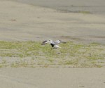
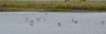
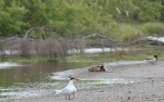
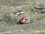
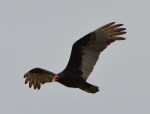
Black-bellied Plover. Summer breeding range is the north coast of Alaska and the Canadian Arctic. Seen here on the margins of seasonal wetland that the VA project will impact.American Avocets on seasonal wetland that will be covered by VA clinic/columbarium project. Can be replaced elsewhere on Nature Reserve.Caspian Terns next to seasonal wetland that will be impacted by VA project.Killdeer mating next to least tern nesting site. Killdeer often nest inside the least tern area. Killdeer are attracted to the Nature Reserve in abundance.Great Blue Heron nesting in a cypress tree in the Runway Wetland.Horned Lark foraging on grassland, with mate nearby.Turkey Vulture soaring over the reserve. Turkey Vultures feed on animal carcasses, such as rabbits that have been taken by hawks.
Black-bellied Plover soon headed on long migration to northern Alaska/Canada.
Black-bellied Plover in breeding plumage. Breeding area is northern Alaska/Canada.
American Avocet
American Avocets on seasonal wetland at VA development site margin.
American Avocet on seasonal wetland at margin of VA columbarium/clinic site.
Caspian Terns near the willows.
Killdeer checking out potential nesting spot.
Great Blue Herons above two nests in cypress on Runway Wetland – Alameda Point Nature Reserve.
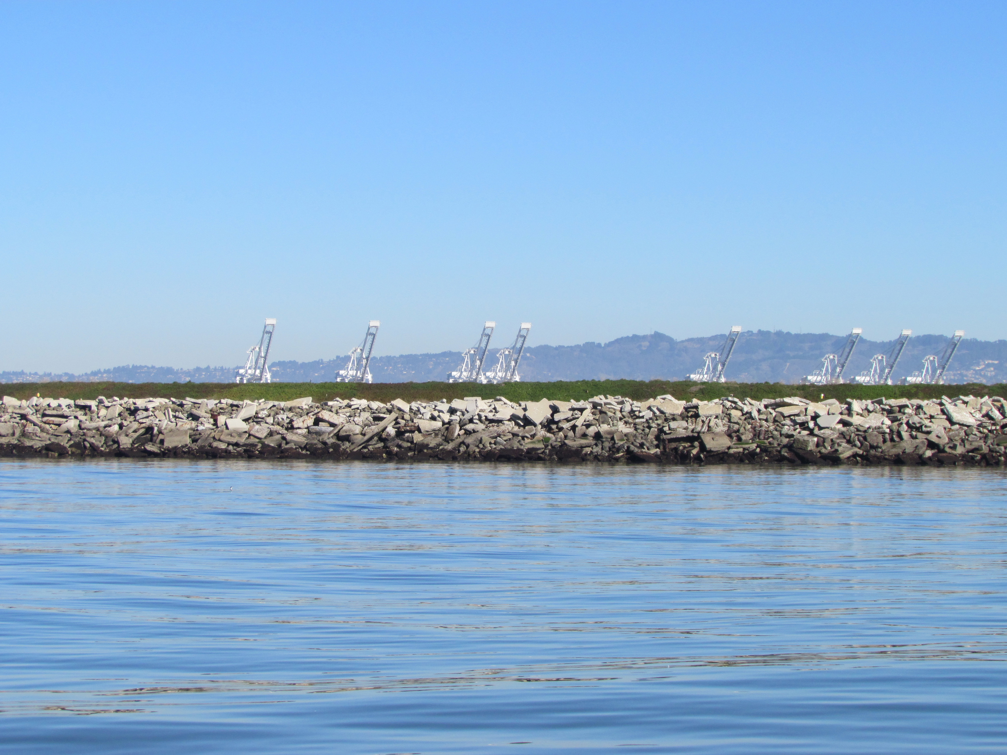
Northwest tip of Alameda Point. Waste burning area is immediately to the right of trees. Port of Oakland is in background.
It was the 1950s, before the environmental movement of the 1970s and the laws that followed in its wake. Hauling waste materials out to the western shoreline of Alameda Point to be burned and bulldozed into the Bay was not considered irresponsible. The “Burn Area,” as it is called, lies next to the shore near the entrance to the Oakland Estuary.
Burn Area on Site 1. San Francisco Bay to the left. Oakland Estuary to the north.
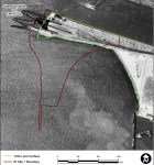
By 2009, the Navy was ready with a plan to finally remove several acres of contaminated Burn Area soil and haul it away. In 2010, testing by the cleanup contractor preparing to do the work, however, revealed additional burn residue that extends over a longer area and under the shoreline slope. The new information triggered a complete re-evaluation of the plan.
Excavation and removal at the greater depth and under the shore would drive the cost up from the original $5 million to $40 million. Fortunately for the Navy, a new and lower cost option became available just as the Navy and regulatory agencies were gathering more soil and groundwater data and discussing options.
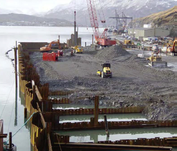
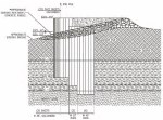
In 2011, the US Army Corps of Engineers approved a shoreline steel containment system called an “open cell vertical confined disposal facility.” Primarily used for harbor and waterway reinforcement and as a containment area for dredge sediment, the system is also suitable for permanently isolating and containing the toxic burn material along several hundred feet of Bay shoreline. This option will cost $13 million.
Open cell sheet pile containment system under construction at Dutch Harbor, Alaska. The same system is proposed for the Alameda Point Burn Area. Photo source: US Army Corps of Engineers 2011 report.
The Navy calls the open cell system a “waste isolation bulkhead.” It consists of a wall of interlocked steel plates embedded in the earth along the shoreline. Perpendicular steel walls extend toward the shoreline to form cells, or compartments, and provide anchorage. The absence of welding to hold the system together allows it to flex without failing and eliminates the problem of welds corroding.
Tests around the Burn Area were conducted in 2010, 2011, and 2012 to determine if any of the chemicals in the burn residue were entering San Francisco Bay. None were found to be entering the Bay. Nevertheless, the Burn Area’s proximity to the Bay requires that it either be removed or permanently isolated.
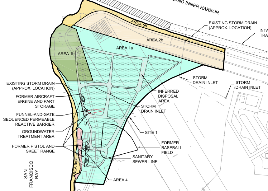
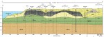
The Burn Area is located on the 37-acre Site 1 cleanup area. The site includes about a half dozen unlined underground pits that were used for waste disposal and are now partially covered by runway pavement.
Site 1 landfill map. Area 1b is the Burn Area as it was originally configured. Click to enlarge.
Cleanup of asolvent plumeon Site 1 that posed a potential threat to the Bay took place last year. Previous cleanup on the site included removal of debris and soil contaminated by radium-226 used in painting luminescent aircraft dials.
When the Navy is finished with the Burn Area bulkhead barrier, the Burn Area will again be tested for radiological contamination. All 37 acres of Site 1 will then be covered by at least two feet of clean soil and seeded with native grasses.
Site 1 will be available for passive recreational use as part of the proposed 147-acre regional park along the northern shoreline. Site 1 will be part of the final conveyance of land to the city slated for 2019. The VA’s property is adjacent and to the south and east.
The Navy’s project manager along with the cleanup contractor for Site 1 will be present at a special public meeting to answer questions and take comments on the new proposed plan for the Burn Area. The meeting is on April 9 at the Alameda Main Library, 1550 Oak Street, from 6:30 pm to 8:00 pm.
The Navy’s recently-completed soil and groundwater study for the Burn Area is called aFocused Feasibility Study(FFS) and is located on the state Envirostor website.
The FFS is very large and is divided into parts. Recommended parts to look at first:
Part 1, Part 3 (cool maps), Part 4 (mostly raw data, but has trench photos), and Part 8 (descriptive letters from PND Engineers that own the patent on the open cell system, and all the comments by the regulatory agencies and the responses to comments.) Part 5 has a lot of technical data and description of the groundwater model in relation to the Bay.
Reference material on the open cell barrier proposed for the Burn Area:
Overview of the Open Cell Confinement Disposal Facility system byPND Engineers.
2012reportto the Alaska Legislature on the Open Cell system.
Image highlights from the Focused Feasibility Study for the Site 1 Burn Area
Click on images to enlarge.
1939 Land Surface – Site 1
1946 Land Surface – Site 1
2010 Land Surface – Site 1
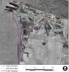
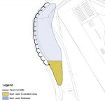
Updated Burn Area shape – Site 1
Gold area is part of the newly discovered burn material. This relatively thin area will be dug up and placed in the main burn area behind the bulkhead barrier.
Well locations for groundwater testing.
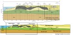
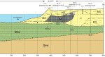
Geologic conceptual model – Site 1
Geologic model cross section – hand drawn
Geologic cross section. Charcoal area is the burn material.
Burn Area geology legend
Charcoal-colored area is the burn residue and debris.
Sheet pile bulkhead drawing for containing the Burn Area at Site 1.