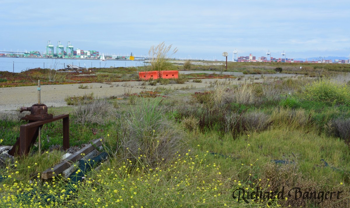
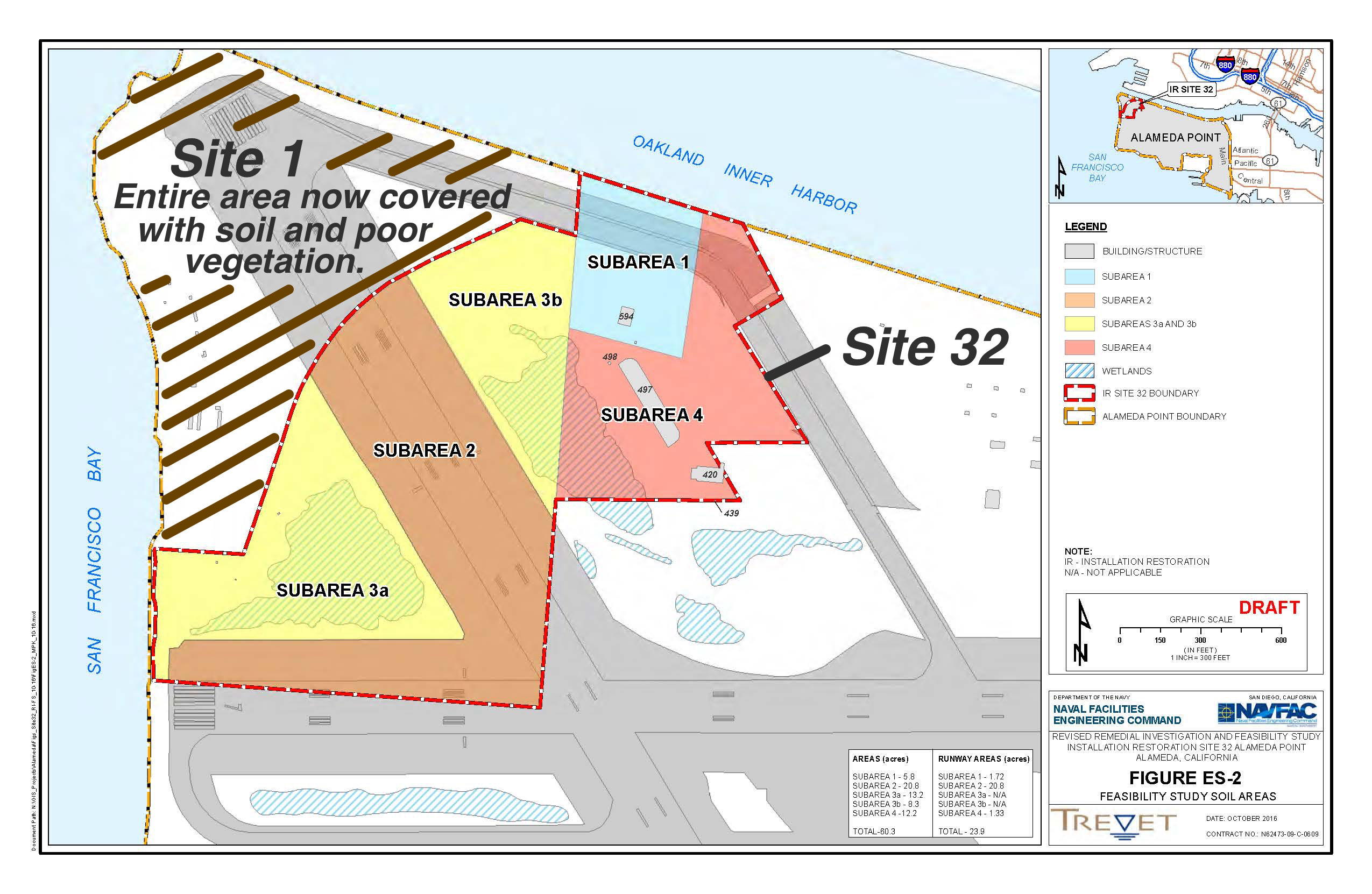
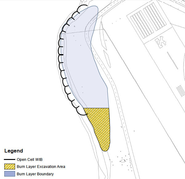
The Navy will present options on possible ways to clean up 60 acres at Alameda Point slated for a regional park on Thursday night. The draft cleanup options for Site 32 represent the culmination of 25 years of groundwater and soil studies that began before base closure was announced. Only five acres have been flagged for cleanup, but uncertainty about what lies beneath the pavement and structures requires a conservative approach.
The site lies in the northwest portion of the old airfield along the Oakland Estuary and features open grassland, seasonal wetlands, runway, a large concrete bunker and two buildings. Input from the community and regulatory agencies on the cleanup plan will have a major impact on the design and use of the future park.Continue reading “Navy presents parkland cleanup plans”
The City of Alameda became the new owner of the Seaplane Lagoon at Alameda Point on April 13, 2016. It came from the Navy with a new condition that exceeds normal protocols for dredging in San Francisco Bay.
As with all cleanup sites, the Navy, city and regulators agreed to what areas needed to be cleaned up in the Seaplane Lagoon. The cleanup plan approved in 2006 was based on testing the sediment throughout the 110-acre lagoon. The problem areas were confined to about 10 acres at the northeast and northwest corners of the lagoon where storm sewers dumped contaminants prior to 1970s environmental laws. The agreed upon plan said that there would be no restrictions on the lagoon when cleanup was done.
Dredging the northwest corner of the Seaplane Lagoon in February 2012.
After cleanup was completed, two years of discussions between the Navy, state and federal regulators, and the city led to an amendment to the official cleanup decision to include a detailed management plan for any future dredging in the Seaplane Lagoon. The city led the effort to create a sediment management plan. It stipulates that all dredge sediment brought to the surface will have to be spread out six inches thick on a drying pad and scanned for radium-226 radiation at a cost borne by the city.Continue reading “Radium safety enhanced at Seaplane Lagoon”
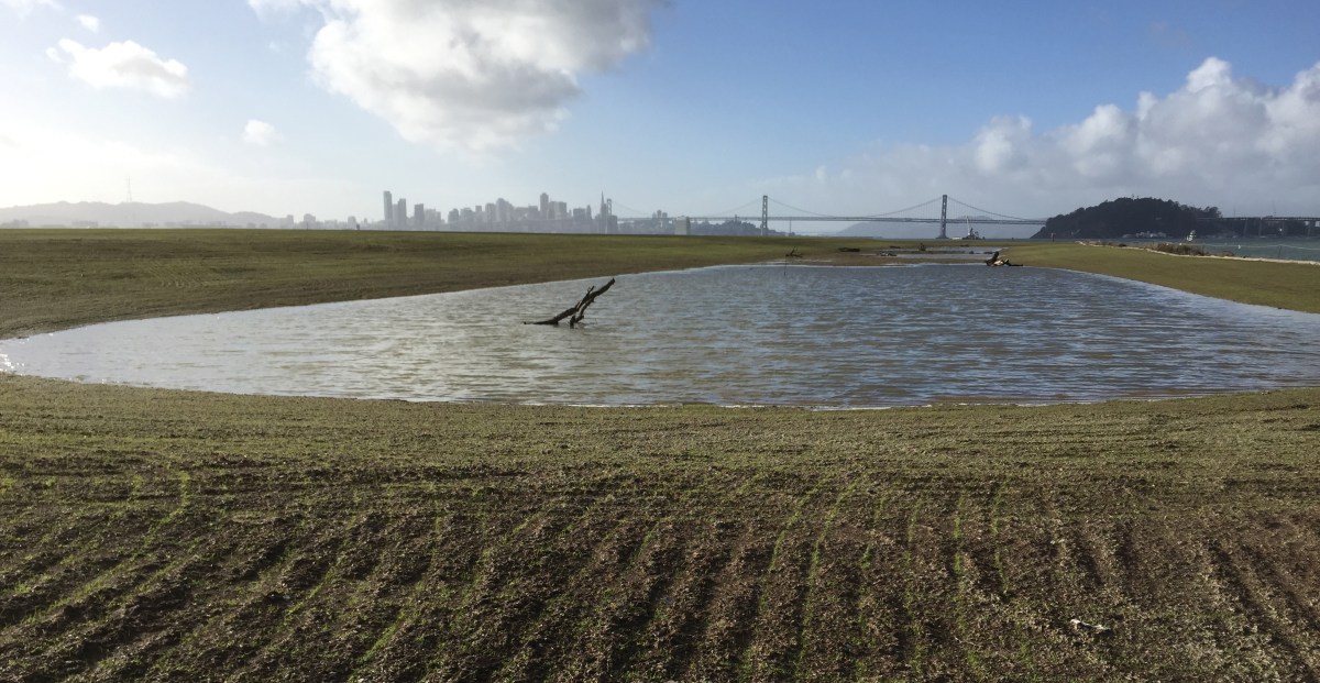
The Navy’s cleanup program has not only removed toxic substances from below ground, it has dramatically improved some of the above ground environment by creating new native grassland and wetlands. January rains filled the Navy’s new seasonal wetland on the northwest shoreline corner of Alameda Point and fostered growth of newly planted native grass seed on the surrounding soil.
New Site 1 wetland on January 13, 2016, with San Francisco in background. Rows in soil with emerging growth were created during sowing of seeds. Navy photo.
The 2.25-acre wetland lies within an approximately 37-acre shoreline cleanup area known as Site 1 at the confluence of the Oakland Estuary and San Francisco Bay. It is where the Navy buried its waste between 1943 and 1956. Most of the waste pits were covered by pavement in the mid-1950s when a new runway was added.Continue reading “Navy adds a wetland and grassland”
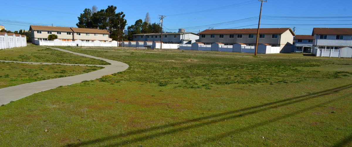
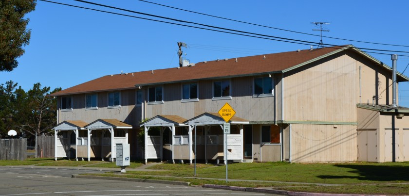
The vacated residential area known as North Housing—located between Alameda Point and Alameda Landing—has been deemed environmentally safe for transfer out of Navy hands. The approval comes after a four-year effort to clean up groundwater to drinking water standards was declared unnecessary and terminated.
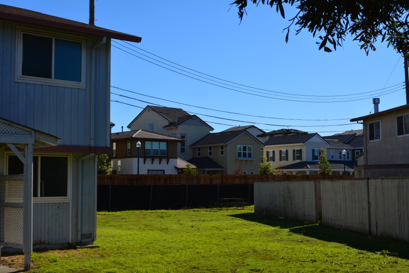
Center courtyard in former Navy housing area called North Housing. Looking north/northeast.
The original overly cautious risk assumption in the 2007 cleanup plan—that humans might somehow ingest the salty groundwater 10 to 20 feet below the surface—is now seen as implausible. The vapor extraction system covering a six-acre area of benzene and naphthalene-contaminated groundwater was dismantled in 2014 after a new round of tests showed that there is no evidence of harmful vapors rising to the surface.
The land was originally slated for transfer to the Coast Guard. But the Coast Guard decided in 2008 that it no longer wanted the property. The Navy and the city then worked out a plan that incorporates a federal requirement for homeless accommodation and a for-profit development.
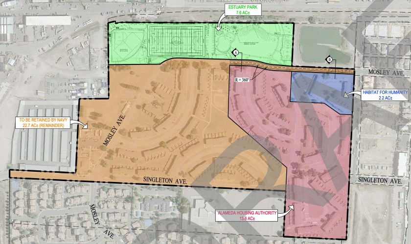
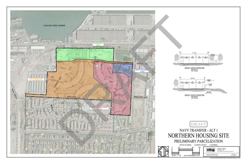
The 22.7 acres slated for auction to a private developer will be tagged with utility infrastructure costs—streets, drainage, utilities—on all of the North Housing area, except for the Housing Authority’s 13.6 acres and Habitat for Humanity’s 2.2 acres. The Housing Authority and Habitat for Humanity will be responsible for bringing new utility services from the nearest street to their housing units.
Draft map prepared by the city of Alameda showing proposed Housing Authority, Habitat for Humanity, and private developer parcels. Pending final approval. Dusty rose area going to Housing Authority, blue to Habitat for Humanity, tan to private developer. Click on map to enlarge.
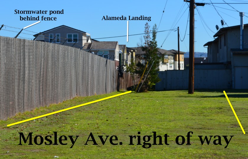
Mosley Avenue will be connected between Alameda Landing and North Housing with 360 feet of new roadway.
In 2013, the Navy turned off its air pump and carbon filter vacuum cleanup system to see if it made any difference in the concentrations or movement of contaminants. It didn’t.
But before the U.S. Environmental Protection Agency (EPA) would sign off on a permanent shutdown of the cleanup system, it wanted a new set of tests at ground level to ensure there is no risk of harmful vapors. The Navy conducted tests inside the vacant housing, in the crawl spaces, and under the parking lot and basketball courts at the former Island High School property. The negative results satisfied the EPA.
In April the Navy officially amended its original 2007 Record of Decision cleanup plan, with regulatory agency concurrence, citing new evidence. It also cited city, county, and state regulations that prohibit intrusive activities and specifically prohibit well installation in the shallow groundwater where the contamination is located. The cleanup plan amendment said that results of the evaluations of extensive data for this cleanup area “show that there is no unacceptable risk for current residential and school uses and any potential future land uses.”
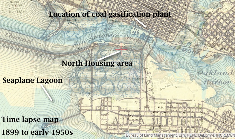
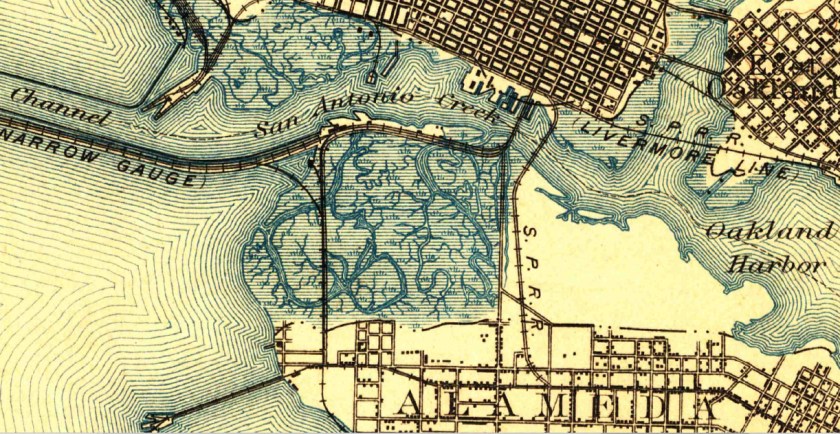
The amended plan also cited new evidence that suggested the contaminants were part of what is called the Marsh Crust at around 20 feet below ground and essentially stuck there. The Marsh Crust is a layer of “hydrocarbon gunk” that Oakland Gas Light Company’s coal gasification plant discharged from about 1880 to 1910. The waste discharges went into what was then San Antonio Creek, and much of it settled on the nearby marshland where North Housing now sits.
Time lapse map showing former marshland where North Housing is now located. Source: US Geological Survey Historical Topographic Map Explorer.
The land was never cleaned up before being filled in for use as San Francisco Bay Aerodrome—hangars and two runways—from 1930 to 1941. The Marsh Crust extends from the Oakland Estuary to Bayport and over to central Alameda Point. A city ordinance requires a permit before digging into the Marsh Crust to ensure safe handling.
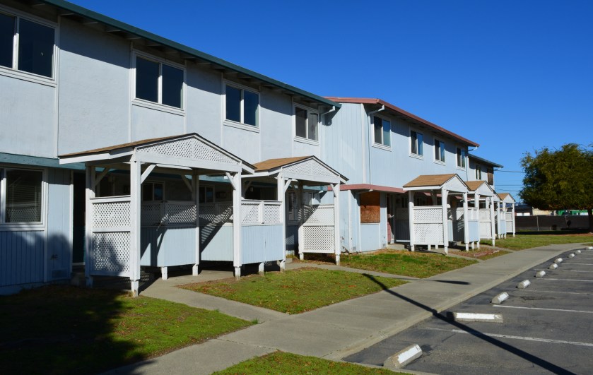
The 37-acre North Housing area lies adjacent to the new Alameda Landing residential neighborhood. The site currently contains 51 residential structures with 282 three- and four-bedroom units constructed in 1969. With the possible exception of the two acres going to Habitat for Humanity, all of the units will be demolished to make way for new construction.
Future Housing Authority property, with new Alameda Landing houses in the background.
The Housing Authority will build 90 units of supportive housing that will include a community center.
It is not yet determined what Habitat for Humanity will do with its parcel. The private developer area is currently zoned for 315 units of multifamily residential housing and may exceed that number if the density bonus is applied for.
The transfer of properties is expected in 2016. The auctioning of the for-profit North Housing Navy property will follow, but no firm timeline has been announced.
Edited version of article first appearing in the Alameda Sun.
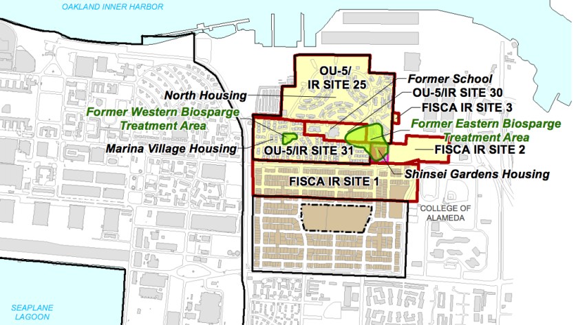
Map showing two groundwater cleanup areas in OU-5.Control module with pumps for groundwater cleanup system waiting to be hauled away from North Housing.Charcoal filter tank to remove benzene and naphthalene from groundwater vapors, waiting to be hauled away.
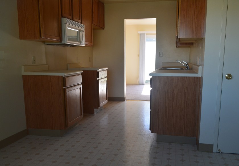
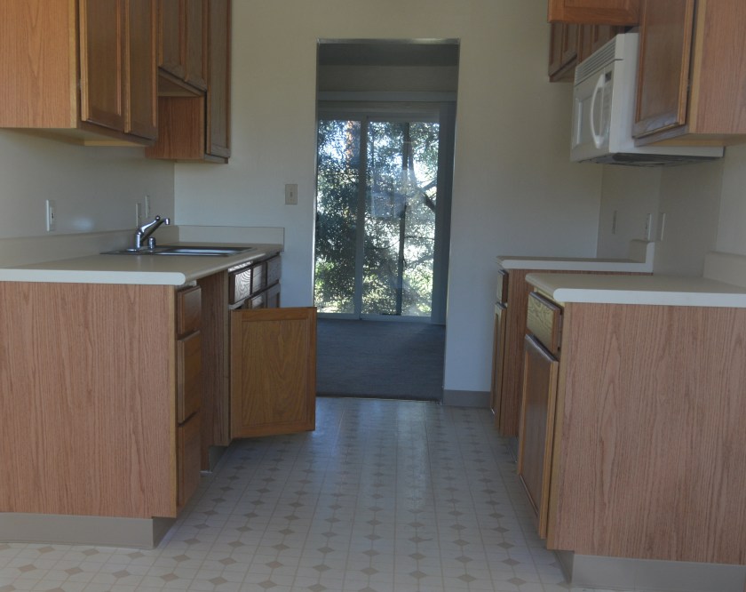
Typical current condition of North Housing interiors.Typical current condition of North Housing interiors. Photo date: November 19, 2015.
Draft North Housing site map, with Mosley Avenue connection details. Click on map to enlarge.1899 topographical map of western Alameda showing marshland. Source: US Geological Survey Historical Topographic Map Explorer.
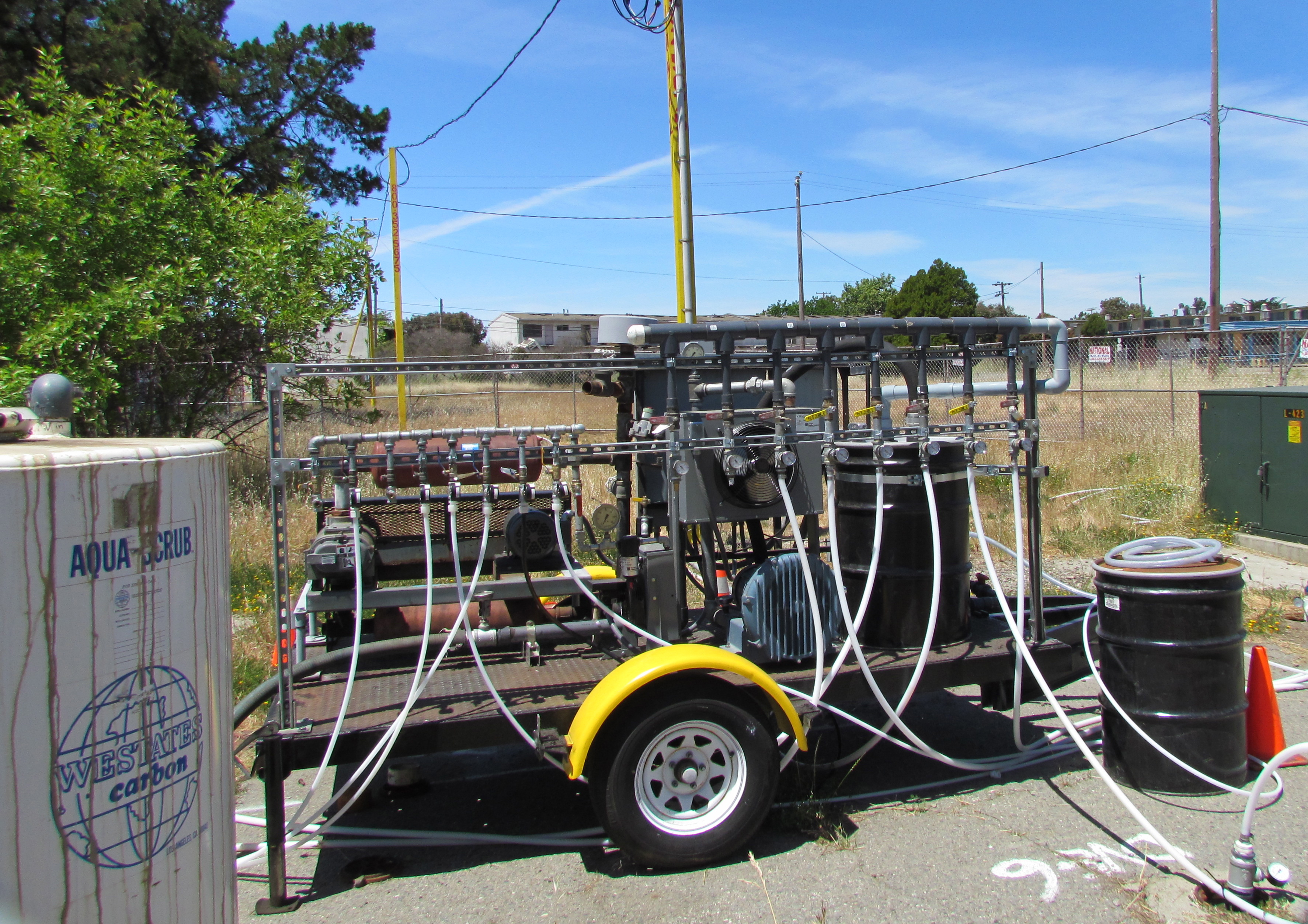
The Navy has spent more than 15 years cleaning up contaminated groundwater underneath two former gas station sites at Alameda Point. They are still at it, but it’s not because the Navy is slow or lacking in commitment and expertise. It’s the nature of groundwater cleanup, which involves intermittent treatment efforts.
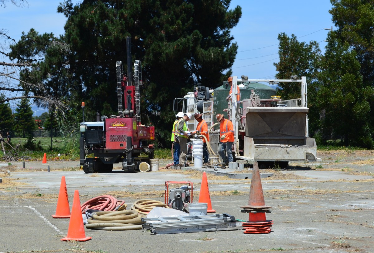
In July, the Navy’s contractor returned to the old gas station and car wash site on West Pacific Avenue at Main Street and to the old commissary gas station site at West Tower Avenue and Main Street across from Bayport. It’s the third visit to these sites to eliminate petroleum hydrocarbon contamination in groundwater, in addition to earlier removal of underground tanks, fuel lines, and soil. The contaminants are located from 2 to 16 feet below ground surface.
Workers at the old gas station and car wash site on West Pacific Avenue on July 13, 2015 preparing to inject cleanup solutions into the ground. The Navy operated a gas station and car wash on the site from 1971 to 1980. Green tank on truck contains non-potable water for on-site mixing of treatment solution. Soccer field is in the background.
The goal is to bring the property up to the public health and environmental standards required for the future commercial and residential uses previously determined by the city.
“When groundwater contamination is involved, such as at the two former gas stations, cleanups often involve multiple phases, each building upon earlier accomplishments,” said Dr. Peter Russell, who has been reviewing Navy cleanup plans and preparing cleanup-related documents on behalf of, and at the direction of, the city since 1997. “As long as all imminent health and environmental risks are eliminated early on, often the most cost-effective approach to complete remediation is incremental,” explained Russell. “In contrast, a massive initial remedial effort that is sure to achieve all remedial goals in one pass would likely involve over-sizing the treatment system, which is more disruptive and expensive than a phased approach.”
During previous cleanup visits, the Navy used a vapor extraction system to remove the bulk of the petroleum contamination. The process involves pumping air into numerous pipes, called wells, which extend into the water-saturated zone where the contamination is. The air pressure creates vapor that is part air, part water and part petroleum. The vapor is then sucked out through another set of wells, and the petroleum vapors are captured in drums of granulated charcoal, while the water is shunted off to a separate container.
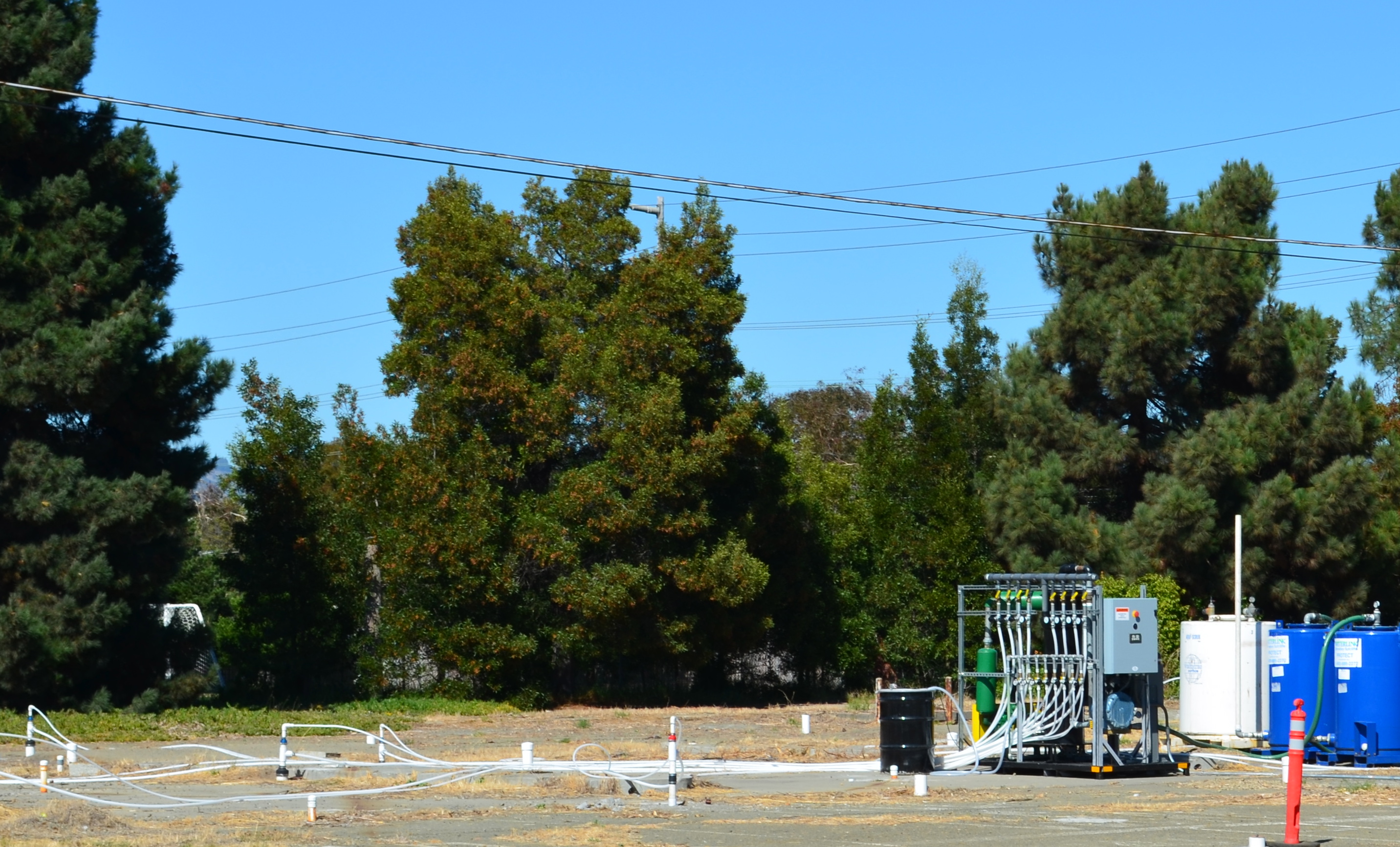
Air injection/extraction system operating at W. Pacific Avenue gas station site in 2013 and 2014. System extracts and captures petroleum vapors.
The method of blowing bubbles in mud and sucking out the air sounds unsophisticated, but it works. After running the system in 2013 and 2014 at the West Pacific Avenue gas station site, for example, the level of one contaminant, benzene, went from around 1,000 micrograms per liter down to 58, bringing the contamination low enough to allow indigenous bacteria to finish the job.
Air injection and vapor extraction system operating at former commissary gas station site in May 2013. Charcoal tank to capture vapors is at left.
The Navy returned to these sites in July and, in this phase, they came to help natural bacteria finish up the job. Allowing bacteria to clean up petro chemicals through natural digestion is called bioremediation. To be effective and not take a century to eliminate the problem, the bulk of the chemicals need to first be reduced to concentrations that do not overwhelm the bacteria.
At both gas station sites the Navy used a special product designed to foster growth of natural bacteria in the ground, which includes a form of time-release peroxide that turns into oxygen over a period of 12 months. An oxygen environment is necessary for the bacteria to digest petroleum. The bacteria utilize the hydrocarbons (hydrogen and carbon) in the petroleum chemicals as part of their metabolic processes and convert them into carbon dioxide, water, and microbial cell mass. Water samples will be taken at three, six, and nine months after the July injections to evaluate effectiveness.
“The Navy’s gas station remedial program is comparable to the private sector gas station cleanup program,” said Yemia Hashimoto, Engineering Geologist with the San Francisco Bay Water Board. “The cleanup requirements are similar and the required timelines for project completion are similar.” The Water Board is a California state agency and is the lead regulatory agency overseeing the Navy’s petroleum cleanup program.
The other type of groundwater contamination encountered at Alameda Point comes from a chlorinated solvent used in cleaning aircraft parts. Unlike lighter-than-water petroleum products, chlorinated solvents can sink through the upper water zone to a depth of 30 feet or more and complicate cleanup. But solvent cleanup still relies on a phased cleanup approach, often employing bacteria in the final phase.
Navy environmental cleanup operations at Alameda Point ran the gamut during the summer and fall of 2014.
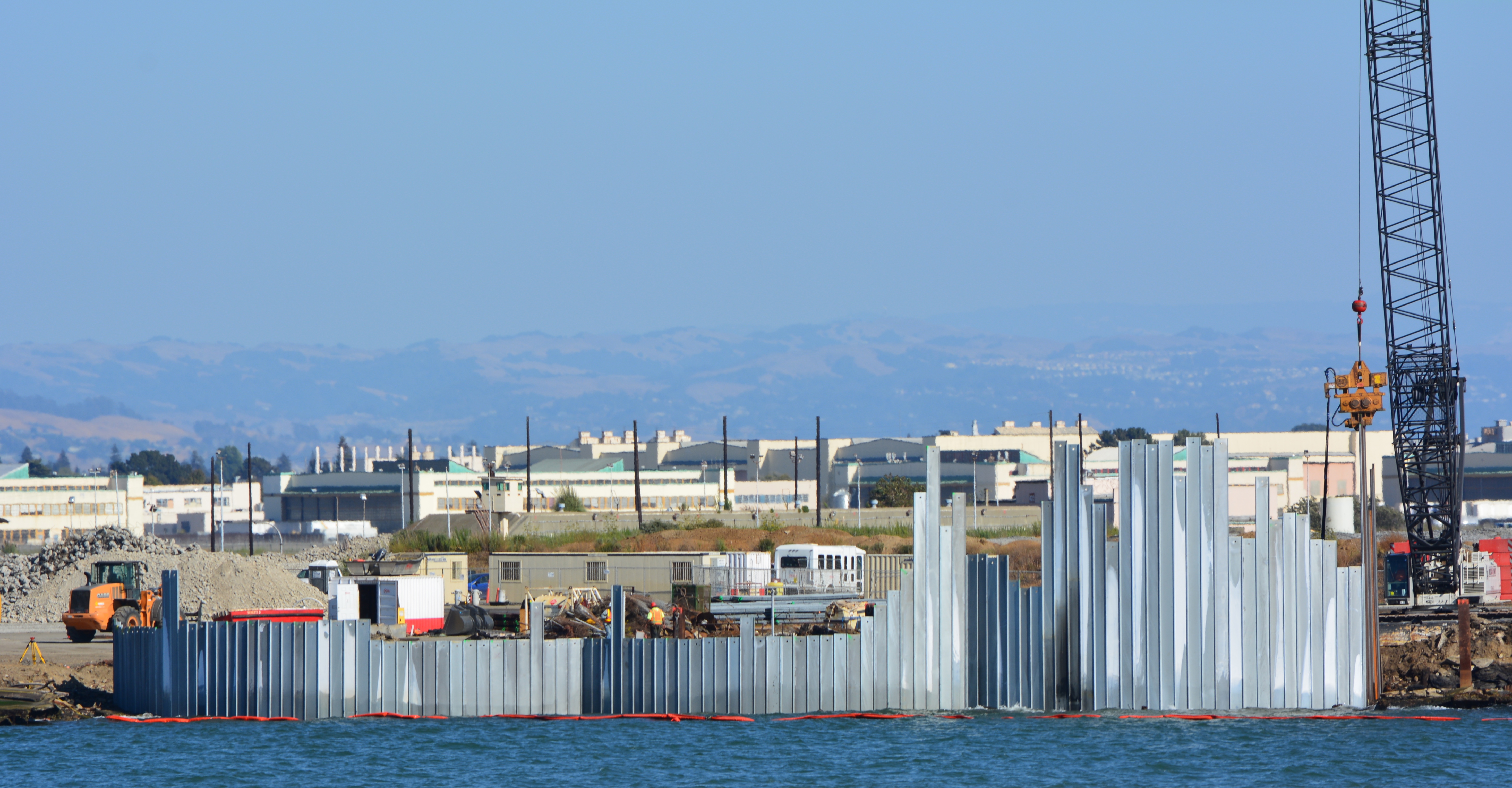
Operations included using bacteria to clean up groundwater, grinding radium out of a building floor, digging up lead-contaminated soil, constructing a metal shoreline waste barrier, digging up shoreline waste, preparing to install a 30-acre soil cover, constructing a new shoreline wetland, checking drain lines for contamination with cameras, and demolishing a several-acre temporary concrete drying pad near the old Control Tower.
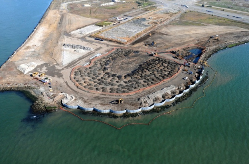
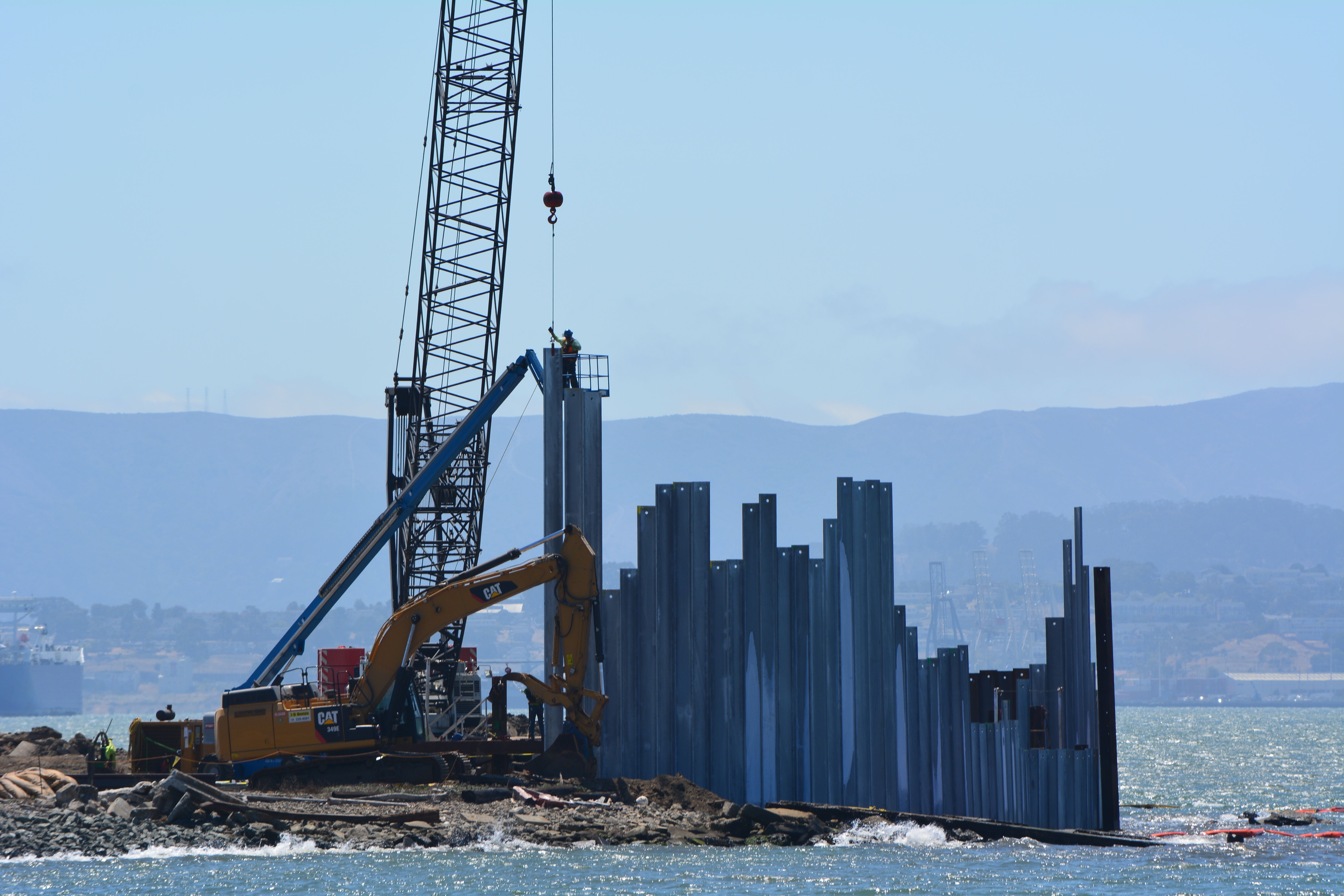
Aerial view of Site 1 cleanup area at northwest tip of Alameda Point, showing newly installed waste isolation barrier along Bay shoreline, piles of contaminated soil in horseshoe shaped area that were excavated from watery pit on right, and stockpiled soil on old runway to be used for soil cover. A wetland area will be constructed on clear strip on left along Oakland Estuary. Navy photo.
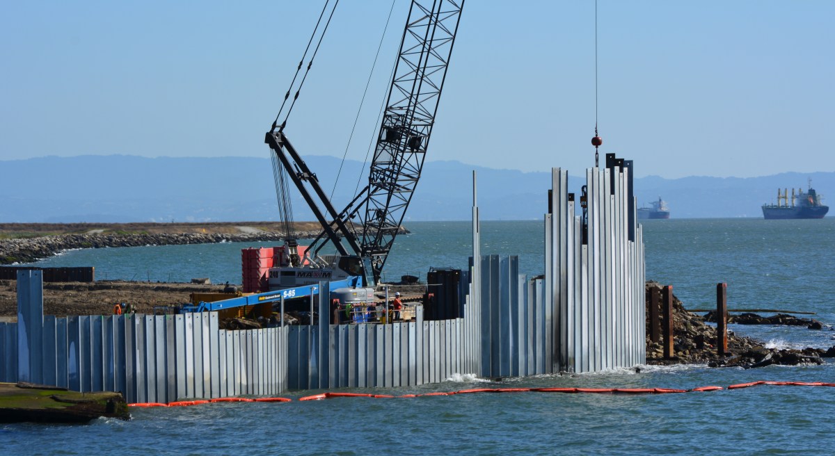
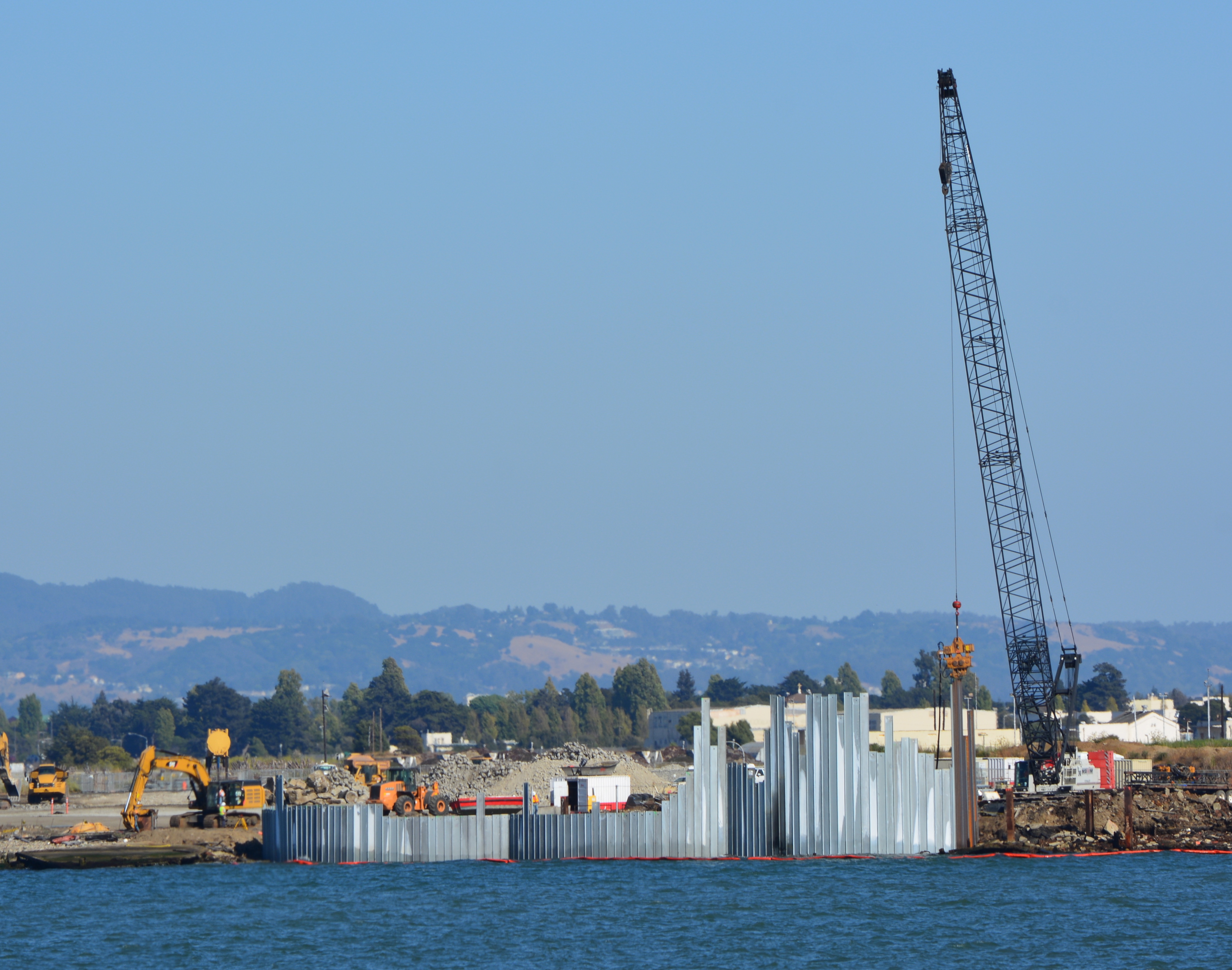
The Navy began embedding a steel barrier along several hundred feet of the western shoreline of Alameda Point during the week of August 18. The purpose of the barrier is to contain contaminated ash and burn waste material that was bulldozed into the Bay some 60 years ago and is now overlain with silt. The area is where the Navy burned various waste materials.
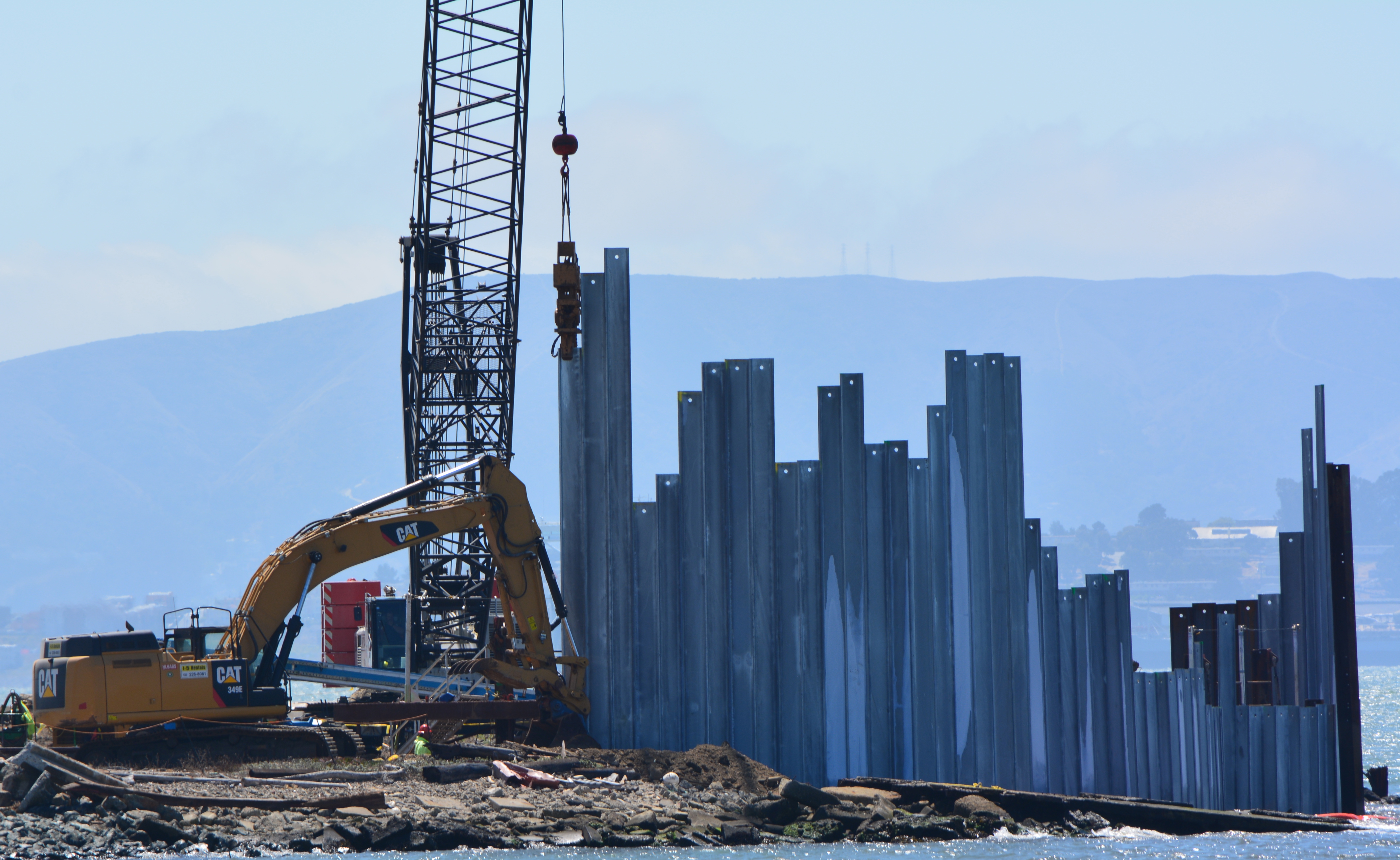
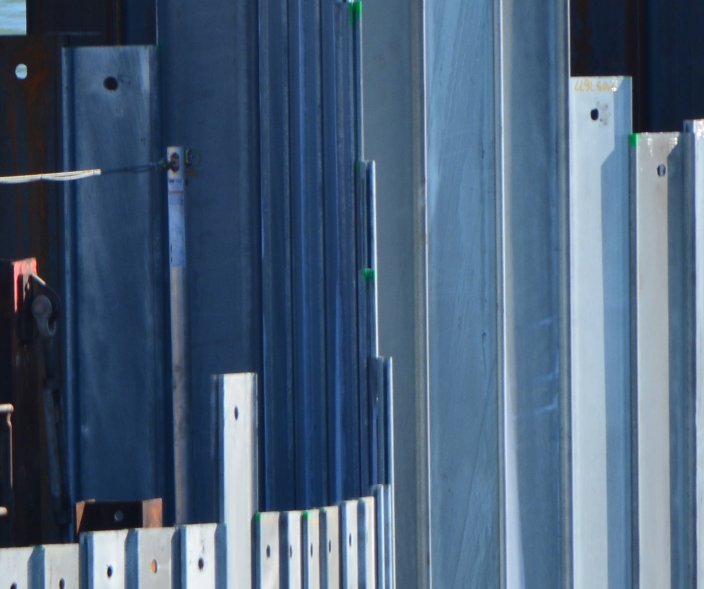
Three of the waste isolation cells under construction at northwestern tip of Alameda Point. A total of 15 cells, each one separated by a wall behind the face of the barrier, will be constructed here.
The containment system is called a waste isolation barrier. It consists of 35-foot-long interlocking steel pilings that are hammered into the ground with a hydraulic vibrator suspended from a crane cable. Perpendicular steel walls behind the barrier add stability. The final elevation of the top of the waste isolation barrier will be approximately 10 feet above mean sea level.
A worker guides one of the galvanized steel pilings into place as crane operator maneuvers.
Tests around the area were conducted in 2010, 2011, and 2012 to determine if any of the chemicals in the burn residue were entering San Francisco Bay. None were found to be entering the Bay. Nevertheless, the Burn Area’s proximity to the Bay requires that the contaminated waste either be removed or permanently isolated. Removing all of the waste from under the shoreline would have cost $40 million. The containment system costs $13 million.
Piling being slowly driven into the ground by a hydraulically operated vibratory hammer.
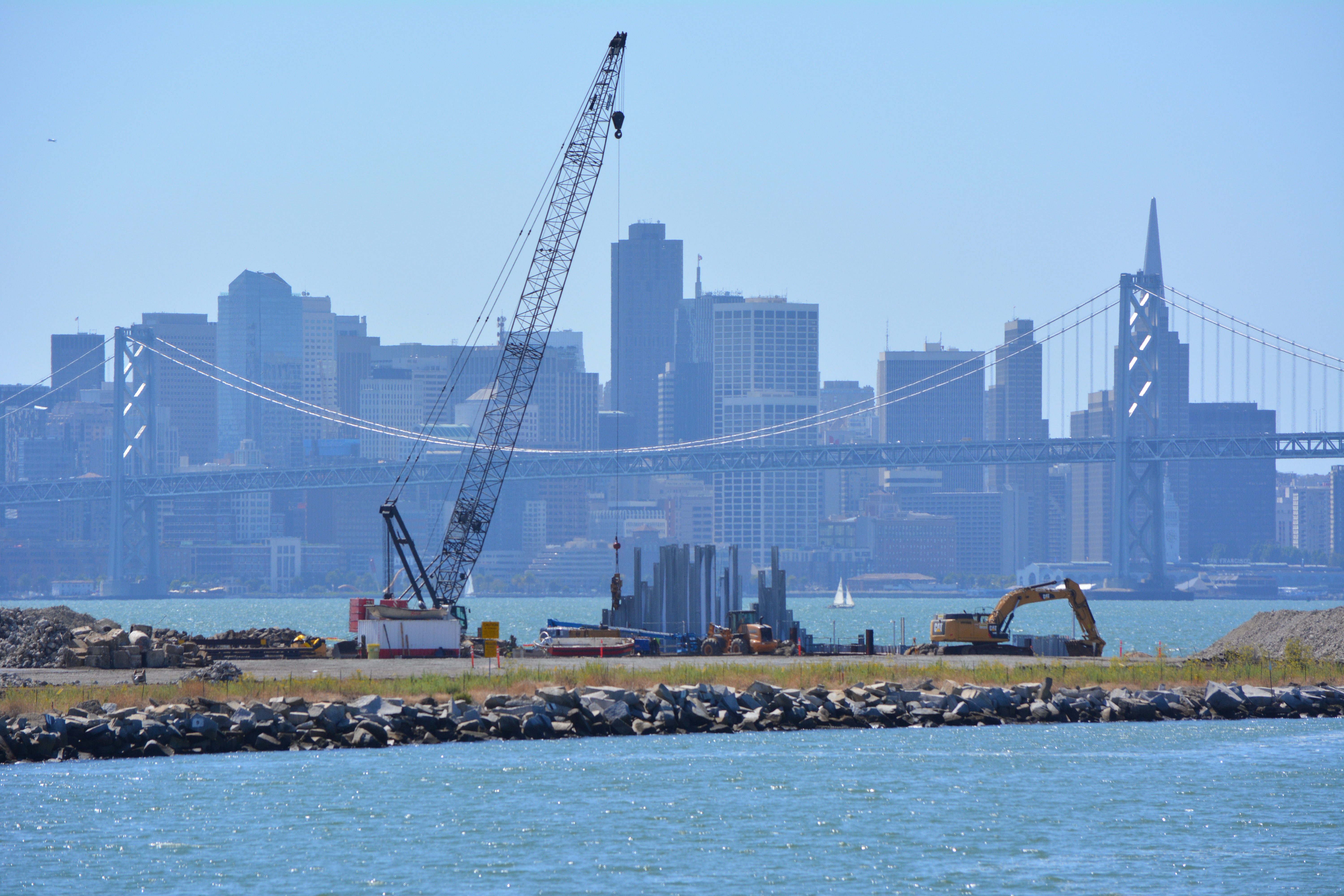
The construction of the shoreline waste barrier is part of a larger Navy cleanup project on the adjacent 37 acres, called Site 1, which was once used as an underground waste disposal area. Much of the area is now covered by runway pavement that will remain in place. The entire 37 acres right up to the steel barrier will be covered with three feet of clean soil and seeded with native vegetation. A small wetland area will also be created along the shoreline.
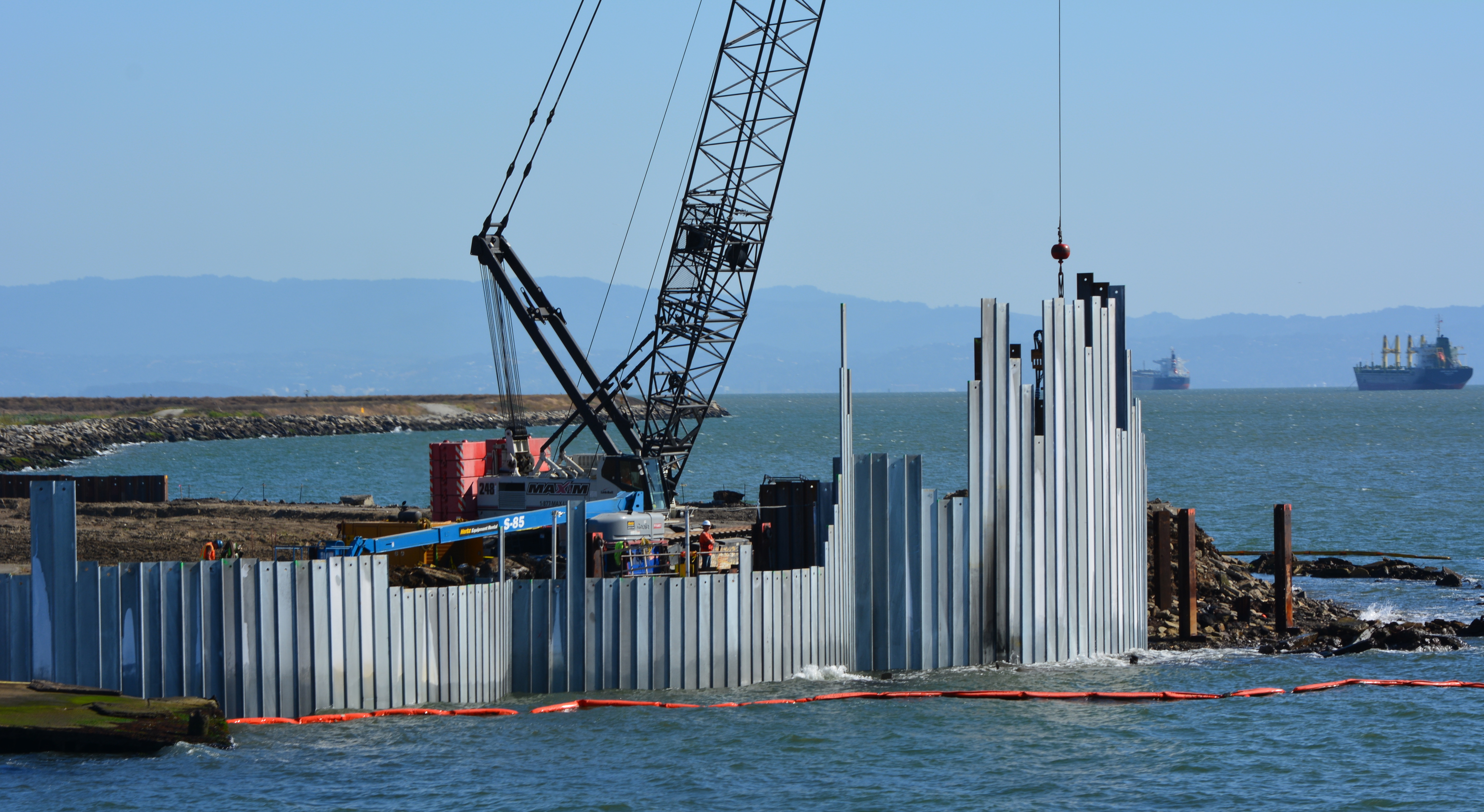
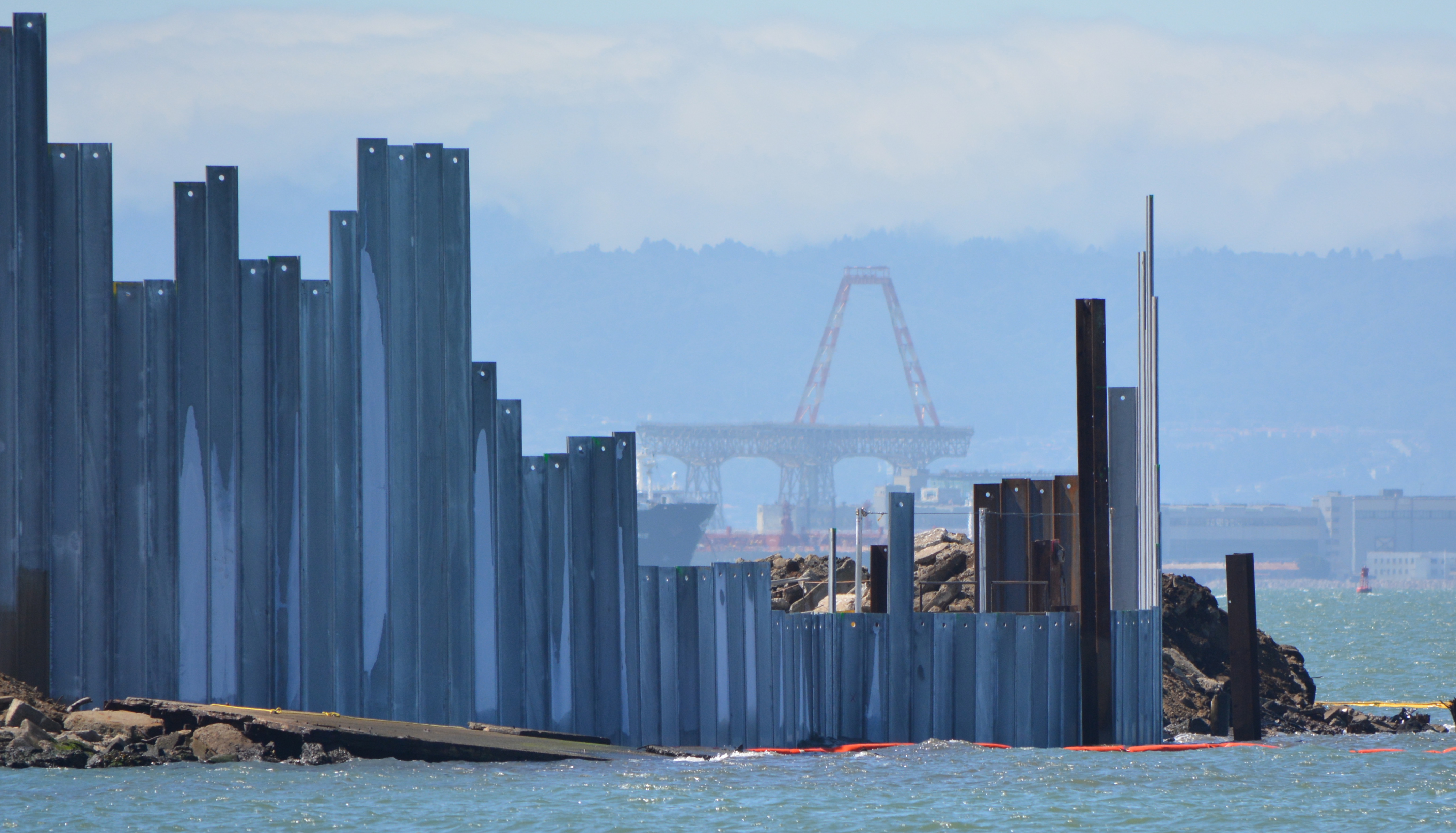
Site 1 cleanup project with crane. Oakland Estuary in the foreground and San Francisco in the background.
When completed early next year, the area will be suitable for passive recreational use, including the Bay Trail.
The work can be observed from the Oakland side of the estuary at Middle Harbor Shoreline Park right next to the cranes.
Background information can be found in this post from April 2013.
More photos and a diagram below
Waste isolation barrier will have 12 more cells to the right when completed.Diagram of shoreline waste isolation barrier at northwestern tip of Alameda Point. Navy diagram.