Cleanup plan changes at waste burning area

Northwest tip of Alameda Point.  Waste burning area is immediately to the right of trees.  Port of Oakland is in background.
Northwest tip of Alameda Point. Waste burning area is immediately to the right of trees.  Port of Oakland is in background.

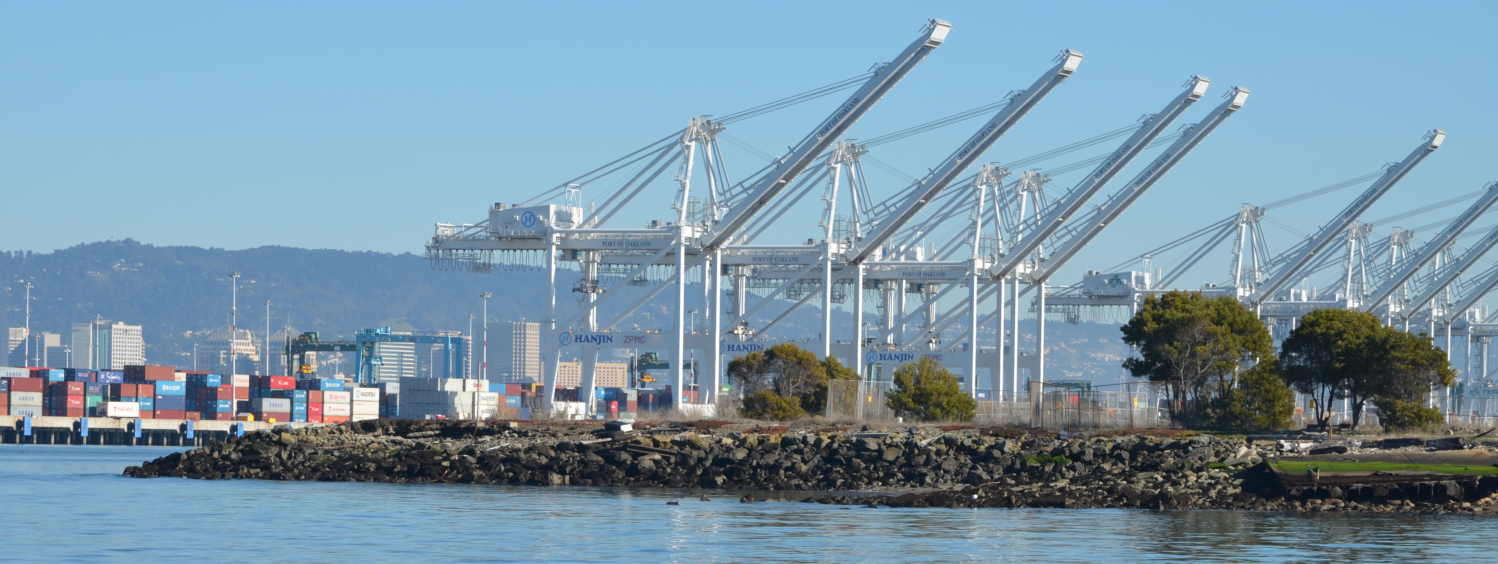
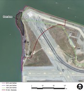
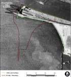
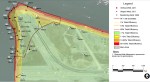
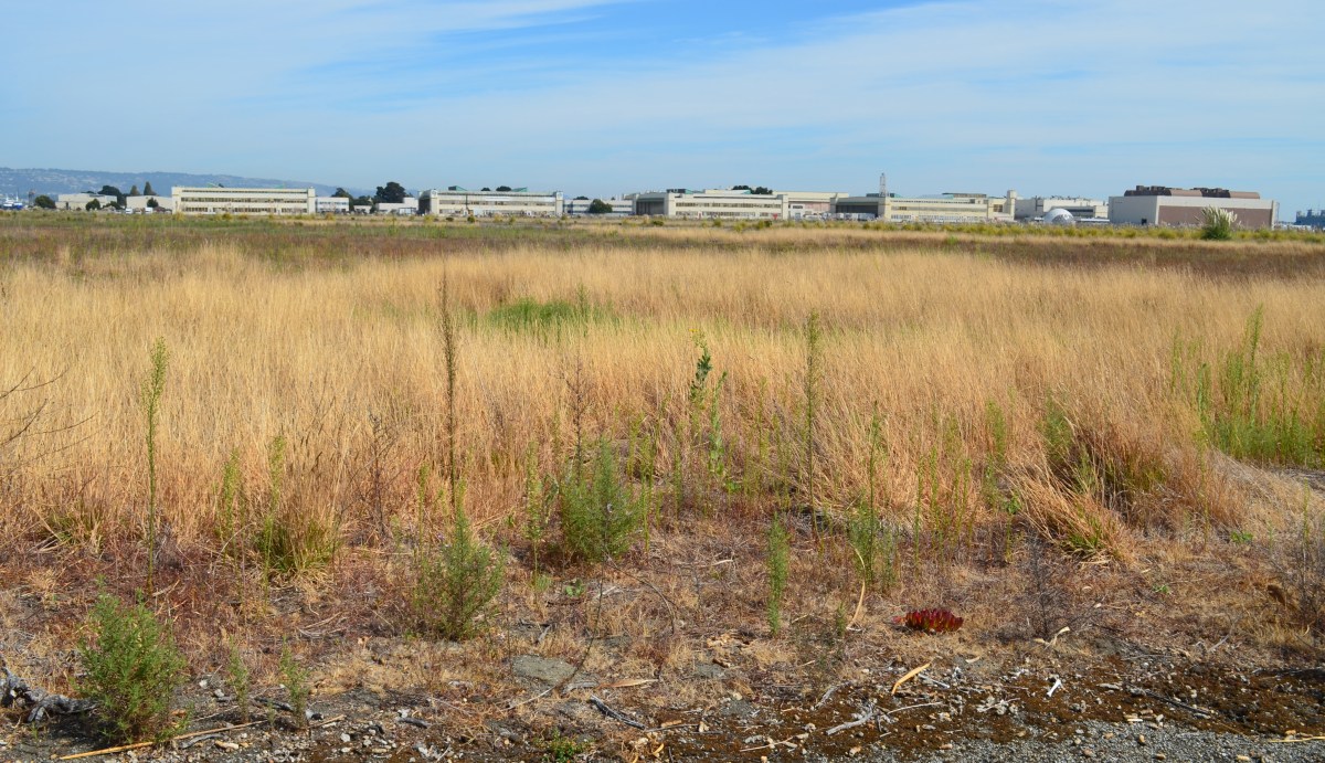
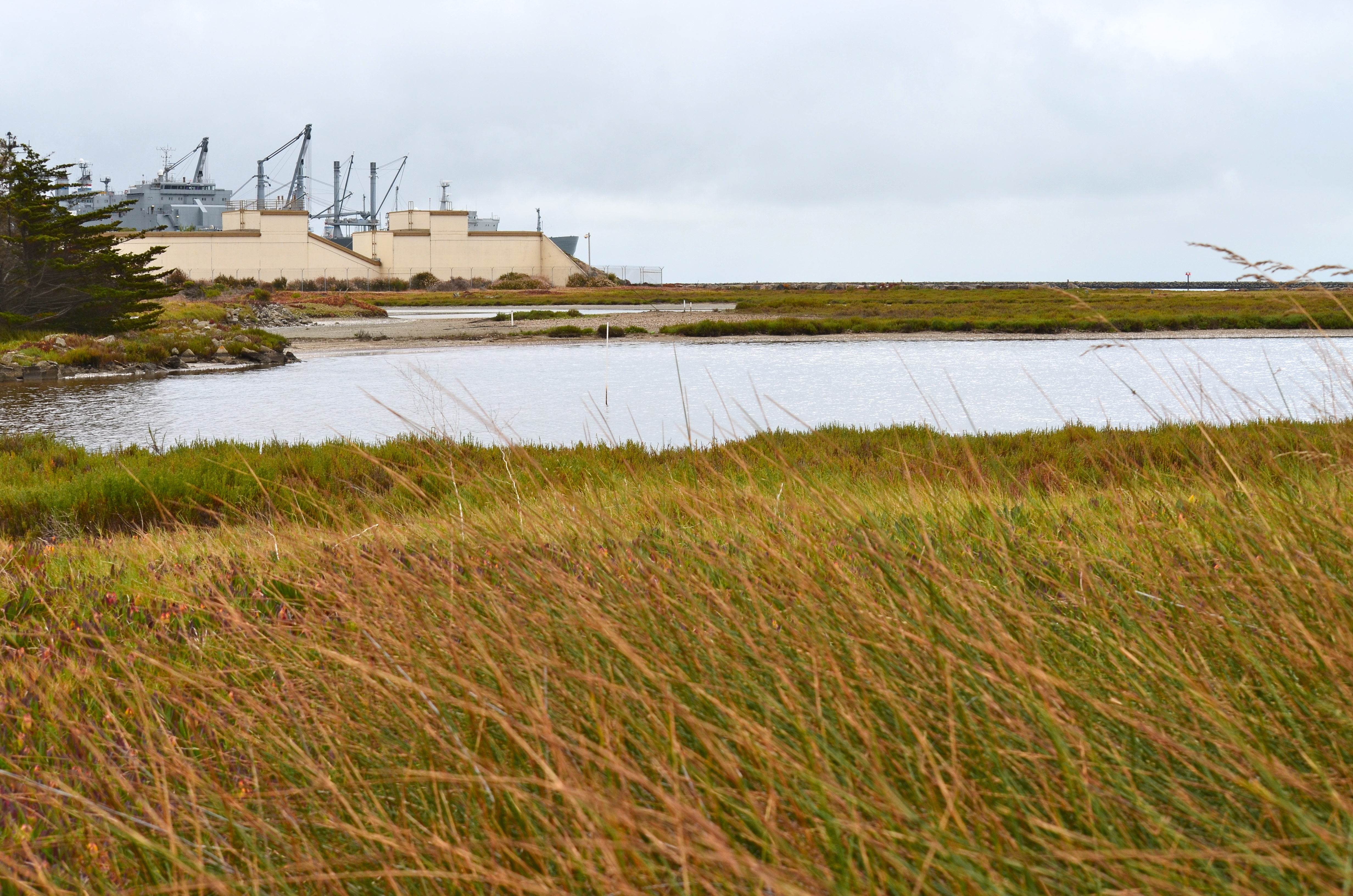
It was the 1950s, before the environmental movement of the 1970s and the laws that followed in its wake.  Hauling waste materials out to the western shoreline of Alameda Point to be burned and bulldozed into the Bay was not considered irresponsible.  The “Burn Area,” as it is called, lies next to the shore near the entrance to the Oakland Estuary.

Burn Area on Site 1.  San Francisco Bay to the left.  Oakland Estuary to the north.
Burn Area on Site 1. San Francisco Bay to the left. Oakland Estuary to the north.

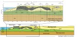
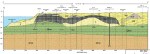
By 2009, the Navy was ready with a plan to finally remove several acres of contaminated Burn Area soil and haul it away.  In 2010, testing by the cleanup contractor preparing to do the work, however, revealed additional burn residue that extends over a longer area and under the shoreline slope.  The new information triggered a complete re-evaluation of the plan.

Excavation and removal at the greater depth and under the shore would drive the cost up from the original $5 million to $40 million.  Fortunately for the Navy, a new and lower cost option became available just as the Navy and regulatory agencies were gathering more soil and groundwater data and discussing options.

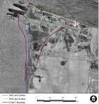
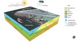
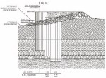
In 2011, the US Army Corps of Engineers approved a shoreline steel containment system called an “open cell vertical confined disposal facility.”  Primarily used for harbor and waterway reinforcement and as a containment area for dredge sediment, the system is also suitable for permanently isolating and containing the toxic burn material along several hundred feet of Bay shoreline.  This option will cost $13 million.

Open cell sheet pile containment system under construction at Dutch Harbor, Alaska.  Photo source:  US Army Corps of Engineers 2011 report.
Open cell sheet pile containment system under construction at Dutch Harbor, Alaska.  The same system is proposed for the Alameda Point Burn Area.  Photo source: US Army Corps of Engineers 2011 report.

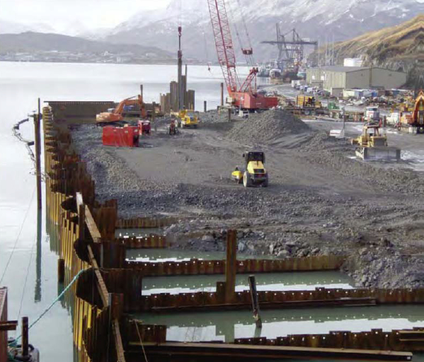
The Navy calls the open cell system a “waste isolation bulkhead.”  It consists of a wall of interlocked steel plates embedded in the earth along the shoreline.  Perpendicular steel walls extend toward the shoreline to form cells, or compartments, and provide anchorage.  The absence of welding to hold the system together allows it to flex without failing and eliminates the problem of welds corroding.

Tests around the Burn Area were conducted in 2010, 2011, and 2012 to determine if any of the chemicals in the burn residue were entering San Francisco Bay.  None were found to be entering the Bay.  Nevertheless, the Burn Area’s proximity to the Bay requires that it either be removed or permanently isolated.

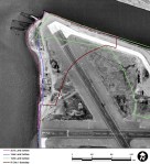
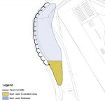
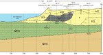
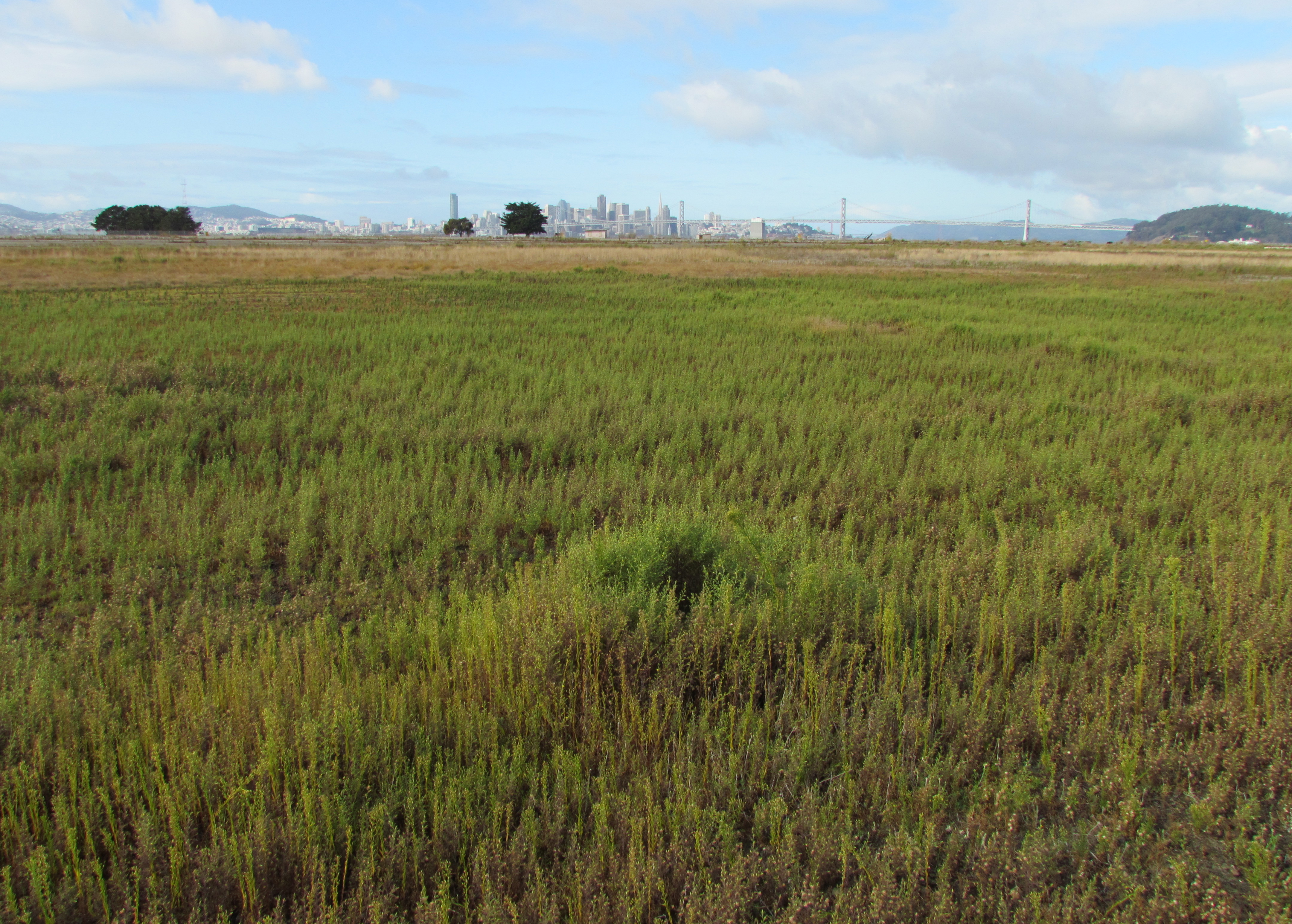
The Burn Area is located on the 37-acre Site 1 cleanup area.  The site includes about a half dozen unlined underground pits that were used for waste disposal and are now partially covered by runway pavement.

Site 1 landfill map.  Area 1b is the Burn Area as it was originally configured.
Site 1 landfill map. Area 1b is the Burn Area as it was originally configured.  Click to enlarge.

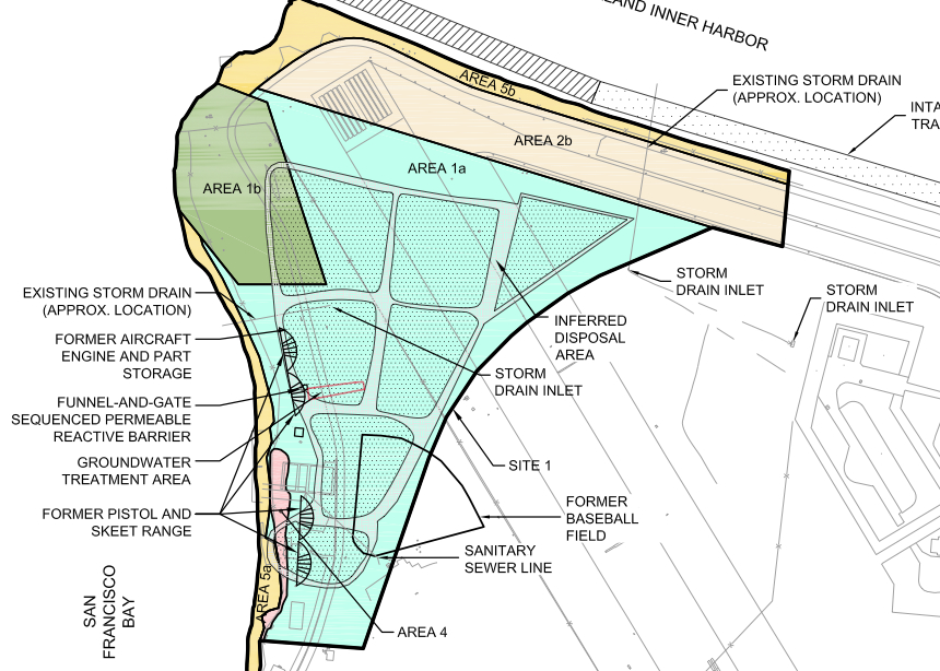
Cleanup of a solvent plume on Site 1 that posed a potential threat to the Bay took place last year.  Previous cleanup on the site included removal of debris and soil contaminated by radium-226 used in painting luminescent aircraft dials.

When the Navy is finished with the Burn Area bulkhead barrier, the Burn Area will again be tested for radiological contamination.  All 37 acres of Site 1 will then be covered by at least two feet of clean soil and seeded with native grasses.

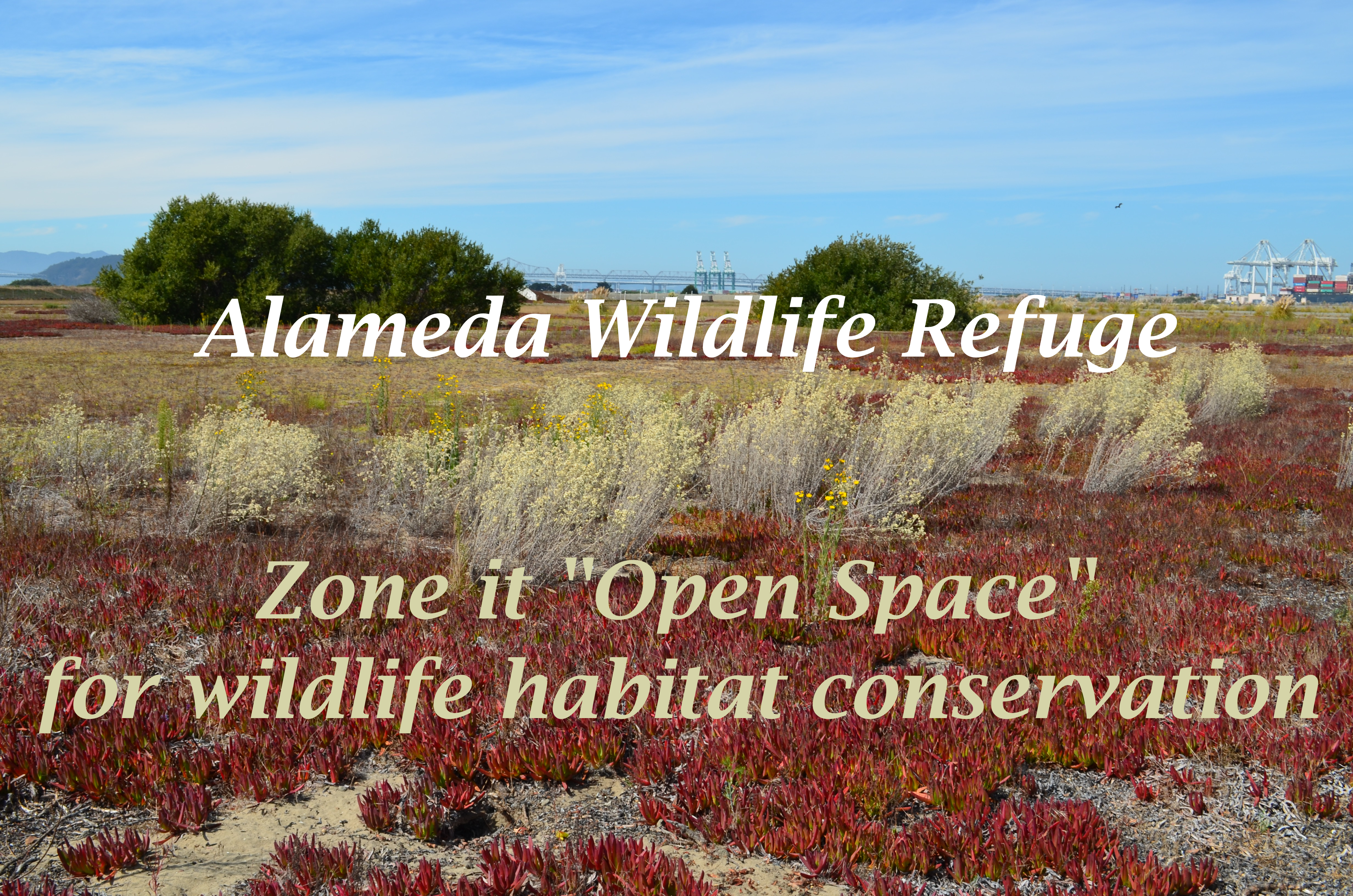
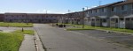
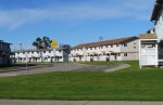
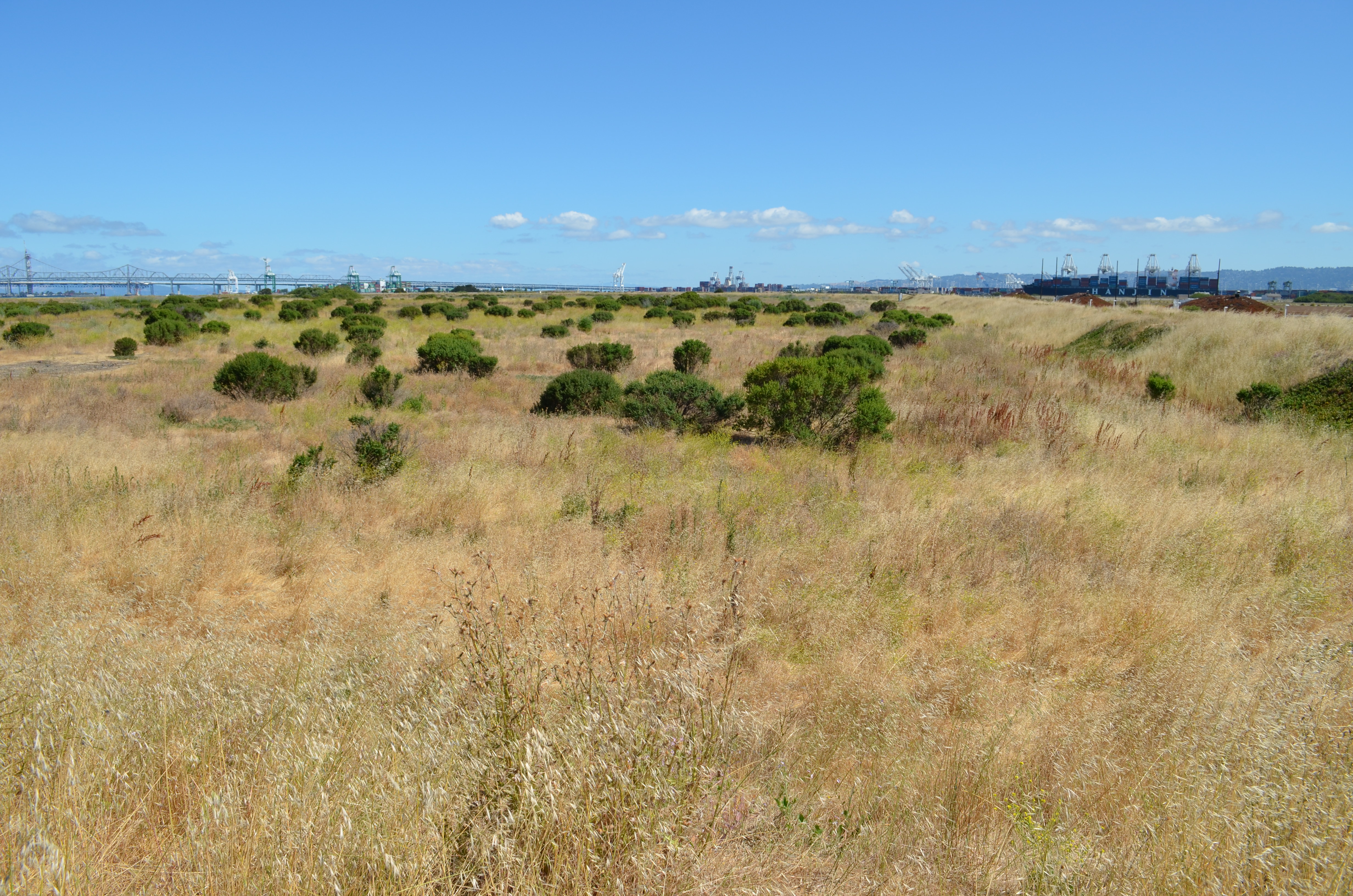
Site 1 will be available for passive recreational use as part of the proposed 147-acre regional park along the northern shoreline.  Site 1 will be part of the final conveyance of land to the city slated for 2019.  The VA’s property is adjacent and to the south and east.

The Navy’s project manager along with the cleanup contractor for Site 1 will be present at a special public meeting to answer questions and take comments on the new proposed plan for the Burn Area.  The meeting is on April 9 at the Alameda Main Library, 1550 Oak Street, from 6:30 pm to 8:00 pm.

Originally published in the Alameda Sun.

Further Reading on the Navy’s Burn Area Study

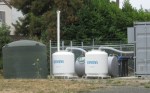
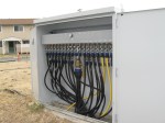
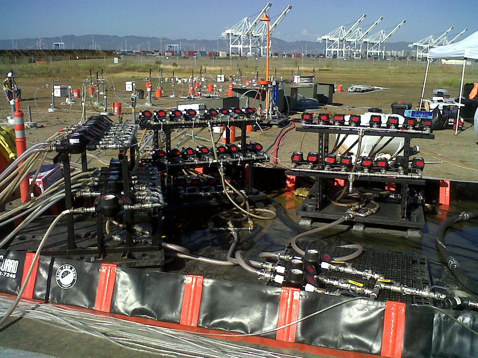
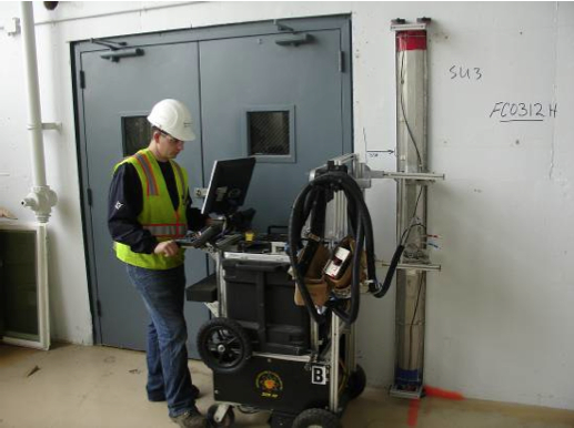
The Navy’s recently-completed soil and groundwater study for the Burn Area is called a Focused Feasibility Study (FFS) and is located on the state Envirostor website.

The FFS is very large and is divided into parts.  Recommended parts to look at first:

Part 1, Part 3 (cool maps), Part 4 (mostly raw data, but has trench photos), and Part 8 (descriptive letters from PND Engineers that own the patent on the open cell system, and all the comments by the regulatory agencies and the responses to comments.)  Part 5 has a lot of technical data and description of the groundwater model in relation to the Bay.

Reference material on the open cell barrier proposed for the Burn Area:

US Army Corps of Engineers 2011 report on the use of the Open Cell Sheet Pile Containment System for contaminated dredge material.

Overview of the Open Cell Confinement Disposal Facility system by PND Engineers.

2012 report to the Alaska Legislature on the Open Cell system.

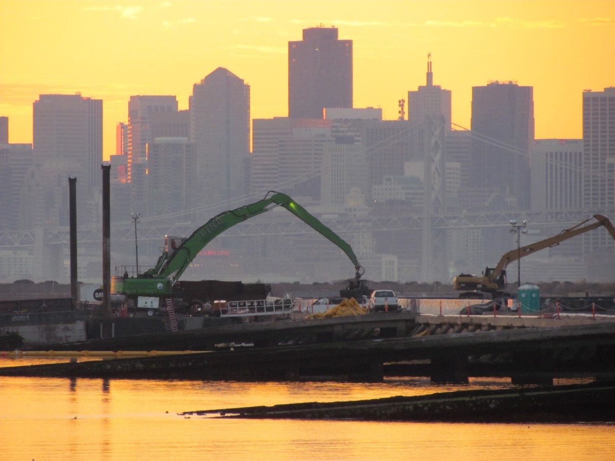
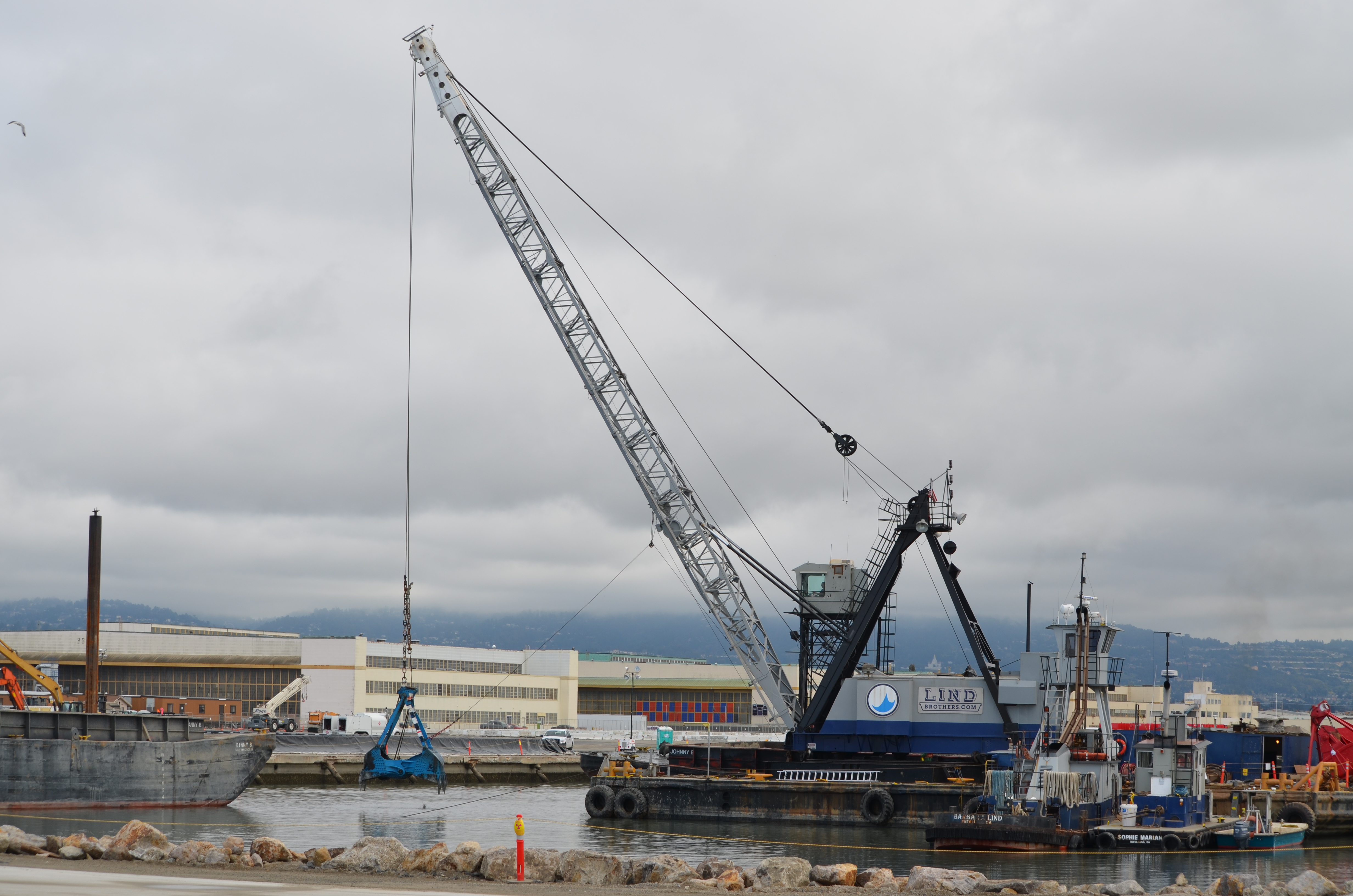
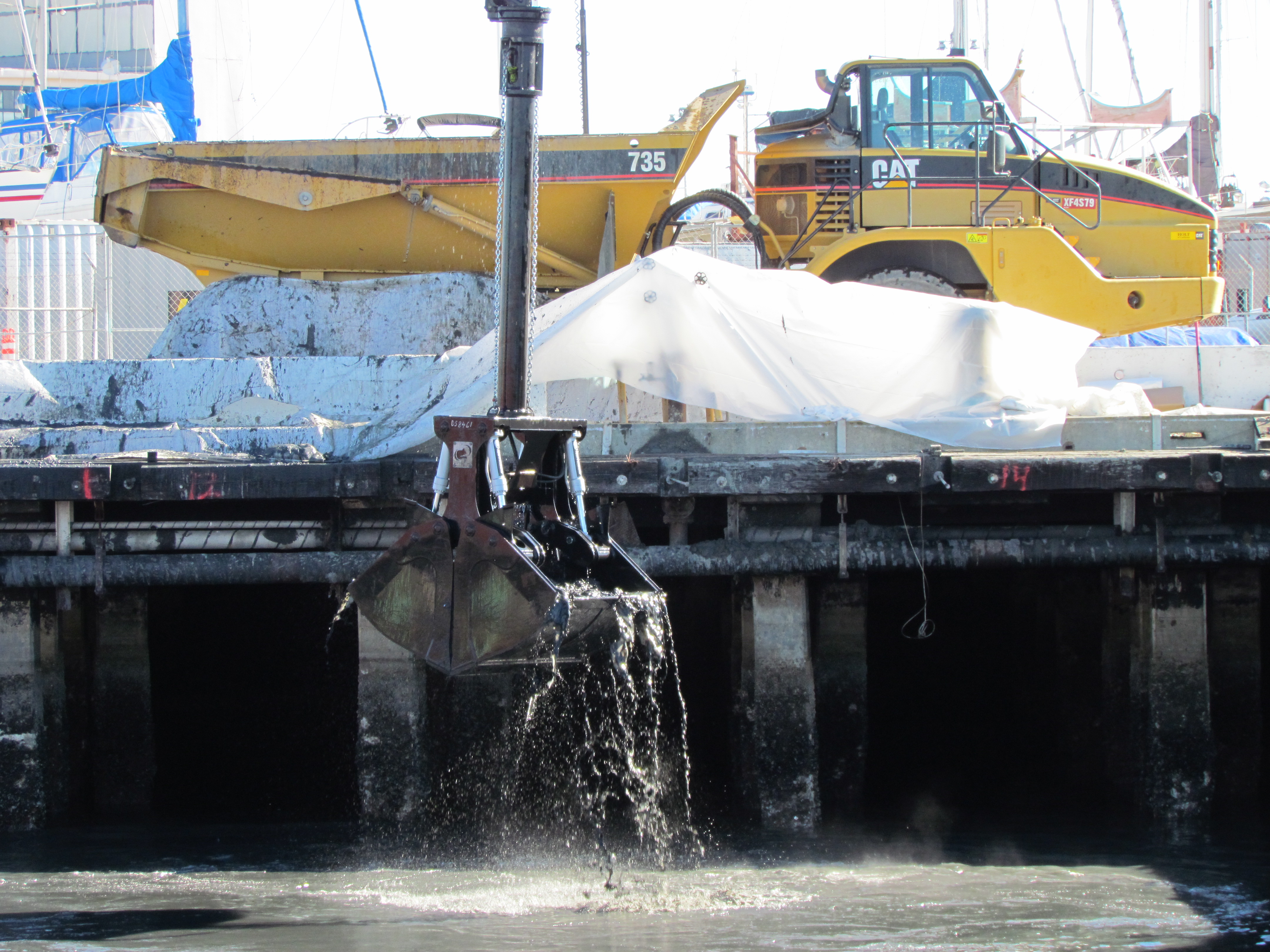
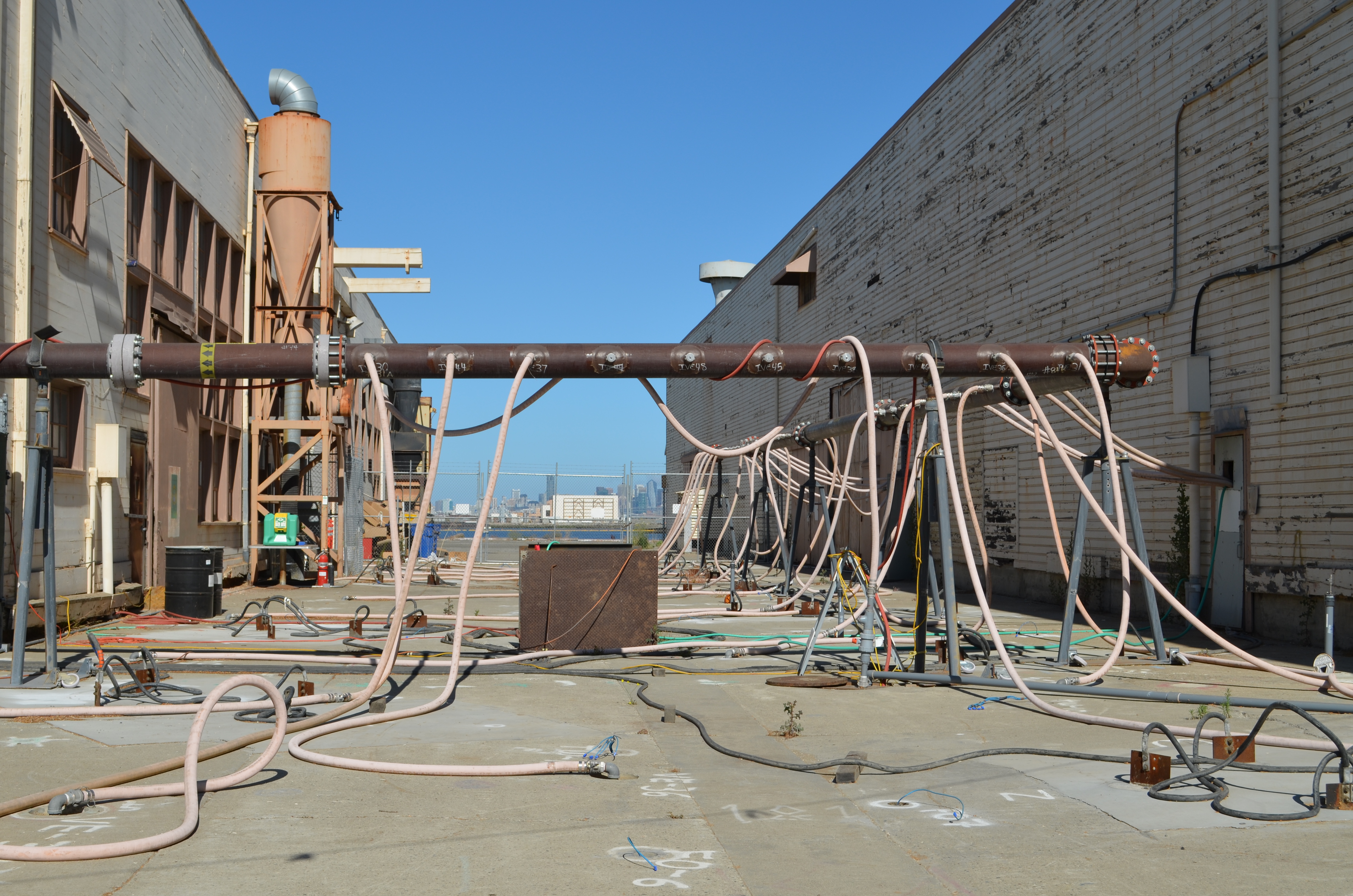
Image highlights from the Focused Feasibility Study for the Site 1 Burn Area

Click on images to enlarge.

Zone the wildlife refuge “Open Space”

Below is the draft of a city council resolution that has been introduced to the council by councilmembers Stewart Chen and Tony Daysog.  It is on the council agenda for 7 PM, Tuesday, February 19, 2013.  The community is urged to attend and voice their opinion.  

The refuge has been home, harbor, and safe haven for many species, even during use as a military base.  As the property transitions to VA ownership, the protective status of “Open Space” and “Wildlife Refuge” should travel with it on into the future.  It is a rare piece of earth on the Bay that should be available for nature to reclaim.  Proper zoning will reflect the level of commitment we have toward environmental stewardship in an era of growing demands on ecosystems everywhere.

zone it open space

Draft – City Council Resolution

Resolution re-affirming support for creation of the Alameda Wildlife Refuge at Alameda Point

Whereas, the 1996 Community Reuse Plan identifies the southern two-thirds of the Naval Air Station-Alameda airfield for preservation as a wildlife refuge;

Whereas, the 1996 Community Reuse Plan stipulates that this area “would remain as open space to provide for the preservation of wetlands, sensitive species, and regional open space uses”;

Whereas, the City of Alameda General Plan was amended in 2003 to add Chapter 9 on Alameda Point, which includes support and encouragement for funding and implementation of the U.S. Fish and Wildlife Service’s Comprehensive Conservation Plan for the Alameda National Wildlife Refuge;

Whereas, the General Plan amendment supports “a system of trails that provide public access to and within the Wildlife Refuge” that balances natural conservation with public access and education;

Whereas, the General Plan amendment supports the creation of education facilities and programs, similar to other conservation areas such as the Elsie D. Roemer Bird Sanctuary;

Whereas, the wildlife refuge is home to one of the most successful nesting sites in California for the endangered California Least Tern;

Whereas, Breakwater Island is part of the wildlife refuge vision in the 1996 Community Reuse Plan, and it is the only night roosting area of its kind in San Francisco Bay for California Brown Pelicans, which were only recently removed from the Endangered Species List;

Whereas, the wildlife refuge, and the entirety of Alameda Point and its adjacent waters, are subject to special restrictions for protection of the least terns by authority of the 2012 Biological Opinion issued by the US Fish & Wildlife Service, the responsible agency for enforcement of the Endangered Species Act;

Whereas, the 511-acre refuge area offers a rare and vast inner urban opportunity for public access and education, a respite and retreat from the built environment, introduction of native plant species, expansion of wetlands, and wildlife recovery and protection efforts;

Whereas, the Alameda Wildlife Refuge would complement the land uses contemplated for the mixed-use area of Alameda Point, as well as complementing the entire city and the Bay Area;

Whereas, numerous federal, state, and regional public agencies possess the experience and mission for collaboratively managing a wildlife conservation area;

Whereas, environmental cleanup and remediation will be completed by the Navy in compliance with federal and state environmental laws;

Whereas, ownership by the VA will ensure that potential environmental cleanup liabilities regarding the Site 2 landfill, and any other portion of the federal property, will be borne by the VA (unless retained by the Navy) regardless of the land uses;

Whereas, the wildlife refuge vision is compatible with, and complementary to, proposed plans for a VA clinic and columbarium;

Now be it therefore resolved:

          The City Council of the City of Alameda re-affirms our commitment to and support for the creation of a wildlife conservation area known as the Alameda Wildlife Refuge at Alameda Point;

          And be it further resolved that the adjacent waters of the Alameda Point Channel, and Breakwater Island, are to be included in the management plan for the refuge;

          And be it further resolved that the City Council of the City of Alameda will support the zoning of the wildlife refuge property as “Open Space with a Refuge Overlay,” or similar conservation zoning designation, to promote the protection and implementation of the values and goals recited in this resolution.

Burrowing owl on refuge.

Alameda Wildlife Refuge podcast

This interview with wildlife biologist Leora Feeney was done in 2008 as part of the San Francisco Bay Joint Venture’s “Your Wetlands” series.

Click hereor on image below, to access the podcast.

Your Wetlands podcast AWR

The only updates are that the Loggerhead Shrikes are no longer seen nesting on the western shoreline following cleanup work that was performed.  And the Harriers have not been seen nesting at Alameda Point in recent years.  

The refuge remains a unique wildlife habitat that deserves permanent protection.

Runway Wetland on southeastern corner of refuge.

Navy could shut down groundwater treatment at housing site

The Navy often hears calls to increase its environmental cleanup effort.  Now, the community and regulators are hearing a call from the Navy to eliminate one cleanup effort altogether.

North Housing area next to Island High School where benzene plume is located.

Since 2009, several acres of the area north of Bayport that includes the Shinsei Gardens affordable housing development, former Coast Guard and military housing, the closed Island High School, and the Woodstock Child Development Center have been undergoing groundwater treatment to eliminate hot spots of benzene and naphthalene vapors.  Shinsei Gardens also included special building slab engineering in its design as an extra precaution against vapor intrusion.  The Navy now says that its groundwater treatment system is unnecessary and should be shut down.

Shinsei Gardens
Shinsei Gardens

In a report issued in December 2012, the Navy said the underground vapor extraction system called biosparging is not making the area any safer for human habitation.  Biosparging is a form of bioremediation that uses air and oxygen injections to stimulate the growth of naturally occurring bacteria, which break down toxics.  In this case, the contamination is composed of waste material discharged from an Oakland coal gasification plant and an Alameda oil refinery that operated long before the area was filled in.  The contamination layer has been dubbed the Marsh Crust.

OU-5 map with plume & landmarks

The Navy’s report points to the initial studies in the area that showed no risk from vapors.  The only justification for the remediation in the first place was the limited risk of contact with water through non-potable uses, since drinking water will always be supplied by East Bay Municipal Utility District. 

Now the Navy says that even non-potable uses are impractical and off the table due to high levels of minerals such as salt.  With no way of coming in contact with water containing benzene and naphthalene, the Navy decided to review the data for vapor exposure and concluded there is plenty of evidence to turn off the pumps.  The biosparge system was designed to run for eight years in order to reach its cleanup goals.

The Navy’s December 2012 Technical Memorandum is seeking to amend the original cleanup decision — known as the Record of Decision (ROD) — for this cleanup area.  They will need the concurrence of the regulatory agencies:  the regional Water Board, state Department of Toxic Substances Control (DTSC), and the Environmental Protection Agency (EPA).  But the EPA and DTSC are not ready to agree without further testing. 

According to EPA’s Chris Lichens, “The Navy’s conclusions are not based on current data, site conditions, or investigation methods.  Before proceeding with a ROD Amendment,” he said, “the agencies would like the Navy to collect additional data to verify that vapor intrusion would not present a significant risk in the absence of biosparging.”  Lichens added, “Along those lines, EPA and DTSC jointly prepared recommendations for additional groundwater, soil vapor, and indoor air sampling and provided those recommendations to the Navy.  The Navy has not yet agreed to collect additional data, although we are still discussing it with them,” he said.

Originally published in the Alameda Sun.

Alameda Point 2012 environmental cleanup review, and busy year ahead

Cleanup activity at Alameda Point in 2012 started where it left off in 2011 — at the Seaplane Lagoon.  The northwest corner of the lagoon was the site of the second and final phase of lagoon dredging, which targeted sediment that had been contaminated near storm drain outfalls.  With dredging completed by spring, the sight of Americas Cup racing yachts arriving at their temporary dock in the lagoon seemed to be a harbinger of the approaching end of the Superfund era at the Point.

Dredging northwest corner of Seaplane Lagoon

Just outside the Seaplane Lagoon, another dredging operation was started and finished at one of the maritime ship piers where the Cape Orlando had been docked.  By November, the massive ship was back at dockside, hull lights glowing at night.

Dredging Pier 1 wharf area

In one of the most complicated and contaminated areas to the east of the Seaplane Lagoon, cleanup work began at an area 30 feet below ground where a cleaning solvent used on aircraft parts had seeped into the groundwater.  After driving a series of metal bars down to the contaminated area, the soil, groundwater, and solvent were heated to just below simmering by means of electricity.  This turned the water and solvent into vapor, which was then vacuumed out into a filtering system through a series of pipes. 

Heat treatment and vapor extraction - OU-2B
Heat treatment and vapor extraction – OU-2B

At the far end of Alameda Point on the northwest landfill, the Navy relied on chemicals, rather than heat, to do the cleanup on a small portion of the site.  Dozens of hoses snaking around the site to the injection wells delivered an oxidizing mixture of neutralizing chemicals into a pocket of solvents.  Without this remediation, the solvents had the potential to reach the Bay.

Injecting oxidizing chemical into solvent plume - Site 1.  Navy photo.
Injecting oxidizing chemical into solvent plume – Site 1. Navy photo.

The year ends with a cloud of controversy over the Navy’s plan for leaving drain pipes under the old Naval Air Rework Facility — Building 5.  Letters from both the Restoration Advisory Board (RAB) and the city call for the complete removal of any lines containing radium paint waste.  The Navy ruled out a more costly alternative that would remove all the contaminated pipes.  The city challenged this decision, in part, on the ground that the Navy’s cost estimates for a thorough job are inflated and have asked that they reconsider.

Building 5
Building 5

Also in Building 5, plans to remove above-ground radium contamination from floors, walls, and ceilings in the mezzanine area will get underway within weeks.  This area is where aircraft dials and markers were painted with radium paint that provided visibility in the dark.  A final scanning investigation to detect radium, using sophisticated equipment employed in the decommissioning of nuclear power plants, found dozens of pie-sized irregular areas where radium dust had embedded in the surfaces.  This project will conclude two decades of scanning and radium removal efforts in Building 5 and other buildings.  Around $50 million has already been spent replacing drain lines leading to the lagoon under the surrounding tarmac, and dredging the lagoon, due to the disposal of radium paint and other chemicals down storm drains.

Scanning a wall for radiological contamination.  Navy photo.
Scanning a wall for radiological contamination. Navy photo.

2013 

2013 will see the long-awaited final soil cover installed on the waste disposal site called Site 2 on the southwest corner of the wildlife refuge.  It will be the largest engineering project since the runways were expanded in the 1950s, with over 200,000 cubic yards of clean soil being barged in from Decker Island in the Sacramento River.  It will be seeded with California native flowering grasses selected by the RAB.  This is the controversial dump that led the US Fish & Wildlife Service to balk at accepting the land for a wildlife refuge ten years ago.  Since then, this dump has seen numerous reviews and a new plan that the US Environmental Protection Agency, regional Water Board, and state Department of Toxic Substances Control will be signing off on shortly.

Site 2 underground dump on southwest corner of Alameda Point.

2013 will end with commencement of a similar soil covering operation on the nearby landfill on the northwest corner of Alameda Point called Site 1.  Both landfill areas will be safe for open space recreational activities when completed, but will be limited to hiking trails rather than mowed playing fields in order to maintain soil-stabilizing vegetation. 

Northwest corner of Alameda Point where soil cover will be installed.

Annual Audubon Society bird count includes Alameda Point wildlife refuge

On December 16, from before dawn until dusk, hundreds of hardy volunteer birders trekked through parks, neighborhoods, wetlands, and woods to count birds during the Audubon Society’s annual Christmas Bird Count in the East Bay.  In Alameda, three teams fanned out across the city.  One team went to Alameda Point.  

Carrying binoculars, spotting scopes, a clipboard, and bird reference books, bird watchers were participating in the annual Christmas Bird Count (CBC) organized by the Golden Gate Audubon Society.  While the total number of birds tallied during the count helps to fill out the picture, the main goal of the day was to identify as many different species of bird as possible.

White-crowned Sparrow
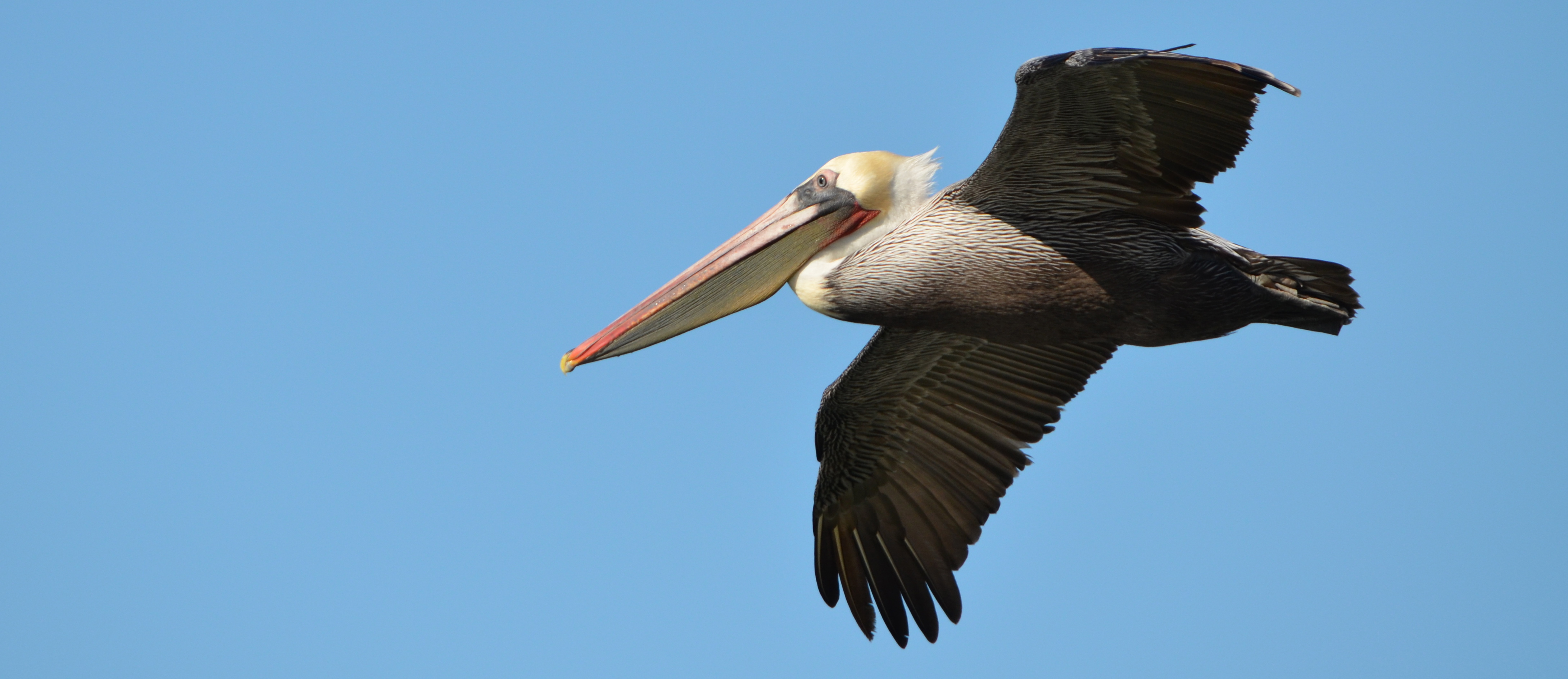
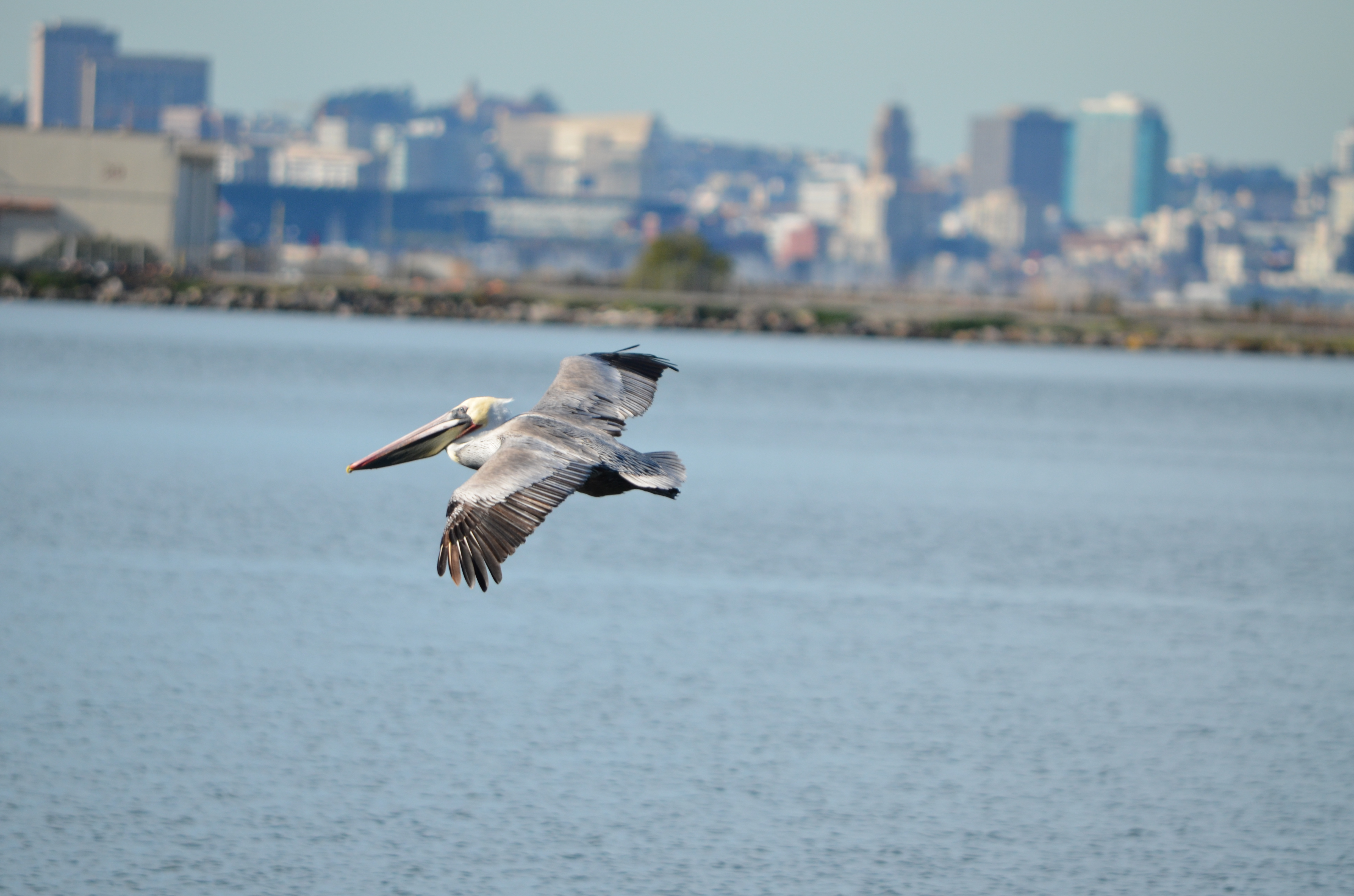
“This is not just about counting birds,” said Gary Langham, Audubon’s chief scientist. “Data from the Audubon Christmas Bird Count are at the heart of hundreds of peer-reviewed scientific studies and inform decisions by the U.S. Fish and Wildlife Service, the Department of the Interior, and the EPA.  Because birds are early indicators of environmental threats to habitats we share, this is a vital survey of North America and, increasingly, the Western Hemisphere.”

The Alameda Point team was led by Alameda resident Leora Feeney, of Friends of the Alameda Wildlife Refuge, and John Luther, one of the most experienced bird watchers in the state.  Linda Vallee was responsible for tallying results on her clipboard list of bird species as they were reported.   

Merlin
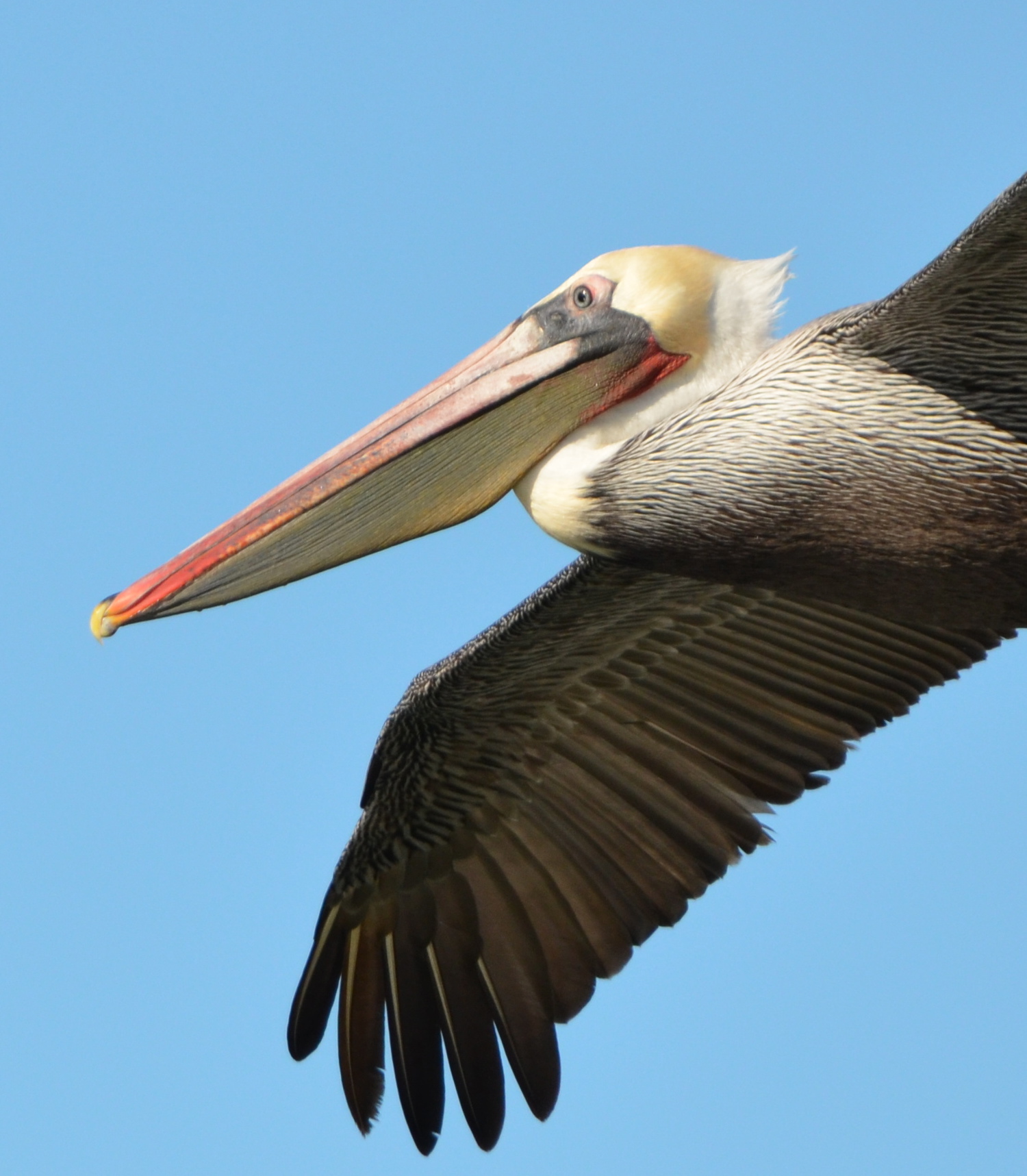
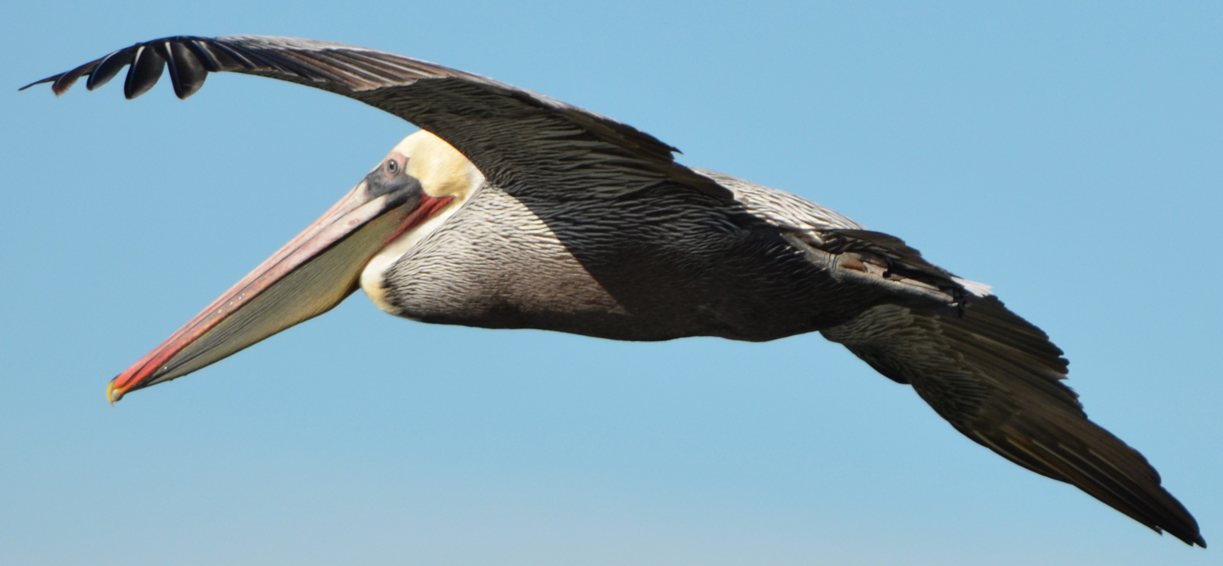
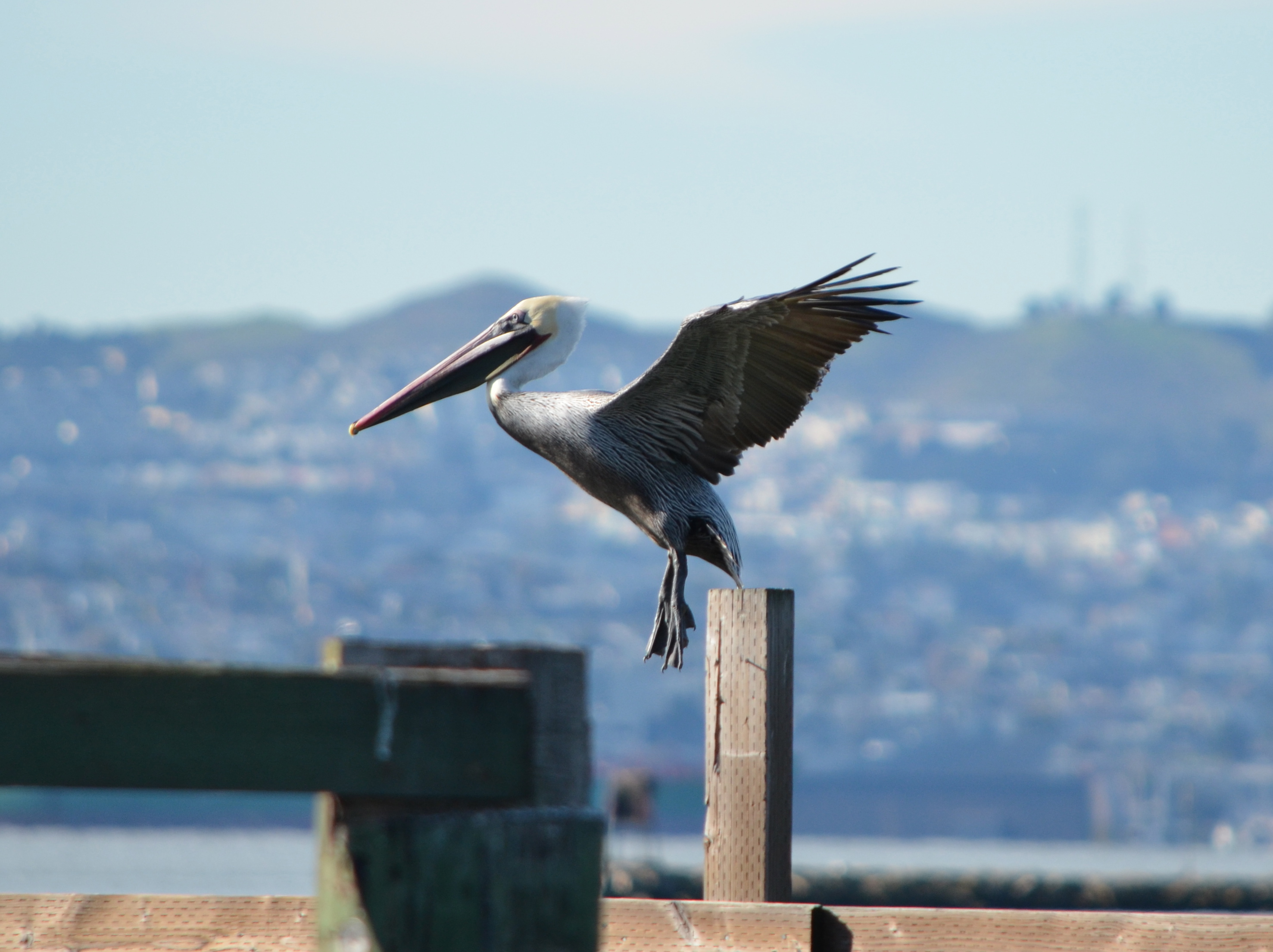
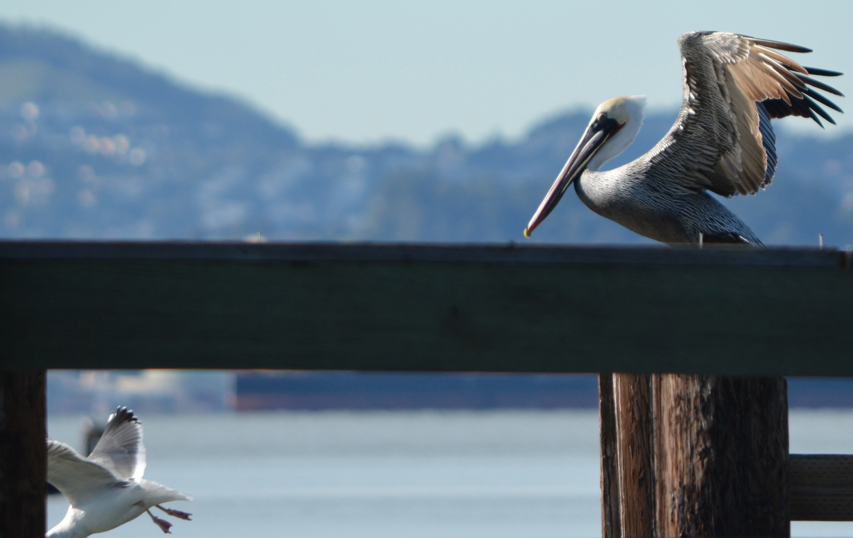
John’s 50 years of observing birds in every California county is evident in his quick identifications and economy of movement with his spotting scope.  “There’s a Common Loon…and…it just went under…there it is…turn around(as if speaking to the bird)…it’s… a Red-throated Loon,” he would say.  “White-crowned Sparrows – two.”

One thing you learn about bird counting etiquette, if you’ve never been to one of these events, is that you should not chit chat with someone while they are staring intently through a scope.  They could be trying to systematically count hundreds of birds by adding groups of 5 or 20 or 100 in their head as they keep landmark references in focus.  At one stop, attention turned to Breakwater Island on the other side of the Alameda Point Channel where an unusually high number of California brown pelicans (for this time of year) were roosting amongst the cormorants.  Leora counted 304 pelicans.

Continuing around the refuge, there were Burrowing Owls, Killdeer, a Horned Lark, a Peregrine Falcon perched on a fence, and a much smaller falcon not commonly seen around Alameda Point called a Merlin.  Often the birds were in fast moving groups darting around, landing, skip, skip, pick, pick, and off they flew.

Great Horned Owl at Alameda Point wildlife refuge.
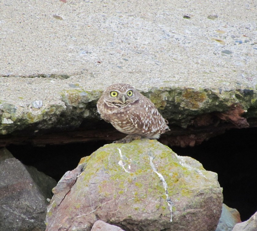
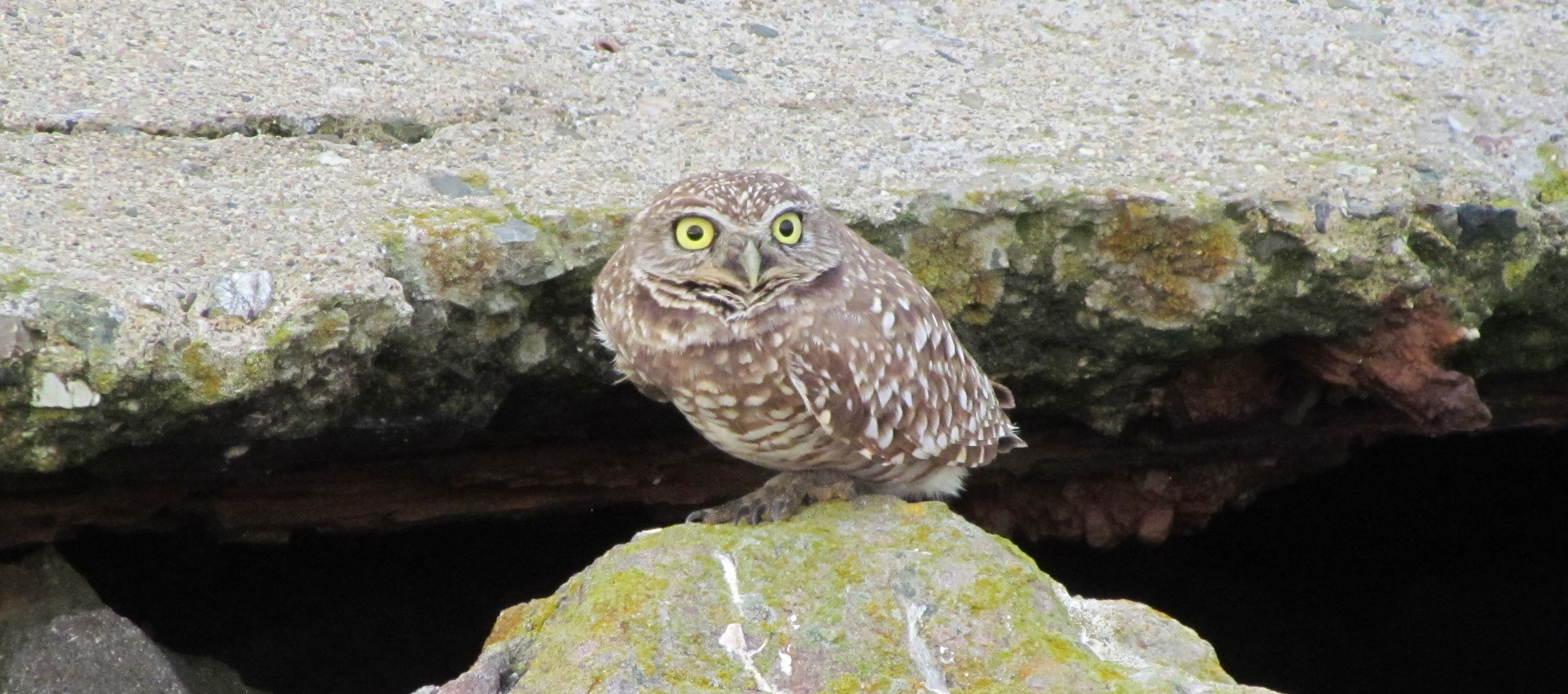
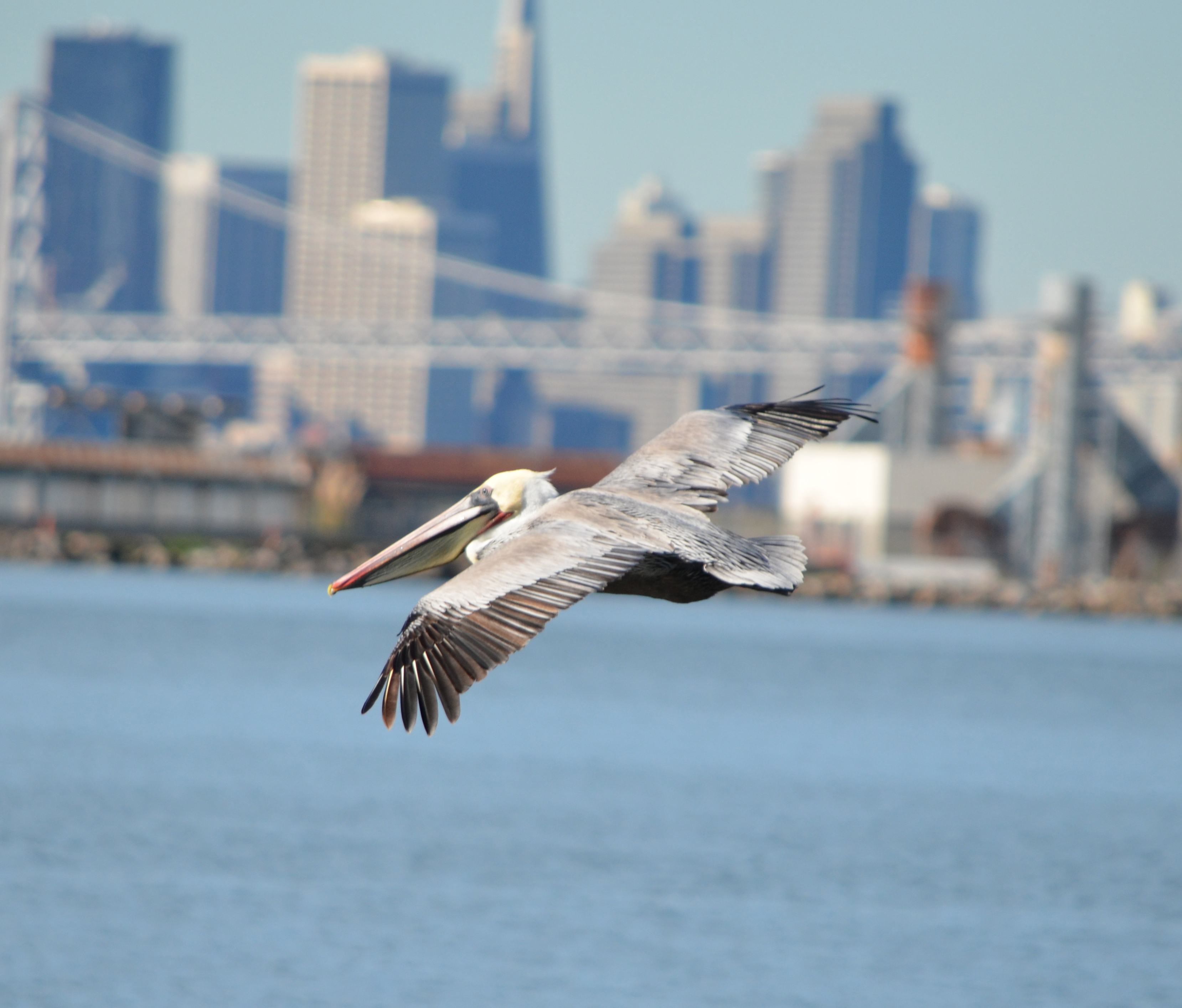
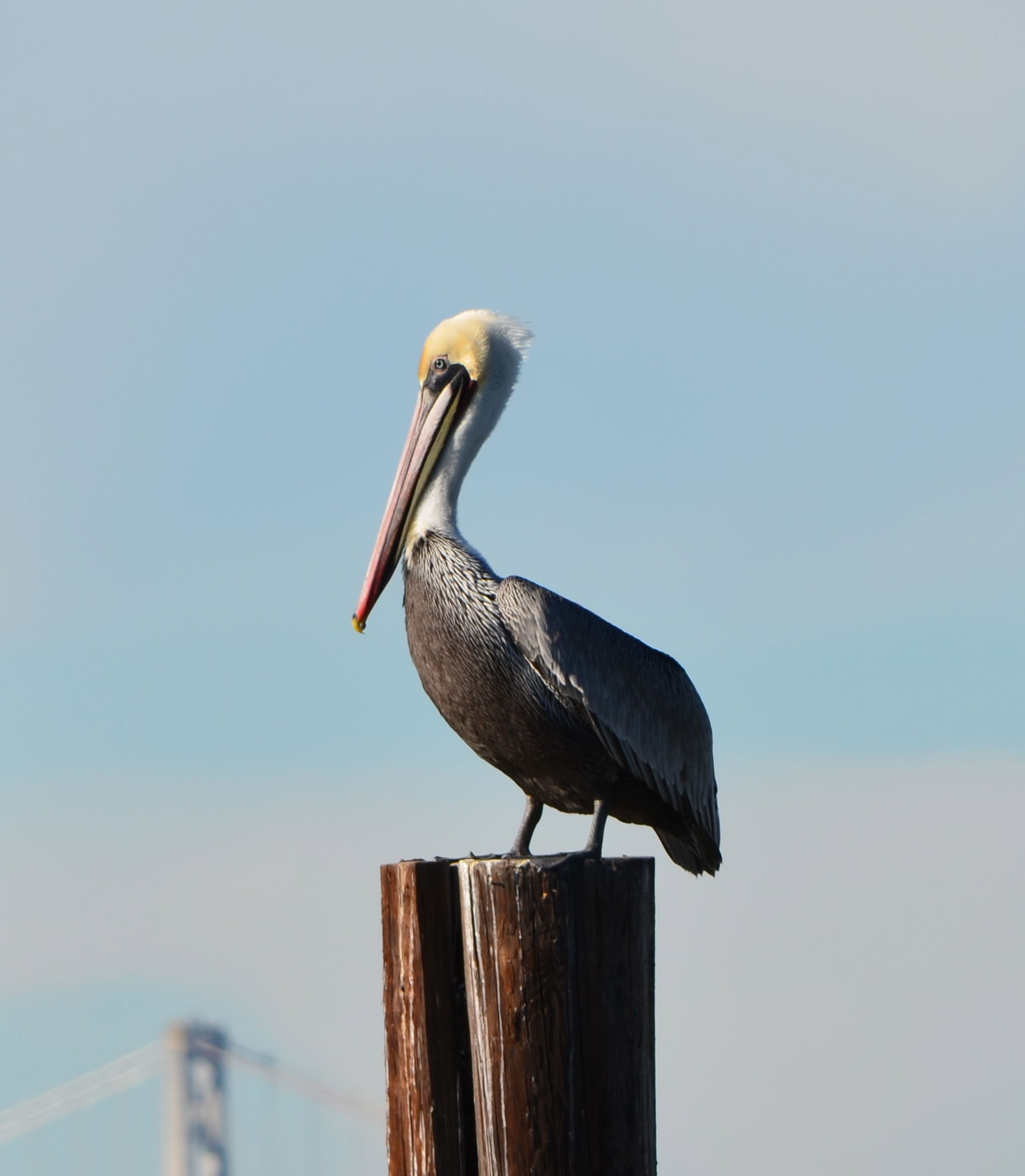
The biggest surprise came at the thick stand of willows at the north boundary of the refuge.  There, just inside the branches was a Great Horned Owl, a bird that Leora said she had never seen in eight years of doing twice-monthly bird surveys on the refuge.  Even more surprising was how approachable the owl was as it was being photographed, slowly turning its its head 180 degrees, appearing fearless.

After leaving the refuge, the team made other stops at the Seaplane Lagoon, the Inner Harbor on the south side, Breakwater Beach, and the neighborhood where the Big Whites are located.  The Big Whites neighborhood has a very good variety of mature trees, ideal for bird watching.

The preliminary total for all species sighted in the Oakland count area on Sunday (the 15 mile circle that is centered at Lake Merritt and includes Alameda) was 177 species.  According to GGAS Communications Director Ilana DeBare, “That is pretty much in line with a normal ‘good’ year.  There were 29 teams total, with well over 100 participants.”

“Christmas Bird Counts combine many of the things Golden Gate Audubon stands for,” said GGAS Executive Director Mike Lynes. “It’s a fun day with a serious purpose.  Everyday volunteer bird-watchers become citizen scientists, contributing data that will help inform future decisions about Bay Area bird life and habitat.”  The San Francisco Christmas Bird Count is on December 27.

Spotted during Audubon Society's 2012 Christmas Bird Count.
Burrowing Owl spotted during Audubon Society’s 2012 Christmas Bird Count.
Burrowing Owl at shoreline embankment on Alameda Point wildlife refuge, Dec. 16, 2012.
Spotted on western shoreline during Dec. 16, 2012 Christmas Bird Count.
Merlin spotted on western shoreline during Dec. 16, 2012 Christmas Bird Count.
Spotted during Dec. 16, 2012 Christmas Bird Count.
Peregrine Falcon spotted on Alameda Point wildlife refuge during Christmas Bird Count 2012.
Great Horned Owl in willow tree on wildlife refuge at Alameda Point
Great Horned Owl in willow tree on Alameda Point wildlife refuge – Dec. 16, 2012.
Great Horned Owl spotted during December 16, 2012 Audubon Christmas Bird Count.
Great Horned Owl spotted during December 16, 2012 Audubon Society Christmas Bird Count.
Merlin - Dec. 16, 2012, Christmas Bird Count at Alameda Point wildlife refuge.
Merlin spotted during Christmas Bird Count at Alameda Point wildlife refuge.
Spotted during Dec. 16, 2012 Christmas Bird Count.
Surf Scoter (with colored bill) in Seaplane Lagoon during Dec. 16, 2012 Christmas Bird Count.

Read background info on the Audubon Society’s Christmas Bird Count here.  

Follow reports about the Oakland and San Francisco Christmas Bird Counts on the Golden Gate Audubon Society’s website.

Read more about the Christmas Bird Count in Alameda on the Alameda Patch.