Navy cleans long-gone gas stations

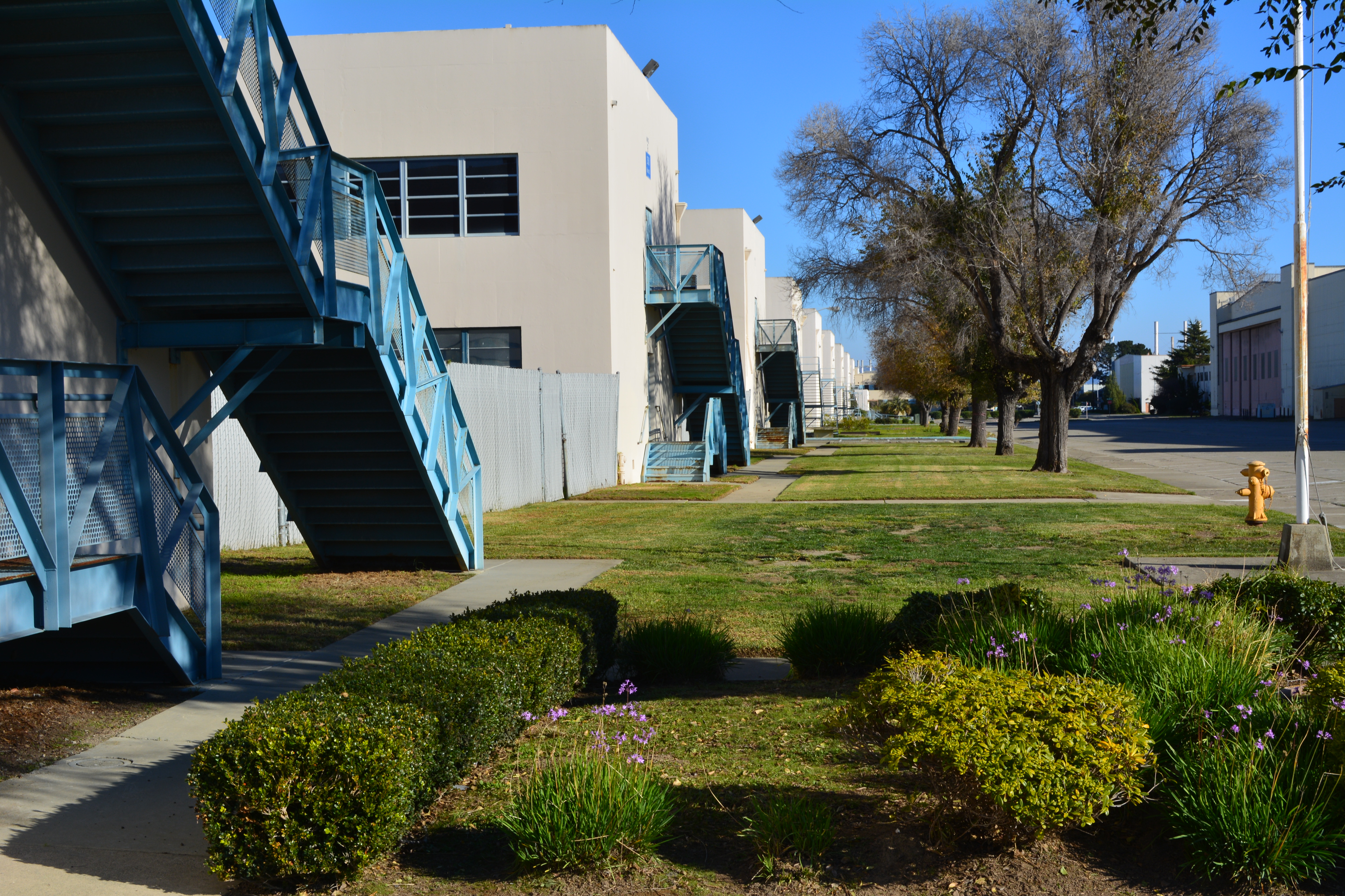
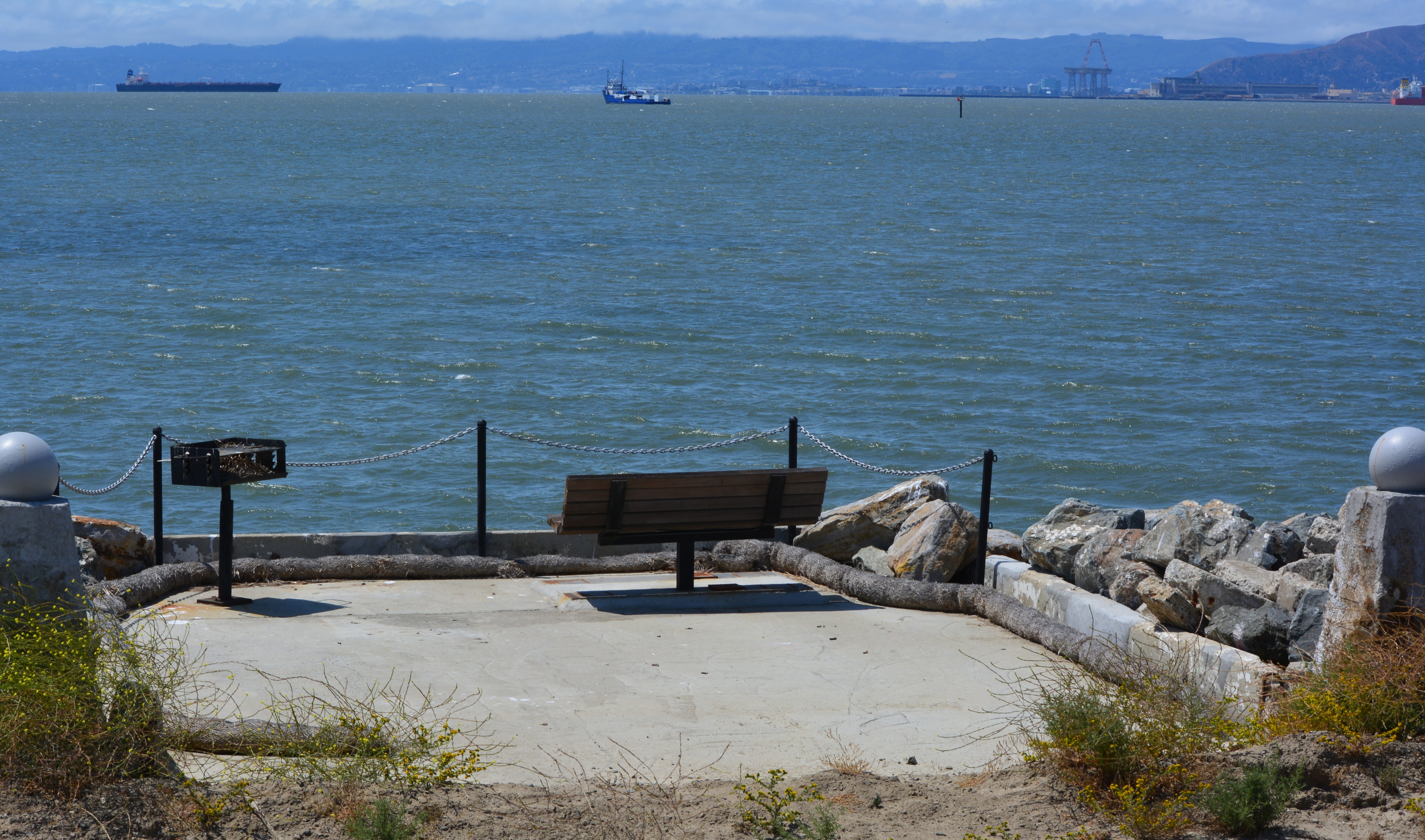
The Navy has spent more than 15 years cleaning up contaminated groundwater underneath two former gas station sites at Alameda Point. They are still at it, but it’s not because the Navy is slow or lacking in commitment and expertise. It’s the nature of groundwater cleanup, which involves intermittent treatment efforts.

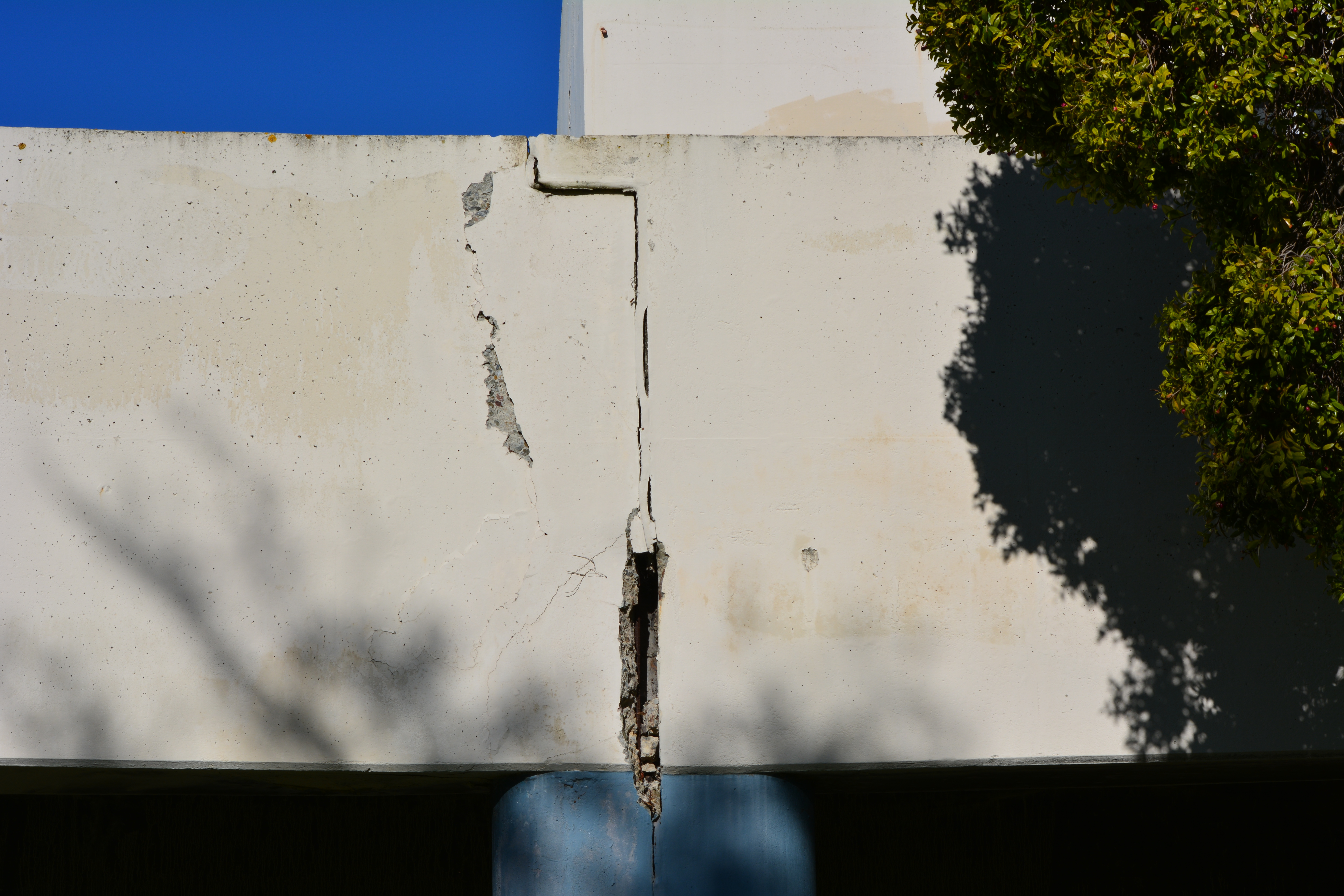
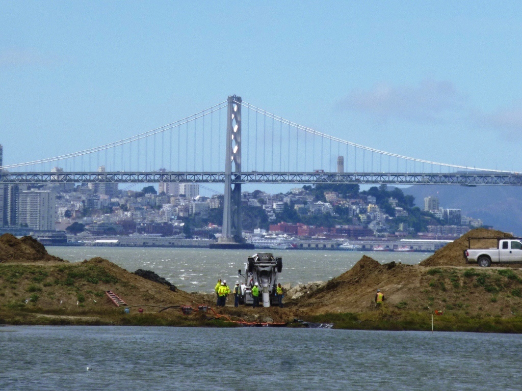
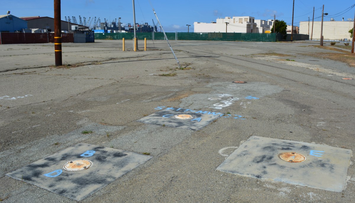
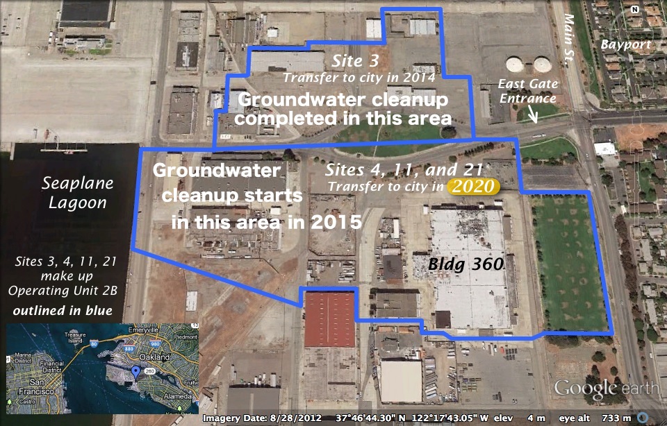
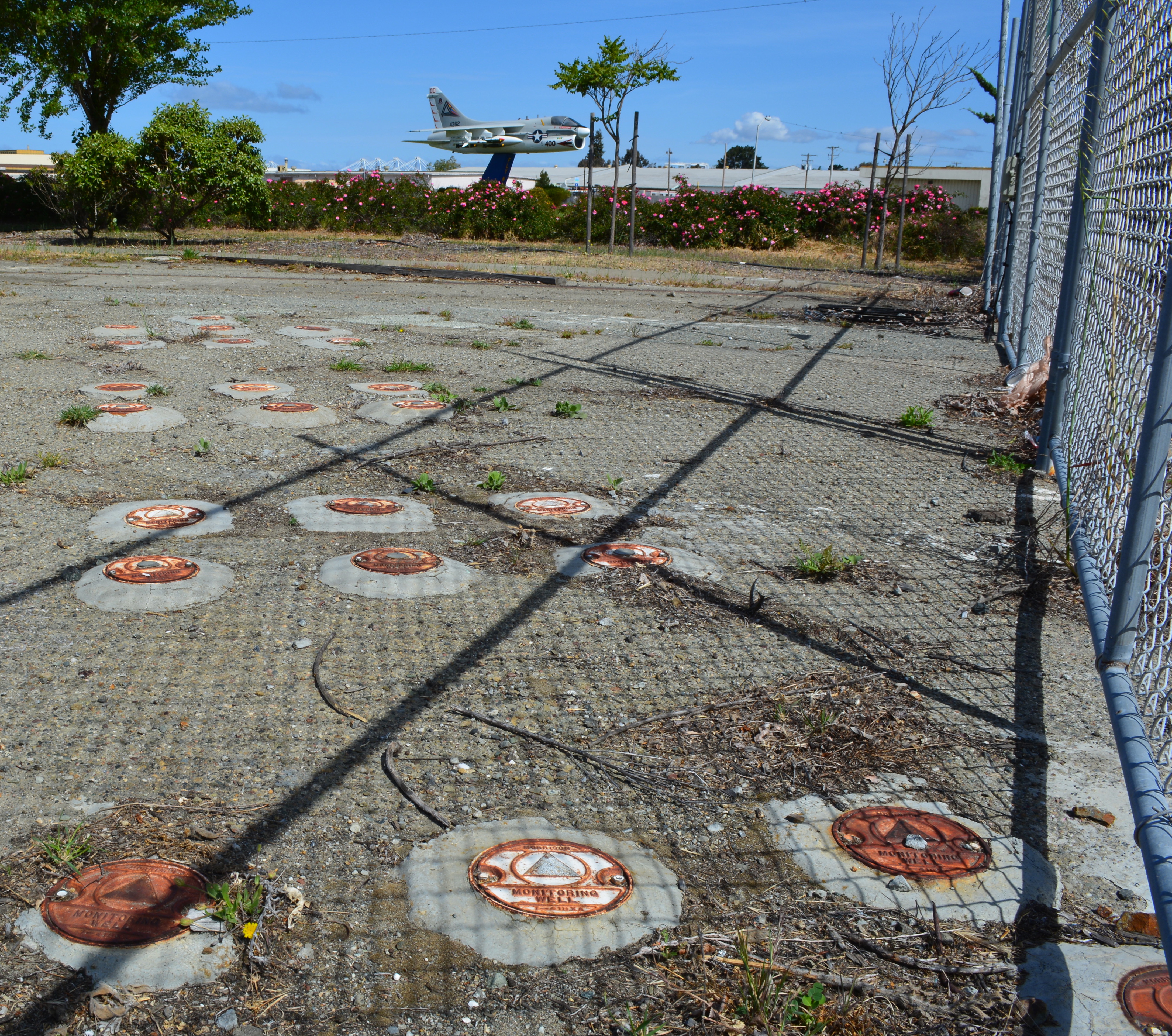
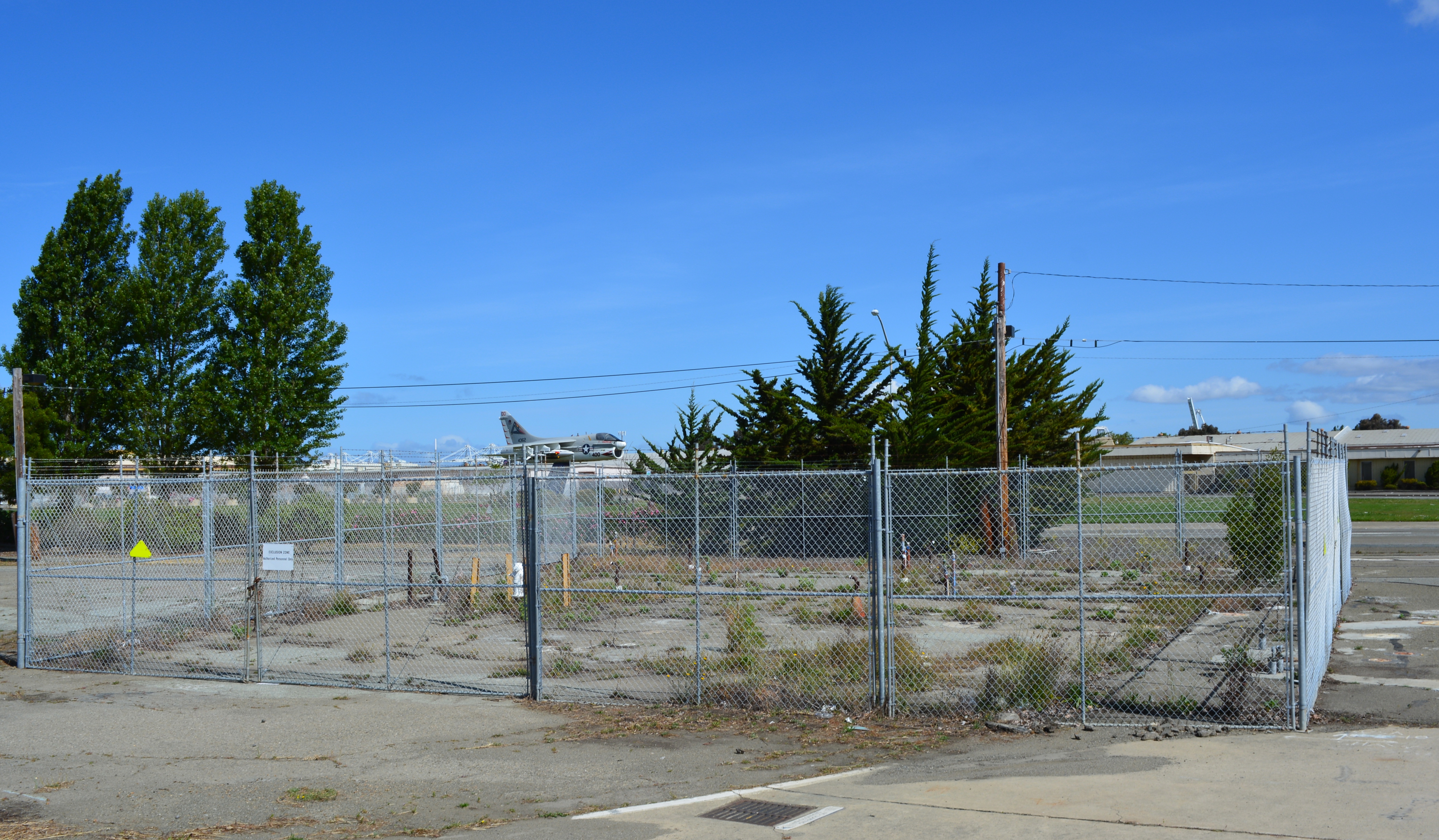
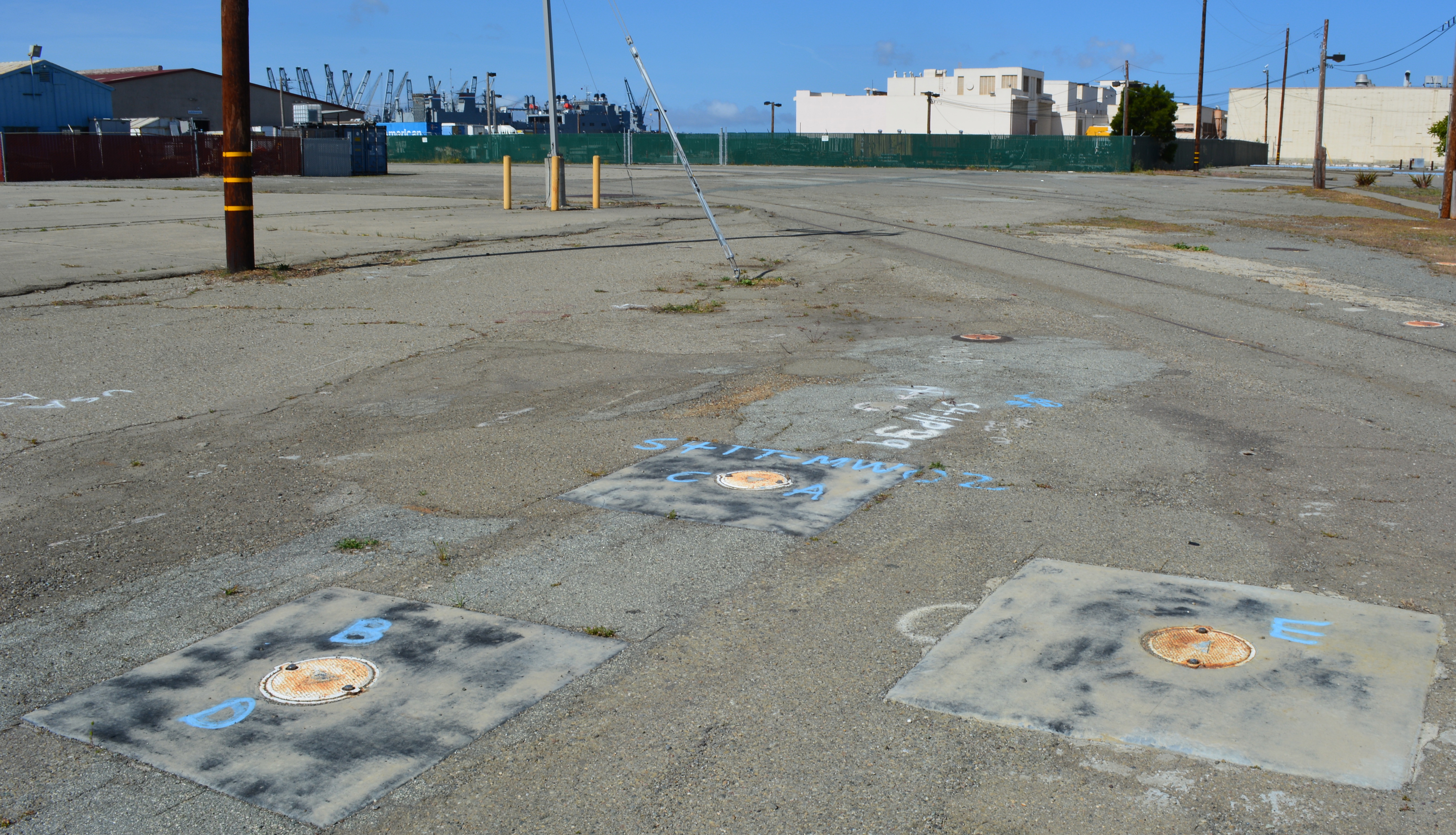
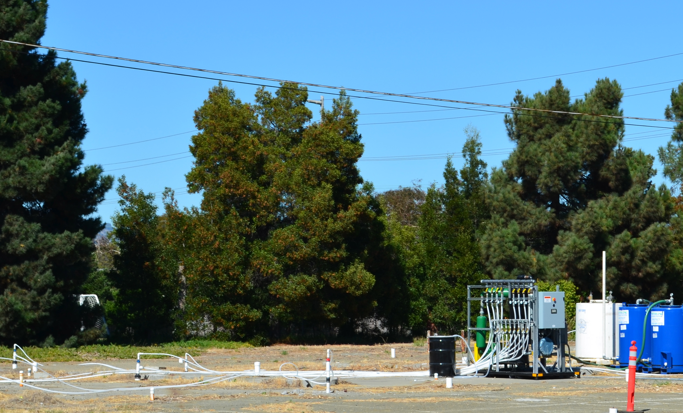
In July, the Navy’s contractor returned to the old gas station and car wash site on West Pacific Avenue at Main Street and to the old commissary gas station site at West Tower Avenue and Main Street across from Bayport. It’s the third visit to these sites to eliminate petroleum hydrocarbon contamination in groundwater, in addition to earlier removal of underground tanks, fuel lines, and soil. The contaminants are located from 2 to 16 feet below ground surface.

Workers at the old gas station and car wash site on West Pacific Avenue on July 13, 2015 preparing to inject cleanup solutions into the ground. The Navy operated a gas station and car wash on the site from 1971 to 1980. Green tank on truck contains non-potable water for on-site mixing of treatment solution. Soccer field is in the background.

The goal is to bring the property up to the public health and environmental standards required for the future commercial and residential uses previously determined by the city.

“When groundwater contamination is involved, such as at the two former gas stations, cleanups often involve multiple phases, each building upon earlier accomplishments,” said Dr. Peter Russell, who has been reviewing Navy cleanup plans and preparing cleanup-related documents on behalf of, and at the direction of, the city since 1997. “As long as all imminent health and environmental risks are eliminated early on, often the most cost-effective approach to complete remediation is incremental,” explained Russell. “In contrast, a massive initial remedial effort that is sure to achieve all remedial goals in one pass would likely involve over-sizing the treatment system, which is more disruptive and expensive than a phased approach.”

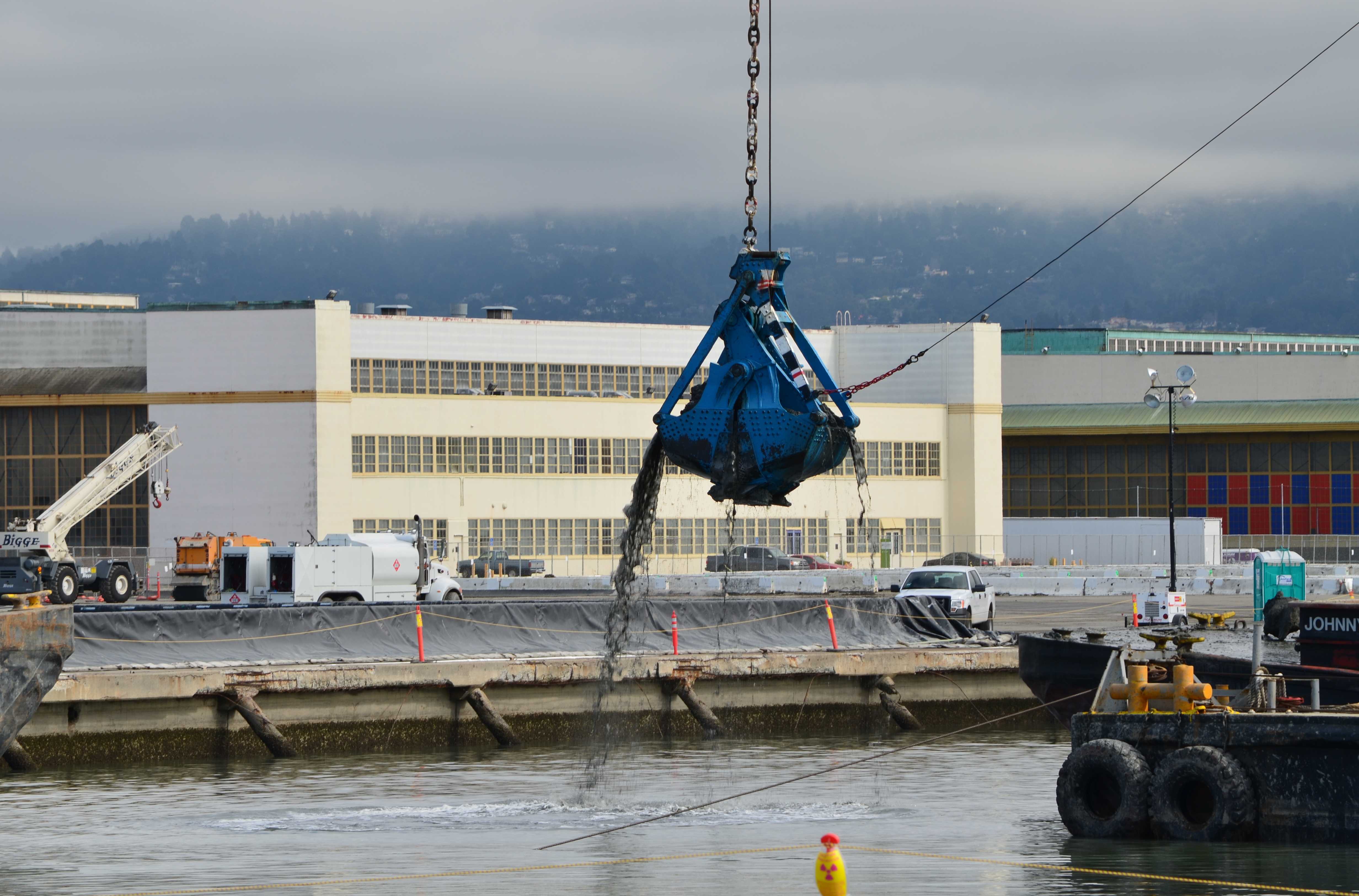
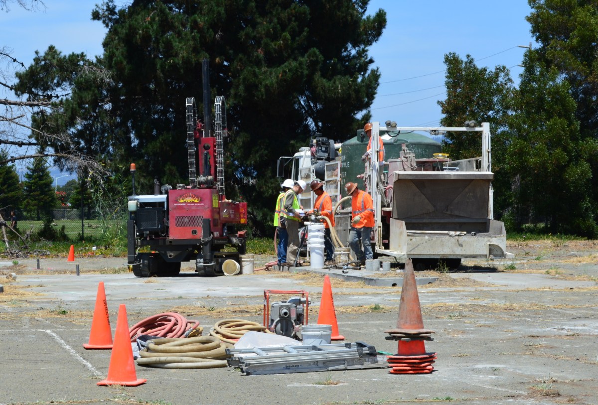
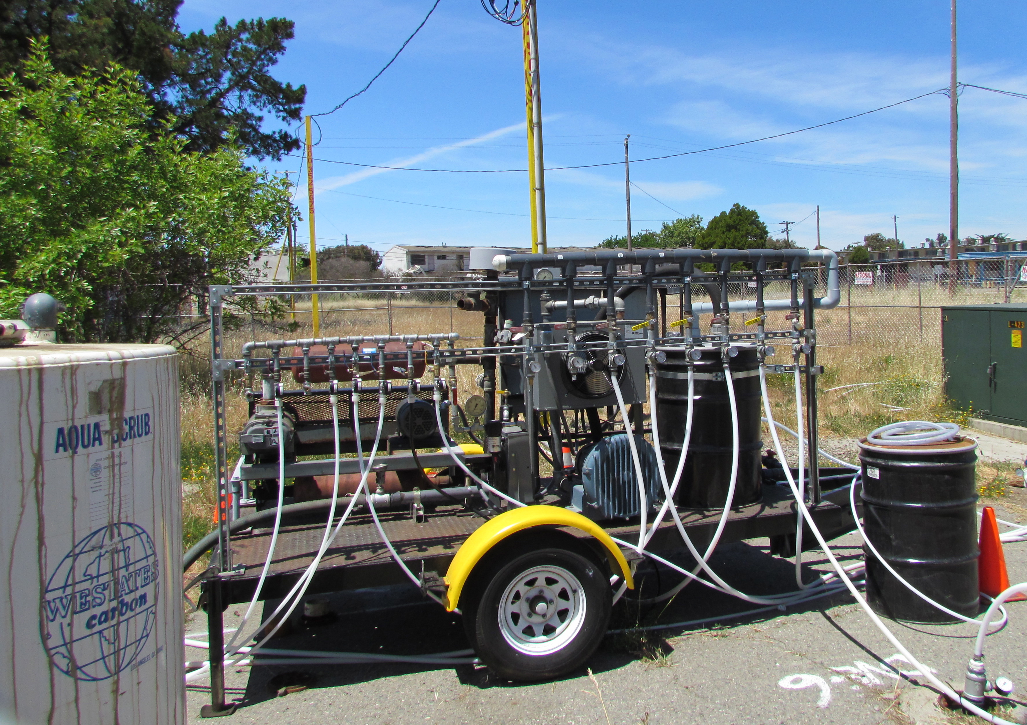
During previous cleanup visits, the Navy used a vapor extraction system to remove the bulk of the petroleum contamination. The process involves pumping air into numerous pipes, called wells, which extend into the water-saturated zone where the contamination is. The air pressure creates vapor that is part air, part water and part petroleum. The vapor is then sucked out through another set of wells, and the petroleum vapors are captured in drums of granulated charcoal, while the water is shunted off to a separate container.

Air injection/extraction system operating at W. Pacific Avenue gas station site in 2013 and 2014. System extracts and captures petroleum vapors.

The method of blowing bubbles in mud and sucking out the air sounds unsophisticated, but it works. After running the system in 2013 and 2014 at the West Pacific Avenue gas station site, for example, the level of one contaminant, benzene, went from around 1,000 micrograms per liter down to 58, bringing the contamination low enough to allow indigenous bacteria to finish the job.

Air injection and vapor extraction system operating at former commissary gas station site in May 2013. Charcoal tank to capture vapors is at left.

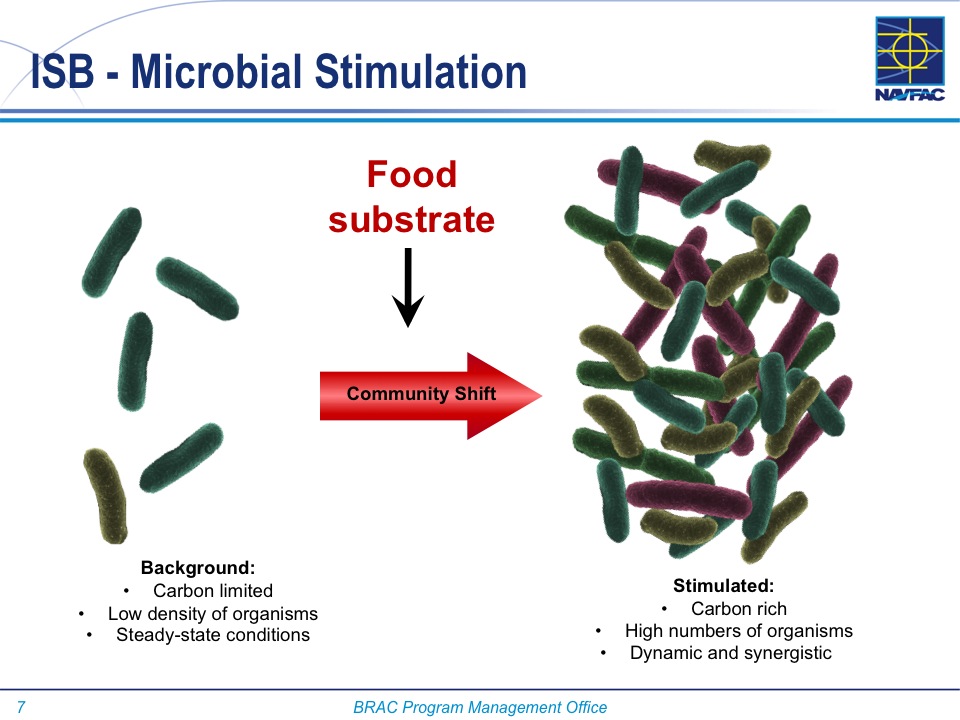
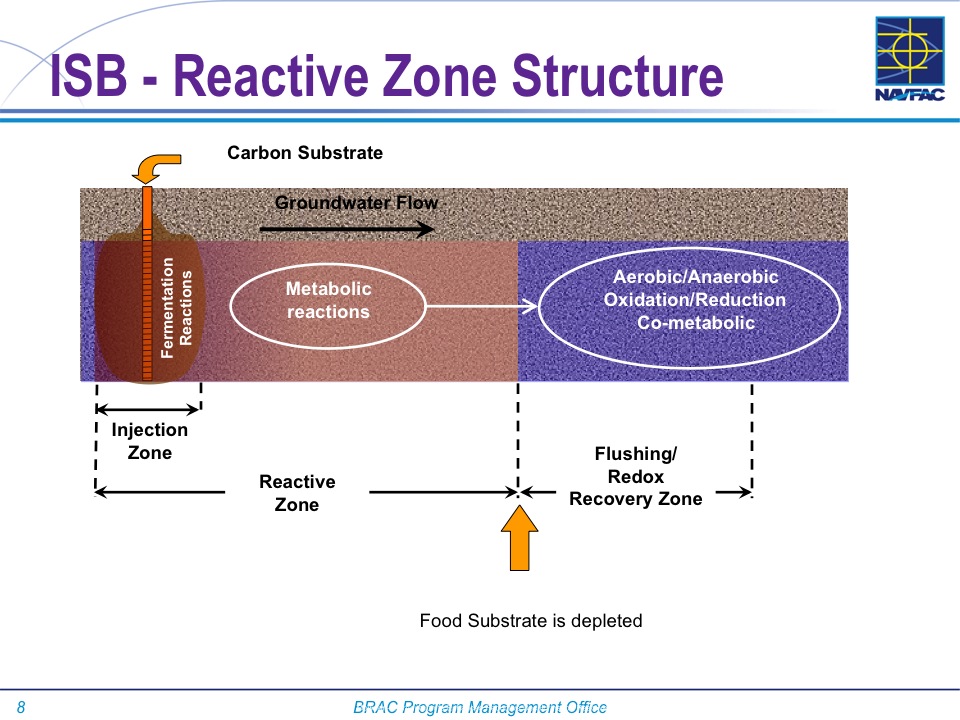
The Navy returned to these sites in July and, in this phase, they came to help natural bacteria finish up the job.   Allowing bacteria to clean up petro chemicals through natural digestion is called bioremediation. To be effective and not take a century to eliminate the problem, the bulk of the chemicals need to first be reduced to concentrations that do not overwhelm the bacteria.

At both gas station sites the Navy used a special product designed to foster growth of natural bacteria in the ground, which includes a form of time-release peroxide that turns into oxygen over a period of 12 months. An oxygen environment is necessary for the bacteria to digest petroleum. The bacteria utilize the hydrocarbons (hydrogen and carbon) in the petroleum chemicals as part of their metabolic processes and convert them into carbon dioxide, water, and microbial cell mass. Water samples will be taken at three, six, and nine months after the July injections to evaluate effectiveness.

“The Navy’s gas station remedial program is comparable to the private sector gas station cleanup program,” said Yemia Hashimoto, Engineering Geologist with the San Francisco Bay Water Board. “The cleanup requirements are similar and the required timelines for project completion are similar.” The Water Board is a California state agency and is the lead regulatory agency overseeing the Navy’s petroleum cleanup program.

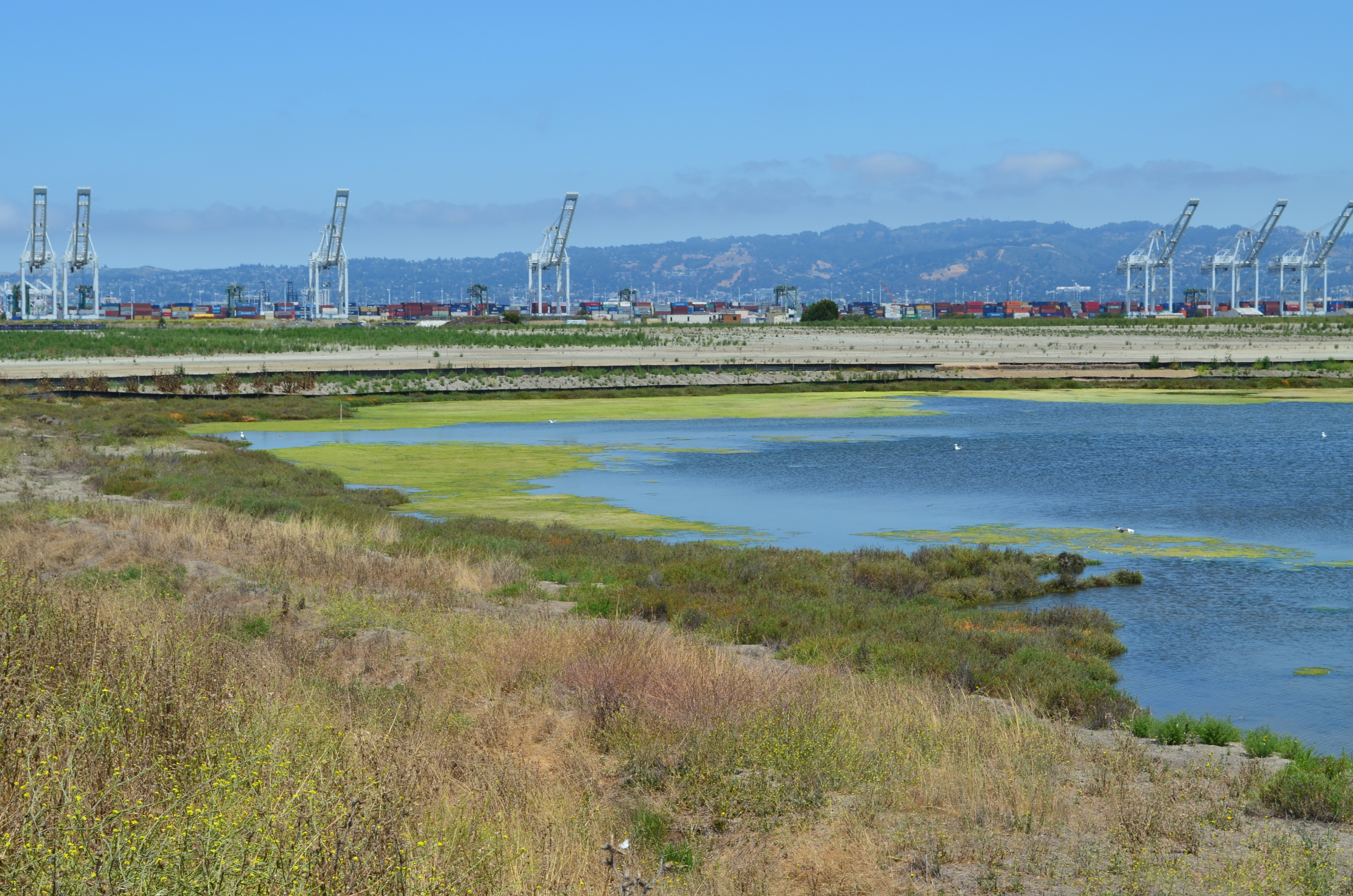
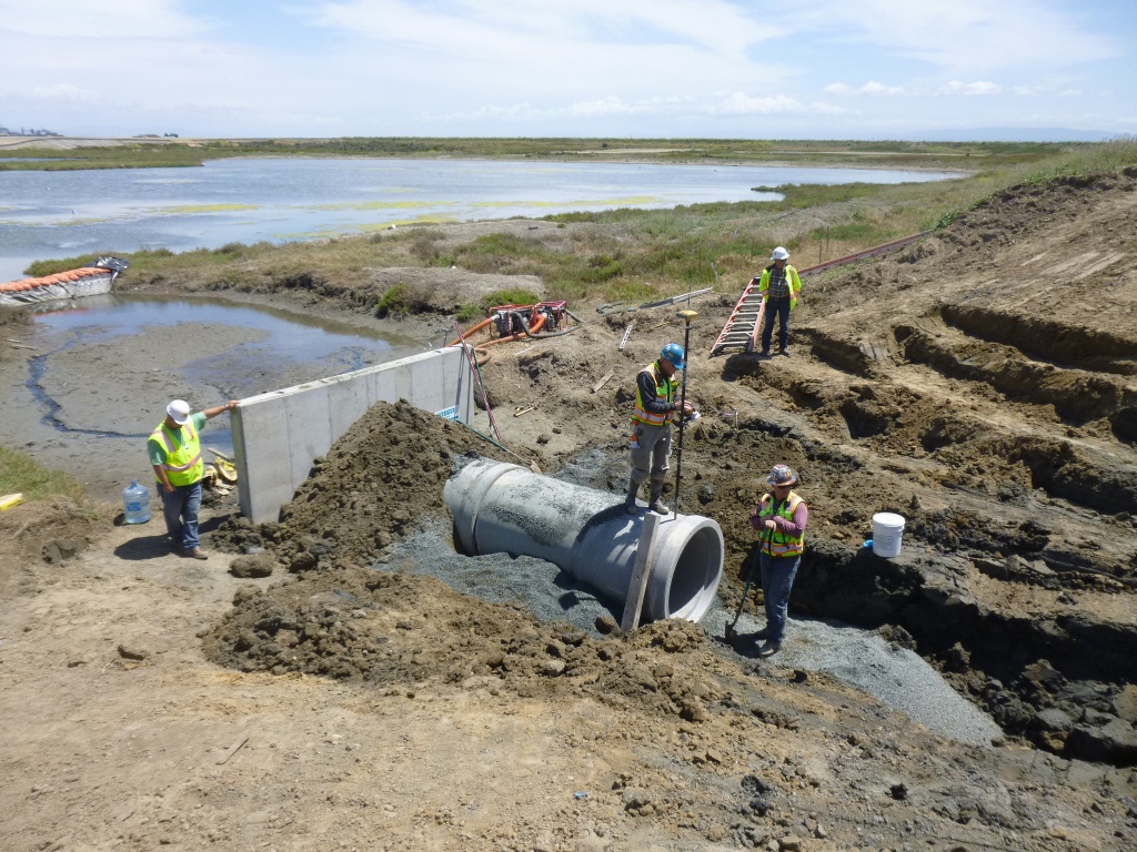
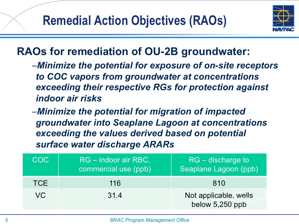
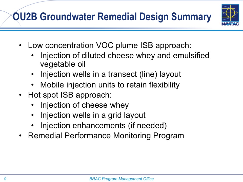
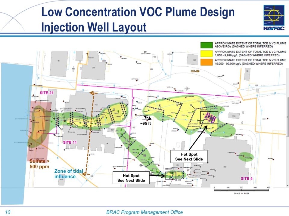
The other type of groundwater contamination encountered at Alameda Point comes from a chlorinated solvent used in cleaning aircraft parts. Unlike lighter-than-water petroleum products, chlorinated solvents can sink through the upper water zone to a depth of 30 feet or more and complicate cleanup. But solvent cleanup still relies on a phased cleanup approach, often employing bacteria in the final phase.

Originally published in the Alameda Sun.

Complete background and a detailed description of the cleanup process at the two gas station sites is in the Bioremediation Work Plan issued in July 2015.

Rehab falters at historical Bachelor Enlisted Quarters

Outdoor soccer activities thrive in the field outside the Bachelor Enlisted Quarters (BEQ) on Lexington Street at Alameda Point. Unfortunately, potential indoor activities languish for lack of a viable business plan.

Soccer game on BEQ Quadrangle at Alameda Point.

Negotiations for converting the BEQ to an international boarding school and a senior assisted living facility ended on January 31, 2015, without a deal. The city council had authorized a six-month exclusive negotiating agreement with developer Alameda United Commercial (AUC) in August of 2014. The developer sought to purchase 20 acres that includes the U-shaped three-building complex, but not the quadrangle lawn area in the middle used by soccer teams.

Despite a favorable staff recommendation to the Planning Board in December to approve the Development Plan for the project, agreement on terms of the deal could not be reached.

The international school (K-12) would have offered boarding for students in junior high and older, commercial offices, an assisted senior living facility, and recreation and dining amenities. The developer proposed landscaping upgrades, 500 bike racks and up to 1,000 parking spaces. “The uses of the site will provide financial support to expand transit services to Alameda Point and the users of the property,” stated city planner Andrew Thomas.

The proposed deal called for the city to receive $7.76 million that would have remained dedicated to Alameda Point. In addition, the developer was going to provide roadway, sidewalk, bike lane and utility infrastructure upgrades to the surrounding four streets totaling $20 million, according to a letter to the city from AUC’s Salvatore Caruso.

South side of BEQ with West Midway Avenue on the right.

The BEQ complex, with a 518,219-square-foot building footprint, is one of the most important contributing sites to the Naval Air Station Historic District. The U.S. Navy constructed the complex in 1940 to provide facilities for the boarding, dining and recreating of enlisted men. The architectural style of the complex is known as “Moderne” and is a unifying design theme of the Historic District.

BEQ Mess Hall

“The City remains very interested in developing the BEQ and believes firmly that it has the potential to be a flagship development in Alameda Point,” said Jennifer Ott, Chief Operating Officer for Alameda Point. “We will be open to any proposals that come our way in the future.”

Meanwhile, the four soccer fields on the BEQ Quadrangle that are leased to the Alameda Soccer Club are booked solid on weekends by as many as 100 East Bay soccer teams that the club is affiliated with. The soccer club funded the replacement of various lawn sections and general lawn refurbishment last year as part of their lease agreement.

BEQ Quadrangle

The exteriors of the fortress-like reinforced concrete buildings show few signs of cracking and structural deterioration since 1940. The interiors are a different story.

BEQ south wing residential and office

Metal thieves have trashed the insides to remove copper wire. With the copper cache picked clean, thieves have turned to aluminum, removing a 15-foot-long aluminum handrail from a mess hall staircase. Some night visitors just come to party and leave behind their spray-painted artwork on the walls. Peeling layers of paint the size of a hand towel dangle from the ceiling of the mess hall kitchen.

BEQ Mess Hall kitchen

“I think it is likely that as Site A [a 68-acre proposed residential and commercial development next to the Seaplane Lagoon] hopefully comes to fruition there will be increased attention on the historic properties in Alameda Point and we will receive more interest in the property,” said Ott.

West side of BEQ along Monarch Street looking toward San Francisco.

Last year, negotiations between the city and AUC on a separate proposal to construct a hotel and condominium project between the aircraft hangars and the Seaplane Lagoon also ended without a deal.

Originally published in the Alameda Sun.

Appendix of photos

Pegasus statue at BEQ

BEQ Mess Hall

BEQ Mess Hall - Alameda Point

BEQ Mess Hall kitchen

BEQ Mess Hall Alameda Point

BEQ Mess Hall kitchen Alameda Point

BEQ Mess Hall dining area Alameda Point

BEQ Mess Hall

BEQ Mess Hall staircase with missing aluminum handrail.
Living quarters on second floor of BEQ Mess Hall.
BEQ Mess Hall second floor living quarters.

BEQ

BEQ Mess Hall dining area.
BEQ Mess Hall storage room.
Second floor room in BEQ Recreation Center.

BEQ Homeport Club recreation center

View from BEQ toward Monarch Street.
BEQ north side.  West Redline Avenue is to the right.
BEQ north side. West Redline Avenue is to the right.
One of the rare cracks in the 75-year-old BEQ.
BEQ north wing living quarters with balcony.

BEQ north wing

BEQ Mess Hall
BEQ Mess Hall

BEQ living quarters

BEQ Mess Hall staircase showing exceptional structural integrity after 75 years.

Soccer on the BEQ Quadrangle

Soccer on BEQ Quadrangle

Soccer on the BEQ Quadrangle

BEQ Mess Hall exterior

BEQ Eagle

Environmental cleanup update – November 2014

Navy environmental cleanup operations at Alameda Point ran the gamut during the summer and fall of 2014.

Operations included using bacteria to clean up groundwater, grinding radium out of a building floor, digging up lead-contaminated soil, constructing a metal shoreline waste barrier, digging up shoreline waste, preparing to install a 30-acre soil cover, constructing a new shoreline wetland, checking drain lines for contamination with cameras, and demolishing a several-acre temporary concrete drying pad near the old Control Tower.

Aerial view of Site 1 cleanup area at northwest tip of Alameda Point, showing newly installed waste isolation barrier along Bay shoreline, piles of contaminated soil in horseshoe shaped area that were excavated from watery pit on right, and stockpiled soil on old runway to be used for soil cover.  A wetland area will be constructed on clear strip on left along Oakland Estuary.  Navy photo.
Aerial view of Site 1 cleanup area at northwest tip of Alameda Point, showing newly installed waste isolation barrier along Bay shoreline, piles of contaminated soil in horseshoe shaped area that were excavated from watery pit on right, and stockpiled soil on old runway to be used for soil cover. A wetland area will be constructed on clear strip on left along Oakland Estuary. Navy photo.

Continue reading “Environmental cleanup update – November 2014”

Endangered Alameda least terns get a secure home

Alameda’s nesting colony of endangered California Least Terns has a new government landlord – and a secure home for the future.  After years of negotiations, the U.S. Navy transferred 624 acres of its former airfield at Alameda Point to the Department of Veterans Affairs (VA) on Monday, November 3.

Least Tern chick, adult with fish, and resting adult, next to tile used for shelter, June 2014.

The transfer includes the former airstrip that was adopted by Least Terns for nesting in the 1970s and that has become the most productive breeding site in California for that species. More than 500 acres – including the area used by the terns – will be preserved as a wildlife reserve. Continue reading “Endangered Alameda least terns get a secure home”

Shoreline contamination barrier under construction at NW tip of Alameda Point

The Navy began embedding a steel barrier along several hundred feet of the western shoreline of Alameda Point during the week of August 18. The purpose of the barrier is to contain contaminated ash and burn waste material that was bulldozed into the Bay some 60 years ago and is now overlain with silt. The area is where the Navy burned various waste materials.

Three of the waste isolation cells under construction at northwestern tip of Alameda Point.  A total of 15  cells, each one separated by a wall behind the face of the barrier, will be constructed here.
Three of the waste isolation cells under construction at northwestern tip of Alameda Point. A total of 15 cells, each one separated by a wall behind the face of the barrier, will be constructed here.

The containment system is called a waste isolation barrier. It consists of 35-foot-long interlocking steel pilings that are hammered into the ground with a hydraulic vibrator suspended from a crane cable. Perpendicular steel walls behind the barrier add stability. The final elevation of the top of the waste isolation barrier will be approximately 10 feet above mean sea level.

A worker guides one of the galvanized steel pilings into place as crane operator maneuvers.

Tests around the area were conducted in 2010, 2011, and 2012 to determine if any of the chemicals in the burn residue were entering San Francisco Bay.  None were found to be entering the Bay.  Nevertheless, the Burn Area’s proximity to the Bay requires that the contaminated waste either be removed or permanently isolated. Removing all of the waste from under the shoreline would have cost $40 million. The containment system costs $13 million.

Piling being slowly driven into the ground by a hydraulically operated vibratory hammer.

The construction of the shoreline waste barrier is part of a larger Navy cleanup project on the adjacent 37 acres, called Site 1, which was once used as an underground waste disposal area. Much of the area is now covered by runway pavement that will remain in place. The entire 37 acres right up to the steel barrier will be covered with three feet of clean soil and seeded with native vegetation. A small wetland area will also be created along the shoreline.

Site 1 cleanup project with crane.  Oakland Estuary in the foreground and San Francisco in the background.
Site 1 cleanup project with crane. Oakland Estuary in the foreground and San Francisco in the background.

When completed early next year, the area will be suitable for passive recreational use, including the Bay Trail.

The work can be observed from the Oakland side of the estuary at Middle Harbor Shoreline Park right next to the cranes.

Originally published in the Alameda Sun.

Background information can be found in this post from April 2013.

More photos and a diagram below 

Waste isolation barrier, looking east

Interlocking pilings closeup

Waste isolation barrier will have 12 more cells to the right when completed.
Diagram of shoreline waste isolation barrier at northwestern tip of Alameda Point.  Navy diagram.
Diagram of shoreline waste isolation barrier at northwestern tip of Alameda Point. Navy diagram.

Site 1 waste isolation barrier under construction

Environmental cleanup reaches milestones as work continues

The Seaplane Lagoon’s north side will be looking like its old self in a few months. The Navy has begun dismantling the waterproof concrete-walled containment system that was used for three years for dewatering and testing of soil dredged from the Seaplane Lagoon, marking a major cleanup milestone. Prior to that dredging work, much of the lagoon’s north frontage served as a staging area for replacement of storm drain lines contaminated with radium-226.

Construction of a new and improved soil cover over a waste disposal site concluded this spring, marking another milestone. The 110-acre site on the southwest corner of Alameda Point took 10 years of haggling about potential environmental impacts before a cleanup plan was adopted in 2010. Work began in early 2013. The dome-shaped soil cover required 500,000 cubic yards of barged-in soil to complete.

North Pond of West Wetland on southwest corner of Alameda Point.  Pond is connected to San Francisco Bay via a new culvert near upper left of pond.  Landfill soil cover is partially visible on far side of pond and will be seeded with flowering native grasses later this year.
North Pond of West Wetland on southwest corner of Alameda Point. Pond is connected to San Francisco Bay via a new culvert near upper left of pond. Landfill soil cover is partially visible on far side of pond and will be seeded with flowering native grasses later this year.

At the far northwestern corner of the Point, work is about to begin on another long studied and analyzed waste disposal site. In a few months, the Navy will be installing an interlocking steel retaining wall along 200 yards of the Bay shoreline to contain contaminated burned waste material that was bulldozed into the Bay more than a half century ago. Water dye tests showed no toxics are leaching into the Bay, but members of the Restoration Advisory Board (RAB) questioned whether the barrier would withstand a catastrophic earthquake. Partially covered by runway pavement, the entire 30-acre site will receive a three-foot soil cover. The work is expected to be completed in 2015. The area will be available for passive recreational use such as hiking trails when the city receives the land.

Northwest tip of Alameda Point where Site 1 is located.  Waste burning area is here.  Trees have been removed.  Port of Oakland is in background.
Northwest tip of Alameda Point where Site 1 is located. Waste burning area is here. Trees have been removed. Metal retaining wall will go here.  Port of Oakland is in background.

One of the longest-running and most problematic cleanup sites is at the old Naval Air Rework Facility (NARF), also known as Building 5, covering nearly one million square feet. Radium paint used for aircraft dial painting, and chemicals associated with engine repair work led to contamination that is still being remediated. The entire floor area will be scanned again for radiation in 2015, following up on at least three prior scanning surveys of walls, ceilings, pipes, and ducts. The year 2015 will also see the Navy returning to the site for a final round of groundwater cleanup treatments targeting contamination remaining after an intensive cleanup effort a decade ago.

Building 5, also known as Naval Air Rework Facility (NARF), where additional radium-226 and groundwater cleanup is planned.  At the corner of West Tower Avenue and Monarch Street.
Building 5, also known as Naval Air Rework Facility (NARF), where additional radium-226 and groundwater cleanup is planned. At the corner of West Tower Avenue and Monarch Street.

Next door to the Bladium Sports Club on West Tower Avenue, another previously treated groundwater cleanup site will be treated again. Workers have already begun boring holes in the pavement for a network of hoses that will be used for introducing contaminant-eating bacteria into groundwater along with a bacteria food source.

On Saturday, July 12, the Navy’s annual cleanup site tour visited four of the cleanup areas. The most impressive stop was the 110-acre landfill site mentioned above. For the first time in over 15 years, members of the public were allowed to walk around and enjoy the magnificent views from the embankment that is closer to San Francisco than to city hall. The fencing is all gone, and with it the radiological warning signs. The Navy replaced an aging metal culvert that connects the site’s North Pond to San Francisco Bay with a concrete culvert.

New culvert being installed connecting San Francisco Bay, which is to the right, and North Pond of the West Wetland at Alameda Point.  Navy photo taken 5/22/14.
New culvert being installed connecting San Francisco Bay, which is to the right, and North Pond of the West Wetland at Alameda Point. Navy photo taken 5/22/14.
New culvert being installed.  North Pond of West Wetland at Alameda Point in foreground, San Francisco Bay in background.  Navy photo.
New culvert being installed. North Pond of West Wetland at Alameda Point in foreground, San Francisco Bay in background. Navy photo.

Tour participants were able to see the area’s expanded wetland with a new tiny island. Caspian Terns started nesting on the island a few months ago, another type of milestone. “The last time Caspian Terns were seen in that area nesting was in 1999 when only one nest was detected,” said Alameda wildlife biologist and Alameda Point bird surveyor Leora Feeney. The 79-acre soil cover on the landfill will be seeded with flowering native grasses later this year. The vegetation mix was chosen by the RAB.

South Pond of West Wetland at Alameda Point.  Island in pond has become a nesting site for Caspian Terns.  Looking north toward Port of Oakland.
South Pond of West Wetland at Alameda Point. Island in pond has become a nesting site for Caspian Terns. Looking north toward Port of Oakland.

According to the Navy’s environmental cleanup coordinator, Derek Robinson, $513 million has been appropriated to date for Alameda Point cleanup, although some of it remains to be spent on upcoming work. His office, the Base Realignment and Closure Program, estimates another $80 million will be needed by the time remaining projects and follow-up monitoring are completed.

Later this year, the Navy is expected to transfer to the city the 33-acre North Housing site and seven-acre former Island High School site that sit next to Alameda Landing and Estuary Park, marking another milestone on the long and winding cleanup road to civilian use.

This story appeared in the Alameda Sun:  Print edition front page and online edition.

Navy Environmental Tour Guide July 12, 2014 – Cleanup Fact Sheets

Navy Presentation Environmental Cleanup Program Review July 12, 2014 to Restoration Advisory Board

More photos and a map

Caspian Terns and chicks at West Wetland, Alameda Point.
Caspian Terns and chicks at West Wetland, Alameda Point.  Click on image to enlarge.
Trail on embankment at southwest corner of Alameda Point.  Looking south with San Francisco Bay to the right and ahead.  Additional trail to the right at riprap elevation.
Trail on embankment at southwest corner of Alameda Point. Looking south with San Francisco Bay to the right and ahead. Additional trail to the right at riprap elevation.
Concrete pad served as a base for conveyor that transferred soil from barge to land for the soil cover at Site 2.  Contractor left it in place and added a few amenities for future users of a place they had come to appreciate the beauty of as they worked here for a year.  Thank you, TetraTech.
Concrete pad served as a base for conveyor that transferred soil from barge to land for the soil cover at Site 2. Contractor left it in place and added a few amenities for future users of a place they had come to appreciate the beauty of as they worked here for a year. Thank you, TetraTech.
Dredging the northwest corner of the Seaplane Lagoon at Alameda Point in February 2012.  Tarmac dewatering, drying, and testing area behind black tarp is now being dismantled.  All dredging work is completed.
Dredging the northwest corner of the Seaplane Lagoon at Alameda Point in February 2012. Tarmac dewatering, drying, and testing area behind black tarp is now being dismantled. All dredging work is completed.

Previous stories about waste disposal areas: 

Scenic Alameda Point wildlife refuge section to be off limits with security fence (May 31, 2012)

Update notes: Subsequent criticism of the Navy as to the necessity of a security fence by members of the public and regulatory agencies led to the removal of the security fence from the final work plan design. The Navy also agreed to shorten the soil gas vents to two feet, since only trace amounts of methane gas are now emitted from the landfill waste, most of which is industrial and did not produce methane in the first place.  Additionally, the Navy agreed to examine the aging metal culvert that connects the North Pond of the West Wetland to San Francisco Bay.  The culvert provides the water lifeline for the North Pond habitat and was at risk of collapse and being stopped up with debris.  The Navy replaced the metal culvert with a concrete culvert (see photo above) and debris screen.

Navy receives comments on landfill/wetlands plans on Alameda Point wildlife refuge (July 15, 2012)

Ending threat of solvents in groundwater leaching into San Francisco Bay (August 31, 2012)

Cleanup plan changes at waste burning area (April 5, 2013)

Landscaping the Navy’s underground waste disposal site (June 4, 2013)

Massive landscaping project changing scenic area on Nature Reserve (August 5, 2013)

Landfill landscaping on Nature Reserve – Update October 2013 (October 26, 2013)

Groundwater solvent cleanup will use cheese whey and veggie oil to feed natural bacteria

Cleanup Operating Unit 2B at east entry to proposed Town Center - Alameda Point.    Graphics by Alameda Point Environmental Report.
Cleanup Operating Unit 2B at east entry to proposed Town Center – Alameda Point. Graphics by Alameda Point Environmental Report.

A Navy contractor will be cleaning up groundwater in part of the Town Center area next to the Seaplane Lagoon by injecting a solution of cheese whey, emulsified vegetable oil and water into nearly 200 wells that go down between 30 and 40 feet. The whey and vegetable oil will cause natural bacteria to flourish that will feed on the toxic trichloroethene (TCE) solvent causing it to break down.

According to the Navy, this type of food-stimulated bacterial bioremediation is common. The cheese whey is similar to the powdered whey products found in grocery stores. It will be delivered to the site already diluted in water. A hose will be connected to a fire hydrant and hooked to a metering device that will mix the whey and oil solution with municipal water as it is pumped into the wellheads.

The work is expected to begin in 2015, with periodic visits and testing until 2020. The first year of operation the contractor will make two visits of 35 days each. During each of these work periods they will inject 246,000 gallons of whey, oil, and water solution into the ground, allowing gravity to disperse the liquid.

The goal of the cleanup is to minimize the potential for hazardous vapors entering buildings, and chemicals migrating into the Seaplane Lagoon. TCE is an industrial solvent used to degrease metal parts. It was heavily used at aircraft and ship engine repair facilities on the site. A leak from a rail car is believed to be one of the major sources of the plume.

The 33-acre cleanup area is immediately to the south of the Navy jet on West Atlantic Avenue at the east entry to Alameda Point near Main Street. It is within the 150 acres of the Town Center that the city is seeking to develop in the near future.  In April, the city council sent out requests seeking qualified developers interested in residential and commercial projects. The cheese and veggie oil cleanup area will not be transferred to the city until at least 2020 when cleanup has been certified to have met its goals.

Cleanup of fuel in groundwater ended about four years ago at an old fuel distribution point on the north side of the jet monument.

Below is an audio and image presentation from the Alameda Point Restoration Advisory Board meeting on May 8, 2014.

voice graphic w:text

Slide01

Slide02

Slide03

Slide04

Slide05

Slide06

Slide07

Slide08

Slide09

Slide10

Slide11

Slide12

One of the high contamination "hot spots" that will get extra treatment to cleanup trichlorethene solvent in groundwater 30 to 40 feet deep.
One of the high contamination “hot spots” that will get extra treatment to cleanup trichloroethene solvent in groundwater 30 to 40 feet deep.
Fenced area is where testing was conducted.  This is one of the hot spot areas that will get extra attention to clean up trichloroethene in groundwater.
Fenced area is where testing was conducted. This is one of the hot spot areas that will get extra attention to clean up trichloroethene in groundwater.
Groundwater cleanup area on OU-2B.  Cleanup will not be completed until 2020.  Looking west with maritime ships in background in Seaplane Lagoon.
Groundwater cleanup area on OU-2B. Cleanup will not be completed until 2020. Looking west with maritime ships in background in Seaplane Lagoon.