~ Developer proposes housing, hotel, and plaza at former Navy supply center
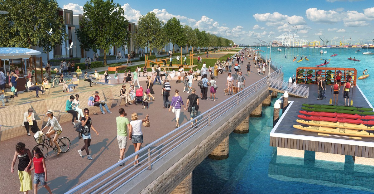
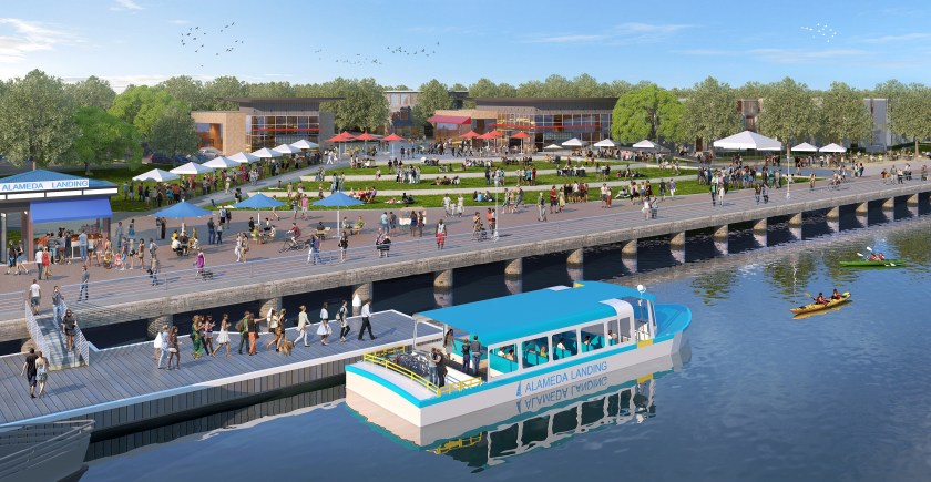
Alameda Landing is about to enter its final phase of development. A 2006 plan that once called for all commercial on the 41-acre waterfront parcel behind Target is being replaced with a new plan. It includes an additional 375 housing units, a 124-room hotel, restaurants, and a small amount of commercial space. An eight-acre waterfront park and promenade remain as the centerpiece.
Proposed Fifth Street Plaza with water shuttle. Courtesy of Catellus.
The developer, Catellus, decided to shelve the all-commercial plan due to lack of demand, coupled with high costs to develop the seismically challenged site.
Sean Whiskeman, senior vice president of development for Catellus, points to the fact that zero new office construction is underway along the Interstate 880 and Interstate 80 office corridor. The lack of demand “is a very compelling statistic in our opinion,” said Whiskeman, “especially given the alternative office sites available within Alameda.”Continue reading “Waterfront plans change at Alameda Landing”
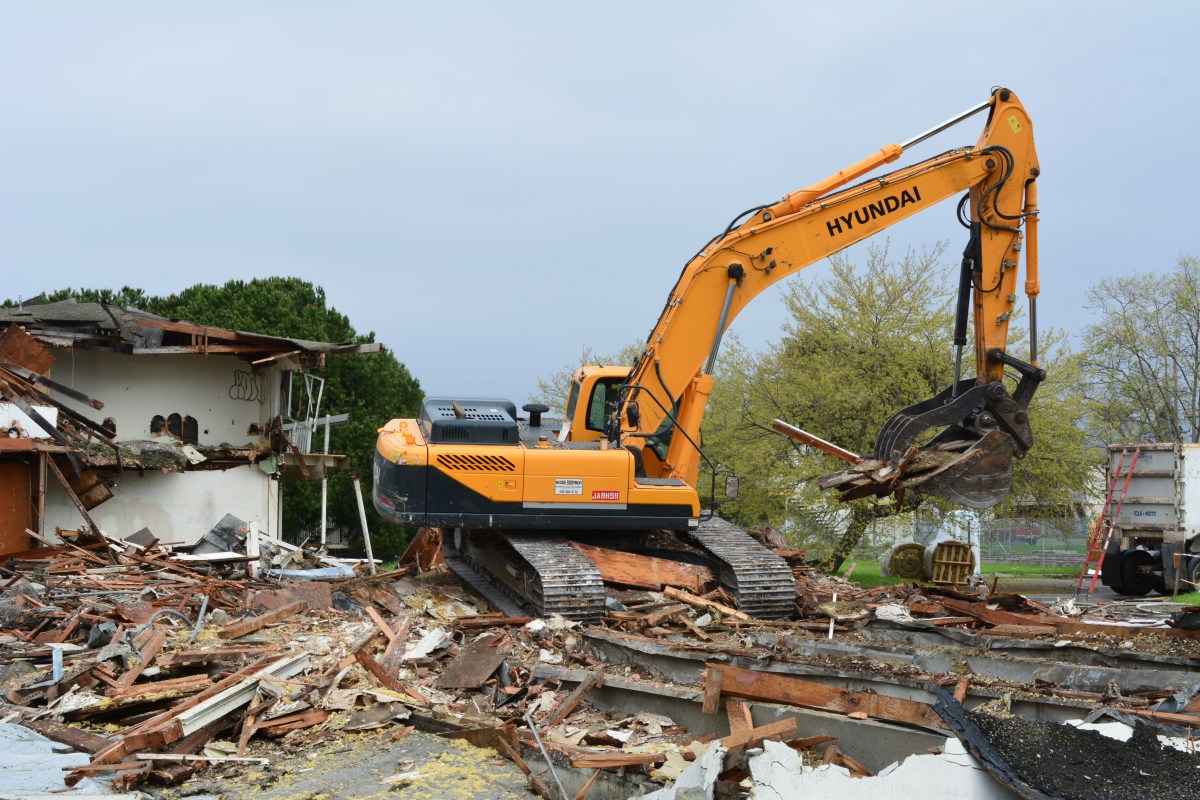
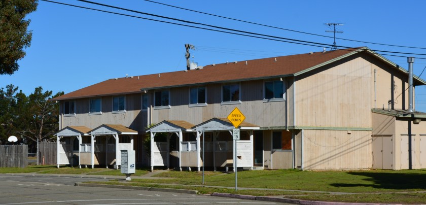
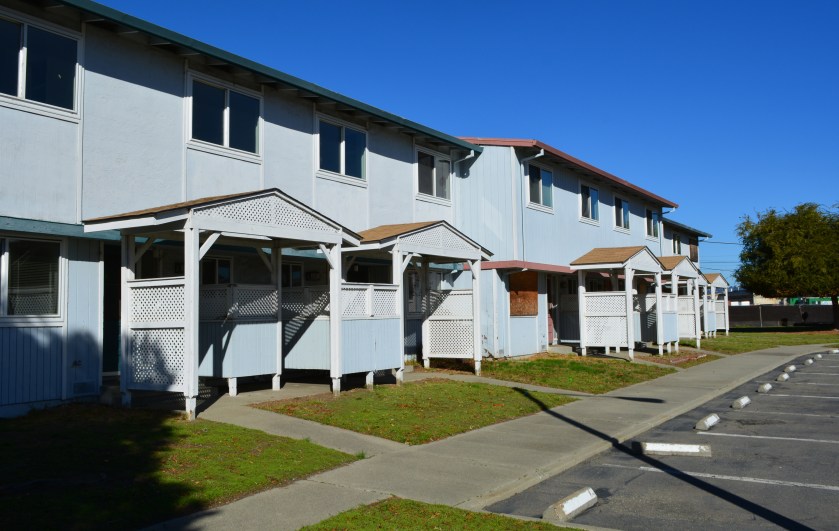
The demolition of 16 former Navy apartment buildings at Alameda Point has begun. On January 5, 2016, the City Council awarded a $547,000 contract to Asbestos Management Group of Oakland to perform the demolition.
Demolition of Navy apartment buildings at West Tower Avenue and Orion Street, Alameda Point.
In April of 2015, the city council directed city staff to come up with a plan to address safety and blight issues after KTVU Channel 2 aired a story about unsafe conditions at the abandoned housing area.
The structures are located on Orion Street, West Tower Avenue, Stardust Place and Pearl Harbor Road. Demolition began during the second week of March and is expected to be completed within 60 days. The job is being paid for out of Alameda Point base reuse funds. Continue reading “Demolition of former Navy apartments begins”
The city has received a prestigious award for its successful collaboration with a private developer on a brownfield redevelopment project—namely, Alameda Landing. The new retail and residential area is located near the Webster/Posey Tubes.
“The Landing is a complex project that lends itself to a public-private partnership,” said Debbie Potter, the city’s Community Development Director. Potter accepted the Phoenix Award on behalf of the city at the “Brownfields 2015” conference in Chicago. The award dovetailed with the conference theme of transforming blighted areas into productive sustainable development projects.
An old warehouse used for the Navy’s former Fleet Industrial Supply Center and a crane at the Port of Oakland provide a backdrop for condominiums nearing completion on Bette Street at Alameda Landing.
“Public-private partnership is pretty much the model at all former military bases. But it’s not a business model that every developer embraces,” said Potter. “Business is conducted in public.”
More business will be conducted in public early next year when Catellus is expected to approach the city council with revised plans for the last and final phase, which will include downsizing the previously approved office space and adding housing.
One project is selected from each of the 10 U.S. Environmental Protection Agency regions. Alameda Landing took home the award for Region 9, which covers California, Nevada, Arizona, Hawaii and Pacific Islands.
The city inherited a potentially valuable land asset from the Navy in 2000—a housing area that was to become Bayport, and an abandoned naval supply complex and hospital that was to become the Landing. Soon thereafter, the city selected Catellus as the developer.
Since then, challenges have been a frequent companion. The city and Catellus “had to work through infrastructure challenges, regulatory challenges, and financing challenges,” said Potter. “Virtually every aspect has required special attention, from soil conditions to retail makeup to the strength of the pier structure along the waterfront.”
As Bayport construction was underway, it became apparent that the initial proposed plan for 1.3 million square feet of research and development office space at the Landing was not viable. The time to adapt or die arrived early. “Being nimble throughout the process is key,” said Potter. “Without flexibility, you end up with no project.”
By early 2007, the city had decided to give Catellus wide latitude on what it was allowed by right to construct at Alameda Landing. Any configuration is allowed as long as the impacts, namely traffic, do not exceed the impacts identified in the environmental impact report.
The most significant changes were the slashing of office space to 400,000 square feet and the addition of up to 300 residential units at Alameda Landing.
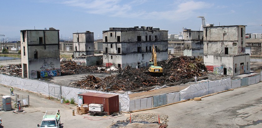
In 2009, while the city and Catellus were waiting on the economy to rebound from the last recession, a fire of suspicious origin engulfed the abandoned hospital, which was still owned by the city. Lead and asbestos were incinerated in the fire. The added demolition and special cleanup costs amounted to several million dollars. The city will finally recoup all of its cleanup costs with a final payment from Catellus during the waterfront phase, according to Potter.
Wooden debris being cleaned up after a fire destroyed the abandoned Navy hospital in 2009. Location is about 100 feet west of Target at Alameda Landing. Looking northwest. Photo used by permission from City of Alameda.
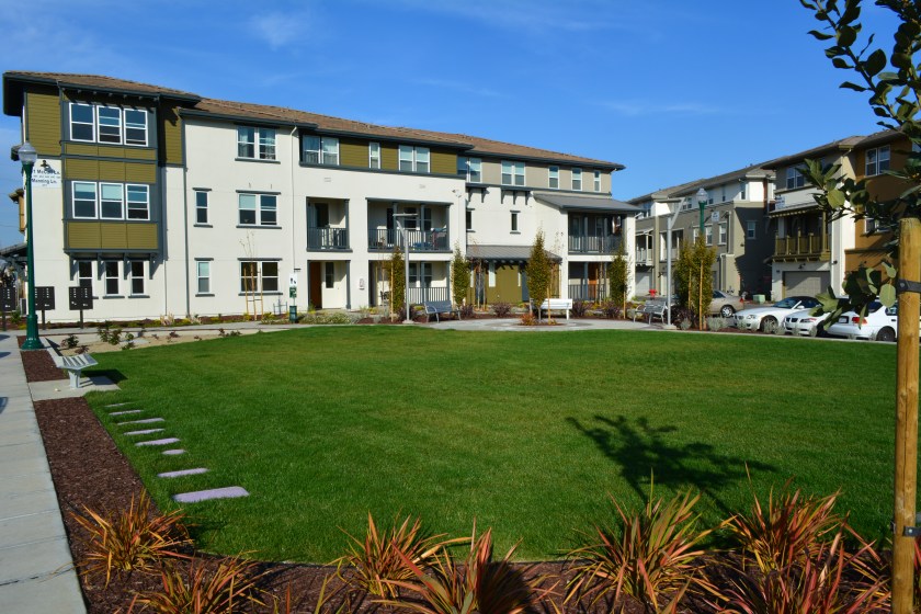
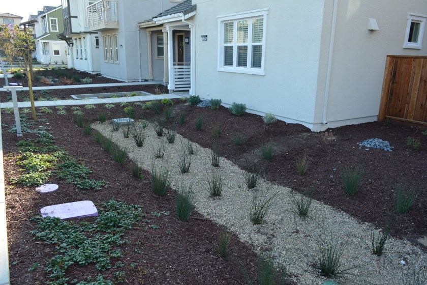
Most of the Landing retail space is now filled, and the 284 residential units are nearing completion. “Tri Pointe is the first private multifamily housing constructed in Alameda since the charter amendment known as Measure A was enacted in 1973,” said Potter. “The Tri Pointe residential project was approved under provisions of the city’s Density Bonus Ordinance.”
Generous landscaping complements the loft-style condominiums at Alameda Landing near Target.
Construction is about to begin on Stargell Commons, 32 rental units for low- and very-low-income households, along with a community center. Catellus is bringing the infrastructure to the site and contributing $2 million for this project. The City of Alameda Housing Authority will own the land and lease the land to Resources for Community Development, which will build and manage the complex.
Stargell Commons, to be located at Bette Street and Stargell Avenue at Alameda Landing.
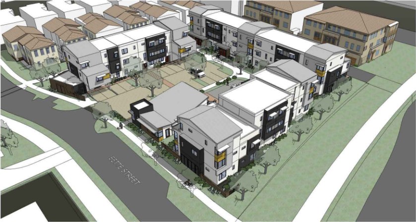
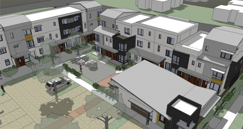
The final phase of the Landing—in the warehouse area between Mitchell Avenue and the Oakland Estuary that was originally slated for office space, a Miracle League baseball park, and a waterfront park and promenade—begins next year.
But first, the city council will be asked to approve a major revision that will include the addition of housing and the subtraction of office space due to weak demand. The Miracle League baseball park has been scratched because it’s now slated to become part of Estuary Park nearby, which Catellus contributed toward.
The authority for adding housing to the last phase of the Landing project originated in 2012, when the former city council updated the General Plan Housing Element, creating a Multifamily Overlay zoning designation. These special overlay zones, or sites, provide the rights for multifamily housing on specific sites. It designated 10 acres at 30 units per acre on the land north of Mitchell Avenue.
“It gives Catellus zoning rights to residential if they want to pursue residential,” said Potter. “No amendment to the development agreement or master plan is needed,” explained Potter. “But keep in mind that the zoning designation—multifamily overlay—is constrained by the requirement that any revised uses must fit within the environmental impact report and not generate additional impacts.”
The city currently owns the warehouse area north of Mitchell and collects about $800,000 a year in rent from two tenants. The land will be sold to Catellus upon approval of the revised plan.
The Phoenix Awards Institute, Inc., a nonprofit, administers the awards. The U.S. Environmental Protection Agency and the International City/County Management Association organized the national conference in Chicago.
Brownfield definition: “A brownfield is a property, the expansion, redevelopment, or reuse of which may be complicated by the presence or potential presence of a hazardous substance, pollutant, or contaminant.” Source: U.S. Environmental Protection Agency.
Additional info: California State Water Resources Control Board Brownfields Program.
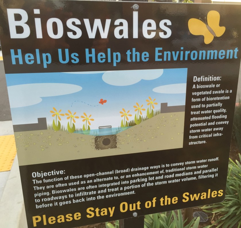
Stargell Commons courtyard close-up.Bioswale water filtration in the parking lot of Alameda Landing retail area.Description of “bioswales” in Alameda Landing parking lot.Bioswale natural filtration for water runoff in residential area of Alameda Landing.
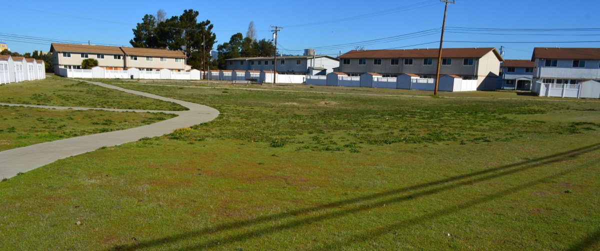
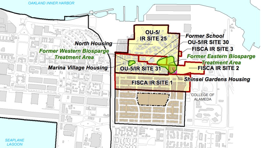
The vacated residential area known as North Housing—located between Alameda Point and Alameda Landing—has been deemed environmentally safe for transfer out of Navy hands. The approval comes after a four-year effort to clean up groundwater to drinking water standards was declared unnecessary and terminated.
Center courtyard in former Navy housing area called North Housing. Looking north/northeast.
The original overly cautious risk assumption in the 2007 cleanup plan—that humans might somehow ingest the salty groundwater 10 to 20 feet below the surface—is now seen as implausible. The vapor extraction system covering a six-acre area of benzene and naphthalene-contaminated groundwater was dismantled in 2014 after a new round of tests showed that there is no evidence of harmful vapors rising to the surface.
The land was originally slated for transfer to the Coast Guard. But the Coast Guard decided in 2008 that it no longer wanted the property. The Navy and the city then worked out a plan that incorporates a federal requirement for homeless accommodation and a for-profit development.
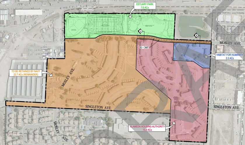
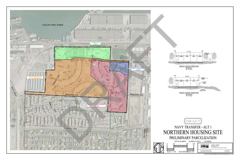
The 22.7 acres slated for auction to a private developer will be tagged with utility infrastructure costs—streets, drainage, utilities—on all of the North Housing area, except for the Housing Authority’s 13.6 acres and Habitat for Humanity’s 2.2 acres. The Housing Authority and Habitat for Humanity will be responsible for bringing new utility services from the nearest street to their housing units.
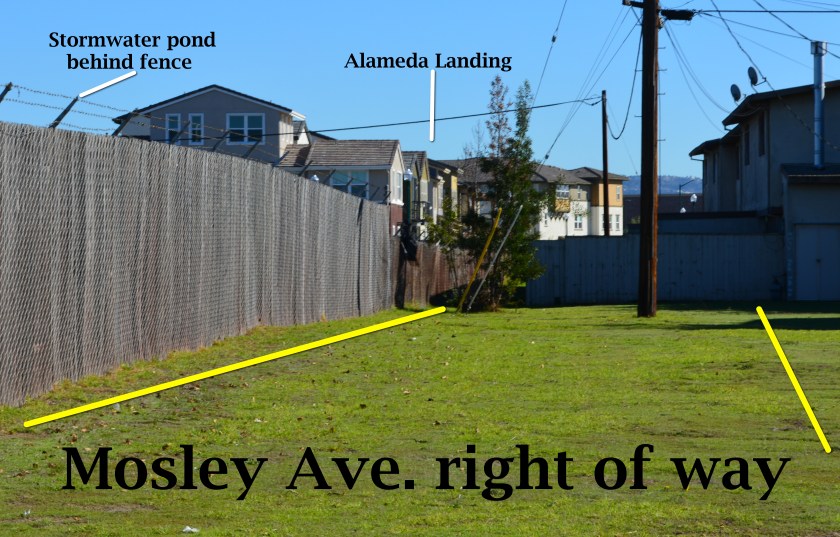
Draft map prepared by the city of Alameda showing proposed Housing Authority, Habitat for Humanity, and private developer parcels. Pending final approval. Dusty rose area going to Housing Authority, blue to Habitat for Humanity, tan to private developer. Click on map to enlarge.
Mosley Avenue will be connected between Alameda Landing and North Housing with 360 feet of new roadway.
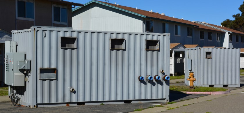
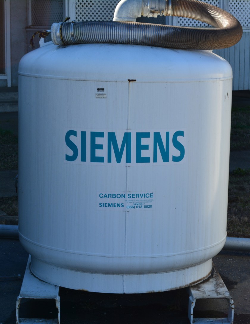
In 2013, the Navy turned off its air pump and carbon filter vacuum cleanup system to see if it made any difference in the concentrations or movement of contaminants. It didn’t.
But before the U.S. Environmental Protection Agency (EPA) would sign off on a permanent shutdown of the cleanup system, it wanted a new set of tests at ground level to ensure there is no risk of harmful vapors. The Navy conducted tests inside the vacant housing, in the crawl spaces, and under the parking lot and basketball courts at the former Island High School property. The negative results satisfied the EPA.
In April the Navy officially amended its original 2007 Record of Decision cleanup plan, with regulatory agency concurrence, citing new evidence. It also cited city, county, and state regulations that prohibit intrusive activities and specifically prohibit well installation in the shallow groundwater where the contamination is located. The cleanup plan amendment said that results of the evaluations of extensive data for this cleanup area “show that there is no unacceptable risk for current residential and school uses and any potential future land uses.”
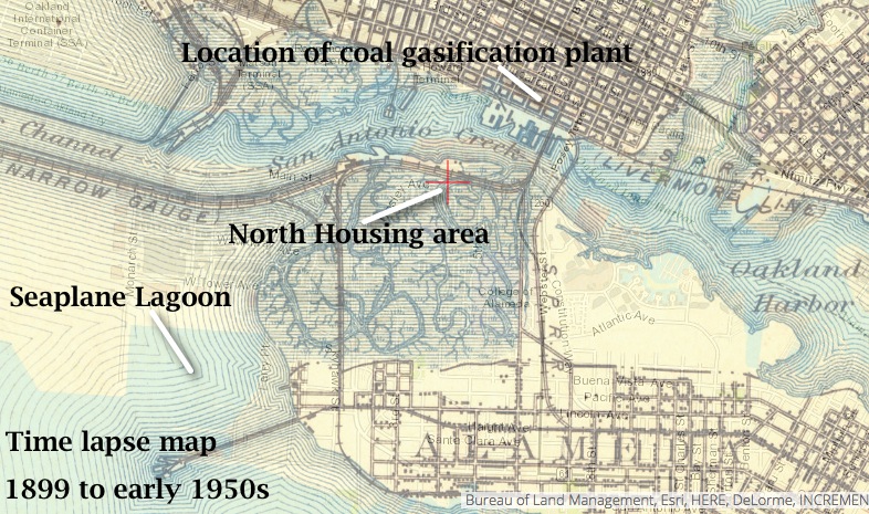
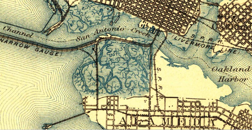
The amended plan also cited new evidence that suggested the contaminants were part of what is called the Marsh Crust at around 20 feet below ground and essentially stuck there. The Marsh Crust is a layer of “hydrocarbon gunk” that Oakland Gas Light Company’s coal gasification plant discharged from about 1880 to 1910. The waste discharges went into what was then San Antonio Creek, and much of it settled on the nearby marshland where North Housing now sits.
Time lapse map showing former marshland where North Housing is now located. Source: US Geological Survey Historical Topographic Map Explorer.
The land was never cleaned up before being filled in for use as San Francisco Bay Aerodrome—hangars and two runways—from 1930 to 1941. The Marsh Crust extends from the Oakland Estuary to Bayport and over to central Alameda Point. A city ordinance requires a permit before digging into the Marsh Crust to ensure safe handling.
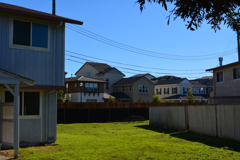
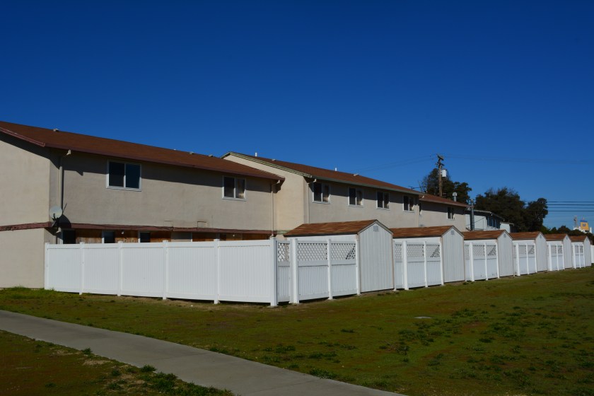
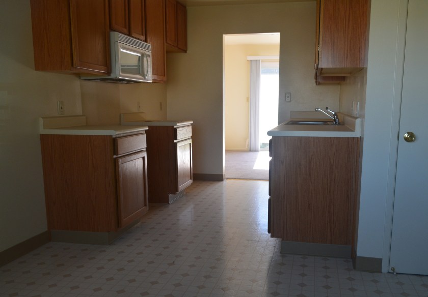
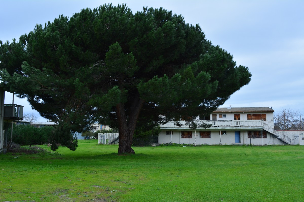
The 37-acre North Housing area lies adjacent to the new Alameda Landing residential neighborhood. The site currently contains 51 residential structures with 282 three- and four-bedroom units constructed in 1969. With the possible exception of the two acres going to Habitat for Humanity, all of the units will be demolished to make way for new construction.
Future Housing Authority property, with new Alameda Landing houses in the background.
The Housing Authority will build 90 units of supportive housing that will include a community center.
It is not yet determined what Habitat for Humanity will do with its parcel. The private developer area is currently zoned for 315 units of multifamily residential housing and may exceed that number if the density bonus is applied for.
The transfer of properties is expected in 2016. The auctioning of the for-profit North Housing Navy property will follow, but no firm timeline has been announced.
Edited version of article first appearing in the Alameda Sun.
Map showing two groundwater cleanup areas in OU-5.Control module with pumps for groundwater cleanup system waiting to be hauled away from North Housing.Charcoal filter tank to remove benzene and naphthalene from groundwater vapors, waiting to be hauled away.
Typical current condition of North Housing interiors.Typical current condition of North Housing interiors. Photo date: November 19, 2015.
Draft North Housing site map, with Mosley Avenue connection details. Click on map to enlarge.1899 topographical map of western Alameda showing marshland. Source: US Geological Survey Historical Topographic Map Explorer.
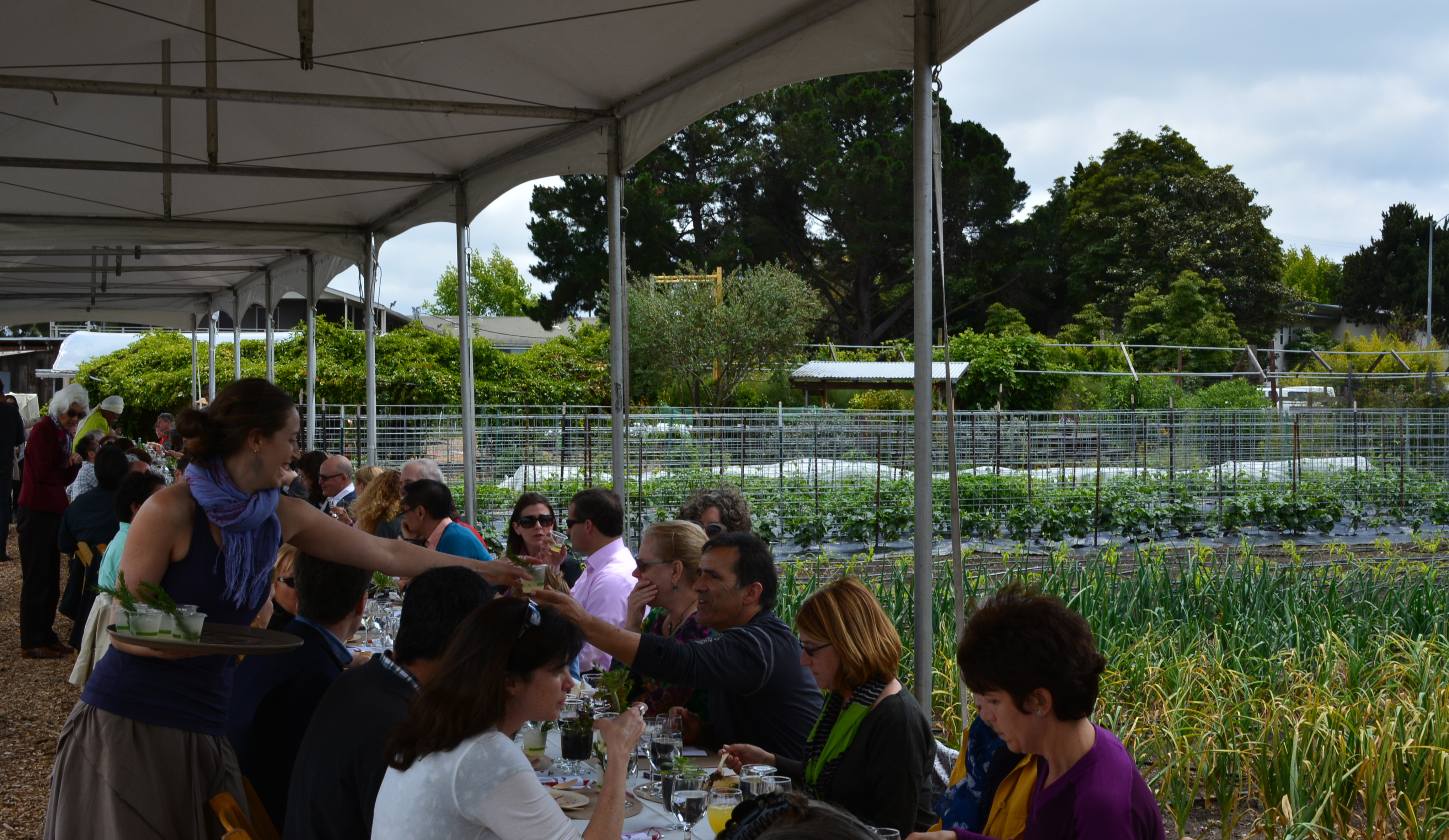
Patrons seated themselves under a canopy between rows of crops at Alameda Point Collaborative’s farm for its fifth annual “Urban Farm Table” fundraising luncheon on Sunday, May 17. A guitar and stringed bass duo provided musical ambience for the arriving guests from within a nearby thicket of blossoming passion fruit vines. Bees went about their business from teeming beehives clinging to the branches of a fruit tree in the farm orchard. It was an earthy affair.
The Collaborative provides supportive housing for homeless individuals, children and youth services, and job training programs, such as selling their farm produce through a subscription service, operating a commercial kitchen, and raising and selling plants at the Ploughshares Nursery.
Nationally known author and sustainable food activist Bryant Terry gave the keynote address. He wove together personal memories of food and culture from the days before the phrase “slow food movement” was coined. Terry characterized APC’s local farm program as a radical idea in an era of corporate agribusiness that harms the environment and shortchanges consumers’ health.
Terry praised the Collaborative’s Farm2Market subscription produce program as a model that should be emulated throughout the country. “There are many urban neighborhoods where it’s easier to find a gun than a fresh apple,” he said. Terry is the author of the critically-acclaimed “Vegan Soul Kitchen: Fresh, Healthy, and Creative African-American Cuisine.”
Terry wrapped up his engaging talk about food and culture by preparing a simple veggie dish over a gas burner. While he was chopping and stirring, he offered a tip for anyone expecting dinner guests. He said no matter what you’re serving, throw some olive oil and garlic into a hot skillet before the guests arrive to get that aroma into the air. “They’ll compliment you every time, even if all you are serving is dessert.”
A cadre of snappily dressed servers delivered a two-course meal. The tricolored beet salad with pistachios, spring greens and radishes was topped with a roasted apricot and Point Reyes bleu cheese vinaigrette and accompanied by a slice of Rosemary focaccia.
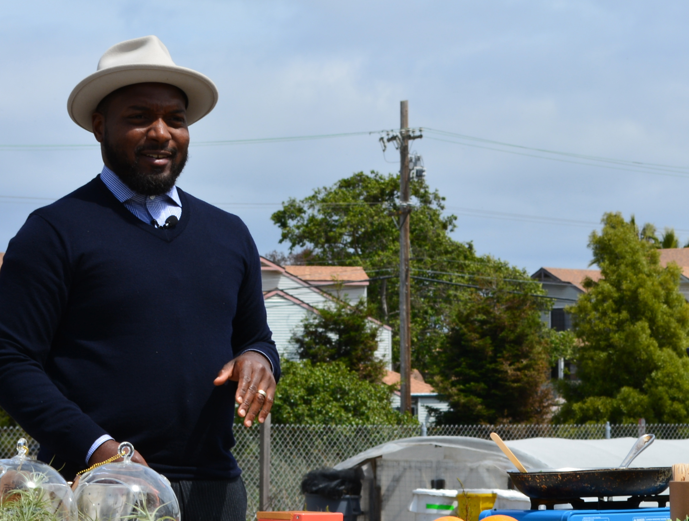
Jeff Rosen at left in white.
The gourmet menu was created and supervised by Jeff Rosen, executive chef at Oakland’s Blue Heron Catering. All of the produce was grown at APC’s farm. Joe Pucci Seafood provided the local salmon. The featured beverages came from Rock Wall Wine Company, St. George Spirits, and Petitpot.
As each pan-roasted salmon entre was assembled, chef Rosen personally inspected each plate and spooned on the Tuscan salsa verde before it was hustled off to the table. The nine vegetarians enjoyed the chef’s fresh pea and green garlic cakes with shaved fennel.
Awards were handed out to volunteers and supporters from the Haas School of Business, Buena Vista United Methodist Church, Bay Farm Elementary School, and Alain Pinel Realtors.
The event was sponsored by Alameda Point Partners, Penumbra, SanMan Productions, VF Outdoor, and Assemblyman Rob Bonta.
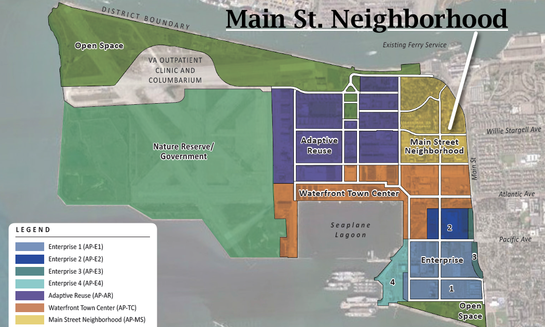
Alameda Point is on the cusp of a new era in civilian reuse. Plans for construction of residential neighborhoods and commercial space are taking form, alongside growing productive reuse of aircraft hangars. The U.S. Department of Veterans Affairs (VA) is poised to begin the first phase of their $240 million clinic and columbarium project. In addition, the Water Emergency Transportation Authority (WETA) is studying plans for accommodating their increasing ferry ridership.
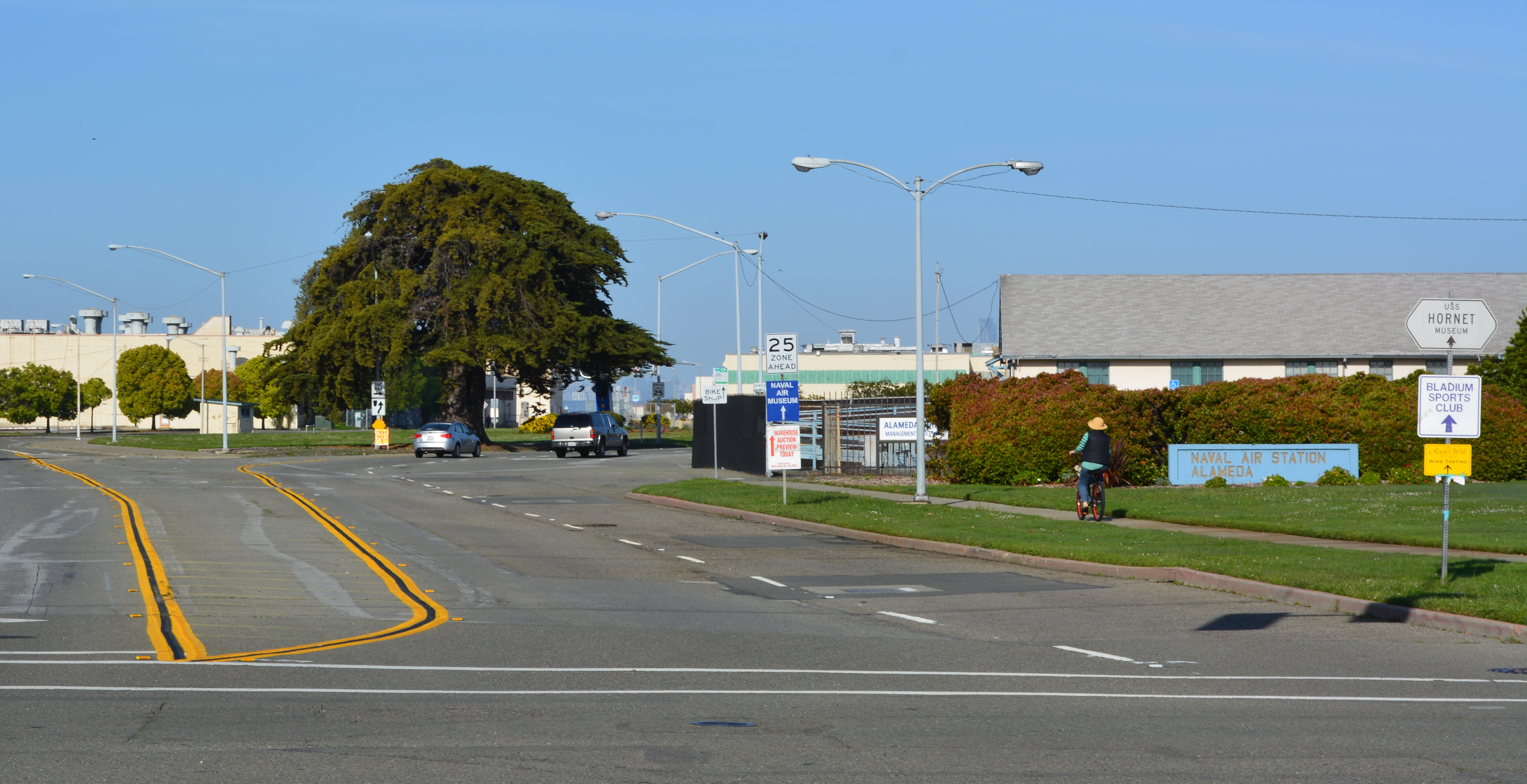
At its January 20, 2015 meeting, the city council will weigh-in on the preliminary layout proposed by developer Alameda Point Partners (APP) for a 68-acre residential and commercial parcel between Main Street and the Seaplane Lagoon.
West Atlantic Avenue will be realigned as a four-lane divided street to the right of the big tree and become a continuation of Ralph Appezzato Memorial Parkway. Main Street in foreground.
APP was selected by the former city council on November 18, 2014, to work up a plan for 800 condos and apartments and 200,000 square feet of retail and commercial space. The developer will also be responsible for changing the gateway street alignment from an oval to a straight line leading to a new public plaza at the Seaplane Lagoon.Continue reading “Alameda Point gateway plan begins taking shape”