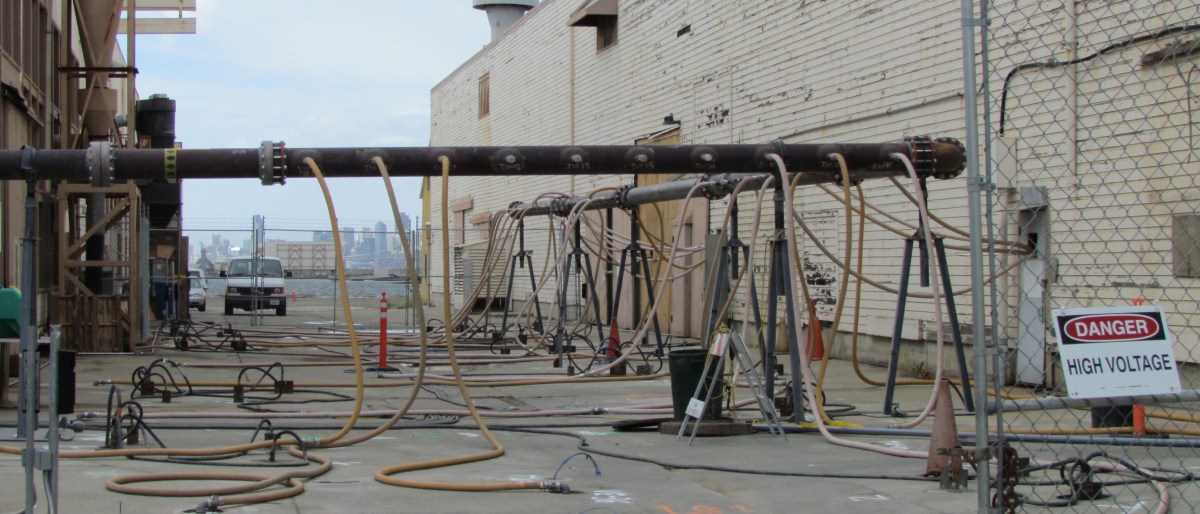
The groundwater remediation project between two buildings near the East Gate entrance, in the area known as Operating Unit 2B, finally got underway after a long delay in startup since last spring.
During set up, one of the 30-foot-long steel electrodes driven into the ground to generate heat struck a plastic sewer line. The sewer line was not on any maps and was undetectable through scanning since it is not iron. Operation of the system began last month after a sewer line bypass was installed, and it will continue through May.
Heating and extraction of solvents in groundwater between East Gate entrance and Seaplane Lagoon.
The contamination is from nearby aircraft maintenance operations that resulted in chlorinated solvents, used in cleaning aircraft parts, ending up deep underground in the groundwater. Of the three most common methods for cleaning up groundwater contaminated with solvents and fuels – pumping in neutralizing chemicals, heating up the ground to vaporize and extract the contamination, and bioremediation using microbes – the heat treatment method was chosen for this site because it is the fastest.
Graphic illustration of heat treatment system. Brown electrodes are heated with electricity, which heats the soil and groundwater, creating steam and toxic vapors that are sucked out into red pipe. Navy graphic.
It takes weeks for the ground to get to the target temperature of 194 degrees, which is the temperature at which the solvent boils and turns to vapor. Pipes at ground level suck the vapor out of the ground and channel it through a large pipe to the granulated activated carbon filter system.
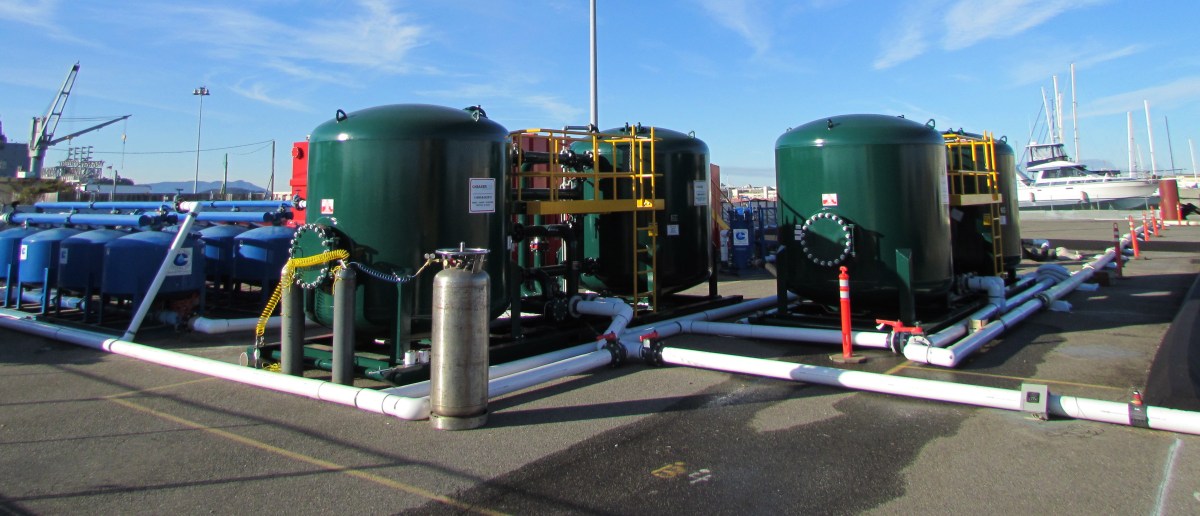
Granulated activated carbon filter system in tanks. Water vapor and toxic vapors are captured and separated.
Other groundwater contamination nearby will be treated by a different method not yet announced. The Alameda Point electrical substation is near the other treatment area, and underground electrical lines leading every which way preclude the use of electrodes to heat the groundwater.
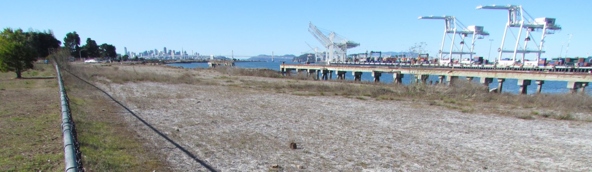
Todd Shipyards/Site 28. Dog Park to left of fence, Port of Oakland on right.
Right next to the Main Street Ferry Terminal, between the Oakland Estuary and the Dog Park, is the Navy’s cleanup Site 28, also known as the Todd Shipyards site. The contamination at this site — copper and arsenic, and to a lesser extent lead and hydrocarbons — was not the result of Navy activities, even though the Navy owns the property.
Background
Filling in the land with estuary dredge soil contaminated with hydrocarbons from the coal gasification plant that once operated in Oakland was likely responsible for the petroleum-related hydrocarbons in the ground. The Alameda Mole Railroad operated along this route from 1883 until 1939 and was also a possible contributor to the hydrocarbon residue in the soil. Non-Navy shipbuilding and repair between 1941 and the 1980s was responsible for lead, arsenic, and copper contamination.
According to the Navy fact sheet, “The property was leased to various entities for non-Navy shipbuilding and repair between 1941 and 1970. The property was purchased from the Navy in 1970 by the Todd Shipyards Corporation, which used the land as an extension of its adjoining shipyard property until 1983, when the property was then sold to Alameda Gateway Limited. The IR Site 28 portion of the former shipyard reverted to Navy ownership in 1995.”
Paint used on ships
The copper contamination came from paint used on the bottoms of ships. The paint was an anti-fouling paint that served to prevent the growth of barnacles. Copper in the paint acted as the biocide, which is why possible leaching into the estuary is a big concern.
Emerging cleanup technology
Todd Shipyard/Site 28 groundwater monitoring well. Alameda Main Street Ferry Terminal in background.
Even though the Navy did not cause the contamination, they are responsible for the cleanup, which it performed in 2010. They are also responsible for monitoring the groundwater for 10 years to make sure their methods are permanent. Some of the methods used here were straightforward: Digging up soil and replacing with new soil.
The copper at groundwater level, however, is being dealt with by an emerging technology called metals immobilization. In this process a proprietary non-toxic compound is injected into the ground to bind to the copper and cause it to be absorbed into soil particles, which will prevent it from leaching into the estuary and harming aquatic life. Hence, the term immobilization – the copper is no longer mobile, or able to move. Water and natural microbes in the ground are what activates this immobilization compound. A helpful byproduct of this reaction is that food (carbon) for natural microbes is released, further enhancing the effectiveness of this process.
So-called emerging cleanup technologies are halfway between experimental and mainstream. They have been proven effective in the short term, or in some locations, but have not been in widespread use long enough to be considered 100% effective in every soil type. No one knows for certain if the binding effect will hold, but pilot lab tests were done on soil from Site 28, and the Navy and regulators fully expect it will work. If groundwater monitoring indicates that it’s not working, the Navy will have to come up with another plan since there is no statute of limitations on their responsibility for cleanup.
The past year had some high points and low points in the cleanup process at Alameda Point. Added delays, including a pile-driving surprise, were balanced out by steady progress.
The year saw, among other things, completion of a second Point-wide radiological survey of buildings and structures that identified two building interiors needing radium remediation, a new soil scan for radium on a section of the western runway area, replacement of a storm drain segment next to the Seaplane Lagoon, and preparation of the environmental document for the Berkeley Lab site, which will be useful whether we get the Lab or not.
Northwest Territories - Site 1 dump area, partly covered by runway
The contractor preparing to cover the old dump with rocks and soil at the northwest tip of Alameda Point delivered some embarrassing news to the Navy. In the normal course of their duties, work-plan design testing revealed that the shape of part of the contamination did not match the official description. You would think they could just process a work-order change. But the Superfund law requires an additional two-year review process, which will push the completion of this open space opportunity to 2015.
At another cleanup project, the Navy drove over four dozen 30-foot steel electrodes into the ground to heat up the toxins and capture the vapor. But before turning on the electricity, the contractor discovered they had hit a sewer line. The project has since been idle for months awaiting a decision on how to proceed.
Seaplane Lagoon dredge dewatering pad - northwest corner
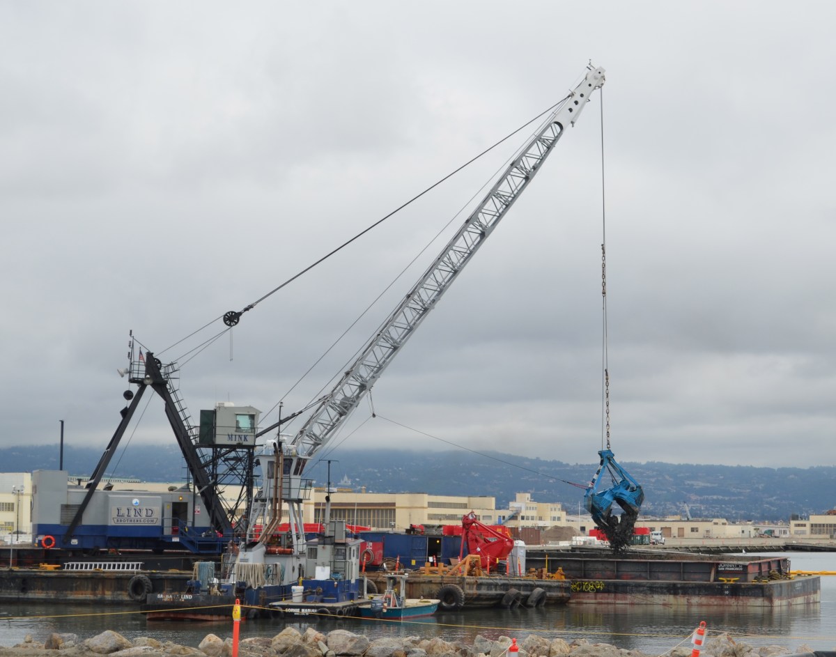
The big Seaplane Lagoon dredging project that began in January is certainly one of the most dramatic displays of cleanup. Both the northeast and northwest corners of the lagoon were supposed to have been dredged by April and final soil disposal completed by year’s end. But the contractor failed to meet the deadline and was let go. A new contractor has been testing and removing existing soil, as well as doing extensive set-up over the past two months for the dredging of the northwest corner that will begin in January.
Another dredging project has just begun under the dock area next to the maritime ships. They’re removing mud contaminated from two storm drain lines. That project is on schedule. It’s worth visiting the area to get a glimpse of the elaborate engineering needed to capture and clean water runoff from the mud.
Shinsei Gardens low-income housing located above ongoing groundwater cleanup
Less dramatic and seldom seen work is always ongoing. Groundwater is monitored at cleanup sites to ensure cleanup goals are being met. One example is the monitoring of the removal of benzene and naphthalene under Shinsei Gardens and vicinity.
Evidence of the Petroleum Program is also seldom seen, other than some white PVC pipes in the ground. But besides the big fuel extraction projects, there is ongoing testing of pipelines and oil/water separators in order to develop a remedial plan.
Finally, and perhaps most important, getting the first, very large, no-cost land conveyance from the Navy next year appears to be on schedule. To help make it happen, the Navy and regulators are planning on modifying cleanup goals by enacting restrictions against future ground-floor residential development near the east entrance to Alameda Point.
Looking toward Berkeley Lab site.Conceptual buildout for Lab 2nd campus
The Site Management Plan (SMP) for the proposed site of the Berkeley Lab Second Campus at Alameda Point was finalized on November 18. Prepared by the city’s longtime environmental consultant, and signed off on by the Navy and regulatory agencies, the document was prepared in order to mitigate potential risks associated with development of the 45-acre parcel near the ship docks. Its primary purpose is to provide direction to construction contractors and workers so that their digging, dewatering, and soil handling activities do not jeopardize the environment or the health of the surrounding community.
Crash Course on Cleanup
The document offers a crash course on the 20-plus years of environmental cleanup of the area, including areas that barely intersect the Site on the margins. Even if the area were never to have been polluted by Navy activities, the SMP would still be required because of a decade-old city ordinance governing digging into a subsurface layer called the Marsh Crust that contains petroleum-related pollution.
What is the Marsh Crust?
Before 1900, the areas now occupied by Alameda Point and Bayport were tidal marshlands. In the late 1800s and early 1900s, before the health effects of industrial pollution were known, two industries nearby dumped their waste into the water. One of those industries was a coal gasification plant in Oakland. The other was the Pacific
Alameda in 1915
Coast Oil Refinery located at what was then the tip of Alameda, not far from Encinal High School. Much of the petroleum-related waste, classified as polynuclear aromatic hydrocarbons (PAHs), settled in the marsh. Between 1900 and 1940, these marshlands were filled with dredge material to create more land.
PAH contamination created the “marsh crust” layer at four to fifteen feet below ground surface, which is a thin layer of PAHs and oil believed to come from historical waste discharges prior to infill.
No one was concerned about this marsh crust caused by former private industrial activity until the Navy decided to close down the base.
Underground testing
By the time the Navy was ready to close down the base, including the area that is now Bayport and the future Alameda Landing, soil boring and groundwater testing was routine. Underground tests in the late 1990s are what led to the Remedial Action Plan and Record of Decision that were signed in 2000. (If these documents were drafted today, they would probably have the term “carbon sequestration” in them because this carbon waste is best left where it is – sequestered in the earth.)
Those two documents led to the creation of Alameda’s “permit-before-you-dig” Marsh Crust Ordinance. The city’s ordinance requires a permit only for digging projects that dig deep enough to potentially encounter the marsh crust — that is, for digging deeper than the threshold depth. The ordinance is in place so that excavated soil containing petroleum-related waste is properly handled. The Marsh Crust extends from the Bayport/Main Street area about halfway out onto the Point at 4 to 15 foot depths. A significant portion of the proposed Lab site (see maps below) does not have any Marsh Crust underneath.
Cleanup of Navy contamination at Site in final stages
Some work, including groundwater remediation, is in the final stages. And some groundwater is past the active remediation stage and now in the stage during which contaminants will be degraded by natural processes.
The land will be cleaned to commercial standards ahead of the Lab’s timeline for occupancy. If any digging, trenching or excavating encounters a treatment zone, then more stringent handling procedures and protocols would come into play.
It will be the duty of the contractors to develop a site-specific Health and Safety Plan for their workers based on the disclosures in the Site Management Plan. These health and safety plans have to be submitted to the Navy and regulatory agencies for review.
The Protocols
The SMP describes the protocols for handling soils from the Marsh Crust, such as dust and erosion control. The SMP includes protocols for dewatering excavated soil, handling of asbestos and lead-based paint during building demolition, and an air monitoring system. In certain areas, vapor intrusion measures will be required, which could include a vapor barrier, passive venting systems under slabs, and podium-level (partially above-ground) garages with natural venting.
Paint stripping building (Building 410) with white cleanup pipe stubs in ground. Active cleanup completed. Looking northwest.
Navy’s Environmental Investigations
The Navy began comprehensive investigations of the area being offered to the Lab starting in the late 1980s. They analyzed for metals, petroleum-related compounds, PCBs, pesticides, chemicals that evaporate, and a form of hydrocarbon called PAHs (polycyclic aromatic hydrocarbons.) More than a dozen above ground storage tanks containing paint stripping chemicals and fuel were removed from the area. Underground fuel storage tanks from an adjacent area were excavated. Soil has been excavated. Leaked jet and diesel fuel has been removed using vapor extraction, chemical neutralizers, and bioremediation. Monitoring wells and former injection/extraction wells (evident as PVC stubs in the ground) dot the area.
Concerted Cleanup Effort
Considering the contamination history, the concerted cleanup effort over the past two decades, starting before the EPA became involved, has come a long way. The suitability of the site for commercial or residential uses has been, or will be, satisfied by the remediation programs under the Comprehensive Environmental Response and Liability Act (CERCLA) and the Petroleum Program. Furthermore, when discounting the fact that no groundwater would ever be used for drinking water, the site would meet the even higher unrestricted residential use standard much sooner.
Dr. Peter Russell, the city’s environmental consultant, made a presentation to the Alameda Reuse and Redevelopment Authority on November 2, 2011, updating them on the status of cleanup at Alameda Point.
This video is an edited version with added images.
(Note: The phrase “closed site” used in the presentation does not mean off limits. It means active cleanup is finished.)
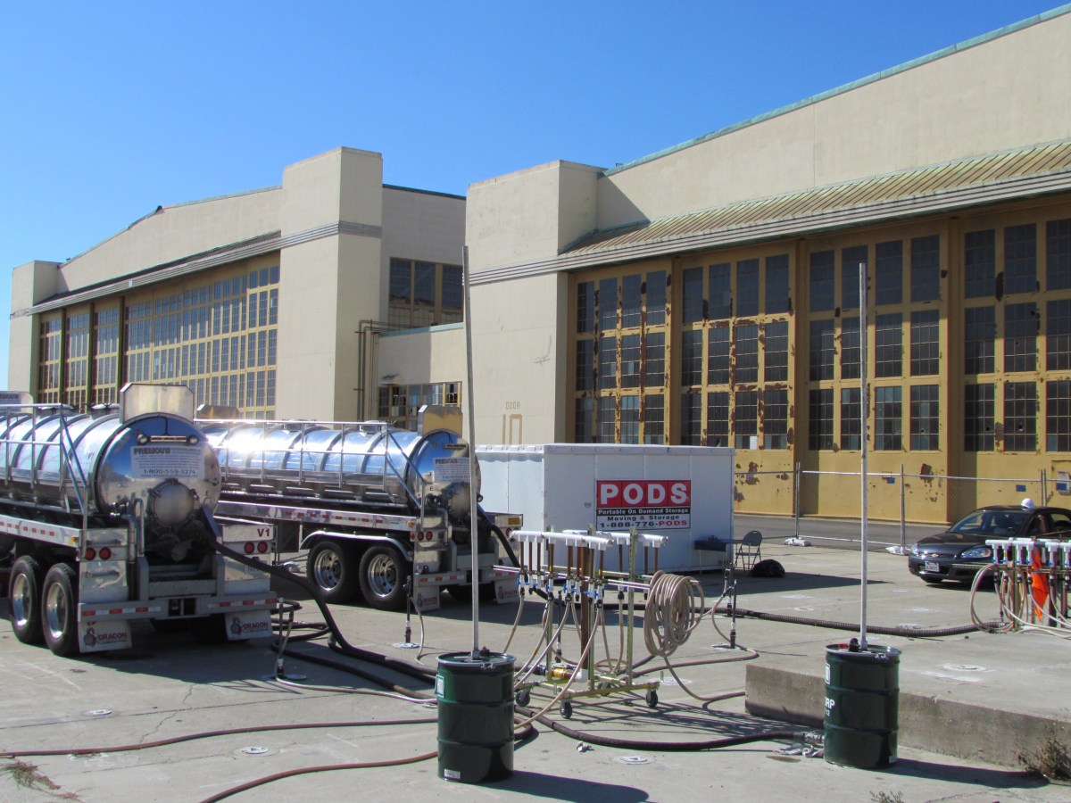
Tanker trucks sucking jet fuel out of the ground next to Building 5. Looking northwest.
Background
The Navy has three cleanup programs at Alameda Point: Superfund, Petroleum, and Radiological. The Petroleum Program takes care of underground concentrations of petroleum, mostly jet fuel, and is organized by corrective action areas. One such area outside Building 5 made it onto the calendar this year.
Dumping jet fuel – Building 5, the largest hangar at the Point, was a busy aircraft maintenance facility. Petroleum products like jet fuel were often disposed of down a drain, which in this case would have gone to an underground oil/water separator. A Navy contractor concluded that jet fuel detected in test wells outside of Building 5 on the south side could have leaked either from the oil/water separator, or the drain line, or both. The area has been designated Corrective Action Area 5B (CAA 5B). Continue reading “Cleaning Up Jet Fuel at Building 5”