News About Cleanup, Sustainability, Parks, Open Space, and Wildlife at Alameda Point, Alameda, CA
Author: richard94501
My blog is Alameda Point Environmental Report covering parks and open space, environmental cleanup, wildlife, and sustainability at the former Navy base in Alameda now called Alameda Point.
Articles on my blog are frequently posted on the Alameda Post news site.
I also host a Flickr photo site, which is accessible via the sidebar wildlife photo gallery.
I hope you find my stories and photos of interest.
Richard Bangert
Alameda, California
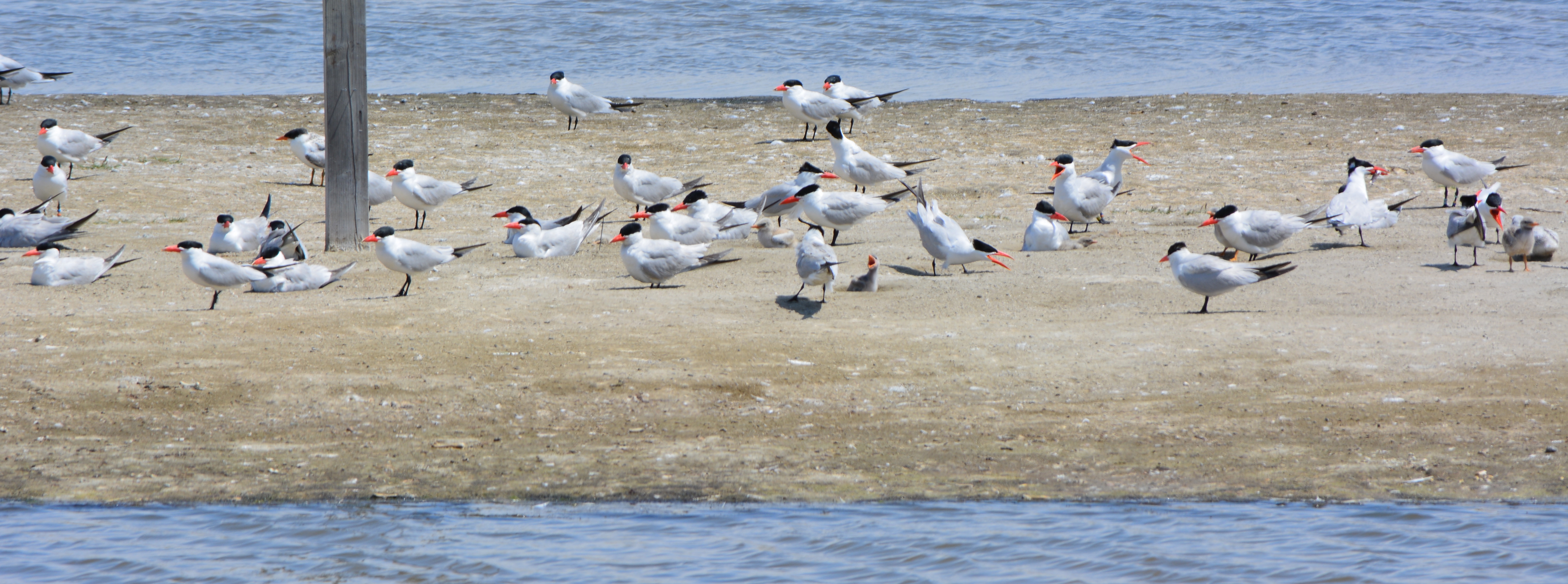
Alameda’s nesting colony of endangered California Least Terns has a new government landlord – and a secure home for the future. After years of negotiations, the U.S. Navy transferred 624 acres of its former airfield at Alameda Point to the Department of Veterans Affairs (VA) on Monday, November 3.
Least Tern chick, adult with fish, and resting adult, next to tile used for shelter, June 2014.
The transfer includes the former airstrip that was adopted by Least Terns for nesting in the 1970s and that has become the most productive breeding site in California for that species. More than 500 acres – including the area used by the terns – will be preserved as a wildlife reserve.Continue reading “Endangered Alameda least terns get a secure home”
An old aircraft hangar at Alameda Point will become the first production facility in the world for an innovative hydropower turbine. After two years of testing and design work, Natel Energy began outfitting the hangar this summer, which is just a few hundred yards from their headquarters in the former Control Tower for the Navy airfield. “By 2016 we expect to be producing 75 units a year,” said Chief Executive Officer Gia Schneider, “and reach 200 units a year by 2017.”
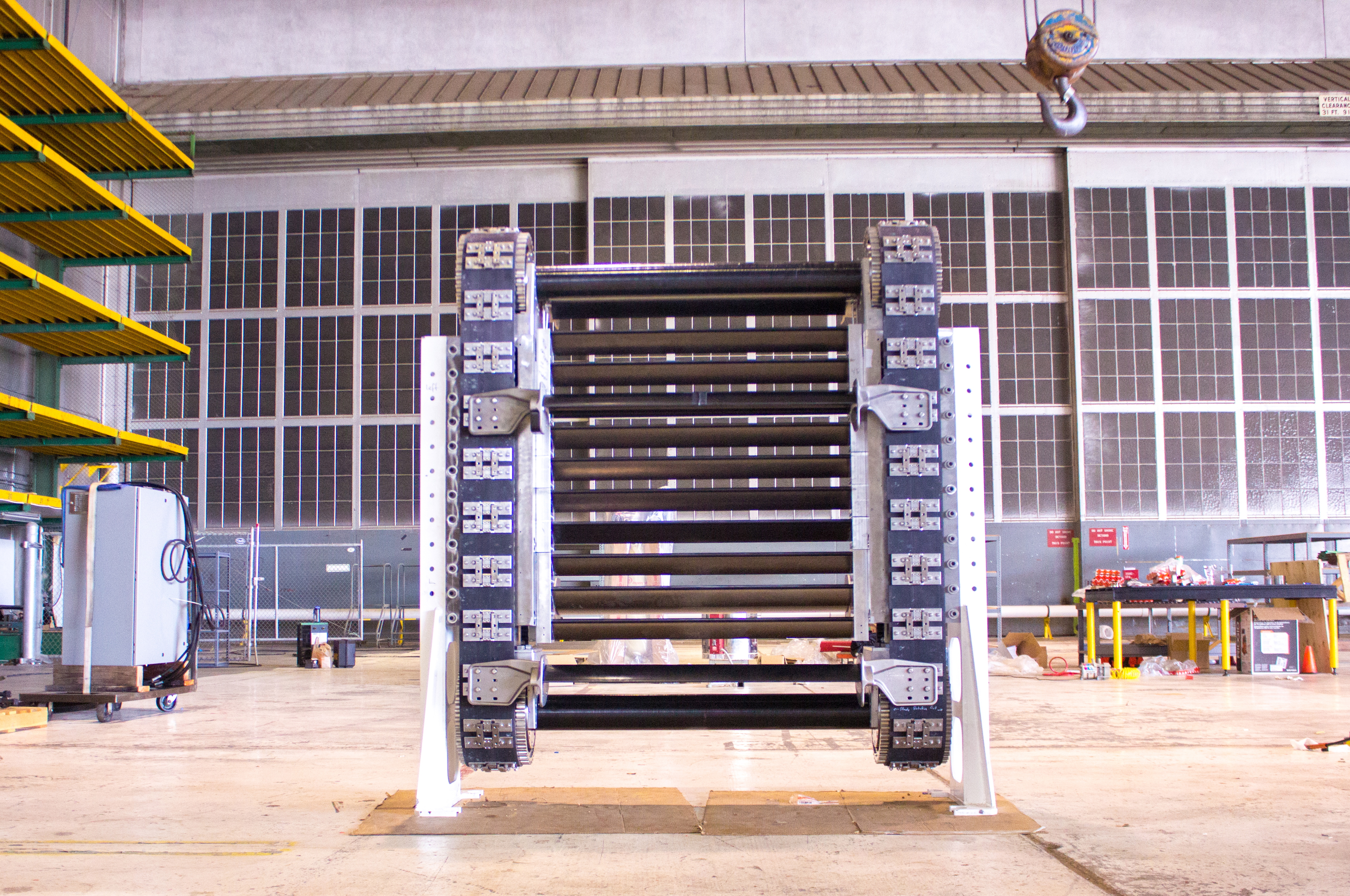
HydroEngine drive system called a cassette. Blades connected to conveyor belts are moved by water guided by fins called guidevanes (not shown). As water contacts first set of blades, the belt is moved upward, while exiting water drives the rear set of blades downward. Natel Energy photo. Used by permission.
Formed by alumni of the Massachusetts Institute of Technology, Natel Energy set out to create a utility-scale hydropower system without the costs and environmental consequences of hydroelectric dams.
Natel Energy touts their turbine system, trademarked EcoSmartHydro™ Power, as an environmentally superior method of watershed development because it does not require flooding an entire ecosystem to drive an electric hydropower generator at a dam.
“Whereas conventional hydropower is characterized by a centralized approach to project planning and large environmental footprint, EcoSmartHydro™ Power is distributed, low-impact, yet still successful at the utility scale,” proclaims the company’s website. “Conventional hydropower plants are designed solely to maximize power output. EcoSmartHydro™ Power plants are designed to maximize power output while maintaining the health of watershed ecosystems.”
When installed in streams and small rivers, the system allows for young fish to travel downstream and through the system unharmed. Traditional fish ladders can be installed for spawning fish travelling upstream.
The heart of the system, called a cassette, is about the size of a king size bed. It consists of a conveyor belt of blades that are moved as water flows through. A generator connected to one or both of the conveyor shafts generates electricity.
The system can be installed virtually anywhere there is flowing water, such as irrigation canals, water supply channels, thermal power plant water outfalls, and existing non-hydroelectric dams. The Natel Energy system is able to generate electricity with relatively small drops in elevation because it’s based solely on water flow, not water pressure.
Water canal shown as an example of existing water flow where Natel Energy hydropower system can be installed. Natel Energy photo. Used by persmission.
In December 2013, Natel Energy got a boost from the U.S. Department of Energy with a $2 million tax credit under the Advanced Energy Manufacturing Tax Credit program. The money for product development and manufacturing, however, is coming solely from investors. “We don’t get any benefit from the tax program until we start selling our product,” said Schneider.
“The company currently has 14 employees, and we will be adding 80 to 90 people as production grows at Alameda Point, with up to 35 of those in manufacturing,” said Schneider. “Our goal is to give special attention to hiring and training of veterans and to make use of Department of Energy vocational training programs.”
Employees assembling gearbox at Alameda Point hangar. Natel Energy photo. Used by permission.
All of the parts and components of the turbine are manufactured in the United States. Schneider said that working with parts suppliers in the U.S. during the product-development phase made the process logistically less stressful and time-consuming. For some of their parts, the company would not have gained any cost advantage by going outside the U.S., according to Schneider. She said that once production levels reach the point where new production facilities are being added elsewhere in the U.S. or the world, some parts may be sourced from outside the country.
Assembling cassette drive belt. Belt connectors underwent testing and re-working at Alameda Point. Final product surpassed 60 million cycles without failure. Natel Energy photo. Used by permission.
Videos made by Natel Energy this year offer a look into the elaborate parts testing program the company has been running at their Alameda Point headquarters, as well as a look into the process of setting up their production facility. An animated video shows how their system works in the field.
Example of flowing body of water where Natel Energy system can be installed to create energy with minimal civil engineering. Natel Energy photo. Used by permission.
Water canal – example of where Natel Energy’s turbine can be easily installed to create electricity. Natel Energy photo. Used by permission.
Employees moving HydroEngine component at Alameda Point production facility. Natel Energy photo. Used by permission.
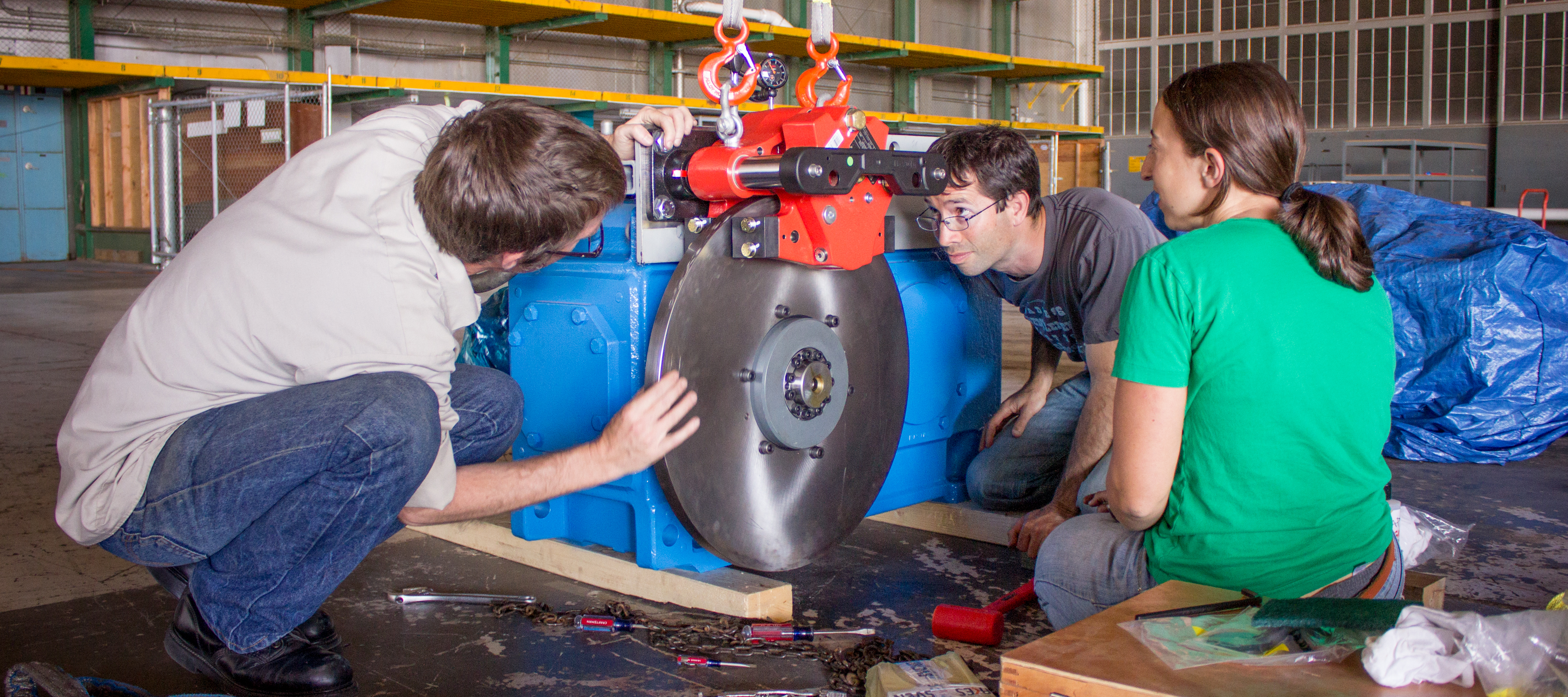
Gearbox for HydroEngine. Natel Energy photo. Used by permission.
Water testing unit set up next to Control Tower. Natel Energy photo. Used by permission.
Employees moving the cassette in new production facility. Natel Energy photo. Used by permission.
Employees moving HydroEngine components in hangar production facility. Natel Energy photo. Used by permission.
Employees assembling HydroEngine at Alameda Point. Natel Energy photo. Used by permission.
Shipping container rigged up with scale model of HydroEngine turbine for testing. White pipe circulates water. Control Tower on right. Natel Energy photo. Used by permission.
Employee checking specs as HydroEngine cassette is being set up. Natel Energy photo. Used by permission.
Employee testing the cassette. Natel Energy photo. Used by permission.
Building 400A production space. Natel Energy photo. Used by permission.
Building 400A, former aircraft hangar at Alameda Point. Control Tower in background.
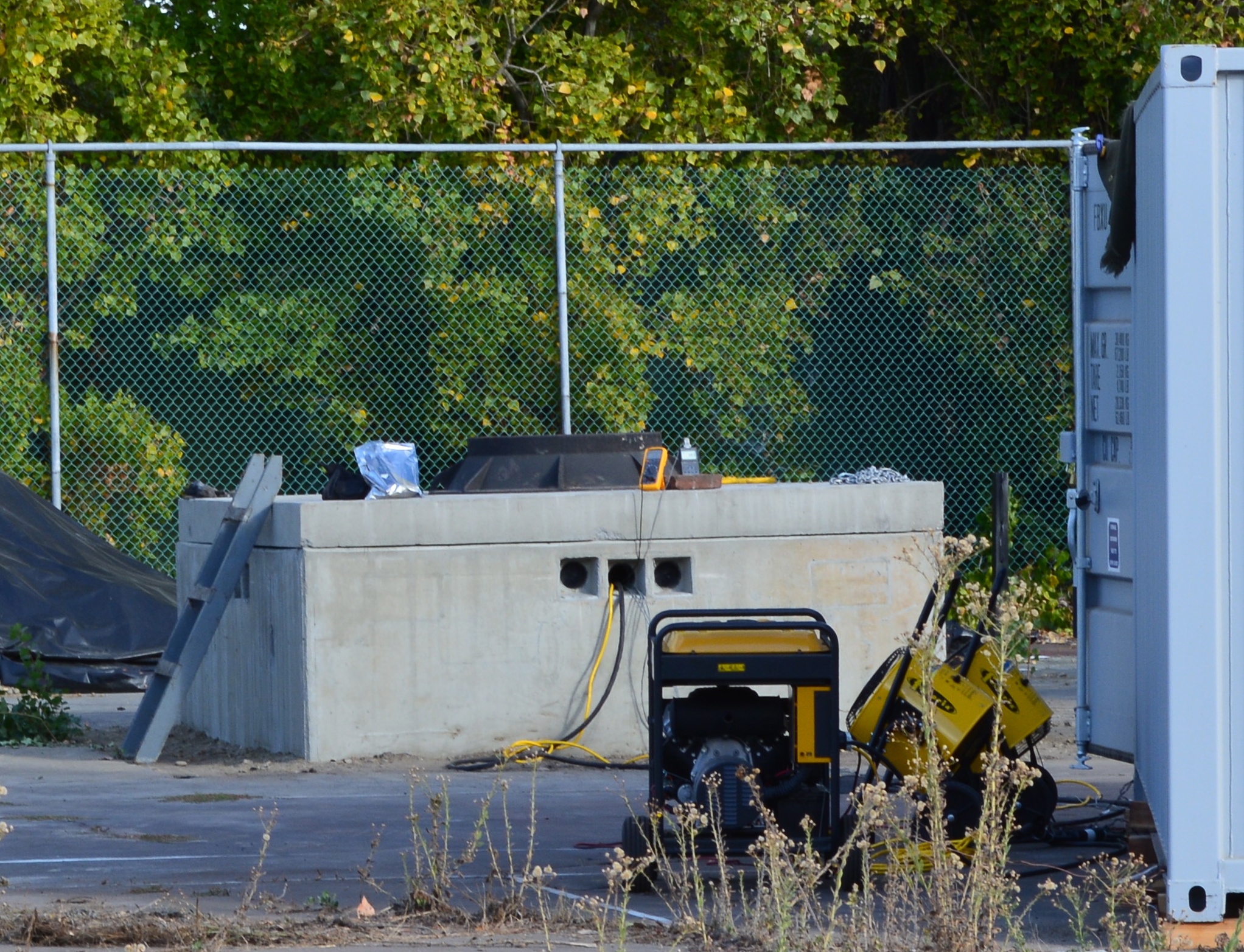
A small company based in Union City is quietly conducting underground field tests of their flywheel energy storage system at Alameda Point. The mechanical device seeks to accomplish the same result as battery storage, only cheaper and with completely recyclable materials. The system is ideally suited for storing electrical energy created by commercial size solar facilities.
Alameda Point test site
Working with the City of Alameda, Amber Kinetics is leasing space on an old tennis court next to the O Club at Alameda Point. The two concrete vaults that they installed in the ground to house their flywheel system go down seven feet. That’s how far they were able to dig before hitting the layer of hydrocarbon residue called the Marsh Crust. Digging into the Marsh Crust would have complicated the testing and created added expense. Since there is no electrical service at the site, they brought in their own generator to perform the tests, which they store in a shipping container.
Their test is being partially funded by the U.S. Department of Energy (DOE) under the Smart Grid Demonstration Program. The DOE Project Description says in part: “The goal is to deliver a cost-effective prototype flywheel system that can be grid connected and electrically charged and discharged. The flywheel stores energy in a spinning rotor that is connected to an electric motor that converts electrical energy into mechanical energy. To recover the energy, the motor is electrically reversed and used as a generator to slow down the flywheel converting the mechanical energy back into electrical energy. Amber Kinetics will improve the traditional flywheel system by engineering breakthroughs in three areas, resulting in higher efficiency and radically reduced cost: bearings, low-cost rotor, and high-efficiency motor generator. This technology can also be used to optimize existing infrastructure.”
According to aDOE report on energy storagefrom December 2013, so-called distributed storage facilities like the type being tested at Alameda Point can improve the efficiency and reliability of high power transmission lines. They would do so by reducing “line-congestion and line-loss by moving electricity at off-peak times, reducing the need for overall generation during peak times. By reducing peak loading (and overloading) of transmission and distribution lines, storage can extend the life of existing infrastructure.” The report also notes the value of distributed electrical storage for emergency preparedness.
According to the company, benefits of their system would be:
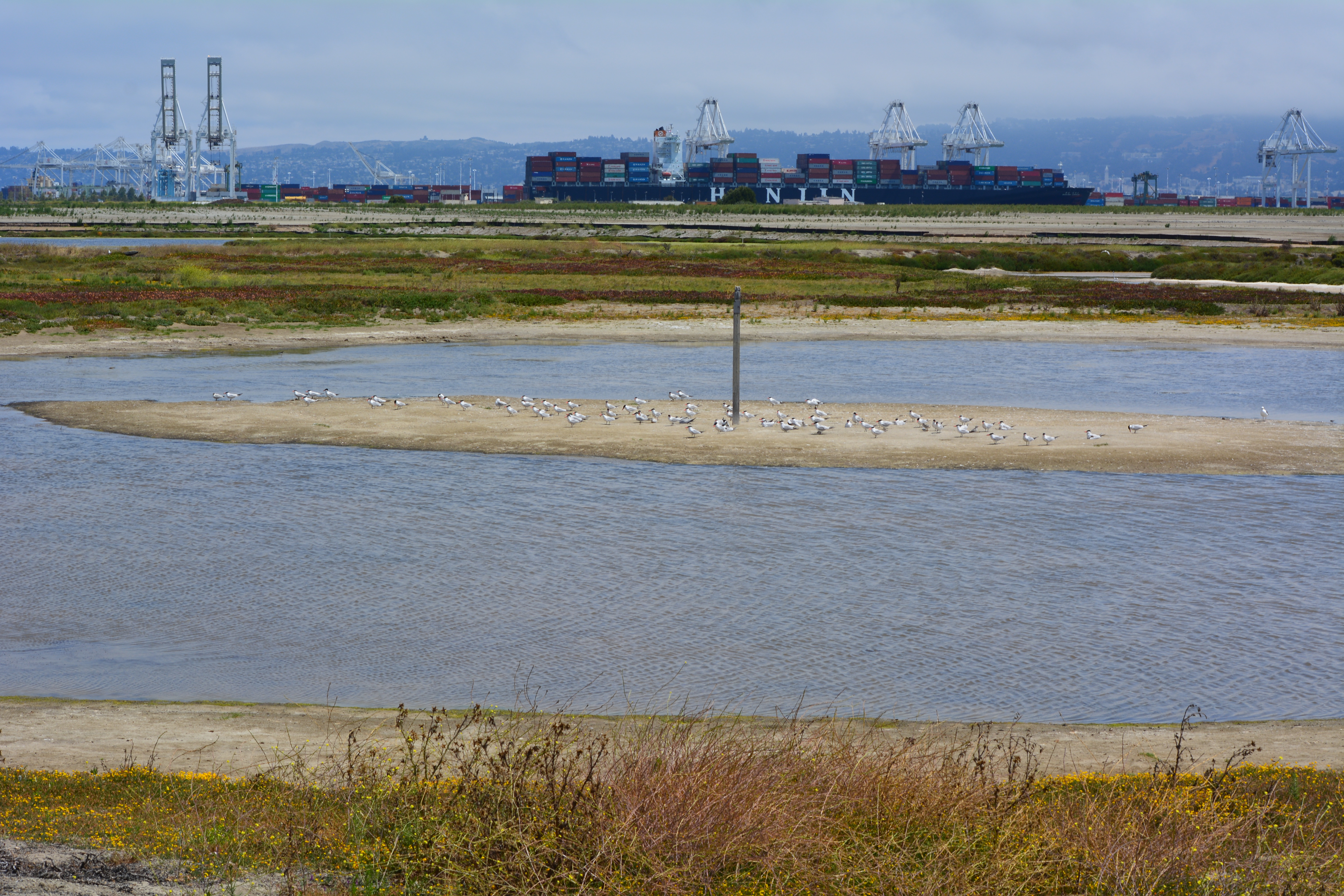
“Demilitarized Landscapes” is a nine-minute film about three San Francisco Bay Area communities in which the military has played a major role: San Francisco’s Bayview Hunters Point, Alameda Point, and the Richmond waterfront. The film was featured in a special exhibition called “Above and Below: Stories From Our Changing Bay” at the Oakland Museum of California. The exhibition, which ran from August 31, 2013 to February 23, 2014, explored the impacts of humans and natural forces on San Francisco Bay over the last 6,000 years.
The film played continuously in a special display area titled “Military Landscapes – Demilitarized Landscapes” and shows the transitions being made today. The Alameda Point segment focuses on the Nature Reserve and the recovery effort for the endangered California Least Tern.
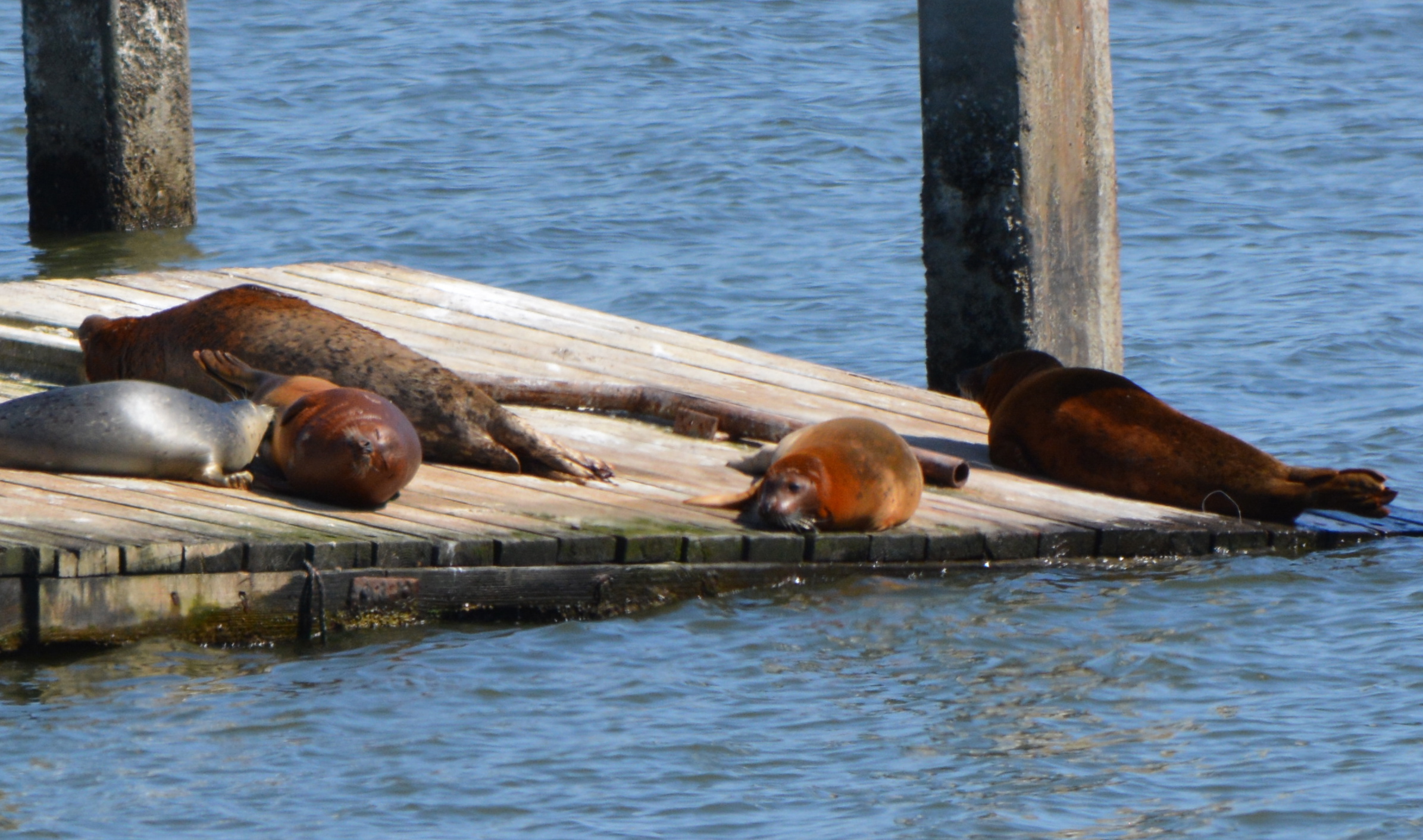
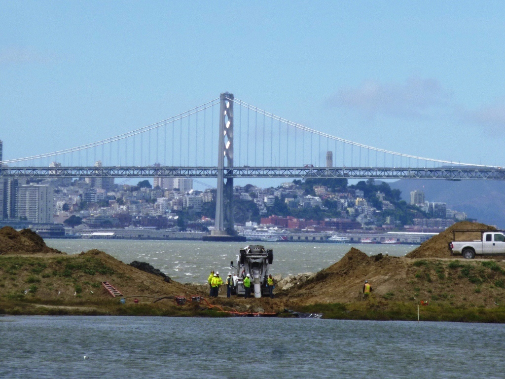
Construction of the ferry maintenance facility at Alameda Point is delayed another year. Originally scheduled to begin in August of this year, the project is on hold while the Water Emergency Transportation Authority (WETA) seeks a federal permit allowing for harassment of harbor seals during demolition and construction.
The public, beginning in January of 2014, raised concerns about the harbor seals being displaced at the project site. The Central Bay Operations and Maintenance Facility is slated for construction east of the USS Hornet where the Navy operated a recreational boating dock.
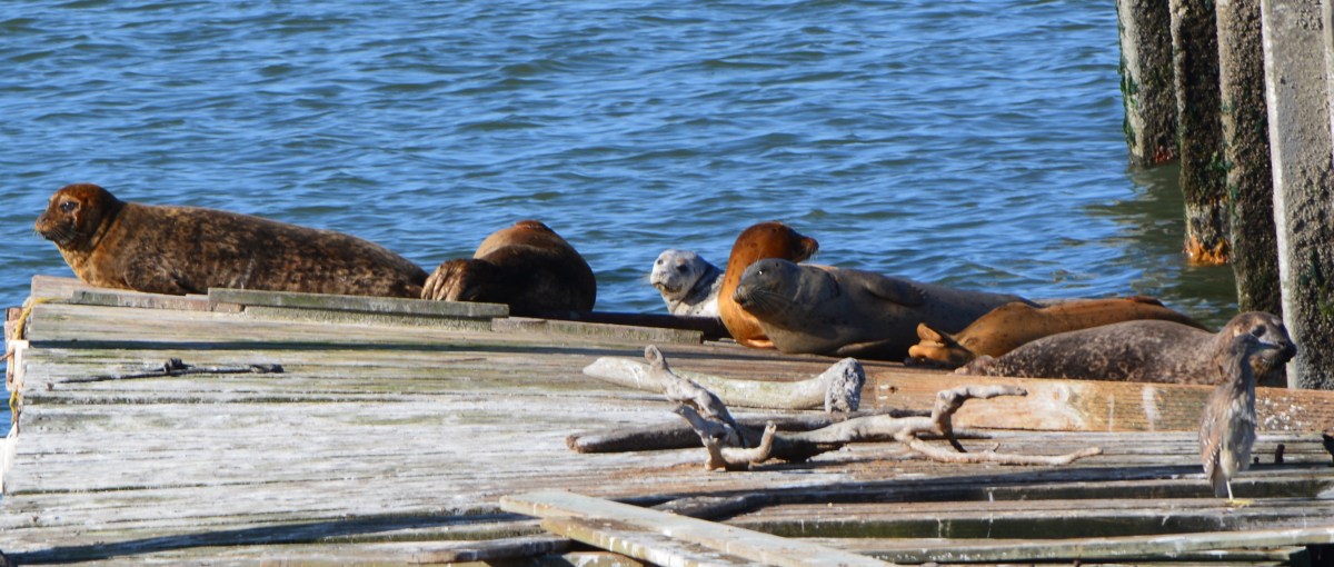
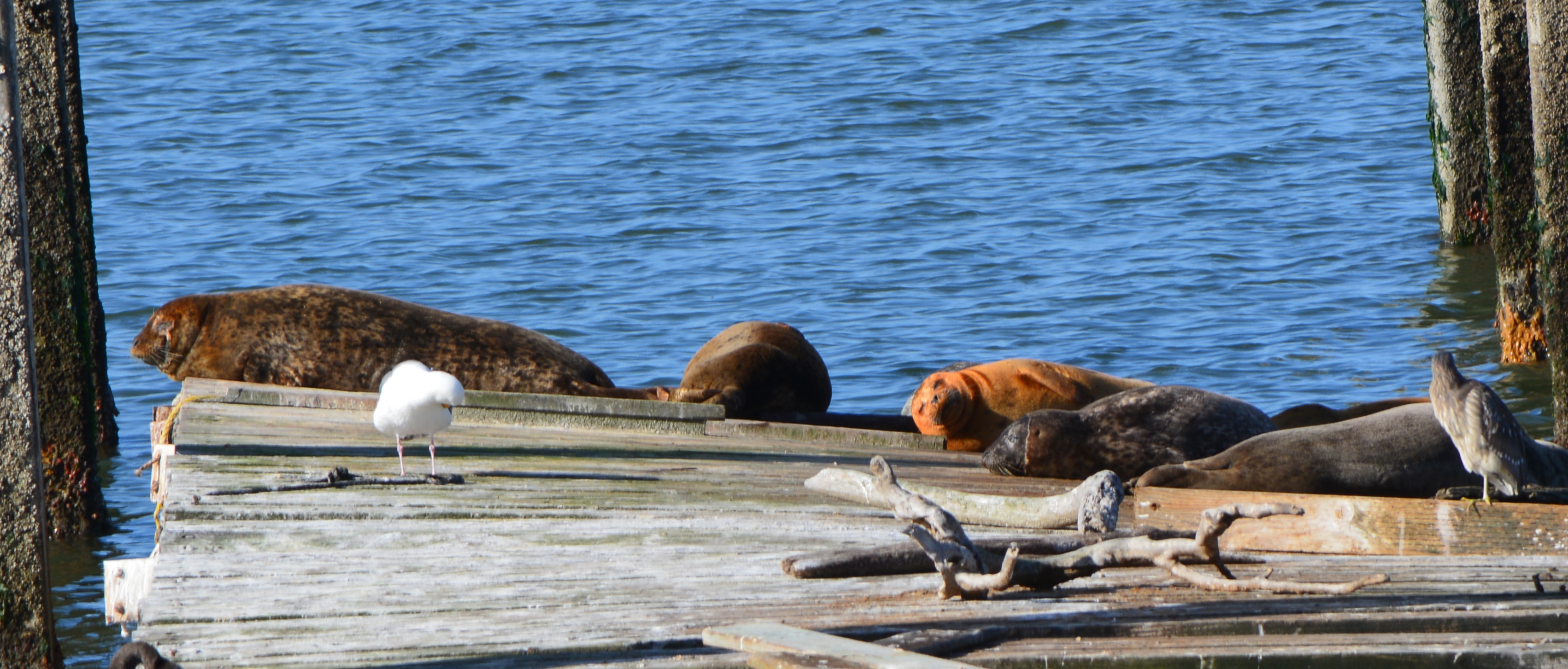
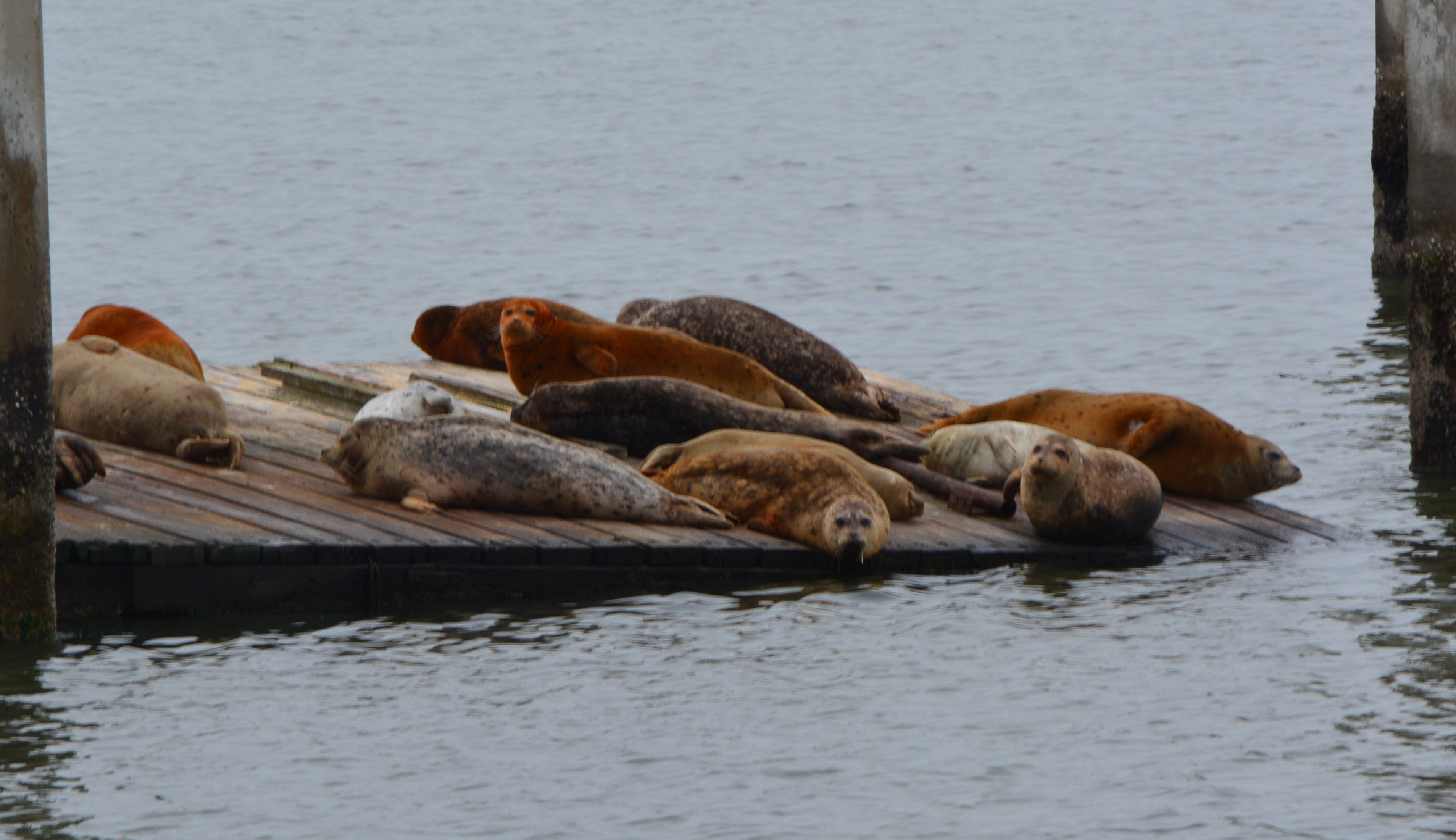
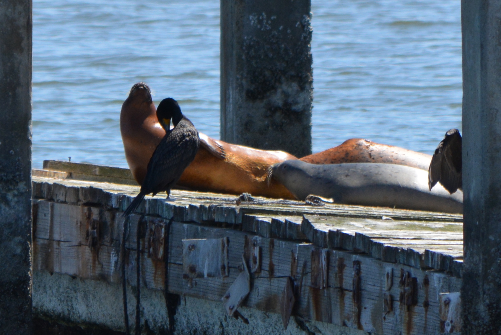
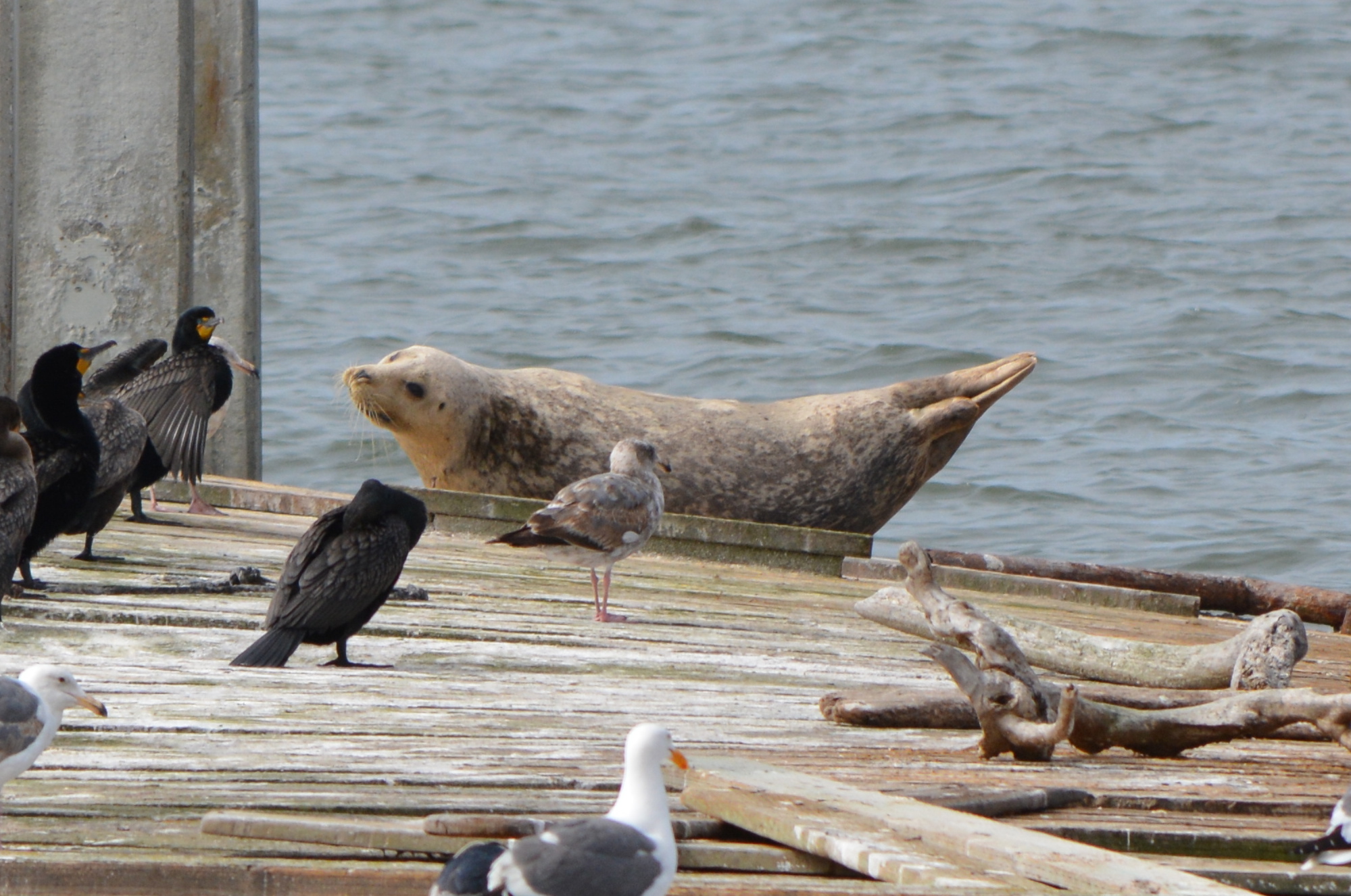
14 harbor seals resting on June 4, 2014, at Alameda Point dock where ferry facility is planned.
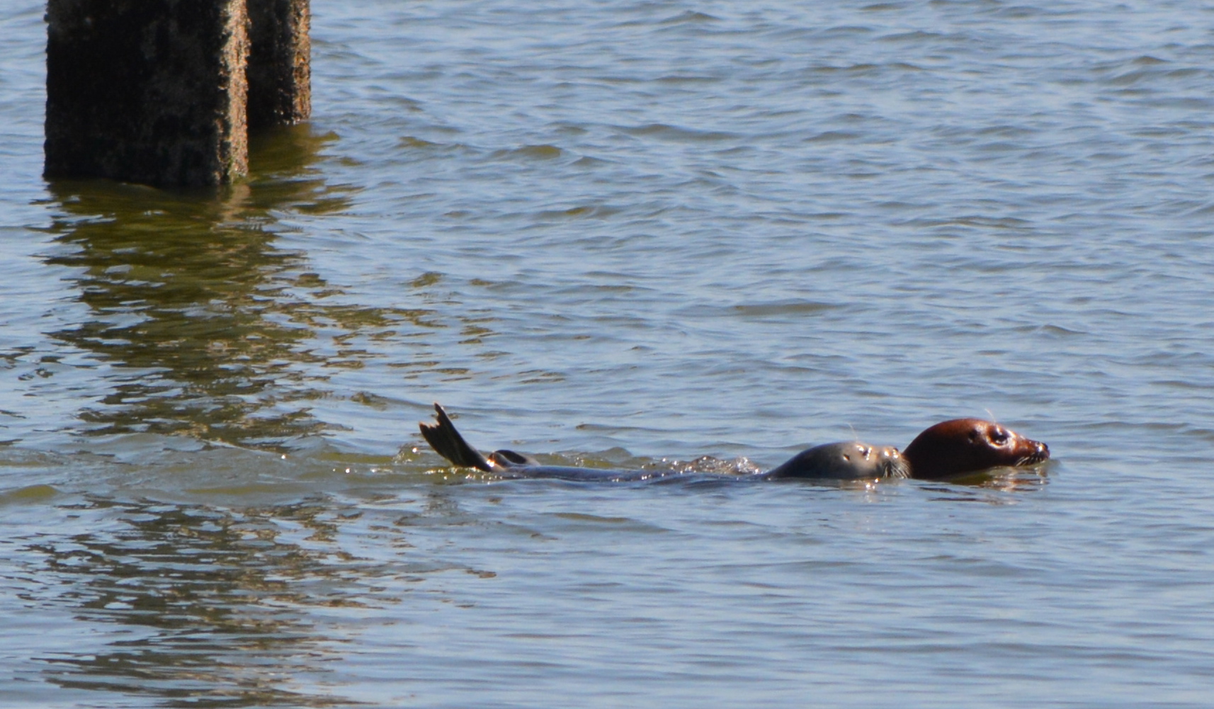
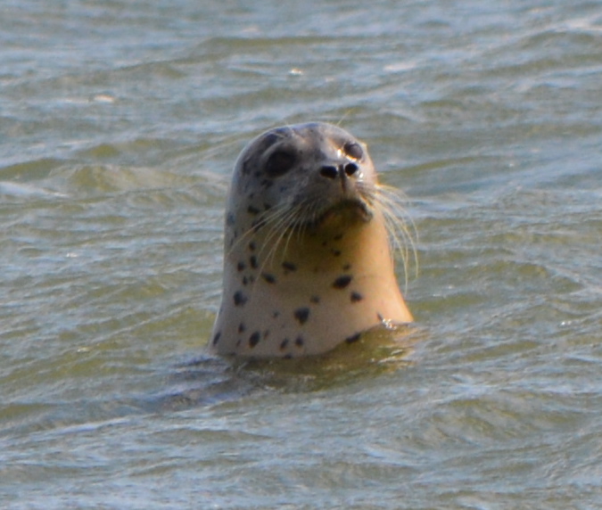
Part of the dock structure has sunk, but the main dock and remnant timbers have attracted harbor seals in recent years that manage to haul themselves up onto the wooden islands to rest. In May 2014, a female harbor seal was observed nursing a pup on the old dock and leading the pup in training exercises around the dock area.
Nursing harbor seal pup – May 13, 2014 – Alameda Point
In its permit application published in the Federal Register on September 17, 2014, the description of the type of harassment for which WETA is seeking a permit is limited to sounds emitted during demolition of the existing pilings and hammering in new ones.
The application makes only passing reference to residents having observed seals at the site. The loss of a resting site is not contemplated in the federal review, even though the Marine Mammal Protection Act lists habitat loss as a form of harassment. A haul-out resting site is considered habitat integral to the welfare of seals.
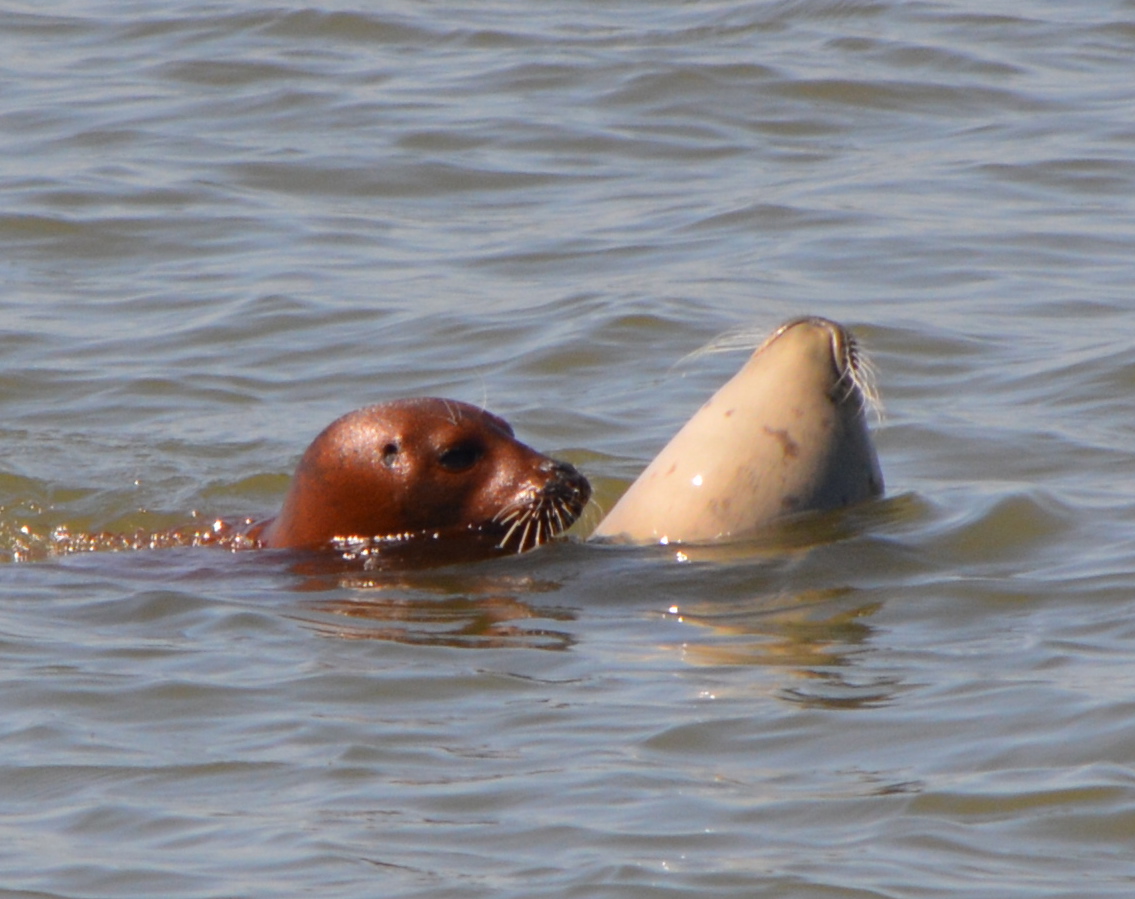
Adult harbor seals with silver pup – May 29, 2014
The permit is being processed as part of a federal Environmental Assessment and is being prepared by the National Marine Fisheries Service (NMFS). The NMFS is an arm of the National Oceanic and Atmospheric Administration that enforces the Marine Mammal Protection Act (MMPA), as well as aquatic components of the Endangered Species Act.
The permit being applied for by WETA is called an Incidental Harassment Authorization (IHA). An IHA “Level A” involves injury to a marine mammal. “Level B” involves disruption of behavioral patterns. The WETA permit is Level B.
The preliminary conclusion of NMFS is that no significant impact will occur, especially in light of the acoustical mitigation measures worked out between WETA and NMFS. The mitigation measures call for gradual start-ups to demolition and dock construction work, a sound curtain in the water, and NMFS-approved biological monitors.
Silver-colored harbor seal pup nursing on May 13, 2014.
Despite the fact that a regular haul-out site will be eliminated with the dock removal, NMFS concludes, “No permanent impacts to marine mammal habitat are proposed to or would occur as a result of the proposed Project.” WETA’s proposed facility “would not modify the existing habitat. Therefore, no restoration of the habitat would be necessary,” stated NMFS.
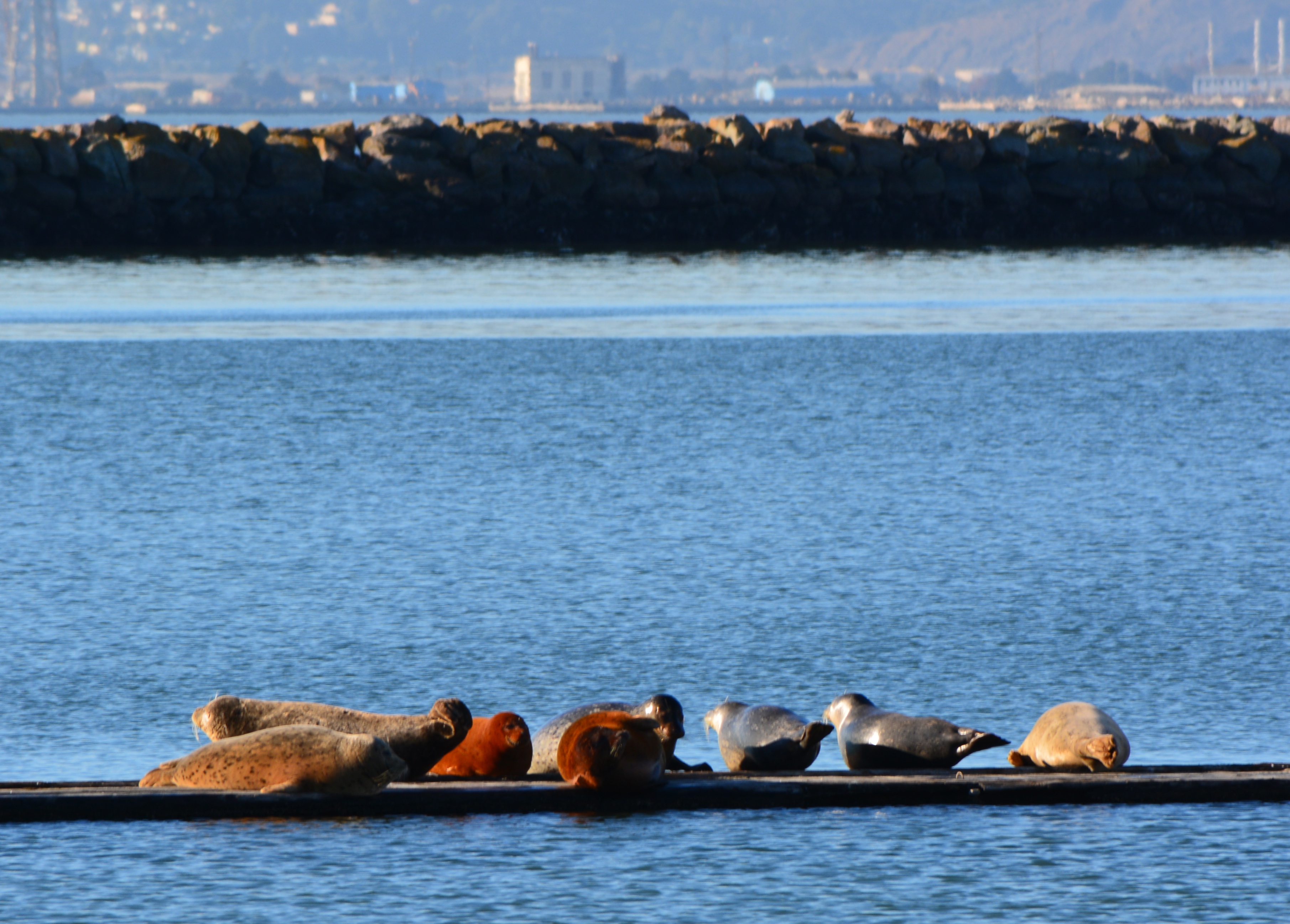
The most recent harbor seal data for the area cited by NMFS in the application is from 1998. It highlights Breakwater Island, the rocky barrier forming the south side of the Alameda Point Channel, as “the only haul-out site in the Central Bay that is accessible to seals throughout the full tidal range.”
The Alameda Point seals have been seen again in the project area in recent weeks after an absence of a few months, which corresponds with behavior predicted by NMFS. Citing harbor seal research, NMFS stated, “Haul-out sites are relatively consistent from year to year, and females have been recorded returning to their own natal haul-out when breeding.”
The public can submit comments no later than October 17, 2014. Pending review of the comments, the NMFS may impose additional mitigation measures. Comments can be sent via email to:itp.guan@noaa.gov. Paper mail to: Jolie Harrison, Chief, Permits and Conservation Division, Office of Protected Resources, National Marine Fisheries Service, 1315 East-West Highway, Silver Spring, MD 20910.
Adult harbor seal with pup at proposed ferry facility site, Alameda Point, May 13, 2014.
WETA will also need a permit from the Bay Conservation and Development Commission, which follows state rules regarding marine mammal impacts. WETA will be leasing the site from the city, and still needs to conclude a lease agreement and obtain a building permit. Demolition and dredging at the site can only occur between August 1 and November 30 due to foraging by least terns in the spring and summer and fish migration in late fall. The permit is for 2015.
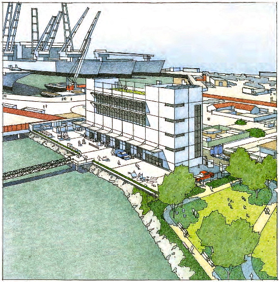
The project was authorized by WETA in 2009 and has been undergoing review ever since. It will include berths for 11 ferries, a service yard and a four-story workshop and administration building. The facility would also function as an emergency operation center for passenger service in the event of an emergency.
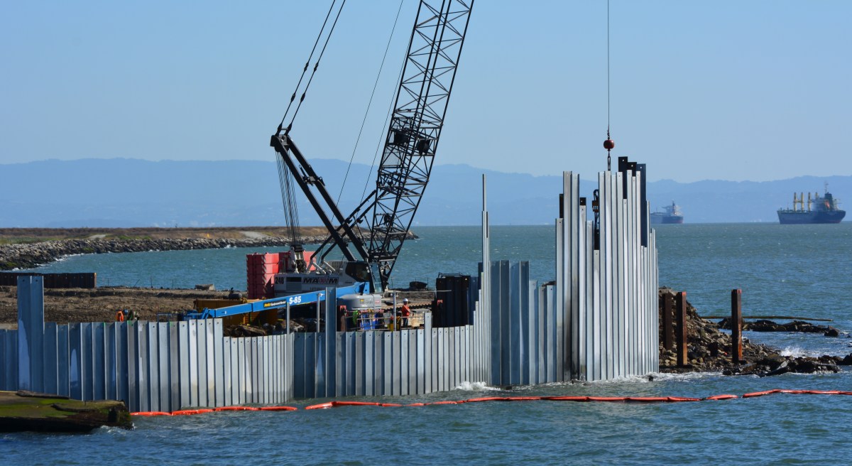
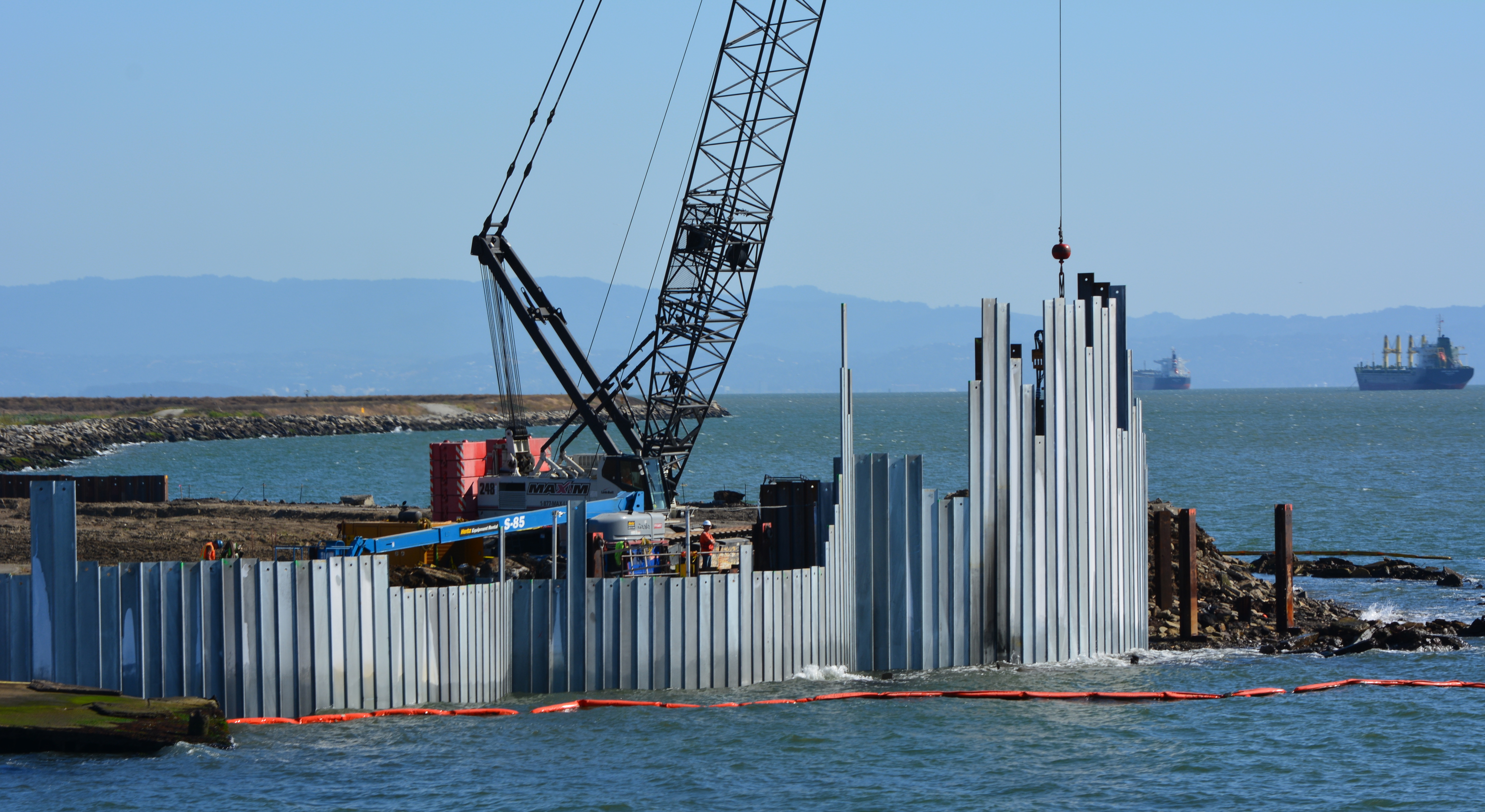
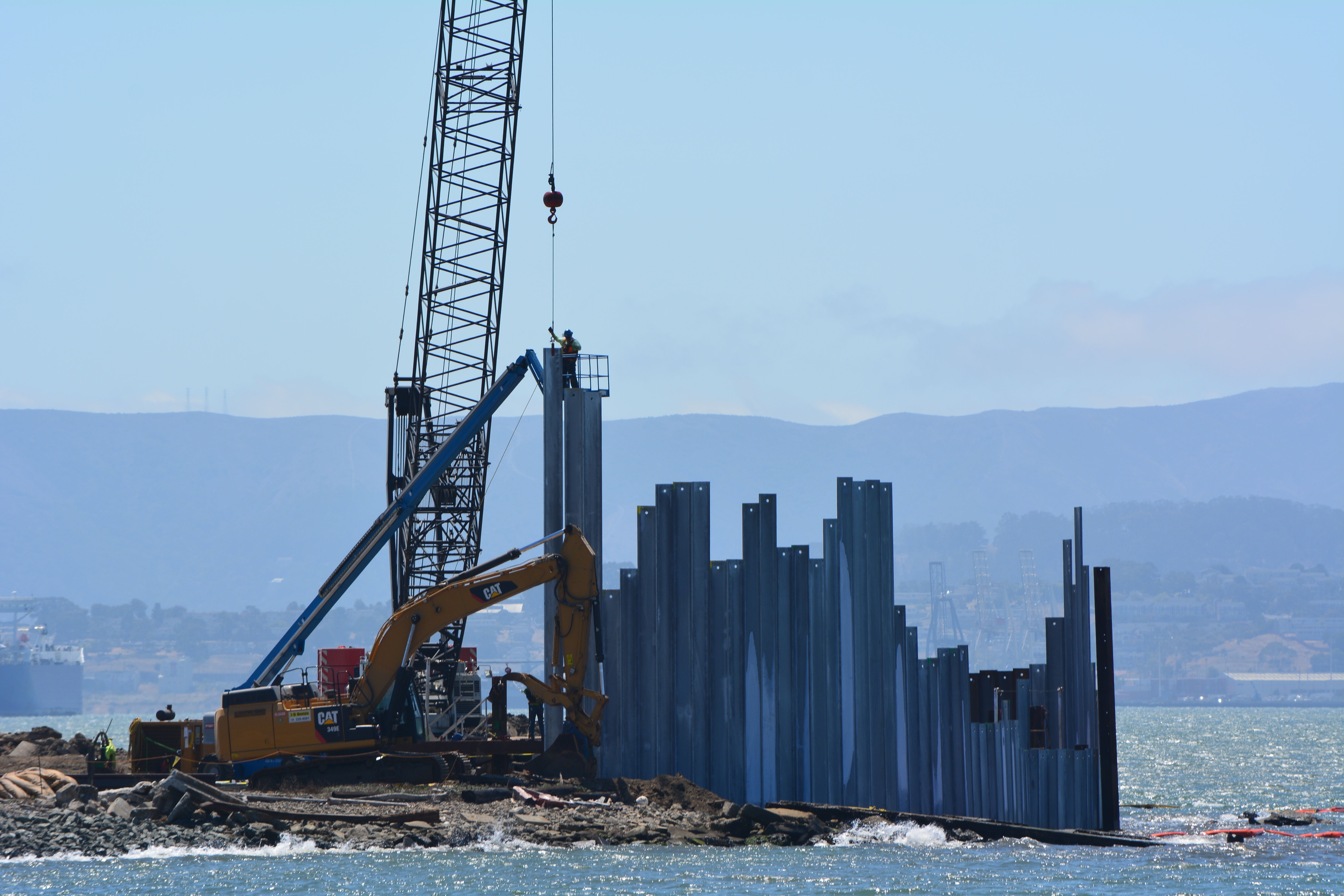
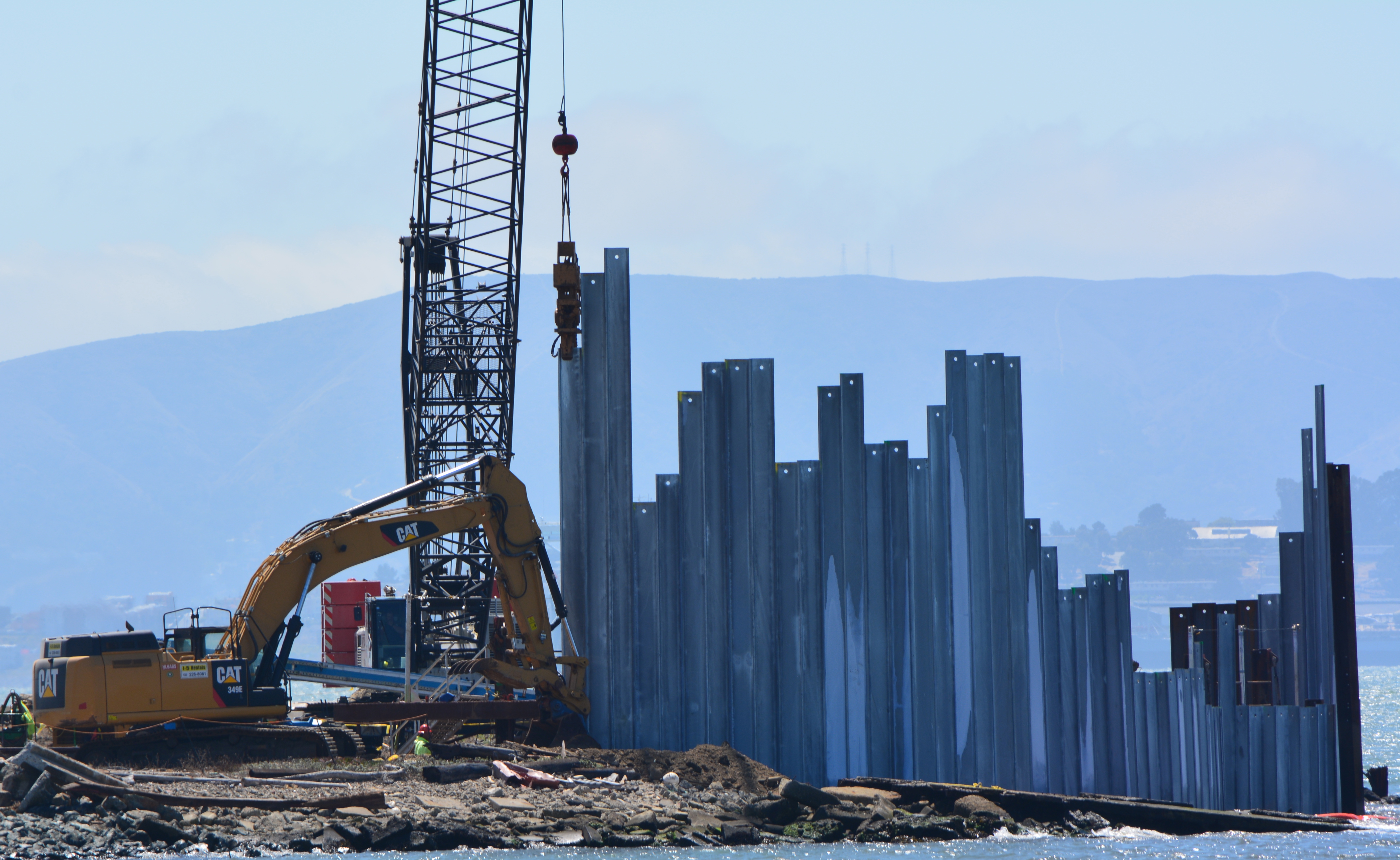
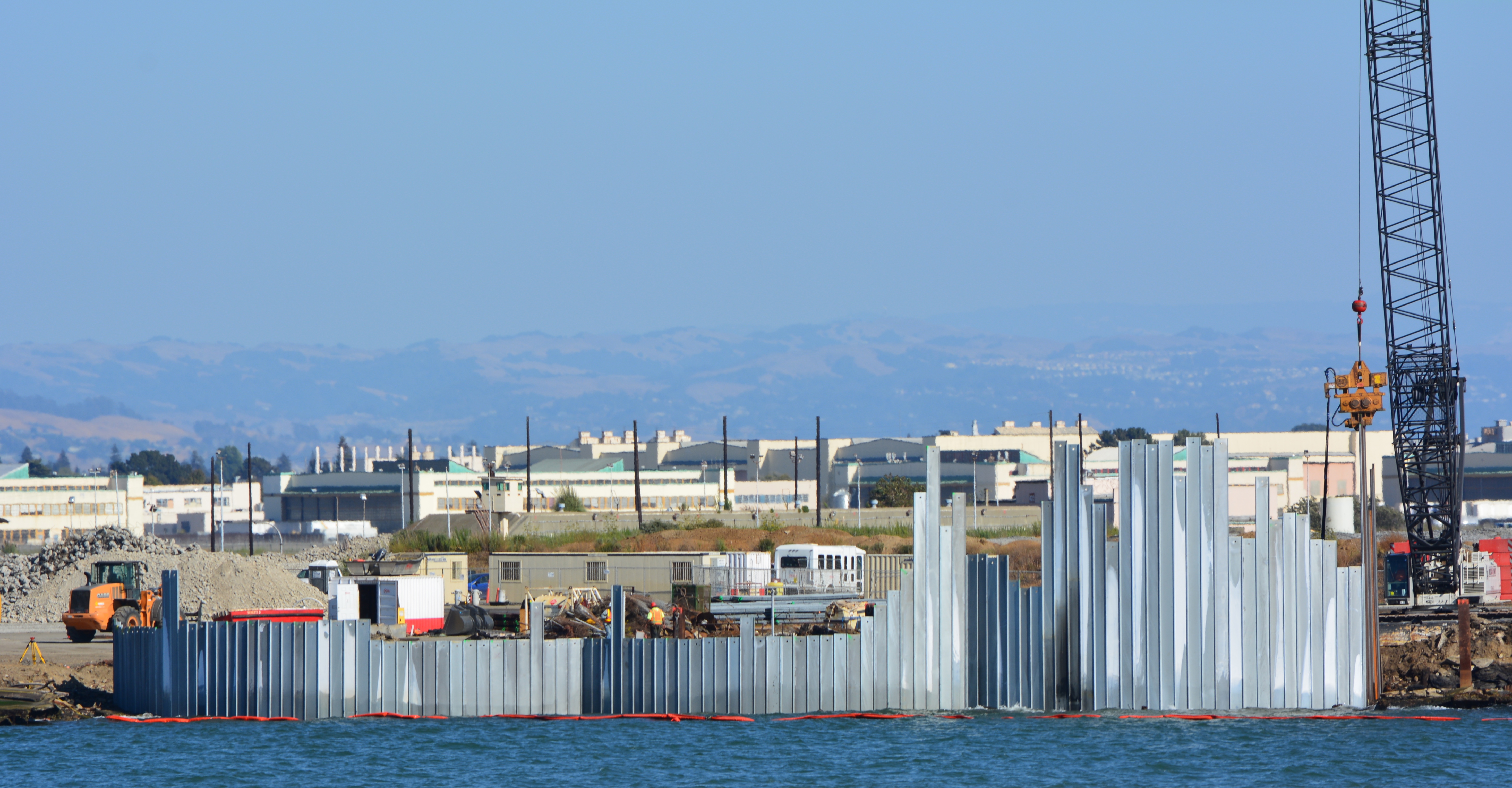
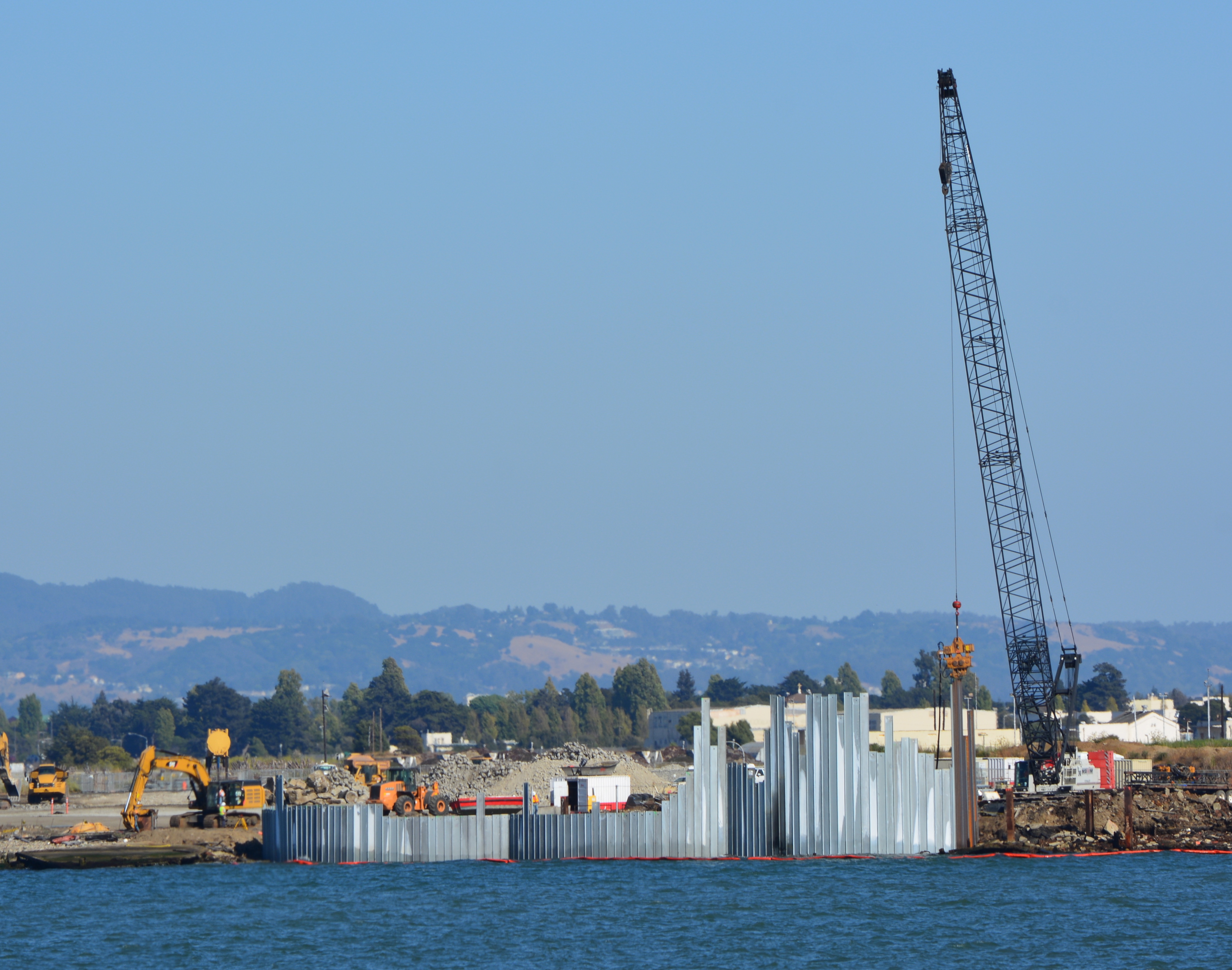
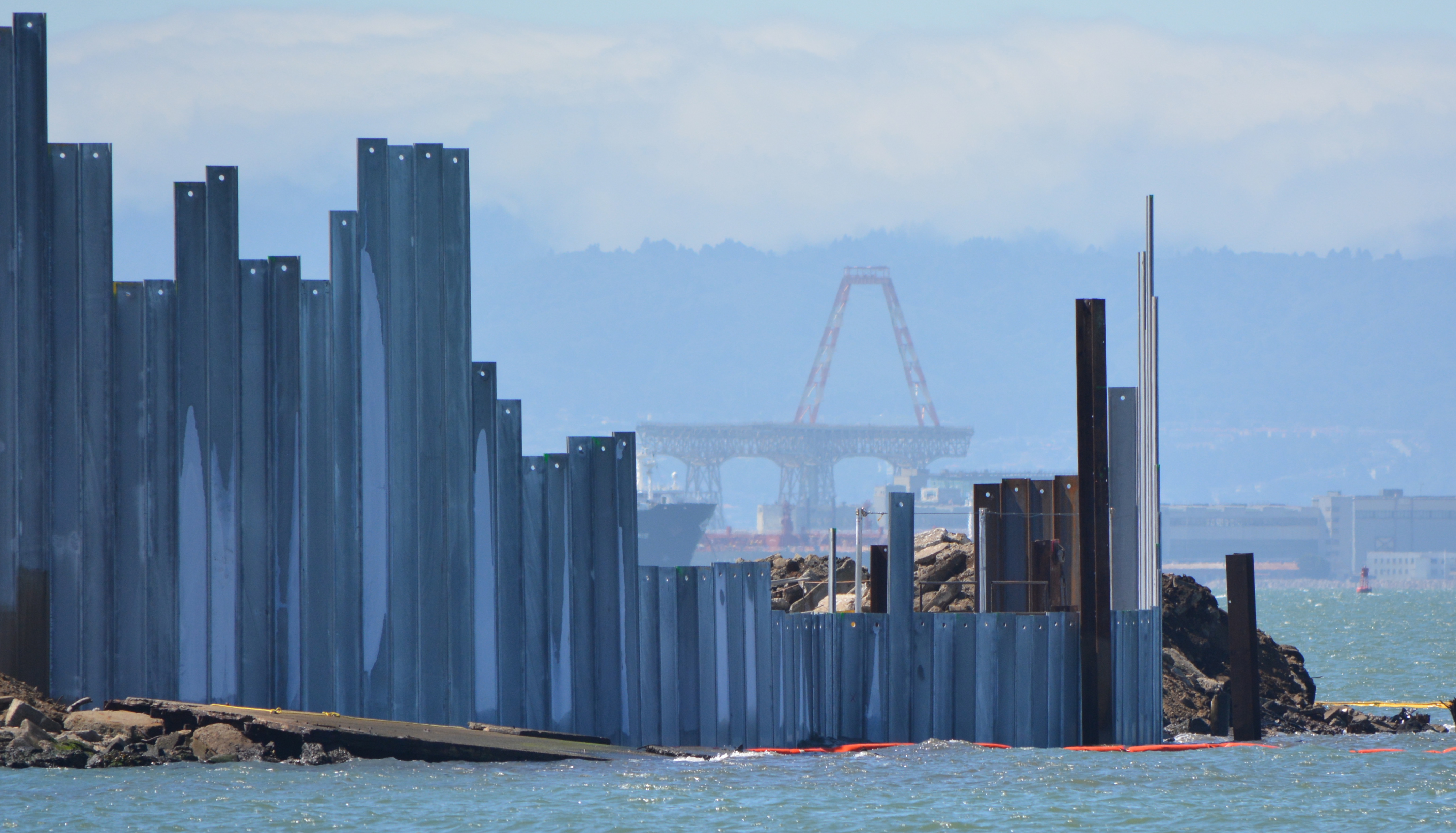
The Navy began embedding a steel barrier along several hundred feet of the western shoreline of Alameda Point during the week of August 18. The purpose of the barrier is to contain contaminated ash and burn waste material that was bulldozed into the Bay some 60 years ago and is now overlain with silt. The area is where the Navy burned various waste materials.
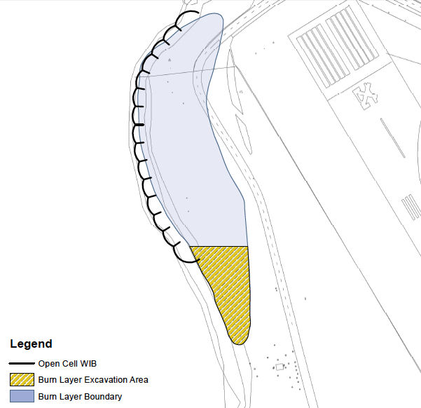
Three of the waste isolation cells under construction at northwestern tip of Alameda Point. A total of 15 cells, each one separated by a wall behind the face of the barrier, will be constructed here.
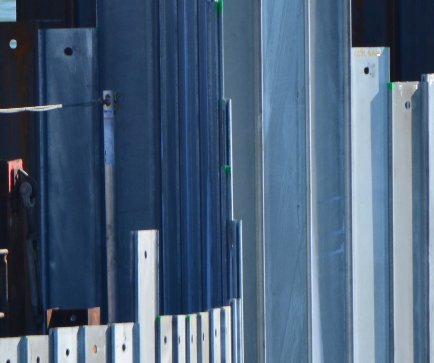
The containment system is called a waste isolation barrier. It consists of 35-foot-long interlocking steel pilings that are hammered into the ground with a hydraulic vibrator suspended from a crane cable. Perpendicular steel walls behind the barrier add stability. The final elevation of the top of the waste isolation barrier will be approximately 10 feet above mean sea level.
A worker guides one of the galvanized steel pilings into place as crane operator maneuvers.
Tests around the area were conducted in 2010, 2011, and 2012 to determine if any of the chemicals in the burn residue were entering San Francisco Bay. None were found to be entering the Bay. Nevertheless, the Burn Area’s proximity to the Bay requires that the contaminated waste either be removed or permanently isolated. Removing all of the waste from under the shoreline would have cost $40 million. The containment system costs $13 million.
Piling being slowly driven into the ground by a hydraulically operated vibratory hammer.
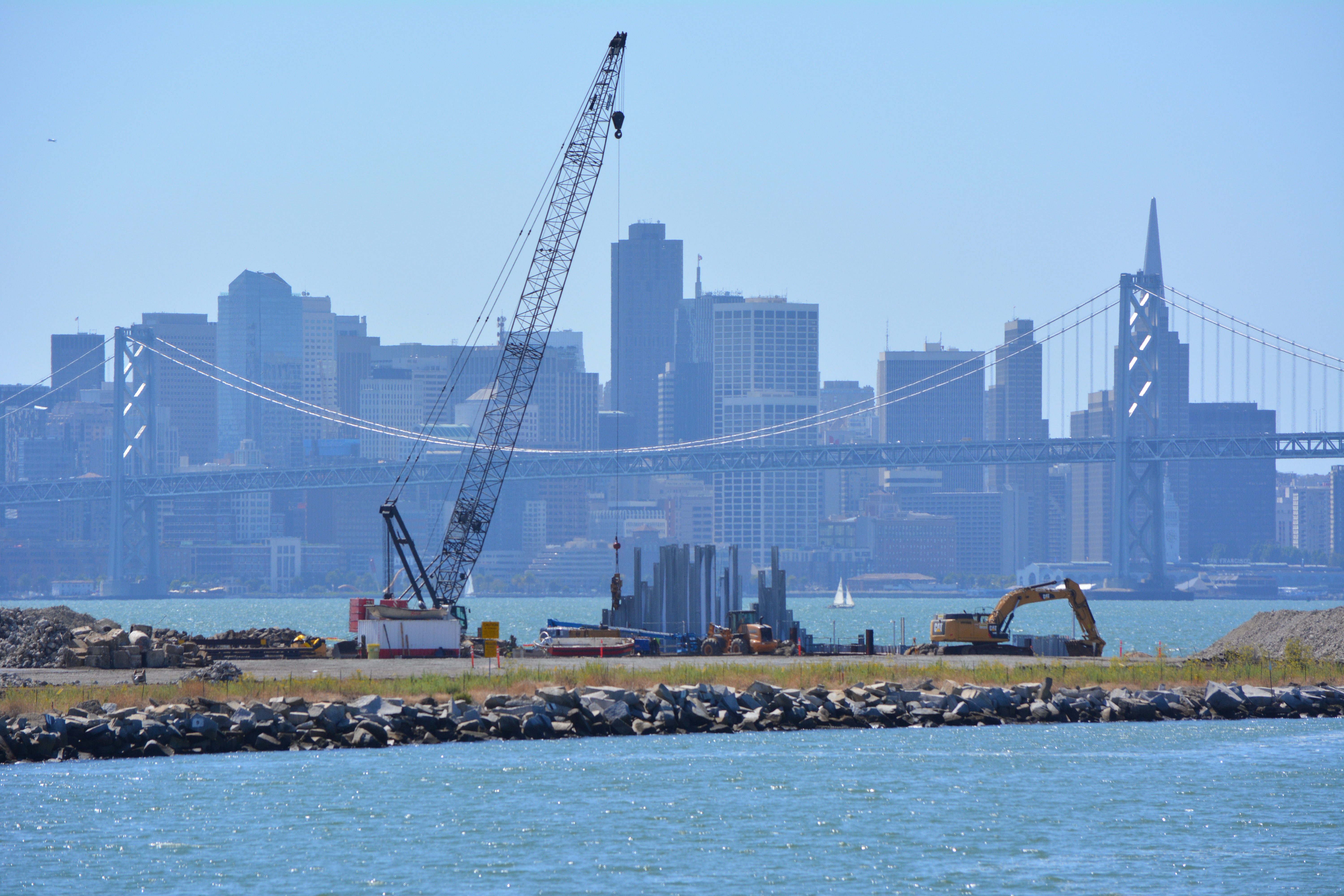
The construction of the shoreline waste barrier is part of a larger Navy cleanup project on the adjacent 37 acres, called Site 1, which was once used as an underground waste disposal area. Much of the area is now covered by runway pavement that will remain in place. The entire 37 acres right up to the steel barrier will be covered with three feet of clean soil and seeded with native vegetation. A small wetland area will also be created along the shoreline.
Site 1 cleanup project with crane. Oakland Estuary in the foreground and San Francisco in the background.
When completed early next year, the area will be suitable for passive recreational use, including the Bay Trail.
The work can be observed from the Oakland side of the estuary at Middle Harbor Shoreline Park right next to the cranes.
Background information can be found in this post from April 2013.
More photos and a diagram below
Waste isolation barrier will have 12 more cells to the right when completed.Diagram of shoreline waste isolation barrier at northwestern tip of Alameda Point. Navy diagram.
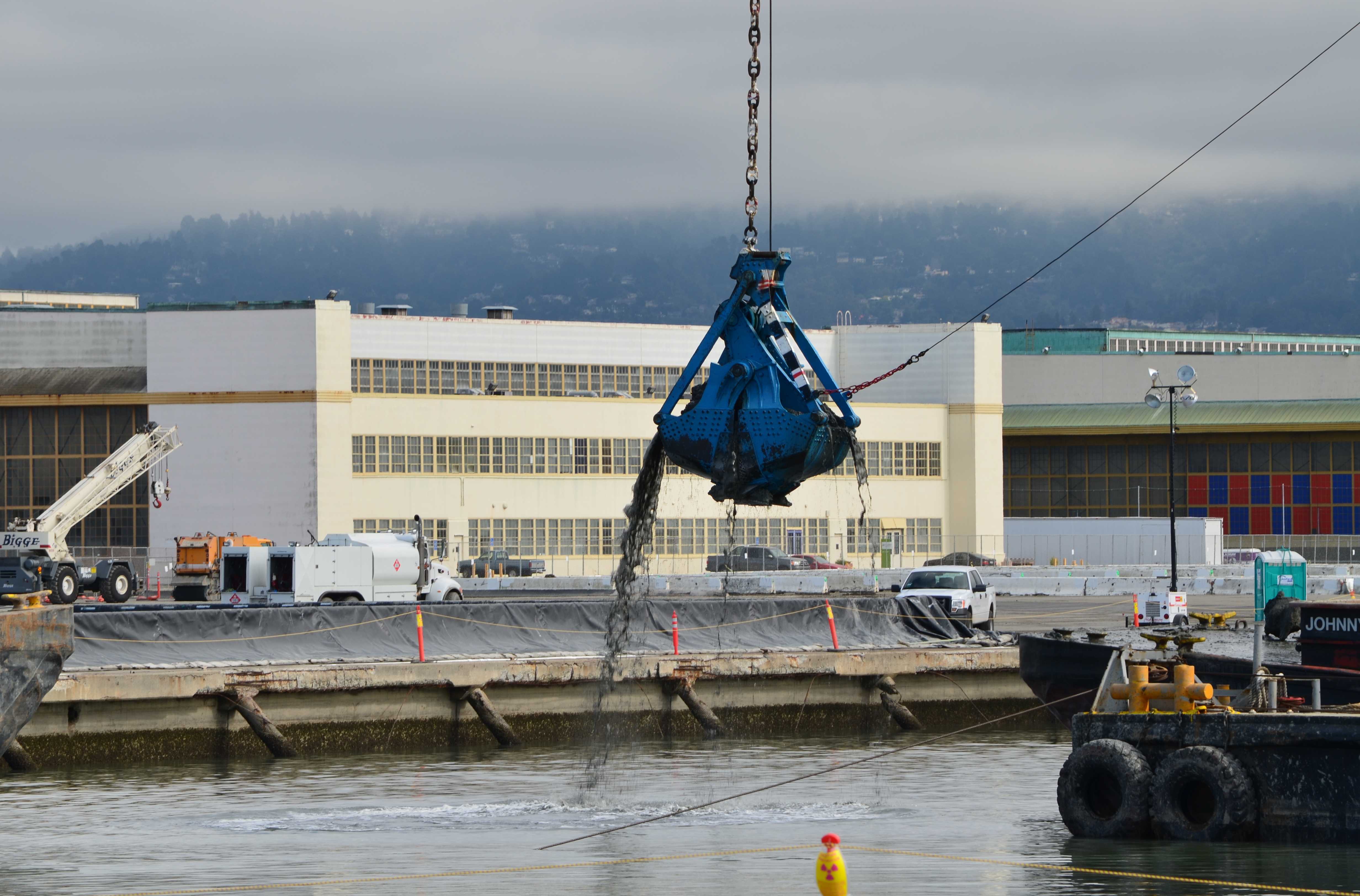
The Seaplane Lagoon’s north side will be looking like its old self in a few months. The Navy has begun dismantling the waterproof concrete-walled containment system that was used for three years for dewatering and testing of soil dredged from the Seaplane Lagoon, marking a major cleanup milestone. Prior to that dredging work, much of the lagoon’s north frontage served as a staging area for replacement of storm drain lines contaminated with radium-226.
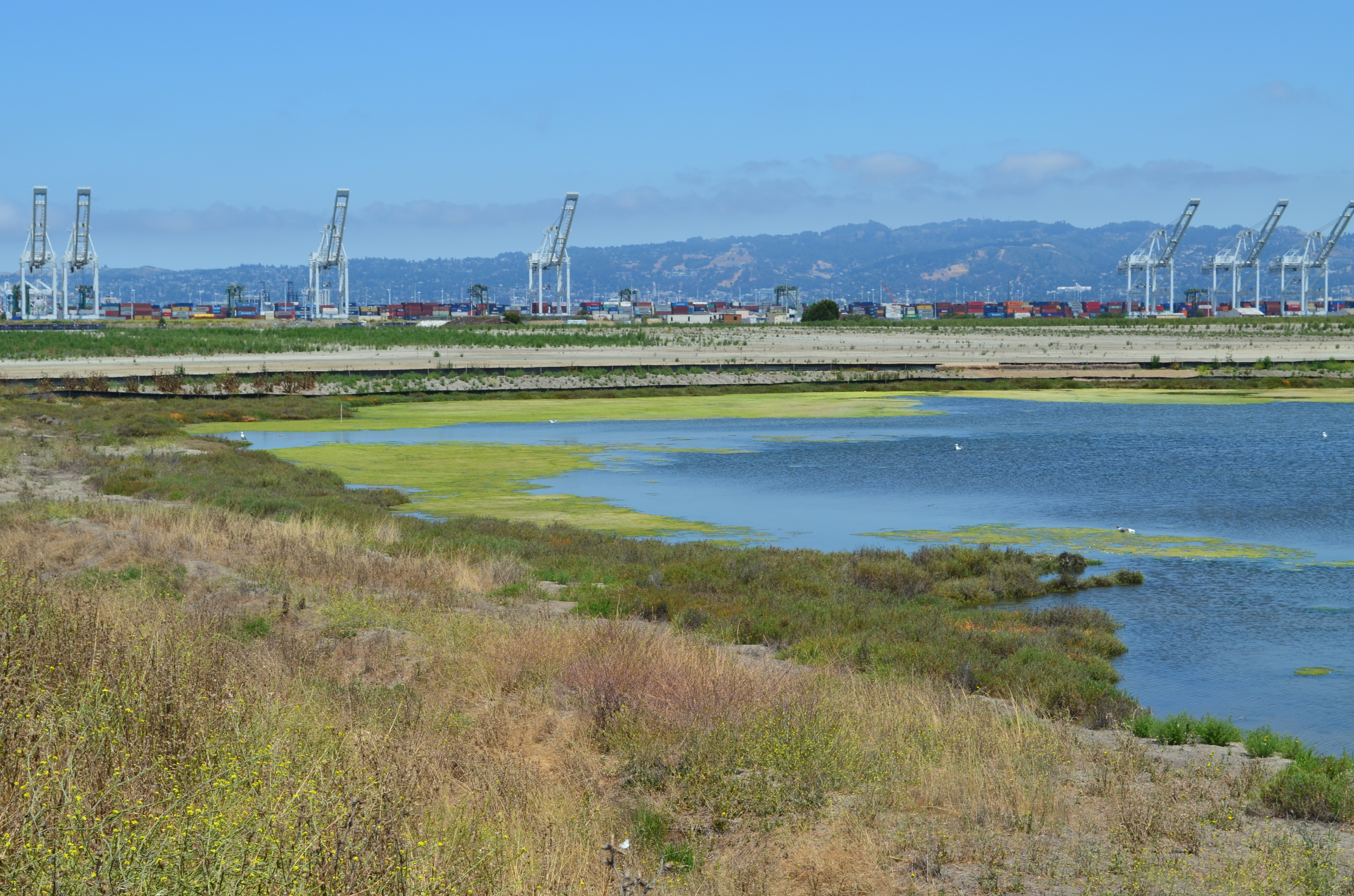
Construction of a new and improved soil cover over a waste disposal site concluded this spring, marking another milestone. The 110-acre site on the southwest corner of Alameda Point took 10 years of haggling about potential environmental impacts before a cleanup plan was adopted in 2010. Work began in early 2013. The dome-shaped soil cover required 500,000 cubic yards of barged-in soil to complete.
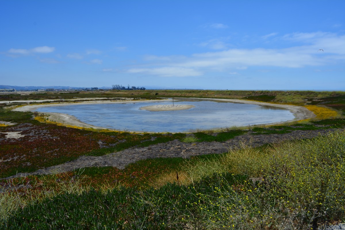
North Pond of West Wetland on southwest corner of Alameda Point. Pond is connected to San Francisco Bay via a new culvert near upper left of pond. Landfill soil cover is partially visible on far side of pond and will be seeded with flowering native grasses later this year.
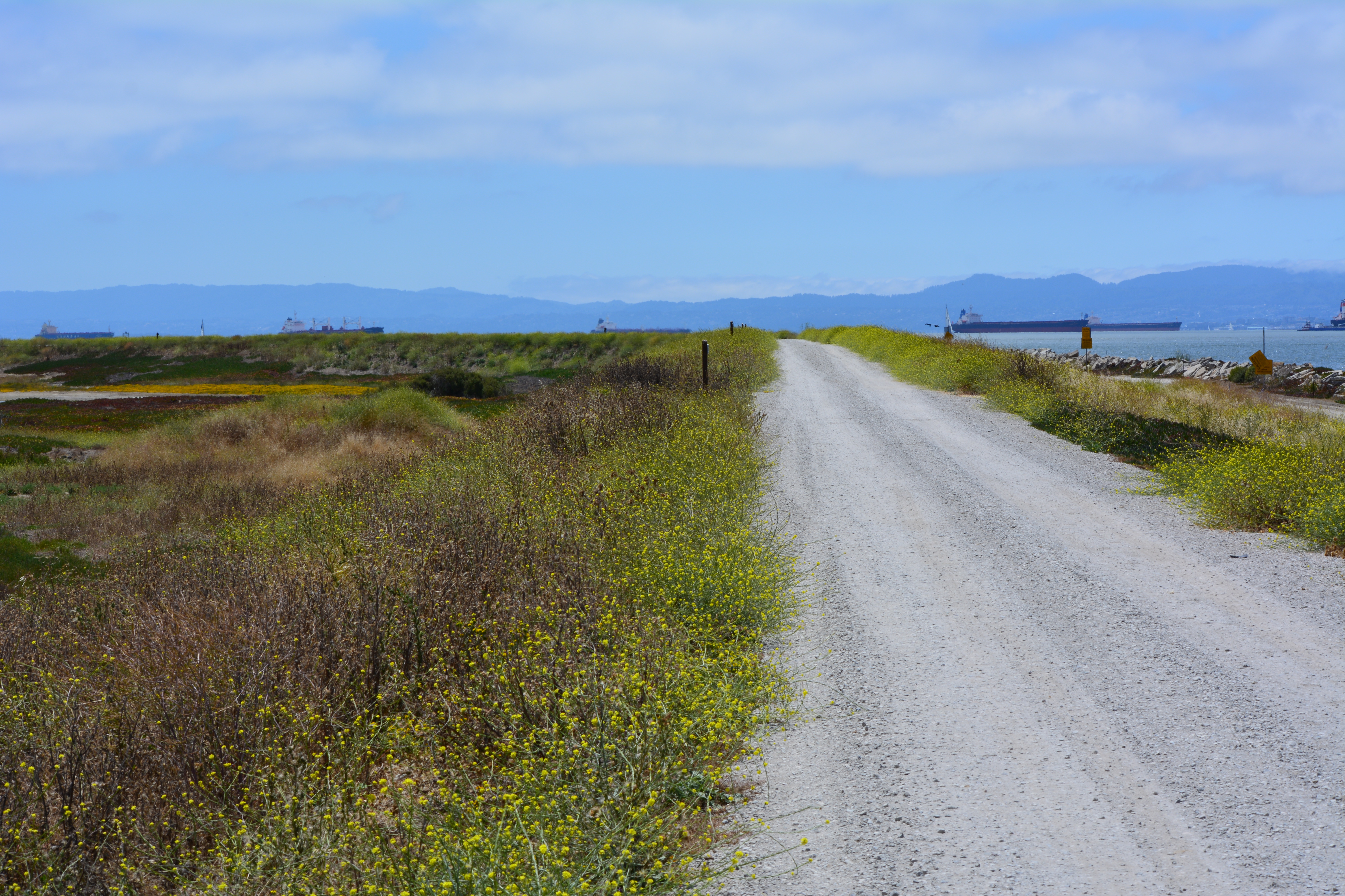
At the far northwestern corner of the Point, work is about to begin on another long studied and analyzed waste disposal site. In a few months, the Navy will be installing an interlocking steel retaining wall along 200 yards of the Bay shoreline to contain contaminated burned waste material that was bulldozed into the Bay more than a half century ago. Water dye tests showed no toxics are leaching into the Bay, but members of the Restoration Advisory Board (RAB) questioned whether the barrier would withstand a catastrophic earthquake. Partially covered by runway pavement, the entire 30-acre site will receive a three-foot soil cover. The work is expected to be completed in 2015. The area will be available for passive recreational use such as hiking trails when the city receives the land.
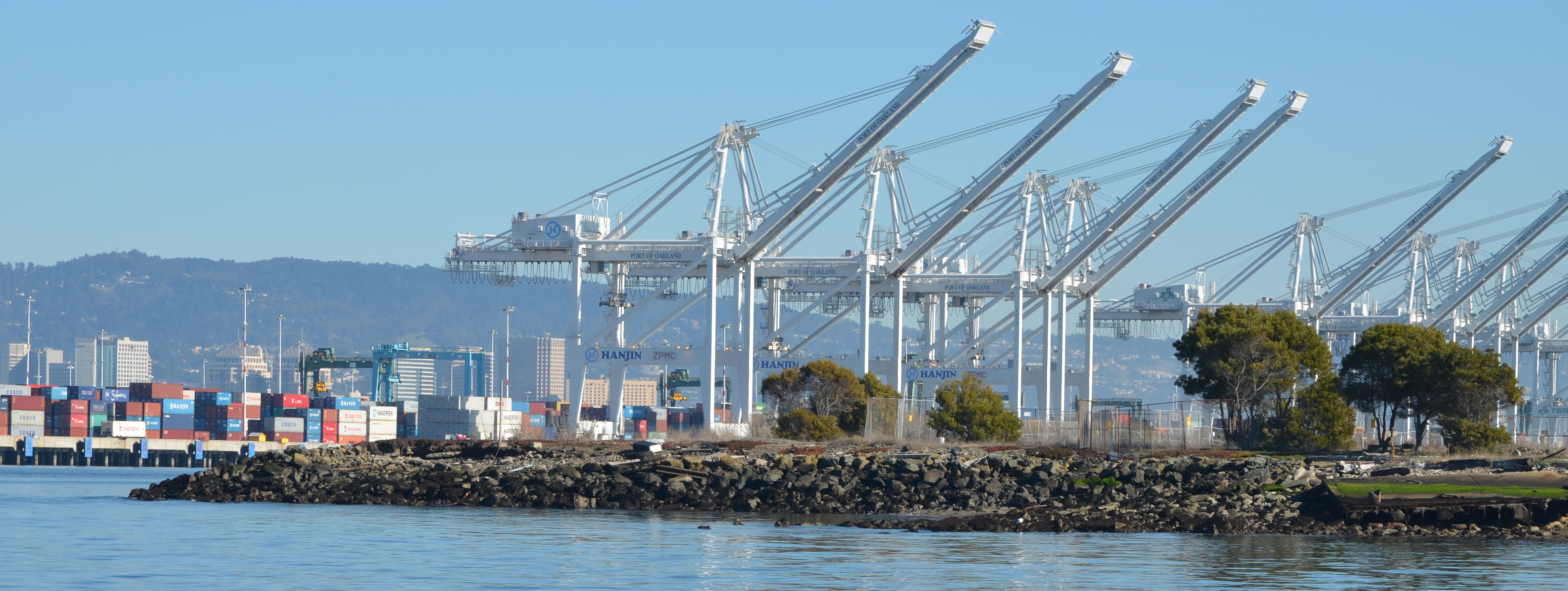
Northwest tip of Alameda Point where Site 1 is located. Waste burning area is here. Trees have been removed. Metal retaining wall will go here. Port of Oakland is in background.
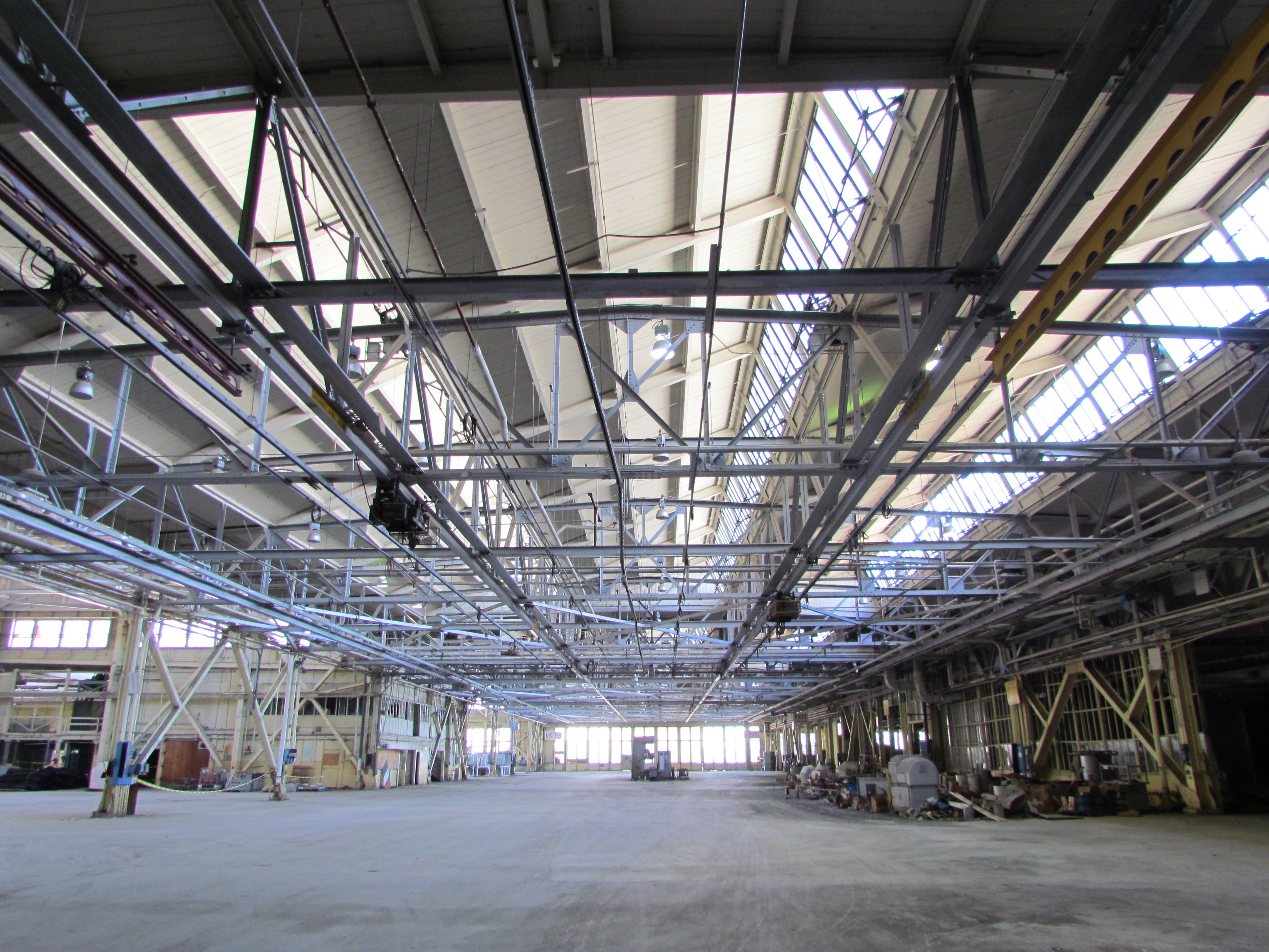
One of the longest-running and most problematic cleanup sites is at the old Naval Air Rework Facility (NARF), also known as Building 5, covering nearly one million square feet. Radium paint used for aircraft dial painting, and chemicals associated with engine repair work led to contamination that is still being remediated. The entire floor area will be scanned again for radiation in 2015, following up on at least three prior scanning surveys of walls, ceilings, pipes, and ducts. The year 2015 will also see the Navy returning to the site for a final round of groundwater cleanup treatments targeting contamination remaining after an intensive cleanup effort a decade ago.
Building 5, also known as Naval Air Rework Facility (NARF), where additional radium-226 and groundwater cleanup is planned. At the corner of West Tower Avenue and Monarch Street.
Next door to the Bladium Sports Club on West Tower Avenue, another previously treated groundwater cleanup site will be treated again. Workers have already begun boring holes in the pavement for a network of hoses that will be used for introducing contaminant-eating bacteria into groundwater along with a bacteria food source.
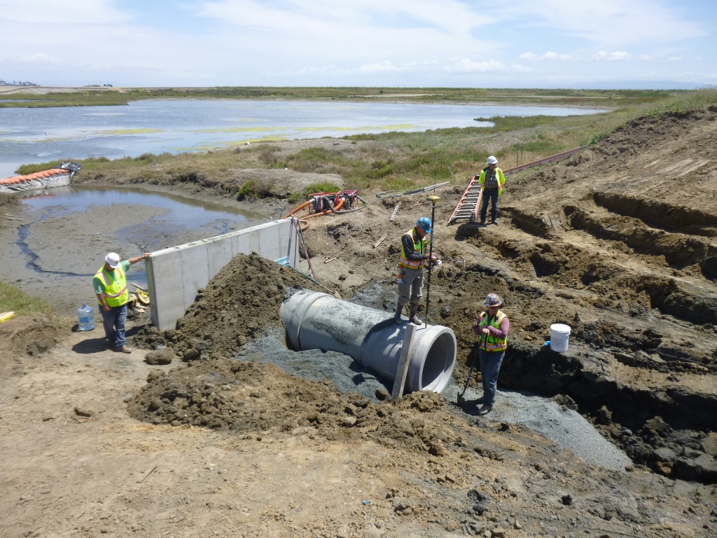
On Saturday, July 12, the Navy’s annual cleanup site tour visited four of the cleanup areas. The most impressive stop was the 110-acre landfill site mentioned above. For the first time in over 15 years, members of the public were allowed to walk around and enjoy the magnificent views from the embankment that is closer to San Francisco than to city hall. The fencing is all gone, and with it the radiological warning signs. The Navy replaced an aging metal culvert that connects the site’s North Pond to San Francisco Bay with a concrete culvert.
New culvert being installed connecting San Francisco Bay, which is to the right, and North Pond of the West Wetland at Alameda Point. Navy photo taken 5/22/14.New culvert being installed. North Pond of West Wetland at Alameda Point in foreground, San Francisco Bay in background. Navy photo.
Tour participants were able to see the area’s expanded wetland with a new tiny island. Caspian Terns started nesting on the island a few months ago, another type of milestone. “The last time Caspian Terns were seen in that area nesting was in 1999 when only one nest was detected,” said Alameda wildlife biologist and Alameda Point bird surveyor Leora Feeney. The 79-acre soil cover on the landfill will be seeded with flowering native grasses later this year. The vegetation mix was chosen by the RAB.
South Pond of West Wetland at Alameda Point. Island in pond has become a nesting site for Caspian Terns. Looking north toward Port of Oakland.
According to the Navy’s environmental cleanup coordinator, Derek Robinson, $513 million has been appropriated to date for Alameda Point cleanup, although some of it remains to be spent on upcoming work. His office, the Base Realignment and Closure Program, estimates another $80 million will be needed by the time remaining projects and follow-up monitoring are completed.
Later this year, the Navy is expected to transfer to the city the 33-acre North Housing site and seven-acre former Island High School site that sit next to Alameda Landing and Estuary Park, marking another milestone on the long and winding cleanup road to civilian use.
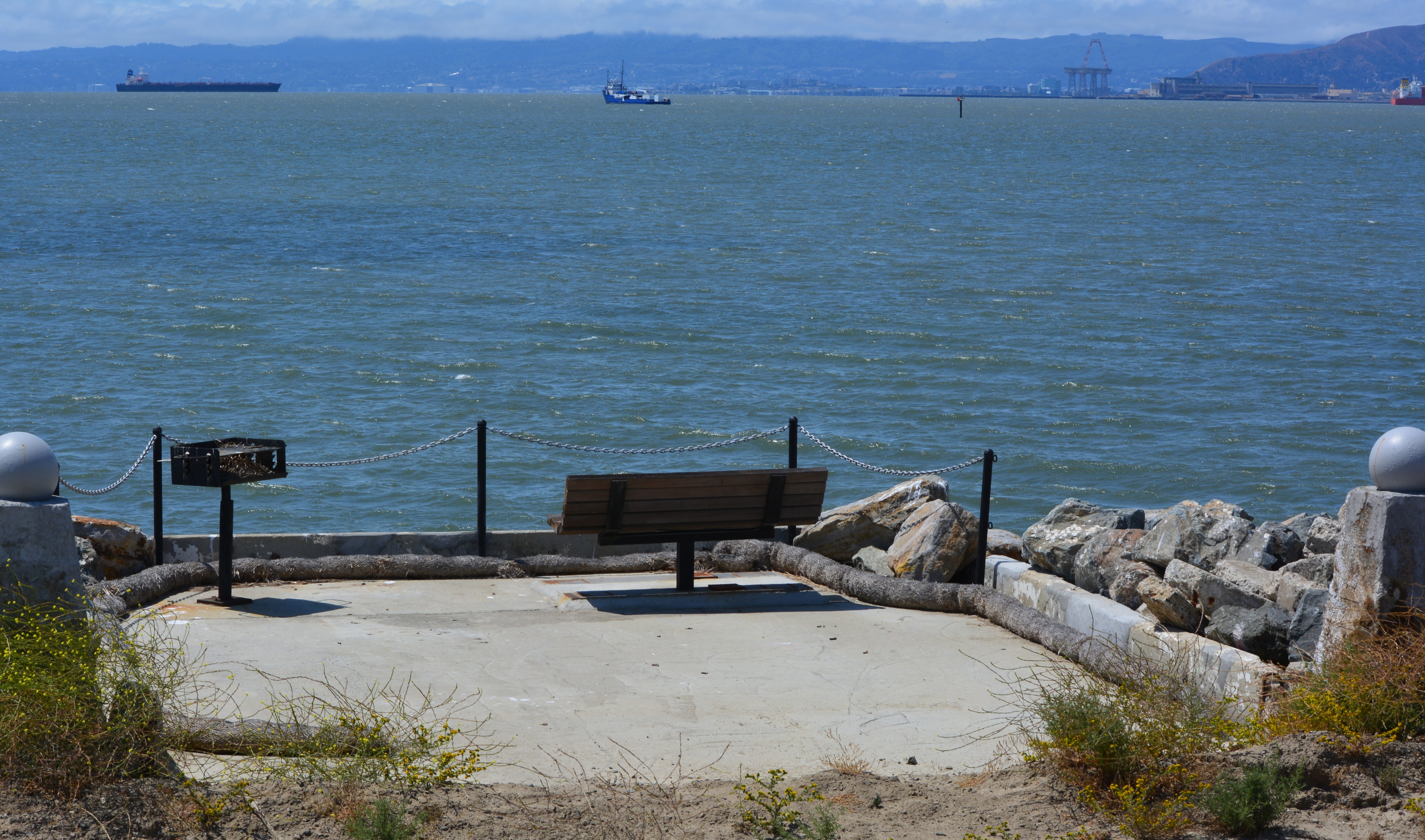
Caspian Terns and chicks at West Wetland, Alameda Point. Click on image to enlarge.Trail on embankment at southwest corner of Alameda Point. Looking south with San Francisco Bay to the right and ahead. Additional trail to the right at riprap elevation.Concrete pad served as a base for conveyor that transferred soil from barge to land for the soil cover at Site 2. Contractor left it in place and added a few amenities for future users of a place they had come to appreciate the beauty of as they worked here for a year. Thank you, TetraTech.Dredging the northwest corner of the Seaplane Lagoon at Alameda Point in February 2012. Tarmac dewatering, drying, and testing area behind black tarp is now being dismantled. All dredging work is completed.
Update notes: Subsequent criticism of the Navy as to the necessity of a security fence by members of the public and regulatory agencies led to the removal of the security fence from the final work plan design. The Navy also agreed to shorten the soil gas vents to two feet, since only trace amounts of methane gas are now emitted from the landfill waste, most of which is industrial and did not produce methane in the first place. Additionally, the Navy agreed to examine the aging metal culvert that connects the North Pond of the West Wetland to San Francisco Bay. The culvert provides the water lifeline for the North Pond habitat and was at risk of collapse and being stopped up with debris. The Navy replaced the metal culvert with a concrete culvert (see photo above) and debris screen.