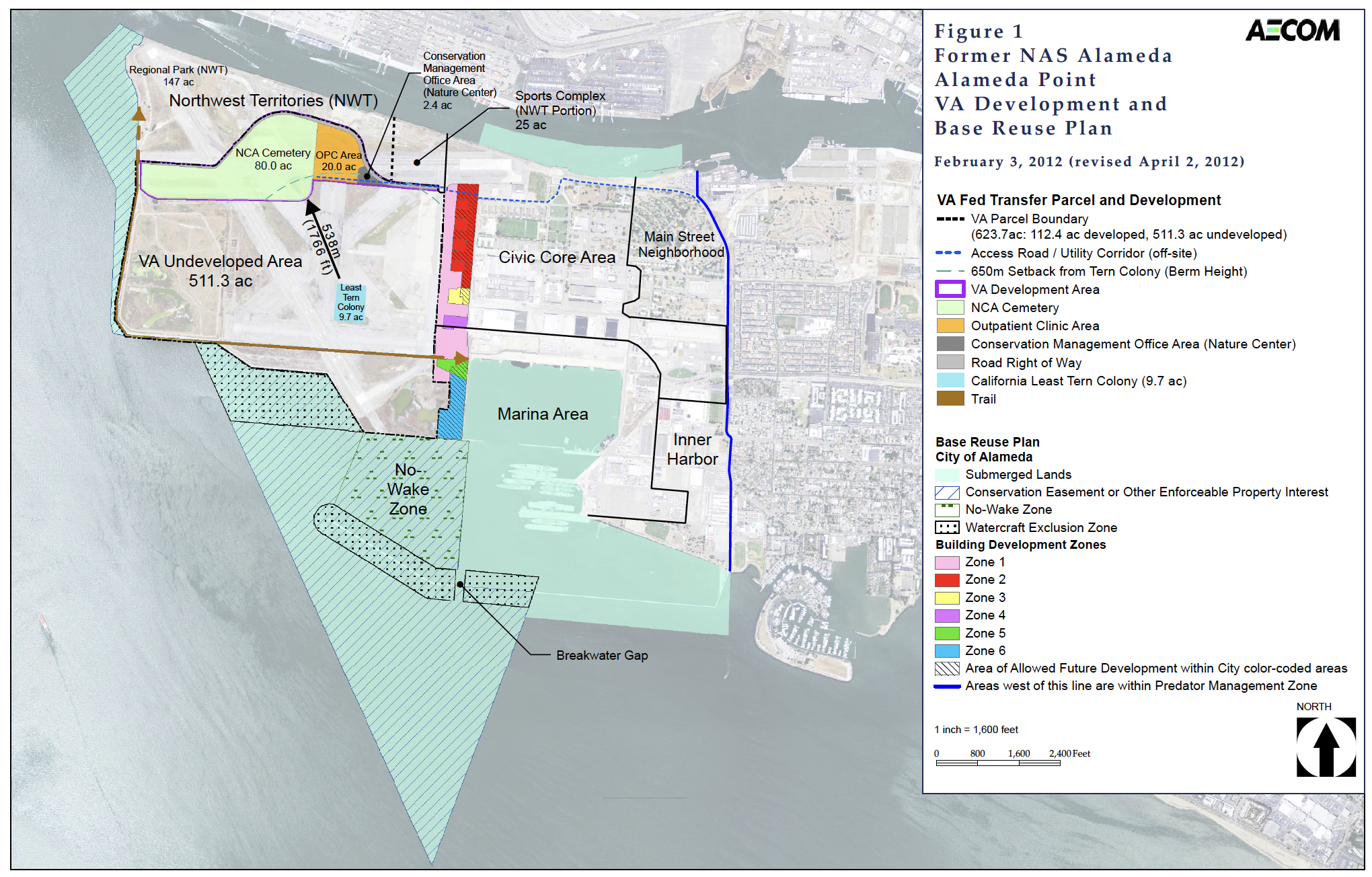
1936 map of Alameda – ferries departed from far left tip of island. Map on display in Naval Air Museum at Alameda Point.
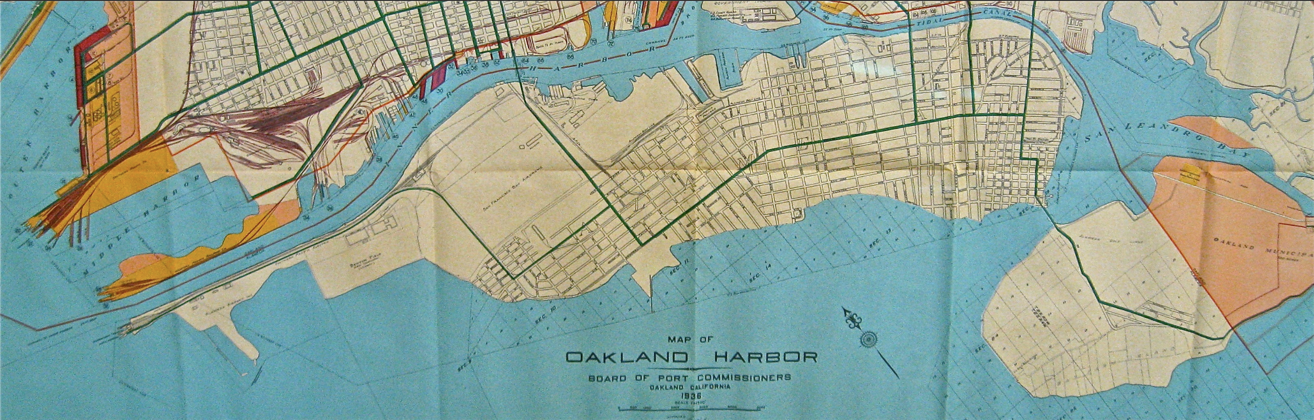
1956 Pictoral Map of Naval Air Station – Alameda. Source: National Archives
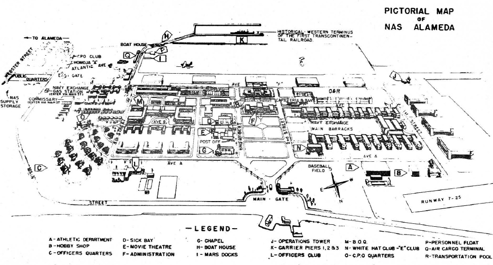
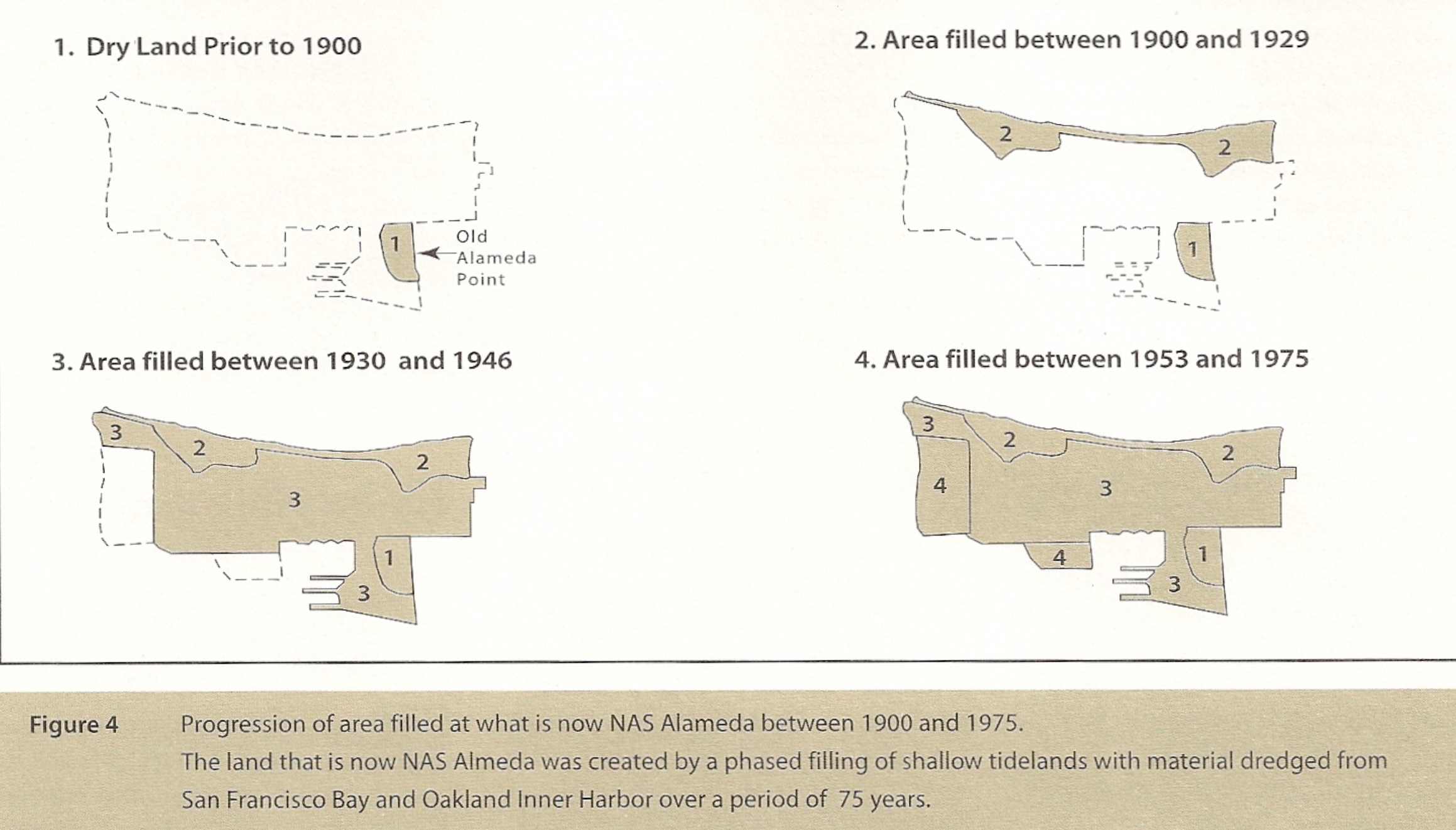
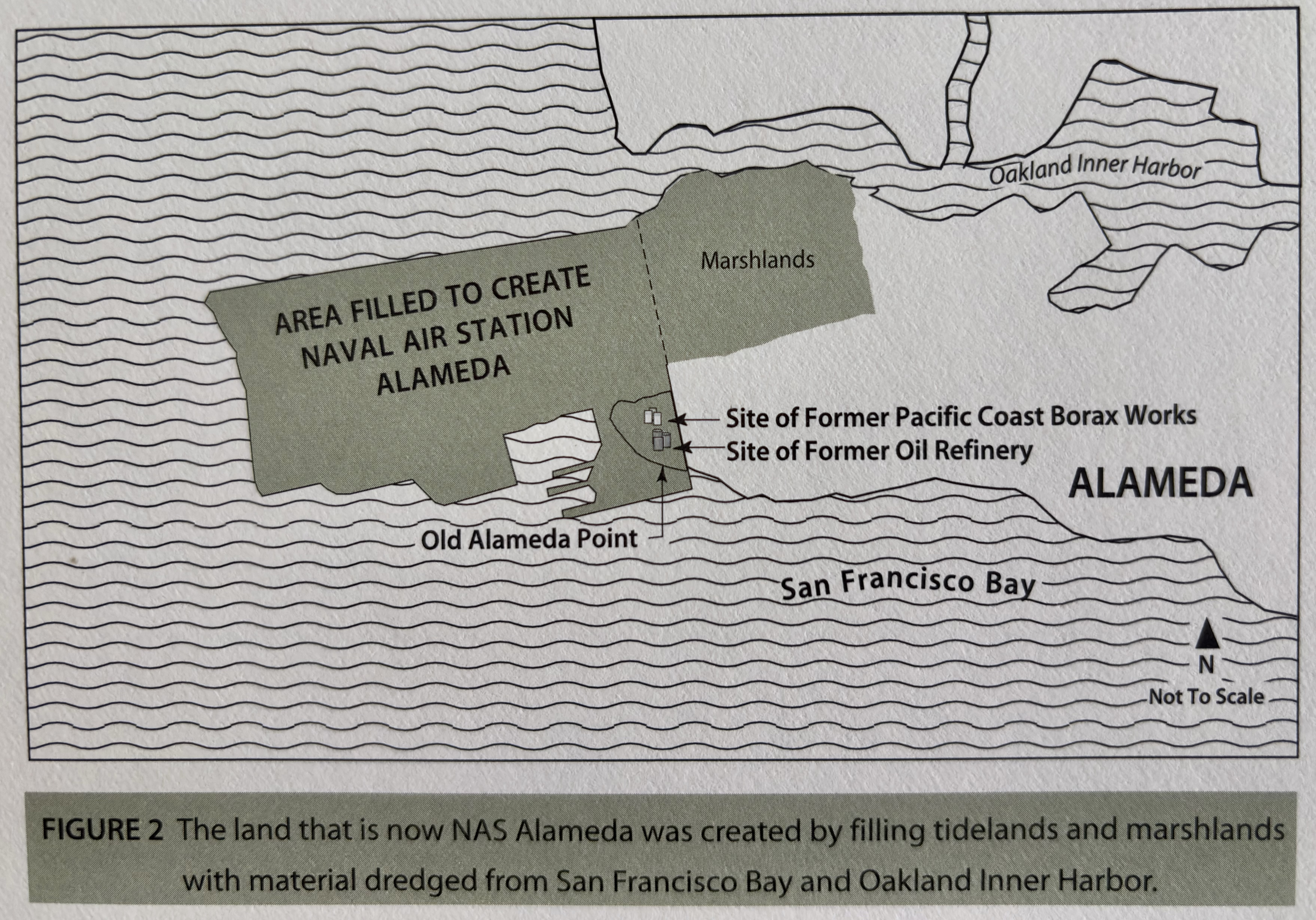
Late 19th Century Alameda From History & Geology Fact Sheet, Number 7, June 1996 Published by Naval Air Station – Alameda
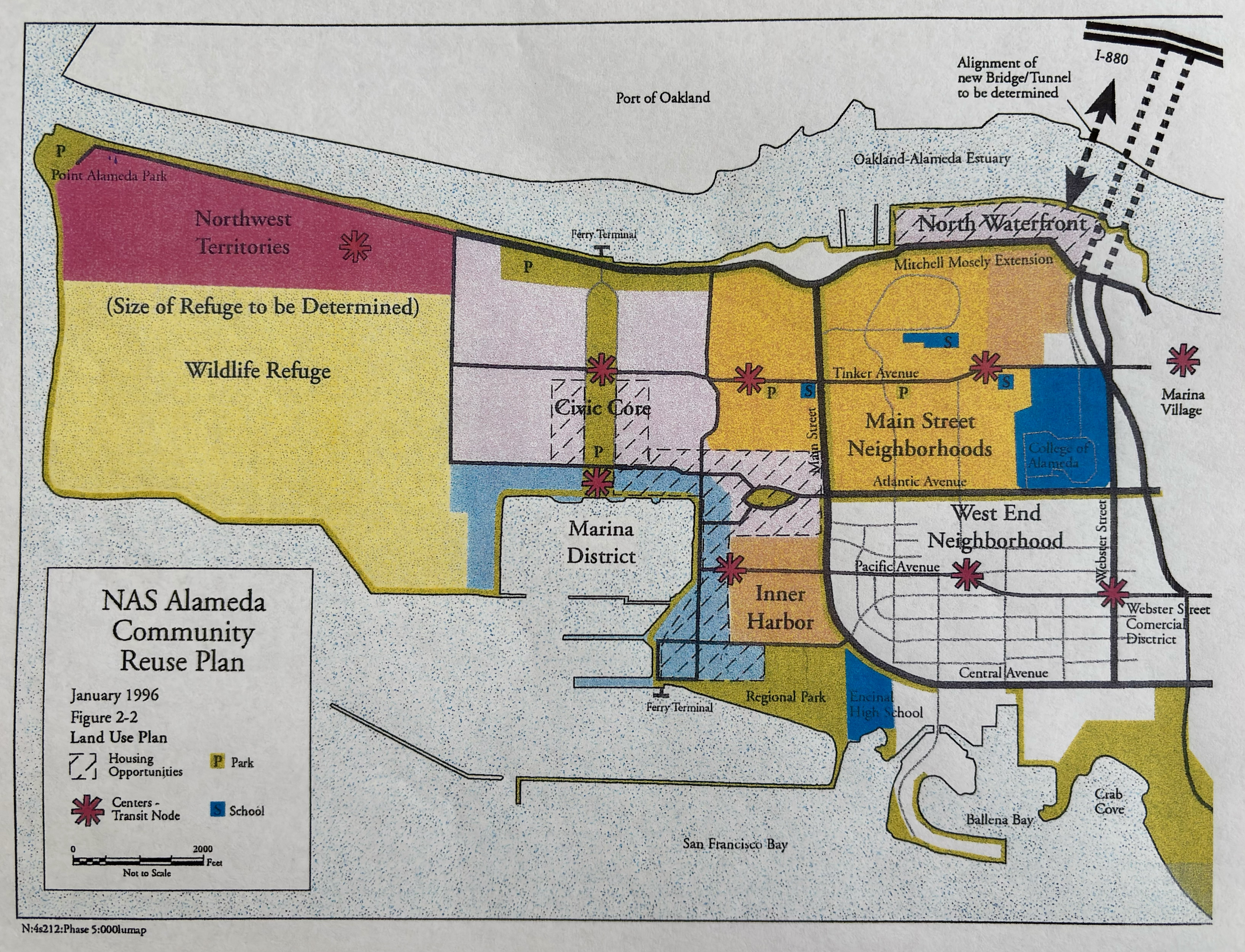
January 1996 NAS Alameda Community Reuse Plan Map
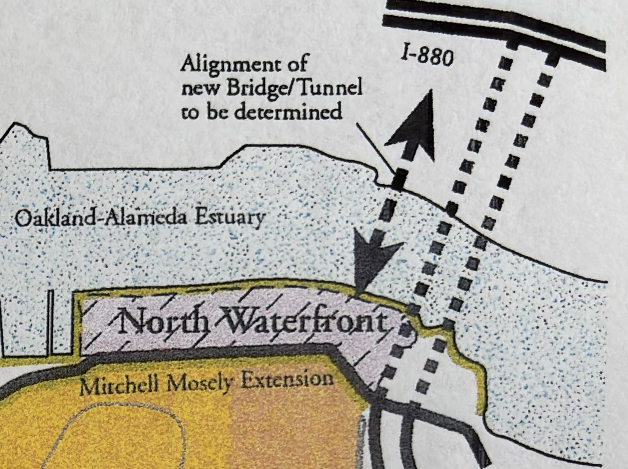
The “Forgotten” Transportation Element from the 1996 Community Reuse Plan showing the aspiration for a new bridge or tunnel to connect Alameda with Oakland.
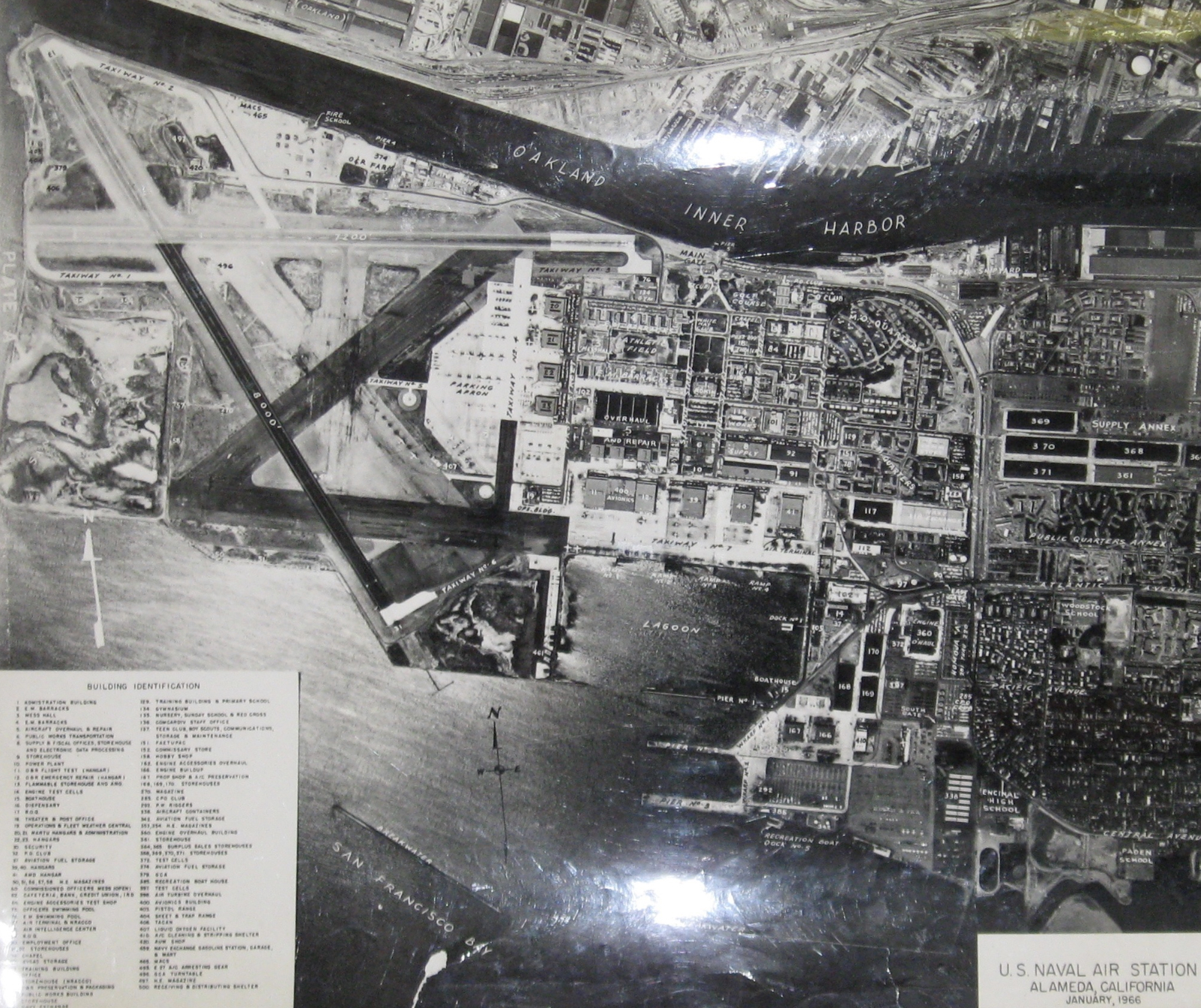
Naval Air Station – Alameda in 1966. Photo on display in Naval Air Museum at Alameda Point.
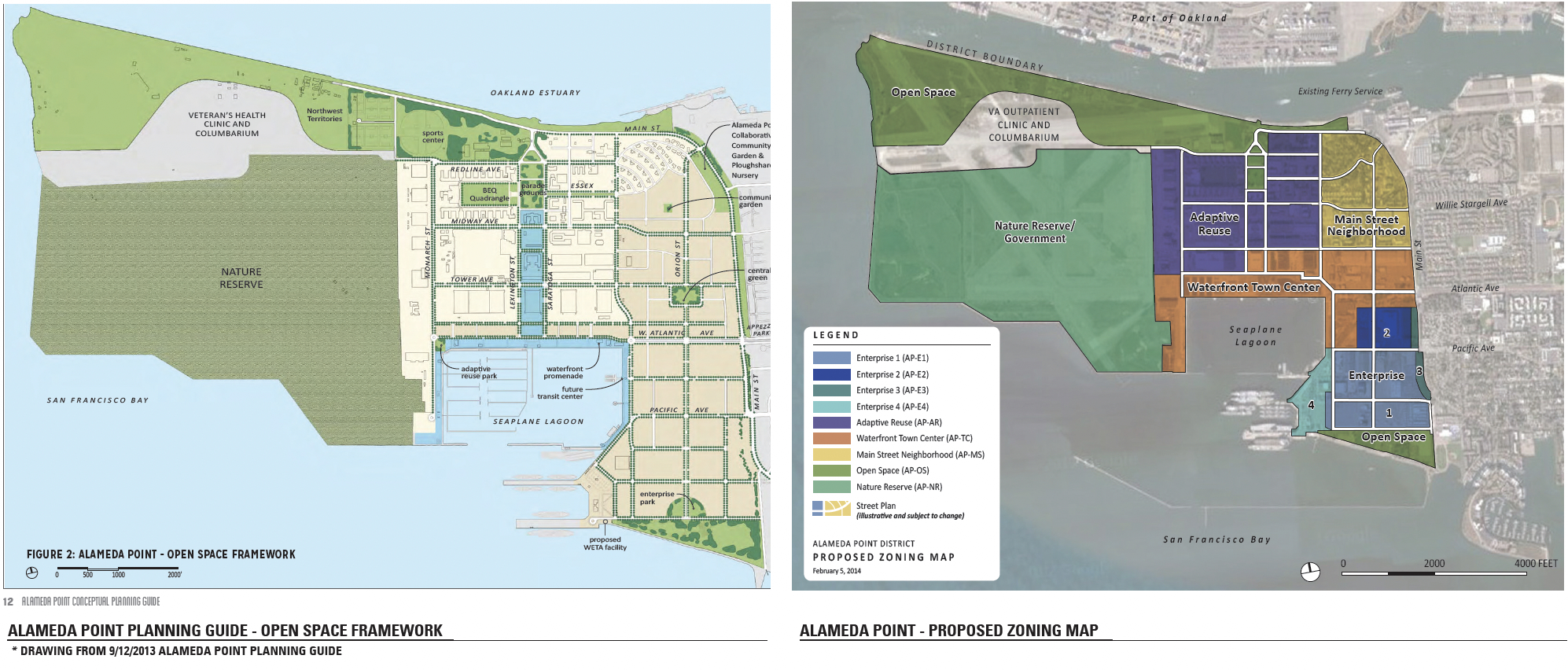
Site A developer Alameda Point Partners presentation to City Council 2/17/2015
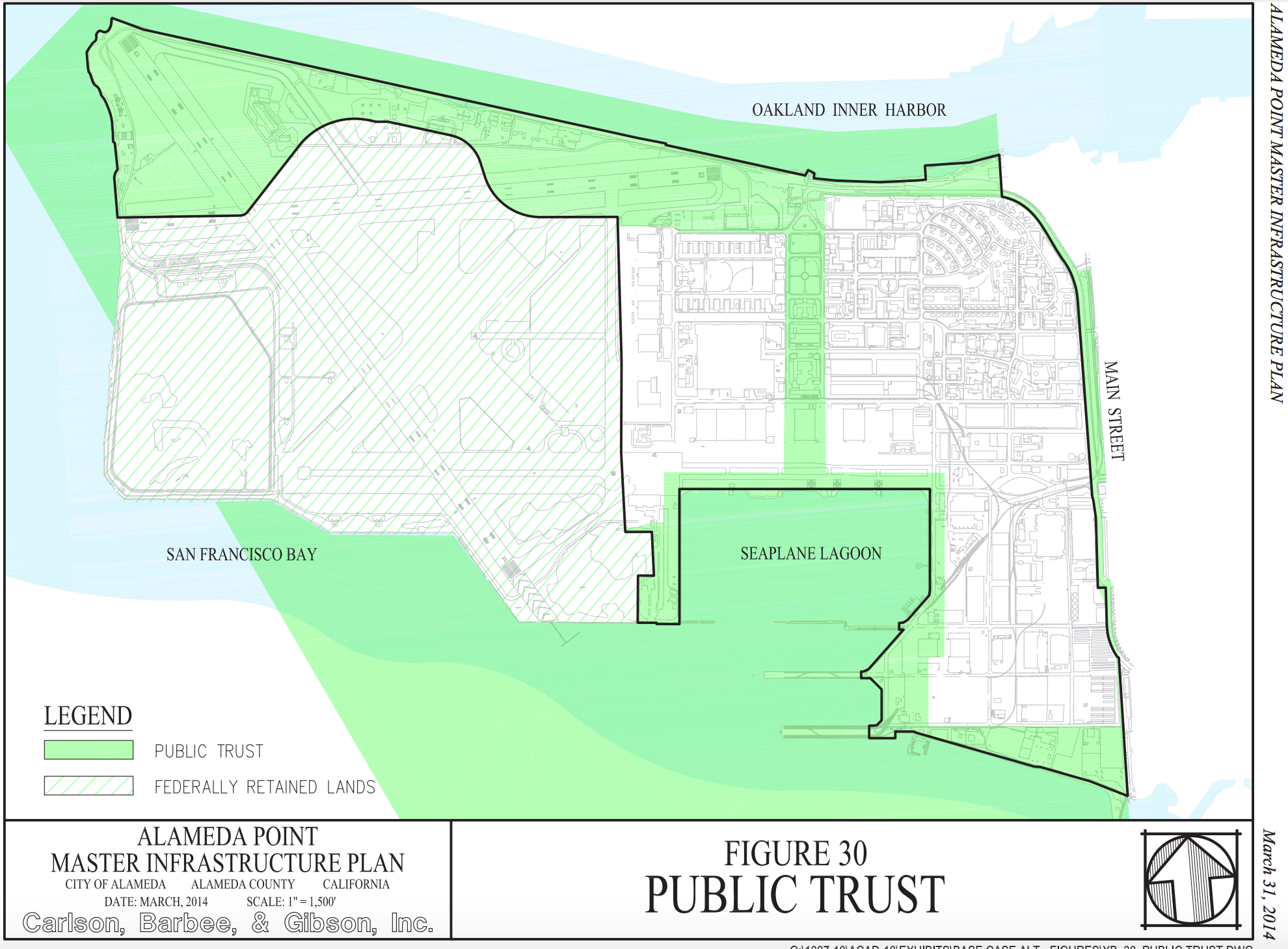
Alameda Point Public Trust Lands
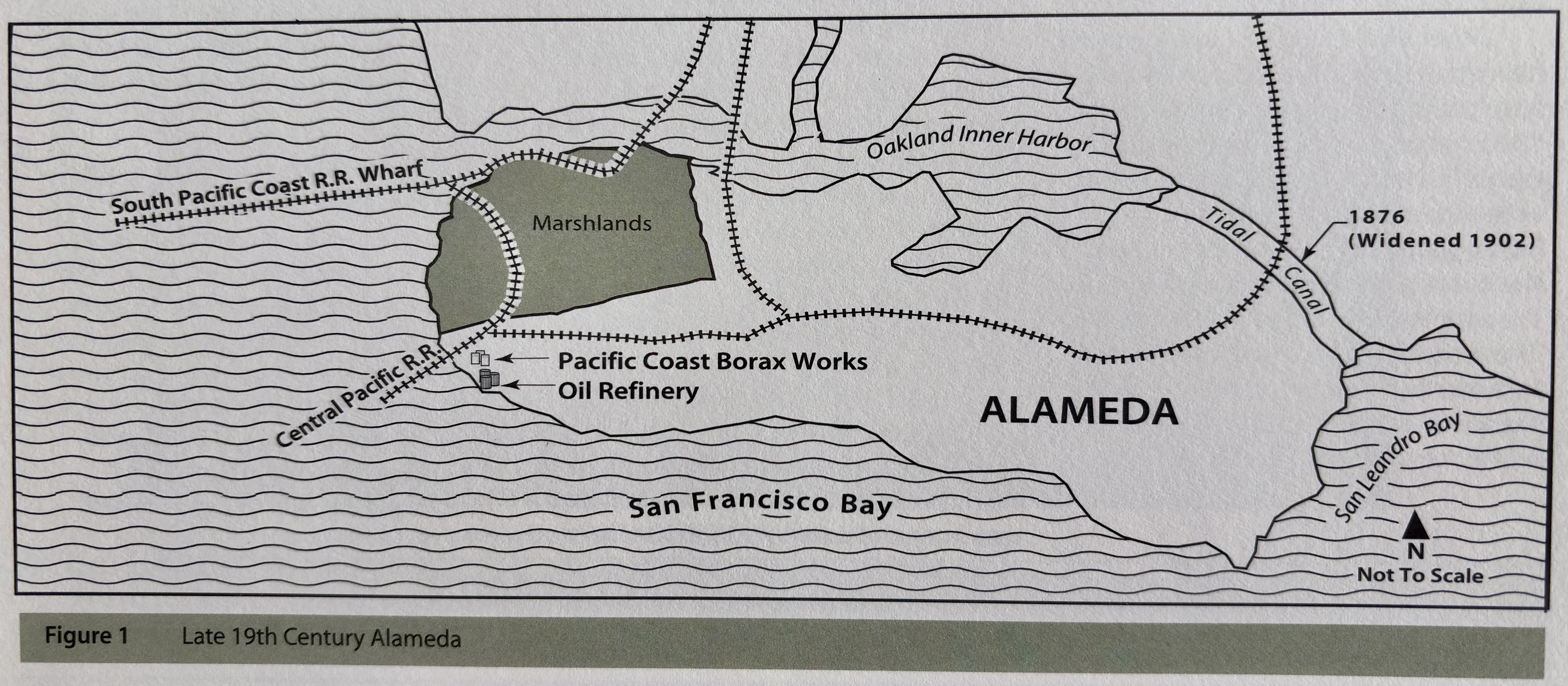
VA Development and Base Reuse Plan