Part of the shoreline along the Oakland Estuary at Alameda Point has been upgraded with a prominent new pale gray stone embankment. While the aesthetic value is immediately apparent, the engineering value is not.
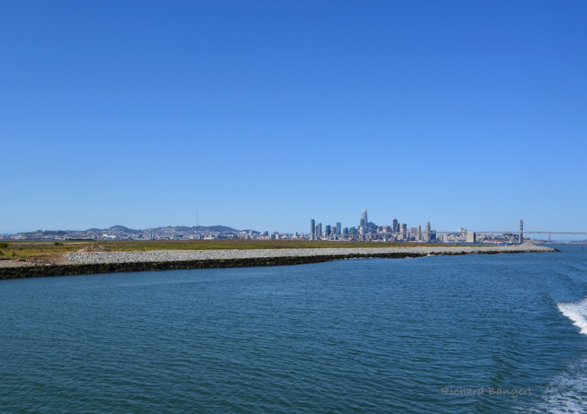
The reinforcement of this Estuary shoreline, including several hundred feet on the Bay side, ensures that both shorelines remain stable.
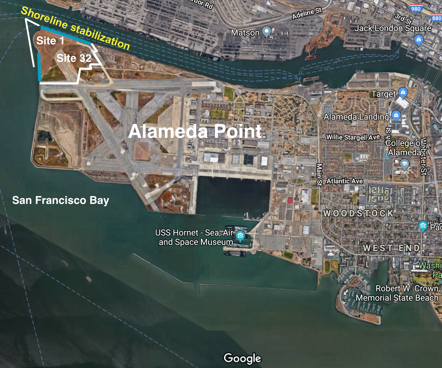 This area includes two cleanup sites, totaling nearly 100 acres. Site 1 has been covered with three feet of new soil and steel retaining wall added at the tip of Alameda Point. Site 32 is expected to be covered within a year.
These shorelines needed reinforcement to ensure that the added weight of the new soil with its added lateral pressure, combined with wave action, tidal currents, storm surges, and earthquakes does not lead to collapse. The impact of failure into the Estuary shipping channel would be especially acute.
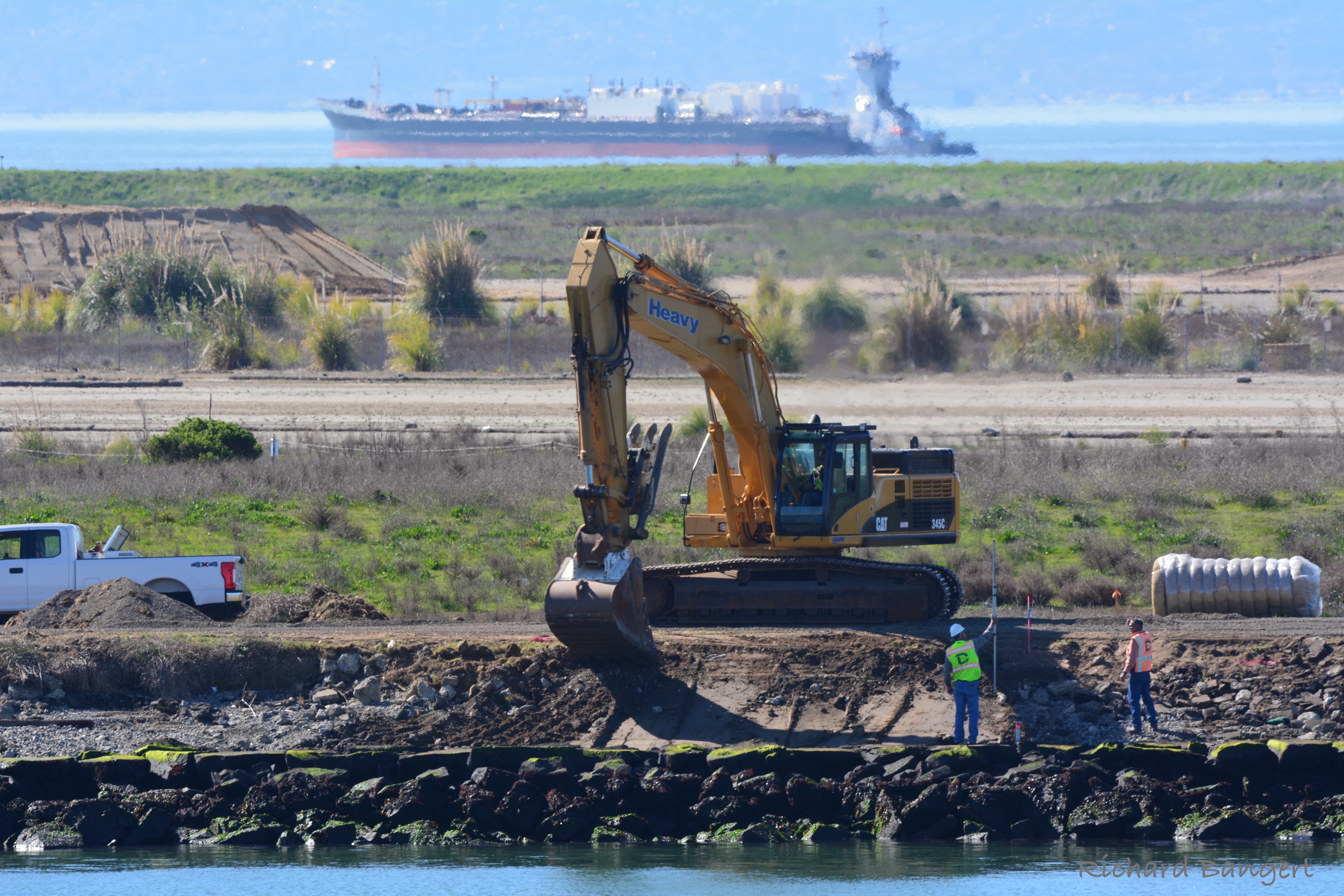
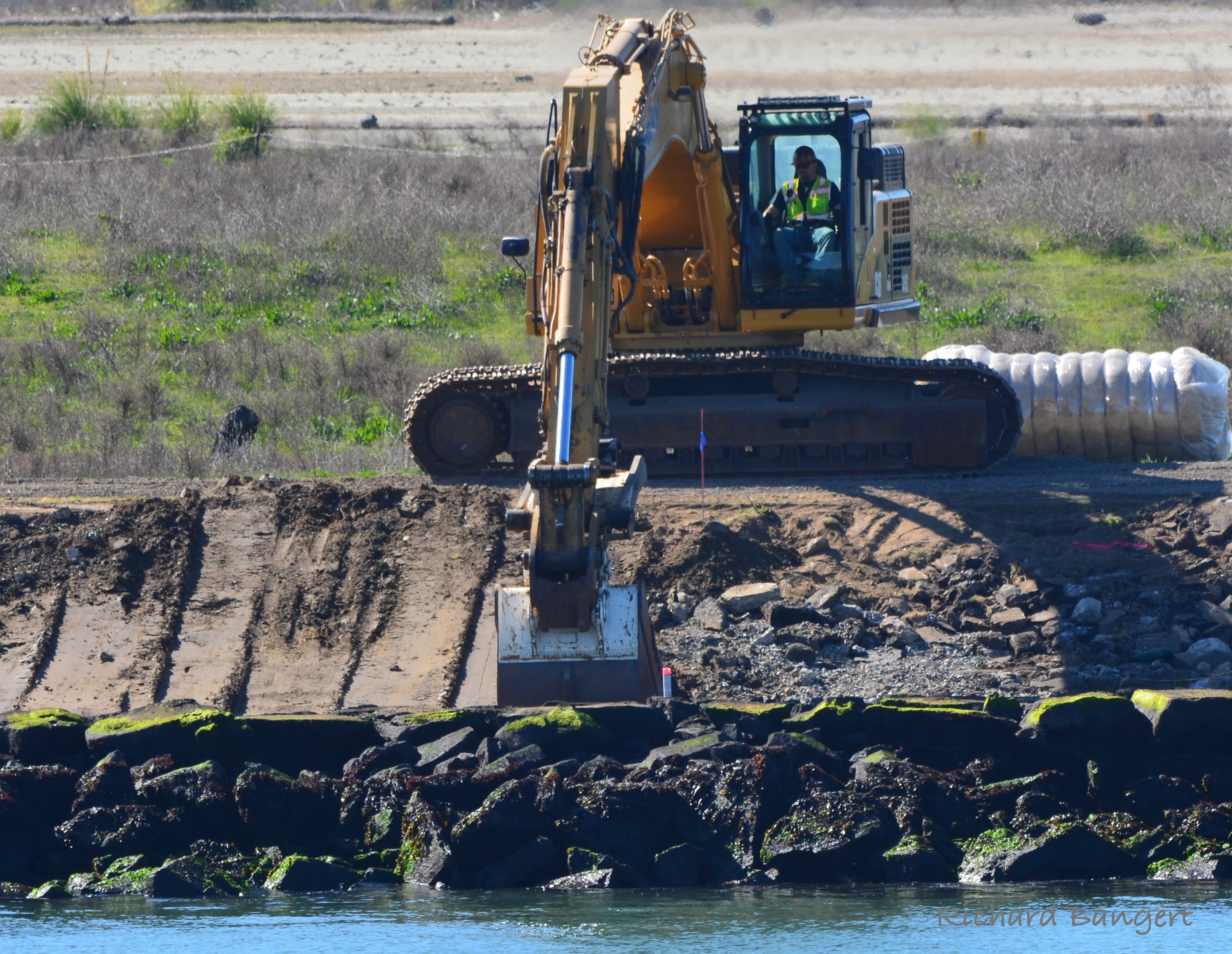
Work began earlier this year with a backhoe operator digging out, or undercutting, the shorelines behind the existing rock.
The supply of new rocks, called armor stone, was quarried at the Dutra San Rafael quarry and delivered by barge.
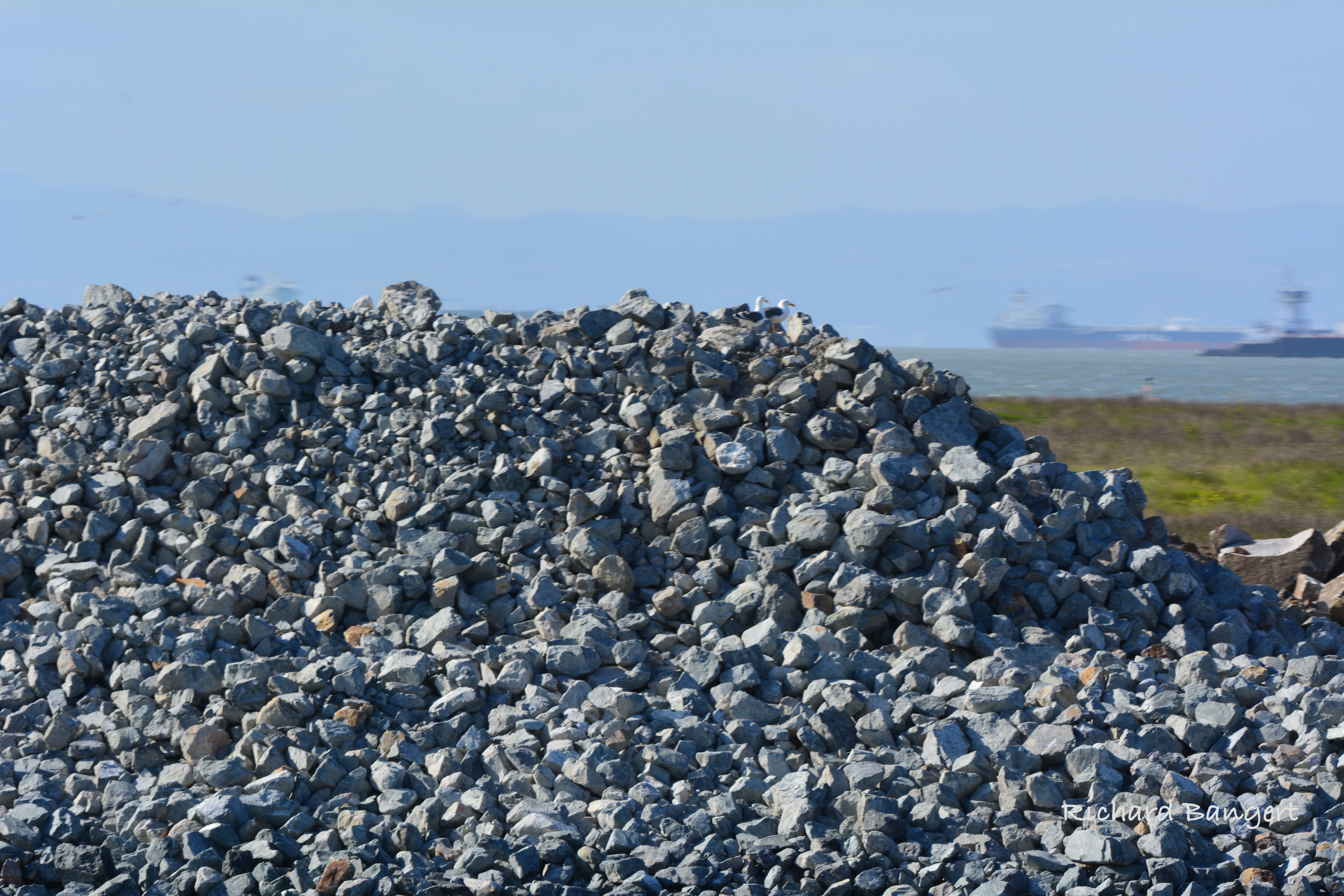
On the Bay side, existing concrete slab remnants used as rip rap were broken up and reused. Some work there remains to be completed. Total cost of the shoreline stabilization project spanning 4,000 linear feet of shoreline is $5 million.
Last year, several hundred thousand cubic yards of clean soil were delivered by truck to cleanup Site 32 and stockpiled. The mountains of soil, visible during a ferry ride to San Francisco, will be used to cover and contour Site 32 and completely reconstruct and expand an existing wetland.
Site 1 and Site 32 comprise two-thirds of the proposed Alameda Point regional shoreline park. In that light, it would be fair to say that the Navy has already started construction of the regional park.
The modern day Oakland and Alameda shorelines along the Estuary were first constructed between 1874 and 1896 by the U.S. Army Corps of Engineers. Known as the “Alameda Training Wall” on the Alameda side, this wall and a similar wall on the Oakland side were designed to “train” the tide to scour the channel. The training walls marked the beginning of modern-day improvements to Oakland Harbor in order to foster shipping and commerce.
The Alameda Training Wall is listed in the National Register of Historic Places for its significance in the areas of transportation and engineering. The new rock reinforcement is now, in effect, a monument to that historic structure barely visible at water’s edge.
This work will have no adverse effect on historic properties, according to Navy Environmental Coordinator Cecily Sabedra. None of the original stone work for the Training Wall, much of it brought from a quarry on Angel Island, was removed. “The Navy believes that the proposed undertaking has been designed in a way that avoids adverse effect,” stated Sabedra in a letter to the State Historic Preservation Office.
After the walls were completed, infill was added behind the walls to create a berm with railroad tracks, called a mole, leading to port facilities. In the late 1800s, the Southern Pacific Railroad built the Alameda Mole from where the current Main Street Ferry Terminal sits out to a cargo and passenger ferry terminal across from where the westernmost shipping cranes today loom over the Port of Oakland.
