
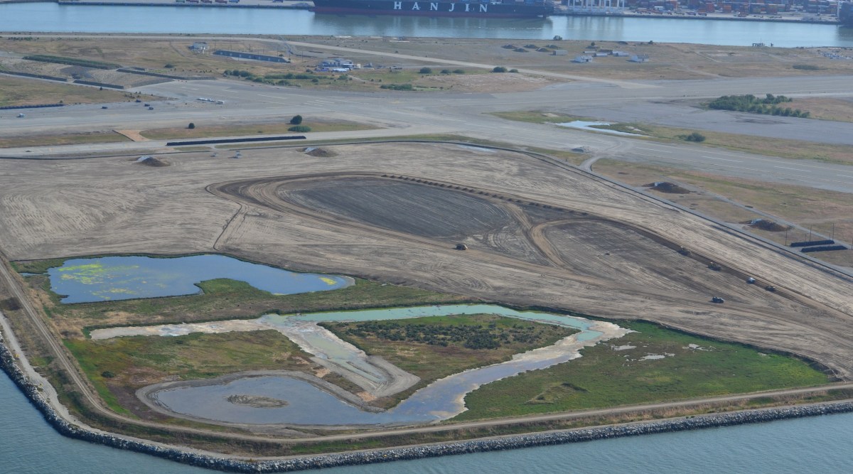
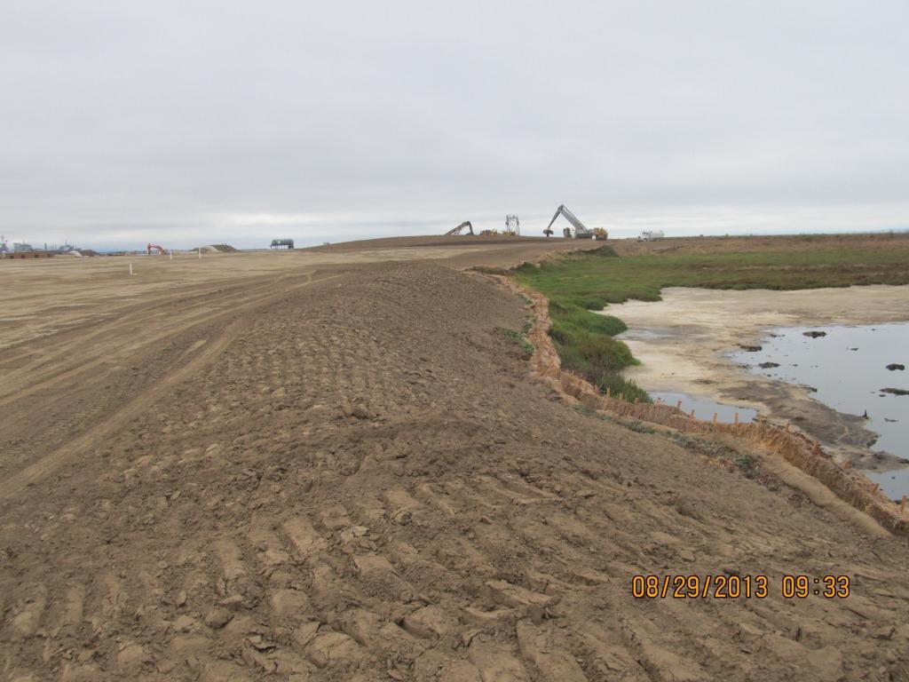
Landscaping of the 100-acre landfill area on the southwest corner of Alameda Point is nearing completion. The seeding of the landfill site with flowering native grasses is almost ready to begin. Contouring of the site is complete. Stabilization of the shoulder around the wetland area is complete. Placement of the final soil cover is underway.
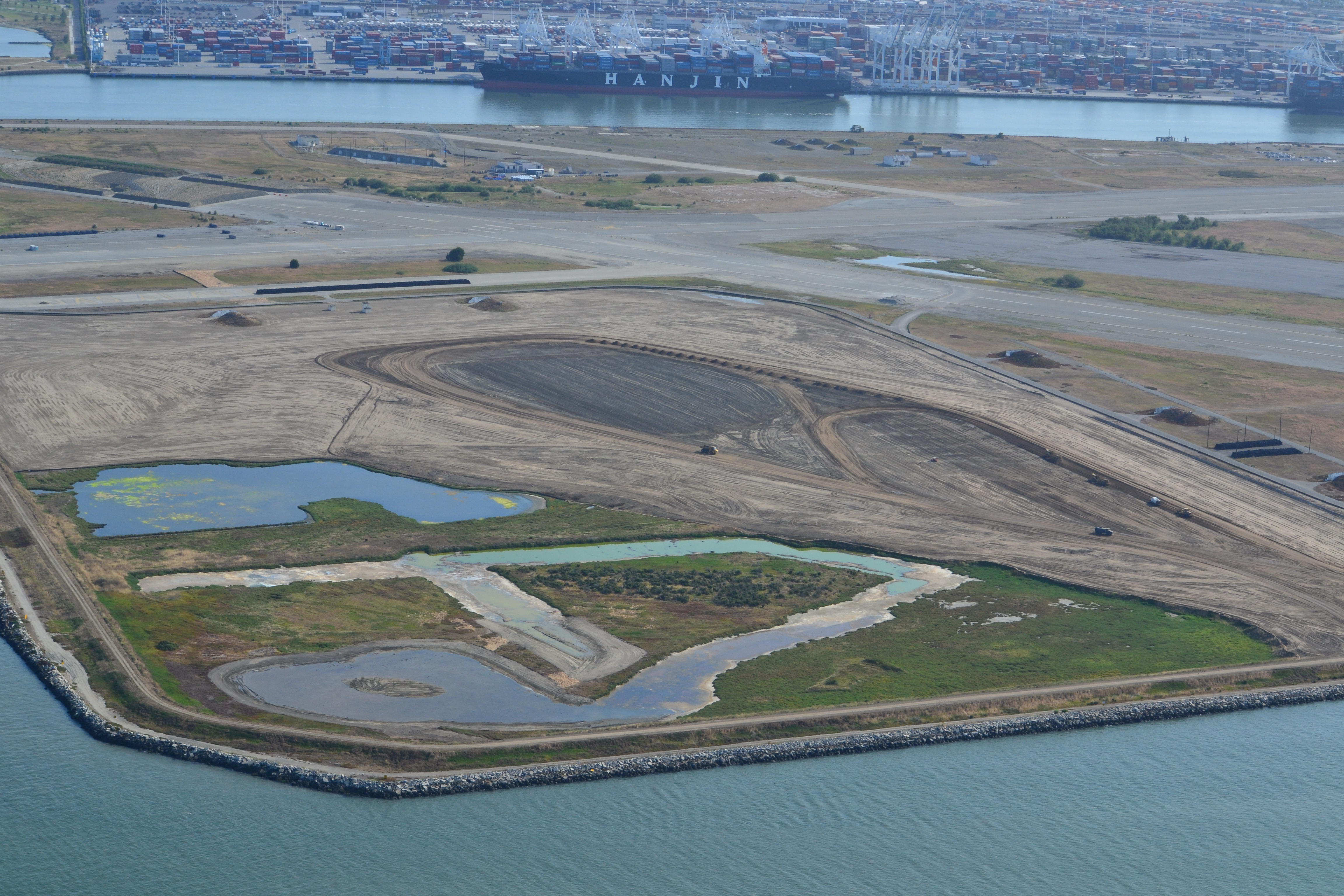
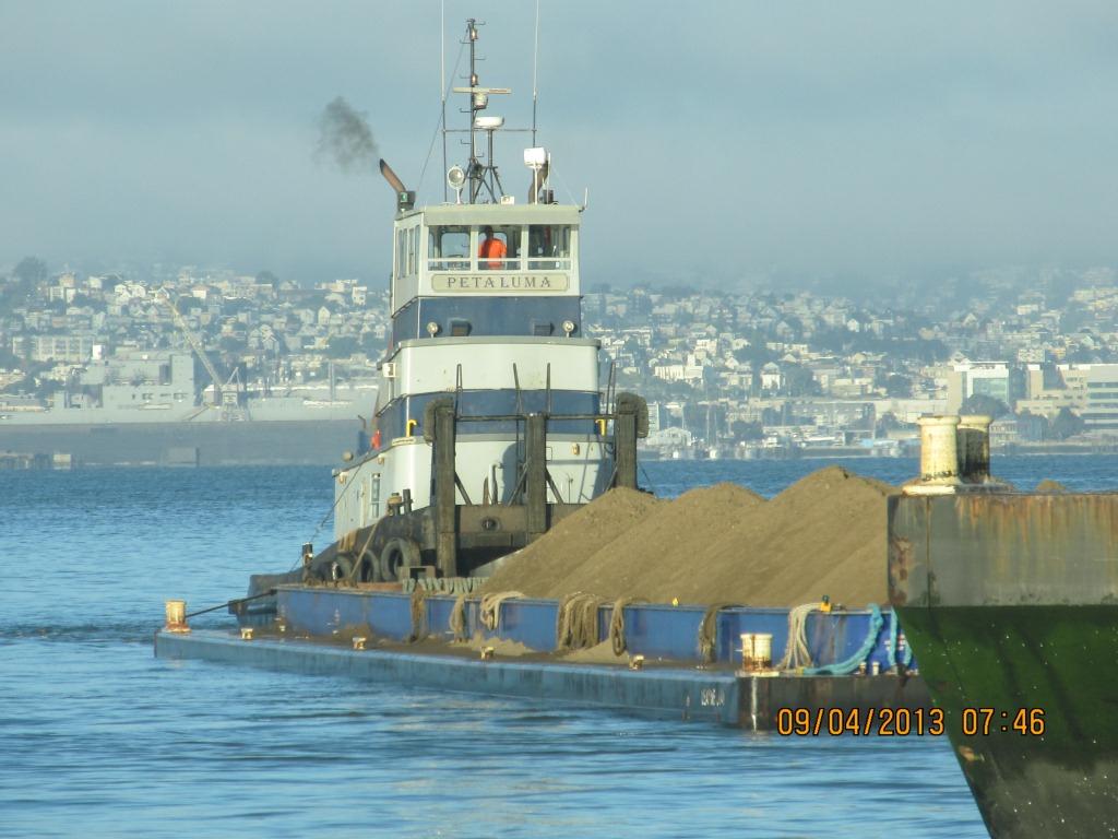
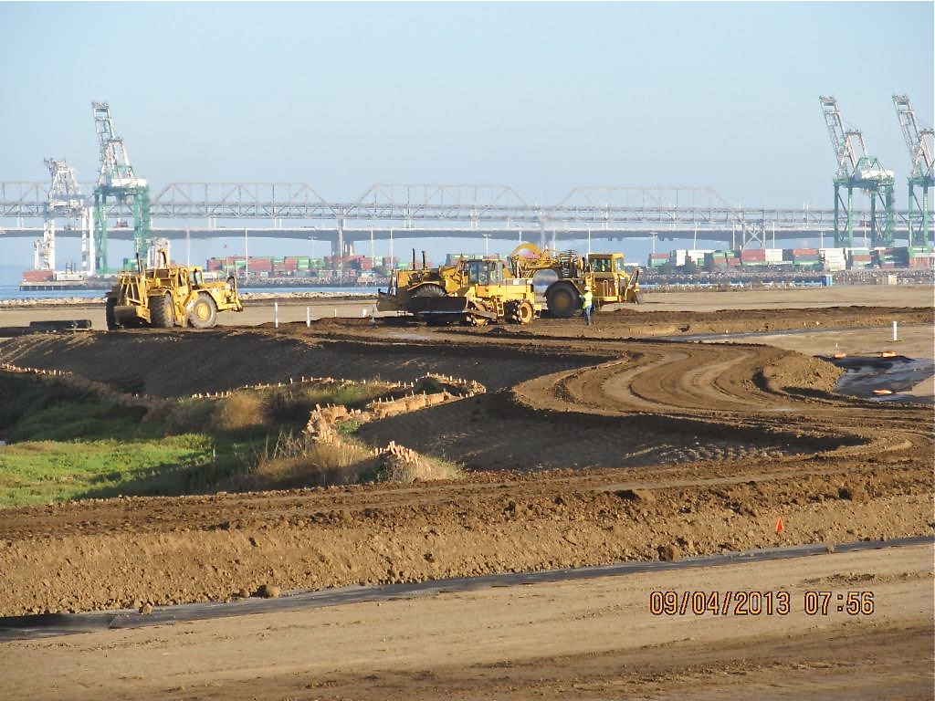
The contouring of this industrial landfill site was completed on August 16, 2013. Approximately one-third of the contouring, or base layer, soil is clean soil recycled from Seaplane Lagoon dredging. The recycled soil stock was quickly exhausted, along with soil recycled after removing some of the berms and high areas. More than half of the base layer – 193,000 cubic yards – is soil barged in from Decker Island in the Sacramento River.
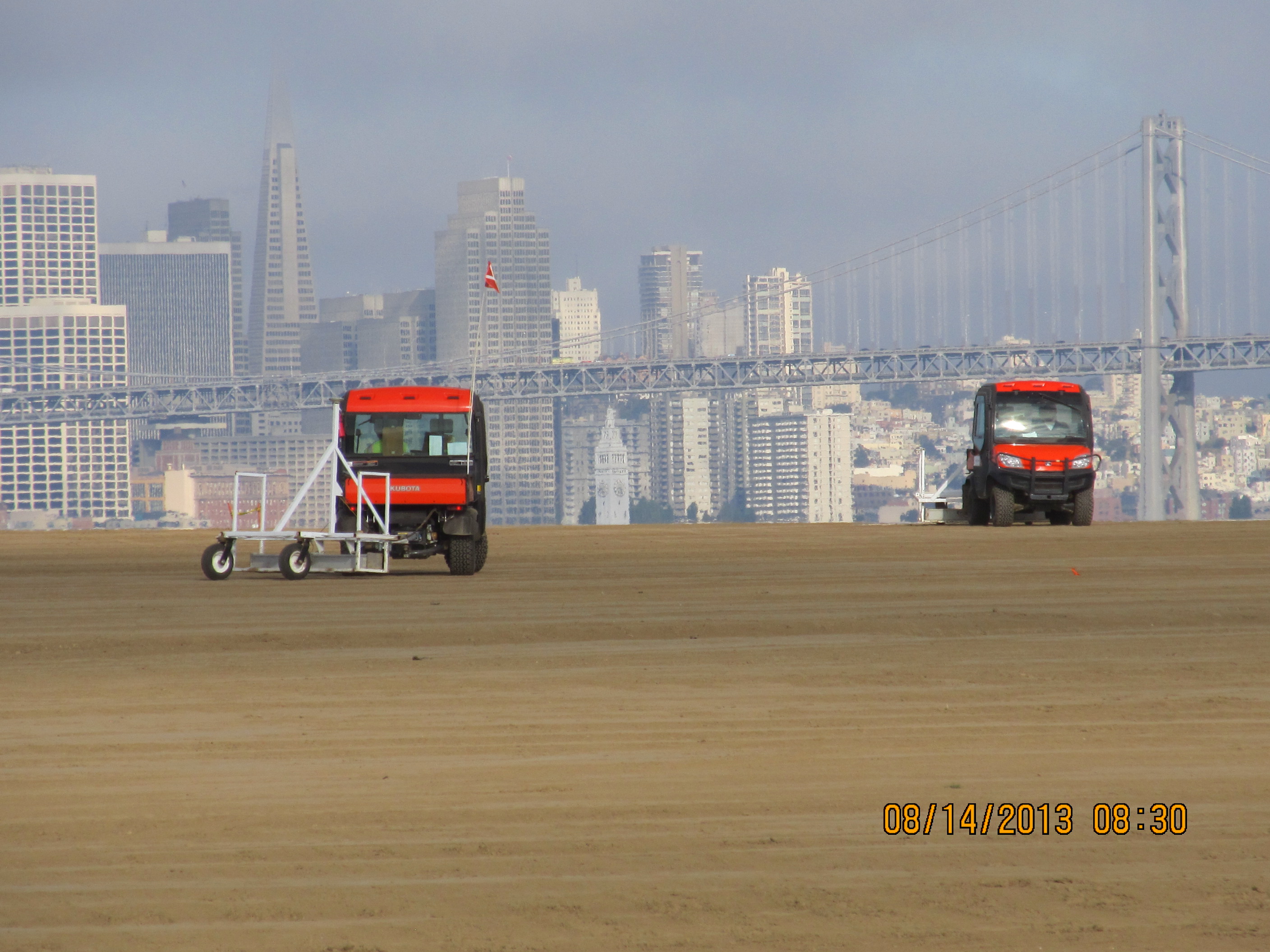
This contouring phase, which began in January of 2013, created the base layer with a specially-engineered slope. It was then scanned for radiation using scanners towed by a small vehicle, even though the site had been surveyed for radiation prior to placing the base layer.
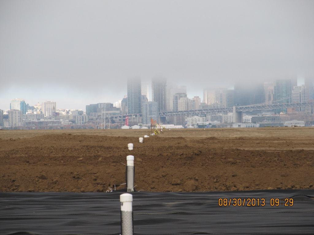
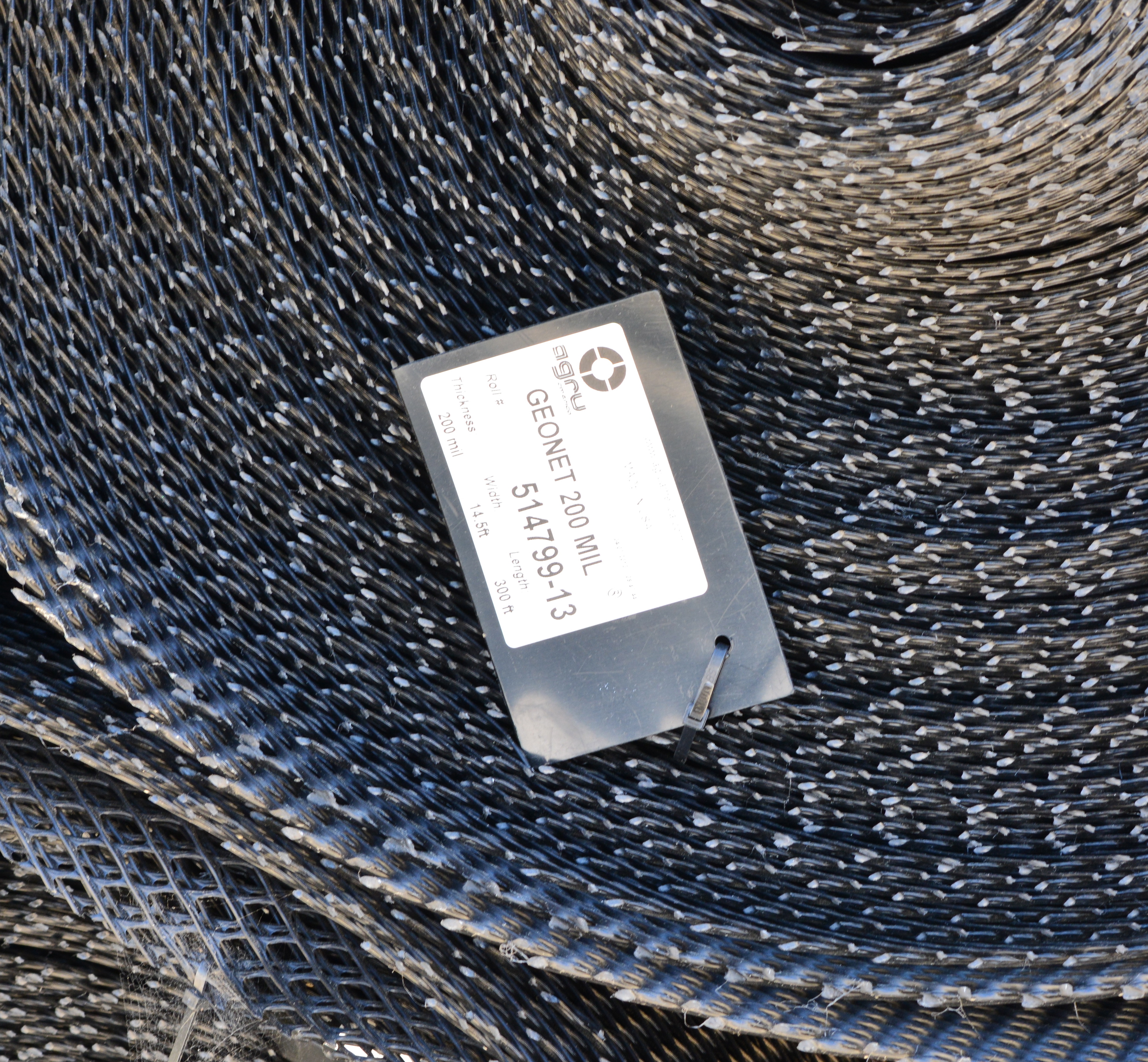
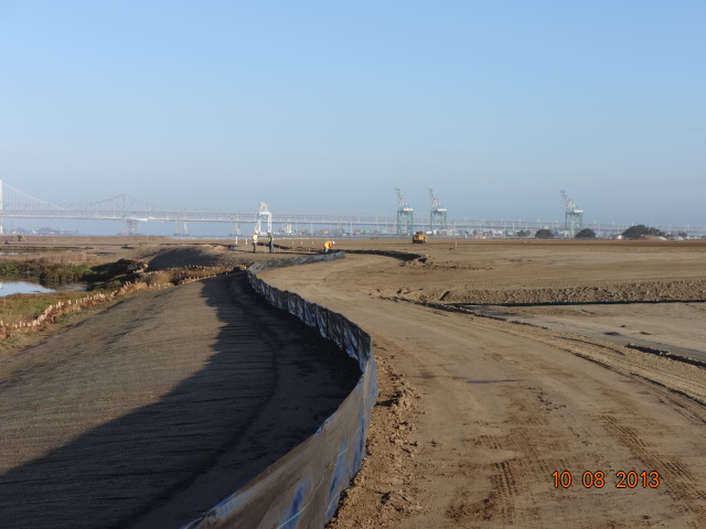
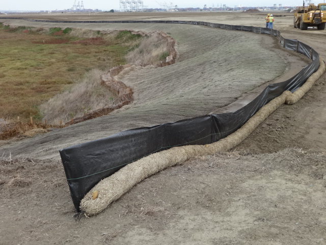
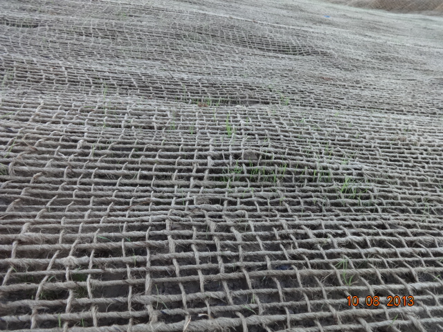
Placement of the plastic biobarrier (see photo below) and the final soil cover using soil barged in from Decker Island began on August 19, 2013. The biobarrier is a plastic mesh that is designed to discourage burrowing animals from coming into contact with the waste area. The biobarrier installation is over 90% complete as of week #38 (October 24, 2013). The final two-foot soil cover is over 60% complete. The final soil cover includes six inches of soil amended to promote growth of vegetation.
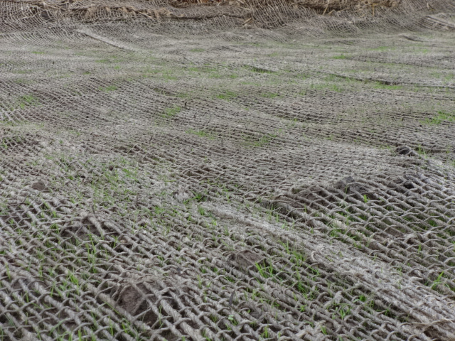
The soil stabilization and drainage work on the shoulder around the wetland area is also completed. It includes native rye grass seeding, a jute mesh cover, and a silt fence. Some of the rye grass has already started to sprout.
New monitoring wells will be installed starting in late November.
Hydroseeding of the site with an assortment of California native grasses will begin in late November or early December.
In 2014 the old culvert connecting the north side of the wetland with San Francisco Bay will be replaced with a new culvert.
Fifty tons of old fence and metal have been recycled. The temporary work fence will be removed at the end of the job. The methane gas vents will be short and virtually unnoticeable (see photo below). Due to the age of the landfill and the fact that very little organic waste was deposited there, the methane gas produced is minor and will not require the 10-foot tall vent stacks proposed in an earlier workplan.
This site, along with adjacent land, will be transferred to the U.S. Department of Veterans Affairs in late 2013 or early 2014.
Source: The information in this update was gathered from the weekly progress reports for Installation Restoration Site 2 Remedial Action at Alameda Point. The progress reports are posted on the Envirostor website maintained by the California Department of Toxic Substances Control (DTSC). The source for all photos in this update, unless otherwise credited, is DTSC.

Awesome. Thank God for its creation.
LikeLike
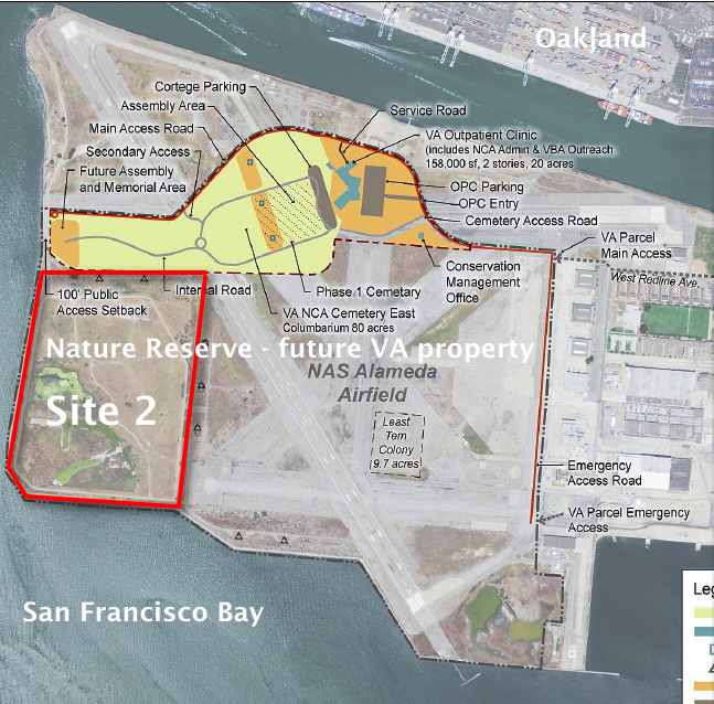
Am I reading the map correctly that a large bulk of the runway area is slowly fated to become a massive cemetery? You have “Phase 1” cemetery; the 80-acre “East” cemetery; and then a memorial area at the far west, implying that the unlisted “West” cemetery will go in the hundred acres between the two. Is the bulk of the remaining property “Future VA Property” as well? The labeling is ambiguous on this map. If so, is it also fated for more military graves?
LikeLike
Jack,
Sorry for the ambiguity and confusion. The red outline delineating the Site 2 cleanup area and the words “Nature Reserve – future VA property” were added by me. The rest of the drawing and labeling was done by the VA.
The military cemetery will only be in the area that is light yellow. It totals 80 acres, and it will be built in phases over the course of decades. Phase 1 is about 20 acres. The rest of the airfield to the south of the clinic/cemetery (including Site 2) will be owned by the VA and will remain undeveloped – no cemetery, no buildings (the Fish & Wildlife Service concrete-block office near the tern colony will remain standing).
The area to the north of the VA clinic/cemetery will be owned by the city of Alameda and is designated open space. Most of this area is slated for a regional park, and part of it is for the Sports Complex that will extend eastward to the old gym and ball field. The U.S. Fish & Wildlife Service’s Biological Opinion for Alameda Point describes in detail the regional park that is proposed for the city-owned area to the north of the VA property.
Hope this helps,
Richard
LikeLike
Yes. Thanks for the clarification
LikeLike
I’m assuming the runway is going to be removed at some point? Curious to see how they will do this without disturbing the feathered residents..
LikeLike
There are no plans to remove any of the runway pavement at this point. Part of it is the money to remove the pavement. Part of it is the fact that near the least tern nesting area it would create a new logistical problem of volunteer vegetation that would need to be removed in order to keep a beach-like clear line of sight for the terns. Too much vegetation close to the nesting area would make the terns nervous about potential predators lurking and could lead to some of the terns abandoning the area.
The areas more distant from the tern nesting area could actually help the terns when they are nesting by attracting potential avian predators away from the nesting area to look for ground prey like rabbits and squirrels. There are already many acres that are grassland – areas that were never paved – and in the opinion of some people it’s time to start planning for making those area contiguous grassland areas.
The new owners of the area labeled “Nature Reserve – future VA property,” namely the VA, are not opposed to landscape alterations/enhancements. But some other agency will have to round up the funding. The VA has its hands full with veterans care. That’s where wildlife and open space advocates come in. The U.S. Fish & Wildlife Service, which is currently managing the Nature Reserve and the least tern colony, is an underfunded agency and not likely to go out of its way to find funding. But other sources are available. With enough public attention and pressure, the true potential of the site could be realized.
LikeLike
Yes, it would be nice to realize the true potential of this amazing site. Thanks for the info.
LikeLike